sdgs are geospatial
TRANSCRIPT

23/05/2017
1
ggim.un.org
ggim.un.org
GGIM Links Geospatial
Datasets to SDGs
SDGs are Geospatial
�and statistical
�and require international collaboration
�and multi-stakeholder
partnerships.
2
23/05/2017
2
ggim.un.org
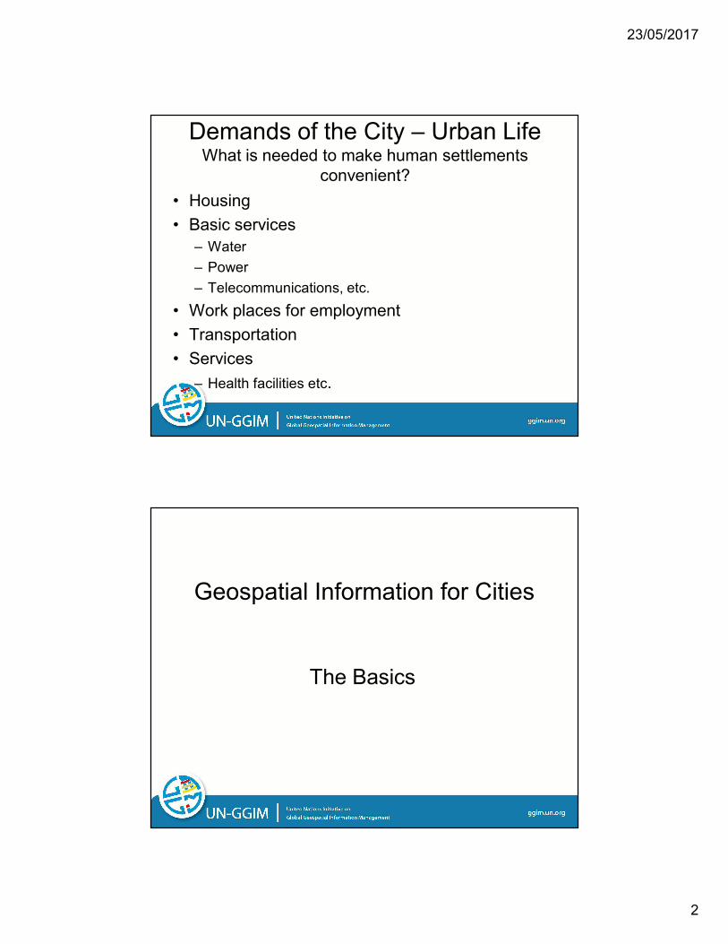
Demands of the City – Urban LifeWhat is needed to make human settlements
convenient?
• Housing
• Basic services
– Water
– Power
– Telecommunications, etc.
• Work places for employment
• Transportation
• Services
– Health facilities etc.
ggim.un.org
Geospatial Information for Cities
The Basics
23/05/2017
3
ggim.un.org
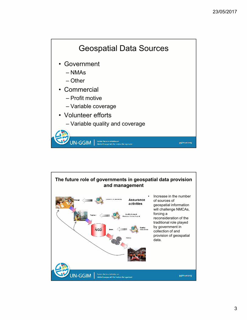
Geospatial Data Sources
• Government
– NMAs
– Other
• Commercial
– Profit motive
– Variable coverage
• Volunteer efforts
– Variable quality and coverage
ggim.un.org
The future role of governments in geospatial data provision
and management
• Increase in the number
of sources of
geospatial information
will challenge NMCAs,
forcing a
reconsideration of the
traditional role played
by government in
collection of and
provision of geospatial
data.

23/05/2017
4
ggim.un.org
Geospatial Data Types
• Digital sources with attribution
• Remotely sensed data
– Satellite
– Photography
– LiDAR
• Specialized
– Infrastructure geospatial data below ground
ggim.un.org
Technology
• GIS
• Mobile
• Sensors
• More satellites
• Drones
• Etc.

23/05/2017
5
ggim.un.org
ggim.un.org
Need for Geospatial Requirements for Cities
• Importance of the role of location relative to attribution
and statistics in measuring
• Knowing “where” leads to follow-on questions such as
how much or how often or in what circumstances
– Are there patterns of occurrence or is this an isolated
instance
• What level of geography is needed for effective
knowledge and action
• Determining geospatial data gaps and taking corrective
steps increases the value of statistical data

23/05/2017
6
ggim.un.org
Evolving Applications
• Public safety and emergency response
• Autonomous vehicles
• Gaging stations to monitor:
– Water levels
– Environmental factors such as air quality
• Etc@
ggim.un.org
What is information is helpful in managing
data?
• Definition
– Need same understanding of terms, meaning, and usage
• Data
– Source – who or where does the data come from?
• National and local governments?...private sector?...other?...
• Is it readily available or does it require a new partnership?
– Complete or partial coverage?
– Is it “good enough” data?
– Source
• Methodology
• Process and procedure
12

23/05/2017
7
ggim.un.org
An example for data:
The sanity check@
• What is the ideal state?
– Full coverage of available, current and
maintained, high quality, well-documented
data at the needed level of geography
• What is the preferred state?
• What is minimally acceptable?
• What can be salvaged?
• What is not helpful?
13
ggim.un.org
Examples of Statistical Data used in Geospatial
Analysis
– Census population and housing data files
– Patient files
– Soil data
– Animal sighting
– Cancer registry
– Police records
– School records (assignments, attendance)

23/05/2017
8
ggim.un.org
Statistical data can be overwhelming
ggim.un.org
Statistical Data Spatial Data
16
23/05/2017
9
ggim.un.org
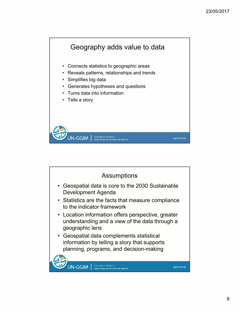
Geography adds value to data
• Connects statistics to geographic areas
• Reveals patterns, relationships and trends
• Simplifies big data
• Generates hypotheses and questions
• Turns data into information
• Tells a story
ggim.un.org
Assumptions
• Geospatial data is core to the 2030 Sustainable
Development Agenda
• Statistics are the facts that measure compliance
to the indicator framework
• Location information offers perspective, greater
understanding and a view of the data through a
geographic lens
• Geospatial data complements statistical
information by telling a story that supports
planning, programs, and decision-making

23/05/2017
10
ggim.un.org
Statistical Geospatial Framework
ggim.un.org20
Establishing a Geospatial Framework for Statistical Data
• What geographic data are needed?
• What level of accuracy is required?
• What is your timeframe?
• How frequently are the data utilized?
• What geospatial technologies are available?
• What are the benefits and costs?
• Who are the stakeholders?
23/05/2017
11
ggim.un.org
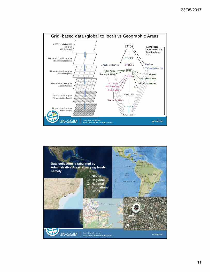
Grid-based data (global to local) vs Geographic Areas
10,000 km window/100
km grids
(Global scale)
1,000 km window/10 km grids
(International regions)
100 km window/1 km grids
(National regions)
10 km window/100m grids
(Urban Districts)
1 km window/10 m grids
(Urban neighborhoods)
100 m window/1 m grids
(Urban blocks)
21
ggim.un.org22
� Global
� Regional
� National
� Subnational
� Cities
Data collection is tabulated by
Adminstrative Areas at varying levels,
namely:

23/05/2017
12
ggim.un.org
Cities and Human Settlements:
Example enumeration boundaries for places in the US
Counties
Census tracts
Census blocks
Census Designated Places
Minor Civil Divisions/Towns
Public ownership and use:
Parcel and land records
Geographic Areas and Boundaries
Census blocks
Pittsburgh Region
Census tractsCounties
Pittsburgh
Pittsburg metropolitan region
23
ggim.un.org
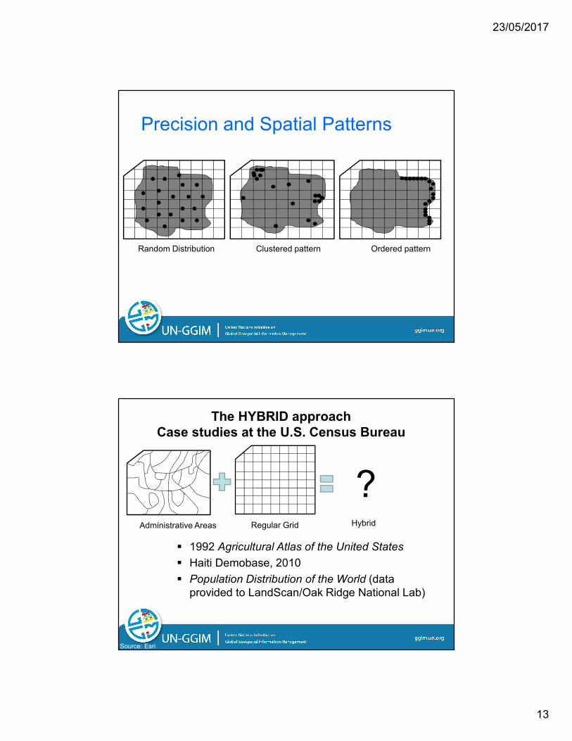
@and can have many different distributions of
known data points
Geographic areas come in a variety of
shapes and sizes@
23/05/2017
13
ggim.un.org
Precision and Spatial Patterns
Random Distribution Clustered pattern Ordered pattern
ggim.un.orgSource: Esri
The HYBRID approach
Case studies at the U.S. Census Bureau
Administrative Areas Regular Grid
� 1992 Agricultural Atlas of the United States
� Haiti Demobase, 2010
� Population Distribution of the World (data
provided to LandScan/Oak Ridge National Lab)
Hybrid
?

23/05/2017
14
ggim.un.org
So where are these urban areas?
ggim.un.org
Observations
• No international agreement or practice on urban/rural by NSOs
• Urban/rural serves different purposes– Some intentional
• Economic development (Urbanized Areass to Metropolitan Areas)
– Some unintentional• Program implementation via laws
– Rural health care and housing
• Normally no control but sometimes has unintended consequences (“it’s because of the Census Bureau@”)
23/05/2017
15
ggim.un.org
Realities
• More than one type of use of urban/rural designations– Functional use – population based
– Physical observable - for example land use planning
• Challenge with urban/rural applies to both developed and developing countries
• The impact of this exercise is not limited to supporting the SDGs: it enables capacity development.
ggim.un.org
Considerations
• Temporal issues are important– Development and movement of population occurs
over time• Increase and decrease based on events and conditions
– How are temporal data accounted?
• How to react to special circumstances and anomalies within a Member State– The U.S.
• American Indian Areas
• Colonias
23/05/2017
16
ggim.un.org
Cities and Example SDGs
ggim.un.org
By 2020, halve the number of
global deaths and injuries due
to traffic accidents@
Total numbers for a nation are telling for a national perspective
To take action requires more information
Operator error (drunken driving, seat belt use@)
Road conditions (sharp curves, pot holes@)
Traffic safety aids (speed signs, traffic lights@)
Knowing location of traffic events is required for next steps

23/05/2017
17
ggim.un.org
@Reforms giving women equal
rights to economic resources as
well as access to ownership and
control over land@
How does geospatial data contribute?
Land parcel and cadastre records are needed
Parcel size and extent (boundary)
Land use (agriculture, residential, economic)
Ownership by characteristics including sex
ggim.un.org
@building resilient infrastructure,
promoting inclusive and
sustainable industrialization and
fostering innovation@
“Proportion of rural population who live within 2 km of an
all-season road”
What are the geospatial implications?
How to differentiate rural and urban populations?
Accepted definitions are needed
Locations of housing units
Existence of a geospatial detailed maintained
road network

23/05/2017
18
ggim.un.org
Example
Goal 11: Make cities and human
settlements inclusive, safe, resilient,
and sustainable.
Goal | Target | Indicator
Target 11.7: By 2030, provide
universal access to safe, inclusive and
accessible, green and public spaces,
particularly for women and children,
older persons and persons with
disabilities.
Indicator: The average share of
the built-up areas of cities in open
space in public ownership and use.
35
ggim.un.org
Goal 11: Getting Started
� An assumption – there is public accessibility to diverse datasets
and GIS tools on a national and global scale
� An urban geography framework - small area geography to
merge target group statistics, and land use/land classification data
� Diverse datasets – demographic data, earth observation data,
crime data, land use/land classification data, open areas, or protected
areas
� A geospatial methodology - an integrated solution to
geospatial problem; see previous studies listed below
2012, S. A. Bennet, N. Yiannakoulias A. M. Williams, P. Kitchen. Playground Accessibility and Neighborhood Social Interaction Among
Parents, Social Indicators Research 108:199-213.
2001 S. Nicholls, Measuring the accessibility and equity of public parks: a case study using GIS, Managing Leisure, 6:201-212.
36
23/05/2017
19
ggim.un.org
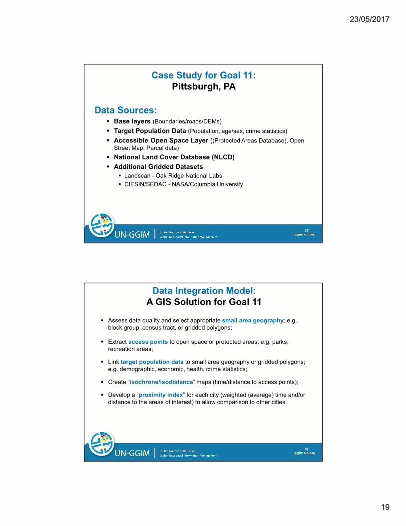
Case Study for Goal 11:
Pittsburgh, PA
Data Sources:� Base layers (Boundaries/roads/DEMs)
� Target Population Data (Population, age/sex, crime statistics)
� Accessible Open Space Layer ((Protected Areas Database), Open
Street Map, Parcel data)
� National Land Cover Database (NLCD)
� Additional Gridded Datasets
� Landscan - Oak Ridge National Labs
� CIESIN/SEDAC - NASA/Columbia University
37
ggim.un.org
Data Integration Model:
A GIS Solution for Goal 11
� Assess data quality and select appropriate small area geography; e.g.,
block group, census tract, or gridded polygons;
� Extract access points to open space or protected areas; e.g. parks,
recreation areas;
� Link target population data to small area geography or gridded polygons;
e.g. demographic, economic, health, crime statistics;
� Create “isochrone/isodistance” maps (time/distance to access points);
� Develop a “proximity index” for each city (weighted (average) time and/or
distance to the areas of interest) to allow comparison to other cities.
38

23/05/2017
20
ggim.un.orgSource: European Environment Agency
Administrative bdys
Population
Human settlement
Infrastructure
Rainfall
Temperature
Land use
Land cover
Topography
Vegetation
Surface water
Groundwater
Soils
Elevation
Imagery
All of these variables can be integrated into consolidated information….
if the data is consistently available as a data ecosystem
ggim.un.org
A Path Forward
• Close collaboration is needed by:
– National Mapping and Geospatial Agencies
– National Statistical Organizations
– Those who have begun this process are realizing
tangible successful outcomes
• 2020 Round of Censuses benefit from these
collaborations where new data and new data
types are identified and planned for in support of
the SDGs
• New synergies across organizational boundaries
have longer term benefits beyond meeting the
SDGs

23/05/2017
21
ggim.un.org
Conclusion
• Geospatial data is core to the 2030 Sustainable
Development Agenda
• Statistics are the facts that measure compliance
to the indicator framework
• Location information offers perspective, greater
understanding and a view of the data through a
geographic lens
• Geospatial data complements statistical
information by telling a story that supports
planning, programs, and decision-making
ggim.un.org