section five land resource and management area …
TRANSCRIPT

Land Resource Management Plan
LAND RESOURCE AND
MANAGEMENT AREA
POLICIES
SECTION FIVE

SECTION FIVE
LAND RESOURCE AND
MANAGEMENT AREA POLICIES
A. INTRODUCTION AND DEFINITIONS
The goals and objectives that form the foundation for the policy framework are by nature general and
common to a large part of the County. The goals and objectives give the LRMP direction and establish
the character and nature of activities and conditions that should exist within the County. Policy
Land Resource Management Plan 5-1

Land Resource Management Plan 5 − 2
statements posed here must be more precisely aimed at where these activities and conditions should
take place within the County.
These policies are structured around a more explicit definition of the management areas, and an
application of those management areas to a location or locations in Kendall County. The management
areas serve to fuse the planning of physical characteristics within the area with the institutional
characteristics including the responsibilities of governments, developers, and the public.
Under the description of each management area are policy statements that guide the LRMP and will
guide the actions of the County Board and its committees. A distinguishing feature of this LRMP is its
essential design that allows it to grow and be refined in a continuing planning process. As such, the
following policy statements are limited to focus on principal issues.
Fifteen management areas are identified in this LRMP. Twelve exclusive management areas cover the
urbanized communities, suburban residential areas, rural communities, rural residential areas, rural
estate areas, countryside residential areas, rural settlements, commercial, mixed use business,
public/institutional, open space, and agriculture. Three additional management areas may overlay any
of the exclusive management areas. These overlay areas include transportation corridors, potential
mining district, and natural resource areas.

5 − 3
EXCLUSIVE MANAGEMENT AREAS
Urbanized Communities:
An urbanized community is served by
central utilities, and development has or will occur
at urban or suburban densities. Urbanized
communities generally contain a wide range of
land uses including residential, commercial and
industrial. Municipal services such as police
protection, libraries, and health services are also
provided. The primary responsibility for achieving
plan objectives within urbanized communities
remains with the municipality. Existing urbanized
communities include Aurora, Joliet, Minooka,
Montgomery, Newark, Oswego, Plainfield, Plano,
Sandwich and Yorkville.
Suburban Residential. (Not to exceed 1.0
dwelling units per gross buildable acre if developed
under County zoning authority.) The Suburban
Residential land use category promotes a
residential character of low to medium density
Conventional Suburban Residential Design
residences. This land use is consistent with the County’s RPD-3 zoning district, permitting a base
density of 0.86 du/ac and a maximum density of 1.0 du/ac. Higher municipal densities are
appropriate on lots where adequate public sewer and water systems exist or can be made available
(via community septic and well systems). Creative
planned developments may also be appropriate
under County zoning authority at a much lower
density. While anticipated to contain primarily
single family detached housing, some attached
housing units may be considered, particularly within
Land Resource Management Plan
Conservation Design Suburban Density

Land Resource Management Plan 5 − 4
a planned development. Compatible governmental, educational, religious, and recreational uses also
may be permitted in these areas. Suburban Residential uses are typically located around incorporated
areas since these areas have the highest likelihood of being annexed into the municipality.
Rural Residential. (Not to exceed .65 dwelling units per gross buildable acre.) The Planned Rural
Residential land use category promotes large-lot, low-density detached single-family residential
development. This land use category is generally consistent with the County’s RPD-2 zoning district,
permitting a base density of 0.45 du/ac. Planned
development and clustering are strongly encouraged within
this category to preserve the natural features of the land
such as topography and vegetation. Lot size may be varied
with a planned development, but the overall density should
be within the guidelines established in this plan. An
additional density bonus allowing up to 0.65 du/ac may be
granted for particularly creative development plans providing
additional public amenities. If this bonus up to 0.65 du/ac is achieved, an additional density bonus
allowing up to 0.85 du/ac may be granted in the case of a proposed RPD development that (a)
utilizes both community septic and community water services, (b) is all or partially located within 100 ft
of the Aux Sable Creek (including tributaries of the main creek), and (c) is located in Lisbon Township,
Seward Township, or Na-Au-Say Township.
The district provides a semi-rural or countryside setting, retaining a greater amount of open space.
Compatible governmental, educational, religious, and recreational uses also may be permitted in these
areas. Public water should be provided where practical.
Rural Estate Residential. (Not to exceed .45 dwelling units per gross
buildable acre.) The Planned Rural Estate Residential land use category
promotes low-density detached single family residential development. This
land use category is generally consistent with the County’s RPD-1 zoning
district, permitting a base density of 0.33 du/ac and a maximum density

Land Resource Management Plan 5 − 5
of 0.45 du/ac. Planned development and clustering are strongly encouraged within this land use
category to preserve the natural features of the land such as topography and vegetation. Lot size may
be varied with a planned development, but the overall density should be within the guidelines
established in this plan. The district provides a semi-rural or countryside setting, retaining a greater
amount of open space. Compatible governmental, educational, religious, and recreation uses also may
be permitted in these areas.
Countryside Residential.
(Not to exceed .33 dwelling units per gross buildable
acre.) The countryside Residential land use category
promotes large lot and/or low density detached single
family residential development in an area that primarily
maintains an agricultural/rural environment. This land use
category is generally consistent with the County’s R-1
zoning district which requires a minimum 3-acre lot size.
The district provides a rural or countryside setting, retaining a large amount of agricultural land or open
space.
Hamlet:
Hamlets have developed naturally over time or may be the
result of planned development. Generally, they are small un-
incorporated communities of 2,000 residents or less, having a
central commercial district that provides support services to
residents and the farms that comprise the surrounding rural
landscape. Rural settlements enhance the rural character of
the County by grouping necessary support services,
employment and housing within the rural landscape without
supplanting the agriculture uses they serve. The LRMP focuses on the support and enhancement of
rural settlements, rather than the redevelopment or conversion of the settlements to more intense

Land Resource Management Plan 5 − 6
urbanized communities. Existing rural settlements include Bristol, Helmar, Little Rock and Lisbon
Center.
Rural Community:
Rural Communities are incorporated municipalities that
are generally developed at low densities and do not
have a public water or sewer system. They are
generally similar in character to a Hamlet, but as an
incorporated municipality they have their own governing
body. Rural Communities include Lisbon and the more recently incorporated Villages of Millbrook,
Millington and Plattville.
Agriculture:
Natural environmental conditions and economic conditions favor
clustering of farm activities without urban intrusion for successful
agriculture. The LRMP designates agriculture based on factors
that suggest that agriculture has a reasonable chance for
economic and environmental success. The LRMP focuses on
assuring adequate opportunities for development of housing and
employment in other management areas, and on managing the
development pressure placed on agriculture lands.
Commercial. The Commercial land use
category provides for office and retail
establishments that offer goods and services in
easily accessible locations. Commercial uses
are mainly located along major transportation
routes such as Route 47, Route 52 and the WIKADUKE Trail.

Land Resource Management Plan 5 − 7
Mixed Use Business. The Mixed Use Business land use category provides for employment
opportunities for County residents while providing a balanced tax base. This land use category is
consistent with the County’s Office and Research Park District as well as the County’s three
manufacturing districts. Buildings and land in this category should be properly landscaped and
developed in an orderly manner that conveys a well-maintained environment. Due to their high trip
generation rates, these uses are generally planned in easily accessible locations, such as the Mixed
Use Business uses located along County Line Road and near the I-80 interchange at WIKADUKE
Trail/Ridge Road.
Transportation Corridors:
These are concentrations of land uses that require
accessibility to large metropolitan markets. Transportation
corridors are located along major federal and state highways
which carry high volumes of traffic. County economic
development efforts can focus on preparing the areas
adjoining high-capacity transportation routes for
development. The LRMP identifies four potential
transportation corridors. Additional transportation corridors
may be appropriate in the future if a north-south freeway is located within the County.
Mining.
The Mining land use category applies to existing, active
mining quarries. These quarries are located just west of
Route 47 between Joliet Road and Sherrill Road. Although
the quarries are largely kept out of view by tall man-made
hills, the existence of the quarries is fairly apparent by the
volume of truck traffic in the area, particularly as the trucks
enter and exit off of Route 47 via Quarry Road. Mining
uses typically fall under the M-3 Manufacturing District (Earth Material Extraction, Processing and Site
Reclamation).
Land Resource Management Plan 5 − 8
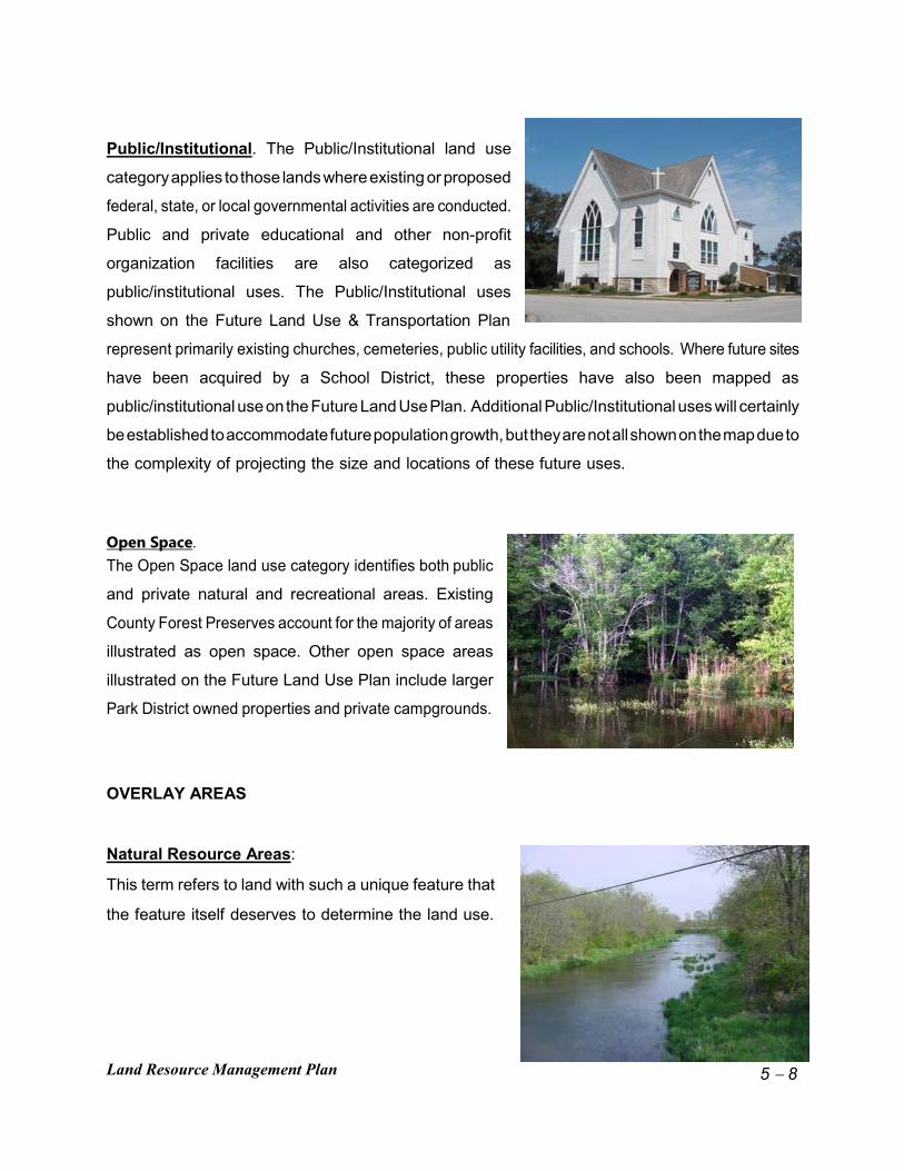
Public/Institutional. The Public/Institutional land use
category applies to those lands where existing or proposed
federal, state, or local governmental activities are conducted.
Public and private educational and other non-profit
organization facilities are also categorized as
public/institutional uses. The Public/Institutional uses
shown on the Future Land Use & Transportation Plan
represent primarily existing churches, cemeteries, public utility facilities, and schools. Where future sites
have been acquired by a School District, these properties have also been mapped as
public/institutional use on the Future Land Use Plan. Additional Public/Institutional uses will certainly
be established to accommodate future population growth, but they are not all shown on the map due to
the complexity of projecting the size and locations of these future uses.
Open Space. The Open Space land use category identifies both public
and private natural and recreational areas. Existing
County Forest Preserves account for the majority of areas
illustrated as open space. Other open space areas
illustrated on the Future Land Use Plan include larger
Park District owned properties and private campgrounds.
OVERLAY AREAS
Natural Resource Areas:
This term refers to land with such a unique feature that
the feature itself deserves to determine the land use.

Land Resource Management Plan 5 − 9
These features include wetlands, floodplains, prime aquifer recharge areas, surface water, significant
forest cover, scenic areas, etc. The long term economic and physical health of the County and its
residents depends on the preservation of these environmental resources. The LRMP proposes the use
of both public acquisition of development rights and strong regulation to preserve these areas.
Potential Mining District: The County has established a Mining District Overlay
(denoted by the hatched areas on the map), which creates
a special use district within which other mining quarries
could be established to take advantage of Kendall County’s
rich stock of natural resources. The County continues to
work with its mining consultant to identify the most viable
location(s) for a Mining District, keeping in mind the
availability of natural resources, impacts on the
environment, access to key transportation routes, and proximity to incompatible land uses. Any specific
mining application will be closely reviewed to ensure that it meets environmental performance standards
appropriate to Kendall County and the specific location, including the buffering of such uses from
adjacent residential, institutional, or public uses. Road impacts will also be closely evaluated to
minimize impact on local transportation systems.
The proposed Mining District illustrated on the Future Land Use Plan was based on review of soil
borings in the area and testimony regarding the presence of quality stone with limited cover. The
Illinois Department of Natural Resources recently contracted with the Illinois Geological Survey to study
and map subsurface geology throughout the State. The survey is anticipated to provide a wealth of
data that will provide insight on the type, quality, and location of natural resources. Survey results
would also provide insight into the potential designation of a Mining District or a set of multiple
dispersed quarries. The County plans to monitor the progress of the survey and accordingly plan for a
Mining District as data becomes available over the next few years. The Potential Mining District has
been pulled back from Route 47 to preserve opportunities for future commercial development.

Land Resource Management Plan 5 − 10
B. URBANIZED COMMUNITIES
Urbanized communities can be characterized by the extent and level of services offered to residents,
and by the variety of supporting non-residential activities. Municipal and public services often include
the following: police, fire and emergency medical services, municipal street maintenance, sweeping and
snow plowing, local parks and recreation activities, municipal operated or licensed waste collection, and
local library and cultural services. Non-residential activities include extensive and varied retail uses,
commercial and business services, industry, institutions, schools, churches and other places of
assembly.
Existing urbanized communities include Aurora, Joliet, Minooka, Montgomery, Newark, Oswego,
Plainfield, Plano, Sandwich and Yorkville. To accommodate varying needs, a full range of housing
types should be provided, allowing a free choice to those families or individuals who will find that living
in Kendall County best fulfills their personal needs. Development within urbanized communities is
regulated by each individual municipality.
The LRMP is based on the following Planning Policies for Urbanized Communities:
1. Incorporate land uses as shown in municipal comprehensive plans within the
boundaries of existing municipalities in this LRMP.
2. Encourage a compact development pattern that clusters neighborhoods, villages, and
towns, rather than a pattern that scatters isolated buildings and subdivisions.
3. Encourage the single family character of urbanized areas in the County while permitting
the inclusion of limited townhome, apartment, and other multi-family development.
4. Build on the pattern of established urbanized communities, rather than creating new
urbanized places isolated from existing development.
5. Encourage the planned growth of urban communities, including the expansion of
municipal boundaries through annexation of lands only as shown on adopted municipal

Land Resource Management Plan 5 − 11
plans.
6. Maximize the use of non-automotive modes of transportation, including walking, the use
of bicycles, and mass transit.
7. Encourage concentrations of employment located in areas within the county providing
good access to transportation and public safety services.
8. Establish specific area plans for employment zones emphasizing coordinated
transportation system planning integrated with land use planning. One such zone
should be in the I-80 Corridor in southeastern Kendall County near and within the
Village of Minooka.
9. Encourage commercial development within the County; major intersections may lend
themselves to commercial use. Appropriate transportation improvements such as limited
curb cuts, turn lanes, and access roads must be considered to provide for movement of
traffic.
10. Use open water areas for public open space and storm water management or as the
buffer surrounding residential or office uses which benefit from attractive views of the
water.
11. Encourage the preservation and enhancement of historic and cultural sites and
structures within urbanized communities.
The LRMP is based on the following Management Policies for Urbanized Communities:
a. The County acknowledges that the primary responsibility for achieving plan objectives
within urbanized communities remains with the municipalities. The County further
acknowledges that it shares responsibility with the municipalities and townships for
achieving the plan objectives within the one and one-half (1½) mile area of shared
jurisdiction.

Land Resource Management Plan 5 − 12
b. The County will act to coordinate the municipal planning and development practices and
to resolve conflicts between communities toward the benefit of the County as a whole
and toward its adopted planning and management goals and objectives.
c. The County will encourage the revitalization and redevelopment of urbanized
communities.
d. The County will encourage municipalities to adopt land use regulations that allow a full
range of housing types while maintaining the single family character of residential areas
of the County.
e. The County will encourage each municipality to adopt land use controls that support the
central business district in each community.
f. The County supports the establishment of employment concentrations within the County
through land use regulation and planning. These concentrations should support transit
options that allow people to use public transit and carpooling to and from the work
place.
g. The County will encourage municipalities in the adoption of urban design standards that
guide public and private development toward a compatible community image, including
guidelines for improvements within public rights-of-ways, open spaces, and private
buildings.
h. The County will consider the net savings of energy in fuel, road building materials and
electricity, and impacts on air quality when reviewing and choosing among
transportation alternatives.

Land Resource Management Plan 5 − 13
C. SUBURBAN RESIDENTIAL Suburban Residential Areas surround existing urbanized communities, providing opportunities for growth
in a suburban or countryside setting, generally within close proximity of existing community boundaries.
Development within contiguous growth areas is served by central sewer and water systems, except
within planned developments which provide independent septic or other appropriate systems.
Contiguous growth areas rely on urbanized communities for the provision of essential services, and
these services are limited in comparison to the urbanized communities. Police, fire and Emergency
medical services are provided, but with slower response times than in urbanized communities.
Decisions on land use and zoning within suburban residential areas will follow the recommendation of
adjacent municipalities. If municipal planning areas overlap, the County will review development
proposals with all affected communities
The LRMP is based on the following Planning Policies for Suburban Residential:
1. Continue to preserve open space and protect natural resources before, during and after
development of land uses within the contiguous growth area.
2. Encourage preservation of woodlands, conservation areas, and open spaces close to
developed areas to protect the natural environment and so that the effects of
urbanization and the loss of the open character of the area can be minimized.
3. Limit residential development to a maximum net density of one dwelling unit per acre in
unincorporated contiguous growth areas unless a public or community sanitary sewer
system is provided.
4. Develop housing surrounding existing municipalities served by public sewer and water,
in a sequence that follows an orderly pattern of annexation, zoning, subdivision and the
extension of public facilities. Where properties are contiguous to existing urban
development, similar urban densities may be extended into the contiguous growth
areas.

Land Resource Management Plan 5 − 14
5. Encourage the location of public schools, parks and libraries in locations that are
central to existing and recently developed areas so that automobile driving and the
need for school bus facilities can be minimized.
6. Develop those areas adjoining future commuter rail stations along the Burlington
Northern Santa Fe Railroad for residential, service and employment clusters in locations
identified in the commuter service extension study, primarily in Montgomery, Oswego,
Yorkville, and Plano.
7. Continue to develop and refine a multi-use trail system which links major residential
areas to employment centers and public facilities and recreation areas.
The LRMP is based on the following Management Policies for Suburban Residential Areas:
a. The County and each municipality should require residential developers to dedicate
publicly accessible open space usable in part for active and passive recreation at the
rate that maintains at least 10 acres of active park/recreation land per 1,000 residents.
Where a park district has been established, County and municipalities should review
development proposals with the park district for potential open space dedication.
b. The County should consider and encourage municipalities to adopt land use regulations
that include standards for landscaping, impervious surface areas and maximum lot
coverage with the intent of protecting human and wildlife habitat from the effects of
development.
c. The County should consider and encourage municipalities to adopt codes for building
development and enforcement to assure new construction is safe, sound, and sanitary.
Such codes should be reviewed annually by staff to incorporate advances in building
materials and construction techniques.
d. The County's land use practices will encourage planned development. Higher density

Land Resource Management Plan 5 − 15
attached and multi-family residential developments are most appropriate within
municipalities where additional services are available.
e. County site plan review procedures shall be maintained and enhanced to uses
permitted and conditionally permitted, dimensional regulation, building setback and bulk,
scale, density, intensity, landscaping, parking, required public facilities, open space
characteristics, site engineering, aesthetics and off-site impacts.
f. The County will promote subdivision and building orientation standards that encourage
energy efficiency, including the placement of buildings with regard to solar gain, heat
loss and natural convective circulation, and the use of deciduous trees for summer
shade and winter sun.
g. The County shall continue to promote the use of clustered development or planned unit
development procedures that allow the construction of dwellings in an arrangement that
encourages the permanent protection of open space within the immediate area of those
dwellings.
h. The County and municipalities will work together to establish boundary agreements and
other mutual planning actions that discourage the premature, competitive or
inappropriate annexation of land.
i. The County will strongly discourage the annexation of land not governed by adopted
municipal plans unless the proposal is consistent with the County’s Future Land Use
Plan.
j. The County Highway Department will require the installation and maintenance of traffic
control devices and adopt roadway standards for County roads to reduce automotive
emissions due to congestion and discontinuous traffic flow. Such devices include
synchronized traffic signal systems and intelligent controllers. Roadways and
intersections should be designed to maintain a minimum service standard equivalent to

Land Resource Management Plan 5 − 16
the Institute of Transportation Engineers' "Level of Service D" in urbanizing areas.
D. RURAL RESIDENTIAL AREAS
Rural Residential Areas are designed to provide a transition between more intense development within
municipalities and more rural or agricultural parts of the county. Residential uses, with a maximum
density of .65 dwelling units per acre, are desirable within planned developments which provide ample
common open space and blend into the surrounding countryside.
The LRMP is based on the following Planning Policies for Rural Residential Areas:
1. Provide opportunities for low density, well planned residential development in rural
areas.
2. Preserve open space and protect natural resources before, during and after
development of land uses within the Rural Residential area.
3. Limit development within areas not served by central water supply systems to densities
that do not pose a threat to ground water capacity.
The LRMP is based on the following Management Policies for Rural Residential Areas:
a. The County will adopt land use regulations that discourage the removal of a substantial
percentage of the significant trees (as defined in the Subdivision Ordinance) from any
development site within unincorporated Kendall County.
b. The County shall continue to prepare adequate codes for building development and
enforcement to assure new construction is safe, sound, and sanitary. Such codes
should be reviewed annually by staff to incorporate advances in building materials and
construction techniques. Such revisions and updates should be done with input from

Land Resource Management Plan 5 − 17
local fire departments and districts.
c. Planned development review procedures shall address dimensional regulation, building
setback and bulk, scale, density, intensity, landscaping, parking, open space
characteristics, site engineering, aesthetics, and off-site impacts and buffering.
d. The County will continue to promote the use of clustered development or planned unit
development procedures that allow the construction of dwellings in an arrangement that
encourages the permanent protection of open space.
E. RURAL ESTATE and COUNTRYSIDE RESIDENTIAL AREAS
Rural Estate Areas are designated based on physical, environmental and geographic conditions that
suggest a variety of low intensity land uses. Estate residential uses, with a maximum density of .45
dwelling units per acre, are desirable in these areas due to the proximity to natural resources such as
streams and woodlands. Such development should be accomplished through the planned development
process to encourage clustering and conservation design. Limited business use may also be
appropriate for small offices or agriculture service enterprises. By providing opportunities for these uses
in defined areas, development associated with future expansion of the Chicago metropolitan area can
be contained, while preserving agricultural activities. Agricultural uses will continue to be a major use
in Rural Estate areas.
Countryside Residential Areas are similar to rural estate areas, except that they are typically farther
from urban development and more appropriate for a lower density (maximum .33 dwelling units per
acre). They may be developed as a Planned Development using conservation design techniques, or as
more conventional large estate lots.
The LRMP is based on the following Planning Policies for Rural Estate and Countryside Areas:
1. Provide opportunities for low density, well planned residential development in rural

Land Resource Management Plan 5 − 18
areas.
2. Preserve open space and protect natural resources before, during and after
development of land uses within the Rural Estate area.
3. Limit development within areas not served by central water supply.
The LRMP is based on the following Management Policies for Rural Estate and Countryside Areas:
a. The County will adopt land use regulations that discourage the removal of a substantial
percentage of the significant trees (as defined in the Subdivision Ordinance) from any
development site within unincorporated Kendall County.
b. The County shall prepare adequate codes for building development and enforcement to
assure new construction is safe, sound, and sanitary. Such codes should be reviewed
annually by staff to incorporate advances in building materials and construction
techniques.
c. Site plan review procedures shall continue to be used to address dimensional
regulation, building setback and bulk, scale, density, intensity, landscaping, parking,
open space characteristics, site engineering, aesthetics, and off-site impacts and
buffering.
d. The County will promote the use of clustered development or planned unit development
procedures that allow the construction of dwellings in an arrangement that encourages
the permanent protection of open space.
F. COMMERCIAL AREAS
Commercial Areas are compact areas of land-uses that provide opportunities for shopping, dining, and
Land Resource Management Plan 5 − 19
economic development within the County. These areas generally require accessibility to a large section
of the County and are located along one or more high-capacity transportation routes.
The LRMP is based on the following Planning Policies for Commercial Areas:
1. Develop concentrations of commercial use at strategic locations along arterial roadways,
typically at major intersections (see Future Land Use Plan for specific locations
2. Concentrate non-agricultural employment within these commercial/industrial areas, and
within proximity to support services.
The LRMP is based on the following Management Policies for Commercial Areas:
a. The County will encourage the Kendall County Economic Development Commission to
attract employers to areas near population concentrations, and within reasonable
distance to mass transportation routes, so that Kendall County residents have the
opportunity to reduce long energy-absorbing commuting.
b. The County will make the benefits of its economic development incentives available to
firms within commercial/industrial areas located and built according to the County Plan.
G. MIXED USE BUSINESS
Mixed Use Business areas are designed to provide for concentrations of employment within Kendall
County. The type of business within these areas may be varied, and will often be developed within
planned business parks. The desire for additional employment opportunities within Kendall County was
highlighted in the 2010 LRMP survey.
The LRMP is based on the following Planning Policies for Mixed Use Business Areas:

Land Resource Management Plan 5 − 20
1. Develop a County-wide economic development strategy which identifies the who, what,
where, and how to expand and develop new businesses to provide employment
opportunities for County residents.
2. Locate future Mixed Use Business areas along major regional arterial routes and near
rail facilities for enhanced access for both employers and employees.
3. Foster cooperative planning efforts focused on specific economic development
opportunities within major transportation corridors.
4. The County will promote and encourage the development of structured business parks,
such as Kendall Point. Planned business parks should be designed to protect
employment areas from incompatibility and land use conflicts both internally and
externally.
The LRMP is based on the following Management Policies for Mixed Use Business Areas:
a. Work closely with municipal and regional economic development organizations to
promote opportunities for job growth within Kendall County.
b. Enhance the County’s web site to better promote economic development and available
resources to assist businesses in expanding or relocating to Kendall County.
H. TRANSPORTATION CORRIDORS
Transportation Corridors are finger-like concentrations of land-uses that require accessibility to a large
section of the metropolitan area, organized along one or more high-capacity transportation routes.
Transportation corridors are areas within which the County may encourage economic development,
outside municipal boundaries.

Land Resource Management Plan 5 − 21
The LRMP is based on the following Planning Policies for Transportation Corridors:
1. Develop principal highway corridors as transportation corridors.
2. Employment and commercial activities requiring exceptional access to metropolitan
markets can be accommodated in these transportation corridors. Some suburban
density residential uses may also be anticipated within these corridors.
3. Concentrate non-agricultural employment within the transportation corridors, and within
proximity to support services.
4. Encourage the development of manufacturing, assembly, and processing activities with
minimal off-site impacts including noise, odor, glare, vibration, truck and automotive
traffic generation, and hours of operation.
The LRMP is based on the following Management Policies for Transportation Corridors:
a. The County and effected municipalities will prepare specific area plans and adopt land
use controls for the transportation corridor areas that enhance the opportunity for
economic development.
b. The County will promote and encourage the development of structured business parks,
such as Kendall Point. Such parks should be located primarily within municipalities.
Planned business parks should be designed to protect employment areas from
incompatibility and land use conflicts both internally and externally.
c. The County will encourage the provision of adequate public facilities and infrastructure
for all land within designated transportation corridors.
d. The County will encourage the Kendall County Economic Development Committee to
attract employers to areas near population concentrations, and within reasonable

Land Resource Management Plan 5 − 22
distance to mass transportation routes, so that Kendall County residents have the
opportunity to reduce long energy-absorbing commuting.
e. The County will make the benefits of its economic development incentives available to
firms within the transportation corridor located and built according to the County Plan.
I. MINING and POTENTIAL MINING DISTRICT
Kendall County is blessed with significant mineral resources (primarily limestone) and has been home
to several mining operations. These minerals provide important materials to support road building and
other construction activity within the County.
The LRMP is based on the following Planning Policies for Mining and Potential Mining Areas:
1. Work closely with the Illinois Geological Survey to identify key mineral resources within
Kendall County.
2. Reserve sufficient area for mining to meet current and future needs of development
within Kendall County.
3. Minimize development that would conflict with mining activities within existing or
identified potential mining areas.
4. Locate mining areas in proximity to arterial roadways for convenient and safe
transportation of mining materials.
The LRMP is based on the following Management Policies for Mining and Potential Mining Areas
1. Encourage the sensitive and appropriate reuse of reclaimed mining areas.

Land Resource Management Plan 5 − 23
2. Ensure that all mining activities are closely monitored to minimize impact on roadways,
nearby homes, and water resources.
3. Carefully review applications for compliance with guidelines within this LRMP and within
the County’s zoning regulations.
J. PUBLIC/INSTITUTIONAL
Community facilities such as schools and churches play a key role in the daily life of area residents.
Such facilities often play an important role in attracting new residents to an area. They also serve as
key landmarks within the area. Key County facilities include the courthouse, administrative office
building, and highway department facilities. However, most public uses that might be developed in
Kendall County are planned and operated by other governmental entities such as school districts or fire
protection districts.
The LRMP is based on the following Planning and Management Policies for Public/Institutional Areas.
1. Work closely with other governmental units in Kendall County to provide facilities to
meet growing demand for services such as schools, fire protection, and roadway
maintenance.
2. Promote regional cooperation to offer shared resources and facilities where
advantageous, such as 911 services.
K. RURAL SETTLEMENTS
Rural settlements may be divided into two categories: Hamlets of 500 or fewer residents, consisting of
predominantly residential uses, and Rural Communities of up to 2,000 residents, which have
residential, retail and business service uses, limited police and emergency services, and often a central
open space. Incorporated rural communities include Millbrook, Millington, Lisbon, and Plattville. Bristol,
Helmar, Little Rock and Lisbon Center are unincorporated hamlets. Some limited expansion of existing

Land Resource Management Plan 5 − 24
rural settlements is permitted.
Rural settlements enhance the rural character of the County by grouping necessary support services,
employment and housing within the rural landscape without supplanting the agriculture uses they serve.
The LRMP is based on the following Planning Policies for Rural Settlements:
1. Incorporate land uses as shown in plans adopted by municipalities or townships for
rural settlements.
2. Support and maintain housing and support services within rural communities.
3. Promote the establishment or expansion of public facilities that discourages the loss of
rural character through indiscriminate expansion of the rural settlement.
4. Define the physical and practical limit of rural settlements based on the capacity of
facilities and the historic function of the community.
5. Preserve and enhance places of cultural or historic significance in preservation districts
or sites, whether within municipal boundaries or in unincorporated lands.
The LRMP is based on the following Management Policies for Rural Settlements:
a. The County will discourage the annexation of land not anticipated in adopted municipal
comprehensive plans.
b. The County and municipalities must maintain a compatible road function and road
character within the rural settlements. Roadway design and improvements within and
along the rights-of-way must help to establish the rural character of the area.
c. The County will continue to work with IDOT and private developers to provide a well
Land Resource Management Plan 5 − 25
planned circulation system that reduces the exposure of rural settlements to through
traffic.
d. The County and rural communities may enter into intergovernmental agreements, with
the County providing planning, building, and zoning support to the rural community with
appropriate reimbursement.
L. AGRICULTURE
Agriculture is designated based on potential productivity, and the feasibility of being protected from
intrusion by urbanization. Agriculture has not been designated for those areas having high natural
productivity that lie in the path of reasonable and anticipated urban growth. Agriculture and rural
residential uses are predominant within these areas. County services and facilities are provided to
assure that agriculture may remain a viable and important economic activity in the County.
The LRMP is based on the following Planning Policies for Agriculture:
1. Maintain portions of Little Rock, Fox, Kendall, Big Grove, Lisbon and Seward
Townships as agriculture. Such areas will include highly productive farmlands not
planned for urbanization or contiguous growth.
2. Promote the adoption of Agricultural Preservation Areas (as permitted by state law), of
350 or more acres of mostly contiguous agricultural land, if requested by property
owners.
3. The County will permit clusters of non-farm homes in farming areas where physical and
environmental conditions exist as defined in the A-1 Special Use Zoning regulations.
4. Preserve natural resources, including woodlands, open water, wetlands, prairie,
savanna, and other features in their natural condition.

Land Resource Management Plan 5 − 26
5. Preserve and enhance places of cultural or historic significance to the rural landscape.
The LRMP is based on the following Management Policies for Agriculture:
a. The Regional Planning Commission will work with the Soil and Water Conservation
District to use the Kendall County Land Evaluation and Site Assessment (LESA)
system as one guide in the evaluation of proposed non-agricultural uses.
b. The County will require that a statement be placed on plats for new home subdivisions
near existing agricultural activities that notifies prospective residents that late
night/early morning operations, spraying, dust, noise, odors and agricultural runoff may
occur.
c. The County may require a greenbelt buffer, composed of trees and shrubs, between the
property line and the proposed non-farm home or other non-farm use.
d. The County will work with property owners to establish land use controls that preserve
and enhance the agricultural industry.
e. The County will adopt land use regulations and land use transitions designed to reduce
potential conflicts arising from the proximity of agriculture to established urbanized areas
and other incompatible land uses.
f. The County will assist in the preservation of the agricultural economy in Kendall County
through the Farmland Preservation Committee.
g. The Soil Conservation Service will inform farmers and construction contractors and
municipal officials of proper management techniques to reduce soil erosion, including
strip cropping, minimum tillage, small sediment control structures, hedge rows and
ground cover.
h. The County will promote adherence to standards that prevent erosion, sedimentation

Land Resource Management Plan 5 − 27
and adverse visual impact resulting from modification of rivers, lakes, and streams.
M. NATURAL RESOURCE and OPEN SPACE AREAS
Natural Resource Areas are lands with such unique environmental characteristics that they deserve to
determine land use. These characteristics include wetlands, floodplains, prime aquifer recharge areas,
surface water, woodland coverage of 5 acres or more, prairies, savannas, and scenic areas. Often,
these natural areas form environmental corridors or greenways. Greenways are corridors of open land
that link open space areas. They provide wildlife with migration routes and habitats. Some greenways
may also contain trails for recreational use. These areas would remain in open space or agriculture.
Open Space Areas often contain areas of permanently preserved natural resources within a Forest
Preserve or State Recreational Area.
The LRMP is based on the following Planning Policies for Natural
Resource and Open Space Areas:
1. Identify and preserve all areas with natural resources or
other unique characteristics including wetlands,
floodplains, prime aquifer recharge areas, surface water,
woodland coverage of 5 acres or more, prairies,
savannas, and scenic areas.
2. Permit only those recreational activities that pose no threat of destroying sensitive
natural environments and do not create a nuisance to surrounding uses.
3. Link open spaces and natural resource areas of significance to increase the usefulness
and accessibility of individual open spaces. Open space linkage should be provided to
greenway systems in surrounding counties.
Land Resource Management Plan 5 − 28
4. Use utility rights-of-way and abandoned railroad corridors as part of the open space
trail system.
5. Develop a regional greenway along the Fox River through implementation and potential
expansion of the Fox River Corridor Plan.
6. Follow guidelines established in the Fox River Corridor Plan for both preservation and
development within the Fox River Corridor west of Yorkville.
The LRMP is based on the following Management Policies for Natural Resource and Open Space
Areas:
a. The County will adopt open water, wetland and floodplain protection ordinances that
prevent the degradation of water quality and habitat. Such ordinances should
discourage the channelization of streams, should preserve natural vegetative buffers
near open water and wetlands, and should establish reasonable building and site
improvement setbacks from streams and open water.
b. The County will adopt land use regulations, including zoning, subdivision, floodplain,
storm water, wetland, and building codes that carefully regulate development with
particular reference to safeguarding environmentally sensitive areas.
c. The County will pay particular attention to protection of critical and sensitive areas and
ground water resources in its review and adoption of regulations concerning land
application for wastewater disposal, and in establishing solid waste facility siting criteria.
d. The County and municipalities shall work together to develop a County-wide Storm
Water Management Plan and accompanying regulations. The County Storm water
committee should require the maintenance, enhancement or replacement of each such
system as a condition of approval of any subdivision or development.

Land Resource Management Plan 5 − 29
e. The County will participate in groundwater
protection planning efforts of local and regional
agencies, including the Northwest Water Planning
Area.
f. The Building and Zoning Department will take
action to require all illegal and uncontrolled
dumping to be removed and placed in an
appropriate waste management facility.
g. Follow guidelines established in the Kendall
County Forest Preserve District Master Plan for future acquisition and development of
open space areas.
h. The County will continue to encourage the Forest Preserve District to take an active
role in conserving wetlands, prairies, and other sensitive lands through acquisition of
land or development rights, and though land management practices.
N. COUNTY-WIDE POLICIES
Some policies governing both the planning and management of growth and change within the County
are not specific to certain management areas listed above. Rather than repeating policies with County-
wide application in each of the management areas, the following policies are grouped together.
The LRMP is based on the following Planning Policies for the entire County:
1. Ensure that the demand for residential development may be accommodated within
urbanized communities, contiguous growth areas, rural settlements, and transportation
corridors to eliminate pressure for agricultural land conversion to residential use.
2. Support the construction of dwelling units that meet the needs of all economic
segments of the market in appropriate locations within urbanized communities and

Land Resource Management Plan 5 − 30
contiguous growth areas by providing for a range of densities and building types.
3. Encourage dispersal of affordable housing within the urbanized communities and
contiguous growth areas throughout the County instead of concentrating lower cost or
subsidized housing in a few geographic areas.
4. The County will adopt land use regulations and land use transitions designed to reduce
potential conflicts arising from the proximity of agriculture to established urbanized areas
and other incompatible land uses.
5. Permit new waste water treatment facilities and solid waste facilities only in locations
that minimize land use conflicts with existing and planned uses within their vicinity.
6. Encourage commercial enterprise development within existing central business districts.
Discourage unplanned commercial activity outside existing municipalities.
7. Encourage the growth of the tourism industry by reinforcing the viability of the County's
historic, open space, and recreation resources, especially along the Fox River and
within state and county parks and forest preserves.
8. Encourage preservation of Kendall County history for public education and enjoyment.
9. Discourage non-essential changes to scenic and historic roads that traverse scenic or
historic areas.
10. Promote a system of rational arterial connections between adjacent counties.
The LRMP is based on the following Management Policies for the entire County:
a. The County will continue to cooperate and exchange data and views with surrounding
County Agencies and CMAP regarding inter-County and region-wide issues.
Land Resource Management Plan 5 − 31
b. The County will act to mediate problems and disputes between municipalities and
between municipalities and townships regarding boundaries, service areas, and land
use.
c. The County should not adopt any rezoning, subdivisions, variations, special use
permits, site plans, utility extensions or similar requests that are not in compliance with
the LRMP.
d. The County will review and adopt only those management activities or programs that
are adequately staffed and funded.
e. Encourage municipal and private water utilities to diversify water sources to available
lake, river, reservoir, shallow and deep aquifer supplies so as not to create a
dangerous dependence nor excessive load on any one source.
f. The County will encourage municipal and private water utilities to plan and implement
groundwater recharge programs that balance water extraction and replacement.
g. The County and municipalities will encourage water conservation measures through
building code requirements, and limits to lawn sprinkling and other non-critical uses.
h. The County will adopt and will encourage municipalities to adopt land use regulations
that minimize airborne and water borne erosion on construction sites, mining areas,
agriculture lands and undeveloped lands.
i. The County will establish & require strict adherence to standards that prevent erosion,
sedimentation & adverse visual impact resulting from modification of river, lake &
stream shorelines.

Land Resource Management Plan 5 − 32
j. The Building and Zoning Department will prepare and the County will adopt land use
controls and discourage the placement of structures or the filling or grading of land that
may restrict the flow of storm water within the floodway or reduces the storage capacity
of floodplains within the County. The County will seek to have municipalities adopt
similar restrictions.
k. The County and municipalities will convene a stormwater management committee that
shall prepare a countywide stormwater management ordinance that identifies existing
stormwater facilities and conditions, identifies potential changes to the stormwater
system capacity due to development and natural trends, and propose solutions for relief
of existing and future stormwater problems.
l. The County will restrict access to County roads where necessary for safety, requiring
the use of shared access where practical.
m. The County will encourage municipalities to require each development that uses public
water treatment and transmission capacity to pay for its fair share of capital costs to
construct such facilities through connection charges.
n. The County will maintain a current waste management plan that ensures adequate and
safe capacity to meet the needs of County residents, businesses and industry.
o. The County has established an historic preservation commission to protect and enhance
historic buildings and sites within incorporated and unincorporated sections of the
County. The commission has established and will maintain a registry of buildings, sites,
districts and places on the National Register of Historic places, and those properties
that may be of local historic significance but not yet on the Register. The Commission
will work closely with state and municipal agencies to promote and coordinate historic
preservation in Kendall County.
p. The County’s Historic Preservation Commission will research the historic significance of

Land Resource Management Plan 5 − 33
each property proposed for its local historic registry. Once approved, it may install
permanent historic notes in an appropriate and visible location. The County will work
with school districts, the Kendall County Historical Society and recreation agencies to
encourage an increase in the historic literacy of Kendall County.
q. The County and municipalities must pay special attention to the siting and development
of new uses in proximity to historical or cultural sites to increase the attractiveness of
that area for recreation and tourism.
r. The County will require commercial, industrial and mineral extraction uses to meet
environmental performance standards appropriate to Kendall County and the specific
location, including the buffering of such uses from adjacent residential, institutional, or
public uses.
s. The County will support municipalities in their applications or communication with other
agencies or governments in pursuit of County goals.
t. The GIS/Mapping Division shall be encouraged to maintain a geographic information
data base for the entire County that will provide a central, reliable and coordinated
source of information accessible by municipalities, townships, and County agencies.
u. The County Forest Preserve District and/or local municipalities should acquire land of
particular attractiveness for recreation and open space uses in advance of
development pressure.

Land Resource Management Plan 5 − 34