sediment control on unsealed roads - clearwatervic.com.au · the handbook is designed as an aid for...
TRANSCRIPT

Sediment Control on Unsealed Roads:
A Handbook of Practical Guidelines for Improving Stormwater Quality
‘This project has been assisted by funding from the Victorian Government through EPA Victoria as part of the Victorian Stormwater Action Program.’

Principal Author:
Alison Kemp Project Reference Group:
Peter McLean (Cardinia Shire Council) Ian Stevenson (City of Casey / Cardinia Shire Council) Rachel Pearce (City of Casey) Paul Healy (Mornington Peninsula Shire Council) Amanda Bolton (EPA Victoria)
Main Contributors:
Jencie McRobert & George Giummarra (ARRB Transport Research) Prof. Steven Riley & Dr Surendra Shrestha (University of Western Sydney) Dr Tony Patti & Melanie Szydzik (Monash University) Dr Tim Fletcher & Dr Ana Deletic (Cooperative Research Centre for Catchment
Hydrology) This publication or parts of may be reproduced if accompanied by the following acknowledgement: ‘Reproduced with permission from EPA Victoria and Cardinia Shire Council’. September 2004 The Report is a summary of the findings of the Unsealed Roads Stormwater Project conducted by Cardinia Shire Council, Casey City Council and Mornington Peninsula Shire Council (the Councils). The contents of the Report are considered to be true and accurate as at September 2004. Changes in circumstances after this time may impact on the accuracy of the Report, and the Councils do not warrant or represent that the information is free from errors or omissions. The Councils also give no representation or warranty as to the qualifications or suitability of any of the service providers or products mentioned, nor any representation or warranty that there are no other persons who provide services or products of the type discussed as the Report is not intended to be exhaustive. A person using the Report should conduct independent enquiries to verify the accuracy of the information, and whether any intellectual property rights exist in the products discussed. To the extent permitted by law, the Councils shall have no liability (including liability by reason of negligence) to any person for any loss, damage, cost or expense incurred or arising as a result of any of the information, whether by reason of any error, omission or misrepresentation in the Report or for any action taken by any person in reliance on the information.

TABLE OF CONTENTS
1. Unsealed Roads and the Environment .................................................1
1.1. Why is Sediment Runoff Important? .............................................................1 1.2. The Bottom Line ............................................................................................2 1.3. Limitations .....................................................................................................2 1.4. Erosion and Sediment Runoff........................................................................3 1.5. Sediment from Unsealed Roads.....................................................................5 1.6. The Benefits of Sediment Control .................................................................6
2. Road Surfaces ......................................................................................7
2.1. Road Pavement ..............................................................................................7 2.2. Road Condition ..............................................................................................9 2.3. Grading ..........................................................................................................9 2.4. Road Profile .................................................................................................10 2.5. Traffic ..........................................................................................................10 2.6. Shoulders......................................................................................................11 2.7. Batters ..........................................................................................................11
3. Road Drainage....................................................................................12
3.1. Treatment Train Approach...........................................................................13 3.2. Stream Proximity & Connectivity ...............................................................13 3.3. Table Drains.................................................................................................14 3.4. Grass Swales ................................................................................................16 3.5. Check Dams.................................................................................................17 3.6. Cut-off Drains ..............................................................................................18 3.7. Cross Drains.................................................................................................20 3.8. Sediment Traps ............................................................................................21 3.9. Large Scale Sediment Control Structures ....................................................24
4. Roadside Vegetation ..........................................................................26
4.1. Filter & Buffer Strips ...................................................................................27 5. Assessing Roads for Environmental Risks ........................................29 6. Dust Suppression ...............................................................................33 7. References..........................................................................................35

Executive Summary This Handbook is a product of the project ‘Minimisation of the impact of unsealed roads on stormwater quality’, hereafter called the Unsealed Roads Stormwater Project. With funding by EPA Victoria as part of the Victorian Stormwater Action Program (VSAP), the municipalities of Cardinia, Casey and Mornington Peninsula initiated the project in an effort to protect stormwater quality in the Westernport catchment. The information contained in the Handbook has been collected from field trials, experiments, literature searches and industry liaison. It aims to provide guidance on best unsealed road maintenance practices, including measures to control sediment and improve stormwater quality. Accompanying this Handbook, are the following:
• Technical Report: A comprehensive report detailing the project activities for the twelve-month period (approx. 100 pages).
• Field Guide: An on-site guide outlining simple measures for protecting water
quality along unsealed roads (4 pages). • Video: A short video demonstrating the main measures for protecting water
quality, as outlined in the Field Guide (7 minutes). A copy of these tools will be distributed to all Victorian councils. Alternatively, copies can be found on the Clearwater website (www.clearwater.asn.au). The Handbook is designed as an aid for councils to implement erosion and sediment control along unsealed roads. It was developed with council operations and limited resources in mind, thus the practices outlined are typically low cost and relatively easy to install. Complex structures such as large sedimentation basins and wetlands require detailed engineering design, so expert advice should be sought when considering these options. The erosion and sediment control industry is growing and the information detailed here should be supplemented and modified accordingly as new technologies emerge. The Handbook is divided into six parts:
Section 1: Introduction An unsealed road pavement has the potential to produce large amounts of sediment. Runoff sampled from an unsealed road in Hastings indicated turbidity levels over 40 times the objective set for waterways in the Westernport catchment. The sediment produced from unsealed roads is typically very fine, with up to 60% of particles in runoff found to be very fine silt and clay. This type of sediment has the potential to be suspended in stormwater for long periods of time, carried long distances and cause environmental harm once reaching waterways. ‘Muddy’ water can smother animals and plants, clog fish gills and reduce the health of our rivers and streams.

Section 2: Road Surfaces While an unsealed road pavement road has the potential to produce a large amount of sediment, experiments conducted as part of the Unsealed Roads Stormwater Project found that no single gravel surfacing technique produces significant benefits to sediment runoff. The best practice is to aim for a good quality, well-maintained road pavement. Aim for:
Crossfall of 4-6%. A well compacted surface, using water whenever possible. Adequate gravel thickness. Minimal rills and corrugations. Good quality road material, with a well-graded mix of stone sizes.
Section 3: Road Drainage Management of roadside drainage is the most effective way of controlling sediment runoff from unsealed roads. Focusing on the maintenance of roadside drainage structures and the treatment of drainage water prior to discharge will provide maximum benefits for the environment for any resources invested. To minimise sediment load, an unsealed road network should have an emphasis on slowing drainage flows and dispersing them more frequently. Stormwater should be diverted away from the road early and often, so as to reduce the catchment area of the road. Sediment filters and traps can also be used to capture sediment before it reaches waterways.
Section 4: Roadside Vegetation Roadside vegetation is essential to maintaining good stormwater quality. The vegetation performs a variety of different functions, including slowing and filtering stormwater runoff. Machinery working along unsealed roads should keep well clear of any native vegetation, including trees, shrubs and native grasses. The drip line of the tree canopy can be used as a guide for the exclusion area around vegetation within the road reserve. Material from the road pavement or roadside drains should not be windrowed into vegetation. The strategic planting of filter or buffer strips along unsealed roads can be a long-term solution to the treatment of road runoff.
Section 5: Risk Assessment of an Unsealed Road Network Due to the proximity of the road at stream crossings, these sections are inherently the highest risk to water quality. Management of these high risk sites through the prioritised implementation of sediment control measures is an effective way to improve water quality at the catchment scale. A survey methodology is outlined in this section of the Handbook to identify and assess these high risk areas. This prioritised management of sediment control works can ensure cost effective measures that result in the maximum benefits to the environment.

Section 6: Dust Suppression
Dust suppression is widely used by councils to reduce the amount of dust generated from local roads. Chemical-based dust suppressants have the potential to cause adverse impacts on stormwater quality and the surrounding environment. The use of dust suppression should be a balance between minimising the impacts of the dust itself and minimising the environmental impacts of suppressant application. If dust suppression is to be used, application must be performed in a way that minimises the risk to the environment. The problem of sediment runoff from unsealed roads is not unique to the Westernport catchment. Many other areas within the state have extensive networks of unsealed roads. All Victorian councils have a legal responsibility to manage unsealed roads so as to minimise erosion, sediment and pollutant transport. Consequently, the results of this study are relevant for other councils and have importance for the protection of water quality across Victoria. Council staff should be aware of the environmental risks associated with unsealed roads and adopt good environmental practices when working along unsealed roads. This Handbook outlines best practices relating to unsealed road maintenance and measures to control sediment and improve stormwater quality. These guidelines are designed to present the findings of the project in a user friendly format that can easily be transferred into on-ground practices.

1. Unsealed Roads and the Environment Roads are a feature of the built environment. They provide a trafficable pathway across the landscape. Unsealed roads, in particular, have the potential to interact with the environment due to the unformed and variable nature of the roadway. An unsealed road, being surfaced mainly with crushed stone and not bounded with bitumen or any other sealant, is subject to erosion by stormwater. Essentially unprotected by vegetation or ground cover, the gravel pavement and associated road surfaces have the potential to generate substantial amounts of sediment. In fact, an unsealed road can produce one hundred times more sediment in stormwater runoff than a sealed road1. Roads interrupt the natural drainage pattern of the landscape. Stormwater is concentrated in drainage channels and directed away from the road into surrounding areas to protect the road structure and road users from flood waters. Consequently, water is concentrated in drainage channels and directed to receiving waters. This comconcentrated stormwater can lead to the significantfor stormwater quality issues.
1.1. Why is Sediment Runoff Important?One of greatest threats to the environment from unsfrom the road surface. Sediment and suspended sosignificant of all road runoff pollutants due to the non ecosystem health. Discharge of muddy or turbid water into waterwaysdamage. Reduced amounts of sunlight caused by scan affect the growth of plant life and makes it difffish and birds to hunt2. Sediment can also clog the and interfere with the uptake of oxygen3. Coarser sediment can be deposited in the waterwaycreek bed. High levels of sediment can fill pools, cwoody debris or ‘snags’. This sediment depositionalgae, insects, snails, worms and shrimps, and redubreeding, shelter and feeding2. As a result, fish andthe waterway can be significantly altered.
Sediment Control on Unsealed Roads
Photo 1: Sediment runoff from an
unsealed road.
bination of exposed surfaces and erosion problems and the potential
ealed roads is sediment runoff
lids are considered to be the most umerous direct and indirect effects
can cause serious environmental ediment suspended in the water icult for visual predators such as gills of fish and other stream life
, thus changing the nature of the over rocky bottoms and coat can smother fish eggs, plants, ce the available habitat for invertebrate communities within
Page 1

Many pollutants such as nutrients, heavy metals and organic substances are attached onto and travel with sediment4. Small particles, in particular, have the capacity to transport other pollutants from the road surface. Thus the impact of increased suspended sediment maybe exacerbated by increased pollutant loads and potential toxic effects.
1.2. The Bottom Line By law Victorian councils have a responsibility to:
‘maintain and, where relevant, manage roads and infrastructure to minimise erosion and sediment and pollutant transport, particularly along urban, unsealed and forestry roads.’5
This responsibility is specified in the State Environment Protection Policy (Waters of Victoria) (SEPP(WOV)), thereby making this a statutory requirement. Runoff from unsealed roads can reach levels in excess of 1000 turbidity units or NTU. The water quality objective in the State Environment Protection Policy (Waters of Victoria) for rivers and streams in the Westernport catchment is less than 25 NTU6. Therefore, sediment runoff from unsealed roads can be up to 40 times the accepted levels for healthy waterways (see Table 1). Table 1: Stormwater quality observed from unsealed roads compared to objectives of Schedule F8 (Waters of Western Port and Catchment) of the SEPP (WOV). Water quality parameter
Objective for rivers and streams1
Observed from trial at Hastings2
Degree over objective
Turbidity 25 NTU 1000 NTU3 ≥40
Suspended Solids 30 mg/L 658 mg/L 22 1. 75th percentile. 2. 75th percentile for a 1-in-1 year storm from a gravel surfaced road. 3. 1000 NTU was the upper limit that the meter could detect. It is likely that this result is actually greater than 1000 NTU.
1.3. Limitations As outlined above, an unsealed road network has the potential to be a significant sediment source, however, any solution to this environmental issue is limited by the following constraints:
• Large Scale - Unsealed road networks can extend throughout a large area. For example, Cardinia Shire Council encompasses approximately 1000km of unsealed roads. Approximately 60% of all roads in Australia are unsealed roads7. Sediment control works over such a distance would be cost prohibitive.
• Diffuse Source of Runoff – An unsealed road network may have countless
discharge points to the environment, making it difficult to implement cost efficient and effective sediment control measures.
Sediment Control on Unsealed Roads Page 2

Sediment Control on Unsealed Roads Page 3
• Always have Exposed Surfaces – An unsealed road is a continuous source of
sediment. As opposed to a temporary disturbance such as a building site or subdivision, a road surface is a permanent structure. The gravel pavement and associated shoulders, drains and batters are subject to the erosive forces of stormwater throughout the life of the road.
• Variable Pavement – The gravel surface of an unsealed road pavement is
typically variable and changeable. As opposed to a sealed pavement, it is subject to local conditions such as weather and traffic.
• Require High Levels of Maintenance – Unsealed roads require periodic
maintenance to ensure the serviceability and safety of the road. Table drains, cut-off drains and sediment traps require frequent cleaning to remove sediment that has settled or been trapped. If maintenance is not conducted, the efficiency of erosion and sediment control measures can be substantially reduced.
1.4. Erosion and Sediment Runoff Erosion is the process by which the earth is worn away by the agents of water or wind. Erosion and sediment release into waterways is a natural occurrence, however human activities such as urban development, agriculture, forestry and roads have accelerated this process. Even small amounts of unprotected or disturbed soil can produce large amounts of sediment runoff during rainfall events. Some soil types are more susceptible to erosion than others, depending on the mechanical, chemical and physical characteristics of the soil8. For example, heavy clays tend to resist higher flow velocities than sandy soils7. Erosion is the combination of two processes9:
• Detachment - Particles are separated as a result of raindrops hitting the road surface or bare soil.
• Transport – Particles are transported by the movement of stormwater. The
road drainage system is the main vehicle for sediment transport along unsealed roads due to the concentration of flows at relatively high velocity.
Erosion is the process by which sediment is produced. By preferentially controlling erosion, stormwater quality issues further downstream can be prevented. Erosion control focuses on stabilisation (source control), whereas sediment control focuses on filtration and deposition (downstream treatments). Many factors can influence the detachment and transport of sediment particles on unsealed roads. Figure 1 shows a typical unsealed road and the main features influencing sediment runoff. While there are common factors contributing to erosion on unsealed roads, site specific characteristics will determine the extent to which these factors contribute to water quality impacts.

ent Control on Unsealed Roads Page 4
Figure 1: Common factors influencing sediment runoff from unsealed roads.
Sedim

1.5. Sediment from Unsealed Roads
Sediment from unsealed roads is typically very fine. Figure 2 shows that approximately 60% of the sediment collected in runoff from an unsealed road in Hastings, Victoria was very fine silt and a further 30-40% was silt.
60%
37%
3%
Very Fine Siltand Clay
Medium to FineSilt
Fine Sand andCoarse Silt
Figure 2: Particle Size Distribution of Sediment Runoff from an Unsealed Road Pavement in Hastings, Victoria.
Small sized particles are generally hard to control due to the long detention times required for the particles to settle. A proportion of the material will be suspended indefinitely because the particle size is too small to fall out of suspension, even if detained for long periods. The Westernport Sediment Study found that a proportion of the fine material delivered to the north arm of the bay was sourced from unsealed roads10. This provides evidence that these fine materials from unsealed roads can be transported relatively long distances through the catchment. Other road pollutants such as nutrients, heavy metals and toxicants generally attach to particles less than 0.063mm33. The Unsealed Roads Stormwater Project found that 97% of the material from an unsealed pavement in Hastings was less than 0.043mm in size. This indicates that these fine materials are likely to transport other stormwater pollutants, and subsequently have additional environmental impacts. During large storms a higher proportion of coarse sediment is produced because the increased volume and velocity of the stormwater has the capacity to pick-up and transport larger road particles. Therefore, during large storm events coarse material may be transported to waterways and contribute to stream bedload. This deposition of sediment can smother aquatic life and negatively alter the nature of the stream bed habitat. Road managers should take into account the high proportion of fine sediment contained in unsealed road runoff when selecting appropriate stormwater treatment measures along unsealed roads. A key to dealing with these fine particles is to ensure stormwater is diverted away from the road early and often.
Sediment Control on Unsealed Roads Page 5

1.6. The Benefits of Sediment Control As detailed in Section 1.2, councils are required to manage unsealed roads so as to minimise erosion, sediment and pollutant transport. In doing so, the environment impacts will be minimised and councils can also receive the following benefits.
1.6.1. Cost Savings
In Cardinia Shire Council, approximately 90 000 tonne of rock is placed on unsealed roads per year. In 2004/05, Cardinia Shire Council budgeted $730 000 for the purchase of road materials. Most of the rock that is placed on the road each year is replacing material that has been displaced or broken down by processes such as vehicle usage, erosion and dust. By controlling erosion and sediment loss on unsealed roads, these maintenance costs can be reduced by preventing the road materials from literally being washed away.
1.6.2. Reduced Maintenance
Active erosion can cause significant damage to the road structure. In such cases, remediation of the erosion can be time consuming and costly. By stabilising erosion and controlling sediment, the condition of the road will be improved, thus requiring less maintenance and resources. Preventative measures may, in the long-term, be more cost effective than remedial measures.
1.6.3. Customer Satisfaction
On reaching waterways, sediment runoff from unsealed roads can potentially pollute farm dams, irrigation channels and private water supplies. As a result, council may receive complaints from downstream users and requests for cleaning of such supplies. A large proportion of the community is increasingly becoming environmentally aware. Councils being proactive in protecting water quality in local catchments can have a positive impression on this sector of the community. SECTION 1 KEY POINTS - Unsealed roads are a significant sediment source:
The variable nature of an unsealed road is subject to erosion by stormwater.
Sediment discharge directly into waterways can cause serious environmental damage.
Victorian councils have a legal responsibility to manage unsealed roads so as to minimise erosion, sediment and pollutant transport.
Sediment produced from unsealed roads is typically very fine. These types of particles have the potential to be suspended in stormwater for long periods and carried long distances through the catchment.
Sediment Control on Unsealed Roads Page 6

2. Road Surfaces The gravel pavement of an unsealed road pavement, shoulders, drains and batters are subject to the erosive forces of stormwater. The rate of erosion on unprotected or disturbed surfaces such as these may increase by a factor of one hundred or more compared to natural rates11. Other factors such as vehicle traffic and maintenance practices can also increase the potential for sediment production. While an unsealed road pavement road has the potential to produce a large amount of sediment, experiments conducted as part of the Unsealed Roads Stormwater Project found that no single gravel surfacing technique produces significant benefits to sediment runoff. A gravel pavement is highly variable. The best practice is to aim for a good quality, well-maintained road pavement with the following considerations.
2.1. Road Pavement 2.1.1. Road Materials
A higher quality road material tends to produce less sediment12,13. A study in North America found that a marginal quality aggregate on a forestry road produced up to 12 times more sediment compared to a similar section surfaced with a good quality aggregate14. Unsealed road materials should have the following characteristics7:
Good quality, locally available aggregate. 100% of the material passing through a 26.5mm sieve. Figure 3 shows the
approximate proportions of material size that perform best as an unsealed surface.
Free from oversized rocks, vegetation and organic matter. Plasticity Index (PI) between 4 and 8. Linear shrinkage (LS) between 2 and 8.
More information on the above specifications can be found in the ‘Unsealed Roads Manual: Guidelines to Good Practice’7.
0
20
40
60
80
100
0 5 10 15 20 25Sieve Size (mm)
% P
assi
ng T
hrou
gh S
ieve
Figure 3: Approximate proportions of particle sizes for an unsealed road pavement.
Sediment Control on Unsealed Roads Page 7

2.1.2. Wearing Course
A wearing course can be added as a surface layer on the road pavement to form a hard crust. This additional layer can resist wheel abrasion and minimise water infiltration into the layers below. A wearing course also has the potential to reduce surface scour by creating a mix that will easily bind together and minimise detachment of particles7,15. A wearing course should meet the following depth, grading and plasticity specification:
Minimum depth: 70mm Passing 19 mm sieve: 100 %
Passing 6.70 mm sieve: 60-80 % Passing 2.36 mm sieve: 40-60 %
Passing 0.300 mm sieve: 25-35 % Passing 0.075mm sieve: 10-20 %
PI should be in the range of: 8-12
2.1.3. Thickness
A thicker layer of road material has found to substantially reduce sediment production from the road pavement16,13, ,17 18. A study in the Yarra catchment of Victoria found that a gravel layer of 70-100mm produced less sediment, while a thin gravel layer of 40-50mm deteriorated quickly and produced more sediment19. A thicker layer of road material can increase the structural stability of the road, avoid breaking up and reduce deterioration. The ‘Unsealed Roads Manual’ recommends a minimum pavement thickness of 100mm7.
2.1.4. Compaction
Compaction increases the density of a material by expelling air from the spaces between particles. Good compaction of road material prevents the detachment and dispersion of material by passing vehicles15. This strengthening of the road surface can produce a surface that is less prone to deterioration and provide some protection from erosion7. The moisture content of the material strongly influences the level of compaction7. By adding water during road maintenance, compaction levels can be increased and
grading frequency can be reduced24. If a water cart is not available during maintenance, taking advantage of wet weather periods can provide a more compacted and coherent surface than dry grading alone. As a general guide, eight passes of an appropriate roller will provide effective compaction on a typical unsealed pavement7. When the roller is no longer observed to leave an ion the surface, the material can be regarded as having sufficient compaction. It is important that compactconducted with the correct plant and equipment. Usvehicle traffic to compact newly graded roads can caexcessive pavement material loss7.
mprint
ion is ing use
Photo 2: Multi-wheel roller compacting a section of Boes Rd Hastings.
Sediment Control on Unsealed Roads Page 8

2.2. Road Condition Ov nsealed road will deteriorate due to wear by vehicle tra s. Defects such as corrugations (parallel ridges at right
es
vement influences ater flow across the surface, which in turn
a as,
2.3. Grading Ro es surface defects such as corrugations and potholes, which is im g erosion12. A study by Melbourne Water found that on roads
s d
an temporarily increase ediment because a layer of soil is disturbed on the road pavement, shoulders and
re s
e
n. The area of work should be kept s small as possible, while minimising soil disturbance and damage to vegetated
The
er time the surface of an uffic and climatic condition
angles to the direction of the traffic), rutting (longitudinal depressions) and potholare common7. When the road surface deteriorates, the amount of sediment available for runoff is increased. The shape of the road pa
Photo 3: Potholes in an unsealed pavement.
waffects sediment transport20. For example, stormwater will follow ruts or rills instead offlowing uniformly across the surface. This concentrates the water flow and subsequently increases erosion of the road surface12. Concentrated flow from the road pavement can also increase erosion of adjacent resuch as shoulders and table drains12,21.
ad grading rectifiportant in reducin
that were well-maintained, the impact of vehicle traffic on sediment production wareduced17, 19. Maintenance should be set at frequency appropriate to the function anclassification of the road22. Councils are required to develop a Road Management Plan, which outlines intervention levels for local roads. While road grading repairs defects to the road surface, it csdrains that is a source of easily eroded material21,23. In one study, twelve times mosediment was collected the week after grading as compared to ungraded roads. It iimportant to achieve sufficient compaction imm diately after grading to ensure the new road surface can adequately resist erosion. When grading, avoid widening the road formatioaareas. Avoid leaving windrows on the roadside. Grading should start from the table drain or road edge and work inwards, thus creating windrows in the road centre. deposited material can then be spread back across the road on the following pass. Grading off the crown of the road should be avoided as this can accelerate the loss of road profile (See Section 2.4)24.
Sediment Control on Unsealed Roads Page 9

2.4. Road Profile There are three types of road profile24, 25:
• Crowned (two-way crossfall): The road is formed with an apex in the middle so that the both sides of the road are sloped outwards, usually at a 4-6% crossfall.
• Outsloping (one-way crossfall): The road drainage directed towards the outer edge of the road. Runoff is not concentrated into a drain but continuously dispersed into the surrounding environment. This profile is restricted to straight sections or low speed roads due to safety considerations.
• Insloping (one-way crossfall): Drainage is directed to the inner edge of the road towards the batter.
The three alternative crossfall designs for unsealed roads are illustrated in Figure 4. The use of an outsloping crossfall can be effective in reducing the concentration of road drainage water. It allows diffuse drainage off the road into the environment and avoids the need to concentrate drainage in table drains. Alternatively, where there are erosive soils and drainage water needs to be contained, the use of an insloped crossfall can be effective in reducing drainage impacts. The choice of the most appropriate pavement crossfall design will depend on the local environmental, topographical and safety factors. Figure 4: Three types of road profile26.
Regular maintenance of the profile by grading ensures adequate drainage, reduces erosion and prevents surface defects15,25. Roads maintained to a reasonable crossfall i.e. 4–6%, will shed water more rapidly and are less likely to deteriorate7. The road formation should always be maintained at a higher elevation than the drainage system to prevent the road becoming a drain itself25.
2.5. Traffic Road surface erosion is extremely sensitive to traffic levels, with heavily used roads generating substantially more sediment than lesser used roads. Heavy traffic on a forestry road in North America contributed 7.5 times more sediment than light traffic use on the same road27. In a forested catchment in New South Wales, sediment runoff was 5 to 8 times higher in well used roads than abandoned roads20. High levels of traffic increase sediment production because the vehicle passage generates loose material which can be carried away with each rain event. The loose material is then replenished after each rainfall by continued vehicle use. After periods of dry weather these stores of material can build up to large quantities.
Sediment Control on Unsealed Roads Page 10

2.6. Shoulders Road shoulders provide a number of functions to the road formation, such as structural support to the pavement, drainage and extra width for the passage of traffic7. Unsealed shoulders should be maintained at 4-6% crossfall and be the same grade as the road pavement to facilitate drainage24. Materials used to construct or maintain shoulders should be a similar quality to the pavement to minimise the formation of defects such as rutting and potholes. More information on unsealed shoulders can be found in Chapter 8 of the ‘Unsealed Roads Manual: Guidelines to Good Practice’7.
2.7. Batters During road construction, batters may be formed on the low side of the road (fillslope) and high side of the road (cutslope). Being an exposed area, batters can make a substantial contribution to sediment runoff. A study in the Central Highlands of Victoria found that one of the principal sources of sediment from an unsealed forest road was the fillslope batter which contributed coarse bedload to an adjacent waterway28. Catch drains or earthen banks can be constructed above cutslope batters to protect the surface from erosion. These divert runoff away from the slope to prevent uncontrolled stormwater flow from surrounding areas eroding the surface. Catch drains should be installed during construction to prevent erosion over the life of the road. Sediment production from road batters can be minimised by using vegetation or fabrics to stabilise the slope. Grass vegetation and matting have been found to significantly reduced sediment yield on both cutslopes and fillslopes as compared to bare soil29. For best results, it is important that these stabilisation measures are installed immediately after construction is complete. Vegetation can be established quickly using a variety of techniques, including rapid seeding of sterile rye grass. Installation of biodegradable matting can control erosion while the vegetation is being established. During maintenance, grading should avoid the toe of batter slopes to prevent the risk of the bank collapsing24. SECTION 2 KEY POINTS - Maintain a good quality road surface:
Use good quality road surfacing materials, with a well-graded mix of rock sizes.
Aim for at least 100mm pavement thickness. Construct a well compacted surface, using water whenever possible. Aim for 4-6% crossfall. Minimise rills and corrugations. Stabilise batters as soon as possible after construction.
Sediment Control on Unsealed Roads Page 11

3. Road Drainage Traditional road design and maintenance practices aim to collect and convey stormwater runoff in the most efficient manner possible. These characteristics of roadside drainage provide an easy pathway for the transport of sediment and other stormwater pollutants. Once a particle is picked up by the flow, it may travel long distances depending on the particle properties and the transport capacity of the flow30. Roadside drainage is a critical factor in controlling water quality impacts from unsealed roads. Data collected as part of the Unsealed Roads Stormwater Project indicate that the road surface treatments tested provided minimal differences to stormwater quality. Efforts should be directed at improving maintenance of roadside drainage and treatment of stormwater prior to reaching waterways. Focus on these areas will provide maximum benefits for the environment for the resources invested. To minimise sediment load, an unsealed road network should have an emphasis on slowing drainage flows and dispersing them more frequently into the roadside environment. Stormwater should be diverted away from the road early and often, so as to reduce the catchment area of the road and prevent the concentration of flows. Use the following principles, when considered drainage options along unsealed roads:
Slow the flow Where the velocity of water is doubled, its capacity to erode and transport sediment increases 64 times31. Slowing the flow of stormwater will reduce its carrying capacity and allow particles to settle.
Reduce the volume of runoff
A large volume of stormwater has increased capacity to erode and transport sediment. By diverting and dispersing water away from the road at periodic intervals, the catchment area of the roadway is reduced.
In urban areas, private land, houses and other structures may pose barriers to slowing and dispersing stormwater from the road. As a final alternative, try to:
Catch and treat the runoff Most roads deliver their runoff at concentrated outlets32. By identifying discharge points from the road, the runoff can be detained and treated before it reaches the stream. A variety of sediment trapping techniques are available depending on the characteristics of the site.
Figure 5 outlines options available for erosion and sediment control along unsealed roads. This list is not exhaustive but includes measures that are typically low cost and relatively easy to install. The options are separated into source (erosion control) and downstream measures (sediment control). Larger sediment control structures that require detailed planning and involve higher costs are discussed in Section 3.9.
Sediment Control on Unsealed Roads Page 12

OPTIONS:
Table drain shape (p15) Drain maintenance practices (p16)
Source Controls Drain liners (p16)
Figure 5: Options for erosion and sediment control along unsealed roads.
3.1. Treatment Train Approach No single treatment measure can remove all pollutants from road runoff. Treatment measures can typically only target a particular range of particle sizes. For example, sedimentation basins are effective at removing coarse to medium-sized sediment particles, whereas wetlands are more effective at removing very fine particulates33. A number of management measures placed in a series, thus forming a ‘treatment train’, can be effective approach for removing a large majority of pollutants from road runoff33, 15. The treatment train approach is a key principle of Water Sensitive Urban Design (WSUD). For example, rather than installing a single sediment trap at a stream crossing (outlet approach), a more effective approach is to place additional measures upstream to slow and disperse water before entering the sediment trap (distributed approach)45.
3.2. Stream Proximity & Connectivity More important than any sediment control measure, is simply preventing table drains and cut-off drains from discharging directly into waterways. These types of drains typically have concentrated, high-velocity flows and can frequently form channels
direct to waterways. These channels provide an easy pathway for sediment to reach streams and adversely impact on water quality. Photo 4: Runoff from an unsealed road flowing directly into Cockatoo Creek.
Grass swale (p17) Check dam (p18)
Cut-off drain (p19) Cross drain (p21)
Downstream Treatments Culvert rock apron (p21)
Sediment trap (p22) Filter / buffer strip (p28)
Sediment Control on Unsealed Roads Page 13

Try to divert stormwater away from the road before it reaches a stream so that sediment is deposited before entering waterways. As a general rule, cut-off drains should be installed at least 50 metres prior to a stream crossing7. If cut-off drains are not possible, alternatively trap sediment via basins, barriers or filters at the drainage outlet. Section 3.8 provides information on the construction of sediment traps. At stream crossings in particular, the proximity of the road means that stormwater only has a short distance to travel to reach the stream. These sections of roads have the potential to contribute high loads of sediment. Sealing the road at waterway crossings can be an option to limit sediment discharge in these areas15. Section 5 of this Handbook details a method by which stream crossings within an unsealed road network can be surveyed and a priority management approach adopted.
3.3. Table Drains Roadside drains are a key element of the road drainage system. They collect runoff from the road formation to channel flow away from the pavement. This concentration of flow has the potential to dislodge soil particles and transport sediment runoff long distances. If the road is well maintained, the majority of erosion is in the table drain34. A study conducted in the Blue Mountains, New South Wales found that the concentration of sediment runoff from the road gutter can be more than 100 times the concentration derived from the road pavement1. Only runoff from the road formation should enter table drains. Table drain should not collect stormwater from surrounding areas. In doing so, good quality overland drainage water is being contaminated by the road runoff and increases the demand on the roadside drainage system.
3.3.1. Table Drain Shape
The cross-sectional area, shape and longitudinal grade of a table drain effects the potential for erosion. Channels should have sufficient capacity to carry the required flows and have adequate stability to resist the erosive action of the stormwater. A
flat-based profile will minimise scour by providing wide, shallow channel. Low sloping sides will also reduce the risk of the drain sides undermining and failing. Drains should be of parabolic or trapezoid cross section. ‘V’ or steep-sided ‘U’ shapes should to be avoided35. Drain sides should be sides no steeper
S
than 3 horizontal:1 vertical. An excavator or backhoe is better suited to achieving this shape than a grader.
36
Figure 6: Optimum table drain shape .ediment Control on Unsealed Roads Page 14

3.3.2. Drain Maintenance
The cleaning of table drains produces a smooth, readily erodable surface. Table drains that have recently been cleaned are more prone to erosion and produce more sediment21. A ‘dirty’ drain may contain vegetation and obstacles such as logs, fallen debris and leaf litter, which act to slow flow velocities and allow sediment to deposit20. Newly constructed or recently cleaned drains can temporarily increase flow velocity and sediment production by providing a smooth, unprotected channel. By keeping road drains wide, rough and irregular shaped, flow velocity can be reduced and sediment is more easily trapped20. As a result, drains should be cleaned only when it is necessary to restore drainage capacity. Table drains require regular cleaning to ensure water is effectively carried away from the road20, 25. If table drains do not have adequate capacity, then runoff will overtop banks and cause erosion in other areas8. When table drains are cleaned, the original shape should be restored as detailed in Figure 6. Cleaning drains by mowing and raking rather than scraping or grading can generate fewer particles of silt and sediment24.
Photo 5: A recently cleaned table drain.
Avoid windrowing drain material into roadside vegetation. Spoil should not be dumped near the outlet of culverts or cut-offs because the sediment then can be remobilised by stormwater. If the material cannot be recycled into the pavement, the soil should be removed to a designated disposal site.
3.3.3. Lining of Table Drains
Artificial drain liners are essentially a replacement of surface cover. They in no way can replace the benefits of natural vegetation but can perform similar functions such as slowing and filtering runoff. Where necessary, such as on highly erodable soils, table drains can be stabilised with matting or rock rubble so that the drain does not
become a source of sediment itself. Table 2 outlines different types of liners that can be used in table drains. Drain liners are also a useful tool in areas with small median strips that do not permit a wide, shallow drain as indicated in Figure 6. If the gradient is more than 5%, the drain can be intercepted with small check dams to slow runoff velocity and improve sedimentation15. Check dams are discussed in Section 3.5.
Photo 6: A table drain lined with rock rubble.
Sediment Control on Unsealed Roads Page 15

Table 2: Table drain liners. Type Description Specifications Vegetation See Section 3.4. Grass Swales Grade <5% Matting A large variety of biodegradable matting and geotextiles are
available for stabilising soil. Selection of an appropriate material will depend on the flow velocity, cost and durability required to stabilise the surface and/or establish vegetation. Fabrics should be correctly installed to ensure their effectiveness and long-term efficiency (see supplier for guidance on correct installation). Ensure the fabric is laid over a smooth even foundation to prevent water undermining the material.
Grade <5%
Rock Rubble or ‘RipRap’
Rock rubble can be placed in drain sections to slow and disperse the flow. When determining the size of rock, ensure that the rocks are large enough to resist dislodgment by peak water flows37. It is recommended that an assortment of rock sizes is used, instead of one uniform size38. Rough angular rock is more resistant to scouring, as it interlocks and resist overturning better than smooth rounded rock30. The base of such drains should be evenly graded to prevent water ponding and becoming stagnant8. The rock rubble should be laid in the same shape as the table drain (Figure 6) to prevent water diverting around the rock. Use of a geotextile underneath the rock will reduce the likelihood of water undermining the rock.
Grade 5-10%: 50-150mm
diameter rock 200mm thick
Grade >10% 100-300mm
diameter rock 300mm thick
(Adapted from 39)
3.4. Grass Swales Grass swales are shallow, open drains with a dense cover of vegetation. Often used as drainage features in water sensitive urban developments, they are an alternative to the conventional piped drainage40. Essentially, swales are specially constructed table drains, with the vegetation providing additional functions such as infiltration and treatment of sediment and other pollutants33. Swales are most effective on low to moderate slopes with a gradient between 2% to 4% 15. They should be located on well drained soils with a deep water table25. The vegetation cover should be maintained though watering, reseeding, weeding or fertilising, to ensure the treatment capacity of the swale. In some situations, table drains alongside unsealed roads are not able to sustain vegetation growth due to large volumes of runoff at high velocities. The large volumes of sediment generated from unsealed roads also can smother vegetation and prevent growth41. The maintenance requirements of table drains also mean that drains require frequent cleaning, thus removing vegetation. Alternative drain liners are outlined in Table 2. When considering installation of a grass swale, qualified personnel should be consulted so that these structures are constructed adequately and for optimum performance. Information on grass swales can be found in the Water Sensitive Urban Design Engineering Manual available from Melbourne Water. Appendix B of the WSUD Engineering Manual contains detailed guidance on plant species suitable for grass swales.
Sediment Control on Unsealed Roads Page 16

3.5. Check Dams Devices such as silt fences, straw bales or rock rubble can be placed in table drains to slow stormwater runoff. These temporary structures use the process of deposition to remove sediment from road runoff. Deposition occurs when flow velocity is reduced, thus reducing the energy of the stormwater and causing particles to drop out of suspension. Structures which appear to act as filters such as sediment fences and straw bale barriers actually work via deposition25. Each structure is essentially a small dam or ‘check dam’ that slows the flow and results in the settling out of sediment. Check dams are also effective at keeping vegetation, litter and other debris from reaching and plugging culverts 39. Table 3 lists a number of different devices that can be used to construct check dams.
Photo 7: A series of rock check dams. Table 3: Devices that can be placed in table drains to act as check dams. Type Description Rock Rubble Rock rubble is recommended for sites with large flow volumes. Rock
should be of adequate size to resist dislodgment by peak water flows. It is recommended that an assortment of rock sizes is used, instead of one uniform size. Rough angular rock is more resistant to scouring as it interlocks and resists overturning better than smooth rounded rock.
Silt Fence & Straw Bales
Silt fence and straw bales should be used in conjunction to increase strength and minimise dam failure. The straw bales should be placed downstream of the silt fence. For maximum strength, both need to be supported with star pickets or wooden posts, entrenched 200mm deep, backfilled and compacted to ground level. Due to the decomposition of bales, straw bales generally require replacement approximately every 3 months.
Biodegradable Logs
Biodegradable logs can be made from coir (fibre from coconut husks38), straw or wool and typically break down over three to six months. The logs are usually anchored with pins, or star pickets. The area beneath the log should be stripped to ensure firm contact with the ground.
Synthetic Logs
As above. Synthetic logs have a longer life than biodegradable materials and some can also be reused.
Gravel Sausages
Permeable sacks (either geotextile or synthetic netting) filled with coarse sand or rock aggregate up to 50mm38.
Gabions A gabion is a wire basket (typical dimensions: 2x1x1 metres) filled with rock. Wire baskets are available either galvanised or coated with plastic to resist corrosion. Due to size and installation requirements, gabions are only recommended for sites with large flow volumes at high velocities.
Check dams should be placed so that the base of the upslope dam is level with the crest of the downslope dam38. The centre of the check dam should be lower than the edges to create a spillway. Figure 7 provides guidance on correct installation. Check dams should only treat a relatively small catchment area, maximum of one hectare43.
Sediment Control on Unsealed Roads Page 17

Figure 7: Appropriate placement of check-dams.
3.6. Cut-off Drains Cut-off drains, also called turn-outs, push-outs or mitre drains, divert water away from the table drain into the surrounding area7. This reduces the volume and velocity of water flow from the above section of road, disperses stormwater and allows sediment to settle. Cut-off drains have been found to effectively remove sediment load of runoff water by up to 50% 20. They should be have a broad flat base (>1m width) with gentle sides and feathered at the exit point24.
Cut-off drains should be adequately spaced. The greater the distance between cut-off drains, the greater the stormwater volume and velocity25. The distance between cut-offs should be determined by the gradient of the landscape. For example in the Cuttagee Creek catchment in NSW, where the road gradient is 5 degrees and the discharge gradient is 7½ degrees, the optimum length between cut-offs is 95 metres. As a general rule, cut-off drains should be placed at approximately 100 metres apart, if the landscape permits. Intervals between cut-off drain should be shortened with increasing steepness24. If construction of a coff drain is not possible due to barriers suchsteep slopes, private land or buildings, catch Photo 8: Cut-off drain diverts runoff
into a stable vegetated area.
ut- as
Sediment Control on Unsealed Roads Page 18

and treat the runoff at another outlet point further downstream. Other methods such
areful placement of cut-off drains is necessary because they can potentially relocate
ted
r
off drains
ut-off drains have the potential to negatively impact on roadside vegetation. lth.
oadside
as a table drain liners or check dams can also be used as an alternative to control erosion and sediment. Chighly erosive stormwater from the road to surrounding areas. Cut-off drains should be placed on a gentle slope that slows stormwater and allows sediment to deposit. Discharge onto steep slopes can cause further erosion beyond the road structure. Evenly shape the outlet of the cut-off drain so that the concentrated flow is converback to sheet flow. Treatments at the end of cut-off drains have been found to decrease sediment discharge by 40%42. By treating the cut-off outlet with eithevegetation, rock rubble or silt fence the sediment load of the runoff can be substantially decreased. Figure 8 shows treatments that can be used in cut-to increase treatment capacity. CExcessive runoff from cut-off drains can waterlog soil and effect vegetation heaSome areas of roadside vegetation have significant environmental values, which maycontain rare or threatened species, and so extra caution is needed. Swale type vegetation can be used at the base of cut-off drains to reduce waterlogging of rvegetation and create sheet flow at the outlet of the cut-off drain. Use Appendix B from the WSUD Engineering Manual to determine the appropriate plant species.
Figure 8: Treatment methods for cut-off drains.
Sediment Control on Unsealed Roads Page 19

3.6.1. Maintenance Requirements
Cut-off drains require regular inspections to monitor weed infestations, the condition of surrounding vegetation and erosion at the outlet. The drain inlet may also need to be reopened if blocked by road grading. Regular maintenance to remove deposited sediment should ensure that cut-off drains do not gradually become deeper and wider. Machinery should avoid damaging or removing adjacent vegetation.
3.7. Cross Drains Culverts are used on unsealed roads as cross drains to direct the flow of water from the high side to the low side of the road. Similar to cut-off drains, cross drains should be adequately spaced to reduce the volume and velocity of stormwater in the table drain. Under average conditions cross drains should be a maximum of 150 metres apart. Optimum spacing distance can be determined by the ‘rule of thumb method’41: A study in a forested catculvert outlets20. To redon an angle that allows avelocities at the culvert ovelocity and erosive pote
A change in flow heightat culvert outlets. A watwaters above the waterfawaterfall. This abrupt trculvert outlets should beof a hydraulic jump. If awhereby a small basin isOnce the stormwater leaerosion downstream is d
Sediment Control on Un
300 Spacing in metres = % grade
chment in NSW found that the majority of gullies occurred at uce velocity at the culvert outlet, the pipe should be aligned dequate drainage by gravity but keeps runoff at low utlet. Any increase in slope or pipe length will increase the ntial of the stormwater.
Culverts discharge concentrated flow at the pipe outlet and as such can be subject to erosion. Culvert outlets should be constructed and maintained with sufficient resistance to the erosive forces of the stormwater43. Erosion can be controlled using an energy dissipater, whereby energy is absorbed by impact through an obstruction in the flow path35. The most common type is a rock apron, which uses rock rubble in a fanned arrangement to slow and disperse the flow. Figure 9 provides guidance on constructing a culvert rock apron. The rock should be large enough to resist flow and of sufficient area to slow flow enough to prevent erosion beyond the outlet. The rock can be underlain with
35
Photo 9: Culvert outlet. geotextile to provide additional scour protection ., also known as a hydraulic jump or ‘head’30, is often present erfall is an example of a hydraulic jump, where the calm ll are changed into turbulent and high-energy flow below the ansition has significant erosion potential. Where possible, placed flush with the ground surface to prevent the formation jump is present, the energy can be lost via a stilling pool35, created at the culvert outlet to contain the turbulent flows. ves the stilling pool, the energy has been lost and the risk of ecreased.
sealed Roads Page 20

Figure 9: Guidance for constructing a culvert rock apron.
3.8. Sediment Traps y er
runoff. Devices such as silt ge outlets, such as cut-off drain slowing the velocity of the pe of structure used, the runoffparticles. Sediment traps can be creatcan simply be an excavated use temporary structures suguidance on constructing a used as sediment barriers. P r
be It is portant that a spillway is ot
high flows,
small, temporary structures that slow or catch stormwat fence, straw bales or rock rubble can be used in drainas or culvert outlets, to act as small sediment traps. By
runoff, the sediment is deposited. Depending of the ty is also able to be filtered to remove fine sediment
ed from a variety of means. For example, a sediment trap area with earth banks. Alternatively, a sediment trap canch as sediment fence or barriers. Figure 11 provides sediment trap and the types of devices that can also be rimarily, the trap should hold the majority of stormwate
detained and sediment can settle out of suspension. created so that large flows will bypass the trap and n
Sediment traps are typicall
flows so that runoff canimcause flooding or failure of the structure. A well constructed sediment trap will35:
Minimise land and vegetation disturbance of the surrounding area, Be placed as close to the source of sediment as possible, Have adequate capacity to settle the desired proportion of sediment from the
runoff, Ensure only polluted waters should enter the sediment trap, Allow for frequent maintenance, Contain a spillway to divert
Sediment Control on Unsealed Roads Page 21

Photo 10 shows a site in the City of Casey where gabions have been used to provide a highly permeable sediment trap. Photo 11 shows a site where a sediment filter was installed at a discharge point into a tributary of Cardinia Creek. The filter was a simple structure that cost less than $500, was easy to install and effectively removed both coarse and fine sediment from the stormwater.
Photo 10: A sediment trap constructed from gabions.
Photo 11: A sediment filter used to construct a sediment trap.
Over a period of a few weeks, a substantial mass of sediment had built up behind the filt evels of sediment that gradually accumulated behind the
er. Figure 10 shows the lfilter. Before the filter was installed, all this material would have been discharged directly to a local stream, which is a tributary of Cardinia Creek and Westernport Bay.These types of measures can protect local catchments from stormwater pollutants.
100nt
0
20
40
60
80
0 20 40 60 80
Days After Installa
Aver
age
Hei
ght o
f Sed
iD
epos
ited
(mm
)
tion
me
Sedremoved from traps and basins at sufficient rage capacities and e ould be located to allo
Figure 10: The level of sediment deposited afteinstallation of tsediment filter (indicative only).
r he
3.8.1. Maintenance Requirements
iment traps are ineffective unless adequately maintained41. Sediment needs to be frequencies to maintain sto
to nsure their ongoing effective operation37. Sediment traps shw easy sediment removal and minimise disturbance to surrounding areas.
Sediment Control on Unsealed Roads Page 22

Figure 11: Guidance for constructing a sediment trap.
Sediment Control on Unsealed Roads Page 23

3.9. Large Scale Sediment Control Structures The majority of techniques discussed up to this point have been small-scale, low cost and relatively easy to install. In some cases more complex structures are required to provide more long-term solutions to sediment control. Qualified expertise should be sought to ensure adequate design and construction of these options. Further information can be sourced from the following texts:
Melbourne Water. 2004. Water Sensitive Urban Design – Engineering Guidelines. Ecological Engineering, WBM, Parsons Brinkerhoff.
Stormwater Committee. 1999. Urban Stormwater: Best Practice Environmental Management Guidelines. Environment Protection Authority, Melbourne Water Corporation, Dept. Natural Resources and Environment, Municipal Association of Victoria. CSIRO Publishing, Melbourne.
Melbourne Water. 2002. Constructed Wetland Systems – Design Guidelines for developers. Melbourne Water July 2002.
3.9.1. Sedimentation basins
Sedimentation basins are permanent earthen or concrete ponds, constructed individually or in series33 that detain stormwater to allow the sediment particles to settle. Sedimentation basins are often used to settle coarse to medium sized sediment and as such are important as a primary measure in the treatment train. Sediment basins take into consideration the time required for the desired particle size to settle and adequate capacity to store and trap sediment. For example, if a basin has a 10 hour retention period for an average five-year recurrence interval stormwater flow, most clay sized particles (<0.002 mm diameter) will tend to be retained37.
3.9.2. Wetlands
The use of wetlands for stormwater treatment is becoming a more widely used practice as a stormwater detention system and a means to improve water quality. A constructed wetland is an artificial structure design to replicate natural processes for retention or removal of stormwater pollutants such as nutrients, heavy metals, pathogens, hydrocarbons and fine sediments43. A wetland is typically a combination of vegetated areas and open water areas40. The aquatic vegetation performs several
treatment processes including sedimentation, fine particle filtration, nutrient uptake and storage, energy dissipation, flow redirection and soil stabilisation33. Wetlands are complex to design and need to take into account many factors including location, sizing, pre-treatment, outlet structures, vegetation, maintenance, loading of
ic matter, public safety, groundwater interaction, mosquito control40.
Photo 12: A wetland used to treat stormwater runoff from a subdivision in Officer.
organ
Sediment Control on Unsealed Roads Page 24
3.9.3. Infiltration
Infiltration can be used as a means to reduce the amount of urban runoff. The stormwater is retained by encouraging infiltration and permeation into the soil. The typical operation of an infiltration system is to divert flow into soak wells, sumps or gravel-filled trenches where the stormwater infiltrates into the ground40.
lternatively, porous pavements, constructed from lattice or modular paving, allow pport33. Infiltration
me
Biorete o one sysbio form frea wit and development of
conducted by the Institute for Sustainable Water Resources at Monash University, in conjunction with the Cooperative Research
Ainfiltration into the ground while still maintaining structural su
asures are best suited to sandy soils with deep groundwater.
3.9.4. Bioretention
ntion systems combine a number of water sensitive urban design elements inttem. They use an arrangement of filtration and detention measures plus
logical processes to retard and treat stormwater44. Bioretention can either be in theo a vegetated swale or a static basin. They are typically made up of a vegetated
h an underground bioretention trench. Investigation abioretention systems is currently being
Centre for Catchment Hydrology45. SECTION 3 KEY POINTS - Roadside drainage:
Efforts should be directed at improving maintenance of roadside drainage and treatment of stormwater prior to reaching wat rways. e
To minimise sediment load, an unsealed road network should have an emphasis on slowing drainage flows and dispersing them more frequently.
Avoid directing roadside drainage from unsealed roads into waterways. Either divert stormwater away from the road or catch sediment before it reaches a stream.
Where possible, place cut-off drai s at 100 metre intervals along the nroad and at least 50 metres prior to a stream crossing.
Clean table drains only when nece t-based ssary. Aim for a shallow, flaprofile when restoring drain shape.
Sediment Control on Unsealed Roads Page 25

4. Roadside Vegetation
good
Increasing infiltration into the soil, Acting as a filter to sediment and other
removed and the ground surface is exposed, rosion can increase above natural rates by one hundred times or more11. A stabilised urface is more resistant to the detachment of particles. When working along
inimum and the natural ea has been disturbed, the area
sho Ro ipro troads. cleanin hould keep well clear of a shrubs not onl bs and branches but ocom cand wacon bdrip of
r the exclusion area around vegetation. ome areas of vegetation are more
significant than others. If disturbance is necessary, check with the council’s Environment Department.
Roadside vegetation is essential to maintainingstormwater quality by46:
Slowing stormwater runoff Breaking the fall of raindrops and thereby
reducing the erosion potential of rain drops onthe ground surface,
Reducing the total amount of runoff throughuptake by the root system,
pollutants. Photo 13: Native vegetation along Foott Rd, Upper Beaconsfield.
hen the natural vegetative cover is Wesunsealed roads, soil disturbance should be kept to a mvegetation conserved as much as practicable. If an ar
uld be stabilised using matting or vegetation.
ads de vegetation should always be tec ed when working along unsealed
During road grading and drain g, machinery s
ny vegetation such as large trees, small and native grasses. Machinery can y directly damage lim
als cause soil compaction. Increased pa tion can reduce the amount of the air
ter reaching plant roots and tri ute to the decline of vegetation7. The
the tree canopy can be used a guide foS
Figure 12: The canopy drip line outlines the area around vegetation to be avoided.
Sediment Control on Unsealed Roads Page 26

ny spoil from the road or drains should beA
re directed towards the road pavement or
avegetation or into the table drai Machinery can potentially transpor ed infestations are a major environmental vegetation and contribute to its declineand tracks, should be washed or bruEnvironment Department can assist
4.1. Filter & Buffer Strips Filter strips, also known as buffer strips, are areas of natural vegetation used to treat stormwater by slowing runoff, settling sediment and filtering pollutants15. As discussed above, the vegetation flow velocities and traps sediment pa e, thus minimising erosion43. Som filter strips can trap more
an 90% of sediment and more than 70% of nitrogen and phosphorus in
n
signated filter strip rather than a ut-off drain. Whilst revegetation of roadsides an
be a long-term solution to managing road
nsure optimum filtering capacity. A substantially increase sediment and
th strip48. As outlined in rease as the gradient of the slope
Recommended filter strip width
l should not be windrowed onto the roadside ns47.
moved from the site. Materi
t weeds and other introduced plant species. Weproblem because they can invade native . To avoid transporting weeds, machinery tyres
shed down prior to leaving a site. The Council’s with identification and appropriate management.
provides protection from raindrop impact, slows rticles. The roots also help to bind the soil surfac
studies have found that ethstormwater48. Filter strips can be used along unsealed roads to remove sediment and other pollutants from stormwater runoff. Frequent dispersion of road runoff into filter strips careduce sediment and pollutants loads. Filter strips can also be used as an alternative to cut-off drains, whereby runoff is directed to a dec d stream crossings can be time consuming and relatively costly, it can runoff. Filter strips should be of sufficient width to egrass filter strip of six metres have found to nutrient filtering capacity compared to a three metre widTable 4, the width of the filter strip should incincreases. Table 4: Recommended filter zone widths.
Slope of land between road and waterway 0-10% 15 metres
10-20% 15-20 metres 20-40% 20-35 metres 40-70% 35-45 metres
(Amended from 39) Ideally, filter strips should be located on an area o
ther than concentrated flow. Generally, slopesrmation of rills, which results in a higher flow
tant removal efficiency. Under such circumstances, flow spreaders such as check dams can be constructed at regular intervals15, 40. A filter strip may also be
f low grade to ensure sheet flow steeper than 17% would result in velocity and a significant reduction
rafoin pollu
Sediment Control on Unsealed Roads Page 27

underlaid by rocks and geotextile fabric prior to planting to provide additional
ould be in line with the native vegetation of the cal area. By replacing the vegetation communities that are native to the area,
table
infiltration capacity and protection against erosion40. Species selection for a filter strips shlosurvival and growth is typically higher thus requiring less resources for maintenance of the vegetation. Council’s Environment Department can provide advice on suispecies and planting techniques. SECTION 4 KEY POINTS - Always protect roadside vegetation:
When working along unsealed roads keep well clear of any native vegetation, including trees, shrubs and native grasses.
Use the drip line of the canopy as a guide for the exclusion rea ara ound vegetation.
Avoid transporting weeds from one site to another. Material from the road pavement or roadside drains should not be
windrowed into vegetation or table drains. By frequently diverting road runoff into filter strips, the sediment and
pollutant load of the stormwater can be reduced. Where possible, use vegetation to minimise scour and sediment
transport.
Sediment Control on Unsealed Roads Page 28

5. Assessing Roads for Environmental Risks An unsealed road network may contribute disproportionate amounts of sediment to the local catchment. Only some road sections may have the necessary characteristics to potentially impact on water quality of receiving waters. Identifying these areas is an important step in ensuring cost effective sediment control measures that result in he maximum benefits to the envit ronment. This strategic management approach rovides a long-term solution to minimising stormwater impacts from unsealed roads.
igure 13 outlines a framework for the assessment of potential water quality impacts
Figure 13: A framework for the strategic reduction in sediment input from an unsealed road network. The following steps provide a simple method of assessing unsealed roads for environmental risks:
p Ffrom unsealed roads:
5. Review
2. Assess Each site using a survey checklist.
3. Prioritise Each site using the survey score and then rank accordingly.
High Risk
4. Minimise Implement sediment control
measures or alter current maintenance regime
Low/Moderate Risk
No Immediate Action
1. Identify Stream crossings along unsealed roads.
Sediment Control on Unsealed Roads Page 29
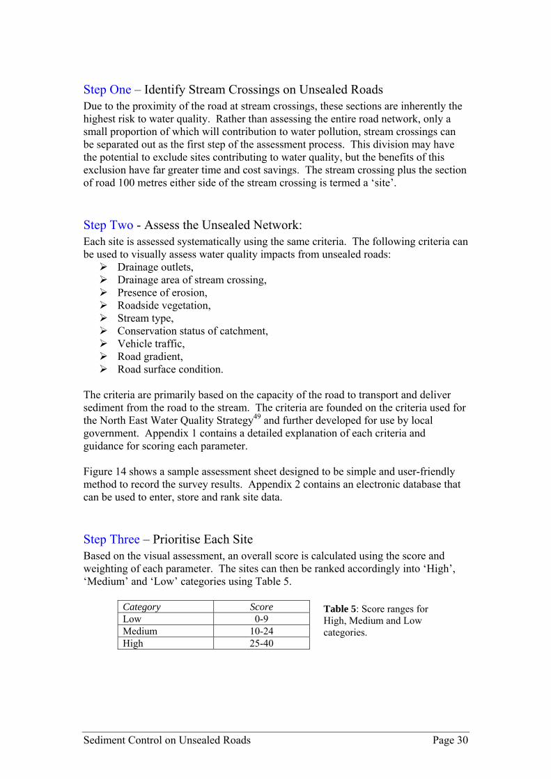
Step One – Identify Stream Crossings on Unsealed Roads
ue to the proximity of the road at stream crossings, these sections are inherently the
tion
the Unsealed Network: ach site is assessed systematically using the same criteria. The following criteria can
quality impacts from unsealed roads: Drainage outlets, Drainag Presenc Roadside vegetation, Stream type, Conservation status , Vehicle traffic, Road grad Road surface condition.
The criteria are primarily based on the capacity of the road to transport and deliver sediment from the road to criteria are founded on the criteria used for the No for use by local government. Appendix 1 contains a detailed explanation of each criteria and guidance for scoring each parameter. Figure 14 shows a sample assessment sheet designed to be simple and user-friendmethod to record the survey results. Appe ic database can be used t nd rank site da Step ThreeBased overall score is calculated using the score and weight sites can then be ranked accordingly into ‘High’, ‘Medium using Table 5.
Category Score
Dhighest risk to water quality. Rather than assessing the entire road network, only a small proportion of which will contribution to water pollution, stream crossings can be separated out as the first step of the assessment process. This division may have the potential to exclude sites contributing to water quality, but the benefits of this exclusion have far greater time and cost savings. The stream crossing plus the secof road 100 metres either side of the stream crossing is termed a ‘site’.
tep Two - Assess SEbe used to visually assess water
e area of stream crossing, e of erosion,
of catchment
ient,
the stream. Therth East Water Quality Strategy49 and further developed
ly that ndix 2 contains an electron
ta. o enter, store a
– Prioritise Each Site on the visual assessment, aning of each parameter. The
’ and ‘Low’ categories
Low 0-9 Medium 10-24 High 25-40
Table 5: Score ranges for High, Medium and Low categories.
Sediment Control on Unsealed Roads Page 30

Figure 14 ple assess
: Sam ment sheet.
Date:
Assessor:
Road name:
Road section from:
Road section to:
Distance to nearest intersection::
Weight Score
Drainage Outlets: inkag a e ream - harge to stream 5 0 - No L e to stream 1 - Parti l linkag to st 2 Direct disc
Drainage Area of Stream tres 3
Cros g: ineal 00 lineal - al me
sin0 - 0-50 l metres 1 - 50-1 metres 2 >100 line
Presen : table tively Stabce of Erosion 0 - S 1 - Rela le 2 - Unstable 3
Roadside Vegetation: ood 2 - 0 - G 1 - Fair Poor 2
Stream Type: emporary anent 2 - 0 - T 1 - Perm Wetland 2
Conservation Status of ion value 2
Catchment: 0 - Highly distur
tly or moderately rbed
2 - conservat1 - Slighdistu
bed High
Vehicle Traffic 0 - Low ium 2 - 1 - Med High 1
Roa t: lat erate Slope 2 - d Gradien 0 - F 1 - Mod Steep 1
Road Surface Condition: ood 2 - 0 - G 1 - Fair Poor 1
Overall Score: Photos: 1. 2.
Sediment Control on Unsealed Roads Page 31

Sediment Control on Unsealed Roads Page 32
Step Four – Minimise The list of ranked sites fo ed action plan for sediment contr orks. All ‘High’ risk sites should be actioned as soon as possible, whilrisk sites require no immediate action. Step Five – Review The assessment process should be revisited periodically. Factors such as vehicle traffic, drainage and catchment development may change over time. As a result, the categorie edium and Low also may change i.e. Medium sites may escalate to High risk, or High risk sites m y becom Low wing the sediment control works. The sedim p ented on the high risk sites should be reviewed. As local characteris s a im r t on ll s mroads, it is essential that sediment control works are reviewed for effectiveness so that in future kno ge can b
rms a prioritis ol we ‘Moderate’ to ‘Low’
s of High, Ma e risk follo
ent control measures im
this
lemre tic po tan in c tro ing edi ent on unsealed
wled e applied to other local sites.
SECTION 5 KEY POINTS - Plan ontr sediment c ol works: Due to the proximity of t o areas of an he r ad at stream crossings, these
unsealed roads n a network re i herently the highest risk to water quality. Councils should assess stream k to crossings within a road networ
evaluate risks to water quality and prioritise sediment control w s. ork The strategic planning of sediment control works can ensure cost
effective measures that result in the maximum benefits to the environment.

Sediment Control on Unsealed Roads Page 33
6. Dust Suppression Road dust can have significant implications for human health, road safety, aestheticsand the environment. Dust suppression
techniques are widely used by local
overnments to reduce the amount of dust generated from local roads. Traditionally, of water, however in recent times new
ed in a large variety of dust suppression chemicals.
7
self and
on sense principles for e application of dust suppression. This guide is designed to minimise the
ent risks during application, however it is by no means absolute. The ld take into account the characteristics and
quirements of the site.
Du g 1. U .
Follow the supplier' r lo el if
2. Keep a record. Write down the date, location, area, rate of application, total
volume applied and weather conditions (including conditions before and after application). This information will help to assess the effectiveness of the treatment and allow applications to be tailored in the following year/s to achieve the best result. A control section i.e. an untreated road section, can be useful to compare results.
gdust suppression was simply the application technologies have result Research conducted as part of the Unsealed Roads Stormwater Project has found that dust suppressants have the potential to impact on stormwater quality and subsequently effect the surrounding environment. See the project Technical Report for more information on the research undertaken. All products may have adverse environmental impacts if used improperly . The use of dust suppression is a balance between minimising the impacts of the dust itminimising the environmental impacts of suppressant application. If dust suppression is to be used, application must be performed in a way that minimises the risk to the environment. The following guidelines provide some commthenvironmapplication of dust suppression shoure
rin application, use the following guidelines:
se the minimum quantity of product required to obtain the desired results specifications, but be aware of the need to account fo
cal conditions. It is advisable to start with lower levels and increase the lev not initially effective.
Photo 14: Dust
suppression application.

3. Apply during the dry
Avoid application during or prio season. Apply dust suppression when it is needed most.
r to the wet season of the year.
product is to be applied using a tanker or
4. Check weather forecasts before applying. Do not apply when it is raining or
when rainfall is forecast within the next three days. Rainfall immediately after application of the dust suppressant is likely to wash the chemical away. This results in wasted time, money and possible contamination of stormwater.
5. Apply only on the road pavement. Do not apply on road shoulder, drainage
channels or road verge. During application, prevent drift of the chemical through either airborne droplets or run-off.
. Use calibrated equipment. If the 6
pump system, make sure the equipment is calibrated and set to the correct flow rate before commencing.
7. Aim to maintain a buffer distance of 100 metres between the application
area and waterways. Proximity to surface waters and the water table can mean that the chemical is easily transported to waterways. Avoid applying dust suppressants near stream crossings, wetlands or flood-prone areas.
SECTION 6 KET POINTS - Dust suppression:
Chemical-based dust suppressants have the potential to cause adverse impacts on stormwater quality and the surrounding environment.
If dust suppression is to be used, application should be performed in a way that minimises the risk to the environment.
Sediment Control on Unsealed Roads Page 34
7. eferences
R
1 Bl Mountains Urban Runoff Control Program (BMURCP). 1999. Rainfall Simulation Trials Blue Moun ains. University of Western Sydney Nepean, Hawkesbury-Nepean Catchment Management
Engineering Report CE14. website (www.epa.vic.gov.au). Oceanics Australia. 2002. Mornington Peninsula Shire Council Stormwater Management Plan.
ue t
Trust, 2 EPA 3 WBM
ustrro
5 EPA rnment Gazett
oria. 2001a. Variation of State Environment Protection Policy (Waters of Victoria) – rti 2,
o7 ARR al: Guidelines to Good Practice. ARRB Transport Research
td. Stld
9 RansLands. 10 Wal y, G.,
oleman, R. & Stevenson, J. 2003a. The Western Port sediment study. CSIRO Consultancy report. Australian Rainfall and Runoff, Volume 1, 2001. The Institute of Engineers Australia. Elliot, W.J., Foltz, R.B. & Luce, C.H. 1999. Modelling low-volume road erosion. Transportation esearch Record 1652, 244-249.
n on Forest Roads. General Technical
14 F , road. Six 5. 15 StormGuidelin tion, Dept. Natural Resources
Envi Melbourne. Elliot, W.J., Foltz, R.B. & Luce, C.H. 1999. Modeling low-volume road erosion. Transportation esearch Record 1652, 244-249. Haydon, S.R., Jayasuriya, M.D.A. & O’Shaughnessy, P.J. 1991. The effect of vehicle use and road
maintenance on erosion from unsealed roads in forests: the road 11 experiment. Melbourne Water Report No. MMBW-W-0018. 18 ARRB Transport Research. 2003. Trial of low cost treatments on Stumpy Gully Road – Final Report. Contract report by ARRB Transport Research for Mornington Peninsula Shire Council. 19 Grayson, R.B., Haydon, S.R., Jayasuriya, M.D.A. & Finlayson, B.L. 1993. Water quality in mountain ash forests – separating the impacts of roads from those of logging operations. Journal of Hydrology 150, 459-480. 20 Croke, J., Wallbrink, P., Fogarty, P., Hairsine, P., Mockler, S., McCormack, B. & Brophy, J. 1999. Managing sediment sources and movement in forests: the forest industry and water quality. Cooperative Research Centre for Catchment Hydrology technical report 99/11. 21 Luce C.H. & Black T.A. 1999. Sediment production from forest roads in western Oregon. Water Resources Research 35(8), 2561-2570. 22 Giummarra, G. 2001. Road classifications, geometric designs and maintenance standards for low volume roads. ARRB Transport Research Ltd, Vermont South, Victoria. Research Report ARR 354. 23 Zeigler, A.D., Sutherland, R.A. & Giambelluca, T.W. Runoff generation and sediment production on unpaved roads, footpaths and agricultural land surfaces in northern Thailand. Earth Surface Processes and Landforms 25, 519-534.
4 A oads. 2001. Road runoff & drainage: environmental impacts and management options. Aust ads Incorporated, Sydney.
Victoria. 2003. State Environment Protection Policy (Waters of Victoria). Victorian Govee 4th June 2003.
6 EPA VictInse on of Schedule F8, Waters of Western Port and Catchment. Victoria Government Gazette S 192nd N vember 2001.
B. 2000. Unsealed Roads Manuh Vermont, VIC. L
8 Go man, S. J., Jackson, K. & Bursztynsky, T. A. 1986. Erosion and sediment control handbook. McGraw-Hill.
om, M. J. 1987. Control of erosion on construction sites. Department of Conservation Forests &
lbrink, P.J., Hancock, G.J., Olley J.M., Hughes, A., Prosser, I.P., Hunt, D., RooneC11
12
R13 Burroughs, E.R. & King, J.G. 1989. Reduction of Soil ErosioReport INT-264, Intermountain Forest and Range Research Station, USDA Forest Service.
oltz R.B. & Truebe, M.A. 1995. Effect of aggregate quality on sediment production from a forestth International Conference on Low-Volume Roads, Minneapolis, Minnesota, July 199
water Committee. 1999. Urban Stormwater: Best Practice Environmental Management es. Environment Protection Authority, Melbourne Water Corporaronment, Municipal Association of Victoria. CSIRO Publishing,and
16
R17
Sediment Control on Unsealed Roads Page 35

E., Giummarra, G., McArthur, M. & Sheridan, G. 2001. Environmental al sealed and unsealed roads. ARRB Transport Research Ltd. Melbourne, Aust.
25 Austroads. 2001. Road runoff & drainage: environmental impacts and management options.
ervice. In Transportation Research Record, 1426 pp. 10-14. ent production from forest road surfaces. Water Resources
ality al Processes 16, 2599-2612.
Research Record 1652, 227-234. mall
Gravel Road Erosion Prevention Guidelines. Department of Conservation
, P.J., Hairsine, P.B. & Grayson, R.B. 2003. Determining the sources of
ds Publication No. AP-R232/03. low-
ion. New
ediment Control – Road Corridors. Proceedings of Transport
ria
res
Cooperative Research Centre for Catchment Hydrology technical
n sites in Victoria. Soil Conservation Authority, Melbourne.
s of
2004. Water Sensitive Urban Design – Engineering Guidelines. Ecological
ent Plan.
24 McRobert, J., Styles, practices manual for rur
Austroads Incorporated, Sydney. 26 Moll, J.E. (1993). Reducing low-volume road impacts on the environment: success in the US Department of Agriculture Forest S27 Reid, L.M. & Dunne, T. 1984. SedimResearch 20(11), 1753-1761. 28 Lane, N.J. & Sheridan G.J. 2002. Impact of an unsealed forest road stream crossing: water quand sediment sources. Hydrologic29 Grace, J. M. 1999. Erosion control techniques on forest road cutslopes and fillslopes in North Alabama. Transportation30 Haan, C. T., Barfield, B. J. and Hayes, J. C. 1994. Design Hydrology and Sedimentology for SCatchments. Academic Press, San Diego. 31 Garden, F. M. 1980.Forests & Lands. 32 Motha, J.A., Wallbrinksuspended sediment in a forested catchment in southeastern Australia. Water Resources Research 39(3), 1-14. 33 Austroads. 2003. Guidelines for treatment of stormwater runoff from the road infrastructure. Austroa34 Tysdal, L.M., Elliot, W.J., Luce, C.H. & Black, T.A. 1999. Modeling erosion from inslopingvolume roads with WEPP watershed model. Transportation Research Record 1652, 250-256. 35 NSW Department of Housing. 1998. Managing Urban Stormwater: Soils and ConstructSouth Wales Government. 36 Norvill, M. 1999. Erosion and SCorridor Management Conference. November 1999, Brisbane. Pp. 119-137. 37 EPA Victoria. 1991. Construction Techniques for Sediment Pollution Control. EPA VictoPublication No. 275. 38 EPA Victoria. 2004. Doing it Right on Subdivisions: Temporary environmental protection measufor subdivision construction sites. EPA Publication No. 960. 39 Berkshire Regional Planning Commission. 2001. The Massachusetts Unpaved Roads BMP Manual. Project 98-06/319. 40 Wong, T., Breen, P. & Lloyd, S. 2000. Water sensitive road design: design options for improvingstormwater quality of road runoff.report 00/1. 41 Garvin, R. J., Knight, M. R. & Richmond, T. J. 1979. Guidelines for minimising soil erosion andsedimentation from constructio42 Grace III, J. M. 2002. Control of sediment export from the forest road prism. American Society of Agricultural Engineers Vol. 45(4), 1127-1132. 43 International Erosion Control Association (IECA). Undated. Course notes: ‘The fundamentalerosion and sediment control’. Course presenter – Michael Frankcombe CPESC. 44 Melbourne Water. Draft Engineering, WBM, Parsons Brinkerhoff. 45 Melbourne Water’s water sensitive urban design website (wsud.melbournewater.com.au). 46 WBM Oceanics Australia. 2002. Cardinia Shire Council Stormwater Managem47 Cardinia Shire Council. Undated. Roadside Management Plan. 48 Hairsine, P. 1997. Controlling sediment and nutrient movement within catchments. Cooperative Research Centre for Catchment Hydrology industry report 97/9. 49 North East Catchment Management Authority & Dept Natural Resources and Environment. 2003. Implementation of North East Water Quality Strategies on Public Land.
Sediment Control on Unsealed Roads Page 36