sedimentary rocks - msu billings 2010/suits/geo... · •what characteristics of sedimentary rocks...
TRANSCRIPT
1
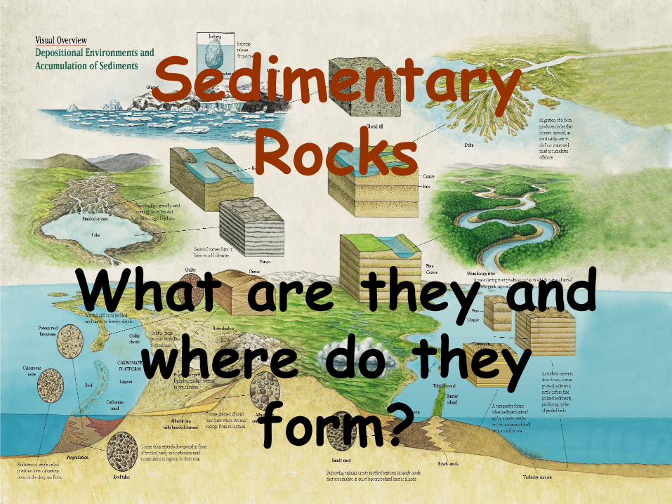
Sedimentary Rocks
What are they and where do they
form?
2
Guiding Questions
• What characteristics of sedimentary rocks
can we use to identify the environment of
deposition, i.e., where it was formed?
• How does vertical stacking of distinctive
types of strata provide clues to changes in
environments of deposition that indicate
larger changes in the Earth such as sea level
rise and fall and changes in the
environment?
– > the latter is Stratigraphy
3
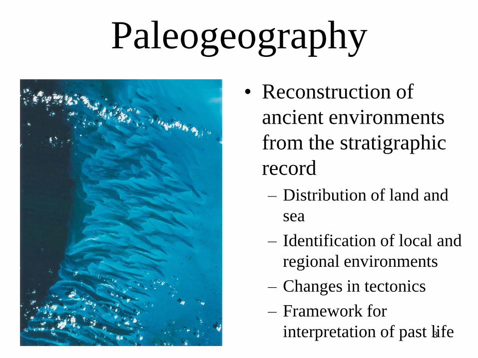
Paleogeography
• Reconstruction of
ancient environments
from the stratigraphic
record
– Distribution of land and
sea
– Identification of local and
regional environments
– Changes in tectonics
– Framework for
interpretation of past life

4
Three Basic Depositional Environments:
Marine,
Non-marine and
Marginal Marine

5
Three Basic Depositional Environments:
Marine the ocean
Non-marine lakes, rivers, floodplains, glaciers
Marginal Marine beaches, lagoons, estuaries
Marine Limestones and Shales
Non-marine Sandstones and Shales
Marginal Marine Sandstones and Mudstones

6
Nonmarine Environments
• Soil
– Loose sediment containing organic matter and accumulated in contact with atmosphere
– Topsoil
• Upper zone of many soils
• Sand and clay mixed with humus
– Humus
• Organic matter that gives topsoil its dark color
• Derived from decay of plant debris by bacteria

7
Nonmarine Environments
• Soils
– Type of soil depends on
climatic conditions
• Caliche
– Calcium carbonate produced
by evaporation of
groundwater
• Laterite
– Iron oxide rich soil produced
in moist tropical regions
8
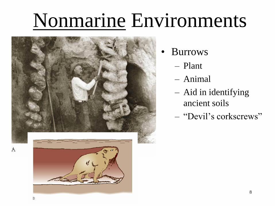
Nonmarine Environments
• Burrows
– Plant
– Animal
– Aid in identifying
ancient soils
– “Devil’s corkscrews”

9
Nonmarine Environments• Lakes
– Lower elevation, more likely preservation
– Indicates abundant precipitation
• Sediments
– Coarsest around lake margin
– Finest at center
• Often layered, i.e., non-bioturbated
• Freshwater fossils
• Less bioturbation . >>> laminated

10
Nonmarine Environments
• Glaciers
– Indicate cold climates
• Scratches produced by
glacial motion
– Record direction of
motion

11
Nonmarine Environments• Meltwater
– Transports sediments from
glacier
– Forms streams and lakes
• Outwash
– Well-stratified layers of
sediment
• Varve
– Annual layers of alternating
coarse and fine sediments
12
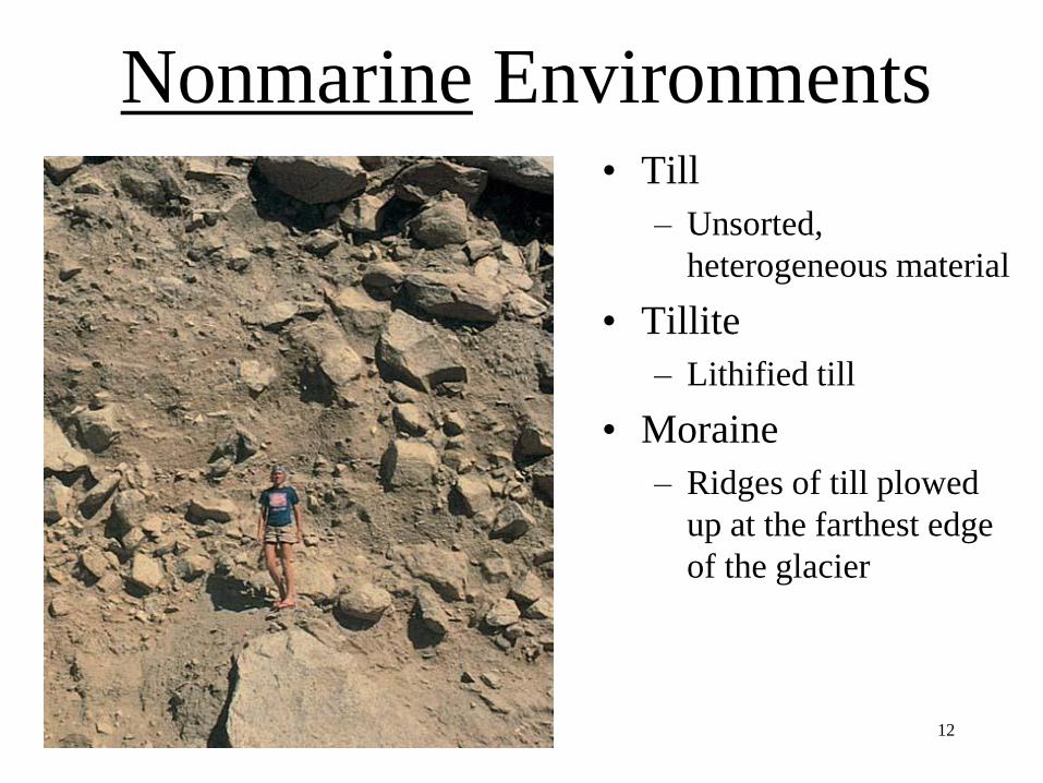
Nonmarine Environments• Till
– Unsorted,
heterogeneous material
• Tillite
– Lithified till
• Moraine
– Ridges of till plowed
up at the farthest edge
of the glacier


Moraines - Till
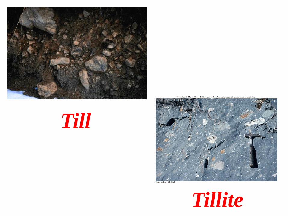
Till
Tillite
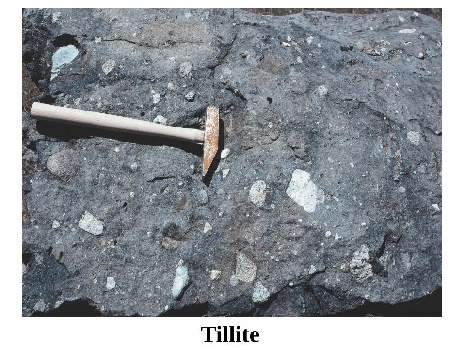
Tillite

17
Nonmarine Environments
• Varves
– Annual record
• Count!
• Dropstones
– Scattered coarse
sediments found in
sediment matrix
– Ice-rafted debris

18
Nonmarine Environments
• Desert soils
– Little organic matter
– Evaporite minerals
• Interior drainage
– Precipitation does not leave the basin
– Playa lake
• Temporary lakes
• Associated with evaporites

19
Nonmarine Environments
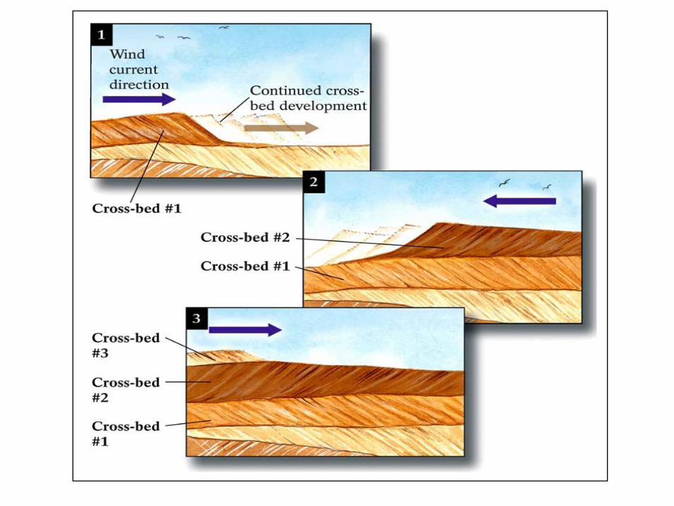
• Dunes
– Piles of sand
– < 1% of deserts
– Moves with prevailing
wind direction
– Associated with deserts
and beaches

Desert Dunes

Desert Dunes

Rocks from Desert Dunes

Cross BedsZion National Park, UT
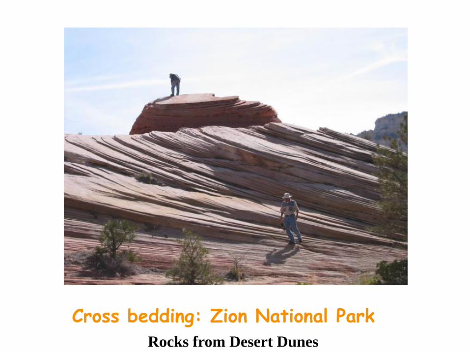
Cross bedding: Zion National Park
Rocks from Desert Dunes

Cross bedding: Kaibab Sandstone, Zion National Park
Rocks from Desert Dunes

Rocks from Desert Dunes

Crossbeds
Aeolian
(deserts)
Rivers and Beaches

Fig. 7-19, p. 218
30
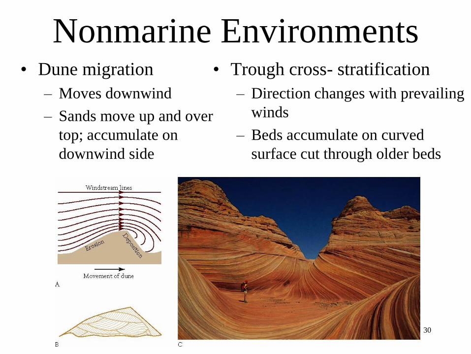
Nonmarine Environments• Dune migration
– Moves downwind
– Sands move up and over
top; accumulate on
downwind side
• Trough cross- stratification
– Direction changes with prevailing
winds
– Beds accumulate on curved
surface cut through older beds

31
Nonmarine Environments• Alluvial fans
– Low, cone-shaped
structures
– Develop where
mountain slope meets
valley floor
– Change in slope
reduces stream velocity
• Sediments settle out
• Braided streams form

Alluvial Fans

Rocks from Alluvial Fans

34
Nonmarine Environments
• Mudcracks
– Polygonal shape
– Form from alternate
wetting and drying
– Associated with
evaporites
• Halite
• Gypsum
• Anhydrite

35
Nonmarine Environments
• RIVERS and STREAMS
• Waters move from mountains to sea through a variety of depositional environments
– Braided streams
– Meandering rivers
– Marginal marine systems

36
Nonmarine Environments
• Braided streams
– More sediment
available than the
water can transport
– Forms numerous
channels and bars

The North Platte River: A Braided Stream
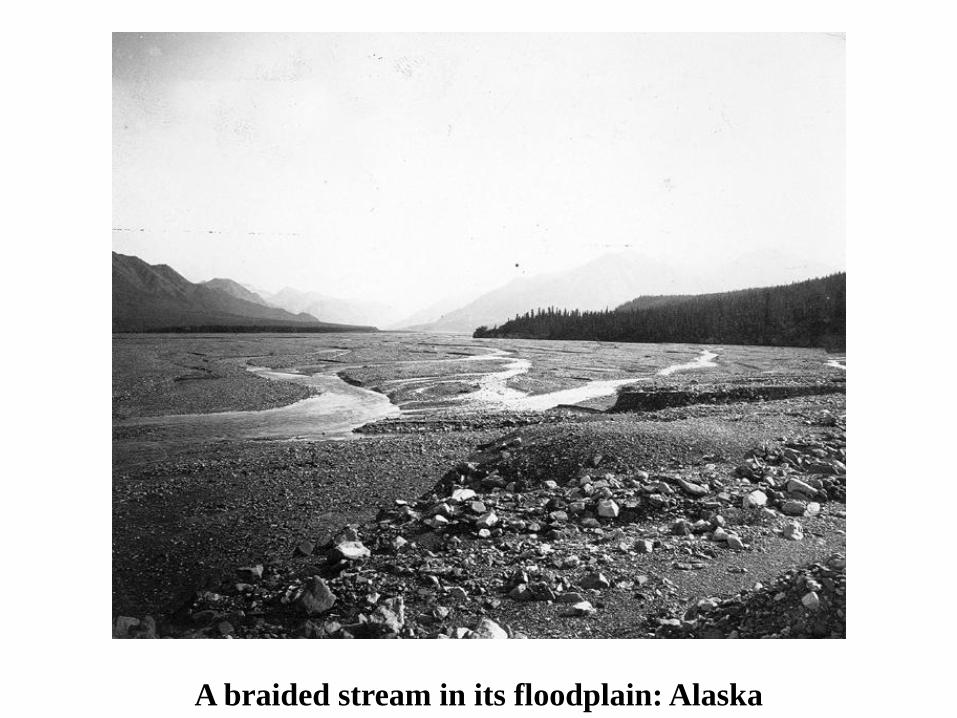
A braided stream in its floodplain: Alaska

39
Nonmarine Environments
• Meandering River
– Abundant water
relative to sediment
• Backswamps
– Flood plain
– Mud settles out when
stream overflows
40
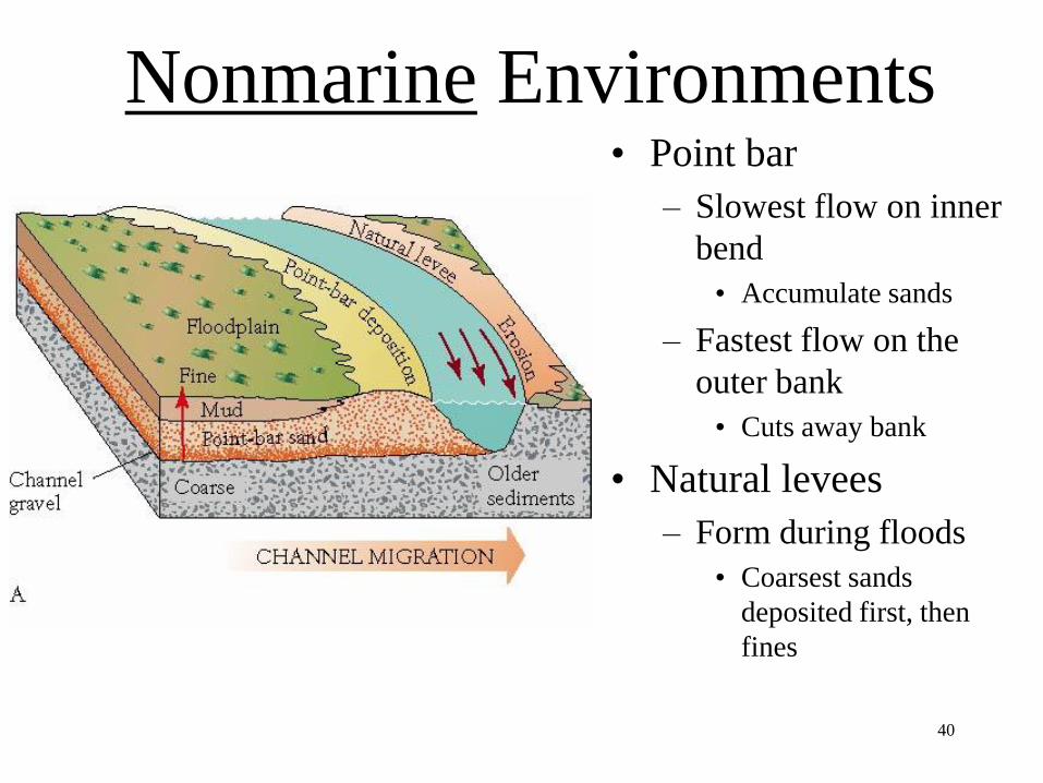
Nonmarine Environments• Point bar
– Slowest flow on inner
bend
• Accumulate sands
– Fastest flow on the
outer bank
• Cuts away bank
• Natural levees
– Form during floods
• Coarsest sands
deposited first, then
fines

A braided stream in its floodplain: Laramie River

Oxbow lakes in a floodplain


River channels

River channels


Riparian foliage in a floodplain
49
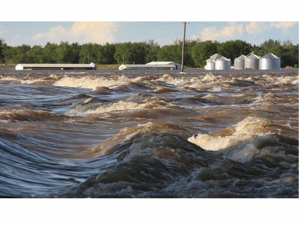
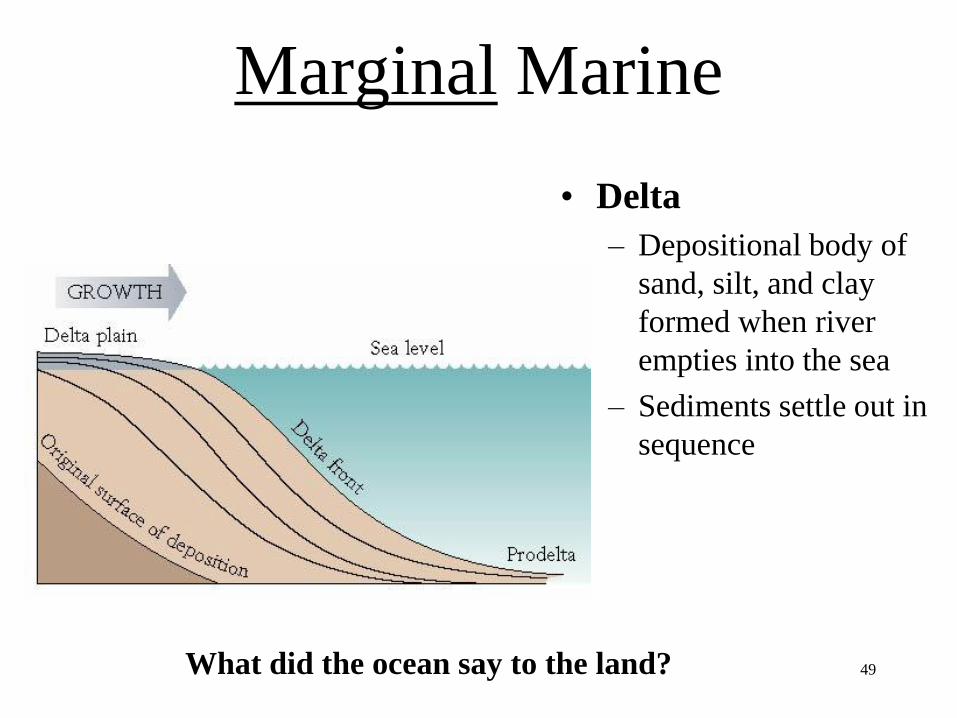
Marginal Marine
• Delta
– Depositional body of
sand, silt, and clay
formed when river
empties into the sea
– Sediments settle out in
sequence
What did the ocean say to the land?


The Ganges River Delta

52
Marginal Marine
• Delta front
– Silt and clay slope deposits
• Prodelta
– Clays often deposited by a freshwater plume
• Progrades into basin
– Sediments coarsen upward
• Delta plain
– Layers of sand and silt deposited as river nears sea
– Distributary channels
• Separated by levees

53
Marginal Marine
• Mississippi River Delta
– River dominated delta
– Progrades into Gulf of
Mexico
– Lobes
• Growing portion of the
delta

54
Marginal Marine
• Mississippi River Delta
– Active lobe
• Growing portion of delta
• Switched lobes in the past
– Abandoned lobe
• Sediments compact
• Lobe sinks
• New lobe forms on top


Marine Transgression = Sea Level Rise
Aside: What happens when
sea level changes?
Marine Regression = Sea Level Fall

Blue = No deposition
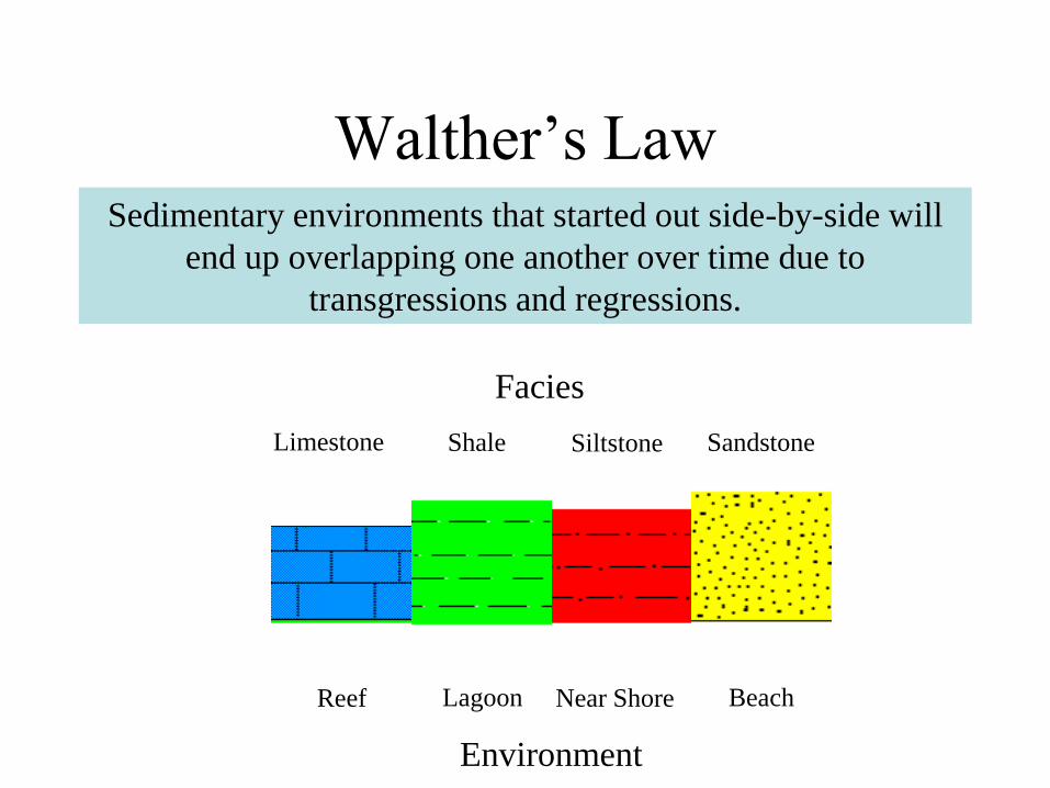
Walther’s LawSedimentary environments that started out side-by-side will
end up overlapping one another over time due to
transgressions and regressions.
Limestone Shale Siltstone Sandstone
Reef Lagoon Near Shore Beach
Environment
Facies

Marine Trangression
Walther’s Law

Marine Regression
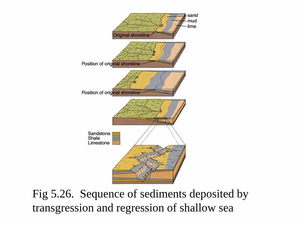
Fig 5.26. Sequence of sediments deposited by
transgression and regression of shallow sea

“The sea goes in, the sea goes out.”

63
Back to…
Marginal Marine
• Deltaic Cycles
– Sequence of
deposition
– Coarsens
upward
– Erosion can
remove tops

64
Marginal Marine• Barrier-Island Lagoon
Complex
• Barrier Islands
– Waves and currents pile up sands
– Longshore Current
• Lagoons
– Protected from strong waves behind barriers
– Muds and muddy sands

65
Marginal Marine
• Progradation
– Shoreline builds out
into sea
• High supply of
sediment
– Builds over deeper
water environments
– Illustrates Walther’s
Law

66
Marginal Marine
• Fossils
– Useful in
reconstructing
environments of
past

67
Marine
• Tempestites
– Storm deposits on shelf
– Sands deposited within
normal muds and
muddy sands

68
Carbonate Systems• Organic reefs
– Modern reefs
formed from coral
– Ancient reefs
formed from
different
organisms
69
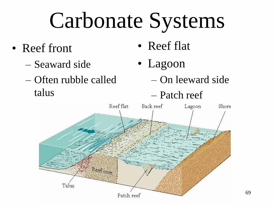
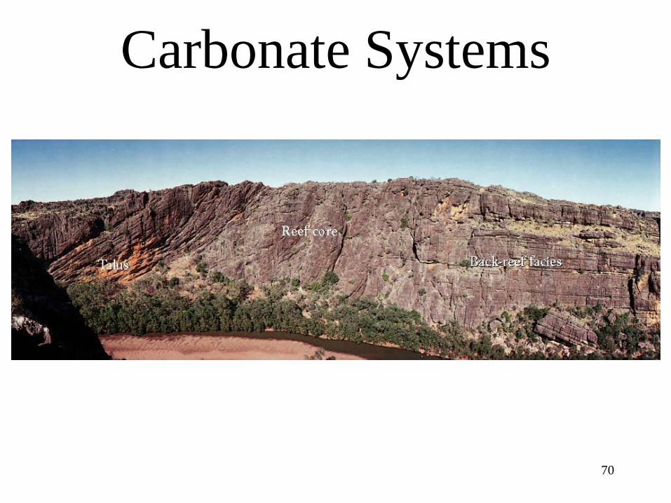
Carbonate Systems• Reef front
– Seaward side
– Often rubble called
talus
• Reef flat
• Lagoon
– On leeward side
– Patch reef
70
Carbonate Systems

71
Carbonate Systems• Barrier reefs
– Elongate reefs
with lagoon
behind
• Fringing Reefs
– Grow along coast
– Lack lagoon
72
Carbonate Systems
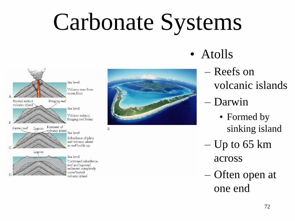
• Atolls
– Reefs on
volcanic islands
– Darwin
• Formed by
sinking island
– Up to 65 km
across
– Often open at
one end
73
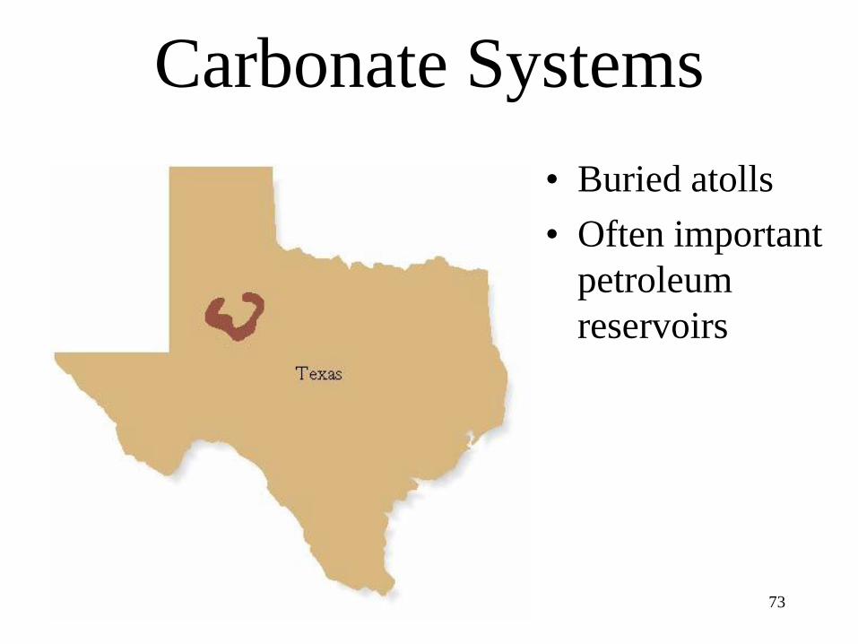
Carbonate Systems
• Buried atolls
• Often important
petroleum
reservoirs

74
Carbonate Systems
• Carbonate Platform
– Broad carbonate
structure above
seafloor
– Windward side
• Nutrient rich
• Abundant reefs
• Buffered system– CO2 + H2O = H2CO3
– HCO3 + CaCO3 =
2HCO-3
75
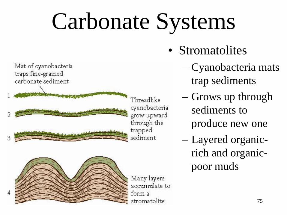
Carbonate Systems• Stromatolites
– Cyanobacteria mats
trap sediments
– Grows up through
sediments to
produce new one
– Layered organic-
rich and organic-
poor muds
76
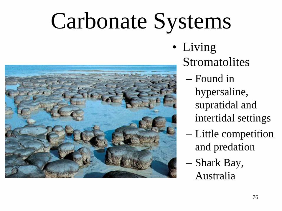
Carbonate Systems• Living
Stromatolites
– Found in
hypersaline,
supratidal and
intertidal settings
– Little competition
and predation
– Shark Bay,
Australia

77
Deep Sea Environments• Turbidity current
– Dense sediment-laden
flow driven by gravity
• Turbidite
– Produces graded
deposit
– Poorly sorted coarse
grains at base
– Fine grains at top

78
Deep Sea Environments
• Turbidites are
common in canyons
• Drop sediment load at
base
– Form deposit similar to
alluvial fan

79
Deep Sea Environments
• Pelagic sediment
– Fine-grained sediments
that accumulate by
settling through the
water column
– Calcium carbonate
– Silica
– Clay

80
Deep Sea Environments
• Calcareous ooze
– Accumulations of single-
celled planktonic
organisms
• Foraminifera
• Calcareous nannoplankton
• Common < 4 km w.d.
– Dissolution increases
below 4 km w.d.

81
Deep Sea Environments
• Siliceous ooze
– Diatoms
– Radiolarians
• Common in
upwelling regions
• Accumulations can
alter to opal then
chert

82

Alluvial fans in Death Valley


Coral Reefs

Fig. 14-11, p. 336
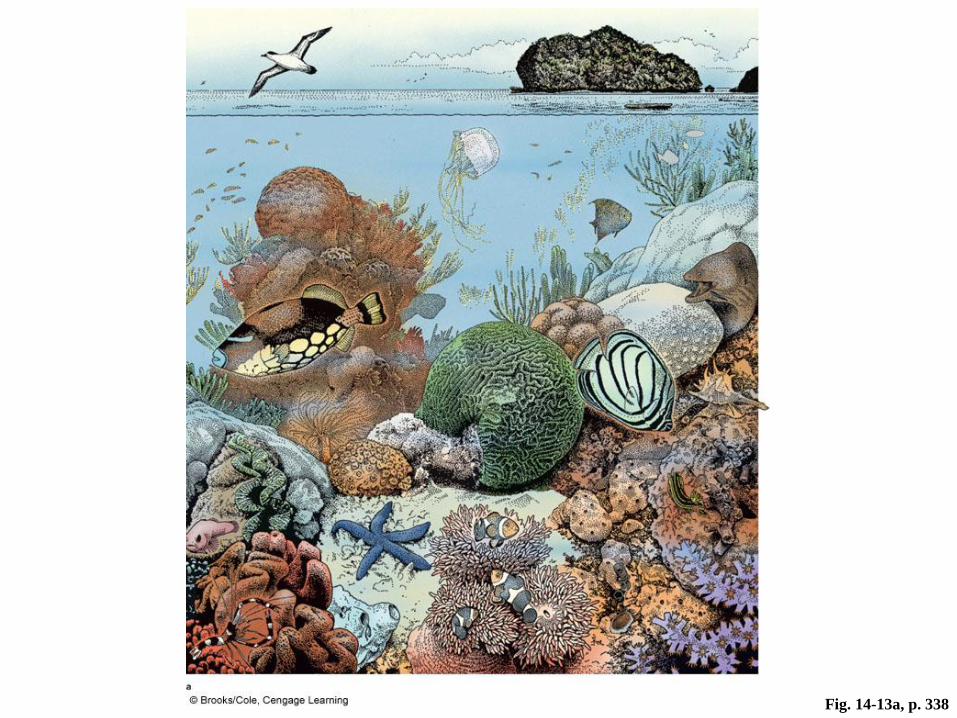
Fig. 14-13a, p. 338

Fig. 11-23, p. 261
Great Barrier Reef
Australia

Fig. 14-14d, p. 339

Fig. 14-12, p. 337

Reefs
• Coastal feature of biological origin
• Complex community of coral, algae &
other marine animals living in warm
seas
• Reef structure has large influence on
coastal processes