semantically mapping science (sms)
TRANSCRIPT
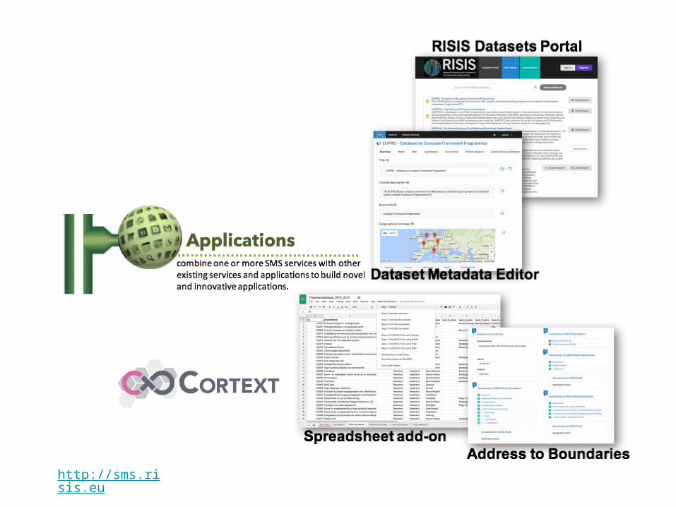
Semantically Mapping Science (SMS)a linked open data infrastructure for science and
innovation studies
Ali Khalili**, Peter van den Besselaar*, Al Idrissou*, Antonis Loizou**, Stefan Schlobach**, Frank van Harmelen**
* Network Institute & Department of Organization Sciences ** Network Institute & Department of Computer Science
Vrije Universiteit Amsterdam, Amsterdam, The Netherlands

http://risis.eu


How to capture new insights by integrating data from
multiple heterogeneous data sources in the STI domain?

SMS Platform

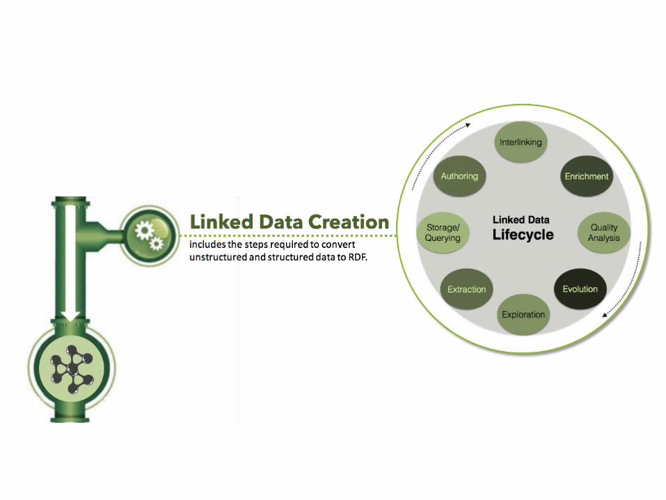

Linked (Open) Data
A set of best practices for publishing data on the Web.Follows 4 simple principles:
a. Use URIs as names (identifiers) for conceptual things.b. Use HTTP URIs so that users can look up (dereference) those names.c. When someone looks up a URI, provide useful information, using the
open standards.d. Include links to other URIs, so that users can discover more things.
https://www.ted.com/talks/tim_berners_lee_on_the_next_web

Linked (Open) Data: Principles
WWW World
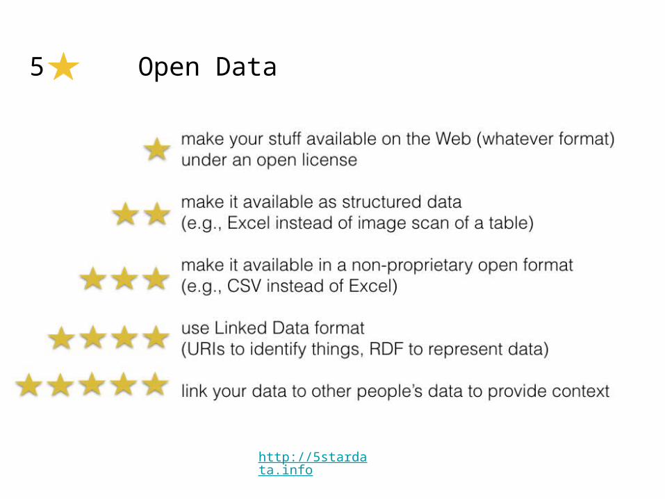

5 Open Data
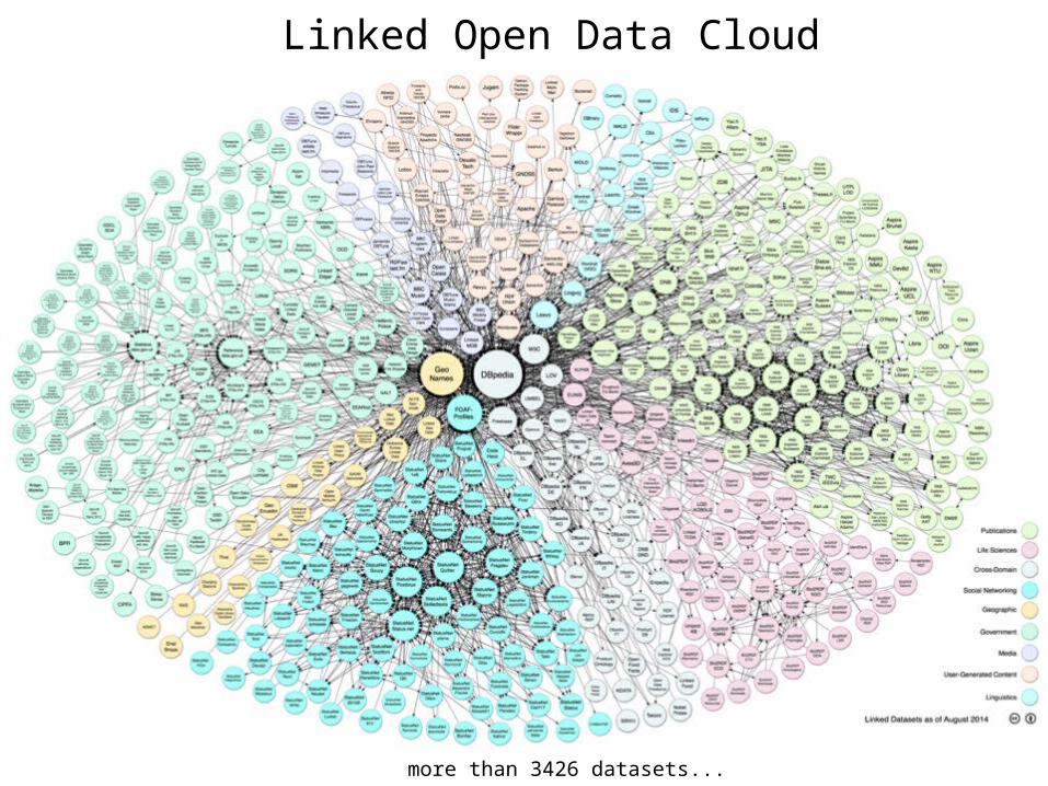
Linked Open Data Cloud
more than 3426 datasets...

Example: DBpedia

Example: Linked Data Queries● Give me a list of capital cities in Europe with population more than
400,000 who have female mayors...

Interlinking

Scientific Lenses


http://api.sms.risis.eu/

SMS Platform

Example Use Case
Adaptive Delineation of Functional Urban Areas (FUAs)

Functional Urban Areas (FUAs)
• defined by OECD in collaboration with EC/Eurostat• consider factors beyond the predefined city boundaries to
better reflect the economic geography of where people live and work• population• area• GDP• environment (CO2 emissions and air pollution)• labour market (employment and unemployment growth) • innovation (patent intensity)• urban form and territorial organization

FUA: Example

Data Interlinking
CBS-NL
RVO-NL

Statistical data about boundariese.g. CBS-NL
Open boundariese.g. OpenStreetMap
e.g. RVO-NL

Open Administrative Boundaries

Adaptive Delineation of FUAs: CBS Data + Open Boundaries
https://hyperir.carto.com/viz/7abbf192-4775-11e6-b8b6-0e98b61680bf/public_map
Research question
Investigating the effect of socio-economic and structural properties of the urban areas on innovative activities, as stimulated by recent RTD policies in the Netherlands.
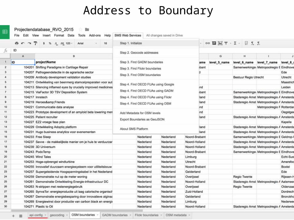
Address to Boundary

Mapping RVO Projects to the delineated FUAs
http://demo.ld-r.org/browse/http%3A%2F%2Fgeo.risis.eu%2Frvo-nl
Conclusion
SMS platform aims to produce much richer data to be used in social research – through the integration of heterogeneous datasets ranging from tabular statistical data to unstructured data found on the Web...
http://sms.risis.eu