sensor & computing infrastructure for environmental risks scier fp6-2005-ist-5 stathes...
Post on 19-Dec-2015
214 views
TRANSCRIPT
Sensor & Computing Infrastructure for Environmental
Risks
SCIER FP6-2005-IST-5
Stathes Hadjiefthymiades (NKUA)
1st Student Workshop on Wireless Sensor Networks
Brussels, Oct. 2008

Main Objectives
• Sensor network infrastructures for the detection and monitoring of disastrous natural hazards.
• Advanced sensor fusion and management schemes.
• Risk evolution models simulated on GRID.
• Multi-risk platform.
• Public-private sector cooperation.

LACU
Computing System
Public infrastructure
private infrastructure
con
trol
Local Alerting Control Unit LACU
LACULACU LACU
LACU
LACU
SCIER architecture

SCIER Sensing Subsystem• Sensor Infrastructure
– In-field sensor nodes (humidity, temp, wind speed/direction)
– Out-of-field vision sensors (vision sensor)
• Sensor Data Fusion
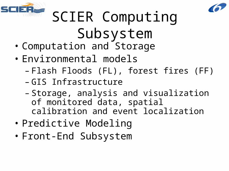
SCIER Computing Subsystem
• Computation and Storage• Environmental models
– Flash Floods (FL), forest fires (FF)– GIS Infrastructure– Storage, analysis and visualization of
monitored data, spatial calibration and event localization
• Predictive Modeling• Front-End Subsystem
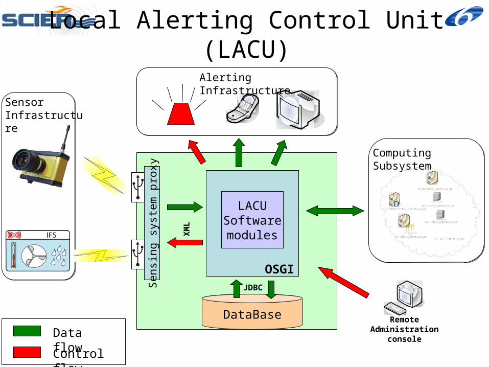
Local Alerting Control Unit (LACU)
Data flow
Control flow
DataBase
Worker Node
Worker Node
VO Storage Disk Pool
MON:ctb30.gridctb.uoa.gr
CE,SiteBDII:ctb31.gridctb.uoa.gr
SE:ctb32.gridctb.uoa.gr
WN:ctb33.gridctb.uoa.gr
WN:ctb34.gridctb.uoa.gr
SCIER Site @ UoA
Computing Subsystem
Alerting Infrastructure
JDBC
Sensor Infrastructure
Sen
sing
sys
tem
pro
xy
XM
L
LACUSoftwaremodules
Remote Administration
console
OSGI
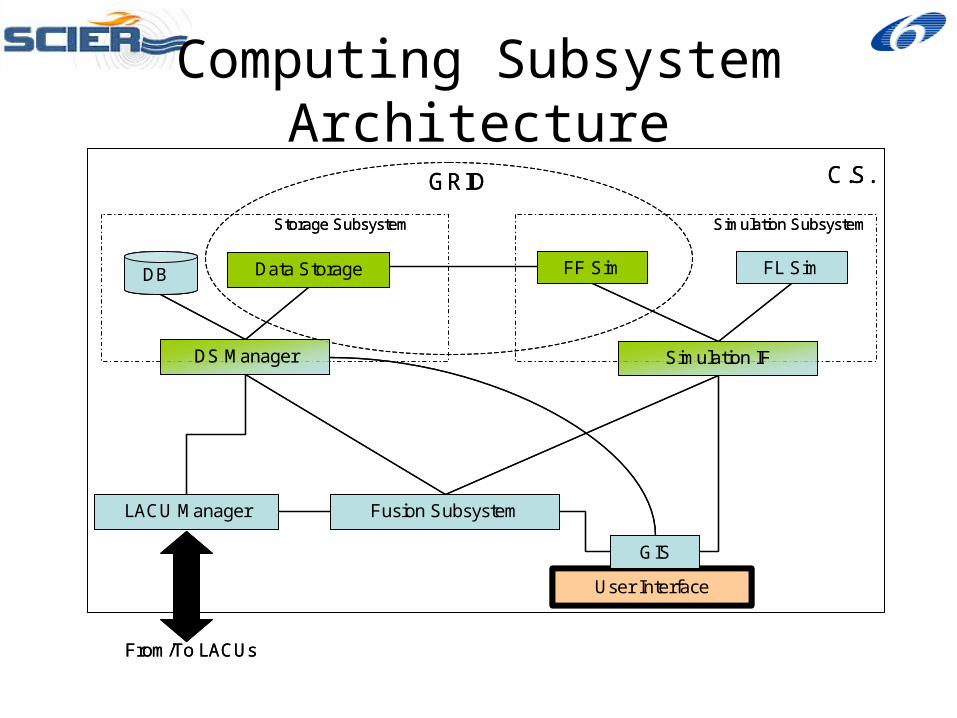
Computing Subsystem Architecture
User Interface
Fusion SubsystemLACU Manager
GRID C.S.
From/To LACUs
Simulation IF
Simulation Subsystem
FF Sim FL Sim
Storage Subsystem
DS Manager
Data StorageDB
GIS
User Interface
Fusion SubsystemLACU Manager
GRID C.S.
From/To LACUs
Simulation IF
Simulation Subsystem
FF Sim FL Sim
Storage Subsystem
DS Manager
Data StorageDBDB
GIS
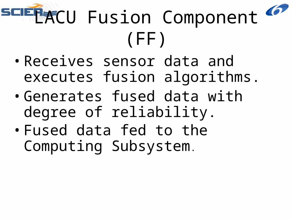
LACU Fusion Component (FF)
• Receives sensor data and executes fusion algorithms.
• Generates fused data with degree of reliability.
• Fused data fed to the Computing Subsystem.
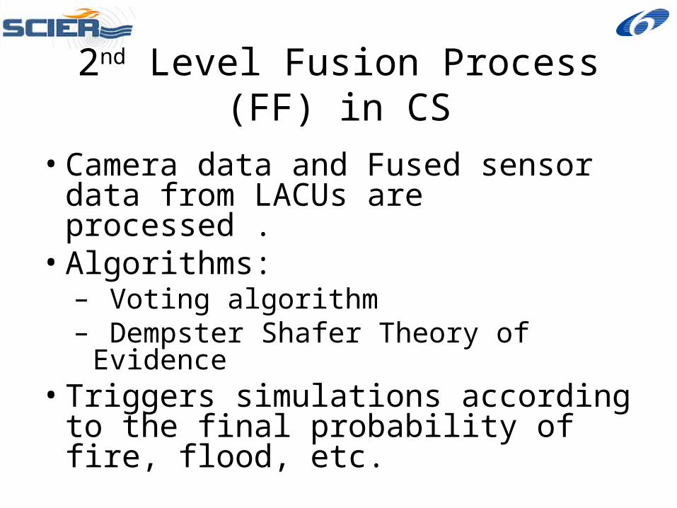
2nd Level Fusion Process (FF) in CS
• Camera data and Fused sensor data from LACUs are processed .
• Algorithms:– Voting algorithm– Dempster Shafer Theory of Evidence
• Triggers simulations according to the final probability of fire, flood, etc.
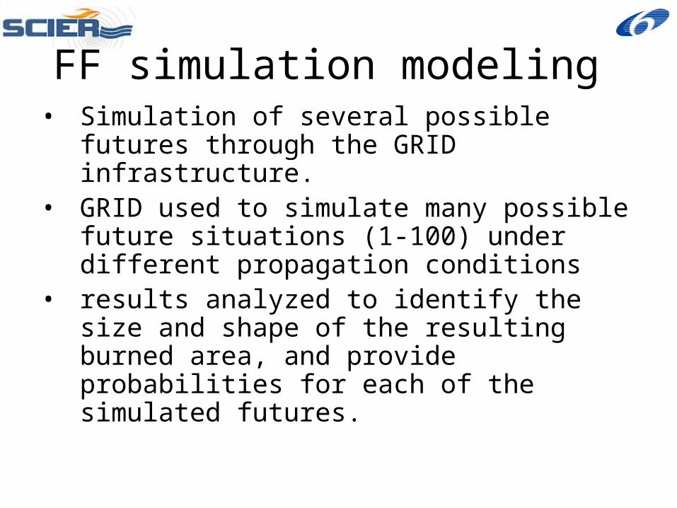
• Simulation of several possible futures through the GRID infrastructure.
• GRID used to simulate many possible future situations (1-100) under different propagation conditions
• results analyzed to identify the size and shape of the resulting burned area, and provide probabilities for each of the simulated futures.
FF simulation modeling
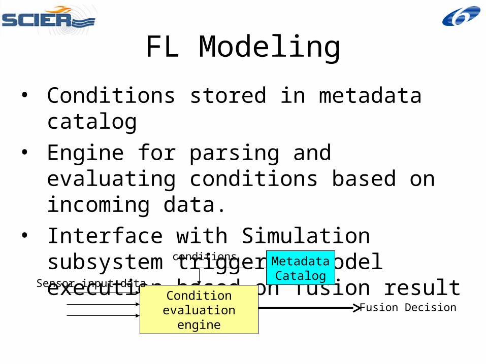
• Conditions stored in metadata catalog
• Engine for parsing and evaluating conditions based on incoming data.
• Interface with Simulation subsystem triggering model execution based on fusion result
Condition evaluation engine
Sensor input data
Metadata Catalog
conditions
Fusion Decision
FL Modeling
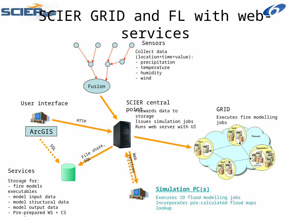
SCIER GRID and FL with web-services
Fusion
Sensors
Storage for:- fire models executables- model input data- model structural data- model output data- Pre-prepared WS + CS scenarios
Services
GRIDSCIER central point
Collect data (location+time+value):- precipitation- temperature- humidity- wind
ArcGIS
Executes fire modelling jobs
User interface
Simulation PC(s)
Executes 1D flood modelling jobsIncorporates pre-calculated flood maps lookup
Forwards data to storageIssues simulation jobsRuns web server with UI
Web services
File share, SQLSQ
L
HTTP
System Validation & Evaluation
• Testing includes both fires and flooding– Gestosa, Portugal (experimental and
controlled burns)– Stamata, Attica, Greece (fires, system
deployed)– Aubagne, Bouches du Rhone, S. France
(fires and floods, deployment underway)– Brno, Czech Republic (floods, system
deployed)

System Validation & Evaluation
• Gestosa, Portugal (experimental and controlled burns)
System Validation & Evaluation
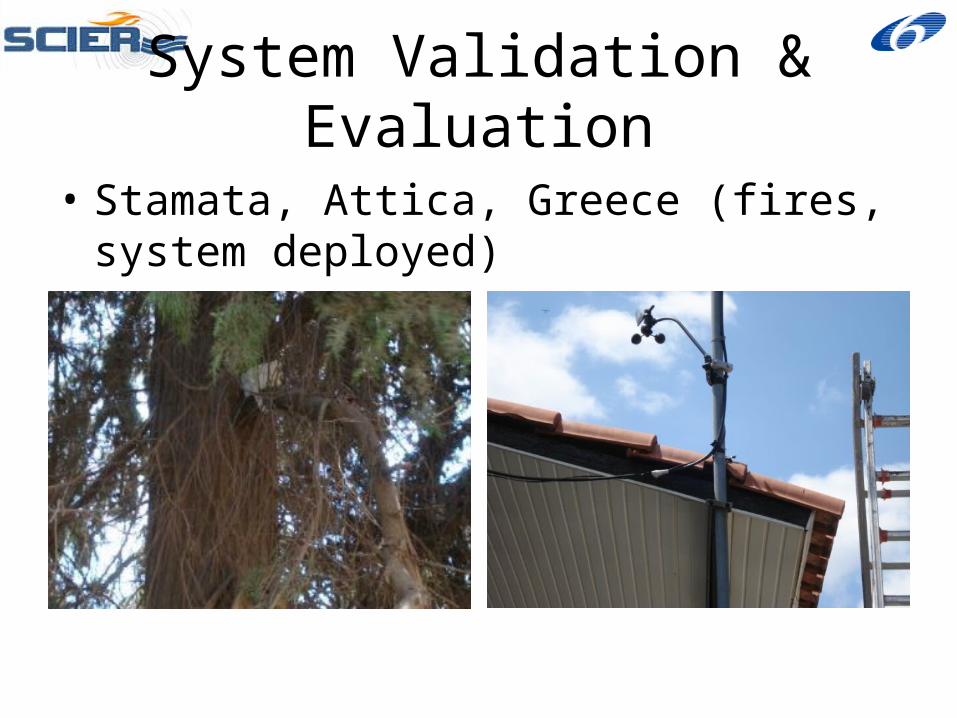
• Stamata, Attica, Greece (fires, system deployed)
System Validation & Evaluation
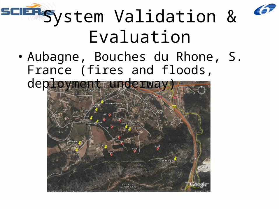
• Aubagne, Bouches du Rhone, S. France (fires and floods, deployment underway)

Thank you!
Project website: http://www.scier.eu