september 2005wsn05, toulouse, france applications of the mcgill algorithm for precipitation...
TRANSCRIPT

September 2005September 2005 WSN05, Toulouse, France WSN05, Toulouse, France
Applications of the McGill Algorithm for Precipitation Nowcasing Using Semi-
Lagrangian Extrapolation (MAPLE) within the ARPAV HydoMet Decision Support
System
Bill Conway1, Dr Gabriele Formentini2, Chip Barrere1, Dr Luciano Lago2
1Weather Decision Technologies, Norman, Oklahoma, USA
2Environmental Protection and Prevention Agency Veneto Region, Centro Meteorological, Teolo, Italy

September 2005September 2005 WSN05, Toulouse, France WSN05, Toulouse, France
Teolo radar viewed from weather station
September 2005September 2005 WSN05, Toulouse, France WSN05, Toulouse, France
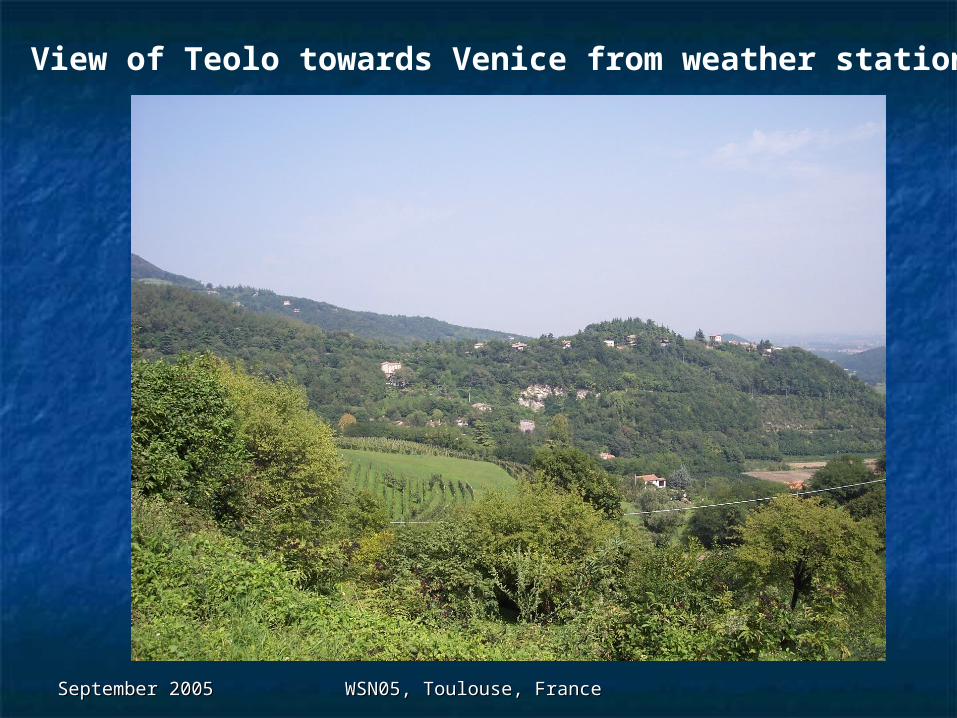
View of Teolo towards Venice from weather station
September 2005September 2005 WSN05, Toulouse, France WSN05, Toulouse, France
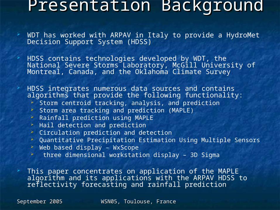
Presentation BackgroundPresentation Background WDT has worked with ARPAV in Italy to provide a HydroMet
Decision Support System (HDSS)
HDSS contains technologies developed by WDT, the National Severe Storms Laboratory, McGill University of Montreal, Canada, and the Oklahoma Climate Survey
HDSS integrates numerous data sources and contains algorithms that provide the following functionality:
Storm centroid tracking, analysis, and prediction Storm area tracking and prediction (MAPLE) Rainfall prediction using MAPLE Hail detection and prediction Circulation prediction and detection Quantitative Precipitation Estimation Using Multiple Sensors Web based display – WxScope three dimensional workstation display – 3D Sigma
This paper concentrates on application of the MAPLE algorithm and its applications with the ARPAV HDSS to reflectivity forecasting and rainfall prediction
September 2005September 2005 WSN05, Toulouse, France WSN05, Toulouse, France
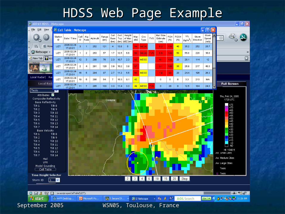
HDSS Web Page ExampleHDSS Web Page Example

September 2005September 2005 WSN05, Toulouse, France WSN05, Toulouse, France
MAPLE - BrieflyMAPLE - Briefly Developed at McGill University, Montreal, Canada by Zawadski and
Germann over a period of several years
Provides forecasts of reflectivity out to 8 hours depending on scale predictablity
Uses prior image history to forecast reflectivity out to 8 hrs in advance using stream function analysis
Determines the changing scale of predictability using past images compared to current image though wavelet analysis
Filters non-predictable scales from the T=0 analysis
Deduces stream functions for predictable scales and uses those stream functions to forecast radar reflectivity location and intensity
Current research includes integration of numerical model data for applications towards storm growth and decay
WDT has developed software to run MAPLE in real-time for commercial applications and also to provide radar based QPF

September 2005September 2005 WSN05, Toulouse, France WSN05, Toulouse, France
Example Vector Derivation

September 2005September 2005 WSN05, Toulouse, France WSN05, Toulouse, France
1.5h
>8h
5.5h
C a n a d a
Gulf of Mexico
Scale predictability determinedby comparison of previous forecastswith current images.
Scales are removed in the forecastafter exceeding their derived“predictability” flag
Example of Scale Predicability

September 2005September 2005 WSN05, Toulouse, France WSN05, Toulouse, France
Example 4 hr Precip Type Forecast 4 hr Precip Type Forecast

September 2005September 2005 WSN05, Toulouse, France WSN05, Toulouse, France
Hybrid ScanningHybrid Scanning
Grey – data from 1st elevationYellow – data from 2nd elevationOrange – data from 3rd elevation

September 2005September 2005 WSN05, Toulouse, France WSN05, Toulouse, France
Hybrid Scan Example

September 2005September 2005 WSN05, Toulouse, France WSN05, Toulouse, France
MAPLE Applications to QPFMAPLE Applications to QPF Uses output from QPE-SUMS as “T0” input for Uses output from QPE-SUMS as “T0” input for
MAPLEMAPLE
Applies a Z-R or Z-S relationship to each 5 min Applies a Z-R or Z-S relationship to each 5 min MAPLE time step based on surface MAPLE time step based on surface temperature and whether stratiform or temperature and whether stratiform or convectiveconvective
Will apply a bias correction at each time step Will apply a bias correction at each time step based on QPESUMS radar to gauge correction*based on QPESUMS radar to gauge correction*
Accumulates total rainfall forecasts at each Accumulates total rainfall forecasts at each grid point across the MAPLE domaingrid point across the MAPLE domain

September 2005September 2005 WSN05, Toulouse, France WSN05, Toulouse, France
Objective Analysis of Rain Gauge Data
September 2005September 2005 WSN05, Toulouse, France WSN05, Toulouse, France
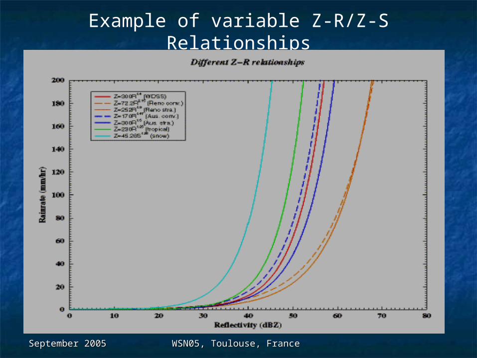
Example of variable Z-R/Z-S Relationships

September 2005September 2005 WSN05, Toulouse, France WSN05, Toulouse, France
1 Hr MAPLE Hybrid Forecast

September 2005September 2005 WSN05, Toulouse, France WSN05, Toulouse, France
MAPLE 2 hr Accumulation

September 2005September 2005 WSN05, Toulouse, France WSN05, Toulouse, France
Future WorkFuture Work McGill continuing to work on model integration and storm growth/decay McGill continuing to work on model integration and storm growth/decay
for MAPLE improvementsfor MAPLE improvements
Correct Italian data for beam blockageCorrect Italian data for beam blockage
Integrate further radars from Italy network as they become availableIntegrate further radars from Italy network as they become available
Develop software for real-time statistical analysis of MAPLE performanceDevelop software for real-time statistical analysis of MAPLE performance
Optimize the Z-R and Z-S relationships used in the northern Italy regionOptimize the Z-R and Z-S relationships used in the northern Italy region
Use basin delineation and flash flood guidance with MAPLE QPF results to Use basin delineation and flash flood guidance with MAPLE QPF results to provide a Flash Flood Prediction Algorithmprovide a Flash Flood Prediction Algorithm
Merci! Grazie! Thanks! Ciao!Merci! Grazie! Thanks! Ciao!