serious geospatial apps using whirlyglobe-maply
TRANSCRIPT

Serious Geospatial Apps using
WhirlyGlobe-Maply
Steve Gifford mousebird consulting inc

OverviewIntroduction WhirlyGlobe-Maply Toolkit Pretty demos Getting Started Roadmap Conclusion

WhirlyGlobe-MaplyAn open source, mobile first geospatial display toolkit.
Apache 2.0 License
OpenGL ES 3.0
Fast: 60, 30fps
Globe & Map
iOS
Android
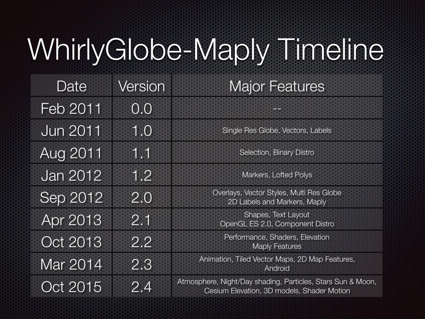
WhirlyGlobe-Maply TimelineDate Version Major Features
Feb 2011 0.0 --
Jun 2011 1.0 Single Res Globe, Vectors, Labels
Aug 2011 1.1 Selection, Binary Distro
Jan 2012 1.2 Markers, Lofted Polys
Sep 2012 2.0 Overlays, Vector Styles, Multi Res Globe 2D Labels and Markers, Maply
Apr 2013 2.1 Shapes, Text Layout OpenGL ES 2.0, Component Distro
Oct 2013 2.2 Performance, Shaders, Elevation Maply Features
Mar 2014 2.3 Animation, Tiled Vector Maps, 2D Map Features, Android
Oct 2015 2.4 Atmosphere, Night/Day shading, Particles, Stars Sun & Moon, Cesium Elevation, 3D models, Shader Motion

UsersWeather
Maps
AerospaceEducation

Dark Sky: Weather
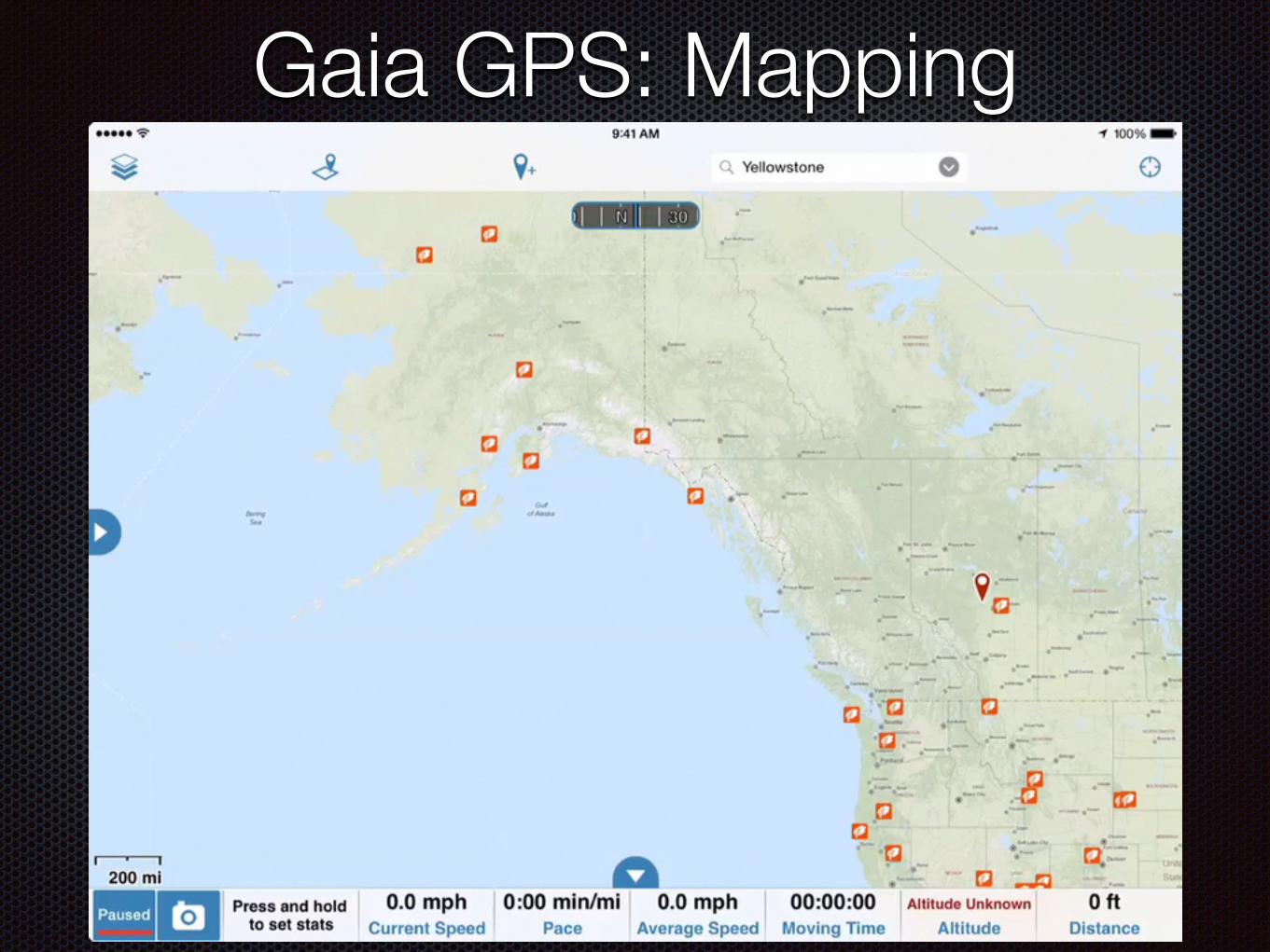
Gaia GPS: Mapping

World Atlas: Education

FlyQ EFB: Aviation
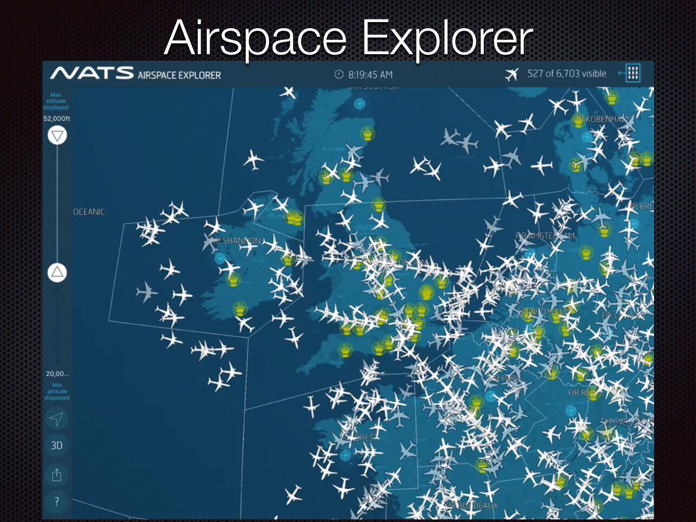
Airspace Explorer

Developing Your own Apps
Mobile web vs. Native
iOS Development tools
iOS Tutorials
Image Layer Example
WhirlyGlobe-Maply Tutorials

Native Dev for Mobile
Pros
Apps more interactive
Better integrated into system
Cons
Development tools unfamiliar
One version of app per platform

Web Geospatial for Mobile
You can, but keep it simple
Not as interactive
Not very well integrated
Example
Google Maps for Web (vs)
Google Maps App

iOS Dev Tools
Xcode

iOS Tutorials
Apple’s Own Tutorials
developer.apple.com
Apple’s Xcode Templates
Ray Wenderlich’s site
www.raywenderlich.com/tutorials
Many others (search: ‘iOS tutorial’)

WhirlyGlobe-Maply Tutorials
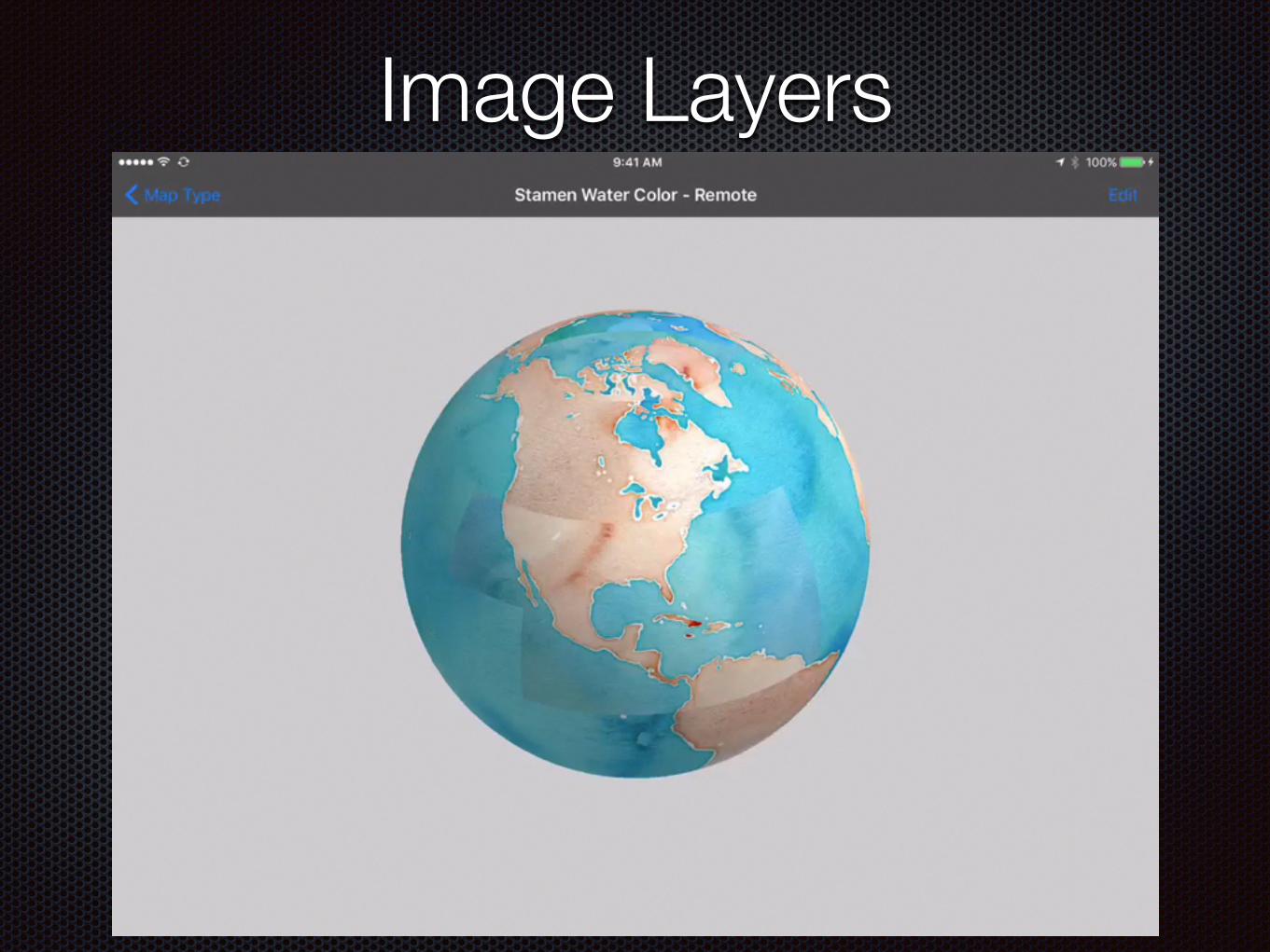
Image Layers
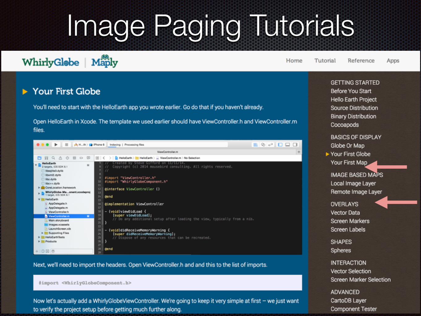
Image Paging Tutorials

Flat Map

Flat Map Tutorial

Screen Markers (pins)

Screen Marker Tutorials

RoadmapOptimization for image layers Vector Map Tiles - More style support More advanced cartography Clustering & Particles & LIDAR Display Android - Lots more features Feature testing framework

Marker Clustering
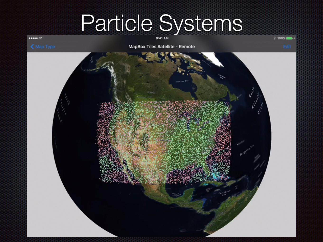
Particle Systems

LIDAR Display

Summary
WhirlyGlobe-Maply Watched Pretty demos Discussed Geospatial on web vs native Talked about development Go write some apps!

Links & ContactsContact
@mousebirdc
mousebirdconsulting.com
Slides {will tweet}
WhirlyGlobe-Maply mousebird.github.io/WhirlyGlobe