shawnee county department of public works upgrade/replacement …€¦ · shawnee county department...
TRANSCRIPT


SHAWNEE COUNTY DEPARTMENT OF PUBLIC WORKS
UPGRADE/REPLACEMENT OF
PUMP STATIONS 55, 56, AND 59
DESIGN MEMORANDUM
PREPARED BY:
Professional Engineering Consultants, P.A. 1263 S. W. Topeka Boulevard
Topeka, Kansas 66612 785-233-8300
PEC PROJECT NO. 08A08-001-2085
SEPTEMBER 2008
SECTION 1 – INTRODUCTION 1 - 1
SECTION 1 INTRODUCTION 1.1 General – The Shawnee County Department of Public Works is responsible for the operation of the Sherwood Regional Wastewater System (Sherwood System), a wastewater utility that furnishes wastewater collection, transport, and treatment for residential and commercial property that generally surrounds Sherwood Lake. As with all infrastructures, it is necessary to provide maintenance, repairs, upgrades, and replacement on a periodic basis. System expansion(s) and extension(s) of service must be considered for new development before existing facilities become overloaded. This Design Memorandum includes:
• Design criteria to be used in preparing plans and specifications for construction of improvements.
• Detailed evaluations of alternatives to accomplish the recommendations of the Sherwood Collection System Management Plan (the Management Plan).
• Probable project costs based on specific, detailed evaluations of alternative configurations.
1.2 Sherwood Collection System Management Plan –
In the effort to provide appropriate system management for the Sherwood System, the Shawnee County Board of Commissioners and the Public Works Department initiated an engineering evaluation to identify major infrastructure needs and to project system growth. The Sherwood Collection System Management Plan was completed in February 2002. The Management Plan recommended eight major collection system improvements to solve concerns existing at that time and to provide for future system growth. The Management Plan provided a broad view of the collection system improvements needed, set an order of priority for those improvements, and estimated budgets based on generalized, historic costs of major project. The proposed scope of the project detailed in this Design Memorandum, plus projects that have previously been completed, represent five of the eight recommended projects of the Management

SECTION 1 – INTRODUCTION 1 - 2
Plan. The three remaining projects provide for the extension of infrastructure and for capacity increases of the existing collection system to serve undeveloped areas that will have future needs for public sewers. With the completion of the currently proposed collection system work, all present-day collection system needs identified by the Management Plan, as well as a portion of the future needs, will have been addressed. 1.3 Current Project – The proposed project consists of five components which include:
Pump Station 55 (PS 55) at 6920 SW Fountaindale Road: complete replacement, capacity increase, and rerouted force main with greater capacity.
Pump Station 56 (PS 56) at 7151 SW Fountaindale Road: complete replacement,
capacity increase, and rerouted force main with greater capacity. (PS 56 also receives flow from PS 57, which is not included in this project.)
Pump Station 59 (PS 59) at 7206 SW Robins Drive: complete replacement, capacity
increase, and rerouted force main with greater capacity. (PS 59 receives flow from PS 61, but that pump station is also not included in this project.)
Variable grade sewer construction on the north side of Sherwood Lake from the point of common force main discharge of PS 56 and 59 to the point of discharge for PS 55.
Gravity sewer construction on the north side of Sherwood Lake from the point of force main discharge from PS 55 and the end of the variable grade sewer serving PS 56 and PS 59 to the Sherwood WWTP.
1.4 Pre-Design Considerations – In the process of planning the approach to this evaluation, it was apparent that improvements must be considered for more than just pump station replacement, pumping capacity increases, and rerouting of force mains to obtain overall system reliability and to consider projected future growth of the system in the evaluation. The current arrangement of the collection system on the north side of Sherwood Lake necessitates that the West End Pump Station (PS 57) discharge to a sewer tributary to PS 56, which in turn discharges to a sewer tributary to PS 55. PS 55 then discharges to a public sewer of minimum diameter which extends to the Sherwood WWTP. Such a system configuration has an increased potential for local sewer surcharging (with basement backups and/or wastewater overflows to Sherwood Lake) because the pump stations are arranged in series. Failure of the mechanical/electrical equipment at any pump station will have negative consequences for service areas upstream of that pump station.
SECTION 1 – INTRODUCTION 1 - 3
With the proposed increased pumping capacity for PS 55 and PS 56, the conveyance capacity of the existing gravity sewers receiving flows from these pump stations will be exceeded if the present series configuration remains. The critical need to provide greater system reliability and to increase the pumping capacity of PS 55 and 56 leads to the conclusion that additional collection system improvements on the north side of Sherwood Lake, not originally identified in the Management Plan, are required. Those improvements are needed to convey wastewater from PS 55 and PS 56 to the wastewater treatment plant at the recommended capacity increases. The future North Sherwood Pump Station proposed in the Management Plan would be located at the west end of Sherwood Lake in the vicinity of SW Indian Hills Road, between SW 41st and SW 33rd Streets. The existing collection system is also not capable of conveying additional flow from the proposed North Sherwood Pump Station. The Management Plan proposed extending a 9,000 foot long force main from the proposed pump station to the Sherwood WWTP, through the areas of the collection system contributing flow to PS 55 and 56. Therefore, future flows to be generated at the North Sherwood Pump Station were evaluated in this pre-design effort in conjunction with collection system improvements being contemplated for PS 55 and PS 56. On the south side of Sherwood Lake, PS 59 presently discharges to a 6” force main at a design rate of 300 gpm. The force main is over 13,000 feet in length and has two other pump stations (PS 28 and PS 60) which pump into it. The force main is routed through fully-developed neighborhoods south and east of the Lake. Increasing the pumping rate to 450 gpm, as recommended in the Management Plan, will result in significant increases in pressure if the existing force main is used. Additionally, the friction losses at this increased flow rate necessitate pumps driven by large horsepower motors. Preliminary pump selection shows that pumps for such an application must operate near the edge of generally recommended operating conditions for conventional wastewater pumping equipment. Consequently, the concern for reliability of equipment operation, changes in operating conditions for PS 28 that would require pump change-out at this time, and the uncertain ability of the existing 25-year old force main to continue in operation without breaks or leakage under higher pressure conditions means a new force main must be considered. The route of a new force main on the south side of the lake would likely parallel the route of the existing force main. The route presents a potential for major disruption to streets, access issues, disruption to houses, conflicts with existing utilities, and impacts on many property owners. Consequently, the scope of the design effort must be expanded beyond the scope of work originally defined by the Management Plan for these three pump stations in an effort to provide a comprehensive view of solving current problems and incorporating future needs. With selection of a comprehensive solution, total probable project costs will be expected to be greater than those presented in the Management Plan. The following sections will provide a summary of the design criteria and assumptions utilized for the pre-design conceptual development, including probable cost estimates. Evaluation of various collection system improvement configurations are presented and recommendations given. The criteria, guidelines, and selected configuration will serve as the basis for actual design and construction of the facilities. F:\2008\08A08-001\corresp\Design Memo\SECTION 1 Intro.doc 9/5/2008

SECTION 2 – PROJECT OVERVIEW 2 - 1
SECTION 2 PROJECT OVERVIEW 2.1 General – This section provides the background for the project, including basic information about the pump stations, the collection system, and future conditions as determined by the Sherwood Collection System Management Plan, (February 2002). Figure 2-1 – Existing System shows the locations for the three existing pump stations and force mains to be upgraded/replaced with this project. The pump stations are PS 55 (Tennis Court Pump Station), PS 56 (Fountaindale Pump Station), and PS 59 (Oxfordshire Pump Station). Also shown are existing sewers that receive flow from these pump stations and other features of the existing collection system that may impact the project. Pump stations that connect into the service area or force main of one of the pump stations being considered in this Design Memorandum are also shown. 2.2 Pump Stations 55 and 56 – These two pump stations are located north of Sherwood Lake at 6920 and 7151 SW Fountaindale Street, respectively. The pump stations have each been in operation in excess of 30 years. The original firm design capacity for the pump stations is 125 gpm (PS 55) and 110 gpm (PS 56). The Collection System Management Plan recommended an increase in the pumping capacity at PS 55 and 56 to 250 gpm, each. During a major storm event in the spring of 2007, several houses received damage due to backup of wastewater into the basements of the houses, reinforcing the need to increase the pumping capacity and review downstream gravity sewer capacities. These two stations have received necessary maintenance to keep them in operation over the life of each station. Recent inspection of the stations and discussions with personnel from the Water Pollution Control Division of the City of Topeka confirm PS 55 and PS 56 are in need of replacement to improve reliability. Due to the geography of the area, pump stations at these two locations are the only feasible means for providing sewer service to the existing residential neighborhood. Reliability of the stations is essential for protecting the lake environment. As part of the pre-design effort, an evaluation of the receiving collection system sewers confirmed findings of the Management Plan that the existing pipes are insufficient to carry proposed wastewater flows if discharged at the current configuration of the collection system. The wastewater collection system along the north side of Sherwood Lake is configured into several small service areas due to geography, with each service area being served by a pump station. The farthest west pump station discharges to the service area to its east. P S 56 receives wastewater pumped at a rate of 110 gpm from PS 57 as well as the wastewater conveyed by


SECTION 2 – PROJECT OVERVIEW 2 - 3
gravity to the station from its service area. In turn, PS 56 pumps at a rate of 110 gpm into the collection system served by PS 55. PS 55 discharges at 125 gpm into the gravity sewer system serving the residential area east. That system discharges by gravity directly to the Sherwood WWTP. 2.3 Pump Station 59 – PS 59 was constructed in 1982 at 7206 SW Robins Drive. Maintenance of the station has kept it in operation over the past 25 years; however, there have been events of pump failure. Also, electrical replacement parts are becoming unavailable. The pump station structure is a buried, steel chamber showing signs of structural deterioration. Entrance to the station by maintenance personnel is problematic due to the 20-foot long entrance ladder and the confined space nature of the structure. Failure of the mechanical, electrical or structural components of the station could result in basement backups and possible overflow of wastewater to Lake Sherwood. To provide continued, reliable service, the replacement of PS 59 should also be undertaken. An increase in firm capacity from 300 to 450 gpm was recommended in the Collection System Management Plan. The existing force main from this station extends over 13,000 feet to a discharge point at the Sherwood WWTP. An evaluation of the operating conditions for the existing force main at the new flow rate showed higher pressures that might result in increasing repairs of the 25-year old force main. The pre-design evaluation must therefore include consideration of a new force main to convey the recommended rate of flow. 2.4 Flow Equalization Storage Consideration – The Management Plan presented several generic improvement options to address collection system needs. The options presented in the report included replacement of pump stations and flow equalization storage. Storage of wastewater during peak flow times was not recommended over increasing the pumping capacity. However, it was determined necessary during this pre-design effort to reconsider flow equalization storage as a potential alternative due to the extent of collection system improvements that were being considered to accommodate increased flows from PS 55, 56, and 59. Equalization storage basins have been included as possible configurations presented in Section 4. Flow equalization has been configured and estimates of the cost made to compare against force main and gravity sewer improvements. Flow equalization basins in the residential areas surrounding the pump station would require covered, underground, concrete structures. Even if the tanks are fully covered, there is still the potential for odor generation from equalization storage. It should be noted that the pump stations must be replaced even if the pumping rates do not change because the pump stations have exceeded their useful life for maintenance and repair.

SECTION 2 – PROJECT OVERVIEW 2 - 4
2.5 Future Flow Contributions – One of the outcomes of the Management Plan was the projection of the future peak wastewater flow rates to be used in evaluating improvements to the existing collection system facilities. Future flows were evaluated from areas to be developed west and south of the existing Sherwood System service area. On Figure 2-1, the approximate location for a future North Sherwood Pump Station is shown near SW Indian Hills Road in the 3500 block to serve an area generally west of SW Indian Hills Road and between SW 33rd Street and SW 45th Street if extended on a map. The currently undeveloped areas that drain towards Sherwood Lake generally south of SW 41st Street and east of SW Indian Hills Road can be served by future pump stations discharging to the east, with force mains generally routed along SW 41st Street, parallel to the existing 6” force main from PS 59. F:\2008\08A08-001\corresp\Design Memo\SECTION 2 Proj Overview.doc
SECTION 3 – DESIGN CRITERIA 3 - 1
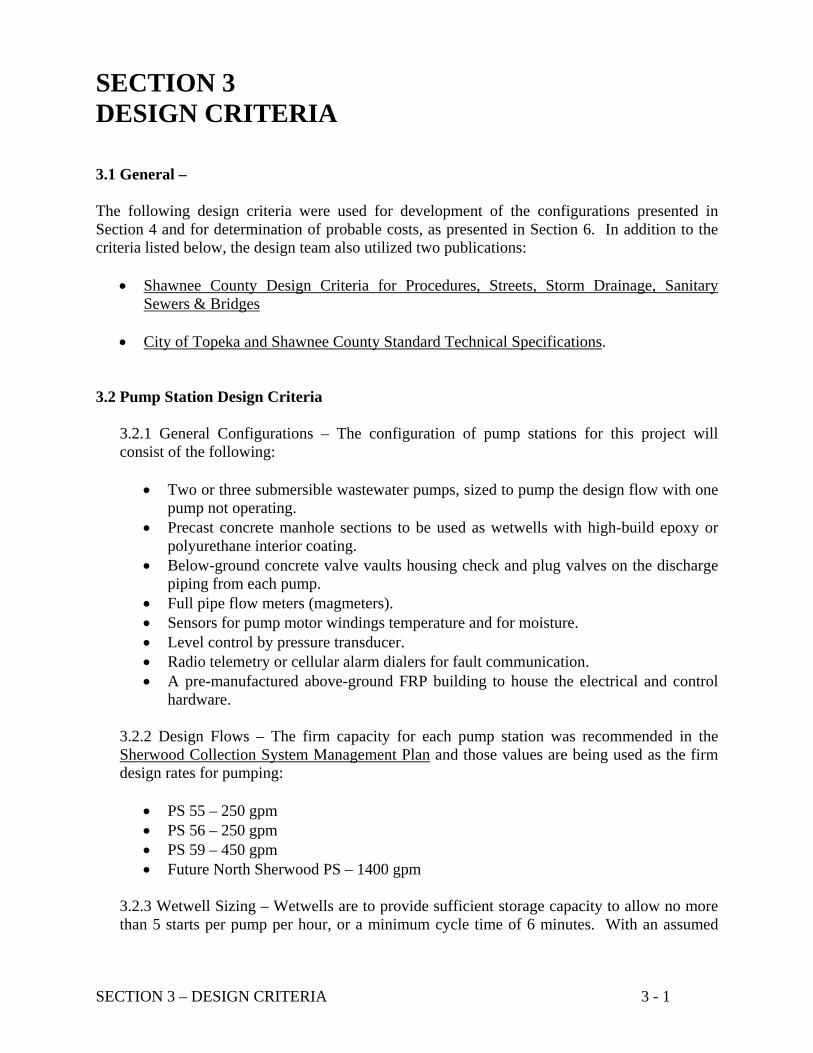
SECTION 3 DESIGN CRITERIA 3.1 General – The following design criteria were used for development of the configurations presented in Section 4 and for determination of probable costs, as presented in Section 6. In addition to the criteria listed below, the design team also utilized two publications:
• Shawnee County Design Criteria for Procedures, Streets, Storm Drainage, Sanitary Sewers & Bridges
• City of Topeka and Shawnee County Standard Technical Specifications. 3.2 Pump Station Design Criteria
3.2.1 General Configurations – The configuration of pump stations for this project will consist of the following:
• Two or three submersible wastewater pumps, sized to pump the design flow with one pump not operating.
• Precast concrete manhole sections to be used as wetwells with high-build epoxy or polyurethane interior coating.
• Below-ground concrete valve vaults housing check and plug valves on the discharge piping from each pump.
• Full pipe flow meters (magmeters). • Sensors for pump motor windings temperature and for moisture. • Level control by pressure transducer. • Radio telemetry or cellular alarm dialers for fault communication. • A pre-manufactured above-ground FRP building to house the electrical and control
hardware.
3.2.2 Design Flows – The firm capacity for each pump station was recommended in the Sherwood Collection System Management Plan and those values are being used as the firm design rates for pumping:
• PS 55 – 250 gpm • PS 56 – 250 gpm • PS 59 – 450 gpm • Future North Sherwood PS – 1400 gpm
3.2.3 Wetwell Sizing – Wetwells are to provide sufficient storage capacity to allow no more than 5 starts per pump per hour, or a minimum cycle time of 6 minutes. With an assumed

SECTION 3 – DESIGN CRITERIA 3 - 2
operating range of 3 feet for the lead pump from pump “on” to pump “off”, PS 55 and 56 will require 5’ diameter wetwells and PS 59 will require a 6’ diameter wetwell. 3.2.4 NPSH – The net positive suction head available (NPSHA) was determined assuming a minimum water elevation 1.5 feet above the pump volute centerline. A NPSHA value of 33.8 feet was calculated for all three pump station. The net positive suction head required (NPSHR) by pumps for this project will be specified to not exceed 25 feet to assure the pumps do not operate near the NPSHA value of 33.8 feet which would cause cavitation and pump damage. 3.2.5 Site Considerations – The pump station sites are located in residential neighborhoods and are highly visible. The proposed station sites will not be fenced to minimize the visual impact. All facilities are to be designed in a manner and constructed of suitable material to minimize damage from vandalism. All utilities serving the stations will be underground, at least within the pump station easements.
3.3 Force Main Hydraulic Design Friction losses in force mains were calculated using the Hazen-Williams equation with the friction factor constant “C” value of 140. The 140 value is considered representative of PVC, HDPE or lined DIP pipe at typical operating conditions. Force main velocities are to be designed in the range of 3 to 7 feet per second (fps), with 3 to 5 fps where possible. 3.4 Variable Grade Sewers Variable Grade Sewers will be designed using the following criteria:
• C=140
• Velocity between 3 and 7 fps (3 to 5 fps preferred).
• Pipe materials: the same as for force mains. For variable grade sewers, the minimum slope allowable will be the minimum slope required for a comparable gravity sewer. Variable grade sewers will generally follow the grade of the ground surface if it is steeper than the minimum slope. Variable grade sewers work with a combination of gravity flow and pressure head at high flows. A curved alignment will have a radius of curvature no greater than the minimum bend criteria for HDPE pipe and the maximum joint deflection of PVC and DIP pipe, whichever results in the more stringent requirement. If connections to the variable grade sewer portion of the collection system will be part of this project or are anticipated at some later date, connections must be made only at structures to allow for appropriated maintenance access.

SECTION 3 – DESIGN CRITERIA 3 - 3
3.5 Gravity Sewer Pipe Flow Characteristics The following design criteria were used in the capacity calculations for the gravity sewers of each configuration. They are consistent with KDHE requirements and those given in the Shawnee County Design Criteria for Procedures, Streets, Storm Drainage, Sanitary Sewers & Bridges.
• Manning’s ‘n’ = .011 • Velocity between 2 and 10 fps • Design flow at 1/2-full pipe capacity up through 18-inch diameter sewers • Design flow at 2/3-full pipe capacity for sewers > 18-inch diameter
The minimum required slope is the sewer gradient at which the designated pipe size can convey the design flow at the design depth. Each sewer segment will be designed to equal or exceed the minimum required slope for the required design flows and depths. 3.6 Force Main and Gravity Sewer Materials of Construction
3.5.1 Force Mains - Three pipe materials were considered: • Ductile Iron Pipe with ceramic epoxy interior lining • HDPE Pipe • C900 or C905 PVC Pressure Pipe, depending on pipe size
All three of these materials are considered suitable for open-cut and may also be used for directional drilling installation. Joints for DIP and PVC must be specifically designed for the application if these materials are considered for installation by directional drilling. 3.5.2 Gravity Sewers – The same three pipe materials were considered:
• Ductile Iron Pipe with ceramic epoxy interior lining • HDPE Pipe • ASTM D 3034 SDR 35 PVC
PVC and DIP for gravity sewers are specified in the City of Topeka and Shawnee County Standard Technical Specifications. HDPE will be specified for the depth of cover based on a maximum allowable deflection of 5%. 3.5.3 Directional Drilling – For construction of force mains and variable grade sewers, directional drilling may present an advantage over open-cut trench construction. Construction means and methods will be the responsibility of the installation contractor. Pipe material will be specified as HDPE with a maximum SDR of 17. The project specifications may allow for an option to propose other materials, such as fused joint PVC or lock-joint DIP.

SECTION 3 – DESIGN CRITERIA 3 - 4
3.5.4 Installation – Installation shall be in accordance with the City of Topeka and Shawnee County Standard Technical Specifications and recommendations of the pipe manufacturer, whichever is more stringent. F:\2008\08A08-001\corresp\Design Memo\SECTION 3 Design Criteria.doc

SECTION 4 – ALTERNATIVES 4 - 1
SECTION 4 ALTERNATIVES 4.1 General – Multiple configurations for collection system improvements were developed to consider variables regarding routing of force mains and additional gravity sewers, use of flow equalization storage, and inclusion of future flows. Seven figures are included with this Section to provide schematics of each configuration. For pipe sizing and costs considerations, each configuration was evaluated with and without future flows. Pipe sizes determined in final design may differ from those shown on the configuration drawings. The routing of new force mains and gravity sewers was impacted by the desire to use existing street rights-of-ways and existing easements to help reduce the time for easement acquisition. Limiting disruption to the neighborhoods can also impact routes of new piping. 4.2 Configuration 1- On Site Peak Flow Holding Basins for Pump Stations 55 and 56 - A representation of peak flow equalization tanks at PS 55 and at PS 56, only, is given in Figure 4-1. Due to the deteriorated condition of the existing pump stations, this configuration includes replacement pump stations and the flow equalization basins so that collection system improvements would not be needed. The equalization tanks would be sized for the volumes of wastewater greater than the pump station firm capacity. The stored wastewater would be pumped when the influent rate to the pump station is less than firm capacity. Major assumptions were made regarding influent rates and duration of peak flows to estimate the size of the holding basins. No actual flow measurements have been made for sizing the basins. Based on these assumptions, holding tanks with a depth of 12 feet and a footprint of approximately 50 feet by 50 feet would be required at each pump station location. 4.3 Configuration 2 - Pump Stations 55 & 56 Common Outfall to Sherwood WWTP (Fountaindale Route) - There are four variations shown for this configuration in Figures 4-2 and Figure 4-2 (Cont). The routing of the force mains and combined gravity sewer for Configs 2A and 2B from PS 55 and PS 56 along SW Fountaindale and Sherwood Court (the Sherwood Court Route) are shown in Figure 4-2. Configs 2A and 2B provide for the force mains and gravity sewer portions carrying the discharge from PS 55 and 56 to be routed generally within the public road rights-of-ways and in existing sewer easements, wherever possible, along the Fountaindale Route. The alignment shown for the discharge piping from the future North Sherwood Pump Station extends north of the houses on the north side of SW 33rd Street on property that is included within the Aldersgate Subdivision (the Aldersgate Route).

Design MemorandumUpgrade/Replacement of Pump Stations
Sherwood Regional Sewer District
B
A
N
Sher ood Lake
PS 55Tennis Court PS 56
Fountaindale SherwoodWWTP
Future PS North Sherwood
CONFIGURATION 1
A Collection System ID Point C TFlow Equalization Basins PS 60New Force Main SW 37thFuture Force Main New Gravity/Variable Grade Sewer
UPS 28
Eagle Point #1
Figure 4‐1 On Site Peak
Flow Equalization Basins for Pump Stations 55 & 56
Sherwood LakePS 59
Oxfordshire
F:\2008\08A08‐001\corresp\Design Memo\Sec 4 Figures.xlsxConfiguration 1 9/5/2008

Design MemorandumUpgrade/Replacement of Pump Stations
Sherwood Regional Sewer District
D E
B
F GA H
PS 55Tennis Court
PS 56Fountaindale
I
SherwoodWWTP
(500)1900
(0)1400
(0)1400
(0)1400
(250)250
(250)250
(500)500
Fountaindale Route
Aldersgate Route
6" ф
6" ф
8" ф
12" ф
10"/15" ф
12" ф
10" ф
N
CONFIGURATION 2A (500) gpm CCONFUGURATION 2B 1400 gpm
A Collection System ID Point
Flow Equalization BasinsNew Force MainFuture Force Main New Gravity/Variable Grade Sewer
Nominal Pipe Diameter
Figure 4‐2 Pump Stations 55 & 56
Common Outfall to Sherwood WWTP
Sherwood LakePS 59
Oxfordshire
Future PSNorth Sherwood
10"/15" ф
F:\2008\08A08‐001\corresp\Design Memo\Sec 4 Figures.xlsxConfigurations 2A & 2B 9/5/2008

Design MemorandumUpgrade/Replacement of Pump Stations
Sherwood Regional Sewer District
D E
F GA
H
PS 55Tennis Court
PS 56Fountaindale
I
SherwoodWWTP(250)
1650
1400
14001400
(250)250
(250) or 250 To existing collection
system from B
(250)250
Fountaindale Route
Aldersgate Route
(0)1400
(0)1400
(0)1400
B
6" ф
6" ф
8" ф
12" ф
10"/15" ф
12" ф
10" ф
N
CCONFIGURATION 2C (500) gpmCONFIGURATION 2D (1650) gpm
A Collection System ID PointFlow Equalization BasinsNew Force MainFuture Force Main New Gravity/Variable Grade Sewer Nominal Pipe Diameter
Figure 4‐2 (Cont) Pump Stations 55 & 56
Common Outfall to Sherwood WWTP
Sherwood LakePS 59
Oxfordshire
I
Future PSNorth Sherwood
10"/15" ф
F:\2008\08A08‐001\corresp\Design Memo\Sec 4 Figures.xlsxConfigurations 2C & 2D 9/5/2008

SECTION 4 – ALTERNATIVES 4 - 5
For Config 2A, the design flow rates are shown in red text adjacent to the segment of force main and sewer. Config 2B is the same as 2A regarding PS 55 & 56, but includes flow from the future pump station. The flow rates for Config 2B are shown in black text. Config 2C and 2D provide for PS 55 to continue to discharge to the existing collection system with PS 56 having a new force main and gravity sewer extended to the Sherwood WWTP. The Management Plan concluded that the existing collection system could convey the new flow rate from only PS 55. The flow rates for Config 2C are represented adjacent to piping in Figure 4-2 (Cont) with red text. For Config 2D, the future North Sherwood Pump Station force main and gravity sewer are routed north of the residential housing on NW 33rd Street. 4.4 Configuration 3 - Pump Stations 55 & 56 Common Outfall to Sherwood WWTP (Aldersgate Route) - The two configurations shown in Figure 4-3 provide for PS 55 and 56 to discharge to a new gravity sewer routed partly along the south boundary of the Aldersgate property (the Aldersgate Route). The gravity portion extending to the WWTP would carry only flow from PS 55 and 56 in Config 3A. The red text adjacent to the pipe segments represents the design flow for Config 3A and the black text is for Config 3B, which includes flow from the future North Sherwood Pump Station. 4.5 Configuration 4 - Pump Stations 55, 56, & 59 Common Outfall to Sherwood WWTP (Aldersgate Route) - The first 3 configurations considered the collection system on the north side of Sherwood Lake and did not include PS 59, which serves an area south of Sherwood Lake. Figure 4-4 shows a similar configuration to Config 3, but with the flow from PS 59 conveyed from the south side to the north side of Sherwood Lake and extended to the proposed variable grade sewer at Point D. Config 3A is without flow from the future North Sherwood Pump Station. The design flow rates are shown in red text. Config 3B includes flow from the future North Sherwood Pump Station with the design flow rates in black text. The lake crossing has been initially visualized as a directionally drilled crossing under the lake. This method of crossing has been confirmed as possible by contractors experienced in this type of work. However, the viability must also be confirmed through geotechnical investigations of the soils and rock under Lake Sherwood at the crossing location. In the event that the directionally drilled crossing is considered not feasible, a lake bottom crossing should be further investigated. This type of crossing would be a force main contained in a protective casing pipe. The pipes would be installed by adding concrete ballast blocks to the pipes and sinking the combined pipes and ballast to the lake bottom from shore to shore.

Design MemorandumUpgrade/Replacement of Pump Stations
Sherwood Regional Sewer District
D E
G
BA H
PS 55Tennis Court
PS 56Fountaindale
I
SherwoodWWTP
(0)1400
(250)250
(250)250
(250)1650
(500)1900
(500)1900
Aldersgate Route
6" ф 6" ф
6"/12" ф
10"/15" ф
10" ф
8"/14" ф
N
C
CONFIGURATION 3A (500) gpmCONFIGURATION 3B 1400 gpm
A Collection System ID PointFlow Equalization BasinsNew Force MainFuture Force Main New Gravity/Variable Grade Sewer Nominal Pipe Diameter
Figure 4‐3 Pump Stations 55 & 56
Common Outfall to Sherwood WWTP
Sherwood Lake
PS 59Oxfordshire
I
Future PSNorth Sherwood
10"/15" ф
F:\2008\08A08‐001\corresp\Design Memo\Sec 4 Figures.xlsxConfigurations 3A & 3B 9/5/2008

Design MemorandumUpgrade/Replacement of Pump Stations
Sherwood Regional Sewer District
D EG
BA H
N
PS 55Tennis Court
PS 56Fountaindale
I
SherwoodWWTP
(450)
(0)1400 (700)
2100(950)2350
(950)2350
(250)250
(250)250
Aldersgate Route
6" ф
6" ф
6"/12" ф
10"/15" ф
10" ф 8"/14" ф
N
C
CONFIGURATION 4A (500) gpmCONFIGURATION 4B 1400 gpm
A Collection System ID PointFlow Equalization BasinsNew Force MainFuture Force Main New Gravity/Variable Grade Sewer Nominal Pipe Diameter
Figure 4‐4 Pump Stations 55, 56, & 59
Common Outfall to Sherwood WWTP
Sherwood Lake
PS 59Oxfordshire
Future PSNorth Sherwood
(450)450
8" ф
10"/15" ф
F:\2008\08A08‐001\corresp\Design Memo\Sec 4 Figures.xlsxConfigurations 4A & 4B 9/5/2008

SECTION 4 – ALTERNATIVES 4 - 8
4.6 Configuration 5 - New Pump Station 59 and New Force Main to Sherwood WWTP - The configuration of Figure 4-5 considers only PS 59 and other collection system features on the south side of Sherwood Lake. This configuration represents a new PS 59 pumping at 450 gpm and a new force main sized for the new flow with discharge at the Sherwood WWTP. The new force main would receive flow from the existing PS 28 (Eagle Point #1). The existing force main would remain to convey wastewater from PS 60 and from currently undeveloped area south of SW 41st. 4.7 Configuration 6 - On Site Flow Equalization Basin for Pump Station 59 - This configuration provides for a new PS 59, with a reduction in the firm pumping capacity to 250 gpm to allow the increase of the discharge rate from PS 28, as recommended in the Management Plan, without increasing the total flow in the existing force main. Wastewater flow in excess of 250 gpm would be conveyed to a flow equalization basin at the PS 59 site. The estimated size for the basin is 50 feet by 50 feet square and 12’ deep. This configuration allows the existing force main to remain in service for PS 59, PS 28, and PS 60. This configuration provides no capacity to convey future flows that may be generated from currently undeveloped area south of SW 41 Street. 4.8 Configuration 7 – New Pump Station 59 Pumping 450 gpm to the Existing Force Main and PS 28 Upsized to 100 gpm. - Utilization of the existing force main at design flow rates recommended from the Management Plan is represented in Figure 4-7 for Config 7. The configuration includes a new PS 59 pumping at 450 gpm and PS 28 upsized to convey 100 gpm. The discharge rate from PS 60 does not change. 4.9 Combined Configurations – To address the collection system needs on the north and south side of Sherwood Lake associated with PS 55, PS 56 and PS 59, Configs 1, 2 or 3 need to be combined with Configs 5, 6, and 7. Config 4 addresses wastewater conveyance from both side of Sherwood Lake. The estimated costs associated with each configuration, as well as the combined costs to determine the least cost approach to the overall project are presented in Section 6. F:\2008\08A08-001\corresp\Design Memo\SECTION 4 Alternatives.doc

Design MemorandumUpgrade/Replacement of Pump Stations
Sherwood Regional Sewer District
BA
N
Sherwood Lake
PS 55Tennis Court
PS 56Fountaindale
I
SherwoodWWTP
Future PSNorth Sherwood
500
CT 200
PS 60SW 37th
A Collection System ID PointFlow Equalization Basins
New Force Main
Existing Force Main Nominal Pipe Diameter
Future Flows from currently undeveloped areas South & West into existing force main
PS 28 50 Eagle Point #1
Figure 4‐5 New Pump Station 59 and Force Main to Sherwood
WWTP
CONFIGURATION 5
PS 59Oxfordshire
450
500U
South Lake Route
8" ф
6" ф
10"/15" ф
F:\2008\08A08‐001\corresp\Design Memo\Sec 4 Figures.xlsxConfiguration 5 9/5/2008

Design MemorandumUpgrade/Replacement of Pump Stations
Sherwood Regional Sewer District
BA
N
PS 55Tennis Court
PS 56Fountaindale
I
SherwoodWWTP
Future PSNorth Sherwood
550
CT 200
PS 60SW 37th
A Collection System ID PointFlow Equalization BasinsNew Force Main UExisting Force Main New Gravity Sewer
Nominal Pipe Diameter
PS 28 Eagle Point #1 100
Figure 4‐6 On Site
Flow Equalization Basin for
Pump Station 59
CONFIGURATION 6
Sherwood Lake
PS 59Oxfordshire
250
350
550
Flow Equalization
Basin
South Lake Route
6" ф
200
8" ф
10"/15" ф
F:\2008\08A08‐001\corresp\Design Memo\Sec 4 Figures.xlsxConfiguration 6 9/5/2008

Design MemorandumUpgrade/Replacement of Pump Stations
Sherwood Regional Sewer District
BA
N
PS 55Tennis Court
PS 56Fountaindale
I
SherwoodWWTP
Future PSNorth Sherwood
750
CT 200
PS 60SW 37th
A Collection System ID PointFlow Equalization BasinsNew Force Main UExisting Force Main New Gravity Sewer
Nominal Pipe Diameter
PS 28 Eagle Point #1 100
CONFIGURATION 7
Figure 4‐7 New Pump Station 59 Pumping 450 gpm to
the Existing Force Main PS 28 Upsized to 100 gpm
Sherwood Lake
PS 59Oxfordshire
450
550
750
South Lake Route
6" ф
8" ф
10"/15" ф
F:\2008\08A08‐001\corresp\Design Memo\Sec 4 Figures.xlsxConfiguration 7 9/5/2008

SECTION 5 – HYDRAULICS 5 - 1
SECTION 5 HYDRAULICS 5.1 Force Main System Curves System curves for the force mains of the configurations presented in Section 4 were generated to determine the preliminary pumping equipment characteristics. Friction losses in force mains were calculated using the Hazen-Williams equation with the friction factor constant “C” of 140, a value considered representative of PVC, HDPE or lined DIP pipe. The system curves at C=140 are shown in Figures 5-1 through 5-10 for Configurations 1 through 7. Pumping equipment available from three manufacturers was reviewed to confirm availability of suitable wastewater pumps and to confirm the motor horsepower for probable cost development. 5.2 Pump Station Characteristics – Table 5-1 Pumping Characteristics Summary for Configurations provides a tabulation of the characteristics developed and assumed for the seven configurations. The table includes all seven configurations and the variations of each as presented in Section 4. The pump stations and the collection system junction points on Figures 4-1 through 4-7 are also listed in the table. Design flow rates and force main characteristics assumed for each configuration are given. The motor horsepower was developed based on the pumping rates and total dynamic head (TDH). These values were use for estimating probable costs of each pump station configuration as developed in Section 6. 5.3 Preliminary Hydraulic Profiles – A large number of routes were considered for the force mains, variable grade sewers, and gravity sewers in the evaluation of the multiple configurations. The profiles are available for viewing at the PEC office. Profiles for selected routes will be refined with field survey data and will be shown as part of the construction plan set.
F:\2008\08A08-001\corresp\Design Memo\SECTION 5 Hydraulics.doc

15.0
20.0
25.0
feet)
PS 55, C=140, 4" Force Main System Curve, Existing Route
Static Head= 11.0'
Design Point= 125 gpm @ 13.8' TDH
F:\2008\08A08-001\engrcalc\System Curves\Existing 55 & 56 FMs.xlsxFig 5-1 9/5/2008
0.0
5.0
10.0
0 20 40 60 80 100 120 140 160 180 200 220 240
TDH (f
Flow (gpm)
System Curve
Figure 5‐1Pump Station 55Configuration 1

15 0
20.0
25.0
30.0
feet)
PS 56, C=140, 4" Force Main System Curve, Existing Route
Design Point = 110 gpm @ 14.7' TDH
F:\2008\08A08-001\engrcalc\System Curves\Existing 55 & 56 FMs.xlsxFig 5-2 9/5/2008
0.0
5.0
10.0
15.0
0 20 40 60 80 100 120 140 160 180 200 220 240
TDH (f
Flow (gpm)
System Curve
Static Head= 11.0'
Figure 5‐2Pump Station 56Configuration 1

0 0
50.0
60.0
70.0
80.0
feet)
PS 55, C=140, 4" Force Main System Curve, Fountaindale Route
Static Head32 8'
Design Point= 250 gpm @ 53.4' TDH
F:\2008\08A08-001\engrcalc\System Curves\Route 1 .xlsxFig 5-3 9/5/2008
0.0
10.0
20.0
30.0
40.0
0 20 40 60 80 100 120 140 160 180 200 220 240 260 280 300 320 340
TDH (f
Flow (gpm)
System Curve
= 32.8'
Figure 5‐3Pump Station 55Configuration 2

100.0
120.0
140.0
160.0
180.0
feet)
PS 56, C=140, 4" Force Main System Curve, Fountaindale Route
Design Point = 250 gpm @ 103.0' TDH
F:\2008\08A08-001\engrcalc\System Curves\Route 1 .xlsxFig 5-4 9/5/2008
0.0
20.0
40.0
60.0
80.0
0 20 40 60 80 100 120 140 160 180 200 220 240 260 280 300 320 340
TDH (f
Flow (gpm)
System Curve
Static Head= 31.5'
Figure 5‐4Pump Station 56Configuration 2

50.0
60.0
70.0
80.0
eet)
PS 55, C=140, 4" Force Main System Curve, Aldersgate Route
Design Point = 250 gpm @ 49.7' TDH
F:\2008\08A08-001\engrcalc\System Curves\Route 4.xlsxFig 5-5 9/5/2008
0.0
10.0
20.0
30.0
40.0
0 20 40 60 80 100 120 140 160 180 200 220 240 260 280 300 320 340
TDH (fe
Flow (gpm)
System Curve
Static Head= 19.7'
Figure 5‐5Pump Station 55Configuration 3

70 0
80.0
90.0
100.0
110.0
120.0
130.0
140.0
feet)
PS 56, C=140, 4" Force Main System Curve, Aldersgate Route
Static Head= 66.5'
Design Point = 250 gpm @ 101.6' TDH
F:\2008\08A08-001\engrcalc\System Curves\Route 2.xlsxFig 5-6 9/5/2008
0.0
10.0
20.0
30.0
40.0
50.0
60.0
70.0
0 20 40 60 80 100 120 140 160 180 200 220 240 260 280 300 320 340
TDH (f
Flow (gpm)
System Curve
Figure 5‐6Pump Station 56Configuration 3

50.0
60.0
70.0
80.0
eet)
PS 55, C=140, 4" Force Main System Curve, Aldersgate Route
Design Point = 250 gpm @ 49.7' TDH
F:\2008\08A08-001\engrcalc\System Curves\Route 4.xlsxFig 5-7 9/5/2008
0.0
10.0
20.0
30.0
40.0
0 20 40 60 80 100 120 140 160 180 200 220 240 260 280 300 320 340
TDH (fe
Flow (gpm)
System Curve
Static Head= 19.7'
Figure 5‐7Pump Station 55Configuration 4

70 0
80.0
90.0
100.0
110.0
120.0
130.0
140.0
feet)
PS 56, C=140, 4" Force Main System Curve, Aldersgate Route
Static Head= 66.5'
Design Point = 250 gpm @ 101.6' TDH
F:\2008\08A08-001\engrcalc\System Curves\Route 2.xlsxFig 5-8 9/5/2008
0.0
10.0
20.0
30.0
40.0
50.0
60.0
70.0
0 20 40 60 80 100 120 140 160 180 200 220 240 260 280 300 320 340
TDH (f
Flow (gpm)
System Curve
Figure 5‐8Pump Station 56Configuration 4

100
120
140
160
180
et)
PS 59, C=140, Existing 6"/8" Force Main System Curve, South Lake Route
Design Point = 250 gpm @ 117.8' TDH
Static Head= 78 5'
F:\2008\08A08-001\engrcalc\System Curves\Existing FM on Route 5 - 3 PSs.xlsxFig 5-9 9/5/2008
0
20
40
60
80
0 40 80 120 160 200 240 280 320 360
TDH (fe
Flow (gpm)
System Curve
Figure 5‐9Pump Station 59Configuration 6
78.5

300
400
500
600
PS 59, C=140, Existing 6"/8" Force Main System Curve, South Lake Route
Design Point = 450 gpm @ 221.1' TDH
F:\2008\08A08-001\engrcalc\System Curves\Existing FM on Route 5 - 3 PSs.xlsxFig 5-10 9/5/2008
‐100
0
100
200
0 40 80 120 160 200 240 280 320 360 400 440 480 520 560 600 640 680
TDH (feet)
Flow (gpm)
System Curve
Figure 5‐10Pump Station 59Configuration 7
Static Head= ‐16.5'

TABLE 5‐1 PUMPING CHARACTERISTICS SUMMARY FOR CONFIGURATIONS Sherwood Regional Sewer District Pump Station Upgrade/Replacement
PEC PROJECT NO. 08A08‐001‐2085
Concept Configurations* Pump StationPump Station
Point*Discharge Point* Flow
Nominal FM Size
Assumed FM Material
FM I.D. FM Length**Static
Head***TDH
Motor HP Used for Cost Estimate
Voltage Available
(gpm) (inches) (inches) (feet) (feet) (feet) (hp)
PS 55 B current MH 125 4 PVC 4.42 337 11.0 13.8 10 240PS 56 A current MH 110 4 PVC 4.42 480 11.0 14.7 5 240
PS 55 B F 250 4 PVC 4.42 750 32.8 53.4 10 240PS 56 A F 250 4 PVC 4.42 3,050 31.5 103.0 20 240
PS 55 B current MH 250 4 PVC 4.42 340 19.0 26.6 10 240PS 56 A F 250 4 PVC 4.42 3,050 31.5 103.0 20 240
PS 55 B E 250 4 PVC 4.42 1,170 19.7 49.7 10 240
PS 56 A D 250 4 PVC 4.42 1,400 66.5 101.6 20 240
PS 55 B E 250 4 PVC 4.42 1,170 19.7 49.7 10 240
PS 56 A D 250 4 PVC 4.42 1,400 66.5 101.6 20 240
PS 59 C D 450 6 HDPE 5.57 3,030 66.5 135.0 30 480
PS 59 C I 450 8 PVC 8.04 7,200/13,559 78.5 126.9 50 480
PS 59 C I 250 6"/8" existing PVC 5.96/7.76 7,200/13,559 78.5 117.4 30 480
PS 59 C I 450 6"/8" existing PVC 5.96/7.76 13,559 ‐16.5 221 100 480PS 28 ‐‐‐ U 100 4" P VC 4.42 75 10 117.4 15 240/480
* Configurations listed in Column 1 and Points listed in Columns 3 and 4 correspond with Figures 3‐1 through 3‐7.
** When two lengths are shown, the first value is the length to the controlling high point for the system curve and the second value is the total length of the force main.
*** The value shown is the static head to the controlling high point that corresponds with the first length listed in the previous column.
1
6
7
2A & 2B
2C & 2D
3A & 3B
5
4A & 4B
F:\2008\08A08‐001\engrcalc\System Curves\Design Pumping Conditions Summary.xlsx 9/5/2008

SECTION 6 – COST ESTIMATES 6 - 1
SECTION 6 COST ESTIMATES 6.1 General – The probable cost estimates for each configuration shown in Section 4 considered the cost of the conveyance system components (gravity sewers, variable grade sewers, and force mains) and the cost of the pump stations. Table 6-1 Probable Configuration Costs (Current Pricing) lists the estimated construction costs by conveyance system components and by pump station. The table also shows a total probable cost for each of the seven configurations. The values shown in Table 6-1 are based on costs that were effective in the spring of 2008. The original target schedule at project initiation was based on bid opening in the summer of 2008. As the evaluations of the configurations were being finalized and as the findings were being considered by the Public Works Department, it was apparent the scope of the project would need to expand and that the target schedule developed at the start of the project would not be valid. At the time this Design Memorandum was completed (July 2008), the bid opening date for construction of the project was updated and projected for March of 2009. The values of Table 6-1 are valid for the purpose of configuration comparisons; however, for budgeting purposes, the total probable project costs must be adjusted for the anticipated bid date. A probable budget cost and related discussion are given below in 6.5 Project Budget. The probable cost estimates for the conveyance system components were developed by dividing the project into line item quantities and then estimated unit costs were applied to these line items. The unit cost estimates were derived by the analysis of local-area bids for similar projects. The bid tabulations for the recently completed Deer Creek South projects which included force main construction around Lake Shawnee were particularly useful. Unit costs were updated to current pricing based on the Engineering News Record (ENR) construction cost index. These were supplemented with estimates from material suppliers and contractors as necessary. For the pump stations, bid tabulations for pump stations already constructed in the Shawnee County area of varying capacities were analyzed. The cost data was plotted as a function of installed pump horsepower and a “best fit” curve established for projecting the cost of the various Sherwood Regional Sewer District pump stations based on estimated installed horsepower. This historical bid information for construction of area pump stations was updated to current pricing based on the ENR construction cost index. The probable cost for equalization basins, a component included with two of the configurations, was estimated separately.

CONFIGURATION 1 2A 2B 2C 2D 3A 3B 4A 4B 5 6 7
$0 $714,960 $971,968 $652,310 $662,510 $419,604 $504,331 $1,001,078 $1,128,791 $899,338 $0 $0
$580,600 $189,500 $189,500 $189,500 $189,500 $189,500 $189,500 $189,500 $189,500 $0 $0 $0
$543,600 $278,500 $278,500 $278,500 $278,500 $278,500 $278,500 $278,500 $278,500 $0 $0 $0
$0 $0 $0 $0 $0 $0 $0 $311,500 $311,500 $439,500 $1,030,500 $757,500
$0 $0 $0 $0 $0 $0 $0 $0 $0 $0 $0 $216,500
$1,124,200 $1,182,960 $1,439,968 $1,120,310 $1,130,510 $887,604 $972,331 $1,780,578 $1,908,291 $1,338,838 $1,030,500 $974,000
$1,478,998 $1,556,302 $1,894,422 $1,473,880 $1,487,299 $1,167,731 $1,279,198 $2,342,529 $2,510,548 $1,761,375 $1,355,726 $1,114,256
$1,922,697 $2,023,193 $2,462,748 $1,916,044 $1,933,489 $1,518,051 $1,662,958 $3,045,287 $3,263,712 $2,289,787 $1,762,444 $1,665,813
PS# 55 2 - 10 Hp w/ Equalization Basin 2 - 10 Hp 2 - 10 Hp 2 - 10 Hp 2 - 10 Hp 2 - 10 Hp 2 - 10 Hp 2 - 10 Hp 2 - 10 Hp N/A N/A N/A
PS# 56 2 - 5 Hp w/ Equalization Basin 2 - 20 Hp 2 - 20 Hp 2 - 20 Hp 2 - 20 Hp 2 - 20 Hp 2 - 20 Hp 2 - 20 Hp 2 - 20 Hp N/A N/A N/A
PS#59 N/A N/A N/A N/A N/A N/A N/A 2 - 30 Hp 2 - 30 Hp 2 - 50 Hp 3 - 30 Hp w/ Equalization Basin 2 - 100 Hp
PS#28 N/A N/A N/A N/A N/A N/A N/A N/A N/A N/A N/A 2 - 15 Hp
*
Subtotal Pump Station # 28
PROBABLE CONFIGURATION CONSTRUCTION COST
North Side System Upgrade Configurations*
Combined North and South Side System
Upgrade Configuration*
South Side System Upgrade Configurations*
Configurations 4A and 4B present costs that address both north and south side system upgrades and therefore the Total Probable Configuration Cost is also the Total Project Costs. All other configurations must be paired (one north side and one south side configuration) to obtain a Total Project Cost to address all needed collection system improvements for this project.
TABLE 6-1 PROBABLE CONFIGURATION COSTS (CURRENT PRICING)SHERWOOD REGIONAL SEWER DISTRICT PUMP STATION UPGRADE/REPLACEMENT
PEC PROJECT NO. 08A08-001-2085
Basis for Pump Station Probable Costs
CONFIGURATION CONSTRUCTION COSTS W/ CONTINGENCIES
TOTAL PROBABLE CONFIGURATION COST
Subtotal Conveyance System
Subtotal Pump Station #55
Subtotal Pump Station # 56
Subtotal Pump Station # 59
F:\2008\08A08-001\engrcalc\Cost Data\SherwoodRegionalCost.xlsTable 6-1 9/5/2008

SECTION 6 – COST ESTIMATES 6 - 3
6.2 Cost Assumption Summary
• No rock excavation is included in the estimates. Limited geologic information indicates the area geology to primarily consist of glacial till and thick shale.
• Horizontal Directional Drilling (HDD) estimates are based on installation in soil that is relatively free of cobbles.
• “Clearing and Grubbing” was estimated at $3 per foot of trench and backfill.
• “Stormwater Pollution Control” was estimated at $2 per foot of trench and backfill.
• “Traffic Control” was estimated at $1.25 per foot of construction within or along public streets and roadways.
• Both variable grade sewer installation and conventional gravity sewer installation was estimated based on an average anticipated trench depth of 6 to 8 feet.
• Manholes were estimated on the basis of an average depth of 8 feet. Manholes for the variable grade and conventional gravity sewers were assumed to be located at all major bends in the sewer line. The maximum distance between manholes on the conventional sewer was 400 feet.
• All street crossings were assumed to be 40-foot long bored and cased road crossings.
• Driveway replacement quantities were based on an estimated 15’ X 25’ replacement area for each driveway encountered.
• Seeding and fertilizing was based on an estimate of area to be reseeded encompassing a 50 foot strip along all areas designated for trench and backfill.
• Air release assemblies were assumed to be located at all high points along force main routes.
6.3 Probable Project Costs for Configurations – Table 6-1 Probable Configuration Costs (Current Pricing) provides a summary of the costs associated with each of the seven configurations. Configurations 1 through 3 address the needs on the north side of Sherwood Lake. Configurations 5 through 7 are for the south side needs. Consequently, one of the north three configurations must be combined with one of the south configurations to obtain a Total Probable Project Cost for comparison purposes. Only Configuration 4 includes pumping and conveyance on both the north and south sides of Sherwood Lake. The combination of configurations and the total project cost are discussed in paragraph 6.4, below. Construction costs are shown separately for conveyance system components that include the conventional gravity sewers, variable grade sewers, and force mains. The cost shown for the pump stations are for a complete installation, including all equipment, structures, electrical, and site costs. If the configuration includes a flow equalization basin, the probable cost is included with the value shown for the pump station.

SECTION 6 – COST ESTIMATES 6 - 4
The subtotal of the probable total construction costs at current pricing is shown for each configuration. The contingencies added include for the inherent uncertainty at the pre-design level of estimating and for unknown construction issues, for a total contingency of 30%. The Total Probable Configuration Cost includes the construction cost; plus the pre-design and construction contingencies; plus project-related costs such as engineering design, construction-phase services including inspection; and miscellaneous costs for administration, legal, and easements. 6.4 Project Cost Comparisons – For the purpose of comparing total probable project costs, there are two general considerations, to include or not include future flows from the proposed North Sherwood Pump Station. Configurations 1, 2A, 2C, and 3A provide conveyance capacity only for current needs on the north side of Sherwood Lake from PS 55 and PS 56 and no capacity for future flows. The least cost of these configurations at current pricing is 3A at $1,518,051. Configurations 2B, 2D, and 3B provide for future flows from the west end of the lake to be conveyed in the proposed variable grade and gravity sewer portions of those configurations. The least cost configuration of these is Configuration 3B at $1,662,958, also at current pricing. On the south side of Sherwood Lake, Configuration 7 has the lowest total cost for conveying design flows from PS 59 to treatment. This configuration has the least capital cost, but there remains a concern about use of the existing force main at a pressure greater than it currently experiences. The cost of possible repairs cannot be predicted; however, for project cost comparison purposes, Configuration 7 will be used. With three separate configurations on the north side and three on the south side of Sherwood Lake, a total of nine combinations could be considered for comparison, so the lowest cost configurations from each side of the lake were combined for comparison with Configuration 4. Table 6-2 Total Probable Project Cost Comparisons (Current Pricing) provides a tabulation of costs for the least cost combination of configurations from the north and south side of Sherwood Lake and also lists the Configuration 4 probable costs for direct comparison. Configuration 4A provides capacity for only immediate needs and 4B includes conveyance capacity for flows from the proposed North Sherwood Pump Station. At either of the two conditions, (with or without future flow), Configuration 4 provides the least cost approach to meeting the needs associated with the upgrade/replacement of PS 55, PS 56, and PS 59. 6.5 Project Budget – With the current volatility of pricing and construction costs, it is appropriate to adjust the probable project costs developed for comparison purposes for likely cost increases to be experienced between the current time and the projected time of bidding. A value of 10% for construction cost increases was utilized, resulting in a budget value for Total Probable Project Cost of $3,494,253, or an overall project cost increase of 7.1% more that the value for

SECTION 6 – COST ESTIMATES 6 - 5
Configuration 4B used for comparison with the other configurations. Table 6-3 provides a breakout of the component costs of the project budget. F:\2008\08A08-001\corresp\Design Memo\SECTION 6 Costs.doc

Configurations Meeting the Immediate Needs for the North and South Sides of Sherwood Lake
TABLE 6-2 TOTAL PROBABLE PROJECT COSTS COMPARISON (CURRENT PRICING)SHERWOOD REGIONAL SEWER DISTRICT PUMP STATION UPGRADE/REPLACEMENT
PEC PROJECT NO. 08A08-001-2085
Configuration 3A$1,518,051
Configuration 7$1,665,813
Total$3,183,864
Configuration 4A
Total$3,045,287
F:\2008\08A08-001\engrcalc\Cost Data\SherwoodRegionalCost.xlsTable 6-2 9/5/2008
Configurations Meeting the Immediate and Future Needs for the North and South Sides of Sherwood Lake
Configuration 3B$1,662,958
Configuration 7$1,665,813
Total$3,328,771
Configuration 4B
Total$3,263,712
F:\2008\08A08-001\engrcalc\Cost Data\SherwoodRegionalCost.xlsTable 6-2 9/5/2008

Construction Contract: $2,881,672
Design and Bid Services: $265,324
Geology (allowance): $15,000
Right-of-Way (allowance): $50,000
Construction-Phase Services: $270,877
Administration, Legal, Misc: $11,380
Total Probable Project Budget: $3,494,253
TABLE 6-3 TOTAL PROBABLE PROJECT BUDGETSHERWOOD REGIONAL SEWER DISTRICT PUMP STATION UPGRADE/REPLACEMENT
PEC PROJECT NO. 08A08-001-2085
F:\2008\08A08-001\engrcalc\Cost Data\SherwoodRegionalCost.xlsTable 6-3

SECTION 7 – CONCLUSIONS AND RECOMMENDATIONS 7 - 1
SECTION 7 CONCLUSIONS AND RECOMMENDATIONS 7.1 Conclusions Based on the design criteria, the collection system upgrade configurations, and the probable cost estimates of this Design Memorandum, the following conclusions are made:
• The Sherwood Collection System Management Plan (Management Plan) of 2002 recommended system improvements to meet current and future collection system needs that included increasing the firm pumping capacity of PS 55, PS 56, and PS 59 to 250, 250 and 450 gpm, respectively.
• The increase in pumping capacity recommended by the Management Plan for PS 55, PS 56, and PS 59 will require complete replacement of each pump station due to deterioration of the equipment and structures and the lack of available replacement parts for these installations having been in service for 25 to 30 years.
• Collection system improvements, including gravity sewers, are needed to convey the new
flow rates from PS 55 and PS 56 on the north side of Sherwood Lake to the Sherwood WWTP.
• There is an economy of scale to include capacity in the collection system improvements
on the north side of Sherwood Lake for the future North Sherwood Pump Station, identified in the Management Plan.
• Collection system improvements, specifically a new force main crossing Sherwood Lake
from the south side to the north side of the lake, provide the least cost configuration to convey the wastewater from the PS 59 site.
• For Configurations 4A and 4B, pumping from PS 59 under the lake to the north side frees
up conveyance capacity in the existing force main presently serving PS 59 that could be used for future development southwest of the lake.
• Configuration 4A provides the least probable project cost for providing the recommended
pumping capacity increases and the conveyance infrastructure for only the current needs associated with PS 55, PS 56, and PS 59.
• Configuration 4B provides the least probable project cost for conveying current needs
associated with PS 55, PS 56, and PS 59, plus future flows from a North Sherwood Pump Station and also from future development within the drainage basin southwest of Sherwood Lake.

SECTION 7 – CONCLUSIONS AND RECOMMENDATIONS 7 - 2
• If capacity for the future North Sherwood Pump Station is not included in the proposed sewers to convey identified current needs to the Sherwood WWTP, a pipe paralleling a major portion of those sewer improvements constructed to meet current needs would be required at a cost much greater than the incremental cost for that capacity in a single pipe.
7.2 Recommendations
• Initiate design of Configuration 4B as schematically shown in Figure 7-1, Configuration 4B, at the Project Budget of $3,494,253.
• Conduct a geological investigation to confirm the viability of a lake crossing by directional drilling.
• Hold a public informational meeting to provide project information for interested parties and to obtain input early in the design process.
• Identify easement needs early in the design process and begin acquiring.
• Configure the project as a single bid package for a single general contractor. 7.3 Implementation Assuming a notice to proceed to complete the design is given by August 1, 2008, the following tentative schedule is proposed:
• Design Completed January, 2009
• Easement Acquisition Finalized January, 2009
• KDHE Approval Given January, 2009
• Bids Opened February , 2009
• Construction Started March, 2009
• Construction Completed April, 2010
• 1-Year Certification Given to KDHE April, 2011 F:\2008\08A08-001\corresp\Design Memo\SECTION 7 Recommend.doc

D EG
N B H
CONFIGURATION 4
Figure 7‐1 ‐ Configuration 4BUPGRADE/REPLACEMENT OF PUMP STATIONS
SHERWOOD REGIONAL SEWER DISTRICT
PS 59Oxfordshire$532,752
Sherwood Lake
SherwoodWWTP
Future PSNorth Sherwood
PS 55Tennis Court$324,098
I
FM C to D$ 914,892
FM A to D$ 195,197 FM B to E
$ 104,708
D to I715,752
Future Middle School?
Elementary School?
Potential Future Developer PS serving the currently undeveloped southwest area. Connect to the existing force main after a new
force main for PS 59 is completed
C
A
PS 56Fountaindale$476,313
F:\2008\08A08‐001\engrcalc\Cost Data\ConfigDwg 4A&B Costs.xlsxFigure 7‐1 9/5/2008