shipwrecks on the upper wicomico river, salisbury maryland
TRANSCRIPT
MAHS Begins the Bodkin Creek Survey
By David Shaw and Dennis Knepper
n August of 2008, MAHS received a non-capital
historic preservation grant from the Maryland
Historical Trust to conduct the “Bodkin Creek Area
Maritime and Terrestrial Survey and Synthesis of
Prehistoric and Historic Resources.” Application for the
grant was submitted last
spring at the suggestion of
Dr. Susan Langley,
Maryland State Underwater
Archaeologist, following
discussions about ways to
increase the coverage of
maritime archaeological
surveys in the region.
As stated in the grant
application, “the [purpose of]
the Bodkin Creek area study
is to 1) synthesize existing
data in the Maryland State
Archives related to
settlement in the Bodkin
Creek estuary and its
tributary streams;
2) perform new survey
work in the maritime or
underwater portions of the
creek; and 3) combine the
results into a single
synthetic report that updates
and re-evaluates the full
breadth of
archeology and history of the Bodkin Creek area.”
Maryland has been occupied for several thousand
years beginning with its original settlement by Native
Americans as early as 5,000 B.C. The area including the
Bodkin Creek estuary became an important agricultural
region for European colonists by
the early 1600s. The waterways
were used to transport produce and
other foodstuffs to markets in
Baltimore and points beyond.
Hancock's Resolution, a rural
middle class or middling
plantation, was settled in the mid-
1600s on the shores of Bodkin
Creek. The stone house that still
stands at Hancock’s Resolution
Historic Park was built in 1785 and
continued on page 3
I
MASTHEAD
VOLUME 19, NO.2 FALL 2008
INSIDE THIS ISSUE:
Bodkin Creek Survey ....................................... 1 UNESCO Goes into Effect ............................ 14
MAHS Field School 2007 ................................. 6 Aquarium of the Pacific ................................ 15
Japanese Wood Block Prints .......................... 9 Book Review .................................................. 17
Northampton Survey ...................................... 11 NMAH Reopens ............................................. 18
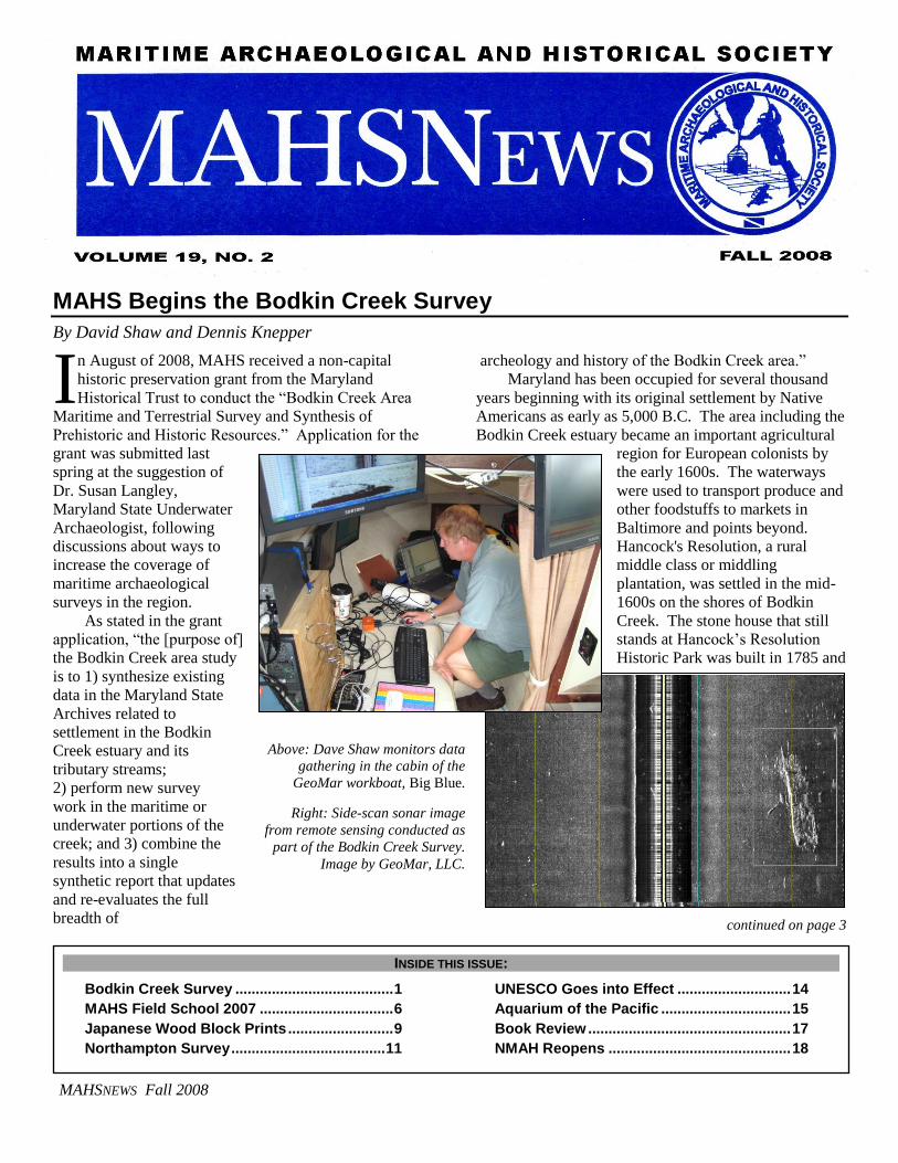
Above: Dave Shaw monitors data
gathering in the cabin of the
GeoMar workboat, Big Blue.
Right: Side-scan sonar image
from remote sensing conducted as
part of the Bodkin Creek Survey.
Image by GeoMar, LLC.
MAHSNEWS Fall 2008
2
Notes from the Prez – Steven Anthony
This has been an exciting summer for MAHS. Our
training programs and research projects were in high
gear.
In June, Earl Glock offered a Nitrox course to all
MAHS members. Nitrox has become increasingly
popular among sport divers, and several MAHS
members took this opportunity to learn the latest
techniques in the safe and effective use of enriched air.
During July, MAHS conducted its 20th Annual Field
School in Underwater Archaeology. This two-day event
was held on July 18 and 19 on the Slobodna shipwreck
site off Key Largo, Florida. Tom Berkey, MAHS
Education Director, led the field school with assistance
from Jim Smailes, Heather Price, and Dennis Knepper.
Captain Rob Bleser of Quiescence Dive Shop managed
the diving logistics and skippered one of the dive boats.
Captain Rob is among the best in the business and
worked hard to ensure the success of the field school.
The course ran so smoothly and the participants were so
enthusiastic about the results that we all agreed MAHS
would be working out of Quiescence Dive Shop again
next year. Slobodna is an exciting wreck and everyone
had a great time. See the enclosed article.
In August, the State of Maryland announced the
recipients of the 2009 Maryland Historical Trust Non-
Capital Grants, and MAHS was honored to be among the
grantees. The state agreed to fund the MAHS project
entitled “Bodkin Creek Area Maritime and Terrestrial
Survey and Synthesis of Prehistoric and Historic
Resources”. This project will be managed by Dave
Shaw and conducted under the auspices of Dr. Susan
B.M. Langley, State Underwater Archaeologist, and Dr.
Brian Jordan, Assistant State Underwater Archaeologist.
As part of the survey, MAHS will be searching for the
American privateer Lion of Baltimore that was sunk by a
British warship in 1814. The maritime survey portion of
the project kicked off in October with a side-scan sonar
and magnetometer survey. See enclosed the article.
The MAHS speaker series continued over the
summer and included several notable presentations,
among which were Rear Admiral Joe Callo’s talk on the
storied career of John Paul Jones; Wendy Coble, on the
Naval Historical Center's research identifying the
submarine USS Lagarto, which was discovered in
Thailand; Mel Brisco, on recent civilian diving
expeditions on the USS Monitor; Eric Nordgren, on
conservation, interpretation, and display at the new USS
Monitor Center at The Mariners’ Museum in Newport
News; and Don Shomette, on his most recent book,
Shipwrecks of Delmarva (see the enclosed review).
continued on page 18
MAHSNEWS Fall 2008
2008 MAHS OFFICERS
Steven Anthony – President (301) 652-2622
Dennis Knepper – Vice President (703) 642-6878
James A. Smailes – Secretary (202) 543-4895
Earl Glock -- Treasurer
At Large Board Members
David Shaw
Kirk Pierce
Committee Chairpersons
Education Director – Thomas Berkey
Dive Safety Officer – Earl Glock
Webmaster – David Shaw
Equipment Manager – James A. Smailes
MAHSNEWS Editors: James A. Smailes, Dennis Knepper
ADVISORS
John Broadwater Maritime Heritage Program Manager, National Oceanic and
Atmospheric Administration
Dr. Michael Crawford Early History Branch, Naval Historical Center
Dr. Kevin Crisman Assistant Professor of Anthropology, Texas A&M University
James A. Goold, J.D. Covington and Burling
Dr. Richard Gould Professor of Anthropology, Brown University
Dr. Paul Johnston Curator, Maritime History, National Museum of American
History, Smithsonian Institution
Dr. Susan Langley State Underwater Archeologist, Maryland
Jeffery Morris President, Azulmar, LLC
Larry Murphy Submerged Resource Center, National Park Service
Dr. Robert Neyland Head, Underwater Archaeology Branch, Naval Historical Center
Dr. John Seidel Assistant Professor of Anthropology and Environmental Studies,
Washington College
Dr. Roger C. Smith State Underwater Archaeologist, Florida
Bruce Terrell National Marine Sanctuaries, National Oceanic and Atmospheric
Administration
Dr. Gordon Watts Director, Institute for International Maritime Research
MAHSNEWS is the official publication of the Maritime Archaeological
and Historical Society (MAHS), a non-profit organization
dedicated to preserving our global maritime heritage.
MAHSNEWS will consider articles and notices for publication which
enhance public awareness and appreciation of maritime history,
archaeology, and heritage preservation.
3
is the oldest existing structure in Anne Arundel County
north of the Severn River. The house remains virtually
unchanged from its days as an 18th-century farmstead.
The Bodkin Creek area is also significant for the
role it played in the British invasion of fledgling
America during the War of 1812. After the burning
of Washington, D.C., the British moved north aiming to
capture Baltimore, an important port and a major center
for privateering operations that were decimating British
commercial shipping. One of the privateers known to
have been from this area was the Lion of Baltimore, a
Baltimore clipper. As privateers these clipper schooners
wreaked havoc on British shipping. The vessels were
also prized by the Royal Navy for their speed and
maneuverability – captured clippers made excellent
dispatch vessels. Crewmen from the frigate HMS
Menelaus were sent to take the Lion of Baltimore while
it lay at anchor in Bodkin Creek. The American crew
abandoned the ship and stripped it of its sails. Unable to
move the vessel, the British burned her where she lay. If
still present in Bodkin Creek, the Lion's remains would
represent the only surviving remnants of an original
Baltimore clipper. The remains could provide valuable
information about how these ships were built and how
the famous clipper design evolved. Additional maritime
finds in are expected in the Bodkin Creek area. This part
of the Chesapeake Bay, lying at the mouth of the
Patapsco River leading to Baltimore, played a significant
role in the development of commercial shipping and has
been a busy shipping lane since the 18th century.
A preliminary review of Maryland Historical Trust
archaeological site files indicates that as many as 26
archaeological sites, mostly terrestrial, have been
recorded along Bodkin Creek. A large regional study of
terrestrial sites, conducted in 1977 by Steve Wilke and
Gail Thompson, included the shoreline of the creek. In
1997, divers from MAHS supported a survey project at
Hancock's Resolution as part of the efforts to restore the
plantation as a historical center (see the project report at
http://mahsnet.org/papers.php). The survey included the
remains of an old pier and another shoreline site on Back
Creek to determine if remnants of the pier or other
artifact remains were present. The surveyors identified a
3,000-year old Native American campsite on the
property. In 2005 and 2007, Stephen Bilicki, then an
underwater archaeologist with the Maryland Maritime
Archaeology Program (MMAP), conducted remote
sensing surveys in Bodkin Creek. And finally, several
shoreline erosion studies have been conducted by the
Maryland Geological Survey. Combining the results of
these studies with new information gained from the
current investigation will advance our understanding of
the full scope of history in the Bodkin Creek stream
valley.
he Bodkin Creek Survey project will be carried out
in several phases, including intensive archival
research; a remote sensing survey of underwater portions
of the Bodkin Creek estuary and bayside approaches to
the creek; and a survey of known terrestrial sites along
the shores of the estuary. Ultimately a report will be
generated that combines the information into a summary
of the archaeology and history of the entire estuary. A
final task involves reconditioning a side-scan sonar unit
that was donated to the Maryland Historical Trust.
MAHS will also write a user manual for the unit which
will then be made available to volunteer groups working
in State waters.
The first phase of field work was begun over Labor
Day weekend. For the remote sensing work we were
fortunate to be able to team with GeoMar Research,
LLC, a firm that specializes in remote sensing and
T
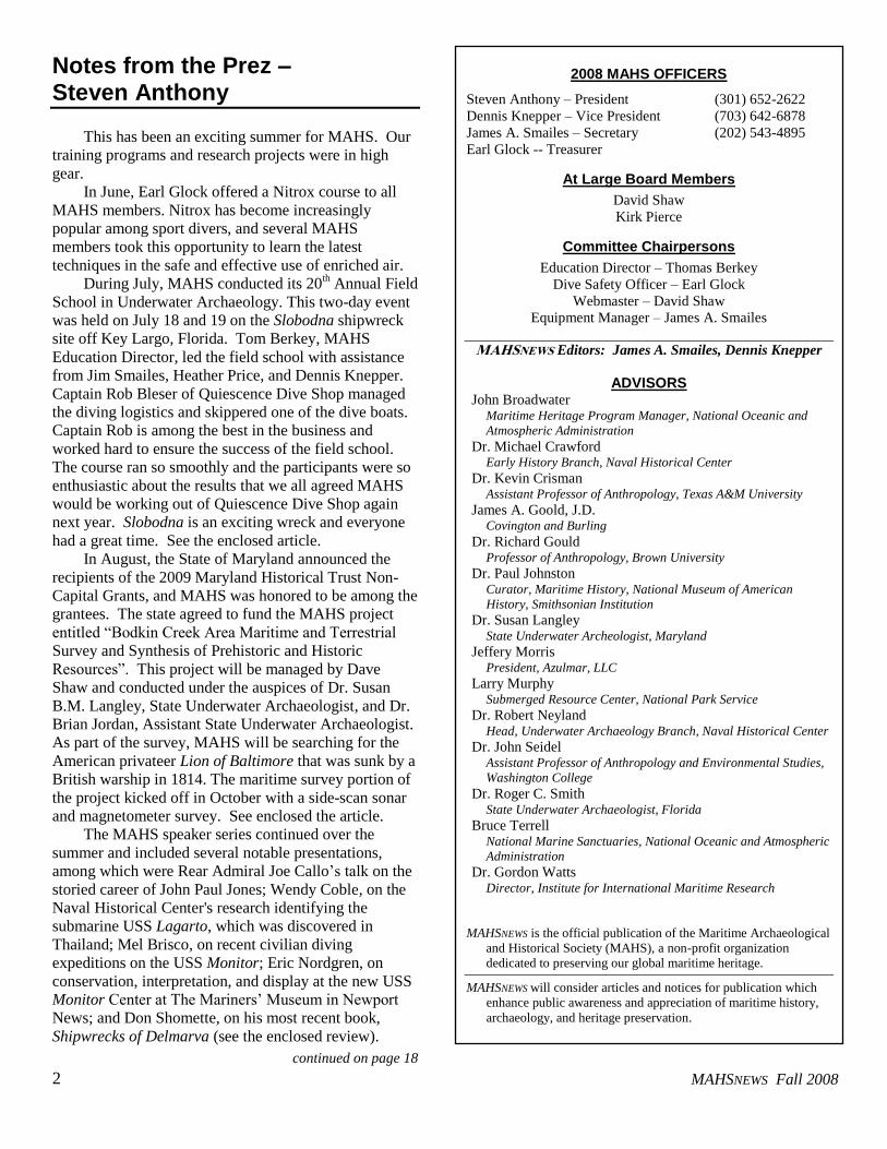
The Bodkin Creek Estuary near the turn of the last
century. United States Geological Survey 1904.
Bodkin Creek
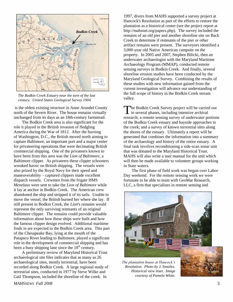
The plantation house at Hancock’s
Resolution. Photo by J. Smailes.
Historical view inset. Image
courtesy of Pamela White.
MAHSNEWS Fall 2008
4
oceanographic data collection services. The company is
owned and operated by Jeff Morris, a long-time friend of
MAHS going back to his days as a graduate student at
East Carolina University. At that time, MAHS and Jeff
collaborated on field work for the Chickahominy
Shipyard project, which recorded the Revolutionary
War-era remains of launching ways, wharf, and vessels
in the river and was the subject of Jeff’s Master’s thesis.
Jeff offered the use of his survey equipment for the
Bodkin Creek survey.
An initial meeting was held in late August with
Brian Jordan, Maryland Assistant State Underwater
Archaeologist, who serves as the grant administrator for
the project. We made plans to begin the remote sensing
survey almost immediately after the meeting to take
advantage of the early fall weather and a break in
GeoMar’s commercial schedule.
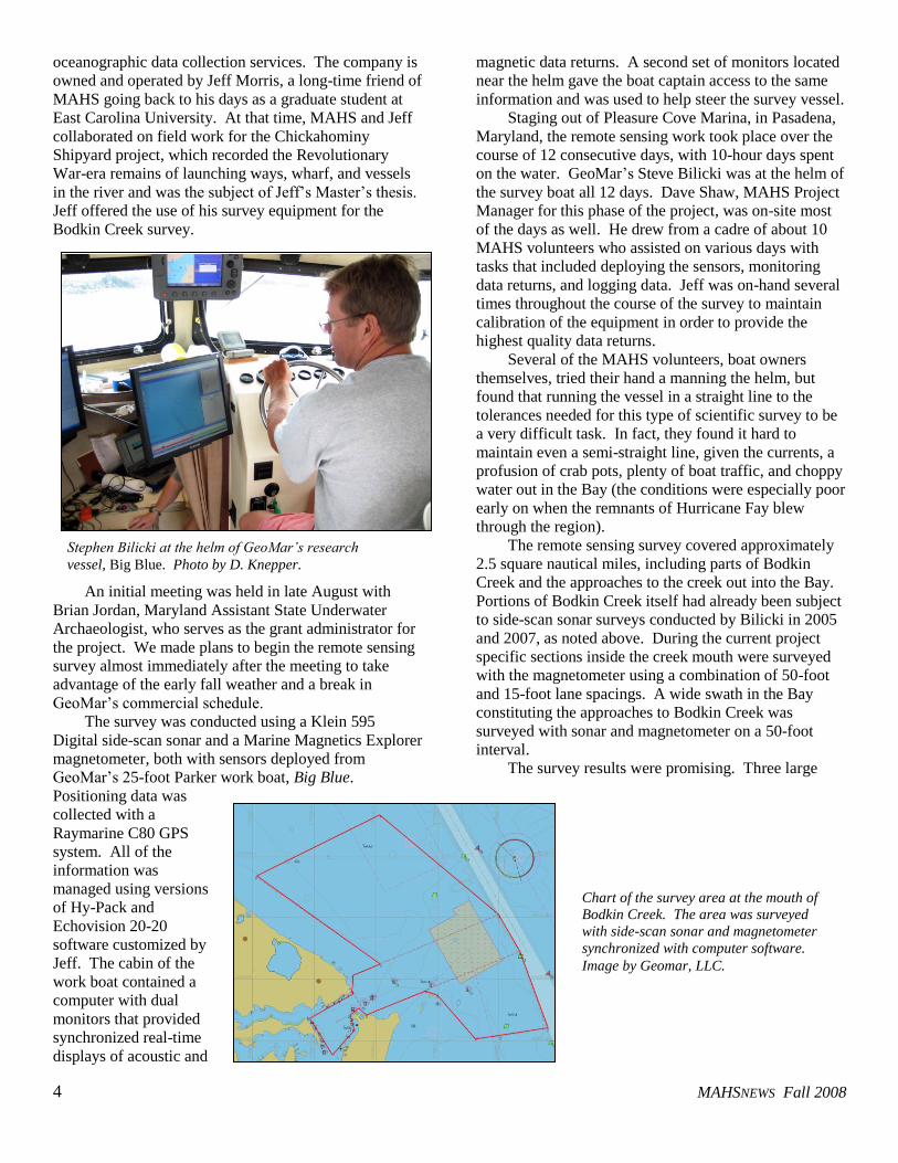
The survey was conducted using a Klein 595
Digital side-scan sonar and a Marine Magnetics Explorer
magnetometer, both with sensors deployed from
GeoMar’s 25-foot Parker work boat, Big Blue.
Positioning data was
collected with a
Raymarine C80 GPS
system. All of the
information was
managed using versions
of Hy-Pack and
Echovision 20-20
software customized by
Jeff. The cabin of the
work boat contained a
computer with dual
monitors that provided
synchronized real-time
displays of acoustic and
magnetic data returns. A second set of monitors located
near the helm gave the boat captain access to the same
information and was used to help steer the survey vessel.
Staging out of Pleasure Cove Marina, in Pasadena,
Maryland, the remote sensing work took place over the
course of 12 consecutive days, with 10-hour days spent
on the water. GeoMar’s Steve Bilicki was at the helm of
the survey boat all 12 days. Dave Shaw, MAHS Project
Manager for this phase of the project, was on-site most
of the days as well. He drew from a cadre of about 10
MAHS volunteers who assisted on various days with
tasks that included deploying the sensors, monitoring
data returns, and logging data. Jeff was on-hand several
times throughout the course of the survey to maintain
calibration of the equipment in order to provide the
highest quality data returns.
Several of the MAHS volunteers, boat owners
themselves, tried their hand a manning the helm, but
found that running the vessel in a straight line to the
tolerances needed for this type of scientific survey to be
a very difficult task. In fact, they found it hard to
maintain even a semi-straight line, given the currents, a
profusion of crab pots, plenty of boat traffic, and choppy
water out in the Bay (the conditions were especially poor
early on when the remnants of Hurricane Fay blew
through the region).
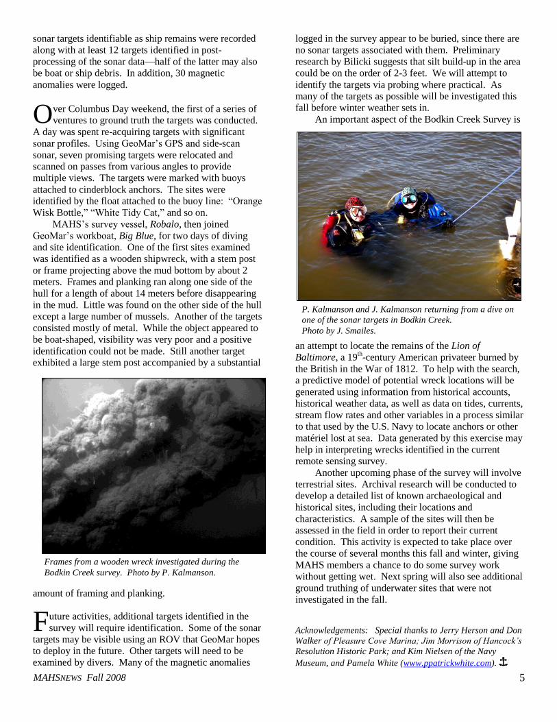
The remote sensing survey covered approximately
2.5 square nautical miles, including parts of Bodkin
Creek and the approaches to the creek out into the Bay.
Portions of Bodkin Creek itself had already been subject
to side-scan sonar surveys conducted by Bilicki in 2005
and 2007, as noted above. During the current project
specific sections inside the creek mouth were surveyed
with the magnetometer using a combination of 50-foot
and 15-foot lane spacings. A wide swath in the Bay
constituting the approaches to Bodkin Creek was
surveyed with sonar and magnetometer on a 50-foot
interval.
The survey results were promising. Three large
Stephen Bilicki at the helm of GeoMar’s research
vessel, Big Blue. Photo by D. Knepper.
Chart of the survey area at the mouth of
Bodkin Creek. The area was surveyed
with side-scan sonar and magnetometer
synchronized with computer software.
Image by Geomar, LLC.
MAHSNEWS Fall 2008
5
sonar targets identifiable as ship remains were recorded
along with at least 12 targets identified in post-
processing of the sonar data—half of the latter may also
be boat or ship debris. In addition, 30 magnetic
anomalies were logged.
ver Columbus Day weekend, the first of a series of
ventures to ground truth the targets was conducted.
A day was spent re-acquiring targets with significant
sonar profiles. Using GeoMar’s GPS and side-scan
sonar, seven promising targets were relocated and
scanned on passes from various angles to provide
multiple views. The targets were marked with buoys
attached to cinderblock anchors. The sites were
identified by the float attached to the buoy line: “Orange
Wisk Bottle,” “White Tidy Cat,” and so on.
MAHS’s survey vessel, Robalo, then joined
GeoMar’s workboat, Big Blue, for two days of diving
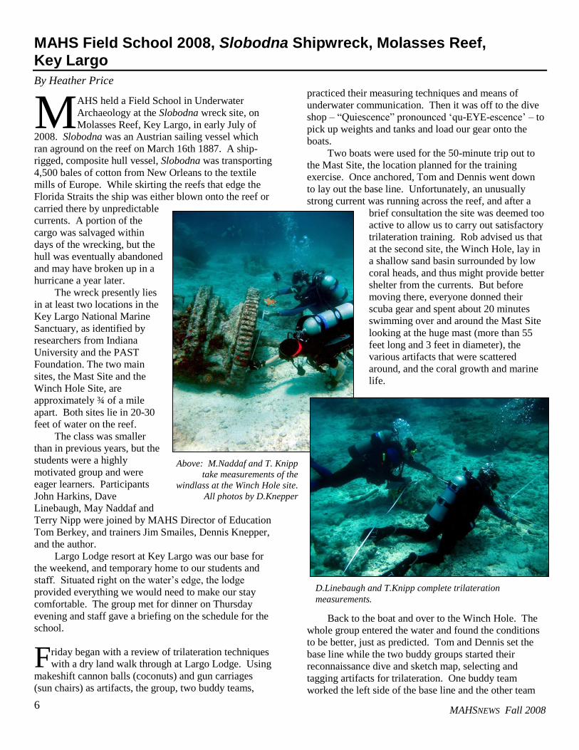
and site identification. One of the first sites examined
was identified as a wooden shipwreck, with a stem post
or frame projecting above the mud bottom by about 2
meters. Frames and planking ran along one side of the
hull for a length of about 14 meters before disappearing
in the mud. Little was found on the other side of the hull
except a large number of mussels. Another of the targets
consisted mostly of metal. While the object appeared to
be boat-shaped, visibility was very poor and a positive
identification could not be made. Still another target
exhibited a large stem post accompanied by a substantial
amount of framing and planking.
uture activities, additional targets identified in the
survey will require identification. Some of the sonar
targets may be visible using an ROV that GeoMar hopes
to deploy in the future. Other targets will need to be
examined by divers. Many of the magnetic anomalies
logged in the survey appear to be buried, since there are
no sonar targets associated with them. Preliminary
research by Bilicki suggests that silt build-up in the area
could be on the order of 2-3 feet. We will attempt to
identify the targets via probing where practical. As
many of the targets as possible will be investigated this
fall before winter weather sets in.
An important aspect of the Bodkin Creek Survey is
an attempt to locate the remains of the Lion of
Baltimore, a 19th-century American privateer burned by
the British in the War of 1812. To help with the search,
a predictive model of potential wreck locations will be
generated using information from historical accounts,
historical weather data, as well as data on tides, currents,
stream flow rates and other variables in a process similar
to that used by the U.S. Navy to locate anchors or other
matériel lost at sea. Data generated by this exercise may
help in interpreting wrecks identified in the current
remote sensing survey.
Another upcoming phase of the survey will involve
terrestrial sites. Archival research will be conducted to
develop a detailed list of known archaeological and
historical sites, including their locations and
characteristics. A sample of the sites will then be
assessed in the field in order to report their current
condition. This activity is expected to take place over
the course of several months this fall and winter, giving
MAHS members a chance to do some survey work
without getting wet. Next spring will also see additional
ground truthing of underwater sites that were not
investigated in the fall.
Acknowledgements: Special thanks to Jerry Herson and Don
Walker of Pleasure Cove Marina; Jim Morrison of Hancock’s
Resolution Historic Park; and Kim Nielsen of the Navy
Museum, and Pamela White (www.ppatrickwhite.com). Î
O
F
Frames from a wooden wreck investigated during the
Bodkin Creek survey. Photo by P. Kalmanson.
P. Kalmanson and J. Kalmanson returning from a dive on
one of the sonar targets in Bodkin Creek.
Photo by J. Smailes.
MAHSNEWS Fall 2008
MAHSNEWS Fall 2008 6
MAHS Field School 2008, Slobodna Shipwreck, Molasses Reef, Key Largo
By Heather Price
AHS held a Field School in Underwater
Archaeology at the Slobodna wreck site, on
Molasses Reef, Key Largo, in early July of
2008. Slobodna was an Austrian sailing vessel which
ran aground on the reef on March 16th 1887. A ship-
rigged, composite hull vessel, Slobodna was transporting
4,500 bales of cotton from New Orleans to the textile
mills of Europe. While skirting the reefs that edge the
Florida Straits the ship was either blown onto the reef or
carried there by unpredictable
currents. A portion of the
cargo was salvaged within
days of the wrecking, but the
hull was eventually abandoned
and may have broken up in a
hurricane a year later.
The wreck presently lies
in at least two locations in the
Key Largo National Marine
Sanctuary, as identified by
researchers from Indiana
University and the PAST
Foundation. The two main
sites, the Mast Site and the
Winch Hole Site, are
approximately ¾ of a mile
apart. Both sites lie in 20-30
feet of water on the reef.
The class was smaller
than in previous years, but the
students were a highly
motivated group and were
eager learners. Participants
John Harkins, Dave
Linebaugh, May Naddaf and
Terry Nipp were joined by MAHS Director of Education
Tom Berkey, and trainers Jim Smailes, Dennis Knepper,
and the author.
Largo Lodge resort at Key Largo was our base for
the weekend, and temporary home to our students and
staff. Situated right on the water’s edge, the lodge
provided everything we would need to make our stay
comfortable. The group met for dinner on Thursday
evening and staff gave a briefing on the schedule for the
school.
riday began with a review of trilateration techniques
with a dry land walk through at Largo Lodge. Using
makeshift cannon balls (coconuts) and gun carriages
(sun chairs) as artifacts, the group, two buddy teams,
practiced their measuring techniques and means of
underwater communication. Then it was off to the dive
shop – “Quiescence” pronounced ‘qu-EYE-escence’ – to
pick up weights and tanks and load our gear onto the
boats.
Two boats were used for the 50-minute trip out to
the Mast Site, the location planned for the training
exercise. Once anchored, Tom and Dennis went down
to lay out the base line. Unfortunately, an unusually
strong current was running across the reef, and after a
brief consultation the site was deemed too
active to allow us to carry out satisfactory
trilateration training. Rob advised us that
at the second site, the Winch Hole, lay in
a shallow sand basin surrounded by low
coral heads, and thus might provide better
shelter from the currents. But before
moving there, everyone donned their
scuba gear and spent about 20 minutes
swimming over and around the Mast Site
looking at the huge mast (more than 55
feet long and 3 feet in diameter), the
various artifacts that were scattered
around, and the coral growth and marine
life.
Back to the boat and over to the Winch Hole. The
whole group entered the water and found the conditions
to be better, just as predicted. Tom and Dennis set the
base line while the two buddy groups started their
reconnaissance dive and sketch map, selecting and
tagging artifacts for trilateration. One buddy team
worked the left side of the base line and the other team
M
F
Above: M.Naddaf and T. Knipp
take measurements of the
windlass at the Winch Hole site.
All photos by D.Knepper
D.Linebaugh and T.Knipp complete trilateration
measurements.
7
the right side. Visibility was good at both the Winch
Hole and Mast sites, but the reduced current at the
Winch Hole allowed easier working conditions. Up, for
a surface interval, lunch and discussion on the morning’s
work.
The second dive at the Winch Hole was dedicated
to trilateration. The group spent approximately 50-55
minutes on this dive taking further measurements before
calling it a day.
Aboard the boat with a lazy ride ahead to the dock,
everyone reflected on the day’s dives. After rinsing off
the gear and hanging things to dry at the dive shop,
ready for an early morning dive on Saturday, the group
made their way back to the lodge to plot the points from
each individual team’s collected data, which was no
mean feat—it always sounds easier than it is. It turned
out that Dave had an inconsistency in his measurements
for one of his points. This is the reason for plotting your
data right away—you find any errors and can plan the
following day’s dive to allow you to re-collect the data.
Viewing the points on the map and the images held in
the mind from the swim through and tagging of artifacts,
the maps that the teams produced after the first day
appeared to be fairly accurate representations of the site.
Most of the second day was again spent at the
Winch Hole site. Due to the size of the group, we took
only one boat out this day. Since Quiescence limits the
number of divers on their boats to six, Heather and Jim
took the opportunity to do some reef dives. The class
spent two dives continuing trilateration and doing
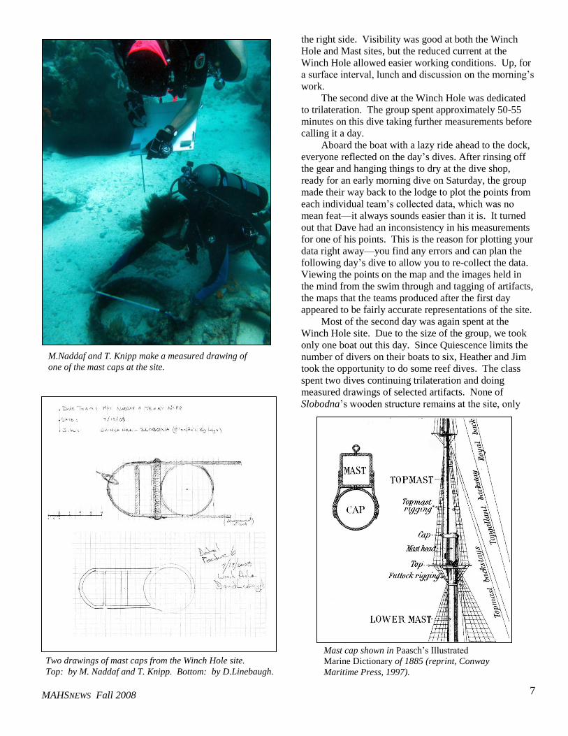
measured drawings of selected artifacts. None of
Slobodna’s wooden structure remains at the site, only
M.Naddaf and T. Knipp make a measured drawing of
one of the mast caps at the site.
Two drawings of mast caps from the Winch Hole site.
Top: by M. Naddaf and T. Knipp. Bottom: by D.Linebaugh.
Mast cap shown in Paasch’s Illustrated
Marine Dictionary of 1885 (reprint, Conway
Maritime Press, 1997).
MAHSNEWS Fall 2008
8
scattered metal artifacts such as knees, mast caps, chain,
davits and, of course, the large windlass or winch, from
which this particular dive site takes its name. Both
teams chose to draw the mast caps, distinctive large
metal objects that served to connect sections of the mast.
Finally, the class tried their hands at photographing
features underwater using disposable cameras. While
the quality of the images did not match that of the more
sophisticated digital cameras that are available these
days, the disposables did produce serviceable images
and provided some good practice in yet another
important facet of archaeological site recording. Tom
brought a video camera down to the site as well and
added video-documentation to the forms of data we
collected at the site.
Near the end of the second dive, which was to be
the last at the site, the class spread out across the area
removing flagging tape from features and generally
policing the site, making sure that we left it as clean and
undisturbed as it was when we arrived the day before.
The baseline was rolled up, the datum point rebar
removed, and everyone headed back to the boat.
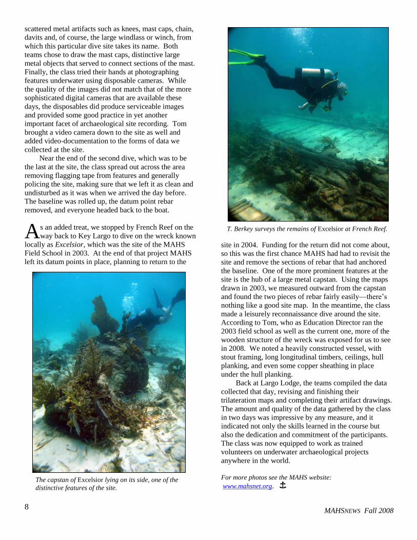
s an added treat, we stopped by French Reef on the
way back to Key Largo to dive on the wreck known
locally as Excelsior, which was the site of the MAHS
Field School in 2003. At the end of that project MAHS
left its datum points in place, planning to return to the
site in 2004. Funding for the return did not come about,
so this was the first chance MAHS had had to revisit the
site and remove the sections of rebar that had anchored
the baseline. One of the more prominent features at the
site is the hub of a large metal capstan. Using the maps
drawn in 2003, we measured outward from the capstan
and found the two pieces of rebar fairly easily—there’s
nothing like a good site map. In the meantime, the class
made a leisurely reconnaissance dive around the site.
According to Tom, who as Education Director ran the
2003 field school as well as the current one, more of the
wooden structure of the wreck was exposed for us to see
in 2008. We noted a heavily constructed vessel, with
stout framing, long longitudinal timbers, ceilings, hull
planking, and even some copper sheathing in place
under the hull planking.
Back at Largo Lodge, the teams compiled the data
collected that day, revising and finishing their
trilateration maps and completing their artifact drawings.
The amount and quality of the data gathered by the class
in two days was impressive by any measure, and it
indicated not only the skills learned in the course but
also the dedication and commitment of the participants.
The class was now equipped to work as trained
volunteers on underwater archaeological projects
anywhere in the world.
For more photos see the MAHS website:
www.mahsnet.org. Î
A
The capstan of Excelsior lying on its side, one of the
distinctive features of the site.
T. Berkey surveys the remains of Excelsior at French Reef.
MAHSNEWS Fall 2008
9
Wooden Boats in Japanese Woodblock Prints
By James Smailes
t the Society for Historical
Archaeology conference this
past January in Albuquerque,
New Mexico, the first-ever
symposium in maritime archaeology
was held. Although individual papers
on Asian ships had been presented
previously, there had never been an
entire symposium devoted to this
topic. The session, entitled East Asian
Ship Building Technology and
Seafaring, included papers that
ranged from thirteenth-century
Mongolian ships, to fifteenth-century
Chinese shipyards, to eighteenth-
century Japanese domestic vessels, to
nineteenth-century Pacific
steamships. The presenters hoped to
highlight this understudied
geographic area and present current
research on Asian maritime topics.
In the previous issue of
MAHSNews (Vol. 19, No. 1), a
synopsis of one of the presentations,
The Origin of the Lost Fleet, by
Randall Sasaki, was published. The
article summarized his paper on the
Mongol invasion of Japan in 1281
B.C. that was one of the largest
maritime disasters in history, in which
more than 4,000 ships were lost
during a single storm known as the
Kamikaze.
In this issue, we will present a
selection of Japanese woodblock
prints from the paper by Michelle
Damian, who also organized the
session. Her presentation, drawn
from her Master’s thesis work at East
Carolina University, examined the
technological accuracy in depictions
of wooden boats in Japanese
woodblock prints of the late Edo
period (1603 – 1867), comparing the
prints to contemporary models and
treatises as well as to modern boats
built using traditional construction
methods.
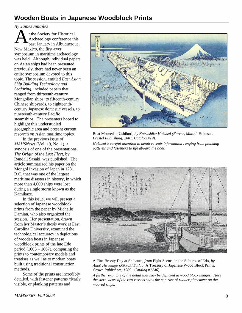
Some of the prints are incredibly
detailed, with fastener patterns clearly
visible, or planking patterns and
A
Boat Moored at Ushibori, by Katsushika Hokusai (Forrer, Matthi. Hokusai.
Prestel Publishing, 2001. Catalog #19).
Hokusai’s careful attention to detail reveals information ranging from planking
patterns and fasteners to life aboard the boat.
A Fine Breezy Day at Shibaura, from Eight Scenes in the Suburbs of Edo, by
Andō Hiroshige (Kikuchi Sadao. A Treasury of Japanese Wood Block Prints.
Crown Publishers, 1969. Catalog #1246).
A further example of the detail that may be depicted in wood block images. Here
the stern views of the two vessels show the contrast of rudder placement on the
moored ships.
MAHSNEWS Fall 2008
10
rudder construction plainly depicted.
Other images show simply a white
square representing a sail on the horizon.
Yet all of them illustrate something about
how these vessels were made and used.
The art is perhaps more revealing in an
analysis of maritime culture in general, as
the woodblock prints depict a variety of
fishing, shipping, pleasure cruising, and
even military scenes, hinting at the myriad
roles these vessels played.
Michelle’s paper will be published in
the proceedings of the Advisory Council of
Underwater Archaeology. More details
about her research can be found in her
project journal “Japanese Wooden Boats in
Woodblock Prints” part of the on-line
Museum of Underwater Archaeology,
which follows the progress of her research.
See www.uri.edu/mua/. Î
Kawado, from Stages on the Kiso Highway, by Keisai Eisen (Kikuchi
Sadao. A Treasury of Japanese Wood Block Prints. Crown
Publishers, 1969. Catalog #1310).
Eisen depicts cormorant fishing in the river, a relatively unusual
subject of woodblock prints.
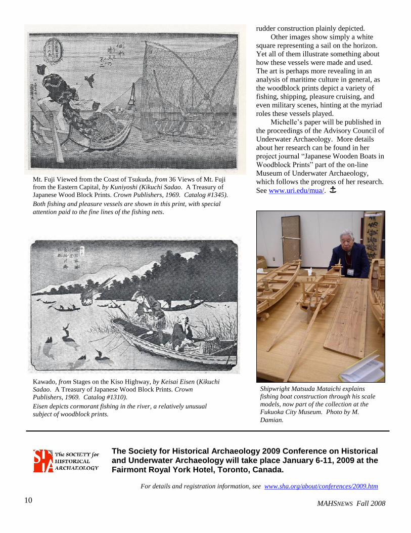
Mt. Fuji Viewed from the Coast of Tsukuda, from 36 Views of Mt. Fuji
from the Eastern Capital, by Kuniyoshi (Kikuchi Sadao. A Treasury of
Japanese Wood Block Prints. Crown Publishers, 1969. Catalog #1345).
Both fishing and pleasure vessels are shown in this print, with special
attention paid to the fine lines of the fishing nets.
Shipwright Matsuda Mataichi explains
fishing boat construction through his scale
models, now part of the collection at the
Fukuoka City Museum. Photo by M.
Damian.
The Society for Historical Archaeology 2009 Conference on Historical and Underwater Archaeology will take place January 6-11, 2009 at the Fairmont Royal York Hotel, Toronto, Canada.
For details and registration information, see www.sha.org/about/conferences/2009.htm
MAHSNEWS Fall 2008
11
That’s Not Supposed To Be There: A Maritime Cultural Resources Survey in Northampton County, Virginia
by Stephen R. Bilicki
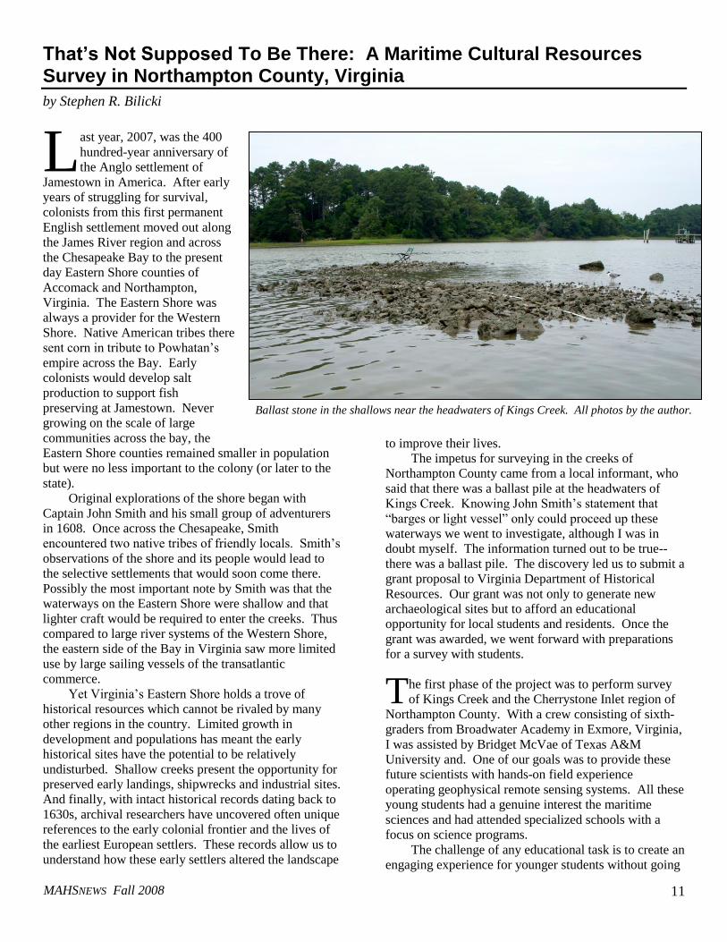
ast year, 2007, was the 400
hundred-year anniversary of
the Anglo settlement of
Jamestown in America. After early
years of struggling for survival,
colonists from this first permanent
English settlement moved out along
the James River region and across
the Chesapeake Bay to the present
day Eastern Shore counties of
Accomack and Northampton,
Virginia. The Eastern Shore was
always a provider for the Western
Shore. Native American tribes there
sent corn in tribute to Powhatan’s
empire across the Bay. Early
colonists would develop salt
production to support fish
preserving at Jamestown. Never
growing on the scale of large
communities across the bay, the
Eastern Shore counties remained smaller in population
but were no less important to the colony (or later to the
state).
Original explorations of the shore began with
Captain John Smith and his small group of adventurers
in 1608. Once across the Chesapeake, Smith
encountered two native tribes of friendly locals. Smith’s
observations of the shore and its people would lead to
the selective settlements that would soon come there.
Possibly the most important note by Smith was that the
waterways on the Eastern Shore were shallow and that
lighter craft would be required to enter the creeks. Thus
compared to large river systems of the Western Shore,
the eastern side of the Bay in Virginia saw more limited
use by large sailing vessels of the transatlantic
commerce.
Yet Virginia’s Eastern Shore holds a trove of
historical resources which cannot be rivaled by many
other regions in the country. Limited growth in
development and populations has meant the early
historical sites have the potential to be relatively
undisturbed. Shallow creeks present the opportunity for
preserved early landings, shipwrecks and industrial sites.
And finally, with intact historical records dating back to
1630s, archival researchers have uncovered often unique
references to the early colonial frontier and the lives of
the earliest European settlers. These records allow us to
understand how these early settlers altered the landscape
to improve their lives.
The impetus for surveying in the creeks of
Northampton County came from a local informant, who
said that there was a ballast pile at the headwaters of
Kings Creek. Knowing John Smith’s statement that
“barges or light vessel” only could proceed up these
waterways we went to investigate, although I was in
doubt myself. The information turned out to be true--
there was a ballast pile. The discovery led us to submit a
grant proposal to Virginia Department of Historical
Resources. Our grant was not only to generate new
archaeological sites but to afford an educational
opportunity for local students and residents. Once the
grant was awarded, we went forward with preparations
for a survey with students.
he first phase of the project was to perform survey
of Kings Creek and the Cherrystone Inlet region of
Northampton County. With a crew consisting of sixth-
graders from Broadwater Academy in Exmore, Virginia,
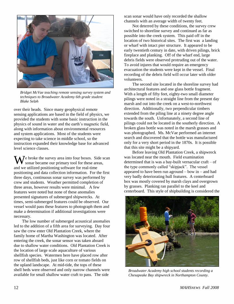
I was assisted by Bridget McVae of Texas A&M
University and. One of our goals was to provide these
future scientists with hands-on field experience
operating geophysical remote sensing systems. All these
young students had a genuine interest the maritime
sciences and had attended specialized schools with a
focus on science programs.
The challenge of any educational task is to create an
engaging experience for younger students without going
L
T
Ballast stone in the shallows near the headwaters of Kings Creek. All photos by the author.
MAHSNEWS Fall 2008
12
over their heads. Since many geophysical remote
sensing applications are based in the field of physics, we
provided the students with some basic instruction in the
physics of sound in water and the earth’s magnetic field,
along with information about environmental resources
and system applications. Most of the students were
expecting to take science in middle school, so the
instruction expanded their knowledge base for advanced
level science classes.
e broke the survey area into four boxes. Side scan
sonar became our primary tool for these areas,
and we utilized positioning software for real-time
positioning and data collection information. For the first
three days, continuous sonar survey was performed by
crew and students. Weather permitted completion of
three areas, however results were minimal. A few
features were noted but none of these anomalies
presented signatures of submerged shipwrecks. At
times, semi-submerged features could be observed. Our
vessel would pass these features to photograph them and
make a determination if additional investigations were
necessary.
The low number of submerged acoustical anomalies
led to the addition of a fifth area for surveying. Day four
saw the crew enter Old Plantation Creek, where the
family home of Martha Washington was located. After
entering the creek, the sonar sensor was taken aboard
due to shallow water conditions. Old Plantation Creek is
the location of large scale aquaculture of various
shellfish species. Watermen here have placed row after
row of shellfish beds, just like corn or tomato fields on
the upland landscape. At mid-tide, the tops of these
shell beds were observed and only narrow channels were
available for small shallow water craft to pass. The side
scan sonar would have only recorded the shallow
channels with an average width of twenty feet.
Not deterred by these conditions, the survey crew
switched to shoreline survey and continued as far as
possible into the creek system. This paid off in the
location of two historical sites. The first was a landing
or wharf with intact pier structure. It appeared to be
early twentieth century in date, with driven pilings, brick
fireplace and planking. Off of the wharf end, large
debris fields were observed protruding out of the water.
To avoid injures that would require an emergency
evacuation the students were kept in the vessel. Final
recording of the debris field will occur later with older
volunteers.
The second site located in the shoreline survey had
architectural features and one glass bottle fragment.
With a length of fifty feet, eighty-two small diameter
pilings were noted in a straight line from the present day
marsh and out into the creek on a west-to-northwest
direction. Additionally, two perpendicular timbers
extended from the piling line at a ninety degree angle
towards the south. Unfortunately, a second line of
pilings could not be located in the southerly direction. A
broken glass bottle was noted in the marsh grasses and
was photographed. Ms. McVae performed an internet
search and discovered that the bottle was manufactured
only for a very short period in the 1870s. It is possible
that this site might be a shipyard.
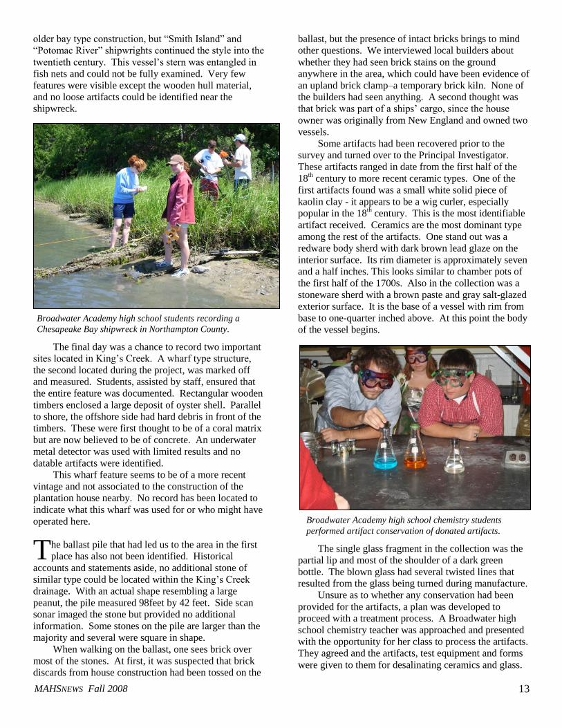
Before leaving Old Plantation Creek, a shipwreck
was located near the mouth. Field examination
determined that is was a bay-built vernacular craft – of
the type commonly called “skipjack”. The vessel
appeared to have been run aground – bow in – and had
very badly deteriorating hull features. A centerboard
box was mostly covered by marsh clays and overgrown
by grasses. Planking ran parallel to the keel and
centerboard. This style of shipbuilding is considered the
W
Bridget McVae teaching remote sensing survey system and
techniques to Broadwater Academy 6th grade student
Blake Selph
Broadwater Academy high school students recording a
Chesapeake Bay shipwreck in Northampton County.
MAHSNEWS Fall 2008
13
older bay type construction, but “Smith Island” and
“Potomac River” shipwrights continued the style into the
twentieth century. This vessel’s stern was entangled in
fish nets and could not be fully examined. Very few
features were visible except the wooden hull material,
and no loose artifacts could be identified near the
shipwreck.
The final day was a chance to record two important
sites located in King’s Creek. A wharf type structure,
the second located during the project, was marked off
and measured. Students, assisted by staff, ensured that
the entire feature was documented. Rectangular wooden
timbers enclosed a large deposit of oyster shell. Parallel
to shore, the offshore side had hard debris in front of the
timbers. These were first thought to be of a coral matrix
but are now believed to be of concrete. An underwater
metal detector was used with limited results and no
datable artifacts were identified.
This wharf feature seems to be of a more recent
vintage and not associated to the construction of the
plantation house nearby. No record has been located to
indicate what this wharf was used for or who might have
operated here.
he ballast pile that had led us to the area in the first
place has also not been identified. Historical
accounts and statements aside, no additional stone of
similar type could be located within the King’s Creek
drainage. With an actual shape resembling a large
peanut, the pile measured 98feet by 42 feet. Side scan
sonar imaged the stone but provided no additional
information. Some stones on the pile are larger than the
majority and several were square in shape.
When walking on the ballast, one sees brick over
most of the stones. At first, it was suspected that brick
discards from house construction had been tossed on the
ballast, but the presence of intact bricks brings to mind
other questions. We interviewed local builders about
whether they had seen brick stains on the ground
anywhere in the area, which could have been evidence of
an upland brick clamp–a temporary brick kiln. None of
the builders had seen anything. A second thought was
that brick was part of a ships’ cargo, since the house
owner was originally from New England and owned two
vessels.
Some artifacts had been recovered prior to the
survey and turned over to the Principal Investigator.
These artifacts ranged in date from the first half of the
18th century to more recent ceramic types. One of the
first artifacts found was a small white solid piece of
kaolin clay - it appears to be a wig curler, especially
popular in the 18th century. This is the most identifiable
artifact received. Ceramics are the most dominant type
among the rest of the artifacts. One stand out was a
redware body sherd with dark brown lead glaze on the
interior surface. Its rim diameter is approximately seven
and a half inches. This looks similar to chamber pots of
the first half of the 1700s. Also in the collection was a
stoneware sherd with a brown paste and gray salt-glazed
exterior surface. It is the base of a vessel with rim from
base to one-quarter inched above. At this point the body
of the vessel begins.
The single glass fragment in the collection was the
partial lip and most of the shoulder of a dark green
bottle. The blown glass had several twisted lines that
resulted from the glass being turned during manufacture.
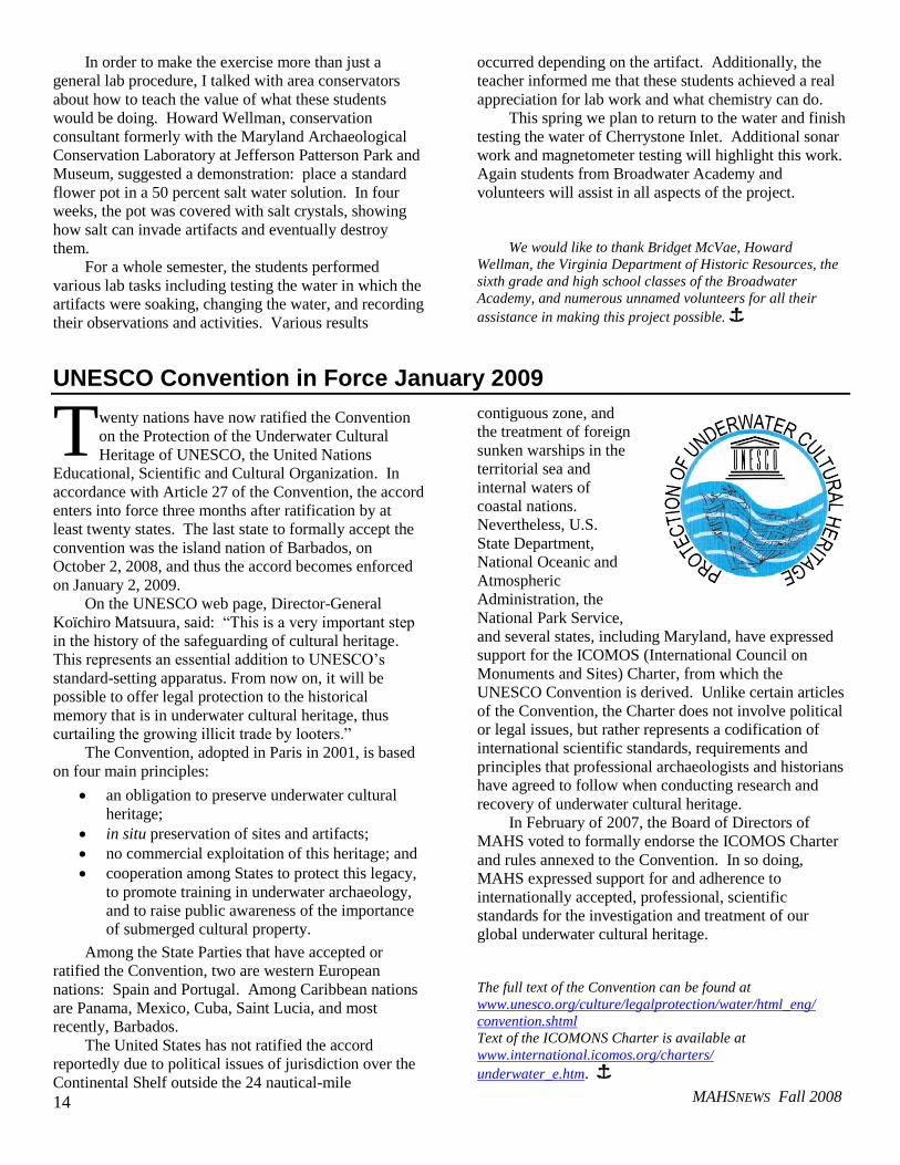
Unsure as to whether any conservation had been
provided for the artifacts, a plan was developed to
proceed with a treatment process. A Broadwater high
school chemistry teacher was approached and presented
with the opportunity for her class to process the artifacts.
They agreed and the artifacts, test equipment and forms
were given to them for desalinating ceramics and glass.
T
Broadwater Academy high school students recording a
Chesapeake Bay shipwreck in Northampton County.
Broadwater Academy high school chemistry students
performed artifact conservation of donated artifacts.
MAHSNEWS Fall 2008
14
In order to make the exercise more than just a
general lab procedure, I talked with area conservators
about how to teach the value of what these students
would be doing. Howard Wellman, conservation
consultant formerly with the Maryland Archaeological
Conservation Laboratory at Jefferson Patterson Park and
Museum, suggested a demonstration: place a standard
flower pot in a 50 percent salt water solution. In four
weeks, the pot was covered with salt crystals, showing
how salt can invade artifacts and eventually destroy
them.
For a whole semester, the students performed
various lab tasks including testing the water in which the
artifacts were soaking, changing the water, and recording
their observations and activities. Various results
occurred depending on the artifact. Additionally, the
teacher informed me that these students achieved a real
appreciation for lab work and what chemistry can do. This spring we plan to return to the water and finish
testing the water of Cherrystone Inlet. Additional sonar
work and magnetometer testing will highlight this work.
Again students from Broadwater Academy and
volunteers will assist in all aspects of the project.
We would like to thank Bridget McVae, Howard
Wellman, the Virginia Department of Historic Resources, the
sixth grade and high school classes of the Broadwater
Academy, and numerous unnamed volunteers for all their
assistance in making this project possible. Î
UNESCO Convention in Force January 2009
wenty nations have now ratified the Convention
on the Protection of the Underwater Cultural
Heritage of UNESCO, the United Nations
Educational, Scientific and Cultural Organization. In
accordance with Article 27 of the Convention, the accord
enters into force three months after ratification by at
least twenty states. The last state to formally accept the
convention was the island nation of Barbados, on
October 2, 2008, and thus the accord becomes enforced
on January 2, 2009.
On the UNESCO web page, Director-General
Koïchiro Matsuura, said: “This is a very important step
in the history of the safeguarding of cultural heritage.
This represents an essential addition to UNESCO’s
standard-setting apparatus. From now on, it will be
possible to offer legal protection to the historical
memory that is in underwater cultural heritage, thus
curtailing the growing illicit trade by looters.”
The Convention, adopted in Paris in 2001, is based
on four main principles:
an obligation to preserve underwater cultural
heritage;
in situ preservation of sites and artifacts;
no commercial exploitation of this heritage; and
cooperation among States to protect this legacy,
to promote training in underwater archaeology,
and to raise public awareness of the importance
of submerged cultural property.
Among the State Parties that have accepted or
ratified the Convention, two are western European
nations: Spain and Portugal. Among Caribbean nations
are Panama, Mexico, Cuba, Saint Lucia, and most
recently, Barbados.
The United States has not ratified the accord
reportedly due to political issues of jurisdiction over the
Continental Shelf outside the 24 nautical-mile
contiguous zone, and
the treatment of foreign
sunken warships in the
territorial sea and
internal waters of
coastal nations.
Nevertheless, U.S.
State Department,
National Oceanic and
Atmospheric
Administration, the
National Park Service,
and several states, including Maryland, have expressed
support for the ICOMOS (International Council on
Monuments and Sites) Charter, from which the
UNESCO Convention is derived. Unlike certain articles
of the Convention, the Charter does not involve political
or legal issues, but rather represents a codification of
international scientific standards, requirements and
principles that professional archaeologists and historians
have agreed to follow when conducting research and
recovery of underwater cultural heritage.
In February of 2007, the Board of Directors of
MAHS voted to formally endorse the ICOMOS Charter
and rules annexed to the Convention. In so doing,
MAHS expressed support for and adherence to
internationally accepted, professional, scientific
standards for the investigation and treatment of our
global underwater cultural heritage.
The full text of the Convention can be found at
www.unesco.org/culture/legalprotection/water/html_eng/
convention.shtml
Text of the ICOMONS Charter is available at
www.international.icomos.org/charters/
underwater_e.htm. Î
T
MAHSNEWS Fall 2008
15
The Aquarium of the Pacific Celebrates Its Tenth Anniversary
by James Smailes
hile on a recent trip
to California, I had
the opportunity to
visit with former MAHS
member Michelle Damian, who
is now attending the University
of Southern California in Los
Angeles getting a PhD in
History. She volunteers at the
Aquarium of the Pacific,
feeding fish and cleaning the
large tanks. Eventually
Michelle will complete her
training to become a diver
presenter, one who speaks
through a full face mask to the public about the exhibits
in the tank. She was able to give me a behind the scenes
tour before I struck out on my own.
Located in Long Beach, California, across the
harbor from the Queen Mary, the Aquarium of the
Pacific is celebrating its Tenth Anniversary this year.
The Aquarium is organized into three main galleries
highlighting the major regions of the Pacific Ocean:
Southern California and Baja; the North Pacific; and the
Tropical Pacific. There is also a Special Exhibits
Gallery. Outdoors, the Explorers Cove features a Shark
Lagoon, where one can pet small nurse sharks, skates
and other creatures, and the Lorikeet Forest, where
visitors can hand feed these small, colorful birds from
Australia. A larger shark aquarium is nearby where one
can view various species of sharks, the kind you
definitely don’t want to touch.
The Special Exhibits Gallery this fall features the
exhibit Ocean on the Edge, presenting the top ten threats
to the ocean, such as climate change; overfishing and the
unintentional catching of unwanted fishes, seabirds and
other creatures that often die in the process; biodiversity
loss; and the impacts of global trade and coastal
development. Two major areas presented are sustainable
seafood—environmentally friendly and long-term ways
to meet the growing demand for seafood; and watershed
management—how rainwater after falling on our streets,
farms and yards affects the ocean and other water
resources.
Also part of the Aquarium are Discovery Labs for
children of all ages, where one can touch marine life and
learn interesting facts from the exhibit interpreters. Like
most museums today, there are several theaters where
films, some in 3D, are presented. The museum takes
advantage of its location at the Long Beach/Los Angeles
Harbor by offering seasonally narrated tours of the
harbor, one of the busiest in the world, as well as tours to
the nearby ocean to see whales, dolphins, sea lions and
migratory birds. For the budding marine scientist, there
are opportunities to join the crew of a 90-foot ocean
research vessel to collect and identify marine life.
Dozens of aquaria of various sizes are found
throughout the building, but the Blue Cavern and the
Tropical Pacific Gallery are large enough for divers to
enter and swim about with the fish, feeding them and
cleaning the tank.
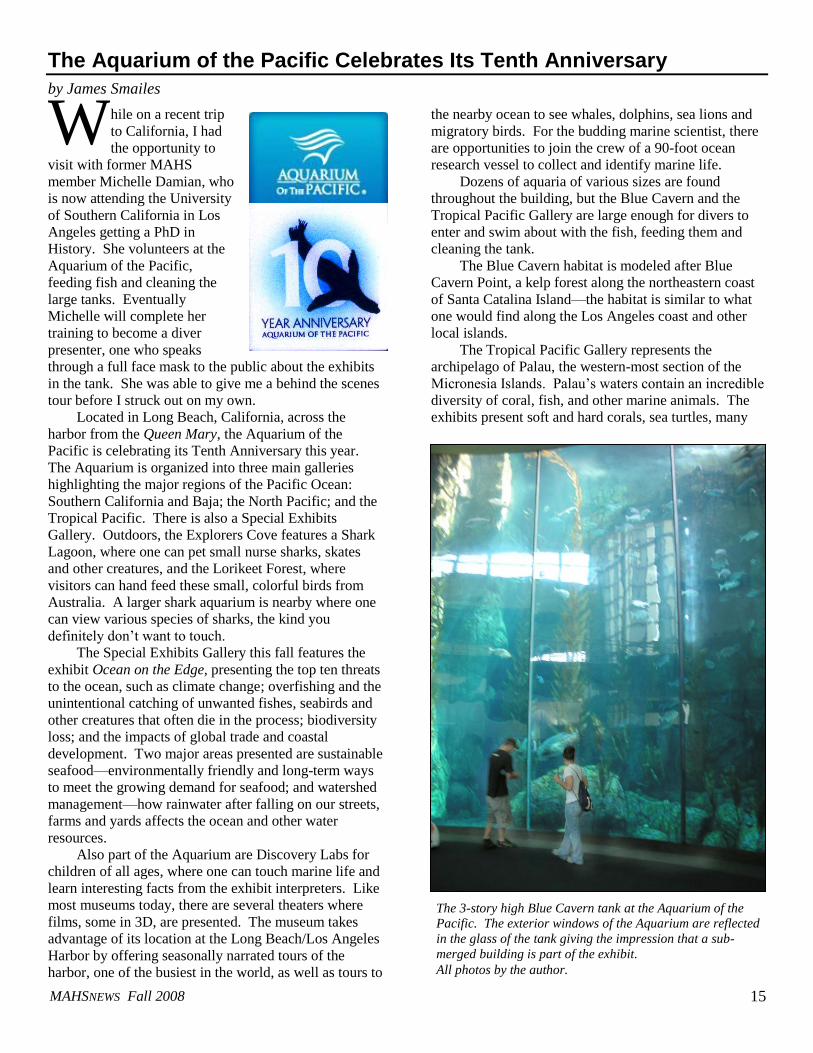
The Blue Cavern habitat is modeled after Blue
Cavern Point, a kelp forest along the northeastern coast
of Santa Catalina Island—the habitat is similar to what
one would find along the Los Angeles coast and other
local islands.
The Tropical Pacific Gallery represents the
archipelago of Palau, the western-most section of the
Micronesia Islands. Palau’s waters contain an incredible
diversity of coral, fish, and other marine animals. The
exhibits present soft and hard corals, sea turtles, many
W
The 3-story high Blue Cavern tank at the Aquarium of the
Pacific. The exterior windows of the Aquarium are reflected
in the glass of the tank giving the impression that a sub-
merged building is part of the exhibit.
All photos by the author.
MAHSNEWS Fall 2008
16
kinds of tropical fish including lionfish and stonefish,
sharks, sea horses and sea snakes.
Part of the coral exhibit includes an exhibit on coral
bleaching. As we know, coral reefs are the most
biologically diverse ecosystems on Earth but are
threatened by the effects of global warming. I learned
that corals are animals that rely on tiny, single-celled
plants known as zooxanthellae that give the coral some
of its color. Zooxanthellae live within the coral tissue
and can provide up to 95 percent of a coral’s nutrition.
In return, they get nutrition from the coral’s waste.
These small plants are very sensitive to the surrounding
water’s temperature and other factors. If conditions
become undesirable for the zooxanthellae they will
leave. When this happens, the coral becomes bleached.
Bleached corals have typically lost 60 to 90 percent of
their zooxanthellae residents, putting them at risk of
dying.
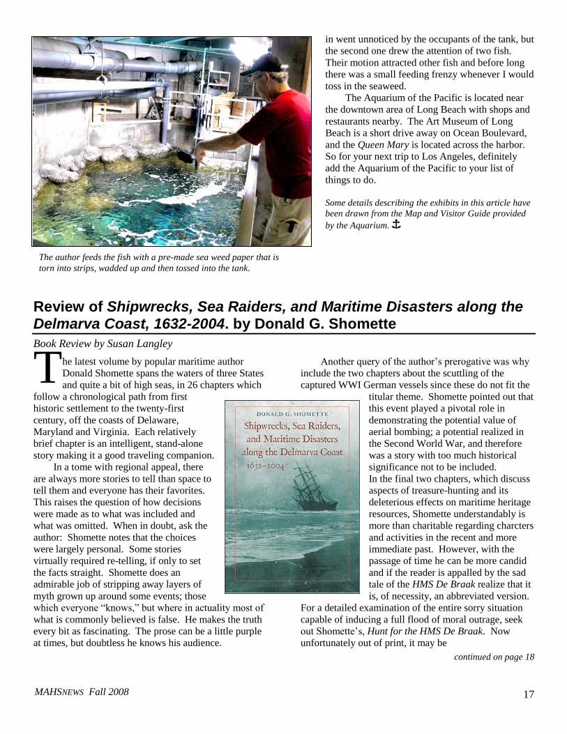
Returning to the Northern Pacific gallery, one finds
a number of tanks with various species of jellyfish. Sea
jellies are made up of over 90 percent water. They have
no brain, no eyes, no heart, and no bones. But as many
divers can attest they have long stinging tentacles.
Despite how simply sea jellies have evolved, they
require special round tanks called kreisels that are
designed to keep the water flowing in a circle so that the
animals do not become caught on the sides of the
exhibit.
y private tour of the Aquarium began at the top of
the fish tanks after going through a maze of
offices to exit outside, climbing several sets of stairs and
then re-entering into the dive locker. Divers enter from
the top of the tanks and, except for their own mask, fins
and snorkel, use equipment exclusively provided by the
Aquarium to eliminate the possibility of outside
contaminants being brought in. No extraneous sea life is
allowed. Before proceeding into the tank area, everyone
must walk through a shallow pool of disinfectant to
reduce the possibility of bringing in unwanted
contaminants on one’s shoes.
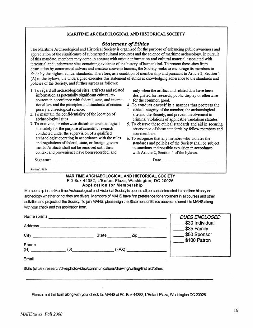
The top of the tank area is quite large, humid and
not air conditioned. The fish are fed with a seaweed
“paper” that combines the nutritional benefits of several
species of seaweed. It has a seaweed smell that is not
overwhelming and comes wrapped in a cellophane
package like copy paper. One pulls out a sheet that is
about 8-by-10 inches and tears it into strips. These strips
are then wadded into balls and pitched into the tank.
Balling up the material gives it the ability to sink—flat
seaweed pieces will often just float on the surface, and
the fish won’t see them. As the water is constantly
recycled the floating seaweed will clog the intake vents.
So wadded up it is. The first wad of seaweed I dropped
M
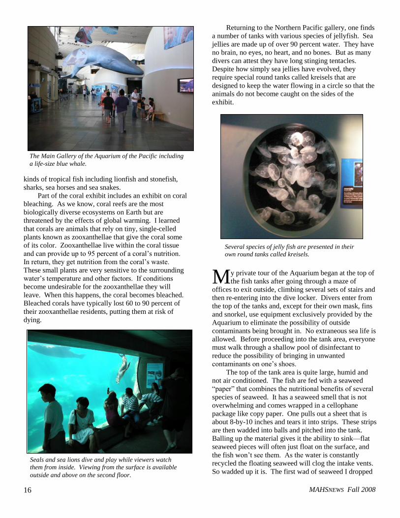
The Main Gallery of the Aquarium of the Pacific including
a life-size blue whale.
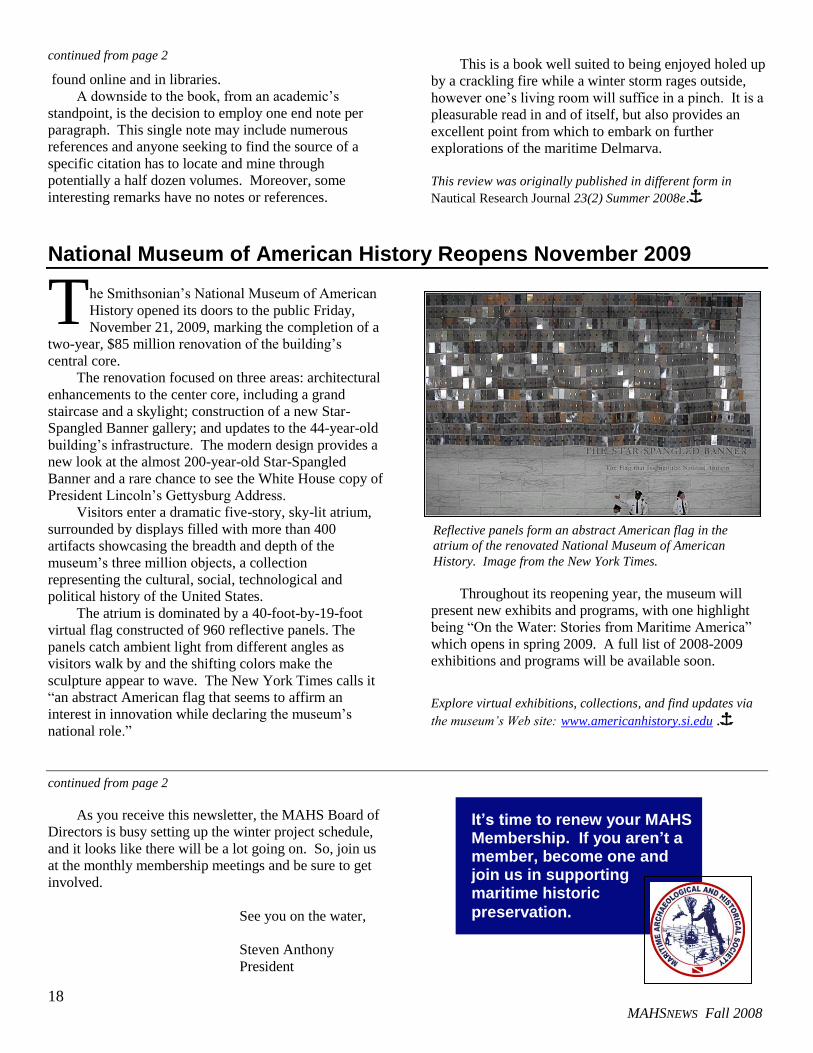
Seals and sea lions dive and play while viewers watch
them from inside. Viewing from the surface is available
outside and above on the second floor.
Several species of jelly fish are presented in their
own round tanks called kreisels.
MAHSNEWS Fall 2008
17
in went unnoticed by the occupants of the tank, but
the second one drew the attention of two fish.
Their motion attracted other fish and before long
there was a small feeding frenzy whenever I would
toss in the seaweed.
The Aquarium of the Pacific is located near
the downtown area of Long Beach with shops and
restaurants nearby. The Art Museum of Long
Beach is a short drive away on Ocean Boulevard,
and the Queen Mary is located across the harbor.
So for your next trip to Los Angeles, definitely
add the Aquarium of the Pacific to your list of
things to do.
Some details describing the exhibits in this article have
been drawn from the Map and Visitor Guide provided
by the Aquarium. Î
Review of Shipwrecks, Sea Raiders, and Maritime Disasters along the Delmarva Coast, 1632-2004. by Donald G. Shomette
Book Review by Susan Langley
he latest volume by popular maritime author
Donald Shomette spans the waters of three States
and quite a bit of high seas, in 26 chapters which
follow a chronological path from first
historic settlement to the twenty-first
century, off the coasts of Delaware,
Maryland and Virginia. Each relatively
brief chapter is an intelligent, stand-alone
story making it a good traveling companion.
In a tome with regional appeal, there
are always more stories to tell than space to
tell them and everyone has their favorites.
This raises the question of how decisions
were made as to what was included and
what was omitted. When in doubt, ask the
author: Shomette notes that the choices
were largely personal. Some stories
virtually required re-telling, if only to set
the facts straight. Shomette does an
admirable job of stripping away layers of
myth grown up around some events; those
which everyone “knows,” but where in actuality most of
what is commonly believed is false. He makes the truth
every bit as fascinating. The prose can be a little purple
at times, but doubtless he knows his audience.
Another query of the author’s prerogative was why
include the two chapters about the scuttling of the
captured WWI German vessels since these do not fit the
titular theme. Shomette pointed out that
this event played a pivotal role in
demonstrating the potential value of
aerial bombing; a potential realized in
the Second World War, and therefore
was a story with too much historical
significance not to be included.
In the final two chapters, which discuss
aspects of treasure-hunting and its
deleterious effects on maritime heritage
resources, Shomette understandably is
more than charitable regarding charcters
and activities in the recent and more
immediate past. However, with the
passage of time he can be more candid
and if the reader is appalled by the sad
tale of the HMS De Braak realize that it
is, of necessity, an abbreviated version.
For a detailed examination of the entire sorry situation
capable of inducing a full flood of moral outrage, seek
out Shomette’s, Hunt for the HMS De Braak. Now
unfortunately out of print, it may be
continued on page 18
T
The author feeds the fish with a pre-made sea weed paper that is
torn into strips, wadded up and then tossed into the tank.
MAHSNEWS Fall 2008
18
continued from page 2
found online and in libraries.
A downside to the book, from an academic’s
standpoint, is the decision to employ one end note per
paragraph. This single note may include numerous
references and anyone seeking to find the source of a
specific citation has to locate and mine through
potentially a half dozen volumes. Moreover, some
interesting remarks have no notes or references.
This is a book well suited to being enjoyed holed up
by a crackling fire while a winter storm rages outside,
however one’s living room will suffice in a pinch. It is a
pleasurable read in and of itself, but also provides an
excellent point from which to embark on further
explorations of the maritime Delmarva.
This review was originally published in different form in
Nautical Research Journal 23(2) Summer 2008e.Î
National Museum of American History Reopens November 2009
he Smithsonian’s National Museum of American
History opened its doors to the public Friday,
November 21, 2009, marking the completion of a
two-year, $85 million renovation of the building’s
central core.
The renovation focused on three areas: architectural
enhancements to the center core, including a grand
staircase and a skylight; construction of a new Star-
Spangled Banner gallery; and updates to the 44-year-old
building’s infrastructure. The modern design provides a
new look at the almost 200-year-old Star-Spangled
Banner and a rare chance to see the White House copy of
President Lincoln’s Gettysburg Address.
Visitors enter a dramatic five-story, sky-lit atrium,
surrounded by displays filled with more than 400
artifacts showcasing the breadth and depth of the
museum’s three million objects, a collection
representing the cultural, social, technological and
political history of the United States.
The atrium is dominated by a 40-foot-by-19-foot
virtual flag constructed of 960 reflective panels. The
panels catch ambient light from different angles as
visitors walk by and the shifting colors make the
sculpture appear to wave. The New York Times calls it
“an abstract American flag that seems to affirm an
interest in innovation while declaring the museum’s
national role.”
Throughout its reopening year, the museum will
present new exhibits and programs, with one highlight
being “On the Water: Stories from Maritime America”
which opens in spring 2009. A full list of 2008-2009
exhibitions and programs will be available soon.
Explore virtual exhibitions, collections, and find updates via
the museum’s Web site: www.americanhistory.si.edu .Î
continued from page 2
As you receive this newsletter, the MAHS Board of
Directors is busy setting up the winter project schedule,
and it looks like there will be a lot going on. So, join us
at the monthly membership meetings and be sure to get
involved.
See you on the water,
Steven Anthony
President
T
It’s time to renew your MAHS Membership. If you aren’t a member, become one and join us in supporting maritime historic
preservation.
Reflective panels form an abstract American flag in the
atrium of the renovated National Museum of American
History. Image from the New York Times.
MAHSNEWS Fall 2008
19
MAHSNEWS Fall 2008