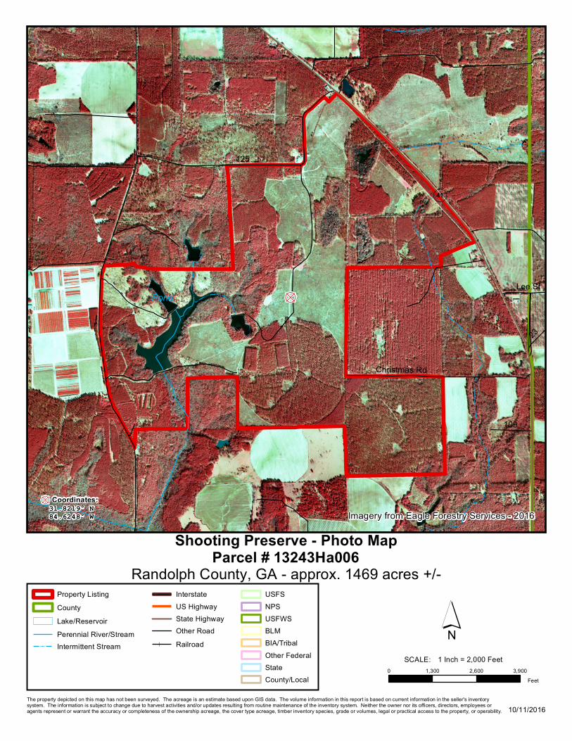
shooting preserve - photo map 13243ha006 randolph county ... · q (41 pond 3 125 chri stma rd 109 2...

1
q ( 41 Pond 3 125 Christmas Rd 109 23 Lee St 0 1,300 2,600 3,900 Feet 13243Ha006 Shooting Preserve - Photo Map 10/11/2016 Property Listing County Lake/Reservoir Perennial River/Stream Intermittent Stream Interstate US Highway State Highway Other Road Railroad USFS NPS USFWS BLM BIA/Tribal Other Federal State County/Local Randolph County, GA - approx. 1469 acres +/- Parcel # Imagery from Eagle Forestry Services - 2016 ´ SCALE: 1 Inch = 2,000 Feet The property depicted on this map has not been surveyed. The acreage is an estimate based upon GIS data. The volume information in this report is based on current information in the seller's inventory system. The information is subject to change due to harvest activities and/or updates resulting from routine maintenance of the inventory system. Neither the owner nor its officers, directors, employees or agents represent or warrant the accuracy or completeness of the ownership acreage, the cover type acreage, timber inventory species, grade or volumes, legal or practical access to the property, or operability. 84.6248° W q 31.8219° N Coordinates:

Upload: lethuan

Post on 08-Nov-2018

214 views

Category:

Documents


0 download

TRANSCRIPT

q

(41

Pond

3

125

Christmas Rd

109

23

Lee St

0 1,300 2,600 3,900Feet

13243Ha006Shooting Preserve - Photo Map

10/11/2016

Property ListingCountyLake/ReservoirPerennial River/StreamIntermittent Stream

InterstateUS HighwayState HighwayOther RoadRailroad

USFSNPSUSFWSBLMBIA/TribalOther FederalStateCounty/Local

Randolph County, GA - approx. 1469 acres +/-Parcel #

Imagery from Eagle Forestry Services - 2016

´SCALE: 1 Inch = 2,000 Feet

The property depicted on this map has not been surveyed. The acreage is an estimate based upon GIS data. The volume information in this report is based on current information in the seller's inventory system. The information is subject to change due to harvest activities and/or updates resulting from routine maintenance of the inventory system. Neither the owner nor its officers, directors, employees or agents represent or warrant the accuracy or completeness of the ownership acreage, the cover type acreage, timber inventory species, grade or volumes, legal or practical access to the property, or operability.

84.6248° Wq31.8219° NCoordinates: