sierra morena pathsenderogr48.sierramorena.com/fichas/topoguia_gr48jaen_en.pdf · se de la...
TRANSCRIPT

GR
-48
Jaé
n
1
PROVINCE OF JAÉN
SIERRA MORENA PATH
ANDALUCÍA
5 Trail maps Scale 1:30000 and 1:75000

GR
-48
Jaé
n
2
Commissioned by and Copyright: ADIT Sierra MorenaCalle Retama, 1 14350 Cerro Muriano-Obejo (Córdoba)957350273 www.senderogr48.com [email protected]
Produced by:Zumaya Ambiente CreativoJuan Relaño MoyanoGloria Pareja CanoStela María Alcántara Guerrero (cartography)Pedro Peinado (graphic design & illustration)Karmen Domínguez (translation) Illustrations: Zumaya Ambiente CreativoJuan Manuel Delgado Marzo page (14, 15, 73)Ricardo Benítez Lomas page (8)
National Book Catalogue Number: XXXXXXXX

GR
-48
Jaé
n
3
ÍNDICE
Introduction 4
Presentatión 6
Towns and Villages. 17
Stage 1 Marmolejo/Virgen de la Cabeza 34
Stage 2 Virgen de la Cabeza/Viñas de Peñallana 47
Stage 3 Viñas de Peñallana/Baños de la Encina 57
Stage 4 Baños de la Encina /La Carolina 67
Stage 5 La Carolina/Santa Elena 78
Useful Information 86
List of species 109
PROVINCE OF JAÉN
SIERRA MORENA PATH
ANDALUCÍA

GR
-48
Jaé
n
4
INTRODUCTION
The Asociación para el Desarrollo Integral del Territorio de Sierra Morena, ADIT Sierra Morena, (Association for an Integral Development of Sierra Morena Territory) is a non profit organization established by the fo-llowing bodies: Asociación Grupo de Desarrollo Rural Sierra de Aracena y Picos de Aroche; Asociación Grupo de Desarrollo Rural Sierra Morena Sevilla-na; Asociación para el Desarrollo Rural de Sierra Morena Cordobesa and the Asociación para el Desarrollo Rural de la Campiña Norte de Jaén. The group also includes other public and private institutions from Huelva, Sevilla, Córdoba and Jaén provinces.
ADIT Sierra Morena is supporting many activities and projects around hi-king. From an environmental and healthy position, this outdoor activity appears to be an important tool for introducing the highland regions to visitors. At the same time, hiking is seen as the fundamental outdoor ac-tivity on which many others are based and that will reinforce a proper growth of the region without compromising its cultural and environmen-tal values.
The GR-48 ‘Sierra Morena Track’ is a 590 kilometres of way marked route through the provinces of Huelva, Sevilla, Córdoba and Jaén in Andalusia. The starting point is Barrancos, a village located in Portugal at the border with Huelva province. The journey, described here from west to east, embraces an astonishing territory worthy of visiting or living in it.
This is a full colour essential hiking topo-guide to some of the blissfully undiscovered walks in southern Andalusia. It has been designed for better appreciate the natural beauty and cultural aspects exhibited throughout the walk. The guide provides texts, pictures, sketches and relevant maps in order to facilitate the walking. It also features information on estimated times, distances, route and elevation profile, and difficulty of the walk as well as on the most interesting historical, cultural and ethnographical fea-tures located on the route. The reading will help the walkers to pay atten-

GR
-48
Jaé
n
5
tion to different ways of countryside labour; to discover singular natural features; to perceive the footprint left on the natural environment; and to appreciate the many environmental features they may come across with at any season of the year. In addition, readers will find easier to understand the many shades between the provinces and regions where the trail goes through. This hiking topo-guide will certainly enhance the walkers’ vision of the track as well as providing a complete picture of the journey.
Every section of the route is introduced with some general information about the natural world and how human beings have traditionally related to it in each province. Also included are detailed overviews of each the sites the walkers will find on their journey. We do believe that hiking stirs up complicity between the walker and the environment while uplifting the walker’s interest and curiosity about the reality around them. The walk itself evidences the harmonious relation established through centuries between human beings and the land. It is an amazing way to discover how much tradition is still rooted in the small towns located along way. Moreover, it will give the walker the chance to find out about natural re-sources uses and costumes as well as other activities around those.
In general, this is an easy to follow route. Each section of the trial is suita-ble for mountain biking, horse riding or just walking. The technical diffi-culty of each section determines its length. Every stage of the route starts off and most finishes in a well-equipped small town, village or settlement where the hiker may find supplies such as food, drinks and accommoda-tion for at least one night.
Certainly this is a much essential guide which cannot be missing from the backpack of those of culture and nature lovers.

GR
-48
Jaé
n
6
PRESENTATION
HIKING
Hiking is a non-competitive sporting activity which takes place on rural tracks and paths. These paths are mainly endorsed by the different na-tional Mountaineering Federations. In Spain, vías pecuarias, local paths and riverside paths -all they of public uses- are preferably designated for hiking. This recently developed outdoor activity is becoming very popular since ramblers not only enjoy outdoor walking but also achie-ve a much deeply knowledge of the social, cultural, ethnographic and historical heritage of the places located throughout the trial.
Hiking is an activity which posses low impact onto the environment. In order to sustain the environmental conditions and natural heritage of the areas covered by the trail, a thoughtful system of regulated sig-ns and marks is posed on countryside paths, animal tracks, rivers alle-yways and rural roads. This system also facilitates and ensures walkers safety. So far, it could be said that hiking is a most engaging and harm-less way to discover both the environmental wealth of a country and the peculiarities of the people living in.
A BRIEF NOTE ABOUT HIKING
It seems to be in France where hiking was considered as an activity for vi-siting places. Shortly after the World War II, the FFRP (Fédération Françai-se de la Randonnée Pedestre) was established and soon other countries as Germany, Netherland, Belgium and Switzerland starting to promote hiking as a way for sporting and doing tourism up in the mountains.
In Spain, this outdoor activity is managed by the FEDME (Federación Es-

GR
-48
Jaé
n
7
pañola de Deportes de Montaña y Escalada) the body in charge for the management of this outdoor activity. Hiking is seen as directly related to mountaineering at the time it does require of regulation about waymar-ked trails.
PATHS HOMOLOGATION AND SIGN POSTING
The FEDME is the body responsible for a footpath homologation. This means that the route are in place well marked and a system of registered trade mark signs. It does also mean that there is a writing topoguide whe-re the route is thoughtfully described and that there is a legal body fully compromised to the path maintenance and care.
Wherever possible, a homologated path will avoid crossing or using tar-macs and traffic roads. It is a pedestrian path well equipped with direc-tion signs such milestones or mileposts, direction arrows, paint marks and interpretation boards. Most footpaths are suitable for cycling and horse riding.In Spain, footpaths are classified into SGR (long distance paths), SPR (short distance paths) and SL (local paths).
• SGRs. Those are tracks that run over 50 kilometres and link countries, regions or single sites really far away from each other. A SGR route is usually split into several sections for a much affordable journey. SGR routes that run through more than three European countries are classified as European International Path (E).
• SPRs. Half-day or one-day walks that cover any distance between 10 and 50 kilometres. These short journeys are designed for visiting specific and singular natural sites or for taking the walkers up to a location of interest.
• SLs. Those are easy walks which cover less than 10 kilometres.

GR
-48
Jaé
n
8
• Señalización
Milestone or MilepostFinger pointer
RECOMENDATIONS
To maximize your enjoyment and minimize problems on the trail, before star-ting any outdoor activity, we need to carefully ponder over the stuff and equip-ment we are going to take with us. It is also worthy to give lengthy thought to prevent any unforeseen incidents they may occur along the route.
BEFORE THE WALK
Gather information and use accurate maps for planning on the route. Work out your time realistically. Take the advice culled by other hikers and ask to local people since they best know the area. Ramblers’ experience enhan-ces through vivid conversation with locals.
Get updated permissions from the environment department if you might trespass restricted areas. You may need to get especial permits for walking on restricted areas; certain protected sites of a natural park; for using coo-king devices or lit a fire; and for using a mountain refuge or accommoda-tion within the limits of protected areas.
Continue straight
Trail turn Wrong direction

GR
-48
Jaé
n
9
Make sure your equipment is the right one. Boots are perhaps the most important tool when hiking. Get a pair of lightweight, over-the-ankle boots with a Gore-Tex lining that keeps rainwater from seeping in yet allows your feet to breathe. Your ankles will suffer a lot if your boots do not provide enough support and you may experience internal injuries such sprains. Re-member to break in your boots thoroughly before departure. Lightweight polyester hiking pants are preferable to jeans or heavy cottons, which can be uncomfortable in wet or warm weather.
Get a good quality daypack with enough capacity to tote your personal items. Better if it has bottle holders that keep precious water within easy reach. The following items are essential in your pack: a water bottle, the topoguide and useful maps, sunglasses, sun cream and lips moist, a brim-med hat, some energetic food, a Swiss Army knife, a hiking lantern or a mountaineering one and a basic first aid kit equipped for topical injuries.
Take a mobile phone with you even you might find yourself walking in low or no-signal areas. Remember the Spanish number for emergency calls: 112
ALONG THE WALK
Hiking may produce threats to personal safety. Even if you are in top condition, it is a good idea to combine techniques for hiking to your physical po-tential in order to mini-mize strenuous exercising.
It is important to start your walk to a slower pace and progressively increase your speed until you find yourself walking steadily. Matching your wal-king pace to the breathing will keep you better oxy-genated. Avoid prolonged stops to prevent muscles cooling. A walking pace of 3 to 4 km per hour on flat appears to be a right walking rhythm.
Keep yourself well hydrated. Drink water frequently and, every now and then have an isotonic drink in order to prevent metabolic imbalances.
OUR RELATIONSHIP WITH NATURE
• Fire is perhaps nature worst enemy. Along the walk, surely there will be designates areas where you are allow to lit a fire. Obeying area regula-tions about seasonal restrictions on fire will reduce the risk of wildfire.
• Human waste is often a major source of environmental impact from hiking. A responsible hiker will take out their garbage and dispose it pro-perly. When getting ready for the walk, it is important to think ahead
GR
-48
Jaé
n
10
about the amount of garbage you may finish your walk with.
• Just like the unwritten standards established in the cities, a logical and sounded relationship is set up between nature and hiking. An emphatic relationship is often established among hikers and local people in the villages.
• Collecting living plants, animals or stones will have an adverse impact on the ecosystem. A picture will make an everlasting souvenir though.
• A good practice is keep country gates and railings closed behind us to avoid cattle and wild animals entering fenced-off areas.
• Personal pets should always go by our side and supervised.
• Dangerous hiking circumstances include losing the way. It is para-mount to keep walking on the path and always keep an eye on it when we walk somewhere else. Missing the way may put at risk our safety and turn a joyful experience into a proper mare.
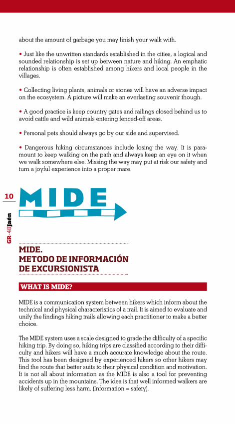
MIDE. METODO DE INFORMACIÓN DE EXCURSIONISTA
WHAT IS MIDE?
MIDE is a communication system between hikers which inform about the technical and physical characteristics of a trail. It is aimed to evaluate and unify the findings hiking trails allowing each practitioner to make a better choice.
The MIDE system uses a scale designed to grade the difficulty of a specific hiking trip. By doing so, hiking trips are classified according to their diffi-culty and hikers will have a much accurate knowledge about the route. This tool has been designed by experienced hikers so other hikers may find the route that better suits to their physical condition and motivation. It is not all about information as the MIDE is also a tool for preventing accidents up in the mountains. The idea is that well informed walkers are likely of suffering less harm. (Information = safety).

GR
-48
Jaé
n
11
WHEN MIDE WAS CREATED?
MIDE is a relatively recent tool. It was developed in 2002 within the fra-mework of the programme ‘Montañas Para Vivirlas Seguro’. Three years after the project started, some of the programme sponsors (Gobierno de Aragón -Protección Civil-, Obra Social y Cultural de Ibercaja y la Federación Aragonesa de Montañismo) pondered over the need for expert informa-tion to be put in Procedures Manual in order to prevent accidents in the mountain. In 2003, the MIDE Handbook is introduced to the public and therefore the MIDE method begins to be used.
WHAT SORT OF INFORMATION DOES MIDE PROVIDE?
The MIDE contains background information and assessment informa-tion. Background information is about informing on general aspects of a rated route. It gives information about where the track starts and finishes; about places where the track passes by; about both positive cumulati-ve slope and negative cumulative drop for the whole route; horizontal distance for the entire route; and weather conditions for which the as-sessment applies.
Assessment information is about rating the following topics: • Severity of the natural environment • Guidance on the route about choosing and keeping good orientation. • Difficulty in walking along the track (type of path, slopes, etc) • Struggle required for accomplishing the route.
A numerical value (1 to 5) is given to the above topics in order to set down the degree of difficulty posses on the route.
Environment 1- The environment holds low risk 2- There is more than one factor of risk 3- There are several factors of risk 4- There are enough factors of risk 5- There are many factors of risk
Orientation 1- Well defined tracks and junctions 2- Paths or signposting showing the way 3- It requires precise identification of geographical features and of compass points 4- It requires walking out the track tracing 5- The track is obstructed by unavoidable obstacles –a river, a reservoir, etc, which must be skirted along.

GR
-48
Jaé
n
12
Track features 1- The track runs on smooth surface 2- The track runs on bridle paths 3- The track runs on irregular surface and staggered paths 4- The use of hands and even jumping over obstacles is required to negotiate the track 5- The use of hands is required to progress
Struggle 1- Up to 1 hour walk 2- From 1 to 3 hours walk 3- From 3 to 6 hours walk 4- From 6 to 10 hours walk 5- More than 10 hours walk
Calculations made according to MIDE criteria for an average and slightly loaded hiker.Hiking rated according to MIDE criteria for summers without snow.
Sample of a MIDE route rating:
Más información:www.euromide.infowww.fam.es
THE NATURAL WORLD
The GR-48 Trail may be seen as an almost uninterrupted natural site through this section of Sierra Morena Mountain Range. Moreover, the inescapable human factor has left in the region a rich cultural and histo-rical heritage. We need to keep in mind that this is a continuous natural region where the natural environment is clearly attached to any other impressions.

GR
-48
Jaé
n
13
GEOLOGY
The trail will most times skirt the mountain range and occasionally, it will go through the plain fields along the Guadalquivir River. Therefo-re, the predominant geological materials are from the Palaeozoic Era: slates, granite batholiths, greywackes, etc.
The trail will wind through the Sierra de Andújar Natural Park at the very first sections of the route. Here, the granite substrate has facilitated the fitting of many water streams and brooks into deep valleys with hills and mountains of massive granite blocks resulting from erosion. Therefore, we will see scattered clusters of ‘berrocales’ or enormous round granite boulders resulting from physical weathering which broke up the rocks. Once the rock has been broken down into smaller bits and sand are carried by streams and rivers towards the lower areas of the mountains and valleys. Together are areas resulting from contact metamorphism, at and near the contacts between the batholiths and the host rocks such as slates and quartzite rocks. It is at this aureoles where loca-te the mineral deposits of lead and iron which has been extracted or mined from ancient time.
Minas de Teuler
Granite outcrops are very common along every stage of the route.

GR
-48
Jaé
n
14
THE PLANTS WORLD
Undoubtedly, the main natural feature is the omnipresent Mediterranean forest and shrub, especially Holm Oak wood with shrub comprising all sorts of Rockroses, Tree Mastic and Wild Olive trees among others. The Sierra de Andújar buffer area and nearby Santa Elena village both are mainly covered on large Pine groves resulting from the reforestation which happened in the middle 20th century.
Traditional cattle breeding -especially of bulls for bullfighting- is well sett-led in large pastures of Holm Oaks and the plain areas surrounding Baños de la Encina and La Carolina towns.
Three good examples of riparian forest locate adjacent to the Arroyo de los Santos Brook on the first stage of the route; the Jándula River on the second stage and the Rio de la Campana River on the last one. All they are supporting an excellent range of riparian forest buffers of Alder trees and Ash-trees.
THE ANIMAL WORLD
Herpetologists and amateur herpetologist will find a good community of am-phibians along the GR-48 Trail through the province of Jaen. The areas cove-red by the trail are home to many Iberian species such as the Painted Frog, the Southern Marbled Newt and the Western Spadefoot Toad.
Despite a great variety of mammal species in the area, hikers rarely will spot
Desert Truffle (Terfezia spp.) and associated Rockrose
GR
-48
Jaé
n
15
any other than Deer which exist in large amounts in the Sierra de Andújar mountain range. The region is home to Foxes, Otters, the Egyptian Mongo-ose and the Iberian Lynx which is one of the jewels of the Iberian wildlife. However, the Iberian Lynx is confined to the most remote natural sites, espe-cially to those deep granite sites with abundant Mediterranean shrub which is home to rabbits, the Iberian Lynx’s ideal food.
Nevertheless, birds will be the most common animal species which can be spotted as the trail winds through special areas for conservation and protec-tion of birds. Big eagles such as the Golden Eagle, Spanish Imperial Eagle and the Bonelli’s Eagle are very common in the most abrupt Mediterranean forests of the Sierra Morena de Jaén mountain range. Pine, Cork Oak and Holm Oak groves are home to the Northern Goshawk, the Beaudouin’s Snake Eagle and the Booted Eagle. Other common species such the Common Buzzard and the Common Kestrel together with the less common Black-Winged Kite find shelter and food in open areas, plain fields and cultivated fields. Griffon Vul-tures and Black Vultures have their breeding colonies in the adjacent areas to the Valle del Yeguas Valley and to the Sierra Quintana Mountain Range which are ideal sites for birdwatching all year around.
In addition, patches of Mediterranean undergrowth are home to Moltoni’s Warblers, Dartford Warblers, Melodious Warblers, European Turtle-Doves, Red-Legged Partridges, Common Nightingales and Thekla Larks. Then the rocky crests of the hills and mountains are ideal sites for birds such the Eu-rasian Crag Martin, the Rock Bunting, the Eurasian Eagle-Owl, the Eastern Black-Eared Wheatear, the Blue Rock-thrush and the above mentioned Bonelli’s Eagle and Common Kestrel. Colourful birds can be spotted at Ripa-rian forests such the Jándula River and river banks which gives shelter to the Kingfisher, the Golden Oriole, the Grey Wagtail and the European Bee-eater together with other bird species such the Grey Heron, the Little Egret, the Red Junglefowl, the Common Snipe, the Mallard and the Cirl Bunting.
Finally, Hoopoes, Azure-Winged Magpies, Little Owls and European Gre-enfinches will be a constant companion to hikers when walking through pastures and by Olive groves.
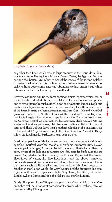
Long-Tailed Tit (Aegithalos caudatus)

GR
-48
Jaé
n
16
HUMAN FOOTPRINT
Since the GR-48 Trail uses of many traditional cattle routes and paths, many are the different ethnologic elements that hikers will come across with. Some are closely related to the pilgrimage route to the Santuario de la Vir-gen de la Cabeza Sanctuary while others resulted from a former mining activity in the region, especially those located near La Carolina town and in Baños de la Encina surrounding area.
Bastions, watch-towers and castles still remain in this region which was border between the Muslim and Christian Kingdoms in the middle ages. Good samples of this legacy are the castles which locate in Baños de la Encina and in Las Navas de Tolosa towns.
Big game hunting and cattle breeding are also left a clear footprint in the region. Large private Country Estates fully devoted to big game hunting of Deer and Wild Boars cover the hills of the Sierra de Andújar mountain ran-ge while fighting bulls are bred in the pastures of Jaén where is the main character too. Certainly, hikers will find cattle grazing in the pastures along almost every single stage of the GR-48 Trail through Jaen province.
Finally, mention in here to healing waters which are the source for a large and rich cultural heritage in the region. Especially interesting is the Bal-neario de Aguas de Marmolejo, a large spa resort very much appreciated by the ‘agüistas’ (people who believe in the curative powers of mineral waters) because of the Sodium sulphate waters. The remains of a famous spa resort, La Aliseda, will be seen on the last stage of the route. This for-mer spa resort which became very popular among aristocrats at the end of the 19th and the early 20th century has recently been converted into a recreation area where hikers will find a good relief after such an amazing adventure.
Cattle and herds have left an undeniable footprint on this land

GR
-48
Jaé
n
17
TOWNS AND VILLAGES
MARMOLEJO
Altitude: 248 m Population: 7.485 (2010)
Marmolejo is one of the towns and villages of La Campiña region which locates to the west of the Campiña area and at the border with the pro-vince of Córdoba. The northern half of this municipality is very mountai-nous and is fully integrated in the Sierra Morena mountain range whi-le a large section is also part of the Sierra de Andújar Natural Park. On the other hand, the southernmost regions are covered by cultivated fields; mainly Olive groves while some important irrigated crops such as corn, cotton, alfalfa and other hor-ticulture plants are cultivated in the Vega del Guadalquivir plain fields. Livestock is also important; mainly because of a large farm of dairy catt-le which is farmed in ‘semiestabula-ción’ that is a combination between
open range and indoor farming. So therefore, the main activities are tho-se related to agriculture and livestock together with big game hunting and hospitality to travellers of the nearby Autovía de Andalucía motorway.
The Guadalquivir River flows through the municipality while drawing two massive meanders in a zigzag with three almost plain rounded hills at both sides of the river.
A different landscape can be seen to the north of the Guadalquivir River and very close to it (the area surroun-ding the Jándula River). Cultivated fields are completely washed out of the landscape and Mediterranean woodland of trees and Rockroses

GR
-48
Jaé
n
18
is the main feature on the ancient rocks that shape this section of the Sierra Morena mountain range. The site is itself a relatively important hillock, especially when seen from the plain areas, which highest peak is the Vértice ‘Colodro’ (704 m). This rounded hillock which dominates the central area of the municipality is also surrounded by many short and rapid water streams and brooks that flow down on quartzite rocks and slates and through Rockroses pat-ches and pastures. To the northeast and east are the streams that come to water into the Jándula River; to the northwest and west those that water into the Yeguas River and to the south some small tributaries of the Guadalquivir River. Neverthe-less, this mountainous landscape was also shaped by some actions of the Plan Jaén Programme. Over five thousand hectares were reforested and Pine trees were planted creating an artificial thick forest with the less number of trees on those steep slo-pes of the gorges carved on the rock by the streams.
Down in the valley, signs of an ex-cellent economic development are the fertile cultivated fields, perma-nent water resources, the Madrid-Sevilla Railway and the IV National Primary A-road (aka Autovía de An-dalucía Motorway).
Special mention in here to some cele-brations and festivals which among others are: on January the 24th, the festival honouring Nuestra Señora de la Paz, saint patron of the town; on May the 27th is Marmolejo Independence Day; the first Sunday of June is the Cor-pus Christi, a religious celebration from ancient times; and between the 10th and the 15th of August are the celebra-tions honouring San Julián, the town’s saint patron.
Source: www.marmolejo.org
Town HallPlaza de la Constitución953 540 126Contemporary Art Museum Mayte Spinola. Youth CentreC/Armando Palacio Valdés 8953 540 126 ext. 41Civil protection ServicePlaza Belén nº 4953 540 737 / 629 455 497Local LibraryC/ Jesús, 35953 540 126 ext. 45Museum of EthnologyC/ Jesús, 35953 540 126 ext. 61Español Theatre and Cinema C/ Antonio Alcalá953 540 126 ext. 49Guardia Civil (National Guard)Carretera de la Estación S/N953 517 744Local Police630 870 905EC112ER061Guardia Civil (National Guard)062National Police091Medical CentreC/ Severo Ochoa
How to get here• Estación de AutobusesC/ General Brenan, s/n• Bus Ramírez (Andújar-Córdoba route with one stop in Marmolejo town)957 422 177 / 953 752 157• Ureña (Andújar-Marmolejo)953 220 116• Taxi953 540 132

GR
-48
Jaé
n
19
ANDÚJAR
Andújar locates at the Guadalqui-vir Basin, by the river and near the Autovía de Andalucía Motorway. A peculiarity about this municipali-ty is its size as it is the tenth bigger in Spain. The natural environment comprises a large section of Sierra Morena mountain range, the lands along the Guadalquivir River and the ‘campiña’ (cultivated countryside) of Olive groves. In addition, a 60% of the municipal district is a protected natural site.
The municipality locates in the Sierra de Andújar Natural Park. The park stretches 74,774 hectares having its highest point in Sierra Quinta-na mountain range at 1,291 metres above the sea level and the lowest at just 196 metres. Within the limits of the park also locate Baños de la Encina, Marmolejo and Villanueva de la Reina municipalities. The most interesting and attractive feature is the animal world. Certainly, Siera de Andújar mountain range is home to many species which have become critically endangered while having their population dramatically redu-ced in the last years. Some of those endangered species are the Iberian
Altitude: 212 m Population: 39.171 (2010)
Lynx, the Wolf, the Black Vulture and the Spanish Imperial Eagle.
However, big game hunting of Deer, Fallow Deer and Wild boar is so far the main natural resource in this mountain range. An adequate ma-nagement and exploitation of this natural resource have proved to be paramount when working on the conservation of other species and habitats.
In the Sierra de Andújar Natural Park can be also found the wider patches of wild vegetation in Sierra Morena mountain range. Mediterranean fo-rests comprising Holm Oaks, Cork Oaks and Portuguese Oaks together with Stone Pine reforested areas are the main woodland. Mediterranean scrub comprises different Rockroses and Broom species harmoniously interlocking with Wild Olive trees, Strawberry trees, Terebinth trees, Mastic trees, Kermes Oaks, Tree Germanders and a great range of aromatic herbs and plants such as Rosemary, Lavender, Wild Marjoram (Oregano), Thyme, etc.
Best Riparian forests within the park

GR
-48
Jaé
n
20
are those along the Jándula River and the Yeguas River although good samples of riparian vegetation (Ash-trees, Alder trees, Oleanders, Elaeag-nus Willows) can be also be found in ravines and along other smaller streams.
Finally, there are different recreation areas and campsites as well as picnic areas in the park which are managed by the Consejería de Medio Ambien-te de Andalucía (Andalucía Envi-ronmetal Agency). Any information about uses of those public utilities can be found in:
Viñas de Peñallana Visitors CentreCtra. J-6177, Km 13 (Andújar – San-tuario Road). 953 549 030Cercado del CiprésSierra de Andújar Natural Park Infor-mation Office.Parque Forestal Cercado del CiprésCamino de Los Rubiales s/n. Andújar953 539 620Picnic sitesLugar Nuevo, El Encinarejo, La Recta, Jándula, El Jabalí, Entorno del San-tuario and Selladores.To visit: ‘Cercado del Ciprés’, Leisure Activi-ties and Environmental Education
Olive oil and honey from Andújar and from the Sierra de Andújar Na-tural Park are very famous nationwi-de. Olive oil is a key product in Jaén province becoming the base for the economy and society in the region. Honey together with big game hun-ting is one of the most important natural resources in the region since Andújar is the second best producer of honey in Andalucía. And for the local celebrations and festivals, the most important is the Ro-mería de Nuestra Señora de la Cabe-za (pilgrimage up to the Sanctuary of the Virgen de la Cabeza) which takes
place the last Sunday of April. This traditional pilgrimage is considered to be the oldest romería in Spain and of national tourist interest. The other important celebration is the Feria de Septiembre (local fest) which is held between the 7th and the 12th of the month. In addition, some neighbour-hoods hold their own and very local celebrations being the most famous the Verbena de San Eufrasio (on May the 15th) honouring the saint patron of both the town and the Diocese of Jaén. The Fiesta de la Aparición de la Virgen de la Cabeza (August 11th-12th) is another popular and traditio-nal celebration.
Source: www.andujar.es
Town HallPlaza de España, 1. 953 508 200Local PolicePlaza de España, 1953 525 019 / 953 508 201Tourist Information Office“Torre del Reloj”Plaza de Santa María, s/n.953 504 959ER phone number 112 National Police953 515 260Guardia Civil (National Guard)953 512 176Hospital953 021 400Medical Centre Andújar A953 539 416Medical Centre Andújar B953 539 458Civil Protection Edificio Estación Autobuses953 512840 Fire BrigadeSanta Úrsula. 953 515050 Antonio González Orea Museum of Plastic ArtC/ Calancha, s/n. Antiguo Conven-to de Capuchinas953 505 903 / 953 510 231

GR
-48
Jaé
n
21
Profesor Sotomayor Archaelogy MuseumC/ Maestra, s/nPalacio de los Niños de Don Gome953 513 178 / 953 500 603Hnos. Del Val Antique Car Museum C/ Del Val, 2 (Junto al Hotel del Val, inicio de la Ctra. Del Santuario).Necesaria cita previa. 953 506 100
How to get here• Train Information: 902 240 202• Local Bus (Mornings, every 15 minutos; Saturdays and evenings, every 30 minutes)Andújar: 953 513 072Jaén: 953 250 106• TaxiStation Plaza del Castillo 953 501 009Station at Sector Sevilla 953 504 080Station at 22 de julio Street 953 501 010
VILLANUEVA DE LA REINA
Altitude: 221 m Population: 3.403 (2010)
Villanueva de la Reina locates to the northeast most and in the Cam-piña region, a privileged natural region by the Guadalquivir River. The town is some 42 kilometres from Jaén capital city and equally close to the province of Córdoba. It stretches the central area of the river (some 207, 12 square meters) which is from the valley by the ri-ver to the northern region of Sie-rra Morena mountain range. We will get there by following the A-4 Motorway and by the JA-3409, JA-3413, JA-3412 and JA-3410 roads.
The municipality has borders with Baños de la Encina, Bailén, Espeluy, Cazalilla, Fuerte del Rey, La Higue-ra and Andújar municipalities.
The municipal district together with Marmolejo, Andújar y Baños de la Encina municipalities stret-ches a large region within the li-mits of the Sierra de Andújar Natu-ral Park. The park is located to the northeast of the province and at the heart of Sierra Morena moun-tain range. The area surrounding the town is flat since is really near

GR
-48
Jaé
n
22
to the Guadalquivir River and in the valley with rich Riparian fo-rests and vegetation. However, the northern region is very moun-tainous with great geomorpholo-gic variations in shape and high. Thick and healthy Mediterranean forests of Holm Oaks, Portuguese Oak, Oak trees, Pine groves and scrub comprising Rockroses, Te-rebinth trees, Mastic trees, False Olive trees, Strawberry trees, La-vender, and Rosemary shrubs co-ver the mountains and hills. The region is also home to many ani-mal species such the Iberian Lynx together with Deer, Fallow Deer, Wild Boars, Mouflons, the Egyp-tian Mongoose, Wolves and birds of prey such the Griffon and Black Vultures. The never ending Oli-ve groves in the campiña region are home to insectivorous birds and other birds such Partridges, Turtle-Doves, Common Quails and Common Wood-Pigeons. To-gether with birds are some impor-tant mammals such Rabbits, Hares and Badgers. Finally, the southern area is very dry with scarce vege-tation.
The main activity is agriculture of Olive groves since the fertile plain fields appear to be ideal for this crop. Other important agribusi-nesses are the production of aspa-ragus and other horticultural pro-ducts. Many farmers have recently begun to diversify into other forms of agriculture, especially indoor farming of asparagus which has turned to be a main exported pro-duct. In addition, farming is fairly complemented by other industry such textile and carpentry.
A natural site known as ‘El Batane-jo’ locates near to the Guadalquivir River. The site which is covered by
a large number of Eucalyptus trees, is well equipped for picnics and other leisure activities since this is the area where is held a traditional pilgrimage, the Romería de Santa Potenciana, on the first Friday of May. The remains of a former ‘ba-tán’ -a fulling mill- which used the water force of the Guadalquivir River to produce the movement of the loom. In the fulling mill, ma-chinery was operated by cams on the shaft of the waterwheel and the cloth was beaten with wooden hammers in order to eliminate oils, dirt, and other impurities, and ma-king it thicker.
Source: www.vreina.com
Town HallPlaza de Andalucía, 1953 537 110 / 953 537 502 953 537 086
Local PolicePlaza de Andalucía, 1679 489 805Medical CentreC/ Real953 537 079959710252
How to get hereBus Ctra. Espeluy.Transportes Ure-ña, 953 220 116 (Jaén).
GR
-48
Jaé
n
23
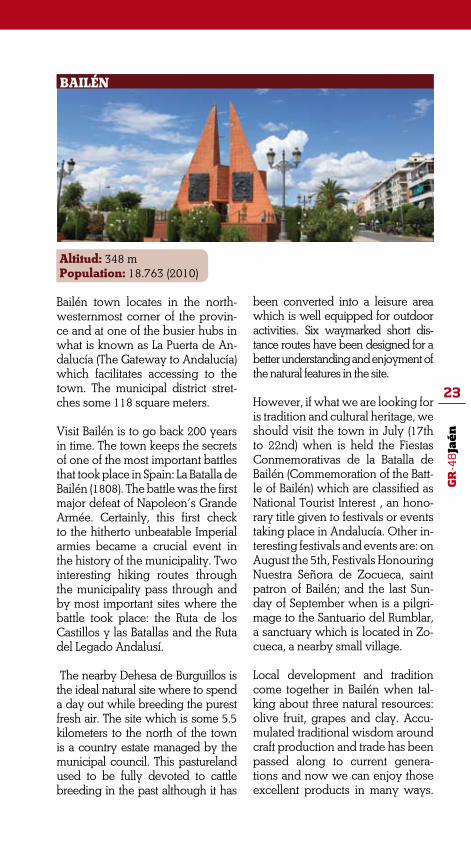
BAILÉN
Altitud: 348 m Population: 18.763 (2010)
Bailén town locates in the north-westernmost corner of the provin-ce and at one of the busier hubs in what is known as La Puerta de An-dalucía (The Gateway to Andalucía) which facilitates accessing to the town. The municipal district stret-ches some 118 square meters.
Visit Bailén is to go back 200 years in time. The town keeps the secrets of one of the most important battles that took place in Spain: La Batalla de Bailén (1808). The battle was the first major defeat of Napoleon’s Grande Armée. Certainly, this first check to the hitherto unbeatable Imperial armies became a crucial event in the history of the municipality. Two interesting hiking routes through the municipality pass through and by most important sites where the battle took place: the Ruta de los Castillos y las Batallas and the Ruta del Legado Andalusí.
The nearby Dehesa de Burguillos is the ideal natural site where to spend a day out while breeding the purest fresh air. The site which is some 5.5 kilometers to the north of the town is a country estate managed by the municipal council. This pastureland used to be fully devoted to cattle breeding in the past although it has
been converted into a leisure area which is well equipped for outdoor activities. Six waymarked short dis-tance routes have been designed for a better understanding and enjoyment of the natural features in the site.
However, if what we are looking for is tradition and cultural heritage, we should visit the town in July (17th to 22nd) when is held the Fiestas Conmemorativas de la Batalla de Bailén (Commemoration of the Batt-le of Bailén) which are classified as National Tourist Interest , an hono-rary title given to festivals or events taking place in Andalucía. Other in-teresting festivals and events are: on August the 5th, Festivals Honouring Nuestra Señora de Zocueca, saint patron of Bailén; and the last Sun-day of September when is a pilgri-mage to the Santuario del Rumblar, a sanctuary which is located in Zo-cueca, a nearby small village.
Local development and tradition come together in Bailén when tal-king about three natural resources: olive fruit, grapes and clay. Accu-mulated traditional wisdom around craft production and trade has been passed along to current genera-tions and now we can enjoy those excellent products in many ways.
GR
-48
Jaé
n
24
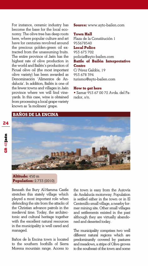
BAÑOS DE LA ENCINA
For instance, ceramic industry has become the base for the local eco-nomy. The olive tree has deep roots here, where popular culture and art have for centuries revolved around the precious golden-green oil ex-tracted from the unassuming fruits. The entire province of Jaén has the highest rate of olive production in the world and Bailén’s production of Picual olive oil (the most important olive variety) has been awarded as Denominación ‘Alimentos de An-dalucía’. In addition, Bailén is one of the fewer towns and villages in Jaén province where we will find vine-yards. In this case, wine is obtained from processing a local grape variety known as ‘la molinera’ grape.
Source: www.ayto-bailen.com
Town HallPlaza de la Constitución 1953678540Local Police953 673 [email protected] of Bailén Interpretative CentreC/ Pérez Galdós, 19953 678 [email protected]
How to get here• Samar 953 67 00 72 Avda. del Pa-rador, s/n.
Altitude: 450 m Population: 2.733 (2010)
Beneath the Bury Al-Hamma Castle stretches this stately village which played a most important role when defending the site from the attacks of the Christian advance patrols in the medieval time. Today, the architec-tonic and cultural heritage together with the excellent natural resources in the municipality is well cared and managed.
Baños de la Encina town is located to the southern foothills of Sierra Morena mountain range. Access to
the town is easy from the Autovía de Andalucía motorway. Population is settled either in the town or in El Centenillo small village, a nearby for-mer mining site. Other small villages and settlements existed in the past although they are virtually abando-ned and deserted today.
The municipality comprises two well different natural regions which are predominantly covered by pastures and meadows, a stripe of Olive groves to the southeast of the town and some

GR
-48
Jaé
n
25
isolated patches of cereal fields. The southern region is in the valley and where the town locates. This is a region of rolling landscape with soft slopes. The northern region which is also the border to Ciudad Real province (Casti-lla-La Mancha region) is a more abrupt area where locate some of the mining sites that have shaped the history of this municipality. The western half stretches the Sierra de Andújar Natural Park whe-re locate the higher mountains, some of them raising over 1000 meters such the Cerro de los Caballeros (1093 m). Other high mountains are Selladores (968 m), Peñón Jurado (932 m), Alarcones (762 m) and Moro (677 m).
Evidence of prehistoric human sett-lements (100000 to 30000 BC) has been discovered in the river terra-ces of the Rumblar River. Transition from the Neolithic Age to the Metal Age is well documented because of the many cave paintings discovered in the small caves and cracks in the northern mountains. At the middle section of the Rumblar River have been discovered the larger number of archaeological features from El Argar culture (Bronze Age) although there are also some good samples of the cultural and social development of other cultures such Iberian and an-cient Roman. Agriculture developed strongly in the middle ages thanks to the Islamic occupation of the mu-nicipality. A thoughtful network of water channels, ditches and water wells was designed in order to water the many gardens and plots which surrounded the town. Therefore a growing economy based on irriga-ted agriculture flourished.
From 1969, the town is granted Con-junto Histórico-Artístico (National Historical and Cultural Assets) and also classified as Bien de Interés Cul-tural (Cultural Property) by the Junta de Andalucía (Andalusian Gover-
nment). In Baños de la Encina visi-tors will discover many interesting cultural features; some of them are registered in the Catálogo General del Patrimonio Artístico Andaluz (An-dalusian Historical Heritage General Catalogue). In addition, many are the archaeological sites in the municipa-lity which are recorded in the natio-nal catalogue. Finally, both the town and the municipality are part of diffe-rent interesting walking routes such the Ruta de los Castillos y las Batallas (Route of the Castles and Battles), Ruta del Renacimineto (Renaissance Route) and the Rutas del Legado An-dalusí (Routes of Al-Andalus Legacy).
Source: www.bdelaencina.com
Town HallPlaza de la Constitución, 1953 613 004Local PolicePlaza de la Constitución, 1953 613 004National Civil GuardAvda. de la Picoza, 5. 953614002Medical CentreConsultorio, s/n953 609 881Bury Al-Hammam Castle953 613 229 / 651 436 [email protected] of the Territory630 921 [email protected] Information OfficeC/ Callejón del Castillo, 1953 613 229 / 651 436 478
How to get here• Bus StationAvda. José Luis Messías, s/n953 693 607• Taxi (Pedro Ramos)C/ La Serna, 1629 493 013

GR
-48
Jaé
n
26
GUARROMÁN
Altitude: 345 m Population: 2.909 (2010)
Guarromán locates at the Autovía de Andalucía Motorway (former National IV) and half way from both Madrid and Seville. The municipal district stretches the central area of the Norte de Jaén region which is to the south of Sierra Morena mountain range and between the Sierra de An-dújar and the Despeñaperros Natural Parks, both of a great biodiversity and excellent samples of the Medi-terranean forest. Some 30 kilometers to the east locate Úbeda, Baeza and Sabiote monumental towns which form the so-called Triángulo del Re-nacimiento Andaluz (Andalusian Re-naissance Triangle).
Guarromán origins are back to the 18th century when many towns resulted from the Nuevas Poblacio-nes de Sierra Morena Programme, an Enlightenment project started in 1767 by Pablo de Olavide (Spanish Quartermaster to Carlos III King). Fruit of this peculiar colonization of the re-gion is the central-European heritage in the municipality where still prevail many of the first settlers’ German na-mes and surnames. In addition, many traditional meals and deserts come from that period such Guarroman’s
famous cakes known as ‘los rubios’ (the blondies), ‘los alemanes’ (the ger-mans) and the nationwide celebrated Guarroman’s puff pastry cake. Pipi-rrana de pintahuevos is also a very famous traditional local dish with ve-getables and eggs which is the main meal at the picnic that takes place on Easter Sunday.
Local festivals and celebrations are all year around in Guarromán town. The most celebrated are: Romería de San Isidro, a pilgrimage to Dehe-sa de Piedra Rodadera, a beautiful Holm Oak pasture nearby the Gua-diél River (on Sunday and by the 15th of May); Pintahuevos Festival (June the 24th, celebration of Saint John); Corazón de Jesús Festival honouring the town’s saint patron (off to Corpus Christi Day); El Día de La Pura Celebration honouring the Immaculate Conception of Mary, saint patron of the town (December the 8th); Fiestas del Olivar (Olive Groves Festival in July); San Antón Celebrations (January the 17th); and Fiestas de los Colonos y Fiestas de las Aldeas (The Settlers and the Vi-llages Festival) which takes place on Sunday before October the 26th.

GR
-48
Jaé
n
27
CARBONEROS
Source: www.guarroman.net
Town HallC/ Iglesia, 18953 615 004 Local policeC/ Iglesia, 18953 615 004Magistrates’ CourtC/ Iglesia, 18953 615 177
How to get here• BusLa Sepulvedana953 615 284Travimeta953 657 762 / 953 657 802• TaxiPedro Sánchez953 616 167
Altitude: 403 m Population: 670 (2010)
Three small villages (La Mesa, El Acebuchar and Los Cuellos –cu-rrently abandoned) give shape to this small municipality which loca-tes to the southernmost slopes of the northern Sierra Morena de Jaén mountain range and by the Auto-vía de Andalucía Motorway.
The village is one of the five towns and villages resulting from the Nuevas Poblaciones de Sierra Mo-rena Programme in Jaén province. As it happens in the nearby Gua-rromán, cultural heritage and gas-tronomy are deeply rooted in the first settlers’ culture. Many citizens still have their German surnames and Pintahuevos, one of the most ancient central-European tradi-tions, still is hold in this village.
Olive groves management and culture is the base of the economy which is also strongly complemen-ted with related jobs in the nearby town La Carolina.
Landscape features large grassland and meadows with fewer trees which is mainly devoted to provide for livestock farming in open range and small game hunting. Best sample of Mediterranean forest and pasture can be seen near La Fernandina Dam where the large number of Holm Oaks benefices extensive livestock farming in the area. Slates are the most interesting geological feature in the municipality, thus.
The most significant landmark in Carboneros is La Inmaculada Con-cepción Church from the second

GR
-48
Jaé
n
28
half of the 18th century. The most in-teresting architectural element of this neoclassical building is the large se-micircular facade composing a tiny square in front of the church.
Carboneros most remarkable festi-vals are: festivals Honouring Inmacu-lada Concepción, Saint Patron of the village (December 7-9); Fundación Festivals are held at the beginning of August; San Isidro Pilgrimage is the weekend around the 15th of May and on Easter Sunday, the Pintahue-vos Festival.
Source: www.carboneros.es
Town HallPlaza de la Constitución, 21953 661 179 / 953 661 104Medical CentreBarrionuevo, 18953 609 713Magistrates’ CourtPlaza de la Constitución, 21953 661 179
LA CAROLINA
Altitude: 595 m Population: 15.901 (2010)
La Carolina municipality stretches 270 km2 at the heart of Sierra Mo-rena mountain range to the north of Jaén province. The municipal district has boundaries with El Viso del Marqués in Ciudad Real province (Castilla-La Mancha re-gion) and it surrounded by other municipalities in Jaén province: Santa Elena to the northeast; Vil-ches to the southeast; Carbone-ros to the south and Baños de la Encina to the west. La Carolina town occupies a strategic loca-tion near one of the most impor-tant communication hubs at the
Autovía de Andalucía Highway and the A-4 motorway and it is just 67 kilometres far from Jaén city and some 270 kilometres from Madrid capital city.
Many archaeological sites locate in the municipality, the most re-markable are: La Calera (Middle Stone Age, Copper and Bron-ze Ages) El Minado, El Ochavo, Cortijo de Amalia, etc. There are also some interesting representa-tions of Post-Paleolithic Cave Art (Schematic Style) in Doña Dama, El Puntal and El Guindo sites.

GR
-48
Jaé
n
29
From the Roman period remain some mine sites such as Fuente Spis and El Guindo.
However, the historical event which has marked the cultural heritage of this town was Las Navas de Tolosa Battle (July the 16th, 1212). The Almohads army was severely defeated by the Christians causing years later the Almohad Empire disintegrated. The battle was fought not so far from the town and near Miranda del Rey village. Just some vesti-ges of the main tower remains of Las Navas de Tolosa Castle which located in the town and that is easily seen from the GR-48 trail at the last stage of the route.
Traditionally, the municipality has been closely related to mi-ning activities and many features of the cultural heritage which locate near the town come from that mining past. The list of for-mer mines and mining sites in this municipality is endless; just mentioning in here some inter-esting sites like El Guindo, La Manzana, La Urbana, El Manto, La Española, El Rafaelito, Sinapismo, Makrina, El Castillo, La Rosa and La Aquisgrana. In addition, there is a recreational area which in-cludes some mining sites near La Campana River and no far from both the demolished Las Navas de Tolosa Castle and the town.
And for festivals and celebra-tions, the most interesting events
are: La Feria, by the 13th of May; Fundacion Festivals, the 15th of July; and festivals Honouring John of the Cross, Saint Patron of the town.
Source: www.lacarolina.eswww.pueblos-espana.org
Town Hall953 660 034ER Phone Number061Medical Centre (Emergency line) 953 661 150Medical Centre 953 661 076EC112Local police953 660 034 National Guard953 660 293Fire Brigade953 024 200Civil protection953 682 222
How to get here• Taxi953 660 327• Autobuses Sepulvedana953 660 335

GR
-48
Jaé
n
30
Altitude: 742 m Population: 1.007 (2010)
Santa Elena locates at the northern-most region in Jaen having boun-dary to the north with Ciudad Real province (Castilla-La Mancha region). The municipality is called La Puerta de Andalucía (Gateway to Andalucia) since this is the first municipality when entering Andalucía region from the north and after crossing Despeñaperros Mountain Pass. Despeñaperros Natural Park stretches across the northern region, an area of brea-thtaking landscape and home to many protected animal and plants species.
Like many other towns and villages in the region, Santa Elena was built from scratch when the colonizing project Nuevas Poblaciones de Sie-rra Morena was commissioned to Pablo de Olavide, an enlightened advisor to King Carlos III. The ur-ban planning reproduced the cos-tume of the time, streets that cross at perpendicular angles and give way to symmetrical town blocks that extend to both sides of the main throughway. Sierra Morena former throughway run along San-ta Elena and caused a larger urban plant comparing with other villa-ges and towns of the project.
Agriculture is not really relevant in Santa Elena municipality and only 1% of the land surface is far-ming oriented. The forest-based economy encompasses forestry, hunting, mushrooms collection, and cattle breeding. However, hospitality has become a main source for economic growth due to the strategic location by the Au-tovía de Andalucía Highway and the inherent cultural and environ-mental values of Despeñaperros Natural Park which visit is largely demanded by schools and educa-tion centres from within and outsi-de the region.
Despeñaperros Natural Park boasts beautiful natural sites and we would like to mention in here just some of the most attractive.
• Los Órganos: one of the most breathtaking sites of Despeñape-rros Gorge which is also classified as Natural Monument in Andalu-cía.
• Abrigo de los Órganos: the most remarkable Cave paintings in the area. From here, we will have an astonishing view of the tree mass that is the Natural Park
SANTA ELENA

GR
-48
Jaé
n
31
with reforested Pine groves and the Underwood beneath compri-sing Cork Oaks, Portuguese Oaks, Holm Oaks and Strawberry trees.
• El Empedraíllo: a section of a Roman path that connected Cás-tulo (Linares), El Centenillo Galena Mine and Toledo city.
• Quejigal del Collado de los Jar-dines: a most outstanding natural site which boasts some of the best preserved plant species in the re-gion such Portuguese Oaks, Cork Oaks, Mapple trees and other plants of wet Mediterranean fo-rest. The site is also home to some of the most endangered animal species such the Wolf, the Iberian Lynx, the Otter, the Spanish Impe-rial Eagle, the Golden Eagle and the Northern Goshawk.
Despeñaperros Mountains and hills are nationwide recognized mushrooms areas. Many people travel to the region in autumn in the search for collecting mushro-oms, especially the Saffron Milk Cap. Despeñaperros Natural Park Mycological Congress is held every year in November which gathers many international and national experts and mushrooms lovers.
Santa Elena most celebrated festi-vals are: Festivals Honouring San-ta Elena, Saint Patron of the village (August the 18th). As it happens in other towns and villages of the Nuevas Poblaciones project, some festivals are marked by central European tradition and custom. That is the case of ‘Rolahuevos’ Celebration held on Easter Sun-day. Other festivals are: San Antón Festivals in January and San Isidro Pilgrimage (May the 15th).
Source: www.santaelena.es
Town HallPlaza de la Constitución, 1953 664 010
National GuardDr. Pérez Negro, 10953 664 004 – 062
Local police Plaza de la Constitución, 1953 664 010
Medical centreAvda. Andalucía, 43953 664 146
Tourist Information OfficeOficina de Turismo Abades Puerta de Andalucía. Autovía A-4, Madrid - Cádiz, km. 262. Telf 953 66 43 58Visitors Centre Puerta de Anda-lucíaAutovía A4, salida 257953 664 307La Batalla de las Navas de Tolo-sa MuseumAutovía A4 salida 257 a Ctra. Mi-randa del Rey, Km 0,2953 664178Despeñaperros Natural Park In-terpretaion CentreAutovía A4 salida 250 a Ctra. Al-deaquemada, Km. 6,30 “Collado de los Jardines”

GR
-48
Jaé
n
32
ce of the river bed rocks together with some steep slopes resulting from the many faults. Especially re-markable is the 40 meters high La Cimbarra Waterfall which locates to the south and just 2 kilometres from the village. This beautiful na-tural feature is also classified as Pa-raje Natural (Natural Site of Special Value)
Aldeaquemada municipality dis-plays a large array of lush vegeta-tion within different environmental zones resulting from the interac-tion of topographic and edaphic factors, the peculiar weather con-ditions and human action. Stret-ching across the northern and cen-tral areas we will see some of the best preserved Mediterranean fo-rests of Holm Oaks and Cork Oaks together with dense undergrowth comprising Strawberry trees, Wild Pear trees, False Olive trees, Roc-kroses and Rosemary shrubs. Refo-rested Pine groves and Black Pine groves locate to the southeast whi-le the central area surrounding the village is totally occupied by Olive groves and some cereal fields. In addition, well preserved beautiful
ALDEAQUEMADA
Altitude: 696 m Population: 541 (2010)
Aldeaquemada municipality loca-tes on the plateau that stretches across the southern area of the Hesperic Massif. The geology pre-dominantly comprises slates and quartzite rocks from the Palaeozoic period.
Aldeaquemada village is one of the villages and towns which were built in the region according to the Nuevas Poblaciones de Sierra Morena colonizing project which took place under the reign of King Carlos III causing the characteristic urban plant of the village. Some ci-tizens’ surnames refer to those cen-tral-European first settlers, thus.
The topography of the municipal district establishes two clearly di-fferent areas. To the north, a gent-le landscape comprising passable hills of 7 to 15% positive slope. In contrast, the southern region is shaped by gorges and ravines bet-ween hills and mountain ranges, some of them of over 30% positive slope.
Waterfalls along the Guarrizas River result from the different resistan-

GR
-48
Jaé
n
33
Riparian forests grow on the river banks and river shores of many water streams. Perhaps, the most remarkable forests are those along the Guarrizas River.
And for the animal world, the muni-cipality is home to many mammals which can be seen in other regions of Sierra Morena mountain range. The most emblematic animal spe-cies are the Rabbit, the Hare, the Deer and the Wild Boar together with some predators such the Fox and the Genet. Traditionally, hun-ting activity has reported great be-nefits to the local economy being big game hunting of Deer the most popular.
However, as in most wild areas the bird community is the larger in number of species and we could easily spot small birds such the Eurasian Crag Martin, the Blackcap Warbler and the Common Nightin-gale but also some of the most en-dangered birds such the Spanish Imperial Eagle, the Griffon Vulture, the Bonelli’s Eagle and the Eurasian Eagle-Owl. The aquatic wild life is also rich and varied. There exist up to four auto-chthonous fish species: the Barbel, the Iberian Nase, the Iberian-Roach and the Iberian-Chub. But rivers are also home to animal species other than fish like Otters and Newts which can be seen at the river banks and plain fields along the Arroyo de la Cueva Brook.
Finally, mention in here some of the most popular celebrations and festivals boasted in Aldeaquema-da all year around. Festivals ho-nouring San Antón; La Candelaria Celebration; La Cuca on Easter Sunday; Festivals honouring San
marcos (April the 25th); Food fes-tival in May; Veraneante Festivals (aka Sanmiguelillo Festivals); and the Patron Festival Honouring San Miguel (September 29th).
En cuanto a fiestas y tradiciones populares, Aldeaquemada se carac-teriza por la Fiesta de San Antón, la Candelaria, La Cuca (Domingo de Resurrección), San Marcos (25 de abril), las Jornadas Gastronómicas en mayo, Fiestas del Veraneante (o El Sanmiguelillo) y Fiestas Patronales de San Miguel (29 de septiembre).
Source: www.aldeaquemada.com
Town HallPlaza de la Constitución, 8953 669 003/42National GuardAvda. de Andalucía, 75953 669 009Medical centreC/ Antonio Machado, 1953 669 177PharmacyLdo. Angel Luis Barrionuevo FunesC/ Concordia, 36. 953 669 010Post OfficeC/ Federico García Lorca, 18953 669 035
How to get hereAutobuses Travimeta953 657 802

GR
-48
Jaé
n
34
SIERRA MORENA TRAIL:
PROVINCE OF JAÉN
STAGE 1:
MARMOLEJO/ VIRGEN DE LA CABEZA
This first stage of the GR-48 trail through the province of Jaén starts off at Marmolejo town and finished at the Virgen de la Cabeza Sanc-tuary. The trail matches the traditio-nal path which is used throughout the year by the pilgrims and espe-cially the last Sunday of April when is the celebration at the Cabezo Hill where the sanctuary locates.
The trail starts climbing up the hills from the very first section of the stage. The reward for such clim-bing is the astonishing view of the foothills and the Yeguas River valley which is the natural border between Córdoba and Jaén pro-vinces.
Remember that at this very begin-ning of the route we will be ente-ring the Sierra de Andújar Natural Park which is a natural region of
great ecological value and home to many endangered animal species. We must be very respectful with this delicate natural site.
We will have an excellent view of the landscape and natural features in this section of Sierra Morena mountain range from both Las Ma-jadillas natural viewpoint and from Navalasno farmhouse. We will see many deep valleys with hills cove-red by Holm Oaks and Rockroses patches resulting from the strong action of the water streams and brooks on the granite bedrock.
This will be a most beautiful and rewarding stage of the GR-48 route although it is one of the most cha-llenging because of the distance (over 30 kilometres) and the diffe-rence between positive and nega-tive accumulative slope (over 300

GR
-48
Jaé
n
35
Start: Marmolejo TownFinish: Virgen de la Cabeza Sanctuary(Andújar)Distance: 32 KmTime: 12 horas
Suitability:
Environment: Severity of the natural envi-ronmentTrack Features: Difficulty in following the track
2
2
Orientation: Guidance on the route directions
Struggle: Struggle required for accomplis-hing the route
MIDE evaluation:
3
5
*Suitability: Walking, horse riding and mountain biking
This ascending section of the route is really hard and only suitable for very fit bikers.
The Autovía de Andalucía (E-05) Motorway connects to the J-5001 Pri-mary-A road which passes through many natural sites of the mountain range by means of using any of the forest tracks that crosses through the natural park. Between the 16.5 kilometre (natural border of the park) and the 32.2 kilometre vehicles are not allow and must be left at any of those mentioned kilometre marks.
metres). Nevertheless, hikers will not forget this beautiful climbing
up towards because of the natural beauty in the area..

GR
-48
Jaé
n
36
Stone made water trough at the beginning of the stage.
ROUTE GENERAL DESCRIPTION
This stage of the route starts at the Plaza del Ayuntamiento Square in Mar-molejo. From here, go into Francisco Calero Herrero Street and towards Iglesia de Jesús. Bend to the left at the cross with Jesús Street and towards the Balneario de Marmolejo Spa. We will leave the town at Calvario Street to connect to the A-420 road that leads to the Guadalquivir River. Marmolejo’s impressive Spa will remain to the right before crossing over the Renaissance Bridge.
••• 2.75 km Renaissance Bridge at Marmolejo
Following the A-420 road and after crossing the Renaissance Bridge, the trail matches the forest track to the right which continues parallel to the river while climbing up towards La Aliseda and La Centenera country

GR
-48
Jaé
n
37
estates (J-5001 country road). Some water sources and springs flow out from the limy slopes where there are many ferns such the Maidenhair Fern, very common by water springs.
The trail splits into two near the electricity power plant. Ignore the track that runs by the Guadalquivir River and that is known as Sendero de la Ribera del Guadalquivir Path and continue walking onto the country road and towards La Aliseda Country Estate. From this point onwards, the trail skirts through the foothills while climbing up towards the highest slopes at La Centenera Country Estate.
As the trail starts ascending, slate rocks will replace the red sandstone and the scattering Olive groves and garden plots which can be seen on both sides of the trail will be replaced by pastures of young Holm Oaks. The countryside road will become a path by the shepherds’ house of El Baldío Country Estate to the right and Valdeleches Country Estate to the left.
••• Km 9.6 Mirador de las Mijadillas Viewpoint
At this point, we have already hiked some 9.5 kilometres from Marmo-lejo town although almost 23 kilometres remain before coming to the Sanctuary. This natural viewpoint locates half way before reaching the top of the hill. From here, we will have an astonishing panoramic view of the southern region where Rockrose bushes and Holm Oak trees stretch
Panoramic view from the Mirador de las Mijadillas natural viewpoint.
across and to the Guadalquivir River valley. Some whitewashed villages and towns such Arjona, Arjonilla and Porcuna locate far away together with some irrigated fields near Marmolejo and Andújar towns. Finally, the horizon line is shaped by the silhouette of the Béticas mountain range,

GR
-48
Jaé
n
38
the Peñón de Martos Rock, Jabalcuz and Sierra Mágina foothills.
The Mirador de las Mijadillas viewpoint locates in an area of granite be-drock. The natural erosion on the slope causes the bedrock being broken into large granite boulders.
On leaving behind the viewpoint, the trail winds through some refores-ted groves of Stone Pine trees and Eucalyptus trees which have replaced the mass of Mediterranean undergrowth and forest. At one twist of the trail, we will go across a bridge over a small brook. This is a good site where to stop and contemplate the slate rocks on the borders. Those are known as ‘mosqueadas’ because of the dark inlays on the rock surface resulting from contact (thermal) metamorphism which means that we are walking on the strip between the contact area (slates) and the unmeta-morphosed country rock (granite rock).
The trail continues climbing up to the top of the hill. The reward for such steep climbing will be the view from one of the highest areas which is near the main access to Los Valles County Estate. From here we will enjoy the breathtaking view to the west of the Yeguas River valley. This natural site is at the time a natural border between Córdoba and Jaén provinces and where the river is tamed into the Yeguas Reservoir.
As the trail flattens out, it comes to the junction with La Centenera de
The reward after such steep climbing is an impressive panoramic view.
Espinola Country Estate where we will turn left and towards La Aliseda Country Estate. The trail will continue ahead and through reforested Pine groves which appear to eclipse a pasture where we may find the pre-cious Saffron Mil Cap mushroom in autumn.

GR
-48
Jaé
n
39
••• Km. 16,5. Cancela de entrada al Parque Natural
One kilometre after passing the junction at La Centenera the trail will come at the gate to the Natural Park. Only Authorized vehicles are allowed from this point onwards. We will entering the park through the access to the left of the gate to get back to the path which makes a sharp turn to the right just opposite to the rangers’ station while starts climbing down through a steep gully known as La Fuente de la Perdíz.
As the trial climbs down, typical Mediterranean shady vegetation as Hea-th Trees, Tupertine Trees and Portuguese Oaks start covering the slopes while having to the right the Espinarejo ravine and La Parra hill. We will see to the north the steep foothills of Valquemado gorge which locates at the Yeguas River valley and even, in clear sunny day, we will spot in the far away distance the Sierra Madrona mountain range which is the border with Ciudad Real province in Castilla-La Mancha region.
Gate to Sierra de Andújar Natural Park
Jándula River valley and Cerro del Cabezo Hill in the background

GR
-48
Jaé
n
40
Waymarking signs at the vía pecuaria junction
The path continues climbing down and through Holm Oaks and Cork Oaks pastures with some impressive Iberian Wild Pear trees which grow by the streams’ fords. To the right, the steep and abrupt valley carved by the Arroyo Valdepeñoso Brook which waters into the Jándula River –at the very far away background- and the exceptionally well preserved Me-diterranean forest covering the steep and beautiful hillslopes. At the very far away background are both the Cerro del Cabezo Hill and the Virgen de la Cabeza Sanctuary atop the hill.
••• Km 19.8 Cancela Cable del Espinarejo Gate
At the end of the steep climbing down, the trail comes into a natural site shaped by reforested Pine groves. Ignore any other paths and tracks and continue ahead and until a gate with two granite pillars and a thick wire which is blocking the path. On having crossed the gate, the path splits into two. Ignore the path to the right which is used by pilgrims’ autho-rized vehicles and carts and continue walking onto the path to the left which is the one for hikers and pilgrims who walk up to the Sanctuary.
Pine groves bring a taste of forest to the site where we may spot some Deer and perhaps birds such the Eurasian Jay and the Great Spotted Wo-odpecker which may be singing on the treetops. On having come to the junction at the path, we will need to pay attention
to the waymarking sings in there. Ignore the path that climbs down and continue walking onto the path that heads up. Some two hundred meters after, we will eventually leave the path to continue walking onto another path which is a former cattle route (vía pecuaria) that leads to the Sanc-tuary. This waymarked path is suitable for walking, horse riding and bi-king although bikers may struggle when negotiating some steep slopes.

GR
-48
Jaé
n
41
Soon after, we will come to a green country gate which is blocking the path and that must remain closed behind us. The path becomes rocky while fitting in a small yet hard ditch running down. Pine groves have been fully replaced by Rockrose bushes and scrub.
On having come to the top of the hill, the path connects to another path and the path’s surface becomes smoother. The path climbs up slightly and towards a natural viewpoint from where we will enjoy the panoramic view of the Valle de la Cabrera valley and the Navalasno Nuevo County Estate, both located to the west. The silhouette of the Sanctuary atop the Cerro del Cabezo hill which locates to east appears to be closer to us.
••• Km 24.2 Navalasno Nuevo County Estate
On reaching the top of the hill, the path flattens and winds through an area where noble Mediterranean undergrowth thickens with many sam-ples of Strawberry Trees, Junipers and Laurustinus shrub. Tracks of Deer and other mammals suck Foxes and Egyptian Mongooses may be spotted on the path. On both sides we will see small ponds ‘bañas’ resulting from the depression in the red sands and clay which are used by Wild Boars to remove parasites from inside the fur.
‘Bañas’ along the path produced by Wild Boars’ action

GR
-48
Jaé
n
42
As the walk progresses, the trail will come through a young pasture of Holm Oaks while passing by a small water trough to the right and a short-cut path used by pilgrims. Ignore this path and continue ahead on the path which now flattens. We will see some rose granite outcroppings resulting from water erosion of former stream beds. These rocky sites are ideal habitat for Juniper trees though.
Some meters ahead we should to pay close attention to the direction marks. We will see a GR-48 waymarking sign together with another green and white sign that reads ‘A la Virgen’. We will continue walking onto another path that branches off left while climbing down in the same direction as the stream bed to come to a former basin area -in the shape of a funnel- which locates between two wire mesh fences.
After fording a small brook with Reed and Round-leaved Mint bushes, we will continue onto another path that branches off right. Some five hundred meters after, the path will make a sharp curve where we will return to the original path to get to a green countryside gate which is the main access to La Navarra County Estate. From here, we will spot some Eucalyptus trees at the farmhouse’s access which locates atop the hill.
The trail winds through the County Estate where a water well and two water troughs locate in a meadow. This site is used by pilgrims on their way up to the Sanctuary as animals may water and refresh in the troughs. Navalasno Viejo Farmhouse locates atop the hill, well guarded by large Eucalyptus trees.
Navalasno Farmhouse

GR
-48
Jaé
n
43
••• Km 27.4 Navalasno Viejo Farmhouse
This is a good site for breaking. In front of the farmhouse still can be seen the remains of both a former threshing area and a kiln and some scatte-ring semi-ruined structures such former stables and animal pens around the farmhouse.
On having left behind and to the left the farmhouse and to the right a livestock building, we will continue walking along the firebreak track and to the east. After some six hundred metres, we will come at Fuencubierta Country Estate main access. After crossing the gate which should remain shut behind us, we will return to Lugar Nuevo Country Estate.
The trail winds through young pastures and meets another path that is perpendicular to the direction we are travelling. Ignore that path and con-tinue ahead. Step by step the path will start descending towards another valley. Granite boulders will be a common natural feature as the path climbs down while many White Foxgloves give colour to the wild mea-dow, especially in spring.
White Foxglove, very common by granite boulders
GR
-48
Jaé
n
44
The wooden bridge over the Arroyo de los Santos Brook
The end of the slope may be harder for bikers since the path’s surface becomes rocky and the slope steepens and even fits into the ground. The beauty of the site is a good reward though and especially at the Arroyo de los Santos Brook. The brook supports a beautiful lineal forest along the riverbanks with big samples of hundreds years old Ash-Trees whose thick trunks will be a surprise for hikers.
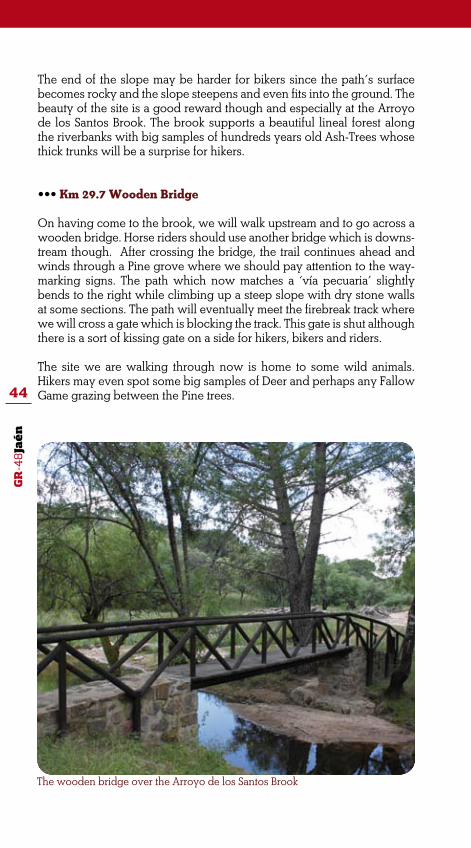
••• Km 29.7 Wooden Bridge
On having come to the brook, we will walk upstream and to go across a wooden bridge. Horse riders should use another bridge which is downs-tream though. After crossing the bridge, the trail continues ahead and winds through a Pine grove where we should pay attention to the way-marking signs. The path which now matches a ‘vía pecuaria’ slightly bends to the right while climbing up a steep slope with dry stone walls at some sections. The path will eventually meet the firebreak track where we will cross a gate which is blocking the track. This gate is shut although there is a sort of kissing gate on a side for hikers, bikers and riders.
The site we are walking through now is home to some wild animals. Hikers may even spot some big samples of Deer and perhaps any Fallow Game grazing between the Pine trees.

GR
-48
Jaé
n
45
••• Km 30.7 Track towards the Sanctuary
Another path approaches from the right on this last section of the stage. This path which is known as either Camino Viejo or Cordel de los Moli-nos is a traditional path used by pilgrims when travelling from Andújar town to the Virgen de la Cabeza Sanctuary. The path is also classified as Tourism Interest in Andalucía. We may choose to come to the Mirador del Camino Viejo Viewpoint which locates some metres down this path and that is one of the most popular sites used by pilgrims when brea-king. Then we should return to the trail to continue ahead with the GR-48 route.
The track climbs up and comes into a small ravine to the left where hikers will enjoy the whimsical forms of some big and fragmented granite rocks and boulders in the site. Pines groves have been replaced by Medite-rranean undergrowth which appears to struggle when colonizing the cracks on the granite rocks and boulders.
The first brotherhood buildings (cofradías) will start showing at the top of the hill. Those are the houses for the pilgrims that located nearby the Sanctuary. The trail will eventually come near Marmolejo Brotherhood’s Headquarter which is also the end of this stage of the route.
Granite rocks take whimsical forms on this section of the stage

GR
-48
Jaé
n
46
••• The first historical review of the Renaissance Bridge is recor-ded in Benito del Castillo’s last Will which is dated on May the 21th, 1600. The manuscript reads that this master stonemason was employed as a wage earner to build the bridge although the bill was still unpaid.
Even first works were done in the second half of the 16th century; the bridge was almost comple-tely rebuilt in the 19th century. In the first decade of the 21st cen-tury, the Ministry of Public Works of the Government of Andalusia commissioned some restoring works which gave cultural value to the bridge.
The bridge has seven semicircle arches with a span of 125 meters and a rise of 25 meters at the cen-
Marmolejo. Renaissance Bridge
tral arch. The three first arches from the right bank are from the 16th century while the other four were built in the 19th century.
The bridge is strategically located as for connecting the plain fields of the Guadalquivir Valley to the highlands up in the mountain ran-ge. This was especially important in the 16th century as many cattle routes passed through the region and livestock moving became a most important activity. For many centuries, the bridge was the pass for accessing to sites located up in the mountains such La Centenera or La Virgen de la Cabeza as well as the path which currently is the A-420 Road towards the Yeguas Ri-ver and the Campana Bridge from where it follows up to the Pedro-ches Valley.

GR
-48
Jaé
n
47
STAGE 2:
VIRGEN DE LA CABEZA/ VIÑAS DE PEÑALLANAThe GR-48 trail continues ahead and through the Sierra de Andújar Na-tural Park in Jaén province. On this stage of the route, some sections of the trail will match other paths and tracks used by the pilgrims and carts when travelling from Andújar town to the Virgen del a Cabeza Sanctuary. Along this stage of the route, hikers will discover many cultural and reli-gion features directly related to the pilgrims’ fervour which can be breath in this mountain range.
In the first section of the stage, the trail clearly descends into the Jándu-la River valley and from there it will follow the serpentine A-6177 road while climbing up towards Viñas de Peñallana housing, a natural site to enjoy some breathtaking views of this rough and wild land. Hikers will also have the opportunity for a better understanding of the natural world around them because of the information boards placed in different natu-ral viewpoints like the one at the Mirador del Peregrino Viewpoint.
Water streams are deeply fitted into the omnipresent granite bedrock while scouring out rough valleys and awesome granite boulders and rocks. Certainly, the region is the kingdom of granite rocks and Rockrose shrubbery, perhaps one of the last bastions for the Iberian Lynx recove-ring and survival.
This will be an easy walk which is suitable for hiking, biking and horse riding although it may harden when descending towards the Jándula Ri-ver, near Encinarejo Dam. Last quarter of the stage is all about a soft and
Valle del río Jándula

GR
-48
Jaé
n
48
Start: V. de la Cabeza SanctuaryFinish: Viñas de PeñallanaDistance: 17,2 Km.Time: 5 hours and 30 minutes
Suitability:
Environment: Severity of the natural environment
Track Features: Difficulty in following the track
3
2
2
3
Orientation: Guidance on the route directions
Struggle: Struggle required for accomplis-hing the route
MIDE evaluation:
easy climbing up to the top of the mountain range and the trail matches a comfortable mountain road.
ROUTE GENERAL DESCRIPTION
The trail starts off at the Virgen de la Cabeza Sanctuary in Andújar muni-cipal district. With a population of over 38000 people, the municipality which is the fourth larger in Spain stretches some 963 kilometres.
According to the traditional belief, on August the 12th, 1227 and in the early morning, the spirit of the Blessed Virgin Mary appeared to Juan Alonso de Rivas, a young shepherd from Colomera –a village in Granada province. After healing the shepherd’s disable arm, Virgin Mary asked for a hermitage to be built after Her Name at the very exact place where the miracle happened, that is atop the Cerro del Cabezo Hill. Every year
*Some struggle when climbing down to Encinarejo Natural Site

GR
-48
Jaé
n
49Nuestra Señora de la Cabeza Sanctuary
since 1304, over 600000 pilgrims gather on the last Sunday of April to honouring the Virgin Mary which is locally known as ‘La Morenita’.
Some 300 metres from an information board and towards the Sanctuary, the trail matches another path to the left that comes out from Alcala la Real Brotherhood buildings. Eventually, we will walk through the picnic area while having to the right the Cerro del Cabezo Hill before heading towards the Area Recreativa del Jabalí, a nearby recreation area.
••• Km 1.5 Sendero del Jabalí Path
As the Sanctuary and the surroundings areas remains to our back, the path starts descending through Pine groves and shrub and passes by a natural site known as Huerta de los Frailes. We will enjoy the breathta-king view of the valleys carved on the granite bedrock of the southern hills and the Cerro del Cabezo foothills. The valley which locates closer to us is the Arroyo del Membrillar Brook valley.
Ignore another path that crosses perpendicular and continue walking ahead. The path surface becomes slippery because of the granite sand known as ‘saliega’ resulting from a series of weathering actions. Granite rock has tradi-tionally been used in local building. A good example of this is a former ruined country house which locates to the right and that still hold the charming featu-res of traditional rock buildings. The views around us are particularly bucolic and hikers may be likely of spending some time in this natural site.

GR
-48
Jaé
n
50
El Jabalí Solitario Sculpture
The path continues ahead and becomes wavy between great varieties of lush Mediterranean undergrowth. Rockroses and Mastic Trees appear to be competing for supremacy in the area and tracks of Deer and Wild Boars can be spotted on the sandy ground.
Gum Rockroses are well accompanied by their ‘little sister’ the European Frostweed (Xolantha guttata). This is an annual herb whose flowers are relatively large with five yellow petals which generally have a dark spot at the base. In Spanish, this plant is known as Hierba de la Patata de Tierra or Madre de las Criadillas since it is associated and live in symbiosis to rare fungi (Criadillas de Tierra) that grow underneath.
As the walk progresses, the path matches again the firebreak track whi-le approaching to the Área Recreativa del Jabalí (recreation area) where reforested Pine groves and other conifer species are the main natural fea-ture. The area near the road is well equipped with some picnic tables, benches and other utilities. The main feature is a sculpture carved in the rock which is locally known as El Jabalí Solitario (The Lonely Wild Board). The sculpture by Luis Aldehuela, a local artist from Andújar, represents the main character in Jaime de Foxá’s novel, ‘Solitario’ (1961).
On leaving behind the recreation area, the path will head towards Sen-dero del Jabalí – Encinarejo Path that runs parallel to the road. After a kilometre or so we need to pay attention to the trail sings since we will leave this path to continue walking onto another firebreak track which is blocked by a countryside gate.
••• Km 4.42 Climbing down towards the Encinarejo Recreation Area
We access to the firebreak track after crossing a country gate that must be shut behind us. The track descends steeply. After some four hundred meters we will leave the firebreak track to make a 90º turn to the right and continue climbing down towards the stream bed which is the head of a

GR
-48
Jaé
n
51
Boards along the path tell about Iberian Lynx existing in the area
small seasonal brook that flows down and parallel to our path. Landsca-pe is clearly dominated by Reeds and phreatic woody shrub which is a sign of the nearby phreatic level and of the seasonal nature of the water stream.
It is paramount to keep walking onto the waymarked path. Temporal en-closures for Rabbits locate along the path. Those are to provide food for the Iberian Lynx since the path winds through an area which is one with the highest density on the world of this most endangered big cat.
As the walk progresses, meadows with Pine groves and Mediterranean shrub will remain behind us and the path turns to the left and away from the track to coming into a rougher area with great granite rocks and boul-ders outcropping on the slopes surface. We may now guess the Jándula River valley at the bottom of the hill. The hill is locally known as ‘Loma de Vaciabolsas’ perhaps the name is after any former bandit.
The climbing down hardens because of the steep and the slippery sandy path surface which now is curving and twisting like a snake in order to avoid granite rocks and boulders. Bikers must find this section of the path a bit more difficult.
After crossing other country gate, the path comes to the bottom of the hill and matches another track connecting an Electricity Power Station and
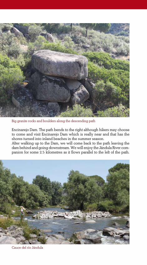
GR
-48
Jaé
n
52 Big granite rocks and boulders along the descending path
Cauce del río Jándula
Encinarejo Dam. The path bends to the right although hikers may choose to come and visit Encinarejo Dam which is really near and that has the shores turned into inland beaches in the summer season.After walking up to the Dam, we will come back to the path leaving the dam behind and going downstream. We will enjoy the Jándula River com-panion for some 2.5 kilometres as it flows parallel to the left of the path.

GR
-48
Jaé
n
53
The large watercourse is also well protected by a continuous riparian fo-rest of Ash trees on both riverbanks. The river water is really cold because it comes from the dam pipeline located at the lower section of the dam.
The area is part of Encinarejo Recreation Area and therefore is well equi-pped for better enjoying Nature. There are scattering picnic tables and benches along the riverbanks and a small birdwatching hut where we can watch for any bird like the Grey Heron which is very common in this site.
••• Km 9.58 the A-6177 Road (section) Step by step we will leave the agreeable companion of both the Jándula River and Encinarejo Recreation Area to connect to the countryside road towards Viñas de Peñallana and Andújar towns. We will eventually find ourselves outside the Sierra de Andújar Natural Park after going across the bridge over the river.
From this point to the end of this stage of the route, the trail will match this serpentine road while gently climbing up to Viñas de Peñallana Housing. Despite of being walking along the road, the surroundings are really interesting because of the natural and ethnological features in the area; the later clearly related to the pilgrimage to the Cerro del cabezo Hill. Nevertheless, we should pay attention to the road and, especially if we are hiking on weekends and/or bank holidays when we can have some heavy traffic about.
It will be easy to spot some samples of Deer by the road as they are likely of being grazing in the meadows which are the natural border between the Pine groves and the road. The green mass of Pine groves will be suddenly cut by the Barranco de Valdeinfierno Ravine which locates to the left. As the path continues climbing up, Mediterranean undergrowth comprising Rockroses, Mastic Trees and Wild Olive trees is colouring the hillslopes.
On the hills we can observe many distinctively shaped large granite boulders. At the 16.7 kilometre, the trail passes by a large granite block which is known as ‘La Piedra que Habla’ (The Talking Rock). The rock is in fact a monument with a poem carved on the rock surface. The work was commissioned and fully paid in 1923 by José del Prado y Palacio, Mar-quis of Rincón de San Idelfonso and Minister for Public Instruction under Alfonso XIII reign. He also was the author of the poem.
The serpentine road continues climbing up and soon we will reach the Mirador del Peregrino, a natural viewpoint which locates by the road. This is a good place for breaking while looking at the landscape and ad-miring the moving sculpture representing a man pointing at the Sanc-tuary as showing the site to a child next to him.
The end of the stage is not far from here. After some few meters of soft climbing, the road comes near a cluster of houses by Viñas de Peñallana

GR
-48
Jaé
n
54
La Piedra que Habla Monument
Housing which locates just before Los Pinos, a tourist resort. There is also the junction with Los escoriales Road (JH- 5002) which is the end of this stage of the route and the beginning of the next one.

GR
-48
Jaé
n
55
Mirador del Peregrino Viewpoint

GR
-48
Jaé
n
56
The Oldest Pilgrimage Tradition in Spain
••• According to tradition, when Saint Eufrasio arrived to Spain, he brought with him a sculpture of the Virgin Mary to which he was devoted to. Later in the 8th cen-tury when Arabs occupied An-dújar, the sculpture was hid in a most remote hill in Sierra Morena mountain range to keep it away from profanation.
Later on in the 13th century a most amazing event happened. In 1227, a shepherd called Juan Alonso Rivas from Colomera (Gra-nada) who had a disabled arm was shepherding his flock in the valley near the Cerro del Cabezo Hill. That night the shepherd could see some glowing lights atop the hill and heard a tolling bell in the distance. He climbed up the hill in the middle of the night and found the sculpture hid between the gra-nite rocks where he kneed and at sudden his disabled arm recove-red mobility and healed.
The shepherd fervently asked for a sanctuary to be built atop the hill and became a most impor-tant character in Andujar history. The sanctuary was finally built between 1287 and 1304 and tho-roughly reformed at the end of the 16th century. On April the 20th 2010, the sanctuary was granted by law the title of Basílica Menor (Minor Basilica).
Over 600,000 pilgrimages from all over the country gather at the Cerro del Cabezo Hill on the last Sunday of April to honouring the Saint. This Saint Virgin is locally known as ‘La Morenita’, a nickname clearly refe-rring to the dark colour of the sculp-ture and that is also the main theme of the official hymn.
“Morenita y pequeñitalo mismo que una aceituna,
una aceituna bendita,Morena de luz de luna,
Meta de jiennense anhelo;bronce de carne divina,escultura en barro santo,un chocolatín del cieloenvuelto por la platinadel orillo de su manto.
Es la Ermitareja que su marco aroma
entre jaras de la sierrauna cita,
colgada entre cielo y tierra.
Morenita y pequeñitala virgen su gracia asoma
entre el joyel que la encierra,Morena de luz de luna,desde el olivar del cielo
que en platas de hojas se cierracayó una aceituna al suelo,rodó y se paró en la sierra.
Morenita y pequeñita¡Una aceituna bendita!
Es la Ermitareja que su marco aroma
entre jaras de la sierrauna cita
colgada entre cielo y tierra.”

GR
-48
Jaé
n
57
On this stage of the route the GR-48 will take us from Viñas de Peñallana to Baños de la Encina, a small highland town. The trail will mainly follow the trace of another traditional path which is used by people when trave-lling from Baños de la Encina to the Virgen de la Cabeza Sanctuary.
The trail continues winding through the Sierra de Andújar Natural Park although step by step we will leave behind this beautiful protected na-tural area. The main feature along the path will be the landscape com-prising many pastures and meadows fully devoted to breeding Spanish toro bravo (fighting bull). Especially interesting are those near ‘Los Esco-riales’, a former mining village totally deserted where still remain some characteristic features and parts of the former equipment used for mining activities.
The trail will take us from Pine groves and former vineyards which gave name to the site to private country estates, like Friscalejo Country Estate, which are excellent samples of the purest and lush Mediterranean forest where Deer and Wild Boards are the main reason for big game hunting. Finally, large pastures will be the natural substitute to such woodland; perhaps the most interesting is the Finca de Corrales, a large country sta-te comprising pastures and meadows which used to breed the mesteña sheep and that today is fully devoted to fighting bull breeding.
We will enjoy the most impressive landscape features and breathtaking views of the foothills and of the plain fields in Jaen province from the natural site where the first water source of the Gorgogil River locates. This is also a good site for breaking while enjoying the natural world at the very heart of Sierra Morena mountain range. A range of landscape features which will be complemented at the end of the stage with the view of the Rumblar Dam.
STAGE 3:
VIÑAS DE PEÑALLANA/ BAÑOS DE LA ENCINA
Panoramic view of La Nava in Andújar municipality

GR
-48
Jaé
n
58
A long descending hike of over 30 kilometres which is quite easy and comfortable as most time the trail will match a countryside road and a large half section matching a dirt track in good surface conditions.
ROUTE GENERAL DESCRIPTION
This stage of the route starts off at Viñas de Peñallana which is an area of scattering houses within Andújar municipal district and where still re-main some of the best preserved typical buildings of the region as the traditional houses of thick stone walls. Some of them are real historical buildings converted in businessmen’ mansions while others are just ei-ther a second residence for some people from Andújar or modest rural accommodations for tourists.
The starting point is the junction at the A-6177 Road (Andújar – Puertolla-no) and the JH-5002 Road to Los Escoriales. Near the junction is Los Pinos Tourist Resort which could be a good place for provisioning before starting
Environment: Severity of the natural environment
Orientation: Guidance on the route directions
2
2
2
4
Track Features: Difficulty in following the track
Struggle: Struggle required for accomplis-hing the route
MIDE evaluation:
Start: Viñas de PeñallanaFinish: Baños de la EncinaDistance: 32,8 km approx.Time: 9,30 horas
Suitability:

GR
-48
Jaé
n
59
Waymarking signs and direction signs at the starting point of the stage
San José Hermitage
the walk. In addition, if we follow some 2 kilometres up the A-6177 Road towards Andújar, we will get to Viñas de Peñallana Visitors Centre where we will find relevant information about the Sierra de Andújar Natural.
••• Km 0 A-6177 Road
The trail starts at this countryside road to Los Escoriales, the Jándula Dam and Cabeza Parda sites. The road is really narrow and all precautions must be con-sidered when walking along it although this is a very comfortable walk under the fresh shadow of the Pine groves.
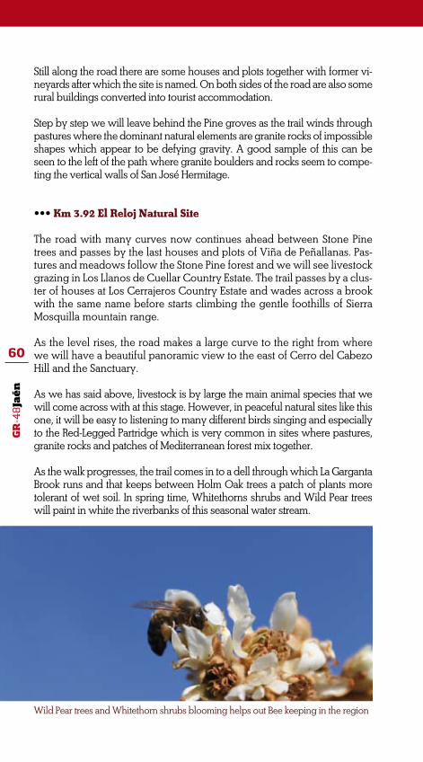
GR
-48
Jaé
n
60
Still along the road there are some houses and plots together with former vi-neyards after which the site is named. On both sides of the road are also some rural buildings converted into tourist accommodation.
Step by step we will leave behind the Pine groves as the trail winds through pastures where the dominant natural elements are granite rocks of impossible shapes which appear to be defying gravity. A good sample of this can be seen to the left of the path where granite boulders and rocks seem to compe-ting the vertical walls of San José Hermitage.
••• Km 3.92 El Reloj Natural Site
The road with many curves now continues ahead between Stone Pine trees and passes by the last houses and plots of Viña de Peñallanas. Pas-tures and meadows follow the Stone Pine forest and we will see livestock grazing in Los Llanos de Cuellar Country Estate. The trail passes by a clus-ter of houses at Los Cerrajeros Country Estate and wades across a brook with the same name before starts climbing the gentle foothills of Sierra Mosquilla mountain range.
As the level rises, the road makes a large curve to the right from where we will have a beautiful panoramic view to the east of Cerro del Cabezo Hill and the Sanctuary.
As we has said above, livestock is by large the main animal species that we will come across with at this stage. However, in peaceful natural sites like this one, it will be easy to listening to many different birds singing and especially to the Red-Legged Partridge which is very common in sites where pastures, granite rocks and patches of Mediterranean forest mix together.
As the walk progresses, the trail comes in to a dell through which La Garganta Brook runs and that keeps between Holm Oak trees a patch of plants more tolerant of wet soil. In spring time, Whitethorns shrubs and Wild Pear trees will paint in white the riverbanks of this seasonal water stream.
Wild Pear trees and Whitethorn shrubs blooming helps out Bee keeping in the region

GR
-48
Jaé
n
61
••• Km 9.96 Los Escoriales
The trail comes to a deserted village known as Los Escoriales. The settlement used to be a mining site which produced different quality ore such copper and iron. The name of the site is after the mining waste (escoria) which was generated and disposed in the site.
The path comes to a junction where different paths and tracks meet. The path to the right leads to the Mirador del Embalse del Jándula and the Mirador del Rey, two viewpoints located some 6.5 kilometres from the junction. However, we will continue walking ahead whi-le passing by a tentadero which is an enclosure where calves and young bulls’ bravery is tested. The path winds through different pas-tures fully devoted to fighting bulls breeding. Some 150 metres after the junction we should pay attention to the waymarking signs and continue walking onto another path known as Sendero del Rumblar that branches off right and to the south.
Walking on this new path turns to be very pleasant as the trail runs between large pastures where bulls are peacefully grazing. Man made granite features are very common since granite rocks are all over the area. We will see granite posts along the wiring fences, fee-ding troughs for cattle, different countryside buildings, etc. perhaps the most peculiar is a large feeding trough for cattle decorated with a roof and arches along the front.
Step by step we will approach to a beautiful pasture with Cork Oak trees. The path starts descending and the visual beauty of the Me-diterranean undergrowth becomes the main natural feature. This is famous site for Deer and Wild Boar hunting and perhaps we are lucky enough to spot any of those ungulates by the path.
Trail section between pastures and livestock at Los Escoriales

GR
-48
Jaé
n
62••• Km 14 First Source of Gorgogil and Friscalejo Brooks
The path becomes wavy while skirting along the eastern foothills of Sierra Mosquila mountain range. At a bend of the path locates a water spring which is the first source of the Gorgogil Brook. Although in the past water was channelled to Baños de la Encina village, today is just collected in a series of cisterns. (aljibes). This is a good site for breaking and where hikers may quench their thirst. Many Bracken Ferns grow around the spring adding a special and valuable beauty to the site.
On having come to the lower foothills of Sierra Mosquila mountain range, the path comes into a large and open Holm Oak forest. There we will take onto another path that branch off to the left and that runs bordering a cluster of houses by the Gorgogil gardens.
As the level flattens, the path continues ahead and passes by a stone made water trough which is well protected by some Eucalyptus trees. Soon after, we will see some scattering country houses surrounded by fruit trees. Those are some farms and houses by the Friscalejo Brook. Landowners and local administration are working together to lower the impact onto an area which is home to the Iberian Lynx. Along the path we will see many boards informing about this.
As the walk progresses, the path runs through a large treeless plateau (nava) surrounded by soft rounded hills which is already in Villanue-va de la Reina municipality and where many shooting estates and livestock pastures locate. The area is also home to many birds of prey such Short-Toed Eagles, Common Buzzards and Vultures.
Long roofed feeding trough decorated with arches

GR
-48
Jaé
n
63
Passing by Friscalejo Fountain
••• Km 19 Nava de Andújar or Santa Amalia Site
The path passes by and borders around a cluster of buildings which locate on a soft hill to the left. This impressive site is known as Nava de Andújar or Santa Amalia. The group of buildings comprises the country estate workers housing, farmhouses and even a school and a small hermitage.
The site’s surrounding area is a large meadow at 400 metres above the sea which is mainly devoted to horse breeding. Many fountains and water troughs serve for watering horses which can be seen pea-cefully grazing between fruit trees, like Almond trees.
There are also some Olive groves since the fertile substratum favours other plants growing and therefore land uses diversify. However, it is the large pasture land which provokes a warm sense of peace and harmony around us.
The path continues ahead and will wade across the Yeguas Brook which later will become Andújar Brook. This is one of the main water streams which drain the pastures and meadows in the area. Excellent samples of Tamujo shrub grow along the sandy riverbanks of the bro-ok though.
After going across the bridge over the brook, the landscape turns more mountainous. The treeless plateau which is the Yeguas pasture will soon be replaced by the lush Mediterranean forest which covers Lomas de Mesonero Hills. As the path starts climbing down, we will approach to Rumblar Dam which is almost at sight.

GR
-48
Jaé
n
64
Santa Amalia
Ancient lineal pastures are a common feature along the path
Step by step we will leave behind the dam to continue walking ahead and towards the end of this stage of the trail. The path runs now bet-ween rocky rocks where clearly can be seen the distinctive rock stra-ta and while supporting some good samples of Wild Olive trees and Wild Asparagus bushes.
••• Km 26.2 Rumblar Dam
On having come to the dam, the path becomes a countryside road that matches the JH-5044 Road.
The Rumblar Dam was built in 1941 to collect water for the region’s irrigated fields. It is 65 metres high and collects some 126 Hm3. The dam shores and the watershed are home to many aquatic birds such Grey Herons, Cormorants and the shy and rare Black Stork.

GR
-48
Jaé
n
65
Rumblar Reservoir
The path starts climbing up although the level flattens immediately after passing by the Casas de la Confederación, a cluster of country-side buildings which locates to the left. This is a more humanized area and small Olive groves and plots will start showing at both sides of the path.
As the path approaches Baños de la Encina village, hikers will come across with some places’ names such Minas de la Marquesa or Con-tramina which clearly evoke to a past time when mining activities were paramount in the area. We will eventually leave the road to con-tinue walking onto a path that branch off to the left and leads to the village where this stage of the route finishes. Soon after, we will spot the impressive vertical wall surrounding Baños de la Encina Castle.

GR
-48
Jaé
n
66
Iberian Lynx
••• The Iberian Lynx is consi-dered to be the world’s most endangered wild big cat. Iberian Lynx species are on the verge of extinction, thus. Most breeding populations live in areas of Sierra Morena mountain range, such Cardeña mountain range but especially in the Sierra de Andújar moun-tain range which is home to some 200 specimens, the largest breeding population in the country. The second largest breeding population remains in Doñana National Park (some 70 specimens). Because of the long distance, these two main areas are not connected which proves to be another threat posses onto this big cat.
The Iberian Lynx is native to the Iberian Peninsula being largely restricted to mountainous areas of Mediterranean forest and scrub. It is not easy to spot the Iberian Lynx since they are ge-nerally nocturnal creatures, with peak activity occurring at twi-light. Even if you are a thoughtful expertise, you will need a good dose of luck to see one of these animals in the forest.
Rabbits are closely related to Ibe-rian Lynx since they are the main food resources. The decline of the Iberian lynx has been mainly due to the decline of its main prey, the rabbit. Therefore, con-servation programmes consider ensuring the protection of this lagomorphs’ habitat and preying conditions for the Iberian Lynx in order to avoid extinction.

GR
-48
Jaé
n
67
STAGE 4:
BAÑOS DE LA ENCINA/ LA CAROLINAThis stage of the route connects two highlands towns: Baños de la Encina and La Carolina. The trail will match two traditional paths: the cattle route known as Cordel de Guarromán on the first section of the stage and the former municipal path from Baños de la Encina to La Carolina.
In despite of being a long walk with some hard sections for hiking, walkers will enjoy the beautiful natural features and landscape along the path as well as the breathtaking panoramic views from the highest na-tural sites. Olive groves, Pine groves and pastures (dehesas) will follow each other as the path progresses along the foothills of the mountain ran-ge from where we will have some impressive views of the largest plain fields in the region.
The bucolic Rumblar Valley locates at the northern hills of the mountain range with slopes covered by Rockroses patches and thick Mediterranean forest which is the kingdom of Deer and Wild Boars. In addition, scatte-
ring mining sites and tailing disposal facilities not longer in use appear to fragment this impressive green carpet comprising a large range of Medi-terranean plants.
Pozo de los Cuellos Water Well

GR
-48
Jaé
n
68
Environment: Severity of the natural environment
Orientation: Guidance on the route directions
2
2
3
5
Track Features: Difficulty in following the track
Struggle: Struggle required for accomplis-hing the route
Dificultad. Valoración según método Mide:
Start: Baños de la EncinaFinish: La CarolinaDistance: 26 kmTime: 7hours
Suitability:
ROUTE GENERAL DESCRIPTION
This stage of the route starts off at Baños de la Ecina Town Hall. From there, look for San Mateo Street to get to Linares Avenue. All the way from the Town Hall is a gentle descending walk until reaching the J-5040 Road outside the town. Soon after start walking along the road, we will see a service area to the left. In shortly we will leave the road to continue walking onto a path which winds through Olive groves and leads to the Virgen de la Encina Sanctuary and the Jesús del Camino Hermitage. This path also matches the PR A-289, a short distance path towards La Veró-nica Site.
*Some sections may be hard to accomplish on the bike though

GR
-48
Jaé
n
69
The beginning of this stage outside Baños de la Encina town
A serpentine path gently climbs towards Pine groves
••• Km 1 Majavieja Path and La Verónica Site
At this very beginning of the stage, the GR and PR paths match a traditio-nal cattle route (vía pecuaria) on the way to the Virgen de la Encina. After some 500 metres we will leave the path to continue walking on another path to the left that leads to an open area with no Olive groves. There the path meets other paths at a junction from where we will bend to the right onto a serpentine path that gently climbs up to an area with Pine groves. The junction was in the past a ‘descansadero’, the area where shephers and flocks came for resting and that used to be well equipped with some buildings and water facilities. In this one, still remain the traces of former garden plots, a former water well and the water trough under the shadow of some fruit trees. In addition, dry stone walls and Prickly Pear Cactuses appear to mark the borders of the path.
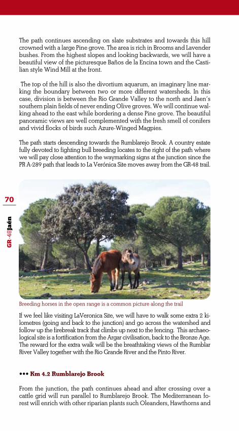
GR
-48
Jaé
n
70
Breeding horses in the open range is a common picture along the trail
The path continues ascending on slate substrates and towards this hill crowned with a large Pine grove. The area is rich in Brooms and Lavender bushes. From the highest slopes and looking backwards, we will have a beautiful view of the picturesque Baños de la Encina town and the Casti-lian style Wind Mill at the front.
The top of the hill is also the divortium aquarum, an imaginary line mar-king the boundary between two or more different watersheds. In this case, division is between the Rio Grande Valley to the north and Jaen’s southern plain fields of never ending Olive groves. We will continue wal-king ahead to the east while bordering a dense Pine grove. The beautiful panoramic views are well complemented with the fresh smell of conifers and vivid flocks of birds such Azure-Winged Magpies.
The path starts descending towards the Rumblarejo Brook. A country estate fully devoted to fighting bull breeding locates to the right of the path where we will pay close attention to the waymarking signs at the junction since the PR A-289 path that leads to La Verónica Site moves away from the GR-48 trail.
If we feel like visiting LaVeronica Site, we will have to walk some extra 2 ki-lometres (going and back to the junction) and go across the watershed and follow up the firebreak track that climbs up next to the fencing. This archaeo-logical site is a fortification from the Argar civilisation, back to the Bronze Age. The reward for the extra walk will be the breathtaking views of the Rumblar River Valley together with the Rio Grande River and the Pinto River.
••• Km 4.2 Rumblarejo Brook
From the junction, the path continues ahead and after crossing over a cattle grid will run parallel to Rumblarejo Brook. The Mediterranean fo-rest will enrich with other riparian plants such Oleanders, Hawthorns and
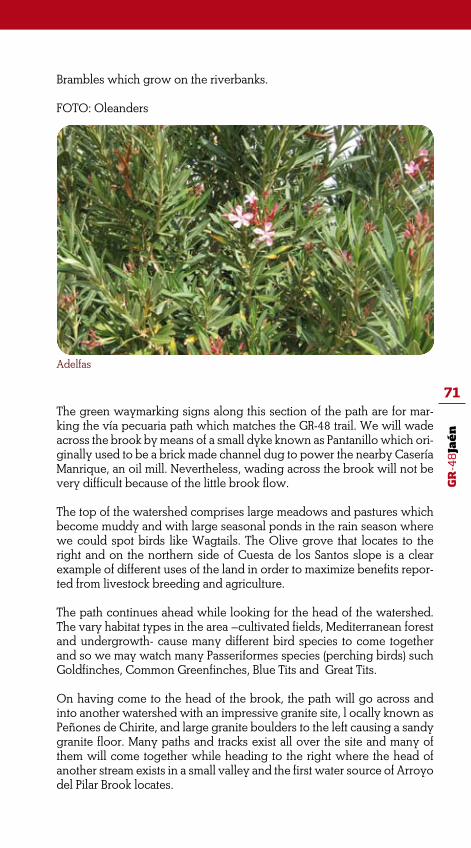
GR
-48
Jaé
n
71
Brambles which grow on the riverbanks.
FOTO: Oleanders
The green waymarking signs along this section of the path are for mar-king the vía pecuaria path which matches the GR-48 trail. We will wade across the brook by means of a small dyke known as Pantanillo which ori-ginally used to be a brick made channel dug to power the nearby Casería Manrique, an oil mill. Nevertheless, wading across the brook will not be very difficult because of the little brook flow.
The top of the watershed comprises large meadows and pastures which become muddy and with large seasonal ponds in the rain season where we could spot birds like Wagtails. The Olive grove that locates to the right and on the northern side of Cuesta de los Santos slope is a clear example of different uses of the land in order to maximize benefits repor-ted from livestock breeding and agriculture.
The path continues ahead while looking for the head of the watershed. The vary habitat types in the area –cultivated fields, Mediterranean forest and undergrowth- cause many different bird species to come together and so we may watch many Passeriformes species (perching birds) such Goldfinches, Common Greenfinches, Blue Tits and Great Tits.
On having come to the head of the brook, the path will go across and into another watershed with an impressive granite site, l ocally known as Peñones de Chirite, and large granite boulders to the left causing a sandy granite floor. Many paths and tracks exist all over the site and many of them will come together while heading to the right where the head of another stream exists in a small valley and the first water source of Arroyo del Pilar Brook locates.
Adelfas

GR
-48
Jaé
n
72
The brook flows down towards the campiña to the south while the path moves in the opposite direction and as it does the cattle route that joins to the left. We will find ourselves in a completely different natural envi-ronment after crossing a wiring gate that must remain closed behind us. The site is large Holm Oak woodland as the natural reception area of a most extensive one, Navarredonda pasture. The path runs parallel to the fencing to the right until it meets the path that leads to La Nava country house. Ignore that path and continue walking ahead and towards a roun-ded hill covered with Holm Oak woodland. From there the path starts climbing down sharply between rills resulting from water erosion while looking for the Parrilla Brook. Immediately before coming to the brook, we will leave the vía pecuaria path to come into Navarredonda pasture after crossing a wiring country gate which locates to the left of the path.
••• Km 9.5 Navarredonda Pasture
Navarredonda Pasture
After coming into Navarredonda Pasture, the path starts climbing until meeting another track which is the one leading to La Nava country house that we met earlier. There we will bend right and to the north. From here, we will have a beautiful view of this beautiful pasture land which is fully devoted to cattle breeding. Surrounded by the pasture is the cluster of barn, country houses and the main farmhouse.
The path surface is in better conditions now and the path continues ahead with gentle ups and downs through pastures of young Holm Oaks. The walk pace is pleasant along this section as marked by the distant sound of cowbells. The landscape turns wilder and bucolic and perhaps any bird of prey such Common Buzzards and Kites can be watched flying over our heads.As the path continues climbing up to the top of the hill, we will enjoy the

GR
-48
Jaé
n
73
Black Kite
panoramic view of the valley and the tails of the Rumblar Reservoir to the north and to the left of the path. This is a rougher watershed covered by Mediterranean shrub and Rockroses patches which become a gift to the senses in the spring time when all plants are blooming.
As the walk progresses, the path will split into two and we will continue walking onto the path to the left which will come out of Navarredonda Pasture after crossing a an iron countryside by a large Holm Oak tree. Then we will be entering La Parrilla Country Estate.
The path continues ahead while tracing up a large ascending curve. On both sides there are many granite boulders which cracks are home to many vertical White Asphodel plants that seem to competing in colour with some purple Lavender bushes.
The path passes by the Parrilla farmhouse and this seem to be a good site for breaking and recover after the climbing. From here we may also enjoy a panoramic view of valleys and hills. After a well deserved break, we will continue walking on the same path that soon will split into two. Then choose the path that branches off to the left and that runs parallel to the fencing. Again we will enjoy the panoramic views of the northern hills and watersheds and the tails of the Río Grande River, main tributary to the Rumblar River. The hills, fully covered with lush Mediterranean un-dergrowth and shrub, appear to be resonance boxes reproducing Deer grunts in autumn.
••• Km 13. Quinto de los Cuellos Pasture
On this section of the stage, the path winds through flat pastures. We will come across many country gates blocking the path. Remember, all coun-try gates must remain closed behind us to prevent livestock and cattle

GR
-48
Jaé
n
74Quinto farmhouse.
Salamander
from trespassing on other land. Eventually, the Centillo path will join us on its way down from the northern regions.
After passing by Quinto farmhouses, the path leads to the east and until anew junction where we will bend right onto a path that winds through a large watershed and between meadows. We will be leaving this pasture-land after crossing another country gate located near a water trough.
Water troughs turn to be extremely important to wild animals. Cattle Egrets make frequent use of them as amphibians and reptiles are com-plementary food to insects. On the other hand, amphibians such Midwife Toads, Western Spadefoot Toads and Salamanders lay their eggs in this artificial ponds. Birds of prey such Black Storks and Golden Eagles may be spotted when flying for hunting over the troughs.
On leaving behind and to the right the pond, the path continues ahead now matching a former path that links Baños de la Encina and La Carolina towns which is the one that we will follow up to the end of this stage of the route. Atop the hill is the watershed line that marks the boundaries between the extensive plain cultivated fields to the south and the northern hills and some scattering deserted mining sites.

GR
-48
Jaé
n
75
The path continues ahead and soon will be entering Carboneros municipali-ty. After crossing a country gate which is blocking the path, we will come into a site with the typical enclosures for testing fighting bulls’ bravery (tentadero) which will remain to the right of the path. There is also a small factory which resembles the local countryside buildings of stone and masonry.
After crossing another country gate, the path will come into Nava de los Cuellos. The site is a large and open plain field with fewer trees. The far-mhouse which locates at the soft rounded hill is another beautiful example of rural architecture as uses slate rock masonry and beautiful buttresses. This bucolic site is complemented with a picturesque water well.
Together with other villages and towns in the region such La Carolina, Carboneros, Guarromán and Miranda del Rey, Los Cuellos was one of the settlements established along the mountain range within the Nuevas Po-blaciones de Sierra Morena housing plan, back to King Carlos III reign.
However, this colony failed to progress and settlers moved to other near-by villages remaining the site just as a cluster of farmhouses and barns.
The path passes between the farm buildings to continue ahead and af-ter crossing another country gate. La Carolina town can be easily spotted from here yet another six kilometers remain to the end of this stage.
••• Km 19.5 Los Cuellos Path
The path surface is in good conditions along this section. The most interesting features will be the breathtaking views and the impressive landscape. On the foothills we will see many abandoned mining sites and mining facilities not longer in use; a silver-green sea of Olive groves stretching the southern water-shed to the right; in bright sunny clear days, can be seen the foothills of Sierra de Cazorla, Segura y Las Villas mountain range and Sierra Mágina mountain range on the westernmost horizon; and Los Vilches village which is half way from us and that can be easily spotted because of the Castle which locates
Enclosure for testing fighting bull’s bravery

GR
-48
Jaé
n
76
Panoramic view at the last section of the stage
atop a round hill. The castle has been converted into hermitage though.
We will continue ahead and pass by Los Ruices farmhouse which locates atop a hill to the right. There are some vegetable plots near the farmhouse and a brick made water well and trough locates opposite to them and by the path.
Cattle have been substituted by sheep, especially segureña race. Sheep flocks are travelled from the winter pastures located in Sierra Morena Highlands to the summer ones in Santiago de la Espada and Portones municipalities at the heart of Sierra de Segura mountain range.
Eventually, the path enters La Carolina municipality while passing by the impressive La Cerrada farmhouse which locates atop a hill to the right. This site is locally known as La Media Legua (half league) since that is the distance remaining from the site to La Carolina town.
The path makes a sharp curve and we will be facing a treeless and dry envi-ronment. However, this site is home to the Lesser Kestrel and other bird spe-cies associated to meadow-steppe habitats which may find their ideal food in this dry meadow. Following a conservation programme, Lesser Kestrel speci-mens were relocated in La Carolina municipality.
On the left side of the path we will see a most peculiar series of folds in gra-nite layers which resemble semicircular arches. The Cerro de la Cruz Hill also locates to the left of the path. This is an impressive 650 metres high hill which is very popular among hikers and local occasional walkers because of the impressive views from the top of the hill.
Shortly after passing through this site, the path meets El Centenillo Road. The-re we will bend to the right to continue walking along the road until come into Virgen del Rosario Avenue, outside the town. At the roundabout, choose the road to the left that leads into the town by Camino de Baños Street where this stage of the trail finishes.
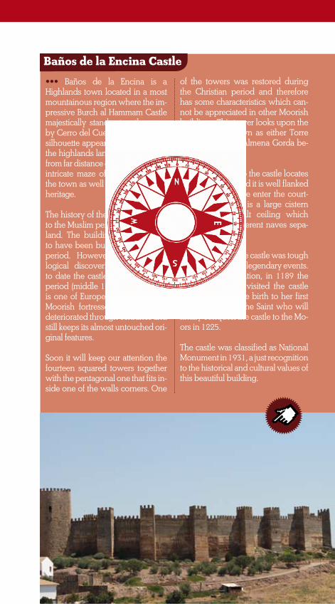
GR
-48
Jaé
n
77
Baños de la Encina Castle
••• Baños de la Encina is a Highlands town located in a most mountainous region where the im-pressive Burch al Hammam Castle majestically stands atop the near-by Cerro del Cueto Hill. The castle silhouette appear to be printed on the highlands landscape and even from far distance one can guess the intricate maze of streets which is the town as well as its rich cultural heritage.
The history of the castle goes back to the Muslim period in the Iberian land. The building was believed to have been built in the Caliphal period. However, late archaeo-logical discoveries have helped to date the castle in the Almohad period (middle 12th century). This is one of Europe’s best preserved Moorish fortresses as it has little deteriorated through centuries and still keeps its almost untouched ori-ginal features.
Soon it will keep our attention the fourteen squared towers together with the pentagonal one that fits in-side one of the walls corners. One
of the towers was restored during the Christian period and therefore has some characteristics which can-not be appreciated in other Moorish buildings. This tower looks upon the town and is known as either Torre del Homenaje or Almena Gorda be-cause of its shape.
The main access to the castle locates to the east wing and it is well flanked by two towers. We enter the court-yard where there is a large cistern with a barrel-vault ceiling which splits into two different naves sepa-rated by pilasters.
The conquest of the castle was tough and evolved some legendary events. According to tradition, in 1189 the Queen of Castile visited the castle and there she gave birth to her first son Fernando III, the Saint who will finally conquest the castle to the Mo-ors in 1225.
The castle was classified as National Monument in 1931, a just recognition to the historical and cultural values of this beautiful building.

GR
-48
Jaé
n
78
STAGE 5:
LA CAROLINA/ SANTA ELENA
This last stage of the route will take us through the mountains and hills in Despeñaperros when travelling from La Carolina to Santa Elena, two border towns with a strong tradition of hospitality and a region where important battles that changed the course of history were fought.
The GR-48 trail comes to finish this adventure after travelling over 500 kilometres from the westernmost spurs of Sierra Morena Massif at the bor-der between Portugal and Spain to the natural ‘Gateway to Andalusia’ which is Despeñaperros Pass.
This is an easy with no struggle walk suitable for walking, horse riding and mountain biking. Hikers will enjoy breaking at the beautiful natural site known as La Aliseda Recreation Area which is half way to the end and that is well equipped with facilities for picnic and controlled barbecuing.
Environment: Severity of the natural environment .
Orientation: Guidance on the route directions
3
2
2
3
Track Features: Difficulty in following the track
Struggle: Struggle required for accomplis-hing the route
MIDE evaluation:
Start: La CarolinaFinish: Santa ElenaDistance: 14,8 Km.Time: 4 horas
Suitability:

GR
-48
Jaé
n
79
On the first section of this stage, we will travel through a land where most resources have traditionally been devoted to mining activities. Mining activity has also left a clear footprint in the region where the foundations of demolis-hed mine buildings and other related structures such chimneys can be seen on the foothills and mountains as another landscape feature.
Then we will come into an area predominantly dominated by Medite-rranean forests with mountains and hills fully covered with Pine groves near La Campana River Valley and La Aliseda Recreation Area. In the late 19th century, these two sites became very popular as healing retreats for members of the Spanish aristocracy.
The GR-48 trail comes to an end in Santa Elena, a highland village su-rrounded by Despeñaperros Natural Park in Jaen province. Many traditio-nal paths together with an interesting natural and cultural heritage will be the most attractive features of the last stage of the route.
ROUTE GENERAL DESCRIPTION
After leaving La Carolina town, we will walk parallel to the N-IV Motorway towards Santa Elena. On having passed by the industrial estate immedia-tely before the cemetery, we will turn 90º to the left to come into Ministro Josep Piqué Avenue and the crossing of the industrial estate. Continue walking straight ahead and pass by the Fire Station before bordering the solar power plant. From there, the trail goes into a tiny country road that moves away from the urban fabric and towards La Aquisgrana Recreation Area where we will see some interesting vestiges of a mining past.
••• Km 2 Los Tramposos Gorge and the Castle
The walk goes ahead and we will soon have some breathtaking views of Sierra Morena foothills and La Campana River Valley which some Oli-ve groves on the fertile slopes and patches of Mediterranean forest and shrub on the higher levels of the hills at the background and former mi-ning buildings spattering everywhere.
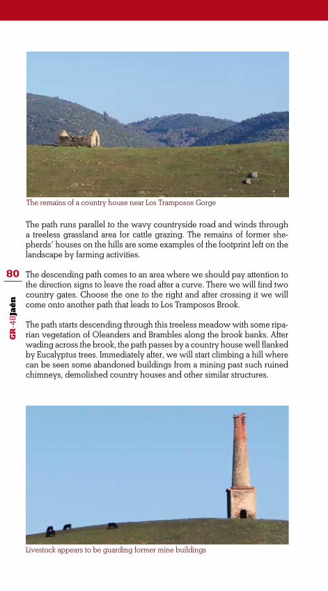
GR
-48
Jaé
n
80
The path runs parallel to the wavy countryside road and winds through a treeless grassland area for cattle grazing. The remains of former she-pherds’ houses on the hills are some examples of the footprint left on the landscape by farming activities.
The descending path comes to an area where we should pay attention to the direction signs to leave the road after a curve. There we will find two country gates. Choose the one to the right and after crossing it we will come onto another path that leads to Los Tramposos Brook.
The path starts descending through this treeless meadow with some ripa-rian vegetation of Oleanders and Brambles along the brook banks. After wading across the brook, the path passes by a country house well flanked by Eucalyptus trees. Immediately after, we will start climbing a hill where can be seen some abandoned buildings from a mining past such ruined chimneys, demolished country houses and other similar structures.
The remains of a country house near Los Tramposos Gorge
Livestock appears to be guarding former mine buildings
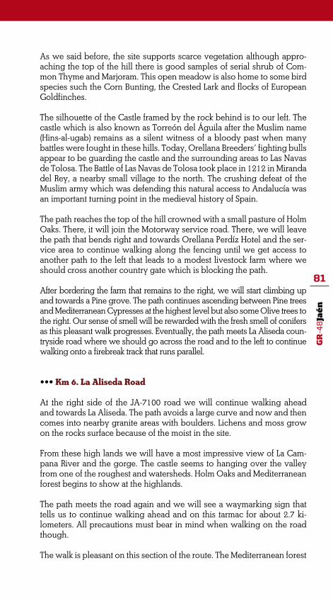
GR
-48
Jaé
n
81
As we said before, the site supports scarce vegetation although appro-aching the top of the hill there is good samples of serial shrub of Com-mon Thyme and Marjoram. This open meadow is also home to some bird species such the Corn Bunting, the Crested Lark and flocks of European Goldfinches.
The silhouette of the Castle framed by the rock behind is to our left. The castle which is also known as Torreón del Águila after the Muslim name (Hins-al-ugab) remains as a silent witness of a bloody past when many battles were fought in these hills. Today, Orellana Breeders’ fighting bulls appear to be guarding the castle and the surrounding areas to Las Navas de Tolosa. The Battle of Las Navas de Tolosa took place in 1212 in Miranda del Rey, a nearby small village to the north. The crushing defeat of the Muslim army which was defending this natural access to Andalucía was an important turning point in the medieval history of Spain.
The path reaches the top of the hill crowned with a small pasture of Holm Oaks. There, it will join the Motorway service road. There, we will leave the path that bends right and towards Orellana Perdíz Hotel and the ser-vice area to continue walking along the fencing until we get access to another path to the left that leads to a modest livestock farm where we should cross another country gate which is blocking the path.
After bordering the farm that remains to the right, we will start climbing up and towards a Pine grove. The path continues ascending between Pine trees and Mediterranean Cypresses at the highest level but also some Olive trees to the right. Our sense of smell will be rewarded with the fresh smell of conifers as this pleasant walk progresses. Eventually, the path meets La Aliseda coun-tryside road where we should go across the road and to the left to continue walking onto a firebreak track that runs parallel.
••• Km 6. La Aliseda Road
At the right side of the JA-7100 road we will continue walking ahead and towards La Aliseda. The path avoids a large curve and now and then comes into nearby granite areas with boulders. Lichens and moss grow on the rocks surface because of the moist in the site.
From these high lands we will have a most impressive view of La Cam-pana River and the gorge. The castle seems to hanging over the valley from one of the roughest and watersheds. Holm Oaks and Mediterranean forest begins to show at the highlands.
The path meets the road again and we will see a waymarking sign that tells us to continue walking ahead and on this tarmac for about 2.7 ki-lometers. All precautions must bear in mind when walking on the road though.
The walk is pleasant on this section of the route. The Mediterranean forest

GR
-48
Jaé
n
82
Panorámicas del entorno del Castillo de las Navas de Tolosa
of Holm Oaks enriches with Rockroses, Lavenders and Rosemary shrub growing on both sides of the road. The path goes through La Inmediata Country Estate where still we will see some abandoned shot towers to later come into another country estate, Las Cañadas from where it will run parallel to the road. The nearby river causes the fresh air and moist. Just before coming at the bridge over the river, we will leave the road behind us to continue walking onto another path that runs upstream and along the river.
••• Km 9.5 La Aliseda
The path will wind through a most interesting natural and historical site in this section of the route. As we walk upstream and along the river, we will see an excellently preserved lush riparian forest on the riverbanks with some great specimens of Ash-trees, Alders and Poplar trees.
Some fruit trees and great Walnut trees remain near the former spa resort and where used to be gardens plots. Despite the short flow, the river never dries which proves to be essential for some animal species living in the area as Deer and Wild Boars whose tracks can easily be spotted on the riverbanks.
Rapids, waterfalls and pools mark the course of the river at La Aliseda recreation area. A former public launderette or bag wash (formerly wash house) locates downstream just before a recreation area with facilities for picnic (benches, picnic tables, etc) where there is also a small viewpoint and some looking old Sweet Chestnut Trees with their peculiar twisted trunks.
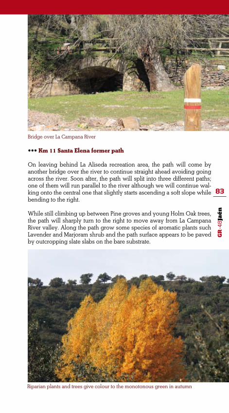
GR
-48
Jaé
n
83
••• Km 11 Santa Elena former path
On leaving behind La Aliseda recreation area, the path will come by another bridge over the river to continue straight ahead avoiding going across the river. Soon after, the path will split into three different paths; one of them will run parallel to the river although we will continue wal-king onto the central one that slightly starts ascending a soft slope while bending to the right.
While still climbing up between Pine groves and young Holm Oak trees, the path will sharply turn to the right to move away from La Campana River valley. Along the path grow some species of aromatic plants such Lavender and Marjoram shrub and the path surface appears to be paved by outcropping slate slabs on the bare substrate.
Bridge over La Campana River
Riparian plants and trees give colour to the monotonous green in autumn

GR
-48
Jaé
n
84
The path continues ahead and winds through Pine groves where we may enjoy the voices of different forest birds and even spot the Chaffinch or the Great Tit. The noise of birds amplifies with large flocks of Azure-Win-ged Magpie and especially with the colourful and noisy Eurasian Jay. All they will be very alert to our movements as we pass through the forest.
The path meets perpendicularly a firebreak track atop the hill. There we will bend to the left to continue walking along the firebreak while the path will move ahead. The firebreak track climbs down and almost meets the road although at sudden it will turn to the right to start climbing up again. Patches of Cork Oak trees begin to share ground with the still pre-dominant Pine groves.
The track meets the road again and passes by the main access to Piedras Blancas Country Estate. We will walk a few metres along the path that runs parallel to the fencing until it makes a 90º turn and moves away.
The noise of cars travelling the nearby motorway becomes louder as we approach to Santa Elena. However, we will have some metres before coming into the town which also give us the chance to enjoy walking through a large Pine grove where we will discover the beauty of a rare tree species native to America, the Monterey Pine (Pinus radiata).
The path meets again the road to La Aliseda which leads to the pedestrian overpass above the highway -Autovía de Andalucía- to finally come into
A section of the trail runs under the shadow of Monterey Pine trees

GR
-48
Jaé
n
85
Santa Elena. This small highland town which locates at Despeñaperros Mountain Pass is at the time the end of the stage and of the GR-48 trail through Sierra Morena Mountain Range.
La Aliseda
••• In the past, La Aliseda Spa re-sort comprised some twenty diffe-rent mineral fountains and springs, all they considered to have curati-ve powers. However, the site was internationally recognised for the healing properties of the mineral water from two fountains: San José and La Salud.
Generally, waters at La Aliseda were carbonated and nitrogen-containing waters and especially recommended for treating certain pathologies of the circulatory and respiratory systems. Similar hea-ling properties were also found in mineral waters of other towns and villages such Villaharta, Marmolejo and Puertollano.
The beginning of the 20th century witnessed a great boom at La Ali-seda. The medical benefits of the water together with the freshest and purest air in the highlands and nicer weather conditions attracted attractive to many bathers and the-refore in the site were built facilities such a hotel, private and renting lodgings, and a retail shop; a large garden with fruit trees and garden
plots was designed too. Today the re-mains of the spa bath and other struc-tures can be seen downstream and on the riverbanks to the right. Some great samples of old Sweet Chestnut trees and Walnut trees remain in the plain fields where probably used to be beautiful gardens and plots.
A well preserved riparian forest loca-tes along the river banks where Ash-trees mix together with Poplar trees and beautiful patches of Alder trees which are key waterside trees and clear bio-indicators of a healthy and constant river flow.
In the river, small waterfalls and ponds built with natural stone ma-sonry are home to many amphibian species such the Iberian Water Frog, the Iberian Midwife Toad and the Marbled Newt.
Certainly, the medical properties of the water cannot be the solely and not the most notable attraction at La Aliseda since this is a natural site of great environmental and ecological conditions under which a well pre-served riparian ecosystem exist.

GR
-48
Jaé
n
86
ALDEAQUEMADA
••• Accomodation
APARTAMENTOS TURÍSTICOS LA ALDEILLA
Camino de la Aldehuela, Km. 0,8 23215 Aldeaquemada 618 547 153 / 618 547 152 www.laaldeilla.com
CASA RURAL LA CIMBARRA
Avenida de Andalucía, 32-A 23215 Aldeaquemada 636 006 190 www.la cimbarra.com
CASA RURAL LA ALDEHUELA
Camino de la Aldehuela, s/n 23215 Aldeaquemada 699 222 579 www.casalaaldehuela.com
ANDÚJAR
••• Accomodation
HOSPEDERÍA RURAL SANTUARIO DE LA VIRGEN DE LA CABEZA
Ctra. Andújar-Puertollano, Km. 33 Santuario de la Virgen de la Cabeza, s/n. 23740 Andújar 953 549 113 www.hospederiasantuario.com
HOTEL SIERRA DE ANDÚJAR
Ctra. Santuario Virgen de la Cabeza 23740 Andújar 953 549 118 / 953 122 530 www.logasasanti.com
USEFUL INFORMATION

GR
-48
Jaé
n
87
COMPLEJO LA MIRADA
Ctra. Santuario Virgen de la Cabeza, s/n 23740 Andújar 953 542 111 / 669 934 389 www.complejolamirada.com
ALOJAMIENTOS RURALES “PARAJE SAN GINÉS”
Ctra. De la Cadena, Km. 11,5 23740 Andújar 657 803 944 http://parajesangines.net46.net
COMPLEJO LOS PINOS
Ctra. Santuario, Km. 14 23740 Andújar 953 549 076 / 953 549 079 www.lospinos.es
AULA DE LA NATURALEZA VILLA MATILDE
Viñas de Peñallana, 302 23740 Andújar 953 549 127 / 618 329 980 www.villamatilde.org
CASA RURAL LA CARACOLA
Viñas de Peñallana, 19-13 23740 Andújar 953 103 207 / 670 727 376 www.lacaracola.es
ALOJAMIENTOS RURALES SIERRA LUNA
Ctra. De la Alcaparrosa, Km. 6,300 23740 Andújar 620 454 935 / 953 041 009 www.sierraluna.com
HOTEL EL SOTO
Ctra. Autovía de Andalucía, Km 325,5. Salida 326. 23740 Andújar 953 501 127 www.lladelsohoteles.com

GR
-48
Jaé
n
88
HOTEL LOGASASANTI
C/ Doctor Fleming, 5 23740 Andújar 953 500 500 www.logasasanti.com
HOTEL DEL VAL
Hermanos del Val, 1 23740 Andújar 953 500 950 www.peraltahoteles.com
COMPLEJO EL BOTIJO
Autovía de Andalucía, Km. 324 23740 Andújar 953 501 008 www.elbotijo.org
••• Travel Agencies
HALCÓN VIAJES, S.A
C/ Veintidós de julio, 4 23740 Andújar 953 511 214
NACETUR
C/ Doce de agosto, 20 23740 Andújar 953 515 796 www.viajesnacetour.grupoairmet.com
SAFE TOUR
C/ Doce de agosto, 4 23740 Andújar 953 890 650 www.safetour.es
VIAJES LUAN-TOURS
C/ Los Hornos, 50 23740 Andújar 953 515 466

GR
-48
Jaé
n
89
VIAJES “EL CORTE INGLÉS”
C/ Los Hornos, 41 23740 Andújar 953 515 410
••• Restaurants
HOSP. RURAL SANTUARIO DE LA VIRGEN DE LA CABEZA
Ctra. Andújar-Puertollano, Km. 33 Santuario de la Virgen de la Cabeza, s/n. 23740 Andújar 953 549 113 www.hospederiasantuario.com
EL BUEN GUSTO
Ctra. Santuario Virgen de la Cabeza 23740 Andújar 953 549 118 / 953 122 530 www.logasasanti.com
LA MIRADA
Ctra. Santuario Virgen de la Cabeza, s/n 23740 Andújar 953 542 111 / 669 934 389 www.complejolamirada.com
ALOJ. RURALES “PARAJE SAN GINÉS”
Ctra. De la Cadena, Km. 11,5 23740 Andújar 657 803 944 www.parajesangines.com
LOS PINOS
Ctra. Santuario, Km. 14 23740 Andújar 953 549 076 www.lospinos.es
SIERRA LUNA
Ctra. de la Alcaparrosa, Km. 6,300 23740 Andújar 620 454 935 / 953 041 009 www.sierraluna.com

GR
-48
Jaé
n
90
EL TOLEDILLO
Ctra. Santuario de la Virgen de la Cabeza, Km. 5 23740 Andújar 953 511 056 www.lladelsohoteles.com
LA CAÑÁ
Ctra. Del Santuario, Km. 1,2. 23740 Andújar 953 500 720
EL TROPEZÓN
Ctra. Del Santuario, Km. 3 23740 Andújar 953 506 921 www.restauranteeltropezon.es
EL PARRAL
Ctra. Del Santuario, Km. 1,7 23740 Andújar 953 505 127 www.restauranteelparral.com
CHOTO
C/ Pastor Juan de Rivas, 14 23740 Andújar 953 503 116
LA FUNDICIÓN
Vía de Servicios Autovía de Andalucía N-4, Km. 325 23740 Andújar 953 505 091
LA MINA
Ctra. De la Estación, 10 23740 Andújar 953 504 325 www.tabernalamina.es
CRISTIAN
Paseo de Joaquín Colodero, 23. 23740 Andújar 953 507 664

GR
-48
Jaé
n
91
LOGASASANTI
C/ Doctor Fleming, 5 23740 Andújar 953 500 500 www.logasasanti.com
CASA GARRIDO
Polígono La Ceca, P-21 23740 Andújar 953 512 567 www.restaurantecasagarrido.com
CASA MANOLO
C/ San Vicente de Paúl, 27 23740 Andújar 953 504 381
MESÓN RURAL “LA CADENA”
Ctra. La Cadena, Km. 2 23740 Andújar 695 923 074 www.mesonrurallacadena.com
PALACIO DEL DRAGÓN
C/ Emperador Adriano, 9 23740 Andújar 953 511 027
TORTUGA AZUL
Polígono Empresarial Europa, s/n 23740 Andújar 953 512 823
ANDÚJAR II
Ctra. N-IV, Km. 316,7 23740 Andújar 953 510 998
COMPLEJO EL BOTIJO
Autovía de Andalucía, Km. 324 23740 Andújar 953 501 008 www.elbotijo.org

GR
-48
Jaé
n
92
EL BUEN GUSTO II
C/ Doctor Fleming, 5 23740 Andújar 953 500 500 www.logasasanti.com
EL CHURRASCO
Corredera Capuchinos, 24 23740 Andújar 953 502 120 www.lladelsohoteles.com
LOS NARANJOS
C/ Guadalupe, 4 23740 Andújar 953 510 390
MESÓN PINCELÍN
C/ Alcalá Wenceslada, 6 23740 Andújar 953 511 154 www.lospincelines.com
DEL VAL
Ctra. Madrid-Cádiz, Km. 321 23740 Andújar 953 500 950 www.peraltahoteles.com
CASA JUANITO
C/ El Pino, 34 23740 Andújar 953 506 723 www.copaytapas.com/casajuanitoandujar
••• Active Tourism
TURISMO VERDE GUÍAS DE NATURALEZA
C/ Historiador Antonio Terrano, 12. 7-M 23740 Andújar 629 518 345 www.lasierradeandujar.com

GR
-48
Jaé
n
93
••• Tourist Information Office
OFICINA MUNICIPAL DE TURISMO DE ANDÚJAR
Torre del Reloj, Plaza de Santa María s/n 23740 Andújar 953 504 959 www.andujar.es
BAILÉN
•••Accommodation
HOTEL GRAN BATALLA
C/ Sevilla, 92 23710 Bailén 953 670 219 www.hotelcuatrocaminos.com
HOTEL BAILÉN
Ctra. Madrid-Cádiz, Km. 296 23710 Bailén 953 670 100 www.hotelbailen.com
HOTEL SALVADOR
Ctra. Madrid-Cádiz, Km 296 23710 Bailén 953 670 058 www.hotelsalvadorbailen.com
HOTEL ZODIACO
Ctra. N-IV, Km. 294 23710 Bailén 953 671 058 www.hzodiaco.com
HOTEL EL CORDOBÉS
Ctra. Madrid-Cádiz, Km 291 23710 Bailén 953 673 388

GR
-48
Jaé
n
94
HOSTAL EL PASO
Ctra. N-IV, Km. 294,500 23710 Bailén 953 671 050 www.hostalelpaso.es
HOSTAL LOS ÁNGELES
Ctra. Madrid-Cádiz, Km. 294,75 23710 Bailén 953 670 010
••• Restaurants
CHINO PEKÍN
C/ Sevilla, 78 23710 Bailén 953 673 869
LOS MANUELES
Avda. Manolo Gómez Bur, 28 23710 Bailén 649 969 400
EL MIRADOR
Cat. De las Aguas, 1 23710 Bailén 953 673 055
EL ÁLAMO
Ctra. Madrid-Cádiz, Km. 293 23710 Bailén 953 672 842
EL CORDOBÉS
Ctra. N-IV, Km. 291 23710 Bailén 953 673 388

GR
-48
Jaé
n
95
EL PASO
Ctra. N-IV, Km. 294,500 23710 Bailén 953 671 050 www.hostalelpaso.es
IDEAL
C/ Huertas, 12 23710 Bailén 953 670 264
LA TASCA
Ctra. Nacional IV, Km. 294 23710 Bailén 953 672 333
LOS ÁNGELES
Ctra. N-IV, Km. 294,75 23710 Bailén 953 670 010
SAN JOSÉ Ctra. Madrid-Cádiz, Km. 298 23710 Bailén 953 671 201
RESTAURANTE HOTEL BAILÉN
Avda. del Parador, s/n 23710 Bailén 953 670 100 www.hotelbailen.com
SALVADOR
Ctra. Madrid-Cádiz, Km 296 23710 Bailén 953 670 058 www.hotelsalvadorbailen.com
ZODÍACO
Ctra. N-IV, Km. 294 23710 Bailén 953 671 058 www.hzodiaco.com

GR
-48
Jaé
n
96
CASA ANDRES
C/ Sevilla, 92. 23710 – Bailén 953 673 038 www.restaurantecasandres.com
ABADES BAILÉN
Autovía A4, Madrid-Cádiz, km. 288. 23710 – Bailén. 953 635 545 www.abades.com
••• Travel Agencies
MASVIAJES
Plaza General Castaños, 10 23710 Bailén 953 673867
MUNDO TOUR VIAJES
C/ Arroyo, 26 Bajo 23710 Bailén 953 676 124
VIAJES CALLES
Avda. del Parador, 3 23710 Bailén 953 672 802
VIAJES JACI TOURS
C/ Zarco del Valle, 16 23710 Bailén 953 678 507
VIAJES MAVI
C/ Rafael Alberti, 12 23710 Bailén 953 670 218

GR
-48
Jaé
n
97
BAÑOS DE LA ENCINA
•••Accommodation
HOSPEDERÍA RURAL PALACIO GUZMANES
C/ Trinidad, 4 23711 Baños de la Encina 953 613 075 www.palacioguzmanes.com
HOTEL BAÑOS
Cerro La Llanada 23711 Baños de la Encina 953 614 068 www.hotelbanos.com
CR. LA TIENDA DE PACO VALLE I y II.
C/ Mestanza, 2 23711 Baños de la Encina 645 801 562 www.latiendadepacovalle.com
CR. TÍO LEANDRO I y II.
C/ La Cruz, 44 y 48. 23711 Baños de la Encina 615 602 703 www.eltioleandro.es
•••Restaurantes
MIRASIERRA
C/ Bailén, 6 23711 Baños de la Encina 953 613 290
BAÑOS
Cerro de la Llana, s/n 23711 Baños de la Encina 953 614 068 www.hotelbanos.com

GR
-48
Jaé
n
98
PALACIO GUZMANES
C/ Trinidad, 4 23711 Baños de la Encina 953 613 075 www.palacioguzmanes.com
••• Oficina de turismo
OFICINA MUNICIPAL DE TURISMO DE BAÑOS DE LA ENCINA
C/ Castillo, 1 23711 Baños de la Encina. 953 613 229 www.bdelaencina.com
••• Otros servicios turísticos
CULMINA, SERVICIOS TURÍSTICOS Y CULTURALES, C.B
C/ Castillo, 1 23711 Baños de la Encina 953 613 229 / 651 436 478 www.culmina.es
CARBONEROS
••• Restaurantes
CASA SALVADOR
C/ Álamos, 10 23211 Carboneros 953 661 214
JORMA
Ctra. Madrid-Cádiz, Km. 275 23211 Carboneros 953 660 003
COMPLEJO LOS PALOMOS
Ctra. Madrid-Cádiz, Km. 270 23211 Carboneros 953 682 121

GR
-48
Jaé
n
99
GUARROMÁN
••• Alojamientos
HOTEL DIAM
Polígono Guadiel, s/n Parcela E, 7 23210 Guarromán 953 670 000
HOTEL YUMA
Ctra. N. IV. Km. 281 23210 Guarromán 953 615 036
HOTEL PALACIO DEL INTENDENTE
Avda. Andalucía, 35 23210 Guarromán 609 550 426 www.hotelpalaciodelintendente.com
HOTEL GUARROMÁN
Ctra. Madrid-Cádiz, Km. 282 23210 Guarromán 605 889 560
PENSIÓN CASA CHAVES
Ctra. Madrid-Cádiz Km. 280 23210 Guarromán 953 615 160
PENSIÓN LOS MELLIZOS
Ctra. Madrid-Cádiz, Km. 280 23210 Guarromán 953 615 159
PENSIÓN LA MEZQUITA
Avda. Andalucía, 111 23210 Guarromán 953 615 182

GR
-48
Jaé
n
100
••• Restaurantes
CARLOS III
Antigua Carretera Nacional IV 23210 Guarromán 953 615 269
DON PEPE
Ctra. N-IV, Km. 303 23210 Guarromán 953 673 308
EL VENTORRILLO
Aldea El Ventorrillo, 19 23210 Guarromán 953 676 663
LA MEZQUITA
Ctra. Madrid-Cádiz, Km. 282 23210 Guarromán 953 615 182
ANDAMUR
Polígono Guadiel, 131 23210 Guarromán 953 676 249
CASA CHAVES
Autovía Andalucía, Km. 280 23210 Guarromán 953 615 160
CENTRO
Avda. Andalucía, 37 23210 Guarromán 953 616 001

GR
-48
Jaé
n
101
DIAM
Polígono Guadiel, s/n Parcela 7 E 23210 Guarromán 953 670 000
GASOLINERA DE GUARROMÁN
Ctra. Madrid-Cádiz, Km 282, 8 23210 Guarromán 953 616 133
HOJALDRES MORENO
Ctra. Madrid-Cádiz, Km. 280 23210 Guarromán 953 615 071
VENTA LOS GRANAOS
Avda. Andalucía, 14 23210 Guarromán 953 615 284
VIRGEN DE ZOCUECA
Ctra. Madrid-Cádiz, Km. 303 23210 Guarromán 953 674 002
JAIMA-PARK
Ctra. Nacional IV, Km. 283,5 23210 Guarromán 953 615 497
LA CAROLINA
••• Alojamientos
HOTEL GRAN PARADA
Avda. Lindez Vilches, 9 23200 La Carolina 953 660 275

GR
-48
Jaé
n
102
HOTEL ORELLANA PERDIZ
Ctra. Madrid- Cádiz, Km. 265 23200 La Carolina 953 661 251
HOTEL ORELLANA PERDIZ II
Ctra. Madrid- Cádiz, Km. 265 23200 La Carolina 953 661 830
HOTEL ORELLANA PERDIZ NUEVAS POBLACIONES
Autovía de Andalucía, Km. 266 23200 La Carolina 953 680 684
HOTEL NH - LA PERDIZ
Ctra. Madrid-Cádiz, Km. 268 23200 La Carolina 953 660 300
HOSTAL NAVAS DE TOLOSA
Autovía de Andalucía, Salida 266 23200 La Carolina 953 660 627
PENSIÓN EL RETORNO
C/ General Sanjurjo, 5 23200 La Carolina 953 661 613
PENSIÓN LOS JARDINEROS
C/ General Sanjurjo, 1 23200 La Carolina 953 660 812
••• Restaurantes
CHINO FUXING
Avda. Juan Carlos I, 9 23200 La Carolina 953 660 574
GR
-48
Jaé
n
103
ALSUR
Avda. Juan Carlos I, 2 23200 La Carolina 953 685 074
GRAN PARADA
Ctra. N-IV, Km. 270 23200 La Carolina 953 660 052
LA TOJA
Avda. Juan Carlos I, 2 23200 La Carolina 953 661 018
ORELLANA PERDIZ
Ctra. Madrid- Cádiz, Km. 265 23200 La Carolina 953 661 251
ORELLANA PERDIZ II
Ctra. Madrid- Cádiz, Km. 265 23200 La Carolina 953 661 830
ORELLANA PERDIZ NUEVAS POBLACIONES
Autovía de Andalucía Km. 266 23200 La Carolina 953 680 684
••• Agencias de viajes
VIAJES BETULA, S.L
C/ Madrid, 6 23200 La Carolina 953 681 710
VIAJES KELBATUR
Plaza de España, 4 23200 La Carolina 953 660 746

GR
-48
Jaé
n
104
VIAJES ROSATRAVEL
C/ San Juan de la Cruz, 4 23200 La Carolina 953 685 197
MARMOLEJO
••• Alojamientos
HOTEL “GRAN HOTEL SPA”
C/ Calvario, 101 23770 Marmolejo 953 540 975 www.peraltahoteles.com
HOSTAL DE CIUDAD PLAZA
Plaza Amparo 23770 Marmolejo 953 540 156 www.hostalplaza.net
PENSIÓN VIRGEN DE LA CABEZA
C/ Gamonal, 9 23770 Marmolejo 953 517 617
••• Restaurantes
ASADOR EL RINCONCILLO
Pasaje de Jesús, 1 23770 Marmolejo 953 540 073
EL RINCÓN DE MARIO
Polígono Industrial, s/n 23770 Marmolejo 953 653 714

GR
-48
Jaé
n
105
GRAN BAR Plaza del Amparo, 1 23770 Marmolejo 953 540 150
LA RIBERA
Autovía de Andalucía, Km. 335 23770 Marmolejo 953 517 231
••• Agencias de viajes
VIAJES AURINGIS
Divino Maestro, 1 23770 Marmolejo 953 271 727
SANTA ELENA
••• Alojamientos
CAMPING “DESPEÑAPERROS”
Ctra. Santa Elena 23213 Santa Elena 953 664 192 www.campingdespenaperros.com
CR MESA DEL REY
Paraje Mesa del Rey 23213 Santa Elena 953 125 055 www.santaelena.eu/crural
CR FINCA COLLADO DE LOS JARDINES
Finca Collado de los Jardines 23213 Santa Elena 953 664 153 www.parquenaturaldp.com

GR
-48
Jaé
n
106
HOTEL EL MESÓN
Ctra. N-IV, Km. 257 23213 Santa Elena 953 664 100 www.hotelalfonsoviii.com
HOTEL ALFONSO VIII
Ctra. Nacional IV, Km. 258 23213 Santa Elena 953 664 100 www.hotelalfonsoviii.com
••• Restaurantes
ABADES PUERTA DE ANDALUCÍA
Autovia A-4, Salida 262. 23213 Santa Elena 953 664 358 www.abades.com
AREA DE DESPEÑAPERROS
Autovia A-4, km. 259. 23213 Santa Elena 953 664 221
LOS JARDINES DE DESPEÑAPERROS
Ctra. Andalucía, Km. 246 23213 Santa Elena 953 125 306
RINCÓN DESPEÑAPERROS
Ctra. Nacional IV, Km. 254 23213 Santa Elena 953 125 335
ALFONSO VIII
Ctra. Madrid-Cádiz, Km. 258,8 23213 Santa Elena 953 664 231 www.hotelalfonsoviii.com

GR
-48
Jaé
n
107
ÁREA DE SERVICIO 258
Autovía A-4, Madrid-Cádiz, km. 258. 23213-Santa Elena. 953 664 031 www.area258.com
CAMPING DESPEÑAPERROS
Carretera de Santa Elena, Km. 257 23213 Santa Elena 953 664 192 www.campingdespenaperros.com
EL MESÓN
Avda. de Andalucía, 91 23213 Santa Elena 953 623 100 www.hotelalfonsoviii.com
••• Oficina de turismo
ABADES PUERTA DE ANDALUCÍA
Autovía A-4, Salida 262. 23213 Santa Elena 953 664 358
••• Turismo activo
PUERTANATURA, C.B
C/ Carlos III, 22 23213 Santa Elena 953 664 307 www.puertanatura.vivesantaelena.com

GR
-48
Jaé
n
108
VILLANUEVA DE LA REINA
••• Alojamientos
HOTEL RESTAURANTE PAYBER
Enlace Ctra. N-IV con Ctra J-232 23730 Villanueva de la Reina 953 537 050 www.hotelpayber.com
PENSIÓN CASA POSTAS
Autovía de Andalucía, Km. 310 23730 Villanueva de la Reina 953 537 217
HOSTAL SYSY
Ctra. Andújar, 4 23730 Villanueva de la Reina 953 548 032 http://hostalsysy.com
HOSTAL MESÓN ANDALUZ
Ctra. La Redonda, s/n 23730 Villanueva de la Reina 953 537 406 www.mesonandaluz-pr.es
HOTEL PAYBER II
Ctra. de Andújar, 4 23730 Villanueva de la Reina 953 537 050 www.hotelpayber.com
••• Restaurantes
SYSY
C/ Andújar, 4 23730 Villanueva de la Reina 953 548 032 http://hostalsysy.com

GR
-48
Jaé
n
109
LIST OF SPECIES
THE PLANTS WORLD
•••Plants
Blue Bedder (Echium plantagineum)Bramble (Rubus ulmifolius)Broom (Retama sphaerocarpa)Buttercup (Ranunculus sp.)Common Cattail (Typha latifolia)Common Hawthorn (Crataegus monogyna)Common Smilax (Smilax aspera)Dandelion (Taraxacum officinale)Flax-Leaved Daphne (Dagne nidium)Foxglove (Digitalis purpúrea)French Lavender (Lavandula stoechas)Gorse (Genista hirsuta)Greasy/Gum Rockrose (Cistus ladanifer)Gurumelo (Amanita ponderosa)Jerusalem Sage (Phlomis purpurea)Laurustinus (Viburnum tinus) Lesser calamint (Calamintha nepetta)Mastic Thyme (Thymus mastichina)Mastic Tree (Pistacea lentiscus)Mirtle (Mirtus communis)MossNavelwort (Umbilicus pendulinus)Oleander (Nerium oleander)Peony (Paeonia lactiflora)Pine Tree (Pinus sp.)Prickly Pear Cactus (Opuntia ficus-carica)Rascavieja (Adenocarpus telonensis)Reed (Juncus sp.)Rosemary (Rosmarinus officinalis)Sage (Salvia)Steppe Rockrose (Cistus albidus)Strawberry Tree (Arbutus unedo)Tamujo (Flueggea tinctorea)Terebinth Tree (Pistacia terebintus)White Rockrose/Sageleaf Rockrose (Cistus salvifolius)White Spanish Broom (Cytisus multiflorus)Wild Asparagus (Asparagus acutifolia)Wild Carnation (Dianthus caryophyllus)

GR
-48
Jaé
n
110
•••Trees
Almond (Prunus dulcis)Ash-Tree (Fraxinus excelsior)Black Poplar (Populus nigra)Common/White Mulberry (Morus alba)Cork Oak (Quercus suber)Eucalyptus Tree (Eucaliptus globulus)Fig Tree (Ficus carica)Holm Oak (Quercus ilex)Kermes Oak (Quercus coccifera)Monterrey Pine (Pinus radiata)Olive Tree (Olea europea)Orange Tree (Citrus sinensis)Pine Tree (Pinus pinea)Pommegranate Tree (Punica granatum)Portuguese Oak (Quercus faginea)Sweet Chestnut Tree (Castanea sativa)Walnut Tree (Juglans regia)White Poplar (Populus alba)Wild Iberian pear Tree (Pyrus bourgaeana)Wild Olive Tree (Olea europea silvestris)Willow Tree (Salix alba)
THE ANIMAL WORLD
•••Birds
Beaudouin’s Snake Eagle (Circaetus gallicus)Bee-Eater (Merops apiaster)Black Kite (Milvus migrans)Black Stork (Ciconia nigra)Blue Rock-Thrush (Monticola solitarius)Blue Tit (Parus caeruleus)Bonelli´s Eagle (Hieraaetus fasciatus)Booted Eagle (Hieraetus pennatus)Common Blackbird (Turdus philomelos)Common Buzzard (Buteo buteo)Common Kestrel (Falco tinnunculus)Common Redstart (Phoenicurus phoenicurus)Common Chaffinch (Fringilla coelebs)Common Wood-Pigeon (Columba palumbus)Corn Bunting (Miliaria calandra)Egyptian Vulture (Neophron percnopterus)Eurasian Crag Martin (Ptyonoprogne rupestris)Eurasian Eagle-Owl (Bubo bubo)

GR
-48
Jaé
n
111
Eurasian Wryneck (Jynx torquilla)European Goldfinch (Carduelis carduelis)European Greenfinch (Carduelis chloris)Golden Eagle (Aquila chrysaetos)Golden Oriole (Oriolus oriolus)Great Spotted Woodpecker (Dendrocopos major)Great Tit (Parus major)Grey Heron (Ardea cinerea)Griffon Vulture (Gyps fulvus)Hawfinch (Coccothraustes coccothraustes)Hoopoe (Upupa epops)Lesser Spotted Woodpecker (Dendrocopos minor)Little Grebe (Tachybaptus ruficollis)Long-Tailed Tit (Aegithalo caudatus)Mallard (Anas platyrhynchos)Mistle Thrush (Turdus viscivorus)Montagu’s Harrier (Circus pygargus)Nightingale (Luscinia megarhynchos)Red Kite (Milvus milvus)Red-rumped Swallow (Hirundo daurica)Redwing (Turdus iliacus)Rock Bunting (Emberiza cia)Rock Sparrow (Petronia petronia)Spotted Flycatcher (Muscicapa striata)Stork (Ciconia ciconia)Thekla Lark (Galerida theklae)
•••Mammals
Badger (Meles meles)Common Genet (Genetta genetta)Deer (Cervus elaphus)Egyptian Mongoose (Herpestes ichneumon)Fox (Vulpes vulpes)Garden Dormouse (Eliomys quercinus)Iberian Lynx (Lynx pardina)Otter (Lutra lutra)Wild Boar (Sus scrofa)

GR
-48
Jaé
n
112
•••Fish
Freshwater white-clawed crayfish (Austropotamobius pallipes)Iberian Barbel (Barbus bocagei)Iberian Nase (Pseudochondrostoma polylepis)
•••Amphibians
Common Fire Salamander (Salamandra salamandra)Common Toad (Bufo bufo)Iberian Water Frog (Pelophylax perezi)

GR
-48
Jaé
n
113

GR
-48
Jaé
n
114
The GR-48 ‘Sendero de Sierra Morena’ Trail covers some 590 kilometers through the provinces of Huelva, Seville, Córdoba and Jaen in Andalucía although the route starts off at Barrancos, a small village in Portugal.
Four different rough guides have been produced for a better understanding and interpretation of this long distance trail. Each guide suits each one of the provinces covered by the GR-48Trail.
This guide is about the 120 kilometers through Jaén province. This five stages trail matches a protected green corridor connecting the Sierra de Andújar Natural Park and Despeñaperros mountain range. The landscape comprises pure Mediterranean forests and pastures fully devoted to cattle breeding. A region where still remain some of the world’s most endangered animal species such the Iberian Lynx, the Wolf, the Black Vulture and the Spanish Imperial Eagle. We will find some historic towns and villages where people incorporate natural values to their own lifestyle and personal development. Definitively, hiking in this section of Sierra Morena mountain range in Jaén province will be an unforgettable experience.