snoqualmie corridor recreation plan
TRANSCRIPT
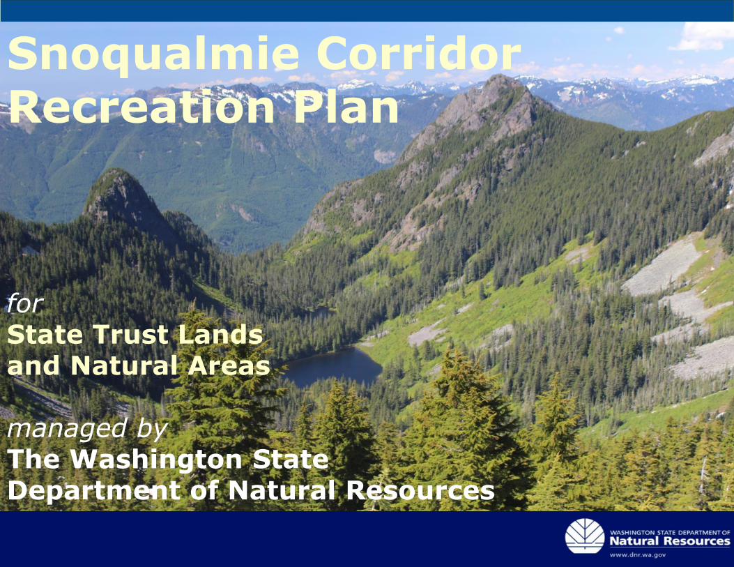
Snoqualmie Corridor Recreation Plan
forState Trust Lands and Natural Areas
managed byThe Washington State Department of Natural Resources
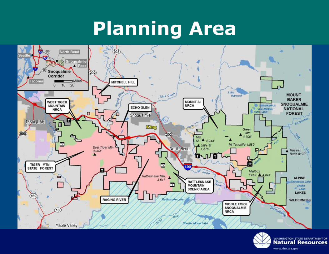
Planning Area
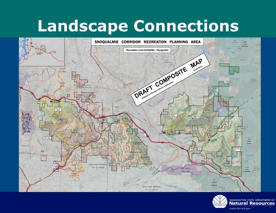
Landscape Connections
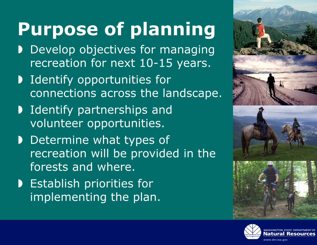
Purpose of planning Develop objectives for managing
recreation for next 10-15 years.
Identify opportunities for connections across the landscape.
Identify partnerships and volunteer opportunities.
Determine what types of recreation will be provided in the forests and where.
Establish priorities for implementing the plan.
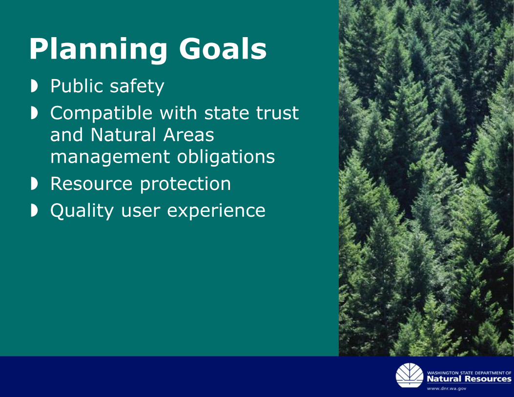
Planning Goals Public safety
Compatible with state trust and Natural Areas management obligations
Resource protection
Quality user experience
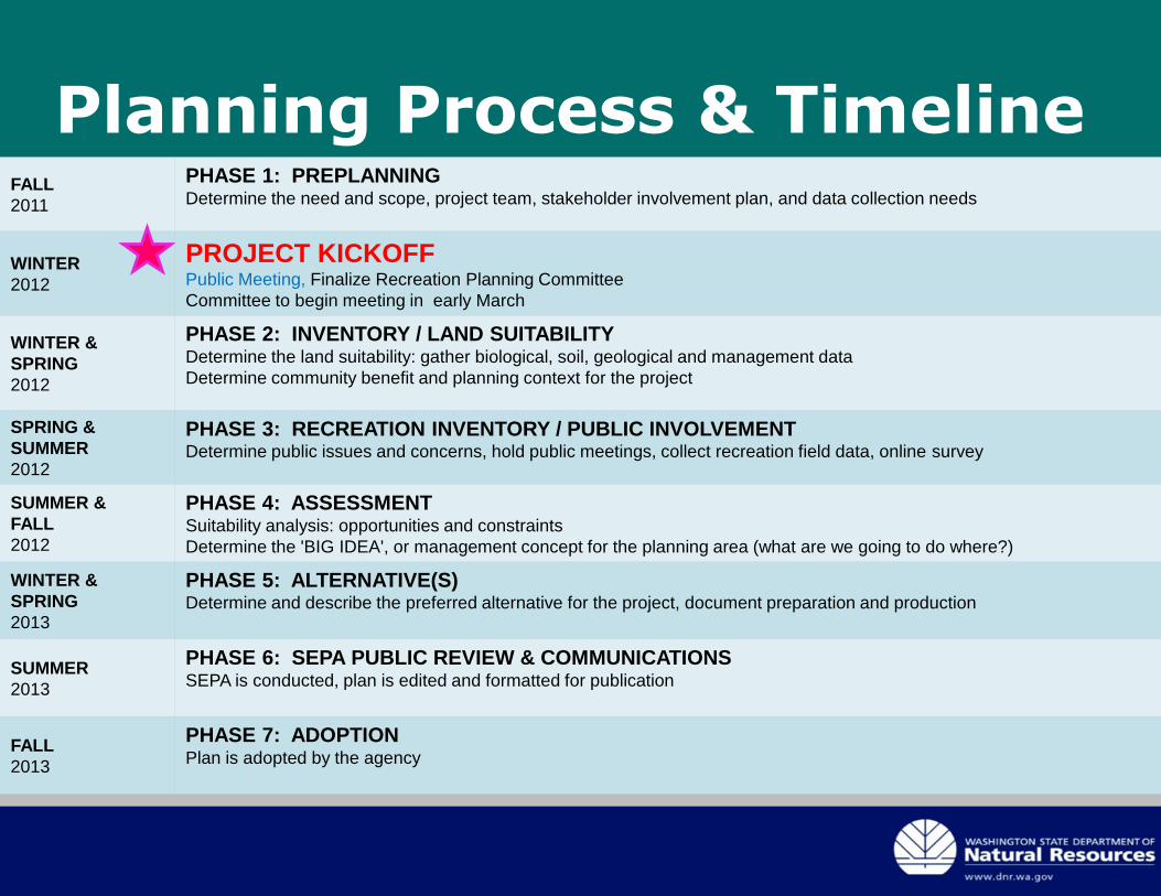
Planning Process & TimelineFALL
2011
PHASE 1: PREPLANNINGDetermine the need and scope, project team, stakeholder involvement plan, and data collection needs
WINTER
2012
PROJECT KICKOFFPublic Meeting, Finalize Recreation Planning Committee
Committee to begin meeting in early March
WINTER &
SPRING
2012
PHASE 2: INVENTORY / LAND SUITABILITYDetermine the land suitability: gather biological, soil, geological and management data
Determine community benefit and planning context for the project
SPRING &
SUMMER
2012
PHASE 3: RECREATION INVENTORY / PUBLIC INVOLVEMENTDetermine public issues and concerns, hold public meetings, collect recreation field data, online survey
SUMMER &
FALL
2012
PHASE 4: ASSESSMENTSuitability analysis: opportunities and constraints
Determine the 'BIG IDEA', or management concept for the planning area (what are we going to do where?)
WINTER &
SPRING
2013
PHASE 5: ALTERNATIVE(S)Determine and describe the preferred alternative for the project, document preparation and production
SUMMER
2013
PHASE 6: SEPA PUBLIC REVIEW & COMMUNICATIONSSEPA is conducted, plan is edited and formatted for publication
FALL
2013
PHASE 7: ADOPTIONPlan is adopted by the agency
Public Meeting: Listening Stations
Two photos here
Or one big photo here
Station 1. Landscape
Connections
• What opportunities are there to connect
trails between DNR-managed lands,
communities, and local, state and federal
lands?
Station 2: Middle Fork
Snoqualmie and Mt. Si
NRCA
• What do you enjoy about
recreation in this area?
• What is your favorite place to
visit?
• What is missing from your
experience in this area?
• Do you have concerns about the
future recreation management of
this area?
Station 3: Raging River
State Forest
• What recreational
opportunities would you like to
see?
• Do you have concerns about
the future management of this
area?
Station 4: Trust lands:
surrounding the
community of Preston
• What recreational
opportunities would you like
to see?
• What is your favorite place
to visit?
• What is missing from your
experience in this area?
• Do you have concerns
about the future recreation
management of this area?
Station 5. Questions and Issues
we might have missed?
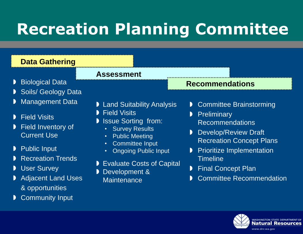
Recreation Planning Committee
Biological Data
Soils/ Geology Data
Management Data
Field Visits
Field Inventory of
Current Use
Public Input
Recreation Trends
User Survey
Adjacent Land Uses
& opportunities
Community Input
Land Suitability Analysis
Field Visits
Issue Sorting from:• Survey Results
• Public Meeting
• Committee Input
• Ongoing Public Input
Evaluate Costs of Capital
Development &
Maintenance
Committee Brainstorming
Preliminary
Recommendations
Develop/Review Draft
Recreation Concept Plans
Prioritize Implementation
Timeline
Final Concept Plan
Committee Recommendation
Data Gathering
Assessment
Recommendations
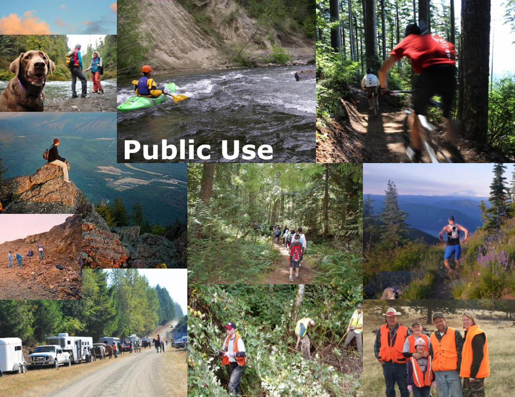
Public Use
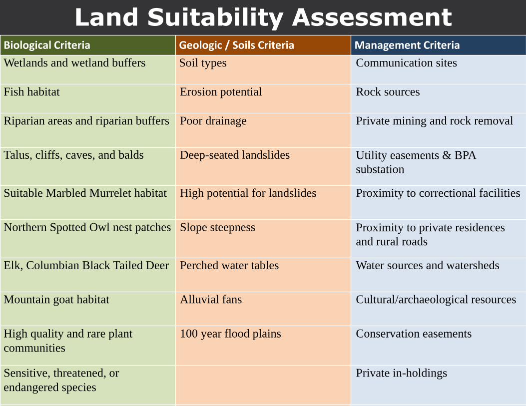
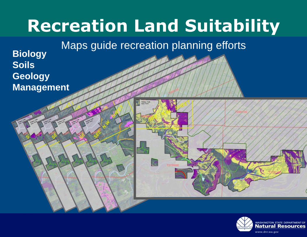
Land Suitability AssessmentBiological Criteria Geologic / Soils Criteria Management Criteria
Wetlands and wetland buffers Soil types Communication sites
Fish habitat Erosion potential Rock sources
Riparian areas and riparian buffers Poor drainage Private mining and rock removal
Talus, cliffs, caves, and balds Deep-seated landslides Utility easements & BPA
substation
Suitable Marbled Murrelet habitat High potential for landslides Proximity to correctional facilities
Northern Spotted Owl nest patches Slope steepness Proximity to private residences
and rural roads
Elk, Columbian Black Tailed Deer Perched water tables Water sources and watersheds
Mountain goat habitat Alluvial fans Cultural/archaeological resources
High quality and rare plant
communities
100 year flood plains Conservation easements
Sensitive, threatened, or
endangered species
Private in-holdings
Adjacent ownerships
io
Recreation Land SuitabilityMaps guide recreation planning efforts
Biology
Soils
Geology
Management
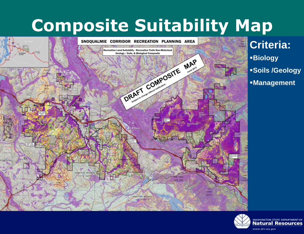
Composite Suitability MapCriteria:Biology
Soils /Geology
Management
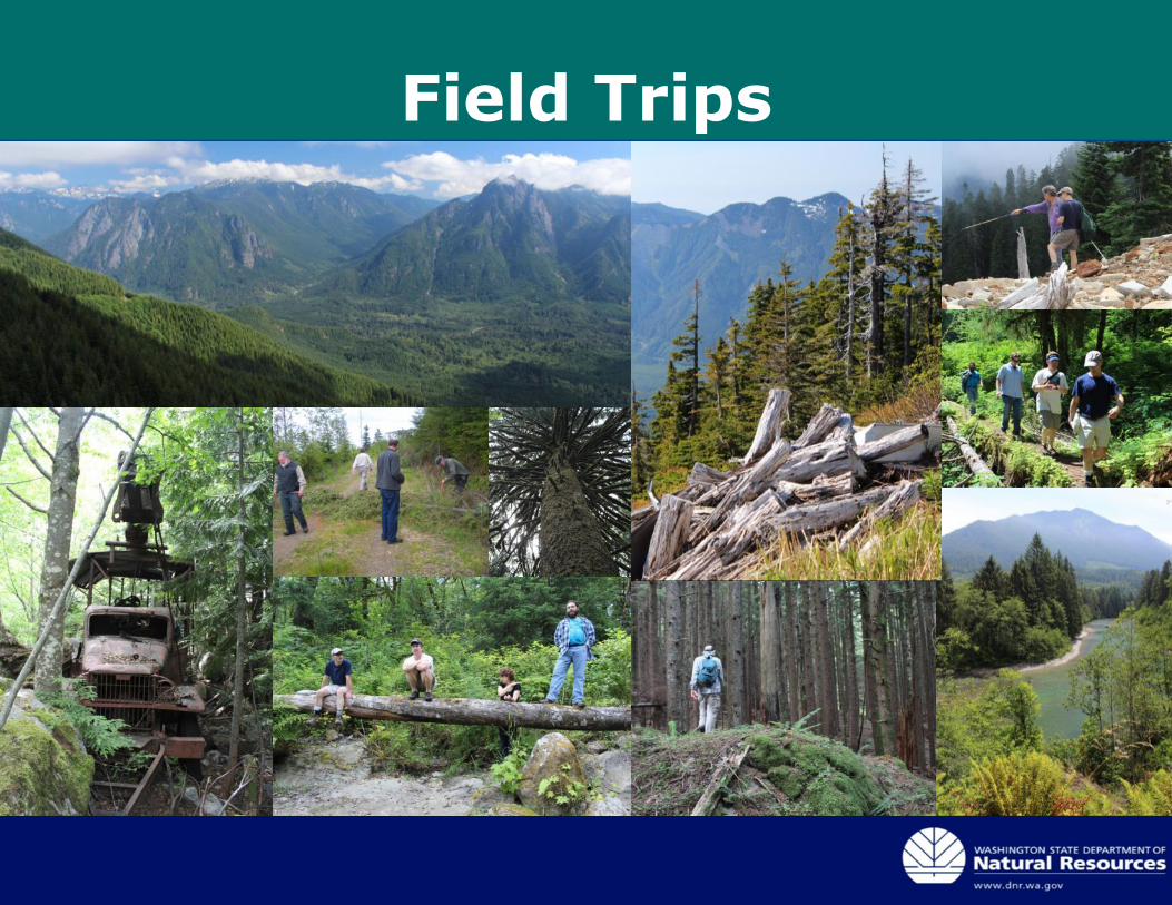
Field Trips
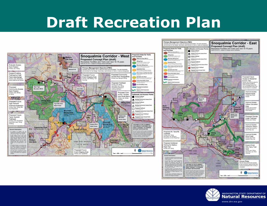
Draft Recreation Plan
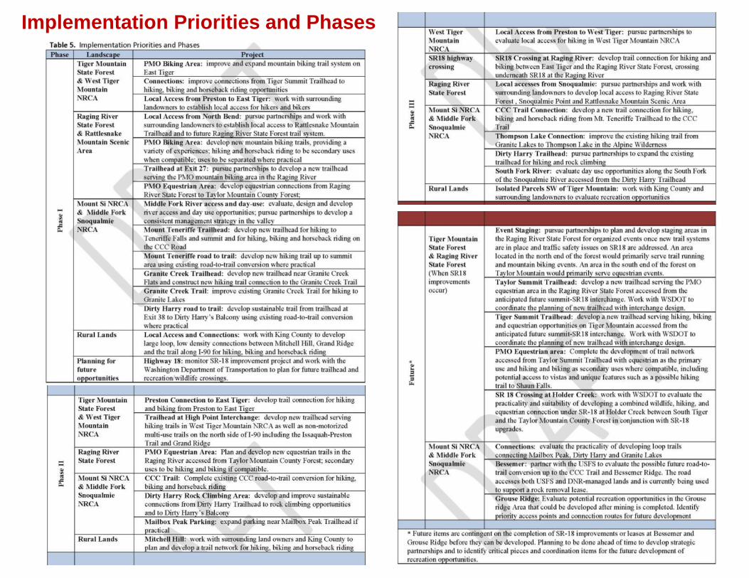
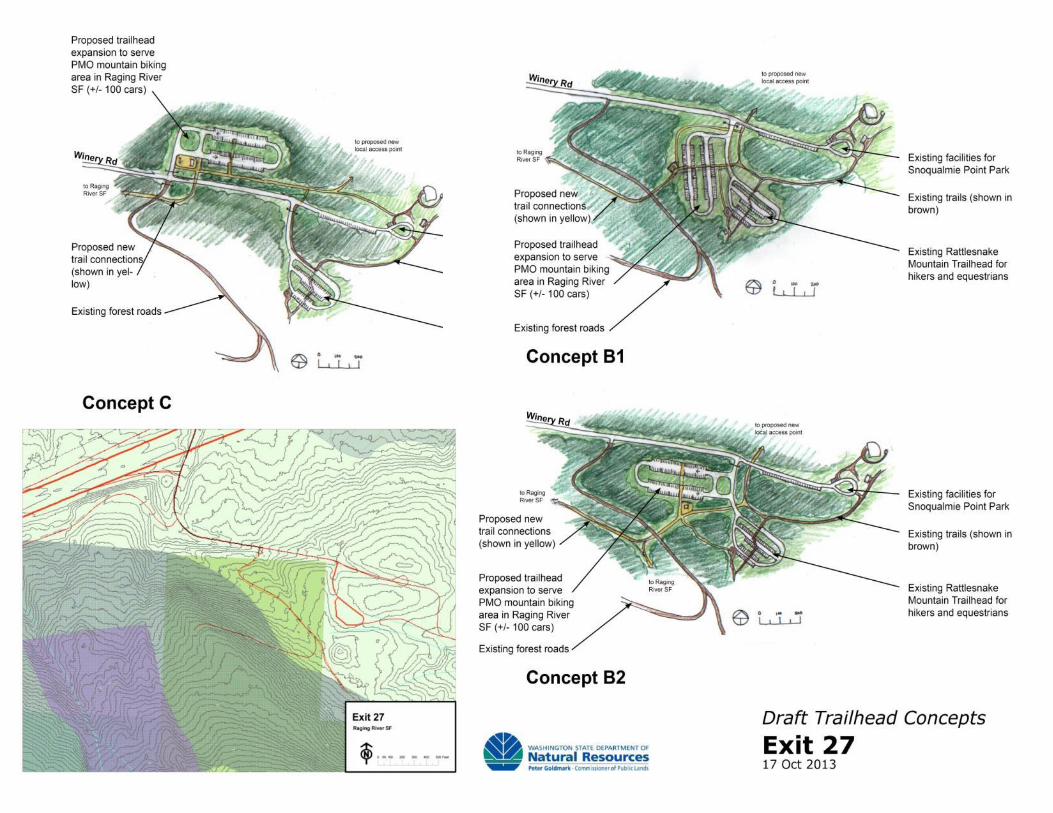
Implementation Priorities and Phases
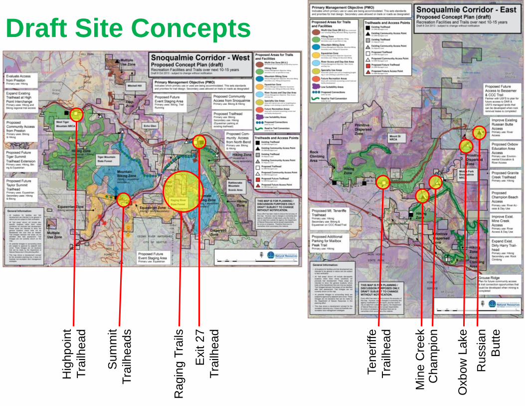
Hig
hpoin
t
Tra
ilhead
Exit 2
7
Tra
ilhead
Teneriffe
Tra
ilhead
Min
e C
ree
kC
ham
pio
n
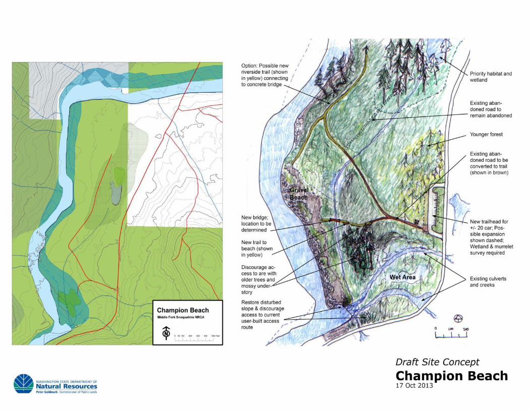
Oxbow
Lake
Ru
ssia
n
Butt
e
Draft Site Concepts
Ragin
g T
rails
Sum
mit
Tra
ilheads
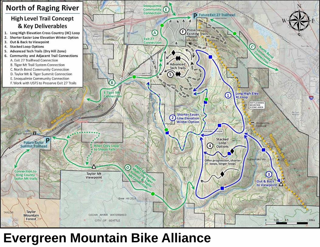
Evergreen Mountain Bike Alliance
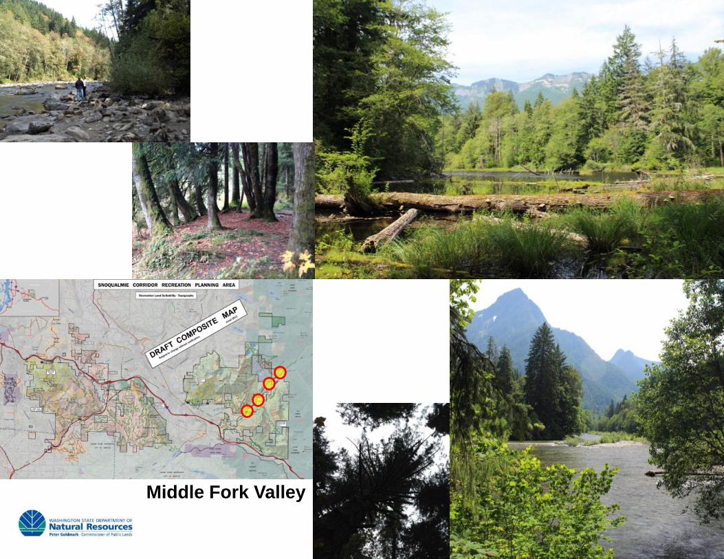
Middle Fork Valley
conservation
recreation
volunteeringeducation
timber
restoration
research
culture