somerset west and taunton local plan 2040 · 2020-02-02 · 3 a new council, a new local plan the...
TRANSCRIPT
1
Somerset West and Taunton
LOCAL PLAN 2040Issues and Options Document Consultation Document
January 2020

2
Contents
1 Introduction ...................................................................................................................... 3
2 Easy Read Summary ..................................................................................................... 8
3 About our area ...............................................................................................................10
4 Objectives ........................................................................................................................ 12
5 Issues and options ....................................................................................................... 13
5.1 Carbon neutrality ............................................................................................ 14
5.2 Sustainable locations .................................................................................... 17
5.3 Newandaffordablehomes ........................................................................23
5.4 A prosperous economy .................................................................................27
5.5 Infrastructure ....................................................................................................30
5.6 Connecting people .........................................................................................32
5.7 Thenaturalandhistoricenvironment ...................................................34
5.8 Thrivingcoastalandruralcommunities ...............................................37
5.9 Wellbeing of our residents .........................................................................39
5.10 Policies for our places: Taunton ................................................................ 41
5.11 Policies for our places: Wellington .........................................................45
5.12 Policiesforourplaces:TheCoastalStrip ............................................46
6 References ......................................................................................................................48
3
A New Council, a New Local PlanThe new Somerset West and Taunton Council came into being on Monday 1 April 2019 and combined the former West Somerset Council and Taunton Deane Borough Council into a brand new District council.
This is an exciting time for our area and we are keen to keep up momentum and progress with a new Local Plan. The Local Plan will set out the spatial strategy for where new development will be located over the next 20 years and set out our ambitions and aspirations for addressing issues affecting our area now and in the future.
This Issues and Options consultation documentThis document is the first consultation stage in the Local Plan process. It has some brief facts about our area (Section 3) and draft Local Plan Objectives (Section 4). Section 5 sets out the key issues for the Local Plan and suggests ways in which we could address these and meet the Objectives through the Local Plan (otherwise known as ‘Options’). Options are where we have not decided on the best course of action (and may be awaiting further technical evidence) and would like to hear your views.
Section 5 also sets out additional policy approaches that we intend to take forward into the Local Plan to meet the relevant Objective. We don’t provide any alternative options to choose from for these approaches as we think these are the only reasonable things to do but we welcome views on these.
All the comments received before the consultation closes will be analysed and a summary report produced and published on our website. The responses will be carefully considered and used to help prepare the Draft Local Plan which will include detailed policy wording.
Section 1: Introduction
25
23
26
27
28
24
25
26
Williton
Minehead
Wiveliscombe
Bishops Lydeard
Taunton
Wellington
Watchet
Somerset West and Taunton Council
Somerset West and Council Local Plan area
Exmoor National Park

4
What about the existing Local Plan documents?Many of the policies and allocations for new development within our current Local Plan documents1 may still be relevant but it is important that we don’t just roll forward existing policies. We must review our spatial strategy and policies in the light of up-to-date evidence and guidance.
Combined, our existing Local Plan documents contain a large number of allocations for new housing and employment. We will use updated evidence on need and deliverability to determine whether all of these are appropriate to be retained or if further sites are required.
Once the new Local Plan is adopted, the current Local Plan documents will all be superseded. Neighbourhood Plans will remain in place.
Taunton Deane Borough Council Core Strategy 2011-28
Taunton Town Centre Area Action Plan (2008)
Site Allocations and Development Management Plan (2016)
Saved policies from the Taunton Deane Local Plan 2004
West Somerset Local Plan 2032
Saved policies from the West Somerset District Local Plan 2006
Replaced by:Somerset West and Taunton Local Plan 2040
Sustainability Appraisal and Habitats Regulation AssessmentSustainability Appraisal (SA), incorporating Strategic Environmental Assessment (SEA), is an important process when producing a Local Plan and is required by law2. The SA process makes sure that the Local Plan considers improvements in environmental, social and economic matters and minimises any potential negative effects of the Local Plan. The first stage is the Scoping Report3 which identifies issues and objectives which the Local Plan will be judged against. Natural England, Historic England and the Environment Agency were all consulted on this.
It is also required by law4 for us to consider the impacts of the Local Plan on European designated sites including Special Areas of Conservation, Special Protection Areas and Ramsar sites of which there are a number within or close to our area. This process is called the Habitat Regulation Assessment (HRA).
EvidenceLocal Plan policies must be justified with up-to-date evidence. Evidence could be in the form of data, information or technical reports by experts. We will need to gather some new evidence to develop our new Local Plan policies.

5
The Council’s Corporate Strategy and other strategiesThe Corporate Strategy sets out the high-level priorities for the Council. The two themes relevant to the Local Plan are:
• A low-carbon, clean, green and prosperous district that attracts high quality employment opportunities and encourages healthy lifestyles.
• A district which offers a choice of good quality homes for our residents, whatever their age and income, in communities where support is available for those who need it.
Other Council strategies are also relevant to the Local Plan including the Taunton Garden Town Vision, the Carbon Neutrality & Climate Resilience Plan, Waterways Strategy, Health and Wellbeing Action Plan, Taunton Transport Strategy, Taunton Cultural Strategy and the Equalities Action Plan.
Other local strategies include the Blackdown Hills AONB Management Plan 2019-24, the Quantock Hills AONB Management Plan 2019-24, the Exmoor National Park Local Plan 2031, Somerset’s Future Transport Plan 2011–2026 and the forthcoming Somerset Housing Strategy and Somerset Climate Emergency Strategy.
Carbon neutrality by 2030We have joined many other local authorities across the UK in declaring a climate emergency and we have committed to working towards making the Council and district as a whole carbon neutral by 2030. ‘Carbon Neutrality’ means balancing a measured amount of carbon released with an equivalent
amount absorbed, removed or offset. This would achieve ‘net-zero carbon emissions’.
The emerging Carbon Neutrality and Climate Resilience Plan responds to the IPCC report5 to set out our actions to deliver or support the carbon neutrality target.
The Local Plan plays a key role in mitigating and adapting to the climate emergency and we are also legally required to make sure that development and use of land contributes to the mitigation of, and adaptation to, climate change6.
The new Local Plan will have mitigation of and adaptation to the climate emergency at its heart and these measures will not be viewed as an optional extra or “nice to have”. The Local Plan will look to push the boundaries of planning policy to deliver Carbon Neutrality.
National Planning Policy FrameworkThe National Planning Policy Framework7 sets out the government’s planning policies for England and how these should be applied. Local Plans must be in line with the NPPF.
The Local Plan will cover many issues such as the climate emergency and flood risk; the location and design of development; transport and infrastructure needs; new homes, businesses, shops, leisure and community facilities; the protection and enhancement of our heritage, landscapes, local character and improving biodiversity.

6
What Happens Next?This Issues and Options document is part of Stage 1. All the comments received before the consultation closes will be analysed and a summary report produced and published on our website. The responses will be carefully considered and, along with technical evidence, will to help prepare the draft Local Plan (Stage 2).
We are here Jul-Sep 2020 Oct-Dec 2020 Apr-Jun 2021 Sep-Dec 2021
Stage 1 Stage 2 Stage 3 Stage 4 Stage 5
Evidence gathering (Reg 18)
Draft Plan (Reg 19)
Submission Plan Planning Inspector’s hearings
Plan is adopted
Includes the consultation on this Issues and Options document (Jan-Feb 2020), draft Sustainability Appraisal of alternatives, Habitat Regulation Assessment production of technical evidence.
Consultation on policies and potential development locations informed by earlier consultation.
Plan submitted to the Secretary of State.
An independent Planning Inspector examines the plan, evidence and comments made. The Inspector holds hearing sessions to discuss the ‘soundness’ of the plan.
The plan is adopted and is used to inform local planning policy and decisions on planning applications.
7
Step One: Read the information
Ifyouhavejust15minutestospare...Read our Easy Read Summary on the next page.
Ifyouhavemoretime...Read the whole document or the sections that interest you. There are also Topic Paper on some matters.
You can also read the Sustainability Appraisal and Habitat Regulation Assessment which we are also consulting upon.
If you want to suggest a site......for development for housing, gypsy and traveller pitches, employment, community uses, renewable energy or other uses.
Respond via our ongoing Call for Sites forms https://www.somersetwestandtaunton.gov.uk/planning-policy/propose-a-site-for-development/
Sites already submitted for inclusion in our annual Strategic Housing Land Availability Assessment do not need to be re-submitted but we request up to date evidence on the deliverability of the site if available.
Step Two: Respond to the questions
Visit our Online Consultation Portal where we have a quick questionnaire and a longer questionnaire. yoursay.somersetwestandtaunton.gov.uk
Although we prefer you to use the Online Consultation Portal if you have access to the internet you can email us at [email protected]. By visiting the online portal you can give permission for us to keep you up-to-date with later stages of the Local Plan and we can assess your comments more efficiently.
Fill in a paper comment form Contact the Strategy Team on [email protected] or 0300 304 8000 for a paper comment form, You can also drop into Deane House, Belvedere Road, Taunton, TA1 1HE or West Somerset House, Killick Way, Williton TA4 4QA and collect one.
Come and see us at one of our consultation events somersetwestandtaunton.gov.uk/localplan
Be sure to respond between Monday 13 JanuaryandMonday16March2020.
Join our conversations on social media
How to get involved

8
What is a Local Plan?A Local Plan sets out how many new homes we need and where new homes and jobs will go. It says how buildings should be designed. It sets out how our places will be improved and protected.
What are we asking for comments on?This is the first chance to tell us what you think about the Local Plan. We want to know if you agree with our plans.
Sometimes we are not sure what is best to do and need more information. We have set out choices for what we could do.
How can I find out more?The rest of this document has more detail. It sets out where we have choices to make (Options). Section 5 is split into subject areas. You can choose to read about what interests you. Find out how to comment on the next page.
I don’t have time to read the full document. Can you quickly tell me what you are proposing for the Local Plan?
ClimateChangeandtheEnvironmentClimate change means we will have hotter and wetter weather. Flooding will be more common. Wildlife will struggle to adapt.We must make sure that new homes don’t use much energy.
We should produce power such as from solar panels. We want to find places for green energy farms and places to plant trees. We want to help farmers adapt their methods to improve the soil and help wildlife.
HomesWe must decide how many homes we need over the next 20 years. We must make sure there are enough housing sites. We will set out the types of homes that we need such as affordable homes and lifetime homes.
Section 2: Easy Read Summary

9
Affordable housing is very important to the Council. We also want to find ways to help people build their own homes. We will set out the space that homes should have so that they are not too small.
We will set out where new housing should go. Most new homes will be on the edge of Taunton. These new homes are already part of Taunton’s Garden Town plans. Some homes will be in other places. It is very important to build most homes close to places of work and services. This will mean more people can walk, cycle or use the bus.
JobsWe want to attract new businesses to our area. We also want to help current businesses expand. It is difficult to get young people to stay in or move to our area. This makes it difficult for businesses to grow.
We want to grow the number of high-value jobs. These will help keep young people in our area. We would keep the best employment sites to draw in new businesses. We could use poorer sites for other uses.
CommunitiesWe want our places to help us be healthy and active. We have a high number of older people in our area. People should be able to move around easily and safely whatever their ability.
We will make sure that new places have the things that people need. We want to help people can be as active as possible. Open spaces help our well-being.
InfrastructureMore people living and working here puts pressure on GPs, schools and transport. Developers must give money or buildings to ease this pressure. But we cannot ask for too much or homes will not get built. We also need affordable housing. We need to decide what is most important from all the things we need.
10
Section 3: About our area
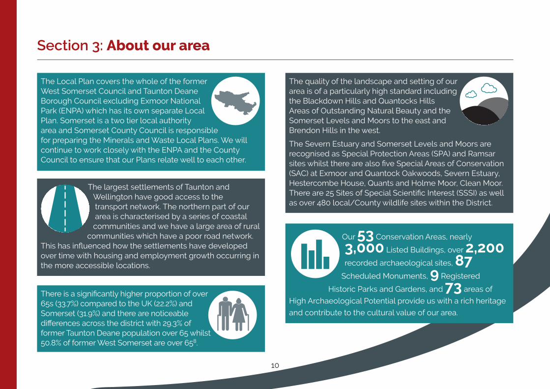
The largest settlements of Taunton and Wellington have good access to the transport network. The northern part of our area is characterised by a series of coastal communities and we have a large area of rural
communities which have a poor road network. This has influenced how the settlements have developed over time with housing and employment growth occurring in the more accessible locations.
The quality of the landscape and setting of our area is of a particularly high standard including the Blackdown Hills and Quantocks Hills Areas of Outstanding Natural Beauty and the Somerset Levels and Moors to the east and Brendon Hills in the west.
The Severn Estuary and Somerset Levels and Moors are recognised as Special Protection Areas (SPA) and Ramsar sites whilst there are also five Special Areas of Conservation (SAC) at Exmoor and Quantock Oakwoods, Severn Estuary, Hestercombe House, Quants and Holme Moor, Clean Moor. There are 25 Sites of Special Scientific Interest (SSSI) as well as over 480 local/County wildlife sites within the District.
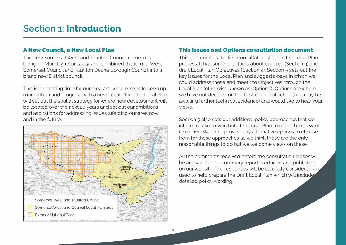
The Local Plan covers the whole of the former West Somerset Council and Taunton Deane Borough Council excluding Exmoor National Park (ENPA) which has its own separate Local Plan. Somerset is a two tier local authority area and Somerset County Council is responsible for preparing the Minerals and Waste Local Plans. We will continue to work closely with the ENPA and the County Council to ensure that our Plans relate well to each other.
Our 53 Conservation Areas, nearly
3,000 Listed Buildings, over 2,200
recorded archaeological sites, 87
Scheduled Monuments, 9 Registered
Historic Parks and Gardens, and 73 areas of
High Archaeological Potential provide us with a rich heritage
and contribute to the cultural value of our area.
There is a significantly higher proportion of over 65s (33.7%) compared to the UK (22.2%) and Somerset (31.9%) and there are noticeable differences across the district with 29.3% of former Taunton Deane population over 65 whilst 50.8% of former West Somerset are over 658.

11
The ratio of house prices to earnings is one measure of how affordable it is to buy a property. ‘Lower quartile’ price provides an indication of the entry level house price in
a local market, typically those purchased by first-time buyers. In 2018, there was a lower
quartile house price to earnings ratio9 of 9.87 in former West Somerset and 8.55 in former Taunton Deane. With mortgage lenders capping the ratio at 4.5 times10, this shows how challenging it is to buy a home in this area.
Unemployment in Somerset West and
Taunton is 3.2% which is below
the Great Britain average of 4.2%11.
Unemployment is low in both the former Taunton Deane (3.8%) and West Somerset (3%) areas over the plan period. Estimate for 2016 indicate that unemployment in both districts is below the national (4.89%) and regional rates (3.9%).
Along the coast there are areas vulnerable to sea flooding between Blue Anchor and Minehead. There is also a risk of river flooding across the District particularly from the Rivers Tone, Exe, Parrett and tributaries and a risk of extensive flooding in the Somerset Levels and
Moors and these risks are projected to increase with climate change.
Lambrook, Halcon and Lyngford in Taunton
are within the 10% most deprived areas of the UK12.

12
These are our proposed Objectives which will set the framework for the Local Plan policies.
Objective 1 ToensureallnewdevelopmentworkstowardstheDistrict’s“carbonneutralityby2030”target
Objective 2 ToenhancetheroleofTauntontowncentreinthesub-regionandtostrengthenthefunction,vitalityandself-containmentofallourtowns
Objective 3 Toprovideasufficientandvariedsupplyofhighqualityandaffordablehomestomeettheneedsofallsections of our communities
Objective 4 Tocreateaprosperous,resilientandentrepreneurialeconomyensuringcompetitivenessacrossthewidersub-regionandattractingthemosttalentedworkerstotheDistrict
Objective 5 Toensurethatnewdevelopmentissupportedbyessentialinfrastructureinatimelymanner
Objective 6 Toachieveamajorchangeintravelbehaviourtowardswalking,cyclingandpublictransportandtoreducetheneedtotravel
Objective 7 Toprotectandenhancetheenvironmental,historic,economicandwellbeingvalueoftheDistrict’sdistinctivelandscapesbiodiversityandlocalcharacter.
Objective 8 Toboosttourism,economicdevelopment,agriculturaltransformationanddelivermoreaffordablehomesinour rural and coastal communities
Objective 9 Toimprovewellbeing,inclusivityandareductionininequalitiesenablingindependenceandfacilitatingsocial interaction
Objectives question: Do you agree that these are the right Objectives for the Local Plan?
Section 4: Objectives

13
Section 5: Issues and options
This section sets out what we consider to be key issues for our Local Plan that relate to an objective. It focusses on the matters where we need your input to help us agree a way forward.
The sub-sections are generally set out in this format:
5.1.1 Key issue for our Local Plan
An Option box that relates to that issue and a question. We want to hear from you about which of the options you prefer. This will help us decide the policy that will go in the Local Plan.
A list of additionalpolicyapproaches relating back to the Objective. These are policy approaches that we intend to include in the Local Plan. We ask a question about whether you agree with these.
14
5.1 Carbon neutrality
Objective1-ToensureallnewdevelopmentworkstowardstheDistrict’s“carbonneutralityby2030”target
5.1.1 Issue: AchievingcarbonreductionfromnewdevelopmentTo achieve carbon neutrality (see page 5), we must achieve minimum fabric energy efficient standards measures and use low and zero carbon technologies to limit on site built emissions particularly as the Government has a target of no new gas connections after 2025.
The Government is consulting on proposals to increase the energy efficiency requirements to future-proof homes with low carbon heating and world-leading levels of energy efficiency to be introduced by 202513. Before any changes come in, it is crucial that the Local Plan policy requires carbon reduction from new development above and beyond the current minimums set out in Building Regulations14.
The policy would set a carbon reduction requirement expressed as a series of percentage reduction improvements over Building Regulations progressing towards zero carbon. The policy would be flexible as to how this could be achieved as different approaches might suit different contexts and we would not want to stifle innovation.
We need to decide at what date we will require all new developments to be zero carbon. This is a balance between
the need for urgent action, the need for new homes to address the housing crisis, and the priority for other infrastructure and policy requirements in assessing viability of development. In exceptional circumstances, the Local Plan could also consider the use of carbon offsetting financial contributions if a development can’t meet the requirements, but this should be a last resort.
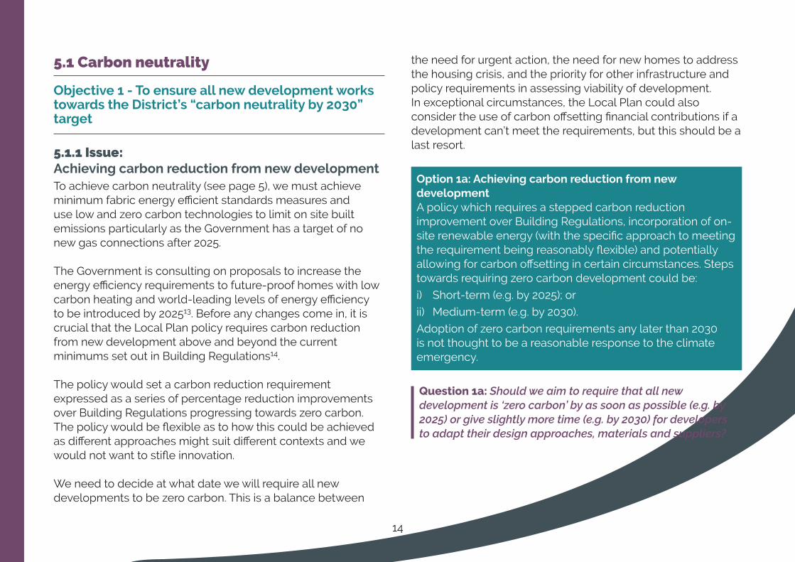
Option1a:AchievingcarbonreductionfromnewdevelopmentA policy which requires a stepped carbon reduction improvement over Building Regulations, incorporation of on-site renewable energy (with the specific approach to meeting the requirement being reasonably flexible) and potentially allowing for carbon offsetting in certain circumstances. Steps towards requiring zero carbon development could be:
i) Short-term (e.g. by 2025); or
ii) Medium-term (e.g. by 2030).
Adoption of zero carbon requirements any later than 2030 is not thought to be a reasonable response to the climate emergency.
Question 1a: Should we aim to require that all new development is ‘zero carbon’ by as soon as possible (e.g. by 2025) or give slightly more time (e.g. by 2030) for developers to adapt their design approaches, materials and suppliers?

15
5.1.2 Issue: Delivering low carbon and renewable energy infrastructureIt is essential that our energy sector moves from fossil fuels such as coal to low carbon and renewable technologies. Wind farms on land are the best value for money per tonne of carbon saved, and the cost of solar PV panels has reduced significantly in the last few years. The Local Plan will set a positive and proactive policy position encouraging low carbon and renewable energy generating infrastructure. This could take the form of a simple, criteria-based policy that sets out the circumstances when such developments would be acceptable.
To achieve the target of carbon neutrality by 2030, the Council will need to set a policy framework that encourages the maximum capacity of generation possible so we are considering whether it is best to directly allocate sites or simply indicate suitable areas for such developments.
Option 1b: Delivering low carbon and renewable energy infrastructure
Include a policy that will encourage and support new low carbon and renewable energy infrastructure developments in line with specific criteria and also:
Option i) Allocate specific sites; or
Option ii) Identify suitable areas for development of such infrastructure through criteria based policies
Question 1b: Should we allocate sites for specific renewable energy development or identify broad areas which we consider suitable?

16
WeproposetheseadditionalpolicyapproachestomeetObjective1:
1c/1 Set a target to achieve carbon neutrality across the district by 2030 and require developments to consider and demonstrate their impact on the district achieving this target (this policy is in addition to carbon reduction design requirements placed on new development – Option 1a).
1c/2 Require the integration of sustainable, adaptable and resilient design into new developments to ensure they are future-proofed, requiring cabling ready for the installation of electric vehicle charging or electric vehicle chargers in all new residential parking spaces.
1c/3 Encourage and enable the sustainable retrofit of existing buildings and communities.
1c/4 Support community de-centralised renewable energy schemes and micro-generation.
1c/5 Protect best and most versatile agricultural land and sets criteria as to when it is acceptable for its loss, protect soil quality and require mitigation from developments to avoid detrimental impacts.
1c/6 Allow for and facilitate rural diversification where it will enable farmers to change practices and deliver ecosystem services.
1c/7 Maximise the efficiency and convenience of recycling with a policy ensuring good accessibility for waste/recycling vehicles in new developments and the good design of waste and recycling facilities for homes.
Question 1c: Do you have any comments on these policy approaches?

17
5.2 Sustainable locations
Objective2-ToenhancetheroleofTauntontowncentreinthesub-regionandtostrengthenthefunction,vitalityandself-containmentofallourtowns
5.2.1 Issue: ThesettlementtiersAn important part of the Local Plan in responding to the climate emergency and meeting our Carbon Neutrality target by 2030 is our settlement strategy – this is where new development will be located. To mitigate the effects of climate change it is essential that new development is directed to the most sustainable locations that maximise accessibility by sustainable modes of transport, minimise the need to travel, is close to jobs and services, is focussed on brownfield land as much as possible and away from areas of flood risk.
New development should put people rather than vehicles at its heart. It should facilitate easy access to day-to-day services and be designed to prioritise walking, cycling, and the use of public transport to provide real choices for everyone. Development in sustainable locations drives up the viability of public transport services to those locations, creating the opportunity to further improve services and living conditions. Transport considerations need to be fundamental to the Local Plan process and not retrofitted later.
Our two former district areas have their own separate settlement strategies for the location of new development. The challenge for the Local Plan is to develop a new coherent sustainable strategy covering the whole Local Plan area.
There are a large number of housing commitments (planning permissions) in our area which give an existing pattern of new development or ‘direction of travel’ particularly a commitment to deliver Garden Town communities at Monkton Heathfield, Comeytrowe and Staplegrove and associated infrastructure at Taunton.This existing strategy of focussing development at our largest town is sustainable and appropriate to our Local Plan and Corporate Plan objectives. Taunton has the most comprehensive bus network in our area and a rail station. It is the home of major employers, education and health facilities and services. For these reasons we will continue to focus most development at Taunton.
The level of settlements beneath Taunton has been reviewed as part of Topic Paper 115 (Table 8). This is a very high level assessment and is a ‘first draft’ to start the discussion. The position of settlements will be refined with further work.
18
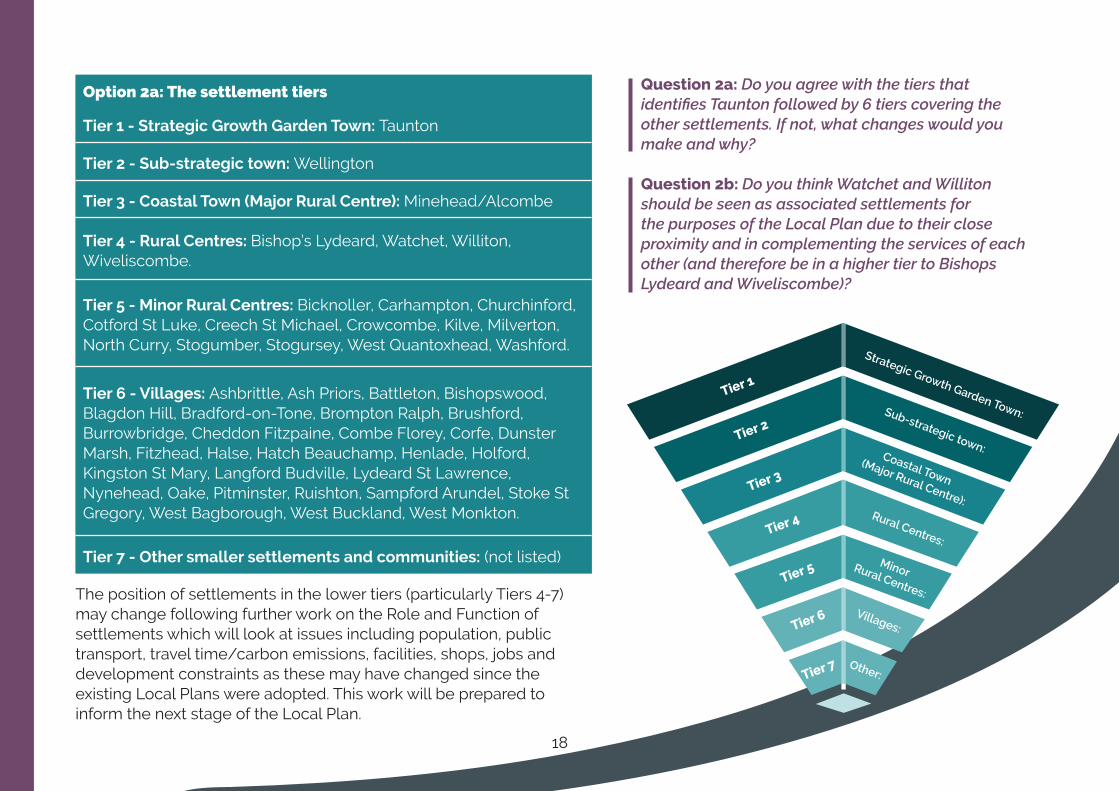
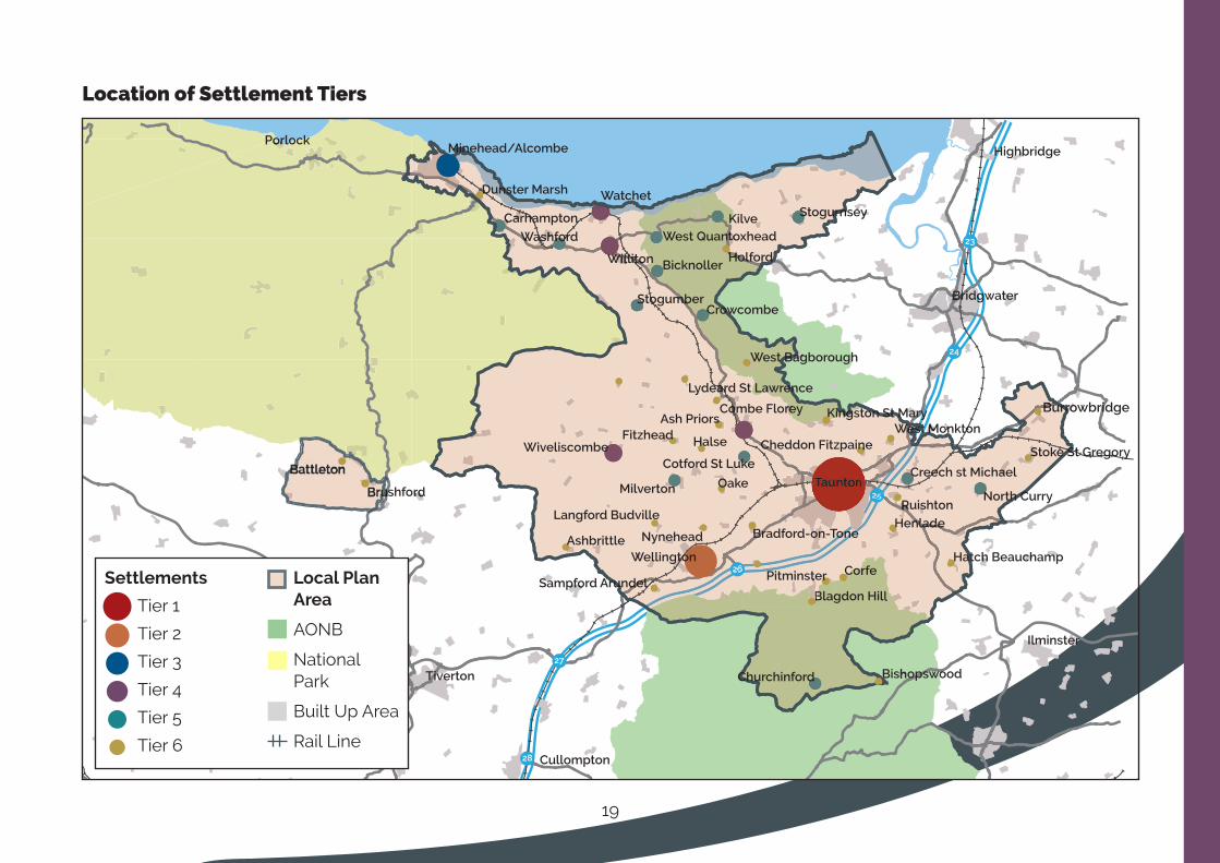
Option 2a: The settlement tiers
Tier1-StrategicGrowthGardenTown:Taunton
Tier2-Sub-strategictown:Wellington
Tier3-CoastalTown(MajorRuralCentre):Minehead/Alcombe
Tier4-RuralCentres:Bishop’s Lydeard, Watchet, Williton, Wiveliscombe.
Tier5-MinorRuralCentres:Bicknoller, Carhampton, Churchinford, Cotford St Luke, Creech St Michael, Crowcombe, Kilve, Milverton, North Curry, Stogumber, Stogursey, West Quantoxhead, Washford.
Tier6-Villages:Ashbrittle, Ash Priors, Battleton, Bishopswood, Blagdon Hill, Bradford-on-Tone, Brompton Ralph, Brushford, Burrowbridge, Cheddon Fitzpaine, Combe Florey, Corfe, Dunster Marsh, Fitzhead, Halse, Hatch Beauchamp, Henlade, Holford, Kingston St Mary, Langford Budville, Lydeard St Lawrence, Nynehead, Oake, Pitminster, Ruishton, Sampford Arundel, Stoke St Gregory, West Bagborough, West Buckland, West Monkton.
Tier7-Othersmallersettlementsandcommunities: (not listed)
The position of settlements in the lower tiers (particularly Tiers 4-7) may change following further work on the Role and Function of settlements which will look at issues including population, public transport, travel time/carbon emissions, facilities, shops, jobs and development constraints as these may have changed since the existing Local Plans were adopted. This work will be prepared to inform the next stage of the Local Plan.
Question 2a: Do you agree with the tiers that identifies Taunton followed by 6 tiers covering the other settlements. If not, what changes would you make and why?
Question 2b: Do you think Watchet and Williton should be seen as associated settlements for the purposes of the Local Plan due to their close proximity and in complementing the services of each other (and therefore be in a higher tier to Bishops Lydeard and Wiveliscombe)?
Strategic Growth Garden Town:Sub-strategic town:Coastal Town
(Major Rural Centre):Rural Centres:
MinorRural Centres:
Villages:
Other:
Tier1
Tier2
Tier3
Tier4
Tier5
Tier6
Tier7
19
25
24
23
26
27
28
Settlements
Tier 1
Tier 2
Tier 3
Tier 4
Tier 5
Tier 6
Local Plan Area
AONB
National Park
Built Up Area
Rail Line
Location of Settlement Tiers

20
5.2.2 Issue: Thedistributionofhousing
We also need to decide how much new housing will be directed to each tier. At the moment we haven’t decided upon our final housing requirement figure (see section 5.3.1, Option 3a) as we are still gathering technical evidence (a Housing Needs Assessment) so we cannot yet precisely suggest the number of homes per tier.
What we can look at now is whether we should be doing anything different to our current Local Plans in terms of where we should focus housing particularly as we are trying to reduce the need to travel and encourage use of public transport, walking and cycling to jobs and services. Currently, the combined housing planned for in our current Local Plans is distributed in the following way:
DistributionofhousingincurrentLocalPlans
Villages (see Tier 6 list above)
Minor Rural Centres (see Tier 5 list above)
Bishop’s Lydeard, Watchet, Williton, Wiveliscombe
Minehead
Wellington
Taunton
Taunton
Wellington
Minehead
Bishop’s Lydeard, Watchet, Williton, Wiveliscombe
Minor Rural Centres (see Tier 5 list on page 18)
Villages (see Tier 6 list on page 18)
The pie chart shows the planned distribution of housing. The reality of where growth has come forward first has been on greenfield sites in Wellington and Rural Centres and Villages including Bishops Lydeard, Creech St Michael, Churchinford and North Curry. Part of this has been that these are all greenfield sites which had little constraints. Taunton delivery has been steady but has more constraints due to infrastructure and viability issues. Brownfield town centre sites have struggled due to the economic crisis in 2008 but progress is now happening on some key town centre sites.
Minehead, Watchet and Williton are not delivering as much housing as planned. We will need to look at why this is and what it means for the new Local Plan16.
Topic Paper 1 has looked at ways in which we could distribute housing with three out of eight options17 potentially compatible with the draft Local Plan objectives and sustainable development.
These are:
Topic Paper 1 Option B - Current Local Plan Strategies existing proportions of development;
Topic Paper 1 Option D - Taunton increase, Minor Rural Centres reduction. This retains some development to support the vibrancy of villages (Tier 6) but redistributes some housing from Tier 5 to Tier 1;
Topic Paper 1 Option E - Taunton and Wellington increase, Minehead and Rural centres reduction. This retains some development to support the vibrancy of Tiers 5 and 6 but redistributes housing from Tiers 3 and 4 to Tiers 1 and 2.
68.3%
13.1%
6.3%
8.1%
1.8%
2.4%

21
Importantly, the housing requirement figures in our current Local Plans are significantly higher than the new Standard Method figure required by the Government (Option 3a). This means that even if the proportion of housing development increases in any of the tiers, it is possible (depending on the outcome of Option 3a) that the number of homes directed to any of the tiers may still be fewer than the current Local Plan requirement.
Once we have refined the housing requirement figure we will be able to indicate the number of dwellings for each tier. There are many factors in deciding whether a place is suitable for development. We will look at characteristics and constraints of individual settlements which may limit their suitability for housing growth.
Option2c:Thedistributionofhousing
Some things to think about are:
i) Whether the current distribution (pie chart) is best for our area in terms of delivering sustainable development and responding to the climate emergency (i.e. is it where jobs, facilities and public transport are located);
ii) Whether Taunton, as the most sustainable place, should take a higher proportion of new housing so that smaller and less sustainable towns and villages receive a lower proportion but still maintain their vitality;
iii) Whether Taunton’s highway network (even with a major shift in travel behaviour to public transport, walking and cycling) is a constraint to new large scale housing development;
iv) Whether both Taunton and Wellington should take a higher proportion of new housing given that Wellington would become more sustainable if a rail station opens there;
v) Whether Watchet and Williton, being closer to major employment towns of Taunton and Bridgwater and close to Hinkley Point C, should be more of a focus for housing development than Minehead which is further away and more remote;
vi) Whether settlements closer to the M5 corridor should have a higher proportion of development (than those closer to the coast) due to their higher land values and ability to deliver new housing.
Question 2c: Do you think we should carry on with the way housing is currently distributed across our area (see pie chart) or should we be doing something different, such as one of the three options suggested above?
22
Site selection
As discussed in Section 5.3, we already have commitments (planning permission granted) of 6,177 dwellings and further sites identified as deliverable18 of 7,911 dwellings19 coming forward under the existing Local Plan policies including new Garden Neighbourhoods at Taunton (Monkton Heathfield, Comeytrowe and Staplegrove).
Further strategic housing allocations may not be required but this will depend on our final housing requirement figure which is yet to be determined.
Even though we have large numbers of housing allocated in the existing Local Plans, the sites should still be appraised to confirm whether allocations are still appropriate. The first stage of the assessments are part of the Sustainability Appraisal20 (SA) which considers the sites against environmental, economic and social criteria. The sites assessed came from the most recent Strategic Housing Land Availability Assessments21
(SHLAA).
For the next stage of the Local Plan, these sites will be looked at in terms of their suitability for development in relation to the settlement strategy that we decide to take forward (Section 5.2) and whether the site is likely to be delivered. At that stage we will also consider any new sites suggested to us through our ongoing ‘call for sites’22. This information will help create a map that sets out our pattern of development.
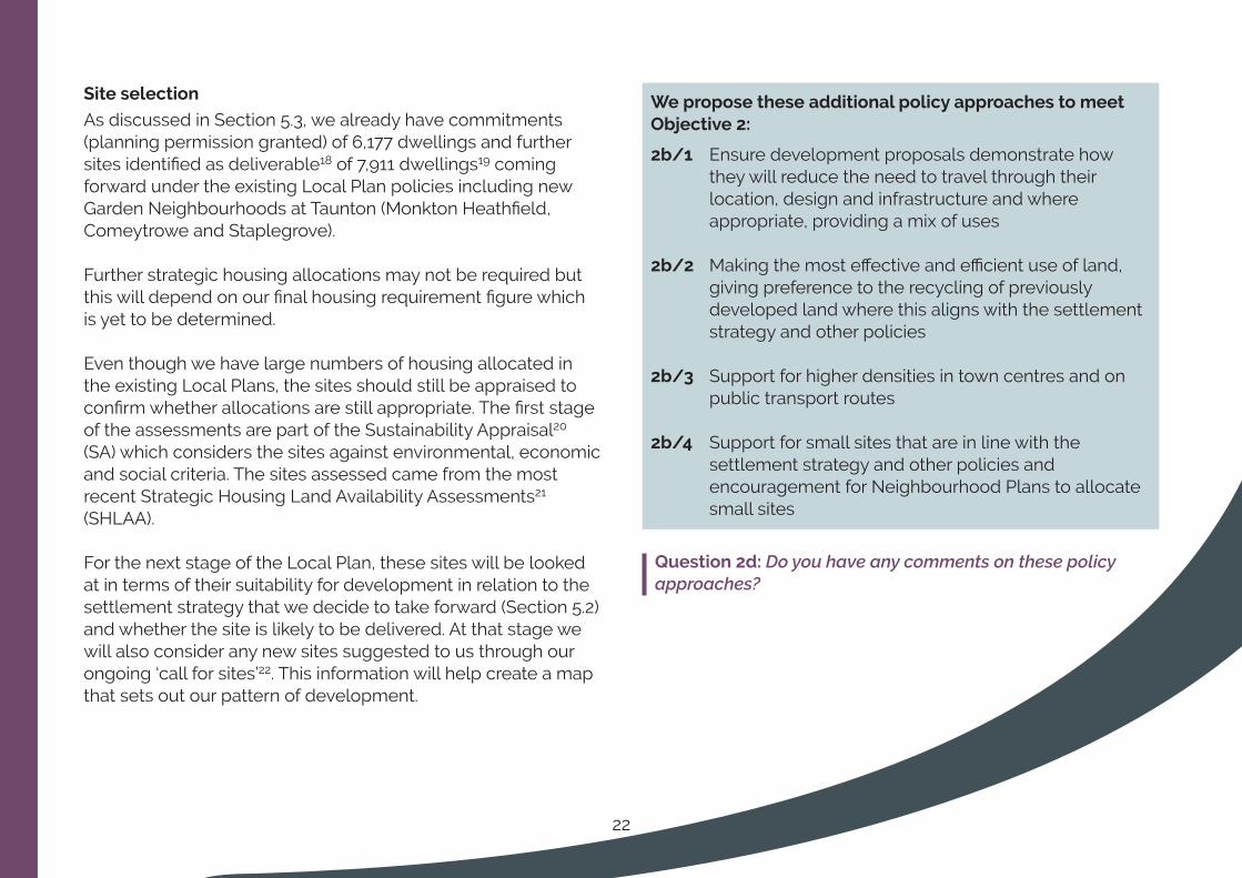
WeproposetheseadditionalpolicyapproachestomeetObjective 2:
2b/1 Ensure development proposals demonstrate how they will reduce the need to travel through their location, design and infrastructure and where appropriate, providing a mix of uses
2b/2 Making the most effective and efficient use of land, giving preference to the recycling of previously developed land where this aligns with the settlement strategy and other policies
2b/3 Support for higher densities in town centres and on public transport routes
2b/4 Support for small sites that are in line with the settlement strategy and other policies and encouragement for Neighbourhood Plans to allocate small sites
Question 2d: Do you have any comments on these policy approaches?

23
5.3 New and affordable homes
Objective3-Toprovideasufficientandvariedsupplyofhighqualityandaffordablehomestomeettheneedsofallsectionsofourcommunities
5.3.1 Issue: ProvidingtherightnumberofnewhomesThe Local Plan will have a housing requirement figure and must have pro-active policies to help deliver this amount of housing. The Government’s ‘Standard Method’ calculates our minimum figure which is 702 dwellings per year totalling 14,040 dwellings over 20 years.
To put this in context, we already have commitments (planning permission granted) of 6,177 dwellings and further sites identified as deliverable23 of 7,911 dwellings24 . These total 14,088 dwellings and with many further sites identified as developable2526 and small windfall sites continuing to come forward the housing supply in our area is very healthy and it is unlikely that any further significant allocations will need to be made if we use 702 as our annual requirement figure. We will check the suitability of known sites against the spatial strategy that we take forward (see Section 5.2.2).
We must decide if we should use this 702 figure or a higher figure. We will produce technical evidence to understand what the higher figure might be. Reasons for a higher figure could be:
• To deliver an economic growth strategy that needs more housing to support it (see Issue 5.4.1) to be informed by the Economic Development (Prosperity) Strategy;
• To support strategic infrastructure improvements;
• To deliver unmet need from neighbouring planning authorities (Exmoor National Park);
• Whether past higher housing delivery rates are justification for a higher target
AffordableHousing
Affordable housing includes social rented, affordable rented and intermediate housing. Affordable housing is a key priority for the Council, particularly social rented housing which helps those households in greatest need. Affordable housing is usually delivered by housebuilders as a legal requirement. The Local Plan will set out the percentage of new dwellings on a site that must be affordable. It is likely that we will set out the tenure requirement focussed on social rented affordable housing in a Supplementary Planning Document. We will investigate opportunities to deliver key worker housing. We will update our evidence of need and we will produce a Viability Assessment to make sure that the percentage and tenure of affordable housing we ask for does not make development unviable (see Section 5.5.1).

Option 3a: Providingtherightnumberofnewhomes
i) To reflect the Standard Method (minimum of 14,040 dwellings over 20 years 2020-40 or 702 dwellings per year); or
ii) To use a higher housing requirement figure with the precise figure to be determined following further work. To be informed by:
• Economic growth strategies;• The need to support strategic infrastructure
improvements;
• ▪The need to accommodate any unmet need from neighbouring planning authorities;
• ▪Existing delivery rates (existing Local Plan requirement is a minimum of 19,900 dwellings over 20 years 2020-40 or 995 dwellings per year);
Question 3a: Should our housing requirement figure match the Government’s minimum figure of 702 dwellings per year or should we have a higher figure?
5.3.2 Issue: ProvidingpitchesforGypsies,TravellersandTravellingShowpeopleGovernment guidance requires us to identify sites for pitches for at least 10 years-worth of need27, providing certainty for travellers, for the resident population and minimise unauthorised encampments. However, this is a significant challenge as it relies on landowners being willing to release land for pitches which, compared to general housing, has a much lower land value.
Option 3b: ProvidingpitchesforGypsies,TravellersandTravellingShowpeople
i) Apply rural exceptions criteria for small scale residential sites where pitches which would be affordable in perpetuity. and/or
ii) Require a proportion of development sites to provide an area for residential Traveller pitches; and/or
iii) Allocating sites specifically for pitches.
Question 3b: How should we proactively plan for Gypsy, Traveller and Travelling Showpeople pitches?
24

25
5.3.3 Issue:ProvidingaccessibleandlifetimehomesIn our area there is a high and growing proportion of older people28. Housing to suit the needs of older people could be as bungalows, or could be as homes which can be adapted to meet a change in people’s needs over their lifetime. Such housing should be in locations with good access to services and facilities.
With a higher than average proportion of people with a long-term health problem or disability that limits a person’s day to day activities29 there is a need for housing which has high accessibility standards, is adaptable or fully wheelchair accessible. The Local Plan can require a proportion of dwellings to meet any of these categories. Including these dwellings affects the viability of development so a balance will need to be taken against other requirements (see Section 5.5.1).
Option3c:Providingaccessibleandlifetimehomes
i) Do not require specific measures for adaptable, accessible and wheelchair homes
ii) Require a proportion of dwellings to meet the category standard as set out in Building Regulations Part M. The proportion would be determined through evidence of need and the forthcoming Viability Assessment.
Question 3c: Should we require all new housing developments to make sure that a percentage of the new homes are designed to be accessible, adaptable and wheelchair accessible?
5.3.4 Issue: Providingcustomself-buildplotsThe Government expects us to give suitable permission to enough plots of land to meet the demand for custom self build (CSB) and we are currently delivering enough sites to comply with this. We need to consider whether the Local Plan should be pro-active towards CSB. It is not affordable housing (by definition) in its own right but it could be a method of delivering affordable housing, typically as affordable low-cost market (intermediate) housing.
Option 3d: Providingcustomself-buildplots
i) A positive encouragement policy, including for community-led projects, and leave the housing market to deliver plots as and when demand arises; and/or
ii) Identify and allocate specific sites for self-build plots in locations related to where people want to live according to our self-build register; and/or
iii) Include a requirement for all housing development sites over a threshold to include a proportion of plots as self-build plots; and/or
iv) Allow self-build plots on Rural Exception sites provided that they are secured as affordable housing in perpetuity.
Question 3d: Should we allocate sites and/or make sure a percentage of housing developments are for self-built plots for people wanting to build their own homes? Should we allow self-build plots on Rural Exceptions sites provided that they are affordable?

26
WeproposetheseadditionalpolicyapproachestomeetObjective3:
3e/1 Requiring affordable housing on sites of 10 dwellings or more, or the site has an area of 0.5 hectares or greater (matching the Planning Practice Guidance)
3e/2 A percentage requirement of affordable housing on residential and mixed use sites with residential to be informed by a Viability Assessment and a balance of other developer contributions (See Section 5.5.1)
3e/3 A tenure mix requirement with the intermediate tenures limited to those evidenced as affordable in our area. Tenure mix to be informed by evidence of need and a Viability Assessment
3e/4 A housing size mix to reflect need in our area. A Supplementary Planning Document or Technical Advice Note could provide more detail
3e/5 Support for:
• ▪Specialist housing for older people in sustainable locations close to public transport, services and facilities which follows HAAPI (Housing our Ageing Population Panel for Innovation) principles of design
• ▪Affordable housing on Rural Exception sites
• ▪Permanent and temporary housing for rural workers
3e/6 Requiring internal space of dwellings to meet the Government’s space standards30
3e/7 Policy detail to guide development for outdoor space requirements; conversions, alterations and extension; ancillary accommodation; subdivision of dwellings and live/work units
Question 3e: Do you have any comments on these policy approaches?
27
5.4 A prosperous economy
Objective4-Tocreateaprosperous,resilientandentrepreneurial economy ensuring competitiveness acrossthewidersub-regionandattractingthemosttalentedworkerstotheDistrict
5.4.1 Issue: SettingastrategiceconomicgrowthtargetOur local economy is underpinned by jobs in public services; professional and other private services; tourism; wholesale and retail; and accommodation, food services and recreation. Construction will account for a larger percentage of jobs now that construction works at Hinkley Point C are under way.
For many years we have had high aspirations for attracting new businesses to the area but this has not been as successful as we hoped. The new Local Plan, along with the emerging Economic Development (Prosperity) Strategy will try to understand and address this issue.
The Heart of the South West Local Enterprise Partnership is seeking to double the size of the economy of the sub-region over 20 years31. This would be a high economic growth target and would require a significant increase in the number of jobs in our area. This may also require an increase in our housing target about the Standard Method (see Section 5.3.1).
However, we have a higher proportion of older people here compared to the national average, particularly nearer the coast.
Fewer young people makes it a challenge for businesses to attract the talent and workforce that they demand and may choose not to locate here. A lack of labour is likely to act as a constraint to growth meaning a high economic growth scenario may not be realistic for our area.
Our emerging Economic Development (Prosperity) Strategy will set local economic growth targets which recognise the constraints in our labour supply so it would be more realistic and deliverable. It will still be ambitious in driving up productivity but it would do this through improving the quality of the jobs on offer rather than a significant increase in the number of jobs and associate housing.
Clean energy and digital technology have been identified as knowledge sectors of the economy that our area might focus upon32. Development that supports the circular economy of eliminating waste and the continual use of resources is important in mitigating climate change and minimising plastic waste and its harm on our environment. Providing opportunities for these sectors will give our area the best chance of achieving a strategic economic target and meeting the wider objectives of the Local Plan particularly around the climate change emergency. For this reason, we will include a policy within the Local Plan that encourages and supports growth of these sectors.

28
Option 4a: Settingastrategiceconomicgrowthtarget
i) Develop bespoke and realistic growth ambitions linked to the Council’s Economic Development (Prosperity) Strategy (i.e. increase the proportion of higher value jobs within existing overall job numbers and not pursue a significant increase in job numbers overall); or
ii) Align with the Heart of the South West growth ambitions (deliver a shift towards a significant increase in overall job numbers including higher value jobs)
Question 4a: Should we ensure the growth of our local economy through an increase in the proportion of higher value jobs (with limited increase of jobs overall) or through a significant increase in the number of jobs?
5.4.2 Issue:Making better use of employment sitesThe Local Plan will help deliver economic growth through maintaining a range of good quality employment sites in sustainable locations so that businesses can stay in the area as they expand. Providing small start-up units as new build or subdivision of larger buildings will encourage micro business and small and medium enterprises (SMEs) particularly in the rural and coastal areas.
Many businesses can reduce their office space as more people work flexibly from home which also reduces their carbon footprint. Requiring full-fibre digital connectivity in housing and employment development will further encourage this.
Evidence33 shows that we have too much new land allocated for employment compared to demand. We will review our employment sites in terms of their quality and sustainability and, informed by the forthcoming Economic Development (Prosperity) Strategy, whether or not they should be retained for alternative employment uses.
Those that remain should be of the highest quality, have potential for modernisation, be attractive to employers and have links to the clean growth agenda. Often though the most attractive sites to employers are those with good car parking and road access so we will need to ensure that employment sites have good access to convenient public transport, or contribute to public transport improvements, otherwise this may not see a reduction in car-based traffic.
Option 4b: Making better use of employment sites
i) Retain all existing and currently allocated employment sites; or
ii) Allow the loss of specific sites for alternative uses – with a high flexibility buffer (i.e. fewer sites lost); or
iii) Allow the loss of specific sites for alternative uses – with a low flexibility buffer (i.e. more sites lost); or
iv) Develop flexible policy allowing for the loss of any existing/ proposed employment site subject to specific criteria
Question 4b: Should we keep all of our existing employment sites and allocations in employment use or should we allow the loss of some to other uses? How should we decide which ones to lose?

29
5.4.3 Issue: Improvingthevitalityofourtowncentres
Evidence34 suggest that there is no need for any further retail or leisure sites in our area beyond existing planned sites. However, there are place-making benefits from having small-scale convenience shops (food, drink, newspapers etc), comparison shops (TVs, mobile phones, cars) and leisure uses including food and drink as part of new settlements/urban extensions.
With increased online shopping35 and people choosing the convenience of travelling to out of town stores, our high streets may need to be less dependent on traditional retail shops in order to thrive. Our Local Plan should be more flexible to allow empty retail units to be used in a more diverse way by creative trades, pop-ups, libraries, exhibitions, markets, cultural events. If our shopping areas regularly offered something new they could attract more regular return visits.
Empty spaces above shops can be converted to flats or start up offices, and resisting out of town retail stores would add to the vibrancy of our towns with more people spending money locally. Making more efficient use of space in town centres can help address housing need. Section 5.10 covers Taunton town centre specifically.
WeproposetheseadditionalpolicyapproachestomeetObjective4:
4c/1 Supporting clean energy and digital technology and infrastructure sectors
4c/2 Developing a circular economy in which we keep resources in use for as long as possible, then recycle and regenerate products and materials
4c/3 Supporting the conversion of premises to employment and expansion of existing sites and premises to make best use of land and support existing business. Support the delivery of affordable employment sites.
4c/4 Integrate communal work hubs into new developments and existing communities, as well as encourage or require home offices to be included on a certain percentage of new dwellings
4c/5 Work to secure Local Labour Agreements with developers and contractors on allocated sites to secure job sustainability in construction industries by improving local skills and support proposals which strengthen the range and quality of training opportunities
4c/6 To encourage their success and vitality, define our network and hierarchy of town centres to focus new shops in town centres first, then edge of centres, and a requirement for impact assessments when proposals are not in town centres
4c/7 Allow our town centres to diversify to respond to changes in the retail and leisure industries, allows a suitable mix of uses (including housing) whilst reflecting their individual character. Encourage the use of vacant upper floors for other uses
4c/8 Show on the Policies Map the town centre, primary shopping areas and shopping frontages and make clear the range of uses permitted
4c/9 Policy detail to guide development for advertisements and shop fronts/signage
Question 4c: Do you have any comments on these policy approaches?
30
5.5 Infrastructure
Objective5-Toensurethatnewdevelopmentissupported by essential infrastructure in a timely manner
5.5.1 Issue: Deciding on our priorities for developer contributionsLocal Plans put expectations on new developments to deliver high quality development with infrastructure that supports the local community. These requirements have financial implications for developments. Our policies should be clear so that developers do not pay too much for a piece of land then calculate that they cannot afford to meet our policy requirements. To help us set our policy requirements at a level that is viable for development to go ahead, the Council has commissioned a Viability Assessment.
All policy requirements are important but no requirement can be too high that it makes development unviable so if one is raised, another may need to reduce. We want to understand what you think is most important out of these key policy requirements.
AffordableHousingAffordable housing meets the need of those unable to afford their own home and is mainly delivered by housebuilders as a legal requirement. It is the biggest influence on the viability of development. The type of tenure required will also affect viability where social rent is more costly compared to
intermediate tenures (shared ownership, affordable rent, low cost market etc) (see Section 5.3). We will require a percentage of new homes on sites to be affordable.
DesigningfortheclimateemergencyCarbon reduction targets and design requirements make developments more sustainable, adaptable and resilient to climate change but cost more than standard homes due to features such as special construction materials, renewable energy technology and electric charging points although this could be offset by such homes selling for more money (see Section 5.1.1).
Accessible,AdaptableandWheelchairAccessiblehomesWe can require a proportion of homes on a site to be more accessible, adaptable or fully wheelchair accessible for those with long-term health issues. These homes have additional construction costs and take up more land as they often require greater internal space standards (see Section 5.3.3).
Contributions to strategic infrastructureContributions towards school place provision, transport improvements, sports and community facilities etc. is strategic infrastructure and are currently delivered either through the Community Infrastructure Levy (CIL)36 (in the former Taunton Deane) or using Section 106 legal agreements (in the former West Somerset).
Under CIL, contributions towards strategic infrastructure are pooled together. Once the money is collected, the Council later decides what projects the money will be spent on rather than

31
it being set out in the Local Plan. For this reason, the question below asks about strategic infrastructure in general rather than individual types. The Council will continue to investigate opportunities, including bidding for Government funding, to deliver infrastructure as soon as possible subject to viability.
Option 5a: Deciding on our priorities for developer contributions
Affordable Housing is the biggest influence on viability so this option first asks whether we should prioritise affordable housing or not. Should we require:
i) More affordable housing but lower design and infrastructure requirements; or
ii) Less affordable housing but higher design and infrastructure requirements
Whether you prefer Option (i) or (ii) we also want to know what you think is most important out of the following:• Carbon reduction design/renewable energy infrastructure• Accessible, adaptable or fully wheelchair accessible homes• Strategic Infrastructure (School place provision; bus
services, walking and cycling; community and sports facilities)
The chart shows two examples (1) is where affordable housing is a higher priority (2) is where affordable housing is a lower priority. If any one of the types of infrastructure was increased, it would reduce how much money to go to other types of infrastructure.
Examplesofhowwecouldmanageourpriorities
Question 5a: On what infrastructure should we prioritise developer contributions?
WeproposetheseadditionalpolicyapproachestomeetObjective 5:
5b/1 Set out the approach of using viability assessments37
5b/2 Set out the approach to infrastructure provision via S106 or CIL
5b/3 Policy detail to guide development for power lines and telecommunications equipment
5b/4 Policy for requiring water and sewerage infrastructure and for surface water to be disposed of using Sustainable Urban Drainage Systems
Question 5b: Do you have any comments on these policy approaches?
22
11
0 20 40 60 80 100
Strategic InfrastructureStrategic Infrastructure
Accessible, Adaptable and Wheelchair Accessible HomesAccessible, Adaptable and Wheelchair Accessible Homes
Designing for the Climate EmergencyDesigning for the Climate Emergency
A�ordable HousingA�ordable Housing
55% 15% 15% 15%
20%20%20%40%
Affordable Housing
Accessible, Adaptable & Wheelchair Accessible homes
Designing for the Climate Change Emergency
Strategic Infrastructure (schools, transport, community facilities)
32
5.6 Connecting people
Objective6-Toachieveamajorchangeintravelbehaviourtowardswalking,cyclingandpublictransportandtoreducetheneedtotravel
5.6.1 Issue: Achievingamajorchangeintravelbehaviour
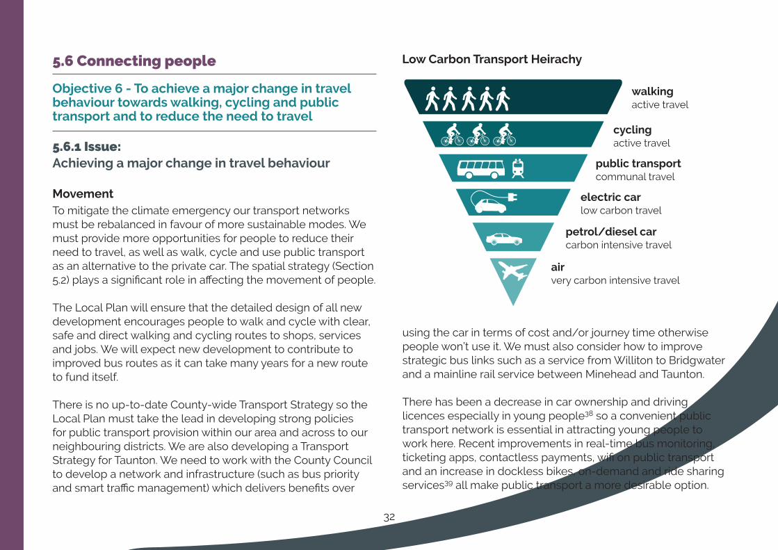
MovementTo mitigate the climate emergency our transport networks must be rebalanced in favour of more sustainable modes. We must provide more opportunities for people to reduce their need to travel, as well as walk, cycle and use public transport as an alternative to the private car. The spatial strategy (Section 5.2) plays a significant role in affecting the movement of people.
The Local Plan will ensure that the detailed design of all new development encourages people to walk and cycle with clear, safe and direct walking and cycling routes to shops, services and jobs. We will expect new development to contribute to improved bus routes as it can take many years for a new route to fund itself.
There is no up-to-date County-wide Transport Strategy so the Local Plan must take the lead in developing strong policies for public transport provision within our area and across to our neighbouring districts. We are also developing a Transport Strategy for Taunton. We need to work with the County Council to develop a network and infrastructure (such as bus priority and smart traffic management) which delivers benefits over
using the car in terms of cost and/or journey time otherwise people won’t use it. We must also consider how to improve strategic bus links such as a service from Williton to Bridgwater and a mainline rail service between Minehead and Taunton.
There has been a decrease in car ownership and driving licences especially in young people38 so a convenient public transport network is essential in attracting young people to work here. Recent improvements in real-time bus monitoring, ticketing apps, contactless payments, wifi on public transport and an increase in dockless bikes, on-demand and ride sharing services39 all make public transport a more desirable option.
walkingactive travel
cyclingactive travel
public transportcommunal travel
electric carlow carbon travel
petrol/diesel carcarbon intensive travel
airvery carbon intensive travel
LowCarbonTransportHeirachy

33
Digital connectivityThere is a need for high quality digital connectivity for residents, businesses and transport infrastructure40. Our towns and some larger villages typically have access to superfast broadband but connection outside of these areas is extremely limited. The Government is proposing requiring all new build residential developments to be equipped with full fibre digital connections which our Local Plan will support.
The Government wants the UK to be a world leader in 5G mobile technology but this is frustrating for our rural areas, some of which have no mobile signal at all, or are only served by a single operator. The Local Plan should continue to support fixed mobile network infrastructure and support the effective use of rooftops and street furniture to accommodate mobile digital infrastructure, including small cells for 5G so that we are ready for the new technology. 5G rollout will rely on full-fibre connectivity and may potentially enable us to develop smarter transport and energy solutions in particular.
Question 6a: How can we encourage people not to use their car when travelling into our towns for shopping and work? How can we provide more opportunities for using public transport in rural areas?
WeproposetheseadditionalpolicyapproachestomeetObjective 6:
6b/1 New developments to be designed in line with Sport England’s active design guidelines41 so that walking and cycling networks permeate through developments in a safe and convenient way.
6b/2 Seek S106 contributions to develop new or enhance bus routes; developers to liaise with bus operators on highway design that facilitates new bus routes.
6b/3 Policy detail to guide development for car and cycle parking standards; Travel Plans; Transport Assessments; protection and restoration of disused railway and canal corridors.
6b/4 Ensure new residential developments are equipped with full-fibre digital connections.
6b/5 Support fixed mobile network infrastructure and support the effective use of rooftops and street furniture to accommodate mobile digital infrastructure where appropriate.
Question 6b: Do you have any comments on these policy approaches?
34
5.7 The natural and historic environment
Objective7-Toprotectandenhancetheenvironmental,historic,economicandwellbeingvalueoftheDistrict’sdistinctivelandscapes,biodiversityandlocalcharacter
5.7.1 Issue:AchievinganetgaininbiodiversityOur natural environment is of huge value to local people in terms of health, well-being and recreation but is particularly at risk due to climate change specifically its effect on our biodiversity. It is also at risk due to the cumulative effects of development.
The NPPF expects net gains in biodiversity from new development and so our new Local Plan will need to be strong in this regard. Somerset County Council has developed a procedure42 to assess how a development can provide net gains in biodiversity. Our Local Plan should require new development to follow this procedure. Trees provide habitats and wildlife corridors as well as shade, particularly in our towns, so opportunities could be explored to ensure further tree planting, of appropriate species, in new development and by allocating sites for tree planting.
Question 7a: Are there any specific measures that you would like to see new developments deliver to improve biodiversity locally?
5.7.2 Issue:MinimisingfloodriskRising sea levels and increased storm violence as a result of the climate emergency gives rise to a greater flood risk from the sea and rivers.
This poses an increasing threat to new and existing development close to the parts of the coast and areas which are low-lying and/or which are unstable and vulnerable to rapid erosion and within or close to areas at risk from river flooding. We are updating our Strategic Flood Risk Assessment to ensure we avoid siting new development in areas of greatest flood risk.
5.7.3 Issue: Protecting our valued landscapesThe nationally protected landscapes of The Quantock Hills and Blackdown Hills Areas of Outstanding Natural Beauty have the highest level of protection related to conservation and enhancement of the landscape and scenic quality, not only through the NPPF but also the Countryside and Rights of Way Act 2000.
The setting of these landscapes is however under considerable pressure with development encroaching closer to their boundaries. Statutory Management Plans are in place and are revised every 5 years43. The Local Plan area adjoins Exmoor National Park so the impact of development on the setting of the national part is also important.
35
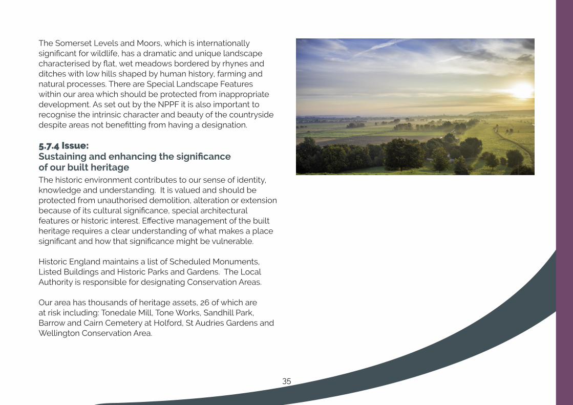
The Somerset Levels and Moors, which is internationally significant for wildlife, has a dramatic and unique landscape characterised by flat, wet meadows bordered by rhynes and ditches with low hills shaped by human history, farming and natural processes. There are Special Landscape Features within our area which should be protected from inappropriate development. As set out by the NPPF it is also important to recognise the intrinsic character and beauty of the countryside despite areas not benefitting from having a designation.
5.7.4 Issue: SustainingandenhancingthesignificanceofourbuiltheritageThe historic environment contributes to our sense of identity, knowledge and understanding. It is valued and should be protected from unauthorised demolition, alteration or extension because of its cultural significance, special architectural features or historic interest. Effective management of the built heritage requires a clear understanding of what makes a place significant and how that significance might be vulnerable.
Historic England maintains a list of Scheduled Monuments, Listed Buildings and Historic Parks and Gardens. The Local Authority is responsible for designating Conservation Areas.
Our area has thousands of heritage assets, 26 of which are at risk including: Tonedale Mill, Tone Works, Sandhill Park, Barrow and Cairn Cemetery at Holford, St Audries Gardens and Wellington Conservation Area.
36
WeproposetheseadditionalpolicyapproachestomeetObjective7:
7b/1 Maintain and enhance biodiversity, taking into account climate change and the need for habitats and species to adapt to it. Requirement of a net gain in biodiversity from new development using the Somerset Habitat Evaluation Procedure44 which could include re-wilding and tree planting.
7b/2 Protect and enhance the coherence and resilience of the ecological network and avoid/minimise the loss of or damage to trees, woodland and hedgerows.
7b/3 Conserve and enhance the natural beauty and exceptional character and quality of the landscape in the Areas of Outstanding Natural Beauty.
7b/4 Protect the Somerset Levels and Moors, and the locally designated Special Landscape Features.
7b/5 Protect, conserve or enhance landscape and townscape character whilst maintaining green wedges, green infrastructure networks and open breaks between settlements exploring opportunities for Local Green Space designations.
7b/6 Avoid harm to, sustain and enhance the significance of heritage assets and their setting. Require information to understand the significance of the heritage asset and sympathetic design.
7b/7 Not worsen, and where possible improve the quality, quantity and availability of the water resource, Reduce flood risk.
7b/8 Focus development away from the areas at most risk of flooding. Ensure that flood risk is not exacerbated from increased surface water flows.
7b/9 Protect the landscape, environmental quality, nature conservation, fisheries and recreational interest of water courses and wetlands and improve public access to, along and from our waterways.
7b/10 Development on sites within the Bat and Wildfowl Consultation Zones will require a ‘test of significance’ under the Habitat Regulations to be carried out.
7b/11 Require evaluation of the archaeological value of sites where development affects a site of archaeological importance or an Area of High Archaeological Potential.
7b/12 Allocate sites specifically for tree planting.
Question 7b: Do you have any comments on these policy approaches?
37
5.8 Thriving coastal and rural communities
Objective8-Toboosttourism,economicdevelopment, agricultural transformation and delivermoreaffordablehomesinourruralandcoastal communities
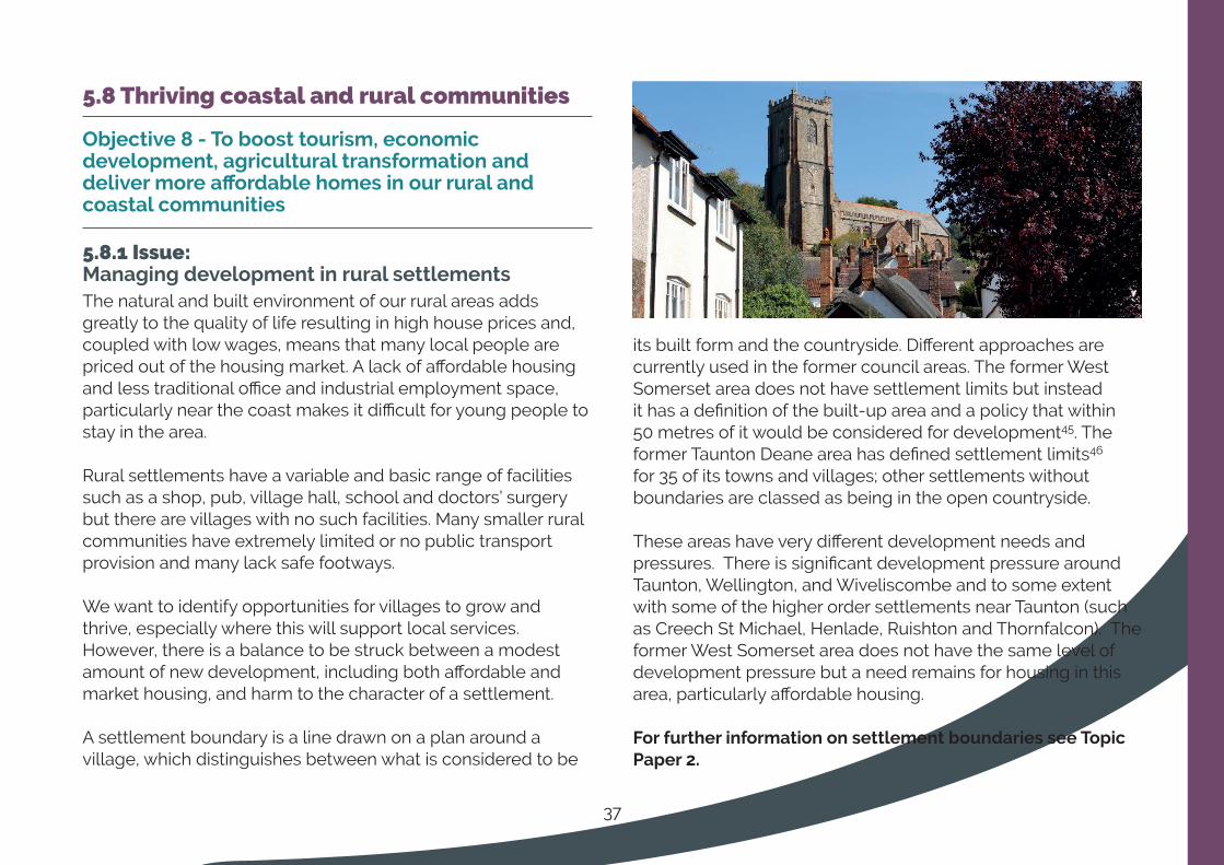
5.8.1 Issue:Managing development in rural settlementsThe natural and built environment of our rural areas adds greatly to the quality of life resulting in high house prices and, coupled with low wages, means that many local people are priced out of the housing market. A lack of affordable housing and less traditional office and industrial employment space, particularly near the coast makes it difficult for young people to stay in the area.
Rural settlements have a variable and basic range of facilities such as a shop, pub, village hall, school and doctors’ surgery but there are villages with no such facilities. Many smaller rural communities have extremely limited or no public transport provision and many lack safe footways.
We want to identify opportunities for villages to grow and thrive, especially where this will support local services. However, there is a balance to be struck between a modest amount of new development, including both affordable and market housing, and harm to the character of a settlement.
A settlement boundary is a line drawn on a plan around a village, which distinguishes between what is considered to be
its built form and the countryside. Different approaches are currently used in the former council areas. The former West Somerset area does not have settlement limits but instead it has a definition of the built-up area and a policy that within 50 metres of it would be considered for development45. The former Taunton Deane area has defined settlement limits46 for 35 of its towns and villages; other settlements without boundaries are classed as being in the open countryside.
These areas have very different development needs and pressures. There is significant development pressure around Taunton, Wellington, and Wiveliscombe and to some extent with some of the higher order settlements near Taunton (such as Creech St Michael, Henlade, Ruishton and Thornfalcon). The former West Somerset area does not have the same level of development pressure but a need remains for housing in this area, particularly affordable housing.
ForfurtherinformationonsettlementboundariesseeTopicPaper 2.
38
Option 8a: Managing development in rural settlements
i) Have settlement boundaries across the District; or
ii) Do not have settlement boundaries but instead have a criteria based policy to determine development proposals against; or
iii) Have a policy which is a hybrid of (i) and (ii) where there are settlement boundaries only in areas of greater development pressure i.e. parts of the District that are more accessible - closer to the M5, Taunton and Wellington areas.
Question 8a: Should we keep or remove settlement boundaries? Or should we have settlement boundaries in areas where there is higher pressure from development i.e. closer to Taunton, Wellington and Wiveliscombe but remove them in more remote areas to provide more options for development?
WeproposetheseadditionalpolicyapproachestomeetObjective 8:
8b/1 Criteria-based policy for when development in the countryside (outside of settlement limits) would be acceptable.
8b/2 Support for sustainable tourism and facilities in settlements subject to criteria.
8b/3 Support for farm diversification and transformation particularly where it responds to the need to address climate change impacts and mitigation.
8b/4 Policy to protect the best and most versatile agricultural land.
8b/5 Criteria-based policy for the removal of agricultural/forestry occupancy conditions would be acceptable.
8b/6 Ensure coastal development can take place without causing unacceptable damage to the coastal environment.
8b/7 Limit development within the coastal change management areas and areas that are vulnerable to rapid coastal erosion.
8b/8 Ensure that Hinkley Point C nuclear power station proposals mitigate short and long term adverse cultural, economic, environmental and social impact and provides a net gain in biodiversity of the area.
Question 8b: Do you have any comments on these policy approaches?
39
5.9 Wellbeing of our residents
Objective9-Toimprovewellbeing,inclusivityandareductionininequalitiesenablingindependenceand facilitating social interaction
5.9.1 Issue:AchievinghighqualitydesigntoreduceinequalitiesLocal Plans should aim to achieve healthy, inclusive and safe places that promote social interaction, are safe and accessible and enable and support healthy lifestyles. The ability to access suitably designed and affordable housing is a key factor in the wellbeing of people and this issues is covered in section 5.3.
Our area has a much higher proportion of older people than average and so high quality design to create environments suitable for older people is particularly important in our area. The Local Plan should also aim to provide opportunities to improve everybody’s physical and mental wellbeing.
To help older people enjoy a better quality of life, the Local Plan will consider the location of development in relation to key services and facilities, supporting better rural public transport and improving the self-containment of settlements to reduce isolation.
It is also important that everybody is able to safely navigate their local communities and towns. The highway (footpaths and roads) and the public realm should be designed to be safe and accessible.
To help disabled people and people living with mental health problems feel more confident navigating the urban environment we will ensure that new development is designed to maximise accessibility such as streets being free from obstructions; bus stops conveniently located and with seating and handrails; parks and playgrounds are accessible by level walkways; public spaces are overlooked and have seating; direct and clear routes through new development; well-designed transport interchanges; good lighting to improve safety. The Council is producing a Design Supplementary Planning Document.
5.9.2 Issue: EncouraginghealthylifestylesOur environment goes a long way to determining the quality of our health and wellbeing. Local Plans are encouraged by the NPPF to do more in terms of supporting healthy lifestyles for personal physical and mental health and for minimising our impact on the climate. For many years Local Plans have sought to encourage walking and cycling, provide sport and recreational facilities, play parks and open spaces, enable accessible primary healthcare among other measures that are inherent in good Plan-making. However, we should bring health and well-being to the forefront of design through Health Impact Assessments and Active Design. We could also identify areas of the district where there are inequalities in health and actively try to deliver improvements in those areas. The Council will also be producing a Health and Wellbeing Action Plan.

40
WeproposetheseadditionalpolicyapproachestomeetObjective9:
9a/1 Ensure the consideration of healthy place-shaping from the outset by requiring Health Impact Assessments from larger developments (threshold to be determined) to demonstrate how the design incorporates Active Design measures.
9a/2 Require high quality design from all developments to reflect the site and its context, including existing topography, landscape features and the historic environment and potentially requiring character appraisals to support proposals. The Council will be producing a Supplementary Planning Document on Design and will set out design principles/design codes for key development sites.
9a/3 Allow flexibility in the design of the highway and public realm to achieve high quality design that maximises accessibility by those who are less mobile and prioritises accessibility by walking, cycling and public transport over the car.
9a/4 Strengthen the self-containment of our settlements through the protection of community uses (eg pubs, sports facilities, recreational open space, community and leisure facilities, allotments), the allocation of sites to include multi-purpose community uses and support for uses that improve the balance of land uses and create mixed communities.
9a/5 Ensure that air quality, pollution, contaminated land, noise, nuisance, smell, land instability are considerations for planning applications.
9a/6 Include policies on public art, landscaping and tree planting.
9a/7 Ensure new development enhances and does not detract from the Taunton skyline.
Question 9a: Do you have any comments on these policy approaches?

41
5.10 Policies for our places: Taunton
Taunton is the historic county town of Somerset and has a population of around 69,42647. The town is centrally located between Exeter and Bristol on the strategic road network. Taunton also provides good rail links to Bristol, Exeter and London Paddington.
Taunton it is one of the fastest growing locations in the South West and the only settlement with “Garden Town” status. Planned growth in adopted Local Plans involves Taunton increasing in size by about 30% to approximately 85,000 people by 2028. This involves 13,000 new homes, with the majority in new garden communities at Monkton Heathfield, Comeytrowe and Staplegrove, and new jobs such as the Nexus 25 strategic employment site at Junction 25, and the regeneration of Firepool.
Due to its existing sustainable transport links and the concentration of the population, Taunton has the greatest potential of our local area to mitigate climate change through investment in further sustainable transport improvements and high quality design.
What’sbeenhappeninginTauntonConsiderable progress has been made in delivering many of the key themes and projects from existing Local Plans and the Garden Town Vision. This includes:
• Awarded Garden Town status in 2017 and the delivery of over 900 homes so far at Monkton Heathfield Garden Community
• Adoption of a Local Development Order for Nexus 25 strategic employment site to deliver more than 3,500 jobs
• Council proposals to invest over £45m in town centre regeneration and related activities and seeking £25m match funding from the Governments High Street Fund
42
Key issuesinTauntonfortheLocalPlan:
Employment&housing• Economic growth not keeping up with nearby towns▪
• Reliance on public sector jobs which have significantly reduced in number over the last decade
▪• The lack of significant investment from the private sector over the last decade
• ▪A need to establish a better digital infrastructure
• ▪Stalled regeneration sites e.g. Firepool and a need to make more efficient use of land and introduce more housing to improve viability
Option10a:WecouldincreasehousingdensitiesinTauntontowncentretomakemoreefficientuseoflandandencouragetheredevelopmentofsitesby:
i) Requiring a housing mix skewed towards dwellings with fewer bedrooms; or
ii) Positively encouraging taller buildings (subject to impact upon the skyline); or
iii) Encouraging car-free developments (which could include allocating specific sites for car-free developments).
Question 10a: How do you think we could introduce more housing into Taunton Town centre?
Town centre & retail • ▪The need to diversify the nighttime and leisure offer
• ▪Poor environment for pedestrians in the town centre
• ▪Declining number of people visiting the town centre, some empty shops and reduced quality and variety of retail and visitor attractions
• ▪Placing the river Tone and Taunton’s waterways back at the heart of the town and the need to improve the access, quality and design of public spaces
• ▪The desire for more compact and intensely used town centre
Infrastructure and accessibility• ▪Rebalancing the movement hierarchy in favour of active
modes of travel.
• Integrating and improving the transport network with improved bus links and priority and greater prioritisation for pedestrians and cyclists
• ▪Ensure there are sustainable transport corridors along green routes connecting the three new garden communities to the town centre
• ▪Reduce risk of river flooding through further strategic flood schemes
Environmentalquality• ▪Sustaining and enhancing significant and designated
heritage, cultural and wildlife assets “Greening’ urban spaces to support climate change objectives.
• ▪Improve air quality in Air Quality Management Areas (AQMAs) at the A358 in Henlade and East Reach, Taunton.

43
Heath&wellbeing• Pockets of deprivation. Lambrook, Halcon and Lyngford in
Taunton are within the most 10% deprived areas of the UK48.
• Musgrove Park Hospital: a new surgical centre to improve patient care and replace aging 1940s buildings.
WeproposetheseadditionalpolicyapproachesforTauntontoaddresstheseissues:
10b/1 Encouraging the redevelopment of key regeneration sites through site allocations that contain a mix of uses (including housing) to allow flexibility.
10b/2 Creating a more compact town centre with a retail core centred around Market House, East Street, North Street and High St (through intensive use of upper floors and the fringes, increase housing in the town centre, built higher where appropriate).
10b/3 Diversifying the offer of the town centre to increase the mix of employment, retail, arts and leisure uses.
10b/4 Improve choice and opportunities to use sustainable modes through measures including:
• Attractive, safe and convenient walking and cycling routes to key locations and public transport stops.
• Shifting the priority to pedestrians, cyclist and public transport through pedestrianisation and the reallocation of road space.
• Maintain and enhance sustainable transport links especially from the new garden communities and Nexus 25 to the town centre.
10b/5 Providing strategic car parking provision through consolidation of existing parking freeing up land for other uses.
10b/6 Continuing to deliver the new garden communities at Monkton Heathfield, Staplegrove and Comeytrowe.
10b/7 Enhancing the public realm through high quality urban design, ensuring new development helps to deliver the Taunton Public Space Improvement Project and sustains and enhances the significance of heritage assets
10b/8 Improve access to Taunton’s waterways
10b/9 Safeguarding a new surgical centre at Musgrove Park Hospital.
10b/10 Protecting and extending the “green wedges” and corridors developing a comprehensive network of green and blue infrastructure.
Question 10b: Do you have any comments on these policy approaches?

44
5.11 Policies for our places: Wellington
Wellington provides an important function as a market town and it acts as focus for a rural hinterland which extends into Devon. The town has significant employment, retail and leisure offering and is the Districts secondary centre, after Taunton. The town occupies an attractive setting at the foot of the Blackdown Hills Area of Outstanding Natural Beauty.
It has a rich history with historic core contributing a high proportion of listed buildings as well as a number of important non-designated heritage assets and is within the Conservation Area. Overall, the town centre is healthy and performing its role in the retail hierarchy and has a range of independent shops and restaurants. There is scope for improvement, particularly in terms of enhancing the public realm to encourage people using the town centre to increase dwell time and potentially also spend in the centre.
What’sbeenhappeninginWellington• The re-opening of a railway station in Wellington is at
an advanced stage
• All planned urban extensions are completed or under construction
• Project officer employed to work specifically on the heritage assets at risk within the town
• Aspirations to produce a Wellington Place Plan
• Clear business and community ambitions demonstrated through its own vision and plan for 202749.
Key issuesinWellingtonfortheLocalPlan:• The town centre is fairly spread out and there is a need the need
to retain the integrity of the retail ‘core’ to provide opportunities for competition and consumer choice
• The need to support employment generating uses and ancillary facilities especially in areas such as Westpark, Chelston, and Ryelands
• The general environment of the town centre is poor, and should be improved through:a) Supporting the restoration or rehabilitation of listed buildings in
the Conservation Area, such as Cornhill, in addition to Tonedale Mill and Tone works at the north side of the town. Wellington Monument is a key marker and important asset for the town.
b) Supporting the completion of the northern relief road to enable the enhancement of the town centre by removing HGV traffic
c) Protecting and enabling a viable use for the historic area of Cornhill perhaps through a development brief.
d) Supporting the re-opening of the Railway Station to encourage use by public transport and help with the regeneration of Tonedale Mill and Tone Works
• Risks to heritage assets in Wellington including:a) The Conversation Area and Buildings at Risk at Cornhill,
Tonedale Mill and Toneworksb) Neglect of and incremental changes to designated and non-
designated heritage assets particular by changes to windows and doors
c) The negative visual effect of vehicle domination through on-street parking and cars parked in backland areas and gardens
d) Infill development
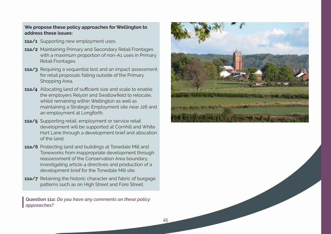
45
WeproposethesepolicyapproachesforWellingtontoaddresstheseissues:
11a/1 Supporting new employment uses.
11a/2 Maintaining Primary and Secondary Retail Frontages with a maximum proportion of non-A1 uses in Primary Retail Frontages.
11a/3 Requiring a sequential test and an impact assessment for retail proposals falling outside of the Primary Shopping Area.
11a/4 Allocating land of sufficient size and scale to enable the employers Relyon and Swallowfield to relocate, whilst remaining within Wellington as well as maintaining a Strategic Employment site near J26 and an employment at Longforth.
11a/5 Supporting retail, employment or service retail development will be supported at Cornhill and White Hart Lane through a development brief and allocation of the land.
11a/6 Protecting land and buildings at Tonedale Mill and Toneworks from inappropriate development through reassessment of the Conservation Area boundary, investigating article 4 directives and production of a development brief for the Tonedale Mill site.
11a/7 Retaining the historic character and fabric of burgage patterns such as on High Street and Fore Street.
Question 11a: Do you have any comments on these policy approaches?
46
5.12 Policies for our Places: The Coastal Strip
The seaside resort of Minehead, together with the smaller adjacent settlement of Alcombe, is the largest town along our coast and is the main service centre in the local area. It is the location of a Butlins holiday centre, which in the peak holiday season is home to up to c.6,000 visitors at a time and is an important gateway for visitors to Exmoor National Park. The Minehead Coastal Community Team created an Economic Plan to inform the development of future projects for the town. The Business Improvement District Business Plan 2018-23 aims to make Minehead a more prosperous and vibrant place to work, live and visit. Minehead residents have a good level of access to its services and facilities by a range of transport modes including walking and cycling.
The historic port of Watchet has a Community Strategic Plan from 2009 developed by volunteers. The Onion Collective, a Watchet regeneration social enterprise, formulated a plan for four interlinked regeneration schemes. Meanwhile, through a Coastal Communities Team, the town is collectively working towards developing a stronger future for the town with a thriving tourism economy which celebrates the rich heritage, increases jobs and provides better community facilities in Watchet. Williton provides some local services to the surrounding area. Both towns are gateway settlements for visitors to the Quantock and Brendon Hills.
What’sbeenhappeningalongtheCoastalStrip• Minehead Seafront has been re-developed to improve the
public realm
• Watchet’s East Quay Community, Cultural and Enterprise Development due to be completed in 2020
• The Council will be developing a Coastal Communities Strategy to bring together initiatives for the area.
• Hinkley Point C is under development with the first of its two reactors expected to be up and running in 2025
Key issues alongtheCoastalStripfortheLocalPlan• The A39 from Minehead to Bridgwater, and the A358 from
Taunton to Williton are both relatively narrow A roads with points of restricted headroom and narrowing
• High reliance on tourism, food and retail sectors and lack of skilled jobs and the need to improve the prosperity of coastal towns particularly their role as gateway settlements to tourist areas
• Poor road, public transport, digital and mobile infrastructure networks and the need to improve self-containment and sustainability of the towns
• Seasonal pressures on local roads and car parking
• Enhanced risk of flooding and coastal change, e.g. at Blue Anchor and Minehead, from the sea due to the climate emergency
• Impact of Hinkley Point C construction on housing needs, affordability and traffic movements in the local area.
• A very high proportion of older people and low proportion of young people. A lack of affordable housing to enable younger people to stay in the area
• Ensuring an appropriate and well-designed redevelopment of Watchet Paper Mill site
• Maintaining connectivity of settlements where flooding poses risk
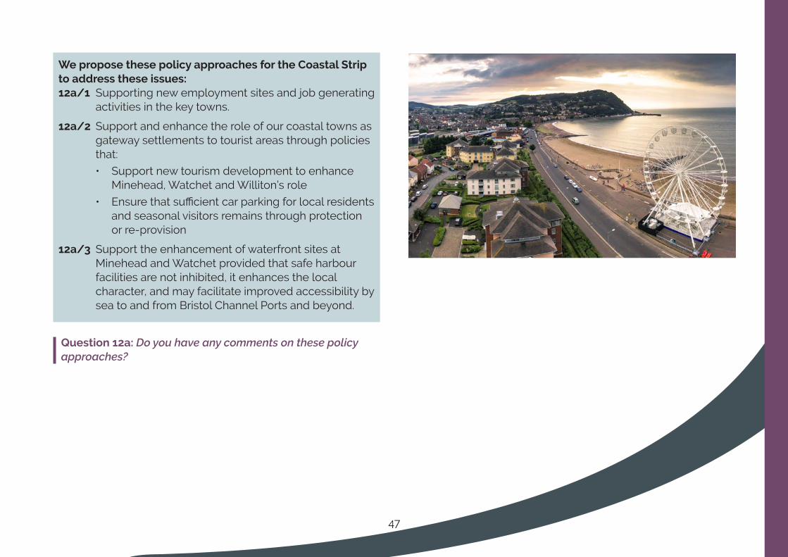
47
WeproposethesepolicyapproachesfortheCoastalStriptoaddresstheseissues:12a/1 Supporting new employment sites and job generating
activities in the key towns.
12a/2 Support and enhance the role of our coastal towns as gateway settlements to tourist areas through policies that:
• Support new tourism development to enhance Minehead, Watchet and Williton’s role
• Ensure that sufficient car parking for local residents and seasonal visitors remains through protection or re-provision
12a/3 Support the enhancement of waterfront sites at Minehead and Watchet provided that safe harbour facilities are not inhibited, it enhances the local character, and may facilitate improved accessibility by sea to and from Bristol Channel Ports and beyond.
Question 12a: Do you have any comments on these policy approaches?
48
1 These are the West Somerset Local Plan 2032 (Nov 2016), Taunton Deane Core Strategy 2011-29 (2012), Site Allocations and Development Management Plan (Dec 2016), Taunton Town Centre Area Action Plan (Oct 2008) and saved policies from the Taunton Deane Local Plan (2004) and West Somerset District Local Plan 2006.
2 Section 19 of the Planning and Compulsory Purchase Act 2004; European Directive 2001/42/EC and the Environmental Assessment of Plans and Programmes Regulations 2004
3 Sustainability Appraisal Objectives and Alternatives Report (Nov 2019)
4 Conservation of Habitats and Species Regulations 2017
5 IPCC Special Report (Oct 2018) UN Intergovernmental Panel on Climate Change
6 Section 19 of the Planning and Compulsory Purchase Act 2004 (as amended by the Planning Act 2008)
7 National Planning Policy Framework (Feb 2019) MHCLG
8 Population Estimates for UK, England and Wales, Scotland and Northern Ireland: Mid-2017 (Jun 2018) Office for National Statistics
9 The ratio of house prices to earnings is one measure of how affordable it is to buy a property. ‘Lower quartile’ price provides an indication of the entry level house price in a local market, typically those purchased by first-time buyers. The higher the ratio, the less affordable it is for households to get onto the property ladder. 2019 ONS data
10 Money Advice Service
11 Nomis Official Labour Market Statistics - Model-based estimate for 2018
12 2015 Indices of Multiple Deprivation, DCLG
13 The Future Homes Standard (1 Oct 2019) MHCLG
14 Building Regulations Part L: Conservation of Fuel and Power
15 Topic Paper 1
16 Table 13, Topic Paper 1
17 Options B, D and E of Topic Paper 1. See section 8 of the Topic Paper for a summary
18 To be considered deliverable, sites for housing should be available now, offer a suitable location for development now, and be achievable with a realistic prospect that housing will be delivered on the site within 5 years (NPPF glossary)
References
49
19 Housing Trajectories (Planning permissions); Table 4 (total capacity for deliverable sites) Taunton Deane Housing and Employment Land Availability Report 2019 and West Somerset Housing Land Availability Report 2019
20 Section 4, Sustainability Appraisal Objectives and Alternatives Report (Nov 2019)
21 Strategic Housing Land Availability Assessments 2019
22 Call for sites form
23 To be considered deliverable, sites for housing should be available now, offer a suitable location for development now, and be achievable with a realistic prospect that housing will be delivered on the site within 5 years (NPPF glossary)
24 Housing Trajectories (Planning permissions); Table 4 (total capacity for deliverable sites) Taunton Deane Housing and Employment Land Availability Report 2019 and West Somerset Housing Land Availability Report 2019
25 To be considered developable, sites should be in a suitable location for housing development with a reasonable prospect that they will be available and could be viably developed at the point envisaged (NPPF glossary)
26 Tables 5 Taunton Deane Housing and Employment Land Availability Report 2019 and West Somerset Housing Land Availability Report 2019
27 Paragraph 10, Planning Policy for Traveller Sites (Aug 2015) DCLG
28 Population Estimates for UK, England and Wales, Scotland and Northern Ireland: Mid-2017 (Jun 2018) Office for National Statistics
29 Proportion of people with a long-term health problem or disability that limits a person’s day to day activities where day-to-day activities are limited ‘a lot’ or ‘a little’: 18.3% Taunton Deane; 23.8% West Somerset; 21% Somerset West and Taunton (former Council’s combined); 17.6% England. Nomis Local Area Reports/Census 2011, Office for National Statistics
30 Technical Housing Standards: Nationally Described Space Standards (May 2016) and as amended, MHCLG
31 The Heart of the South West Productivity Strategy: Stepping Up to the Challenge (2018) HoTSW Local Enterprise Partnership
32 Heart of the South West LEP Productivity Strategy and Local Industrial Strategy (LIS) Command Paper
33 Section 5.5 Employment, Retail and Leisure Study (Oct 2018) Peter Brett Associates
34 Paragraph 9.3.10 Employment, Retail and Leisure Study (Oct 2018) Peter Brett Associates
35 High Street 2030: Achieving Change (Dec 2018) Institute of Place Management; Manchester Metropolitan University
36 CIL can only be spent on items set out in the Regulation 123 list
37 Planning Practice Guidance: Viability (July 2017) MHCLG
50
38 Young people’s travel – what’s changed and why? (Jan 2018) Department for Transport
39 The Future of mobility: Urban Strategy (Mar 2019) Department for Transport
40 Future Telecoms Infrastructure Review (July 2018) Department for Digital, Culture. Media and Sport
41 Active Design (Oct 2015) Sport England
42 Somerset Habitat Evaluation Procedure (2017) Somerset County Council
43 Quantock Hills AONB Management Plan 2019-2024; Blackdown Hills AONB Management Plan 2019-2024
44 Somerset Habitat Evaluation Procedure Somerset County Council
45 Policy SC1, West Somerset Local Plan to 2032 (2016) West Somerset Council
46 Policy SP1, Taunton Deane Core Strategy (2012) Taunton Deane Borough Council
47 ONS Mid-2017 year estimates
48 English Indices of Deprivation 2019
49 A Vision for Wellington (2008) Wellington Economic Partnership
51
For further information please contact:
www.somersetwestandtaunton.gov.uk/localplan/
Strategy TeamSomerset West and Taunton CouncilDeane HouseBelvedere RoadTauntonTA1 1HE

52