south eastern latin america la26: impact of gc on coastal areas of the rio de la plata: sea level...
TRANSCRIPT

South Eastern Latin America
• LA26: Impact of GC on coastal areas of the Rio de la Plata: Sea level rise and meteorological effects
• LA27: Building capacity to assess impact of CC/V and develop adaptive responses for the mixed crop/livestock production systems in the Argentinean and Uruguayan pampas
• LA29: Integrated assessment of social variability and adaptation to CV and change among farmers in Mexico and Argentina
• LA32: Assessing global change I, V & A strategies for estuarine waters of the Rio de la Plata
Objectives
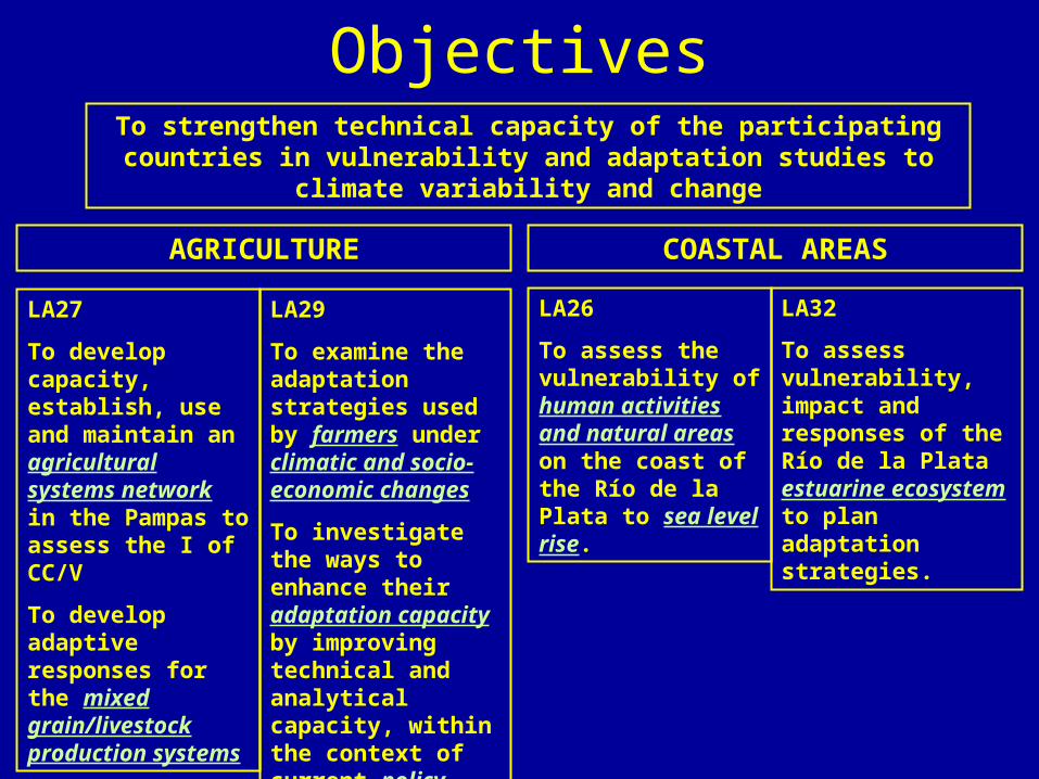
LA26
To assess the vulnerability of human activities and natural areas on the coast of the Río de la Plata to sea level rise.
LA32
To assess vulnerability, impact and responses of the Río de la Plata estuarine ecosystem to plan adaptation strategies.
LA27
To develop capacity, establish, use and maintain an agricultural systems network in the Pampas to assess the I of CC/V
To develop adaptive responses for the mixed grain/livestock production systems
LA29
To examine the adaptation strategies used by farmers under climatic and socio-economic changes
To investigate the ways to enhance their adaptation capacity by improving technical and analytical capacity, within the context of current policy trends.
AGRICULTURE COASTAL AREAS
To strengthen technical capacity of the participating countries in vulnerability and adaptation studies to climate variability and change
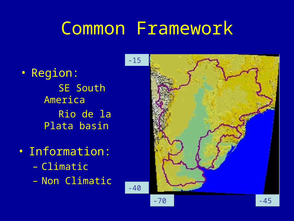
Common Framework
• Information:– Climatic– Non Climatic
-15
-40
-45-70
• Region: SE South America
Rio de la Plata basin

Information
CLIMATIC• Daily data from
several surface weather stations
• Gridded global datasets (daily and monthly)
• Rivers stream flow• Sea level
NON CLIMATIC• Demographic
projections• Economic: GNP, input
& prod. prices, etc• Land use• Water consumption• Population spatial
distribution• Other (crop yield,
livestock prod., etc)
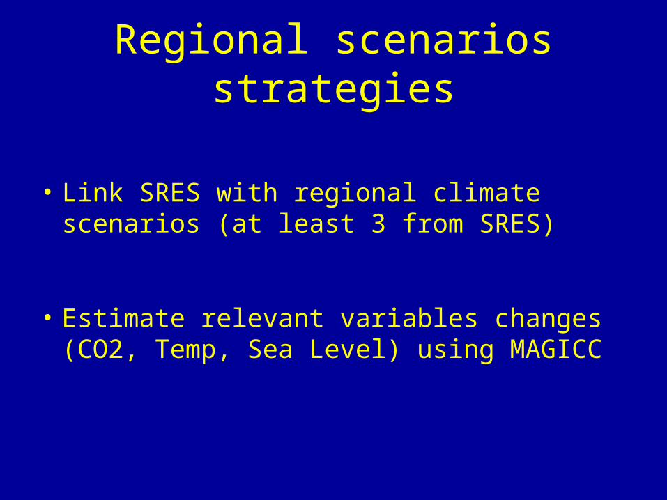
Regional scenarios strategies
• Link SRES with regional climate scenarios (at least 3 from SRES)
• Estimate relevant variables changes (CO2, Temp, Sea Level) using MAGICC

Climatic information needed
• Daily and monthly:– Precipitation– Temperature (minimum and maximum) – Solar radiation– Wind speed– Geopotential 925, 850, 500, 250 hPa– Sea level
• Extreme events (daily and hourly):– Precipitation – Wind speed– Sea level
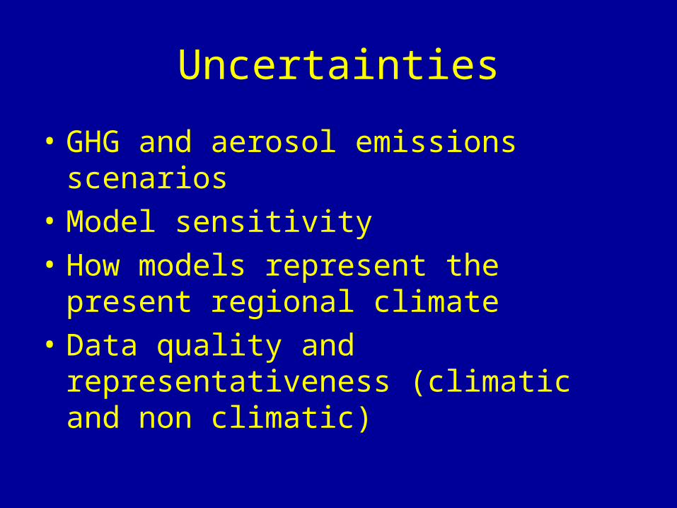
Uncertainties
• GHG and aerosol emissions scenarios
• Model sensitivity
• How models represent the present regional climate
• Data quality and representativeness (climatic and non climatic)

Spatial and temporal scales• Latitude 15° S - 40° S. Longitude 70° W - 45° W• Temporal scale:
– Monthly: Tmax, Tmin, Precip, Sol Rad, Wind, SLP
from weather stations in the region.
– Reanalysis NCEP 2.5° x 2.5°.
– Daily: Tmax, Tmin, Precip, Sol Rad, Wind and SLP
from weather stations and from NCEP reanalysis.
SL from gauge stations.
– Hourly: Wind and SLP.
– Outputs from a RCM (every 6 hours) after dynamic
downscaling (GCM from IPCC/DDC).
– Hydrological data: stream flow (Paraná, Paraguay,
Uruguay, Iguazú).
-15
-40
-45-70
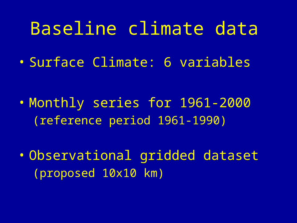
Baseline climate data
• Surface Climate: 6 variables
• Monthly series for 1961-2000(reference period 1961-1990)
• Observational gridded dataset (proposed 10x10 km)
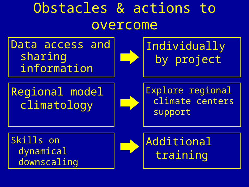
Obstacles & actions to overcome
Data access and sharing information
Skills on dynamical downscaling
Regional model climatology
Individually by project
Explore regional climate centers support
Additional training
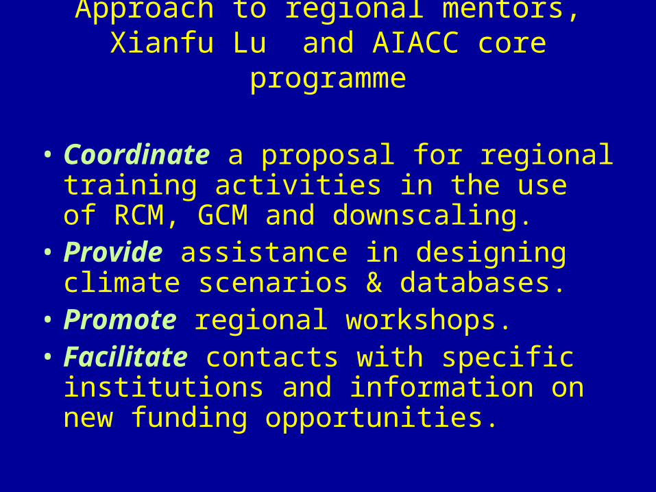
Approach to regional mentors, Xianfu Lu and AIACC core programme
• Coordinate a proposal for regional training activities in the use of RCM, GCM and downscaling.
• Provide assistance in designing climate scenarios & databases.
• Promote regional workshops.• Facilitate contacts with specific
institutions and information on new funding opportunities.