south slough reserve 2016 year in review - · pdf file · 2017-01-08south slough...
TRANSCRIPT

South Slough Reserve 2016 Year in Review
Milestones
The 2017-2022 Reserve Management Plan completed.
Eleven hundred upland acres added to the Reserve.
Weather station relocated to Tom’s Creek Marsh.
Cultural surveys begin at Indian Point.
Indian Point
Valino Island
Staff-Outgoing, incoming, and passing through
Long time maintenance assistant Don Smith retired in May. Don, who could be found anywhere
and everywhere along the trails during a day’s work, loved caring for South Slough’s trails. He is
missed for his all-round “get the job done” attitude.
Talo Silver began working full time as maintenance assistant in June. Previously, as an employee
of Cardinal Services, Talo worked on contract with the Friends of South Slough (FOSS) to
maintain the Reserve’s aquariums at the Visitors Center.
Astrea Strawn left her position as AmeriCorps science outreach specialist in August. The
outreach specialist works with local elementary students participating in the Estuary Explorers
after-school program. Through this program students learn to apply classroom lessons in
science and math to real world problems.

Jesse Gilfillan, who replaced Astrea as science outreach specialist, began work in September
and will continue in the temporary position until next fall.
Computer mapping specialists Brian Mladenich and Jane Rombouts, and science technicians
Erica Wilkinson, Ryan Scott, and Sam Schrager, provided temporary assistance on grant-funded
projects, some of which continue through early 2017.
Don Smith Talo Silver
Astrea Strawn Jesse Gilfillan
Grants
Grants provide a significant source of funding for science and education. Grant-funded projects
approved in 2016 include:
Amount Grant
/Recipient
Source Purpose Ends
$20,000 Coquille Tribal Community
Fund /FOSS
Coquille
Indian Tribe
Arrest the decay of the
historic shed at
Fredrickson homestead
2016
$60,000 Bay Watershed Education and
Training (BWET)
/SSNERR
NOAA Outdoor education for
elementary students
2017
$246,000 Integrative Assessment Grant
/SSNERR
NSC Land use analysis for
the Coos estuary
2018
$15,000 Partners in Science
/C. Geierman
M. J. Murdock
Charitable
Trust
European green crab
population study
2019
$329,000 Land Acquisition and
Construction Grant
/SSNERR
NOAA Science lab and office
remodeling/ expansion
2019
$64,141 Fish Habitat Conservation
/FOSS
Pacific Marine
and Estuarine
Fish Habitat
Partnership
Mapping and assessment
of eelgrass in Coos Bay
2017
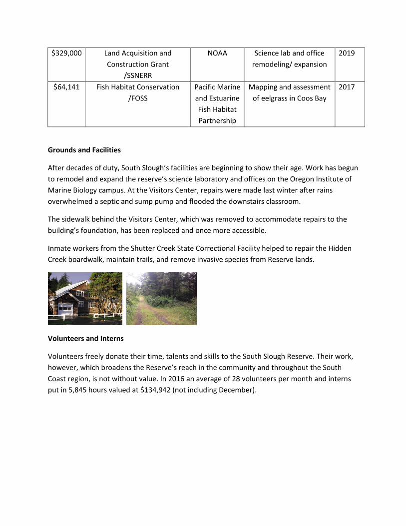
Grounds and Facilities
After decades of duty, South Slough’s facilities are beginning to show their age. Work has begun
to remodel and expand the reserve’s science laboratory and offices on the Oregon Institute of
Marine Biology campus. At the Visitors Center, repairs were made last winter after rains
overwhelmed a septic and sump pump and flooded the downstairs classroom.
The sidewalk behind the Visitors Center, which was removed to accommodate repairs to the
building’s foundation, has been replaced and once more accessible.
Inmate workers from the Shutter Creek State Correctional Facility helped to repair the Hidden
Creek boardwalk, maintain trails, and remove invasive species from Reserve lands.
Volunteers and Interns
Volunteers freely donate their time, talents and skills to the South Slough Reserve. Their work,
however, which broadens the Reserve’s reach in the community and throughout the South
Coast region, is not without value. In 2016 an average of 28 volunteers per month and interns
put in 5,845 hours valued at $134,942 (not including December).

Stewardship
Development of the Wasson Creek Restoration Plan is in its final stages. The ridgetop to estuary
restoration plan will include a reconnected channel design, planting plans to encourage native
plants, and upland forest thinning prescriptions for increasing diversity in previously harvested
stands. The drainage also has a rich cultural heritage which includes the Fredrickson house and
barn.

The arrested decay phase of the Fredrickson Shed project is now complete, thanks to funding
from the Coquille Tribal Community Fund to FOSS. A grant request for Phase 2 of the project, a
more thorough restoration, has been submitted.
Invasive Species Removal
The Reserve is still active with the local Gorse Action Group; the International Port of Coos Bay
pulled pampas grass this summer; Summer Science campers cut back invasive species on Indian
Point; Reserve staff pulled purple loosestrife from a neighboring property; and a Coos Forest
Protective Association inmate crew cut back large patches of Scotch broom and escalonia on
Reserve property.
Partnership for Coastal Watersheds (PCW)
The PCW continues to move forward. The group is guided by a committee that includes
representatives of the Coos County Planning Department, City of Coos Bay (planning and city
council), North Bend Planning, International Port of Coos Bay, South Coast Development
Council, Stuntzner Engineering, Department of Land Conservation and Development, Southwest
Oregon Community College, Oregon Department of Fish and Wildlife, US Fish and Wildlife
Service, Coos Watershed Association, and the Coquille Indian Tribe. Currently the group is
focused on two projects: finalizing the Communities, Lands & Waterways Data Source project,
which is an encyclopedic compilation of all available data describing the socioeconomic and
environmental conditions in the lower Coos watershed
(http://www.partnershipforcoastalwatersheds.org/lands-waterways-data-source/), and a land
use analysis for the Coos estuary.

Education
More than 4900 people came into the Visitors Center between October 2015 and October
2016. Education and coastal training staff provided 123 classes, training courses, workshops,
and field trips, serving 3162 participants. Another 3285 people attended informal community
education classes.
Formal education emphasizes estuarine instruction for students from kindergarten through
12th grade using curriculum guidance from NOAA’s Kindergarten-to-12th grade Estuary
Education Program (KEEP). In 2016 KEEP students participated in programs ranging from
watershed science to mudflat and eelgrass ecology. The program benefits from the work of
dedicated volunteers and interns. More than 3000 students participated in KEEP in 2016.

With support from FOSS, the Education Program hosted four Summer Science Camps from June
through July for elementary through junior high school students. Most campers were from Coos
Bay area schools. Donors supported numerous scholarships for underserved families.
Paddlers’ certifications
Paddler trip leaders Joy Tally, education coordinator, Eric Dean, education program specialist,
and public involvement coordinator Deborah Rudd completed certified paddle instructor
training course provided by the American Canoe Association.
Bay Watershed Education and Training
The Oregon Coast Education Program (OCEP), a partnership of education institutions,
encourages use of best practices for field and classroom-based education to incorporate
meaningful watershed education experiences for students. The program is wrapping up its fifth
year at the Reserve. By participating in professional development workshops and activities,
local teachers gain resources and skills to support coastal education lessons for their students.
Participating organizations include the Reserve, the Oregon Coast Aquarium, the Hatfield
Marine Science Center, Portland State University, and the Oregon High Desert Museum.
Funding for OCEP is provided by NOAA’s Bay Watershed Education and Training program
(BWET).

Coastal Training Program
The Coastal Training Program provides training and technical assistance for coastal managers
and decision makers in the lower Columbia biogeographic province. Coastal training staff
hosted two NOAA-sponsored workshops, including Climate Adaptation for Coastal Communities
(Oct 6-8, 2015, Newport) and Introducing Green Infrastructure for Coastal Resilience (Feb. 23,
2016, Coos Bay); assisted the City of Coos Bay’s City Dock and Waterfront Boardwalk Advisory
Committee to develop redesign options for the boardwalk; began working with computer
mapping specialists in South Coast communities to improve networking, communication and
training, and with the Urban and Regional Information Services Association to develop training
and outreach strategies for computer mapping professionals; helped to develop and present
information about unmanned aerial vehicles (drones), including presentations about the
growing use of unmanned aerial vehicles by the research reserves, at Symposium By The Sea,
an annual one-day conference for computer and geospatial mapping professionals.
CTP staff also began working:
with state and local partners to develop advanced green infrastructure training for
engineers and landscape contractors, scheduled for February;
with NOAA’s Office For Coastal Management to explore the use of green infrastructure
to improve coastal hazard resilience;
with data management and computer mapping specialists to develop and present the
Oregon Geographic Data Fair at the annual GIS In Action conference at Portland State
University, scheduled for April.
The coastal training coordinator serves on the Pacific Marine Estuarine Fish Habitat Partnership
steering, governance, prioritization, and communication committees. PMEP is one of 19
nationally recognized fish habitat partnerships advancing ecological goals for native fish. PMEP

is prioritizing estuarine habitat restoration to benefit juvenile fish in West Coast estuaries,
including mapping and classifying estuarine habitats; documenting tidal wetland loss, and
identifying habitat stressors to prioritize juvenile fish habitat restoration in Washington,
Oregon, and California estuaries.
In 2016 the CTP coordinator assessed training needs, issues, audiences, and stakeholders for
future coastal training, through formal surveys and informal assessments to inform training
needs for the next several years.
Research
The water quality instruments at the four System Wide Monitoring Program (SWMP) stations
have all been upgraded to include wireless communication and smart sensor technology, which
allows for easier calibration and configuration.
Science staff completed the process of relocating the long-term SWMP weather station,
previously located on the campus of the Oregon Institute of Marine Biology (OIMB) from
August 2001-April 2015, due to the installation of a 140 foot wind turbine by OIMB in
December 2014. Staff selected Tom’s Creek Marsh located at the south end of the reserve.
South Slough submitted the implementation plan to NOAA to become a fully operational
Sentinel Site. The NERRS Sentinel Sites program pairs the long term water quality and water

level data collected at SSNERR’s System-Wide Monitoring Program (SWMP) sites with data
quantifying other controlling factors (e.g., marsh elevation, plant community, vertical accretion,
soil salinity, groundwater level) to help interpret long term changes in wetland emergent marsh
plant communities and eelgrass beds.
Science staff received NOAA’s Real-Time Kinematic (RTK) GPS equipment in September and
October. Using the equipment, staff and FOSS intern Sabine Berzins collected marsh elevation
data at all biomonitoring plots where vegetation data were collected. In addition, three new
vertical control marks were surveyed into our local network.
Wasson Watershed Monitoring
Science staff have begun baseline monitoring of the Wasson Creek lowlands, in preparation for
anticipated restoration work. Weekly Coho salmon spawning surveys were conducted (with the
help of volunteers and a FOSS funded intern). In February, staff began vegetation mapping for
four commonly occurring species including two native (slough sedge and small fruited bulrush)
and two non-native (reed canary grass and pasture grass). Last winter, bi-weekly surveys of
birds occurred. In March 2016, these became weekly surveys as birds began to migrate.
Lamprey Monitoring
Very little is known about lamprey distribution or abundance in the Coos watershed and in
particular the South Slough watershed. Reserve science staff met with Oregon Department of
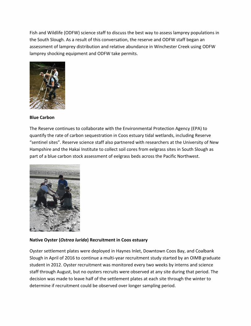
Fish and Wildlife (ODFW) science staff to discuss the best way to assess lamprey populations in
the South Slough. As a result of this conversation, the reserve and ODFW staff began an
assessment of lamprey distribution and relative abundance in Winchester Creek using ODFW
lamprey shocking equipment and ODFW take permits.
Blue Carbon
The Reserve continues to collaborate with the Environmental Protection Agency (EPA) to
quantify the rate of carbon sequestration in Coos estuary tidal wetlands, including Reserve
“sentinel sites”. Reserve science staff also partnered with researchers at the University of New
Hampshire and the Hakai Institute to collect soil cores from eelgrass sites in South Slough as
part of a blue carbon stock assessment of eelgrass beds across the Pacific Northwest.
Native Oyster (Ostrea lurida) Recruitment in Coos estuary
Oyster settlement plates were deployed in Haynes Inlet, Downtown Coos Bay, and Coalbank
Slough in April of 2016 to continue a multi-year recruitment study started by an OIMB graduate
student in 2012. Oyster recruitment was monitored every two weeks by interns and science
staff through August, but no oysters recruits were observed at any site during that period. The
decision was made to leave half of the settlement plates at each site through the winter to
determine if recruitment could be observed over longer sampling period.

Fish Assemblages of South Slough and Coos Estuary
Reserve staff, interns, and volunteers continued monthly seining at six sites in South Slough;
seasonal seining was done at Palouse, Larson, and Willanch Creeks in the upper estuary by
project partners. Reserve staff continues to maintain three water quality instruments at the
upper estuary sites; the sensors are calibrated and data are downloaded monthly. The project is
designed to characterize seasonal patterns of fish and invertebrate species diversity, richness,
and presence/absence throughout the estuary. An additional component of the project is to
assess habitat use of the Kunz restoration site by fishes, which was last investigated in 1997-
1998. Fyke netting in Kunz began in November. Two additional temporary part-time field
technicians (Erica Wilkinson and Sam Schrager) were hired to work on the project through
March 2017.

Eelgrass Mapping
The Reserve received a $64,141 grant from the Pacific Marine and Estuarine Fish Habitat
Partnership (PMEP) to fund eelgrass mapping of the Coos estuary. This project collected aerial
imagery, underwater video and bathymetry data to create updated maps of the distribution of
eelgrass throughout the estuary, including South Slough. In addition to showing the current
extent of eelgrass, maps from this project could be used to assess changes in eelgrass coverage
over the ten years since the last eelgrass maps were made for the estuary.
Green Crab Distribution and Abundance
Reserve received a $15,000 grant from the M.J. Murdock Charitable Trust’s Partners in Science
program. The grant provides a stipend for a high school science teacher (Christina Geierman) to

work for two summers on a European green crab monitoring project in the Coos estuary. The
reserve also hosted an Oregon Sea Grant Undergraduate Summer Scholar (Collin Williams) who
designed and implemented an intensive green crab survey of South Slough. Together these two
projects provided valuable data on the current abundance and distribution of this invasive crab
in the estuary and will help guide future control efforts and surveys.
Outreach
The Department of State Lands (DSL) is joining other state agencies in a project to improve our
websites for the various publics we serve. Throughout 2016 Reserve and DSL staff have been
working on the upgrades. Watch in 2017 for the new site!
Reserve staff and volunteers participated in the following community activities in 2016: Bay
Area Chamber of Commerce Planning Session, hosting an evening for Friends of Shore Acres
Holiday Lights event, Annual Bay Area Chamber of Commerce Awards Banquet, Charleston Crab
Feed, Charleston Oyster feed, a special showing of Avatar with an education table and activity
for Earth Day weekend, Bay Area Brigade Clean-up, Bi-Monthly Wednesday Farmers Market,
Empire Clamboree, Salmon Celebration, Stand up for the Bay on National Estuaries Day,
Octoberfish, Science on the Screen series in partnership with Egyptian Theatre and the Coos
County Tourism Workgroup.
