space for med eyre consulting transparent forest transparent forest transparent forest an esa iap...
TRANSCRIPT
SpaceforMed
Eyre consulting
Tr a n s p a re n t Fo re s t
Transparent Forest
an ESA IAP project
SpaceforMed
Eyre consulting
Tr a n s p a re n t Fo re s t
Background
Reliability of forest certification is
too low, due to lack of
independent data, large scale and
remoteness of forests. Transparency needs to be
improved. Certification burden is currently
much bigger for small than for
large forestry organizations. FSC : world-wide 200 Mio ha
certified forest.
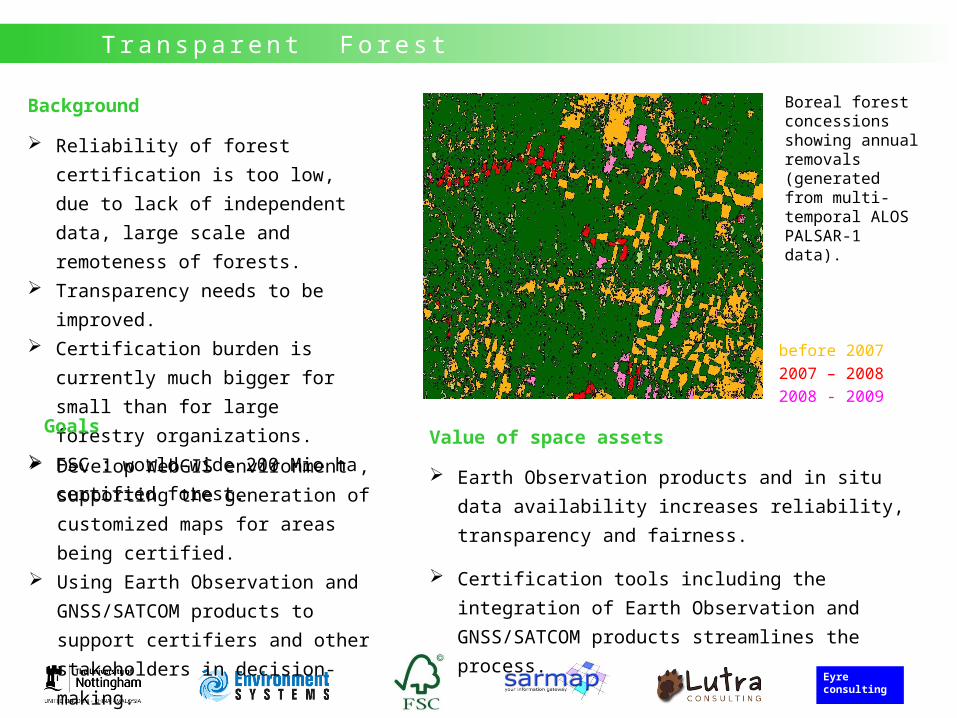
before 20072007 – 20082008 - 2009
Boreal forest concessions showing annual removals (generated from multi-temporal ALOS PALSAR-1 data).
Value of space assets
Earth Observation products and in situ data
availability increases reliability, transparency and
fairness.
Certification tools including the integration of
Earth Observation and GNSS/SATCOM products
streamlines the process.
Goals
Develop WebGIS environment ,
supporting the generation of
customized maps for areas being
certified. Using Earth Observation and
GNSS/SATCOM products to support
certifiers and other stakeholders in
decision-making.
SpaceforMed
Eyre consulting
Tr a n s p a re n t Fo re s t
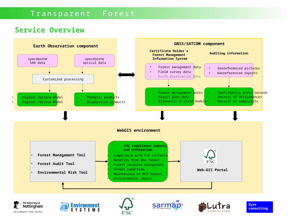
Service Overview
• Digital Surface Model• Digital Terrain Model
Earth Observation component
• Thematic products• Biophysical products
Auditing information
Customized processing
spaceborneSAR data
spaceborneoptical data
WebGIS environment
• Forest Management Tool
• Forest Audit Tool
• Environmental Risk ToolWeb-GIS Portal
FSC Compliance reports and information
• Compliance with FSC criteria• Benefits from the forest• Forest resource management• Forest condition• Maintenance of HCV forest• Environmental impact
• Georeferenced pictures • Georeferenced reports
• Confirmatory photo records• Records of disturbances• Records of complaints
Certificate Holder’s Forest Management Information System
• Forest management data • Field survey data• Earth Observation data
• Forest management units• Forest plot data• Allometric & yield models
GNSS/SATCOM component
SpaceforMed
Eyre consulting
Tr a n s p a re n t Fo re s t
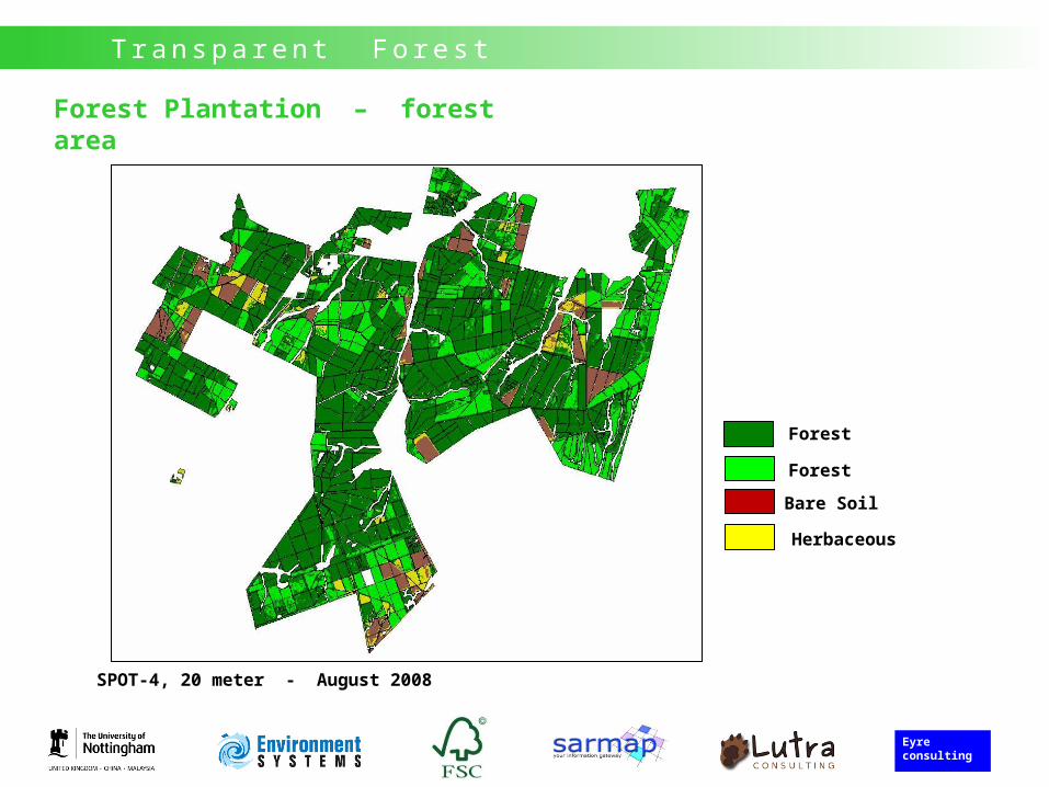
Forest Plantation – forest area
SPOT-4, 20 meter - August 2008
Forest
Forest
Bare Soil
Herbaceous
SpaceforMed
Eyre consulting
Tr a n s p a re n t Fo re s t
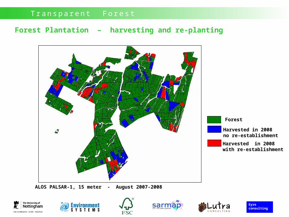
Forest
Harvested in 2008no re-establishment
Harvested in 2008with re-establishment
ALOS PALSAR-1, 15 meter - August 2007-2008
Forest Plantation – harvesting and re-planting
SpaceforMed
Eyre consulting
Tr a n s p a re n t Fo re s t
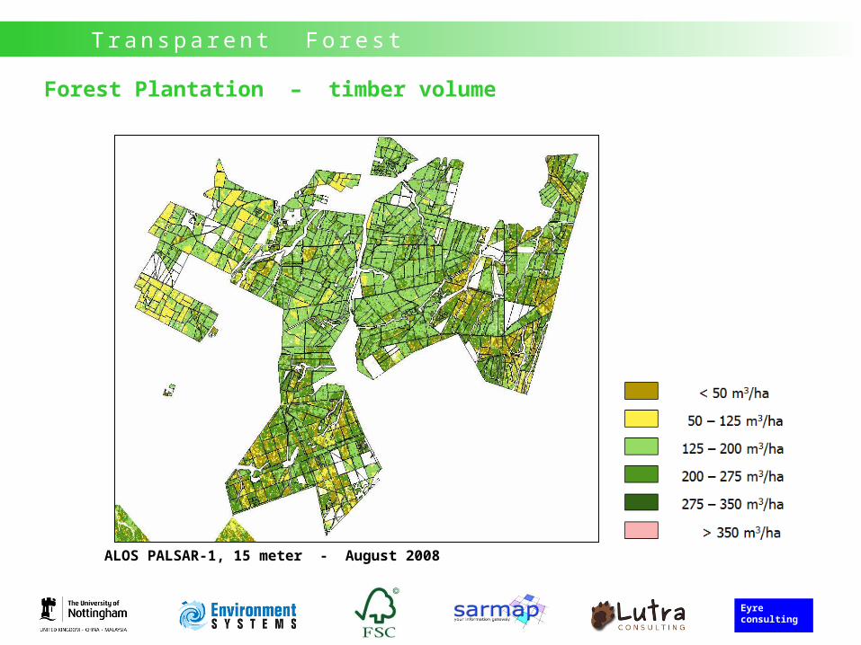
Forest Plantation – timber volume
ALOS PALSAR-1, 15 meter - August 2008
SpaceforMed
Eyre consulting
Tr a n s p a re n t Fo re s t
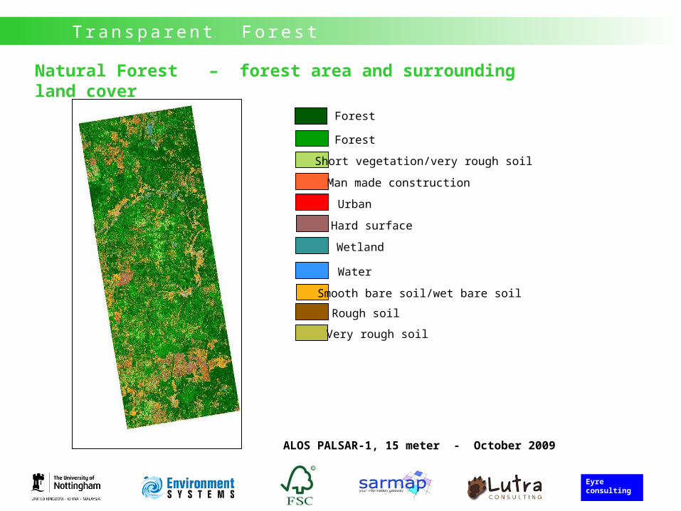
Natural Forest – forest area and surrounding land cover
ALOS PALSAR-1, 15 meter - October 2009
Forest
Forest
Short vegetation/very rough soil
Man made construction
Urban
Hard surface
Wetland
Water
Rough soil
Smooth bare soil/wet bare soil
Very rough soil
SpaceforMed
Eyre consulting
Tr a n s p a re n t Fo re s t
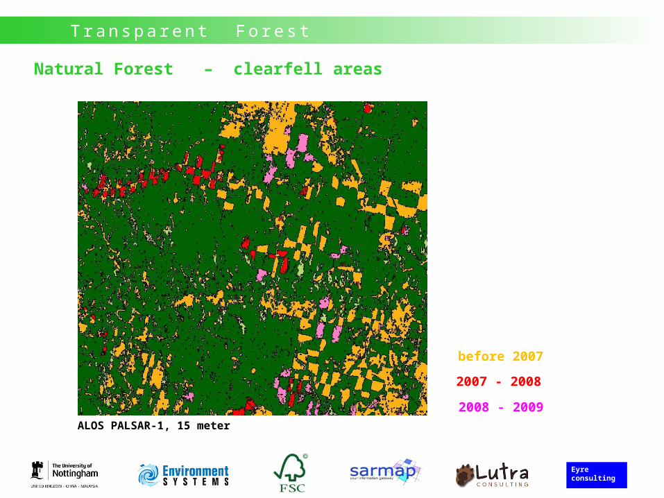
Natural Forest – clearfell areas
2007
2008
2009
before 2007
2007 - 2008
2008 - 2009ALOS PALSAR-1, 15 meter
SpaceforMed
Eyre consulting
Tr a n s p a re n t Fo re s t
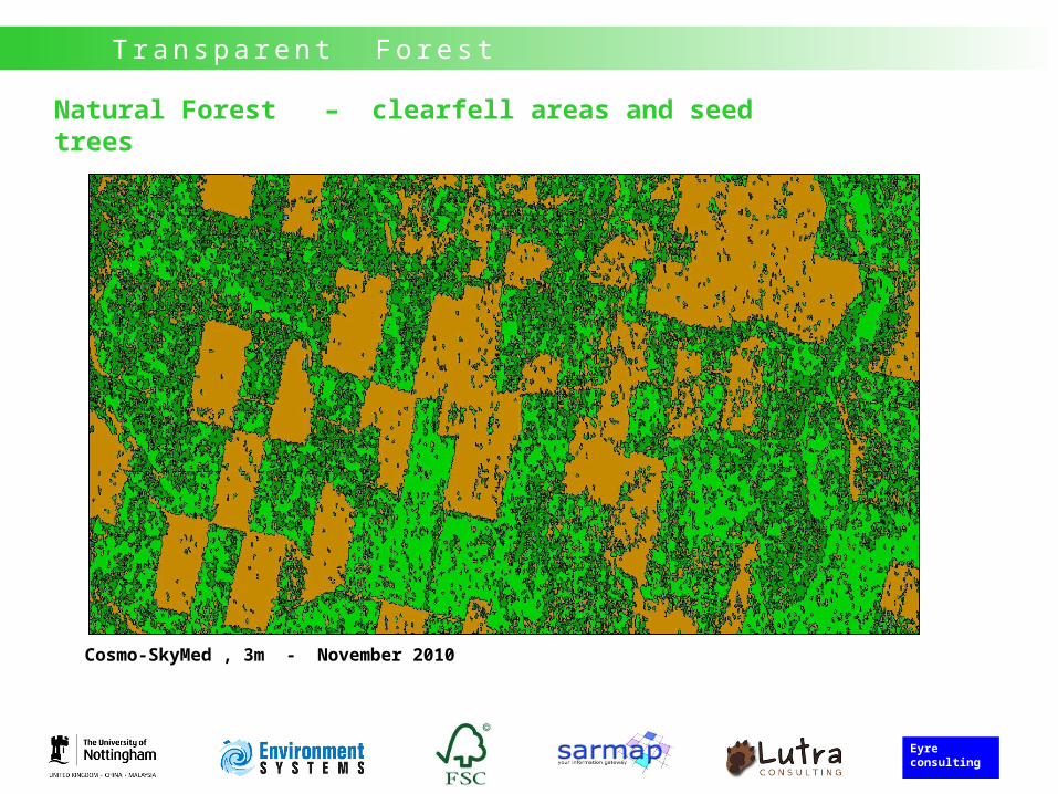
Natural Forest – clearfell areas and seed trees
Cosmo-SkyMed , 3m - November 2010
SpaceforMed
Eyre consulting
Tr a n s p a re n t Fo re s t
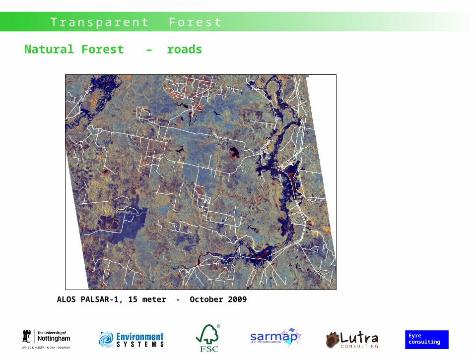
Natural Forest – roads
ALOS PALSAR-1, 15 meter - October 2009
SpaceforMed
Eyre consulting
Tr a n s p a re n t Fo re s t
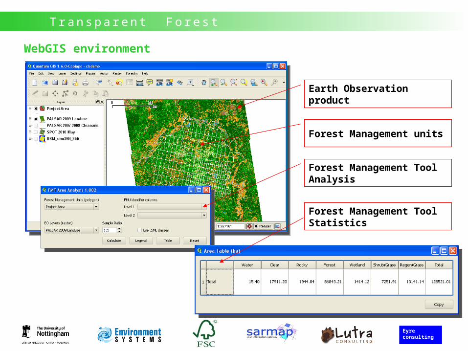
WebGIS environment
Earth Observation product
Forest Management units
Forest Management Tool Analysis
Forest Management Tool Statistics
SpaceforMed
Eyre consulting
Tr a n s p a re n t Fo re s t
Thank you for your attention