special places in the ocean
TRANSCRIPT

Special Places in the Ocean
A Decade of Describing Ecologically or Biologically Significant Marine Areas (EBSAs)

Published by the Secretariat of the Convention on Biological Diversity.
ISBN: 9789292257132
Copyright © 2021, Secretariat of the Convention on Biological Diversity.
The designations employed and the presentation of material in this publication do not imply the expression of any opinion whatsoever on the part of the Secretariat of the Convention on Biological Diversity concerning the legal status of any country, territory, city or area or of its authorities, or concerning the delimitation of its frontiers or boundaries.
The views reported in this publication do not necessarily represent those of the Secretariat of the Convention on Biological Diversity. This publication may be reproduced for educational or non-profit purposes without special permission from the copyright holders, provided acknowledgement of the source is made. Reuse of figures and photos is subject to permission from the original rights holders. The Secretariat of the Convention on Biological Diversity would appreciate receiving a copy of any publications that use this document as a source.
Citation: Secretariat of the Convention on Biological Diversity (2021) Special Places in the Ocean: A Decade of Describing Ecologically or Biologically Significant Marine Areas. 68 pages.
Authors: David E. Johnson, Vikki Gunn, Nicholas Bax, Daniel Dunn and Christopher Barrio Froján, Global Ocean Biodiversity Initiative.
For further information, please contact:
Secretariat of the Convention on Biological DiversityWorld Trade Centre413 St. Jacques Street, Suite 800Montreal, Quebec, Canada H2Y 1N9Phone: 1 (514) 288 2220Fax: 1 (514) 288 6588E-mail: [email protected]: www.cbd.int
Design: Seascape Consultants LtdCover photo: Local fishermen, Kattankudy, Sri Lanka

Special Places in the Ocean
A Decade of Describing Ecologically or Biologically Significant Marine Areas (EBSAs)

1
Contents
Acknowledgments...............................................................................................................................................................................................2Foreword ..............................................................................................................................................................................................................4Executive Summary ............................................................................................................................................................................................5List of Acronyms .................................................................................................................................................................................................71. Ecologically or Biologically Significant Marine Areas ................................................................................................................. 10
Inception of the EBSA process ....................................................................................................................................................................11The CBD regional EBSA workshop process ..............................................................................................................................................13
2. EBSA Stories ................................................................................................................................................................................... 20Baltic Sea ........................................................................................................................................................................................................22Black Sea and Caspian Sea ...........................................................................................................................................................................23Seas of East Asia ............................................................................................................................................................................................24Eastern Tropical and Temperate Pacific Ocean ........................................................................................................................................25Mediterranean Sea ........................................................................................................................................................................................26North Pacific Ocean .....................................................................................................................................................................................27North-East Indian Ocean ............................................................................................................................................................................28North-West Indian Ocean and Adjacent Gulf Areas ...............................................................................................................................29North-West Atlantic Ocean .........................................................................................................................................................................30South-East Atlantic Ocean ..........................................................................................................................................................................31Southern Indian Ocean ................................................................................................................................................................................32Western South Pacific Ocean ......................................................................................................................................................................33Wider Caribbean and Western Mid-Atlantic Ocean ...............................................................................................................................35North-East Atlantic Ocean ..........................................................................................................................................................................36
3. Impact and Achievements ............................................................................................................................................................. 38A global process supporting national efforts.............................................................................................................................................39Uptake in global and regional processes ....................................................................................................................................................40Strengthening the science base ...................................................................................................................................................................45Raising awareness, building capacity .........................................................................................................................................................47
4. Outlook and Legacy ....................................................................................................................................................................... 50The EBSA process: challenges and shortcomings .....................................................................................................................................51Scientific gaps, geographic holes .................................................................................................................................................................52Addressing capacity needs ...........................................................................................................................................................................54Integrating traditional knowledge ..............................................................................................................................................................54Targeting future research to fill gaps in EBSA information ....................................................................................................................55Improving integration with other independent ‘EBSA-like’ processes: IMMAs and IBAs .................................................................56Recognising national processes...................................................................................................................................................................57Using EBSA information to inform planning and management ............................................................................................................59Remaining challenges and future directions .............................................................................................................................................60In conclusion .................................................................................................................................................................................................61
Co-chairs of CBD Regional EBSA Workshops ................................................................................................................................. 63Photo credits ......................................................................................................................................................................................................65References ..........................................................................................................................................................................................................65

2
Acknowledgements
The Secretariat of the Convention on Biological Diversity acknowledges, with appreciation, the many governments, organizations, collaborators and experts who have contributed to the success of work on ecologically or biologically significant marine areas (EBSAs), in particular:
• The Japan Biodiversity Fund and other donors for providing generous financial support for work under the CBD on EBSAs;
• Hosts of the CBD regional EBSA workshops for their kind hospitality and support;
• The Commonwealth Scientific and Industrial Research Organisation and the Duke University Marine Geospatial Ecology Lab for their enormous data support to the CBD regional EBSA workshops;
• CBD regional EBSA workshop co-chairs for their leadership in steering the workshops to productive outcomes;
• Participants of the CBD regional EBSA workshops for contributing their time and scientific knowledge to the description of EBSAs;
• Various global and regional intergovernmental organizations for contributing to the EBSA process and building linkages with their respective processes, and
• Data providers who contributed their valuable information to the CBD regional EBSA workshops.
The Secretariat and authors of this report wish to extend their thanks to the many colleagues who provided material for the EBSA case studies in chapter 2. Grateful thanks are also due to those who kindly allowed the use of their photographs in this publication; credits are provided at the end of this document.

3
King penguins, Antarctica
3

4
Foreword
A decade ago, the CBD community embarked on an epic journey around the world to map and describe the “special places” of the ocean and seas – places that are the most important to the healthy functioning of the global marine ecosystem – known as “ecologically or biologically significant marine areas”, or EBSAs.
At the first CBD regional EBSA workshop in Fiji in 2011, we could not have imagined the adventure ahead, with over 300 EBSAs described by hundreds of experts through 15 regional EBSA workshops covering more than 75 per cent of the world’s oceans. Now, after 10 years, it is time to take stock of this incredible expedition and look to the future.
This journey has been highly collaborative, with more than 500 experts from 144 countries participating in the EBSA process, and has gained widespread global recognition. This science- and data-rich process has coalesced a wealth of knowledge in a wide variety of forms, providing an important tool to support governments and competent authorities in identifying where to focus their efforts to conserve and sustainably use marine and coastal biodiversity and further focus research efforts.
The value of the EBSA process is more than just the EBSAs themselves. The EBSA process has provided many tangible co-benefits: facilitating regional-scale collaboration and information-sharing, elevating political attention and spurring action for improved management, identifying knowledge gaps and areas in need of further research, catalysing new partnerships and building national capacities.
There have also been bumps along the road and many challenges faced. There remain some parts of the ocean that were not able to be fully considered in the EBSA process, particularly in deep and distant areas of the ocean, and difficulties in integrating the knowledge of indigenous peoples and local communities. And the severe lack of data, particularly in the developing world, continues to confound efforts to build a robust understanding of marine ecosystems.
Perhaps most importantly, we must ensure that the EBSA process can be adaptive and incorporate new knowledge into the future, and that the EBSA descriptions that were so painstakingly compiled continue to stay relevant. A decade of describing EBSAs means that some descriptions are now 10 years old and may need updating. And major drivers of biodiversity change, such as climate change, are contributing to rapid transformations in marine ecosystems, affecting many of the features previously described as EBSAs. The EBSA process must continue to keep pace with the many discoveries in the ocean emerging seemingly every day.
The tenth anniversary of the EBSA process also coincides with the development of the post-2020 global biodiversity framework, which will put in place new global goals and targets for biodiversity. The EBSAs and the EBSA process will be an essential tool for implementing the post-2020 framework and achieving the 2050 Vision for Biodiversity which aims at “Living in harmony with nature” where “by 2050, biodiversity is valued, conserved, restored and wisely used, maintaining ecosystem services, sustaining a healthy planet and delivering benefits essential for all people”.
This report, produced with the generous support of the Japan Biodiversity Fund, was commissioned to take stock of the tremendous progress made through the EBSA process on the tenth anniversary of the first EBSA workshop. Rarely have we had the opportunity to hear the stories behind these EBSAs, from those that know them best. Nor have we previously captured, in one place, the role of EBSAs in the wider context, examining how they have impacted national and regional efforts for conservation and sustainable use and influenced developments in other multilateral processes.
Through this report, we also hope to inspire those who have not yet been part of the EBSA journey to join in this important process that has already achieved so much thanks to hundreds of experts who have contributed their knowledge and data to this process, the technical teams who have supported us throughout, the governments that have supported the process, as well as the governments and organizations that have used EBSAs to work towards a better future for the ocean.
Elizabeth Maruma MremaExecutive Secretary
Convention on Biological Diversity

5
Executive Summary
Covering two-thirds of our planet and providing more than 90% of the habitable space on Earth, our oceans are home to a
vast diversity of life. From the smallest of microbes to the majestic blue whale, and from the shoreline to the deepest ocean trenches, marine life is found in all niches of the ocean. The balmy waters of the tropical oceans provide a comfortable home for colourful coral reefs, whilst cooler waters closer to the poles offer ideal conditions for their cold-water cousins; seamounts provide a rocky refuge for the myriad of anemones, sponges and corals clinging to their slopes as well as hiding places for fish, crustaceans and sharks, and the cold, dark abyssal plains – once thought to the be the deserts of the ocean – are now known to host an astonishing array of fauna. Even the apparently hostile conditions of hydrothermal vents, where superheated, mineral-laden fluids spew out into the ocean, are a paradise for specially adapted chemosynthetic ecosystems that thrive in what would normally present a highly toxic environment for life.
However, the marine environment is changing. In many parts of the world, marine biodiversity is facing major threats, such as habitat destruction, overharvesting, pollution and climate change. In order to protect, preserve and sustainably use marine biodiversity, we need to know where to focus and prioritize conservation and management efforts. This knowledge must be based on a sound understanding of the many different types of marine ecosystems in different regions, including which areas are the richest in life, which boast the greatest diversity and abundance of species, and which possess the rarest species and the most unique communities of marine flora and fauna.
Describing and identifying such special places in the ocean has been the core focus of the work under the Convention on Biological Diversity (CBD) on ecologically or biologically significant marine areas (EBSAs). An EBSA is an area of the ocean that has special importance in terms of its ecological and/or biological characteristics, for example, as essential habitats, food sources or breeding grounds for particular species. These areas can include seabed habitats from the coastline to deep ocean trenches, and can be located at a variety of depths in the water column from the surface to the abyss.
In an effort spanning more than a decade, over 300 of these special marine areas have been described around the world, through a scientific and technical process involving more than 500 experts from 144 countries. EBSAs are described on the basis of whether or not they meet one or more of seven internationally agreed scientific criteria. The process is facilitated through a series of regional expert workshops convened by the CBD that bring together scientists
and key data holders from a range of stakeholder organizations, including governments, intergovernmental and non-governmental organizations, research institutions, and indigenous peoples and local communities. A systematic review process culminates in the EBSA descriptions being considered by the Conference of the Parties to the CBD before formal identification as EBSAs.
The EBSA process is a purely scientific and technical exercise – it confers no management obligations as these are a matter for States and competent international organizations. However, the main purpose of EBSAs is to draw attention to those special areas of the ocean and inform measures that may be needed to safeguard biodiversity assets, be it through further scientific research, awareness raising among local communities, or better management of human activities.
To date, the regional EBSA workshop process has examined around 75% of the global ocean and has yielded a portfolio of EBSAs that encompasses a wide range of species, habitats, ocean features and biogeographic provinces. EBSAs range from nearshore to the deepest ocean and include ephemeral and seasonal oceanographic phenomena, as well as areas that are important for biodiversity all year round. The EBSA initiative has expanded our understanding and appreciation of areas that are less immediately visible to the conservation lens, as well as those areas that have more obvious ecological qualities or are home to charismatic species that never fail to capture the public’s attention. It is the only global process to date that has focused on the inherent ecological and biological value of marine ecosystems, considering such a diverse range of marine habitats, seascapes, species and taxa spanning such an enormous global reach. The impact of the EBSA process is illustrated in this report by a series of case studies that showcase an EBSA from each of the regional workshops convened thus far.
The impact of the EBSA process, however, goes far beyond the scientific and technical recognition of an area’s ecological or biological significance. The process has established itself as a global catalyst for regional collaboration, drawing together experts from many different fields, organizations and communities to work together to strengthen national capacity, regional cooperation and scientific understanding. Information held in EBSA descriptions provides a foundation for supporting ocean planning at different scales: it has served to spur national and regional conservation and management efforts as well as progress towards the Aichi Biodiversity Targets. Additionally, EBSA work has been referred to and utilized in a range of intergovernmental processes, including those that deal with issues related to the marine environment and sustainable development, within the context of United Nations Convention on the Law of the

6
Sea or other global/regional instruments and processes. The CBD Conference of the Parties (COP) has consistently encouraged the uptake of EBSA information by other intergovernmental processes at the global and regional levels, and as a consequence EBSAs have become part of the international ocean policy lexicon.
EBSAs have also helped to strengthen the ocean science base by focusing research efforts, building scientific capacities and raising awareness. Conservation and sustainable use of marine resources are knowledge-hungry endeavours: shifting baselines, environmental change, and the expanding human use of marine resources present an insatiable demand for new information, better understanding and innovative solutions. The EBSA process has exposed knowledge and data gaps, highlighted skills shortages in different scientific disciplines such as taxonomy, and has helped focus new scientific research into areas of the ocean about which we know far too little. Hand-in-hand with this is the need for capacity building. The Sustainable Ocean Initiative (SOI) – a platform coordinated by the CBD Secretariat to provide training and capacity building to developing countries in support of their progress towards global biodiversity targets – has raised awareness of the different tools and opportunities available to implement effective marine conservation actions in national waters, encouraged inter-ministry dialogue, and motivated local stakeholders and community groups to engage in such efforts.
Following a decade of work to describe EBSAs, some reflection on the achievements and challenges of these efforts is timely. The EBSA workshop process has evolved and been refined over time, proving itself to be sufficiently flexible and adaptable to meet the specific needs of diverse regions whilst maintaining the necessary scientific rigour to uphold the integrity of the process. Lessons learned from each regional EBSA workshop have iteratively improved the process for the following workshops in terms of participant engagement, communication, consensus building and integration of knowledge from diverse sources whilst maintaining a consistent approach.
Gap analyses have highlighted areas of the ocean that remain under-represented in the EBSA portfolio and pointed to where future efforts might be focused. Inevitably, these are often areas of
the ocean that are distant from land and/or the deepest parts of the ocean: difficulty in measuring and monitoring these areas results in a paucity of data that is not necessarily a reflection of the area’s lack of ecological or biological value. Other gaps exist due to insufficient evidence being available at the workshop to robustly support the case for an area to meet the EBSA criteria. New scientific research, harnessing global data, underpinned by capacity-building and including diverse knowledge systems such as local and traditional knowledge, can help address these gaps.
With new marine biodiversity information being generated through new tools and monitoring techniques, and via independent expert processes such as the description of Important Marine Mammal Areas and Important Bird and Biodiversity Areas, CBD Parties are looking for ways to ensure that new scientific information can be incorporated into the EBSA process.
The success of the regional-scale work has also catalyzed national EBSA efforts. In-country EBSA-like processes also have an important contribution to make to the global EBSA family and can illustrate how EBSA information can be used to support the development of marine spatial planning strategies, marine ecosystem monitoring programmes, the design of marine protected area networks and other area-based management measures.
Overall, the EBSA process has demonstrated the value of an intensely collaborative approach to marine biodiversity evaluation that is rare in contemporary marine science and management. It serves as an example of how to achieve rapid uptake of scientific products in pursuit of national and global goals for conservation and sustainable use of marine resources. Future challenges for the process are filling gaps, capturing best available science and promoting results, particularly in the face of the many and rapid changes taking place in the ocean that are placing marine life under increasing pressure. The global EBSA community is bound by a common interest in improving the foundation of scientific information for effective marine planning and remains at the forefront of continued efforts to protect, conserve and sustainably use those special places in the ocean.
7
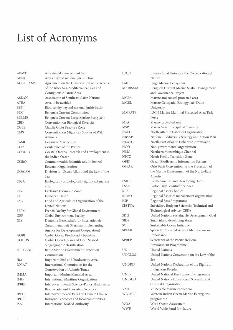
List of Acronyms
ABMT Area-based management toolABNJ Areas beyond national jurisdictionACCOBAMS Agreement on the Conservation of Cetaceans of the Black Sea, Mediterranean Sea and Contiguous Atlantic AreaASEAN Association of Southeast Asian NationsATBA Area to be avoidedBBNJ Biodiversity beyond national judrisdictionBCC Benguela Current CommissionBCLME Benguela Current Large Marine EcosystemCBD Convention on Biological DiversityCGFZ Charlie Gibbs Fracture ZoneCMS Convention on Migratory Species of Wild AnimalsCoML Census of Marine LifeCOP Conference of the PartiesCORDIO Coastal Oceans Research and Development in the Indian OceanCSIRO Commonwealth Scientific and Industrial Research OrganisationDOALOS Division for Ocean Affairs and the Law of the SeaEBSA Ecologically or biologically significant marine areaEEZ Exclusive Economic ZoneEU European UnionFAO Food and Agriculture Organization of the United NationsFFEM French Facility for Global EnvironmentGEF Global Environment FacilityGIZ Deutsche Gesellschaft für Internationale Zusammenarbeit (German Implementing Agency for Development Cooperation)GOBI Global Ocean Biodiversity InitiativeGOODS Global Open Ocean and Deep Seabed biogeographic classificationHELCOM Baltic Marine Environment Protection CommissionIBA Important Bird and Biodiversity AreaICCAT International Commission for the Conservation of Atlantic TunasIMMA Important Marine Mammal AreaIMO International Maritime OrganizationIPBES Intergovernmental Science-Policy Platform on Biodiversity and Ecosystem ServicesIPCC Intergovernmental Panel on Climate ChangeIPLC Indigenous peoples and local communitiesISA International Seabed Authority
IUCN International Union for the Conservation of NatureLME Large Marine EcosystemMARISMA Benguela Current Marine Spatial Management and Governance ProjectMCPA Marine and coastal protected areaMGEL Marine Geospatial Ecology Lab, Duke UniversityMMPATF IUCN Marine Mammal Protected Area Task ForceMPA Marine protected areaMSP Marine/maritime spatial planningNAFO North Atlantic Fisheries OrganisationNBSAP National Biodiversity Strategy and Action PlanNEAFC North-East Atlantic Fisheries CommissionNGO Non-governmental organizationNMC Northern Mozambique ChannelNPTZ North Pacific Transition ZoneOBIS Ocean Biodiversity Information SystemOSPAR Oslo-Paris Convention for the Protection of the Marine Environment of the North-East AtlanticPSIDS Pacific Small Island Developing StatesPSSA Particularly Sensitive Sea AreaRFB Regional fishery bodiesRFMO Regional fisheries management organisationRSP Regional Seas ProgrammeSBSTTA Subsidiary Body on Scientific, Technical and Technological Advice (CBD)SDG United Nations Sustainable Development GoalSIDS Small island developing StatesSOI Sustainable Ocean InitiativeSPAMI Specially Protected Area of Mediterranean ImportanceSPREP Secretariat of the Pacific Regional Environment ProgrammeUN United NationsUNCLOS United Nations Convention on the Law of the SeaUNDRIP United Nations Declaration of the Rights of Indigenous PeoplesUNEP United National Environment ProgrammeUNESCO United Nations Educational, Scientific and Cultural OrganizationVME Vulnerable marine ecosystemWIOMER Western Indian Ocean Marine Ecoregions programmeWOA Word Ocean AssessmentWWF World Wide Fund for Nature

8
Mangrove forests in the Saloum Delta National Park, Joal Fadiout, Senegal
8

9

10
1Ecologically or Biologically
Significant Marine Areas (EBSAs)

11
L ife is found throughout the ocean in enormous diversity. Marine biodiversity abounds from coastal zones to the open sea, from coral reefs to kelp beds, from polar ice floes to hydrothermal vents on the seafloor and beyond.
However, biodiversity is unevenly distributed, with some areas of the ocean boasting higher levels of productivity or diversity, and therefore being comparatively more important for marine and coastal ecosystems.
In order to protect and preserve marine biodiversity effectively, we need to know where to focus and prioritize conservation and management. We must have a good understanding of the many different types of marine ecosystems in different regions, including which areas are the richest in life, which boast the greatest diversity and abundance of species, and which possess the rarest species and the most unique communities of marine flora and fauna.
Describing and identifying such special places in the ocean has been the core focus of work on ecologically or biologically significant marine areas (EBSAs). An EBSA is an area of the ocean that has special importance in terms of its ecological or biological characteristics, for example, by providing essential habitats, food sources or breeding grounds for particular species. These areas can include all seabed habitats from the coastline to the open ocean, and can be located at any depth in the water column from the surface to the abyss.
Inception of the EBSA process
The global EBSA process emerged in the context of the Convention on Biological Diversity (CBD) and is an important initiative intended to support Parties in their efforts to implement the Convention. Opened for signature at the Earth Summit in Rio de Janeiro in 1992 and entering into force in December 1993, the CBD is an international treaty for the conservation of biodiversity, the sustainable use of the components of biodiversity, and the equitable sharing of the benefits derived from the use of genetic resources. With 196 Parties, the Convention has near-universal participation among countries. The Convention seeks to address all threats to biodiversity and ecosystem services through scientific assessments, the development of tools, incentives and processes, the transfer of technologies and good practices, and the full and active
involvement of relevant stakeholders including indigenous and local communities, youth, NGOs, women and the business community.
At the second meeting of the Conference of the Parties (COP) to the CBD, held in Jakarta, Indonesia in 1995, a comprehensive Global Biodiversity Assessment – commissioned by the United Nations Environment Programme (UNEP) and funded by the Global Environment Facility (GEF) – highlighted the evident pressure on marine and coastal environments worldwide. As a consequence, the Jakarta Mandate on Marine and Coastal Biological Diversity was adopted by the CBD COP, affirming a global consensus on the importance of marine and coastal biological diversity. The Mandate’s multiyear work programme to assist its implementation at national, regional and global levels was adopted at the fourth meeting of the CBD COP in Bratislava in 1998.

12
One of the five key elements of the Jakarta Mandate work programme was titled “Marine and coastal protected areas (MCPA)”, with one of its two objectives being to “Develop criteria for the establishment and management of marine and coastal protected areas” including through assisting in developing criteria for the selection of marine and coastal protected areas, where critical habitats for marine living resources should be one important criterion.
Subsequently, there was increasing interest and focus on the importance of conserving and sustainably using biodiversity in marine areas beyond national jurisdiction. In 2006, in decision VIII/24, the COP recognized that the CBD has a key role in supporting the work of the UN General Assembly with regard to marine protected areas (MPAs) beyond national jurisdiction, by focusing on provision of scientific and, as appropriate, technical information and advice relating to marine biological diversity, the application of the ecosystem approach and the precautionary approach, and in advancing the establishment of MPAs.
In the same decision, the COP requested the CBD Secretariat to convene an expert workshop to refine, consolidate and, where necessary, develop further scientific and ecological criteria for the identification of marine areas in need of protection, and biogeographical and other ecological classification systems, drawing on expertise and experience at the national and regional scale. The results of this workshop were to be provided to the CBD Subsidiary Body on Scientific, Technical and Technological Advice prior to its ninth meeting as well as to the Secretary-General of the United Nations for the purpose of informing the deliberations on marine biodiversity in areas beyond national jurisdiction under the UN General Assembly (decision VIII/24, para. 46).
To address this request, an expert workshop was held in the Azores, Portugal in 2007 to review and refine existing ecological criteria and biogeographic classification systems for marine areas in need of protection. From the workshop emerged seven scientific criteria
for identifying ecologically or biologically significant marine areas in need of protection (Table 1), which were adopted by COP 9, held in Bonn, Germany in 2008 (annex 1 of decision IX/20; para. 36 of decision X/29).
At this meeting, the COP urged Parties and invited other Governments and relevant organizations to apply, as appropriate, the scientific criteria and the scientific guidance to identify ecologically or biologically significant and/or vulnerable marine areas in need of protection. The application of the scientific criteria and guidance is intended to enable Parties, other Governments and relevant organizations to work together towards halting the rapid loss of marine biodiversity in open-ocean waters and deep-sea habitats.
To support Parties in their efforts in identifying EBSAs, the COP requested the CBD Secretariat to work with Parties and other Governments as well as competent organizations and regional initiatives, such as regional seas conventions and action plans and regional fisheries management organizations, to organize a series of regional workshops to facilitate the description of EBSAs. This request initiated a global process of regional workshops (figures 1 and 2) that has engaged an enormous number of experts from governments, global and regional organizations, academia and civil society, has catalyzed partnerships and capacity building to improve conservation and sustainable use of biodiversity, and, importantly, has identified more than 300 EBSAs all around the world (Figure 3).
Figure 1: Timeline of the evolution of the EBSA process

13
The CBD regional EBSA workshop process
As of 2021, the CBD Secretariat has convened 15 regional EBSA workshops, covering nearly the entire global ocean (Figure 2). Through an inclusive and science-driven process involving experts from all over the world and an enormous amount of scientific data, these regional EBSA workshops have described the areas of the ocean that are the most crucial to the healthy functioning of the global marine ecosystem.
Workshop participants include experts nominated by governments, intergovernmental organizations (including regional organizations), non-governmental organizations, academia, research institutions, and indigenous peoples and local communities (IPLCs). The workshop participants, with the support of a team dedicated to analysis and mapping of marine geospatial data, review and synthesize as much available information as possible in order to
1 EBSAs described in the Northeast Atlantic Ocean, during the most recent regional EBSA workshop (September 2019) have yet to undergo the formal CBD evaluation process, and therefore are not considered formally identified. Identification of these described EBSAs is on the agenda of the fifteenth meeting of the COP.
map and describe areas that may meet the EBSA criteria, which are then submitted to the CBD Subsidiary Body on Scientific, Technical and Technological Advice (SBSTTA) and the COP for consideration as EBSAs.
To date, more than 300 EBSAs worldwide have been formally identified by the CBD COP1 (Figure 3). The descriptions and associated technical information for all formally identified EBSAs are available via the EBSA website (www.cbd.int/ebsa).
In decision X/29, paragraph 26, the COP noted that the application of the EBSA criteria is a scientific and technical exercise, that areas found to meet the criteria may require enhanced conservation and management measures, and that this can be achieved through a variety of means, including MPAs and impact assessments. The COP also emphasized that the identification of EBSAs and the selection of conservation and management measures is a matter for States
Scientific criterion Definition
Uniqueness or rarity Area contains: (i) unique, rare or endemic species, populations or communities and/or (ii) unique, rare or distinct habitats or ecosystems and/or (iii) unique or unusual geomorphological or oceanographic features
Special importance for life-history stages of species Area that is required for a population to survive and thrive
Importance for threatened, endangered, or declining species and/or habitats
Area containing habitat for the survival and recovery of endangered, threatened, declining species, or areas with significant assemblages of such species
Vulnerability, fragility, sensitivity, or slow recovery Area that contains a relatively high proportion of sensitive habitats, biotopes or species that are functionally fragile (i.e., highly susceptible to degradation or depletion by human activity or by natural events) or with slow recovery
Biological productivity Area containing species, populations, or communities with comparatively higher natural biological productivity
Biological diversity Area contains comparatively higher diversity of ecosystems, habitats, communities, or species, or has higher genetic diversity
Naturalness Area with a comparatively higher degree of naturalness as a result of the lack of or low level of human-induced disturbance or degradation
Table 1: The scientific criteria for the description of EBSAs
“The North-West Atlantic is among the most data-rich parts of the global ocean, and an excellent testing ground for application of the EBSA criteria in a dynamic ocean. The diverse types of EBSAs identified, including areas significant for physical oceanography, seabed topography and benthic biodiversity, seabird foraging, and fish communities illustrate the inclusiveness of the EBSA criteria. EBSA workshop results have been used extensively in developing the network of protected areas for the North-West Atlantic and for bringing more spatial considerations into regional management of fisheries and transportation.”
Jake RiceChair of the Regional EBSA Workshop for the North-West Atlantic (2014)

14
“The Baltic Sea EBSA workshop was very well prepared and the experts had intense and inspiring discussions on the nature values of the Baltic Sea. It
was a stimulating learning process, how to combine knowledge on ecologically particular significant marine features to find the most precious areas.”
Penina Blankett and Dieter Boedeker Co-chairs of the Regional EBSA Workshop for the Baltic Sea (2018)
“In February 2012 Brazil hosted the second regional EBSA workshop and, because of the Caribbean region, we decided to include areas inside the Economic Exclusive Zones. Our technical and scientific intention was to welcome smaller areas of the Caribbean and still demonstrate the connectivity of larger areas in the South Atlantic. After that, all the regional workshops had the option to include the areas inside the EEZ, and I believe it has been a great gain for the knowledge of ocean biodiversity.”
Ana Paula Prates Co-chair of the Regional EBSA Workshop for the Wider Caribbean and Western Mid-Atlantic (2012)
and competent intergovernmental organizations, in accordance with international law, including the United Nations Convention on the Law of the Sea.
The description of EBSAs is based on the scientific information and expert knowledge available at the time of the workshop. Areas described as meeting the EBSA criteria have ranged from relatively small sites to very extensive oceanographic features, and they can overlap or be nested within each other. Areas may meet multiple EBSA criteria, but a strong response to just one is sufficient for description as an EBSA and there are no thresholds that must be met with respect to the criteria. Multiple ecological and/or biological
components of a given area can be described separately or as part of an interconnected system.
EBSA workshops have been convened at a regional scale, and areas described as meeting the EBSA criteria during those workshops are likewise assessed for their significance at a regional scale. This approach has allowed for strong collaboration with regional bodies in the organization of these workshops. It has also generally provided ecological coherence as it recognizes the fundamentally connected nature of the marine environment at a regional scale, and the consequent responsibility of States toward their neighbours when their actions affect shared resources (Dunn et al. 2014).
Above: Participants at the regional EBSA workshop for the Southern Indian Ocean, Mauritius, 2012.

15
Technical support for all the CBD regional EBSA workshops has been provided by experts either at the Commonwealth Scientific and Industrial Research Organisation (for regional EBSA workshops in the southern hemisphere) or Duke University Marine Geospatial Ecology Lab (for workshops in the northern hemisphere), within the context of the CBD Secretariat’s cooperation with the Global Ocean Biodiversity Initiative, which that was created by the government of Germany in support of the EBSA process. Below is an explanation of the process from each of these two teams.
Commonwealth Scientific and Industrial Research Organisation (CSIRO)
CSIRO first worked with the CBD Secretariat and SPREP to organize and run the first EBSA workshop, which took place in the South Pacific, and have provided scientific and technical support to five other regional EBSA workshops. Working with the representatives of Parties and other scientific experts to describe these areas has been a privilege and has given us the opportunity to learn about the incredible diversity of marine ecosystems in the world’s oceans, how they support people in many different ways, and how important it is to have local experts from different stakeholder groups engaged in identifying these significant areas.
CSIRO has worked alongside the CBD Secretariat as our understanding of how the EBSA criteria can be applied has evolved. The recognition of the need to use an inclusive approach when describing EBSAs has been reinforced with each workshop, and the information base underpinning EBSA descriptions has both increased and been used in more sophisticated ways. The role of capacity development and technology transfer to enable local experts to fully engage in scientific and planning exercises has emerged as an important issue. We have also worked with the Secretariat in implementing capacity-building activities under the Sustainable Ocean Initiative (SOI) to both complement EBSA workshops and to identify options for using the EBSA criteria and information in national marine spatial planning processes. We have built on our experience in the EBSA process into research on improved monitoring programmes, national marine spatial planning processes, risk assessments, and enhanced forms of management, including more recently the Blue Economy. With funding from the International Climate Initiative (IKI) programme via the GOBI partnership, we have used our experience in the EBSA workshops to develop and facilitate an inclusive process to describe bioregions for the Indian and South Pacific Oceans, which can be used to assess the completeness of the representativity of EBSAs in those ocean basins.
The EBSA process has provided a scientifically robust description of important marine areas in many places in the world that were lacking that information – a key first step in any management process. It has provided additional impetus for research and provided a strong rationale for many jurisdictions to modify management to account for the new information. It is an open and transparent process that has allowed people from all backgrounds to contribute their understanding of how the world’s oceans function, broadening participation to different disciplines.
Piers Dunstan & Nic BaxCommonwealth Scientific and Industrial Research Organisation
Duke University Marine Geospatial Ecology Lab (MGEL)
The Duke University Marine Geospatial Ecology Lab (MGEL) began working with the Secretariat of the Convention on Biological Diversity on both the formulation of the scientific guidance for the description of EBSAs prior to 2009 and the implementation of EBSA regional workshops since 2011.
MGEL provided scientific and technical support for nine regional EBSA workshops between 2012 and 2019. MGEL was also a participant in the initial regional EBSA workshop for the North-East Atlantic region, held in Hyeres, France (2010) and jointly organized by OSPAR and NEAFC in collaboration with the CBD Secretariat prior to the development of the current EBSA workshop process within the context of CBD. MGEL has maintained the global EBSA database of all workshop outcomes for the CBD Secretariat and has participated extensively in EBSA planning and advisory workshops and activities.
Working directly with regional experts to describe EBSAs in multiple ecosystems, at multiple scales, with significantly different information resources, across different geographic regions has been especially rewarding and informative. These efforts highlighted cases where significant information and documentation existed to support the full description of an EBSA, as well as cases where expert judgement indicated potentially important areas that were eventually dropped from consideration due to a lack of supporting evidence and documentation. The EBSA description process, from initial training sessions through final document preparation, was intensive but variable across regions. Variations in the expertise of participants, the available data and the level of previous regional assessments all contributed to expected variation in the number and specificity of EBSA descriptions developed across different workshop regions.
As an expert elicitation versus systematic conservation process, the description of EBSAs focused on the selection of known or named features. The EBSA process uses an individual, site-level criteria process, so does not consider broader network level criteria such as connectivity, representativity, adequacy or viability. This is in direct contrast to systematic conservation approaches that tend to be implemented by selecting from a variety of spatial indicator layers or environmental covariates through a selection or optimization process. The bias in this type of approach is to identify observed oceanographic or ecological features versus systematic approaches that optimize for areal coverage.
We feel that the results of the EBSA process can directly inform future priority setting for ocean monitoring, planning and governance issues. This work needs to be regularly revisited to assure that the most recent scientific information is considered and that potential errors of omission and or commission in the description of EBSAs and gaps in coverage are addressed into the future.
Pat HalpinDuke University Marine Geospatial Ecology Lab
Box 1: Technical support for the CBD regional EBSA workshops

16
It’s a people thing: The 15 CBD regional EBSA workshops to date have brought together experts from a range of government departments, sectors, regional bodies and national organisations

17
Figure 2: Global m
ap showing coverage of regional E
BS
A workshops to date

18
Figu
re 3
: Glo
bal m
ap s
how
ing
the
loca
tion
of E
BS
As
arou
nd th
e w
orld

19

20
2EBSA Stories

21
E BSAs are more than just shapes on a map; they are reflections of living, breathing ecosystems. EBSAs exist for nearly every type of marine ecosystem in nearly all parts of the ocean, from coastal areas, to the open ocean
and down to the deep sea. Some EBSAs are extremely large, spanning ocean basins, while others are comparatively very small. EBSAs can focus on specific components of a marine area, and only include features on the bottom of the ocean, or they can address whole interconnected ecosystems from the surface to the seafloor. EBSAs can describe features that are static, such as seamounts or hydrothermal vents, or they can describe dynamic features that change or move over time.
Most importantly, each EBSA has a story to tell.
The spectrum of impacts, benefits and practical applications of the EBSA process is best illustrated through a series of case studies. In this section, we showcase EBSA stories from each of the 14 regional workshops thus far considered by the Conference of the Parties to the CBD, plus one example from the suite of candidate EBSAs described in the most recent regional workshop (North-East Atlantic Ocean), the results of which are pending consideration at COP 15. These stories illustrate the diverse range of experiences and contexts for describing these special places in the ocean and demonstrate various ways to use EBSA information.
[A] Fladen, Stora Middelgrund and Lilla Middelgrund, Baltic Sea
[B] Danube Delta, Kuban Delta, Sefidroud Delta and Kura Delta
[C] Sulu-Sulawesi Marine Ecoregion
[D] The Costa Rica Thermal Dome
[E] North-Western Mediterranean Pelagic Ecosystems
[F] North Pacific Transition Zone
[G] Southern Coastal and Offshore Waters between Galle and Yala National Park
[H] Arabian Sea Oxygen Minimum Zone
[I] Seabird Foraging Zone in the Southern Labrador Sea
[J] South Africa’s Fossil Forest
[K] Northern Mozambique Channel
[L] Western South Pacific high aragonite saturation state zone
[M] Golden Floating Rainforest: Sargasso Sea
[N] Charlie-Gibbs Fracture Zone
Figure 4: Location of EBSA stories. Background bathymetry courtesy GEBCO

22
The regional EBSA workshop for the Baltic Sea provided the opportunity to illustrate that, despite the environmental problems in the region, this unique, young, semi-enclosed sea is of great ecological and biological significance. For example, the Fladen, Stora Middelgrund and Lilla Middelgrund – a group of three large offshore banks in the Kattegat, where large seafloor topographic variation supports habitat diversity, such as kelp forest in shallow areas, unique bubbling reefs and maerl beds – is an area important for fish, invertebrates, seabirds and marine mammals.
In the Baltic Sea region, the EBSA process functioned as a catalyst and provided important information to support further work, both nationally and regionally. It focused attention on the importance of considering areas of value in management and planning processes outside the existing Baltic Sea MPA network. By extension of this, the EBSA process has impacted the national and transboundary maritime spatial planning (MSP) processes in the Baltic Sea, facilitating the implementation of the joint HELCOM-VASAB (Helsinki Commission - Vision and Strategies around the Baltic Sea) MSP Working Group’s work plan.
2 www.panbalticscope.eu
On a regional level, the transboundary PanBaltic SCOPE project2 picked up the results and methods used in the EBSA work and brought the region closer to defining the concept of green infrastructure – features that ensure the protection of the biodiversity of the marine ecosystem and improve its functioning while promoting ecosystem services. The project also produced aggregated spatial ecological information using the EBSA criteria and focused specifically on defining how such results can be used in MSP.
On a national level, Finland, for example, is currently working to incorporate ecologically valuable areas into its MSP plans and processes. Using slightly modified EBSA criteria, national marine data and modelling, Finland has identified and delineated around 150 ecologically significant marine areas that are to be included in the MSP process. In line with the procedure for describing EBSAs, a technical description has been drafted for each area.
It is foreseen that the results of the EBSA process will contribute to other processes, such as the Red Listing of threatened species and biotopes, evaluation of effectiveness and coherence of MPA networks, and future HELCOM holistic assessments.
Baltic Sea
Fladen, Stora Middelgrund and Lilla Middelgrund, Baltic Sea [A]
by Jannica Haldin, HELCOM
The Baltic Sea coast, Finland

23
Of the 33 EBSAs described at the regional workshop to facilitate the description of EBSAs in the Black Sea and Caspian Sea, held in April 2017 in Baku, Azerbaijan, four captured the unique habitats created by river deltas, namely the Danube Delta Marine Area on the western shores of the Black Sea, the Kuban Delta on the south-eastern shore of the Sea of Azov (connected to the northern Black Sea by the narrow Strait of Kerch), the Sefidroud Delta on the southern shore of the Caspian Sea, and the Kura Delta on the eastern shore of the southern Caspian Sea.
Deltas are characterized by dynamic sedimentary habitats and variable levels of salinity. As a result, they tend to harbour freshwater, brackish water and marine species, although few species thrive under the full range of environmental conditions available. Nonetheless, adaptations displayed by species that specialize in their preferred set of conditions, together with the short-term tolerance of suboptimal conditions by transient species, make the whole deltaic assemblage remarkably diverse. Deltaic habitats are also renowned for supporting a high level of primary biological productivity, with river-borne nutrients promoting the growth of algae and plants that are grazed by millions of invertebrates in the water and sediment.
Fish and birds in turn feast on the worms and crustaceans. Such conditions make for ideal nursery grounds for fish species that as adults are of commercial importance, such as sturgeon. The marshes and mudflats also provide sustenance to millions of overwintering migratory birds. Consequently, all four deltas described have been designated Wetlands of International Importance by the Ramsar Convention on Wetlands and have been declared Important Bird and Biodiversity Areas by BirdLife International.
Recognizing the importance of the area for wildlife, the newly established Endangered Landscapes Programme of the Cambridge Conservation Initiative has funded a five-year project (2019-2024) to restore and rewild the Danube Delta region, by improving the ecological integrity and ecosystem functioning of the wetland and terrestrial habitats. Emerging initiatives like this reinforce and build upon the significance of such areas, which have been recognized by the international community during the EBSA process. They also demonstrate and exemplify to authorities in other similar areas the intrinsic worth and additional value generated by maintaining such areas as wilderness, benefiting not only nature, but local economies and human wellbeing as well.
Black Sea and Caspian Sea
Danube Delta, Kuban Delta, Sefidroud Delta and Kura Delta [B]
by Ahmet Kideys, formerly of the Black Sea Commission
Aerial view of the Danube Delta, Romania
“The Black Sea and the Caspian Sea have unique hydrographic, biological and ecological properties, including a high degree of endemism, but are subject to intense levels of human activity and are threatened by pollution and sea level fluctuations. Therefore, the assessment of the significant ecological features of these seas through the description of EBSAs was important to support the conservation as well as the sustainable and rational use of their marine resources, and also to support the effective implementation of the Tehran Convention and the Bucharest Convention.”
Ms. Jafarova Elnara Eldar and Ms. Shirin B. Karryeva Co-chairs of the Regional EBSA Workshop for the Black Sea and Caspian Sea (2017)

24
The Sulu-Sulawesi Marine Ecoregion EBSA was adopted by the CBD Parties in 2016 during COP 13, following its description during the Seas of East Asia Regional EBSA Workshop, held in December 2015. This EBSA captures the wide variety of coastal and marine habitats within the broader Coral Triangle3, the richest and most pristine marine biodiversity hotspot in the world, and incorporates the Tubbataha Reefs Natural Park in the Philippines, established in 2010. The Tubbataha Reefs are also a UNESCO World Heritage Site, an ASEAN Heritage Park, and a Wetland of International Importance under the Ramsar Convention on Wetlands.
The ecological and cultural significance of the region, the ecosystem’s vulnerability to damage from ship-sourced pollution and the growing risk of damage posed by an increasing volume of shipping traffic criss-crossing the overlapping boundaries of its numerous internationally recognized areas all highlighted the need for enhanced protection. Daily logs of ships traversing in the proximity of and - at times - within the buffer zone of the Park from 2010 to 2013 showed increasing shipping activities in the Sulu Sea, alerting Park authorities to the potential negative impacts of
3 The Coral Triangle is one of the most important reef systems in the world, representing 30% of the world’s coral reefs and covering 132,636 km2 across six countries: Indonesia, Malaysia, Papua New Guinea, the Philippines, the Solomon Islands and Timor-Leste.
the industry. Prompted by two ship-grounding incidents in 2013, the Government of the Philippines compiled a dossier of evidence, including ecological information set out in the EBSA description, supporting the case for measures to reduce the adverse impact of international shipping. In 2017, the International Maritime Organization designated Tubbataha Reefs as a Particularly Sensitive Sea Area (PSSA), establishing an “area to be avoided” (ATBA) protection measure for all ships exceeding 150 tonnes gross tonnage. Since 2017, ships that are on course to enter the ATBA receive advice to change course via radio from marine park rangers, and compliance with the ATBA restrictions has been high. The Philippine Government’s application for PSSA designation was supported by the UNESCO World Heritage Convention, the World Wide Fund for Nature and assisted by the Global Ocean Biodiversity Initiative. Buoyed by their success, these and other international organizations are redoubling their efforts in support of other vulnerable areas recognized as EBSAs that may also benefit from protection from international shipping activities.
Seas of East Asia
Sulu-Sulawesi Marine Ecoregion [C]
by Angelique Songco, Tubbataha Reefs Natural Park World Heritage Site
The Tubbutaha Reefs National Park ranger station, Philippines
24

25
The Upwelling System of Papagayo and Adjacent Areas EBSA is at the heart of the Costa Rica Thermal Dome, a large upwelling area off the Pacific coast of Central America. In this area, the shoaling of the thermocline brings cool, nutrient-rich waters to the surface, resulting in a massive phytoplankton bloom that feeds a complex array of diverse organisms. This highly productive area is a critical habitat for emblematic species, such as the blue whale and the leatherback turtle, and an important fishing ground for species such as yellowfin tuna and mahi-mahi. The Dome has additional economic relevance to nearby countries: species migrations between the Dome and the Central American coast sustain important coastal industries, such as whale watching and sport fishing.
The description of the Dome as an EBSA in 2015 attracted the attention of governments, NGOs and academic institutions in the region. Subsequently, multiple workshops have taken place in several countries to discuss key aspects of its management and conservation. Public awareness campaigns have started to communicate the importance and value of this area to the Central American population. International research programmes, such
as the Global Ocean Biodiversity Initiative’s work under the International Climate Initiative, have supported the generation and compilation of relevant scientific information into an Atlas of the Thermal Dome of Costa Rica. Furthermore, multiple workshops have been organized to discuss alternative governance models for this area, in preparation for negotiations to develop a new legally binding implementing agreement under UNCLOS for the conservation and sustainable use of biodiversity beyond national jurisdiction. The obvious ecological and economic relevance of the area has motivated the Central American countries to work together to commit to conserving the Dome and its resources as a collective regional responsibility.
The location of the Dome in the path of important navigational routes and the presence of active international fishing fleets within the area represent significant challenges to the maintenance of the Dome’s ecological services and associated marine life. In addition, the dynamic nature of the Dome demands innovative approaches for its management that will require sustained multi-sectoral effort in the coming decades.
Eastern Tropical and Temperate Pacific Ocean
The Costa Rica Thermal Dome [D]
by Jorge Jiménez, Fundación MarViva
Manta Ray, Pacific Ocean

26
The identification of the North-Western Mediterranean Pelagic Ecosystems as an EBSA was justified by the presence of an extraordinary pelagic faunal assemblage (cetaceans, marine birds, turtles, sharks and large pelagic fishes) sustained by the area’s special oceanographic and geomorphological characteristics. The area ranked high for all EBSA criteria except naturalness (ranked medium), which illustrates how criteria can underpin advocacy for management options.
The boundaries of the North-Western Mediterranean Pelagic Ecosystems EBSA circumscribe an area that is four times as large as the Pelagos Sanctuary (the marine mammal sanctuary established in 1999 in the Mediterranean Sea around Corsica), correctly reflecting the actual extension of cetacean habitats that the Sanctuary was designed to protect. This also justifies the effort of combining the existing conservation configuration of Pelagos with new
initiatives in order to best achieve the region’s conservation goals. Such initiatives include: (i) the identification within the EBSA of four Important Marine Mammal Areas (IMMAs), one candidate IMMA, and two Areas of Interest for marine mammals; (ii) the establishment by the Barcelona Convention of a Specially Protected Area of Mediterranean Importance (SPAMI) to protect a whale migratory corridor between the Balearic Islands and the continental mainland; and (iii) a proposal to IMO, within the framework of the Agreement on the Conservation of Cetaceans of the Black Sea, Mediterranean Sea and Contiguous Atlantic Area (ACCOBAMS), to consider the establishment of a PSSA within a large portion of the EBSA (coinciding with the North West Mediterranean Sea, Slope and Canyon System IMMA) to help address the negative effects of maritime traffic on the local cetacean populations.
Mediterranean Sea
North-Western Mediterranean Pelagic Ecosystems [E]
by Giuseppe Notarbartolo di Sciara, Tethys Research Institute
Endangered young Mediterranean monk seal males playfully interacting in the Mediterranean Sea off western Greece
26

27
Many important ocean features are discrete places that can be pinpointed on a map, such as seamounts, seeps, canyons, banks and islands. Their geographic locations never change. The waters of the ocean, however, are far from discrete. Water flows from place to place, cycles with the seasons, changes with depth and collides across hundreds and thousands of kilometres to convene parties of life. Dynamic ocean features – fronts, currents, upwelling zones – are crucial to the life histories of animals.
In the Pacific Ocean, the North Pacific Transition Zone (NPTZ) is one such dynamic feature. The NPTZ is 9,000 km wide and encompasses within it a seasonally migrating chlorophyll front driven by the convergence of warm water from subtropical gyres with the cold, nutrient-laden water from subarctic gyres. Located where two different water masses converge, the zone provides many things at once to many ocean life forms. For plankton, it is a kingdom. For Pacific bluefin tuna and loggerhead turtles, it is a superhighway. For Laysan and black-footed albatross, northern elephant seal and salmon sharks, it is a buffet. For neon flying squid, it is a growth accelerant. For fisheries, it is a hotspot.
There is no doubt that the NPTZ is a significant place in the Pacific Ocean for many species. However, at the regional EBSA workshop for the North Pacific, much discussion surrounded the consideration of an ocean basin-spanning and dynamic feature for candidacy as an EBSA. Could a region this large be an EBSA? Could a region this dynamic be an EBSA? How should a dynamic feature be appropriately represented on a static map? The discussion ultimately galvanized behind the scientific criteria, and the NPTZ was recognized as an EBSA.
My subsequent work on migratory predators in the Pacific Ocean, undertaken with many collaborators, shows predators travelling through over 30 different national jurisdictions during their migrations and spending up to 75% of the year in the high seas, including in the NPTZ. The impact of allowing the scale of EBSAs to expand to match the equally vast geographic scale of life histories of migratory animals was a critical paradigm that became foundational in discussions about managing migratory species across a dynamic ocean.
North Pacific Ocean
North Pacific Transition Zone [F]
by Autumn-Lynn Harrison, Smithsonian Migratory Bird Center
Loggerhead turtle

28
The area between Galle and Yala National Park in southern Sri Lanka, situated within the northern Indian Ocean, is particularly important for its high primary productivity, which sustains multiple species. This distinct biological habitat, encompassing three national protected areas, includes a population of non-migratory blue whales as well as around 20 other cetacean species, whale sharks, five species of turtles, mobulid rays, and multiple other marine predators, including sharks, other ray species, tuna and billfish. Many of these species are categorized as threatened on the IUCN Red List.
The identification of this EBSA has helped to highlight the importance of this region and make it a priority for additional management actions for a range of anthropogenic pressures. This is particularly relevant given that this area is utilised by several fisheries that impact mobulid rays, turtles, small cetaceans, amongst
other species. The larger cetaceans, including the population of blue whales, are also severely threatened due to an overlap with one of the world’s busiest shipping lanes. Consequently, there is significant noise pollution in addition to mortality inflicted by ship strikes.
Management efforts, for example discussions currently underway within the IMO to identify solutions to anthropogenic stressors, including potential relocation of shipping lanes or reduction of ship speeds, are further informed by the EBSA information. Looking more broadly, whilst there is certainly no single solution or method to eliminate the threats faced by these vulnerable marine ecosystems, multiple layers of initiatives – such as the description of EBSAs – play a crucial role in contributing to policy changes via consistent emphasis on the needs of particular regions requiring further attention. This ultimately leads toward positive change that benefits both the ecosystems and the species they support.
North-East Indian Ocean
Southern Coastal and Offshore Waters between Galle and Yala National Park [G]
by Daniel Fernando, Blue Resources Trust
Blue whale
28

29
The surface waters of the Arabian Sea are highly productive, as intense sunlight and abundant dissolved oxygen and nutrients sustain a thriving population of photosynthesizing plankton. These phytoplankton are grazed upon by countless millions of zooplankton that form dense swarms, which are in turn preyed upon by deep-
dwelling fish and squid that migrate to the surface at night to feed. As the waste products from all this feasting slowly sink, they are decomposed in mid-water by bacteria that “breathe” oxygen. The supply of waste is such that decomposing bacteria use up all the dissolved oxygen available, creating a permanent mid-water oxygen minimum zone. Other (anoxic) bacteria that “breathe” nitrate (instead of oxygen) can thrive where oxygen is depleted, producing nitrous oxide, a heat-trapping gas 300 times more potent than carbon dioxide.
Modelled climate change scenarios predict that as the temperature of the ocean rises, warmer surface water will not mix as readily with
cooler water below it, thus limiting the transfer of dissolved oxygen from the surface to mid-water. This will have the effect of enlarging the volume and spread of the mid-water oxygen minimum zone, rendering it uninhabitable for organisms intolerant to low oxygen levels, yet ideal for the proliferation of anoxic bacteria. As the oxygen minimum zone expands, the habitable oxygenated water layer above it is squeezed against the surface, with unknown repercussions on the distribution of ecologically and commercially important fish populations.
The Arabian Sea Oxygen Minimum Zone EBSA recognizes the importance of the diversity of organisms that are specially adapted to the natural occurrence of oxygen minimum zones. It also highlights the fact that this finely balanced ecosystem is highly sensitive to human impacts, in ways that are not always obvious. Description of this EBSA during the North-West Indian Ocean Regional EBSA Workshop exposed the paucity of reliable scientific data on many aspects of the ecology of the region. To address this shortfall, the region would benefit from a greater interest by the oceanographic community and its political and economic sponsors, making it an ideal candidate for promotion during the UN Decade of Ocean Science for Sustainable Development 2021-2030.
North-West Indian Ocean and Adjacent Gulf Areas
Arabian Sea Oxygen Minimum Zone [H]
by Lisa Levin, Scripps Institution of Oceanography
Microscopic marvels of the ocean: plankton
29

30
The Seabird Foraging Zone in the Southern Labrador Sea was described during the North-West Atlantic Regional EBSA Workshop in 2014. This site was identified from seabird tracking data and is a core foraging and wintering area for three seabird species from 20 populations, including the black-legged kittiwake, a species of conservation concern due to widespread population declines.
The identification of this site was facilitated through the Seabird Tracking Database, a global repository of seabird tracking data, hosted by BirdLife International. This database is a platform for international collaboration, and its strength is exemplified through data compilation inputs to international conservation processes such as the CBD-led EBSA process. This has the added benefit of providing conservation impact to the data owners who share their data with the database, and thus there is a reinforcing, snowball effect for collaboration and data sharing.
International discussion and scrutiny of the methods to analyse seabird tracking data to identify important areas at-sea – including the EBSA description of the Seabird Foraging Zone in the Southern Labrador Sea – have also increased acceptance and understanding of a data-driven approach to at-sea site identification. Since 2014, there has been increasing interest in this approach, and it has been
applied to a wide range of different seabird tracking datasets and contexts, including South Georgia Island (South Atlantic Ocean), the Caribbean, Tristan da Cunha (South Atlantic Ocean), and the West Indian Ocean. The increasing acceptance of the approach has also seen a subsequent push for designation of sites identified from tracking data as MPAs or included in marine spatial plans (tracking data influenced the zoning of the South Georgia and Sandwich Islands MPA).
Furthermore, tracking data studies have since led to the identification of other extremely important foraging areas for migratory seabirds, which were previously unknown by researchers and conservationists. For example, the compilation and analysis of data for 21 migratory seabird species from more than 100 colonies (located in both the North and South Atlantic) revealed another important hotspot, now known as the NACES (North Atlantic Current and Evlanov Seamount) area. It is estimated that this hotspot is used by around 3 and 5 million individual birds every year, particularly during their non-breeding season. Along with the Southern Labrador Sea, the NACES area is part of a network of important sites used by highly mobile species in the Atlantic. The NACES site is currently under consideration by the OSPAR Convention as a future High Seas MPA.
North-West Atlantic Ocean
Seabird Foraging Zone in the Southern Labrador Sea [I]
by Maria Dias and Tammy Davies, BirdLife International
Black-legged kittiwake

31
Thirty kilometres offshore of the diamond mining towns on the west coast of South Africa lies a unique feature with a story. Today, this coast is an arid area inshore of the cold productive Southern Benguela ecosystem, but the Namaqua Fossil Forest is proof that things were not always this way. On the seabed, in the dark depths between 120 m and 150 m in this upwelling system, is a series of fossilized yellow trees. It is difficult to imagine temperate forests in what is now an arid region, but this feature dates back to more than a hundred million years ago when the sea level was more than 200 m lower than today. The fossil forest was found in 1997 when a scientific submersible, the Jago, was exploring the offshore environment for mining operations. The submersible pilot described how amazed he was to find fossilized trunks of trees covered in delicate corals among the mosaic of muddy, sand and gravel habitats on the shelf.
The Namaqua Fossil Forest was first recognized as a potential site of ecological or biological importance during consultations held prior to the South-East Atlantic Regional EBSA Workshop, held in 2013. At that point, South Africa had been planning a network of offshore MPAs since 2006 using systematic conservation planning and hundreds of spatial datasets. This site had not been identified for protection, but during a review of areas that may meet the EBSA criteria, industry stakeholders raised the potential significance of the Fossil Forest. The area was subsequently described at the workshop, ranking high against the criteria for uniqueness and fragility in partucular.
The Namaqua Fossil Forest is a unique site of historical and ecological importance. It comprises two (now extinct) species of fossilized yellowwood trees from the same family (Podocarpaceae) as the national tree of South Africa. One of the extinct species, previously unknown, was named Podocarpoxylon jago after the submersible that enabled its discovery. The fossilized tree trunks have been colonized by fragile, habitat-forming scleractinian corals, and a
4 www.operationphakisa.gov.za
newly described habitat-forming Suberites sponge is also present in the area. The fossilized wood, accompanying cold-water coral colonies and habitat-forming sponges are considered vulnerable to any activities that could impact on the seabed. Although the area wasn’t originally planned for protection, the EBSA process ensured that this special place was taken into consideration in subsequent marine management efforts.
In 2014, the South African Government initiated Operation Phakisa4, a multi-sectoral initiative to fast-track South Africa’s ocean economy though development of industrial and commercial sectors, including oil and gas, seabed mining, aquaculture, tourism and transport. From the outset of the initiative, it was recognized that sustainable, responsible ocean governance and marine spatial planning were important to enhance the orderly and coordinated use of the ocean to benefit all. An identified target was to set aside 5% of South Africa’s ocean space for protection through the implementation of an MPA network – an ambitious task, as South Africa’s ocean protection coverage was still below 0.5% at the time. Operation Phakisa provided the multi-sectoral platform needed to pull together work already done, focus dedicated research in priority areas and co-ordinate multiple government departments in implementing protection.
On 24 October 2018, the South African Cabinet approved the Phakisa MPA Network, adding 54,000 km2 to South Africa’s protected area estate through 20 new MPAs, advancing protection from less than 0.5 to 5.4% of the ocean territory around South Africa. The Namaqua Fossil Forest MPA, along with 19 other new MPAs, came into effect in August 2019. All of these MPAs exclude mining and trawling. The EBSA process strengthened efforts to describe important ocean areas by bringing in new information, peer review and helped South Africa implement effective management action.
South-East Atlantic Ocean
South Africa’s Fossil Forest [J]
by Kerry Sink, South African National Biodiversity Institute
Namaqua National Park, South Africa

32
The Northern Mozambique Channel (NMC) was first recognised as an important marine area by the Western Indian Ocean Marine Ecoregions programme (WIOMER) in 2009 and a biogeographic study of corals, which contributed to its description as an EBSA in the Southern Indian Ocean Regional EBSA Workshop in Mauritius in 2012. These efforts, and formal recognition in the EBSA process, helped build a partnership initiative involving countries and conservation NGOs – dubbed the Northern Mozambique Channel initiative (NMCi) – with a focus on integrated ocean management across this part of the ocean, which is shared by six countries: Mozambique, Madagascar, Tanzania, Comoros, France and the Seychelles. The World Wide Fund for Nature (WWF), through its Madagascar office, and CORDIO East Africa led partners in the Consortium for the Conservation of Coastal and Marine Ecosystems in the Western Indian Ocean (WIO-C) in convening discussions on priority-setting for the region, to sustain its biological and ecological systems and provide for sustainable development for the participating countries. Set in the broader regional context of the Nairobi Convention and the Eastern African region, the NMCi emerged as a place-based initiative to build partnerships for sustainability.
The Northern Mozambique Channel has attracted high interest in regional fora in the Western Indian Ocean since its identification as an EBSA and has been frequently cited in subsequent communications. As a result, the region has been prominent in regional Voluntary Commitments made at the UN Oceans Conference in 2017, and in other regional ocean governance processes such as the Marine Regions Forum in 2019. It has been at the core of debates about blue economy development and the balance between ecosystem and species health on the one hand, and sectoral developments such as oil and gas on the other – both of which are headline topics in the Northern Mozambique Channel. The countries and partners involved, led by the Nairobi Convention, were successful in obtaining a grant (dubbed NoCaMo) from the French Facility for Global Environment (FFEM) in 2019, focused on three pillars: (i) establishing a common framework for marine spatial planning across the region, (ii) addressing oil and gas development through a focus on best practice and community/civil society engagement, and (iii) strengthening community-based natural resource management through learning networks that will eventually span from local to regional levels.
Southern Indian Ocean
The Northern Mozambique Channel [K]
by David Obura, CORDIO East Africa

3333

34
The dissolution of atmospheric carbon dioxide (CO2) in seawater results in a chemical reaction that forms carbonic acid, thus increasing the acidity of seawater. This increased acidity can dissolve calcium carbonate present in the shells and skeletons of marine organisms, as well as reduce the availability of building blocks for calcium carbonate in the water, which organisms need for its creation. The physiological stress of having to spend energy growing and maintaining shells and carbonate skeletons in a chemically hostile environment can take its toll on the longevity of individuals and on the viability of certain species. Hard corals, shelled phytoplankton (coccolithophores), molluscs and crustaceans are the most vulnerable to increased acidity of seawater.
One crystalline form of calcium carbonate commonly formed by living organisms is aragonite. In areas of increased acidity, the saturation of dissolved aragonite in seawater is low, hindering or preventing the growth of shells and skeletons. Mathematical models
can forecast areas of the ocean where aragonite saturation will be least affected by increasing levels of atmospheric CO2, thus pinpointing pockets of resilience to the effects of rising seawater acidity. One such area is the high aragonite saturation zone in the western South Pacific Ocean (identified as an EBSA by the 11th meeting of the COP, in 2015). It is thought that areas of high aragonite saturation will become refuges to calcifying species already living within them, whilst other areas deteriorate.
While it can be difficult to justify and implement the protection of ecologically or biologically important areas under many conventional conservation initiatives – especially areas identified by predictive models using less tangible evidence (such as chemical indicators) unlikely to visibly impinge on human activities or charismatic fauna – the scientific criteria behind the expert-driven EBSA process make it the ideal mechanism by which to recognize and draw attention to areas that may otherwise slip through the conservation net. Other examples of areas that are biologically or ecologically important but are not bound by a visible physical feature include migratory corridors for seasonal migrants and mid-ocean zones of intermittent high productivity.
Western South Pacific Ocean
Western South Pacific high aragonite saturation state zone [L]
Christopher Barrio Froján, GOBI Secretariat, and Ian Cresswell, University of New South Wales, Australia
Pacific coral reefs are home to an amazing array of biodiversity
34

35
In March 2012 at the Wider Caribbean and Western Mid-Atlantic Regional EBSA Workshop in Recife, Brazil, the Government of Bermuda proposed that the Sargasso Sea be described as an EBSA. The workshop considered that the 5 million km2 area of the Sargasso Sea met six out of the seven EBSA criteria, with a high rating. The formal EBSA description was developed by the Sargasso Sea Project based on a comprehensive science and management baseline study published in 2011, and the following October, at CBD COP11 in Hyderabad, India, the Parties requested that the Sargasso Sea be added to the EBSA repository.
Over the past decade, the Sargasso Sea Commission has used the EBSA description on a regular basis to raise awareness of the Sargasso Sea’s significance. The Sargasso Sea is the only named ecosystem to merit an individual chapter (Chapter 50) in the First United Nations World Ocean Assessment (2015), and that chapter has been updated in the Second Assessment (due in 2021).
The Sargasso Sea Project has also used the EBSA description as an important part of its strategy when seeking appropriate conservation measures within the relevant international and regional sectoral
organizations – including the International Maritime Organization (IMO), the International Commission for the Conservation of Atlantic Tunas (ICCAT), the North-west Atlantic Fisheries Organization (NAFO), the International Seabed Authority (ISA), and the Convention on Migratory Species (CMS) in relation to the work the Sargasso Sea Commission has been doing with CMS to promote the conservation of the high seas migratory routes and spawning areas of Anguillid eels.
The most notable conservation measure secured for the Sargasso Sea to date has been through NAFO. As a result of a proposal submitted by the European Union with the support of the United States, which relied on the EBSA description, at its 37th meeting in September 2015 NAFO prohibited the use of mid-water trawling gear that could impact the seafloor and enacted a moratorium on bottom trawling for exploratory fishing until the end of 2020. This is an excellent example of using the EBSA criteria and description to underpin effective management decisions.
Wider Caribbean and Western Mid-Atlantic Ocean
Golden Floating Rainforest: Sargasso Sea [M]
by David Freestone and Teresa Mackey, Sargasso Sea Commission
The Sargasso Sea, with its famous floating Sargassum seaweed

36
The CBD regional EBSA workshop covering the North-East Atlantic region (September 2019), described the Charlie-Gibbs Fracture Zone (CGFZ) as an EBSA, an outcome that was supported by SBSTTA at its 23rd meeting in November 2019 and will be considered further at COP 15 in 2021. Reaching a maximum depth of approximately 4,500 m and extending approximately 2,000 km in length, this unique geomorphological feature is the deepest connection between the two sides of the North Atlantic, providing an important route for deep-sea migratory species. The EBSA description includes sections of the Mid-Atlantic Ridge to the north and south, with associated seamounts. It also incorporates the meandering sub-polar front, a pelagic feature of elevated abundance and diversity for many taxa.
In terms of governance, the CGFZ is designated as an Oslo and Paris Convention (OSPAR Commission) High Seas MPA (Charlie-Gibbs South in 2010 and Charlie-Gibbs North in 2012), and as a Vulnerable Marine Ecosystem (VME), which has been closed for bottom fishing by the North East Atlantic Fisheries Commission (NEAFC) since 2009. Subsequently, in 2014 the Parties to the OSPAR Commission and NEAFC signed a Collaborative Arrangement reflecting consensus to jointly consider issues of mutual interest (covering both environmental protection and fisheries management). The EBSA description reinforces the exceptional natural value of this deep-sea feature, located beyond national jurisdiction. Broadly, the different regimes (MPA, VME, EBSA) recognize the same
ecological or biological assets that meet their individual sets of criteria. Non-governmental organizations, such as the World Wide Fund for Nature and Mission Blue, have also played a significant role in highlighting the importance of this area.
The CGFZ is an example of how an area described as an EBSA can draw attention to the latest scientific study and research. Much of the current knowledge of what lives there was derived from the MAR-ECO Project in 2004, a component of the Census of Marine Life. More recently, the European Union-funded H2020 ATLAS project has added new information, including the locations of sponge gardens and a skate nursery. Specifically, the EBSA description recognizes the significance of this unique and extensive mid-ocean area for biological diversity, vulnerability, fragility, sensitivity or slow recovery, and importance for threatened, endangered or declining species and/or habitats, such as orange roughy (H. atlanticus), deep-sea sponge aggregations and Lophelia pertusa reefs. More research is needed to understand biological productivity and any special importance for life history stages of species.
As one of the first High Seas MPAs, the CGFZ and its two main associated parallel rift valleys is in the vanguard of options for area-based management tools being considered by the UN negotiations for an international legally binding agreement for the conservation and sustainable use of biodiversity beyond national jurisdiction.
North-East Atlantic Ocean
The Charlie-Gibbs Fracture Zone [N]
by David Johnson, GOBI Secretariat
Bathymetric map showing the Charlie-Gibbs Fracture Zone EBSA in the north-east Atlantic. Deeper blue colours correspond to
greater water depth. Note that at the time of writing, this EBSA has not yet been formally considered by COP.
36

37

38
Impact and Achievements
3

39
Since its inception, the EBSA process has represented a significant achievement in support of the Convention, improving our understanding of marine ecosystems, supporting enhanced conservation and sustainable use,
catalyzing partnerships and capacity building, and providing a focus for research and monitoring efforts. EBSAs have also provided a major tool to support Parties to the CBD to live up to their responsibilities under the Convention, including through using EBSA information to inform their planning and management, to support the development and improvement of their National Biodiversity Strategies and Action Plans (NBSAPs) and to increase access to international funding for area-based planning, resource management and conservation efforts.
The EBSA process has expanded our understanding and appreciation of areas that are less immediately visible to the conservation lens, as well as those areas that have more obvious ecological qualities or are home to charismatic species that never fail to capture the public’s attention. The EBSA initiative is the only process to date that has focused on the inherent ecological and biological value of marine ecosystems, and considered such a diverse range of marine habitats, seascapes, species and taxa spanning such an enormous global reach. It has enabled scientists and decision-makers from different countries, organizations and sectors to work together to strengthen national capacity, regional cooperation and scientific understanding. The process has brought together a rich suite of information from diverse sources, combining publicly available data (e.g., through open access databases such as the Ocean Biodiversity Information System, OBIS) with information at different scales held by experts and national institutions. The EBSA criteria have been proven to be universally appropriate and fit for purpose, enabling intra-regional comparisons of ecological and biological qualities that highlight special areas. Indeed, the EBSA criteria represent a common currency across marine/maritime sectors that have stimulated a new multi-faceted dialogue among the CBD and international conservation agreements, sectoral management bodies and States (Dunn et al. 2014).
The diverse portfolio of marine areas meeting the EBSA criteria provides a foundation for supporting integrated ocean planning at different scales. The publicly available scientific and technical information highlighted by EBSAs can support their relevant obligations under the CBD to achieve the conservation and sustainable use of marine biological resources. Baseline information acquired, collated and quality assured through the EBSA process can be used as a basis for strategic environmental assessments and marine spatial planning, for the establishment of protected areas and other effective area-based conservation measures, for sectoral regulations, management measures and undertaking environmental impact/risk assessments, as well as establishing research priorities, monitoring, surveillance and control, among other activities.
A global process supporting national efforts
The value of the EBSA process should be acknowledged as much as the EBSAs themselves. In many cases it has served to spur national conservation and management efforts and prompted requests for national capacity building workshops. Indeed, a key aim of the EBSA process has been to provide Parties and competent international organizations with sufficient information to enable them to work towards the conservation and sustainable use of marine biodiversity in line with the CBD’s Strategic Plan, including its Aichi Biodiversity Targets, and individual countries’ NBSAPs. In parallel, a number of countries have undertaken EBSA-like exercises to highlight and describe areas of special ecological or biological significance in their national waters.
Efforts to describe EBSAs through a regional process have encouraged experts to work together at a national level, not only to share information, but as new or enhanced collaborations between ministries/agencies, across sectors and within communities. EBSA information has been used to promote new national conservation initiatives (see case study J on South Africa’s Fossil Forest), stimulate multilateral initiatives to better manage valuable but vulnerable areas of the ocean (see EBSA case study D on the Costa Rica Thermal Dome), and to engage communities in more sustainable ocean resource management practices (as demonstrated in case study K, the Northern Mozambique Channel). Additionally, regional EBSA workshops have catalyzed and enhanced collaboration and networking among experts and institutions at the sub-regional and regional scale among neighbouring countries, supporting the application of the ecosystem approach.
Among the most tangible outcomes of EBSA information being used to further conservation efforts is the establishment of MPAs or other area-based protection/management measures based on information provided by EBSA descriptions. An example of this is the extensive network of MPAs put in place by the Japanese authorities in their national waters (see Box 2).

40
The EBSA process was carefully studied in Japan by scientists and the Ministry of the Environment, Japan (MOEJ), especially after the adoption of the Aichi Biodiversity Targets during CBD COP10 in Nagoya. Realising that it had no accepted definition of MPAs, the Japanese government subsequently produced a report on how MPAs should be considered, and a definition of MPAs was considered by MOEJ. Based on a calculation by MOEJ, the area of MPAs in Japanese seas comprised 8.3% of all national waters but fell short of the Aichi Target 11 stipulation that 10% of coastal and marine areas should be under MPAs. As a result, the Cabinet decided to establish more MPAs to address the shortfall.
Since the annexes to the EBSA selection criteria suggest ways of selecting MPAs from EBSAs, Japan applied the criteria and protocols used by the EBSA process to its national waters. Japan considered EBSAs in three categories: (1) coastal area, (2) offshore surface waters, and (3) offshore deep sea, especially benthic areas. Looking at the Japanese marine area in this way highlighted that most areas meeting the EBSA criteria in shallow waters were already covered by existing MPAs, with no opportunity to expand MPA coverage towards the desired 10% total coverage. This left the offshore surface waters and the offshore seafloor as options for expansion. The offshore surface waters are heavily used by the fishing industry so, working on the principle that marine biodiversity should be conserved in coordination with its sustainable use, MOEJ decided to expand MPA coverage in the deep sea.
To set MPAs in the deep offshore benthic zone would require a change in Japanese law to “design” the protected area in the deep sea. At that time, MOEJ could only designate MPAs within 10 km from the coast, but Japanese law has since been changed to enable designation MPAs in the deep sea.
A decision on which areas meet the EBSA criteria and should therefore be declared as MPAs has yet to be determined and is currently under review, and the design of MPAs based on areas meeting the EBSA criteria is also an ongoing process. The MPA must protect its biodiversity assets from some human activities in the area, so threats to the area under consideration must be defined. Deep-sea fisheries and mining are the two principal threats to deep-sea benthic areas, so these two activities within any new MPA need to be managed. However, a large area is required in order to meet the 10% coverage level required by Aichi Target 11.
The Japanese deep-sea benthic MPAs will be classified into two categories: (1) areas where threatening activities can occur under application, and (2) areas where those activities can only occur with permission. The first area is very large, whereas the second area is likely to be small. MOEJ has selected which EBSAs will be considered for MPA designation and which EBSAs will not proceed to MPA designation. The decision-making process that will determine which EBSAs will become MPAs will commence in July 2020, before CBD COP15.
To conclude, the EBSA process has been very influential in the Japanese national MPA process and marine conservation policies. It has also stimulated new funding for scientific research in the deep sea in Japan, as well as monitoring efforts.
Yoshihisa ShirayamaJapan Agency for Marine-Earth Science and Technology
Uptake in global and regional processes
EBSA information has not only been used by governments and scientists around the world, but also supports global and regional processes. EBSA work has been referred to and utilized in a range of intergovernmental processes, including those that deal with issues related to the marine environment and sustainable development, within the context of UN Convention on the Law of the Sea or other global/regional instruments and processes. The CBD COP has consistently encouraged the uptake of EBSA information by other intergovernmental processes at the global and regional levels and has specifically requested that the outcomes of the regional EBSA workshops should be disseminated to these various processes.
The United Nations General Assembly (UNGA) has highlighted the work on EBSAs in all of its annual resolutions starting in 2010 after the adoption of the EBSA criteria, in which it has repeatedly called on governments to “…further consider options to identify and protect ecologically or biologically significant areas, consistent
5 UN General Assembly Resolutions A/RES/64/71, A/RES/65/37, A/RES/69/245, A/RES/67/78, A/RES/68/70, A/RES/69/245, A/RES/70/235, A/RES/71/257, A/RES/72/73, A/RES/73/124
with international law and on the basis of the best available scientific information”5.
Most recently, the UNGA process to develop an internationally legally binding instrument under UNCLOS on the conservation and sustainable use of marine biological diversity of areas beyond national jurisdiction (as set up by Assembly Resolution 69/292, and hereinafter referred to as the BBNJ process) has listed the EBSA criteria among the draft indicative criteria for the identification of areas requiring protection through the use of area-based management tools, including MPAs, and environmental impact assessments. The CBD Secretariat and various Parties and organizations have been active in raising awareness of the EBSA process through the hosting of various side events at the meetings of the BBNJ Preparatory Committee and subsequent Intergovernmental Conference sessions. In the negotiations themselves, EBSAs and the EBSA process have been referred to and highlighted in various ways for their value in facilitating the application of the ecosystem approach in marine areas beyond national jurisdiction.
Box 2: Adoption and application of the EBSA process in Japanese waters

41
The results of the regional EBSA workshops also informed the First Global Integrated Marine Assessment (also known as the World Ocean Assessment, WOA-16), the outcome of the first cycle of the United Nations Regular Process for Global Reporting and Assessment of the State of the Marine Environment, including Socioeconomic Aspects7, which completed its work in 2015. This landmark report, which examines the state of knowledge of the world’s oceans, provides an important scientific basis for the consideration of ocean issues by governments, intergovernmental processes, policymakers and all others involved in ocean affairs. Information contained within EBSA descriptions provided the basis for substantive sections of two regionally focused chapters (South Atlantic and South Pacific). The EBSA process was also important as a source of information in chapters on pecific ecosystems. The second World Ocean Assessment is currently under review, with publication expected in early 2021.
In 2014, the Secretariat of the Convention on Migratory Species (CMS) requested the Global Ocean Biodiversity Initiative (GOBI) to review the scientific data and results from the CBD EBSA process to: (1) determine how marine migratory species have factored in the description of EBSAs, and (2) explore the potential for the scientific data and information in EBSA descriptions to contribute to the conservation of migratory species in marine areas within and beyond the limits of national jurisdiction, particularly with respect to ecological networks and connectivity. The resulting paper8 was welcomed by the 11th meeting of the CMS COP in November 2014, resulting in a request to CMS Parties to actively participate in the EBSA process and mobilise all available data and information to ensure that the EBSA process has access to the best available science in relation to marine migratory species9 (Box 4).
UNGA Resolution 61/105 calls for fisheries to have no serious adverse impacts (SAIs) on vulnerable marine ecosystems (VMEs). Criteria for identifying VMEs, which are closely comparable to the EBSA cirteria, were developed by the Food and Agriculture Organization (FAO), approved by the UN10. The similarity of the VME and EBSA identification criteria (Rice et al., 2014) and their long-term goals (i.e., to maintain essential ecosystems) suggests
6 www.un.org/regularprocess/content/first-world-ocean-assessment
7 www.un.org/regularprocess
8 Kot et al. 2014; UNEP/CMS/COP11/Inf.23
9 CMS COP11/Resolution 11.25
10 FAO (2009) International Guidelines for the Management of Deep-sea Fisheries in the High Seas. Rome, 90pp.
11 Aichi Biodiversity Targets are a set of 20 global targets under the CBD’s Strategic Plan for Biodiversity 2011-2020. See https://www.cbd.int/sp/targets
12 UNCLOS defines the Area as “the seabed and ocean floor and subsoil thereof, beyond the limits of national jurisdiction”
13 Convention on the Law of the Sea, Dec. 10, 1982, 1833 U.N.T.S. 397.
that both systems could be reported by States as a contribution to implementation of the vulnerable ecosystem aspects of Aichi Biodiversity Target11 6 on sustainable fisheries (United Nations, 2016). As of 2020, eleven EBSAs intersect with VMEs across five EBSA workshop regions. Certain workshop areas have overarching policies that preclude the need for VMEs (e.g., the deep-sea bottom-trawling closure in the Mediterranean), but gaps in geographic coverage of deep-sea RFMOs likely contribute to the lack of VMEs in certain EBSA workshop regions.
FAO coordinated the GEF project on Sustainable Fisheries Management and Biodiversity Conservation of Deep-Sea Living Marine Resources and Ecosystems in Areas beyond National Jurisdiction (the “FAO Deep-Sea ABNJ Project”), which included components on EBSAs. The CBD Secretariat provided technical advice regarding the implementation of the project activities related to EBSAs, including activities to strengthen networks that provide EBSA information to communities of practice; improving EBSA descriptions; and supporting training workshops on the application of the EBSA criteria. The FAO Deep-Sea ABNJ Project highlighted the complementarity between EBSAs and VMEs.
The International Seabed Authority (ISA) is the organization through which States’ Parties to UNCLOS organize and control all mineral resource-related activities in the Area12 for the benefit of “mankind as a whole”13. In so doing, the ISA has the mandate to ensure the effective protection of the marine environment from harmful effects that may arise from deep seabed-related activities. Pursuant to this mandate, the ISA is developing regional environmental management plans (REMPs) for provinces where mineral exploration activities under contracts are carried out, such as the Mid-Atlantic Ridge, the Indian Ocean triple junction ridge and nodule-bearing province, as well as the north-west Pacific and South Atlantic for seamounts. The ISA’s work on developing REMPs is supported by a series of expert workshops, building on the experience in developing the Environmental Management Plan (EMP) for the Clarion-Clipperton Zone (CCZ), approved by the ISA Council in 2012, which included the designation of a network of nine “Areas of Particular Environmental Interest” (APEIs) that
“The description and identification of EBSAs has been instrumental in directing the attention of managers towards the major oceanic processes sustaining biodiversity that are in urgent need of protection. EBSAs introduced a much-needed change of spatial scale at which planning and implementing the protection of marine biodiversity can occur.”
Patricio BernalCo-chair of the Regional EBSA Workshop for the Eastern Tropical and Temperate Pacific (2012)

42
Figure 5: UN Agencies, Programmes and related organizations with criteria suites used to identify important marine areas in need of heightened management. Updated from Dunn et al. (2014)
In 2010, the CBD COP called on regional seas conventions and action plans and regional fisheries management organizations to organize a series of workshops to describe EBSAs. The North-East Atlantic Fisheries Commission and the OSPAR Commission quickly responded to this call for action and worked together with the CBD and the International Council for the Exploration of the Sea (ICES) to develop ten EBSA proposals for the North-East Atlantic, of which four were refined through an ICES review. This first action to describe EBSAs regionally created a model for the EBSA process. Following a hiatus, OSPAR and NEAFC jointly requested CBD to establish a new workshop to finalize the proposals for EBSA in the North-East Atlantic, in line with the approach taken in consecutive regional EBSA workshops convened by the CBD. The CBD regional EBSA workshop for the North-East Atlantic Ocean (September 2019) considered the earlier OSPAR and NEAFC proposals along with new evidence, described 17 areas that met the scientific EBSA criteria and submitted them to the CBD process towards an eventual inclusion in the EBSA repository.
Working together on describing EBSAs has been a very useful process for NEAFC and OSPAR – in some ways at least as useful as identifying the information itself. Both OSPAR and NEAFC already had measures in place when the EBSA process was initiated, consisting of MPAs, closures to bottom fisheries and other fisheries conservation measures. Thus, both organisations had progressed beyond the identification of features of significance, i.e., the focus of the EBSA work, to the implementation of measures needed to protect the features. Nevertheless, the process of working together on describing EBSAs, considering new and relevant scientific information, and – most importantly – finding processes that enabled consensus, have been beneficial to both organizations. This cross-sectoral approach has also contributed to improved coordination between environment and fisheries administrations at a national level, given the need for consistent national positions at the two organizations. OSPAR and NEAFC can now look forward to the new EBSA information in the North East Atlantic informing their respective scientific processes, including for example during meetings under the Collective Arrangement* and independent ICES scientific advice required by NEAFC for its decisions.
Darius Campbell, Secretary, North-East Atlantic Fisheries CommissionLena Avellan, Acting Executive Secretary, OSPAR Commission
* www.ospar.org/about/international-cooperation/collective-arrangement
Box 3: Regional perspective - North-East Atlantic

43
Arabian humpback whale breaching off the coast of Oman
43

44
The CBD EBSA process has directly and indirectly contributed to the conservation of marine migratory species within the Northwest Indian Ocean region and the implementation of the Convention on Migratory Species (CMS).
Marine migratory species – waterbirds and seabirds, sharks and rays, whales and dolphins, dugongs and marine turtles – represent the world’s extraordinary marine biodiversity at its most visible and charismatic. Through their journeys, these animals connect the world’s ecosystems, countries and cultures, make an important contribution to ecosystem structure and function and ultimately contribute to human well-being.
In 2011, the 10th Meeting of the CMS Conference of the Parties (COP) recognized that “processes, workshops and tools are underway within the [CBD] that can assist in identifying habitats important for the lifecycles of migratory marine species listed under CMS Appendices” (CMS COP Resolution 10.3). At its next meeting in 2014, the COP called on CMS Parties and others to collaborate with and participate actively in the EBSA process, and mobilize all available data and information related to marine migratory species (CMS COP Resolution 11.25).
CBD EBSA Workshop for the Northwest Indian Ocean and Adjacent Gulf Areas (2015)
The CMS Office in Abu Dhabi worked with the CBD Secretariat to mobilize CMS’ specialist knowledge networks to contribute to the Regional EBSA Workshop for the Northwest Indian Ocean and Adjacent Gulf Areas (Dubai, 2015). The information generated by the workshop, the collaborative relationships formed and the EBSAs that were described went on to positively impact many countries in the region, and support the implementation of the CMS Programme of Work on Cetaceans, the CMS Dugongs and Sharks Memoranda of Understanding (MOU), and the CMS Indian Ocean and South-east Asia Marine Turtle MOU, including its site network process.
The workshop outputs provided a foundation to guide new work in Oman and Pakistan to establish distribution and migratory routes of Arabian Sea Humpback Whales. In Pakistan, the EBSA process resulted in the description of six EBSAs that were used to inform discussions on developing these areas into MPAs (Moazzam Khan pers. comm, July 2020). A CMS Concerted Action for the Arabian Sea Humpback Whale was adopted by CMS COP12 in 2017 and emphasizes the need for coordinated research and monitoring, and the development of a conservation management plan. In Pakistan, the descriptions for the Churna-Kaio Island Complex EBSA and the Mani Hor EBSA, the former important for marine megafauna including baleen whales, whale sharks and mobulids, and the latter important for migratory birds, have also informed the process with the Government of Baluchistan for developing these areas into MPAs. The descriptions of two other EBSAs – Sandspit/Hawks Bay and the Adjoining Backwaters, and the Indus Estuarine Area and Associated Creeks – are informing discussions with the Government of Sindh to create MPAs. The Malan-Gwader Bank EBSA encompasses the Astola Island MPA – Pakistan’s first MPA, created in 2017.
In Iran, just to the west of the Malan-Gwader Bank EBSA, a significant portion of Iran’s coastline was also described in the workshop as the Makran/Daran-Jiwani Area EBSA which is important for cetaceans and marine turtles. These EBSAs provide a possible basis for future international cooperation between Pakistan and Iran to manage this near-contiguous area of coastline important for marine migratory species (Moazzam Khan pers. comm, July 2020).
For Oman, the description of the Oman Arabian Sea Coast EBSA brought together, for the first time in an intergovernmental forum, expert knowledge of tracking and oceanographic data highlighting the importance of the area for marine migratory species including at least 20 species of cetaceans, four species of marine turtles and a number of species of sharks and seabirds. The heavy shipping traffic passing through the EBSA, and the substantial risk posed by ship strikes to large whales, led a 2019 study to conclude “routing measures designed to limit ship strikes on the Arabian Sea Humpback Whale may be seriously envisaged” and “applications for recommendatory tracks and maximum speed may be envisaged to raise the awareness of mariners, pending sufficient evidence of mandatory measures” (Lyons 2019; Johnson & Barrio Froján 2020).
EBSAs and IMMAs in the Northwest Indian Ocean
In 2019, many of the EBSAs from this workshop, along with a large number of other areas, were reviewed by experts as “areas of interest” for marine mammals during the Western Indian Ocean and Arabian Seas Important Marine Mammal Areas workshop (Salalah, 2019). The IMMA workshop led to the confirmation of fourteen IMMAs; a number of these either correlated to EBSAs described in 2014 or incorporated one or more EBSAs into larger areas identified as IMMAs. This complementarity of the EBSA and IMMA processes identified the most important areas for marine migratory species in the Northwest Indian Ocean and provided a clear foundation for area-based and species-based conservation measures across the region.
Lyle GlowkaExecutive Coordinator, Convention on Migratory Species (Abu Dhabi Office)
Box 4: Regional perspective - Migratory species in the Northwest Indian Ocean
44

45
are protected from future exploitation of mineral resources. The experience of the CBD in describing EBSAs, together with FAO’s experience in the identification of VMEs, has informed the ISA’s expert workshops on REMPs held for the Area in the northern Mid-Atlantic Ridge14 as well as the north-west Pacific15. Specifically, the EBSA and VME criteria were applied, in the context of the ISA, in describing sites/areas in need of protection or increased precaution. Likewise, the workshop Data Reports16, which compile relevant geospatial scientific and technical information, also build on the experience of the CBD in preparing regional-scale data reports to support regional EBSA workshops. Experts at the ISA workshops who were involved in the CBD’s EBSA process shared their experience from the CBD. The results of these workshops will be submitted to the ISA’s Legal and Technical Commission and subsequently to the ISA Council for consideration.
The Marine Environmental Protection Committee of the International Maritime Organization (IMO) has noted the EBSA process and recognized its complementarity with area-based management tools within the purview of IMO (PSSAs and Special Areas, see case study C on the Sulu-Sulawesi Marine Ecoregion EBSA). A recent scoping study sponsored by WWF17 explored links between a range of EBSAs and IMO protective measures. As a result, a number of areas described as EBSAs seem to merit further research on the possibility of enhanced protection from the potential impacts of international shipping (e.g., noise, ship strikes, ballast water discharge) on sensitive biodiversity.
At the regional level, the EBSA process has brought together actors from a diverse range of stakeholder groups and catalyzed political attention. For example, the 11th meeting of the Conference of the Parties to the Abidjan Convention (March 2014) adopted decision CP 11.9 on Marine Areas of Ecological or Biological Significance. The decision outlined the need to further describe EBSAs in the region, following on from the South-East Atlantic Regional EBSA Workshop (Swakopmund, 2013). The 2015-2017 Programme of Work of the Abidjan Convention was extended on the occasion of CBD COP11 so as to include collaboration of the Abidjan Convention Secretariat in the form of a partnership with, among others, the Convention on Biological Diversity, in order to determine ways to protect EBSAs.
Another notable example of regional collaboration is in the Benguela Current Large Marine Ecosystem (BCLME), which stretches along the coast of South Africa, Namibia and Angola and is considered a global biodiversity hotspot. Although the countries in this region are heavily dependent on their natural marine resources, transboundary conservation and sustainable use of biodiversity and its sustainable management are arguably insufficiently reflected in national policies. Regionally unbalanced management capacities as well as human resources have an additional adverse effect on sustainable management. From 2014-2020 the Benguela Current Commission
14 Workshop report is available at https://www.isa.org.jm/files/files/documents/Evora%20Workshop_3.pdf
15 Workshop report will be available at https://www.isa.org.jm/event/workshop-regional-environmental-management-plan-area-northwest-pacific
16 See Data Report for northern MAR at https://www.isa.org.jm/files/documents/data_report-feb2020-reduc.pdf and for Northwest Pacific at https://isa.org.jm/files/files/documents/Northwest%20Pacific%20REMP%20Data%20Report%20v1.pdf
17 Lyons 2019; Johnson & Barrio Froján 2020
(BCC) partnered with the German Implementing Agency for Development Cooperation (GIZ) to strengthen the region’s capacity to sustainably manage the BCLME’s marine biodiversity and natural resources. This partnership conceived the Benguela Current Marine Spatial Management and Governance Project (MARISMA), which aimed to support the development of marine spatial management plans in priority ocean areas at the national level. MARISMA aided BCC member States to review and enhance the existing EBSA descriptions produced during the South-East Atlantic Regional EBSA Workshop, as well as to identify additional areas in the region that meet the EBSA criteria. The project also assessed the vulnerabilities of selected EBSAs to inform the development of possible management measures and planning tools necessary to sustain and conserve their ecological and biological significance, enabling the countries to move EBSAs from scientific information to management and from maps to action.
Strengthening the science base
While the EBSA process is fundamentally based on available scientific information and evidence, it has highlighted important gaps and shortcomings in our knowledge of marine ecosystems and processes, serving to raise new science questions, focus research priorities and stimulate new data collection, especially in regions where data are sparse or absent. The EBSA process has drawn upon a global community of scientists whose collective expertise spans every facet of marine science, from physical oceanography to specialist taxonomic knowledge. One international network of scientists in particular, the Global Ocean Biodiversity Initiative (GOBI; see Box 5), has provided independent scientific advice and support to the EBSA process since its inception over a decade ago. Experts from GOBI have attended all regional EBSA workshops, ensuring a degree of continuity as the process evolved, and have been instrumental in overcoming data sensitivities (including data availability, ownership and sharing) and the challenges of combining datasets for transboundary features. Both technical teams that support regional EBSA workshops (see Box 1) are GOBI partners.
Building on its long-term engagement with EBSAs, GOBI secured a five-year multidisciplinary research programme to generate new information to enhance the value of EBSAs and their utility for promoting environmental protection and management for specific areas of the world’s oceans. This work has generated a suite of new tools and methodologies to aid decision-making and inform policy development in areas of the ocean that are important for marine biodiversity, in particular for seabirds, hydrothermal vent ecosystems, marine mammals and other migratory marine species.

46
The Global Ocean Biodiversity Initiative (GOBI) is an international partnership of institutions committed to advancing the scientific basis for conserving biological diversity in the marine environment. In particular, GOBI contributes expertise, knowledge and data to support the CBD EBSA process by assisting a range of intergovernmental, regional and national organizations to source and develop appropriate data, tools and methodologies. GOBI has set out practical illustrations relating to species, habitats and oceanographic features for each of the seven EBSA scientific criteria, as well as examples of various scientific methods and techniques relevant to each criterion.
Established in 2008, the GOBI partnership comprises more than 45 organizations around the world working to generate new information to enhance the value of EBSAs and their utility for promoting environmental protection and management for specific areas of the world’s oceans. The intention is to foster adaptive approaches to reduce the rate of biodiversity loss through the application of ecosystem approaches to the management of human activities, and to support the establishment of networks of representative MPAs and other protective measures in national and international waters.
GOBI also undertakes research to generate new science that will enhance the value of EBSAs and their utility for promoting environmental protection and management for specific biodiversity-rich marine areas. In 2016, GOBI secured funding from the International Climate Initiative of the Government of Germany to support of a five-year programme of multidisciplinary research to advance the conservation and sustainable use of biodiversity in the deep seas and open oceans. This work comprises a range of scientific activities carried out by GOBI partners CSIRO, Duke University, MarViva Foundation, BirdLife International and the Tethys Research Institute. The project’s overarching objective is to use EBSA descriptions as the basis for promoting environmental protection and management for specific areas of the world’s oceans, and its outcomes will help CBD determine the strengths, challenges and limitations of marine and ecosystem data availability.
Ecosystem connectivity is a strong thread running through the various components of this project, which include: (i) development of detailed biogeographies for the SW Pacific and Indian Oceans to promote connectivity and ecological coherence in spatial management; (ii) visualisation of movements of migratory marine animals and the geospatial interconnections of key sites for a range of marine species at different life stages, in order to inform improved area-based planning and network approaches; (iii) development of a sustainable regional governance model for the Costa Rica Thermal Dome in the eastern Pacific; (iv) increased inclusion of seabird data in marine management measures, including the recognition of Important Bird and Biodiversity Areas; (v) improved understanding of the connectivity between deep-sea hydrothermal vent sites in order to inform the design of spatial strategies to protect their ecosystem structure, function and diversity, particularly in light of the developing deep-sea mining industry; and (vi) identification, description and establishment of Important Marine Mammal Areas in the Indian and South Pacific Oceans, with the aim of strengthening EBSA descriptions as a basis for promoting environmental protection and informing management plans for specific areas in the world’s oceans.
Results from this research are already informing discussions at the Convention on Migratory Species of Wild Animals (CMS) and at the International Seabed Authority, as well as contributing new and important information, tools and methodologies to States, competent authorities and regional bodies who are engaged in the conservation and sustainable use of marine biodiversity.
More information available at www.gobi.org
Box 5: The Global Ocean Biodiversity Initiative
There are increasing calls to significantly scale up scientific research efforts on the ocean, amplified by the United Nations’ designation of 2021-2030 as the UN Decade of Ocean Science for Sustainable Development. This initiative aims to support efforts to reverse the cycle of decline in ocean health and gather ocean stakeholders behind a common framework that will ensure ocean science can fully support countries in creating improved conditions for sustainable development of the ocean. A much greater expansion of long-term, in-depth studies across a variety of areas to obtain more clarity on the spatiotemporal heterogeneity of the ocean will provide evidence to better contribute to future ocean policy needs (Lafolley et al. 2019). In recent years, the global scale of environmental and climatic problems to which society demands scientific answers has been recognized and reflected in the scope of funding programmes for ocean research. Faced with such enormous challenges, scientists have sought rationale to focus their efforts on specific, discrete areas of the ocean to act as benchmarks, monitoring stations, or natural laboratories, rather than attempting to seek answers at the less feasible ocean basin scale. EBSAs can highlight areas of the
ocean where observations could or should be focused to monitor ecosystem health, and/or ecosystem response to changing local, regional or global conditions. EBSAs have proved logical, defensible and scientifically robust choices for such study sites, presenting researchers with a clear and unambiguous rationale for their selection due to their scientific basis, as well as recognition of their inherent natural value and potential international conservation significance.
As well as providing sound scientific reasons for targeting research in a specific area, focusing new research on EBSAs can also enable scientists to demonstrate that their work has international significance and will tangibly contribute to an internationally recognized process that ultimately aims to support the conservation and sustainable use of marine biodiversity.
43

47
An example of where EBSAs have been used in the rationale for selecting scientific study sites is the EU-funded iAtlantic project18, which aims to assess the health, resilience and tipping points of deep- and open-ocean ecosystems throughout the Atlantic basin. Clearly, carrying out the necessary research and data collection exercise over the full ocean-basin scale is unfeasible, so twelve areas were selected on the basis of their location in relation to major ocean features, such as currents or geomorphological structures, their interest to Blue Economy sectors, and their international conservation significance. Of the twelve areas selected, seven are coincident with EBSAs and were specifically chosen because they are recognized for their ecological or biological importance.
As well as highlighting knowledge/data gaps, the regional EBSA workshops have also helped to build scientific capacities at the national level. Many workshop participants, especially those nominated by Parties that have not conducted their own spatial planning, welcomed the inclusion of their waters in the workshop scope to provide international scientific input to their national processes. Moreover, the involvement of the international research community in the regional workshops has, in some cases, revealed scientific datasets collected by international research teams that were previously unknown to national authorities, but which presented a valuable addition to national marine spatial planning and conservation efforts. Regional workshops have also served to raise national awareness of global datasets, such as OBIS, that can be used as a canvas for more detailed or targeted data collection in areas of conservation or management interest.
Raising awareness, building capacity
The EBSA process has fundamentally been a large-scale knowledge-gathering programme. Through the participatory nature of the regional EBSA workshops, the sharing of that knowledge between countries, across sectors and amongst those who have the authority to take that knowledge forward into subsequent actions, the CBD EBSA process represents a significant regional capacity building effort. In many regions, the workshops provided participants with an improved understanding of their national waters and beyond. All regional datasets used at the workshops were made available to all workshop participants (Bax et al. 2015).
Recognizing the need to improve understanding of the EBSA process and its objectives in order to facilitate effective regional workshops and the use of EBSA information, the CBD convened training sessions ahead of most of the regional EBSA workshops. These sessions served to raise awareness among workshop participants of how the EBSA work contributes to achieving broader
18 Integrated Assessment of Atlantic Marine Ecosystems across Time and Space – iAtlantic project; www.iatlantic.eu
19 www.cbd.int/doc/meetings/sbstta/sbstta-16/information/sbstta-16-inf-09-en.pdf
20 www.cbd.int/doc/meetings/sbstta/sbstta-20/information/sbstta-20-inf-21-en.pdf
21 www.cbd.int/doc/meetings/sbstta/sbstta-16/information/sbstta-16-inf-10-en.pdf
global goals for the ocean, as well as the local, national and regional benefits of describing EBSAs and using EBSA information. The sessions primarily focused on the key approaches, principles and techniques to be used in the workshop itself, including data sources, mapping tools, rationale for selecting areas and how the scientific criteria are applied, to enable participants to effectively describe EBSAs. This approach helped ensure participants shared a common understanding of the EBSA process and, for those participants with less advanced technical capacity and limited access to digital infrastructure, familiarization with digital resources.
The CBD Secretariat has also produced various training materials for EBSAs, including training manuals on how to apply each of the EBSA criteria19, how to incorporate traditional knowledge into the description and identification of EBSAs20 and how to integrate the Traditional, Scientific, Technical and Technological Knowledge of Indigenous and Local Communities, and Social and Cultural Criteria and Other Aspects for the Application of the EBSA criteria21.
Many of the regional workshops benefitted from the collaboration of regional intergovernmental organizations, namely Regional Seas Programmes and Regional Fishery Bodies. The close collaboration of regional organizations was often key to identifying available data sources and expertise in the region, identifying how EBSAs fit into regional-scale priorities, and facilitating uptake of EBSA information in regional and national processes (see Box 3 as an example). The engagement of regional programmes provided the focus and consistency to assist the regional workshops in making relevant and lasting contributions to the region, especially developing regions (Bax et al. 2015).
Following their participation in a regional EBSA workshop approach, some Parties have requested a national capacity building workshop focused on using EBSA information to inform national and sub-national planning and management efforts in pursuit of national goals and priorities for the conservation and sustainable use of their marine assets. The Sustainable Ocean Initiative (SOI), conceived in the margins of COP 10 by the CBD and its Parties to provide training and capacity building to developing countries in support of their progress towards the Aichi Biodiversity Targets, has provided the resources and expertise for such training. These capacity building efforts have raised awareness of the different tools and opportunities available to implement effective marine conservation actions in national waters, encouraged inter-ministry dialogue, and motivated local stakeholders and community groups to engage in such efforts. Some countries have taken a step further and have begun to explore how this capacity building can inform national EBSA-like exercises in their own countries.

48
Since 2011, the Japan Biodiversity Fund (JBF) has funded projects on a range of marine and coastal issues. Alongside support for the Sustainable Ocean Initiative (SOI), the EBSA process has been one of the major targets for capacity-building efforts for marine issues through the JBF. The 10th anniversary of the EBSA process is an opportunity for the JBF to reflect on the achievements of the process, and the fruitful collaboration with various donors and partners, such as the Global Ocean Biodiversity initiative (GOBI), that has been brought about by the EBSA process.
In keeping with its focus on supporting the capacity-building efforts of developing country Parties, JBF support for the EBSA process has largely focused on making it possible for experts from developing country Parties to participate in the regional workshops to identify and describe these areas, to enable them to contribute their data and knowledge to the EBSA process and to enhance their own capacity to identify EBSAs and use them for planning and management.
The EBSA process is a scientific and technical exercise, and as such, its outputs may be difficult for non-experts to understand. Therefore, one of the unique aspects of the JBF’s support has been the dedication of a component for outreach, awareness-raising and communication, including through the publication of this report, in order to ensure that the EBSA process is understandable to the general public.
Work on EBSAs is complemented by various training activities under SOI (coordinated by the CBD Secretariat) as well as capacity-building activities by a wide range of partners, including the Food and Agriculture Organization of the United Nations on fisheries and biodiversity, the Intergovernmental Oceanographic Commission of UNESCO (through the Ocean Teacher Global Academy) and the Commonwealth Scientific and Industrial Research Organization (CSIRO) of Australia on marine spatial planning, among others. Such dynamic linkages are good examples of a synergistic approach to mainstream marine biodiversity into various ongoing international initiatives.
The JBF is proud to have supported the EBSA process since its inception in Aichi-Nagoya, Japan. Our efforts alone, however, would not have been as fruitful had it not been for the dedication of the hundreds of experts who participated in these workshops, both from governments and organizations, the technical teams – from CSIRO-Australia and the Marine Geospatial Ecology Lab of Duke University – who made sense of the data compiled, the governments who hosted the workshops, and our partners at the Secretariat, who expertly led the workshops to successful outcomes. The EBSA process is a collaborative process, and this report makes the extent of this collaboration abundantly clear. It has been the JBF’s great privilege to have supported it.
The JBF was established by the Government of Japan, as the Presidency of the tenth meeting of the Conference of the Parties to the CBD (COP 10), held in Aichi-Nagoya, Japan, in 2010, to support the capacity-building efforts of developing countries, through the CBD Secretariat, towards the implementation of the Outcomes of COP 10. The JBF has focused on the Aichi Biodiversity Targets, as well as on the 2030 Agenda for Sustainable Development.
The Japan Biodiversity Fund Team CBD Secretariat
Box 6: Support from the Japan Biodiversity Fund
“The European Commission warmly welcomes the results of this impact study in view of the 10th anniversary of the EBSA process. The EU Commission would like to underline the importance of this vital process in the conservation of marine biological diversity and the hard work that has been carried out by the experts involved in this work. Moreover, the EU Commission wants to reassure its full commitment to keep the work on the description of new EBSAs and the possible modifications in view of new results coming from the scientific community. We also take this opportunity to express our gratitude to the Secretariat of the CBD for all their support and professionalism during all these years.”
Juan-Pablo PertierraDirectorate General for the Environment
European Commission

49

50
Outlook and Legacy
4

51
Following a decade of EBSA regional workshops involving over 500 experts from more than 140 countries, more than 75% of the global ocean has now been covered by the EBSA process. The global suite of EBSAs encompasses
a wide range of species, habitats and biogeographic regions, but how well does it represent the full spectrum of marine biodiversity? Gap analyses highlight areas of the ocean that remain under-represented in the EBSA portfolio and signpost where future efforts might be focused. New scientific research, harnessing global data, underpinned by capacity building and including diverse knowledge systems such as local and traditional knowledge, can build on current efforts. Alongside integration with outputs from other expert-driven processes such as Important Marine Mammal Areas and Important Bird and Biodiversity Areas, the information and knowledge generated by the EBSA process can inform effective planning and management at local, national, regional and global scales.
The EBSA process: challenges and shortcomingsThe EBSA process has achieved much in a relatively short time, with regional workshops covering three quarters of the global ocean by 2020 (Figure 2). It was a rapid learning process for all involved, with a number of challenges to be overcome, including:
• How to communicate detailed scientific data to workshop participants so as to enable them to use the compiled information over the course of a workshop lasting only a week.
• How to engage workshop participants so that it was clear that they were responsible for making the decisions based on their own values and understanding of their systems, supported by scientific data provided by the technical teams. These workshops required active engagement and decisions from all workshop attendees.
• Integrating specific local knowledge into a regional peer-reviewed process that is subject to collective comment and validation.
• Maintaining a high level of consistency (and learning) between workshops through the consistent leadership of the CBD Secretariat, supported by regular attendance of representatives of GOBI and the collaboration with the two technical teams, one of which was present at each workshop.
• Consolidating a detailed standardized summary report, agreed by all participants, within the timeframe of the workshop, facilitating its communication to and endorsement by SBSTTA and COP.
This tight coupling of a political directive from the CBD COP with a science-based process contributed to the rapid uptake and general support for the process, quite different from most scientific-led processes that later seek policy endorsement or relevance. On the other hand, linking science and policy closely in this way meant some scientists could not progress as far as they would have liked with the use of the EBSA process and descriptions for further scientific research. For example, the carefully worded COP decision has meant that experts have not been given license to analyse threats to EBSAs from the environmental impacts of human activities.
Polar bear adult and cubs on an ice floe in the Arctic
51

52
Overall, the EBSA process has developed and demonstrated an intensely collaborative approach to marine planning that is rare in contemporary marine science and management. It serves as an example of how to achieve rapid uptake of scientific products in pursuit of national and global goals for conservation and sustainable use of marine resources.
Scientific gaps, geographic holes
EBSA coverage is not yet universal. Some areas within or adjacent to workshop boundaries were excluded because Parties were conducting their own EBSA-like process, while other regions await agreement or action by the relevant Parties or regional organizations to organize or participate in a workshop.
Generally, two types of scientific input guided the CBD regional EBSA workshops: (1) expert knowledge from within the respective regions documented at the workshop while preparing EBSA submissions, and (2) generally accessible environmental and biological data aggregated by the technical teams prior to the workshop (Dunn et al. 2019). However, many EBSA descriptions were developed almost 10 years ago and new data have since become available, including through thematic reviews of areas such as migratory species or deep-sea ecosystems. CBD COP 13 welcomed voluntary practical options for further enhancing scientific methodologies and approaches of the scientific and technical exercises including collaborative arrangements. As of 2021, discussions are ongoing under the CBD COP to develop appropriate modalities to keep the EBSA decsriptions up to date.
Dunn et al. (2019) mapped overlays of existing EBSAs on other jurisdictional and natural boundaries to identify areas where EBSAs were poorly represented. The 14 regional EBSA workshops convened in the period 2011-2018 cover three quarters of the world’s oceans and inland seas, and generated descriptions for 321 EBSAs (these figures exclude outcomes from the North-East Atlantic regional EBSA workshop held in 2019, which have yet to be considered by CBD COP). Over two-thirds (69%) of the EBSAs are in the northern hemisphere and 31% in the southern hemisphere, with a conspicuous gap in the Southern Ocean and Antarctic ecosystems, where CCAMLR is working independently on bioregionalization products, and in the south-west Atlantic where a regional workshop is yet to take place.
Although there has been much focus on the EBSA work in marine areas beyond national jurisdiction, 89% of EBSAs are located wholly or partially within national waters (Fig. 6). This has resulted from many Parties’ interest (especially Parties from less developed countries) in using the EBSA process to support their national marine/coastal planning and management processes. The majority of EBSAs are located less than 170 km from the coast, and almost half of all EBSAs (43%) are in water depths of less than 200 m (Dunn et al. 2019). Only two EBSAs are primarily centred on the deepest part of the ocean (hadal depths: 6,000 to 7,000 m) despite these depths representing 45% of the total oceanic depth range. However, those parts of the ocean reaching hadal depths account for less than one quarter of a per cent of the surface area of the ocean. Perhaps unsurprisingly, given the lack of data for this realm, the deepest parts of the ocean are not fully represented by the current suite of EBSAs.
Figure 6: Size distribution of EBSAs by jurisdiction (left) and EBSA category (right). EBSA categories are described on page 49. From Dunn et al. (2019)

53
Individual EBSAs average 239,482 km2 in spatial coverage but occur in at least five orders of magnitude of size, from the smallest at 0.95 km2 to the largest at 11,135,900 km2. Larger EBSAs are often located further offshore, reflecting the increased size of physical forcing factors, the lack of detailed information, and possibly the lack of jurisdictional boundaries. These larger EBSAs also have a greater likelihood of representing dynamic or ephemeral features due to the sheer scale of these features. To reflect these variations, EBSAs can be usefully categorized into four types based on their temporal persistence (Johnson et al. 2018):
– Type I: EBSAs representing a single static feature, such as an isolated seamount, a deep-water trench, or a coral reef.
– Type II: EBSAs representing groups of static features, such as a chain of interdependent seamounts, an archipelago, or cluster of discontinuous mudflats important for feeding migratory birds.
– Type III: EBSAs representing ephemeral features, such as seasonal spawning areas for fish, a migratory corridor, or intermittent productivity hotspots.
– Type IV: EBSAs representing dynamic features, such as the seasonally shifting shelf-ice edge or oscillating oceanic fronts.
EBSAs encompass a range of ocean depths, so they can include more than one ecosystem. Identifying primary ecosystem types for each EBSA is a difficult task, as many EBSAs describe areas containing multiple habitat types. In this manner, while mangroves, coral reefs and seagrass beds appear significantly under-represented in the current EBSA coverage, lumped categories that contain most
or all of those ecosystems are common (e.g., coastal sea, bay or lagoon features and islands or atolls; Dunn et al. 2019). Deep-sea geomorphic features were the most frequently identified primary ecosystem type in EBSA descriptions. However, this comparison is biased by the lack of focus on shallow-water ecosystems (<25 m depth) in some of the early workshops, and the exclusion of the national waters of some countries. With the increasing focus on carbon-rich inshore habitats, better delineation of these coastal areas in EBSA descriptions is an issue to address as the EBSA process moves forward.
The distribution of EBSAs relative to available global biogeographic classifications is a valid and useful approach for assessing gaps in EBSA coverage. The Global Open Ocean and Deep Seabed (GOODS) biogeographic classification (UNESCO 2009) is perhaps the best-known classification but is based entirely on physical data and misrepresents the distribution of the few well-known taxa against which it can be tested (O’Hara et al. 2011). Other widely accepted biogeographic classifications – Large Marine Ecosystems (Sherman 1991) and Marine Ecoregions of the World (Spalding et al. 2007) for example – include some biological aspects, such as surface productivity, but are not entirely independent of other classification systems and incorporation of jurisdictional boundaries, and typically focus on areas closer to continental landmasses. Despite these shortcomings, comparison of the EBSA coverage with the GOODS and other published biogeographies (Table 2) is a useful way to get a sense of geographically under-represented ocean areas. Improved biogeographic classifications would most likely identify additional areas under-represented by EBSA coverage.
Biogeographic System No. of biogeographic provinces
% provinces with no EBSA coverage
% provinces with <10% EBSA coverage
GOODS Pelagic 36 8% 36%
GOODS Bathyal 14 7% 21%
GOODS Abyssal 14 0% 36%
Longhurst provinces 50 4% 22%
Sutton Mesopelagic Ecoregions 32 3% 28%
Large Marine Ecosystems 50 28% 44%
Marine Ecosystems of the World (coastal) 172 23% 55%
Table 2: Proportion of biogeographic provinces, as represented by different biogeographic classification schemes, not covered by EBSAs. Data drawn from Dunn et al. (2019)
“The North Pacific EBSA workshop covered the largest geographic scope of any workshop so far, addressing a range of ocean systems from subtropical to subarctic, and many national and regional jurisdictions. Geographic scale was particularly variable among EBSAs: the dynamic oceanographic features of the North Pacific were found to be very important to regional biodiversity, but challenging to fully accommodate in the inherently place-based EBSA framework.”
Jake RiceCo-chair of the Regional EBSA Workshop for the North Pacific (2013)

54
Addressing capacity needs
Capacity development is identified as a major need by at least half of the 24 international conventions that address biological and/or ecological aspects of the ocean (Miloslavich et al. 2018). The World Ocean Assessment identified a common need for capacity development in data analysis, modelling and interpretation that can be translated into useful and appropriate management practices across the physical and biological ocean and the human uses of it (Ruwa et al. 2016; United Nations 2016). Capacity building has been integral to the conduct and successful completion of the regional EBSA workshops held to date. The EBSA process has generated significant capacity building benefits, in particular for scientists and managers around the world, either through participation in regional workshops, participation in projects building on EBSA information or participation in capacity building workshops under the Sustainable Ocean Initiative (SOI) that focused on supporting countries in using EBSA information for planning and management. Building expertise and deep engagement was an explicit component of the regional EBSA workshops from the outset and one that was necessitated by experts nominated by Parties having the final decision-making power – at the workshop and subsequently at meetings of the SBSTTA and COP.
A series of workshops over several years, building on knowledge and best practice gained in earlier workshops, has proven successful in building participants’ technical expertise and ongoing engagement. As a result, the regional EBSA workshops have developed an inclusive community of marine experts from many disciplines that bridge conservation and sustainable resource use. The early engagement of fisheries experts in the workshops and the lack of an explicit management directive associated with the EBSAs were
two of the factors that facilitated this bridging. By not being tied to one specific sector or management tool, the workshops provided a much greater opportunity for joint learning about biodiversity, natural resources and management processes.
Capacity building efforts utilizing EBSA information, including through the SOI, have also demonstrated the value of post-workshop follow-up, as such efforts were able to build on participants’ knowledge and technical expertise gained in the regional EBSA workshops.
Integrating traditional knowledge
The importance of including local and traditional knowledge in science, planning and management is well acknowledged. What is less well acknowledged and/or understood is the diversity of local and traditional knowledge holders, their experience along a spectrum of jurisdictional mechanisms, and their different expectations for engaging in science or policy processes. The challenge is often in finding experts with the experience and familiarity of science and policy processes and then engaging them in a manner that respects their cultural traditions and knowledge systems.
Another challenge in engaging with holders of local and traditional knowledge is that the area within a country about which an individual knowledge holder may feel qualified (culturally or intellectually) to speak may be very limited in comparison to national or regional scales. In many cases it will be unrealistic to expect an individual expert to contribute comprehensively at a national or regional
Traditional fishing boats along the mangrove coast at Vanga Bay, Kenya

55
scale workshop if there has been no preparatory process to gather detailed local knowledge and the permission to share it.
The EBSA process has acknowledged the importance of engaging traditional and local knowledge of indigenous peoples and local communities, although this has often proved challenging for various reasons. Experts nominated by organizations representing indigenous peoples and local communities participated in regional EBSA workshops for the Southern Indian Ocean, North Pacific, South-Eastern Atlantic, Arctic, North-East Indian Ocean, North-West Indian Ocean and Adjacent Gulf Areas, Seas of East Asia, Black Sea and Caspian Sea, and the North-East Atlantic, lending their knowledge and expertise to the description of EBSAs. As noted above, the CBD Secretariat has developed two training manuals related to the linkages between EBSAs and indigenous peoples and local communities.
As explained in the Training Manual on the Incorporation of Traditional Knowledge into the Description and Identification of EBSAs, there are several reasons why the participation of indigenous peoples and local communities in the CBD EBSA description process has been challenging, including the following:
• Providing for full and effective participation is time consuming, and sufficient time is needed to build relationships with communities, gain prior informed consent, and collect and apply traditional knowledge.
• Many indigenous peoples and local communities have limited resources for engaging in third party research projects or assessment work, providing traditional knowledge or traveling to workshops.
• The use of traditional knowledge alongside science is new to many scientists and decision-makers. Thus, scientists and decision-makers may not trust the validity of traditional knowledge, nor know how to go about applying it.
• Communication barriers may arise from different languages and styles of expression. Some indigenous people may not, for example, feel comfortable in participating in a meeting format being organized by UN/international organizations, including meetings in languages they do not use. Scientists and policymakers may also be unfamiliar with concepts of traditional cultures and worldviews when those are translated to them, and thus the messages may be lost on them.
• The territories and lands of indigenous peoples in many regions do not conform to national borders. For example, territories of the Saami and the Inuit span several countries in the Arctic region. Thus, the national approach to nomination of participants in EBSA workshops from governments may lead to important information from indigenous communities being left out, and also has the potential of limiting the holistic consideration of migratory species that cross national borders.
• As some governments decide not to include their jurisdictional waters for consideration in EBSA workshops, some traditional knowledge holders can be deprived of the opportunity to contribute their knowledge of features in these areas.
Given these constraints, it is perhaps unsurprising that traditional knowledge has yet to form a large part of the knowledge utilized by EBSA regional workshops to date. Nonetheless, there is a clear need to invest the necessary time, resources and effort to include such knowledge more effectively in the EBSA process. The CBD COP explicitly acknowledged this need, including in decision XII/22 in which it encouraged Parties to promote the use of the traditional, scientific, technical and technological knowledge of indigenous peoples and local communities at the national level, with their full and effective participation, in support of the description of areas meeting the EBSA criteria and requested the CBD Secretariat to facilitate the participation of indigenous peoples and local communities, with a view to ensuring their full and effective participation in regional or sub-regional EBSA workshops.
Targeting future research to fill gaps in EBSA information
It is not uncommon for areas proposed on EBSA templates submitted prior to regional workshops to change at the workshop. The areas concerned can be re-worked, revised or dropped. Sometimes a national EBSA proposal will become transboundary, sometimes an area proposed by an organization is not supported by a Party or Parties, and sometimes the original justification is supplemented by additional data provided at the workshop. Consideration is being given to agreeing ways forward to revisit specific cases where new information has become available.
EBSAs are only one of many processes that have a bearing on science and research. If they are to influence scientific research prioritization processes, EBSAs will need to be kept updated, so that they are seen as relevant to contemporary research and planning processes. Some EBSAs, like the Sargasso Sea (case study M in chapter 2), already have a high profile and have been identified by other prioritization processes, so the value of their EBSA designation may be hard to separate from the other processes. Similarly, some EBSAs, or parts of EBSAs, have already been taken up in a planning and management exercise, and their value will be maintained by those processes (for example, the EBSA encompassing the Costa Rica Thermal Dome; see case study D). Review of the existing EBSAs and their coverage of biogeographic categorizations would help identify gaps in coverage of EBSAs and provide another option for targeting scientific research.
A variety of approaches would encourage researchers to focus future research activities on EBSAs including:
• Providing dedicated funding to survey/monitor EBSAs.
• Raising the biological and political profile of EBSAs so that independent scientific surveys become more attractive to donors if they include all or part of an EBSA in their research.
• Linking EBSAs to high profile international management

56
initiatives, including achieving and/or monitoring progress against the Sustainable Development Goals (SDGs), the CBD Post-2020 Global Biodiversity Framework, ISA Environmental Impact Assessments, Vulnerable Marine Ecosystems, IMO Particularly Sensitive Sea Areas, UNESCO World Heritage Sites, prospective BBNJ negotiations under UNCLOS, the UN Decade of Ocean Science for Sustainable Development, and the UN Decade for Ecosystem Restoration (Figure 5).
• Linking EBSAs to high-profile international characterization and reporting initiatives, including the World Ocean Assessment, IPBES reports, UNEP Global Environmental Outlooks, Important Bird and Biodiversity Areas (IBAs) and IMMAs.
• Link EBSAs to high profile national (or regional) initiatives including prioritizing and/or monitoring for marine spatial planning (including MPAs), Large Marine Ecosystem programmes, sustainable resource use more generally, and the Blue Economy.
• Establish or influence monitoring of the global oceans through groups like the IOC-UNESCO Global Ocean Observing System, the World Meteorological Organization Global Observing System and the Group on Earth Observations Biodiversity Observation Network (GEO BON).
Improving integration with other independent ‘EBSA-like’ processes: IMMAs and IBAs
As noted previously, there are various processes in addition to the EBSA process focused on identifying important marine areas at the global and national level. There are many overlaps between these processes and the EBSA process, which can be complementary and accounted for when the process is transparent and there is open access to data. There are differences between the criteria suites used in the various exercises, and further differences based on the objectives (e.g., conservation of birds, mammals or biodiversity in general) and how the results of the exercise are intended to be used – for example, for the development of management actions, or other purposes such as awareness raising or targeting scientific research.
As the concept of EBSAs has become established among conservation advocates and practitioners, several initiatives have developed to provide relevant and useable information to the EBSA process. One prominent example is that of BirdLife International’s IBAs, in particular marine IBAs. While the concept of terrestrial and freshwater IBAs has been applied for more than 30 years, the data and methodologies necessary to be able to recognize and map marine IBAs have developed alongside the EBSA process. Data on the distribution and habits of seabirds during all stages of their lives in the most remote reaches of the ocean – generated by birds tagged with satellite tracking devices – have been instrumental in the description of EBSAs all across the world. The habits of seabirds
Marine researchers aboard RV Alpha Crucis, collecting marine biological data in the south Atlantic Ocean

57
are often the only easily visible manifestation of submerged oceanic processes (e.g., convergence of water currents or productivity hotspots) that would otherwise go unnoticed. Coupled with knowledge on their vulnerability to certain threats (e.g., climate change, disturbance at key life stages, fishing-induced mortality), seabirds are one of the key indicators for many of the EBSA scientific criteria.
Recognizing the utility and success of marine IBAs, the IUCN Marine Mammal Protected Area Task Force (MMPATF) has devised and promoted the identification of IMMAs. Marine mammals are emblematic animals whose effective conservation would entrain that of thousands of other marine species and natural processes. IMMAs are recognized areas of ocean that are important to marine mammal species; they are identified chiefly through expert consultation. As with IBAs, IMMAs could be considered by governments, intergovernmental organizations, conservation groups, the EBSA process and the general public to assist in the application of conservation measures. Another community considering the adoption of a taxon-based information layer to assist in the conservation of marine resources are scientists working on the distribution and abundance of sea turtles. Areas important for marine turtles are yet to be defined, but like IBAs and IMMAs, they are likely to be highly complementary to the EBSA process and to other conservation efforts.
Recognising national processes
Several countries have undertaken EBSA-like processes, including Canada, Australia, Norway and Japan, among others (Table 3). It is useful to understand how these EBSA-like features are used in the national management of the marine environment, and the synergies that they have with the CBD EBSA process.
22 www.dfo-mpo.gc.ca/csas/Csas/status/2004/ESR2004_006_E.pdf
23 http://havmiljo.no/Datagrunnlag?artikkelid18=true&artikkelid25=true
In Australia, Key Environmental Features (KEFs) share many characteristics with EBSAs, although their main criteria were areas of relatively high biodiversity and/or productivity. KEFs were originally proposed as the basis for a national system of marine ecosystem monitoring and have been used primarily to guide the planning of the national Australian Marine Park system and to highlight areas and government values of particular concern for environmental impact assessment associated with proposed development activities. The scientific process developed to link government priorities to ecosystem health matches values based on priorities with pressures, through qualitative models, to clearly identify which components of the ecosystem would be informative to monitor so that ecosystem changes can be attributed to particular values (Hayes et al. 2015).
In Canada, since 2005, Fisheries and Oceans Canada (DFO) has undertaken the identification of EBSAs within Canadian waters based on criteria developed by DFO Science through a peer review process. To date, these exercises have resulted in the identification and description of more than 200 Canadian EBSAs22. DFO also convened a peer review process in 2011 to provide the basis for further guidance to effectively apply the criteria, identification of national EBSAs, as well as minimize likelihood of possible bias and inconsistent practices during the identification and evaluation process. Large marine areas typically contain several ecosystems and habitats that interact ecologically at various spatial scales, therefore allowing for holisticconservation opportunities. Large MPAs may capture one or more may capture one or more examples of significant areas (e.g., EBSAs) while also ensuring that particular elements of biodiversity (e.g., species, communities) and some physical characteristics (e.g., oceanographic properties, geological features) are protected.
In Norway, the seven EBSA criteria are a key part of the country’s marine spatial planning process23. EBSA criterion 2 – areas of importance for life-history stages of species – is taken as the basis for their environmental values assessment system. In this context, “environmental value” describes the importance of a specific area
“In 2014, Finland’s Minister of Environment, Mr Niinistö, welcomed the Report of the Regional Workshop on Arctic EBSAs, noting its findings were highly supportive of both the Finnish Arctic Strategy and its National Biodiversity Strategy and Action Plan. The workshop findings stressed the challenges in applying EBSA criteria to sea-ice ecosystems, given the significant features of the Arctic. Sea-ice ecosystems are inherently patchy in space and dynamic on timescales from seasonal to multi-decadal, and are vulnerable to climate change. Therefore, the need to identify areas of particular ecological significance in Arctic waters is greater than ever.”
Anita Makinen and Jake RiceCo-chairs of the Regional EBSA Workshop for the Arctic (2014)

58
Org
aniz
atio
n/G
over
nmen
tC
BD
FAO
IMO
UN
ESC
OR
AM
SAR
Bird
Life
IUC
NA
ustr
alia
Nor
way
Can
ada
Sch
eme
EB
SA
VM
EPSSA
WHS
RAMSAR
IBA
KBA
MM
AKEF
BIA
Env
va
lues
EB
SA
Crit
eria
:
Uni
quen
ess
or ra
rity
X
Spe
cial
impo
rtanc
e fo
r life
his
tory
of
spec
ies
X
Impo
rtanc
e to
thre
aten
ed o
r en
dang
ered
spe
cies
Vuln
erab
ility
, fra
gilit
y, s
ensi
tivity
or
slow
reco
very
X
?X
?X
XX
Productivity
X
XX
?
X
Bio
dive
rsity
X
X
Nat
ural
ness
X
X
X
XX
X
Stru
ctur
eX
XX
X?
X
X?
X
Historical geomorphological
impo
rtanc
eX
XX
X
XX
XX
X?
X
Tabl
e 3:
Cor
resp
onde
nce
betw
een
the
CB
D E
BS
A cr
iteria
(gre
en) a
nd o
ther
inte
rnat
iona
l (ye
llow
) and
sel
ecte
d na
tiona
l (pu
rple
) crit
eria
. Cor
resp
onde
nce
is in
dica
ted
by a
che
ck w
here
it e
xist
s, a
nd X
whe
re it
doe
sn’t,
or a
? w
here
ther
e is
unc
erta
inty
or t
he c
riter
ia s
uite
is
und
er re
view
. Upd
ated
from
Dun
n et
al.
(201
4) a
nd D
unst
an (C
SIR
O; p
ers.
com
m.)

59
habitats for birds, fish, benthic organisms/habitats and marine mammals are distributed over the year. It is primarily the life history importance for species that provide environmental value to the areas; extra value is added in an area that is important for threatened/endangered species or “key species”, or for ecosystem productivity or diversity. Maps are then generated on the basis of these environmental values, highlighting areas where many marine animals congregate in particular life-history stages. However, there are also some important environmental components which cannot be quantified in this way. The environmental value assessments are therefore supplemented with information about the PVAs (Particularly Valuable Areas), which are expert assessments that take into account biological productivity, diversity and naturalness.
Japan was an early adopter of the EBSA process for its national waters (see Box 2). Spurred by the momentum of hosting CBD COP10 in Nagoya, Japanese scientists identified Marine Areas of Particular Importance in Japanese waters in a 2012 report by the Ministry of Environment of Japan. These were assessed further against the EBSA criteria to enable the identification of effective and prioritized areas for ecosystem management, and the results of this assessment were published in 2015 (Yamakita et al. 2015). The focus of these efforts was to test how existing data contributed quantitatively to the attainment of each EBSA criterion, thereby highlighting where gaps in data exist, and enabling the prioritization of effective conservation efforts in areas where criteria could be better assessed. The assessment method used was proposed for selecting important marine areas to meet Aichi Target 11, and provided a substantial input to the regional EBSA workshop for the Seas of East Asia (Xiamen, China, 14-18 December 2015). Discussions are underway in the CBD COP to develop modalities to incorporate the outputs of these types of national exercises into the CBD EBSA process.
24 CBD Expert Workshop to Provide Consolidated Practical Guidance and a Toolkit for Marine Spatial Planning (9-11 September 2014, Montreal).
Using EBSA information to inform planning and management
An important part of the role of science in designing networks of MPAs is the definition and mapping of ecosystem components (Olsen et al. 2013). Consequently, EBSA descriptions provide essential baseline information that can contribute to the development of networks of MPAs. COP decision IX/20, annex II adopted scientific guidelines for designing representative networks of MPAs, including EBSAs as one of the five criteria.
There is a range of different types of area-based management tools, which can include area-based measures within the purview of other UN marine agencies (Diz et al. 2017). Thus, for example, EBSAs can complement IMO considerations designating PSSAs (see case study C on the Sulu-Sulawesi Marine Ecoregion, which includes the Tubbataha Reefs PSSA; Johnson & Barrio Froján 2020) and highlight specific features worthy of high levels of protection within the ISA’s Regional Environmental Management Plans (Johnson 2019). More dialogue is needed to raise awareness of and coordinate these different processes. Whilst initiatives such as the SOI have stimulated cross-sectoral dialogues between intergovernmental agreements, to date there has been little formal collaboration on area-based management tools and the spatial characterization of the ocean that recognizes its biological properties and helps focus development and management activities.
Cross-sectoral approaches extend to efforts to achieve integrated coastal and ocean planning (Belfiore et al. 2004) and MSP (Ehler & Douvere 2009). EBSA information can help formulate management objectives, contributing to these iterative processes and making ecological and biological knowledge readily available to stakeholders. A CBD Expert Workshop on MSP24 in 2014 concluded that “There is an opportunity to use scientific information and traditional knowledge synthesized through the CBD’s
“The EBSA identification process in West Africa was a unique opportunity for diverse stakeholders to jointly recognize and describe those critical ecological areas which are valuable for marine biodiversity conservation and the thriving productivity of the sea in the region. Today, the results from that tremendous work are seen as a valuable reference and are transforming regional ocean governance measures, including marine spatial planning and blue economy as well as the establishment of new MPAs in several countries.”
Charlotte Karibuhoye and Abou Bamba Co-chairs of the Regional EBSA Workshop for the South-Eastern Atlantic (2013)

60
regional workshops to facilitate the description of EBSAs in informing MSP. There is a need to evaluate areas described as meeting the EBSA criteria in terms of their ecosystem values in order to inform trade-offs within the MSP process.” (UNEP/CBD/MCB/EM/2014/4/2, page 26)
The scientific and technical nature of the EBSA process, as mandated by CBD COP, does not extend to consideration or evaluation of threats, including adverse impacts of human uses, to the ecological or biological significance identified for a specific EBSA. Any such evaluation is a task for individual Parties and/or competent international organizations (for example, see case study J on South Africa’s fossil forest). Furthermore, area-based management measures are not always appropriate given the sheer size of some large dynamic oceanographic EBSAs, such as current systems.
Remaining challenges and future directions
A series of independent, objective evaluations (Dunn et al. 2014; Bax et al. 2015; Johnson et al. 2018) have analysed the consistency of the EBSA process, examining EBSA characteristics, the criteria ranking, representation of taxa and features of interest, and the expertise of participants. The results are overwhelmingly positive but, like any process, there are also gaps and areas for improvement. These were explored further (Dunn et al. 2019), building on the outcomes of a CBD expert workshop on developing options for modifying EBSA descriptions, describing new areas and for strengthening the scientific basis of the EBSA process (Berlin, December 2017), by mapping overlays of EBSAs on jurisdictional areas, biogeographic features, habitats and areas with enhanced management status (e.g. MPAs and VMEs) as well as examining individual descriptions.
The report of the above-mentioned expert workshop25 identified a list of reasons why EBSAs should/might need updating and encouraged
25 www.cbd.int/doc/c/6ac0/03a0/d4179dfc152efaeefd81d35e/ebsa-em-2017-01-03-en.pdf
periodic review of EBSAs given the pace of development of ocean observing. These reasons include the following:
• New data have become available• New regional expertise and knowledge have been identified• New analysis methods have been identified• New EBSA classification or categories have been promulgated• Spatial gaps need to be filled• Taxonomic (species) gaps need to be filled• Regional workshop edge matching identifies gaps• Sufficient time has passed that an update appears prudent• Significant environmental change has occurred• Considerations if network connectivity, in line with annex II
to decision IX/20.
A consistent core of technical information has been collated to support the EBSA workshops but significant data gaps (low data collection and/or poor data sharing) exist and, as highlighted by Dunn et al. (2019), for some provinces there is little information available to inform biogeographies (e.g., hadal and abyssal regions). However, such gaps also highlight a chance to target future research to inform site-specific studies and baseline surveys, making use of key opportunities like the UN Decade of Ocean Science for Sustainable Development 2021-2030. For example, this could include the application of scientifically driven, spatially precise, systematic conservation approaches supported by predictive modelling and associated biogeographic multi-criteria approaches based on expert judgment.
Global warming and environmental change are perhaps the biggest threats facing marine ecosystems. Climate change considerations were generally not mainstreamed into biodiversity conservation planning when the EBSA criteria were being negotiated. However, the IPCC Special Report on the Ocean and Cryosphere in a Changing Climate (IPCC, 2019) highlights the likely impacts on ecosystems, including individual species, ecological disturbances and ecosystem functioning. In particular, the projected changes, impacts and risks for ocean regions and ecosystems demonstrate a
Humpback whales, Alaska

61
very high probability of severe impacts and irreversibility of climate-related hazards for warm-water corals. Other ecosystems, such as kelp forests, seagrass meadows and epipelagic (<200 m) fauna are predicted to experience significant and widespread impacts/risks if global mean sea surface temperature (relative to pre-industrial levels) increases by 2ºC. Johnson & Kenchington (2019) draw attention to the strong deterministic component of species’ responses to climate change and the possibility of identifying potential climate change refugia. They proposed adding “Climate Change Refugium” as an integral consideration for EBSAs and as a potential eighth criterion (see case study L on the Western South Pacific high aragonite saturation state zone as an example of an area that may qualify as such). In future, effective integration of climate impacts, including a deep-sea dimension (Levin et al. 2020), could foster resilience if conservation is at its core (Frazão Santos et al. 2020).
The highly participatory nature of EBSA workshops has sought to achieve wide and inclusive representation but the formal process has not always included data from independent scientists, and comprehensiveness of coverage has been reduced when Parties, for whatever reason, have not nominated experts and – to some extent – when individual Parties have elected not to include their national waters in the process. A thematic review (e.g., by taxa or features such as seamounts) could address these gaps, providing input for scrutiny by the EBSA Informal Advisory Group and formal consideration by CBD Parties.
There is overlap between EBSAs and other criteria suites (taxa, specific habitats, regional processes) for protected areas. This can be complementary and accounted for when the process is transparent and there is open access to data. However, the functionality of the EBSA repository still needs to be improved to provide access to full EBSA descriptions and their supporting data in order to allow proper comparison with other initiatives.
Initial efforts to incorporate EBSAs into formal management schemes (consistent with international law and based on scientific information) are exemplified in previous sections of this report, but there is an aspiration for better uptake, and this requires better awareness and political will. For example, EBSAs may require more risk-averse management, including environmental impact assessment. The CBD Expert Workshop to Develop Options for Modifying the Description of Ecologically or Biologically Significant Marine Areas (EBSAs), for Describing New Areas, and for Strengthening the Scientific Credibility and Transparency of this Process26 (Berlin, December 2017) noted a mismatch between the large scale of some EBSAs, the finer scales of area-based considerations and the scales at which MSP is occurring (Weaver & Johnson, 2012; Wright et al. 2019). It is also important to validate, on the ground, large-scale maps, data and monitoring interpolations.
In addition, there have been ongoing discussions in the context of the CBD COP on means to incorporate new information in existing EBSAs and to incorporate the results and outputs of other compatible processes (including national processes) into the EBSA
26 https://www.cbd.int/doc/c/6ac0/03a0/d4179dfc152efaeefd81d35e/ebsa-em-2017-01-03-en.pdf
process. This will be an important means to ensure that the EBSA process is adaptive to new knowledge that is emerging so that EBSAs can continue to inform planning and management efforts at various scales well into the future.
In conclusion
The EBSA process represents a decade of expert-driven effort to seek out, describe and raise awareness of the most special places in our oceans. This process has involved the participation of more than 500 local and international experts in 15 workshops that have covered three-quarters of the global ocean.
Each EBSA in each region has a story to tell – from the tiny Trabzon-Arsin area that covers less than 1 km2 of the south-eastern Black Sea, to the vast North Pacific Transition Zone spanning more than 11 million km2. In the handful of examples that we have showcased in this report, it is clear that these EBSAs are valued far beyond their inherent natural capital. They hold cultural significance, represent livelihoods, support human health and wellbeing, stimulate scientific curiosity and inspire awe and wonder. The EBSA process has raised awareness of the ecological and biological significance of these marine areas but has also provided a lens for a broader appreciation of these natural assets, as well as a strong focus for a spectrum of different communities and stakeholders to work together on a common goal.
The marine environment is under increasing pressure from global change and human use. EBSAs have already played a significant part in supporting marine conservation planning, in particular drawing together data from diverse sources – an outcome that has not been achieved before. Highlighting special marine areas, whilst at the same time acknowledging that our understanding of ocean biodiversity is limited and incomplete, demands collective effort.
Capacity building has been an integral part of the process. These workshops have built a community of participants with a common interest in improving the value of scientific information for marine planning. There is a need to build on this promising start, to maintain the relevance of EBSA information, to encourage recognition by competent international organisations, and ensure the continued provision of capacity building opportunities, including the greater inclusion of local and traditional knowledge at appropriate scales, from sub-national through to regional and global.
The EBSA process has taken great strides in energizing and mobilizing the international community to highlight and recognize the value of marine biodiversity. However, despite all that has been achieved, there remains much more to do. This study provides a critical evaluation of the first decade of the EBSA process; we look forward to the achievements of the next 10 years.

6262
Southern sea lions, Valdes Peninsula, Argentina

63
Co-Chairs of CBD Regional EBSA Workshops
Each regional EBSA workshop has been co-chaired by elected experienced and respected individuals who have particular knowledge of the workshop’s focal region. Typically, a senior expert with a track record of biodiversity
work in the region concerned is elected by the workshop participants and paired with a senior expert from the host country. The co-chairs, supported by facilitators and rapporteurs from amongst the participants, play a critical role in the success of the EBSA workshops: they manage the various inputs to the workshop and coordinate the organization of the work, they seek to achieve consensus among the participants, and take responsibility for overall preparation of the workshop report that is presented to CBD SBSTTA. Without the considerable efforts of the workshop co-chairs, the EBSA process would not be the great achievement that is celebrated in this report.
Western South Pacific Regional EBSA Workshop Nadji, Fiji, 22 - 25 November 2011Co-chairs: Mr. Joeli Veitayaki (Fiji) and Mr. Ian Cresswell (Australia)
Wider Caribbean and Western Mid-Atlantic Regional EBSA Workshop Recife, Brazil, 28 February - 2 March 2012Co-chairs: Ms. Ana Paula Prates (Brazil) and Ms. Angelique Brathwaite (Barbados)
Southern Indian Ocean Regional EBSA Workshop Flic en Flac, Mauritius, 30 July - 3 August 2012Co-chairs: Ms. Kerry Sink (South Africa) and Mr. Ian Cresswell (Australia)
Eastern Tropical and Temperate Pacific Regional EBSA Workshop Galápagos Islands, Ecuador, 27 - 31 August 2012Co-chairs: Ms. Elva Escobar (Mexico) and Mr. Patricio Bernal (GOBI)
North Pacific Regional EBSA WorkshopMoscow, Russian Federation, 25 February - 1 March 2013Co-chairs: Mr. Alexander Shestakov (Russian Federation) and Mr. Jake Rice (Canada)
South-Eastern Atlantic Regional EBSA Workshop Swakopmund, Namibia, 8 - 12 April 2013Co-chairs: Mr. Abou Bamba (Abidjan Convention Secretariat) and Ms. Charlotte Karibuhoye (Fondation Internationale du Banc d’Arguin)
Arctic Regional EBSA Workshop Helsinki, Finland, 3 - 7 March 2014Co-chairs: Ms. Anita Mäkinen (Finland) and Mr. Jake Rice (Canada)

64
North-West Atlantic Regional EBSA Workshop Montreal, Canada, 24 - 28 March 2014Chair: Mr. Jake Rice (Canada)
Mediterranean Regional EBSA Workshop Málaga, Spain, 7 - 11 April 2014Co-chairs: Mr. José Luis Rueda (Spain) and Mr. Moustafa Fouda (Egypt)
North-East Indian Ocean Regional Workshop Colombo, 23 - 27 March 2015 Chair: Mr. P.B. Terney Pradeep Kumara (Sri Lanka)
North-West Indian Ocean and Adjacent Gulf Areas Regional EBSA Workshop Dubai, United Arab Emirates, 25 - 30 April 2015Co-chairs: Mr. Rashid Alshihi (UAE) and Mr. Moustafa Fouda (Egypt)
Seas of East Asia Regional EBSA Workshop Xiamen, China, 13 - 18 December 2015Co-chairs: Mr. Zhengguang Huang (China) and Mr. Loke Ming Chou (Singapore)
Black Sea and Caspian Sea Regional EBSA Workshop Baku, 24 - 29 April 2017Co-chairs: Ms. Jafarova Elnara Eldar (Azerbaijan) and Ms. Shirin B. Karryeva (Turkmenistan)
Baltic Sea Regional EBSA Workshop Helsinki, 19 - 24 February 2018Co-chairs: Ms. Penina Blankett (Finland) and Mr. Dieter Boedeker (Germany)
North-East Atlantic Regional EBSA workshopStockholm, 22 - 27 September 2019Co-chairs: Mr. Staffan Danielsson (Sweden) and Mr. Juan-Pablo Pertierra (EU)

65
Photo credits
Front cover: Sajid Ali
p3: Martin Wettstein
p8: Curioso.Photography
p9: Ethan Daniels/Shutterstock.com
p14: CBD Secretariat
p16: CBD Secretariat/E.Corcoran/D. Johnson
p19: Rick Miskiv/Coral Reef Image Bank
p22: Curioso Photography/Shutterstock.com
p23: iliuta goean/Shutterstock.com
p24: D. Johnson
p25: Sascha Caballero/Shutterstock.com
p26: Joan Gonzalvo/Tethys Research Institute
p27: sirtravelalot/Shutterstock.com
p28: Chase Dekker/Shutterstock.com
p29: secchidisk.org
p30: Nick Pecker/Shutterstock.com
p31: Peter Chadwick
p32: David Obura
p33: Tracey Jennings/Coral Reef Image Bank
p35: J.P. Rouja
p36: Bathymetry courtesy GEBCO
p37: Kondratuk Aleksei/Shutterstock.com
p43: Darryl McDonald/ESO
p49: Philip Hamilton/Coral Reef Image Bank
p51: NOAA/unsplash
p54: Rob Barnes/www.grida.no/resources/11102
p56: P. Sumida, A. Guth & A. Bernardino, University Sao Paolo
p60: George Karelitsky
p62: wildestanimal/Shutterstock.com
p67: François Baelen/Coral Reef Imge Bank
References
Bax N.J., Cleary J., Donnelly B., Dunn D.C., Dunstan P.K., Fuller M. & Halpin P.N. (2015) Results and implications of the first global effort to identify ecologically or biologically significant marine areas. Marine Conservation. DOI 10.1111/cobi.12649
Belfiore S., Cicin-Sain B. & Ehler C. (2004) Incorporating Marine Protected Areas into Integrated Coastal and Ocean Management: Principles and Guidelines. IUCN, Gland, Switzerland and Cambridge, UK. viii + 38pp.
Diz D., Johnson D., Riddell M., Rees S., Battle J., Gjerde K., Hennige S. & Roberts J.M. (2017) Mainstreaming marine biodiversity into the SDGs: The role of other effective area-based conservation measures (SDG 14.5). Marine Policy. DOI 10.1016/j.marpol.2017.08.019
Dunn D.C., Ardron J., Bax N., Bernal P., Cleary J., Cresswell I., Donnelly B., Dunstan P., Gjerde K., Johnson D., Kaschner K., Lascelles B., Rice J., von Nordheim H., Wood L. & Halpin P.N. (2014) The Convention on Biological Diversity's Ecologically or Biologically Significant Areas: Origins, development, and current status. Marine Policy. DOI 10.1016/j.marpol.2013.12.002i
Dunn D.C., Cleary J., DeLand S., Barrio Frojan C., Ortuño Crespo G., Curtice C., Gunn V., Kot C.Y., Johnson D.E & Halpin P.N. (2019) A Review of Ecologically or Biologically Significant Marine Areas (EBSAs). Report prepared for the Secretariat of the Convention on Biological Diversity by the Global Ocean Biodiversity Initiative.
Ehler C. and Douvere F. (2009) Marine Spatial Planning: a step-by-step approach toward ecosystem-based management. Intergovernmental Oceanographic Commission and Man and the Biosphere Programme. IOC Manual and Guides No. 53, ICAM Dossier No. 6. Paris: UNESCO.
Frazão Santos C., Agardy T., Andrade F., Calado H., Crowder L.B., Ehler C.E., Garcia-Morales S., Gissi E., Halpern B.E., Orbach M.K., Portner H.O. & Rosa R. (2020) Integrating climate change in ocean planning. Nature Sustainability. DOI 10.1038/s41893-020-0513-x
Hayes K.R., Dambacher J.M., Hosack G.R., Bax N.J., Dunstan P.K., Fulton E.A., Thompson P.A., Hartog J.R., Hobday A.J., Bradford R., Foster S.D., Hedge P., Smith D.C., & Marshall C.J. (2015) Identifying indicators and essential variables for marine ecosystems. Ecological Indicators 57, 409-419. DOI 10.1016/j.ecolind.2015.05.006
IPCC (2019) Special Report on the Ocean and Cryosphere in a Changing Climate. Pörtner H-O., Roberts D.C., Masson-Delmotte V., Zhai P., Tignor M., Poloczanska E., Mintenbeck K., Alegría A., Nicolai M., Okem A., Petzold J., Rama B., Weyer N.M. (eds). https://www.ipcc.ch/srocc/
Johnson D.E. (2019) Protecting the Lost City vent system: all is not lost, or is it? Marine Policy 107. DOI /10.1016/j.marpol.2019.103593
Johnson D.E., Barrio Froján C., Turner P.J., Weaver P., Gunn V., Dunn D.C., Halpin P., Bax N.J. & Dunstan, P.K. (2018) Reviewing the EBSA process: Improving on success. Marine Policy 88, 75-85. DOI 10.1016/j.marpol.2017.11.014
Johnson D.E. and Kenchington E.L. (2019) Should potential for climate change refugia be mainstreamed into the criteria for describing EBSAs? Conservation Letters, e12634. DOI 10.1111/conl.12634

66
Johnson D.E. and Barrio Froján C. (2020) A new impetus for Particularly Sensitive Sea Area designation. In: Malvárez, G. and Navas, F. (eds.), Proceedings from the International Coastal Symposium (ICS) 2020 (Seville, Spain). Journal of Coastal Research, Special Issue No. 95, pp. 1–5. Coconut Creek (Florida), ISSN 0749-0208.
Levin L.A., Wei C-L., Dunn D.C., et al. (2020) Climate change considerations are fundamental to management of deep-sea resource extraction. Global Change Biology 26, 4664-4678. DOI: 10.1111/gcb.15223
Kot C.Y., Halpin P., Cleary J. & Dunn D. (2014) A Review of Marine Migratory Species and the Information Used to Describe Ecologically or Biologically Significant Areas (EBSAs). Information document prepared by Global Ocean Biodiversity Initiative (GOBI) for the Convention on Migratory Species. Assessment conducted by Marine Geospatial Ecology Lab, Duke University.
Laffoley D., Baxter J.M., Amon D.J. et al. (2019) Eight urgent, fundamental and simultaneous steps needed to restore ocean health, and the consequences for humanity and the planet of inaction or delay. Aquatic Conservation: Marine and Freshwater Ecosystems 1-15. DOI: 10.1002/aqc.3182
Lyons, Y. (2019) EBSAs to inform application for IMO Measures, A report for Global Ocean Biodviersity Initiative and WWF; 79p
Miloslavich P., Seeyave S., Muller-Karger F., Bax N., Ali E., Delgado C., Evers-King H., Loveday B., Lutz V., Newton J., Nolan G., Peralta Brichtova A.C., Traeger-Chatterjee C. & Urban E. (2018) Challenges for global ocean observation: the need for increased human capacity. Journal of Operational Oceanography 12: 1-20. DOI: 10.1080/1755876X.2018.1526463
O'Hara T.D., Rowden A.A., & Bax N.J. (2011) A Southern Hemisphere Bathyal Fauna Is Distributed in Latitudinal Bands. Current Biology 21, 226-230. DOI: 10.1016/j.cub.2011.01.002
Olsen E.M., Johnson D., Weaver P., Goni R., Ribeiro M.C., Rabaut M., Macpherson E., Pelletier D., Fonseca L., Katsanevakis S., & Zaharia T. (2013) Achieving Ecologically Coherent MPA Networks. In: Larkin K.E. and McDonough N. (eds) Europe: Science Needs and Priorities. Marine Board Position Paper 18. European Marine Board, Ostend.
Rice J., Lee J. & Tandstad M. (2014) CBD’s Ecologically or Biologically Significant Areas (EBSAs) and FAO’s Vulnerable Marine Ecosystems (VMEs) criteria and processes. In: Garcia S.M., Rice J. and Charles A. (eds) Governance of Marine Fisheries and Biodiversity Conservation: Interaction and Coevolution. DOI: 10.1002/9781118392607.ch14
Ruwa R., Ajawin A., Green S., Kamara O.K., Rice J., Inniss L., et al. (2016) Capacity-building needs in relation to the status of species and habitats. Chapter 53 of United Nations Division for Ocean Affairs and the Law of the Sea. http://www.un.org/depts/los/global_reporting/WOA_RPROC/Chapter_53.pdf.
Sherman K. (1991) The Large Marine Ecosystem Concept: Research and Management Strategy for Living Marine Resources. Ecological Applications, 1 (4), 349-360.
Spalding M.D., Fox H.E., Allen G.R. et al. (2007) Marine Ecoregions of the World: A Bioregionalization of Coastal and Shelf Areas, BioScience 57(7), 573–583. DOI: 10.1641/B570707
United Nations (2016) First global integrated marine assessment (first world ocean assessment) - summary. United Nations Division for Ocean Affairs and the Law of the Sea, New York. http://www.un.org/depts/los/global_reporting/WOA_RPROC/ Summary.pdf.
UNESCO (2009) Global Open Oceans and Deep Seabed (GOODS) biogeographic classification. Paris, UNESCO-IOC (IOC Technical Series, 84)
Weaver P. and Johnson D.E. (2012) Think big for marine conservation. Nature 483, p399. DOI 10.1038/483399a
Wright G., Gjerde K., Johnson D.E., Finkelstein A., Ferreira MA., Dunn D.C., Rodriquez Chaves, M. & Grehan A. (2019) Marine Spatial Planning in Areas Beyond National Jurisdiction. Marine Policy Special Issue. DOI: 10.1016/j.marpol.2018.12.003
Yamakita T., Yamamoto H., Nakaoka M. et al. (2015) Identification of important marine areas around the Japanese Archipelago: Establishment of a protocol for evaluating a broad area using ecologically and biologically significant areas selection criteria. Marine Policy. DOI 10.1016/j.marpol.2014.07.009

67
The Convention on Biological Diversity (CBD)
Opened for signature at the Earth Summit in Rio de Janeiro in 1992 and entering into force in December 1993, the Convention on Biological Diversity is an international treaty for the conservation of biodiversity, the sustainable use of the components of biodiversity and the equitable sharing of the benefits derived from the use of genetic resources. With 196 Parties, the Convention has near universal participation among countries. The Convention seeks to address all threats to biodiversity and ecosystem services, including threats from climate change, through scientific assessments, the development of tools, incentives and processes, the transfer of technologies and good practices and the full and active involvement of relevant stakeholders including indigenous and local communities, youth, NGOs, women and the business community. The Cartagena Protocol on Biosafety and the Nagoya Protocol on Access and Benefit Sharing are supplementary agreements to the Convention. The Cartagena Protocol, which entered into force on 11 September 2003, seeks to protect biological diversity from the potential risks posed by living modified organisms resulting from modern biotechnology. To date, 172 Parties have ratified the Cartagena Protocol. The Nagoya Protocol aims at sharing the benefits arising from the utilization of genetic resources in a fair and equitable way, including by appropriate access to genetic resources and by appropriate transfer of relevant technologies. It entered into force on 12 October 2014 and to date has been ratified by 124 Parties.
For further information on the work of the CBD on ecologically or biologically significant marine areas (EBSAs), please see www.cbd.int/ebsa
67

6868
