stage 2 proposal to amend certain boundaries of kleanza ... · stage 2 proposal to amend certain...
TRANSCRIPT
Stage 2 Proposal to amend certain boundaries of Kleanza Creek Park, near Terrace, BC
Submission date: July 20, 2015
Submitted by email to: Brian Bawtinheimer,
Executive Director, Parks Planning and Management Branch BC Ministry of Environment
Submitted pursuant to the Provincial Protected Area Boundary Adjustment Policy,
Process and Guidelines (dated March 2010)
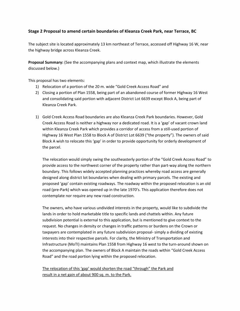
Stage 2 Proposal to amend certain boundaries of Kleanza Creek Park, near Terrace, BC The subject site is located approximately 13 km northeast of Terrace, accessed off Highway 16 W, near the highway bridge across Kleanza Creek. Proposal Summary: (See the accompanying plans and context map, which illustrate the elements discussed below.) This proposal has two elements:
1) Relocation of a portion of the 20 m. wide “Gold Creek Access Road” and 2) Closing a portion of Plan 1558, being part of an abandoned course of former Highway 16 West
and consolidating said portion with adjacent District Lot 6639 except Block A, being part of Kleanza Creek Park.
1) Gold Creek Access Road boundaries are also Kleanza Creek Park boundaries. However, Gold
Creek Access Road is neither a highway nor a dedicated road. It is a ‘gap’ of vacant crown land within Kleanza Creek Park which provides a corridor of access from a still-used portion of Highway 16 West Plan 1558 to Block A of District Lot 6639 (“the property”). The owners of said Block A wish to relocate this ‘gap’ in order to provide opportunity for orderly development of the parcel. The relocation would simply swing the southeasterly portion of the “Gold Creek Access Road” to provide access to the northwest corner of the property rather than part-way along the northern boundary. This follows widely accepted planning practices whereby road access are generally designed along district lot boundaries when dealing with primary parcels. The existing and proposed ‘gap’ contain existing roadways. The roadway within the proposed relocation is an old road (pre-Park) which was opened up in the late 1970’s. This application therefore does not contemplate nor require any new road construction. The owners, who have various undivided interests in the property, would like to subdivide the lands in order to hold marketable title to specific lands and chattels within. Any future subdivision potential is external to this application, but is mentioned to give context to the request. No changes in density or changes in traffic patterns or burdens on the Crown or taxpayers are contemplated in any future subdivision proposal- simply a dividing of existing interests into their respective parcels. For clarity, the Ministry of Transportation and Infrastructure (MoTI) maintains Plan 1558 from Highway 16 west to the turn-around shown on the accompanying plan. The owners of Block A maintain the roads within “Gold Creek Access Road” and the road portion lying within the proposed relocation. The relocation of this ‘gap’ would shorten the road “through” the Park and result in a net gain of about 900 sq. m. to the Park.
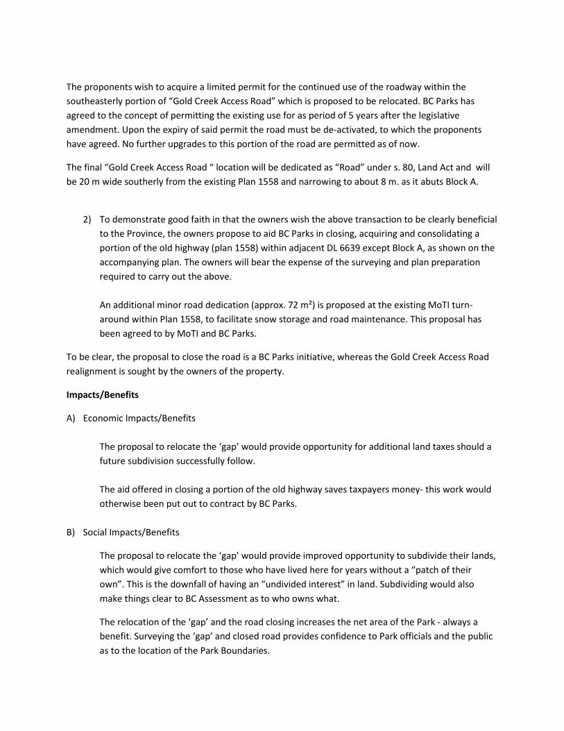
The proponents wish to acquire a limited permit for the continued use of the roadway within the southeasterly portion of “Gold Creek Access Road” which is proposed to be relocated. BC Parks has agreed to the concept of permitting the existing use for as period of 5 years after the legislative amendment. Upon the expiry of said permit the road must be de-activated, to which the proponents have agreed. No further upgrades to this portion of the road are permitted as of now.
The final “Gold Creek Access Road “ location will be dedicated as “Road” under s. 80, Land Act and will be 20 m wide southerly from the existing Plan 1558 and narrowing to about 8 m. as it abuts Block A.
2) To demonstrate good faith in that the owners wish the above transaction to be clearly beneficial to the Province, the owners propose to aid BC Parks in closing, acquiring and consolidating a portion of the old highway (plan 1558) within adjacent DL 6639 except Block A, as shown on the accompanying plan. The owners will bear the expense of the surveying and plan preparation required to carry out the above. An additional minor road dedication (approx. 72 m²) is proposed at the existing MoTI turn-around within Plan 1558, to facilitate snow storage and road maintenance. This proposal has been agreed to by MoTI and BC Parks.
To be clear, the proposal to close the road is a BC Parks initiative, whereas the Gold Creek Access Road realignment is sought by the owners of the property.
Impacts/Benefits
A) Economic Impacts/Benefits The proposal to relocate the ‘gap’ would provide opportunity for additional land taxes should a future subdivision successfully follow. The aid offered in closing a portion of the old highway saves taxpayers money- this work would otherwise been put out to contract by BC Parks.
B) Social Impacts/Benefits
The proposal to relocate the ‘gap’ would provide improved opportunity to subdivide their lands, which would give comfort to those who have lived here for years without a “patch of their own”. This is the downfall of having an “undivided interest” in land. Subdividing would also make things clear to BC Assessment as to who owns what.
The relocation of the ‘gap’ and the road closing increases the net area of the Park - always a benefit. Surveying the ‘gap’ and closed road provides confidence to Park officials and the public as to the location of the Park Boundaries.

C) Environmental Impacts/Benefits
The proposed Park Boundary adjustment and road closing procedures affect no change in the existing land use nor the level of enjoyment of its use.
Some minor clearing may be necessary for the surveying, but is generally limited to brush clearing and limbing to acquire practical lines-of-sight. Occasionally a small tree must be felled or blow-down cut and cleared out, but it is necessary to the task.
At the time of this writing, it is understood by the proponents that the roadway within the dedicated road will not be maintained by MoTI unless upgraded to MoTI standards and it is their responsibility to ensure the road and any appurtenant ditches and culverts are maintained in such a manner as to prevent any additional environmental impact. BC Parks Impact Assessment:
“Stage 2 Summary
The southerly road to be dedicated is already constructed and therefore, most of the impacts have already occurred. However, the full road width has not been cleared yet, so there may be some impacts due to the clearing of brush/danger trees and the potential presence of Smoker’s Lung Fungus which has been identified in the park area (blue-listed – special concern). It is recommended that the landowner try to avoid the blue-listed species during clearing activities. Ongoing maintenance of the road, which will be the responsibility of the landowner, will have minimal impacts. There was one small culvert observed that was visible on the surface of the road. It should be buried properly to allow for adequate drainage. As the legal mechanism for authorizing the road use will likely be Section 80 of the Land Act (the proponent has not yet applied through MFLNRO), it is understood that the dedicated road, if approved, will need to meet the road standard requirements of MFLNRO.
With respect to the southeasterly portion, the landowner proposes to use the access for 5 years after the date of decision. At the end of the 5 years, the road segment could then be reclaimed. The proponent has committed to aid the reclamation process for this area with some planted seedlings/grass seed. This timeline (5 years) and the commitment to aid the reclamation process will need to be tracked by BC Parks to ensure that the road is closed and appropriate action is taken for its reclamation. The best mechanism for doing this would be through the issuance of a 5 year Park Use Permit (PUP) with conditions for reclamation at the end of the term. BC Parks will need to confirm that Schedule D of the Park Act will allow for the issuance of a PUP.
In addition to the commitment for aid in reclamation, the proponent will need to remove their gate, fencing, & posts. It is also recommended that the surface of the road bed/driveway is loosened with a machine and care is taken to ensure that native seedlings/grasses are planted. The site should be monitored for invasive plants while it is regenerating as there are invasive plants in the area such as hawkweed and oxeye daisy. “
Alternatives
The relocation of the Gold Creek Access Road or “gap” results in creating additional Park land without any new construction of roads nor detriment to Park lands or use thereof. The current accesses are the only practical routes to this property, due to topographical constraints. No practical alternatives are foreseen which would be simpler, more economic or having less impact on the Park.
The term ‘alternative’ as applied to the road closing element is not applicable. BC Parks desires the road closure.
Local Government comments:
The Regional District of Kitimat-Stikine (RDKS) commented on this initiative in an email of July 25, 2014 from RDKS Planner Ted Pellegrino. Pertinent email text is copied below in blue:
The proposed relocation of the Gold Creek access road is required to address long standing legal access issues to private land Block A, DL 6639.
From our review, the proposed road relation does not appear to affect access to any other property or to the Park.
Provided that any issues presented by Kitselas, BC Parks and the Ministry of Transportation and Infrastructure are satisfactorily addressed, the proposal is supportable and the Regional District has no objections.
Ministry of Transportation and Infrastructure comments:
The Ministry of Transportation and Infrastructure (MoTI) commented on this initiative in an email of July 15, 2014 from District Development Technician Rena Gibson. Pertinent email text is copied below in blue:
As discussed, the ministry supports the proposed closure of a portion of Old Hwy 16 Plan 1558 within Kleanza Creek Park, however, we require that the existing constructed cul de sac remains under the jurisdiction of the Ministry of Transportation and Infrastructure (MoTI). Please adjust the proposed road closure dimensions to reflect this.
In reference to “Gold Creek Access Road” depicted in sections 1, 2 &3 on the attachment: these accesses are not under the jurisdiction of the MoTI, nor are they on our maintenance plan.

Local First Nation comments:
The Kitselas First Nation was contacted and asked to comment on this project. A reply, dated July 29, 2014 came via email from Sam Coggins, Director of their Lands and Resources Department.
Pertinent email text is copied below in blue:
I don’t see any immediate concerns with it proceeding. If you need any more information please let me know.
On February 27, 2015, our office sent a formal request for comment on this proposal by email to Kitselas First Nation, the text being:
Aaron McMillan, Referrals Coordinator (cc Sam Coggins, Director of Lands and Resources)
Dediluke Land Surveying Inc. act as agent for the owners of Block A, DL 6639, Range 5, Coast District, which lies immediately south of Kleanza Creek Park. We are working with BC Parks to relocate a portion of access corridor which runs through a portion of the Park to correspond with an existing roadway. No new road construction is required. A subsidiary project tagged with the proposal is to close a portion of the old highway and add it to the Park. The full proposal is clearly expressed on the attached maps and the attached copy of our original application to BC Parks.
This email is supplemental to our initial inquiry in 2014 to Sam Coggins with regard to concerns Kitselas may have with this proposal.
We herewith request an official response to the proposal, preferably on letterhead, so that we may post the response on the BC Parks website as part of our due diligence in public and First Nations consultation.
Thank you for your time.
On June 10, 2015 we received a response from the Kitselas Band via email. The referral response letter is shown as attached Schedule 1.
Mineral Title Issues:
As stated in the Stage 1 proposal, BC Parks had agreed to take on the responsibility of securing the extinguishment of the pertinent portions of the Mineral Title Tenure 1021777.
On April 20, 2015, Mineral Titles Branch informed BC Parks that the tenure holder forfeited said claim, hence there is no longer a Mineral Title conflict.

Public Input:
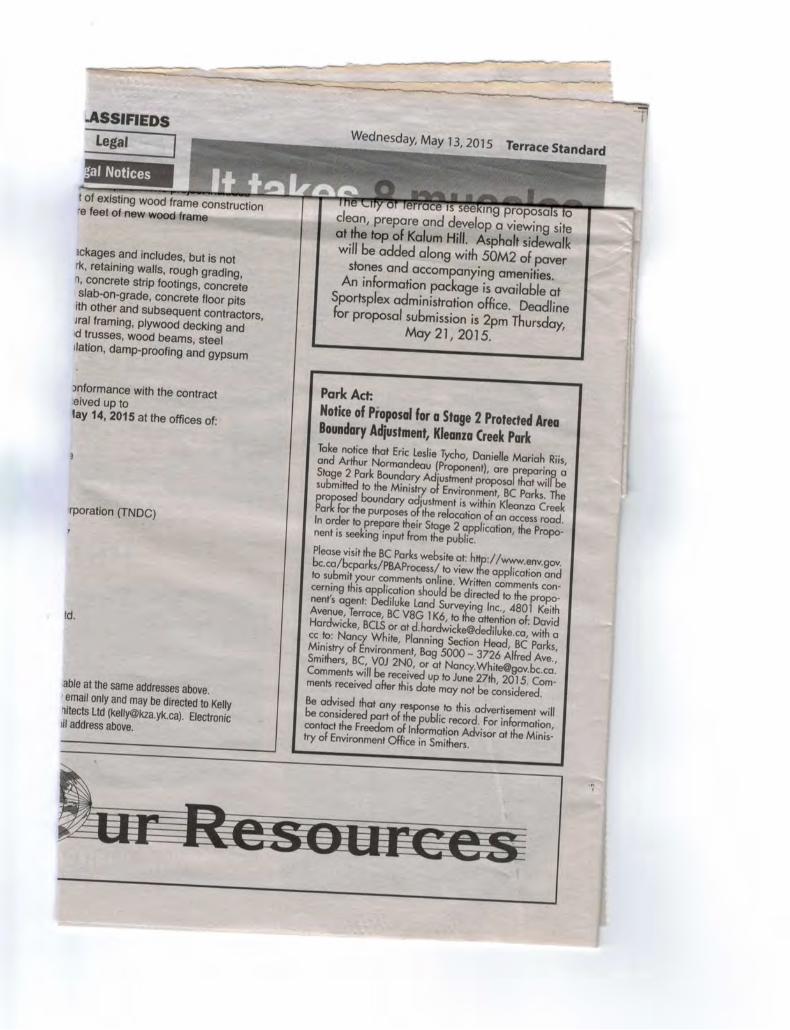
The boundary adjustment proposal prepared by Dedlikue Land Surveying Inc. for Kleanza Creek Park was posted to the BC Parks website for public comment. The BC Parks website included a link to a public comment form where interested parties could make their thoughts known. Comments were solicited from May 13, 2015 to June 27, 2015. The public was notified via an rss feed from the ‘BC Parks Public Consultations/Notification’ page that an opportunity to view the application and submit comments online was available. Dediluke Land Surveying Inc. also posted newspaper ads in the Terrace Standard on May 13, 2015 and on June 10th (see attached ‘proof of advertising’ shown as Schedule 2).
On June 30th, 2015, BC Parks confirmed that no public comments were received via the website.
As of July 2, 2015, Dediluke Land Surveying Inc., acting as agent for the proponents, did not receive any comments from the public.
Project Schedule:
The Gold Creek Access Road realignment process requires the support of the Minister, who would introduce a legislative amendment as it is a proposed adjustment to a legislated Park Boundary. The proponent seeks support from the Minister and ideally would see this proposal included in a future legislative amendment in spring 2016, assuming we meet all requirements to get this project on the table. The Road Closing procedure will take two to six months from initiation to completion of surveying and mapping. This project has now been initiated by BC Parks. This portion of the project is also intended to hit the legislature in spring 2016.
Closure:
This proposal is made to clear up a long-standing access issue, improve Park and private lands planning and development opportunities while adding to Park lands and to assist BC Parks with an initiative to close road and create additional Park lands. This would be all carried out with no additional environmental impact to the site.
Submitted on behalf of the owners of Block A, District Lot 6639, Range 5, Coast District.
David Hardwicke, BCLS Dediluke Land Surveying Inc. (agent) 4801 Keith Avenue Terrace, BC V8G 1K6

Kleanza Creek Park- Boundary Adjustment Context
Kleanza Creek Provincial Park (Site 1)
Alaska
Area of Interest
µ
Detailed Area
Kleanza Creek Provincial Park (Site 2)
Lot Line
Lot Line
Land to be added to parkLand to be removedfrom park
0 30 60 90 12015Metres


K I T S E L A S B A N D C O U N C I L D E P A R T M E N T O F L A N D S A N D R E S O U R C E S 1 5 8 1 K U L S P A I C R E S C E N T , T E R R A C E , B C V 8 G 4 P 5 P: (778) 634-3517 F: (778) 634-3796 www.kitselas.com
Page 1 of 2
June-10-15
Conditional Response Referral ID: Kleanza Creek Park Boundary C Our File #: 298 Date Entered: February-27-15 Dediluke Land Surveying Inc. 4801 Keith Avenue Terrace BC V8G 1K6 Attention: David Hardwicke The Kitselas First Nation has reviewed your proposed project (Referral ID: Kleanza Creek Park Boundary C) under its Lands and Resources Stewardship Policy. Based on the described scope of work and information provided in the referral, Kitselas can provide the following conditions: Reason Explanation No concerns Boundary adjustment Kitselas reserves the right to revoke this response if the above conditions are not met. Kitselas is committed to providing timely and professional responses to requests regarding projects within our Territory. If you have any questions or need assistance, please contact the Lands and Resources office at 250-634-3517. Sincerely,
Aaron McMillan Referrals Coordinator, Kitselas Band Council Office: 778-634-3517 [email protected]

K I T S E L A S B A N D C O U N C I L D E P A R T M E N T O F L A N D S A N D R E S O U R C E S 1 5 8 1 K U L S P A I C R E S C E N T , T E R R A C E , B C V 8 G 4 P 5 P: (778) 634-3517 F: (778) 634-3796 www.kitselas.com
Page 2 of 2
cc: