standard operating procedure s o p … redukcija 12.10.2010. konacan...2010 contents: reference to...
TRANSCRIPT

STANDARD OPERATING PROCEDURE
S O P
SURVEY OF MINE SUSPECTED AREA AND/OR BUILDINGS 01.
AREA REDUCTION IN MSA 01.04
HUMANITARIAN DEMINING
TO 523
FIELD OF APPLICATION PROCESS OF AREA REDUCTION IN MSA
SPECIAL CONDITIONS FOR AREA REDUCTION IN MSA
REPORT AND ANALYSIS
EXCLUSION OF AREAS FROM MSA
DIRECTOR of CROMAC: Oto Jungwirth October
2010

Contents: Reference to legal acts, rules and regulations and SOPs………………………………………….3 Introduction ………………………………………………………………………………………………3
1 Field of application……………………………………………………………………………..4 2 Terms and definitions…………………………………………………………………………..4
3 Process of area reduction in MSA ……………………………………………………………4
3.1. Planning of area reduction in MSA………………………………………………….5 3.1.1. Definition and selection of areas for reduction in MSA………………….5
3.2. Comprehensive analysis of data in MIS…………………………………………….5 3.2.1. Analysis of topographic characteristics……………………………………6 3.2.2. Analysis of war events on the area of reduction in MSA………………...7 3.2.3. Analysis of data on mine planting and demining…………………………7
3.3. Report draft…………………………………………………………………………….7 3.4. Report discussion……………………………………………………………………..8 3.5. Demining for the purpose of reduction……………………………………………...9 3.6. Analysis of completed demining project aiming at reduction……………………..9 3.7. Closing discussion…………………………………………………………………...10 3.8. Issuance of Certificate on exclusion of areas from MSA………………………..10
4 APPENDIX……………………………………………………………………………………..11

References to Legal Acts, Books of Regulations and SOP-s Standard Operating Procedure “Area Reduction in MSA“ is based on the Law on Humanitarian Demining (National Gazette) 153/05, 63/07 and 148/08), the Book of Regulations on conduction of humanitarian demining operations NG 53/07 and 111/07, IMAS (International Mine Action Standards), Standard Operating Procedures of CROMAC: “General Survey“, “Marking of Mine Suspected Area”, “Technical Survey”, Quality Assurance and Quality Control of Mine Search and/or Demining” and other provisions that regulate the field of demining in the Republic of Croatia. It is coherent with other standard operating procedures of CROMAC.
Introduction
Mine contamination in the Republic of Croatia causes a range of economic, ecological and social disturbances, and it mainly causes safety problems to population that lives in the area stricken by war activities. Vast agricultural areas, forests, border areas and parts of river shores are inaccessible due to mines or suspicion of mine existence, thus it is a strategic task to make mine suspected areas available to end users (see: National Mine Action Strategy of the Republic of Croatia for the period 2009 – 2019). The reduction of areas in MSA defined by this SOP takes on a new approach to rationalization and is more efficient way of releasing areas and/or buildings for use, using the comprehensive analysis approach of all data in CROMAC’s Mine Information System (CROMAC MIS). Based on “National Mine Action Strategy of the Republic of Croatia for the period 2009 – 2019” and “Three Year Humanitarian Demining Plan” the selection and comprehensive analysis of an area is conducted for certain county, municipality or town (zone of responsibility of army troops of warring sides at the front line) in order to reduce the area or MSA using practices and methods that are regulated by SOP. The area reduction in defined MSA is based on fulfilment of mutually related criteria listed in SOPs “General Survey”, “Quality Assurance and Quality Control of Mine Search and/or Demining” and criteria defined by this SOP (see: Appendix F).

1 Field of Application
Standard operating procedures “Area Reduction in MSA” define the conditions for selection of wider MSA area and for conducting comprehensive information analysis in MIS. SOPs also specify the possibility of an additional control and collection of new information during the reduction process of the whole MSA at municipality/town level or area (zone) under the responsibility of military troops. Planning of wider MSA for reduction is conducted in accordance with the contamination/non-contamination level i.e. safety/unsafety of the areas for future use (risk assessment of human lives and animals, economy or infrastructure objects, etc.) and is based on carried-out general surveys that indicated not all preconditions had been met to declare a certain area safe for usage. The comprehensive data analysis in MIS is conducted at the regional office level. The holder of all activities relating to MSA reduction, from preparation to report drafting is the Head of Regional Office with its colleagues. Based on the report on the activities carried out (hereinafter: Report) and results of the discussion about the Report, the final conclusion on the MSA reduction procedure is reached. The Regional Office, based on reached conclusion and when all the preconditions have been met, drafts the project documentation – demining project aiming at reduction. Upon the completion of demining operations and final analysis carried out, the conclusion is reached – decision on exclusion (final discussion).
2 Terms and Definitions
Terms and definitions in SOP are compatible with international standards, which define terms and abbreviations in mine action (IMAS 04.10), and they are listed in the SOP “General Survey” and “Technical Survey” and in the draft of the Original Croatian Standard, rpHRN 1129, Humanitarian demining – Glossary – Terms and definitions.
3 Process of Area Reduction in MSA
The process of area reduction in MSA will be carried out through following phases: 1. Planning of area reduction in MSA, 2. Comprehensive data analysis in MIS, 3. Report draft, 4. Discussion about the Report, 5. Demining for the purpose of reduction, 6. Analysis of completed demining project for the purpose of reduction, 7. Closing discussion, 8. Passing the Certificate on exclusion of areas and/or buildings from MSA.
After selection of area for reduction starts the systematic data analysis in MIS and drafting of Report at the regional office level. Based on delivered Report, preparations for the discussion about the Report are made at the Operations Division level.

After the preparations made, the Assistant Director for Operations convokes the Main Discussion about the Report in order to conciliate the opinions about the Report, adopt the conclusion and guidelines for further work i.e. decision on reduction of the whole area in question or just a part of area according to this SOP and SOP-u 01.01 (General Survey). Based on conducted demining activities with function of reduction and additional analysis after completion of demining (regional office, QA and QC Dept.) and Main Discussion carried out, the conclusion on the status of area in question is reached. By issuing the Certificate on exclusion of areas from MSA, in accordance with this SOP and SOP 01.01, the process of reduction in MSA ends and the local community is informed in writing on the new state of MSA within municipality and/or town. 3.1. Planning of Area Reduction in MSA Planning of the reduction in MSA is based on the National Mine Action Strategy of the Republic of Croatia and Three Year Humanitarian Demining Plan (in further text referred to as Three Year Plan) that are the basis for the execution of mine action in certain period in the Republic of Croatia. The Plan and Analysis Department (Division for Plan, Analysis and Finances) based on Three Year Plan proposes to the CROMAC Director areas for reduction in MSA in accordance with criteria for polygon category definition (areas for reduction have to relate to priorities set). When preparing proposals for reduction, the Head of Plan and Analysis Department cooperates with Assistant Director for Operations, Head of Quality Assurance and Quality Control Department and with Heads of CROMAC Branch Offices. After consultations and definition of plan of reduction, the CROMAC Director makes a Decision that adopts the Three Year Reduction Plan and delivers it to Operations Division and to the Branch Office that has jurisdiction over the MSA in question for further procedure. The Three Year Plan is updated every year at the level of the Division for Plan, Analyses and Finances.
3.1.1. Definition and Selection of Areas for Reduction in MSA Comprehensive preparation for area reduction in MSA and analysis of data in MIS is performed at the regional office level. It comprises incorporation of all data collected for the area in question with aim of interlinking mutually conditioned activities and data analysis. During the comprehensive preparation for area reduction, the regional office is free to engage military experts as well as other people well acquainted with mine situation on the area in question. The holder of all activities relating to area reduction is the head of regional office. The result of the comprehensive analysis is the Report to be delivered to the Operations Division. Comprehensive analysis contains qualitative in depth analysis of collected data in order to define the areas for demining and reduction anew. Comprehensive analysis refers to the following segments:
a) Analysis of the war scene on the wider area for reduction in MSA and placement of military formations (wider zone of combat operations or responsibility zone at the level of
municipality/town or county) and communication with commanding officers from the war and engineering officers)
b) Analysis of the combat activities and placement of mine obstacles (from the aspect of terrain conditions and weather conditions) and technical equipment of sides at war
c) Analysis of the entire mine situation, containing all the records of mine planting d) Analysis of the mine incidents in the wider area of the reduction project e) Analysis of all previous reports connected to the revision of the MSA, additional general
surveys, and surveys for project preparations, f) Analysis of results of implemented demining and mine search projects which contain all
records on demining g) Analysis of military topographic maps and h) Analysis of data collected trough interview with contact persons.
Head of Regional Office responsible for the area in question with his associates analyses overlapping of positions and activities, for relevant area. They interlink and interpret data and reconstruct units of combat schedule and deployment of military formations taking in consideration the assessment and the status of mine records before and after demining and/or mine search activities. All the relevant data collected during all surveys and final analyses are reviewed trough particularities of existing relevant documents, categorised and linked into logical information whole. Also, it involves observation of the terrain configuration and vegetation (especially inaccessible mountain and forest areas) in the service of tactics and logic used during placement of mine obstacles, in order to detect exact location of mine obstacles, and form conclusion whether the area in question is mine-contaminated or not. Comprehensive analysis should draw information from the experiences acquired in the field, professional opinion and understanding information sources and area in which data were collected. Expert assessment of the precise positioning of mine records in real space (use of DOP2 and 3D technology) is very important. All the mentioned data are compared to previously known and/or unreliable data, taking in consideration analysis of mine records assessing the state of mine records after activities of mine search and demining have been conducted. Comprehensive analysis gives special attention to assessing the status of mine records after demining activities have been conducted in cooperation with Department for Quality Assurance and Quality Control. 3.2.1. Analysis of Topographic Characteristics Reporter prepares comprehensive analysis of the type of terrain and soil, waterways and water surfaces, infrastructure, roads, paths, tracks and activities on the relevant area based on its understanding of the terrain and studying of natural and constructed objects on the topographic maps and ortophoto maps scale S 1:2 000 (DOP2-3D). Analysis should include terrain and vegetation characteristics of the MSA, especially on the area of mountains, karst and river coasts, swampy areas and waterways that served as front lines of the parties at war.

3.2.2. Analysis of War Events on the Territory of MSA Reduction During analysis of war events on the area to be reduced in MSA, all possible impacts on mine situation should be taken into consideration through the following analyses:
Analysis of chronology of war activities and relocation of front lines;
Analysis of front lines and objects in the function of defence – operative placement of military formation
Analysis of data collected trough interview with contact persons
Analysis of engineer safeguard of military deployment
Analysis of topographic military maps with schemes of placement and records of mine explosive obstacle of before and after war activities
Analysis of topographic military maps using procedure of overlapping positions, placements and events.
3.2.3. Analysis of Data on Mine Planting and Demining Result of analysis of collected information on mine planting and demining has to be a clear and complete concept of the state of mine contamination and demining on the subject location (municipality, town, settlement, village, agricultural area, etc.) which clearly defines following elements:
Status of records on mine explosive obstacles
Status of records on mine explosive obstacles after demining
Status of records on mine incidents
Assessment of number of mines on the wider area of polygon for reduction
Detected mine-explosive ordnance which were assumed by general survey
Detected mine-explosive ordnance which were not identified by general survey
No evidence of mine incidents involving people or animals
Using areas in MSA at own risk
Mine removal by local population
Removal of mines by representatives of the Ministry of Interior
Explosions of mines and other UXO while areas were on fire
Other In case when systematic data analysis in MIS for the area of reduction in MSA proves the need for additional data verification (field work) because no special criteria for the definition of exclusion terms (see Appendix F) have been met, the head of regional office organizes the additional data verification and collection of potentially new information. If new data is collected starts the pre-categorization and/or new inclusion to the MSA. The documentation required as per this SOP and SOP 01.01 is made and delivered to the Operations Department for verification. 3.3. Report Draft The contents of the Report on Complete Analysis of MIS data have to be compliant to this SOP (point 3.2 and Appendix A of this SOP). The Report must include the summary of the work done. The summary should be the ‘’mini report’’. It needs to include relevant elements from all parts of the report and concluding proposal (one printed page the most). The elements are as follows:
- the size of planned area for reduction (to briefly point out the specificities or distinctive features of mine problem on the area in question)
- expected predictions – expectations

- what has been achieved (the size of the area for reduction, demining etc.) - the status of areas (assumed minefield, established minefield status (yes/no) etc.)
The cartographic display of the proposal for the solution of mine problem on the wider area of reduction (TM 25, CBM 5 and DOP2) should be enclosed to each Report on the Complete Analysis of MIS data. The Report is delivered in written form and on CD. 3.4. Report Discussion Upon receipt of the Report on Complete Analysis of MIS data, Operations Department submits the copy of the Report to all members of the working group for the discussion about the Report. Working group members analyse the Report and prepare themselves for the discussion. The head of regional office is the reporter at Report discussions. Head of regional office – reporter, head of survey section, assistant director for operations, head of department for survey, analysis and organization of general and technical survey, head of QA and QC department or person appointed by him/her, internal inspector from director’s office and if needed, external experts (military experts and other persons well acquainted with mine situation at the territory of reduction) are obliged to attend the discussion about the Report. Certain team members (from regional office or division) are free to attend the discussion according to the decision of assistant director for operations. The discussion about the Report is organized at the regional office in the period of 15 days since the report delivery. At the discussion, the head of regional office – reporter presents the results of comprehensive analysis for the area in question emphasizing key arguments and/or documents that resulted in proposed conclusions for the subject area of reduction in the MSA (e.g. the consequence was exclusion of area from the MSA or inclusion into the MSA). After the discussion, the members pass the conclusion about the area in question. If the whole Report on comprehensive analysis and conclusions made at the discussion are accepted, this also represents the verification of the report in question. If the whole Report on comprehensive analysis and conclusions made at the discussion are not accepted due to required modifications, the regional office is obliged to make the necessary amendments urgently in accordance with the discussion conclusions. The official minutes from the discussion should be made about the course of discussion stating the main points of the discussion and the conclusions (see Appendix B of this SOP). 3.5. Demining in Function of Reduction Demining of areas in function of reduction in MSA presents targeted examination of a part of an area defined as the whole area (town/municipality or zone of responsibility) or a part of that area in the relevant MSA of municipality/town.

Based on conclusion about the Report, which contains final model of resolving mine situation of the MSA in question, relevant regional office fills in discussion conclusions in CROMAC MIS (see Appendix B of this SOP) and as per Operative Activity Plan for the current period creates demining project in function of reduction. Analysis, control and verification of the created project of reduction are conducted by Operations Division according to SOP 02. “Designing - Elaboration of Designing Documentation” with mark: PR-RED- ... -... - ... . Having signed the Contract for demining project aiming at reduction QA and QC Department plans the introduction to demining operations. Besides persons stated in the Rules and Regulations on the Method of Conducting Humanitarian Demining, introduction is also attended by project designer and possibly the person appointed by the head of regional office. Project designer and/or head of regional office inform the attendees with basic requirements for project realization. During the realization of project, the head of regional office is obliged to visit the worksite in order to collect additional information. QA Officer performs the supervision over the operations in progress. He informs the QC Monitor about the detection of every mine, UXO or their fragments or other indicators (elements of combat placement), and keeps records of detections. QC Monitor contacts the head of survey section in order to pass the information or potential visit to the worksite and gather additional information. If the existence of mines and indicators of systematic minefield placing are established during the execution of operations, QC Monitor immediately informs the head of QA and QC Department and head of regional office. The head of regional office immediately informs the assistant director for operations about the newly-arisen situation. They organize an urgent meeting in order to analyse the new situation. If needed, another (additional) demining project is made. Quality Control is performed according to valid SOP 04.01 ‘’Quality Assurance and Quality Control of Mine Search and/or Demining’’. The head of regional office (that owns the deminer ID) is allowed to attend the quality control for the purpose of getting an insight into the remaining areas on the territory of reduction. 3.6. Analysis of Completed Demining Project Aiming at Reduction After entry of geodetic measurement data into CROMAC MIS, QC Monitor announces the analysis of completed demining project to the head of regional office. This analysis merges all information collected during the execution of demining operations, demining company’s final report and quality control report. All relevant information and facts are being discussed as well as whether the operations filled the expectations. The purpose of the analysis is to remove every doubt in mine contamination of the area in question in accordance with the reduction criteria (see Appendix F of this SOP). The QC Monitor submits the following documentation to the regional office for analysis:

• Final report of the company with enclosures (CBM S 1: 5 000) with marked boundaries and demined areas per methods, CBM S 1: 5 000 with marked locations of mine and UXO detection and mine contamination indicators
• Report on quality assurance over completed demining operations with marked control sample spots.
QC Monitor submits the Report on the results of the demining project carried out with the purpose of reduction. The analysis should be attended by:
- head of the regional office - assistant director for operations - head of QA and QC Department or person appointed by the head - internal inspector at Director’s Office - QC Monitor - head of survey section - project designer
If needed, the head of regional office can invite other people who know the area in question very well to also attend the analysis. The official records are kept about the course of discussion stating the quality control results, conclusion with the proposal for exclusion of areas in the MSA (see Appendix C of this SOP) and need for removal of mine warning signs and/or remarking of the remaining MSA. 3.7. Closing Discussion Assistant director for operations and head of regional office plan and organize the closing discussion. Head of regional office – reporter, head of survey section, assistant director for operations, head of QA and QC department or person appointed by him/her, internal inspector from director’s office and if needed, county demining coordinators and/ or representatives of the municipality/town or county and external experts (military experts) are obliged to attend the closing discussion. At the discussion, the head of regional office – reporter presents the results of analysis of completed project of area reduction in MSA (see Appendix C) and proposes the areas for exclusion from MSA. Closing discussion should result with a final proposal: THE REMAINING AREA UPON DEMINING WITH THE PURPOSE OF REDUCTION OF MSA IS EXCLUDED FROM THE MSA. The final conclusion, as a result of the closing discussion is made by consensus (unanimous decision based on agreement between all present discussion members from CROMAC). 3.8. Passing the Certificate on Exclusion of Areas from MSA Exclusion and inclusion of areas from MSA and issuance of THE Certificate on exclusion of areas from the MSA are conducted according to the Law on Humanitarian Demining, Rules and Regulations on the Method of Conducting Humanitarian Demining and SOP 01.01 ‘’General Survey’’.

Operations Department prepares the CROMAC Certificates according to Article 17, paragraph 2 of the Law on Humanitarian Demining (NG 153/05, 63/07 and 148/08) and timely informs the towns and/or municipalities about it. The process of reduction of areas in the MSA is concluded by issuing the Certificate on exclusion of areas from the MSA.

4 APPENDICES
Appendix A
REPUBLIC OF CROATIA
CROATIAN MINE ACTION CENTRE REGIONAL OFFICE _________________________ Class: Ref.no: XX, date
REPORT ON COMPREHENSIVE ANALYSIS OF DATA IN MIS
1. GENERAL INFORMATION - SUMMARY
MUNICIPALITY-TOWN: COUNTY: Total MSA m2 No. of mine warning
signs:
MSA of the area covered by reduction
m2 No. of reduction polygons:
Reduction area:
Reduction no: RED-__-__-__-__
No of minefields on wider area:
No. of mines:
Assumed no. of minefields:
Assumed no. of mines:
Mine incidents: Expected no. of mines:
MSA structure as per intended use:
Meadows: % Agricultural areas: % Forests:%
Cartographic data:
TM S 1:25000 CBM S 1:5000 DOP2/ D3
Director’s decision:
Class: Ref.no:
COMPREHENSIVE ANALYSIS AIMING AT RDUCTION
Date of commen- cement
Date of completion
Working days spent
Analytical preparation and comprehensive analysis
Date of commen- cement
Date of completion
Working days spent
Terrain activities (survey) Date of commen- cement
Date of completion
Working days spent
Report draft Date of commen- cement
Date of completion
Working days spent
Areas for reduction project:
% Areas for exclusion: %
Regional office:

2. ANALYSIS OF WAR ACTIVITIES ON WIDER AREA OF REDUCTION OF MSA
Analysis of chronology of war activities and relocation of line of fire
Analysis of combat operations and organization of minefields from the aspect of space (soil and weather conditions)
Analysis of data collected trough interview with contact persons
Analysis of engineer safeguard of military deployment
Analysis of topographic military maps with schemes of and records of mine explosive obstacles of before and after war activities
Analysis and list of topographic military maps using procedure of overlapping positions, placements and events
List of topographic military maps
1. 2. 3.
Annex 1: Cartographic annexes (TM 25 and MM 25)
3. ANALYSIS OF DATA ON MINE PLACING AND DEMINING 3.1. Status of minefield record on wider area of reduction of MSA
No. STATUS OF MINEFIELD RECORD No. of
records
MINEFIELD TYPE Assessment of number
of mines
Mix AT AP AT AP TOTAL
1. Minefields that are completely within the borders of MSA reduction
2. "Cut minefield" demined up to the border of MSA reduction
3. "Cut minefield" that crosses the border of reduction
Total mined on the wider area of MSA reduction
Information on minefied records outside the MSA
1. Minefields demined (or removed) by military units

2. Minefields demined (or removed) by UN peace-keeping forces
3. Minefields demined (or removed) by special police of Ministry of Interior
4. Minefields demined (or removed) by "AKD Mungos" and other companies prior to CROMAC
5. Minefields demined (or removed) by unknown persons
6. Minefields demined (or removed) under CROMAC supervision
Total demined or removed outside MSA in a wider area of MSA reduction
7. Minefield records not relating to reduction area
8. Minefield records of undefined status
3.2. Status of mine incidents record
No. STATUS of the MI
RECORD
Record No.
Type of activated mine or UXO Marks of the MI areas
AT mine AP mine UXO
1. MI within borders of defined MSA reduction area
2.
MI outside MSA reduction area (safe area)
3.
MI records not relating to MSA reduction area
4.
MI records of undefined status
3.3. Assessment of mine number on the wider reduction area
ANTI-TANK MINES
ANTI-PERSONNEL MINES
No. Type of mine No. of mine
Proportion %
No. Type of mine No. of mine
Proportion %
1. TMA-1 PMA-1
2. TMA-2 PMA-2
3. TMA-3 PMA-3
4. TMA-4 PMR-2A
5. TMA-5 PMR-3
6. TMM-1 PROM-1
7. TMRP-6 MRUD
8. unknown unknown

Total AT mines
100
Total AP mines
100
Assessment of total mine number on the wider MSA reduction area: ____ mine/s
4. ANALYSIS OF MINE INCIDENTS ON THE AREA OF MSA REDUCTION
No. MI RECORD STATUS Record no.
Types of activated mines and ERW Marks of MI areas
AT mine AP mine Other ERW
1. MI within the boundaries of defined MSA
2.
MI outside the MSA (on safe areas)
3.
MI records not relating to the Municipality/Town
4.
MI records of non-defined status
5. ANALYSIS OF RESULTS OF CARRIED OUT MINE SEARCH AN DDEMINING OPERATIONS ON WIDER MSA REDUCTION AREA
No. CONFIRMATION/CERTIFICATE
MARK AREA
Findings according to confirmations/certificates
AT mine AP mine ERW
1.
2.
3.
4.
Annex 2: Cartographic overview of minefield record and MI on wider reduction area and demined and searched areas with the positions of mines and UXO detections (TM 25, CBM 5 and DOP2) 6. ANALYSIS OF PREVIOUS ADDITIONAL GENERAL SURVEY (AGS) REPORTS ON THE WIDER MSA REDUCTION AREA
Mark of previous AGS on wider area Area size of
AGS (m2)
Proportion of wider MSA
reduction area %
No. of areas
Total
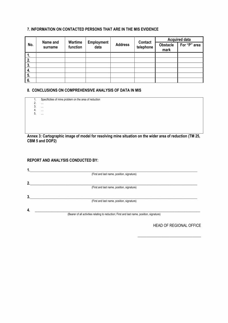
7. INFORMATION ON CONTACTED PERSONS THAT ARE IN THE MIS EVIDENCE
No. Name and surname
Wartime function
Employment data
Address Contact
telephone
Acquired data
Obstacle mark
For “P” area
1.
2.
3.
4.
5.
6.
8. CONCLUSIONS ON COMPREHENSIVE ANALYSIS OF DATA IN MIS
1. Specificities of mine problem on the area of reduction 2. … 3. … 4. … 5. …
Annex 3: Cartographic image of model for resolving mine situation on the wider area of reduction (TM 25, CBM 5 and DOP2) REPORT AND ANALYSIS CONDUCTED BY: 1._______________________________________________________________________________________
(First and last name, position, signature) 2._______________________________________________________________________________________
(First and last name, position, signature)
3._______________________________________________________________________________________
(First and last name, position, signature) 4. ______________________________________________________________________________________
(Bearer of all activities relating to reduction; First and last name, position, signature)
HEAD OF REGIONAL OFFICE
_________________________________

Appendix B Ob-ZR-VI
Form of Record on discussion and verification of Report
REPUBLIC OF CROATIA
CROATIAN MINE ACTION CENTRE REGIONAL OFFICE _________________________ Class: Ref.no: XX, date
Record on discussion and verification of the Report submitted by the head of regional office
SUBJECT Discussion on Report and verification of Report
AREA/MUNICIPALITY/TOWN
COUNTY
Director’s Decision: Class: Ref.no:
MARK OF REPORT ON REDUCTION SUBJECT
REPORTER
Meeting led by: Recording secretary:
Present at the meeting:
No. First and last name Position
Agenda: 1. Report on comprehensive analysis of MIS data – reporter: head of regional office 2. Discussion on presented data and proposed conclusions 3. Passing conclusions on reduction and Report verification proceedings 4. Other

COURSE OF DISCUSSION 1. GENERAL INFORMATION-SUMMARY
2. ANALYSIS OF WARTIME EVENTS ON WIDER AREA OF REDUCTION IN MSA YES NO
Conclusion:
3. ANALYSIS OF DATA ON MINE PLACEMENT AND DEMINING YES NO
Conclusion:
4. ANALYSIS OF MINE INCIDENTS YES NO
Conclusion:
5. ANALYSIS OF RESULTS UPON MINE SEARCH AND DEMINING OPERATIONS CARRIED OUT ON WIDER AREA OF REDUCTION
YES NO
Conclusion:
6. ANALYSIS OF PREVIOUS GENERAL SURVEYS (GS) ON THE AREA OF REDUCTION YES NO
Conclusion: 7. DISCUSSION CONCLUSIONS
3. RESULTS ON AREAS RELATING TO MSA REDUCTION AREA Appendix A Discussion
Polygon in the MSA
Polygon area For project designing
For reduction
Polygon area
For project designing
For reduction
m2 m2 % m2 % m2 % m2 %
TOTAL
Enclosure 1: Cartographic display of mine situation solution model on wider area of reduction (TM 25, CBM 5 and DOP2) registered in CROMAC MIS (reduction 5 (6) XY)

COMPLIANT WITH CONCLUSIONS AND FINAL PROPOSALS: 1.___________________________________________________________________________
(First and last name, position, signature) 2.___________________________________________________________________________
(First and last name, position, signature)
3.___________________________________________________________________________ (First and last name, position, signature)
4.__________________________________________________________________________ (First and last name, position, signature)
_____________________________________________
(HEAD OF REGIONAL OFFICE) REMARK:

Appendix C Ob-AZPRR
Form of Record on analysis of completed demining project aiming at reduction
Date:
Duration Commencement:
Completion:
Place:
Record on analysis of completed demining project aiming at reduction of area in the MSA
SUBJECT Analysis of completed project
AREA/MUNICIPALITY/TOWN
NAME AND MARK OF REDUCTION PROJECT
REPORTER
Meeting led by: Recording secretary:
Present at the meeting:
No. First and last name Position
Agenda: 1. Quality control results – reporter: QA Officer 2. Discussion on presented data 3. Passing conclusions on reduction project 4. Other

RESULTS OF QUALITY CONTROL WITH CONCLUSIONS
CONCLUSIONS:
COMPLIANT WITH CONCLUSIONS: 1.___________________________________________________________________________
(First and last name, position, signature) 2.___________________________________________________________________________
(First and last name, position, signature)
3.___________________________________________________________________________ (First and last name, position, signature)
4.__________________________________________________________________________ (First and last name, position, signature)
_____________________________________________
(HEAD OF REGIONAL OFFICE)

Appendix D Ob-ZZR
Form of Record on Closing Discussion
REPUBLIC OF CROATIA
CROATIAN MINE ACTION CENTRE REGIONAL OFFICE _________________________ Class: Ref.no: XX, date
Record on Closing Discussion
SUBJECT Closing discussion
AREA/MUNICIPALITY/TOWN
COUNTY
MARK OF RECORD ON THE ANALYSIS OF COMPLETED REDUCTION PROJECT
REPORTER
Meeting led by: Recording secretary:
Present at the meeting:
No. First and last name Position
Agenda:
1. Report on analysis of completed project of area reduction in the MSA (Record on analysis) – reporter: head of regional office
2. Discussion on analysis and proposed conclusions 3. Passing the final conclusions

COURSE OF DISCUSSION 1. GENERAL INFORMATION-SUMMARY
2. RESULTS OF ANALYSIS OF COMPLETED PROJECT OF AREA REDUCTION IN THE MSA
Discussion:
3. CONCLUSIONS OF CLOSING DISCUSSION
Analysis of completed project Closing discussion
AREA (m²) AREA (m²) Polygon in the MSA Demined For exclusion For demining Demined For exclusion For demining
TOTAL
Enclosure 1: Cartographic display of mine situation solution model on wider area of reduction (TM 25, CBM 5 and DOP2) registered in CROMAC MIS (reduction 5(6) XY) COMPLIANT WITH CONCLUSIONS AND FINAL PROPOSALS: 1.___________________________________________________________________________
(First and last name, position, signature) 2.___________________________________________________________________________
(First and last name, position, signature)
3.___________________________________________________________________________ (First and last name, position, signature)
4.__________________________________________________________________________ (First and last name, position, signature)

Appendix E
Field of responsibility inside defined MSA- areas ‘’P’’ can be classified in two basic categories (classes):
1. Polygon of the class A All polygons that fulfil the following criteria are classified as polygons of the class A:
a) frontline inside of which the polygon in question is located was stabile i.e. there were no significant relocations of combat and operative deployment of troops;
b) the polygon is classified for mine search by conducting general survey; c) there is no information on mine placing and demining, no minefield records; d) there are no objects (infrastructure or construction facilities) inside the polygon that should be
defended; e) there is no information about mine incidents involving people and animals for the polygon in
question; f) in accordance with warfare tactics – organization of minefield placing on wider and closer area,
it is not probable or there is a slight probability of minefield existence at the polygon (no strategic reasons for the MSA to be mined);
g) no mine search or demining operations nor exclusions of certain parts were conducted because they were not classified as demining priorities;
h) the polygon is included in the Three-year Humanitarian Demining Plan or borders it.
2. Polygon of the class B All polygons that fulfil the following criteria are classified as polygons of the class B:
a) frontline inside of which the polygon in question is located was stabile and there were no significant relocations of combat and operative deployment of troops;
b) there is no reliable information on mine placing and demining on the polygon; c) there is no information about mine incidents involving people and animals for the polygon in
question; d) in accordance with warfare tactics – organization of minefield placing on wider and closer area,
it is not probable or there is a slight probability of minefield existence inside the polygon; e) the polygon is partially searched, excluded and/or crossed by demined roads, highways, electric
and telecommunication lines; forest fire lines, houses and house yards and agricultural area; f) no observable proof of minefield existence was found in searched parts of the polygon; g) there were minefields found on demined areas that had been removed. There is no reliable
information on mine placing in the circle of 50 m on the boundaries of the polygons that border the polygon in question;
h) the polygon is included in the Three-year Humanitarian Demining Plan or borders it.

Appendix F 4. Criteria for Reduction of Areas in MSA
Criteria for defining areas for reduction are confirmed trough procedure of analysis of all the relevant data collected in CROMAC MIS. Trough interlinking data, conclusions are reached that no additional control of data is required.
Areas in the MSA can be declared safe by reduction and exclude from the MSA without demining and additional control of data if the following special criteria are fulfilled:
1. No records exist on minefields, no information exist on mine incidents involving people or animals and there was no additional inclusions of areas in MSA;
2. No mines were detected and there is no proof of existence of mines ( e.g. sticks for trip-wire
activated mine, wire of trip-wire activated mine, parts of package, igniters, remains of explosive, etc.) on searched areas;
3. There are no fortification objects nor barricades that would indicate existence of mines; 4. On parts of polygon where targeted demining was conducted no mines were detected, and
known minefields on border polygons are completely removed; or
4.1 Trough systematic analysis and linking scanned topographic military maps using procedure of overlapping of position placements and events and there is no proof that area was in the midst of war activities.
or 4.2 Trough observation of the terrain configuration from the aspect of combat operations and ‘’protective’’ terrain features (mountains and karsts) and vegetation (thick forests on steep mountainous and forest areas), it is concluded that there was no need to place mine obstacles and no signs of mine contamination exist. The same is applied to swamp areas and wetlands.
or Analysis of all information on mine contamination and demining and insight into status of minefield records resulted in elimination of every suspicion on existence of mine danger.

Appendix G
REPORT DISCUSSION
Issuance of certificate on
exclusion of areas from the MSA
REGIONAL OFFICE Comprehensive analysis of
MIS data
REPORT ON COMPREHENSIVE ANALYSIS
REPORT ACCEPTANCE
YES
NO
EXCLUSION FROM MSA
CLOSING DISCUSSION
Demining operations aiming at MSA reduction
SELECTION OF REDUCTION AREAS IN THE MSA
DIRECTOR'S DECISION
THREE-YEAR REDUCTION PLAN
Analysis of completed
demining project

Appendix H
Date:
Place:
Present at the meeting:
No. Name Position Signature