state estimation with fleeting data. 05/12/20152 > plan 1.introduction 2.approach used: fleeting...
TRANSCRIPT
State estimation with fleeting data
State estimation with fleeting data
18/04/23 2
> Plan
1. Introduction
2. Approach used: fleeting data and tubes
3. Demo
4. Conclusion

State estimation with fleeting data
18/04/23 3
Introduction
State estimation with fleeting data
18/04/23 4
Context: offline SLAM for submarine robots using interval arithmetic and constraint propagation (without outliers)
Introduction
State estimation with fleeting data
18/04/23 5
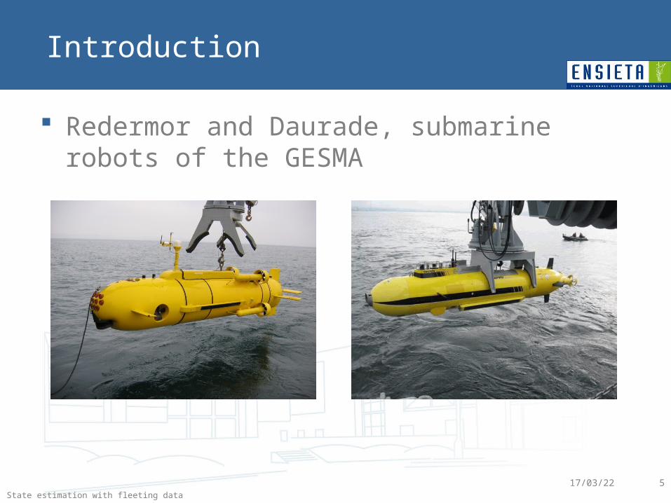
Redermor and Daurade, submarine robots of the GESMA
Introduction
State estimation with fleeting data
18/04/23 6
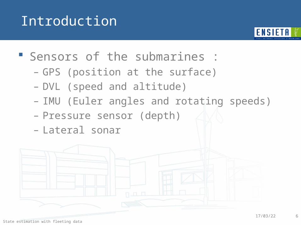
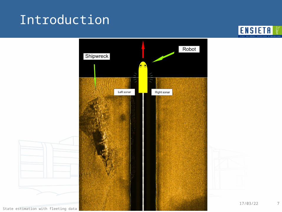
Sensors of the submarines :– GPS (position at the surface)– DVL (speed and altitude)– IMU (Euler angles and rotating speeds)– Pressure sensor (depth)– Lateral sonar
Introduction
State estimation with fleeting data
18/04/23 7
Introduction
State estimation with fleeting data
18/04/23 8
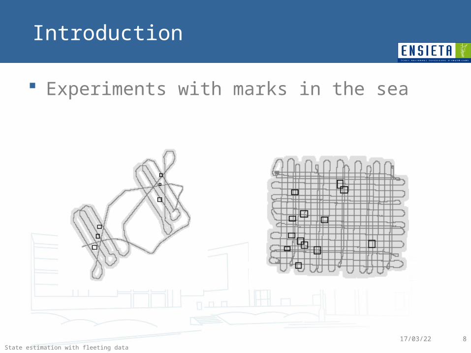
Experiments with marks in the sea
Introduction
State estimation with fleeting data
18/04/23 9
Goals:– Get an envelope for the trajectory of the robot– Compute sets which contain marks– Make a cartography of the area
Introduction
State estimation with fleeting data
18/04/23 10
Introduction
Input:– Navigation data of the submarine (Euler angles,
depth, altitude, speed, some GPS positions) – Marks detections on the sonar image (distance)– Raw sonar image– Time and max error for each data
State estimation with fleeting data
18/04/23 11
Introduction
Output:– Trajectory (envelope and center)– Position of marks in the sea (envelope and center)– Map of the area
State estimation with fleeting data
18/04/23 12
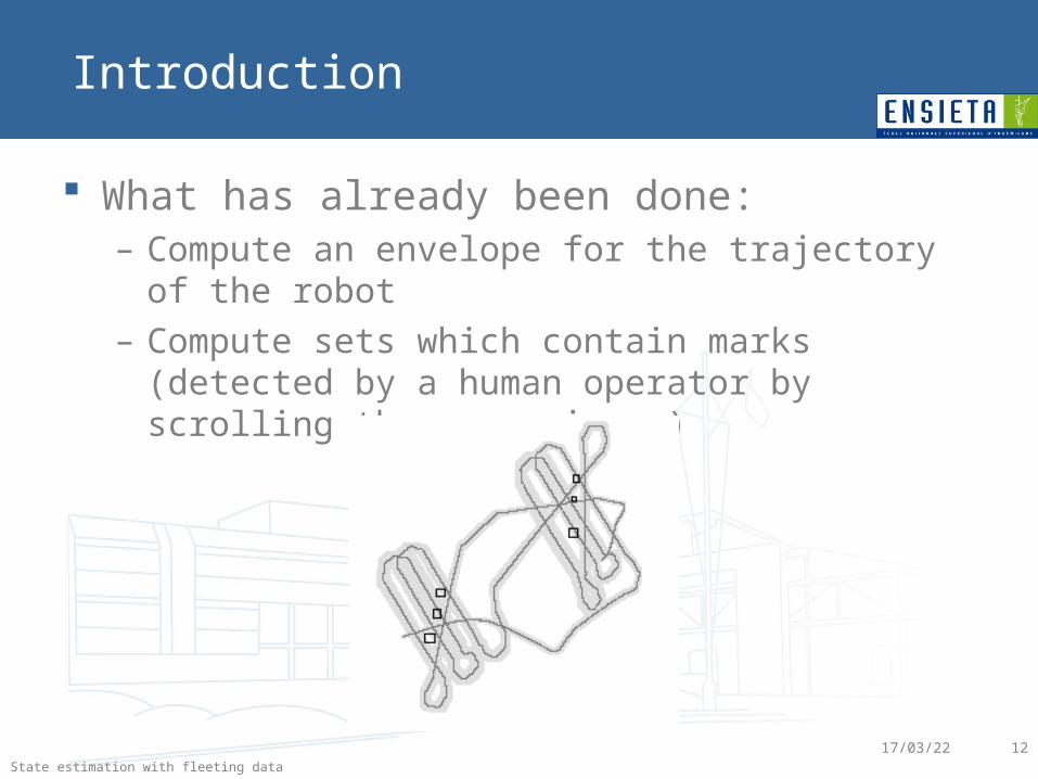
What has already been done:– Compute an envelope for the trajectory of the robot– Compute sets which contain marks (detected by a
human operator by scrolling the sonar image)
Introduction
State estimation with fleeting data
18/04/23 13
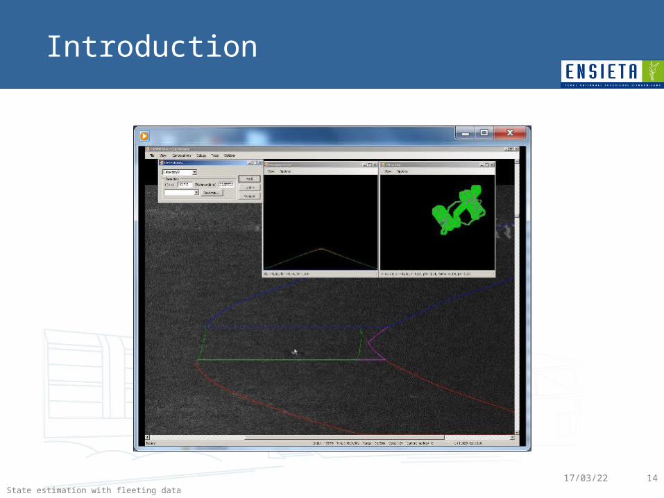
What has already been done:– Generate a reconstitution of the sonar image showing
the estimated position of the marks on it (predicted stain)
– Help the human operator for the detection/identification of the marks
– Check the consistency of input data
Introduction
State estimation with fleeting data
18/04/23 14
Introduction
State estimation with fleeting data
18/04/23 15
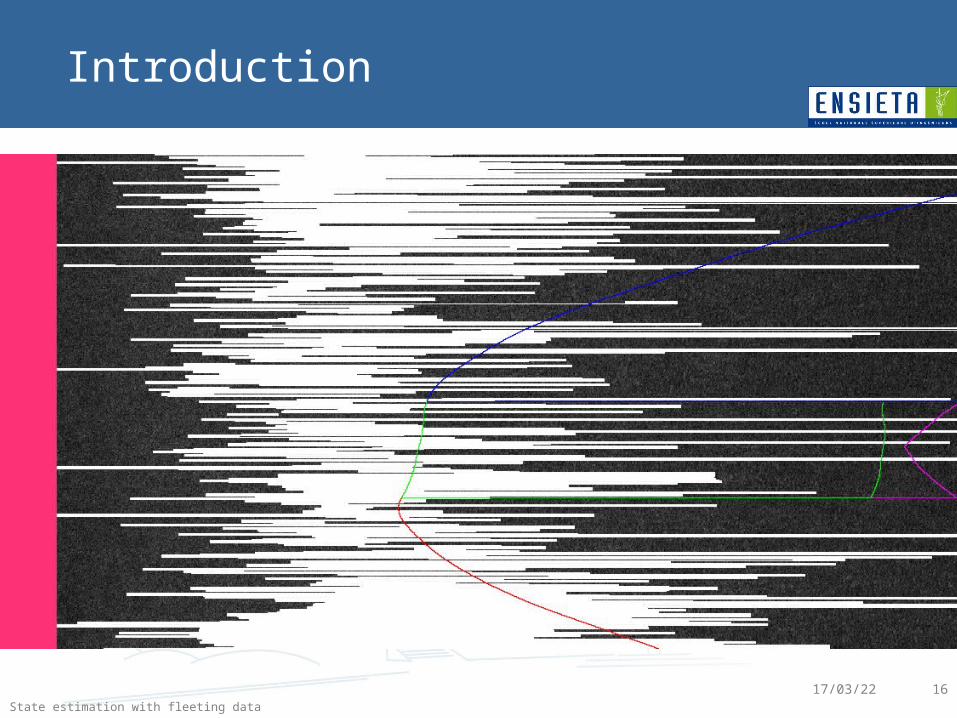
What could be done:– Use a little bit more the sonar image to eliminate
zones where we are sure there is no object (no bright points)
• Should improve the precision of the positions estimation• Could help the user to see which parts of the sonar data
might contain objects
Introduction
State estimation with fleeting data
18/04/23 16
Introduction
State estimation with fleeting data
18/04/23 17
What could be done:– Use a little bit more the sonar image to eliminate
zones where we are sure there is no object (no bright points)
• Should improve the precision of the positions estimation• Could help the user to see which parts of the sonar data
might contain objects
– Generate a cartography of the area using sonar data
Introduction
State estimation with fleeting data
18/04/23 18
Approach used: fleeting data and tubes

State estimation with fleeting data
18/04/23 19
Demo

State estimation with fleeting data
18/04/23 20
Conclusion
State estimation with fleeting data
18/04/23 21
Conclusion
We can use the sonar/telemetric data to improve the estimation of the trajectory
Tubes are well suited to deal with estimation of trajectories
State estimation with fleeting data
18/04/23 22
Conclusion
Prospects : – Do SLAM instead of localization– Apply the method on real sonar data of submarines