state of connecticut geospatial information systems council annual report - december 2007 submitted...
Post on 21-Dec-2015
214 views
TRANSCRIPT

State of Connecticut Geospatial Information Systems Council
Annual Report - December 2007
Submitted in Accordance with C.G.S. 11- 4 (a)

About the GIS CouncilThe State of Connecticut Geospatial InformationSystems (GIS) Council was established by Public Act05-3 to “coordinate, within available appropriations, auniform geo-spatial information system capacity formunicipalities, regional planning agencies, the state andothers.”
The GIS Council was formed in January 2006 with theappointment of members from municipalities, stateagencies, and higher education.
The Council consists of four working groups
Data and Inventory AssessmentEducation and TrainingLegal and SecurityFinance
Twelve GIS Council meetings were held in 2007. In addition over 48 meetings were held by the various active Working Groups of the GIS Council showing the significant commitment by Connecticut's GIS practitioners in improving coordination and planning.
Minutes and agendas are posted on the GIS Councilwebsite, located at www.ct.gov/gis.
GIS Council Membership
Representative of a municipality with population greater than30,000 but less than 60,000 (Appointed by Governor)
Representative of municipality with population greater than60,000 (Appointed by Senate President Pro Tempore)
Representative from a Regional Planning Agency (Appointed bySenate Minority Leader)
Representative of a municipality with population less than 30,000(Appointed by Speaker, House of Representatives)
GIS User (Appointed by Minority Leader, House ofRepresentatives)
Executive Branch AgenciesDepartment of Information Technology (Chair)Office of Policy ManagementDepartment of Environmental ProtectionDepartment of Economic and Community DevelopmentDepartment of TransportationDepartment of Public SafetyDepartment of Public HealthDepartment of Public WorksDepartment of AgricultureDepartment of Emergency Management and Homeland SecurityDepartment of Social ServicesConnecticut Siting CouncilDepartment of Public Utility ControlMilitary Department
Higher Education Connecticut State University SystemUniversity of Connecticut

Public Participation - Strategic and Business Plan
Public participation in the formulation of the strategic and businessplan provided valuable insight for the GIS Council as the plandeveloped.
Public Sessions - Summer 2007
To gather public input and foster communication andcollaboration with the GIS user community, publicsessions were held in New Britain, Danbury, Willimanticand New Haven in July and August 2007. More than 75 individualsattended the sessions.
To access public session presentations, select here.
Online Survey
An online survey of GIS methods, uses and needs wasalso conducted and generated input from more than 60organizations.
Strategic and Business PlanningIn 2007, the GIS Council developed a Strategic and Business Plan*. The plan was formally approved by the GIS Council in September 2007 and contained the following goals:
Strategic Goals
Organize GIS efforts across state and localgovernment agencies.
Develop a core set of data layers that are kept up-to-date and made broadly accessible in a state-manageddata repository.
Communicate and educate potential users anddecision makers about the benefits and capabilitiesachieved by GIS investments.
Program Goals
Improve coordination and organize GIS efforts acrossall levels of government (federal, state, regional, andlocal).
Develop a core set of framework data layers that canbe shared across state agencies and with localgovernment.
Communicate the benefits of and educate decisionmakers on the use of geospatial technology to increaseadoption and provide sustainable funding.*Plans funded by a $50,000 grant from the United States Geological Survey.

Framework GIS Datasets
The Strategic Plan calls for development of a core set of frameworkdata layers that can be shared.
The following datasets were identified for Connecticut’s GIS effort:
Addressing Administrative and Political Boundaries Base Map Imagery (Ortho, Oblique
and Scanned Imagery) Cadastral Information Census and Demographics Critical Infrastructure Elevation and Bathymetry Geodetic Control Geographic Names and Places Hydrography Land Use and Land Cover Transportation List Standards
The Strategic Plan calls for Framework Data layers to containvarious data resolutions and scales. Labels identifyingbusinesses, services and other points of interest would be able to beadded as well as imagery of all types (orthophotos, infrared, oblique,bathymetry) to enhance the use of the data.
This map could be used as a guide for the statewide data repository,and can be used to connect people to spatial data for bettercommunication throughout the state.
Properties that are available for occupation could be accessedthrough an economic development web site.
Working Group Summary:
Data Inventory and Assessment Identifying Framework Datasets
The Data Inventory and Assessment Working Group istasked with identifying framework datasets and establishing standards and policies for the maintenanceand dissemination of GIS data.
In 2007, the working group continued their work and established twelve subcommittees to formulate framework GIS datasets for Connecticut and created an updated and more comprehensive report Connecticut’ Geographic Framework Data .
Each subcommittee consists of stakeholders from state,local, private and federal interests and will serve as asteward for the creation and maintenance of data policies, and procedures associated with each of the framework dataset themes.
This approach is based on a federal model in which coregroups are brought together to develop data useable bymany different groups. Such coordinated data developmentbetween and among agencies is consistent with the Strategic Plan adopted by GIS Council.
Development of Cooperative Data Sharing AgreementsThe working group is also developing cooperative datasharing agreements with three bordering states that haveGIS data. These agreements will enable each State toacquire needed data in the event of an emergency.
Working Group Summary:
Education and Training
The Education and Training Working Group exploresmethods to train and educate GIS users in Connecticutabout events, training opportunities, technology programsand GIS trends.
The GIS Strategic Plan calls for the development ofelements designed to bolster communication andoutreach to multiple audiences, including
Educational Materials, including standardpresentations, for use in education about the use of GIS inthe state;
Newsletters detailing current GIS related activitywithin the state.
GIS User to User Group to foster communication andcollaboration between the GIS Council and the diverseuser community.
The Strategic Plan also identified venues and organizations through which to conduct outreach. This will create an atmosphere of open dialogue and bi-directional flow of information with stakeholder groups.
Areas of Focus in 2007
The working group conducted the following activities in 2007:
Surveyed Existing Training Programs and NeedsA survey of training programs, focusing on state agencies in the Northeast region, was conducted. The survey revealed that States have markedly different means of training. The Working Group seeks to incorporate the most successful of these into its own training programs.
Developed Outreach and Educational MaterialsGeneral educational materials continued to be developed to educatemultiple audiences on geospatial technology in Connecticut and thework of the GIS Council.
Additions to the GIS website included features on how GIS is beingused throughout Connecticut, including examples from schools and municipalities, notices of GIS events, data sources and more.
Organized GIS Day at State CapitolThe working group organized the 2007 GIS Day at the LegislativeOffice Building and invited participation from GIS professionals,educators, students and other practitioners. The 2007 GIS Dayresulted in the largest assembly of posters and GIS work display todate.
GIS Practitioners Database Under DevelopmentA database of GIS practitioners is being developed. The Working Group will put the database online so that it may be viewed and updated by users of the GIS Website.

2008 Goals and ChallengesIn 2007 the State GIS community was able to continue as well as initiate several projects which were funded in whole or partially through several federal grant programs.
Several important pilot programs made significant progress during 2007:
Geospatial Emergency Management System - DEMHS GIS Project, created an Emergency Response and Planning tool
Oblique Imagery Project – Purchase of Pictometry photographic imagery for a third of Connecticut's land area
Road Network Environment – Developed a pilot to test long term road data framework
These important projects will need sustained funding in order to continue to be successful. In 2008 we will be looking to secure sustainable funding for these important projects.
In addition the GIS Strategic Plan calls for the development of elements designed to bolster communication and outreach to multiple audiences to continue these efforts.
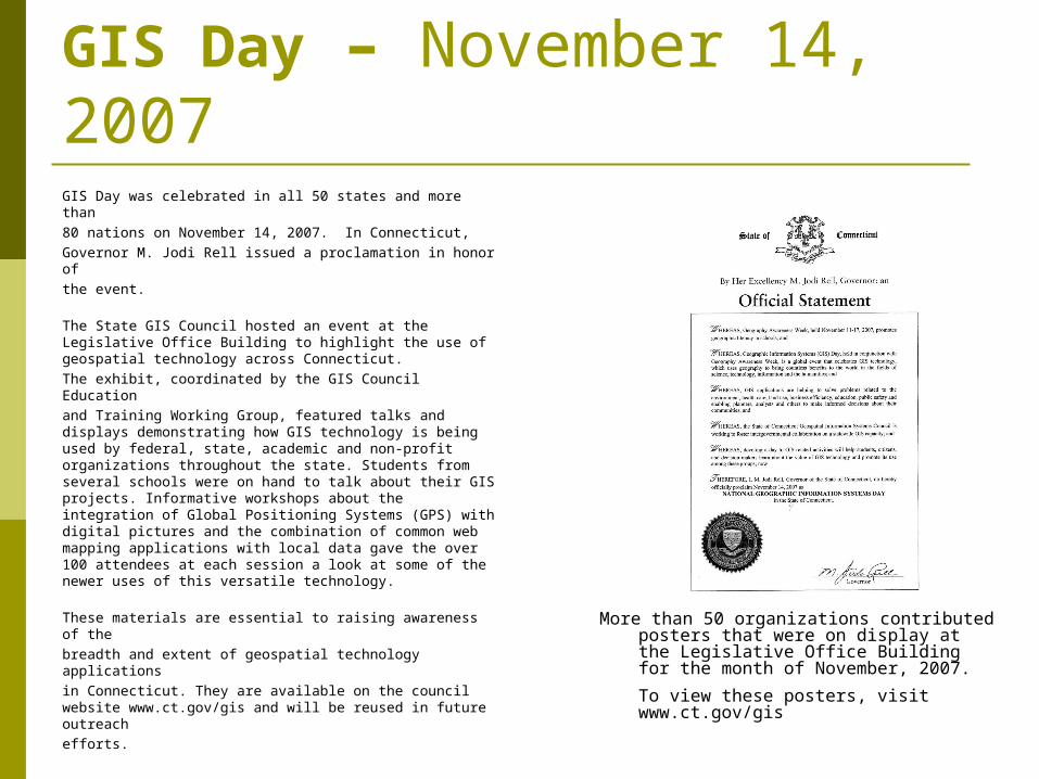
GIS Day – November 14, 2007GIS Day was celebrated in all 50 states and more than
80 nations on November 14, 2007. In Connecticut,
Governor M. Jodi Rell issued a proclamation in honor of
the event.
The State GIS Council hosted an event at the Legislative Office Building to highlight the use of geospatial technology across Connecticut.
The exhibit, coordinated by the GIS Council Education
and Training Working Group, featured talks and displays demonstrating how GIS technology is being used by federal, state, academic and non-profit organizations throughout the state. Students from several schools were on hand to talk about their GIS projects. Informative workshops about the integration of Global Positioning Systems (GPS) with digital pictures and the combination of common web mapping applications with local data gave the over 100 attendees at each session a look at some of the newer uses of this versatile technology.
These materials are essential to raising awareness of the
breadth and extent of geospatial technology applications
in Connecticut. They are available on the council website www.ct.gov/gis and will be reused in future outreach
efforts.
More than 50 organizations contributed posters that were on display at the Legislative Office Building for the month of November, 2007.
To view these posters, visit www.ct.gov/gis