stirling highway local development plan - town of … · highway’ study as the ‘stirling...
TRANSCRIPT

Stirling Highway Local Development Plan
2016
TOWN OF CLAREMONT
Based on Planning for Increased Density along Stirling Highway Study Planning Context and Mackay Urban Design
December 2013

Document ID:
Issue Date Status Prepared by Approved by
Name Initials Name Initials
Charles Johnson
This report has been prepared for the exclusive use of the Client, in accordance with the agreement between the
Client and Planning Context (‘Agreement’).
Planning Context accepts no liability or responsibility whatsoever in respect of any use of or reliance upon this
report by any person who is not a party to the Agreement or an intended recipient.
In particular, it should be noted that this report is a qualitative assessment only, based on the scope and timing of
services defined by the Client and is based on information supplied by the Client and its agents.
Planning Context cannot be held accountable for information supplied by others and relied upon by Planning
Context.
Copyright and any other Intellectual Property arising from and the provision of the services in accordance with
the Agreement belongs exclusively to Planning Context unless otherwise agreed and may not be reproduced or
disclosed to any person other than the Client without the express written authority of Planning Context.

1
Annexure Council Consideration of the Draft Planning for Increased Residential Density along Stirling Highway
A report on the Draft Planning for Increased Residential Density along Stirling Highway was
presented to the Town of Claremont Council at its meeting held on 5 July 2016 where it resolved
pursuant to Part 6 of the Planning and Development (Local Planning Schemes) Regulations 2015, to
approve the draft ‘Planning for Increased Residential Density along Stirling Highway’ study as a Local
Development Plan to guide the proposed amendment to Town Planning Scheme No. 3 and
associated Local Planning Policy to promote the development of land in the proximity of Stirling
Highway with the following modifications:
i) Formally name the ‘Planning for Increased Residential Density along Stirling
Highway’ study as the ‘Stirling Highway Local Development Plan’.
ii) Endorsement of the Staged Model as the development option until such time as the
Local Development Plan is reviewed by Council.
iii) Include the St Louis Estate Retirement Village as an identified “designated landmark”
site which is subject to the preparation of a master plan which informs the
development of a separate Local Development Plan to identify and address specific
development requirements for the site and to guide any future amendment to Town
Planning Scheme No. 3 and/or Local Planning Policy.
iv) The inclusion of No. 2 Richardson Avenue in the Western Residential Precinct
subject to formal reconsideration when the Stirling Highway Local Development Plan
is reviewed to progress proposals to include the Western Residential Precinct at the
R80 density.
A full copy of the Council minutes and report for the meeting on 5 July 2016 is included in Appendix
1 to this study. The design guidelines are included as Appendix 2.

2

3
Contents Executive Summary ................................................................................................................................. 5 Part One: Background ............................................................................................................................. 8 Introduction ............................................................................................................................................ 8 Purpose of this Report ............................................................................................................................ 8 State Government Context ..................................................................................................................... 9 Local Context ......................................................................................................................................... 10 The Study Area ...................................................................................................................................... 11 Project Methodology ............................................................................................................................ 12 Part Two: Assessment and Development Concept ............................................................................... 14 Assessment Outcomes .......................................................................................................................... 14 Stirling Highway Residential Development Concept ............................................................................ 15 Objectives ............................................................................................................................................. 15 Broad Principles .................................................................................................................................... 16 Indicative Development Typologies ...................................................................................................... 20 Density modelling ................................................................................................................................. 21 Part Three: Implementing the Stirling Highway Development Concept through Planning .................. 27 Existing Planning Controls and Proposed Changes ............................................................................... 27 Metropolitan Region Scheme ............................................................................................................... 27 Town of Claremont Town Planning Scheme No. 3 ............................................................................... 29 Local Planning Policy ............................................................................................................................. 42 Other Council Regulations or Policies ................................................................................................... 43 Part 4 - Recommendations ................................................................................................................... 44 Concept ................................................................................................................................................. 44 Town of Claremont Town Planning Scheme No. 3 ............................................................................... 44 Local Planning Policy ............................................................................................................................. 49 Other Council Regulations and Policies ................................................................................................ 49 Attachments/Appendices ..................................................................................................................... 50 Attachment 1 – Notional Study Area .................................................................................................... 51 Attachment 2 - Assessment Criteria and Scoring ................................................................................. 52 Attachment 3 – Assessment Scores Table ............................................................................................ 54 Attachment 4 - Analysis Maps .............................................................................................................. 58 Attachment 5 - Stirling Highway Residential Development Concept – Precincts ................................. 62 Attachment 6 - Indicative Development Typologies ............................................................................ 63 Attachment 7 – 3D Modelling to Determine Potential Yield and Density Coding ................................ 70 Attachment 8 – Advertised MRS Amendment No. 1210/41 Rationalisation of Stirling Highway Reservation – Proposed Rezoning ........................................................................................................ 73 Attachment 9 – Advertised MRS Amendment No. 1210/41 Rationalisation of Stirling Highway Reservation – Property Impacts ............................................................................................................ 74 Attachment 10 – TPS 3 Zoning .............................................................................................................. 77 Attachment 11 – Changes suggested to TPS 3 Zoning Map ................................................................. 78 Appendix 1– Council minutes and report 5 July 2016 .......................................................................... 79 Appendix 2 – Design Guidelines ............................................................................................................ 98

4

5
Executive Summary
Background Purpose The Town of Claremont adopted its Housing Capacity Study in November 2012 to identify constraints and opportunities relating to the housing targets included in Directions 2031 Draft Central Metropolitan Perth Sub-Regional Strategy (CMPSS) which will inform the future review of the Town of Claremont’s Local Planning strategy, Clearly Claremont. This report is in response to the recommendations of the Claremont Housing Capacity Study concerning Stirling Highway to provide the following: 1. Support and progression of the drafting of
a Local Scheme Amendment to reflect Metropolitan Region Scheme (MRS) Amendment No. 1210/41 with suitable commercial and residential zoning and density coding along Stirling Highway.
2. A set of draft statutory and policy planning tools to control redevelopment, reduce amenity impacts, take into account topographical variances with adjoining land and protect local heritage sites and the amenities of lower density surrounding areas along Stirling Highway.
Stirling Highway Access Control Study The Stirling Highway Activity Corridor Study (SHACS) is an integrated transport and land use planning study being undertaken by the Department of Planning (DoP) at the request of the Western Australian Planning Commission (WAPC) and consists of two inter-related and staged studies: Phase 1: A preliminary carriageway design
for Stirling Highway (MRS Amendment No. 1210/41 - Rationalisation of Stirling Highway Reservation); and
Phase 2: A staged urban design and form based code study to guide built form and redevelopment opportunities in a sustainable planned manner (yet to be progressed).
MRS Amendment No. 1210/41 - Rationalisation of Stirling Highway Reservation generally shows a reduction of the Primary Regional Road (PRR) reservation to approximately 40 metres in width with the balance of the land proposed to be rezoned as Urban (and Parks and Recreation for a small section between Bay View Terrace and Bernard Street). Officers from DoP have indicated that a decision from the Minister for Planning on the proposed amendment is expected around mid-2014 following consideration by the WAPC. When MRS Amendment No. 1210/41 is adopted, land no longer affected by the PRR reservation will remain unzoned within the respective local planning schemes. It is recommended that Council takes the initiative to develop its own set of design guidelines and other planning tools rather than await finalisation of Phase 2 of SHACS. This report is has been based on the proposed extent of the Stirling Highway reservation as shown in the MRS Amendment No. 1210/41 plans as were advertised for public comment.
Planning Context The expectations of the State Government is that local governments, including the Town of Claremont, will take positive action to support population and dwellings growth under the framework of Directions 2031 and the CMPSS targets. It is likely that the government will require changes to any proposals where they are seen to be not supporting Directions 2031.
The Study Area The study area comprises of 146 properties and generally includes land along the length of Stirling Highway as it traverses the Town of Claremont, from south of Airlie Street
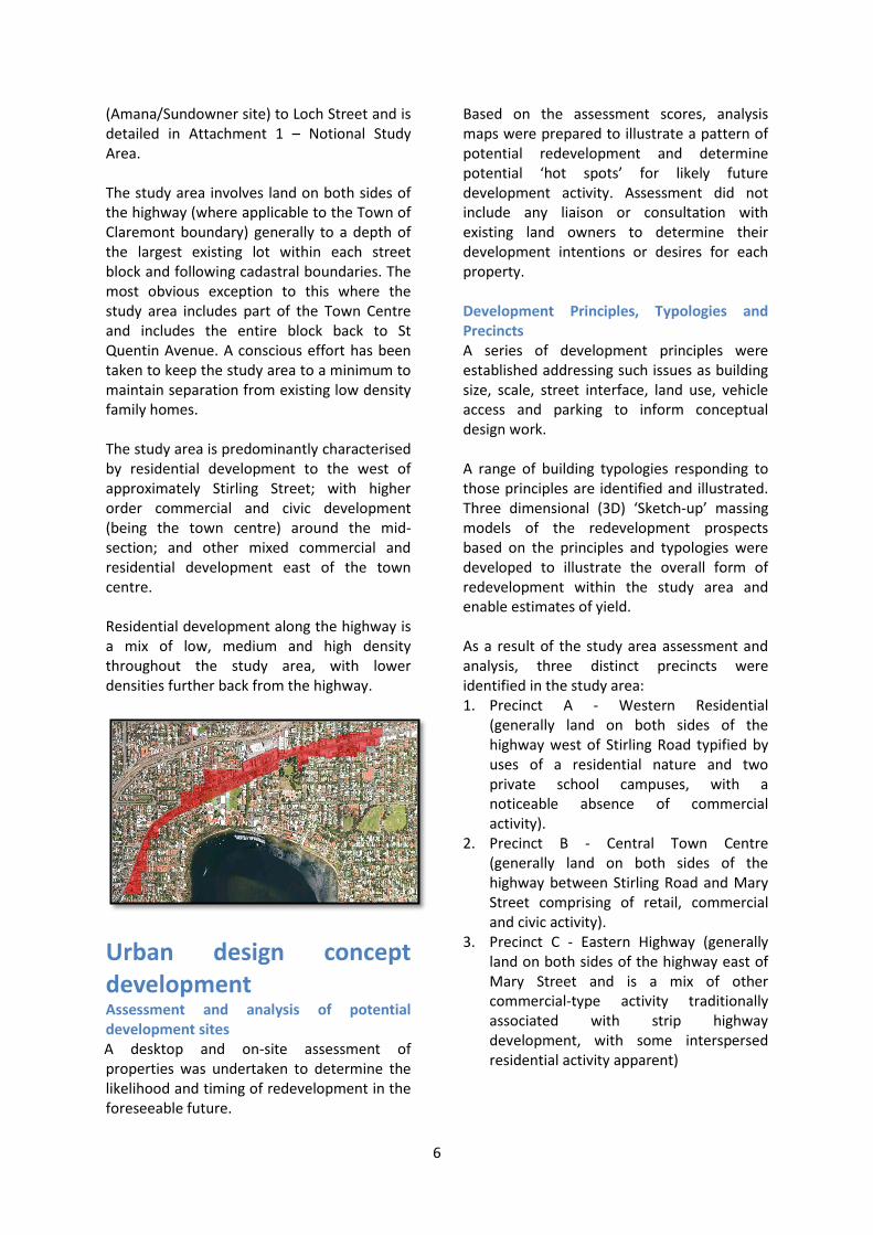
6
(Amana/Sundowner site) to Loch Street and is detailed in Attachment 1 – Notional Study Area. The study area involves land on both sides of the highway (where applicable to the Town of Claremont boundary) generally to a depth of the largest existing lot within each street block and following cadastral boundaries. The most obvious exception to this where the study area includes part of the Town Centre and includes the entire block back to St Quentin Avenue. A conscious effort has been taken to keep the study area to a minimum to maintain separation from existing low density family homes. The study area is predominantly characterised by residential development to the west of approximately Stirling Street; with higher order commercial and civic development (being the town centre) around the mid-section; and other mixed commercial and residential development east of the town centre. Residential development along the highway is a mix of low, medium and high density throughout the study area, with lower densities further back from the highway.
Urban design concept development Assessment and analysis of potential development sites A desktop and on-site assessment of properties was undertaken to determine the likelihood and timing of redevelopment in the foreseeable future.
Based on the assessment scores, analysis maps were prepared to illustrate a pattern of potential redevelopment and determine potential ‘hot spots’ for likely future development activity. Assessment did not include any liaison or consultation with existing land owners to determine their development intentions or desires for each property. Development Principles, Typologies and Precincts A series of development principles were established addressing such issues as building size, scale, street interface, land use, vehicle access and parking to inform conceptual design work. A range of building typologies responding to those principles are identified and illustrated. Three dimensional (3D) ‘Sketch-up’ massing models of the redevelopment prospects based on the principles and typologies were developed to illustrate the overall form of redevelopment within the study area and enable estimates of yield. As a result of the study area assessment and analysis, three distinct precincts were identified in the study area: 1. Precinct A - Western Residential
(generally land on both sides of the highway west of Stirling Road typified by uses of a residential nature and two private school campuses, with a noticeable absence of commercial activity).
2. Precinct B - Central Town Centre (generally land on both sides of the highway between Stirling Road and Mary Street comprising of retail, commercial and civic activity).
3. Precinct C - Eastern Highway (generally land on both sides of the highway east of Mary Street and is a mix of other commercial-type activity traditionally associated with strip highway development, with some interspersed residential activity apparent)

7
A 3D model of the redevelopment prospects for the sites most likely to be developed was interrogated to measure floor space areas, which were then converted to a plot ratio. Based on an average unit size of 75sqm, an indicative dwelling yield for these lots was calculated. This generally informed the determination of density, which was different for each of the precincts. Density Modelling Based on the redevelopment prospects for the sites, the urban design principles and the building typologies, a range of density models were considered for the study area, including: Progressive (Preferred) Western Residential Precinct: R80 Central Town Centre Precinct: R-AC0 Eastern Highway Precinct: R100 Modest Western Residential Precinct: R60 Central Town Centre Precinct: R-AC0 Eastern Highway Precinct: R80 Conservative Western Residential Precinct: R40 Central Town Centre Precinct: R-AC0 Eastern Highway Precinct: R60 Staged Western Residential Precinct: no change yet (R15-R40) Central Town Centre Precinct: R-AC0 Eastern Highway Precinct: R100 The preferred density modelling (‘Progressive’) for the Stirling Highway residential concept relating only to those properties identified as more likely to be developed, results in a redevelopment yield of 1,130 dwelling units. This does not include the Amana (Sundowner) site, which could result in up to approximately a further 400 dwellings. The Consultant’s believe that this option is the most desirable and viable option for the following reasons:
It provides sufficient incentive, flexibility and viability for landowners to initiate development;
It is more likely to result in higher quality development;
Lower densities may pose a greater risk of seeing less redevelopment occur, or seeing interim development in a form that may be of lower quality; and
It more than satisfies the State Government’s housing targets well into the future.
Design Guidelines As part of the concept development, a short suite of illustrated design guidelines suited to the anticipated building typologies were developed to capture and elaborate on the identified development principles within each of the precincts. These form the basis for a separate Design Guidelines document for consideration of adoption as Local Planning Policy (LPP) under Town Planning Scheme No. 3 (TPS3). Scheme Provisions and Development Assessments Changes are suggested with regard to TPS3 to reflect MRS Amendment No. 1210/41 based on the outcome of the design concept and guidelines process. This includes consideration of the introduction of increased residential density coding of R80 in the Western Residential Precinct, R-AC0 in the Central Town Centre Precinct and R100 in the Eastern Highway Precinct. Suggested changes also include other scheme provisions to implement the concept and effectively control development and protect local heritage sites and the amenities of lower density surrounding areas. A draft LPP which incorporates the design guidelines prepared in earlier stages is provided for consideration for adoption.
8
Part One: Background
Introduction Town of Claremont Housing Capacity Study In November 2012, the Town of Claremont adopted its Housing Capacity Study to identify constraints and opportunities relating to the housing targets included in Directions 2031 Draft Central Metropolitan Perth Sub-Regional Strategy (CMPSS), which will inform the future review of the Town of Claremont’s Local Planning strategy, Clearly Claremont.
Stirling Highway Activity Corridor Study The Stirling Highway Activity Corridor Study (SHACS) is an integrated transport and land use planning study being undertaken by the Department of Planning (DoP) at the request of the Western Australian Planning Commission (WAPC) and consists of two inter-related and staged studies: Phase 1
A preliminary carriageway design for Stirling Highway to accommodate bus priority lanes, cycle lanes, dedicated right turn lanes, median strips for pedestrian safety and landscaping, and to generally improve both the environment and safety of the Stirling Highway activity corridor; and
Phase 2 A staged urban design and form based code study to guide built form and redevelopment opportunities in a sustainable planned manner.
Phase 1 was available for public comment until mid-2012 as MRS Amendment No. 1210/41 - Rationalisation of Stirling Highway Reservation, which includes the area of Stirling Highway through Claremont. This amendment has not yet been finalised and therefore, Phase 2 is yet to be progressed. In the context of the Central Metropolitan Perth Sub-region Planning Strategy (CMPSS), the Stirling Highway Growth Corridor is identified to have a potential for an additional
1400 dwellings with possibly up to 400 dwellings in Claremont. MRS Amendment No. 1210/41 does not deal with residential density or built form, only the Stirling Highway road reserve. Redefining the Primary Regional Roads (PRR) reservation will assist in identifying the physical extent of any future land use opportunities. The CMPSS indicates that the rationalisation of the reserve will result in significant development opportunities and it is expected that the WAPC will press for increased residential densities as a way to help compensate land owners, where property is taken for the future road widening. Amongst a range of other recommendations, the Claremont Housing Capacity Study recognises that it is essential for the Town of Claremont to take the lead in the preparation of the urban design study for the Claremont portion of the Stirling Highway Activity Corridor.
Purpose of this Report This report is in response to the recommendations of the Claremont Housing Capacity Study concerning Stirling Highway to provide the following: 1. Support and progression of the drafting of
a Local Planning Scheme Amendment to reflect MRS Amendment No. 1210/41 with suitable commercial and residential zoning and density coding along Stirling Highway.
2. A set of draft statutory and policy planning tools to control redevelopment, reduce amenity impacts, take into account topographical variances with adjoining land and protect local heritage sites and the amenities of lower density surrounding areas along Stirling Highway.

9
State Government Context As identified in the adopted Claremont Housing Capacity Study, the expectations of the State Government is that local governments, including the Town of Claremont, will take positive action to support population and dwellings growth under the framework of Directions 2031 and the CMPSS targets. It is likely that the government will require changes to any proposals where they are seen to be not supporting Directions 2031.
The updated housing target for the Town of Claremont is an additional 760 dwellings by 2031 (250 by 2011-16; 180 by 2016-21; 180 by 2021-26; 180 by 2026-31). Approximately 400 of these dwellings are expected to be located in the vicinity of Stirling Highway. The encouraged housing mix for Central Sub-region includes: 1 bed 10-20%; 2 bed 30-40%; 3 bed 30-40%; 4 bed 1-25%. The Claremont Town Centre is defined as a secondary centre under the WAPC’s State Planning Policy 4.2 - Activity Centres for Perth and Peel. It is likely that in a review of the Claremont TPS3, the State will seek amendments to ensure increased density of residential development (using the minimum of 25 and desirable level of 35 dwellings per gross hectare) for a secondary centre. The WAPC’s State Planning Policy 3 – Urban Growth Settlement and Development Control Policy 1.6 – Planning to Support Transit Use and Transit Oriented Development assist in reinforcing the broader strategic planning objectives of the State Government and are aimed at requiring local governments to take these matters into consideration when planning and development control decisions are being made. The importance of utilising transit networks to their full potential by encouraging development within close proximity to the node and/or corridor and ensuring the highest and optimum use of the land must be considered. Higher residential density is encouraged generally within 800m of railway
stations and 400m from high frequency bus service stops. The Town has raised concern with these broad principles as it is considered that a broad brush density approach surrounding the railway stations and along the high frequency bus routes will have a significant impact on the historic and generally high quality residential living environments within the Town. Figure 1 - Heritage properties within railway station catchments demonstrates the extent of the impact of such an approach, as it highlights the significant number of heritage properties located within the railway station catchments.

10
Figure 1 - Heritage properties within railway station catchments
Local Context The Town of Claremont Local Planning Strategy 2010-2025 (Clearly Claremont) provides a (non-statutory) general policy based planning framework to guide land use and development which is ultimately to be reflected in the Local Planning Scheme (statutory) and Local Planning Policies (non-statutory). The Town of Claremont Local Planning Policies LIV123 – Retention of Residential Character and LIV124 – Retention of Residential
Heritage, along with other sets of design guidelines such as the Municipal Inventory (currently under review) for certain development areas provide more specific guidance for adaptation and change. Although not part of the Town of Claremont Planning Scheme, these LPPs are adopted under the provisions of the Scheme and must be taken into consideration in decision-making.

11
The Study Area What the study area includes and why The study area comprises of 146 properties and generally includes land along the length of Stirling Highway as it traverses the Town of Claremont, from south of Airlie Street (Amana/Sundowner site) to Loch Street, as detailed in Attachment 1 – Notional Study Area. The study area involves land on both sides of the highway (where applicable to the Town of Claremont boundary) generally to a depth of the largest existing lot within each property block and following cadastral boundaries. The most obvious exception to this where the study area includes part of the Town Centre and includes the entire block back to St Quentin Avenue. A conscious effort has been taken to keep the study area to a minimum to maintain separation from existing and often historic or high quality low density family homes. It is also noted that the Town of Claremont Council Offices and Library site has not been included within the study area.
General Description The study area is predominantly characterised by residential development to the west of approximately Stirling Street; with higher order commercial and civic development (being the town centre) around the mid-section; and other mixed commercial and residential development east of the town centre. Residential development along the highway is a mix of low, medium and high density throughout the study area, with lower densities further back from the highway. There are two main sites of aged persons’ accommodation in the western section of the study area, these being the Amana (Sundowner) development at Airlie Street and the St Louis Estate between Albert and Dean Streets. There are also two private school campuses in this vicinity, being the Methodist
Ladies College and Christchurch Grammar, both with boarding schools for temporary accommodation throughout the school year. There is no significant residential development currently within the part of the study area that is adjacent to the Town Centre, other than the mixed use development on the north east corner of Stirling Street and Stirling Highway and the ‘Freshwater’ development currently under construction opposite this. Within the Town Centre (not in the study area); however, there is considerable residential development as part of the mixed use development at Claremont Quarter. There is a range of commercial uses fronting Stirling Highway in this section of the study area including fast food outlets, offices and retail. East of the town centre, existing residential development is predominantly interspersed between other commercial type activities rather than being part of mixed use sites. The study area is generally bordered to the north and south by single family homes of one or two storeys, with the exception of the town centre where high rise mixed commercial at the Claremont Quarter and residential development exists to the north, with parks and civic uses to the south.

12
Project Methodology
Assessment and analysis of potential development sites Following review of available background information (for example heritage listings, previous studies, proposed road reservations, height data, land contours, existing development) and identification of the notional study area, an on-site assessment and photography of building stock was undertaken to determine the likelihood and timing of redevelopment in the foreseeable future. Assessment criteria included a range of factors including lot and building features, ownership and development, heritage significance, access to a rear lane and train station. These elements were considered as being either likely to encourage or present some challenge to redevelopment in the short to medium term and scores were applied to each category accordingly. An explanation of whether the element was considered to be ‘positive’ or ‘more challenging’ in terms of encouraging redevelopment, together with the scores aligned to each factor, is detailed in Attachment 2 - Assessment Criteria and Scoring. Based on the assessment scores, analysis maps were prepared to illustrate a pattern of potential redevelopment and determine potential ‘hot spots’ for likely future development activity. It is noted that the investigations into the development potential of the properties within the study area did not include any liaison or consultation with existing land owners to determine their development intentions or desires for each property.
Corner lot
Vacant lot
Access to rear lane
Significant business operation
Condition of buildings
Heritage
Residential to the south
Institutional use

13
Urban design concept development A series of development principles were established addressing such issues as building size, scale, street interface, land use, vehicle access and parking to inform conceptual design work. A range of building typologies responding to those principles were identified and illustrated. Three dimensional (3D) ‘Sketch-up’ massing models of the redevelopment prospects based on the principles and typologies were developed to illustrate the overall form of redevelopment within the study area and enable estimates of yield. The preparation of the models also considered the preferred location for vehicle access to minimise potential impacts in Stirling Highway and the adjacent residential streets. At this stage, it is assumed that there is either sufficient capacity on the local service infrastructure of that the service utilities will be able to upgrade the infrastructure to provide the necessary capacity to cater for future demand, which is their principal function. As a result of the study area assessment and analysis, it became evident that the study area could be characterised in three distinct sections or precincts having common objectives and principles for development (Precinct A: Western Residential, Precinct B: Central Town Centre and Precinct C: Eastern Highway). A 3D model of the sites most likely to be developed was interrogated to measure floorspace areas, which were then converted to plot ratio. Based on an average unit size of 75sqm, an indicative dwelling yield was calculated. This generally informed the determination of density options, which was different for each of the precincts.
Design Guidelines As part of the concept development, a short suite of illustrated design guidelines suited to the anticipated building typologies were developed to capture and elaborate on the
identified development principles within each of the precincts. These form the basis for a separate Design Guidelines document for consideration of adoption as LPP.
Scheme Provisions and Development Assessments A draft local planning scheme amendment proposal to reflect MRS Amendment No. 1210/41 is recommended based on the outcome of the design concept and guidelines process. This includes consideration of introducing increased residential density code options ranging from no change at this time (R15-R40) to R80 in the Western Residential Precinct, to R-AC0 in the Central Town Centre Precinct and R60 to R100 in the Eastern Highway Precinct. A set of draft changes to scheme provisions is presented for consideration to implement the concept and effectively control development and protect local heritage sites and the amenities of lower density surrounding areas. A draft LPP which incorporates the design guidelines prepared in earlier stages is provided for consideration for adoption under the terms of TPS3.
Consultation The Consultants (Planning Context and Mackay Urbandesign) have held workshops with the Town of Claremont planning staff and elected Council members to develop the proposed development concept and the supporting planning mechanisms for implementation. Land owners have not been consulted or involved with the outcomes of this study. Public consultation will occur through the usual statutory processes involved with amending a local planning scheme and adopting a local planning policy, should the Town of Claremont resolve to initiate these. The Town of Claremont may also decide to hold special public consultation regarding the recommendations made within this report prior to initiating any changes.

14
Part Two: Assessment and Development Concept
Assessment Outcomes An assessment of each property was undertaken within the study area to determine the likelihood and timing of redevelopment in the foreseeable future using a range of factors considered as either likely to encourage or be more challenging for redevelopment, and scores were applied to each category accordingly. Assessment factors included:
Corner lot
Vacant lot
Length of frontage
Lot size
Access to rear lane
Number of owners/tenants
Significant business operation
Condition of building stock
Age of building stock
Heritage listing/significance1
Significant trees on site
Views/potential views from upper levels
Less than 800 metres to train station
Site slope
Residential dwellings to the south
Institutional or civic use
Analysis of the Study Area The results of the measures allocated to each property for the elements investigated as part of this study are tabled in Attachment 3 – Assessment Scores Table. Some of the more interesting factors of note from the analysis are outlined as follows:
There are 56 corner lots within the study area;
There is limited vacant land in the study area, with only four lots currently undeveloped;
37 properties have access to a rear laneway; however, most of these are in
1 Based on the Town of Claremont Heritage Master List
28/11/2012. This list is currently under review and any changes may alter the assessment scores relating to likelihood of redevelopment for those properties.
the central or eastern section of the study area with a distinct lack of laneway access in the western section;
Approximately half of the properties are owned by single landowners; however, there are 25 properties that are owned by five or more landowners;
Most of the existing development in the study area is of fair to good quality; however, 26 properties are identified as having building stock of poor quality;
Some 20 properties are affected by heritage listing of some kind;
Many properties (43) located in the western and central sections of the study area have the potential to obtain views across the surrounding neighbourhood (some with potential ocean or river views) or across parkland or playing fields, whereas views are highly unlikely within the eastern section of the study area;
There are 13 sites where more than one tree of significant size and/or species exists;
All properties (except six) within the study area are within 800 metres of a train station;
Approximately half of the properties in the study area are characterised by at least a slight change in ,level from the Stirling Highway road pavement;
Some 68 properties, mostly all of which are located on the southern side of the highway, have residential development located to the south.
As mentioned in the Project Methodology section of this report, Attachment 2 - Assessment Criteria and Scoring shows whether the element was considered to be ‘positive’ or ‘more challenging’ in terms of encouraging redevelopment, together with the scores aligned to each factor. The total score for each property generally determined to which one of the following four categories of potential redevelopment it belonged:
15
1. Strong likelihood of redevelopment. 2. Moderate likelihood of redevelopment. 3. Limited likelihood of redevelopment. 4. Minimal likelihood of redevelopment. Based on the total assessment scores, Attachment 4 - Analysis Maps illustrates the pattern of potential redevelopment, notionally identifying ‘hot spots’ for likely future development activity. There is no particularly obvious or significant pattern that emerges from the mapping, other than a relatively large section of land in the western part of the study area in the vicinity of the private school campuses and the heritage site on Queenslea Drive, which should not be considered as likely contenders for contributing to residential development sites in the near future.
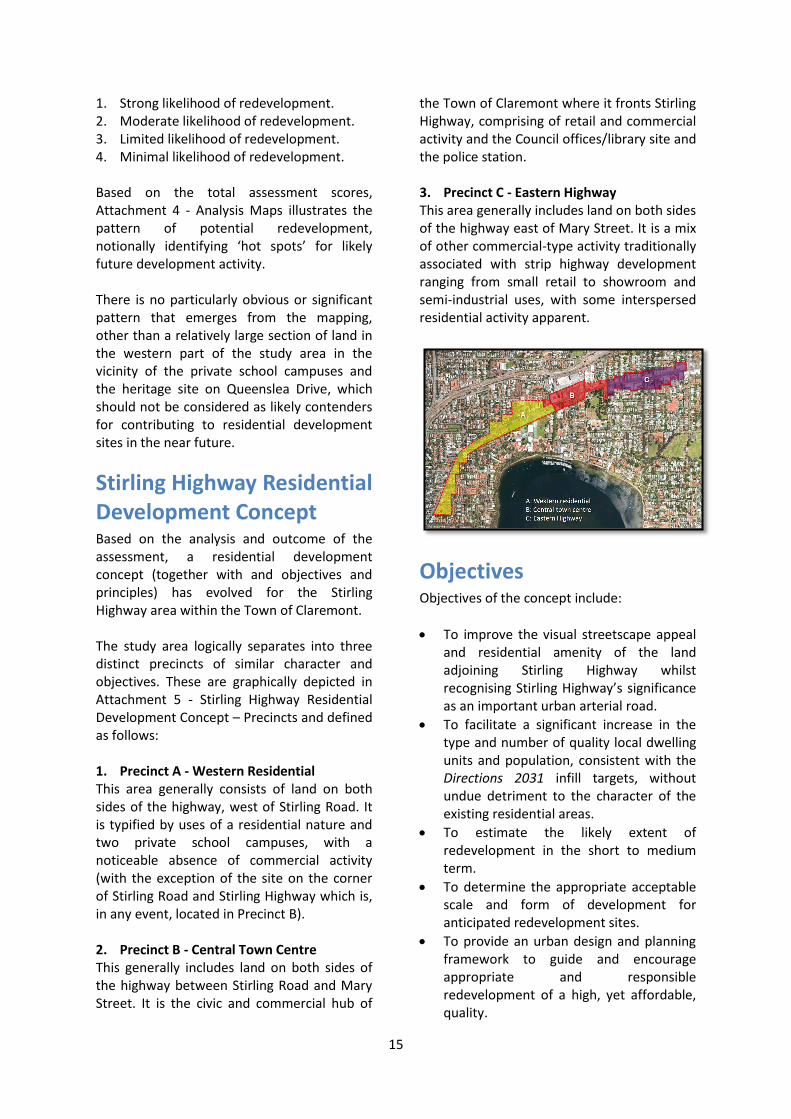
Stirling Highway Residential Development Concept Based on the analysis and outcome of the assessment, a residential development concept (together with and objectives and principles) has evolved for the Stirling Highway area within the Town of Claremont. The study area logically separates into three distinct precincts of similar character and objectives. These are graphically depicted in Attachment 5 - Stirling Highway Residential Development Concept – Precincts and defined as follows: 1. Precinct A - Western Residential This area generally consists of land on both sides of the highway, west of Stirling Road. It is typified by uses of a residential nature and two private school campuses, with a noticeable absence of commercial activity (with the exception of the site on the corner of Stirling Road and Stirling Highway which is, in any event, located in Precinct B). 2. Precinct B - Central Town Centre This generally includes land on both sides of the highway between Stirling Road and Mary Street. It is the civic and commercial hub of
the Town of Claremont where it fronts Stirling Highway, comprising of retail and commercial activity and the Council offices/library site and the police station. 3. Precinct C - Eastern Highway This area generally includes land on both sides of the highway east of Mary Street. It is a mix of other commercial-type activity traditionally associated with strip highway development ranging from small retail to showroom and semi-industrial uses, with some interspersed residential activity apparent.
Objectives Objectives of the concept include:
To improve the visual streetscape appeal and residential amenity of the land adjoining Stirling Highway whilst recognising Stirling Highway’s significance as an important urban arterial road.
To facilitate a significant increase in the type and number of quality local dwelling units and population, consistent with the Directions 2031 infill targets, without undue detriment to the character of the existing residential areas.
To estimate the likely extent of redevelopment in the short to medium term.
To determine the appropriate acceptable scale and form of development for anticipated redevelopment sites.
To provide an urban design and planning framework to guide and encourage appropriate and responsible redevelopment of a high, yet affordable, quality.

16
Broad Principles
The broad principles were developed in consultation with the Town of Claremont Planning Department and are based on best practice and sound planning principles. They inform the design process in determining an appropriate built form scale, massing, use and building typology, and to inform subsequent statutory planning controls. The broad principles for the Stirling Highway Development Concept are outlined as follows, together with a brief justification:
Land use and density 1. Street level commercial activities should
be provided on all lots on Stirling Highway between Stirling Road and Loch Street. (Reason: to consolidate the town centre as the main commercial focal point and to establish Claremont’s eastern section of Stirling Highway as a desirable business address, yet change the nature of the street from a car-based retail strip to a more pedestrian friendly street with greater diversity of business activities).
2. Street level commercial activities to address provision of local services may be supported on corner lots on the southern side of Stirling Highway west of Stirling Road, with the commercial activity principally addressing Stirling Highway. (Reason: to encourage the provision of local services and employment and to capitalise on the higher frequency bus services on Stirling Highway, without undue detriment to the residential character of the side streets).
3. Commercial at upper building levels should be generally restricted to lots east of Stirling Road. (Reason: to consolidate the majority of employment activity in the town centre and the eastern section of Stirling Highway).
4. Plot ratio should be derived from the analysis of the resultant plot ratios of an appropriate built form for typical lots along Stirling Highway. (Reason: Building form should be appropriate to the function and nature of the streets they
abut with massing of buildings being sensitive to adjoining uses).
5. Residential densities should be increased, with R-Codes derived from the analysis of the resultant plot ratios of an appropriate built form for typical lots along Stirling Highway. (Reason: to ensure that the chosen density code matches the desired built form and encourage a variety of housing types with access to alternative modes of transport and activity, whilst respecting existing residential character).
Access
Vehicle access from all lots to Stirling Highway should be from a rear lane, easement or a shared access agreement where available, or from a local street where a rear lane, easement or a shared access agreement is not available. (Reason: to reduce/discourage the number of vehicle crossovers to Stirling Highway).
Vehicle access should only be provided from Stirling Highway where no other alternative is available. (Reason: to acknowledge that in some cases there may be no alternative to direct access from Stirling Highway; to avoid redevelopment being contingent on the prospect of a rear lane being created at some point in the future; and to minimise access points to the highway).
Vehicle access points should be located to take advantage of existing changes in level to minimise ramp structures to undercroft or decked parking. (Reason: to simplify the parking component of buildings and maximise the efficiency of design and streetscape amenity).
The main pedestrian access for visitors should be directly from a street, specifically Stirling Highway for commercial uses on corner sites. (Reason: to improve legibility for pedestrians and to ensure that businesses maintain an address to Stirling Highway rather than a residential street, where a choice exists).

17
Parking
No surface car parking should be provided on-site forward of the building frontage to any street in respect to new development. This is a principle that goes beyond the more relaxed provision of the R-Codes. (Reason: to transition from a ‘highway commercial’ environment with multiple crossovers and dominated by cars to an urban environment with high pedestrian amenity).
Car parking for all new development should be integrated within or located behind buildings and screened from public view. (Reason: to reduce the visual dominance of parked cars and improve pedestrian amenity).
Overshadowing
Building heights on the northern side of Stirling Highway should be limited to a height that ensures that the footpath on the southern side of Stirling Highway remains in full sun at 12pm on 21 June. (Reason: to maintain pedestrian amenity and passive solar design opportunities. Note: will need to be proved by applicant through shadow modelling as part of development application).
The maximum extent of overshadowing to adjacent residential houses beyond the study area should be in accordance with the requirements of the Residential Design Codes (R-Codes). (Reason: to provide a reasonable degree of certainty to adjacent residents, particularly on the south side of new development).
Heights and setbacks
Overall building heights along Stirling Highway should not exceed six storeys (or less subject to overshadowing), except for designated landmark sites2 where a
2 “Designated landmark sites” include Amana (Sundowner) on
corner of Airlie Street as an entry point to the town from the south; the north west corner of Stirling Highway and Stirling Road as a large prominent corner site and a western entry to the town centre; Bayview Centre on corner of Leura Avenue as a large prominent corner site and an eastern entry to the town centre; the north west corner of Stirling Highway and Loch Street as a large prominent corner site and an eastern entry to the town; andthe St Louis Estate Retirement Village (subject to the preparation of a master plan which informs the development of a separate Local Development Plan to identify
maximum of eight storeys may be permissible subject to specific criteria. (Reason: To maintain an appropriate urban scale to Stirling Highway, whilst enabling emphasis at key locations. Note: The shadow at 12pm on 21 June falling southwards across a 34.5m reserve (proposed MRS reserve) and clearing the southern footpath equates to a maximum building height of 22.5m, sufficient for six storeys).
Buildings addressing Stirling Highway should have a maximum ‘street wall’ height of four storeys, with subsequent storeys (maximum of an additional four storeys for designated landmark sites, or maximum of an additional two storeys for all other sites) set back by a minimum of 3m from the ‘street wall’. (Reason: to reduce the perceived scale of buildings to enable them to respond to a pedestrian scale. Note: ‘Street wall’ refers to the height of a building at the street building line before any upper level setback. In the case of mixed-use buildings, the street wall may be at the boundary, and in the case of residential buildings, the street wall may be at the setback line).
Building heights should be progressively reduced in proximity to existing residential houses beyond the study area. ‘Wall height’ to be a maximum of two storeys for those walls adjacent to residential properties beyond the study area (particularly to the south) and storey/s above to be set back sufficiently to be generally unseen from the ground level of the adjacent residential property (Reason: to provide an appropriate transition from an urban scale on Stirling Highway to a suburban scale along the adjacent residential streets).
and address specific development requirements for the site and to guide any future amendment to Town Planning Scheme No. 3 and/or Local Planning Policy.

18
Buildings addressing residential streets (other than Stirling Highway and others of commercial nature)3 should have a maximum ‘street wall’ height of two storeys, with subsequent storeys (maximum of an additional one storey) set back by a minimum of 3m from the ‘street wall’. (Reason: to further reduce the perceived scale of buildings to enable them to respond to a suburban residential scale. Note: ‘Street wall’ refers to the height of a building at the street building line before any upper level setback).
Buildings addressing non-residential or mixed-use streets in the town centre precinct (other than Stirling Highway)4 should have a maximum ‘street wall’ height of three storeys, with subsequent storeys (maximum of an additional two storeys) set back by a minimum of 3m from the ‘street wall’. (Reason: to further reduce the perceived scale of buildings to enable them to respond to a more intimate scale in streets that will have a higher degree of pedestrian movement. Note: ‘Street wall’ refers to the height of a building at the street building line before any upper level setback).
Buildings with street level residential units should be setback from the street as per the standards of the R-Code to which it is applicable). (Reason: to maintain a widely-recognised and acceptable degree of residential amenity).
Buildings should be setback from adjacent existing residential lots beyond the study area as per the R-Codes. (Reason: to maintain a widely-recognised and acceptable degree of residential amenity).
3 “Residential streets” for this purpose includes Airlie Street,
Anstey Street, Osborne Parade, Wilson Street, Prospect Street, Prospect Place, Richardson Avenue, Cliff Road, Corry Lynn Road, Parry Street, Grange Street, Albert Street, Dean Street, Mary Street, Bay View Terrace (south of Stirling Highway), Langsford Street, Vaucluse Avenue, Reserve Street, Walter Street, Brown Street, Bay Road, Goldsworthy, John Street, Queenslea Drive, Freshwater Parade, Chatsworth Terrace, Bernard Street.
4“Non-residential or mixed-use streets in the town centre
precinct” for this purpose includes Stirling Road, Avion Way, St Quentin Avenue, Bay View Terrace (north of Stirling Highway), Leura Avenue.
Building amenity
Buildings should provide frontage to all adjacent streets with the use of windows to habitable rooms, as well as windows and doors to offices and other commercial activities. (Reason: to activate streets and provide opportunities for passive surveillance).
Buildings should articulate street corners with a distinctive architectural element. (Reason: to aid legibility. Note: Further definition to be provided in design guidelines).
Apartments with openings only to Stirling Highway should be avoided. (Reason: to provide healthier natural ventilation options away from a busy road).
Apartments with openings that have only a southern aspect should be avoided. (Reason: to enable access to winter sun for all residents).
Apartments should have a principal outlook to an adjacent street or park, or to a garden or a landscaped courtyard within the development boundary. (Reason: to provide an acceptable level of resident amenity).
Street level residential units within 4m of a street boundary should be raised at least 0.6m above the adjacent street but no more than 1.2 m. (Reason: to provide an acceptable level of resident amenity and increase resident privacy without diminishing the streetscape).
Fencing
Street fencing in front of ground level residential units should not exceed 1.2m in height and provide for visual permeability – details to be described in the design guidelines. (Reason: to achieve a reasonable balance between resident privacy and opportunities for passive surveillance).
Services
Service areas and service equipment should be located out of sight from the adjacent public domain - details to be described in the design guidelines. (Reason: to avoid diminishing the quality

19
of the streetscape, especially for pedestrians)
Heritage
Heritage-listed buildings should be retained, restored and reused wherever possible. (Reason: to maintain consistency with Council’s heritage provisions and policy)

20
Indicative Development Typologies To assist with guiding and illustrating desired residential development outcomes, a range of building typologies responding to the concept’s broad principles have been identified. Six typologies are provided for common situations whilst a seventh typology is provided for a specific site. Attachment 6 - Indicative Development Typologies illustrates these typologies and also shows indicative building cross sections and site plans. This attachment is particularly useful as for each typology it outlines:
Application: The situation and site characteristics most suited;
Variations: Possible adaptations to suit certain circumstances;
Indicative density/yield: Notional lot size, potential dwellings, notional parking requirements, dwellings per site hectare, required R-Code.
The typologies are summarised as follows: 1. Suburban maisonette
A small apartment building with a similar mass and appearance to a large house.
2. Perpendicular terrace A small three-storey terrace of apartments consisting of single-level apartments on the ground level with double-storey apartments above, with the top level of the double-storey apartments opening out onto a private screened roof-top ‘sky balcony’.
3. Compact urban mixed-use terrace block A five-storey mixed-use urban building that is built from boundary to boundary to create a strong urban streetscape and tapers to three storeys at the rear.
4. Semi-urban mixed-use block A five-storey mixed-use urban building that is built from boundary to boundary at ground level but set back from the side boundaries above, to provide continuity of the street edge for pedestrians without creating a fully-urban edge. Includes a mews terrace to the rear as an interface to adjacent suburban residential areas.

21
5. Courtyard block A three-storey, mixed-use urban building that sacrifices height for site coverage (extends outwards rather than upwards) with units arranged around a central courtyard for amenity and cross ventilation.
6. Corner mixed-use block
A five-storey mixed-use urban building that is built from boundary to boundary at ground level but setback from the side boundaries above, to provide continuity of the street edge for pedestrians without creating a fully-urban edge. Includes a mews terrace to the rear as an interface to adjacent suburban residential areas.
7. Specific site investigation – 1 Airlie Street (Amana/Sundowner site).
Attachment 6 - Indicative Development Typologies illustrates these typologies and also shows indicative building cross sections and site plans. This attachment is particularly useful as for each typology it outlines:
Application: The situation and site characteristics most suited;
Variations: Possible adaptations to suit certain circumstances;
Indicative density/yield: Notional lot size, potential dwellings, notional parking requirements, dwellings per site hectare, required R-Code.
Density modelling The Draft Central Metropolitan Perth Sub-Regional Strategy (CMPSS) was prepared by the Western Australian Planning Commission (WAPC) to provide guidance at a local level for issues that are too complex to resolve in detail in Direction 2031, and/or extend beyond local government boundaries. Under this framework, the expected growth for the Town of Claremont includes a projected housing target increase of 2,200 new dwelling by 2031 (i.e. 110 dwellings per year). In the context of the Central Metropolitan Perth Sub-region Planning Strategy (CMPSS), the Stirling Highway Growth Corridor is identified to have a potential for an additional 1400 dwellings with possibly up to 400 dwellings in Claremont. The updated housing target for the Town of Claremont is an additional 760 dwellings by 2031 (250 by 2011-16; 180 by 2016-21; 180 by 2021-26; 150 by 2026-31). Approximately 400 of these dwellings are expected to be located in the vicinity of Stirling Highway.
Calculating density and yields for the study area The suggested density codes were developed through a process that worked back from the built form. In other words, the process was place-based rather than simply a numerical exercise. The process consisted of the following steps:

22
1. Drafting a preliminary set of built form
controls for each precinct based on best practice urban design principle.
2. Identifying which sites were most likely to be redeveloped in the foreseeable future.
3. Building a 3D computer model for the identified sites using the preliminary set of built form controls as a guide.
4. Refining the 3D building models where there was room for improvement in the resultant built form.
5. Interrogating the 3D model to determine the extent of residential and commercial plot ratio floorspace for each identified site and calculating the average plot ratio for each precinct.
6. Dividing the residential plot ratio areas by a typical apartment floorspace to calculate the theoretical dwelling yield.
7. Identifying the R-Coding that best matches the average residential plot ratio for each precinct and then recalculating the dwelling yield based on the plot ratio for those R-Codes.
This approach ensures that there is a good match between the chosen R-Code and an appropriate built form for reach precinct.
Density Options The modelling was applied only to those properties identified as “more likely to be developed” in the study area, and resulted in a total residential dwelling yield of 1,505 as follows:
Western Residential Precinct: 680;
Central Town Centre Precinct: 382; and
Eastern Highway Precinct: 443. These yields do not include the Amana (Sundowner) site, which could result in up to approximately a further 400 dwellings. A number of options were considered in terms of density scenarios in relation to the design modelling and how they could be introduced.
Options range from progressive, to modest, conservative and staged - each with its own merits and limitations, as outlined in the following section. The model testing is illustrated in Attachment 7 – 3D Modelling to Determine Potential Yield and Density Coding. The following density scenarios are based on the nearest R-Code equivalents to the model outcomes.

23
Progressive Total dwelling yield 1,130. Western Residential Precinct: 416 (at R80); Central Town Centre Precinct: 382 (at R-AC); and Eastern Highway Precinct: 332 (at R100).
Pros
Likely to generate landowner/developer interest in redevelopment.
Relatively quick population and rate base growth.
Good catchment for the town centre.
Strong prospect of WAPC support.
Cons
Community concern about building scale, parking and traffic and the like.
Modest Total dwelling yield 939 (798 adjusted5). Western Residential Precinct: R60; Central Town Centre Precinct: R-AC; and Eastern Highway Precinct: R100.
5 Note that the adjusted total is an estimate that takes
into account the reduced incentive to develop as allowable density decreases.
Pros
Less likely to generate landowner/developer interest in redevelopment in the western part.
Modest population and rate base growth.
An advance on the present catchment for the town centre.
Still likely to gain WAPC support.
Cons
Community concern about building scale, parking and traffic and the like.
Conservative Total dwelling yield 863 (648 adjusted). Western Residential Precinct: R40; Central Town Centre Precinct: R-AC; and Eastern Highway Precinct: R60.
Pros
Less community concern about building scale, parking and traffic and the like.
Cons
Still some community concern about building scale, parking and traffic and the like.
Scale of development too low to stimulate redevelopment.
Unlikely to generate landowner/developer interest in redevelopment.
Limited additional catchment for the town centre.
Slow population and rate base growth.
Unlikely to gain WAPC support.

24
Staged Total dwelling yield 922 (818 adjusted). Western Residential Precinct: No change yet (R15-R40); Central Town Centre Precinct: R-AC; and Eastern Highway Precinct: R100.
Pros
Likely to generate landowner/developer interest in redevelopment in the town centre and east part.
Reasonably quick population and rate base growth.
Good catchment for the town centre.
Good prospect of WAPC support.
Fewer community concerns in the more sensitive western areas.
Development focussed into areas with mix of uses.
Cons
Community concern about building scale, parking and traffic and the like.
Possible risk that WAPC might not agree to ‘staging’ approach.
Interim development in western area may preclude future redevelopment.
R-AC Explanation The R-AC coding suggested for the Central Town Centre Precinct is a coding specifically devised by the WAPC for more intensive mixed-use associated with activity centres. There are four levels of R-AC coding ranging from R-AC3, which is intended to be a default setting for mixed-use development, to R-AC0, which provides a local authority with complete freedom to determine its own development standards by means of a
structure plan. The intermediate codings of R-AC1 and R-AC2 come with default settings but these can be varied. It is recommended that the Town of Claremont discuss with the WAPC a coding of R-AC0 for the Central Town Centre Precinct, as it would provide the Town of Claremont a greater degree of control in setting the parameters for development in the town centre.
Development Economics A range of factors - including allowable density or floor space, land use, height views and construction costs - influences the likelihood of redevelopment. Whilst the quantum of allowable development generally results in a proportionate increase in the attractiveness of a redevelopment prospect, there are a number of thresholds that result in a step change that decreases the viability of a project. For example, above three storeys, development will normally require basement parking, which is significantly more expensive than at-grade parking. As a result, additional one to two storeys are required to restore viability. Above three storeys, construction methods generally change from load-bearing to framed methods, which are more expensive. Again, as a result, an additional one to two storeys are required to restore viability. Construction costs rise again when a second basement of parking is required, typically at around six storeys in height, requiring an additional two storeys to restore viability. Once the uppermost floor reaches a height of more than 25m above ground level (around eight to nine storeys) a range of requirements are imposed by the Building Codes of Australia (BCA) in relation to safety in the event of a fire. Typically, a development needs to rise to twelve storeys to achieve an equivalent return.

25
In addition to all of the above, there is a ‘redevelopment penalty’ associated with removing an existing land use from the site. This arises from complex acquisition costs, demolition, lease termination and loss of revenue/relocation costs, which are not applicable to a vacant site. As a result, the planning framework (including density control) needs to provide sufficient incentive and flexibility to overcome the ‘redevelopment penalty’ and to accommodate the relevant step changes in development economics. Insufficient incentive or flexibility may inhibit redevelopment and result in the slow decay of building stock and a failure to achieve density targets or meet regional planning objectives.
Appropriate Density Whilst it may be tempting to establish lower densities than have been recommended in order to reduce community concerns, care must be taken to ensure a balance between the desired outcome of quality higher-density development, sufficient incentive to initiate redevelopment, and a desire for widespread community support. In other words, lower densities may pose a greater risk of seeing less redevelopment occur, or seeing interim development in a form that may be of lower quality. Any interim development occurring at a lower density than ultimately desired would further delay and restrict the property’s ability to develop to full density potential in the medium to long term. If a more conservative approach is taken to density control, the dwelling yield would clearly be less than would be achieved with the recommended densities for the precincts. Whilst a dwelling yield has been identified for the first tier of sites with the highest potential for redevelopment, it should be noted that if a longer-term view is taken and the second tier of sites with moderate development capacity is included in the yield calculations, the total dwelling yield would more than double.
It is important to stress that the yields can only be viewed as potential given the unknown influences of market forces and landowner intentions. Another possibility that should be flagged is the staging of higher density code application in the Western Residential Precinct, as a form of land banking, with the intention that the land be coded at a higher density sometime in the future. Whilst this may seem to be a reasonable solution, it is unlikely to gain the support of the WAPC as this action does not comply with State planning policy, and may result in interim development that prejudices the longer-term aim of achieving higher densities. For this reason, the staging option, whilst providing for land bank, does not necessarily satisfy the criteria required for it to be considered as the preferred option.
Preferred Scenario From the Consultant’s perspective, the most desirable and viable outcome is the ‘Progressive’ option:
Western Residential Precinct: R80;
Central Town Centre Precinct: R-AC0; and
Eastern Highway Precinct: R100. This option is recommended as the preferred option as:
It provides sufficient incentive, flexibility and viability for landowners to initiate development;
It is more likely to result in higher quality development;
Lower densities may pose a greater risk of seeing less redevelopment occur, or seeing interim development in a form that may be of lower quality or inhibit future higher density development; and
It more than satisfies the State Government’s housing targets well into the future.
A workshop was held with the elected members of the Town of Claremont on 18 November 2013 and feedback from that does not indicate any objection to this option.

26
The ‘Conservative’ and ‘Staged’ options are particularly not favoured; however, the ‘Modest’ option may have some border-line potential of acceptance by the WAPC provided that some discretion was allowed for developments to exceed the usual standards in exemplary circumstances. Should Council, having reviewed this entire report on the proposals however, wish to proceed with an alternative option, then the remainder of this report will need to be modified accordingly. The Council’s adopted ‘Staged’ version does, however, contain the same design requirements which apply to the Central Town Centre and Eastern Highway Precincts and accordingly, the Town may base its selected proposed Town Planning Scheme No. 3 amendment and Policy proposals on the documentation provided in the remainder of this report.
The Western Residential Precinct may be considered to include No. 2 Richardson Avenue when the Stirling Highway Local Development Plan is reviewed to progress proposals to include the Western Residential Precinct at the R80 density.

27
Part Three: Implementing the Stirling Highway Development Concept through Planning
Existing Planning Controls and Proposed Changes To facilitate the implementation of the proposed Stirling Highway Residential Development Concept, it is necessary to ensure that the planning controls currently applicable to the study area reflect and support the proposed desired outcomes and development principles. In some instances, changes may be required to both statutory and non-statutory documentation to encourage, guide and facilitate development in accordance with the concept. The main planning tools under consideration include:
Metropolitan Region Scheme (zoning);
Town of Claremont Town Planning Scheme No. 3 (zoning, residential density codes, scheme provisions);
Town of Claremont Local Planning Policies (introduction of design guidelines).
Metropolitan Region Scheme MRS Zoning The Metropolitan Region Scheme (MRS) currently shows a Primary Regional Roads (PPR) reservation approximately 80 metres wide over the extent of Stirling as it traverses the Town of Claremont, and this reservation further extends into a majority of the properties to which the highway abuts. Between the PPR reserve and the extent of the study area, the land is predominantly zoned Urban, with the exception of a Parks and Recreation reservation approximately between Bay View Terrace and Bernard Street (southern side of the highway). Urban zoning supports the residential development concept proposed and no changes would be required in this regard per se. The extent of the Urban zone is determined by the Stirling Highway
PPR reservation requirements and this, in turn, impacts on the land available for residential development and affects potential dwelling yields. Status of MRS Amendment No. 1210/41 Rationalisation of Stirling Highway reservation (SHACS Phase 1) As mentioned earlier in this report, an amendment to the MRS is in progress to rationalise the Stirling Highway PPR reservation between North Fremantle and Nedlands, which impacts on the study area. MRS Amendment No. 1210/41 - Rationalisation of Stirling Highway Reservation as it affects the Town of Claremont, generally shows a reduction of the reserve to approximately 40 metres in width with the balance of the land proposed to be rezoned as Urban (and Parks and Recreation for that small section between Bay View Terrace and Bernard Street). Attachment 8 – Advertised MRS Amendment No. 1210/41 Rationalisation of Stirling Highway Reservation – Proposed Rezoning shows the proposed rezoning and Attachment 9 – Advertised MRS Amendment No. 1210/41 Rationalisation of Stirling Highway Reservation – Property Impacts shows how each property is presently proposed to be affected by the new reservation alignment. As a way of providing safe alternative vehicular access to Stirling Highway properties affected by the amendment, notional rear laneways (Sinclair Knight Merz, 2009) were shown as an attachment to MRS Amendment No. 1210/41. These cannot, and do not, form part of the amendment and are only to be used for information purposes and to inform subdivision and redevelopment proposals. The development concept that forms part of this report has been developed only in
28
consideration of those rights of ways and laneways that currently exist. Should additional laneways eventuate as part of redevelopment and subdivision processes in the future, they are likely to provide further support of the principles and objectives of proposed development concept and the associated recommendations for its implementation. The Town of Claremont considered MRS Amendment No. 1210/41 - Rationalisation of Stirling Highway Reservation on 7 August 2012 and resolved to support the proposed amendment subject to a number of considerations including road construction and traffic control and protection of heritage places and significant trees. The public consultation period for MRS Amendment No. 1210/41 closed on 27 July 2012 and more than 600 submissions were lodged with the WAPC, which included more than 100 requests for panel hearings. Main Roads WA (MRWA) and the Department of Transport are reviewing highway design suggestions made in the submissions and MRWA’s comments will form part of the Report on Submissions which will be considered by the WAPC. Upon completion of the review of submissions and following the panel hearings, the WAPC will make a recommendation to the Minister for Planning. Panel hearings took place in late 2013, and officers from the Department of Planning indicate that a decision from the Minster for Planning is expected around mid-2014. This report is has been based on the proposed extent of the Stirling Highway reservation as shown in the MRS Amendment No. 1210/41 plans as were advertised for public comment.
Phase 2 of the Stirling Highway Activity Corridor Study (SHACS) MRS Amendment No. 1210/41 (Phase 1 of SHACS) does not deal with residential density or built form, only the Stirling Highway road reserve. Redefining the PRR reservation assists in identifying the physical extent of any future land use opportunities and in terms of
land use, the proposed Urban zoning replacing the section of PRR reserve no longer required for Stirling Highway supports the proposed residential development concept. Phase 2 of SHACS is to comprise of a staged urban design and form based code study to guide built form and redevelopment opportunities in a sustainable planned manner. This cannot progress; however, until MRS Amendment No. 1210/41 is finalised. Officers from the Department of Planning have indicated that if MRS Amendment No. 1210/41 is adopted, the land no longer affected by the PRR reservation will remain unzoned within the local planning schemes of the local government affected by the MRS amendment, as Phase 2 of SHACS has not substantially progressed to inform amendments to the local planning schemes. This would present an undesirable situation for the Town of Claremont whereby TPS3 would have no zoning control of the land no longer required for the Stirling Highway reservation. This highlights the imperative need for the Town of Claremont to take the initiative to develop its own set of urban design guidelines and other planning tools rather than await finalisation of Phase 2 of SHACS. By preparing for the MRS amendment outcome, the Town of Claremont will have effectively brought forward Phase 2 of SHACS and will be in a more desirable position to justify and support amendments to TPS3 as soon as possible, thus maintaining continued control and offering appropriate guidance for development, whilst facilitating the delivery of the residential infill targets of Directions 2031 in a manner that addresses the concerns of the local community.
Changes Required 1. Finalisation of MRS Amendment No.
1210/41 Rationalisation of Stirling Highway reservation. (Note that this is beyond the control of the Town of Claremont)

29
Town of Claremont Town Planning Scheme No. 3 Local Zoning, Residential Density and Land Use Control The zoning map applies zones and reserves over the land and also specifies residential density codes for Residential zoned land. In addition, provisions within the Scheme Text specify residential density codes for residential development within a number of the non-residential zones. Other provisions provide land use and development standards for properties within Special Development Zones and Special Zone – Restricted Use. Under TPS3, the study area includes the following reservations and zones (with residential density codes where applicable):
MRS Reserve Primary Regional Road Parks and Recreation Local Zones Residential (R15/20, R30, R30/40, R40) Special Development Zone A Special Zone – Restricted Use Educational Town Centre (R80) Highway (R40) A plan depicting local zoning is shown in Attachment 10 – TPS 3 Zoning. The range of residential uses permitted within those zones and reserves is shown in Table 1- Permitted land use of residential nature as follows:
Table 1- Permitted land use of residential nature
Zone P AA SA IP X
Residential Dwelling (self-contained)
Aged or dependent persons dwellings
Residential Building6
Educational Dwelling (self-contained)
Residential Building
Aged or dependent persons dwellings
Town Centre Dwelling (self-contained)7
Residential Building
Aged or dependent persons dwellings
Highway Aged or dependent persons dwellings
Dwelling (self-contained)
Residential Building
‘P’ means that the use of the land for the purpose indicated is permitted; ‘AA’ means that the land shall not be used for the purpose indicated but the Council may approve of the use of the land for that purpose in certain circumstances (refer to Cl 14 (3)(c) of TPS3); ‘SA’ means that the land shall not be used for the purpose indicated but that in exceptional cases the Council may specifically approve of such (refer to Cl 14 (3)(d) of TPS3); ‘IP’ means the land shall not be used for the purpose indicated unless Council decides that such use is incidental to the predominant use of the land; ‘X’ means that the land shall not be used for the purpose indicated. Source: Town of Claremont Town Planning Scheme No. 3 – Table 1: Land Use Table
6 “Residential Building” TPS3 definition: Means a building, other than a Dwelling (self-contained) used for human habitation and includes such outbuildings as are ordinarily used therewith. The term habitation includes a hostel and a hotel used primarily for residential purposes, a residential club and a residential institution for the intellectually handicapped. 7 See Cl 23 of TPS3 – Dwelling (self-contained) in Town Centre zone (Shopping Policy Area – east of Lot 90 Avion Way) confined to floors above ground floor unless impractical for retail shopping

30
With regard to the properties subject to Special Development Zone A and Special Zone – Restricted Uses, permitted land use is determined by Clause 58 and Appendix VII of TPS3, respectively, as shown in Table 2 - Special and Restricted Uses. The Sundowner/Amana site (Special Development Zone A) is the only property in the study area subject to Clause 58 of TPS3. However, Amendment No. 126 to TPS3, is currently before the Minister for Planning to delete Cl 58. Instead, land use is proposed to be the subject of an approved structure plan, which will also include development standards and conditions. Investigations are currently in progress to develop a suitable structure plan for the Sundowner/Amana site.
It is also noted that 328 Stirling Highway (cnr Freshwater Parade) is currently being developed for mixed commercial (700sqm) and residential apartment (70 units) use. This will comprise of five storeys with two levels of underground parking (when viewed from the highway). The development will have a plot ratio of approximately 1:1. Part of this development complies with Appendix VII, however, the land affected by the PRR reservation does not. In this regard, the development was approved under the MRS whereby no planning requirements have been set. This unfavourable situation could be repeated for all properties along Stirling Highway under current circumstances.
Table 2 - Special and Restricted Uses
Zone Property Permitted Use Special Development Zone A
Sundowner Site: Lot 412 Swan Loc 699 Stirling Highway (Amana – 1 Airlie Street)
(Clause 58 of TPS 3)
Accommodation of semi-frail and aged persons;
Elderly persons day care centre;
Base for domiciliary care services in the surrounding areas;
Sheltered workshop for the aged and handicapped people as approved by the Council.
Note: This use is subject to Amendment 126 to allow for aged persons’ accommodation and ancillary commercial, community and/or recreation uses in accordance with a Council approved Structure Plan.
Special Zone – Restricted Use
264 Stirling Highway (cnr John Street)
All the uses that may be used in the Highway zone as determined in Table 1 Land Use Table and in addition may be used for the purpose of conducting civil ceremonies. Standards/Conditions: Min 22 car bays available for the wedding guests.
10 Albert Street and 5 Dean Street
Aged Care Facility and ancillary uses. Standards/Conditions: Refer to Appendix VII of TPS 3 Note: This is an adjunct to the St Louis retirement village.
355 Stirling Highway (cnr Stirling Road)
Uses to be determined in accordance with the Residential Column in Table 1, excepting Office and Showroom uses which are permitted uses. A density of R40 applies to this land. Standards/Conditions: A min of 23 car bays are to be available for tenant and customer parking for the Office and/or Showroom uses.
328 Stirling Highway (cnr Freshwater Parade)
Civic Building, Consulting Room, Dwelling (self-contained), Home Occupation, Office. Standards/Conditions: Development on the site to be in accordance with development standards applicable to the Highway zone. Density not to exceed R40. Note: Currently being developed for mixed use (five storeys/70 apartments/700sqm commercial space).Does not comply with Appendix VII where land is affected by PRR reserve (Stirling Highway).
26 Vaucluse Avenue Office Standards/Conditions: Gross leasable area of building not to exceed 200m
2.
Source: Town of Claremont Town Planning Scheme No. 3

31
There is some potential for a small number of commercial land uses to be permitted within the Residential Zone as shown in Table 3 -
Permissible uses in the Residential Zone
(Commercial only).
Note that a number of commercial uses are also specified for exclusion in this zone.
Table 3 - Permissible uses in the Residential Zone (Commercial only)
Residential Zone
P AA SA IP X - Home
Occupation Craft Industry Day Care Centre Educational Establishment Hospital Recreation – outdoor Residential Building Restaurant Shop (small)
Car park
Bulk Retail Sales Consulting Room Dry Cleaning Premises Fast Food Outlet Fish Shop Funeral Parlour Hotel/Tavern Light Industry Motel Motor Repair Station Office Open Air Display Recreation indoor – Passive
Restricted Premises Retail Store Service Industry Service Station Service trade Shop (Intermediate) Showroom Small Bar Transport Depot Vehicle Sales Veterinary Clinic/Hospital Warehouse
‘P’ means that the use of the land for the purpose indicated is permitted; ‘AA’ means that the land shall not be used for the purpose indicated but the Council may approve of the use of the land for that purpose in certain circumstances (refer to Cl 14 (3)(c) of TPS 3); ‘SA’ means that the land shall not be used for the purpose indicated but that in exceptional cases the Council may specifically approve of such (refer to Cl 14 (3)(d) of TPS 3); ‘IP’ means the land shall not be used for the purpose indicated unless Council decides that such use is incidental to the predominant use of the land; ‘X’ means that the land shall not be used for the purpose indicated. Source: Town of Claremont Town Planning Scheme No. 3 – Table 1: Land Use Table
Changes required: Upon finalisation of MRS Amendment No. 1210/41 Rationalisation of the Stirling Highway reservation, the following changes would be required to support and implement the development concept: TPS3 Zoning Map 1. Amend TPS3 Zoning Map as depicted in
Attachment 11 – Changes suggested to TPS 3 Zoning Map by: (i) Zoning the land no longer required for
the PRR reservation (i.e. the land proposed to be zoned Urban under the MRS) such that zones and reserves are generally an extension of the current zoning of land immediately adjacent to the previous PRR reservation including Residential, Town Centre, Highway, Educational, Parks and Recreation, Special
Development Zone A, Special Zone – Restricted Use zones and Development zone (pending gazettal of Amendment No 126);
(ii) Notwithstanding the above, rezone Lot 11051 Stirling Highway and Lot 848 Bernard Street (Pt. Reserve 21710), Lot 3771(Reserve 21711) Stirling Highway and the adjoining R.O.W. between Bernard Street and Stirling Highway from Parks and Recreation to Highway Zone (note that road closure and de-vesting of reserves will also be required).
(iii) Applying a residential density code of R80 to the Residential zoned land in the Western Residential Precinct;
(iv) Applying a residential density code of R100 to the Highway zoned land in the Eastern Highway Precinct;

32
(v) Applying a residential density code of R-AC0 to the Highway zoned land in the Central Town Centre Precinct;
(vi) Applying a residential density code of R-AC0 to the Town Centre zoned land in the Central Town Centre Precinct; and
(vii) Applying a residential density code of R100 to the Residential zoned land in the Eastern Highway Precinct; (only relates to two properties: 26 Langsford Street and 42 Reserve Street which are currently R 20 and R 15/20 respectively).
TPS3 Scheme Text The concept encourages ground level commercial uses on all lots on Stirling Highway between Stirling Road and Loch Street, and on corner lots on the southern side of Stirling Highway west of Stirling Road. The range of commercial uses that may be permitted in the Town Centre and Highway zones (Central Town Centre and Eastern Highway precincts, i.e. east of Stirling Road) is more broad than the range of commercial uses that may be permitted in the Residential zone (Western Residential precinct, i.e. west of Stirling Road). This may be considered appropriate as is, or Council may wish to consider additional commercial uses to be permitted on corner lots within the Residential zone in the study area (for example Offices). No action is recommended at this stage. 2. Consideration may be given for Cl 46
Objectives (Residential Zone) to refer to ground level (only) non-residential development on corner lots along the southern side of Stirling Highway, west of Stirling Road.
3. Should Council consider it appropriate to allow for a change of use or uses in addition to those currently permitted for 264 Stirling Highway, 10 Albert Street and 5 Dean Street, 355 Stirling Highway, 328 Stirling Highway and 26 Vaucluse Avenue, amendments to Appendix VII would be required to reflect this.
4. The concept suggests increased residential density codes to R-AC0 in the Central Town Centre Precinct, R100 in the Eastern Highway Precinct and R80 in the Western Residential Precinct. The increased residential density code for the Residential and Highway zones is shown on the Scheme Map; however, the residential densities for the Town Centre and some of the Special Zone – Restricted Uses are specified within the Scheme Text. (i) It is recommended that the R-AC0
Code also be included on the Scheme Map for the Town Centre precinct for clarification (as already stated in the previous section).
(ii) Changes are required to Cl 62(1) of the Scheme Text which refers to residential development within the Town Centre zone being developed in accordance with the R80 density code. A new provision is needed to allow for the land within the Central Town Centre Precinct of the study area to be developed in accordance with a structure plan associated with the R-AC0 coding. This will also need to refer to other development requirements such as height, plot ratio, setbacks and the like. Consideration may be given to amend Appendix VII of the Scheme Text to ensure that a density codes of those properties within the Special Zone – Restricted Use (i.e. 264 Stirling Highway (cnr John Street), 328 Stirling Highway (cnr Freshwater Parade),355 Stirling Highway (cnr Stirling Road) and 26 Vaucluse Avenue) generally reflect the density codes recommended for the precinct within which they are contained.
Plot Ratio TPS3 specifies plot ratio control only in the following instances:
Consulting Room use (Cl 41) – Maximum 0.4 in the Residential zone and of 0.5 in any other zone.
Residential Building use (includes for example residential institution for

33
handicapped persons, not a self-contained dwelling) (Cl 42) – Maximum of 0.4 in the Residential zone; 0.8 in the Town Centre zone; 0.4 in the Highway zone or 0.8 if no direct access to/from Stirling Highway; and 0.5 in all other zones.
Amana (Sundowner) site (Cl 58) – Maximum 0.5 (Note that Amendment No. 126 to TPS3 proposes to delete Cl. 58. Plot ratio will be the subject of a Structure Plan design requirement).
All buildings in the Town Centre zone (Cl 63 and Cl 64) – Maximum of 2 with possible bonus of up to one fifth or increase of number of dwelling units by one fifth in some cases.
10 Albert Street and 5 Dean Street (St Louis aged care site) (Appendix VII) – Maximum of 1.
Plot ratio requirements for residential development in the Residential and Highway zones are not specified in the scheme text, therefore, plot ratio provisions of the Residential Planning Codes come into effect. The deemed to comply provisions for plot ratio under the Residential Design Codes applicable to the suggested density code changes of R80, R100 and R-AC0 are as follows: Single house or grouped dwelling
R80 – No provision
R100 – No provision
R-AC0 – No provision Multiple dwellings
R80 – 1.0
R100 – 1.25
R-AC0 – as set out in structure plan
Minimum 40m2 plot ratio required where development comprises more than 12 dwellings.
Plot ratio is also kept in check in a secondary manner by the use of height restrictions, parking and open space requirements.
Changes required: No changes would be required in relation to plot ratio requirements for single houses and grouped dwellings in the study area, as TPS3 and the Residential Design Codes have no provisions relating to these uses in the zones and density codes proposed. No changes would be required for multiple dwellings within the study area provided the R code densities R80and R100 are applied to the Western Residential Precinct, and Eastern Highway Precinct respectively. Theses codes reflect the plot ratios of the housing typologies developed in this study to create the desired built form. When applying the R-AC0 code to the land within the Central Town Centre Precinct, the structure plan may set desired plot ratio. The plot ratio requirement of 1.0 for the St Louis aged care facility under Appendix VII, is commensurate with the balance of the Western Residential precinct and no changes are required
Access The concept and TPS3 scheme text already align with regard to restricted vehicular access to Stirling Highway. Cl 55 relating to access to grouped dwellings; however, may present some discrepancy worthy of consideration. Part of this clause states that: “…(2) Vehicle access to a grouped dwelling
development shall be from a dedicated road only, and where the driveway into the site provides access to more than one grouped dwelling, Council may require it to be 6 metres wide.”
This could cause an issue in a situation where Stirling Highway is the only available dedicated road for a property, even though alternative access may potentially be available from a laneway, easement or shared access by agreement.
34
There is no current TPS3 reference seeking location of vehicle access points to take advantage of existing changes in level, to minimise ramp structures to undercroft and deck parking. It is considered more appropriate to be facilitated through policy (proposed design guidelines) than as a scheme provision, to allow for some flexibility. TPS3 does not address pedestrian access to commercial properties. There is nothing within the scheme text to prevent pedestrian access to sites as preferred within the development concept, so no changes are suggested in this regard. Changes required: 1. Amend Cl 55 (2) to include vehicular
access to grouped dwellings by alternatives such as laneways, easements and agreed shared access in addition to a dedicated road.
Parking Cl 36 (6) of TPS3 states that Council will not support onsite parking in front of a property where a practical alternative vehicular access point exists, such as to a secondary street, rear laneway or similar. This supports the proposed development concept, however; there are some anomalies with the interpretation of this provision where it is difficult to apply. Accordingly it is recommended that the provision be reviewed to improve the interpretation under the Scheme In addition, Cl 36 attempts to ensure that garages and carports are located behind building lines and/or existing buildings; however, the existing provisions do not specifically prevent surface parking forward of the building line along Stirling Highway, unless alternative access via a right of way or common property driveway is available. It is not recommended to strictly prevent parking forward of the building line as this will be indirectly controlled by proposed smaller front setbacks. In particular, sub-clause Cl 36 (7) states that Council will support the use of land in front of
or beside a single carport or garage as an uncovered tandem parking bay. This may be appropriate in other areas; however, it is not favoured within the development concept for Stirling Highway. Cl 36 also specifies setback distances for garages and carports. This is addressed in a further section of this report related to setbacks. With regard to screening car parking from public view, Cl 31 (7) provides for Council to apply discretion where parking is located adjacent to the Residential zone to require suitable screening from view from that zone. No changes are required to TPS3; however, this may also be reinforced through the proposed design guidelines. Changes required: No changes are required to TPS3 to address screening of car parking; however, this may also be reinforced through the proposed design guidelines as policy.
Overshadowing There are no specific controls within TPS3 scheme text concerning overshadowing or solar access. As such, all residential development would be subject to the provisions of the Residential Design Codes. This is supported by the development concept; however, it is also desired to maintain full solar access for the footpath on the southern side of Stirling Highway by limiting building height/form on the northern side of the highway. Changes required: No changes to TPS3 are suggested to protect the solar access to the footpath on the southern side of Stirling Highway. It is suggested; however, that this be included in the design guidelines and adopted as policy. Whist this is a desirable objective, it is not essential and a degree of flexibility of control is appropriate in this instance. Rather than relying on survey plans for constructed footpath location (which may

35
change over time), it may be easier to use the southern extent of the PRR reservation as the maximum point for shadow reach for properties on the northern side of the highway. The applicant would be responsible for the shadow modelling as part of a development application.
Height Where no height requirements are specified within a scheme, the provisions of the Residential Design Codes come into effect as follows:
R80: 12m external wall, 13m concealed roof, 15m pitched roof;
R100: 12m external wall, 13m concealed roof, 15m pitched roof;
RAC0: as set out in structure plan. Based on storey height of 3.6m, heights within the Stirling Highway concept generally equate (not including roof height) to wall heights of:
7.2m - 2 storeys
10.8m - 3 storeys
14.4m - 4 storeys
18.0m - 5 storeys
21.6m - 6 storeys
25.2m – 7 storeys
28.8m – 8 storeys Cl 40 of TPS 3 deals with height of buildings. Sub clause Cl 40(2) specifies how height is measured (different to the Residential Design Codes) and it does not include the roof in the calculation (roof height is controlled through Residential Design Code provisions). This measurement of height is also different to further references to height introduced within the development concept, which is ‘street wall’ height and ‘storeys’. Applicable to the study area:
Cl 40(3) states that building height in the Residential zone should not exceed 6.6m; however, Cl 40(5) allows for variations in special circumstances within the area contained within the black border and also additions to a dwelling constructed during or before 1920 to exceed the height limit by 1.5m.
Cl 40(7) states that a building of more than two storeys in the Town Centre zone
shall not exceed a height in which Council’s opinion would be contrary to the orderly and proper planning of the locality or have an adverse effect on the amenity of the locality.
Cl 40(9) states that building height in the Highway zone shall not exceed 12m and that Council may even require a lesser height to avoid adverse effects (in Council’s opinion) on the Residential zone.
Cl 40(10) states that building height in the Educational zone shall not exceed 9m; however, in certain circumstances it may be permitted be up to 12m.
No height limit is provided for the Amana (Sundowner) site, although this is expected to be considered in the preparation of a structure plan.
Appendix VII states that 10 Albert Street and 5 Dean Street shall have a maximum building height of 12m to the underside of eaves measured from natural ground level immediately below the eaves. Appendix VII states that development standards for 328 Stirling Highway shall be in accordance with those applicable to the Highway zone, which in this instance is a maximum building height of 12m, and may be required to be less.
The development concept advocates ‘street wall’ height limits of four storeys or six storeys for key designated sites along Stirling Highway, three storeys along non-residential/mixed use streets and two storeys along residential streets. Subsequent storeys may be built as follows, provided the wall is set back a further 3m from the street wall:
Maximum total building height of eight storeys at key designated landmark sites along Stirling Highway (i.e. additional four storeys) or less to accommodate overshadowing requirements;
Maximum total building height of six storeys for all other properties along Stirling Highway (i.e. additional two storeys) or less to accommodate overshadowing requirements;
Maximum total building height of three storeys for buildings addressing
36
residential streets (i.e. additional one storey above the street wall).
Maximum total building height of five storeys for buildings addressing non-residential or mixed use streets in the Central Town Centre precinct (i.e. additional two storeys above the street wall).
The only other height limitation within the concept is in regard to those buildings on the northern side of Stirling Highway, where it is recommended that height be restricted to allow full solar access to the footpath on the southern side of Stirling Highway (as discussed in a previous section of this report). Some preliminary modelling based on a 34.5m road reserve, shows that the shadow of a building height of up to 22.5m on the northern side of the highway, would remain clear of the footpath on the southern side of the highway at 12pm on 21 June. This height would equate approximately to a six storey building. The heights proposed in the concept do not neatly correspond with the either the Residential Design Code provisions or TPS3. It would be necessary to address both matters in any scheme amendments to ensure that where TPS3 does not specify standards, that the Residential Design Codes do not conflict with the concept. Changes required: The heights promoted by the proposed concept are significantly different to what TPS3 currently allows so changes would be needed to the height provisions, as well as new definitions relating to storeys, height and mezzanines. Although there appears to be no simple way of modifying existing provisions to accommodate the proposed concept heights, the following identifies where conflicts exist and changes in some form will be required to accommodate the concept: 1. Include definitions for ‘street wall’ height
and ‘storeys’ (suggested amendment to Cl 40 Height of Buildings).
2. Clarify a position on total height, including the roof to ensure that Residential Design Code provisions do not automatically apply and subsequently conflict with the heights proposed within the concept.
3. Allow for heights to exceed 6.6m for properties within the Residential zone with a density coding of R80 in the Western Residential Precinct and R 100 in the Eastern Highway Precinct (suggested amendment to Cl 40(3)) to enable ‘street wall’ height limits of four storeys along Stirling Highway and two storeys along residential streets with subsequent storeys built as follows, provided the wall is set back a further 3m from the street wall: (i) Maximum total building height of
eight storeys at key designated landmark sites along Stirling Highway (i.e. additional four storeys) (less to accommodate overshadowing requirements);
(ii) Maximum total building height of six storeys for all other properties along Stirling Highway (i.e. additional two storeys) (or less to accommodate overshadowing requirements);
(iii) Maximum total building height of three storeys for buildings addressing residential streets (i.e. additional one storey above the street wall).
4. Allow for heights of buildings in the Town Centre zone and Highway zone within the Central Town Centre Precinct (suggested amend Cl 40(7)) to enable ‘street wall’ height limits of four storeys along Stirling Highway and three storeys along other non-residential/mixed use streets with subsequent storeys built as follows, provided the wall is set back a further 3m from the street wall: (i) Maximum total building height of
eight storeys at key designated landmark sites along Stirling Highway (i.e. additional four storeys) (less to accommodate overshadowing requirements);
(ii) Maximum total building height of six storeys for all other properties along Stirling Highway (i.e. additional two
37
storeys) (or less to accommodate overshadowing requirements);
(iii) Maximum total building height of five storeys for buildings addressing non-residential or mixed use streets in the Central Town Centre precinct (i.e. additional two storeys above the street wall).
5. Allow for heights of buildings in the Highway zone in the Eastern Highway Precinct (suggested amend Cl 40(9)) to enable ‘street wall’ height limits of four storeys along Stirling Highway, three storeys along other non-residential/mixed use streets and two storeys along residential streets with subsequent storeys built as follows, provided the wall is set back a further 3m from the street wall: (i) Maximum total building height of
eight storeys at key designated landmark sites along Stirling Highway (i.e. additional four storeys) (less to accommodate overshadowing requirements);
(ii) Maximum total building height of six storeys for all other properties along Stirling Highway (i.e. additional two storeys) (or less to accommodate overshadowing requirements);
(iii) Maximum total building height of three storeys for buildings addressing residential streets (i.e. additional one storey above the street wall).
6. As one of the designated landmark sites on Stirling Highway, the Amana (Sundowner) currently has no height restrictions which means that TPS3 may currently support the concept of a four storey ‘wall height’ along Stirling Highway and an additional four storeys above, provided they are set back a minimum of 3 metres from the street wall. On the understanding that Amendment No 126 to TPS3 is gazetted, the heights for development on this property should be determined in the preparation of the Structure Plan to respond to the desired heights proposed herein.
Allow for height of buildings at 10 Albert Street and 5 Dean Street, (suggested amend Appendix VII) to be in accordance
with the balance of the Residential zoned land within the Western Residential Precinct. (Note that this area is the subject of previous and ongoing negotiation and discussion for future master planning for the long term redevelopment of the greater St Louis village site).
7. Allow for height of buildings at 328 Stirling Highway (suggested amend Appendix VII) to be in accordance with the balance of the Highway zoned land within the Central Town Centre Precinct and may need to take into consideration the details of the proposal currently being developed on the site.
8. Allow for height of buildings at 26 Vaucluse Avenue (suggested amend Appendix VII if not already covered by general scheme provisions) to be in accordance with the balance of the Highway zoned land within the Eastern Highway Precinct.
9. Include a general provision to ensure a ‘wall height’ limit of two storeys where a building abuts the boundary of a residential property that is not included in the study area (suggest amendment to Cl 27 or Cl 40).
10. Where land is proposed to be coded R-AC0 a structure plan will be required to set development standards, including height.
Setbacks Residential development in Residential zone TPS3 provides for residential uses to be set back from boundaries in accordance with the requirements of the Residential Design Codes, with the exception of garages and carports (as discussed in a previous section of this report). Should the residential density codes be changed as suggested to R80, the deemed to comply provisions for street setbacks that would apply are as follows: Single house or grouped dwelling
R80 – Primary street 1m, secondary street 1m.
Rear and side setbacks are to be as per Tables 2a and 2b of the Residential Design Codes, where building setbacks depend

38
on length and height of walls and the presence or absence of major openings to habitable rooms.
Multiple dwellings
R80 – Primary street 2m, secondary street 2m.
Rear setbacks are to be as per Tables 2a and 2b of the Residential Design Codes for multiple dwellings with a density coding of R80.
Side setbacks for multiple dwellings with an R80 coding are to be as per Table 5 of the Residential Design Codes depending on the width of the lot (i.e. less than and equal to 14m wide = 3m setback, 15m wide = 3.5m setback, equal to and greater than 16m wide = 4m setback). It is possible; however, that a wall may have a zero setback where it abuts an existing or simultaneously constructed wall of equal or greater proportions.
A wall built to one side boundary has a maximum height and average height as set out in Table 4 and a maximum length of two thirds of the length of this boundary.
Should the residential density codes be changed within the study area to R80, setback requirements will automatically change as per above, unless a clause is included in TPS3 to exclude or override the Residential Design Codes requirements. The development concept generally follows the setback requirements of the R80 code. To control mass and scale; however, the setback of some upper storeys from a street, or from a neighbouring residential property that is not included in the study area, are proposed to be more restrictive (as discussed in the previous section in relation to height). Some change would be required, potentially Cl 27 or, or it may be simultaneously addressed in any forthcoming changes relating to height. Changes are also necessary within TPS3 for the setback of garages and carports. Cl 36 of TPS3 specifies parking setback distances (with some possible discretionary relaxation). Garages are generally required to be set back
6m (or up to 4.5m with discretion) and carports set back at 4.5m (or a lesser unspecified distance with discretion). These setbacks are generally similar to setbacks applied to low density residential development and are not appropriate to higher density development as proposed in this instance. As previously mentioned, the R80 code only requires a 1m or 2m setback from the primary and secondary street for a single house/grouped dwelling and multiple dwelling, respectively. In these circumstances, Cl 36 should not apply to garages and carports and the deemed to comply provisions of the Residential Design Codes should prevail. Non-residential development in Residential zone Cl 37A of TPS3 relates to non-residential development abutting a Residential zone and provides for setbacks to buildings, structures and access. This provision is more prescriptive than the concept objective which refers to Residential Design Code setbacks applying to all buildings, regardless of whether they are of a residential nature or not, where they abut residential properties outside of the study area. Given that mixed uses are proposed for the ground floors, Cl 37A requires modification. It is noted from discussions with the Town’s Planning staff that the current provisions contained in Cl 37A are too prescriptive and do not provide for a reasonable amount discretion on matters such as screening of windows and balconies. Any modification to Cl 37A should address both the proposals contained within this document and the existing constraints. Table 2 – Development Table of TPS3 specifies setbacks for a number of uses and zones. Those applicable to the Residential zoned land are as follows:
Restaurant in a Residential zone - building setbacks are to be in accordance with the standards of the residential density code applicable to that land;
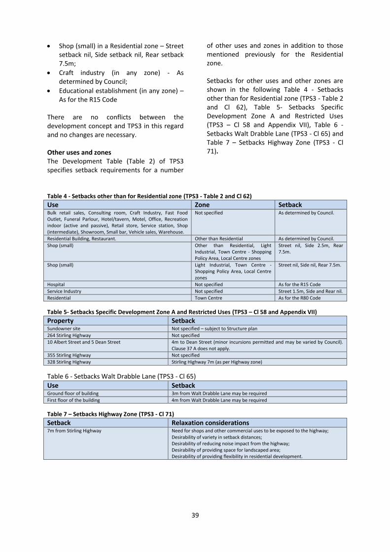
39
Shop (small) in a Residential zone – Street setback nil, Side setback nil, Rear setback 7.5m;
Craft industry (in any zone) - As determined by Council;
Educational establishment (in any zone) – As for the R15 Code
There are no conflicts between the development concept and TPS3 in this regard and no changes are necessary. Other uses and zones The Development Table (Table 2) of TPS3 specifies setback requirements for a number
of other uses and zones in addition to those mentioned previously for the Residential zone. Setbacks for other uses and other zones are shown in the following Table 4 - Setbacks other than for Residential zone (TPS3 - Table 2 and Cl 62), Table 5- Setbacks Specific Development Zone A and Restricted Uses (TPS3 – Cl 58 and Appendix VII), Table 6 - Setbacks Walt Drabble Lane (TPS3 - Cl 65) and Table 7 – Setbacks Highway Zone (TPS3 - Cl 71).
Table 4 - Setbacks other than for Residential zone (TPS3 - Table 2 and Cl 62)
Use Zone Setback Bulk retail sales, Consulting room, Craft Industry, Fast Food Outlet, Funeral Parlour, Hotel/tavern, Motel, Office, Recreation indoor (active and passive), Retail store, Service station, Shop (intermediate), Showroom, Small bar, Vehicle sales, Warehouse.
Not specified As determined by Council.
Residential Building, Restaurant. Other than Residential As determined by Council.
Shop (small) Other than Residential, Light Industrial, Town Centre - Shopping Policy Area, Local Centre zones
Street nil, Side 2.5m, Rear 7.5m.
Shop (small) Light Industrial, Town Centre - Shopping Policy Area, Local Centre zones
Street nil, Side nil, Rear 7.5m.
Hospital Not specified As for the R15 Code
Service Industry Not specified Street 1.5m, Side and Rear nil.
Residential Town Centre As for the R80 Code
Table 5- Setbacks Specific Development Zone A and Restricted Uses (TPS3 – Cl 58 and Appendix VII)
Property Setback Sundowner site Not specified – subject to Structure plan
264 Stirling Highway Not specified
10 Albert Street and 5 Dean Street 4m to Dean Street (minor incursions permitted and may be varied by Council). Clause 37 A does not apply.
355 Stirling Highway Not specified
328 Stirling Highway Stirling Highway 7m (as per Highway zone)
Table 6 - Setbacks Walt Drabble Lane (TPS3 - Cl 65)
Use Setback Ground floor of building 3m from Walt Drabble Lane may be required
First floor of the building 4m from Walt Drabble Lane may be required
Table 7 – Setbacks Highway Zone (TPS3 - Cl 71)
Setback Relaxation considerations 7m from Stirling Highway Need for shops and other commercial uses to be exposed to the highway;
Desirability of variety in setback distances; Desirability of reducing noise impact from the highway; Desirability of providing space for landscaped area; Desirability of providing flexibility in residential development.

40
For the land zoned Town Centre within the Central Town Centre Precinct, TPS3 street setback provisions for shops is nil and other commercial type uses are as determined by Council. This flexibility supports the proposed concept and no changes are required in this regard. Cl 62(1) prescribes the standards of the R Code density of R80 for residential development (including setbacks). As the concept proposed a density of R-AC0 for this precinct, Cl 62(1) should be changed to reflect the requirements of the structure plan that will outline the development standards, including setbacks). The land on the southern side of Stirling Highway in the Central Town Centre Precinct is predominantly within the Highway zone other than 328 Stirling Highway, which is zoned ‘Special Zone – Restricted Use’. TPS3 requires all buildings in the Highway zone to be set back 7m from Stirling Highway. Whist there is some discretion to relax this, the concept proposes a reduced setback of nil for commercial uses and in accordance with the Residential Design Codes for residential uses. Cl 71 will need to be amended to accommodate the setback requirements of R-AC0 as per the balance of the Central Town Centre precinct. For the land zoned Highway zone within the Eastern Highway Precinct (and land recommended to change from Residential to Highway zone), the 7m building setback from Stirling Highway also applies. A density code of R100 is proposed for this precinct which would allow for primary and secondary street setbacks of 2m for residential development. Cl 71 will need to be amended to accommodate the setbacks proposed in the concept. Regardless of the zone or use, the Stirling Highway concept proposes that all buildings adjacent to residential properties outside of the study area be set back from those properties in accordance with the applicable R Code requirement. This may need to be addressed accordingly with some cross reference to Cl 37A.
TPS3 does not presently specify setback requirements for the Amana (Sundowner) site (however these matters will be identified under the proposed structure plan should Amendment No 126 to TPS3 be gazetted), 264 Stirling Highway or 355 Stirling Highway. No changes are required to accommodate the concept, unless Council wishes to stipulate setbacks. If this is the case, changes would need to be made to Appendix VII. TPS3 requires a 4m setback to Dean Street for 10 Albert Street and 5 Dean Street, and a 7m setback to Stirling Highway for 328 Stirling Highway. Density codes of R80 and R100, respectively, are proposed for these sites whereby setbacks of 2m from the primary and secondary streets would be required under the Residential Design Codes. In order to accommodate the concept, changes would be required to Appendix VII accordingly. Changes required: 1. The existing setback provisions for
garages and carports are primarily designed for single residential development and do not readily apply to street frontage development as proposed in the concept. The ability to apply discretion is therefore required to restrict parking at ground level in the front setback area. This may be achieved by excluding development for sites of R80 density codes and above from the current scheme requirements for garages and carport setbacks (suggest amendment to Cl 36).
2. Require certain upper storeys (those above the ‘street wall’ height) to be set back further from a street, or from a neighbouring residential property (those above two storeys) that is not included in the study area, than usually required by the Residential Design Codes to reduce impacts of scale and bulk (potential amendment suggested to Cl 27, or it may simultaneously be addressed in any forthcoming changes relating to height in Cl 40).
3. Refer to development standards of structure plans that will accompany the R-AC0 for the land within the Town Centre

41
zone within the Central Town Centre Precinct instead of R80 (suggest amendment to Cl 62(1)).
4. Allow for a setback of nil from Stirling Highway for commercial uses and for residential development for those properties within the Highway zone within the Central Town Centre Precinct (suggest amendment to Cl 43 and/or Cl 71).
5. Allow for a setback of nil from Stirling Highway for commercial uses and in accordance with the R100 density code for residential development for those properties within the Highway zone (suggest amendment to Cl 43 and/or Cl 71).
6. Ensure that all buildings adjacent to residential properties outside of the study area (regardless of the zone or use) are set back from those properties in accordance with the applicable R Code requirement. (suggest amendment to Cl 27 and cross reference with modification to Cl 37A relative to ground floor commercial premises as part of a mixed use development (and also to apply to all commercial development to improve the current discretionary considerations).
7. Should Council wish to do so (not required), stipulate setback requirements for 355 Stirling Highway in accordance with the concept (suggest amendment to Appendix VII).
8. Allow for setbacks to Dean Street for 10 Albert Street and 5 Dean Street to be reduced from 4m to 2m in accordance with the R80 code requirements (suggest amendment to Appendix VII) Note, however; that details of any amendment to TPS3 relative to this site should be postponed pending progression of master planning, with density and setbacks being determined to respond to the desired setbacks proposed herein)
9. Allow for setbacks to Stirling Highway for 328 Stirling Highway to be reduced from 7m in accordance with the concept (suggest amendment to Appendix VII). As previously mentioned, changes may also need to consider the standards of the
proposal currently being developed on the site.
Building Amenity Part IV of TPS3 relates to special amenity, design and development control for all development applications within the Town of Claremont. Cl 75 allows for the appointment of a Design Advisory Committee (as chosen by Council but including at least two registered architects) to advise on matters of architectural and landscape design. The committee is to have due regard to TPS3 when giving advice and may make recommendations for amendments to the scheme if considered necessary. The principles of the development concept advocate the design of buildings in the study area to maximise visual streetscape appeal as well as promoting function of the use it contains and the amenity of inhabitants of the buildings. The Residential Design Codes addresses many of the built form and amenity issues relating to solar access, addressing street frontages, providing open space and the like. The Residential Design Codes; however, provide minimal reference to architectural form. The subtleties outlined in the development concept for building amenity are considered best provided as design guidelines as a policy. There is scope within Cl 75 to use the Design Advisory Panel when considering applications for development within the study area to gain professional expert advice in this regard. Changes required: No changes are suggested to TPS3 to address amenity; however, this may also be reinforced through the proposed design guidelines as policy.
Fencing TPS3 has no specific requirements for boundary fencing within the study area (unless relative to a mixed use commercial development under Cl 37A(2), therefore, the provisions of the Residential Design Codes are applied for development within the Residential zone. Deemed to comply

42
requirements for front fences with the primary street setback include that they are visually permeable to 1.2m above natural ground level, and are truncated or reduced to no higher than 0.75m within 1.5m of where they meet access points. This, for the most part, aligns with the development concept with the exception that the Residential Design Codes do not specify a maximum height whereas the concept seeks a maximum of 1.2m. It is not considered necessary to make this a statutory requirement as there may be instances where flexibility is warranted. It is better to provide this as guidance through design guidelines adopted as policy. Changes required: No changes are suggested to TPS3 to address fencing; however, this may also be reinforced through the proposed design guidelines as policy.
Services Cl 76 relating to design and construction states that all servicing areas and other parts of the land or building, which are likely to be untidy in appearance, will be completely screened from public view and view from adjoining properties. This aligns with the development concept and no further changes are suggested. Changes required: No changes are suggested to TPS3 to address services; however, this may also be reinforced through the proposed design guidelines as policy.
Heritage Under Cl 78 of TPS3, the Town of Claremont has adopted a schedule of Historic Buildings and Places. In addition, LPP LV123 – Retention of Residential Character and LPP LV124 – Retention of Residential Heritage assist in guiding applications for development involving those properties listed within the schedule.
The development concept supports the retention, restoration and reuse of these heritage buildings and no changes are suggested. Changes required: No changes are suggested to TPS3 to address heritage; however, this may also be reinforced through the proposed design guidelines as policy.
General Discretion Provision There are two approaches that could be used to allow for development to occur for the Stirling Highway vicinity where it is not strictly in accordance with current TPS3 requirements. One is to change existing provisions to specify what is required, and another is to include discretionary provisions allowing Council to relax its usual requirements in certain circumstances. Where the latter is favoured, it is important that local planning policy clearly outlines such circumstances and provides strong guidance.
Local Planning Policy Cl 82 of TPS3 enables Council to prepare planning policy. Much of the proposed development concept can be supported by the existing TPS3, or readily amended to accommodate certain provisions; however, it is advantageous (for applicants and decision makers alike) to have policy guidance for a number of matters that require discretion or special consideration, given their unique location along Stirling Highway. Action required: 1. Consider the Draft Design Guidelines
developed as part of this study for public consultation and adoption as local planning policy.

43
Other Council Regulations or Policies There may be other regulations or Council policies (for example local laws or non-planning policy such as Council Policy LV117 – Front Fences) that may conflict with the suggested changes, or may be used to support and encourage development in accordance with the proposed changes. Action required: 1. Investigate other Council regulations and
policies to ensure that there are no discrepancies or conflicts with the recommended changes and to consider modifications to existing, or development of additional regulation and to pro-actively support and encourage development in accordance with the proposed changes.

44
Part 4 - Recommendations
Concept 1. That the Town of Claremont supports the
proposed urban design concept developed for Stirling Highway residential development as presented in this report, in the event of the finalisation of MRS Amendment No. 1210/41 Rationalisation of the Stirling Highway reservation.
2. That in implementing the Stirling Highway residential development concept, the objectives, broad principles and building typologies presented in this report form the basis of amendments to TPS3 and the development for adoption of local planning policy, including Design Guidelines.
Town of Claremont Town Planning Scheme No. 3 General Comment The following recommendations assist by highlighting where the current provisions of TPS3 conflict or do not pro-actively support the proposed Stirling Highway concept. There may be alternative ways of achieving the same result in the recommendations which could also be explored. There are acknowledged benefits for local governments to include a general discretionary clause within the local planning scheme text to allow for relaxation of standards and provisions in certain circumstances, thus allowing for greater flexibility. For example, the City of Melville and the City of Subiaco have included a scheme provision similar to the following: Council may grant discretion to approve a non- complying application if it is satisfied that:
a. The development would be consistent with: (i) The orderly and proper planning of
the locality; (ii) The preservation of the amenity of the
locality; and (iii) The planning objectives of the
particular zone and relevant precinct planning policies; and
b. Non-compliance would not have any undue adverse impact on: (i) The occupiers or users of the
development; (ii) The property in, or the inhabitants of,
the locality; and (iii) The likely future development of the
locality. This may be an action that Council may also wish to pursue in addition to, or in replace of, some the changes recommended. In any event, it is prudent for Council to seek legal advice regarding how changes can be appropriately worded and identify any possible effects that changes may have on the scheme as a whole document. Following a preliminary look at TPS3 based on the study and the interpretation of the provisions as they exist, a number of modifications will be required. Upon finalisation, or concurrent with the finalisation, of MRS Amendment No. 1210/41 Rationalisation of the Stirling Highway reservation, it is recommended that the Town of Claremont give consideration to initiate procedure to amend Town of Claremont TPS3 as outlined in the following sections.

45
Zoning and Density 3. Amend the zoning map by zoning the land
no longer required for the PRR reservation (i.e. the land proposed to be zoned Urban under the MRS) such that zones and reserves are generally an extension of the current zoning of land immediately adjacent to the previous PRR reservation including Residential, Town Centre, Highway, Educational, Parks and Recreation, Special Development Zone A, Special Zone – Restricted Use zones and Development zone (pending gazettal of Amendment No 126);
4. Notwithstanding the above, amend the zoning map by rezoning Lot 11051 Stirling Highway and Lot 848 Bernard Street (Pt. Reserve 21710), Lot 3771(Reserve 21711) Stirling Highway and the adjoining R.O.W. between Bernard Street and Stirling Highway from Parks and Recreation to Highway Zone (note that road closure and de-vesting of reserves will also be required).
5. Apply a residential density code of:
(i) R80 to the Residential zoned land in the Western Residential Precinct;
(ii) R100 to the Highway zoned land in the Eastern Highway Precinct;
(iii) R-AC0 to the Highway zoned land in the Central Town Centre Precinct;
(iv) R-AC0 to the Town Centre zoned land in the Central Town Centre Precinct; and
(v) R100 to the Residential land in the Eastern Highway Precinct (only relates to two properties: 26 Langsford Street and 42 Reserve Street which are currently R 20 and R 15/20 respectively).
6. Amend Cl 62(1) of the Scheme Text which refers to residential development within the Town Centre zone being developed in accordance with the R80 density code. A new provision is needed to allow for the land within the Central Town Centre Precinct of the study area to be developed in accordance with a structure plan associated with the R-AC0 coding.
7. Develop a structure plan associated with the R-AC0 density code proposed for the land within the Central Town Centre Precinct to reflect the development standards and requirements of this report and recommended policy, which may include such matters as plot ratio, setbacks, height and the like.
8. Give consideration to amend Appendix VII of the Scheme Text to ensure that a density codes of those properties within the Special Zone – Restricted Use (i.e. 264 Stirling Highway (cnr John Street), 328 Stirling Highway (cnr Freshwater Parade), 355 Stirling Highway (cnr Stirling Road) and 26 Vaucluse Avenue) generally reflect the density codes recommended for the precinct within which they are contained.
Land Use Control Consider an amendment (not recommended at this time) to the scheme text for additional commercial uses to be permitted on corner lots within the Residential zone on the southern side of Stirling Highway, west of Stirling Road (for example Offices). 9. If/where supported, changes may be
supported by: (i) Including a provision stating that
notwithstanding the requirements of Table 1 – Land Use Table, additional commercial uses (as determined by Council and then specified in the amendment) may be permitted only for those Residential zoned corner lot properties along the southern side of Stirling Highway, west of Stirling Road;
(ii) Amend Cl 46 Objectives (Residential zone) to refer to ground level (only) non-residential development on corner lots on the southern side of Stirling Highway within the Western Residential Precinct.

46
Plot ratio 10. No changes recommended unless it is
desired to specify plot ratio within a structure plan associated with the R-AC0 density code in the Central Town Centre Precinct.
Access 11. Amend Cl 55(2) to include vehicular
access to grouped dwellings by alternatives such as laneways, easements and agreed shared access in addition to a dedicated road.
Parking 12. No changes recommended. Overshadowing 13. No changes recommended. Height 14. Amend Cl 40 to include a definition for
‘street wall’ height and ‘storey’. It is suggested that a storey be equal to 3.6m in height exclusive of the roof.
15. Amend Cl 40(3) to allow for heights to exceed 6.6m for properties within the Residential zone with a density coding of R80 (most properties within the Western Residential Precinct) and R100 (a small amount of properties within the Eastern Highway Precinct) to enable ‘street wall’ height limits of four storeys along Stirling Highway and two storeys along residential streets with subsequent storeys built as follows, provided the wall is set back a further 3m from the street wall: (i) Maximum total building height of
eight storeys at key designated landmark sites (Amana/Sundowner site) along Stirling Highway (i.e. additional four storeys);
(ii) Maximum total building height of six storeys for all other properties along Stirling Highway (i.e. additional two storeys).
16. Amend Cl 40(7) to allow for heights of buildings in the Town Centre zone to enable ‘street wall’ height limits of four storeys along Stirling Highway and three
storeys along other non-residential/mixed use streets with subsequent storeys built as follows, provided the wall is set back a further 3m from the street wall: (i) Maximum total building height of
eight storeys at key designated landmark sites (north west corner of Stirling Road and the Bayview Centre north west corner of Leura Avenue) along Stirling Highway (i.e. additional four storeys) (less to accommodate overshadowing requirements);
(ii) Maximum total building height of six storeys for all other properties along Stirling Highway (i.e. additional two storeys) (or less to accommodate overshadowing requirements).
17. Amend Cl 40(9) to allow for heights of buildings in the Highway zone within the Central Town Centre Precinct to enable ‘street wall’ height limits of four storeys along Stirling Highway and three storeys along other non-residential/mixed use streets with subsequent storeys built as follows, provided the wall is set back a further 3m from the street wall: (i) Maximum total building height of
eight storeys at key designated landmark sites (north west corner of Stirling Road and the Bayview Centre north west corner of Leura Avenue) along Stirling Highway (i.e. additional four storeys) (less to accommodate overshadowing requirements);
(ii) Maximum total building height of six storeys for all other properties along Stirling Highway (i.e. additional two storeys) (or less to accommodate overshadowing requirements).
18. Amend Cl 40(9) to allow for heights of buildings in the Highway zone within the Eastern Highway Precinct to enable ‘street wall’ height limits of four storeys along Stirling Highway, three storeys along other non-residential/mixed use streets and two storeys along residential streets with subsequent storeys built as follows, provided the wall is set back a further 3m from the street wall:
47
(i) Maximum total building height of eight storeys at key designated landmark sites (north west corner of Loch Street) along Stirling Highway (i.e. additional four storeys) (less to accommodate overshadowing requirements);
(ii) Maximum total building height of six storeys for all other properties along Stirling Highway (i.e. additional two storeys) (or less to accommodate overshadowing requirements).
19. Amend Appendix VII to allow for height of buildings at 10 Albert Street and 5 Dean Street, and 328 Stirling Highway to develop a ‘street wall’ height of up to four storeys along Stirling Highway, and two storeys along Freshwater Parade with subsequent storeys built as follows, provided the wall is set back a further 3m from the street wall: (i) Maximum total building height of six
storeys for all other properties along Stirling Highway (i.e. additional two storeys); and
(ii) Maximum total building height of three storeys for buildings addressing Freshwater Parade (i.e. additional one storey above the street wall).
20. Include a general provision possibly as an additional sub clause to Cl 27 or Cl 40 to ensure a ‘wall height’ limit of two storeys where a building abuts the boundary of a residential property that is not included in the study area.
21. Amend Appendix VII to allow for height of buildings at 10 Albert Street and 5 Dean Streetto be in accordance with the balance of the Residential zoned land within the Western Residential Precinct. (Note that this area is the subject of previous and ongoing negotiation and discussion for future master planning for the long term redevelopment of the greater St Louis village site).
22. Amend Appendix VII to allow for height of buildings at 328 Stirling Highway to be in accordance with the balance of the
Highway zoned land within the Central Town Centre Precinct and may need to take into consideration the details of the proposal currently being developed on the site.
23. Amend Appendix VII to allow for height of buildings at 26 Vaucluse Avenue already to be in accordance with the balance of the Highway zoned land within the Eastern Highway Precinct.
24. Include a general provision (or possible amendment to Cl 27 or Cl 40) to ensure a ‘wall height’ limit of two storeys where a building abuts the boundary of a residential property that is not included in the study area
25. Where land is proposed to be coded R-AC0 a structure plan will be required to set development standards, including height.
Setbacks 26. Amend Cl 36 to allow for garages and
carports within the study area to be set back from the street in accordance with the requirements of the R Code applicable to the site or allow for discretion and exclude application of the provisions for development on and with density codes of R80 and above.
27. Amend Cl 27, or may already be covered through suggested changes to Cl 40 regarding height, to require certain upper storeys (those above to the ‘street wall’ height) to be set back further from a street, or from a neighbouring residential property (those above two storeys) that is not included in the study area, than usually required by the Residential Design Codes to reduce impacts of scale and bulk.
28. As mentioned earlier, Amend Cl 62(1) to refer to development standards set by the structure plan accompanying R-AC0 for the land within the Town Centre zone within the study area instead of R80.

48
29. Amend Cl 43 or 71 to allow for a setback of nil from Stirling Highway for commercial uses and in accordance with the R100 density code for residential development for those properties within the Highway zone.
30. Amend Cl 27 and cross reference with Cl 37A to ensure that all buildings adjacent to residential properties outside of the study area (regardless of the zone or use) are set back from those properties in accordance with the applicable R Code requirement.
31. Although not necessary to facilitate the proposed concept, should Council wish to specify setback requirements for the Amana (Sundowner) site, this should be addressed in the preparation of a Structure Plan for the site as required by Amendment No. 126 if gazetted. Reference to the requirements of the R80 density code is recommended in accordance with the balance of the Western Residential Precinct.
32. Although not necessary to facilitate the proposed concept, should Council wish to specify setback requirements for 264 Stirling Highway, amendments to Appendix VII would be needed. Although not necessary to facilitate the proposed concept, should Council wish to specify setback requirements for 355 Stirling Highway, amendments to Appendix VII may be needed. Alternatively, these may be addressed by the structure plan associated with the recommended R-AC0 density code for the Central Town Centre Precinct.
33. Consider an amendment to Appendix VII to allow for setbacks to Dean Street for 10 Albert Street and 5 Dean Street to be reduced from 4m to 2m as per the R80 density requirements in accordance with the balance of the Western Residential Precinct. Any action should be mindful of continuing negotiations for the future redevelopment of the entire St Louis Retirement Village.
34. Amend Appendix VII to allow for setbacks
to Stirling Highway for 328 Stirling Highway to be reduced from 7m as per the balance of the Central Town Centre Precinct and in consideration of the proposal currently being developed on the site.
Building Amenity 35. No changes recommended. Fencing 36. No changes recommended. Services 37. No changes recommended. Heritage 38. No changes recommended.
49
Local Planning Policy 39. The objectives, principles and typologies
developed as part of the proposed concept for Stirling Highway have been refined and developed as Draft Design Guidelines (a separate document to this report). It is recommended that this considered for advertising and adoption (with or without modification) as a local planning policy under Cl 82 of TPS3. The Draft Design Guidelines address the following: (i) General Provisions (Land use and
density; Street interface; Built form; heights and setbacks; Overshadowing; Building amenity; Vehicle access; Parking; Landscape and public art; Fencing; Services; Heritage; Signage; Resource conservation).
(ii) Specific Provisions for the Western Residential Precinct.
(iii) Specific Provisions for the Central Town Centre Precinct.
(iv) Specific Provisions for the Eastern Highway Precinct.
Other Council Regulations and Policies 40. Although beyond the scope of this report,
it is recommended that the Town of Claremont investigate other regulation and policy under its control to ensure that there are no discrepancies or conflicts with the suggested changes. Changes and/or further development of other regulation and policy may also be considered in order to encourage development through avenues in addition to the local planning system.

50
Attachments/Appendices

51
Attachment 1 – Notional Study Area (For more detailed study area boundaries refer to Attachment 4 – Analysis Maps)

52
Attachment 2 - Assessment Criteria and Scoring This attachment details the assessment criteria used to measure the likelihood of development/redevelopment without further incentive or intervention. Scoring Each property surveyed was allocated a score for sixteen separate elements. A measure was allocated to each element (as detailed under the following sub-section) according to its influence on development potential. The separate element scores were then tallied to reach a total score indicating overall likely development potential of the property, such that:
Positive numbers indicate that the element is likely to have a positive influence on the likelihood of development. The higher the number, the greater the potential for development.
Zero indicates a neutral position or where the element was not applicable to that property; and
Negative numbers indicate that the element is likely to have a constraining influence on the likelihood of development. The lower the number, the less the potential for development
The range in which the total score for each property fell generally determined the development potential category assumed for that property, so that: >10 = Strong likelihood of redevelopment 0 – 10 = Moderate likelihood of redevelopment -10 – 0 = Limited likelihood of redevelopment <-10 = Minimal likelihood of redevelopment When a score was on (or in a couple of cases close to) the limit, some subjectivity was employed based on expertise, rather than relying solely on the mathematics of the process. Elements Elements considered in the assessment as likely to encourage/be more challenging for redevelopment and their applied weighting scores are as follows:
Corner lot Reason: a corner lot is more likely to be developed as it offers more frontage and greater opportunities for vehicle access. Measure: yes (4), no (0) Vacant lot Reason: a vacant lot has no demolition costs and suggests that development is already anticipated. Measure: yes (10), no (0) Length of frontage Reason: lots with greater frontage provide the opportunity for more development to gain access to light and views Measure: <10m (-2), 10-20m (0), 20-40m (2) >40m (5) Lot size Reason: larger lots have a greater capacity to accommodate larger-scaled development. The proportion of land sterilised by setbacks is also reduced. Measure: <1000sqm (0), 1000-2500sqm (2), >2500sqm (5) Access to rear lane Reason: lots with access to a rear lane have more opportunities for vehicle access and avoid access issues arising from restrictions associated with major roads. Measure: yes (2), no (-2) Number of owners/tenants Reason: multiple ownerships such as strata-titled properties and multiple commercial tenancies can be more challenging to achieve owner agreement to redevelop. Measure: 1 (5), 2-5 (-2), 5-10 (-5), 10 (-10) Significant business operation Reason: a large business operation is likely to have a strongly vested interest in its location and a subsequent reluctance to relocate. Measure: yes (-2), no (0) Condition of building stock Reason: building stock in a poor condition is likely to require a decision to renovate or redevelop, or may suggest an intention to redevelop in the near future. Measure: poor (5), satisfactory (0) good, (-5)

53
Age of building stock Reason: recent buildings are unlikely to be considered as redevelopment opportunities. Measure: <20years (-10), 20-40 years (-2), >40years (0) Heritage listing/significance Reason: heritage listed buildings are likely to be constraining to wholesale or significant redevelopment of a lot. Measure: state or not listed (-5), locally listed (-2) not listed (0). Significant trees on site Reason: the presence of significantly sized trees on a lot may be constraining to wholesale redevelopment of the lot. Measure: yes (-1), no (0) and (-1 per tree) Views or potential views from upper levels Reason: the presence of views (such as to a park) or potential views (such as to the river), significantly increase the sale price of developed accommodation. Measure: yes (5), no (0) Less than 800 metres to train station Reason: Proximity to a train station is more likely to attract planning incentives such as reduced parking provision, and increases the attractiveness (and, hence, the value) of developed accommodation. Measure: Yes (2), No (0) Site slope Reason: A steeper site generally increases construction costs, but a moderate slope also allows for access to grade-separated parking areas. Measure: Flat (0) Moderate 2-4m rise (2) Steep 4m+ rise (5) Residential dwellings to the south Reason: A building immediately to the north of residential development is likely to be restricted in height, which will limit the redevelopment of the site. Measure: Yes (-2), No (0) Institutional or civic use Reason: An institutional or civic building has a specific purpose and is unlikely to be redeveloped unless it is an outstanding opportunity. Measure: Yes (-10), No (0)

54
Attachment 3 – Assessment Scores Table
Street Number
Co
rner
lot
Vac
ant
lot
Fro
nta
ge le
ngt
h
Lot
size
Rea
r la
ne
Ow
ner
ship
Bu
sin
ess
Bu
ildin
g Q
ual
ity
Bu
ildin
g ag
e
Her
itag
e
Tree
s o
n s
ite
Vie
ws
80
0m
to
tra
in
Site
slo
pe
Ho
mes
to
so
uth
Inst
itu
tio
nal
use
TOTA
L
1 Airlie St (Amana) 4 0 5 5 -2 5 0 5 -2 0 -1 5 2 2 -2 0 26
4 Airlie St 0 0 5 2 -2 -2 0 -5 -10 0 0 0 2 0 -2 0 -12
6a/b Airlie St 0 0 2 2 -2 -2 0 -5 -10 0 0 0 2 0 -2 0 -15
414 Stirling Hwy 4 0 2 2 -2 5 0 -5 -2 0 0 0 2 2 -2 0 6
412 Stirling Hwy 0 0 2 2 -2 -5 0 0 0 0 -1 0 2 5 -2 0 1
410a Stirling Hwy 0 0 2 2 -2 5 0 5 -10 0 0 0 2 5 -2 0 7
410 Stirling Hwy 0 0 2 2 -2 -2 0 5 -2 0 -1 0 2 2 -2 0 4
408 Stirling Hwy 0 0 2 2 -2 5 0 0 -2 0 0 0 2 0 -2 0 5
2 Anstey Street 4 0 0 0 -2 5 0 -5 -10 0 0 5 2 0 -2 0 -3
4 Anstey Street 0 0 0 0 -2 5 0 0 -2 0 0 0 2 0 0 0 3
5 Minderup Close 0 0 2 0 -2 5 0 -5 -10 0 0 0 2 0 0 0 -8
7 Minderup Close 0 0 2 0 -2 5 0 -5 -10 0 0 5 2 0 0 0 -3
18 Minderup Close 4 0 2 0 -2 5 0 -5 -10 0 0 5 2 0 0 0 1
16 Minderup Close 0 0 0 0 -2 5 0 -5 -10 0 0 0 2 0 -2 0 -12
14 Minderup Close 0 0 0 0 -2 5 0 -5 -10 0 0 0 2 0 -2 0 -12
1A Osborne Pde 4 0 5 2 -2 -5 0 0 -2 0 0 5 2 2 -2 0 9
1 Osborne Pde 0 0 2 0 -2 -5 0 0 -2 0 0 5 2 0 -2 0 -2
19 Wilson St 4 0 2 0 -2 -5 0 0 0 0 -1 5 2 2 0 0 7
396/8 Stirling Hwy 4 0 5 5 -2 -10 0 5 0 0 -1 5 2 2 -2 0 13
394 Stirling Hwy 0 0 2 2 -2 5 0 0 0 -2 -3 5 2 2 -2 0 9
392 Stirling Hwy 0 0 2 2 -2 -10 0 -5 0 0 -1 5 2 0 -2 0 -9
1 Prospect Place 4 0 2 0 -2 -2 0 0 0 0 0 5 2 0 -2 0 7
2 Prospect Place 0 0 0 0 -2 5 0 -5 -10 0 0 0 2 0 0 0 -10
3 Prospect Place 4 0 2 0 -2 5 0 -5 0 -2 -2 0 2 0 0 0 2
382 Prospect Place 0 0 2 0 -2 -5 0 -5 -10 0 0 0 2 0 -2 0 -20
2A/2B Prospect Place 0 0 0 0 -2 -2 0 -5 -10 0 0 0 2 0 -2 0 -19
380 Stirling Hwy 0 0 0 0 -2 5 0 -5 0 -2 -3 0 2 0 -2 0 -7
378 Stirling Hwy 0 0 2 2 -2 5 0 5 9 -2 -3 0 2 0 -2 0 16
1 Richardson Ave 4 0 0 0 -2 5 0 -5 -2 0 0 0 2 0 -2 0 0
1A Richardson Ave 0 0 0 0 -2 5 0 -5 -2 0 0 0 2 0 0 0 -2
1BCD Richardson Ave 0 0 0 2 -2 -2 0 -5 -10 0 -1 0 2 0 -2 0 -18
370 Stirling Hwy 4 0 0 2 -2 5 0 -5 0 0 -1 5 2 2 -2 0 10
368 Stirling Hwy 0 0 0 0 -2 5 0 0 0 0 -1 0 2 0 -2 0 2
1A Cliff Road 4 10 0 0 -2 5 0 0 0 0 0 5 2 2 -2 0 24
1B/C Cliff Road 4 0 2 2 -2 -2 0 -5 -10 0 0 0 2 2 -2 0 -9
2 2A/B Cliff Road 4 0 5 0 -2 -2 0 0 -2 0 0 5 2 2 -2 0 10
2C Cliff Road 0 0 0 0 -2 5 0 -5 -10 0 0 0 2 2 -2 0 -10
1 Corry Lynn Rd 4 0 2 2 -2 5 0 5 0 -2 -1 5 2 2 -2 0 20
3 Corry Lynn Rd 0 0 2 5 -2 -5 0 0 -2 0 0 5 2 2 -2 0 5
389 Stirling Hwy 4 0 5 2 -2 -10 0 0 0 0 -4 5 2 5 0 0 7
393 Stirling Hwy 4 0 5 2 -2 -2 0 0 0 0 -2 5 2 5 0 0 17
395 Stirling Hwy 4 0 2 0 -2 5 0 -5 0 -2 -1 5 2 5 0 0 13
Precinct A – Western Residential (53 properties)
Precinct B – Central Town Centre (31 properties)
Precinct C – Eastern Highway (62 properties)

55
Street Number
Co
rner
lot
Vac
ant
lot
Fro
nta
ge le
ngt
h
Lot
size
Rea
r la
ne
Ow
ner
ship
Bu
sin
ess
Bu
ildin
g Q
ual
ity
Bu
ildin
g ag
e
Her
itag
e
Tree
s o
n s
ite
Vie
ws
80
0m
to
tra
in
Site
slo
pe
Ho
mes
to
so
uth
Inst
itu
tio
nal
use
TOTA
L
397 A/B Stirling Hwy 0 0 2 2 -2 -2 0 5 0 0 0 0 2 2 0 0 9
399 Stirling Hwy 0 0 5 2 -2 5 0 5 0 -2 -2 0 2 2 0 0 15
2a/b Parry Street 4 10 5 2 -2 5 0 0 0 0 0 5 2 0 0 0 31
4 Albert Street 4 0 5 5 -2 5 -2 0 -2 0 -1 5 2 5 0 -10 14
381 Stirling Hwy 4 0 2 2 -2 -2 0 0 0 0 0 5 2 2 -2 0 11
379 Stirling Hwy 0 0 2 2 -2 5 0 -5 -10 0 0 5 2 2 0 0 1
375 Stirling Hwy 0 0 5 5 2 -10 0 0 0 0 0 5 2 2 0 0 11
367 Stirling Hwy 0 0 2 2 2 5 0 -5 -10 0 0 5 2 2 0 0 5
365 Stirling Hwy 0 0 2 0 -2 -2 0 -5 -10 0 0 5 2 0 0 0 -10
4 Chatsworth Tce 0 0 0 0 -2 5 0 0 0 0 0 0 2 2 0 0 7
6 Chatsworth Tce 0 0 0 0 -2 5 0 -5 -10 0 0 0 2 2 0 0 -8
355 Stirling Hwy 4 0 5 2 2 -5 0 0 -2 0 0 5 2 0 0 0 13
36 Stirling Hwy 4 0 5 5 2 -10 0 -5 -10 0 0 5 2 0 0 0 -2
345 Stirling Hwy 0 0 0 2 -2 -2 0 -5 -2 0 0 0 2 0 0 0 -7
343 Stirling Hwy 0 0 0 0 -2 5 0 0 0 0 0 0 2 0 0 0 5
341 Stirling Hwy 0 0 5 5 -2 -10 0 -5 -10 0 0 0 2 0 0 0 -15
331 Stirling Hwy 0 0 0 0 2 5 0 0 -2 0 0 5 2 0 0 0 12
26 St Quentin Ave 0 0 0 0 2 -2 0 -5 -10 0 0 0 2 0 0 0 -13
24 St Quentin Ave 0 0 2 0 2 -5 0 0 -2 0 0 0 2 0 0 0 -1
22 St Quentin Ave 4 0 2 2 2 -10 0 0 -2 0 0 0 2 0 -2 0 -2
327 Stirling Hwy 4 0 2 2 2 5 0 -5 0 -5 -4 0 2 2 0 -10 -5
2 Freshwater Pde 4 0 2 2 2 -5 0 5 0 0 0 5 2 5 -2 0 20
321 Stirling Hwy 4 0 2 2 2 5 -2 0 -10 0 0 5 2 2 0 0 12
326 Stirling Hwy 0 0 5 5 -2 5 0 -5 -2 0 0 5 2 5 -2 -10 6
324 Stirling Hwy 0 0 0 0 -2 -2 0 5 0 0 0 5 2 5 -2 0 11
322 Stirling Hwy 0 0 0 0 -2 -2 0 -5 0 0 0 5 2 5 -2 0 1
320 Stirling Hwy 4 0 2 2 2 -5 -2 0 0 0 0 5 2 5 -2 0 13
53 Bayview Tce 4 0 0 0 2 -2 0 0 0 0 0 5 2 2 0 0 13
319 Stirling Hwy 0 0 0 0 -2 -2 0 0 -2 0 0 5 2 2 0 0 3
328 Stirling Hwy 4 10 5 5 2 5 0 0 0 0 -1 5 2 5 -2 0 40
1 Queenslea Dve 4 0 2 2 2 5 0 -5 0 -2 -4 5 2 0 -2 -10 -1
2 Queenslea Dve 0 0 2 2 -2 5 0 -5 0 0 0 0 2 2 -2 0 4
St Quentin cnr Church Lane 4 0 2 0 2 -5 0 -5 -2 0 0 0 2 0 0 0 -2
St Quentin cnr Bay View 4 0 5 5 2 -5 0 -5 -10 0 0 0 2 2 0 0 0
45 Bayview Tce 0 0 2 0 -2 -2 0 0 0 0 0 0 2 0 0 0 0
47-49 Bayview Tce 0 0 2 2 -2 -5 0 0 0 0 0 0 2 2 0 0 1
51 Bayview Tce 0 0 -2 0 -2 5 0 -5 0 0 0 0 2 0 0 0 -2
60 Bayview Tce 0 0 0 0 -2 -2 0 0 0 -2 0 0 2 2 0 0 -2
62 Bayview Tce 4 0 2 0 2 -2 0 0 0 -2 0 0 2 2 0 0 8
Zenith Stirling Hwy 0 0 2 0 -2 5 -2 5 0 0 0 5 2 2 0 0 17
303 Bayview Tce 4 0 5 5 2 -10 0 0 -2 0 0 5 2 5 0 0 16
301 Stirling Hwy 4 0 5 5 2 -2 0 0 -2 0 0 5 2 5 0 0 24
275 Stirling Hwy 4 0 5 2 2 5 -2 0 -2 0 -1 0 2 2 0 0 17
273 Stirling Hwy 0 0 0 0 -2 5 0 0 -2 0 0 0 2 2 0 0 5
269-271 Stirling Hwy 4 0 2 2 2 -2 0 0 -2 0 0 0 2 2 0 0 10
267 Stirling Hwy 4 0 0 0 -2 5 0 0 -2 0 0 0 2 0 0 0 7
265 Stirling Hwy 0 0 0 0 -2 -2 0 5 0 0 0 0 2 0 0 0 3
263 Stirling Hwy 0 0 0 0 -2 5 0 0 0 0 0 0 2 0 0 0 5

56
Street Number
Co
rner
lot
Vac
ant
lot
Fro
nta
ge le
ngt
h
Lot
size
Rea
r la
ne
Ow
ner
ship
Bu
sin
ess
Bu
ildin
g Q
ual
ity
Bu
ildin
g ag
e
Her
itag
e
Tree
s o
n s
ite
Vie
ws
80
0m
to
tra
in
Site
slo
pe
Ho
mes
to
so
uth
Inst
itu
tio
nal
use
TOTA
L
261 Stirling Hwy 0 0 0 0 -2 5 0 0 -2 0 0 0 2 0 0 0 3
259 Stirling Hwy 0 0 0 0 -2 5 0 0 -2 0 0 0 2 0 0 0 3
257 Stirling Hwy 4 0 0 0 2 5 0 5 -2 0 0 0 2 0 0 0 16
251 Stirling Hwy 4 0 5 2 2 -2 0 -5 -10 0 0 0 2 0 0 0 -2
249 Stirling Hwy 0 0 0 0 -2 5 0 0 -2 0 0 0 2 0 0 0 3
247 Stirling Hwy 4 0 2 2 2 -2 0 -5 -2 0 0 0 2 2 0 0 5
243 Stirling Hwy 4 0 2 0 2 -2 0 0 -2 0 0 0 2 2 0 0 8
237 Stirling Hwy 0 0 2 2 -2 -10 0 0 0 0 0 0 2 2 0 0 -4
235 Stirling Hwy 0 0 0 0 -2 5 0 5 0 0 0 0 2 2 0 0 12
233 Stirling Hwy 0 0 0 0 -2 -2 0 5 0 0 0 0 2 2 0 0 5
231 Stirling Hwy 4 0 0 0 2 -2 0 5 0 0 0 0 2 2 0 0 13
229 Stirling Hwy 4 0 2 2 2 -2 0 0 -2 0 0 0 2 2 0 0 10
227 Stirling Hwy 0 0 2 2 -2 5 0 5 0 0 0 0 2 2 0 0 16
225 Stirling Hwy 0 0 2 2 -2 5 0 0 0 0 0 0 2 0 0 0 9
223 Stirling Hwy 0 0 0 0 -2 5 0 5 0 0 0 0 2 2 0 0 12
221 Stirling Hwy 0 0 0 0 -2 5 0 0 0 0 0 0 2 0 0 0 5
217 Stirling Hwy 0 0 2 2 -2 5 0 5 0 0 0 0 2 0 0 0 14
215 Stirling Hwy 0 0 0 2 -2 -2 0 0 -2 0 0 0 2 0 0 0 -2
213 Stirling Hwy 0 0 0 0 -2 -2 0 0 -2 0 0 0 2 0 0 0 -4
211 Stirling Hwy 4 0 2 2 2 -2 0 -5 -10 0 0 0 2 0 0 0 -5
207 Stirling Hwy 4 0 5 2 2 -2 0 0 -10 0 0 0 0 2 0 0 3
201-205 Stirling Hwy 4 0 5 2 2 -2 0 0 -2 0 0 0 0 2 0 0 11
67 Loch St - Toyota 0 0 2 0 -2 5 -2 0 0 0 0 5 2 2 0 0 12
204 Stirling Hwy 4 0 5 5 2 5 -2 0 -2 0 0 0 0 2 0 0 19
206 Stirling Hwy 4 0 5 5 2 -5 0 0 0 -5 -10 0 0 0 -2 0 -6
26 Brown St 0 0 2 0 -2 -2 0 0 -2 0 0 0 0 0 0 0 -4
35 Brown St 0 0 2 2 -2 -2 0 -5 0 -5 0 0 2 0 0 0 -8
208 Stirling Hwy 0 0 2 2 2 -2 0 0 -2 0 0 0 2 0 0 0 4
216 Stirling Hwy 0 0 2 5 -2 -2 0 -5 -10 0 0 0 0 0 -2 0 -14
220 Stirling Hwy 0 0 0 2 -2 5 0 5 0 0 0 0 2 0 -2 0 10
222 Stirling Hwy 0 0 0 2 -2 5 0 0 0 -2 0 0 2 0 -2 0 3
224 Stirling Hwy 0 0 0 2 -2 -10 0 5 0 0 -1 0 2 0 -2 0 -6
226-230 Stirling Hwy 0 0 5 5 -2 -10 0 5 0 0 -7 0 2 0 -2 0 -4
232 Stirling Hwy 0 0 2 0 -2 5 0 0 -10 0 0 0 2 0 -2 0 -5
234 Stirling Hwy 0 0 0 0 -2 5 0 0 0 0 0 0 2 0 -2 0 3
236 Stirling Hwy 0 0 0 0 -2 5 0 0 0 -2 0 0 2 2 -2 0 3
238 Stirling Hwy 0 0 0 0 -2 5 0 0 0 0 -3 0 2 2 -2 0 2
240 Stirling Hwy 4 0 0 0 -2 5 0 -5 0 0 0 0 2 2 -2 0 4
42 Reserve St 0 0 0 0 -2 5 0 0 0 0 0 0 2 2 -2 0 5
246 Stirling Hwy 4 0 5 2 2 5 0 -5 -2 0 0 0 2 2 -2 0 13
248 Stirling Hwy 0 0 2 2 -2 -2 0 0 -10 0 0 0 2 2 -2 0 -8
250 Stirling Hwy 0 0 2 5 -2 -2 0 0 -2 0 0 0 2 2 -2 0 3
256 Stirling Hwy 0 0 5 5 0 -2 0 0 -10 0 0 0 2 2 -2 0 0
262 Stirling Hwy 0 0 0 0 -2 -2 0 -5 0 -5 -1 0 2 2 -2 0 -13
264 Stirling Hwy 4 0 2 0 2 5 0 -5 0 -5 -2 0 2 2 -2 0 3
26 Langsford St 0 0 0 0 -2 5 0 -5 0 -2 -1 0 2 0 0 0 -3
266 Stirling Hwy 4 0 2 0 -2 -10 0 5 0 0 -1 0 2 2 -2 0 0
268 Stirling Hwy 0 0 2 2 -2 -5 0 -5 0 0 -2 0 2 2 -2 0 -8

57
Street Number
Co
rner
lot
Vac
ant
lot
Fro
nta
ge le
ngt
h
Lot
size
Rea
r la
ne
Ow
ner
ship
Bu
sin
ess
Bu
ildin
g Q
ual
ity
Bu
ildin
g ag
e
Her
itag
e
Tree
s o
n s
ite
Vie
ws
80
0m
to
tra
in
Site
slo
pe
Ho
mes
to
so
uth
Inst
itu
tio
nal
use
TOTA
L
1 John St 0 0 -2 0 -2 5 0 0 0 -2 0 0 2 2 -2 0 1
3A John St 0 10 -2 0 -2 5 0 0 0 0 0 0 2 2 -2 0 13
3B John St 0 0 -2 0 -2 5 0 -5 -10 0 0 0 2 2 -2 0 -12
272 Stirling Hwy 0 0 0 0 -2 5 0 0 -2 0 0 0 2 0 -2 0 1
278 Stirling Hwy 0 0 5 5 -2 -2 0 -5 -10 0 0 0 2 2 -2 0 -7
280 Stirling Hwy 0 0 0 0 -2 5 0 5 0 -2 0 0 2 0 -2 0 6
282 Stirling Highway 4 0 0 0 2 -2 0 0 0 0 0 0 2 0 -2 -10 -6
288 Stirling Highway 4 0 2 5 0 5 0 0 0 0 0 0 2 2 0 -10 10

58
Attachment 4 - Analysis Maps
Legend Strong likelihood of redevelopment Local heritage listing
Moderate likelihood of redevelopment State heritage listing
Limited likelihood of redevelopment
Minimal likelihood of redevelopment

59
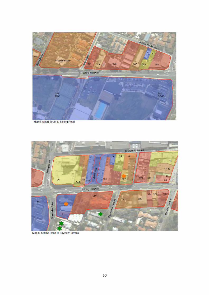
60

61

62
Attachment 5 - Stirling Highway Residential Development Concept – Precincts

63
Attachment 6 - Indicative Development Typologies TYPOLOGY 1 APPLICATION VARIATIONS INDICATIVE
DENSITY/YIELD: INDICATIVE SITE PLAN
SUBURBAN MAISONETTE A small apartment building with a similar mass and appearance to a large house.
Suits smaller development parcels (<1000sqm) in a squarer configuration and as interface between larger scale Highway or town centre development and the suburban residential hinterland.
Could be adapted to mixed use. Could have either rear or front-loaded vehicle access with basement or at-grade parking depending on lot size. Could be either two-or three storeys. Easy to adapted to sloping sites.
(@ 3 storeys) Notional lot size: 900sqm Dwelling yield: 11 dwellings Notional parking requirement: 15 cars Indicative density: 122 du/site ha R-Code required: R60 (tight) – 80

64
TYPOLOGY 2 APPLICATION VARIATIONS INDICATIVE DENSITY/YIELD:
INDICATIVE SITE PLAN
PERPENDICULAR TERRACE A small three-storey terrace of apartments consisting of single-level apartments on the ground level with double-storey apartments above, with the top level of the double-storey apartments opening out onto a private screened roof-top ‘sky balcony’.
Suits smaller development parcels (<1000sqm) in a longer and thinner configuration. Could be appropriate as an interface between larger scale Highway or town centre development and the suburban residential hinterland or for a thin lot with frontage to the Highway and a right-of-way at the rear. Only works well with rear vehicle access.
Could be adapted to mixed use. Could be adapted to sloping sites.
Notional lot size: 720sqm Dwelling yield: 8 dwellings Notional parking requirement: 10 cars Indicative density: 111 du/net ha R-Code required: R60 (tight) – R80
Plan and image courtesy of Peter Hobbs

65
TYPOLOGY 3 APPLICATION VARIATIONS INDICATIVE DENSITY/YIELD:
INDICATIVE SITE PLAN
COMPACT URBAN MIXED-USE TERRACE BLOCK A five-storey mixed-use urban building that is built from boundary to boundary to create a strong urban streetscape and tapers to 3- storeys at the rear.
Suits a town centre and urban highway location. Access should ideally be from the rear.
Could be adapted to residential only by increasing the primary setback and introducing ground floor residential in lieu of commercial uses. Could be adapted to sloping sites. Could be increased in height where appropriate to the context. Could be utilised on wider lots either with multiple courtyards or a longer single courtyard.
Notional lot size: 800sqm Dwelling yield: 12 dwellings Commercial yield: 280sqm Notional parking requirement: 23 cars Indicative density: 150 du/net ha R-Code required: R80-R100

66
TYPOLOGY 4 APPLICATION VARIATIONS INDICATIVE DENSITY/YIELD:
INDICATIVE SITE PLAN
SEMI-URBAN MIXED-USE BLOCK A five-storey mixed-use urban building that is built from boundary to boundary at ground level but set back from the side boundaries above, to provide continuity of the street edge for pedestrians but without creating a fully urban edge. Includes a mews terrace to the rear as an interface to adjacent suburban residential areas.
Suits a town centre and urban highway location. Access should ideally be from the rear.
Could be adapted to residential only by increasing the primary setback, setting back the ground level from the side boundaries and introducing ground floor residential in lieu of commercial uses. Could be adapted to sloping sites. Could be increased in height depending on the context. Could be utilised on wider lots by replicating the module.
Notional lot size: 1600sqm Dwelling yield: 20 dwellings Commercial yield: 550sqm Notional parking requirement: 43 cars Indicative density: 125 du/net ha R-Code required: R80-100

67
TYPOLOGY 5 APPLICATION VARIATIONS INDICATIVE DENSITY/YIELD:
INDICATIVE SITE PLAN
COURTYARD BLOCK A three-storey, mixed-use urban building that sacrifices height for site coverage (goes outwards rather than upwards), with units arranged around a central courtyard for amenity and cross ventilation.
Suits an urban highway location or, if only residential, a residential area. Access should ideally be from the rear.
Could be adapted to residential only by increasing the primary setback, setting back the ground level from the side boundaries and introducing ground floor residential in lieu of commercial uses. Could be adapted to sloping sites. Could be increased in height where appropriate to the context. Could be utilised as a corner solution.
Notional lot size: 1600sqm Dwelling yield: 20 dwellings Commercial yield: 350sqm Notional parking requirement: 36 cars Indicative density: 125 du/net ha R Code required: R80-R100

68
TYPOLOGY 6 APPLICATION VARIATIONS INDICATIVE DENSITY/YIELD:
INDICATIVE SITE PLAN
CORNER MIXED-USE BLOCK A five-storey mixed-use urban building that is built from boundary to boundary at ground level but setback from the side boundaries above, to provide continuity of the street edge for pedestrians but without creating a fully urban edge. Includes a mews terrace to the rear as an interface to adjacent suburban residential areas.
Suits a town centre and urban highway location. Access should ideally be from the rear.
Could be adapted to residential only by increasing the primary setback, setting back the ground level from the side boundaries and introducing ground floor residential in lieu of commercial uses. Could be adapted to sloping sites. Could be increased in height where appropriate to the context. Could be utilised on wider lots by replicating the module.
Notional lot size: 1600sqm Dwelling yield: 21 dwellings Commercial yield: 500sqm Notional parking requirement: 44 cars Indicative density: 132 du/net ha

69
TYPOLOGY 7 APPLICATION VARIATIONS INDICATIVE DENSITY/YIELD: AIRLIE STREET Site specific NA Notional lot size: 15,708 sqm
Gross floorspace: 42,900 sqm Net floorspace(70% gross): 30,030 sqm Indicative plot ratio: 1.91:1 Indicative dwelling yield: 364 dwellings* Building height: 2/3 - 8 storeys *70sqm/du based on 85% net floor area

70
Attachment 7 – 3D Modelling to Determine Potential Yield and Density Coding
The following images illustrate the 3D ‘Sketch-up’ modelling undertaken for the sites determined through the analysis process to be “more likely to be developed”. The building forms for these sites are informed by the broad principles and the suggested development controls in respect to height and setbacks. The models enabled estimations of floor space, plot ratio and dwelling yields, and, as a consequence, a recommendation for appropriate density codes. The models were also used to confirm that the built form did not result in unacceptable overshadowing to adjacent lots or streets.

71

72

73
Attachment 8 – Advertised MRS Amendment No. 1210/41 Rationalisation of Stirling Highway Reservation – Proposed
Rezoning
LEGEND

74
Attachment 9 – Advertised MRS Amendment No. 1210/41 Rationalisation of Stirling Highway Reservation – Property
Impacts
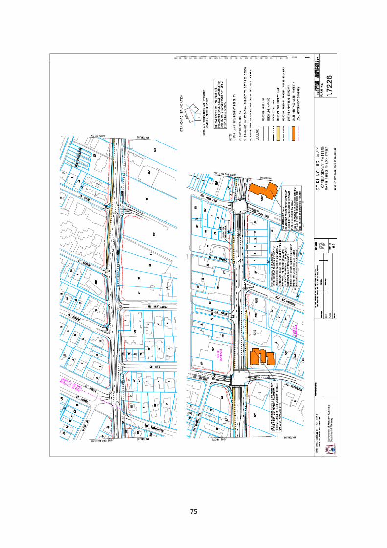
75

76

77
Attachment 10 – TPS 3 Zoning
Residential zone: Ranges from R15 to R40, Height 6.6m
Highway zone: R40, Height 12m Town Centre zone: R80, Height Council’s discretion

78
Attachment 11 – Changes suggested to TPS 3 Zoning Map

79
Appendix 1– Council minutes and report 5 July 2016 13.1.1 STIRLING HIGHWAY HOUSING STUDY
File Ref: LND/00089
Attachments – Public: Planning for Increased Residential Density along Stirling Highway Report
Draft Local Planning Policy – Stirling Highway – Draft Design Guidelines
Attachments – Restricted: Submissions received
Concept plans for “street wall” development of property in Eastern Highway Precinct
Responsible Officer: David Vinicombe Executive Manager Planning and Development
Author: David Vinicombe Executive Manager Planning and Development
Proposed Meeting Date: 5 July 2016
Enabling Legislation: Planning and Development Act 2005 (PDA) Planning and Development (Local Planning Schemes) Regulations 2015 (LPS Regs) Housing Capacity Study 2013 Residential Design Codes (RDC) Town Planning Scheme No. 3 (TPS3)
Purpose
For Council to adopt the ‘Planning for Increased Residential Density along Stirling Highway’ study (SH Study) as a Local Development Plan to guide the development of a Structure Plan / Activity Centre Plan for the town centre (and adjacent land), a TPS3 scheme amendment, Local Planning Policy and development of land along Stirling Highway.
Summary
Council’s Housing Capacity Study (2013) recommended that the Town prepare a study into increasing residential density along Stirling Highway to address the Town’s long term obligations to meet State Government objectives for urban consolidation, while at the same time protecting the single residential streetscape and heritage characteristics of the Town.
The Town appointed Planning Context to prepare the SH Study in 2013.
The SH Study analyses the potential for increased residential density on land adjoining Stirling Highway.
Four development models were prepared for Council consideration as a Local Development Plan to guide the preparation of an amendment to TPS3, a Local Planning Policy and associated Structure Plan / Activity Centre Plan.
The Models analysed in the SH Study include Progressive (1530 additional dwellings), Modest (1198-1339 additional dwellings), Conservative (1048-1263 additional dwellings) and Staged (1218-1322 additional dwellings).

80
It was recommended to Council on 15 March 2016 that the Staged Model be adopted for the purpose of public consultation together with “designated landmark” sites in the Western Residential Precinct. The Staged Model proposes:
o R100 for the Eastern Highway Precinct
o R-AC0 for the Central Town Centre Precinct
o Retention of the current density codings (R30 and R40) and no changes for the Western Residential Precinct (with exception to the “designated landmark” sites) to preserve long term development opportunity into the next century.
Public consultation on the SH Study was undertaken in accordance with the Planning and Development (Local Planning Schemes) Regulations 2015 (LPS Regs) for a period of 28 days up until 6 May 2016.
Three comments of support were received in addition a letter of approval for the preparation of the Local Development Plan from the Department of Planning (DoP) on behalf of the Western Australian Planning Commission (WAPC).
The SH Study contains recommendations for a detailed TPS3 amendment and Local Planning Policy proposals (subject to separate consultation). These proposals are to be finalised following Council approval of the SH Study as a Local Development Plan.
Metropolitan Region Scheme (MRS) Amendment for Stirling Highway (Major Amendment No. 1210/41) is currently being finalised by the DoP. Once this amendment is gazetted, the Town will have 90 days in which to formally resolve to amend TPS3 to address zoning and development requirements for the land previously contained in the Primary Regional Road (PRR) reservation and included as Urban land under the MRS.
Recommend that Council approve the ‘Planning for Increased Residential Density along Stirling Highway’ study as a Local Development Plan, with minor modifications noting the preference for the “Staged” Model plus inclusion of the “designated landmark” site at the St Louis Estate Retirement Village site.
It is also recommended that upon presentation of a master plan to guide development on the St Louis Estate Retirement Village site to the satisfaction of Council, the Western Australian Planning Commission (WAPC) be requested to provide approval for the preparation of a Local Development Plan for the site which links in with the Stirling Highway Local Development Plan.
Finally its recommended that the approved SH Study be used as the basis to progress proposals to initiate an amendment to TPS3 and adopt local planning policies for public consultation within 90 days of MRS Amendment No. 1210/41 being gazetted.
Past Resolutions
In November 2012, Council adopted the Housing Capacity Study to identify constraints and opportunities relating to the housing targets including Directions 2031 (and beyond) and the Draft Central Metropolitan Perth Sub-Regional Strategy (CMPSS). Ordinary Council Meeting 20 November 2012, Resolution No. 221/12 includes the following pertinent extracts:
That Council resolve as follows:

81
1. To adopt the Draft Housing Capacity Study 2012 for the Town of Claremont for inclusion in the review of the Town of Claremont’s Local Planning Strategy 2010 – 2025, Clearly Claremont.
2. The Town of Claremont work toward implementing the 12 recommendations contained in the Housing Capacity Study 2012 as follows:
2.7 Council lead in progressing a suitable commercial and residential zoning and density coding along Stirling Highway to ensure that in drafting a Local Scheme Amendment to reflect Metropolitan Region Scheme Amendment 1210/41, consideration be given to the introduction of a split form of R Coding such as R40/R80 and a strong set of scheme provisions, policies and design guidelines are introduced to control redevelopment and protect local heritage sites and the amenities of lower density surrounding areas.
2.8 Council prepare an Activity Centre Structure Plan for the Claremont Town Centre which includes provisions encouraging additional residential dwellings including mixed use developments and give consideration to the creation of additional opportunities for residential development in walkable catchment of the Town Centre once formally defined.
Council Meeting resolved on 15 March 2016, Resolution No. 37/16 as follows:
THAT Council:
a) Pursuant to Part 6 of the Planning and Development (Local Planning Schemes) Regulations 2015, adopt the draft ‘Planning for Increased Residential Density along Stirling Highway’ study for public consultation as a proposed Local Development Plan including endorsement of the Staged Model as the preferred option plus the identified “designated landmark” site at the north western corner of Stirling Highway and Stirling Road and the St Louis Village site to guide future residential development along Stirling Highway.
b) Advertise the draft ‘Planning for Increased Residential Density along Stirling Highway’ study for a period of 28 days.
c) Require a further report being prepared for Council consideration following completion of the consultation period.
Background
The report to Council detailed the significant strategic background to the formulation of the SH Study. A brief summary is provided for the purposes of this report. MRS Amendment No. 1210/41
The Stirling Highway Activity Corridor Study (SHACS) is an integrated transport and land use planning study being undertaken by the Department of Planning (DoP) at the request of the Western Australian Planning Commission (WAPC) and consists of two inter-related and staged studies:
Phase 1: A preliminary carriageway design for Stirling Highway (MRS Amendment No. 1210/41 - Rationalisation of Stirling Highway Reservation).
Phase 2: A staged urban design and form based code study to guide built form and redevelopment opportunities in a sustainable planned manner (yet to be progressed).
MRS Amendment No. 1210/41 - Rationalisation of Stirling Highway Reservation proposed a reduction of the Primary Regional Road (PRR) reservation to approximately 40 metres in width with the balance of the land proposed to be rezoned as Urban (and Parks and Recreation for a small section between Bay View Terrace and Bernard Street).

82
When MRS Amendment No. 1210/41 is gazetted, land no longer affected by the PRR reservation will be zoned Urban under the MRS but will remain unzoned under TPS3 until such time as a zone (and density codings) are added by way of a scheme amendment. The DoP has recently advised that the MRS amendment is going through its final approval procedures and is about to be gazetted. It was considered appropriate that Council takes the initiative to develop its own set of design guidelines and other planning tools rather than await finalisation of Phase 2 of SHACS. This report has been based on the proposed extent of the Stirling Highway reservation as shown in the MRS Amendment No. 1210/41 plans advertised for public comment, together with the remaining parcels of land which are presently zoned or reserved under TPS3. It is noted that the MRS amendment has slightly modified the proposed PRR reservation (reduced to approximately 38m), however this will not impact on the intent or the outcomes of the SH Study. State Government Direction
The State Government has prepared a number of strategies to promote a balance between urban growth on the fringe and consolidation within the existing urban fabric of the metropolitan area. In recent times a number of strategic directional documents have been prepared, inclusive of Directions 2031(and Beyond), Draft Central Metropolitan Perth Sub-Regional Strategy (CMPSS), Directions 2031 (and Beyond) - 2014 Report Card and Perth & Peel @ 3.5 Million (draft). The expectation is that local government (Town of Claremont included) will take positive action to support this direction and it is likely that the government will require changes to any proposals where they are not seen to be supporting these growth strategies. Most recently, Perth & Peel @ 3.5 Million (draft) proposes that the Town to accommodate 1300 additional dwellings in the Town by 2050. This target appears to include the Directions 2031 Report Card target of 760 dwellings, but is less than the original target of 2200 contained in the Directions 2031 and Beyond / CMPSS proposals. Discussions with the DoP officers when finalising the Housing Strategy for the Town indicated that the base (before Directions 2031 / CMPSS) calculation included 630 dwellings in the NEP. It is envisaged that with increased development yields (22-25%) at the NEP, 1000 dwellings will be accommodated within that development alone (370 dwellings more than the base 630 dwellings). It is therefore estimated that the revised future growth target for the Town of 1300, will consist of:
370 in the NEP 930 elsewhere. Draft ‘Planning for Increased Residential Density along Stirling Highway’ Study
Details of the SH Study were reported to Council in March 2016. The following is a brief summary of that report.
The study area includes land on both sides of Stirling Highway, within the Town of Claremont boundaries generally to a depth of the largest existing lot within each street block and following cadastral boundaries. The study area contains 146 properties and has been separated into three distinct precincts including:

83
1. Western Residential Precinct (generally land on both sides of the Highway to west of Stirling Road typified by uses of a residential nature and two private school campuses, with a noticeable absence of commercial activity).
2. Central Town Centre Precinct (generally land on both sides of the Highway between the commercial development on the west side of Stirling Road and west of Mary Street, comprising of retail, commercial and civic activity).
3. Eastern Highway Precinct (generally land on both sides of the Highway east of Mary Street and is a mix of other commercial-type activity traditionally associated with strip highway development, with some interspersed residential activity).
Following review of available background information (for example heritage listings, previous studies, proposed road reservations, height data, land contours, existing development) and identification of the notional study area, an on-site assessment and photography of building stock was undertaken to determine the likelihood and timing of redevelopment in the foreseeable future.
An assessment of each property was undertaken within the study area to determine the likelihood and timing of redevelopment in the foreseeable future using a range of factors considered as either likely to encourage or be more challenging for redevelopment, and scores were applied to each category.
The suggested density coding contained in the SH Study were developed through a process that worked back from the built form to ensure a good match between the chosen R-Code and an appropriate built form for each precinct.
Four options were presented and analysed for the three precincts as detailed below. It is noted that total yields include an allowance of approximately 400 dwellings for the Amana (Sundowner) site, which has been the subject of a separate amendment to TPS3:
1. Progressive Model
Western Residential Precinct – R80
Central Town Centre Precinct – R-AC0
Eastern Highway Precinct – R100
Total dwelling yield – 1,130 (plus 400 for Amana) – 1530
2. Modest Model
Western Residential Precinct – R60
Central Town Centre Precinct – R-AC0
Eastern Highway Precinct – R80
Total dwelling yield – 939 (plus 400 for Amana) – 1339
Note – taking into account the reduced incentive to develop, yield may be
reduced to 798 (plus 400) - 1198
3. Conservative Model
Western Residential Precinct – R40
Central Town Centre Precinct – R-AC0
Eastern Highway Precinct – R60
Total dwelling yield – 863 (plus 400 for Amana) – 1263
Note – taking into account the reduced incentive to develop, yield may be
reduced to 648 (plus 400) - 1048
4. Staged Model (as per the Progressive Model for the Central Town Centre and
Eastern Highway Precincts)
Western Residential Precinct – No change (retain R30 and R40)
Central Town Centre Precinct – R-AC0
84
Eastern Highway Precinct – R100
Total dwelling yield – 922 (plus 400 for Amana) – 1322
Note – taking into account the reduced incentive to develop, yield may be
reduced to 818 (plus 400) - 1218
It is proposed that the R-AC zone (as referred to at times in the SH Study) be classed
as R-AC0 which requires preparation of a Structure Plan (or possible Activity Centre
Plan) to guide development in the Central Town Centre Precinct.
The consultants recommend the Progressive Model as the most desirable and viable option for the following reasons:
o It provides sufficient incentive, flexibility and viability for landowners to initiate
development.
o It is more likely to result in higher quality development.
o Lower densities may pose risk of seeing less redevelopment occur, or seeing
interim development in a form that may be of lower quality.
o It more than satisfies the State Government’s housing target well into the
future.
To support the recommendation for the Progressive Model, the SH Study includes a detailed assessment of TPS provisions and makes specific recommendations for a scheme amendment and Local Planning Policy Design Guidelines (attached). In summary, the requirements outline expectations on land-use and density, plot ratio, access, parking, overshadowing, heights and setbacks, building amenity, fencing, services, heritage, and provide details for proposed scheme amendments to address these matters. In addition, Design Guidelines are recommended to address a number of these issues, plus street interface, building form, landscaping and public art and precinct specific objectives and requirements.
The Progressive Model, proposes development requirements to create a “street wall” along both sides of the Highway with development up to four storeys high, or six storeys for key “designated landmark” corner sites, with an additional two storeys setback 3m from the “street wall” (eight storeys), except in the Town Centre where Structure Plan / Activity Centre Plan requirements will be developed to support specific Town Centre development opportunities; or where development overshadows adjacent residential property or development on the northern side of the Highway overshadows the footpath on the southern side of the Highway. Height is also proposed to be restricted to three storey “street walls” (with 3m setback additional two storeys) where development fronts commercial side streets or two storey “street walls” (with 3m setback to an additional one storey – three storeys) to residential side streets. Development will also be limited to two storeys where a site abuts a residential property not located in the study area.
“Designated landmark” sites are defined as large prominent corner sites including Amana (Sundowner) on the corner Airlie Street as an entry point to the Town from the south; the north western corner of Stirling Highway and Stirling Road as a western entry to the town centre; Bayview Centre on the corner of Leura Avenue as the eastern entry to the town centre; and north western corner of Loch Street as the eastern entry point to the Town. It is noted that the Sundowner site has since been rezoned under TPS3 and requires no further amendment at this point.
The pre-existing commercial nature of the Central Town Centre and Eastern Highway Precincts and ground floor (and above) commercial development will be required to be maintained with special considerations to accommodate mixed use development.
Preliminary concept plans have been prepared as an example for a mixed use development in the Eastern Highway Precinct (see Attachment – Restricted). This (annotated) concept takes into account many of the design concepts proposed by the

85
SH Study and the draft Design Guidelines to illustrate how the “street wall” development may be accommodated within the existing PRR reserve, and how the impact on residential property to the south may be ameliorated within the current “Highway” zone development requirements on height (max. 12m) etc.
The SH Study is considered to be one of the most important strategic planning documents to be considered by the Town to respond to State Government objectives whilst at the same time protecting the Town’s single residential streetscapes and heritage characteristics. It is important that the Council sets clear direction on which Model to implement before finalising the scheme amendment and policy proposals.
The SH Study assesses the advantages and disadvantages of each Model and indicated the two preferred Models are the Progressive and Staged Models, both of which provide appropriate incentives for development. It was however recommended that the Council endorse the Staged Model which focuses on increasing the density in the Central Town Centre and Eastern Highway Precincts, while retaining the Western Residential Precinct in its current form for future consideration. This option provides for the future proofing of population growth into the next century, while at the same time ensuring that an oversupply of developable land in the foreseeable future does not occur to the detriment of local amenity. A minor variation to this recommendation is the inclusion of the “designated landmark” site at the St Louis Retirement Village Estate site, which is subject to master planning to accommodate long term redevelopment.
The Staged Model option will generate landowner/developer interest in redevelopment in the town centre and the east end of Claremont with a focus on mixed-use development to compliment the town centre.
It is likely that the proposed scale of development may be more acceptable to the community in the Central Town Centre and Eastern Highway Precinct compared to the Western Residential Precinct as there is already a mix of uses and built forms.
Consultation
The draft SH Study Local Development Plan Public was advertised for public comment in the Public Notices section of the Post newspaper and on the Town’s website for a period of 28 in accordance with the Planning and Development (Local Planning Schemes) Regulations 2015 (LPS Regs) up until 6 May 2016.
Three submissions were received from planning consultants representing landowners as summarised in the submission table below. Full copies of the submissions are attached to this report.
Submission Comments Officer Response
1. 230 Stirling Highway (Lots 11 and 12) – Planning consultants Rowe Group on behalf of owners BGC Development Pty Ltd (Buckeridge Properties Pty Ltd)
The current development on site containing 47 apartments in a three storey building is nearing the end of its economic life and requires either significant upgrades or complete redevelopment.
The existing site is coded R40 however the development equates to R60-R100.
Noted
Noted

86
Redevelopment of the site is preferred. It is considered to provide improved development outcomes for the site and local community as the existing development caters for tenant only accommodation with a very narrow demographic which does not suit the general market needs of today; redevelopment will provide for greater housing variety with a wider price point to appeal to a wider demographic including owner/occupiers and investors; and will better suit the needs of the community and reflect the built form outcomes being sought for the Eastern Highway Precinct.
Recommends that the Study be supported as it is considered to promote and encourage redevelopment within the Eastern Highway Precinct in a manner which aligns with the current State Planning Framework and current best practice planning principles.
Once implemented, the Study will provide for the planning framework required to guide and deliver high quality built form outcomes which complement the existing character of Stirling Highway and minimises impacts on adjacent residential dwellings.
Supports the proposed recommendations contained in the study as indicated below:’
Up-coding the Eastern Highway Precinct from R40 to R100.
Proposed height allowing for four storey development along the Highway and six storeys behind the “street wall”.
Recommends the
Noted
Noted
Noted
Noted
Noted
Noted with acknowledgement that heights are proposed to vary to reduce the residential amenity impacts on adjacent residential development towards the rear of the site and adjoining residential development to the side.
This will require detailed

87
inclusion of discretionary provisions in TPS3 to allow Council to relax its usual requirements in certain circumstances.
consideration as part of the proposed TPS3 amendment. Given that most of the developments proposed as a result of the Local Development Plan and TPS3 amendment will be determined by the JDAP on behalf of Council, it is likely that opportunities for discretionary considerations will be constrained.
2. 2 Richardson Avenue (Lot 3) – Planning consultants Harley Dykstra on behalf of owners A & R Jukic
Commends the Town for its proactive approach in considering how it can most appropriately plan for and accommodate sensitive redevelopment to cater for projected housing demand and to meet the infill targets set by State Government.
Also supports development of Stirling Highway as an Activity Corridor.
Requests that the Study Area be extended to include 2 Richardson Avenue as this is consistent with orderly and proper planning and aligns with the fundamental intent of the SH Study.
Noted
Noted
The SH Study generally aims to reduce the impact of higher densities on the adjacent residential areas by providing for the intense “street wall” along the direct Highway frontage. Where a lot extends back into the side streets, the development requirements are proposed to reduce the bulk of development to ameliorate amenity impacts on adjacent residential properties.
It is noted that the property is partially within the line of development either side which is included in the Study Area, however existing development to the rear (Lots 62 and 63) Cliff Road is identified as having a minimal likelihood of redevelopment. In this context, inclusion of 2 Richardson Avenue may present an intrusion in to the adjoining R20 single residential area at the rear of the Highway development front contemplated in the SH Study for the Western Residential

88
Also requests that Council pursue the Progressive Model as there are strong grounds to adopt this approach at the present time.
The property benefits from its proximity to transport infrastructure, natural amenity and facilities as it is located within the 800m catchment of
Precinct.
These matters would suggest that the property should not be included, however when Council considers rezoning proposals consistent with R80 Progressive Model in the Western Residential Precinct, the inclusion of this property can be further considered and the owner will have the opportunity to make a formal submission on the amendment proposals – see further comments below on inclusion of the site into the study area.
The Staged Model involving the deferral of proposals for the Eastern Residential Precinct was recommended for advertising of the Local Development Plan to provide a balanced approach which focuses on increasing the density in the Central Town Centre and Eastern Highway Precincts, while retaining the Western Residential Precinct in its current form for future consideration. This option provides for the future proofing of population growth into the next century, while at the same time ensuring that an oversupply of developable land in the foreseeable future does not occur to the detriment of local amenity.
It is proposed that Council maintain this approach for the immediate future and progress the proposed TPS amendment based on the Staged Model. It is also noted that timing for progression of an amendment to include this Precinct at a higher density will depend in part on the progression of development within the other Precincts and resultant future development pressure to re-code this land.
Noted

89
the Grant and Swanbourne railway stations, 40m of Stirling Highway, 350m from the Swan River, 450m of Christchurch and MLC and 720m from the edge of the Claremont town centre.
Many sites in the locality have been developed above the existing R20 density coding. The property to the immediate south currently contains two storey developed with six dwellings at an equivalent R40 density. Retaining 2 Richardson Avenue at the present R20 density coding will present an anomaly if surrounding land to the north, west and east are developed at the R80 density.
The two storey six unit development to the south means that the increased density of development at 2 Richardson Avenue would have a reduced impact on the locality and therefore be consistent with the intention of the study to protect the amenity of adjacent residential areas.
The site is likely to be developed as a perpendicular terrace if included in the Study. This typology is outlined in the SH Study as being a small, three storey terrace of apartments. This would provide for a gradual reduction in height from six storeys on the Highway down to two storeys existing on the adjoining site to the south of 2 Richardson Avenue.
The submission details a preliminary assessment of the site’s suitability for development consistent with Attachment 2 of the SH Study and indicates that the score exceeds that for at least 20 other properties in the Western Residential Precinct – indicating its suitability for redevelopment.
Noted – this matter could be reviewed as a special consideration for inclusion at the time Council resolves to proceed with amendment proposals contained in the Progressive Model for the Western Residential Precinct, however at this point it is considered premature to progress this Model for the Precinct.
Noted – as indicated above, this matter could be reviewed as a special consideration for inclusion at the time Council resolves to proceed with amendment proposals contained in the Progressive Model for the Western Residential Precinct.
Noted – as indicated above, this matter could be reviewed as a special consideration for inclusion at the time Council resolves to proceed with amendment proposals contained in the Progressive Model for the Western Residential Precinct.
The Western Residential Precinct contains 53 properties which have been assessed for redevelopment suitability. The purpose of this assessment is simply to establish the number of properties likely to be developed over time to inform the expected development yield and add rigor and substance to the achievable
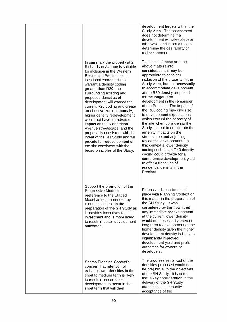
90
In summary the property at 2 Richardson Avenue is suitable for inclusion in the Western Residential Precinct as its locational characteristics warrant a density coding greater than R20; the surrounding existing and proposed densities of development will exceed the current R20 coding and create an effective zoning anomaly; higher density redevelopment would not have an adverse impact on the Richardson Avenue streetscape; and the proposal is consistent with the intent of the SH Study and will provide for redevelopment of the site consistent with the broad principles of the Study.
Support the promotion of the Progressive Model in preference to the Staged Model as recommended by Planning Context in the preparation of the SH Study as it provides incentives for investment and is more likely to result in better development outcomes.
Shares Planning Context’s concern that retention of existing lower densities in the short to medium term is likely to result in lesser scale development to occur in the short term that will then
development targets within the Study Area. The assessment does not determine if a development will take place or otherwise, and is not a tool to determine the desirability of redevelopment.
Taking all of these and the above matters into consideration, it may be appropriate to consider inclusion of the property in the Study Area, but not necessarily to accommodate development at the R80 density proposed for the longer term development in the remainder of the Precinct. The impact of the R80 coding may give rise to development expectations which exceed the capacity of the site when considering the Study’s intent to ameliorate the amenity impacts on the streetscape and adjoining residential development. In this context a lower density coding such as an R40 density coding could provide for a compromise development yield to offer a transition of residential density in the Precinct.
Extensive discussions took place with Planning Context on this matter in the preparation of the SH Study. It was considered by the Town that any immediate redevelopment at the current lower density would not necessarily prevent long term redevelopment at the higher density given the higher development density is likely to significantly improved development yield and profit outcomes for owners or developers.
The progressive roll-out of the densities proposed would not be prejudicial to the objectives of the SH Study. It is noted that a key consideration in the delivery of the SH Study outcomes is community acceptance of the
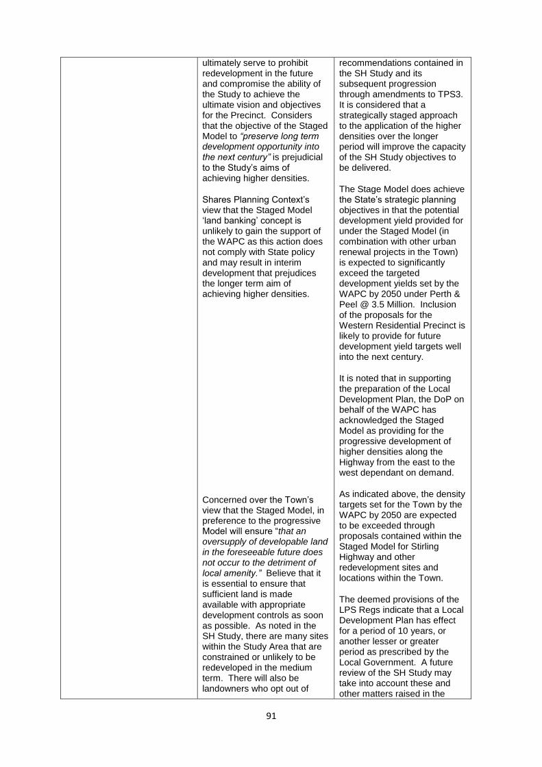
91
ultimately serve to prohibit redevelopment in the future and compromise the ability of the Study to achieve the ultimate vision and objectives for the Precinct. Considers that the objective of the Staged Model to “preserve long term development opportunity into the next century” is prejudicial to the Study’s aims of achieving higher densities.
Shares Planning Context’s view that the Staged Model ‘land banking’ concept is unlikely to gain the support of the WAPC as this action does not comply with State policy and may result in interim development that prejudices the longer term aim of achieving higher densities.
Concerned over the Town’s view that the Staged Model, in preference to the progressive Model will ensure “that an oversupply of developable land in the foreseeable future does not occur to the detriment of local amenity.” Believe that it is essential to ensure that sufficient land is made available with appropriate development controls as soon as possible. As noted in the SH Study, there are many sites within the Study Area that are constrained or unlikely to be redeveloped in the medium term. There will also be landowners who opt out of
recommendations contained in the SH Study and its subsequent progression through amendments to TPS3. It is considered that a strategically staged approach to the application of the higher densities over the longer period will improve the capacity of the SH Study objectives to be delivered.
The Stage Model does achieve the State’s strategic planning objectives in that the potential development yield provided for under the Staged Model (in combination with other urban renewal projects in the Town) is expected to significantly exceed the targeted development yields set by the WAPC by 2050 under Perth & Peel @ 3.5 Million. Inclusion of the proposals for the Western Residential Precinct is likely to provide for future development yield targets well into the next century.
It is noted that in supporting the preparation of the Local Development Plan, the DoP on behalf of the WAPC has acknowledged the Staged Model as providing for the progressive development of higher densities along the Highway from the east to the west dependant on demand.
As indicated above, the density targets set for the Town by the WAPC by 2050 are expected to be exceeded through proposals contained within the Staged Model for Stirling Highway and other redevelopment sites and locations within the Town.
The deemed provisions of the LPS Regs indicate that a Local Development Plan has effect for a period of 10 years, or another lesser or greater period as prescribed by the Local Government. A future review of the SH Study may take into account these and other matters raised in the

92
developing at the higher densities provided. Therefore additional land should be made available for redevelopment to ensure future density targets are achieved.
The submission notes the approval of the Stirling Highway MRS Amendment 1210/41 and suggests it is opportune take advantage of the significantly reduced PRR reservation to simultaneously amend TPS3 to apply zones and density codings to the land which was formerly in the PRR reserve.
submission, the impacts of regulating the roll-out of increased densities in the Precinct and recommend the earlier progression to the R80 proposals for the Western Residential Precinct.
The SH Study has been prepared to address and control development along Stirling Highway in expectation of the gazettal of the MRS Amendment. The strategic direction set by the Local Development Plan will form the basis of the TPS3 amendment required to be initiated within 90 days of gazettal of the MRS Amendment.
The option for a simultaneous amendment was considered previously when Council made its submission on the MRS Amendment, however the strategic objectives for development along the Highway were not sufficiently progressed at that time to warrant a proposal for a simultaneous TPS3 amendment. These objectives will now be set in place though the final approval of the SH Study as a Local Development Plan.
3. 10 Albert Street (Lot 901) and 13, 15A and 15B Dean Street (Lots 123 and 1) – Planning consultants MW Urban on behalf of the owners of the St Louis Estate Retirement Village
Preceding the SH Study, the Town’s Housing Capacity Study highlighted the potential of the St Louis Estate site to accommodate additional housing consistent with State and local government planning objectives, given its strategic location, and hence included the following action:
“Council acknowledge the intent of the St Louis Estate Retirement Village and Mont Clare Residential Aged Care Facility to develop a Master Plan for the future development of the retirement facilities in Claremont to assist in
Noted
Discussions in this regard were placed on hold for a considerable period while the owners considered options on whether to progress the master plans. However, these discussions have recently resumed in light of the proposals contained in the SH Study and a renewed appetite for the project on behalf of the

93
the Town of Claremont providing additional residential accommodation. Further, the Town of Claremont liaise with planning consultants for the project with the view of progressing the Master Plan development towards public consultation prior to formal consideration of the Master Plan.”
With this in mind, a consultant team has been in discussion with the Town regarding progression of the master plan with the view of this being formally adopted as a Local Development Plan for the site.
It is proposed that the future St Louis Estate master plan will incorporate the adjoining properties at 13, 15A and 15B Dean Street and be given statutory effect through the adoption of a separate Local Development Plan.
While the broad principles of the SH Study are acknowledged and generally supported, it is believed that a separate Local Development Plan for the site is required given its unique characteristics and attributes including its 3ha site area in close proximity to the Claremont town centre; its size relative to frontages to Stirling Highway, Dean Street, Barnfield Road and Albert Street; its 370m depth extending north of the Highway; topography; and location opposite MLC and Christchurch.
The master plan will further investigate the appropriate built form outcomes for the staged redevelopment of the site, including a range of building heights across the site consistent with the objectives
owners. Discussions to date have related to how the master plan can be implemented once developed. Previously, this could have been implemented as a Structure Plan, however the Local Development Plan option provided for under the LPS Regs provides opportunity for the Council and landowners to develop a plan to acknowledge the site attributes, density codings of R30/R40 and R40 and address proposals contained in the SH Study Local Development Plan.
Noted
It is noted that 13 Dean Street contains a heritage dwelling, which will need to be appropriately acknowledged and addressed through the preparation of a master plan and a Local Development Plan for the site.
The specific site attributes warrant detailed attention through a master planning process to inform the preparation of a Local Development Plan. The SH Study Local Development Plan does not contemplate all the specific attributes which will apply to a detailed study of this site.
The master plan will need to consider heights and densities under the SH Study compared to the current density codings and scheme provisions and will need to be fine-tuned to acknowledge the site attributes
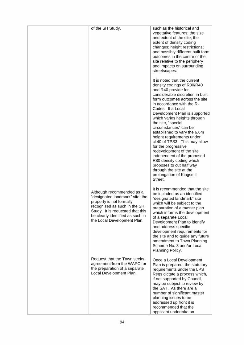
94
of the SH Study.
Although recommended as a “designated landmark” site, the property is not formally recognised as such in the SH Study. It is requested that this be clearly identified as such in the Local Development Plan.
Request that the Town seeks agreement from the WAPC for the preparation of a separate Local Development Plan.
such as the historical and vegetative features; the size and extent of the site; the extent of density coding changes; height restrictions; and possibly different built form outcomes in the centre of the site relative to the periphery and impacts on surrounding streetscapes.
It is noted that the current density codings of R30/R40 and R40 provide for considerable discretion in built form outcomes across the site in accordance with the R-Codes. If a Local Development Plan is supported which varies heights through the site, “special circumstances” can be established to vary the 6.6m height requirements under cl.40 of TPS3. This may allow for the progressive redevelopment of the site independent of the proposed R80 density coding which proposes to cut half way through the site at the prolongation of Kingsmill Street.
It is recommended that the site be included as an identified “designated landmark” site which will be subject to the preparation of a master plan which informs the development of a separate Local Development Plan to identify and address specific development requirements for the site and to guide any future amendment to Town Planning Scheme No. 3 and/or Local Planning Policy.
Once a Local Development Plan is prepared, the statutory requirements under the LPS Regs dictate a process which, if not supported by Council, may be subject to review by the SAT. As there are a number of significant master planning issues to be addressed up front it is recommended that the applicant undertake an
95
engaged master planning process with Council to prepare a plan which informs the development of a formal Local Development Plan. The applicant has indicated a willingness to engage with Council on this matter and plans on presenting options to Council in the coming months.
It is recommended that upon presentation of master plan proposals to guide development on the St Louis Estate Retirement Village site to Council’s satisfaction, Council request the WAPC to provide approval for the preparation of a Local Development Plan which links in with the Stirling Highway Local Development Plan.
Discussion
The submissions received have raised a number of specific site issues which relate to the properties concerned. It is considered appropriate to progress the approval of the SH Study as a Local Development Plan consistent with the deemed provisions of the LPS Regs and recognise the Officer recommendations presented in the submission table above. It is noted that the SH Study is a high level strategic document to guide the preparation of future statutory provisions to regulate development in the Town. The specific proposals contained in the TPS3 amendment and policy guidelines will be extensively advertised to each owner and resident along the Highway together with adjacent landowners and residents.
Financial and Staff Implications
The SH Study provides a strategic direction for Council to consider development of apartments on land abutting Stirling Highway. While the detailed amendment and associated Local Development Plan, Activity Centre Plan / Structure Plan and Local Planning Policies together with consideration of development applications which may result will require considerable staff resourcing, development applications will ultimately be determined by the Metropolitan West Joint Development Assessment Panel on recommendation from and behalf of Council. Once land has been developed, the final yield will assist Council’s rates revenue and the development of community facilities for the betterment of all residents in the Town and the surrounding localities.
Policy and Statutory Implications
It is appropriate that the SH Study be adopted as a Local Development Plan in order to guide the development of a Structure Plan / Activity Centre Plan for land located in and adjacent to the town centre and to form the basis for an amendment to TPS3 and associated Local Planning Policies, together with providing guidance for interim development approvals for land impacted by the PRR reservation under the MRS. Parts 4, 5 and 6 of Schedule 2 in the new Planning and Development (Local Planning Schemes) Regulations 2015 (LPS Regs) identifies procedures for the preparation and adoption of Structure Plans, Activity Centre Plans and Local Development Plans.

96
A Local Development Plan does not require final approval from the WAPC, however WAPC approval is required in the first instance to prepare the Local Development Plan. A Local Development Plan sets out specific and detailed guidance for future development including site and development standards. Once a Local development plan is prepared, the LPS Regs determine specific requirements and time lines for consultation and approval processes, together with setting out State Administrative Tribunal (SAT) review rights for the applicant (not including any person who makes a submission on a proposed Local Development Plan). Activity Centre Plans are also required to be developed in accordance with State Planning Policy 4.2 – Activity Centres for Perth and Peel (SPP4.2). The Town is able to amend its current Town Planning Scheme under section 75 of the Planning and Development Act 2005. Scheme amendments are required to be undertaken in accordance with the LPS Regs. The LPS Regs replace the previous Town Planning Regulations 1967. The LPS Regs came into effect on 19 October 2015, and all procedural requirements are required to be in accordance with the new LPS Regs. A Local Planning Policy must be adopted in accordance with Part 2 of Schedule 2 of the LPS Regs, which includes provisions that override Council’s previous requirements under TPS3 cl.82.
Urgency
Strategy 1.5.3 of the Town of Claremont Corporate Business Plan 2015-2019 requires the Town to undertake the Local Planning Strategy Review / Stirling Highway Study / Loch Street Station Study / Housing Capacity Study. Preparation of the SH Study was recommended by the Housing Capacity Study which was adopted by Council on 20 November 2012. Progression of the SH Study will inform the review of the Local Planning Strategy. Schedule 2 of the LPS Regs requires Council to resolve to approve (with or without modifications) or refuse a Local Development Plan within 60 days of advertising (i.e. prior to 12 July 2016). Accordingly, Council must resolve this matter at this Council meeting. The SH Study is closely aligned to the MRS Amendment No. 1210/41 relating to Stirling Highway. When this Amendment is gazetted, Council is required to apply specific zonings and development requirements to the land zoned Urban under the MRS by initiating a scheme amendment to TPS3 within a period of 90 days. Given the recent advice that the MRS Amendment is about to be finalised, there is now some urgency to finalise the strategic proposals contained in the draft SH Study Local Development Plan to underpin the initiation of the required scheme amendment.
Voting Requirements
Simple majority decision of Council required.

97
Moved Cr Wood, seconded Cr Main
THAT Council:
a) Pursuant to Part 6 of the Planning and Development (Local Planning Schemes) Regulations 2015, approve the draft ‘Planning for Increased Residential Density along Stirling Highway’ study as a Local Development Plan to guide the proposed amendment to Town Planning Scheme No. 3 and associated Local Planning Policy to promote the development of land in the proximity of Stirling Highway with the following modifications:
v) Formally name the ‘Planning for Increased Residential Density along Stirling Highway’ study as the ‘Stirling Highway Local Development Plan’.
vi) Endorsement of the Staged Model as the development option until such time as the Local Development Plan is reviewed by Council.
vii) Include the St Louis Estate Retirement Village as an identified “designated landmark” site which is subject to the preparation of a master plan which informs the development of a separate Local Development Plan to identify and address specific development requirements for the site and to guide any future amendment to Town Planning Scheme No. 3 and/or Local Planning Policy.
viii) The inclusion of 2 Richardson Avenue in the Western Residential Precinct subject to formal reconsideration when the Stirling Highway Local Development Plan is reviewed to progress proposals to include the Western Residential Precinct at the R80 density.
b) On gazettal of Metropolitan Region Scheme Amendment No. 1210/41, prepare a report to initiate an amendment to Town Planning Scheme No 3 to reflect the adopted proposals contained in the Stirling Highway Local Development Plan and detail final proposals for any associated Local Planning Policy.
(c) Upon presentation of a master plan to guide development on the St Louis Estate Retirement Village site to the satisfaction of Council, the Western Australian Planning Commission be requested to provide approval for the preparation of a Local Development Plan for the site which links in with the Stirling Highway Local Development Plan.
CARRIED(100/16)
For the Motion: Mayor Barker and Crs Tulloch, Haynes, Edwards, Browne, Main, Wood, and Kelly.
Against the Motion: Cr Mews.

98
Appendix 2 – Design Guidelines Town of Claremont
Draft Local Planning Policy Stirling Highway – Draft Design Guidelines
5 July 2016 VISION
These design guidelines elaborate on the following vision for Stirling Highway Activity Corridor Area in the Town of Claremont. The gradual transformation of Stirling Highway from a suburban highway strip into an urban activity corridor that offers opportunities for living and working within an easy walk of public transport and the shops and cafes of the Claremont town centre, and which enables the development industry to meet the growing demand for higher density living choices without diminishing the character of the leafy local residential streets in the hinterland. PART 1: GENERAL
The following objectives and policies apply to all development with the Stirling Highway Activity Corridor Area, unless otherwise covered in the specific policy provisions for the three precincts in Parts 2 to 4 of the Design Guidelines. The Town of Claremont may allow variations from the design guidelines at its discretion, provided that the variation contributes to outstanding design quality and supported with a strong rationale. A. Land use and density
Objectives
To realise the aims of the Town of Claremont local planning scheme and supporting planning strategies.
To encourage a diversity of residential accommodation. Policy 1. Diversity in the size and prices of new residential products is encouraged through the provision
of apartments ranging from one-bedroom to three or more bedrooms. 2. Where commercial uses are permitted, the integration of commercial uses into mixed-use
buildings with a range of different uses is encouraged. B. Street interface
Objectives
To create an attractive, safe and comfortable streetscape.
To enliven the street in commercial and mixed-use areas. Policy 1. Crime Prevention through Environmental Design (CPTED) principles should be employed to
create a safe and well-lit pedestrian environment with good surveillance to make walking a
psychologically comfortable alternative to car use, particularly at night. For example, windows,
balconies and other major openings of active areas at all building levels should be designed to
provide for natural surveillance of the public realm.
99
2. Significant changes in level between ground floor commercial activities and the adjacent street
level should be avoided to maximise the opportunity to provide direct access from the street.
3. Spaces that are publicly accessible should be clearly distinguishable from those that are for only
private use to improve legibility, maintain privacy and contribute to the quality of the public
realm.
4. Buildings should incorporate richness in the details and materials of the architectural design to
create a visually pleasing architecture.
5. Buildings should be designed to establish an identifiable scale and character for adjacent streets
and publicly accessible spaces.
6. The main pedestrian access for visitors should be directly from a street. In the case of commercial uses, Stirling Highway should be seen as the principal address.
7. Service areas should be located behind buildings, or screened from public view, to avoid the
intrusion of noise, odour, or visual pollution on publicly accessible areas of the development
site and on adjoining/adjacent residential property.
8. Spaces for temporary overspill activities, such as al fresco dining and external display, are
encouraged to provide additional interest to the street.
9. Where a building is set back from the street boundary, the street edge should be defined
through the use of appropriately scaled walls or fences (refer to section I. Fencing) or planting.
C. Built form, heights and setbacks
Objectives
To realise the aims of the Town of Claremont local planning scheme.
To maintain an appropriate scale of building at the interface with existing residential properties. Policy 1. Building heights along Stirling Highway should not exceed 6 storeys (or less if subject to
overshadowing constraints), except for designated landmark sites where a maximum of 8 storeys may be permissible subject to compliance with requirements and outstanding design quality as determined by the Town of Claremont.
2. Buildings addressing Stirling Highway should have a maximum ‘street wall’ height of 4 storeys,
with subsequent storeys (maximum of an additional 4 storeys for designated landmark sites, or maximum of an additional 2 storeys for all other sites) set back by a minimum of 3m from the ‘street wall’.
3. Buildings addressing local residential streets should have a maximum ‘street wall’ height of 2
storeys, with subsequent storeys set back by a minimum of 3m from the ‘street wall’.
4. Buildings addressing non-residential or mixed-use streets in the town centre precinct (other than Stirling Highway) should have a maximum ‘street wall’ height of 3 storeys, with subsequent storeys set back by a minimum of 3m from the ‘street wall’.
100
5. Building heights should be progressively reduced in proximity to existing residential houses
beyond the study area. The wall height for walls adjacent to residential properties beyond the study should be a maximum of 2 storeys, with any subsequent storey/s above to be set back sufficiently to be generally unseen from the ground level of the adjacent residential property.
6. Building setbacks from the street for residential units should be as per the R-Codes requirement
for primary streets. 7. Building setbacks from adjacent existing residential lots beyond the study area should be as per
the R-Codes. 8. Lift machinery rooms and other plant areas may exceed the prescribed maximum building
heights but should be designed or screened in an appropriate manner to ensure they contribute to the visual quality of the development.
9. The mass of larger buildings should be modulated to create visual interest and break down the
perceived scale of the building. 10. Buildings should articulate street corners with a distinctive architectural element to improve
legibility of the street network.
D. Overshadowing
Objective
To avoid unreasonable overshadowing. Policy 1. Notwithstanding the height limits prescribed in the local planning scheme, taller building
elements on the northern side of Stirling Highway should be designed and located to ensure that the footpath on the southern side of Stirling Highway remains in sun at midday on 21 June.
2. The maximum extent of overshadowing to adjacent residential properties beyond the study
area should be as per the R-Codes relevant to the R-coding of the adjacent residential properties. Upper levels should be setback so as not to create a shadow impact on residential land to the south which would exceed that created by a two storey development.
E. Building amenity
Objective
To ensure an acceptable level of internal amenity for building occupants.
To reduce conflict between residential and commercial activities in mixed use buildings. Policy 1. All apartments should have a principal outlook to an adjacent street or park, or to a garden or a
landscaped courtyard within the development boundary. 2. Buildings should maximise the number of occupants with a view of adjacent streets by locating
windows to habitable rooms, offices and other commercial activities with a clear aspect to an adjacent street.
3. Apartments with openings facing Stirling Highway should also have at least one opening to a
habitable room with an alternative aspect to a secondary street, shared courtyard or private space.

101
4. South-facing apartments should be avoided. Where a south-facing apartment is unavoidable,
the apartment should also have at least one opening to a habitable room with an alternative aspect to enable solar access and natural through-ventilation.
5. Ground floor dwellings within 4m of a street boundary should be raised at least 0.6m above the
adjacent street but no more than 1.2m to provide residents with a degree of visual and physical separation from the street.
6. Where buildings contain a mix of both commercial and residential uses at the upper level, a
separate entry lobby and lift should be provided for the residential and commercial area.
However it may be acceptable for smaller buildings with a total net floorspace at upper levels of
less than 1000sqm to share internal circulation space between commercial and residential uses.
7. Where buildings are likely to incorporate food and beverage outlets, sufficient vertical ducting
should be incorporated to enable kitchen exhausts at roof level.
8. Floor-to-floor heights of residential apartments should be a minimum of 3.2m. Floor-to-floor heights of ground floor commercial tenancies should be a minimum of 4m.
9. Building design should employ noise mitigation measures (e.g. upgraded glazing, ceiling
insulation and sealing of air gaps with provision of mechanical ventilation where necessary), especially where bedrooms and living rooms face Stirling Highway to ameliorate potential traffic noise impacts.
10. Outdoor living areas, including balconies, should not generally face Stirling Highway to reduce
potential traffic noise impacts. F. Vehicle access
Objective
To reduce the impact of vehicle access on the movement of regional traffic, pedestrians and other alternative transport modes.
Policy 1. Vehicle access from all lots fronting Stirling Highway should be from a local street, rear lane,
easement or a shared access agreement where available. Vehicle access should only be provided from Stirling Highway where no alternative is available.
2. Vehicle access points should be located to take advantage of existing changes in level to
minimise ramp structures to undercroft or decked parking. 3. On-street parking will be considered only where consistent with Town Planning Scheme No. 3,
Council Local Planning Policy; and only where available within the road geometry and not in front of and on the same side of the road of adjoining residential development.
4. A single vehicle crossover should be permitted per street for each lot, with vehicle access points
designed and located to minimise any reduction in pedestrian safety and amenity on adjacent footpaths.
5. Vehicle access should provide for the safe use of alternative transport modes (such as bikes,
scooters, gophers) to encourage their use in preference to car travel.
102
G. Parking
Objectives
To provide an appropriate amount of car parking to meet the minimum needs of new development whilst encouraging greater use of alternative means of transport
To minimise the visual impact of car parking
Policy 1. Car parking for all new development should be integrated within or located behind buildings
and screened from public view. 2. No surface car parking should be provided in the street setback areas. 3. The reciprocal use of car parking bays may be considered where appropriate to encourage a high
turnover of parking bays and reduce the need to provide large amounts of expensive and land-consumptive car-parking infrastructure for specific activities.
4. Pedestrian amenity should be provided through the use of passive surveillance, shade and
shelter along pedestrian routes leading to car parks, recognising that car occupants become
pedestrians once they leave their car.
5. Attractive, convenient and secure parking should be provided for personal transport modes
such as bicycles, motorbikes, gophers and scooters, along with suitable end-of-trip facilities, to
encourage their use as a fuel and space efficient alternative to car travel.
6. Provide parking for persons with a disability in accordance with the relevant standards and
locate the bays as close as possible to the entrance points of the main activities within a centre.
H. Landscape and public art
Objectives
To enhance the outlook and amenity of building occupants.
To reduce the life-cycle costs of landscape elements.
To encourage meaningful public art. Policy
1. The use of deciduous vegetation is encouraged to provide shade in summer and allow sun
penetration into buildings and public spaces during winter.
2. Paving materials and street furniture should be robust and easy to clean and maintain.
3. Well-vegetated landscape should be established as a priority in areas that provide an outlook
from residential apartments and in areas that interface with existing residential properties.
4. Existing mature trees on private land should be retained wherever possible to contribute to
Claremont’s ‘green and leafy’ character. Trees in the public realm, such as street trees, shall not
be removed or pruned without approval from the Town of Claremont.
5. Public art should be integrated into the design of buildings and landscape to help explain the
place in which it situated and endow it with cultural significance.

103
6. Public art should reinforce and/or complement the character of Claremont and the adjacent public realm and built form. As such, art installations should also be cognisant of any relevant Town of Claremont policy relating to the provision of public art.
I. Fencing
Objective
To balance the privacy needs of building occupants with the provision of an attractive streetscape.
Policy
1. Street fencing is not permitted in front of ground level commercial uses.
2. Street fencing in front of ground level residential units should not exceed 1.8m in height above ground level and provide for at least 50% visual permeability.
3. Street fencing should be constructed in materials that are consistent with, or sympathetic to,
the main building on the lot.
4. Side or rear boundary fencing to an adjoining residential property should be of a masonry construction unless otherwise agreed with adjoining landowners.
J. Services
Objective
To ensure that building services do not detract from the character of adjacent streetscapes and other public spaces.
Policy
1. Service yards, such as delivery and waste storage areas should be located out of sight from adjacent streets and other public spaces.
2. AC condenser units, TV antennae and other mechanical equipment should be mounted out of
sight from adjacent streets and other public spaces. 3. AC condenser units equipment may be located on balconies or in street setbacks if screened by
discreet housings integrated into the architectural design and not designed to face an impact on the use of the comfortable use balcony by residents.
4. Rooftop AC condensers should be located a minimum of 6m from any adjacent property and screened to a height of 1m above the top of the condensers to reduce noise impacts on the occupants of adjacent properties.
5. Clothes drying areas and equipment may be located on balconies or in street setbacks if screened from public view.
K. Heritage
Objective
To maintain and respect the heritage of Claremont.
Policy
1. Heritage-listed (Town of Claremont Municipal Heritage Inventory) buildings should be retained, restored and reused or integrated into new development wherever possible.

104
2. Any development involving work to a heritage structure or within the curtilage of a heritage structure should be undertaken in accordance with the Burra Charter and Council’s Local Planning Policy 2/2015 – Retention of Heritage Places, Heritage Areas and Heritage Precincts.
L. Signage
Objectives
To ensure that signage does not visually dominate the streetscape.
To integrate signage with buildings.
Policy
1. A signage strategy (for signage on walls and in windows) should be included as part of any development application.
2. Any signage should comply with criteria noted in Town Planning Scheme No. 3 and relevant
Town of Claremont Local Planning Policies and Local Laws.
3. Any signage shall only relate directly to buildings and services provided on site to avoid
excessive, gratuitous and unnecessary signage.
4. Signage should be limited to a maximum of one wall for each commercial tenancy within a building, except where a tenancy or building has more than one street frontage.
5. Signage should be of a scale and design character that complements the pedestrian experience,
rather than relating to views from passing traffic. 6. Signage should relate to the architectural composition of the building it serves, without
obscuring any of the building’s architectural features. M. Resource conservation
Objective
To reduce the environmental impact of new development in regard to the use of energy, water and non-renewable materials.
Policy
1. Windows should be orientated, where possible, to benefit from passive climatic heating and
natural cooling opportunities to reduce fixed energy consumption.
2. Large areas of east and west facing glazing should be avoided.
3. The use of energy-generation systems, energy recovery systems, and energy efficient plant is
encouraged to reduce net energy consumption of buildings.
4. The retention and reuse of stormwater for irrigation purposes should be maximised to reduce
the need for expensive stormwater infrastructure, and to reduce the burden on the
metropolitan water supply.
5. Large open areas of grass and other high water-use landscape should be avoided to reduce the
demand for water consumption.

105
6. Low water-use appliances and plumbing fittings should be incorporated into buildings to reduce
the demand for water consumption.
7. Recycled, recyclable, or materials from renewable sources should be utilised wherever possible
to reduce the demand on finite resource and reduce energy demand in the manufacturing
process.
PART 2: WESTERN RESIDENTIAL PRECINCT
In addition to the general policy provisions of Part 1 of the Design Guidelines above, the following applies specifically to the Western Residential Precinct. The extent of the Western Residential Precinct is described in Attachment 1: Precinct Location Map. Where there are any inconsistencies between these specific policy provisions and the general provisions, the specific policy provisions will take precedence. Objective
To distinguish the Western Residential Precinct as a predominantly residential area.
Policy
1. The inclusion of commercial activities should be limited to the ground floor level of corner lots with the commercial activity principally addressing Stirling Highway.
2. Buildings should be designed to a human scale, with a respect for the prevailing materials and
building forms in the area, and evoke a residential character. 3. Street setback areas should be generously landscaped to create a ‘garden city’ environment,
provide an attractive outlook for residents, and enhance the quality and experience of the adjacent public realm.
PART 3: CENTRAL TOWN CENTRE PRECINCT – NOTE: DEFERRED UNTIL COUNCIL ADOPTS PROPOSALS FOR INCLUSION OF THE PRECINCT IN THE STIRLING HIGHWAY LOCAL DEVELOPMENT PLAN (OTHER THAN ADOPTED “DESIGNATED LANDMARK SITES”)
In addition to the general policy provisions of Part 1 of the Design Guidelines above, the following applies specifically to the Town Centre Precinct. The extent of the Town Centre Precinct is described in Attachment 1: Precinct Location Map. Where there are any inconsistencies between these specific policy provisions and the general provisions, the specific policy provisions will take precedence. Objectives
To distinguish the Town Centre Precinct as the principal focus of activity in Claremont.
To establish a scale of development that reflects the scale of the centre in the overall network and hierarchy of centres.
Policy
1. Street level commercial activities should be provided on all lots with a frontage to Stirling Highway within the Town Centre Precinct.

106
2. Mixed-use buildings with a range of activities are encouraged to help engender non-automotive
modes of travel between activities to reduce transport energy consumption.
3. Either commercial or residential uses, or both, are permissible at upper building levels. 4. Buildings should generally be constructed to the street boundary with exceptions permitted for
elements such as dedicated al fresco areas, corner features, entrance areas or colonnades.
5. Building frontages should incorporate glazed openings and doors at street level to encourage
human activity on the adjacent street and optimise interaction between people inside and
outside buildings.
6. The continuity of building frontages to adjacent streets and other public spaces should be
maximised to provide a strong definition to streets and urban spaces.
7. The use of spaces between structures or objects or ‘inside-outside’ spaces is encouraged. These
spaces, defined through the use of canopies, colonnades, arcades and other shade structures,
provide shade to window displays, shelter to pedestrians and create a softer transition between
the inside and outside of buildings and maintain a Claremont tradition.
8. Large car parks should be located so that the pedestrian routes from them encourage people to
walk past commercial activities that would otherwise not be well supported by the movement
economy.
PART 4: EASTERN HIGHWAY PRECINCT In addition to the general policy provisions of Part 1 of the Design Guidelines above, the following applies specifically to the Eastern Highway Precinct. The extent of the Eastern Highway Precinct is described in Attachment 1: Precinct Location Map. Where there are any inconsistencies between these specific policy provisions and the general provisions, the specific policy provisions will take precedence. Objective
To transform the Eastern Highway Precinct from a car-orientated commercial strip to a pedestrian-friendly mixed-use precinct.
Policy
1. Street level commercial activities are encouraged on all lots with a frontage to Stirling Highway
within the Eastern Highway Precinct.
2. Where street level commercial activities are incorporated, buildings should be constructed to
the street boundary except for elements such as dedicated al fresco areas, corner features,
entrance areas or colonnades.
3. Mixed-use buildings with a range of activities are encouraged to help engender non-automotive
modes of travel between activities to reduce transport energy consumption.
4. Either commercial or residential uses, or both, are permissible at upper building levels.

107
5. Building frontages should incorporate glazed openings and doors at street level to encourage
human activity on the adjacent street and optimise interaction between people inside and
outside buildings.
6. The continuity of building frontages to adjacent streets and other public spaces should be
maximised to provide a strong definition to streets and urban spaces.
7. The use of spaces between structures or objects or ‘inside-outside’ spaces is encouraged. These
spaces, defined through the use of canopies, colonnades, arcades and other shade structures,
provide shade to window displays, shelter to pedestrians and create a softer transition between
the inside and outside of buildings and maintain a Claremont tradition.
8. Large car parks should be located so that the pedestrian routes from them encourage people to
walk past commercial activities that would otherwise not be well supported by the movement
economy.
ATTACHMENT 1: PRECINCT LOCATION MAP