submitted by: for: subject: proposal for mobile lidar (light
TRANSCRIPT
COMMITTEE OF THE WHOLE
For meeting to be held on: April 9, 2013
Submitted by: Chris Traini County Engineer
For: Action
Subject:
PROPOSAL FOR MOBILE LIDAR (LIGHT DETECTION AND RANGING)
MAPPING SERVICES FOR MIDDLESEX COUNTY
BACKGROUND The County Engineer’s Office has been contemplating the creation of a sign inventory database which would include data regarding the age and reflectivity of signs. This would satisfy the requirements of the minimum maintenance standards legislation as well as a better understanding of the condition of all signs on County roads. ANALYSIS The biggest issue with the creation of this sign database would be the manpower required to visit every sign, record the type of sign, identification of the sign, and measurement of the reflectivity. Considering the numerous signs in the County road system this project would require significant staff resources. Middlesex County has received a proposal from Huron Geomatics Inc., a local provider of mobile LiDAR (Light Detection and Ranging) technology to provide highway imaging, including sign inventory and retro reflectivity analysis. A copy of the proposal is attached. There are additional benefits to this technology including the provision of a ‘snapshot’ of the current roadside environment at the time of the inventory. This data can be used to confirm pre construction conditions on County roads. The proposal includes the data and the software required for County staff to view the information. Although the cost was not anticipated in the original 2013 roads operating budget the additional $64,000.00 will be allocated to road patrol, signs and the capital works projects where the LiDAR is recording the pre-construction conditions so there will be no impact on the overall operating budget due to the reduction in staff resources normally required to conduct these surveys. …../2
APRIL 9, 2013 Page 1 of 22 11 B. 2 - CW ACTION

SUBJECT: PROPOSAL FOR MOBILE LIDAR (LIGHT DETECTION AND RANGING) MAPPING SERVICES FOR MIDDLESEX COUNTY RECOMMENDATION That the proposal from Huron Geomatics Inc. for the supply of traffic sign inventory and retro-reflectivity analysis in the amount of $64,000.00 plus taxes be accepted. Attachment
APRIL 9, 2013 Page 2 of 22 11 B. 2 - CW ACTION
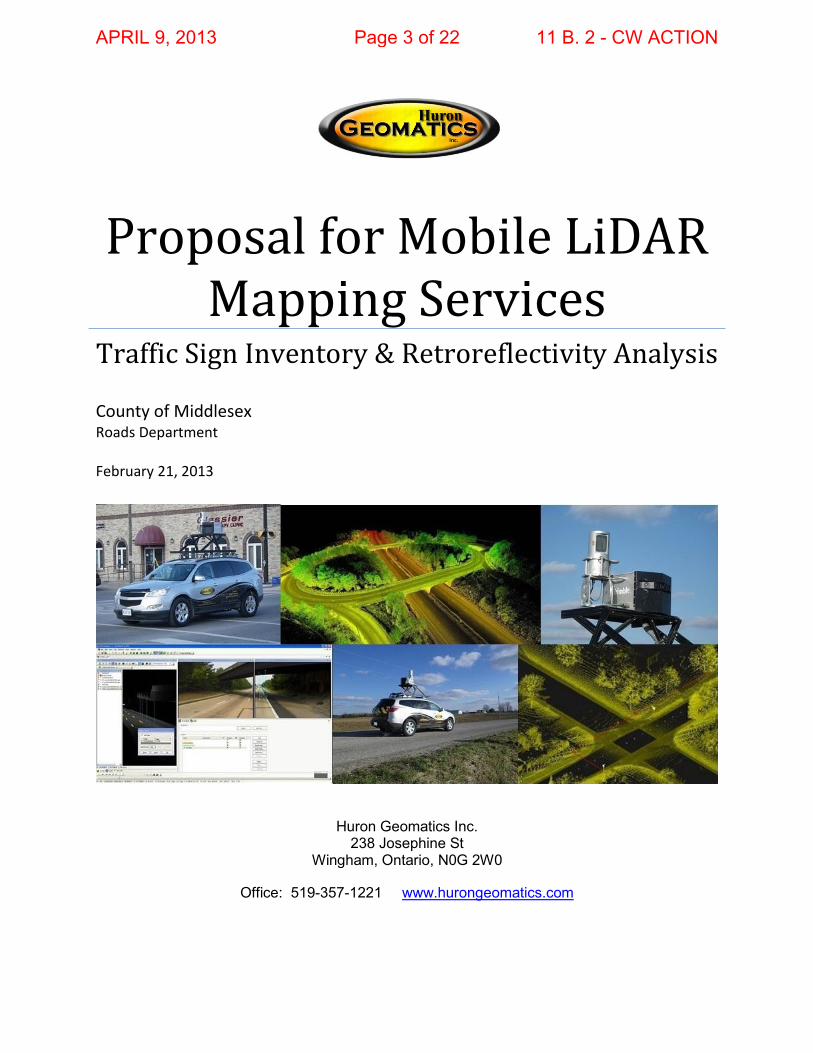
Proposal for Mobile LiDAR Mapping Services
Traffic Sign Inventory & Retroreflectivity Analysis
County of Middlesex Roads Department February 21, 2013
Huron Geomatics Inc. 238 Josephine St
Wingham, Ontario, N0G 2W0
Office: 519-357-1221 www.hurongeomatics.com
APRIL 9, 2013 Page 3 of 22 11 B. 2 - CW ACTION

Proposal for Mobile LiDAR Mapping Services Philip Beckman County of Middlesex Sales Manager Quote #: COM022513A 416-843-7012 February 21, 2013 [email protected]
County of Middlesex Chris Traini, P.Eng County Engineer 399 Ridout St North London, ON N6A 2P1 February 21, 2013 Dear Chris, Thank for you allowing Huron Geomatics Inc. (HGI) the opportunity to submit a proposal to the County of Middlesex for a traffic sign inventory / retroreflectivity analysis. Utilizing our state-of-the-art mobile LiDAR collection vehicle and software technology, HGI will be able to scan the Middlesex road and right of way network, and deliver the final data products in less than 4 weeks. The use of progressive mobile LiDAR technology for the County’s project would produce a deliverable in record time, will exceed requirements, eliminates risk to County employees, and is more cost effective than traditional methods (e.g. visual method, handheld retroreflectometers). An additional boost to the Return on Investment (ROI) for the County of Middlesex would be realized through the added value found in the enriched LiDAR and image data set, which HGI is supplying at no additional charge. These benefits include a robust 3D “point cloud” data set that can be used by multiple departments (e.g. Engineering, Planning, Forestry), the high definition Right of Way video-log that will facilitate “virtual” navigation and inspections of the road and right of way network, and the ability to extract additional infrastructure data in the future without incurring further collection costs. We look forward to ongoing discussions regarding this project. Please review the attached proposal and let me know if you have any questions or concerns. Thank you. Best Regards,
Philip Beckman Sales and Business Development Manager Huron Geomatics Inc.
APRIL 9, 2013 Page 4 of 22 11 B. 2 - CW ACTION

Proposal for Mobile LiDAR Mapping Services Philip Beckman County of Middlesex Sales Manager Quote #: COM022513A 416-843-7012 February 21, 2013 [email protected]
STATEMENT OF QUALIFCATIONS The County of Middlesex is seeking an infrastructure data collection service utilizing mobile LiDAR technology. The primary project deliverable would consist of an inventory (specified GIS attributes, GPS coordinates, and retroreflectivity readings) of all warning and regulatory traffic signs within the County (approximately 857 centreline kilometres). Huron Geomatics Inc. understands the County’s requirements and our aim is to deliver the highest traffic sign data within the timeframes required. This will allow Middlesex to effectively manage roadway traffic sign assets and meet or exceed provincially regulated Minimum Maintenance Standards (MMS). As a Canadian leader in in this field, our exclusive focus is mobile LiDAR mapping and related services. Our proven project management workflows, quality control measures, and advanced technology allows us to deliver the most consistent and accurate data sets to our clients that fully comply with industry standards. The client’s project would be managed by Douglas Culbert. Supporting Mr. Culbert is a cross-functional team of LiDAR, GIS, and CAD experts dedicated to fulfilling requirements and the overall success of this project. We would welcome the opportunity to apply our experience and knowledge towards the County of Middlesex’s data collection. Huron Geomatics has the capability to deliver the project on time and to the required precision, completeness and industry standards required.
APRIL 9, 2013 Page 5 of 22 11 B. 2 - CW ACTION
Proposal for Mobile LiDAR Mapping Services Philip Beckman County of Middlesex Sales Manager Quote #: COM022513A 416-843-7012 February 21, 2013 [email protected]
COMPANY OVERVIEW
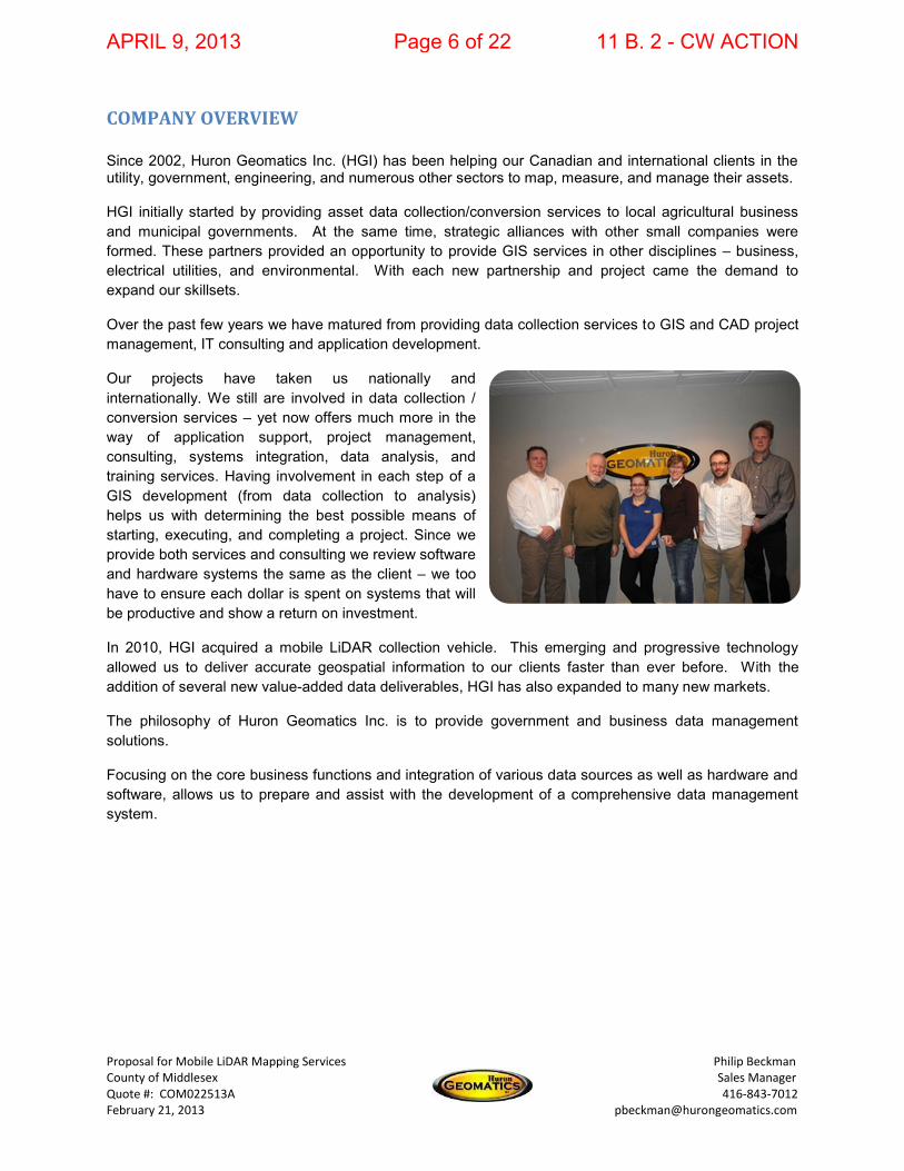
Since 2002, Huron Geomatics Inc. (HGI) has been helping our Canadian and international clients in the utility, government, engineering, and numerous other sectors to map, measure, and manage their assets. HGI initially started by providing asset data collection/conversion services to local agricultural business and municipal governments. At the same time, strategic alliances with other small companies were formed. These partners provided an opportunity to provide GIS services in other disciplines – business, electrical utilities, and environmental. With each new partnership and project came the demand to expand our skillsets.
Over the past few years we have matured from providing data collection services to GIS and CAD project management, IT consulting and application development.
Our projects have taken us nationally and internationally. We still are involved in data collection / conversion services – yet now offers much more in the way of application support, project management, consulting, systems integration, data analysis, and training services. Having involvement in each step of a GIS development (from data collection to analysis) helps us with determining the best possible means of starting, executing, and completing a project. Since we provide both services and consulting we review software and hardware systems the same as the client – we too have to ensure each dollar is spent on systems that will be productive and show a return on investment.
In 2010, HGI acquired a mobile LiDAR collection vehicle. This emerging and progressive technology allowed us to deliver accurate geospatial information to our clients faster than ever before. With the addition of several new value-added data deliverables, HGI has also expanded to many new markets.
The philosophy of Huron Geomatics Inc. is to provide government and business data management solutions.
Focusing on the core business functions and integration of various data sources as well as hardware and software, allows us to prepare and assist with the development of a comprehensive data management system.
APRIL 9, 2013 Page 6 of 22 11 B. 2 - CW ACTION
Proposal for Mobile LiDAR Mapping Services Philip Beckman County of Middlesex Sales Manager Quote #: COM022513A 416-843-7012 February 21, 2013 [email protected]
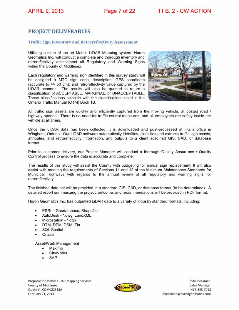
PROJECT DELIVERABLES
Traffic Sign Inventory and Retroreflectivity Assessment
Utilizing a state of the art Mobile LiDAR Mapping system, Huron Geomatics Inc. will conduct a complete and thorough inventory and retroreflectivity assessment all Regulatory and Warning Signs within the County of Middlesex. Each regulatory and warning sign identified in this survey study will be assigned a MTO sign code, description, GPS coordinate (accurate to +/- 50 cm), and retroreflectivity value captured by the LiDAR scanner. The results will also be queried to return a classification of ACCEPTABLE, MARGINAL, or UNACCEPTABLE. These classifications coincide with the classifications used in the Ontario Traffic Manual (OTM) Book 1B. All traffic sign assets are quickly and efficiently captured from the moving vehicle, at posted road / highway speeds. There is no need for traffic control measures, and all employees are safely inside the vehicle at all times. Once the LiDAR data has been collected, it is downloaded and post-processed at HGI’s office in Wingham, Ontario. Our LiDAR software automatically identifies, classifies and extracts traffic sign assets, attributes, and retroreflectivity information, and outputs to a client specified GIS, CAD, or database format. Prior to customer delivery, our Project Manager will conduct a thorough Quality Assurance / Quality Control process to ensure the data is accurate and complete. The results of this study will assist the County with budgeting for annual sign replacement. It will also assist with meeting the requirements of Sections 11 and 12 of the Minimum Maintenance Standards for Municipal Highways with regards to the annual review of all regulatory and warning signs for retroreflectivity. The finished data set will be provided in a standard GIS, CAD, or database format (to be determined). A detailed report summarizing the project, outcome, and recommendations will be provided in PDF format. Huron Geomatics Inc. has outputted LiDAR data to a variety of industry standard formats, including:
ESRI – Geodatabase, Shapefile AutoDesk - *.dwg, LandXML Microstation - *.dgn DTM, DEM, DSM, Tin SQL Spatial Oracle Asset/Work Management
Maximo CityWorks SAP
APRIL 9, 2013 Page 7 of 22 11 B. 2 - CW ACTION
Proposal for Mobile LiDAR Mapping Services Philip Beckman County of Middlesex Sales Manager Quote #: COM022513A 416-843-7012 February 21, 2013 [email protected]
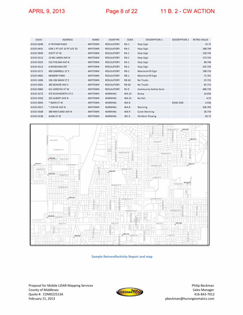
GISID ADDRESS WARD SIGNTYPE CODE DESCRIPTION 1 DESCRIPTION 2 RETRO-VALUE
GISID-0248 6 TATHAM PLACE ANYTOWN REGULATORY RA-1 Stop Sign 25.72
GISID-0431 CON 1 PT LOT 32 PT LOT 33 ANYTOWN REGULATORY RA-1 Stop Sign 268.746
GISID-0049 SCOTT ST W ANYTOWN REGULATORY RA-1 Stop Sign 128.743
GISID-0112 10 MC LAREN AVE N ANYTOWN REGULATORY RA-1 Stop Sign 173.742
GISID-0323 510 THELMA AVE N ANYTOWN REGULATORY RA-1 Stop Sign 98.746
GISID-0113 6 WINDHAM CRT ANYTOWN REGULATORY RA-1 Stop Sign 235.743
GISID-0171 499 CAMPBELL ST E ANYTOWN REGULATORY RB-1 Maximum70 Sign 198.716
GISID-0402 MEMORY PARK ANYTOWN REGULATORY RB-1 Maximum70 Sign 71.701
GISID-1696 326-336 MAIN ST E ANYTOWN REGULATORY RB-62 No Trucks 25.722
GISID-0301 385 BEAVER AVE S ANYTOWN REGULATORY RB-62 No Trucks 65.715
GISID-0082 411 CARDISH ST W ANYTOWN REGULATORY RC-9 Community Safety Zone 368.729
GISID-0173 475 RUSHWORTH ST E ANYTOWN WARNING WA-22 Bump 16.659
GISID-0103 325 ALBERT AVE N ANYTOWN WARNING WA-31 No Exi t 4.53
GISID-0045 * MAIN ST W ANYTOWN WARNING WA-8 DEAD END 4.536
GISID-0317 * LOUISE AVE N ANYTOWN WARNING WA-8 Warning 106.705
GISID-0338 380 MAITLAND AVE N ANYTOWN WARNING WA-9 Curve Warning 36.719
GISID-0138 ALMA ST W ANYTOWN WARNING WC-3 Chi ldern Playing 62.72
Sample Retroreflectivity Report and map
APRIL 9, 2013 Page 8 of 22 11 B. 2 - CW ACTION

Proposal for Mobile LiDAR Mapping Services Philip Beckman County of Middlesex Sales Manager Quote #: COM022513A 416-843-7012 February 21, 2013 [email protected]
LiDAR Data
The resulting LiDAR 3D “point cloud” data set from the vertical scans of the Right of Way will be provided to County of Middlesex as a separate NO CHARGE deliverable. With a collection rate of up to 600,000 points per minute, and 15mm relative accuracy, this dense point cloud can be imported into a variety of GIS, CAD, and 3D visualization tools that support LAS 1.0, 1.2, or CSV formats. Possible applications at the County include: Planning: Measurements, Land use / zoning, visibility analysis Design: Topographic mapping, 3D design alternatives, clash detection Construction: Pre-construction surveys, As-built documentation, quality control Asset Management: Modeling and Inspection
Sample Highway and Urban LiDAR Point Clouds (vertical and horizontal scans)
APRIL 9, 2013 Page 9 of 22 11 B. 2 - CW ACTION

Proposal for Mobile LiDAR Mapping Services Philip Beckman County of Middlesex Sales Manager Quote #: COM022513A 416-843-7012 February 21, 2013 [email protected]
High Definition Right of Way Video-Log
Huron Geomatics will collect right-of-way images at 10 foot intervals using three CCD HD resolution (2448 x 2048) cameras. Our camera configuration offers up to a 170 degree field of view horizontally. Collected concurrently with the LiDAR data, the HD street-level images can be delivered as frame-by-frame still photos, or processed into a streaming video (AVI). Additional information, such as an exact GPS coordinate, can optionally be watermarked on the images (utilizing GPS system described below). This deliverable will allow users at the County of Middlesex to “virtually” drive the entire road network from the desktop, reducing the expense of sending personnel to the field for onsite inspections. Having this photographic record (time, date, location stamped) of pre-existing road and right of way conditions can reduce liability for the organization (e.g. preventing false property damage claims) and potentially lower insurance premiums.
Viewing Software One licenses of Trimble Trident-3D Analyst Viewer software will be provided along with the data deliverables. This desktop application is used in the office to analyze and interpret georeferenced imagery and laser scanner data captured during field data capture operations. Features and capabilities include viewing of sequential street view images in video mode, zooming on visible features, and viewing, navigating, and measuring in 3D from the LiDAR point cloud. With its industry-leading automation functions, Trimble Trident-3D Analyst accelerates your projects and empowers infrastructure managers to make informed decisions using a model of their infrastructure
Sample HD Right of Way Image
APRIL 9, 2013 Page 10 of 22 11 B. 2 - CW ACTION

Proposal for Mobile LiDAR Mapping Services Philip Beckman County of Middlesex Sales Manager Quote #: COM022513A 416-843-7012 February 21, 2013 [email protected]
OPTIONAL DELIVERABLES The County of Middlesex has the option of purchasing the following data deliverables in the future. The information is mined from the original LiDAR and ROW image data set, so there are no additional collection costs.
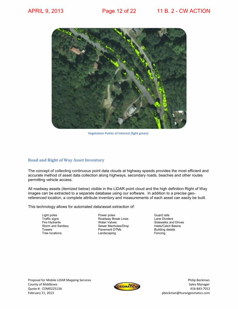
Vegetation Encroachment Analysis As LiDAR data is being processed, custom software algorithms automatically identify and extract Vegetation Points of Interest (VPOI) from the LiDAR 3D point cloud. This identifies geographic areas where trees and branches are encroaching over roadways, under street lighting, and into power lines. The information will be delivered in a GIS format (e.g. Shapefile), with VPOI being represented by polygon features.
With this data, County staff can immediately be deployed to the correct location, with the proper equipment resources, to remedy the situation through prescribed trimming and cutting. Middlesex would now have valid and current information they need to:
Cost effectively manage vegetation growth in their municipality Properly allocate maintenance equipment (e.g. ground trimmer versus bucket truck) Significantly reduce occurrences of injury due to vegetation issues Reduce liability Improve community safety
Sample LiDAR point cloud with tree encroachment
APRIL 9, 2013 Page 11 of 22 11 B. 2 - CW ACTION
Proposal for Mobile LiDAR Mapping Services Philip Beckman County of Middlesex Sales Manager Quote #: COM022513A 416-843-7012 February 21, 2013 [email protected]
Road and Right of Way Asset Inventory
The concept of collecting continuous point data clouds at highway speeds provides the most efficient and accurate method of asset data collection along highways, secondary roads, beaches and other routes permitting vehicle access. All roadway assets (itemized below) visible in the LiDAR point cloud and the high definition Right of Way images can be extracted to a separate database using our software. In addition to a precise geo-referenced location, a complete attribute inventory and measurements of each asset can easily be built. This technology allows for automated data/asset extraction of:
Light poles Power poles Guard rails Traffic signs Roadway Break Lines Lane Dividers
Fire Hydrants Water Valves Sidewalks and Drives Storm and Sanitary Sewer Manholes/Drop Inlets/Catch Basins Towers Pavement DTMs Building details Tree locations Landscaping Fencing
Vegetation Points of Interest (light green)
APRIL 9, 2013 Page 12 of 22 11 B. 2 - CW ACTION

Proposal for Mobile LiDAR Mapping Services Philip Beckman County of Middlesex Sales Manager Quote #: COM022513A 416-843-7012 February 21, 2013 [email protected]
EQUIPMENT RESOURCES
Huron Geomatics Inc. utilizes integrated laser scanning, mobile mapping, and photogrammetry that provides an end-to-end solution that effectively tackle real-world challenges faced by organizations, and infrastructure managers. Our service streamlines the capture and maintenance of high-accuracy as-built models for government, land mobile mapping, transportation, and utilities and energy transmission & distribution industries. These high-accuracy as-built models enable advanced process and workflow integration from the planning phase, through design and construction, to the subsequent maintenance phase—delivering significant improvements in productivity.
Mobile LiDAR Collection Vehicle
APRIL 9, 2013 Page 13 of 22 11 B. 2 - CW ACTION
Proposal for Mobile LiDAR Mapping Services Philip Beckman County of Middlesex Sales Manager Quote #: COM022513A 416-843-7012 February 21, 2013 [email protected]
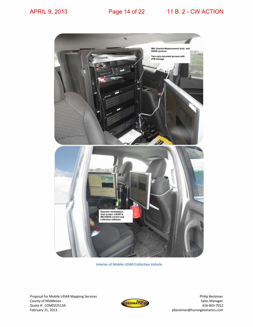
Interior of Mobile LiDAR Collection Vehicle
APRIL 9, 2013 Page 14 of 22 11 B. 2 - CW ACTION

Proposal for Mobile LiDAR Mapping Services Philip Beckman County of Middlesex Sales Manager Quote #: COM022513A 416-843-7012 February 21, 2013 [email protected]
Riegl LMS-Q120D LiDAR Scanner The LMS-Q120D mobile laser scanner is ideal for asset management applications. Field of view: 80 deg Data rate: 10,000 meas./second Max. operating range: 150 m Accuracy: 25 mm Precision: 15 mm Laser product classification: Class 1 (eye safe) HD Camera Array The Grasshopper cameras are color, digital (CCD) cameras that offer up to 2448x2048 pixel resolution (5 megapixels). Remote-source triggering capabilities allow image capture at user-definable time or distance based intervals. The lenses are calibrated to eliminate the imperfections of the lens curvature, crucial to measurement accuracy. Our vehicle is equipped with three forward-facing cameras (straight, left, right) mounted in a 170 degree viewing array. It is a high-definition imaging system to provide a detailed visual record of the route and right of way infrastructure. Position and Orientation System for Land Vehicles (POS LV) The mobile LiDAR mapping vehicle is equipped with a Trimble / Applanix POS LV 220 system. POS LV is a compact, fully integrated, turnkey position and orientation system, utilizing integrated inertial technology to generate stable, reliable and repeatable positioning solutions for land-based vehicle applications. Designed to operate under the most difficult GPS conditions found in urban and suburban environments, POS LV enables accurate positioning for mobile LiDAR mapping, road geometry, GIS database and asset management, road surveying, and vehicle dynamics The POS LV is a combination of Inertial Measurement Unit (IMU) with high accuracy GPS receiver and Distance Measuring Instrument (DMI). 1) IMU
This tactical grade sensor generates a true representation of vehicle motion in all three axes (acceleration, pitch, roll and yaw), producing continuous, accurate position and orientation information. Raw GPS data from as few as one satellite to be processed directly into the system, to compute accurate positional information in areas of intermittent, or no GPS reception
APRIL 9, 2013 Page 15 of 22 11 B. 2 - CW ACTION
Proposal for Mobile LiDAR Mapping Services Philip Beckman County of Middlesex Sales Manager Quote #: COM022513A 416-843-7012 February 21, 2013 [email protected]
2) GPS Receiver & Antenna
A Differentially corrected, 12-channel GPS receiver will be utilized to record accurate GPS coordinates (XYZ) for each LiDAR point, and supplements the inertial data.
After applying differential corrections from a local GPS base station or Virtual Reference Station (VRS) Network, we typically achieve accuracies of +/- 50 cm.
If survey grade monumentation is available in the LiDAR project collection area, the point cloud can be registered to the control points, and accuracy can typically be improved to +/- 10 cm.
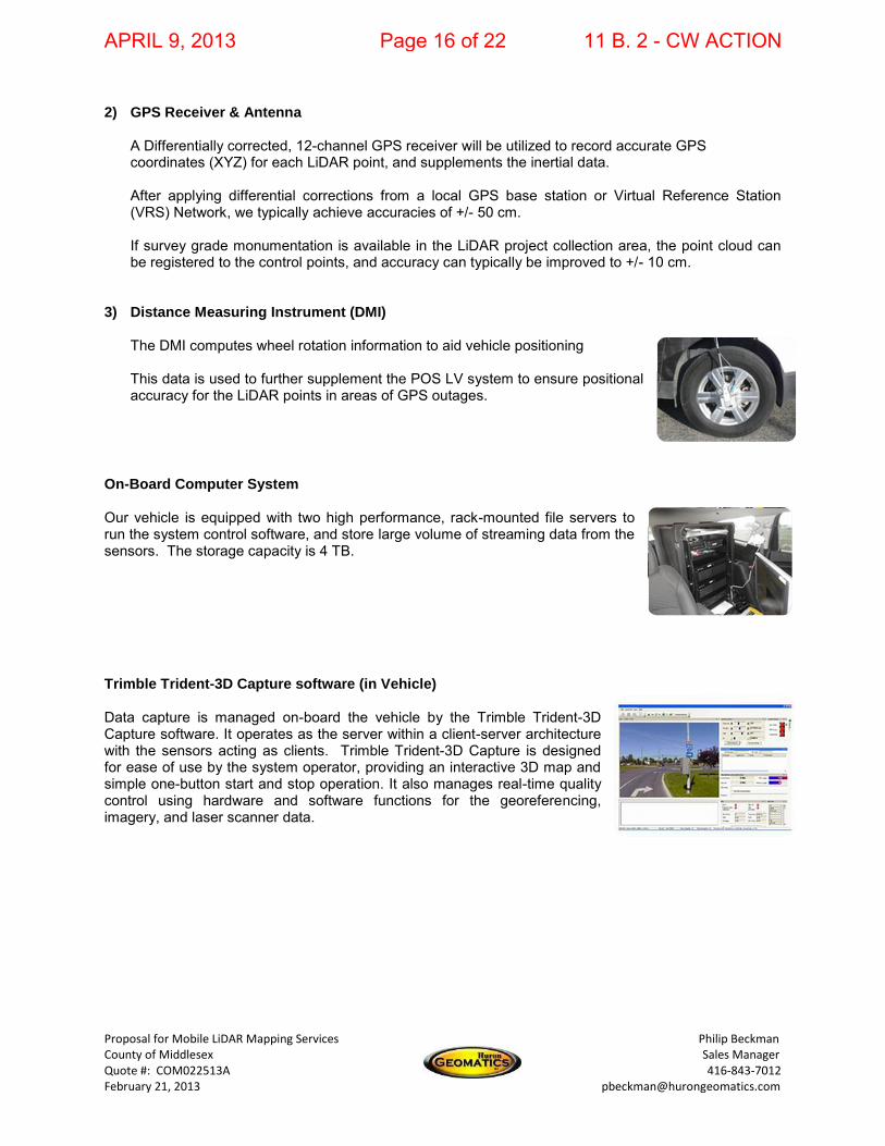
3) Distance Measuring Instrument (DMI)
The DMI computes wheel rotation information to aid vehicle positioning This data is used to further supplement the POS LV system to ensure positional accuracy for the LiDAR points in areas of GPS outages.
On-Board Computer System Our vehicle is equipped with two high performance, rack-mounted file servers to run the system control software, and store large volume of streaming data from the sensors. The storage capacity is 4 TB. Trimble Trident-3D Capture software (in Vehicle) Data capture is managed on-board the vehicle by the Trimble Trident-3D Capture software. It operates as the server within a client-server architecture with the sensors acting as clients. Trimble Trident-3D Capture is designed for ease of use by the system operator, providing an interactive 3D map and simple one-button start and stop operation. It also manages real-time quality control using hardware and software functions for the georeferencing, imagery, and laser scanner data.
APRIL 9, 2013 Page 16 of 22 11 B. 2 - CW ACTION

Proposal for Mobile LiDAR Mapping Services Philip Beckman County of Middlesex Sales Manager Quote #: COM022513A 416-843-7012 February 21, 2013 [email protected]
Trimble Trident-3D Analyst software (in Office) Trimble Trident-3D Analyst software is used in the office to analyze and interpret georeferenced imagery and laser scanner data captured during field data capture operations. It includes a user interface with very robust object positioning, measurement, and data layer creation capabilities. Automation functions increase your productivity and reduce turnaround time. The numerous features and capabilities include: positioning; measuring in 3D; zooming on, adding, editing or deleting visible features using any views from multiple image streams; linear referencing; offset measurement and chainage; data handling flexibility enabled through open data format architecture; ODBC connectivity; automatic data export to most GIS; import and/or customizable data layer representation; data model definition and definable data entry forms; and multiple map projections; and pavement defect rating facilitated by perspective digital imaging capabilities, pavement image rectification and mosaicing. Application specific toolkits can be added to provide additional functions for asset and pavement management, road design, maintenance, and rehabilitation as well as electric distribution asset maintenance. With its industry-leading automation functions, Trimble Trident-3D Analyst accelerates your projects and empowers infrastructure managers to make informed decisions using a model of their infrastructure.
APRIL 9, 2013 Page 17 of 22 11 B. 2 - CW ACTION
Proposal for Mobile LiDAR Mapping Services Philip Beckman County of Middlesex Sales Manager Quote #: COM022513A 416-843-7012 February 21, 2013 [email protected]
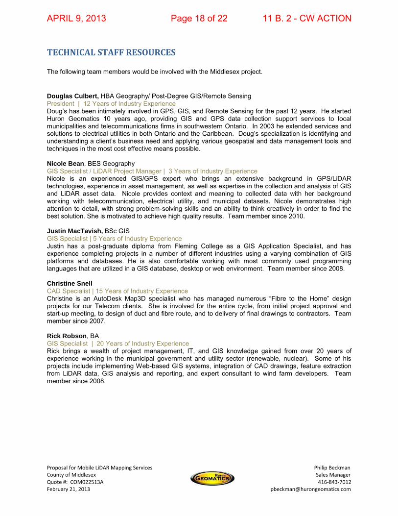
TECHNICAL STAFF RESOURCES The following team members would be involved with the Middlesex project. Douglas Culbert, HBA Geography/ Post-Degree GIS/Remote Sensing President | 12 Years of Industry Experience Doug’s has been intimately involved in GPS, GIS, and Remote Sensing for the past 12 years. He started Huron Geomatics 10 years ago, providing GIS and GPS data collection support services to local municipalities and telecommunications firms in southwestern Ontario. In 2003 he extended services and solutions to electrical utilities in both Ontario and the Caribbean. Doug’s specialization is identifying and understanding a client’s business need and applying various geospatial and data management tools and techniques in the most cost effective means possible. Nicole Bean, BES Geography GIS Specialist / LiDAR Project Manager | 3 Years of Industry Experience Nicole is an experienced GIS/GPS expert who brings an extensive background in GPS/LiDAR technologies, experience in asset management, as well as expertise in the collection and analysis of GIS and LiDAR asset data. Nicole provides context and meaning to collected data with her background working with telecommunication, electrical utility, and municipal datasets. Nicole demonstrates high attention to detail, with strong problem-solving skills and an ability to think creatively in order to find the best solution. She is motivated to achieve high quality results. Team member since 2010. Justin MacTavish, BSc GIS GIS Specialist | 5 Years of Industry Experience Justin has a post-graduate diploma from Fleming College as a GIS Application Specialist, and has experience completing projects in a number of different industries using a varying combination of GIS platforms and databases. He is also comfortable working with most commonly used programming languages that are utilized in a GIS database, desktop or web environment. Team member since 2008. Christine Snell CAD Specialist | 15 Years of Industry Experience Christine is an AutoDesk Map3D specialist who has managed numerous “Fibre to the Home” design projects for our Telecom clients. She is involved for the entire cycle, from initial project approval and start-up meeting, to design of duct and fibre route, and to delivery of final drawings to contractors. Team member since 2007. Rick Robson, BA GIS Specialist | 20 Years of Industry Experience Rick brings a wealth of project management, IT, and GIS knowledge gained from over 20 years of experience working in the municipal government and utility sector (renewable, nuclear). Some of his projects include implementing Web-based GIS systems, integration of CAD drawings, feature extraction from LiDAR data, GIS analysis and reporting, and expert consultant to wind farm developers. Team member since 2008.
APRIL 9, 2013 Page 18 of 22 11 B. 2 - CW ACTION

Proposal for Mobile LiDAR Mapping Services Philip Beckman County of Middlesex Sales Manager Quote #: COM022513A 416-843-7012 February 21, 2013 [email protected]
ADDITIONAL SERVICES
FIELD DATA COLLECTION GPS Field data collection Asset Inventories
o Condition Assessments o Inspections
GIS and CAD CONSULTING Vendor Experience:
o ESRI o Autodesk o Bentley o Intergraph o Manifold o Trimble
GIS Data Modeling System Integration and Data Automation Drafting 3D Modeling Data Conversions and Migrations
o GIS <-> CAD o GIS <-> Engineering / Modeling Software Solutions
Asset Inventories / Condition Assessments o Asset Valuations / Appraisals / Risk Assessments
Disaster Preparation and Recovery Support Custom Software Application Development GIS Services (In-house or on-site technical personnel) Training / Technical Support
o GPS Equipment o GIS Software o Data Management Solutions
BUSINESS PROCESS DOCUMENTATION Asset and Risk Management Plans Data and Work Flow modeling and documentation System Integration Process Modeling
APRIL 9, 2013 Page 19 of 22 11 B. 2 - CW ACTION

Proposal for Mobile LiDAR Mapping Services Philip Beckman County of Middlesex Sales Manager Quote #: COM022513A 416-843-7012 February 21, 2013 [email protected]
SCHEDULE OF EVENTS
1. Mission Planning Configure vehicle parameters Determine essential parameters - Target area to be scanned, point density, a defined
measurement accuracy Define path of vehicle, speed, and laser scanner’s configuration to meet the needs of the client Establish GNSS base station requirements (own, or private / public network) System calibration Validation of calibration
2. Survey
Checklist On board system test Pre-mission IMU/GNSS alignment Ground targets, checkpoints, and planar surfaces confirmed by survey firm Calibration runs to enhance IMU/GPS accuracy Avoid being under bridge for too long Survey target area Pre-mission IMU/GPS alignment
3. Data Post Processing
Prepare IMU/GNSS – raw data Prepare Scanner and Camera raw data Georeferencing scan and image data Visualizing scan data Quality control
4. Data Delivery
WGS84 referenced point cloud GIS, CAD, DTM, DEM, DSM, Database, Tin
APRIL 9, 2013 Page 20 of 22 11 B. 2 - CW ACTION
Proposal for Mobile LiDAR Mapping Services Philip Beckman County of Middlesex Sales Manager Quote #: COM022513A 416-843-7012 February 21, 2013 [email protected]
PROJECT SCHEDULE Once given a notice to proceed by the County, it is anticipated that this project would take less than 4 weeks (weather permitting) to complete, from initial collection to final delivery of data.
DATA DELIVERY All data deliverables associated with this project (data files, LiDAR data, ROW Videolog) will be provided to the County of Middlesex on an external USB hard drive. Trimble Trident Analyst 3D Viewer software will be provided on DVD media or via download from Huron Geomatics FTP site. Our comprehensive QA/QC procedures for all aspects of the project (e.g. sensor calibration on mobile LiDAR data collection vehicle, registering point cloud to survey control monuments, and exporting of data to final GIS / CAD / Database formats), will ensure that data set is complete and accurate, and will meet or exceed the County’s standards for acceptance
APRIL 9, 2013 Page 21 of 22 11 B. 2 - CW ACTION
Proposal for Mobile LiDAR Mapping Services Philip Beckman County of Middlesex Sales Manager Quote #: COM022513A 416-843-7012 February 21, 2013 [email protected]
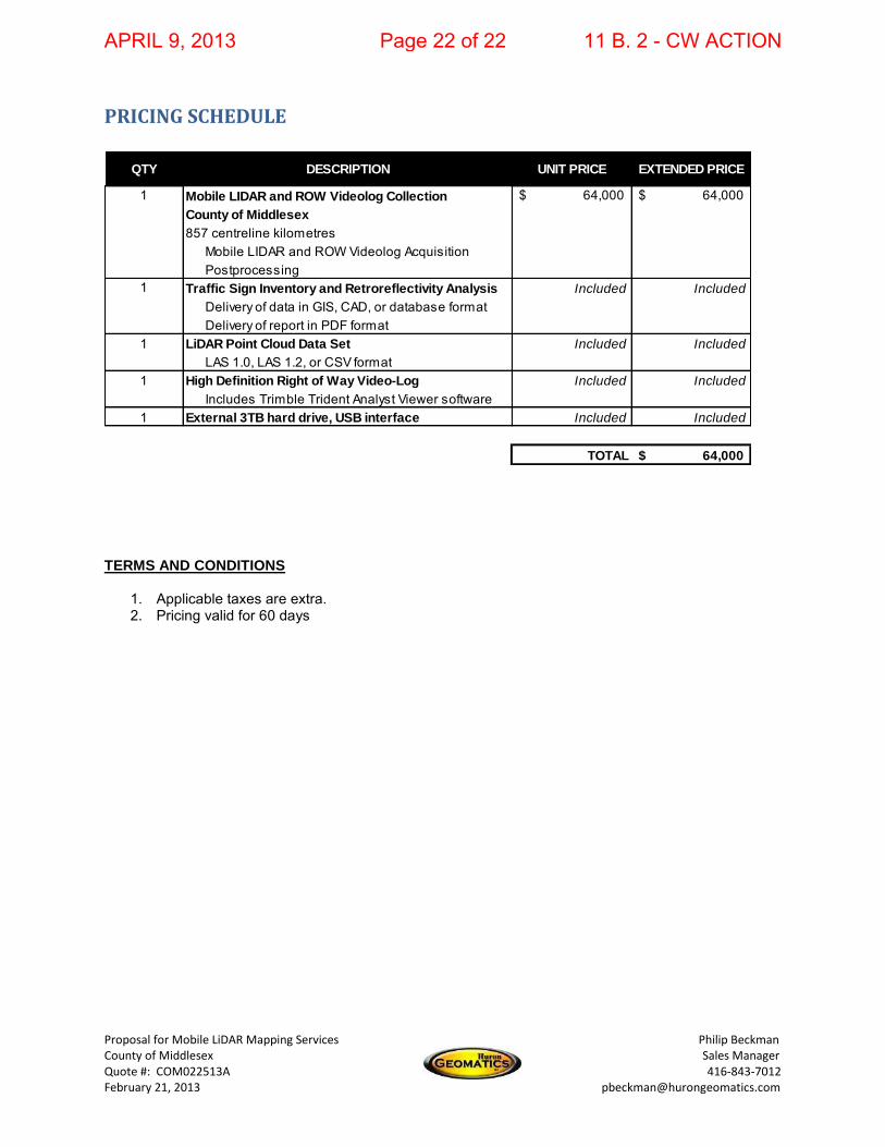
PRICING SCHEDULE
TERMS AND CONDITIONS
1. Applicable taxes are extra. 2. Pricing valid for 60 days
QTY DESCRIPTION UNIT PRICE EXTENDED PRICE
1 Mobile LIDAR and ROW Videolog Collection 64,000$ 64,000$ County of Middlesex
857 centreline kilometresMobile LIDAR and ROW Videolog AcquisitionPostprocessing
1 Traffic Sign Inventory and Retroreflectivity Analysis Included Included
Delivery of data in GIS, CAD, or database formatDelivery of report in PDF format
1 LiDAR Point Cloud Data Set Included Included
LAS 1.0, LAS 1.2, or CSV format1 High Definition Right of Way Video-Log Included Included
Includes Trimble Trident Analyst Viewer software1 External 3TB hard drive, USB interface Included Included
TOTAL 64,000$
APRIL 9, 2013 Page 22 of 22 11 B. 2 - CW ACTION