summary report on the 18 “major” …osiskogr.com/app/uploads/2015/02/2007-ams-report-eng.pdf ·...
TRANSCRIPT
SUMMARY REPORT ON THE 18 “MAJOR” ABANDONED MINERAL EXPLORATION SITES IN NUNAVIK
Update on the Information contained in the Assessment and Prioritization of Abandoned Mining Exploration Sites in Nunavik: Final
Report on a Two-Year Project (2001–2002)
and
Report on the Clean-up Activities Carried Out in the Summer of 2007
Kativik Regional Government
Renewable Resources, Environmental and Land Use Planning Department
October 2007
2
PROJECT LEADERS AND MEMBERS
Kativik Regional Government Michael Barrett, Assistant Director Renewable Resources, Environmental and Land Use Planning Department [email protected] Anne-Marie LeBlanc, Project Co-ordinator Renewable Resources, Environmental and Land Use Planning Department [email protected] David Barrett, Environmental Technician Renewable Resources, Environmental and Land Use Planning Department [email protected] P.O. Box 9 Kuujjuaq QC J0M 1C0 Tel.: 819-964-2961 Fax: 819-964-0694
Partners Fonds Restor-Action Nunavik Ministère des Ressources naturelles et de la Faune Makivik Corporation
Naskapi Nation of Kawawachikamach (Workers) Barnaby Gabriel Bill Einish Christina Mokoush Gregory Tooma Louis Einish
Innu Nation of Matimekush Lac-John (Workers) Daniel Bastien Éric Jourdain Northern Village of Tasiujaq (Workers) Charlie Nayome Maggie Kritik Sandy Kritik Tamisa Mosesiapik
Northern Village of Aupaluk (Workers) Arthur Angma Onningnak Bobby Angutinguak Charlie Akpahatak Dominik Iggyook Lisa Angutinguak
Northern Village of Kangiqsujuaq (Workers) Pitsualaq Uqittuq Willie Qamugaaluk
3
ACKNOWLEDGEMENTS
The Kativik Regional Government (KRG) would like to formally acknowledge the Naskapi Nation of Kawawachikamach and the Innu Nation of Matimekush Lac-John for their participation in the third phase of clean-up work at the site KAW-35. A thank you should also be extended to NORPAQ Adventures and Services Naskapi Adoschaouna; without their support and co-operation, the rehabilitation of the site KAW-35 would not have been possible. The communities of Tasiujaq and Aupaluk should be recognized for their participation in the second phase of clean-up work at the site PJ-1. Special thanks go to Georges Gagnon of the Makivik Corporation’s construction division for his advice concerning the heavy equipment located at the site PJ-1. The KRG would like to acknowledge the community of Kangiqsujuaq for its participation in the first phase of clean-up at the site SW-34. The exploration division of Xstrata Nickel, including Guy Desharnais and Bryan Mckenzie, and the environmental division at the Raglan Mine should also be thanked for their contributions; without their logistical support and advice, the rehabilitation of the site SW-34 would not have been possible. The crew and volunteers of Cruise North Expeditions, and specifically its president Dugald Wells, should be acknowledged for the successful completion of the third phase of rehabilitation work at the site PJ-17. The KRG also thanks Martin Duclos and Raynald Gagnon from the Ministère du Développement durable, de l’Environnement et des Parcs (sustainable development, environment and parks) for their inspections of sites KAW-35, KAW-45, PJ-1 and PJ-17. Mining companies currently active in Nunavik should furthermore be recognized for their initiatives to clean up abandoned mineral exploration sites located on their properties. And finally, the clean-up of abandoned mineral exploration sites in 2007 was made possible with the support of Nunavik Rotors and Canadian Helicopters.
4
TABLE OF CONTENTS
1 INTRODUCTION ....................................................................................................... 7 2 CONTRIBUTION AGREEMENT ................................................................................ 8 3 UPDATED DESCRIPTION OF SITES NOT YET REHABILITATED .......................... 8
3.1 Labrador Trough ............................................................................................... 8 3.1.1 Kawawachikamach Sector ................................................................. 8 3.1.2 Tasiujaq Sector ................................................................................ 11 3.1.3 Aupaluk Sector ................................................................................. 12 3.1.4 Kangirsuk Sector .............................................................................. 12
3.2 Ungava Trough – Hudson Bay ........................................................................ 13 3.2.1 Kangiqsujuaq Sector ........................................................................ 13 3.2.2 Salluit Sector .................................................................................... 14 3.2.3 Umiujaq Sector ................................................................................. 16
4 DESCRIPTION OF CURRENT CLEAN-UP WORK ................................................. 16 4.1 Labrador Trough ............................................................................................. 17
4.1.1 Kawawachikamach Sector ............................................................... 17 4.1.2 Tasiujaq Sector ................................................................................ 18 4.1.3 Aupaluk Sector ................................................................................. 20
4.2 Ungava Trough – Hudson Bay ........................................................................ 22 4.2.1 Salluit Sector .................................................................................... 22
5 CONCLUSIONS ...................................................................................................... 23 6 REFERENCES ........................................................................................................ 23
LIST OF FIGURES
Maps of abandoned mineral exploration sites
Figures 1 to 5……………………………………………………………...
25
Sites not yet rehabilitated
KAW-45 TQ-1 TQ-4 PJ-10 TW K-28 K-61 WB-3 KV-1 SAL-1 SW-27 SW-42 WB-9
Figures 6 to 10……………………………………………………………. Figures 11 to 20…………………...……………………………………… Figures 21 to 26……………………………………...…………………… Figures 27 to 33…………………………………………………………... Figures 33 to 41…………………………………………………………... Figures 42 to 48…………………………………………………………... Figures 49 to 57…………………………………………………………... Figures 58 to 60…………………………………………………………... Figures 61 to 66…………………………………………………………... Figures 67 to 73…………………………………………………………... Figures 74 to 79…………………………………………………………... Figures 80 to 84…………………………………………………………... Figures 85 to 100………………………………………………………….
30 32 37 41 45 49 53 57 59 62 65 68 71
Sites in the process of being rehabilitated
KAW-35 PJ-1 PJ-17 SW-34
Figures 101 to 113…………………………..…………………………… Figures 114 to 126…………………………………………..…………… Figures 127 to 136……………………………………………………….. Figures 137 to 150………………………………………………………..
80 86 93 98
5
ABSTRACT
The Assessment and Prioritization of Abandoned Mining Exploration Sites in Nunavik: Final Report on a Two-Year Project (2001–2002) produced by the Kativik Regional Government (KRG) and the Makivik Corporation in March 2003 identified 18 “major” mineral exploration sites. Through the summer of 2007, 13 of these sites were re-inspected in order to update the information on the sites. One site was not re-inspected (WHA-1) and clean-up work was carried out at the four remaining sites. Among the 13 sites inspected, nine remained unchanged or very similar to the descriptions contained in the 2001–2002 inventory (KAW-45, TQ-4, PJ-10, TW, WB-3, KV-1, SAL-1, SW-27 and SW-42), one site has been transformed into an outfitting camp (TQ-1), two sites are in the process of being cleaned by Canadian Royalties (K-28 and K-61) and, at a final site, no inventory was prepared in 2001–2002 (WB-9). Although rehabilitation actions have been taken at the sites TQ-1, K-28 and K-61, further clean-up work is necessary involving soil decontamination and the transportation of empty barrels. As well, at the site TQ-1, there remain a large number of barrels containing diesel. These barrels were not identified in the 2001–2002 inventory, but will be included in clean-up work at the site. Among the four sites where clean-up work was carried out in 2007, work had already been carried out at three of the sites during earlier pilot projects. Following three summers of fieldwork at the site KAW-35, 87% of the 935 barrels and almost all the hazardous material and metal identified at the site have been transported to appropriate treatment and recycling centres. It was not however mentioned in the 2001–2002 inventory that acid mine drainage is present at the site. Following two summers of fieldwork at the site PJ-1, all the residue found in the abandoned barrels has been transferred into undamaged barrels. All empty barrels have also been cut up, stacked together (three barrels one inside another) and transported to strategic locations to be picked up by snowmobile and transported to Aupaluk in the winter. Almost all identified hazardous material has been stored temporarily at the site. Following three summers of fieldwork at the site PJ-17, 94% of the 308 barrels, 33% of the 40 propane tanks and 76% of the metal debris have been removed from the site and transported to appropriate treatment and recycling centres. In the summer of 2007, clean-up work was initiated for the first time at the site SW-34. A total of 180 barrels scattered around the site were gathered together and residue was transferred into undamaged barrels. As well, between 150 and 200 other scattered barrels were moved to facilitate future fieldwork and 20 batteries were removed from the site.
6
RÉSUMÉ
Le rapport «Assessment and prioritization of abandonned mining exploration sites in Nunavik / Final report on a two-year project (2001-2002) » produit par l’Administration régionale Kativik et la Société Makivik en mars 2003 a montré qu’il existe 18 sites d’exploration minière abandonnés classifiés « majeurs » présentement connus. Durant l’été 2007, 13 de ces sites ont été visités afin d’obtenir l’information la plus complète jusqu’à ce jour, un site n’a pas pu être visité (WHA-1) et quatre autres sites ont été nettoyés. Parmi les 13 sites visités, neuf sont demeurés conformes ou très similaires à la description établie lors de l’inventaire 2001-2002 (KAW-45, TQ-4, PJ-10, TW, WB-3, KV-1, SAL-1, SW-27, SW-42), un site a été transformé en une pourvoirie (TQ-1), deux sites sont actuellement nettoyés par Canadian Royalties (K-28, K-61) et un dernier site est demeuré similaire mais où l’inventaire n’avait pas été réalisé en 2001-2002 (WB-9). Bien que des actions de réhabilitation aient été entreprises aux sites TQ-1, K-28 et K-61, ces sites nécessitent encore des travaux de nettoyage, notamment en ce qui concerne la contamination des sols et le transport des barils vides. De plus, une quantité importante de barils remplis de diesel se trouve à proximité du site TQ-1. Ces barils ne font pas partie de l’inventaire 2001-2002, mais pourront être pris en considération lors du nettoyage de ce site. Parmi les quatre sites nettoyés à l’été 2007, trois avaient déjà été nettoyés lors de projets pilotes. Après trois campagnes de terrain, 87% des 935 barils et presque toutes les matières dangereuses du site KAW-35 ont été transportés vers des centres de disposition de matières dangereuses et de recyclage des métaux. Non mentionné lors de l’inventaire 2001-2002, le site est affecté par le drainage minier acide. Après deux campagnes de terrain, tous les barils du site PJ-1 ont été transvidés, si nécessaire, dans des barils intacts, découpés, empilés trois barils dans un et placés de façon stratégique pour le transport hivernal en motoneige vers Aupaluk. Presque toutes les matières dangereuses ont été entreposées temporairement au site. Après trois campagnes de terrain, 94% des 308 barils, 33% des 40 bonbonnes de propane et 76% des débris métalliques ont été retirés du site PJ-17 et transportés vers des centres de disposition de matières dangereuses et de recyclage des métaux. À l’été 2007, le site SW-34 en était à sa première campagne de terrain. Au total, 180 barils éparpillés ont été accumulés en un endroit et les résidus ont été transvidés dans des barils intacts. De plus, entre 150 et 200 autres barils éparpillés ont été déplacés afin de faciliter les prochaines campagnes de terrain et 20 batteries ont été retirées du site.
7
1 INTRODUCTION
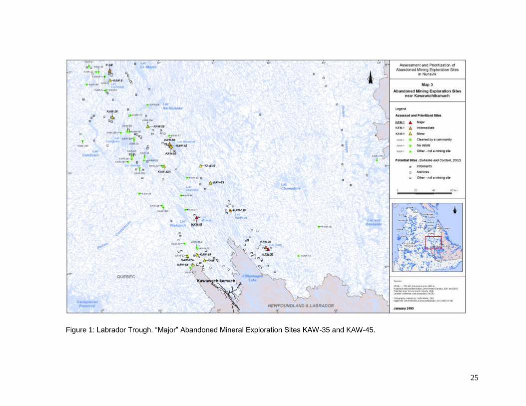
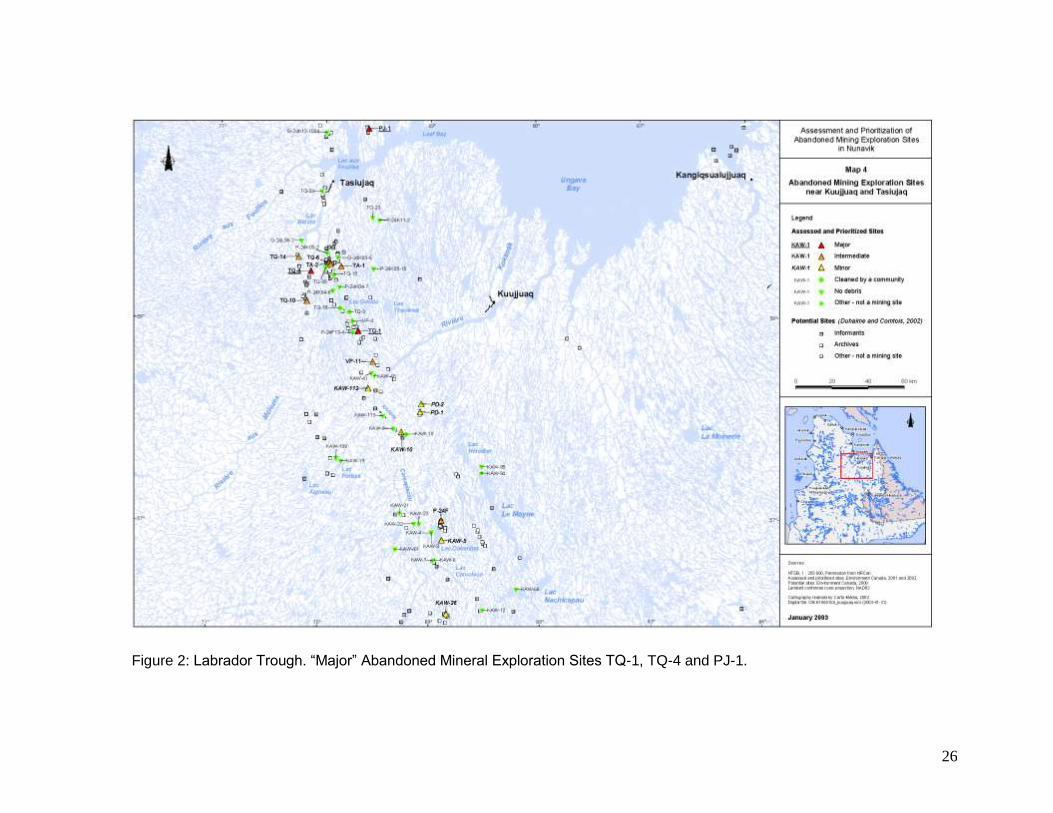
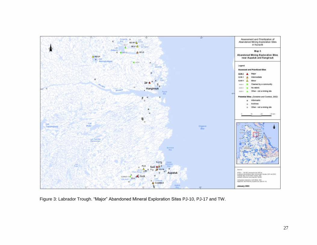
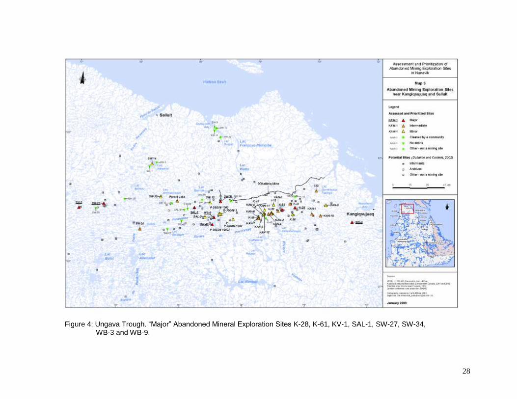
In 2001 and 2002, verification of 193 possible abandoned mineral exploration sites was performed in Nunavik, the territory of Québec north of the 55th parallel. The results of that verification are described in the Assessment and Prioritization of Abandoned Mining Exploration Sites in Nunavik: Final Report on a Two-Year Project (2001–2002) produced by the Kativik Regional Government (KRG) and the Makivik Corporation in March 2003. The final report indicates that, of the 193 possible sites, 90 were confirmed to be abandoned mineral exploration camps. Eighteen of these were classified as requiring major clean-up work, 27 intermediate clean-up work and 45 minor clean-up work. This classification takes into account the quantity of material and equipment present at each site as well as the nature and scope of contaminated soil and surface water. Further to the recommendations derived from the 2001–2002 inventory work and with funding from Environment Canada’s Northern Ecosystem Initiative (NEI) and from the Ministère des Ressources naturelles et de la Faune (natural resources and wildlife, MRNF), in 2005 and 2006 the KRG implemented two rehabilitation pilot projects of “major” abandoned mineral exploration sites, KAW-35 (2005–2006) and PJ-1 (2006). At the same time, Cruise North Expeditions has voluntarily undertaken since 2005 to clean up a third “major” abandoned mineral exploration site, PJ-17. These initiatives represent the initial stage of a proposed Nunavik-wide clean-up project. Specifically in August 2003, the KRG and the Makivik Corporation proposed a funding mechanism and recommendations for the assessment and rehabilitation of abandoned mineral exploration sites (Barrett and Lanari, 2003). The proposal focused in particular on the 18 “major” clean-up sites and promoted a partnership between Northern Québec communities, the mining industry and the different levels of government. In March 2007, the mineral industry took up the challenge and created the Fonds Restor-Action Nunavik (FRAN) to rehabilitate abandoned mineral exploration sites in Nunavik dating as far back as several decades. In October 2007, it is expected that a formal contribution agreement will be signed by the KRG, the Makivik Corporation, the MRNF and the FRAN. The agreement will make it possible to proceed with the clean-up of all the 18 “major” sites using the expertise developed during the above-mentioned pilot projects. This report compiles all the information currently available on the 18 “major” clean-up sites. First, it provides updated descriptions of the sites where clean-up work was not carried out either during the 2007 season or through the KRG pilot projects (KRG, 2006 and 2007). There are 14 such sites: KAW-45 (Figure 1), TQ-1, TQ-4 (Figure 2), PJ-10, TW (Figure 3), K-28, K-61, KV-1, SAL-1, SW-42, SW-27, WB-3, WB-9 (Figure 4) and WHA-1 (Figure 5). The aim of these updated descriptions is to validate the inventories and update the information contained in the Assessment and Prioritization of Abandoned Mining Exploration Sites in Nunavik: Final Report on a Two-Year Project (2001–2002). Secondly, this report describes the clean-up work carried out during the 2007 season and provides an overview of the progress of clean-up work since 2005. The four sites discussed are: KAW-35 (Figure 1), PJ-1 (Figure 2), PJ-17 (Figure 3) and SW-34 (Figure 4).
8
2 CONTRIBUTION AGREEMENT
In October 2007, an agreement concerning the clean-up of abandoned mineral exploration sites in Nunavik will be signed by the KRG, the Makivik Corporation the MRNF and the FRAN. The purpose of the agreement is to ensure the clean-up of 18 “major” sites, before March 31, 2012. The sites are identified in the Assessment and Prioritization of Abandoned Mining Exploration Sites in Nunavik: Final Report on a Two-Year Project (2001–2002) produced by the KRG and the Makivik Corporation in March 2003. The KRG is responsible for the management of the clean-up work at the 18 sites covered under the agreement. Pursuant to the agreement, the estimated cost of the first year of work is $350,000. This cost includes the continuation of clean-up work at Blue Lake (KAW-35), Lake Pio (PJ-1) and Aupaluk (PJ-17), the first phase of clean-up work at Esker Lake (SW-34) and inspections of the 14 other “major” abandoned mineral exploration sites.
3 UPDATED DESCRIPTION OF SITES NOT YET REHABILITATED
This section provides an updated description of the sites where clean-up work was not carried out either during the 2007 season or through the KRG pilot projects. It does not repeat the information contained in the Assessment and Prioritization of Abandoned Mining Exploration Sites in Nunavik: Final Report on a Two-Year Project (2001–2002). Specifically, this section refers to Appendix 9 of the inventory report carried out in 2001 and 2002. Inspections of the 14 sites made it possible to validate the inventories completed in 2001 and 2002 and to make corrections as necessary. To streamline this report, the term “2001–2002 inventory” is used. Each site is described individually with supporting figures, while Table 1 provides a summary of the information about each site.
3.1 Labrador Trough
3.1.1 Kawawachikamach Sector
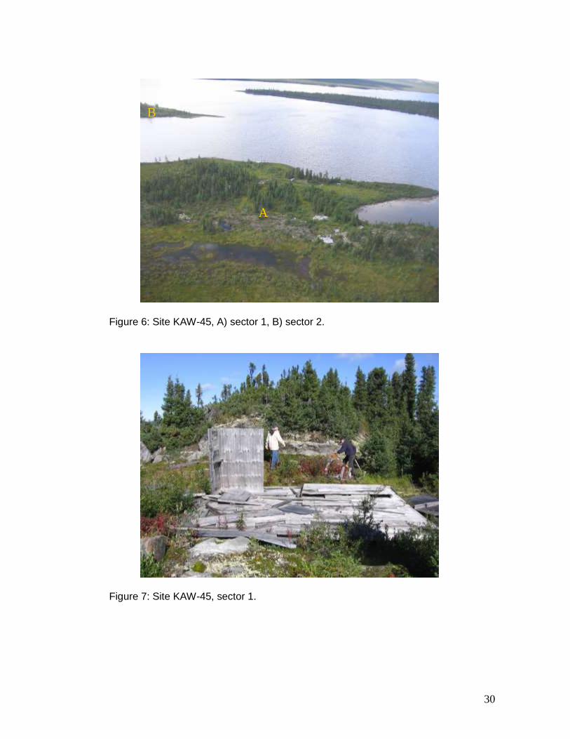
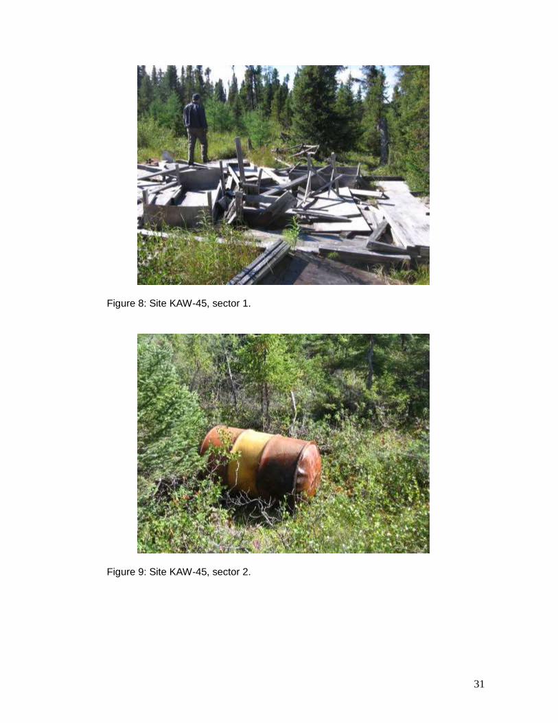
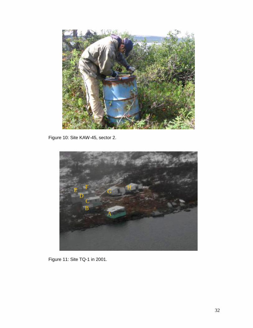
KAW-45 The abandoned mineral exploration site KAW-45 (55º 33.68’ N, 67º 21.20’ W) is located on the shore of Lake Musset, 30 km west-northwest of Kawawachikamach and Schefferville. The site comprises two sectors located close to one another (Figure 6). The site was inspected on June 4 and on August 30, 2007. During the first inspection, considerable snow cover hindered observations. The second inspection revealed that the site matched the description prepared during the 2001–2002 inventory. In sector 1, the main abandoned material is a wooden structure (Figures 7 and 8). Roughly 12 barrels containing residue are also scattered around the sector. Sector 2 contains only seven mostly scattered barrels (Figures 9 and 10). Except for one barrel
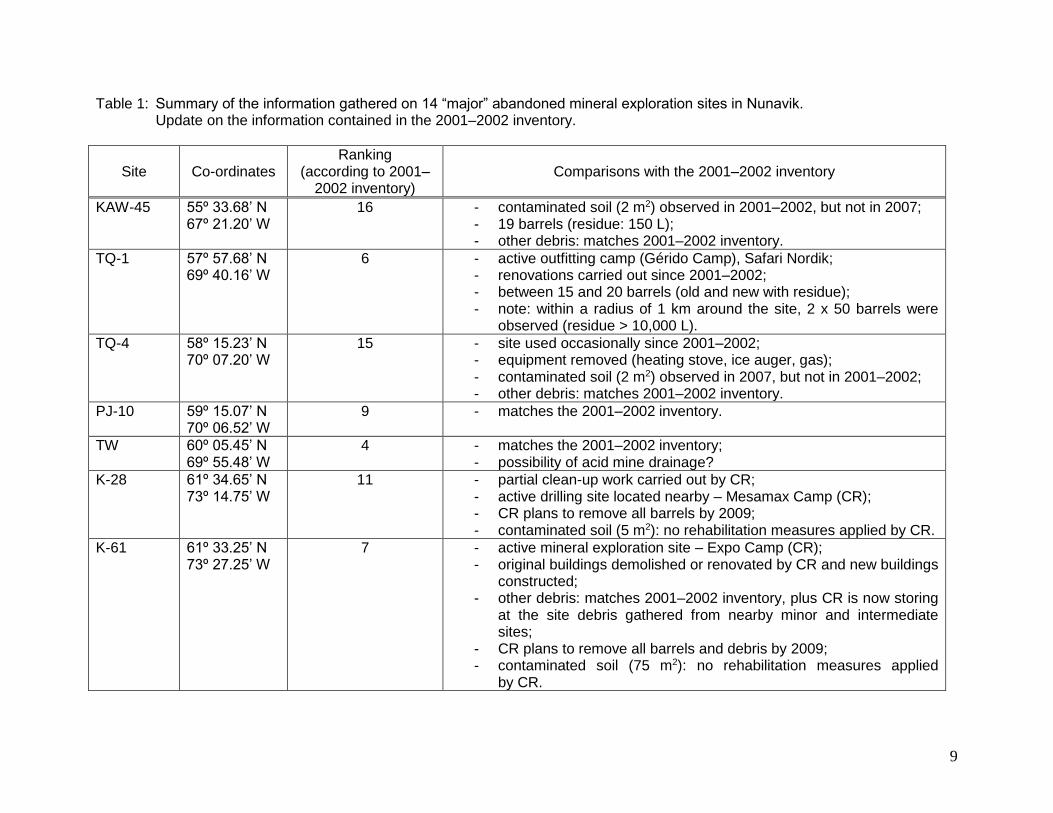
9
Table 1: Summary of the information gathered on 14 “major” abandoned mineral exploration sites in Nunavik. Update on the information contained in the 2001–2002 inventory.
Site
Co-ordinates
Ranking (according to 2001–
2002 inventory)
Comparisons with the 2001–2002 inventory
KAW-45 55º 33.68’ N 67º 21.20’ W
16 - contaminated soil (2 m2) observed in 2001–2002, but not in 2007; - 19 barrels (residue: 150 L); - other debris: matches 2001–2002 inventory.
TQ-1 57º 57.68’ N 69º 40.16’ W
6 - active outfitting camp (Gérido Camp), Safari Nordik; - renovations carried out since 2001–2002; - between 15 and 20 barrels (old and new with residue); - note: within a radius of 1 km around the site, 2 x 50 barrels were
observed (residue > 10,000 L).
TQ-4 58º 15.23’ N 70º 07.20’ W
15 - site used occasionally since 2001–2002; - equipment removed (heating stove, ice auger, gas); - contaminated soil (2 m2) observed in 2007, but not in 2001–2002; - other debris: matches 2001–2002 inventory.
PJ-10 59º 15.07’ N 70º 06.52’ W
9 - matches the 2001–2002 inventory.
TW 60º 05.45’ N 69º 55.48’ W
4 - matches the 2001–2002 inventory; - possibility of acid mine drainage?
K-28 61º 34.65’ N 73º 14.75’ W
11 - partial clean-up work carried out by CR; - active drilling site located nearby – Mesamax Camp (CR); - CR plans to remove all barrels by 2009; - contaminated soil (5 m2): no rehabilitation measures applied by CR.
K-61 61º 33.25’ N 73º 27.25’ W
7 - active mineral exploration site – Expo Camp (CR); - original buildings demolished or renovated by CR and new buildings
constructed; - other debris: matches 2001–2002 inventory, plus CR is now storing
at the site debris gathered from nearby minor and intermediate sites;
- CR plans to remove all barrels and debris by 2009; - contaminated soil (75 m2): no rehabilitation measures applied
by CR.
10
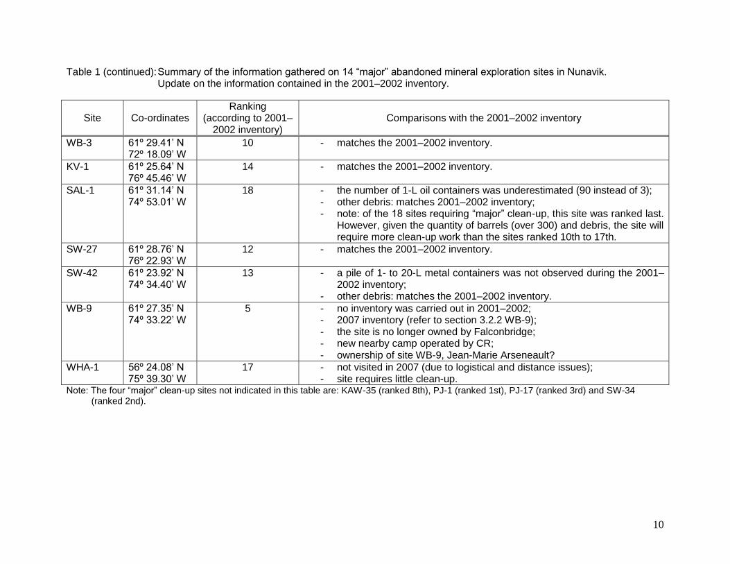
Table 1 (continued): Summary of the information gathered on 14 “major” abandoned mineral exploration sites in Nunavik. Update on the information contained in the 2001–2002 inventory.
Site
Co-ordinates
Ranking (according to 2001–
2002 inventory)
Comparisons with the 2001–2002 inventory
WB-3 61º 29.41’ N 72º 18.09’ W
10 - matches the 2001–2002 inventory.
KV-1 61º 25.64’ N 76º 45.46’ W
14 - matches the 2001–2002 inventory.
SAL-1 61º 31.14’ N 74º 53.01’ W
18 - the number of 1-L oil containers was underestimated (90 instead of 3); - other debris: matches 2001–2002 inventory; - note: of the 18 sites requiring “major” clean-up, this site was ranked last.
However, given the quantity of barrels (over 300) and debris, the site will require more clean-up work than the sites ranked 10th to 17th.
SW-27 61º 28.76’ N 76º 22.93’ W
12 - matches the 2001–2002 inventory.
SW-42 61º 23.92’ N 74º 34.40’ W
13 - a pile of 1- to 20-L metal containers was not observed during the 2001–2002 inventory;
- other debris: matches the 2001–2002 inventory.
WB-9 61º 27.35’ N 74º 33.22’ W
5 - no inventory was carried out in 2001–2002; - 2007 inventory (refer to section 3.2.2 WB-9); - the site is no longer owned by Falconbridge; - new nearby camp operated by CR; - ownership of site WB-9, Jean-Marie Arseneault?
WHA-1 56º 24.08’ N 75º 39.30’ W
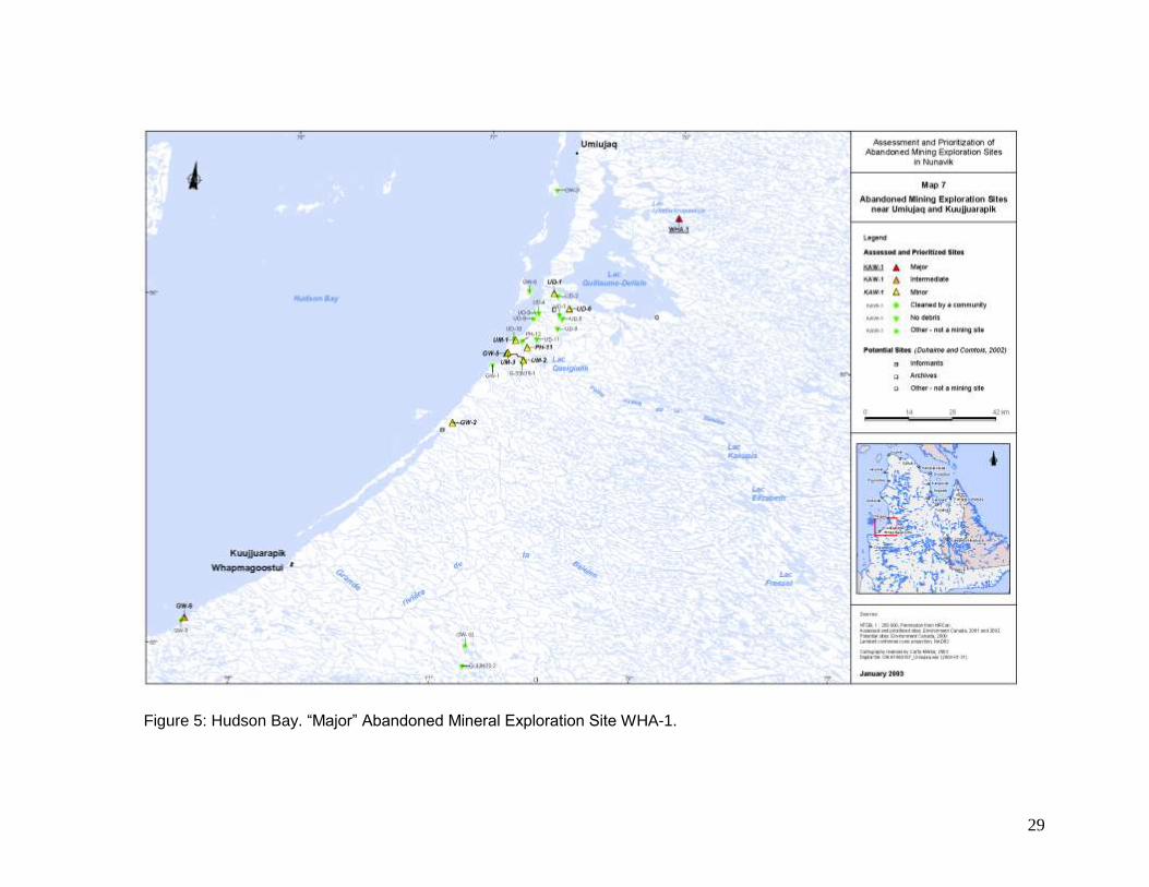
17 - not visited in 2007 (due to logistical and distance issues); - site requires little clean-up.
Note: The four “major” clean-up sites not indicated in this table are: KAW-35 (ranked 8th), PJ-1 (ranked 1st), PJ-17 (ranked 3rd) and SW-34 (ranked 2nd).
11
half-full of diesel, the barrels are empty or contain water. Contradicting the 2001–2002 inventory, no contamination was observed under the barrels. The state of the soil under the barrels was confirmed by representatives of the Ministère du Développement durable, de l’Environnement et des Parcs (sustainable development, environment and parks, MDDEP).
3.1.2 Tasiujaq Sector
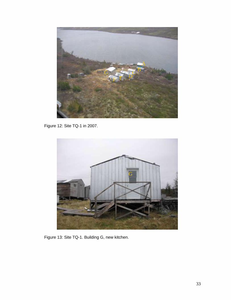
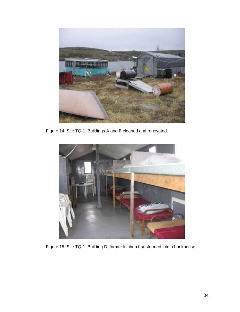
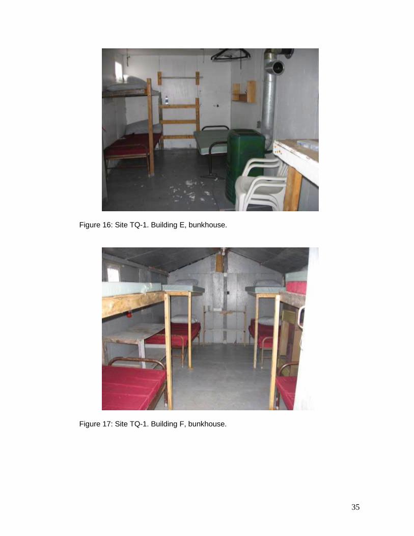
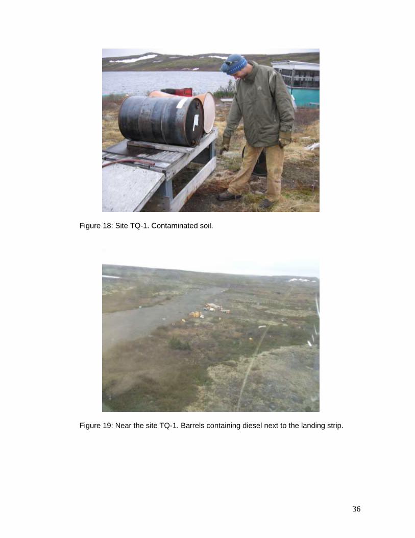
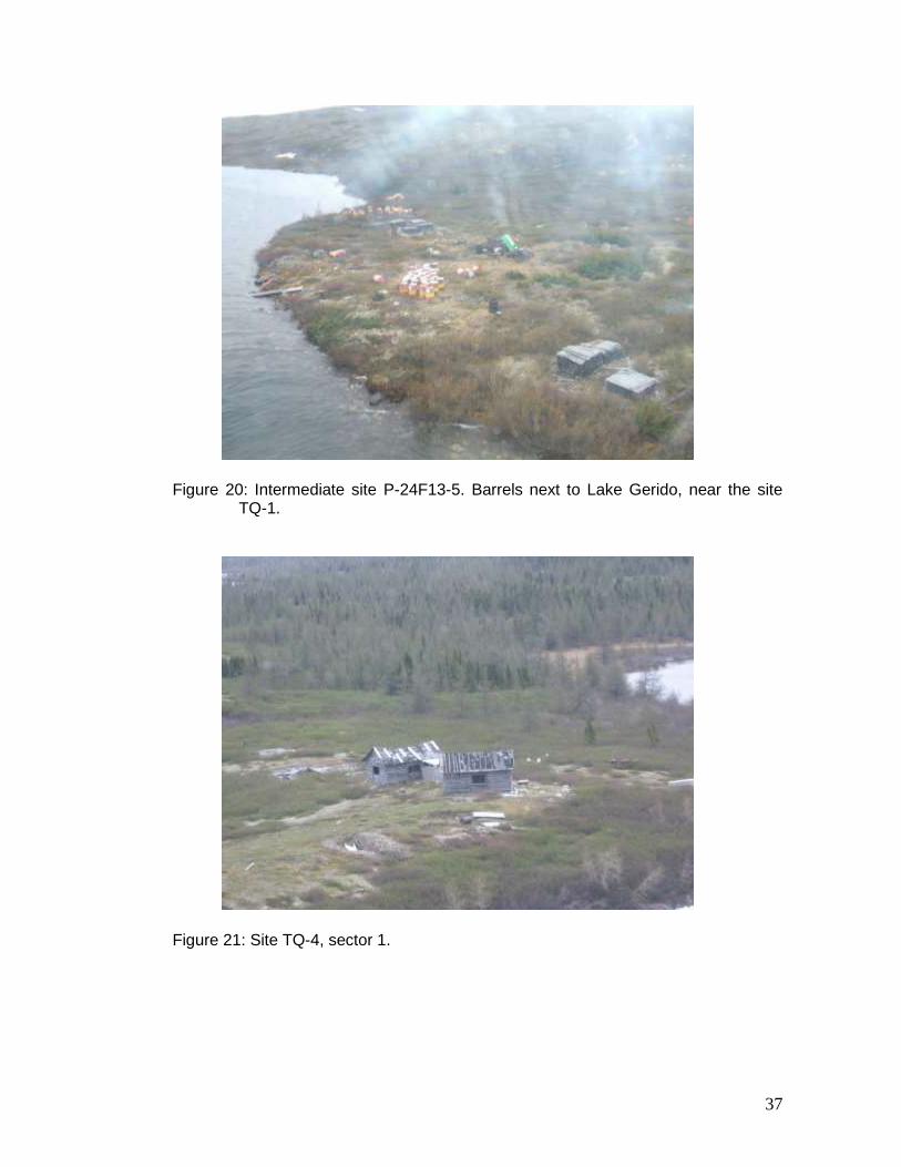
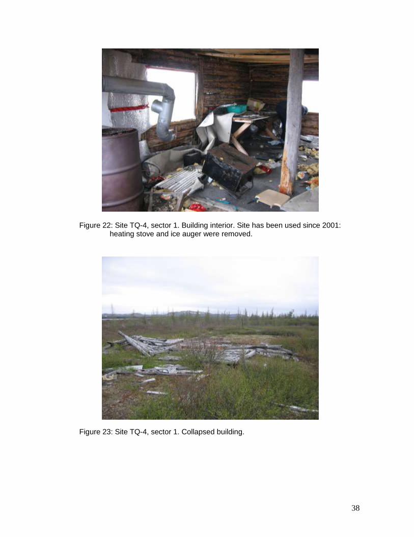
TQ-1 The abandoned mineral exploration site TQ-1 (57º 57.68’ N, 69º 40.16’ W) is located on the shore of Lake Gérido, 75 km west of Kuujjuaq. The site comprises one sector. The site was inspected on June 29, 2007. During the 2001–2002 inventory, it was noted that the outfitter Safari Nordik appeared to be using the site under the name Gérido Camp. The most recent inspection of the site confirmed that Safari Nordik is currently using the site. Further confirmation was obtained from Nicolas Laurin of Safari Nordik. The June 2007 inspection matched the description prepared during the 2001–2002 inventory. Notwithstanding, the site is well maintained and renovations have been carried out. Figures 11 and 12 show the site in 2001 and 2007, respectively. Two buildings (G and H) were dismantled. A new kitchen was built on the spot formerly occupied by building G (Figure 13), and building H was demolished. Building A was renovated, while building B appears to have been cleaned and is now used for ATV storage (Figure 14). Building C is still a bunkhouse. Building D which used to be the kitchen was cleaned and transformed into a bunkhouse (Figure 15). The two stove-ovens were recovered and are in use in the new kitchen. The bunkhouse descriptions for buildings E and F (2001–2002 inventory) match the photographs taken during the June 2007 inspection (Figures 16 and 17). More canoes than documented during the 2001–2002 inventory are also now found at the site. Old propane tanks, some barrels and rock samples remain at the site. The presence of soil contamination under some old barrels located near the buildings was again observed (Figure 18). Approximately one kilometre from the camp, inland from Lake Gérido, roughly 50 barrels filled with diesel were identified next to a landing strip (Figure 19). The barrels were initially at Lake Gérido, a kilometre from the camp (“intermediate” site validated in 2005 – KRG, 2006) and were transported to the landing strip by the community of Tasiujaq after 2002 (information received from Nunavik Rotors). The barrels have however been left at the landing strip, due to inadequate transportation solutions. Currently at Lake Gérido, there are close to 50 other barrels, metal debris and rock samples (Figure 20). According to Nicolas Laurin of Safari Nordik, many barrels at Lake Gérido still contain diesel. Although only an “intermediate” site, these barrels are located close enough to the site TQ-1 to be included in eventual clean-up work. TQ-4 The abandoned mineral exploration site TQ-4 (58º 15.23’ N, 70º 07.20’ W) is located 40 m from Lake Garigue south of Tasiujaq. The site comprises three sectors. The site was inspected on June 29, 2007. The inspection revealed that the site closely matches the description prepared during the 2001–2002 inventory.
12
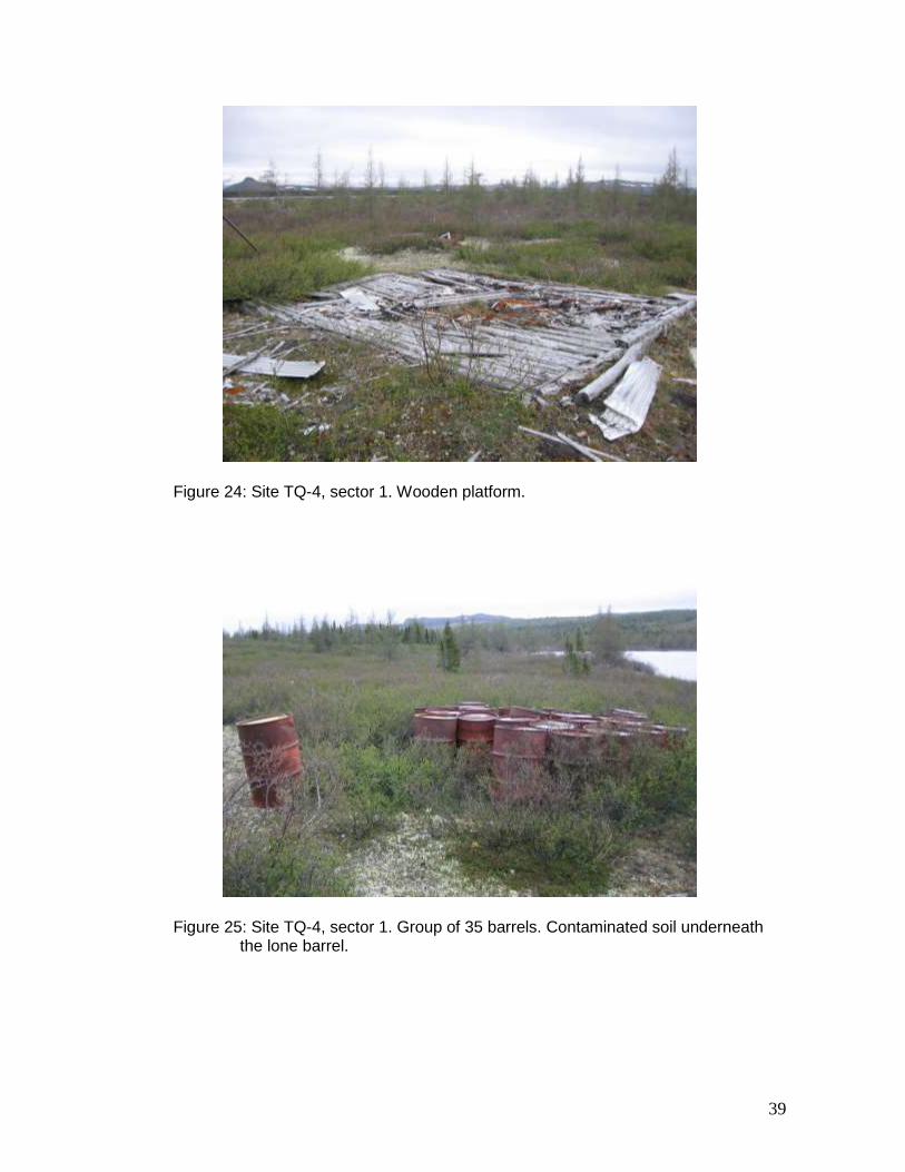
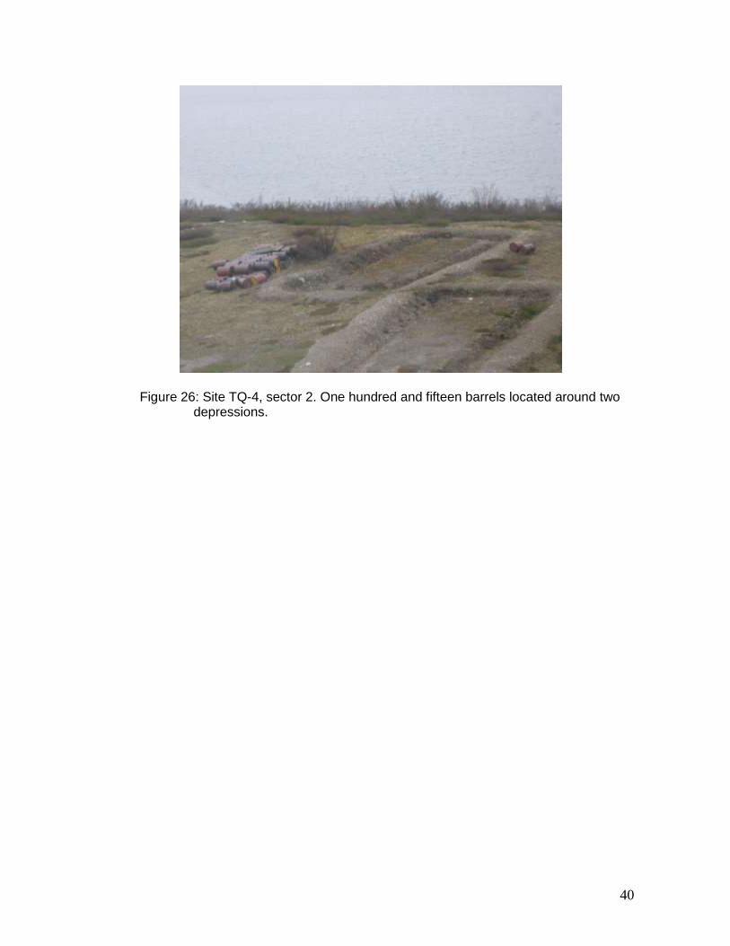
The two buildings in sector 1 are still present (Figure 21), but reference to the description of the building interiors reveals that the site has been used since 2001. The 2001–2002 inventory also notes that the camp is used by Mario Carreau (Tasiujaq). Building 1 still contains waste, to which has been added a battery since 2001. The heating stove and the ice auger, on the other hand, have been removed (Figure 22). Except for the removal of three x 20-L gas cans, building 2 matches the description from the 2001–2002 inventory. It contains for the most part wood and aluminium debris, foam insulation and a Coleman stove. The collapsed building, the wooden platform and a variety of debris (35 barrels, eight propane tanks, aluminium insulation sheets, etc.) near the two buildings are still present (Figures 23 and 24). Sector 2, which encompasses sector 3, matches the description from the 2001–2002 inventory. The 115 barrels are still located next to the two depressions (Figure 26). No soil contamination was noted during the 2001–2002 inventory. Notwithstanding, the contents of one barrel in sector 1 appear to have since leaked, causing soil contamination (Figure 25).
3.1.3 Aupaluk Sector
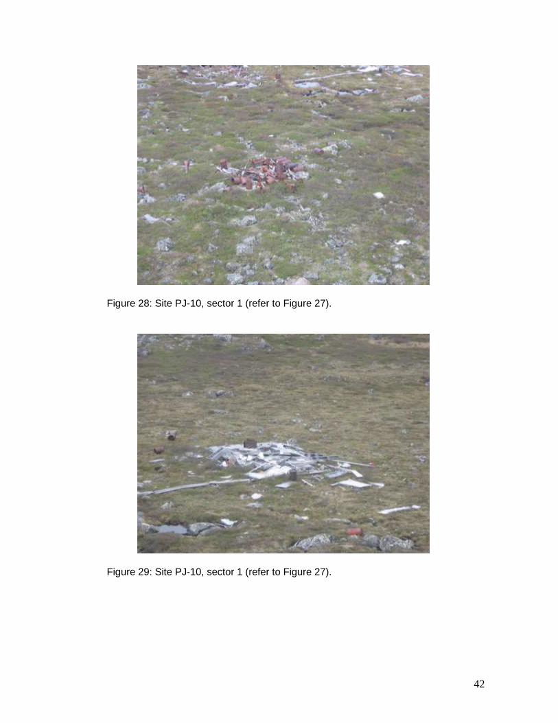
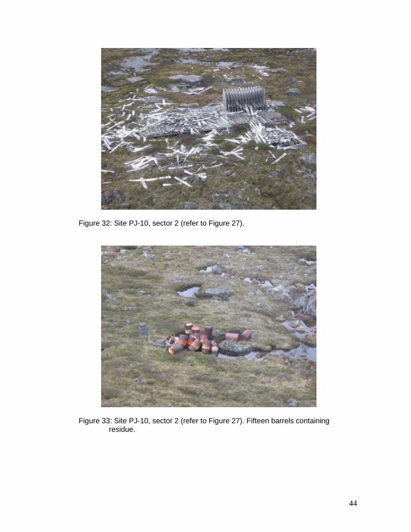
PJ-10 The abandoned mineral exploration site PJ-10 (59º 15.07’ N, 70º 06.52’ W) is located 50 m from Lake Ford, 30 km west-southwest of Aupaluk. The site comprises two sectors. The site was inspected on July 1, 2007. The inspection revealed that the site matched the description prepared during the 2001–2002 inventory. The layout of the site PJ-10 (Figure 27) is reproduced in this report from Appendix 9 of the 2001–2002 inventory. Photographs of sector 1 (Figures 28 to 31) and of sector 2 (Figures 32 and 33) were taken in 2007 and match the description of the site.
3.1.4 Kangirsuk Sector
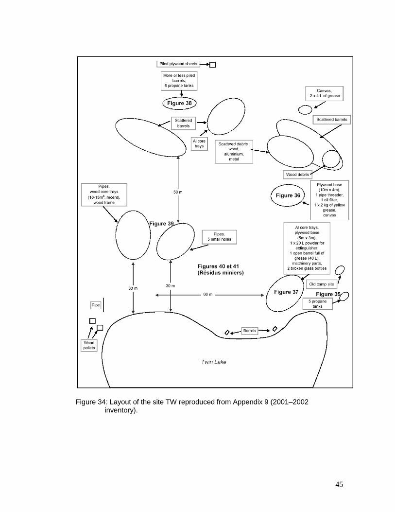
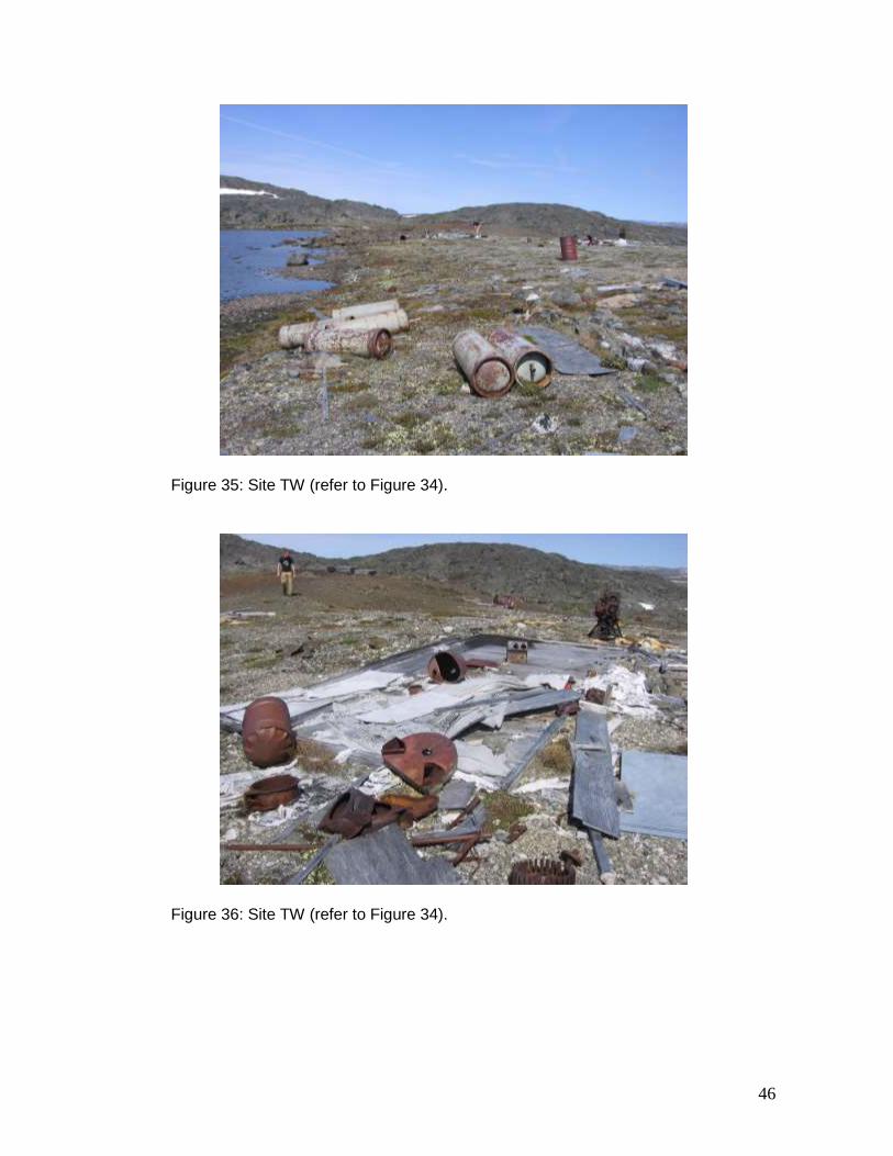
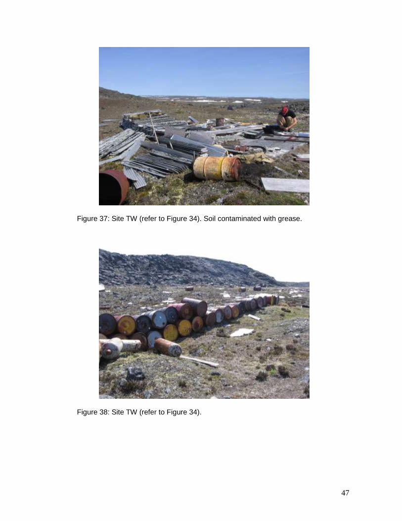
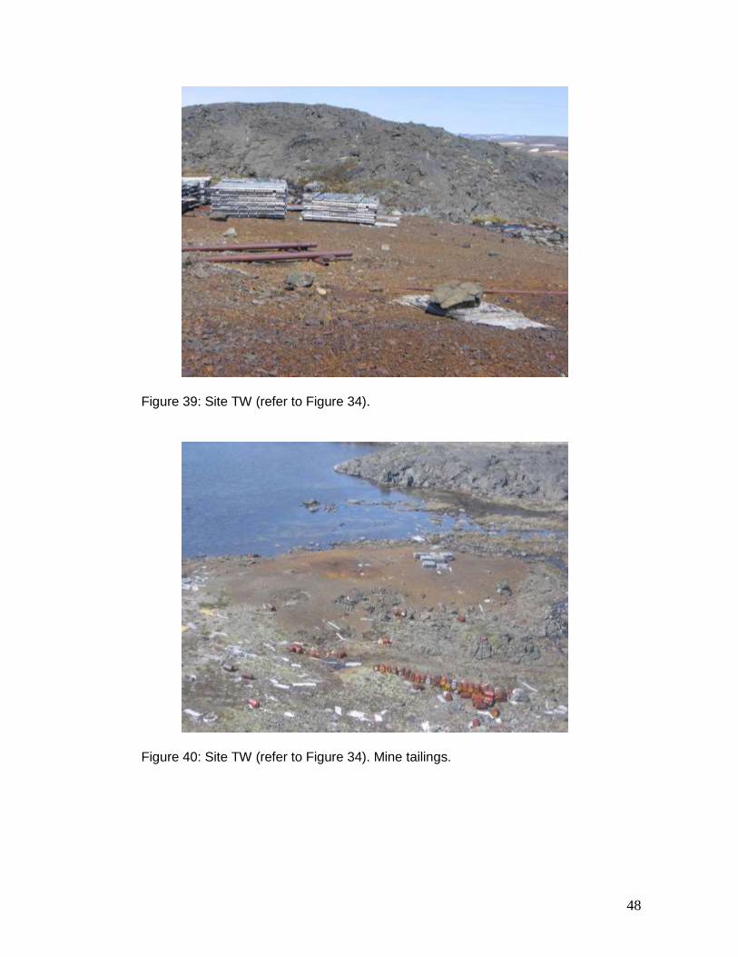
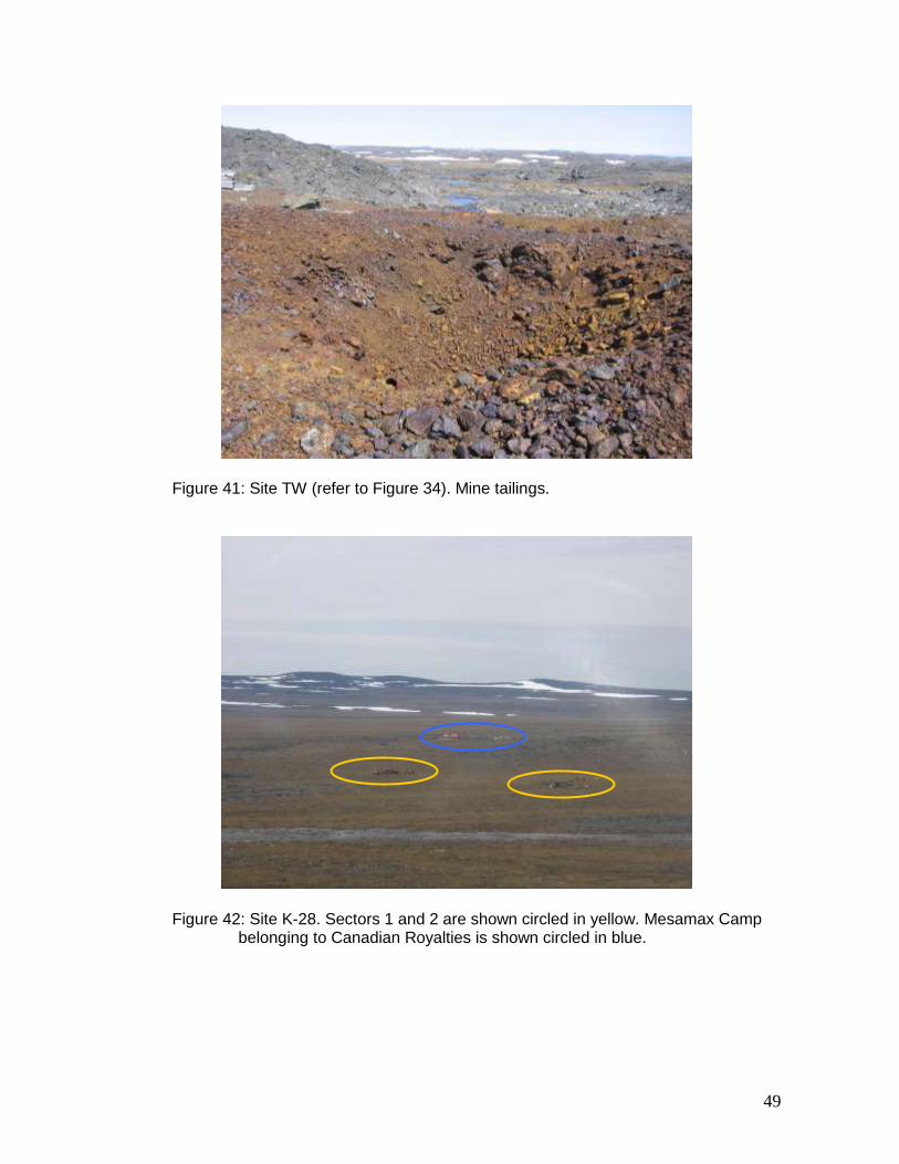
TW The abandoned mineral exploration site TW (60º 05.45’ N, 69º 55.48’ W) is located on the shore of Lake Twin near Kangirsuk. The site comprises one sector. The site was inspected on July 2, 2007. The inspection revealed that the site matches the description prepared during the 2001–2002 inventory. The layout of the site TW (Figure 34) is reproduced in this report from Appendix 9 of the 2001–2002 inventory. Photographs (Figures 35 to 39) were taken in 2007 and match the description of the site. Although not mentioned in the 2001–2002 inventory, the presence or absence of acid mine drainage should be confirmed. Such a verification is all the more important given the proximity of Lake Twin. The reddish-orange tailings produced by mineral exploration work are shown in Figures 40 and 41.
13
3.2 Ungava Trough – Hudson Bay
3.2.1 Kangiqsujuaq Sector
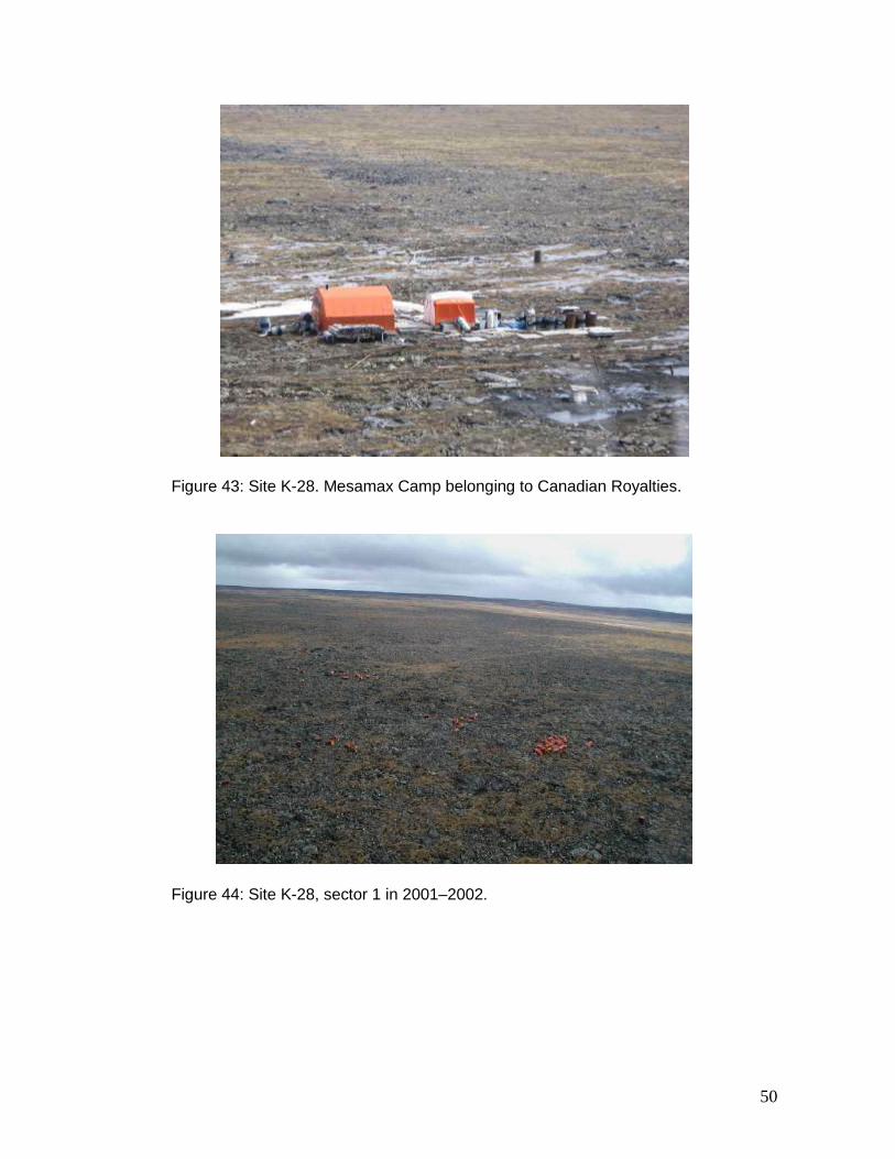
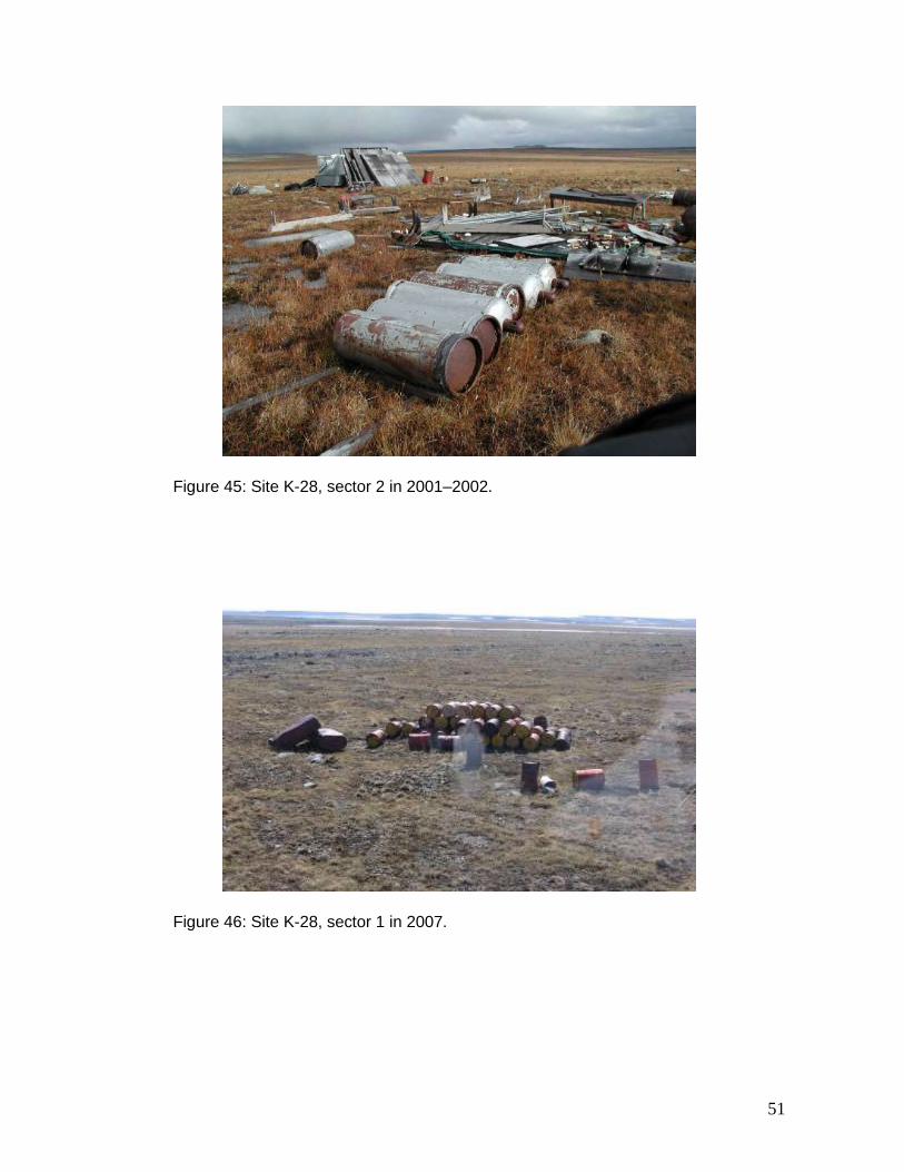
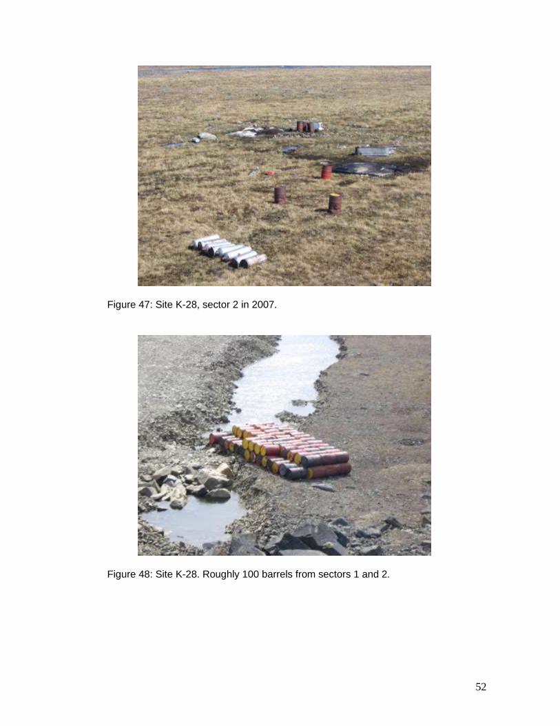
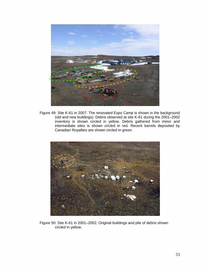
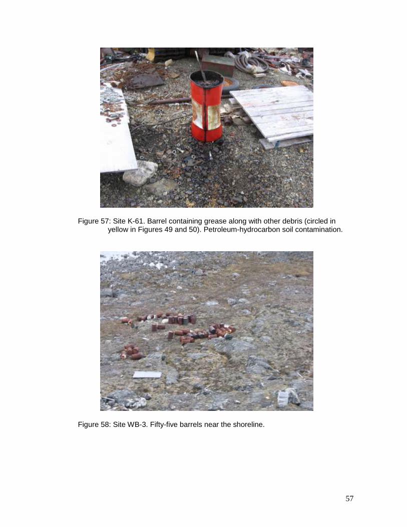
K-28 The abandoned mineral exploration site K-28 (61º 34.65’ N, 73º 14.75’ W) is located 67 km west of Kangiqsujuaq, far from any body of water. The site comprises three sectors. In 2005 and 2006, Canadian Royalties (CR) transmitted to the KRG an updated list of its active camps. Among these camps, the site K-28 (also known as Mesamax Camp) is a drilling site currently operated by CR. A photograph taken during the site inspection on July 3, 2007, shows the location of the site K-28 described in the 2001–2002 inventory, and the location of the new camp (Figures 42 and 43). At the time of the inspection, a survey team was present at the site but no mineral exploration work was underway. In 2006, Canadian Royalties (CR) carried out a partial clean-up of the site. According to the information received, wood was burned, the barrels scattered around the site were stacked together, and barrels of diesel and bags of calcium chlorite were removed from the site. Figures 44 and 45 show sectors 1 and 2 in 2001, while Figures 46 and 47 show the same sectors following clean-up work. CR also gathered along the road leading to its Berbegamo Camp roughly 100 barrels from sectors 1 and 2 (Figure 48). In sector 3, except for the tripod and a pile of metal debris at the base of the tripod, all the drilling equipment observed in 2001 has been removed from the site. CR is continuing its clean-up work and plans to have removed all the barrels by 2009. The contaminated soil observed in sector 1 is still present. No rehabilitation measures have been applied to the petroleum-hydrocarbon contaminated soil (5 m2). K-61 The abandoned mineral exploration site K-61 (61º 33.25’ N, 73º 27.25’ W) is located 80 km west of Kangiqsujuaq, more than 500 m away from a body of water. The site comprises three sectors. The site is currently operated by Canadian Royalties (CR) under the name Expo Camp. It was observed during the 2001–2002 inventory that CR appeared to be using the site. A photograph taken during the site inspection on July 3, 2007, shows the entire camp (Figure 49). Since the 2001–2002 inventory, the original buildings (Figure 50) have been demolished or renovated. In the foreground of Figure 49 and the background of Figure 50, it is possible to see sector 1. This sector remains relatively unchanged (Figures 51 to 57), except that the inventory includes, in addition, debris located near the original buildings and debris gathered from other minor and intermediate sites on CR property. For example, the muskeg was transported by CR from the minor site KAN-11 (61º 32.62’ N, 73º 37.27’ W) to the site K-61 (Figure 49). As well, prior to being removed from the site, barrels recently used by CR are stored and compacted next to sector 1 (Figure 49). CR is continuing its clean-up work and plans to have removed the barrels and debris by 2009. The contaminated soil observed in sector 1 is still present (Figures 51 and 57). No rehabilitation measures have been applied to the petroleum-hydrocarbon contaminated soil (75 m2).
14
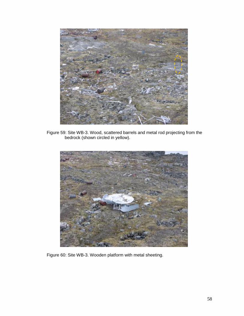
WB-3 The abandoned mineral exploration site WB-3 (61º 29.41’ N, 72º 18.09’ W) is located on the shore of Lake Qulusuttalik, roughly 22 km southwest of Kangiqsujuaq. The site comprises one sector. The site was inspected on July 3, 2007. The inspection revealed that the site matches the description prepared during the 2001–2002 inventory. Still present at the site are 55 barrels located next to the lake (Figure 58), 30 scattered barrels, wood debris, metal rods projecting from the bedrock (Figure 59) and a wooden platform and metal sheeting (Figure 60).
3.2.2 Salluit Sector
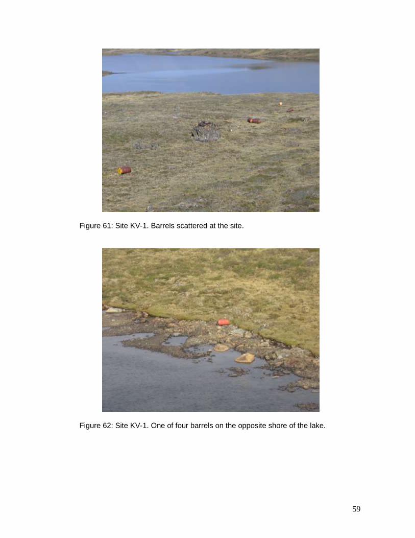
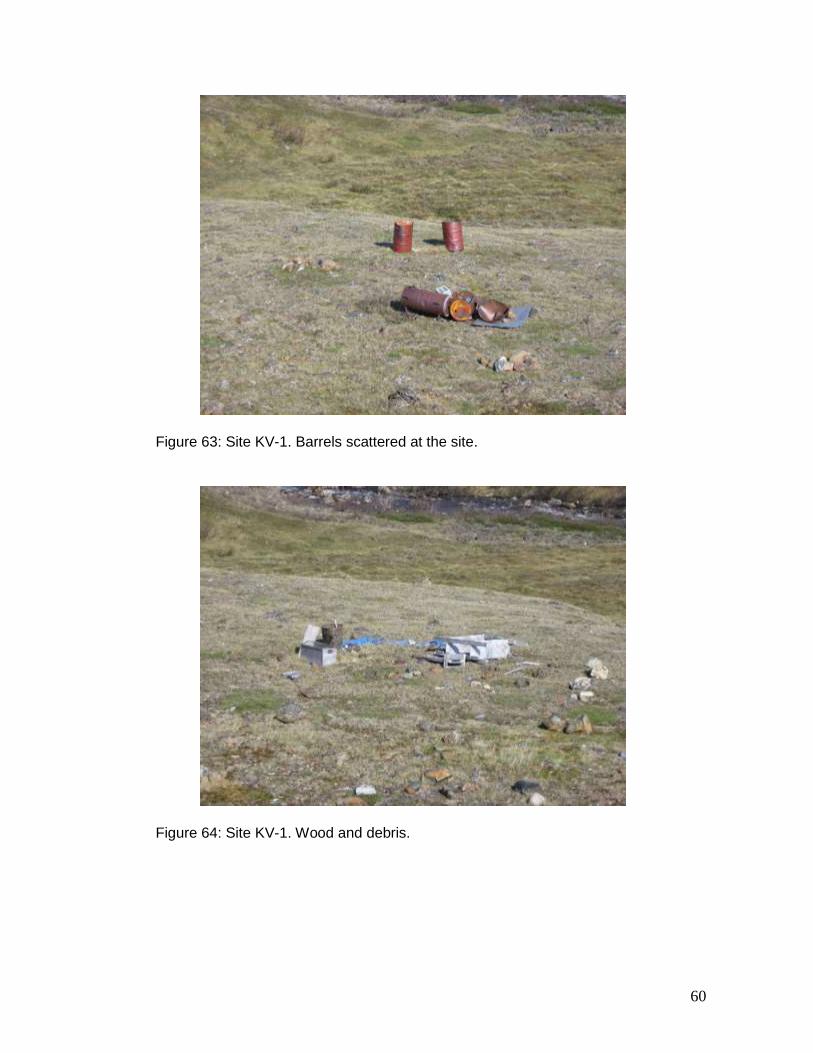
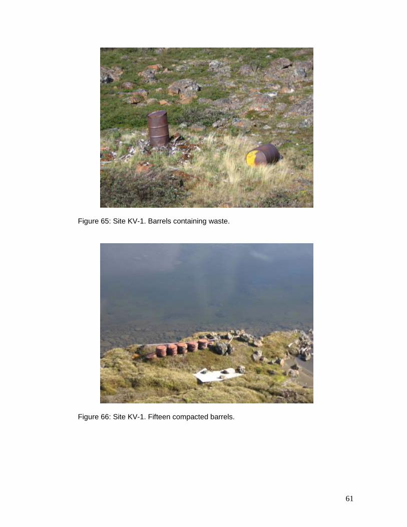
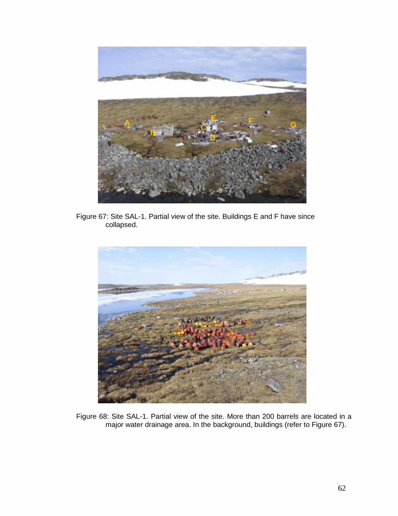
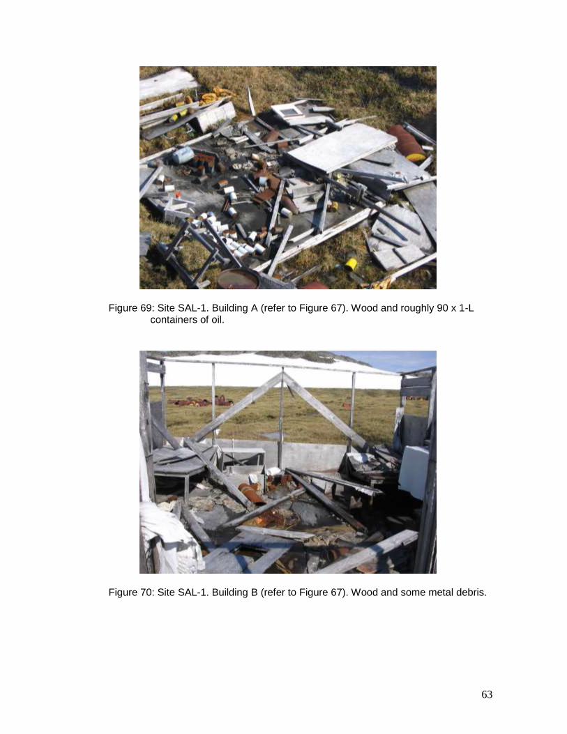
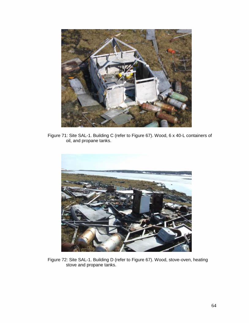
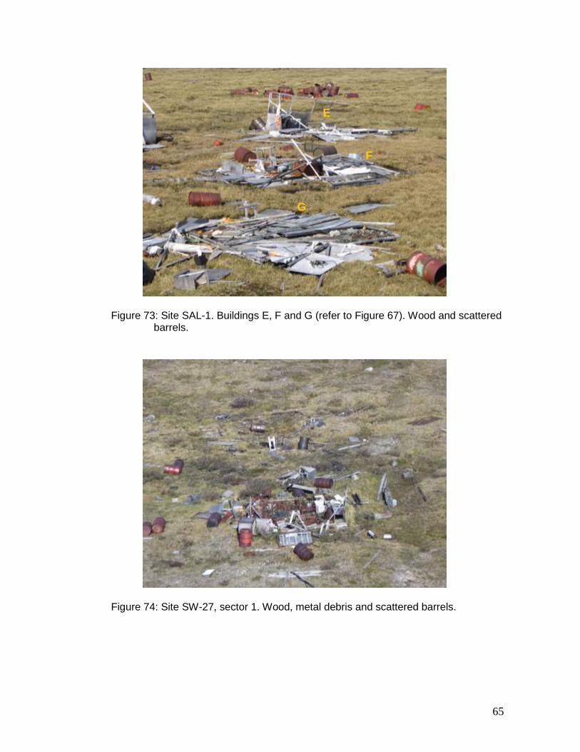
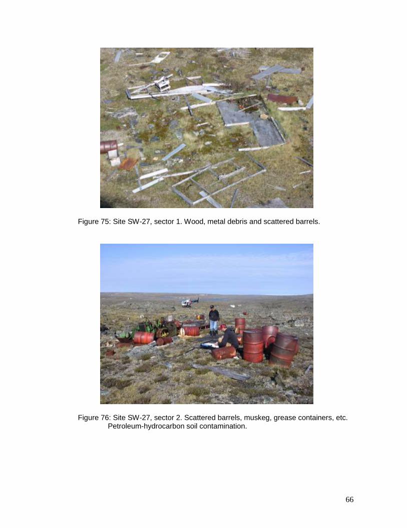
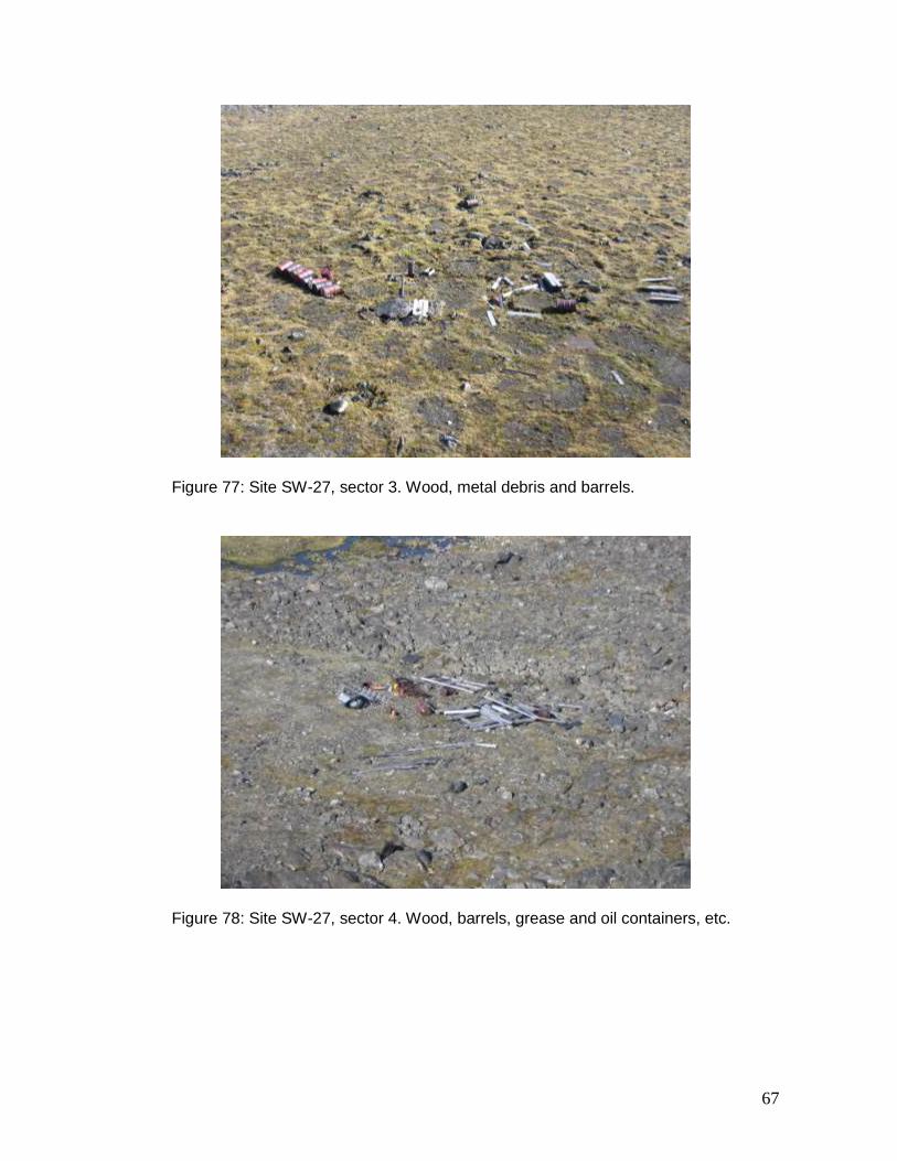
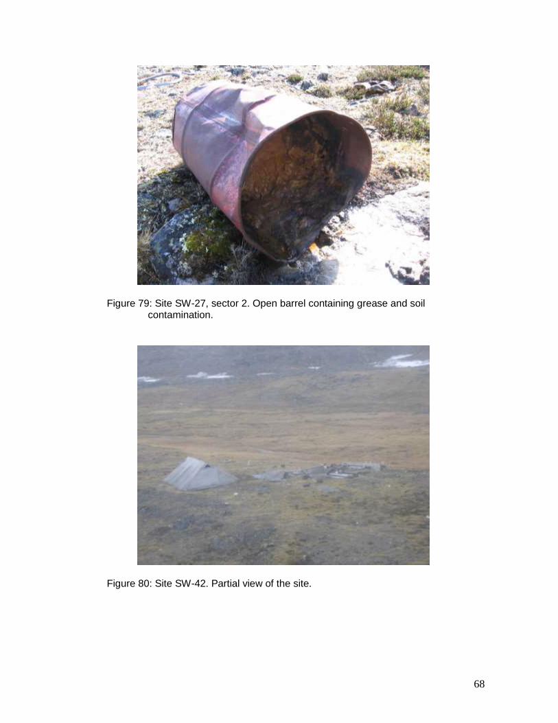
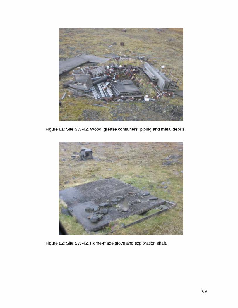
KV-1 The abandoned mineral exploration site KV-1 (61º 25.64’ N, 76º 45.46’ W) is located on the shore of a lake, roughly 100 km southwest of Salluit. The site comprises two sectors. The site was inspected on July 5, 2007. The inspection revealed that the site matches the description prepared during the 2001–2002 inventory. Roughly 23 barrels are scattered around the site and on the opposite shore of the lake (Figures 61 to 63) and 15 compacted barrels and two waste disposal areas are still present (Figures 64 to 66). SAL-1 The abandoned mineral exploration site SAL-1 (61º 31.14’ N, 74º 53.01’ W) is located next to Lake Nuvilik, roughly 90 km south-southeast of Salluit. The site comprises one sector. The site was inspected on July 5, 2007. The inspection revealed that the site matches the description prepared during the 2001–2002 inventory. Figures 67 and 68 show the entire site. Of the six buildings at the site, four have now collapsed. Figures 69 to 73 show in detail the buildings and nearby debris. Close to 90 1-L and six 40-L unopened containers of aviation oil were identified at the site, most of which were unopened. The number of containers was underestimated during the 2001–2002 inventory. In addition to the barrels scattered around the buildings, more than 300 probably empty barrels are divided in three separate groups. The barrels were not systematically verified. SW-27 The abandoned mineral exploration site SW-27 (61º 28.76’ N, 76º 22.93’ W) is located roughly 90 km south-southwest of Salluit, far from any body of water. The site covers 0.2 km2 and comprises four sectors. The site was inspected on July 5, 2007. The inspection revealed that the site matches the description prepared during the 2001–2002 inventory. Figures 74 to 78 show the sectors 1 to 4, respectively. Of all the abandoned mineral exploration sites still requiring clean-up, site SW-27 contains the greatest quantities of residue: roughly 1650 L of diesel, 260 L of grease and 26 L of
15
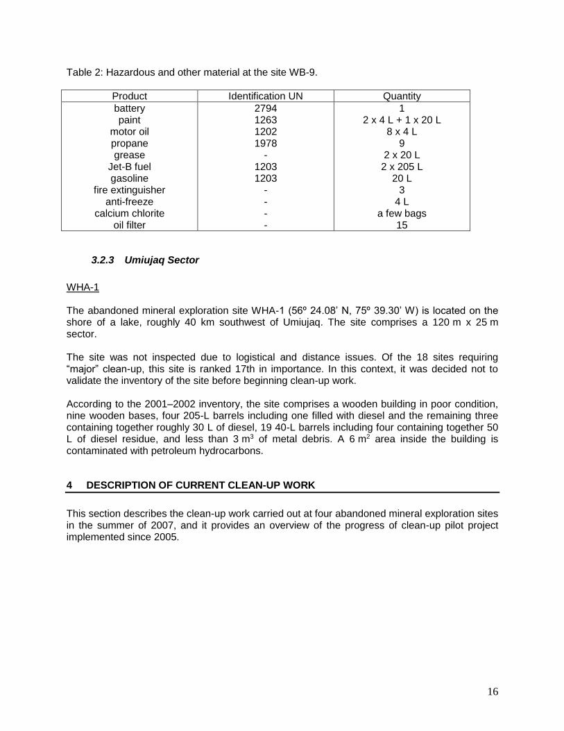
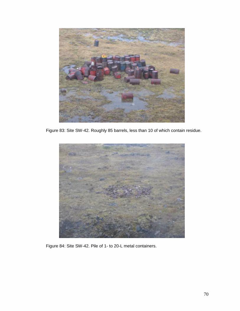
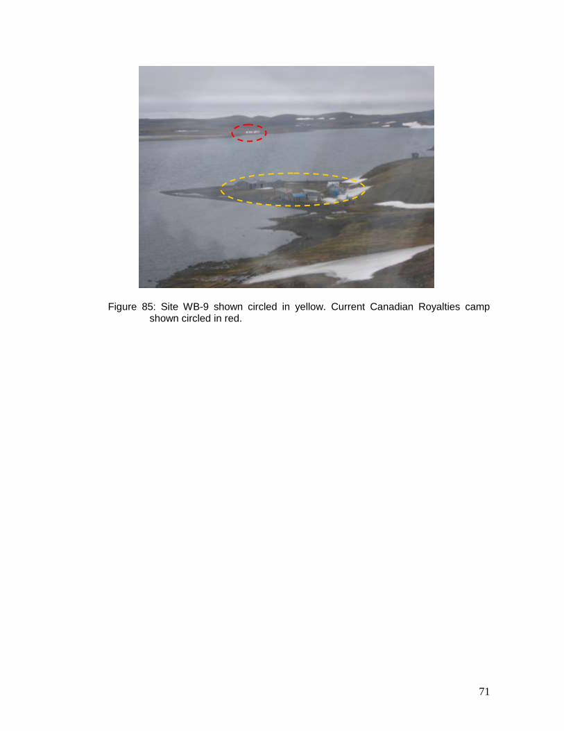
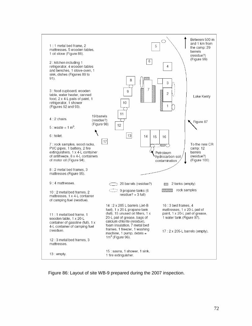
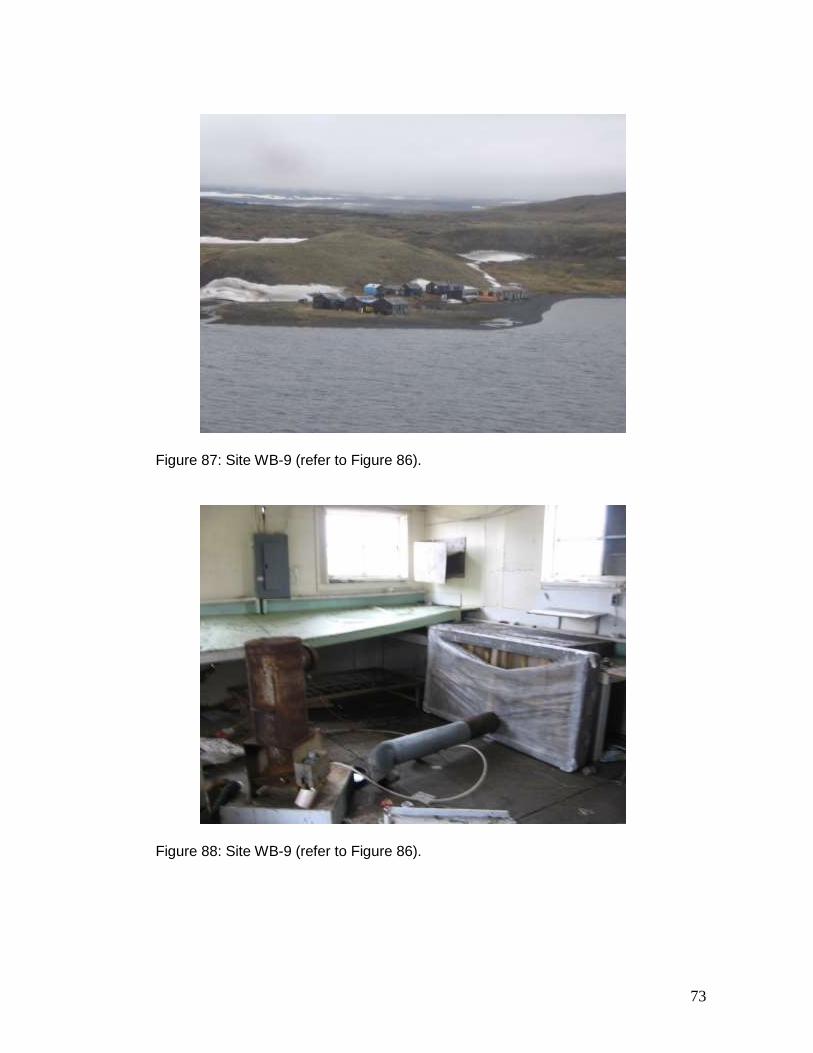
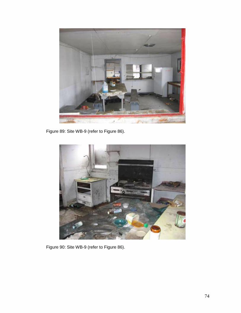
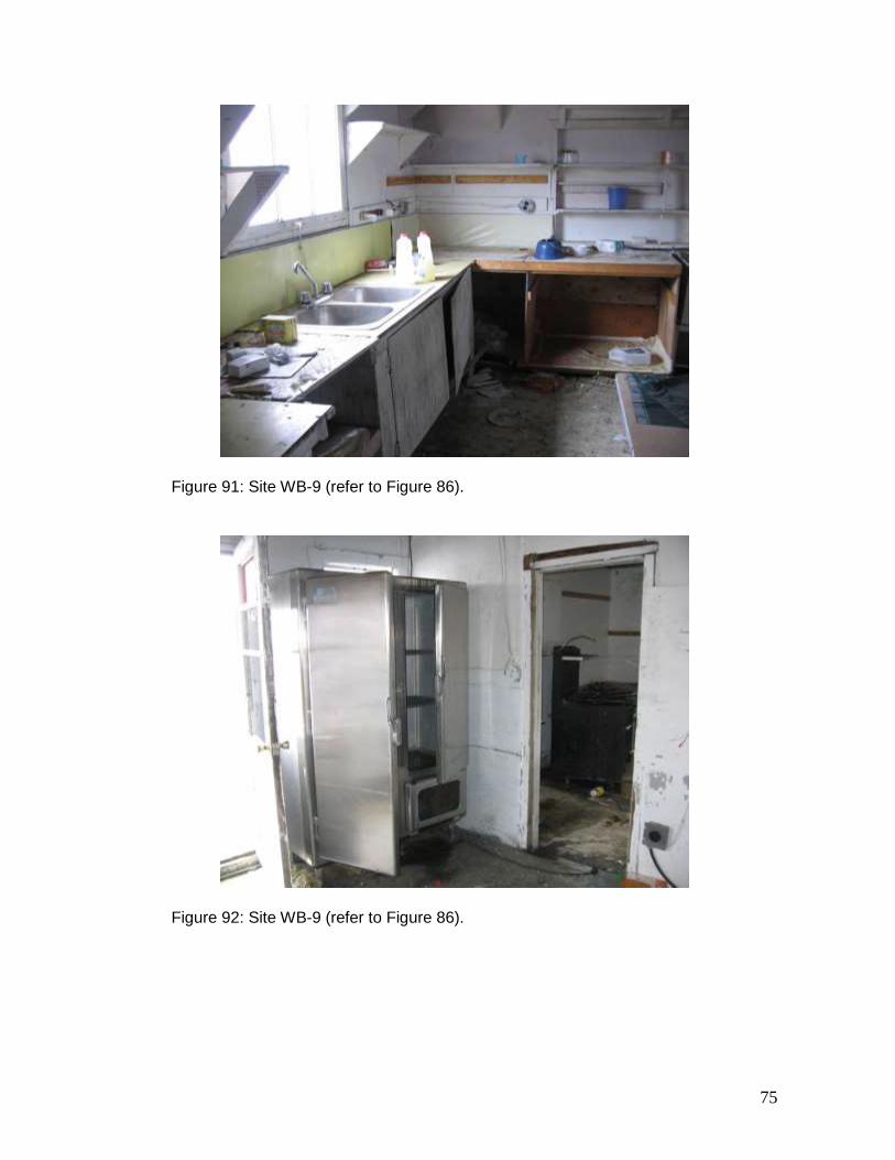
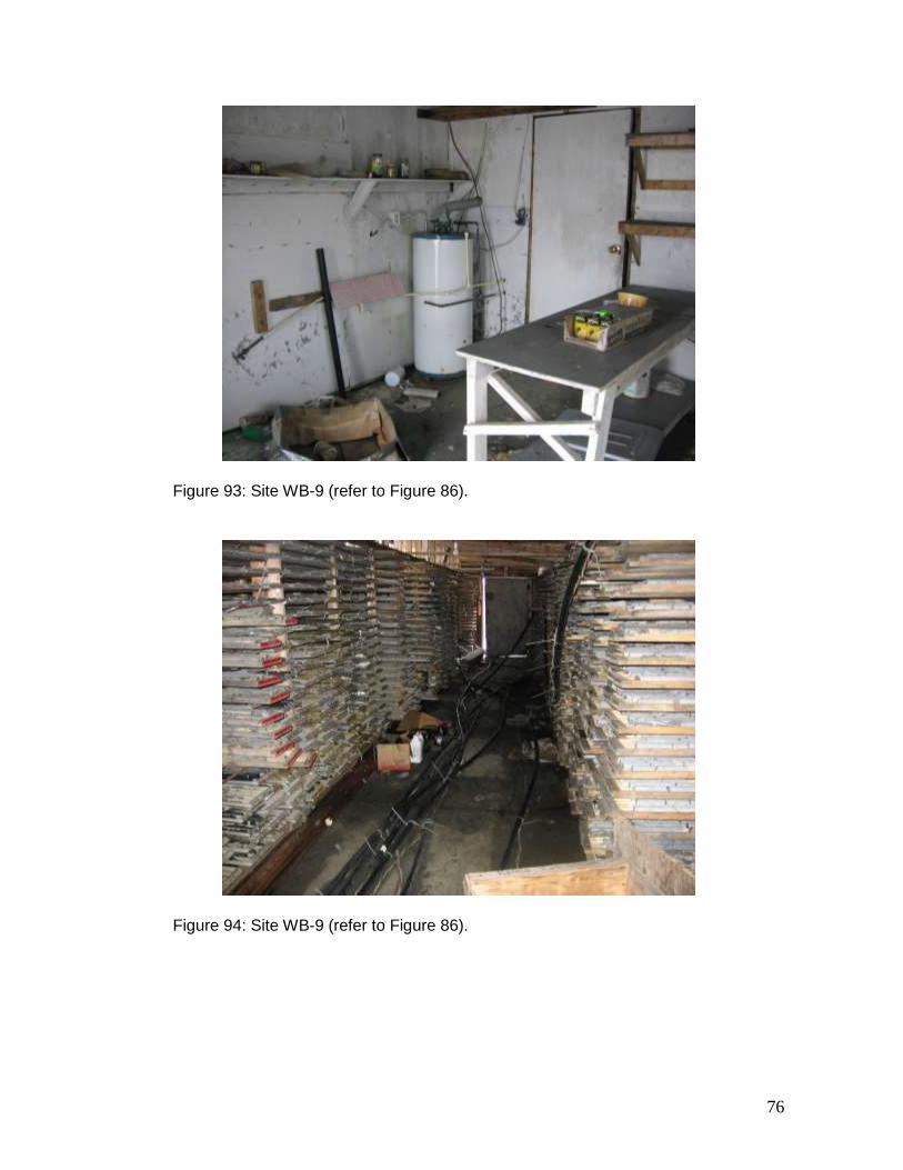
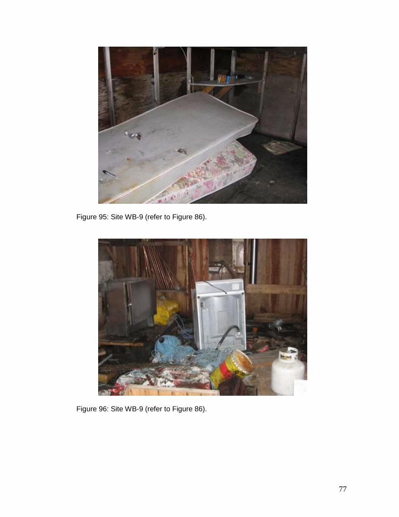
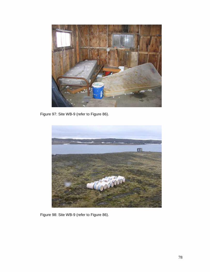
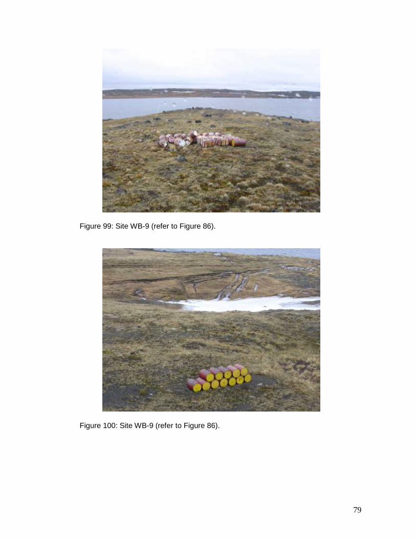
oil. Although covering only 2.5 m2, petroleum-hydrocarbon soil contamination is still very evident. Open or damaged barrels of grease observed during the 2001–2002 inventory are still present (Figure 79). SW-42 The abandoned mineral exploration site SW-42 (61º 23.92’ N, 74º 34.40’ W) is located next to Lake Beauparlant, roughly 100 km south-southeast of Salluit. The site comprises one sector. The site was inspected on July 4, 2007. The inspection revealed that the site matches the description prepared during the 2001–2002 inventory. The wood roof and boards, metal debris, aluminium pipes, home-made stove, and exploration-shaft wood cover were all observed. (Figures 80 to 82). The site also includes a pile of between 80 and 90 barrels (Figure 83) and other barrels scattered along the shore of the lake. Finally, a pile of 1- to 20-L metal containers is located only a few metres from the lake; these containers were not identified in the 2001–2002 inventory (Figure 84). WB-9 The abandoned mineral exploration site WB-9 (61º 27.35’ N, 74º 33.22’ W) is located next to Lake Kenty, roughly 100 km south-southeast of Salluit. The site comprises one sector. During the 2001–2002 inventory, the site was ranked fifth in order of importance among the 18 sites requiring “major” clean-up. Despite being ranked, no inventory of the site was prepared as it appeared to still be in use. Clean-up work was carried out at the site in 1998 by Falconbridge, including the removal of barrels. Around 2002, Falconbridge sold the camp to Jean-Marie Arseneault. Further to being contacted, Mr. Arseneault indicated he is not the owner of the camp. In 2007, another camp, which appears to have been constructed by Canadian Royalties, was identified on the opposite shore of Lake Kenty. Figure 85 shows the site WB-9 in the foreground and the new camp in the background. The site was inspected on July 4, 2007. Figure 86 illustrates the layout and inventory of the site, while Figures 87 to 100 are photographs of the site. The site comprises ten buildings and three small sheds. All the facilities are constructed of wood and have deteriorated since the 2001–2002 inventory. The site contains a large quantity of non-hazardous debris, such as bed frames and damaged mattresses, a stove-oven, a washing machine, rock samples, etc. No heavy equipment was identified at the site. In total, 20 barrels were found scattered near the buildings. The barrels were not systematically verified, but might contain petroleum-hydrocarbon residue. Under two barrels, the soil contamination observed during the 2001–2002 inventory is still present. As well, in a 1-km radius around the camp, 60 barrels divided in three groups were observed, but no verification was carried out to determine if they contained any residue. Table 2 lists the hazardous material and some other products identified in Figure 86.
16
Table 2: Hazardous and other material at the site WB-9.
Product Identification UN Quantity
battery paint
motor oil propane grease
Jet-B fuel gasoline
fire extinguisher anti-freeze
calcium chlorite oil filter
2794 1263 1202 1978
- 1203 1203
- - - -
1 2 x 4 L + 1 x 20 L
8 x 4 L 9
2 x 20 L 2 x 205 L
20 L 3
4 L a few bags
15
3.2.3 Umiujaq Sector
WHA-1 The abandoned mineral exploration site WHA-1 (56º 24.08’ N, 75º 39.30’ W) is located on the shore of a lake, roughly 40 km southwest of Umiujaq. The site comprises a 120 m x 25 m sector. The site was not inspected due to logistical and distance issues. Of the 18 sites requiring “major” clean-up, this site is ranked 17th in importance. In this context, it was decided not to validate the inventory of the site before beginning clean-up work. According to the 2001–2002 inventory, the site comprises a wooden building in poor condition, nine wooden bases, four 205-L barrels including one filled with diesel and the remaining three containing together roughly 30 L of diesel, 19 40-L barrels including four containing together 50 L of diesel residue, and less than 3 m3 of metal debris. A 6 m2 area inside the building is contaminated with petroleum hydrocarbons.
4 DESCRIPTION OF CURRENT CLEAN-UP WORK
This section describes the clean-up work carried out at four abandoned mineral exploration sites in the summer of 2007, and it provides an overview of the progress of clean-up pilot project implemented since 2005.
17
4.1 Labrador Trough
4.1.1 Kawawachikamach Sector
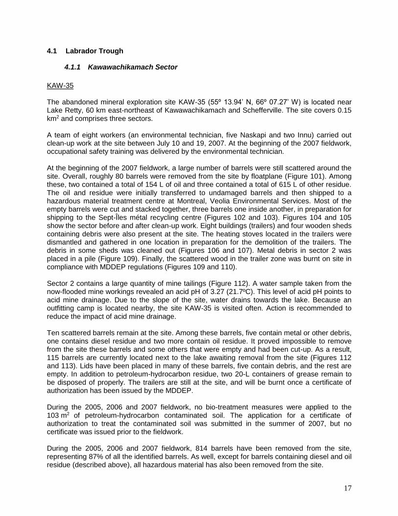
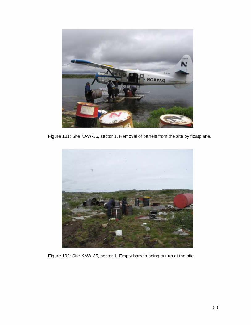
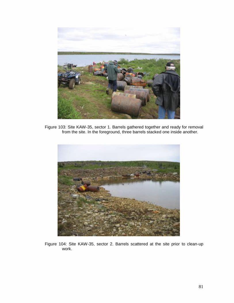
KAW-35 The abandoned mineral exploration site KAW-35 (55º 13.94’ N, 66º 07.27’ W) is located near Lake Retty, 60 km east-northeast of Kawawachikamach and Schefferville. The site covers 0.15 km2 and comprises three sectors. A team of eight workers (an environmental technician, five Naskapi and two Innu) carried out clean-up work at the site between July 10 and 19, 2007. At the beginning of the 2007 fieldwork, occupational safety training was delivered by the environmental technician. At the beginning of the 2007 fieldwork, a large number of barrels were still scattered around the site. Overall, roughly 80 barrels were removed from the site by floatplane (Figure 101). Among these, two contained a total of 154 L of oil and three contained a total of 615 L of other residue. The oil and residue were initially transferred to undamaged barrels and then shipped to a hazardous material treatment centre at Montreal, Veolia Environmental Services. Most of the empty barrels were cut and stacked together, three barrels one inside another, in preparation for shipping to the Sept-Îles métal recycling centre (Figures 102 and 103). Figures 104 and 105 show the sector before and after clean-up work. Eight buildings (trailers) and four wooden sheds containing debris were also present at the site. The heating stoves located in the trailers were dismantled and gathered in one location in preparation for the demolition of the trailers. The debris in some sheds was cleaned out (Figures 106 and 107). Metal debris in sector 2 was placed in a pile (Figure 109). Finally, the scattered wood in the trailer zone was burnt on site in compliance with MDDEP regulations (Figures 109 and 110). Sector 2 contains a large quantity of mine tailings (Figure 112). A water sample taken from the now-flooded mine workings revealed an acid pH of 3.27 (21.7ºC). This level of acid pH points to acid mine drainage. Due to the slope of the site, water drains towards the lake. Because an outfitting camp is located nearby, the site KAW-35 is visited often. Action is recommended to reduce the impact of acid mine drainage. Ten scattered barrels remain at the site. Among these barrels, five contain metal or other debris, one contains diesel residue and two more contain oil residue. It proved impossible to remove from the site these barrels and some others that were empty and had been cut-up. As a result, 115 barrels are currently located next to the lake awaiting removal from the site (Figures 112 and 113). Lids have been placed in many of these barrels, five contain debris, and the rest are empty. In addition to petroleum-hydrocarbon residue, two 20-L containers of grease remain to be disposed of properly. The trailers are still at the site, and will be burnt once a certificate of authorization has been issued by the MDDEP. During the 2005, 2006 and 2007 fieldwork, no bio-treatment measures were applied to the 103 m2 of petroleum-hydrocarbon contaminated soil. The application for a certificate of authorization to treat the contaminated soil was submitted in the summer of 2007, but no certificate was issued prior to the fieldwork. During the 2005, 2006 and 2007 fieldwork, 814 barrels have been removed from the site, representing 87% of all the identified barrels. As well, except for barrels containing diesel and oil residue (described above), all hazardous material has also been removed from the site.
18
Of the 18 major clean-up sites, this site was ranked eighth in importance.
4.1.2 Tasiujaq Sector
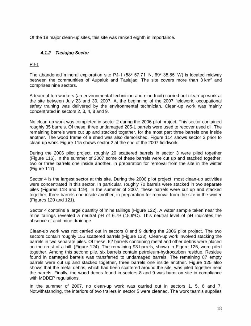
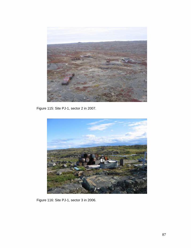
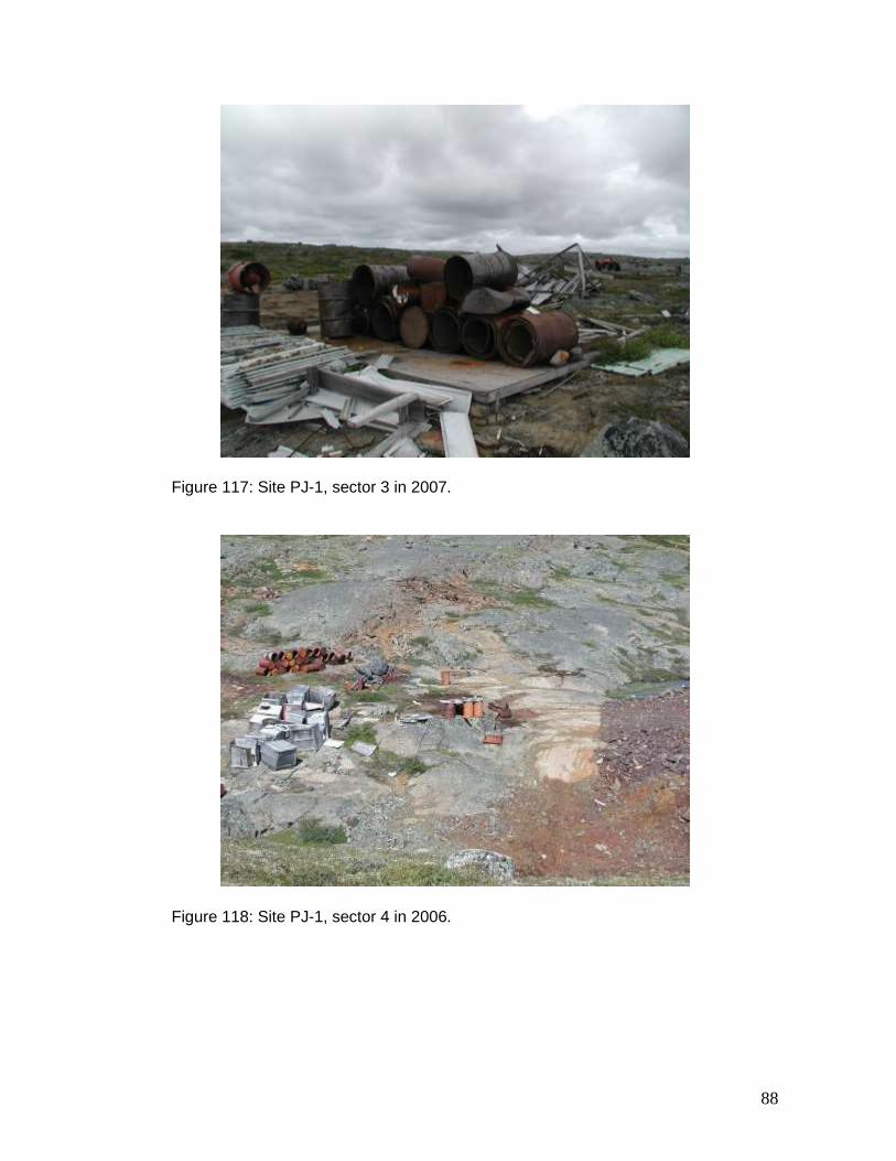
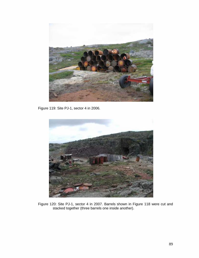
PJ-1 The abandoned mineral exploration site PJ-1 (58º 57.71’ N, 69º 35.85’ W) is located midway between the communities of Aupaluk and Tasiujaq. The site covers more than 3 km2 and comprises nine sectors. A team of ten workers (an environmental technician and nine Inuit) carried out clean-up work at the site between July 23 and 30, 2007. At the beginning of the 2007 fieldwork, occupational safety training was delivered by the environmental technician. Clean-up work was mainly concentrated in sectors 2, 3, 4, 8 and 9. No clean-up work was completed in sector 2 during the 2006 pilot project. This sector contained roughly 35 barrels. Of these, three undamaged 205-L barrels were used to recover used oil. The remaining barrels were cut up and stacked together, for the most part three barrels one inside another. The wood frame of a shed was also demolished. Figure 114 shows sector 2 prior to clean-up work. Figure 115 shows sector 2 at the end of the 2007 fieldwork. During the 2006 pilot project, roughly 20 scattered barrels in sector 3 were piled together (Figure 116). In the summer of 2007 some of these barrels were cut up and stacked together, two or three barrels one inside another, in preparation for removal from the site in the winter (Figure 117). Sector 4 is the largest sector at this site. During the 2006 pilot project, most clean-up activities were concentrated in this sector. In particular, roughly 70 barrels were stacked in two separate piles (Figures 118 and 119). In the summer of 2007, these barrels were cut up and stacked together, three barrels one inside another, in preparation for removal from the site in the winter (Figures 120 and 121). Sector 4 contains a large quantity of mine tailings (Figure 122). A water sample taken near the mine tailings revealed a neutral pH of 6.79 (15.9ºC). This neutral level of pH indicates the absence of acid mine drainage. Clean-up work was not carried out in sectors 8 and 9 during the 2006 pilot project. The two sectors contain roughly 155 scattered barrels (Figure 123). Clean-up work involved stacking the barrels in two separate piles. Of these, 62 barrels containing metal and other debris were placed on the crest of a hill. (Figure 124). The remaining 93 barrels, shown in Figure 125, were piled together. Among this second pile, six barrels contain petroleum-hydrocarbon residue. Residue found in damaged barrels was transferred to undamaged barrels. The remaining 87 empty barrels were cut up and stacked together, three barrels one inside another. Figure 125 also shows that the metal debris, which had been scattered around the site, was piled together near the barrels. Finally, the wood debris found in sectors 8 and 9 was burnt on site in compliance with MDDEP regulations.
In the summer of 2007, no clean-up work was carried out in sectors 1, 5, 6 and 7. Notwithstanding, the interiors of two trailers in sector 5 were cleaned. The work team’s supplies
19
were stored in one and the other was used as a kitchen. Sector 5 contains three other nearby trailers. Despite further normal deterioration, the trailers match the description contained in the 2001–2002 inventory. They contain chiefly plywood, foam insulation, electrical wiring and washroom facilities (Figure 126).
During the 2006 pilot project, bio-treatment measures were applied to contaminated soil in sectors 4 and 6. Comparison with the analysis results obtained in 2002 demonstrates a reduction in petroleum-hydrocarbon contamination of 52% and 23% in sectors 4 and 6 respectively (KRG, 2007). No certificate of authorization was issued by the MDDEP for the application of these bio-treatment measures. The application for a certificate of authorization was submitted at the beginning of the summer, but no certificate was issued prior to the fieldwork.
An assessment of the heavy equipment found in sector 4 was carried out in the summer of 2007 by Georges Gagnon of the Makivik Corporation’s construction division. Of the 14 pieces of equipment (truck, bulldozer, crusher, conveyor, etc.), 12 or 13 could be repaired and removed from the site to be re-used elsewhere. The other equipment could be transported to Aupaluk for temporary storage. This repair and transportation work will be carried out by the Makivik Corporation’s construction division in the fall of 2008.
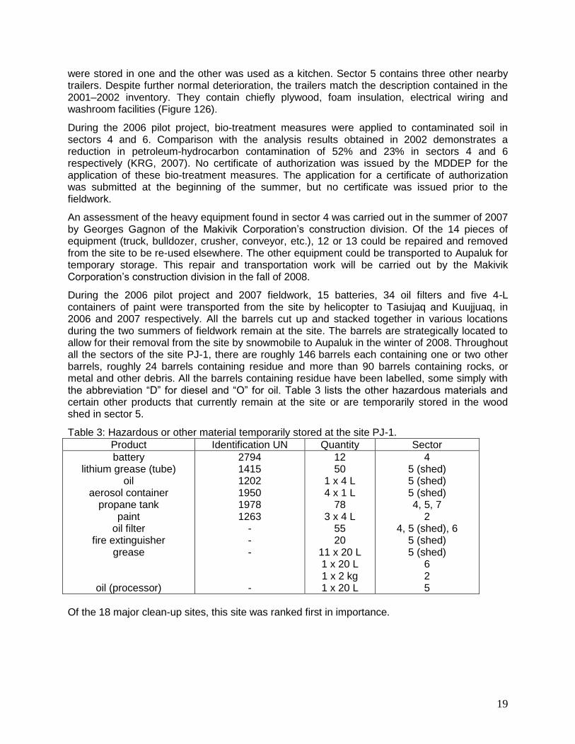
During the 2006 pilot project and 2007 fieldwork, 15 batteries, 34 oil filters and five 4-L containers of paint were transported from the site by helicopter to Tasiujaq and Kuujjuaq, in 2006 and 2007 respectively. All the barrels cut up and stacked together in various locations during the two summers of fieldwork remain at the site. The barrels are strategically located to allow for their removal from the site by snowmobile to Aupaluk in the winter of 2008. Throughout all the sectors of the site PJ-1, there are roughly 146 barrels each containing one or two other barrels, roughly 24 barrels containing residue and more than 90 barrels containing rocks, or metal and other debris. All the barrels containing residue have been labelled, some simply with the abbreviation “D” for diesel and “O” for oil. Table 3 lists the other hazardous materials and certain other products that currently remain at the site or are temporarily stored in the wood shed in sector 5.
Table 3: Hazardous or other material temporarily stored at the site PJ-1.
Product Identification UN Quantity Sector
battery lithium grease (tube)
oil aerosol container
propane tank paint
oil filter fire extinguisher
grease
oil (processor)
2794 1415 1202 1950 1978 1263
- - - -
12 50
1 x 4 L 4 x 1 L
78 3 x 4 L
55 20
11 x 20 L 1 x 20 L 1 x 2 kg 1 x 20 L
4 5 (shed) 5 (shed) 5 (shed) 4, 5, 7
2 4, 5 (shed), 6
5 (shed) 5 (shed)
6 2 5
Of the 18 major clean-up sites, this site was ranked first in importance.
20
4.1.3 Aupaluk Sector
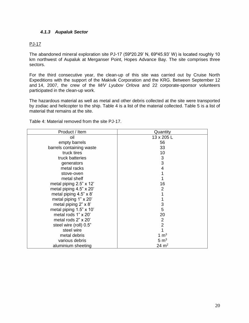
PJ-17 The abandoned mineral exploration site PJ-17 (59º20.29’ N, 69º45.93’ W) is located roughly 10 km northwest of Aupaluk at Merganser Point, Hopes Advance Bay. The site comprises three sectors. For the third consecutive year, the clean-up of this site was carried out by Cruise North Expeditions with the support of the Makivik Corporation and the KRG. Between September 12 and 14, 2007, the crew of the M/V Lyubov Orlova and 22 corporate-sponsor volunteers participated in the clean-up work. The hazardous material as well as metal and other debris collected at the site were transported by zodiac and helicopter to the ship. Table 4 is a list of the material collected. Table 5 is a list of material that remains at the site. Table 4: Material removed from the site PJ-17.
Product / Item Quantity
oil empty barrels
barrels containing waste truck tires
truck batteries generators metal racks stove-oven metal shelf
metal piping 2.5” x 12’ metal piping 4.5” x 20’ metal piping 4.5” x 8’ metal piping 1” x 20’ metal piping 2” x 8’
metal piping 1.5” x 10’ metal rods 1” x 20’ metal rods 2” x 20’ steel wire (roll) 0.5”
steel wire metal debris
various debris aluminium sheeting
13 x 205 L 56 33 10 3 3 4 1 1
16 2 1 1 3 5
20 2 2 1
1 m3
5 m3
24 m2
21
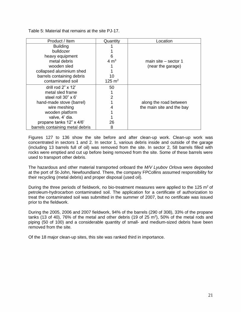
Table 5: Material that remains at the site PJ-17.
Product / Item Quantity Location
Building bulldozer
heavy equipment metal debris wooden sled
collapsed aluminium shed barrels containing debris
contaminated soil
1 1 6
4 m3 1 1
10 125 m2
main site – sector 1 (near the garage)
drill rod 2” x 12’ metal sled frame steel roll 30” x 6’
hand-made stove (barrel) wire meshing
wooden platform valve, 4’ dia.
propane tanks 12” x 4/6’ barrels containing metal debris
50 1 2 1 4 1 1
26 8
along the road between the main site and the bay
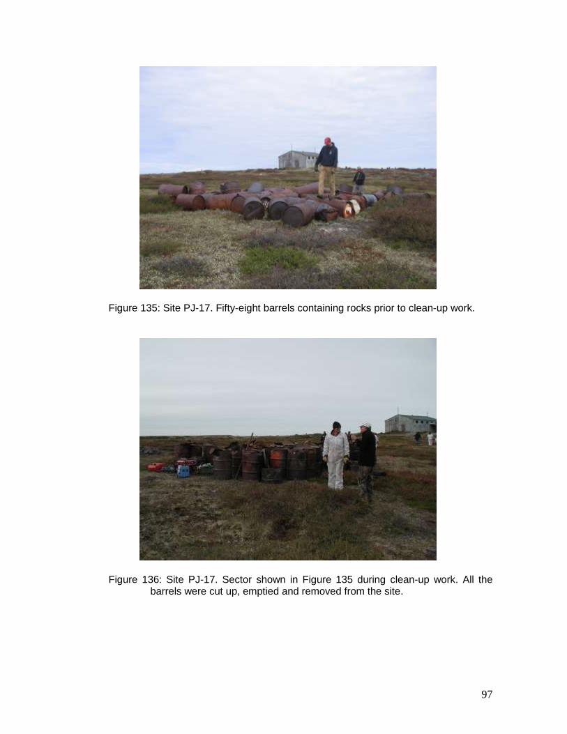
Figures 127 to 136 show the site before and after clean-up work. Clean-up work was concentrated in sectors 1 and 2. In sector 1, various debris inside and outside of the garage (including 13 barrels full of oil) was removed from the site. In sector 2, 58 barrels filled with rocks were emptied and cut up before being removed from the site. Some of these barrels were used to transport other debris. The hazardous and other material transported onboard the M/V Lyubov Orlova were deposited at the port of St-John, Newfoundland. There, the company FPCollins assumed responsibility for their recycling (metal debris) and proper disposal (used oil). During the three periods of fieldwork, no bio-treatment measures were applied to the 125 m2 of petroleum-hydrocarbon contaminated soil. The application for a certificate of authorization to treat the contaminated soil was submitted in the summer of 2007, but no certificate was issued prior to the fieldwork. During the 2005, 2006 and 2007 fieldwork, 94% of the barrels (290 of 308), 33% of the propane tanks (13 of 40), 76% of the metal and other debris (19 of 25 m2), 50% of the metal rods and piping (50 of 100) and a considerable quantity of small- and medium-sized debris have been removed from the site. Of the 18 major clean-up sites, this site was ranked third in importance.
22
4.2 Ungava Trough – Hudson Bay
4.2.1 Salluit Sector
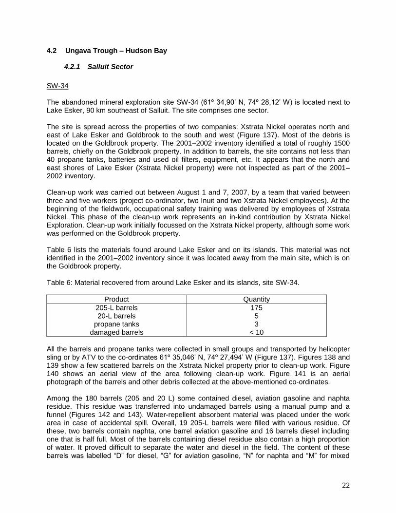
SW-34 The abandoned mineral exploration site SW-34 (61º 34,90’ N, 74º 28,12’ W) is located next to Lake Esker, 90 km southeast of Salluit. The site comprises one sector. The site is spread across the properties of two companies: Xstrata Nickel operates north and east of Lake Esker and Goldbrook to the south and west (Figure 137). Most of the debris is located on the Goldbrook property. The 2001–2002 inventory identified a total of roughly 1500 barrels, chiefly on the Goldbrook property. In addition to barrels, the site contains not less than 40 propane tanks, batteries and used oil filters, equipment, etc. It appears that the north and east shores of Lake Esker (Xstrata Nickel property) were not inspected as part of the 2001–2002 inventory. Clean-up work was carried out between August 1 and 7, 2007, by a team that varied between three and five workers (project co-ordinator, two Inuit and two Xstrata Nickel employees). At the beginning of the fieldwork, occupational safety training was delivered by employees of Xstrata Nickel. This phase of the clean-up work represents an in-kind contribution by Xstrata Nickel Exploration. Clean-up work initially focussed on the Xstrata Nickel property, although some work was performed on the Goldbrook property. Table 6 lists the materials found around Lake Esker and on its islands. This material was not identified in the 2001–2002 inventory since it was located away from the main site, which is on the Goldbrook property. Table 6: Material recovered from around Lake Esker and its islands, site SW-34.
Product Quantity
205-L barrels 20-L barrels
propane tanks damaged barrels
175 5 3
< 10
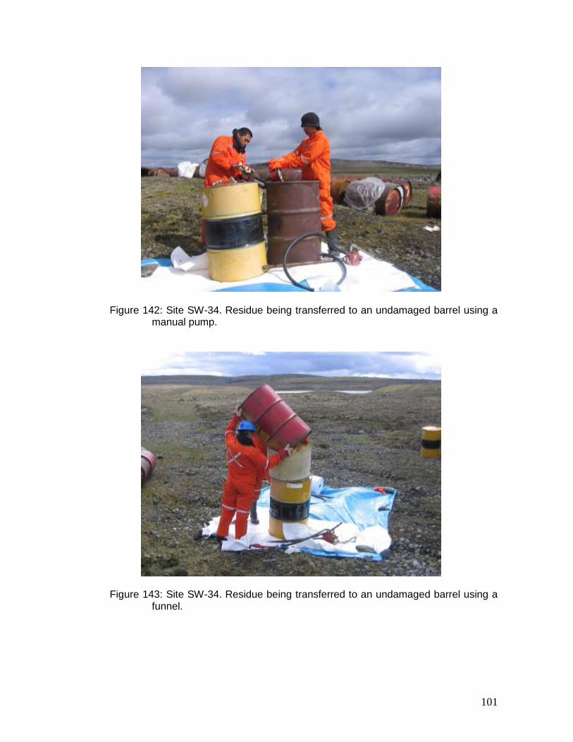
All the barrels and propane tanks were collected in small groups and transported by helicopter sling or by ATV to the co-ordinates 61º 35,046’ N, 74º 27,494’ W (Figure 137). Figures 138 and 139 show a few scattered barrels on the Xstrata Nickel property prior to clean-up work. Figure 140 shows an aerial view of the area following clean-up work. Figure 141 is an aerial photograph of the barrels and other debris collected at the above-mentioned co-ordinates. Among the 180 barrels (205 and 20 L) some contained diesel, aviation gasoline and naphta residue. This residue was transferred into undamaged barrels using a manual pump and a funnel (Figures 142 and 143). Water-repellent absorbent material was placed under the work area in case of accidental spill. Overall, 19 205-L barrels were filled with various residue. Of these, two barrels contain naphta, one barrel aviation gasoline and 16 barrels diesel including one that is half full. Most of the barrels containing diesel residue also contain a high proportion of water. It proved difficult to separate the water and diesel in the field. The content of these barrels was labelled “D” for diesel, “G” for aviation gasoline, “N” for naphta and “M” for mixed
23
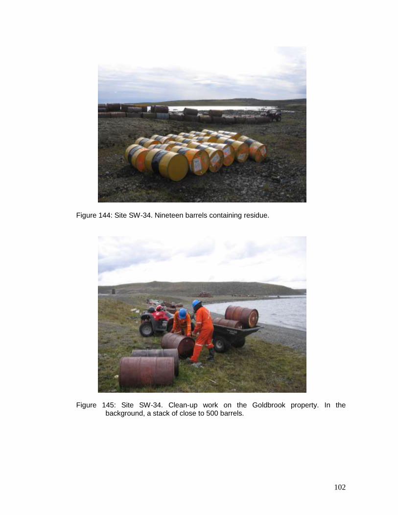
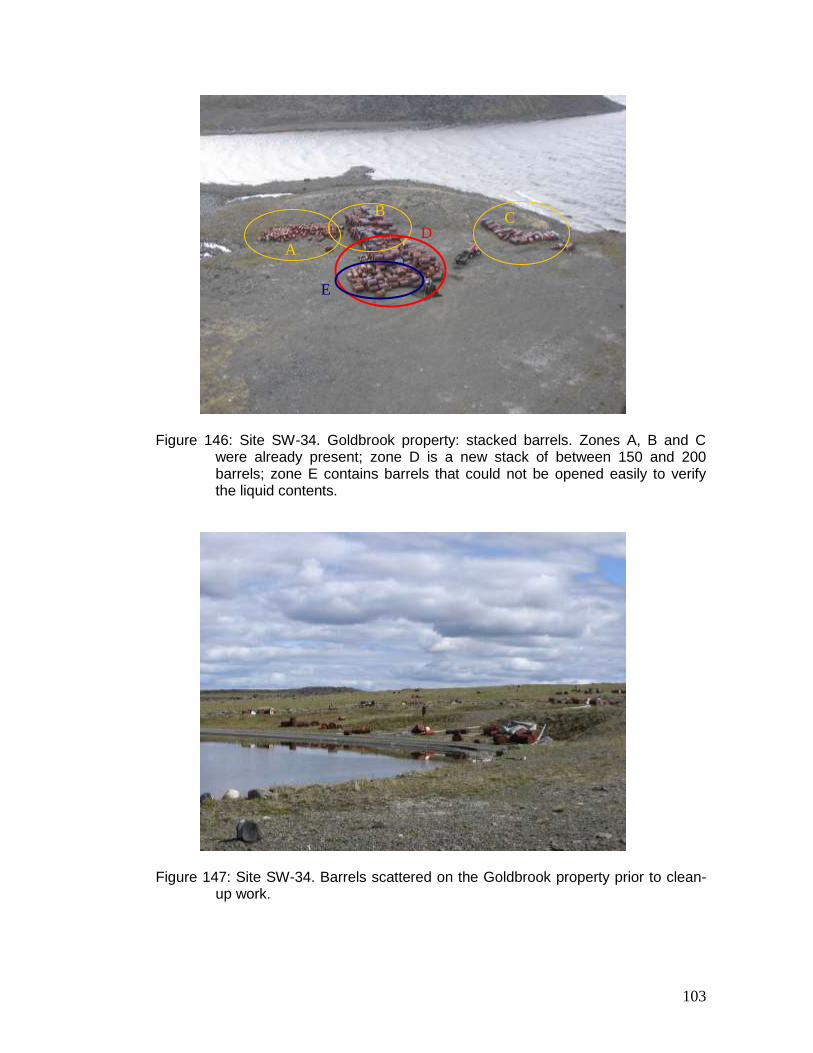
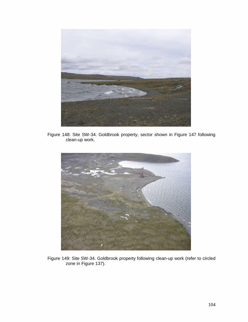
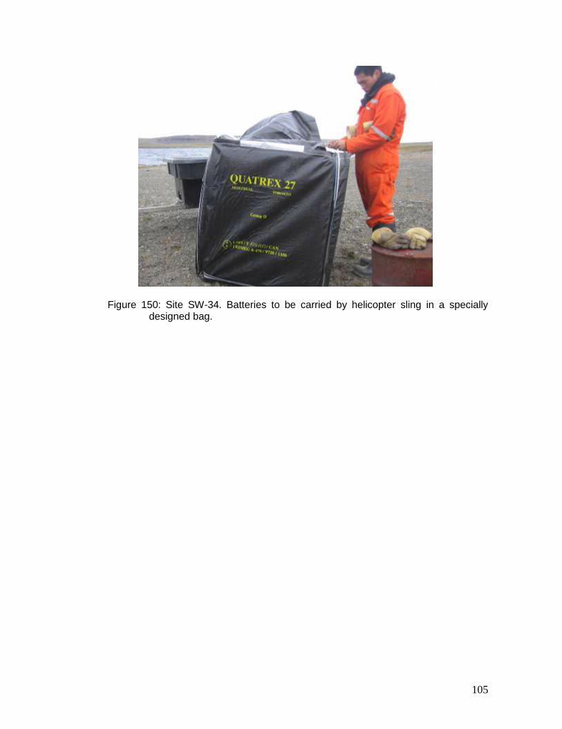
when the barrel contained a high proportion of water (Figure 144). The 19 barrels containing residue will be transported to the Raglan mining site for treatment. The clean-up work carried out on the Goldbrook property involved transporting between 150 and 200 barrels to the main site where the 2001–2002 inventory identified a pile of not less than 500 barrels (Figure 145). Most of the transported barrels were empty and were stacked with the other empty barrels at the site (Figure 146). Barrels which were transported but could not be opened easily to assess their contents were deposited next to the main pile of barrels. Taking into account the 150 to 200 barrels collected during the 2007 fieldwork, the 600 barrels that remain scattered on the Goldbrook property and the residue recovery work completed on the Xstrata Nickel property, it is estimated that between 10 and 15% of the barrels will contain residue material, which is to say between 60 and 100 barrels. Figure 147 shows a few scattered barrels on the Goldbrook property prior to clean-up work. Figure 148 shows the same sector following clean-up work. Figure 149 is an aerial photograph of the cleaned sector on the Goldbrook property. A total of 20 batteries and 20 used oil filters were removed from the site by helicopter. The batteries were slung by helicopter in a specially designed bag (Figure 150). The Raglan mine’s environmental department will assume responsibility for the used batteries and the used filters will be burnt in compliance with practices in place at the mine. Of the 18 major clean-up sites, this site was ranked second in importance.
5 CONCLUSIONS
This report summarizes all the information currently available on the 18 “major” mineral exploration sites in Nunavik. Since the 2001–2002 inventory was completed, clean-up work has been carried out at only three sites (KAW-35, PJ-1 and PJ-17) through pilot projects implemented by the KRG, in co-operation with Cruise North Expeditions. In the summer of 2007, in its capacity as project manager, the KRG undertook to verify the current state of the 14 “major” mineral exploration sites where clean-up work has not yet been carried out, continued clean-up work at the sites KAW-35, PJ-1 and PJ-17, and initiated the first phase of clean-up work at the site SW-34. This update on the state of the 14 sites still requiring clean-up and the four sites undergoing clean-up was necessary to plan future fieldwork. It also represents the first stage of the general response plan (GRP) concerning the rehabilitation of the 18 “major” sites. Financial data on the 2007 verification and the four clean-up projects is not presented herein but will be included in the GRP. The GRP will describe, for each of the 18 sites, the work to be carried out, the timetable, and the estimated budget, based on the technical and financial data generated during the work carried out at the sites KAW-35, PJ-1, PJ-17 and SW-34 since 2005.
6 REFERENCES
Barrett, M. and R. Lanari, 2003. Remedial Measures and Completion of the Assessment of
Nunavik’s Abandoned Mining Exploration Sites. Kativik Regional Government, Makivik Corporation, 27 p.
24
Kativik Regional Government, 2003. Assessment and Prioritization of Abandoned Mining Exploration Sites in Nunavik: Final Report on a Two-Year Project (2001–2002). Kativik Regional Government, Makivik Corporation, Kuujjuaq. 67 p. and appendices.
Kativik Regional Government, 2006. Assessment and Prioritization of Abandoned Mining
Exploration Sites in Nunavik: Progress Report for the Year 2005–2006 of the Project. Kativik Regional Government, Kuujjuaq. 24 p. and appendices.
Kativik Regional Government, 2007. Assessment and Prioritization of Abandoned Mining
Exploration Sites in Nunavik: Progress Report for the Year 2006–2007 of the Project. Kativik Regional Government, Kuujjuaq. 27 p. and appendices.
25
Figure 1: Labrador Trough. “Major” Abandoned Mineral Exploration Sites KAW-35 and KAW-45.
26
Figure 2: Labrador Trough. “Major” Abandoned Mineral Exploration Sites TQ-1, TQ-4 and PJ-1.
27
Figure 3: Labrador Trough. “Major” Abandoned Mineral Exploration Sites PJ-10, PJ-17 and TW.
28
Figure 4: Ungava Trough. “Major” Abandoned Mineral Exploration Sites K-28, K-61, KV-1, SAL-1, SW-27, SW-34,
WB-3 and WB-9.
29
Figure 5: Hudson Bay. “Major” Abandoned Mineral Exploration Site WHA-1.
30
Figure 6: Site KAW-45, A) sector 1, B) sector 2.
Figure 7: Site KAW-45, sector 1.
A
B
31
Figure 8: Site KAW-45, sector 1.
Figure 9: Site KAW-45, sector 2.
32
Figure 10: Site KAW-45, sector 2.
Figure 11: Site TQ-1 in 2001.
A
D C
B
E F
G H
33
Figure 12: Site TQ-1 in 2007.
Figure 13: Site TQ-1. Building G, new kitchen.
A
D C
B
E F
G
G
34
Figure 14: Site TQ-1. Buildings A and B cleaned and renovated.
Figure 15: Site TQ-1. Building D, former kitchen transformed into a bunkhouse.
A B
35
Figure 16: Site TQ-1. Building E, bunkhouse.
Figure 17: Site TQ-1. Building F, bunkhouse.
36
Figure 18: Site TQ-1. Contaminated soil.
Figure 19: Near the site TQ-1. Barrels containing diesel next to the landing strip.
37
Figure 20: Intermediate site P-24F13-5. Barrels next to Lake Gerido, near the site TQ-1.
Figure 21: Site TQ-4, sector 1.
38
Figure 22: Site TQ-4, sector 1. Building interior. Site has been used since 2001: heating stove and ice auger were removed.
Figure 23: Site TQ-4, sector 1. Collapsed building.
39
Figure 24: Site TQ-4, sector 1. Wooden platform.
Figure 25: Site TQ-4, sector 1. Group of 35 barrels. Contaminated soil underneath the lone barrel.
40
Figure 26: Site TQ-4, sector 2. One hundred and fifteen barrels located around two depressions.

41
Figure 27: Layout of the site PJ-10 reproduced from Appendix 9 (2001–2002
inventory).
42
Figure 28: Site PJ-10, sector 1 (refer to Figure 27).
Figure 29: Site PJ-10, sector 1 (refer to Figure 27).
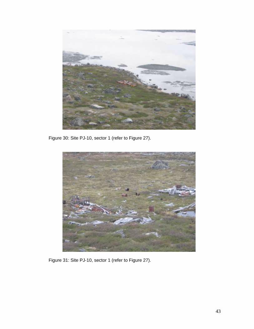
43
Figure 30: Site PJ-10, sector 1 (refer to Figure 27).
Figure 31: Site PJ-10, sector 1 (refer to Figure 27).
44
Figure 32: Site PJ-10, sector 2 (refer to Figure 27).
Figure 33: Site PJ-10, sector 2 (refer to Figure 27). Fifteen barrels containing residue.
45
Figure 34: Layout of the site TW reproduced from Appendix 9 (2001–2002
inventory).
46
Figure 35: Site TW (refer to Figure 34).
Figure 36: Site TW (refer to Figure 34).
47
Figure 37: Site TW (refer to Figure 34). Soil contaminated with grease.
Figure 38: Site TW (refer to Figure 34).
48
Figure 39: Site TW (refer to Figure 34).
Figure 40: Site TW (refer to Figure 34). Mine tailings.
49
Figure 41: Site TW (refer to Figure 34). Mine tailings.
Figure 42: Site K-28. Sectors 1 and 2 are shown circled in yellow. Mesamax Camp belonging to Canadian Royalties is shown circled in blue.
50
Figure 43: Site K-28. Mesamax Camp belonging to Canadian Royalties.
Figure 44: Site K-28, sector 1 in 2001–2002.
51
Figure 45: Site K-28, sector 2 in 2001–2002.
Figure 46: Site K-28, sector 1 in 2007.
52
Figure 47: Site K-28, sector 2 in 2007.
Figure 48: Site K-28. Roughly 100 barrels from sectors 1 and 2.
53
Figure 49: Site K-61 in 2007. The renovated Expo Camp is shown in the background (old and new buildings). Debris observed at site K-61 during the 2001–2002 inventory is shown circled in yellow. Debris gathered from minor and intermediate sites is shown circled in red. Recent barrels deposited by Canadian Royalties are shown circled in green.
Figure 50: Site K-61 in 2001–2002. Original buildings and pile of debris shown circled in yellow.
54
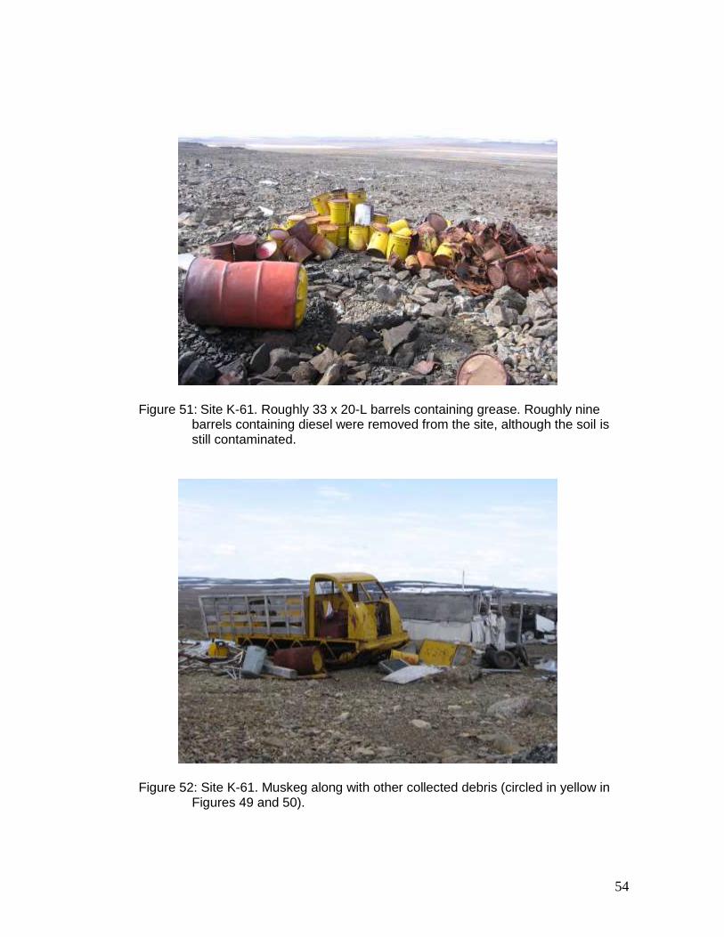
Figure 51: Site K-61. Roughly 33 x 20-L barrels containing grease. Roughly nine barrels containing diesel were removed from the site, although the soil is still contaminated.
Figure 52: Site K-61. Muskeg along with other collected debris (circled in yellow in Figures 49 and 50).
55
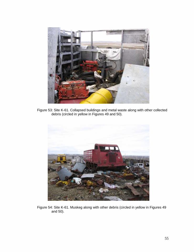
Figure 53: Site K-61. Collapsed buildings and metal waste along with other collected debris (circled in yellow in Figures 49 and 50).
Figure 54: Site K-61. Muskeg along with other debris (circled in yellow in Figures 49 and 50).
56
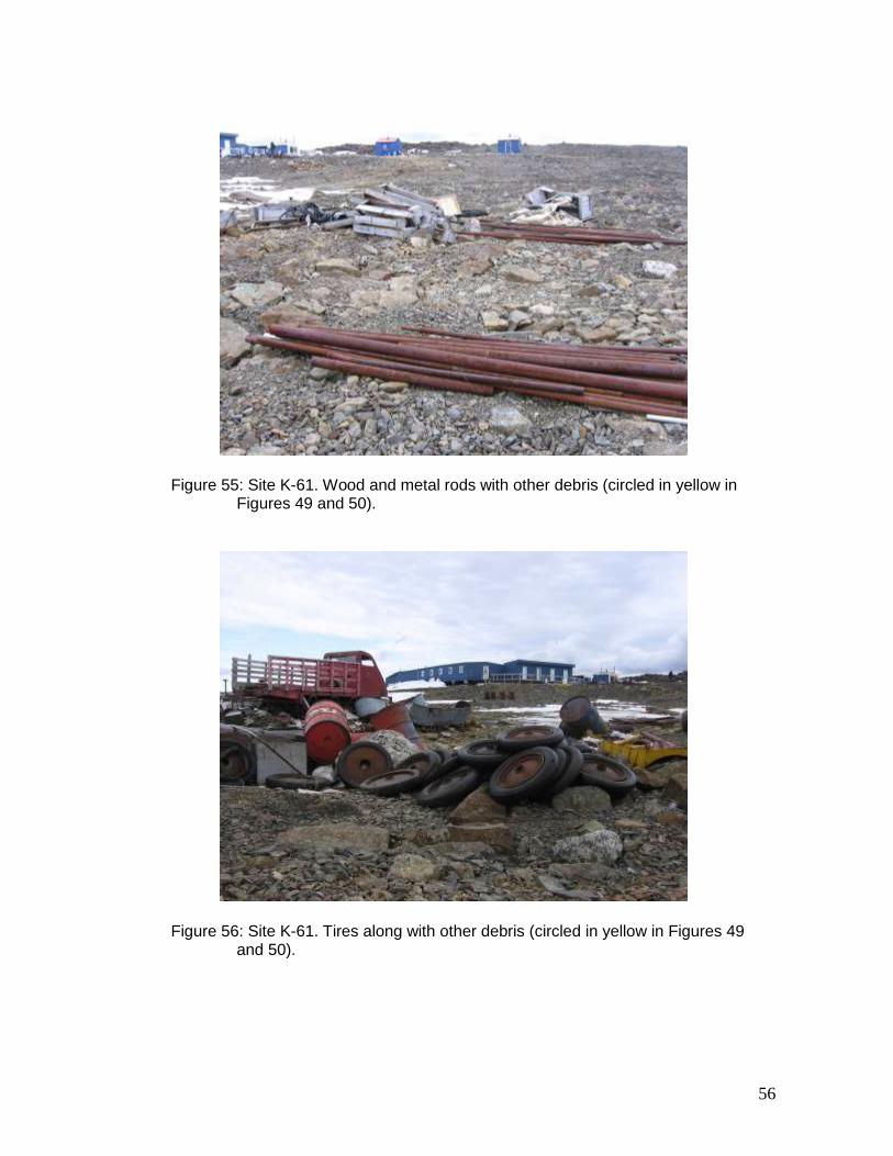
Figure 55: Site K-61. Wood and metal rods with other debris (circled in yellow in Figures 49 and 50).
Figure 56: Site K-61. Tires along with other debris (circled in yellow in Figures 49 and 50).
57
Figure 57: Site K-61. Barrel containing grease along with other debris (circled in yellow in Figures 49 and 50). Petroleum-hydrocarbon soil contamination.
Figure 58: Site WB-3. Fifty-five barrels near the shoreline.
58
Figure 59: Site WB-3. Wood, scattered barrels and metal rod projecting from the bedrock (shown circled in yellow).
Figure 60: Site WB-3. Wooden platform with metal sheeting.
59
Figure 61: Site KV-1. Barrels scattered at the site.
Figure 62: Site KV-1. One of four barrels on the opposite shore of the lake.
60
Figure 63: Site KV-1. Barrels scattered at the site.
Figure 64: Site KV-1. Wood and debris.
61
Figure 65: Site KV-1. Barrels containing waste.
Figure 66: Site KV-1. Fifteen compacted barrels.
62
Figure 67: Site SAL-1. Partial view of the site. Buildings E and F have since collapsed.
Figure 68: Site SAL-1. Partial view of the site. More than 200 barrels are located in a major water drainage area. In the background, buildings (refer to Figure 67).
A
B C
D
E G
F
63
Figure 69: Site SAL-1. Building A (refer to Figure 67). Wood and roughly 90 x 1-L containers of oil.
Figure 70: Site SAL-1. Building B (refer to Figure 67). Wood and some metal debris.
64
Figure 71: Site SAL-1. Building C (refer to Figure 67). Wood, 6 x 40-L containers of oil, and propane tanks.
Figure 72: Site SAL-1. Building D (refer to Figure 67). Wood, stove-oven, heating
stove and propane tanks.
65
Figure 73: Site SAL-1. Buildings E, F and G (refer to Figure 67). Wood and scattered barrels.
Figure 74: Site SW-27, sector 1. Wood, metal debris and scattered barrels.
E
G
F
66
Figure 75: Site SW-27, sector 1. Wood, metal debris and scattered barrels.
Figure 76: Site SW-27, sector 2. Scattered barrels, muskeg, grease containers, etc. Petroleum-hydrocarbon soil contamination.
67
Figure 77: Site SW-27, sector 3. Wood, metal debris and barrels.
Figure 78: Site SW-27, sector 4. Wood, barrels, grease and oil containers, etc.
68
Figure 79: Site SW-27, sector 2. Open barrel containing grease and soil contamination.
Figure 80: Site SW-42. Partial view of the site.
69
Figure 81: Site SW-42. Wood, grease containers, piping and metal debris.
Figure 82: Site SW-42. Home-made stove and exploration shaft.
70
Figure 83: Site SW-42. Roughly 85 barrels, less than 10 of which contain residue.
Figure 84: Site SW-42. Pile of 1- to 20-L metal containers.
71
Figure 85: Site WB-9 shown circled in yellow. Current Canadian Royalties camp shown circled in red.
72
Figure 86: Layout of site WB-9 prepared during the 2007 inspection.
73
Figure 87: Site WB-9 (refer to Figure 86).
Figure 88: Site WB-9 (refer to Figure 86).
74
Figure 89: Site WB-9 (refer to Figure 86).
Figure 90: Site WB-9 (refer to Figure 86).
75
Figure 91: Site WB-9 (refer to Figure 86).
Figure 92: Site WB-9 (refer to Figure 86).
76
Figure 93: Site WB-9 (refer to Figure 86).
Figure 94: Site WB-9 (refer to Figure 86).
77
Figure 95: Site WB-9 (refer to Figure 86).
Figure 96: Site WB-9 (refer to Figure 86).
78
Figure 97: Site WB-9 (refer to Figure 86).
Figure 98: Site WB-9 (refer to Figure 86).
79
Figure 99: Site WB-9 (refer to Figure 86).
Figure 100: Site WB-9 (refer to Figure 86).
80
Figure 101: Site KAW-35, sector 1. Removal of barrels from the site by floatplane.
Figure 102: Site KAW-35, sector 1. Empty barrels being cut up at the site.
81
Figure 103: Site KAW-35, sector 1. Barrels gathered together and ready for removal from the site. In the foreground, three barrels stacked one inside another.
Figure 104: Site KAW-35, sector 2. Barrels scattered at the site prior to clean-up work.
82
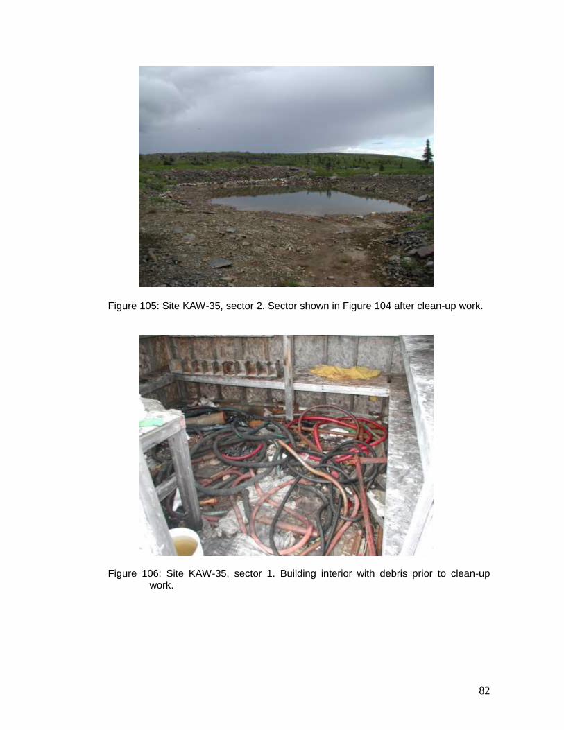
Figure 105: Site KAW-35, sector 2. Sector shown in Figure 104 after clean-up work.
Figure 106: Site KAW-35, sector 1. Building interior with debris prior to clean-up
work.
83
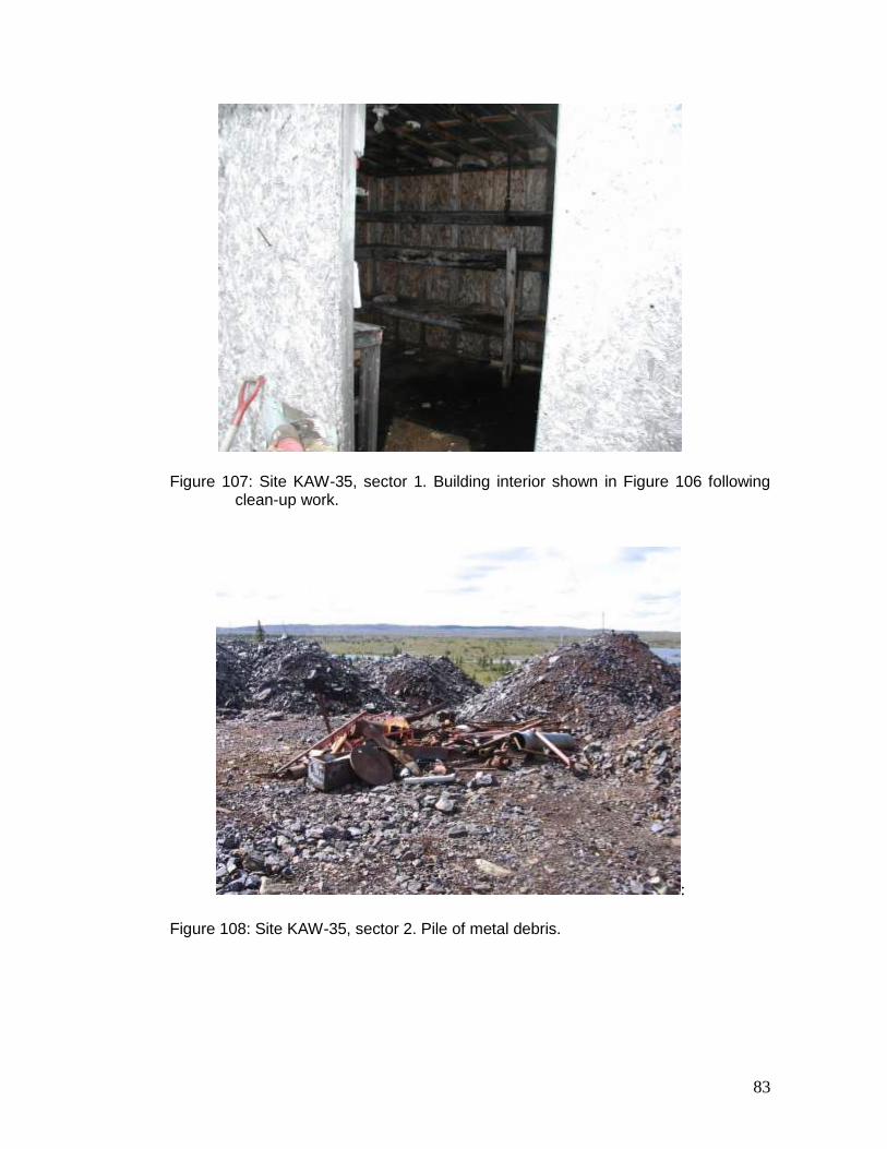
Figure 107: Site KAW-35, sector 1. Building interior shown in Figure 106 following clean-up work.
:
Figure 108: Site KAW-35, sector 2. Pile of metal debris.
84
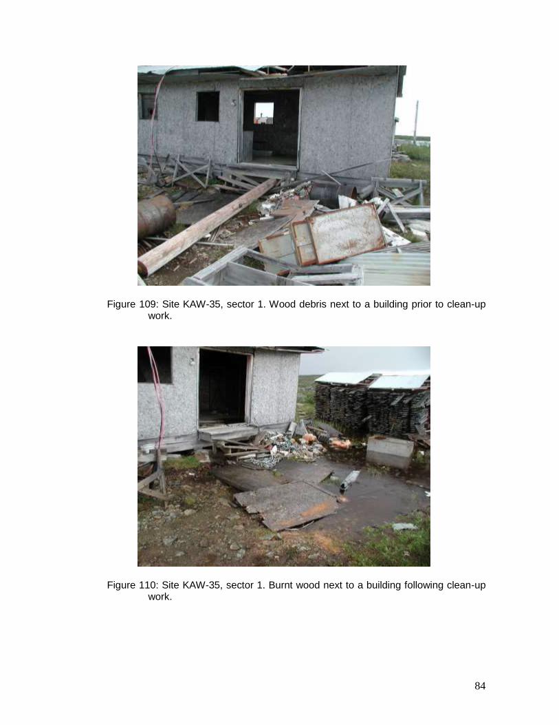
Figure 109: Site KAW-35, sector 1. Wood debris next to a building prior to clean-up work.
Figure 110: Site KAW-35, sector 1. Burnt wood next to a building following clean-up work.
85
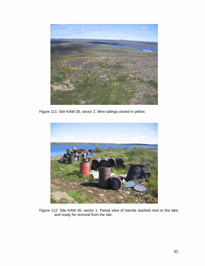
Figure 111: Site KAW-35, sector 2. Mine tailings circled in yellow.
Figure 112: Site KAW-35, sector 1. Partial view of barrels stacked next to the lake and ready for removal from the site.
86
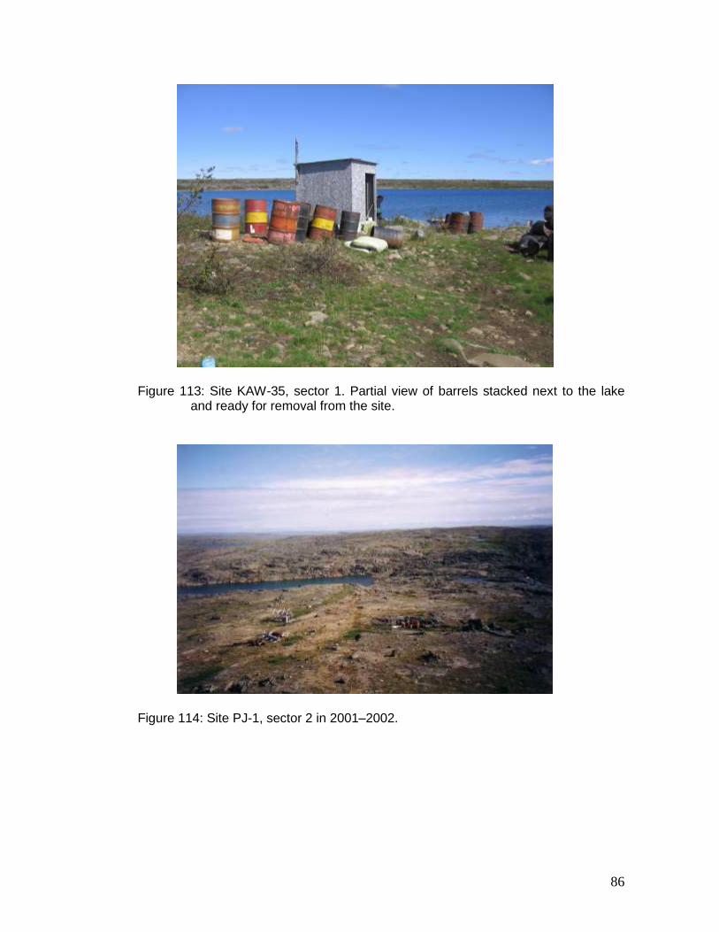
Figure 113: Site KAW-35, sector 1. Partial view of barrels stacked next to the lake and ready for removal from the site.
Figure 114: Site PJ-1, sector 2 in 2001–2002.
87
Figure 115: Site PJ-1, sector 2 in 2007.
Figure 116: Site PJ-1, sector 3 in 2006.
88
Figure 117: Site PJ-1, sector 3 in 2007.
Figure 118: Site PJ-1, sector 4 in 2006.
89
Figure 119: Site PJ-1, sector 4 in 2006.
Figure 120: Site PJ-1, sector 4 in 2007. Barrels shown in Figure 118 were cut and stacked together (three barrels one inside another).
90
Figure 121: Site PJ-1, sector 4 in 2007. Barrels shown in Figure 119 were cut and stacked together (three barrels one inside another).
Figure 122: Site PJ-1, sector 4. Mine tailings.
91
Figure 123: Site PJ-1, sector 8. Barrels and other scattered debris prior to clean-up work.
Figure 124: Site PJ-1, sector 8. Barrels containing metal debris and waste following
clean-up work.
92
Figure 125: Site PJ-1, sector 8. Some empty barrels and others containing residue and metal debris following clean-up work.
Figure 126: Site PJ-1, sector 5. Trailer-home interior.
93
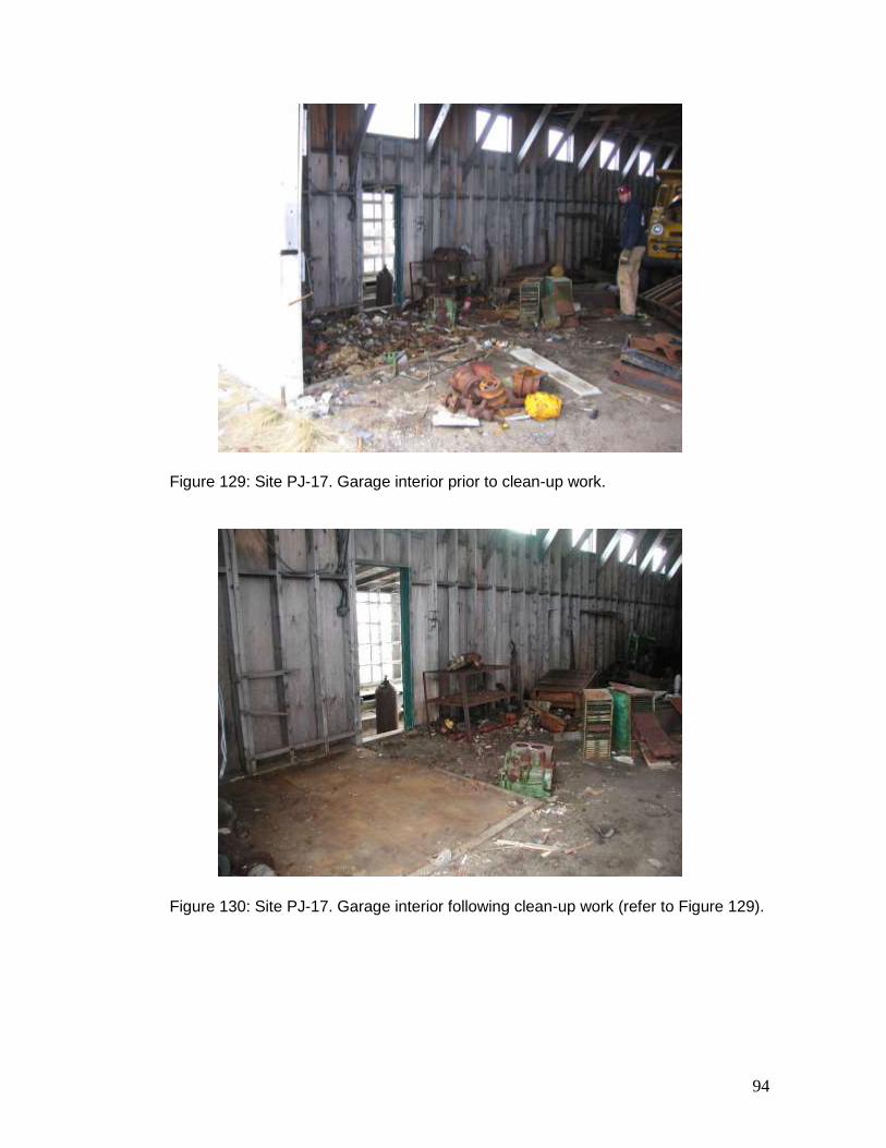
Figure 127: Site PJ-17. Garage interior prior to clean-up work.
Figure 128: Site PJ-17. Garage interior following clean-up work (refer to Figure 127).
94
Figure 129: Site PJ-17. Garage interior prior to clean-up work.
Figure 130: Site PJ-17. Garage interior following clean-up work (refer to Figure 129).
95
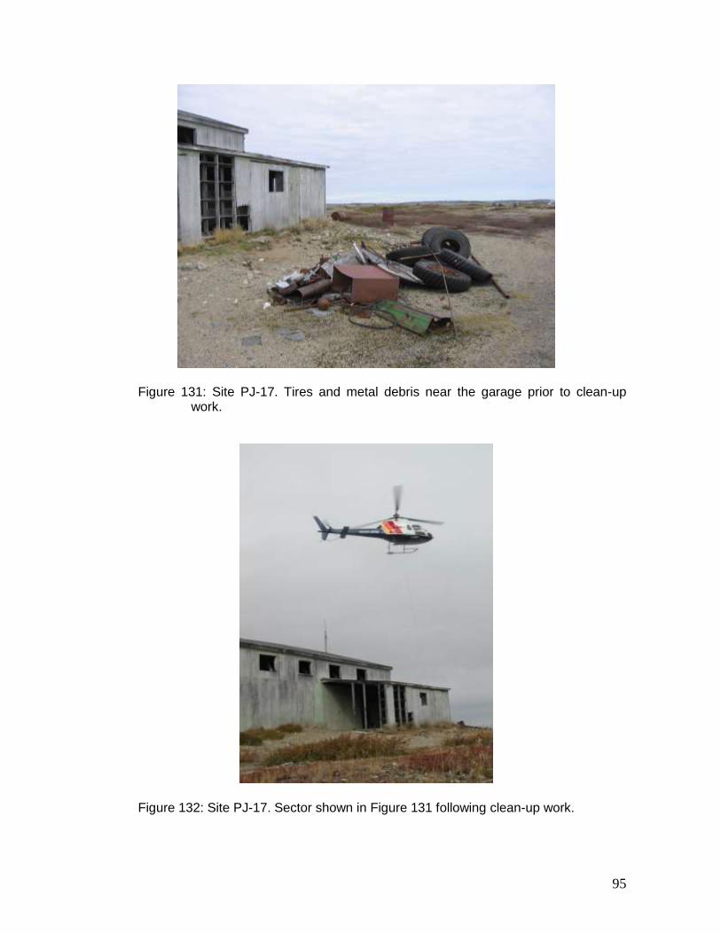
Figure 131: Site PJ-17. Tires and metal debris near the garage prior to clean-up work.
Figure 132: Site PJ-17. Sector shown in Figure 131 following clean-up work.
96
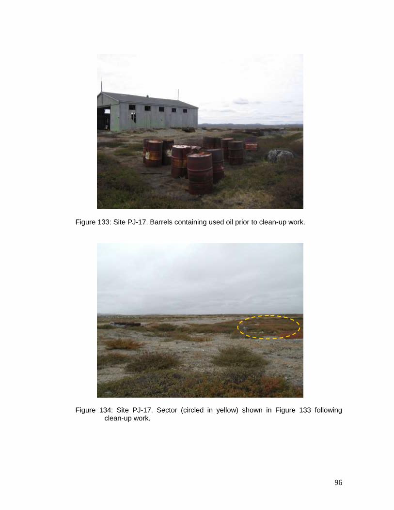
Figure 133: Site PJ-17. Barrels containing used oil prior to clean-up work.
Figure 134: Site PJ-17. Sector (circled in yellow) shown in Figure 133 following
clean-up work.
97
Figure 135: Site PJ-17. Fifty-eight barrels containing rocks prior to clean-up work.
Figure 136: Site PJ-17. Sector shown in Figure 135 during clean-up work. All the barrels were cut up, emptied and removed from the site.
98
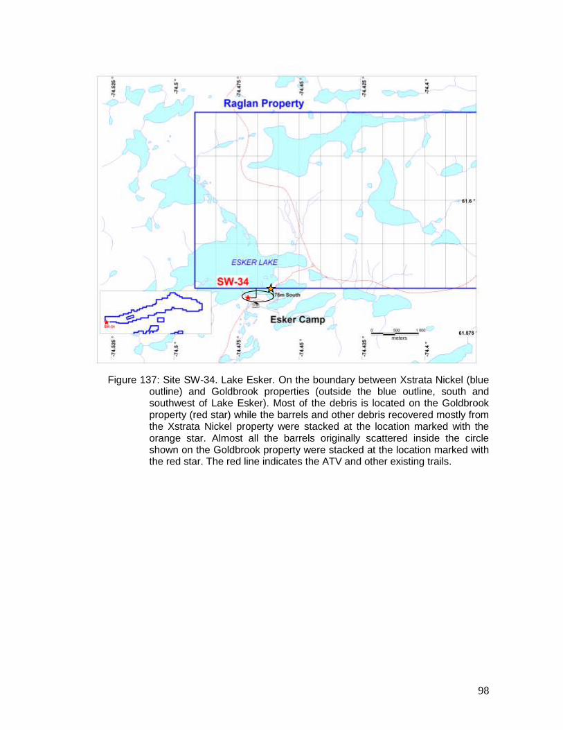
Figure 137: Site SW-34. Lake Esker. On the boundary between Xstrata Nickel (blue
outline) and Goldbrook properties (outside the blue outline, south and southwest of Lake Esker). Most of the debris is located on the Goldbrook property (red star) while the barrels and other debris recovered mostly from the Xstrata Nickel property were stacked at the location marked with the orange star. Almost all the barrels originally scattered inside the circle shown on the Goldbrook property were stacked at the location marked with the red star. The red line indicates the ATV and other existing trails.
99
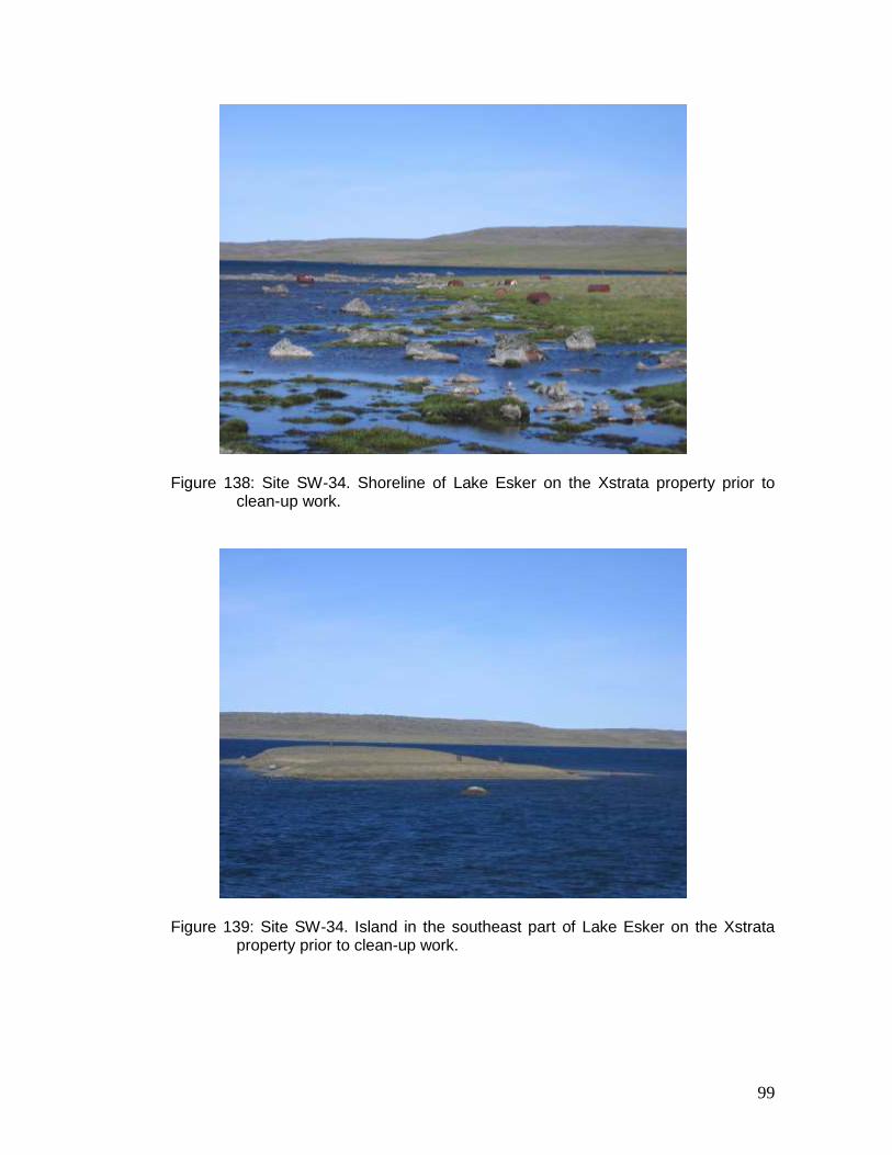
Figure 138: Site SW-34. Shoreline of Lake Esker on the Xstrata property prior to clean-up work.
Figure 139: Site SW-34. Island in the southeast part of Lake Esker on the Xstrata property prior to clean-up work.
100
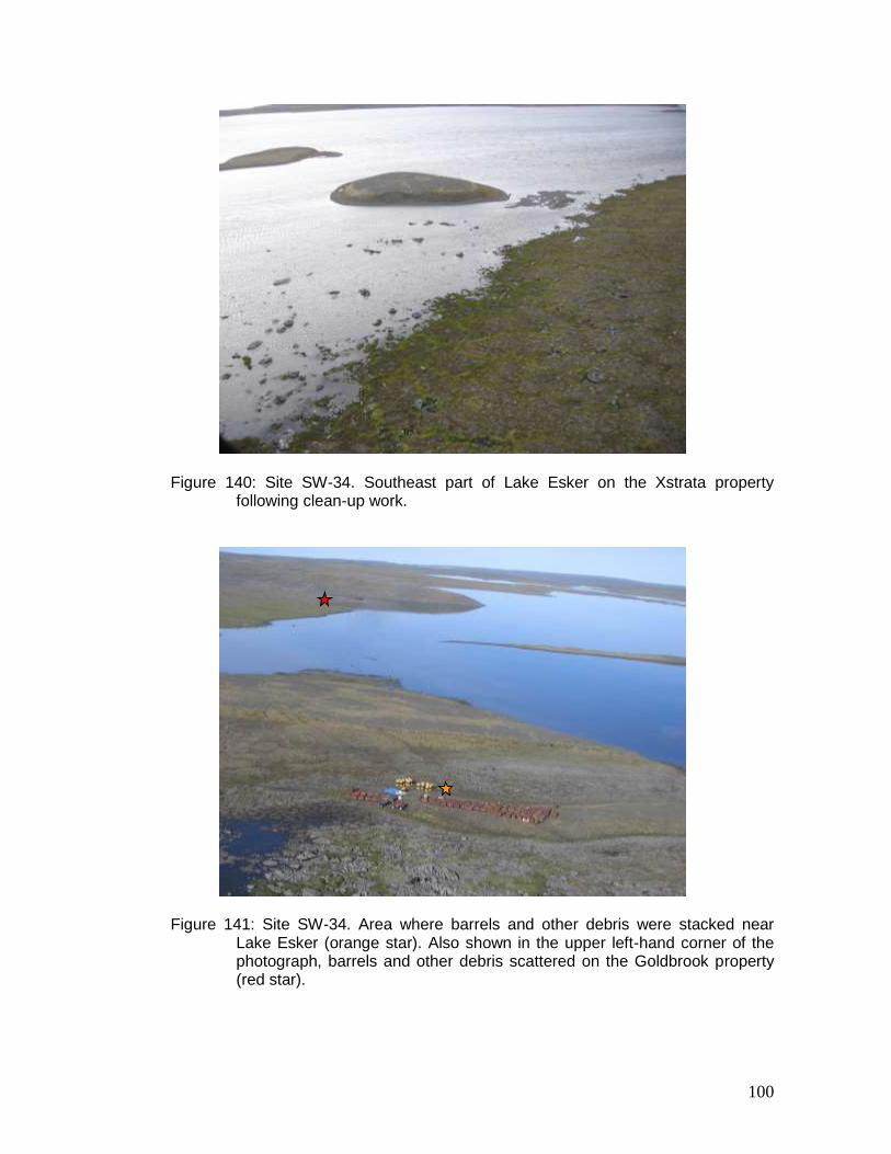
Figure 140: Site SW-34. Southeast part of Lake Esker on the Xstrata property following clean-up work.
Figure 141: Site SW-34. Area where barrels and other debris were stacked near Lake Esker (orange star). Also shown in the upper left-hand corner of the photograph, barrels and other debris scattered on the Goldbrook property (red star).
101
Figure 142: Site SW-34. Residue being transferred to an undamaged barrel using a manual pump.
Figure 143: Site SW-34. Residue being transferred to an undamaged barrel using a funnel.
102
Figure 144: Site SW-34. Nineteen barrels containing residue.
Figure 145: Site SW-34. Clean-up work on the Goldbrook property. In the background, a stack of close to 500 barrels.
103
Figure 146: Site SW-34. Goldbrook property: stacked barrels. Zones A, B and C were already present; zone D is a new stack of between 150 and 200 barrels; zone E contains barrels that could not be opened easily to verify the liquid contents.
Figure 147: Site SW-34. Barrels scattered on the Goldbrook property prior to clean-up work.
A
B C D
E
104
Figure 148: Site SW-34. Goldbrook property, sector shown in Figure 147 following clean-up work.
Figure 149: Site SW-34. Goldbrook property following clean-up work (refer to circled zone in Figure 137).
105
Figure 150: Site SW-34. Batteries to be carried by helicopter sling in a specially designed bag.