sustainable northern community development charrette in
TRANSCRIPT

Research report
Sustainable Northern CommunityDevelopment Charrette in Yellowknife, N.T.

CMHC—Home to CanadiansCanada Mortgage and Housing Corporation (CMHC) hasbeen Canada’s national housing agency for more than 60 years.
Together with other housing stakeholders, we help ensurethat Canada maintains one of the best housing systems in theworld.We are committed to helping Canadians access a widechoice of quality, affordable homes, while making vibrant,healthy communities and cities a reality across the country.
For more information, visit our website at www.cmhc.ca
You can also reach us by phone at 1-800-668-2642 or by fax at 1-800-245-9274.
Outside Canada call 613-748-2003 or fax to 613-748-2016.
Canada Mortgage and Housing Corporation supportsthe Government of Canada policy on access toinformation for people with disabilities. If you wish toobtain this publication in alternative formats,call 1-800-668-2642.

Sustainable Northern Community Development Charrette in Yellowknife N.T.
MAY 17-19, 2005
forCanada Mortgage and Housing Corporation

introduction
Yellowknife is a thriving city in the Northwest Territories ofCanada, on the northern shore of Great Slave Lake at latitude62° North. With its rapid growth, the city faces some of thehighest rental rates and building costs in the country. The highdemand for serviced sites, and the low supply of developableland with inherent cost increases, are critical issues for the city.Innovative, efficient, sustainable and affordable development isrequired to address those problems.
THE CHARRETTE
A charrette (design workshop), sponsored by Canada Mortgageand Housing Corporation (CMHC), was held May 17 to 19,2005. The objective was to explore the issues of Northerncommunity development and to suggest specific solutions toachieve a sustainable and high quality of life.
The charrette examined ways to balance different aspects ofsustainability to promote healthy, affordable, high-quality livingenvironments in Canada's North, by using a holistic approachto finding new solutions.
The charrette focused on the 100-acre, city-owned Negus Pointproperty, in Yellowknife.
The site is close to the abandoned Con Mine and will requireremediation before it is developed for residential use. It islocated on the shore of Great Slave Lake and is less than a 10-minute drive to the downtown area. The low-sloped landfeatures rocky outcrops and areas vegetated by coniferous treesand northern grasses.
Technical Series 07-113April 2007
research highlight
Sustainable Northern Development Charrette in Yellowknife
Figure 1 Satellite image of Yellowknife, with the Negus Pointsite on the lower right, serviced by Con Road
Figure 2 The Negus Point site with the mine shaft near the waterfront

2 Canada Mortgage and Housing Corporation
Research Highlight
Susta inable Northern Development Charrette in Yel lowkni fe
The three-day charrette brought together people such asmunicipal and territory representatives, architects, planners,engineers and northern planners, who contributed diverse skillsand expertise. The charrette was intended to introduce theIntegrated Design Process (IDP), a method that integrates a multi-disciplinary approach throughout the design,implementation and commissioning of buildings. The IDPincorporates issues that are seldom addressed in a standarddesign practice; the multi-disciplinary IDP teams treat them in a more holistic way.
The participants were asked to consider several inter-relatedissues during their team discussions, such as road constructionin the fragile Northern ecosystem; alternative water and sewagetreatment that does not rely on the over-taxed municipalsystem; more efficient construction technologies; and how thenew community would describe a high quality of life forNortherners.
There were 32 attendees including speakers, facilitators andresource people. All participated as members of one of threecharrette teams. Each team included, as much as possible, abalance of architectural, engineering, planning and otherprofessions related to development. Resource people circulatedamong the teams to provide their expertise. Teams were toembark upon parallel courses, but from their own vantage pointand method of approach. Two teams produced developmentconcepts for the site; the third team produced sustainableguidelines that could inform a community-focused designcompetition for the site.
DESIGN CONCEPTS
All three team concepts explored similar issues and proposed amixed density and variety in ownership tenure that includedaffordable, entry-level housing. The community proposed by -all groups should best reflect sustainable goals through anintegrated, inclusive community—including small commerce,community services, information and research facilities, wherepedestrian movement would be encouraged and protected, andaccess and views to the waterfront would be conserved.
SATELLITE COMMUNITY DEVELOPMENT
On-site wastewater treatment, and geothermal water-sourceddistrict heat offer possible infrastructure economies and theseconcepts need to be developed further. The establishment of a Yellowknife research facility was proposed to test potentialsystems, to develop northern data and to train local expertise.Such systems may ultimately save the municipality the cost ofupgrading infrastructure that is overstretched by increasedgrowth. Appropriate new technologies may facilitate thedevelopment process after detailed studies of timeliness, cost,reliability and maintenance factors are considered together withsocial and environmental benefits.
NEW OPTIONS FOR THE DEVELOPMENTPROCESS
Design competitions can offer innovative planning ideas. Forthis concept to work well, Northern principles of sustainabledevelopment, detailed specifications and requirements need toguide the designs and implementation.
WORKING WITH NATIVE TOPOGRAPHYAND HYDROLOGY
A common approach was to use local bedrock formations tooptimize solar exposure while minimizing wind scouring. In theschemes, roads and housing follow these contours to reduceenvironmental damage to the fragile ecosystem. The marshlocated in the low-lying wetlands areas follows lines of naturaldrainage that connect much of the town. By using—whileprotecting—these low-lying areas for continuous pedestrian,bike and ski paths, they could connect with all Yellowknife.Some of these wetlands might also serve as fish hatcheries andadvanced water treatment to relieve the load on the centralmunicipal system.
Figure 3 Concept sketch of the Negus Point site
Canada Mortgage and Housing Corporation 3
Research Highlight
Susta inable Northern Development Charrette in Yel lowkni fe
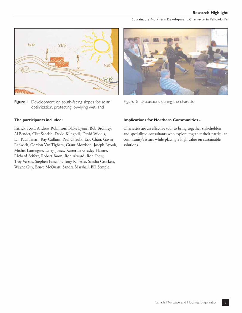
Figure 4 Development on south-facing slopes for solar optimization, protecting low-lying wet land
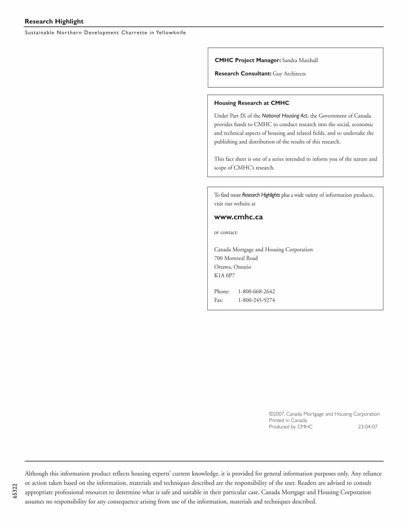
Figure 5 Discussions during the charette
The participants included:
Patrick Scott, Andrew Robinson, Blake Lyons, Bob Bromley, Al Bender, Cliff Sabrish, David Klingbeil, David Widdis, Dr. Paul Tinari, Ray Cullum, Paul Chaulk, Eric Chan, GavinRenwick, Gordon Van Tighem, Grant Morrison, Joseph Ayoub,Michel Lanteigne, Larry Jones, Karen Le Gresley Hamre,Richard Seifert, Robert Boon, Ron Alward, Ron Tecsy, Troy Vassos, Stephen Fancoot, Tony Rabesca, Sandra Crockett,Wayne Guy, Bruce McOuatt, Sandra Marshall, Bill Semple.
Implications for Northern Communities -
Charrettes are an effective tool to bring together stakeholdersand specialized consultants who explore together their particularcommunity’s issues while placing a high value on sustainablesolutions.
Research Highlight
Susta inable Northern Development Charrette in Yel lowkni fe
Although this information product reflects housing experts’ current knowledge, it is provided for general information purposes only. Any relianceor action taken based on the information, materials and techniques described are the responsibility of the user. Readers are advised to consultappropriate professional resources to determine what is safe and suitable in their particular case. Canada Mortgage and Housing Corporationassumes no responsibility for any consequence arising from use of the information, materials and techniques described.
6532
2
©2007, Canada Mortgage and Housing CorporationPrinted in CanadaProduced by CMHC 23-04-07
To find more Research Highlights plus a wide variety of information products,
visit our website at
www.cmhc.ca
or contact:
Canada Mortgage and Housing Corporation
700 Montreal Road
Ottawa, Ontario
K1A 0P7
Phone: 1-800-668-2642
Fax: 1-800-245-9274
Housing Research at CMHC
Under Part IX of the National Housing Act, the Government of Canada
provides funds to CMHC to conduct research into the social, economic
and technical aspects of housing and related fields, and to undertake the
publishing and distribution of the results of this research.
This fact sheet is one of a series intended to inform you of the nature and
scope of CMHC’s research.
CMHC Project Manager: Sandra Marshall
Research Consultant: Guy Architects

introduction
Yellowknife est une ville prospère des Territoires du Nord-Ouest, au Canada. Elle est située sur la rive nord du Grand lacdes Esclaves, à 62° de latitude nord et, avec sa croissance rapide,doit faire face aux loyers et aux coûts de construction les plusélevés au pays. La forte demande de sites viabilisés et la faiblessede l’offre de terrains à bâtir, qui se traduit par l’augmentationdes coûts inhérents, constituent des enjeux essentiels pour laVille. Ces problèmes ne pourront être résolus qu’en misant surdes aménagements novateurs, efficaces, durables et abordables.
LA CHARRETTE
Une charrette (atelier de conception), parrainée par la Sociétécanadienne d’hypothèques et de logement (SCHL), a été tenuedu 17 au 19 mai 2005. L’exercice visait à étudier les problèmesd’aménagement dans le Nord et à suggérer des solutionsprécises pour obtenir une qualité de vie élevée et durable.
La charrette a servi à examiner des façons d’équilibrer diversaspects de la durabilité afin de promouvoir des milieux de viesains, abordables et de haute qualité dans le Nord du Canada,et ce, en utilisant une perspective globale pour trouver denouvelles solutions.
Les participants à la charrette se sont penchés sur une propriétéde 100 acres appartenant à la Ville située à Negus Point, àYellowknife.
Le site se trouve à proximité de la mine Con, maintenantabandonnée, et devra faire l’objet d’une réhabilitation avantd’être transformé en secteur résidentiel. Situé sur les rives duGrand lac des Esclaves, il est à moins de 10 minutes du centre-ville en voiture. Le terrain en pente douce présente desaffleurements rocheux et des aires peuplées de conifères etd’herbes caractéristiques du Nord.
Figure 1 Image satellite de Yellowknife et montrant le site de Negus Point dans le coin inférieur droit. Le site est desservi par le chemin Con.
Figure 2 Le site riverain de Negus Point. Le puits de la mine se découpe à l’horizon.
Série technique 07-113Avril 2007
Charrette sur le développement durable du Nord à Yellowknife
Le point en recherche
AU CŒUR DE L’HABITATION

Le Point en recherche
Charrette sur le développement durable du Nord à Yel lowkni fe
2 Société canadienne d'hypothèques et de logement
Pendant cette charrette de trois jours, représentants municipauxet territoriaux, architectes, urbanistes, ingénieurs et urbanistesspécialisés dans les régions nordiques ont partagé leurscompétences et capacités diverses. La charrette visait à présenterle processus de conception intégré (PCI), une méthode quiadopte une approche multidisciplinaire tout au long de laconception, de la mise en œuvre et de la mise en service desbâtiments. Le PCI aborde des questions rarement touchées dansle cadre d’une pratique de conception standard; les équipesmultidisciplinaires du PCI les traitent de manière plus globale.
On a demandé aux participants de prendre en considérationplusieurs questions interreliées pendant leurs discussions enéquipe, notamment : la construction de routes dansl’écosystème fragile du Nord, une méthode de traitement del’eau et des eaux usées ne reposant pas sur le système municipaldéjà surtaxé, des technologies de construction plus efficaces etquelle serait, pour la nouvelle collectivité, une qualité de vieélevée pour les nordistes.
Trente-deux personnes, y compris les conférenciers, lesanimateurs et les personnes-ressources, ont formé les troiséquipes de la charrette. Chaque équipe comprenait, dans lamesure du possible, un bon équilibre de spécialités, c’est-à-direarchitecture, ingénierie, urbanisme et autres professions liées àl’aménagement, et les personnes-ressources circulaient parmi leséquipes afin de donner des conseils. Les équipes devaientemprunter des chemins parallèles, mais à partir d’un point devue et d’une méthode qui leur étaient propres. Deux équipesont créé des concepts d’aménagement pour le site, et latroisième équipe a élaboré des lignes de conduite en matière dedéveloppement durable qui pourraient servir dans le cadre d’unconcours de conception d’initiative locale.
LES CONCEPTS
Les concepts des trois équipes ont exploré des questionssemblables et proposé une densité mixte et une variété demodes d’occupation, notamment l’accession à la propriétéabordable. Tous les groupes ont imaginé une collectivitéintégrée et inclusive de façon à traduire le mieux possible lesobjectifs durables, y incluant des petits commerces, des servicescommunautaires, ainsi que des installations d’information et derecherche en plus d’en faire un endroit où la circulationpiétonnière serait encouragée et protégée, et où l’accès au bordde l’eau et la vue du lac seraient conservés.
AMÉNAGEMENT D’UNE COLLECTIVITÉSATELLITE
Le traitement des eaux usées sur place, ainsi que le chauffagecollectif géothermique et à base d’eau laissent entrevoir deséconomies possibles au chapitre de l’infrastructure. Cesconcepts doivent donc être étudiés plus en détail. L’établissementd’une installation de recherche à Yellowknife a été proposé pourmettre à l’essai de nouveaux systèmes, recueillir des données sur le Nord et former des travailleurs locaux. Ces genres desystèmes pourraient faire économiser à la municipalité certainscoûts liés à l’amélioration des infrastructures déjà surtaxées parla croissance accélérée. Une fois que des études détaillées aurontété menées sur les délais d’exécution, les coûts, la fiabilité et la maintenance, ainsi que sur les avantages sociaux etenvironnementaux, de nouvelles technologies pourraientfaciliter le processus d’aménagement.
NOUVELLES OPTIONS POUR LEPROCESSUS D’AMÉNAGEMENT
Des concours de conception peuvent susciter des idées deplanification urbaine innovatrices. Pour que ce conceptfonctionne correctement, la conception et la mise en œuvredoivent être guidées par des principes de développementdurable propres au Nord, ainsi que par des caractéristiques etdes exigences détaillées.
LA TOPOGRAPHIE ET L’HYDROLOGIEDES LIEUX
Une approche commune consistait à utiliser les formationsrocheuses locales pour optimiser l’exposition au soleil tout enréduisant au minimum l’érosion éolienne. Dans les conceptsproposés, les voies de circulation et les habitations suivent cescontours afin de minimiser les dommages à l’écosystème fragile.Le marais situé dans les basses terres humides longe le parcoursd’évacuation naturel qui rattache les principaux secteurs duvillage. Tout en protégeant ces basses terres, on pourrait en fairedes sentiers continus pour les piétons, les cyclistes et les skieurset ainsi les rattacher à l’ensemble de Yellowknife. Certaines deces terres humides pourraient même servir d’écloseries et detraitement complémentaire des eaux pour réduire la charge dusystème municipal central.

Société canadienne d'hypothèques et de logement 3
Le Point en recherche
Charrette sur le développement durable du Nord à Yel lowkni fe
Figure 3 Croquis du concept de Negus Point
Figure 4 Aménagement des pentes orientées vers le sud pour optimiser l’exposition au soleil et protéger les basses terres humides
Figure 5 Discussions pendant la charette
Les participants :
Patrick Scott, Andrew Robinson, Blake Lyons, Bob Bromley, Al Bender, Cliff Sabrish, David Klingbeil, David Widdis, Dr Paul Tinari, Ray Cullum, Paul Chaulk, Eric Chan, GavinRenwick, Gordon Van Tighem, Grant Morrison, Joseph Ayoub,Michel Lanteigne, Larry Jones, Karen Le Gresley Hamre,Richard Seifert, Robert Boon, Ron Alward, Ron Tecsy, Troy Vassos, Stephen Fancoot, Tony Rabesca, Sandra Crockett,Wayne Guy, Bruce McOuatt, Sandra Marshall, Bill Semple.
Conséquences pour les collectivités du Nord :
Les charrettes constituent un outil efficace pour réunir desintervenants et des consultants spécialistes qui examinentensemble les enjeux auxquels font face leur collectivité, tout enaccordant une grande importance à des solutions durables.

Le Point en recherche
Charrette sur le développement durable du Nord à Yel lowkni fe
6532
3
Bien que ce produit d'information se fonde sur les connaissances actuelles des experts en habitation, il n'a pour but que d'offrir desrenseignements d'ordre général. Les lecteurs assument la responsabilité des mesures ou décisions prises sur la foi des renseignements contenusdans le présent ouvrage. Il revient aux lecteurs de consulter les ressources documentaires pertinentes et les spécialistes du domaine concerné afinde déterminer si, dans leur cas, les renseignements, les matériaux et les techniques sont sécuritaires et conviennent à leurs besoins. La Sociétécanadienne d'hypothèques et de logement se dégage de toute responsabilité relativement aux conséquences résultant de l'utilisation desrenseignements, des matériaux et des techniques contenus dans le présent ouvrage.
©2007, Société canadienne d'hypothèques et de logementImprimé au CanadaRéalisation : SCHL 23-04-07
Directeur de projet à la SCHL : Sandra Marshall
Consultants pour le projet de recherche : Guy Architects
Pour consulter d’autres feuillets Le Point en recherche et pour prendre
connaissance d’un large éventail de produits d’information, visitez
notre site Web au
www.schl.ca
ou communiquez avec la
Société canadienne d’hypothèques et de logement
700, chemin de Montréal
Ottawa (Ontario)
K1A 0P7
Téléphone : 1-800-668-2642
Télécopieur :1-800-245-9274
Recherche sur le logement à la SCHL
Aux termes de la partie IX de la Loi nationale sur l'habitation,
le gouvernement du Canada verse des fonds à la SCHL afin de lui permettre
de faire de la recherche sur les aspects socio-économiques et techniques du
logement et des domaines connexes, et d'en publier et d’en diffuser les résultats.
Le présent feuillet documentaire fait partie d’une série visant à vous informer
sur la nature et la portée du programme de recherche de la SCHL.

National Office
700 Montreal RoadOttawa ON K1A 0P7
Telephone: (613) 748-2000
Bureau national
700 chemin de MontréalOttawa ON K1A 0P7Téléphone : (613) 748-2000
Puisqu’on prévoit une demande restreinte pour ce document derecherche, seul le résumé a été traduit.
La SCHL fera traduire le document si la demande le justifie.
Pour nous aider à déterminer si la demande justifie que ce rapport soittraduit en français, veuillez remplir la partie ci-dessous et la retourner àl’adresse suivante :
Centre canadien de documentation sur l’habitationSociété canadienne d’hypothèques et de logement700, chemin Montréal, bureau C1-200Ottawa (Ontario)K1A 0P7
Titre du rapport: _______________________________________
_______________________________________
Je préférerais que ce rapport soit disponible en français.
NOM _____________________________________________
ADRESSE___________________________________________ rue App.
___________________________________________________________ville province Code postal
No de téléphone ( ) ____________

2
Table of Contents
1.0 Introduction ……………………………………………………………… 3
2.0 Charrette Process ……………………………………………………………… 8
3.0 Red Team Concepts.………………………………………………………………..16
4.0 Green Team Concepts ……………………………………………………………..20
5.0 Blue Team Concepts.……………………………………………………………….26
6.0 Charrette Conclusions ……………………………………………………………...36
Appendix: List of Participants
Canada Mortgage and Housing Corporation wishes to thank all the participants of the
charrette for taking the time to share their enthusiasm, knowledge and experience in
this collaborative experience. We would also like to thank the Mayor Gordon Van
Tighem and municipal representatives for their guidance. We hope that these ideas
will be further built upon as development occurs in other northern areas of the North.
The participants were:
PATRICK SCOTT RAY CULLUM RICHARD SEIFERT
ANDREW ROBINSON PAUL CHAULK ROBERT BOON
BILL SEMPLE ERIC CHAN RON ALWARD
BLAKE LYONS GAVIN RENWICK RON TECSY
BOB BROMLEY GORDON VANTIGHEM
TROY VASSOS
AL BENDER GRANT MORRISON STEPHENFANCOTT
CLIFF SABIRSH JOSEF AYOUB TONY RABESCA
DAVID KLINGBEIL MICHEL LANTEIGNE SANDRACROCKETT
DAVID WIDDIS LARRY JONES WAYNE GUY
DR. PAUL TINARI KAREN LE GRESLEYHAMRE
BRUCE MCOUATT
SANDRA MARSHALL

3
1.0 Introduction:
Yellowknife is a thriving city in the Northwest Territories of Canada, on the northern shore of
Great Slave Lake at a latitude of 62o North. As a result of its rapid growth needs, the City has
some of the highest rental rates and cost of new homes in the country. The high demand for
serviced sites, low supply and inherent cost increases for developable land are critical issues
for the City and have caused a demonstrated need for innovative, efficient, sustainable and
affordable development.
Figure 1: Satellite view of Yellowknife. Negus site is in the bottom right hand
quadrant, facing the island.
A design workshop known as a charrette was held on May 17-19 2005, sponsored by Canada
Mortgage and Housing Coroporation. The charrette’s objective was to explore the issues of
northern community development and to suggest specific solutions in order to achieve a
sustainable, high quality of life. The focus of the charrette was a Yellowknife site that reflected
one of the city’s few potential major development areas, the 100-acre, City-owned, Negus
Point property. It is close to the abandoned Con Mine and will require remediation before it is
developed for residential use.

4
The desired outcome of this Charrette was:
• Exploration of new development issues and new solution ideas to the City of Yellowknife.
• A focus on an actual site that would provide real challenges, inspire and demand real
solutions.
• A forum and source of concepts, methods of approach and solutions to challenges that
could be considered for other areas of the north.
Figure 2: Yellowknife Charrette Participants
Objectives:
The objective of the charrette was to explore ways to balance different aspects of sustainability
in order to promote healthy, affordable, high quality living environments in Canada’s North.
Dialogue with fellow participants and openness to a holistic way of approaching this problem is
critical to finding new solutions. A real site allowed the participants to debate real problems and
to propose potential solutions.
The three days of this charrette brought together people who contributed diverse skills and
expertise including municipal and territory representatives, architects, planners, engineers and
northern planners. The charrette was intended to be an introduction to the Integrated Design
Process (IDP), a method that integrates a multi-disciplinary approach throughout the design,
implementation and commissioning of buildings. The IDP incorporates issues that are not
often addressed in a standard design practice and the multi-disciplinary IDP teams treat them
in a more holistic way. Together, participants can develop visions of a sustainable community
and suggest ways to achieve greener buildings set in a specific site.

5
The Yellowknife charrette’s goals were to promote:
• Greater understanding of northern culture and its relationship to natural northern
environment.
• Responsiveness to local housing and community needs while emphasizing the
requirements of a healthy environment.
• Links with individuals experienced in various aspects of sustainable northern development.
• Awareness and understanding of building and development methods that will benefit the
north by reducing costs, resource use and energy consumption.
Issues Discussed:
The participants were asked to consider the following issues as they pertained to the selected
site:
• Development and roads are in conflict with the fragile natural environment. How can
damage be limited and mitigated? How can the natural landscape and wildlife be protected
and enhanced?
• )Water resources can also be damaged by development. How can the natural water cycle
be protected? Can grey and black water be treated for reuse and safely returned to the
natural environment? How can the lake be protected from erosion and pollution?
• This off-grid site requires power, heating and water treatment. How can these utilities be
provided for buildings on this site in the least environmentally damaging way?
• What is the cost to the City of operating water and energy utilities?
• The meaning of community and quality of life will shape the plan and building designs. Can
this community combine:
o A mixed-use development with community services, retail, office, and housing?
o Private ownership and rental housing which is socially cohesive?
o E)nergy supply to isolated communities is expensive. How can energy use be reduced
and communities be more self-sufficient?
• Construction costs for materials and labour are also high in the North. Can new methods,
systems and training help to lower these costs and increase the rate of delivering quality
housing?
• Are there economic opportunities that can be developed from this project?

6
The foregoing issues were provided only as a starting point. The participants were encouraged
to expand and develop these ideas. They were also asked to set performance targets for the
selected pilot project community beyond those presently defined in Yellowknife and which
stretched their imaginations.
Site Description:
The Negus Point site is located on the southwest side of Yellowknife City on the shore of Great
Slave Lake. The land area is 100 acres and the topography is fairly flat or of low slope with
rocky outcrops and areas vegetated by coniferous trees and northern grasses. The majority of
the site is undeveloped and offers views of Great Slave Lake. The centre of the lakefront parcel
contains three lots accessed by a developed roadway that runs through the site, less than a
10-minute drive to the downtown. It is also located near the abandoned Con Mine brownfield
with its tailings ponds.
Figure 4: Con mine shaft and Negus site along the
waterfront
Figure 3: Con Mine Property and tailing
ponds adjacent to the Negus waterfront site.

7
Site Zoning: Yellowknife’s Growth Management (GM) Zoning allows considerable
development leeway, which is at the discretion of the approving authority. The uses include
parks and recreation, public or quasi-public use, public utility uses and structures, temporary
activities and the other conditionally permitted uses, which include houses, marina and home
based businesses.
Planning Challenge: No planning constraints were imposed upon the teams. The aim was
to obtain three independent housing approaches addressing specific problems and challenges
of the local development industry and market.
2.0 The Charrette Process:
There were 32 attendees including speakers, facilitators and resource people. All participated
as members of one of three charrette teams. Each team included, as much as possible, a
balance of architectural, engineering, planning and professions related to development.
Resource people circulated among the teams when their expertise was required. Teams were
to embark upon parallel courses, but from their own vantage point and method of approach.
Day One:
On the first day, the guests were welcomed and toured around Yellowknife’s neighbourhoods,
the Con Mine site and finally the Negus Point site, which was the subject of the charrette.
Figure 5: View from Yellowknife towards Negus site in the distance, on the left side of the horizon

8
Yellowknife’s Mayor, Gordon Van Tighem spoke to the group regarding the challenges facing
the City for new development and City expansion: Lack of available land and shortfall of
approximately 400 houses at present are the major challenges for the City. The wastewater
treatment plant is also at its limits, curtailing development. Secondary treatment may soon be
required and additional volume will eventually require infrastructure upgrades to the
wastewater treatment system within the City. Because of the latter, the concept of on-site
wastewater disposal is of great interest to the City.
The participants were divided into three teams (Red, Blue, and Green). Each team discussed
their impression of Yellowknife and developed their own unique approaches and methods.
Typical questions that the groups considered were:
• What are the best aspects of Yellowknife and its housing now?
• What would you like to change about Yellowknife at present?
Presentations were interspersed with teamwork throughout the three days. Bill Semple, CMHC
northern researcher, first presented “Traditional Forms of Housing” to demonstrate
sustainability and showed design concepts from around the world with colour, planning, and
details that emphasized spirituality, pragmatism and the importance of a sense of place. The
expression of culture in the buildings’ orientation was explored, as well as the use of local
labour and materials.
Ray Cullum, of AquaPoint, discussed his company’s on-site wastewater treatment designed to
service a cluster of homes, a large complex or a full community. He said that these insulated
units have been widely tested in very cold climates and have been used extensively for many
years with success. He stressed that local engineers must be consulted prior to installing a
unit. The company would then work with the local developer to make sure the system runs
efficiently and correctly. Successful implementation of these systems requires municipal
acceptance of new collection, treatment and distribution technology. Cullum stated that
Aquapoint’s systems include:
• Performance-based treatment systems distributed in a managed network. They pre-treat
wastewater prior to discharge to soil disposal systems or conventional sewer.

9
• Water reclaim systems using wastewater.
• A modular system called Bioclere uses a modified trickling filter over a clarifier that
reduces the biochemical oxygen demand (BOD5) and total suspended solids (TSS) to
levels that meet U.S. Environmental Protection Agency (EPA) standards.
• A natural biological film process that is stable, simple to manage and inexpensive to
operate.
• Sealed modules that can be installed in parallel for larger flows or in series to achieve
higher levels of treatment in new or existing facilities. Sizes range from 250 gallons to
over one million gallons of water treatment daily. They are insulated to reduce seasonal
temperature variations on the treatment process.
• De-nitrification and sterilization units can be appended to achieve near potable
(drinkable) levels.
Cullum noted that In the USA, because the EPA considers decentralized wastewater treatment
systems to be a permanent long-term solution, these systems can be evaluated on the same
basis as conventional sewer systems and a community may elect to consider it the equivalent
of municipal infrastructure. For many communities, the increase in property values and taxes
associated with municipal infrastructure could offset the cost of installing and managing
decentralized wastewater treatment systems.
Figure 6 and 7: Aquapoint wastewater system
Al Bender presented the Trencor excavation technology that was used for pipeline construction
in the hamlet of Inuvik. He suggested that Trencor’s trenching and roadminer machines would
be suitable for cutting Yellowknife’s bedrock. Unlike blasting, these machines do not disturb the
area around the trench. They break up excavated material for use as fill once lines have been

10
laid, saving money and time, as no additional fill is required and the excavation volume is
smaller than that created by blasting and backhoes. This also helps preserve the natural
landscape. Roadminer attachments can also carve roads.
Figure 8: Trenco roadminer
The roadminer can cut widths up to 16’ by 6 ‘ deep in a single pass while planers and profilers
cut 8 to 15 inches deep. The trenchers used in Inuvik worked all winter and at night, and once
a technical solution was found to the problem of teeth breaking on the cutter, work averaged
one kilometre a day.
Figure 5 a, b and c: Sustainable interrelationships
As a water treatment specialist, Dr. Troy Vassos of NovaTec Consultants, was able to outline
different strategies for wastewater treatment. He first proposed an alternative perspective to
the conventional idea that communities need to develop sustainable solutions that respond to
economic, social and environmental imperatives, as indicated on the first slide in the preceding
illustration, Figure 9a.

11
His alternative paradigm is shown by the hot air balloon diagram in the last two slides, Figure 9
b and c. In this model, he depicted social needs as the main driving force for change and that
these cultural requirements are weighed by ecological and economic imperatives, but added
the key constraint of the regulatory environment.
Dr. Vassos also discussed water supply and its treatment, wastewater treatment and effluent
reuse. Water supply can be obtained from rivers, ground or surface water. Alternate means of
supply include ice and snow harvesting. It was pointed out bottled water can come from
dubious sources and water labelled “bottled at the source” often means city tap water.
Prior to consumption, water treatment is required to:
• remove sediments (turbidity)
• organic compounds,
• metals (arsenic, iron, manganese)
• nutrients (nitrogen, phosphorous)
• Colour / odour (hydrogen sulphide, H2S) and
• Micro-organisms.
Wastewater is treated by the following components :
• filtration (physical)
• chemical precipitation,
• sequestration
• adsorption and disinfecting.
To treat brackish water, freezing, reverse osmosis, snow spray and distillation can be used.
Ultraviolet light can remove harmful micro-organisms and viruses such as E. coli, Giardia,
Hepatitis and Cryptoporidium.
Some recent Canadian research projects have been undertaken to test the use of on-site water
reclamation. Both light (bath, shower) and dark grey water (kitchen sink) have been used for
flushing toilets and showers after treatment by biofilter, sand filtration and chlorine. Black water
has also been reclaimed using a biofilter, sand and carbon filters and ozone for toilet reuse.
Treated water has been chlorinated, then reused for showers, toilets and laundry and on-site
irrigation. Other attempts were not successful due to the choice of technology or components
and lack of appropriate operation and maintenance.

12
Dr. Vassos concluded by reiterating the merit of having a sustainable water treatment strategy:
Such a strategy will provide benefits for the environment. The reclamation could also beautify
the site through the use of plants or by a “living machine”, a system that purifies water using a
series of containers of natural organisms that digest the waste. He noted that education is an
essential part of any sustainable solution, to promote new behaviours. “We need to change the
way we use our resources.”
Day Two
On the second day, the teams continued their discussions with the objective of defining:
• Critical community and site issues.
• Goals of the project and how to attain them.
• Team’s vision of a sustainable development.
The three teams took different approaches to the issues, beginning with initial and subjective
impressions of the City based upon the tour and their collective knowledge. The positive and
negative aspects of the site and Yellowknife in general became the basis for site strategies.
The groups brainstormed and came up with innovative plans on how to develop the proposed
site as a self-sustaining development and possibly bettering the City of Yellowknife.
Dr. Paul Tinari, of the Pacific Institute for Advanced Study introduced a number of concepts
that he believed could significantly reduce the negative impact of buildings on the environment.
Most Canadians spend more than 90% of their time indoors, much of it in structures that
consume vast quantities of natural resources. The impacts of indoor environments on the
health of the occupants and their productivity as well as impacts on the world at large, justifies
the growing interest in sustainable design. He spoke of products such as:
• Water conservation: waterless urinals, dual flush and composting toilets and water-
efficient landscaping
• Conservation of resources: local, recycled salvaged materials
• Energy conservation: photo luminescent exit signs, full spectrum LED lighting, higher
levels of insulation, Heat Recovery Ventilators
• The biological system called “Living Wall” that combines thermal mass, humidification
and plants, to control indoor environments
• Co-generation: Heat pumps extract relative heat from river or lake water in order to heat
homes
• Alternative energy systems: wind power and small hydro electric systems.
13
Dr. Rich Seifert of the University of Alaska spoke about the importance of reducing energy use
through airtight building practice, effective super-insulation and air-to-air heat exchange
systems that will ensure adequate air quality within living environments.1 Designers wanting
high quality cold climate buildings need to:
• Build it tight,
• Ventilate right
• Seal the lid (roof)• “Tune” the foundation to the site
When building in the north, special considerations should include permafrost, logistical and
energy concerns. These topics all require additional time and a special approach. Building on
permafrost usually requires separation and insulation of heated spaces so as to keep the
permafrost areas frozen. Logistics of northern construction, including short supply and
construction seasons, require innovative use of local materials and energy saving practices.
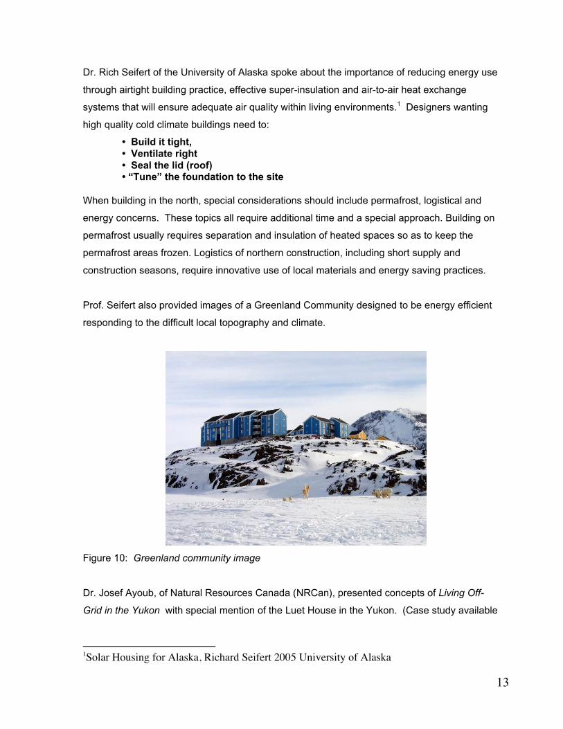
Prof. Seifert also provided images of a Greenland Community designed to be energy efficient
responding to the difficult local topography and climate.
Figure 10: Greenland community image
Dr. Josef Ayoub, of Natural Resources Canada (NRCan), presented concepts of Living Off-
Grid in the Yukon with special mention of the Luet House in the Yukon. (Case study available
1Solar Housing for Alaska, Richard Seifert 2005 University of Alaska

14
on CMHC website.) Josef noted that photo-luminescent exit signs need no electricity and that
new low-energy LED lighting can be run by photovoltaic cells. He described the efficient
renewable energy practices of 30 off-grid northern homes in an NRCan study. He
recommended a free NRCan guide that details efficient and renewable energy solutions,
available at: http://www.nrgsc.yk.ca/offGrid/index.php
Over half of the “off-grid” homes in the NRCan study used renewable energy, mostly
photovoltaic, but also some wind generators and one micro-hydro (moving water). They were
able to generate the bulk of their summer electrical requirements from this renewable energy.
Energy audits of the homes showed high relative returns on investing in energy efficient
methods and components.
Fuel-powered generation was used by most of the homes for winter backup power. Centrally
located woodstoves provide radiant heat as the prime heat source, which lends itself to open-
concept house plans. How well a home is insulated and sealed are the two critical parameters
for sizing heating systems and determine the amount of fuel needed for comfort. An open
space on the south side of a house benefits from solar exposure and better wind flow. If built
into a hillside, the house will also benefit from the insulating properties of the ground. Energy
efficient windows and bulbs (compact fluorescent) are also solutions to reduce the amounts of
energy used.
Day Three:
On Day Three, the teams reassembled and were encouraged to sketch their visions and
solutions for the proposed sustainable community. Teams shifted their focus from general
concepts to specific plans, site layouts and specifications for achieving a self-sustaining
community.
Gavin Renwick and Tony Rabesca introduced the Gameti Ko project, a project dedicated to
developing a contemporary housing design based on traditional Dogrib knowledge. Patrick
Scott contributed to this presentation by stating the reasons why the GNWT Dept. of Municipal
Affairs had provided seed funding for this project, which is development led by community
consultation. They described the social issues and the problems related to the changes from
traditional community design to one built according to southern values. The Gameti Ko
community wants to ensure that:
• Dogrib homes remain connected to the land
• Oral traditions of the elders are heard, understood by the youth, and help inform
contemporary design.

15
For more information on the Gameti Ko community design initiative, see the CMHC website for
the Socio-Economic Research Highlight "The land we live on is our home".
Team Concepts: All the teams agreed that no development should take place until the land
contamination of the Con Mine site was mitigated.
3.0 Red Team Concepts:
Team Members:
Grant Morrison, CMHC Facilitator
Sandra Crockett, Notetaker
Stephen Fancott, Architect, Arctic Energy Alliance
David Widdis, Planning City of Yellowknife.
Ray Cullum, Aquapoint Wastewater Treatment
David Klingbeil, Government of the NWT.- Planning and Development
Troy Vassos., NovaTec Consultants Inc. Wastewater Treatment
Larry Jones, NWT Housing Corporation
The Red Team made Resource Environment and Development (RED) their mantra.
This team agreed that the main issues of consideration for the proposed site were social,
economic, environmental, and self-sufficiency. The goal of this group built on the notion of
sustainability as a basket supported by a hot air balloon, shown in the diagram below.
This concept is that social solutions are constrained by environmental issues and both are
being limited by the economic issues as well as restricted by regulations.
This concept of the interdependent relationships between economic- environmental-social-self-
sufficiency was applied to the site development as a means of simulating specific design
solutions. The final product of these design solutions was illustrated by way of a site sketch
that reflected the concepts that were developed.
Water Treatment
This team looked at a decentralized wastewater treatment process as follows:
• Primary water treatment- for the mine, the tailings pond, lagoon and wetlands
• Secondary- for lakes, wetlands, green house
• Advanced Secondary- for wetlands, reclaim and fish hatchery

16
• Tertiary- all the above, would follow the other treatments and reclaim the water through
additional treatment.
Storm water would be directed into the lake. There was discussion of a pervious road system
that would permit water to sink through its surface, leaving a dryer and safer road without the
requirements for an underground storm water system.
The concept of interdependent economic, environmental and social-self-sufficiency was
applied to the Negus Point site as a means of simulating specific design solutions. The final
product of these design solutions was illustrated by the following concept sketches.
The Red Team’s final site sketch brought together the following sustainable concepts
developed during the planning design process:
• A central research facility that would host visitors, share sustainable planning and energy
efficient concepts, conduct site tours and conduct further research into methods,
technologies and implementation strategies throughout the north.
• Locate higher density low-rise and high-rise housing near the subdivision entrance in order
to minimize local traffic and maintain good views closer toward the water. Traditionally in
Yellowknife, the waterfront has been developed and inaccessible to the public, but the Red
Team created a waterfront with medium density clusters and substantial open spaces
accessible to all of Yellowknife.
• Locate an amphitheatre next to the waterfront to provide a community gathering place for
all Yellowknife residents.
• Locate heavy traffic and parking areas away from the views and waterfront.
• Not permit street parking. Allow only one parked vehicle to be visible on each lot so as to
maintain the area’s scenic qualities.
• Public transportation service would terminate on a roundabout at the north entrance to the
subdivision. Smaller roads would then serve the subdivision, reducing the environmental
impact of roads.
• Foot paths intertwine through the neighborhoods to connect key areas. Inland bodies of
water are developed in order to provide open space and recreational amenities beyond the
Great Slave Lake waterfront.
• The concept of a house which could endure for 200 years was illustrated:
o Local rock is used for construction;

17
o South-facing windows provide energy without cost over the buildings’ life,
o Units would sit on the south-sloping outcrops and
o Provide pedestrian and bike paths from both the upper and lower levels of the
building.
Figure 11: Vision of 200-year Housing
Roads
• Minimize blasting and change to the environment by using the contours of land and
leaving high areas as green space and low marshy areas as parks and enhanced
water ways.
• Separate walking paths that would connect to other neighbourhoods.
• Minimize the number of roads.
• Provide access to emergency vehicles.
• The main access would be via the existing road through the present mine tailings
area. Phase 1 development would occur at this point to reduce development costs.
Accommodations/ Buildings for Phase 1
• The highest density development would be located at the subdivision entrance to
reduce traffic through the other areas.
• It would include small retail and services area such as clinic, small grocer and
apartments/condos. Offices and small retail serving local needs would be permitted.
• Follow the land contours to minimize blasting

18
• Promote a self-reliant community with daycare/school/community centre
• Include a research centre where sustainable northern building techniques and new
designs are tested and monitored and offer training and employment opportunities
o Shared community building could offer services including recreation, native
heritage, guest rooms, craft areas, etc.
o Offer affordable first-time homeowner houses.
• Neighborhoods would be connected by paths and green spaces
• Buildings will take advantage of southern exposure/solar heat and views.
• Noise by-law enforcement
Figure 12: Red Team Traffic Concept.
Figure 13: Protected shoreline and wetland Figure 14: Housing density proposal

19
Water and Wastewater Solutions
• Verify the potential to use the heat from mine water that would be pumped via the
Robertson mine shaft building and be returned via gravity.
• Green, low-lying areas would be used for on-site water treatment facilities for each of
three neighbourhoods on the site
• A fish hatchery could be an added feature in the first phase of development for treated
water output.
Waterfront
• Public access to use the waterfront for all of Yellowknife.
• Public marina with second stage of the fish hatchery on the harbour side of the
breakwater.
• Boardwalk and possible bandshell/ampitheater overlooking the harbour.
• Green space and picnic area in front of harbour area as the backdrop at the main road
entrance .
• Retain the historical waterside trail to Yellowknife that starts at southeast corner of
property.
• Address safety such as guard rails on inclines/steps, wheelchair accessibility, level
paths, etc.).
4.0 Green Team Concepts:
Team Members
Sandra Marshall, Facilitator
Wayne Guy, Note Taker
Ron Tecsy, GNWT- Planner
Blake Lyons, City Councillor- Federation of Canadian Municipalities.
Al Bender, Trenching and road building technologies
Bob Bromley, Environmentalist
Richard Seifert, University of Alaska- Solar and energy efficiency
Josef Ayoub, NRC- Sustainable energy research, photovoltaics
Andrew Robinson, Arctic Energy Alliance
Paul Chaulk, Nunavut Housing Corporation

20
The Green Team explored the issues that they perceived as being critical to the sustainability
of this subdivision, which is a significant distance from the downtown. The Green Team’s main
theme was “to do no harm” to the environment but rather to improve it for the future. No
development should occur before mitigation of contamination. This significant goal required the
protection of the depressed, natural vegetated areas, and that the buildings be sited on the
rocky outcroppings. Supportive services would provide for the immediate needs of the
residents and community space, both interior and exterior lake front amenities would serve all
the population of Yellowknife. The housing would support up to 1000 people, phased over time.
A particular need to be addressed is for smaller, affordable “starter” homes.
The economic benefits to Yellowknife by this community development could be significant.
They include:
• Introduction of new more sustainable technologies/skills/ opportunities to train trades
• Attraction of visitors to sustainable development in natural setting (attraction)
• Provision of low impact infrastructure that could reduce future operational costs to the City.
• Attraction of long-term residents to its a high quality of life, contributing to social life and
community spirit, for families, seniors and young singles.
Character of the Sub-Division
• Lakeshore to be preserved as a green pathway for public use. This would tie into the
original trail from the little bay to the south of the site, which was a traditional landing
point for mine supplies in the 30’s.
• Preserve natural vegetation to control runoff and perform a water
management/purification function. Maintain natural flow of water including ponds and
streams.
• The green areas in the valleys are contiguous drainage basins onto which all the
residential units would face. These green spaces also would have protected paths for
bike, pedestrian and ski trails.
• Buildings to be durable and low maintenance for at least 20 years.
• Housing could be located on the side of the outcroppings so as to provide street
level/barrier free access to the main floor with common green space/laundry area in the
basement which would be open to the green areas at the bottom of the hill.

21
Figure 15: Road and access to hillside housing on south-facing slopes, to get the
benefit of solar orientation.
• Medium Density Housing with between 650 and 1000 units on the site. This would
consist of a taller buildings on high ground furthest from the water, mid rise on middle
ground and small (1000sf) affordable starter homes nearest the water. In this way, all
units maximize views to the water and solar access.
• Sustainability means having diversity to cater to different socio-economic sectors of
society. ”If you want a sustainable community, you can’t have it full of rich people’s
giant houses.” The proposed development would include 50% affordable housing with
• 25% cluster housing with attached contiguous green space
• 12% co-operative multi-family housing
• 12% co-housing units (with separate living/sleeping areas but large common
cooking and dining areas as well as laundry, daycare etc.)
• 12% small housing for seniors and starter homes
• Medium rise, mixed-use development for the rest.
Taller buildings with concealed parking might provide a relatively lesser foot print and
provide residents good views, but they would be located away from the water so as not
to block sunlight and the water view for the rest of the development.
• Create protected walking paths through areas with natural vegetation. Use low wet
lands as a contiguous pedestrian, biking skiing, green space, which connects all
units in the subdivision no vehicules would be permitted. These spaces would tie
into a citywide network of green spaces.
22
• Common areas could have community gardens, skating rink, soccer field and green
houses.
• Landscape for easy maintenance, suited to the northern climate and conditions. Every
tree removed must be replaced.
• Especially in remote areas, individuals, and families need recreation and activities to
attract and retain skilled workers. For example, he Town of Inuvik, established an
aquatic facility and the Inuvik Family Centre to attract teachers and specialists to the
town.
• Street lights should point downwards to reduce light pollution. Viewing the Aurora is an
important local activity, and tourist attraction..
• A good environment is required in order to obtain financing.
• Home-based business is increasingly accessible via the internet. Local services should
be provided in the community to serve those who remain there during the course of the
day. This could reduce car traffic needing basic services, especially after working
hours.
• Sustainable development requirements should be defined by the City in Development
Requirements.
• “Universal Accessibility” - Multi-family and transportation to be accessible for
handicapped. Handrails at change of levels, appropriate window heights, etc.Amenities
such as tot and youth parks, trails, marina, green house and other recreational areas
would be designed. These areas should be able to be monitored from the units for
parent/community supervision. Locate windows of housing to permit “eyes on the
street”, supervision of activity areas for youth that are located where youth will use
them.
• Security/crime reduction should be incorporated at all levels of the design process,
including surveillance for community and police patrols, .
• A minimum of 50% of the natural environment should be retained. Vegetated areas and
trees should be protected from injury and compaction from the start of the development
by the use of appropriate equipment.
o Determine if trenchers and road miners can replace traditional blasting, crushing
and site leveling,
o Maintain natural drainage of water including preserving ponds and streams.

23
Transportation:
o Public transit within a 5 minute walk, with service every 15 minutes to reduce
the need for cars.
o Pedestrian trails and roads to be separated.
o Roads to follow contours on north side of bedrock outcrops.
o Minimize visual impact of parking: one space per unit on the north side of
buildings.
• Waterfront protected for community use such as marina/ dock/ snowmobile. Public
access through agreement with Federal Reserve.
• Community facility to serve as social hub (sauna, health club, meeting rooms)
• Designate areas for commercial/retail use and community space with higher density
housing that could include::
o Daycare, meeting space, community hall, green house
o Pedestrian and motorized traffic to be separated.
o Tourism Centre to have an Interpretive Centre for diamonds and gold
• The abandoned mine buildings adjacent to the site are a “golden“
opportunity for an interpretive centre.
• Innovation Centre for northern sustainable technologies to monitor and
demonstrate the use of new technologies. Sustainability would be the glue
that holds the centre together.
Energy Considerations
• Determine if the mine shaft might provide geothermal heating and sewage treatment
for the subdivision under strata title.
• Hydro-electricity is renewable, but increasing the dam size to accommodate growth
will require high expenditure and affect the natural environment. Reducing energy use
is a first priority. The Minimum Housing Standards required:
• Minimum R-2000 / Energy Star for houses and Leed Silver Standard for multi-
family and other bulidngs.
• Use smart meters so occupant could monitor and control consumption.
• If wood stoves are a backup heat source, they would be required to be airtight.
• NRCan’s CBIP offers subsidies for multis and commercial buildings that are
designed to be 25% more energy efficient than the Energy Code
• Seal air leaks and guarantee air quality through heat exchangers (HRVs).

24
• Optimize solar orientation and evaluate solar window characteristics required for
each orientation.
• Require that minimum performance standards must be met in energy and water
use to receive building permit.
• Low flow plumbing fixtures. Examine possibility of reuse of rainwater/snowmelt
for toilet flushing which takes one third of residential water, and possibly for
laundry.
• Determine feasibility of on-site water treatment & discharge/ storm water.
• Determine the feasibility of obtaining geothermal heat from the mine.
• Determine the feasibility of obtaining potable water from the lake.
• Determine feasibility of self-contained water/sewer. Tax incentives may help to
encourage feasible systems to take load off over-stretched existing municipal
services.
• Maintenance: all condo corporations must maintain a reserve fund on 30-year
maintenance costs.
• If condos will maintain water or energy infrastructure, the City should require
bonds to cover future maintenance obligation.
Figure 16: Green Team Plan showing protected public shoreline, roads and housing on rock
outcrops, leaving lower areas for vegetation and pathways.
25
• Local community gardens could produce some of the community’s food needs. The
mine might have a potential as a source of geothermal to enhance food production. All
Yellowknife produce presently comes from British Columbia and beyond at a high
dollar and energy expense.
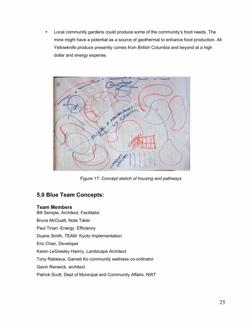
Figure 17: Concept sketch of housing and pathways
5.0 Blue Team Concepts:
Team MembersBill Semple, Architect, Facilitator
Bruce McOuatt, Note Taker
Paul Tinari -Energy Efficiency
Duane Smith, TEAM Kyoto Implementation
Eric Chan, Developer
Karen LeGresley Hamry, Landscape Architect
Tony Rabesca, Gameti Ko community wellness co-ordinator
Gavin Renwick, architect
Patrick Scott, Dept of Municipal and Community Affairs, NWT
26
The Blue Team’s approach was to provide the guidelines for a policy, planning and
implementation process, rather than to work on a specific site plan. The team developed
criteria for evaluating sustainable community design and to facilitate design excellence. To
further these concepts, guidelines for a professional design competition for a sustainable
community were proposed. This process would allow greater flexibility for designers and offer
opportunity for Yellowknife’s population to provide meaningful input into the design and
planning process. Each day the Blue Team focused on a different theme.
Quality of Life
Consensus was reached that a high ‘quality of life’ would be the over-riding theme for the
development of this new community. The community would :
• Be distinguished by its proper identity while maintaining strong City links.
• Be sustainable and as self sufficient as possible in terms of energy and water use,
waste treatment etc.
• Offer housing and density choices for diverse age and family groups.
• Be built in harmony with the natural landscape of the site..
Developing a Sense of Community:
• Reflect local talent and the arts in the community design.
• Support local skills and begin to weave a community fabric of quality.
• Come together to clean up. This pride-building act helps to unite community in a
common cause and provides the satisfaction that comes with being self-improvement.
• Build an accessible neighbourhood:
• Minimize trips and miles traveled for shopping, commuting to work and school
• Planning vehicle travel
• Encourage pedestrian, bicycle traffic
• Restrict noise and visual encounters between non-motorized traffic and vehicles.
• Offer recreation – trails (walking, skiing, hiking, snowmobiles), site facilities,
paths, roadways and a marina for water access. Encourage non-motorized transport
between areas. Pathways should be designed to take advantage of the natural
qualities of the site (e.g. open out to vistas and views)
• The design of homes (family areas, porches and decks) and community facilities
should encourage dialogue and interaction. Community facilities such as a meeting
hall are needed to encourage community identity.

27
• Plan using facilitated community involvement that seeks communal and
intergenerational acceptance. Poor communication will reduce an individual’s ability
to be heard within the community. Good communications will support a person’s
senses of place, of involvement and of power to influence the controls within their
community. Land use contracts, defined zoning requirements, strata councils, and
advisory planning committee roles could provide a platform for better communications.
• Services such as sewer, water, power should be provided internally within the
community where feasible to reduce the community’s environmental footprint.
Alternatives that will allow the community to operate independently of the city should
be encouraged. Public access to the lake and the wilderness should be ensured.
Development should located to away from the waterfront.
Land Use and Ownership:
The community should include both rental and ownership units, with housing options for
different income groups. In addition, a range of ownership and tenure options should be
encouraged. Some options to explore include:
• Leases• Co-operatives
• Stratas
• Communal Living• Housing Alternatives
• Flexible buildings that can respond to changing needs of individuals
And allow them to remain in the community as they age• Houseboats
• Co-Op housing
• Townhouses, Garden Apartments, Brownstone type condominiums (what are
Brownstone type condominiums?)• High-rise
• Single Family
• 3 to 4 story walkups allowing small commercial enterprises
Sense of History:To create a ‘sense of place’, the community development should reflect on past land uses
including:
• Aboriginal History: The First Nations peoples’ use of the land and their place names
should become a part of the design and layout of the community

28
• Mining heritage and history: The relationship of the adjacent mine site and mine
buildings should be considered in designing facilities and infrastructure for the
community. For example, as the adjacent mine buildings are slated for destruction.
the potential use of these buildings as sources or energy and services for the
community need to be explored before demolition.
Public Participation and the Design Process
The issue and importance of public participation was expanded upon.
Defining Needs:
• A need to redefine the development approval process in order to ensure that quality of
life, modern energy efficiency, and sustainable development issues are taken into
account.
• A need to ensure that the real costs of development. This includes road construction
and water treatment. This knowledge could influence the development of other city
areas. Life Cycle Costing methods will help establish the true long-term monetary,
social and environmental costs for individuals, the local community, and that of
Yellowknife.
• A need to see this development in a larger northern context, providing an opportunity
to develop northern solutions to northern problems, and to recognize the growing
impact in the north of issues such as climate change.
Planning Goals:
• Establish a community-led vision to focus good development intentions and ensure
that stated objectives become enforced regulations.
• Develop a complete sustainable community within 10 years and a lifetime
perspective for maintaining the sustainable vision.
• The development should evolve over time. Establish community “corner posts” that
provide a sense of past as well as future.
• A Waterfront Management Plan, Recreation Plan and General Community Plan are all
needed in order to ensure that the sustainable community vision is implemented in the
medium and long term

29
Design Issues:
• Require flexible and adaptive house plans that include flexible interior layouts
(moveable) and room for the owners to expand.
• Integrate differing housing types and sizes to accommodate peoples’ changing life
stages within their community relationships.
• Different densities have pros and cons that need to be explained. High-rises near the
north of the property could provide higher density and a small footprint, leaving more
open space. However, high-rise structures do not achieve the energy efficiency that
low-rise structures can achieve because of heat loss due to the “stack effect”,
especially in Yellowknife’s cold climate.
Environmental Issues:
• All natural habitat sites should be protected.
• DIAND’s standards for site reclamation should be followed for both the Negus site and
the adjacent mine sites. The current plan for the Con Site reclamation falls
significantly short of this stated policy. Verifiy if federal and regional help may be
available for proper remediation. Assess the feasibility of remediation on the adjacent
mine site and the potential for restoring the mine site and affected lands to acceptable
residential standards.
Social Issues:
• Affordability is one of the highest priorities. Yellowknife has the highest rental rates in
the Nation. Low to medium income earners need affordable living quarters. They are
virtually excluded from the present market unless two or more adults in the family unit
are working.
• A social and income mix can produce a better-balanced community. How can we
achieve this in a new project?
• Emphasis should target income groups presently not represented in available
housing, The community needs to provide a a high quality of life, supporting a
permanent community rather than those who are only seeking higher northern pay
levels before leaving the community.
• The current lack of serviced land and poor range of housing choices needs to be
addressed. The Team recommended that the local and territory governments quickly
establish a program to make a larger land area available for housing. The current
impasse resulting from Aboriginal Land Claims was noted as having strong negative
impact on the housing market, affecting everyone including aboriginal people.
30
Implementation – A Design Competition
Design Goals:
The Blue Team recommended that a design competition be held to bring a wider range of
ideas to site design and of housing prototypes. Design guidelines for more sustainable
northern buildings are needed as well. Such a competition would also bring positive
publicity to the City. The team proposed that this competition could gather meaningful
input through community consultation. Sustainable community development would :
o Be a positive contribution to high quality of life in Yellowknife and the North.
o Be affordable and attractive to wide range of incomes and lifestyles, with a
particular emphasis on incomes for which existing housing is not affordable.
o Provide precedent for other development along the shorelines of Great Slave
Lake (being off-grid; efficient technologies; community engagement)
o Not harm the natural environment.
o Be a net contributor to the City with respect to power, sewer and water delivery.
o Be a city-wide resource of community facilities.and recreation areas
o Create a new development model that exemplifies the winter city spirit.
The priority issues identified are:
• Con Mine proximity (toxicity; geothermal, buildings)
• How to integrate the new community with the existing three residential lots.
• Need for a waterfront management plan that considers water depth, wind and wave
exposure as well as public access.
• Present and future uses of adjacent lands not owned by City.
Competition Design Criteria
The backbone of the Blue Team’s proposal takes into account these parameters:
1. Environmental Criteria
• Abiotic resources such as rock formation, views, climate
• Potential site contamination - radon and contaminants from the adjacent sites.
• Biotic resources: flora/fauna, cultural and historic resources, barge landing, protection
of all wildlife habitat sites
• Protection of the waterfront while maximizing views to the lake for all residences.
• Determine the feasibility of using geothermal heat from the mine site

31
2. Site Development Criteria
• Equal access to amenities such as views, trails, waterfront and communal facilities
• All buildings to be constructed away from the waterfront
• Address the need for rental units. A rent-to-own programme should be established
and maintained to include a minimum of 10% of the development. Minimum of 25% to
be low-cost housing.
• A development size range from 300 to 1000 units. This recognizes:
• Inclusion of a school
• Development limit of a maximum of 50% of the 100 acre site. (The City average
density is 6 units per acre)
• Community layout that requires social integration of income groups
• Potential for owner-built homes
• Spaces for retail and cottage industries within the development, such as commercial
sites with residential above.
• Bicycle, walking, skiing and snowmobile trail systems, to be established in first phase
of development.
• Communal lawn/play areas rather than individual lawns.
• Units for seniors as well as “granny” units. “Universal” designed units for disabled.
• Reduce light pollution by the site by implementing LEED gold or better standards.
3. Energy and Sustainability and Energy Generation Criteria:
• Development not to be dependent on City power, sewer and water delivery, but to
contribute to the City’s needs in this regard wherever possible.
• Community as a net contributor to the power grid
• No dependency on diesel fuel
• Set benchmarks to significantly lower greenhouse gas emissions compared to
standard Yellowknife developments.
• 50 % improvement in the energy and water performance levels compared to
standard Yellowknife housing today is feasible through:
• Super-efficient building envelope of a minimum of 0.1 watts per sq m per degree
centigrade (Minimum of R30 in walls and R50 in roof, air locks to all doors,
R2000 standards for building air tightness; mandatory heat recovery system)

32
• All housing forms permitted. They all, including high-rise, must meet an equal
performance level per square metre and allow solar access for their neighbours. To
allow for lake views and to meet these performance levels, it is recommended that all
units be on the south side of the building.
• Natural windbreaks to be employed.
• Southern orientation and passive solar designs to be optimized. Vertical applications
of solar collection systems are suitable in the north.
• Windmills and other alternative energy systems to be assessed.
• District heating system potential to be assessed.
• Photovoltaics (PV): At a minimum, all buildings to be designed for easy retrofit of PV
at a later date, as these become more cost effective
• All light fixtures be compact fluorescent or LED for inside and outside.
• Plumbing and piping systems to allow for introduction of greywater use immediately
or permit easy retrofit at a later date.
• Energy Star appliances required
• Heat recovery ventilation systems required
• LEED Gold rating or equivalent
4. Transportation Criteria:
• Single occupant vehicule use produces a high percentage of Canada’s greenhouse
gases. Public transportation link must be maintained
• Compact design keeps all buildings within 15 min. walking distance
• Group parking (garages or lots)to allow one stall per unit, to a maximum allowable as
2 stalls per unit, based on the number of bedrooms and floor area of the units, with an
overall average at a maximum of not more than 1.5 stalls per unit. Common lots for
parking recreation vehicles.
• Common visitor parking areas within a maximum one stall per unit allowed. Easy
access to the surrounding countryside to be provided for snowmobiles, designed to
avoid conflict with other land uses.
• Walking, bike and ski trail systems to connect to the broader community.
• Access for seniors and the disabled to the developed portion of the site
• Transportation for local school

33
5. Recreation Criteria:
• Equal access to the lake and public boat access
• Water front developments (e.g. a marina) open to Yellowknife residents at large
• Park space open to all Yellowknife
6. Waste and Water Management Criteria:
• Not harm the environment, minimal dependence on City services
• No toxic outputs from the development or operation of the site
• No dependence on city sewer and water delivery. Assess off-grid water and waste
treatment technologies.
• Community composting facility
• Recycling depot.
• Household water use targeted at 50% less than standard in Yellowknife. Mandatory
low flow or dual flush toilets, other water-reducing fixtures and appliances, such as
washing machines.
7. Social and Community Design Criteria:
• House design and layout to encourage a sense of the neighborhood and community.
• A mixture of social groups and styles of buildings
• House designs to encourage local and home businesses such as artisan facilities
• Public meeting spaces
• Communal facilities to include cooking and maintenance facilities
• School to be the core of communal facilities.
• Home-business oriented cluster, with communal boardroom and similar shared
facilities.
• Fitness center, possibly in the school
8. Building Design Criteria:
• Non-toxic materials to ensure high indoor air quality
• Flexible designs for the easy conversion as living needs change
• Living units allow home business through
o High-speed or wireless internet
o Separate door entry for home business

34
• Maximize durability of materials and systems Lifecycle cost assessments to be
prepared.
• Recycled materials to be used where appropriate
Design Competition Implementation Options:
• Encourage inclusion of an architect, developer/builder, landscape architect,
mechanical engineer and planner in Integrated design process. The City could profit
by gaining additional sustainable design ideas, and to bring the public into the design
and planning process.
• Solicit ideas for site development that the city would incorporate into a development
call for the site
• Allow winning team to have the first option on developing the site based on their
submission. Changes, identified through this process, could be negotiated by the city.
• Should a developer secure the property prior to the competition, the city could require
the developer to build according to the winning entry, with changes to the winning
scheme negotiated by the city. (This option was seen as the least favourable by the
team.)
Public Participation:
• Development to contribute positively to the City, and to set a precedent for the
development of the shoreline.
• All stages to include the public It was noted that public participation needs to be meaningful.
Local examples of public participation, such as the Niven Lake development, were not felt to
have been positive examples. Participants felt that the public did not get what it wanted. Good
examples of participatory action is described in A Ladder of Citizen Participation by Sherry
Arnstein at http://lithgow-schmidt.dk/sherry-arnstein/ladder-of-citizen-participation.html/
Jury Selection:
Careful consideration should be given to the jury makeup. It should include:
• An elected official from the City
• Yellowknife residents
• Yellowknife Architect• Architect from outside of City
• City Planner
• Experts in the field of sustainable development (particularly in the north)
35
Blue Team Conclusion:
By developing the requirements for a sustainable community, by ensuring meaningful public
input, and by assembling a skilled and representative jury, a professional design competition
could bring excitement and expertise to the development of Negus Point and could create a
viable, sustainable northern community that is a satisfying and beautiful place to live.
6.0 Charrette Conclusions:
Design Concepts:
All three team concepts explored similar issues and proposed mixed density and variety in
ownership tenure that included affordable entry-level housing. The community was conceived
by all groups to best reflect sustainable goals through an integrated and inclusive community –
integrated with small commerce, community services, information and research facilities where
pedestrian movement would be encouraged and protected and access and views to the
waterfront would be conserved.
Satellite Community Development:
On-site wastewater treatment, water-sourced district and geothermal heat offer possible
infrastructure economies and these concepts need to be developed further. The establishment
of a Yellowknife research facility was proposed to test potential systems, to develop northern
data and to train local expertise. Such systems may ultimately save the municipality the cost of
upgrading infrastructure that is overstretched by increased growth. Appropriate new
technologies may facilitate the development process, after studies of timeliness, cost, reliability
and maintenance factors are considered together with social and environmental benefits.
New Options for the Development Process:
Design competitions can offer new and innovative planning ideas. In order for this concept to
work well, northern principles of sustainable development, detailed specifications and
requirements need to guide the designs and implementation. (For a case study of planned
northern sustainable community, see Bo01 Sustainable Housing Development in Malmo
Sweden from CMHC’s web-based Innovative Buildings series of case studies.)

36
Working with Native Topography and Hydrology: The use of local bedrock formations to
optimise solar exposure while minimising wind exposure was a common approach. In the
schemes, roads and housing follow these contours to reduce environmental damage of the
fragile ecosystem. The marsh in the low-lying wetlands areas follow lines of natural drainage
that connect much of the town. By using, while protecting these low-lying areas, continuous
pedestrian, bike and ski paths could connect with all Yellowknife. Some of these wetlands
could also be used for fish hatcheries and advanced water treatment to relieve the load on the
central municipal system.
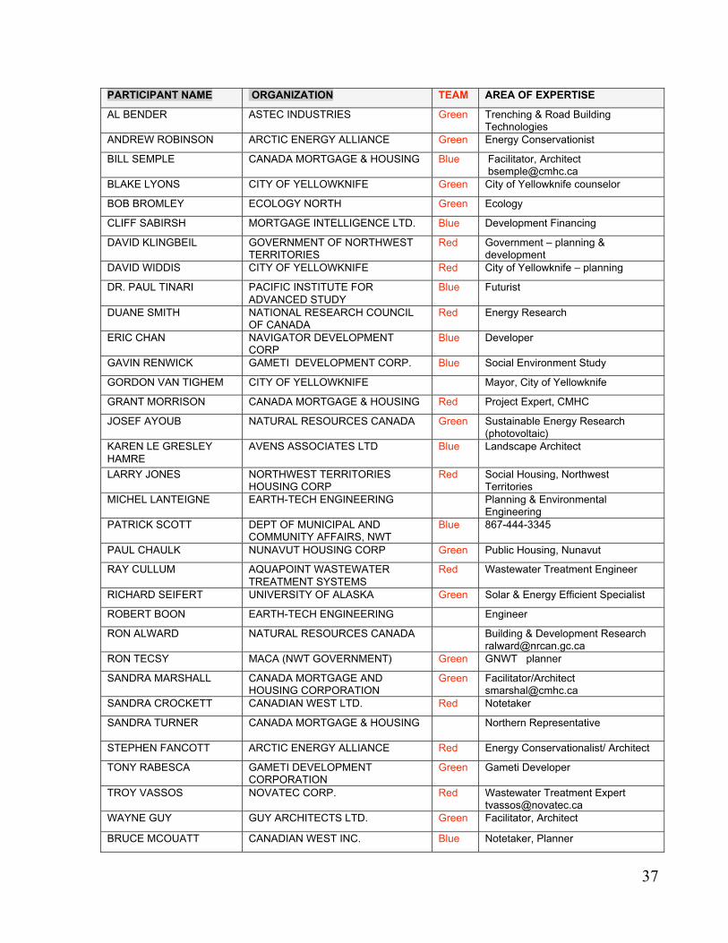
37
PARTICIPANT NAME ORGANIZATION TEAM AREA OF EXPERTISE
AL BENDER ASTEC INDUSTRIES Green Trenching & Road BuildingTechnologies
ANDREW ROBINSON ARCTIC ENERGY ALLIANCE Green Energy Conservationist
BILL SEMPLE CANADA MORTGAGE & HOUSING Blue Facilitator, Architect [email protected]
BLAKE LYONS CITY OF YELLOWKNIFE Green City of Yellowknife counselor
BOB BROMLEY ECOLOGY NORTH Green Ecology
CLIFF SABIRSH MORTGAGE INTELLIGENCE LTD. Blue Development Financing
DAVID KLINGBEIL GOVERNMENT OF NORTHWESTTERRITORIES
Red Government – planning &development
DAVID WIDDIS CITY OF YELLOWKNIFE Red City of Yellowknife – planning
DR. PAUL TINARI PACIFIC INSTITUTE FOR
ADVANCED STUDY
Blue Futurist
DUANE SMITH NATIONAL RESEARCH COUNCILOF CANADA
Red Energy Research
ERIC CHAN NAVIGATOR DEVELOPMENTCORP
Blue Developer
GAVIN RENWICK GAMETI DEVELOPMENT CORP. Blue Social Environment Study
GORDON VAN TIGHEM CITY OF YELLOWKNIFE Mayor, City of Yellowknife
GRANT MORRISON CANADA MORTGAGE & HOUSING Red Project Expert, CMHC
JOSEF AYOUB NATURAL RESOURCES CANADA Green Sustainable Energy Research(photovoltaic)
KAREN LE GRESLEY
HAMRE
AVENS ASSOCIATES LTD Blue Landscape Architect
LARRY JONES NORTHWEST TERRITORIESHOUSING CORP
Red Social Housing, NorthwestTerritories
MICHEL LANTEIGNE EARTH-TECH ENGINEERING Planning & EnvironmentalEngineering
PATRICK SCOTT DEPT OF MUNICIPAL ANDCOMMUNITY AFFAIRS, NWT
Blue 867-444-3345
PAUL CHAULK NUNAVUT HOUSING CORP Green Public Housing, Nunavut
RAY CULLUM AQUAPOINT WASTEWATER
TREATMENT SYSTEMS
Red Wastewater Treatment Engineer
RICHARD SEIFERT UNIVERSITY OF ALASKA Green Solar & Energy Efficient Specialist
ROBERT BOON EARTH-TECH ENGINEERING Engineer
RON ALWARD NATURAL RESOURCES CANADA Building & Development [email protected]
RON TECSY MACA (NWT GOVERNMENT) Green GNWT planner
SANDRA MARSHALL CANADA MORTGAGE ANDHOUSING CORPORATION
Green Facilitator/[email protected]
SANDRA CROCKETT CANADIAN WEST LTD. Red Notetaker
SANDRA TURNER CANADA MORTGAGE & HOUSING Northern Representative
STEPHEN FANCOTT ARCTIC ENERGY ALLIANCE Red Energy Conservationalist/ Architect
TONY RABESCA GAMETI DEVELOPMENTCORPORATION
Green Gameti Developer
TROY VASSOS NOVATEC CORP. Red Wastewater Treatment [email protected]
WAYNE GUY GUY ARCHITECTS LTD. Green Facilitator, Architect
BRUCE MCOUATT CANADIAN WEST INC. Blue Notetaker, Planner

Visit our website at www.cmhc.ca