swe-connected sensors: sensors as additional gis-layersbono.hostireland.com › ... › no54 ›...
TRANSCRIPT
T Jan Jellema, TNO, Build environment and Geosciences, the Netherlands
SWE-connected sensors: Sensors as additional GIS-layers
Sensor networking between scientific institutes
NO

T Jan Jellema Februar 2008
.
Institute Instrument/param PurposeUniversity Wag. Satellite images Biological modeling
KNMI Rain gauche, Humidity Dangerous weather
Hydraulic Lab. Levels, Humidity Oper. Water management
GeoDelft Hydraulic pressure Dike safety
TNO Groundwater head Prediction, GW-models
WS. Rivierenland Groundwater, Humid., Rain gauche
Polder Management,Disaster Management
Eikelkamp Groundwater, Moist. New standards
LOFAR High speed network Environmental network
KPN Sensor connections New business case
Support: IFGI, Muenster

T Jan Jellema Februar 2008
Relation between Institutes
Meteo
Agriculture
Groundwater
Rivers
Shipping
Dikes
Energy
-More sensors-Democratic sensors
-Higher GIS-resolution-More exchange-Local prediction
Health
T Jan Jellema Februar 2008
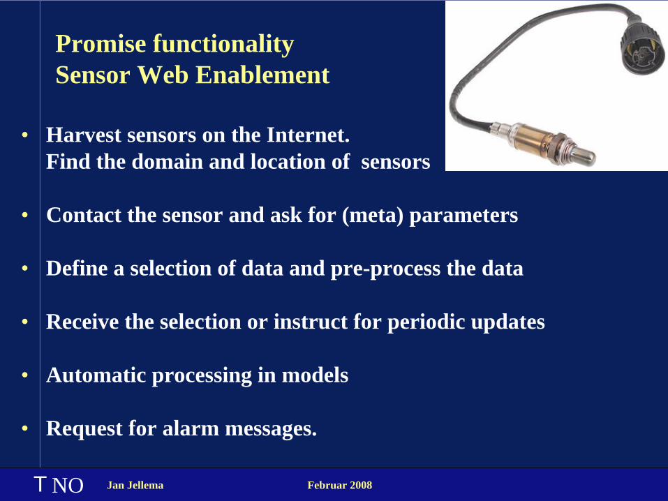
Promise functionality Sensor Web Enablement
• Harvest sensors on the Internet. Find the domain and location of sensors
• Contact the sensor and ask for (meta) parameters
• Define a selection of data and pre-process the data
• Receive the selection or instruct for periodic updates
• Automatic processing in models
• Request for alarm messages.
NO
T Jan Jellema Februar 2008
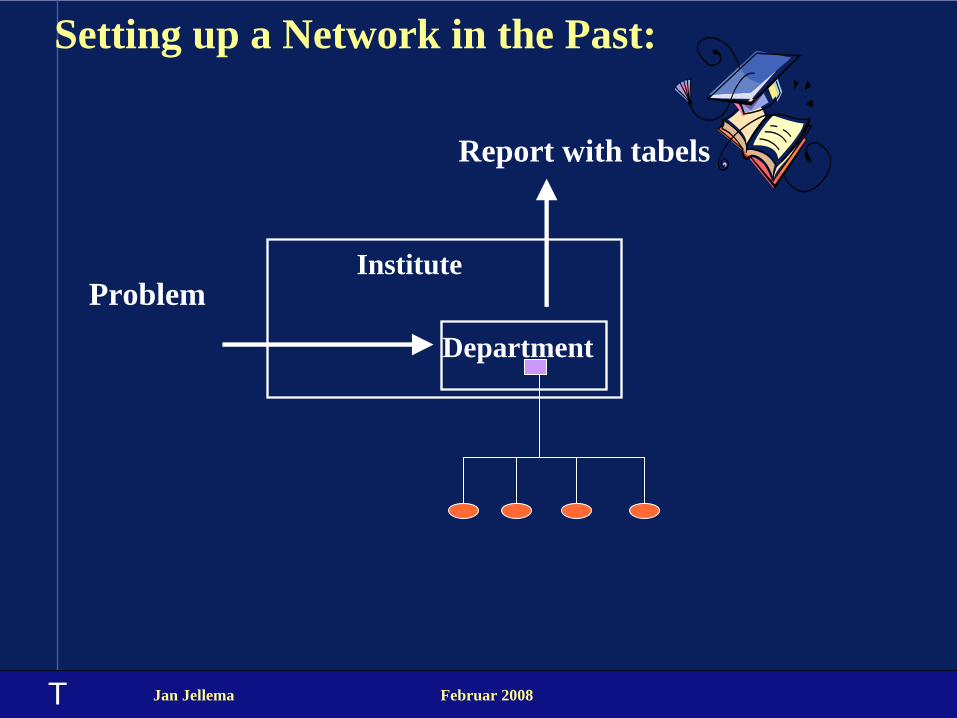
Setting up a Network in the Past:
Institute
Department
Report with tabels
Problem
T Jan Jellema Februar 2008
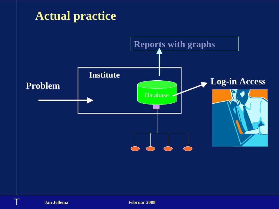
Actual practice
Institute
Reports with graphs
ProblemDatabase
Log-in Access

T Jan Jellema Februar 2008
Future situation
institute
Problem
instituteinstitute
Standard protocol
Internet

T Jan Jellema Februar 2008
Example: Dry period
3. Future Precipitation
Model: Hydroline
1. Moisture
Several locations
2. Precipitation
Local
T Jan Jellema Februar 2008
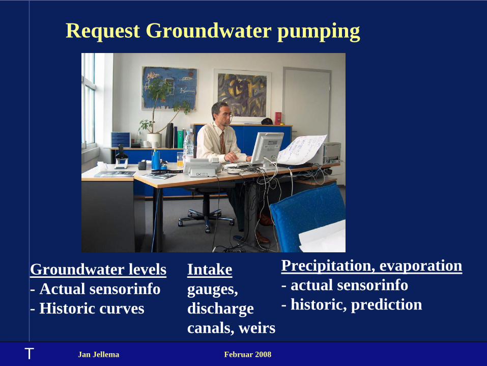
Request Groundwater pumping
Precipitation, evaporation - actual sensorinfo - historic, prediction
Groundwater levels - Actual sensorinfo - Historic curves
Intake gauges, discharge canals, weirs

T Jan Jellema Februar 2008
Example high water
River levels (Werse, Elbe, Oder, Rhine)

T Jan Jellema Februar 2008
Voorbeeld Hoog water
Rivier standen
T Jan Jellema Februar 2008
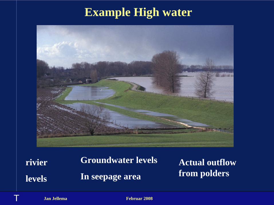
Example High water
Groundwater levels
In seepage areaActual outflow from polders
rivier
levels
T Jan Jellema Februar 2008
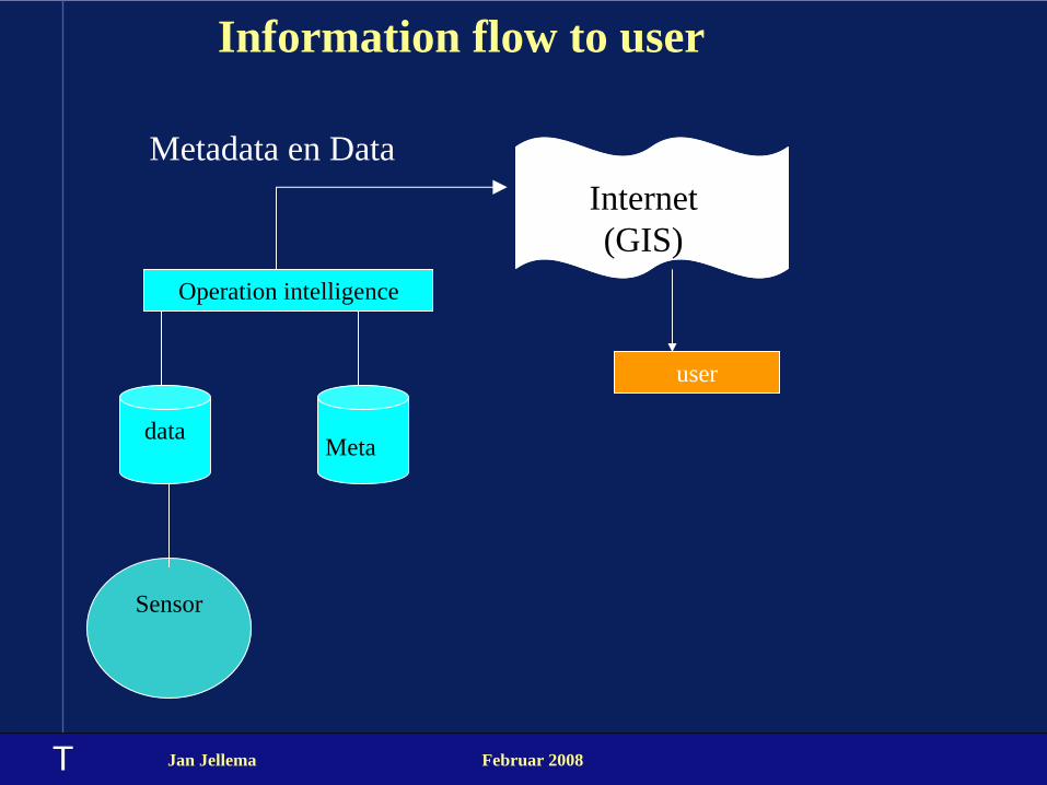
Information flow to user
Sensor
Operation intelligence
dataMeta
Internet (GIS)
Metadata en Data
user
T Jan Jellema Februar 2008
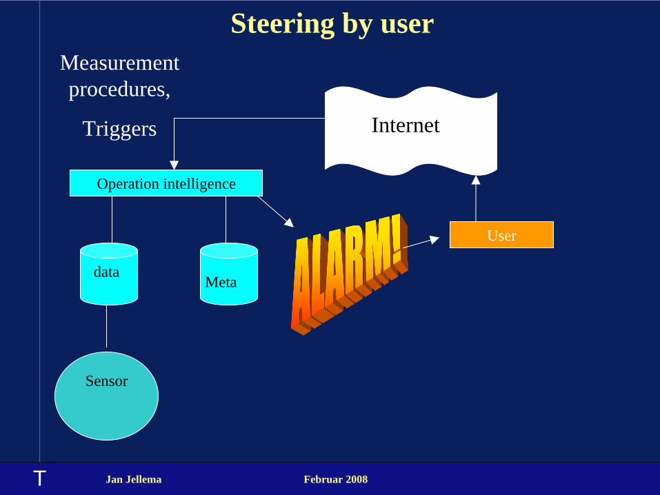
Steering by user
Sensor
Operation intelligence
dataMeta
Internet
Measurement procedures,
Triggers
User

T Jan Jellema Februar 2008
Voorbeeld polder
Lucht-
kwaliteit
Polder
at Lent
Future suburb of Nijmegen

T Jan Jellema Februar 2008
River level Pannerdense KopWater Quality
Lobith
River level Nijmegen-Haven
Water Quality RWZI
Groundwater head aquifer 1 aquifer 2
Groundwater head aquifer 1 aquifer 2
Groundwater head aquifer 1
River level
Groundwater head aquifer 1 aquifer 2
Soil moisture
Precipitation measurementPrecipitation
measurement
T Jan Jellema Februar 2008
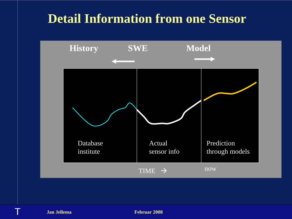
Detail Information from one Sensor
History SWE Model
Actual sensor info
Database institute
Prediction through models
TIME now

T Jan Jellema Februar 2008
Experiences
• The standards are too open. For every domain a profile is required. (X, Y, dimensions, vocabularies)
• Trend to wireless communication is diametrally opposite the introduction of voluminous protocols.
• Relation with GML requires intelligent and highly paid developers
• Geo-objects and measurements are different objects. They follow different processes. Do not combine in one standard.

T
Successes• Models: meteo, river level, groundwater, can import SOS.
• GIS-layers (WMS) with sensors are available.
• Cooperation between institutes is increasing.
• New ideas for high resolution measurements are put in practice.
Jan Jellema Februar 2008
Work underway• Prediction curves
• Dynamic maps

T Jan Jellema Februar 2008
Conclusions
• Better cooperation , better models, better predictions.
• Active and Informed civilians (Aarhus).
• Flexible and reliable support for urgent decisions.
T Jan Jellema Februar 2008
Demonstration
.
T Jan Jellema Februar 2008
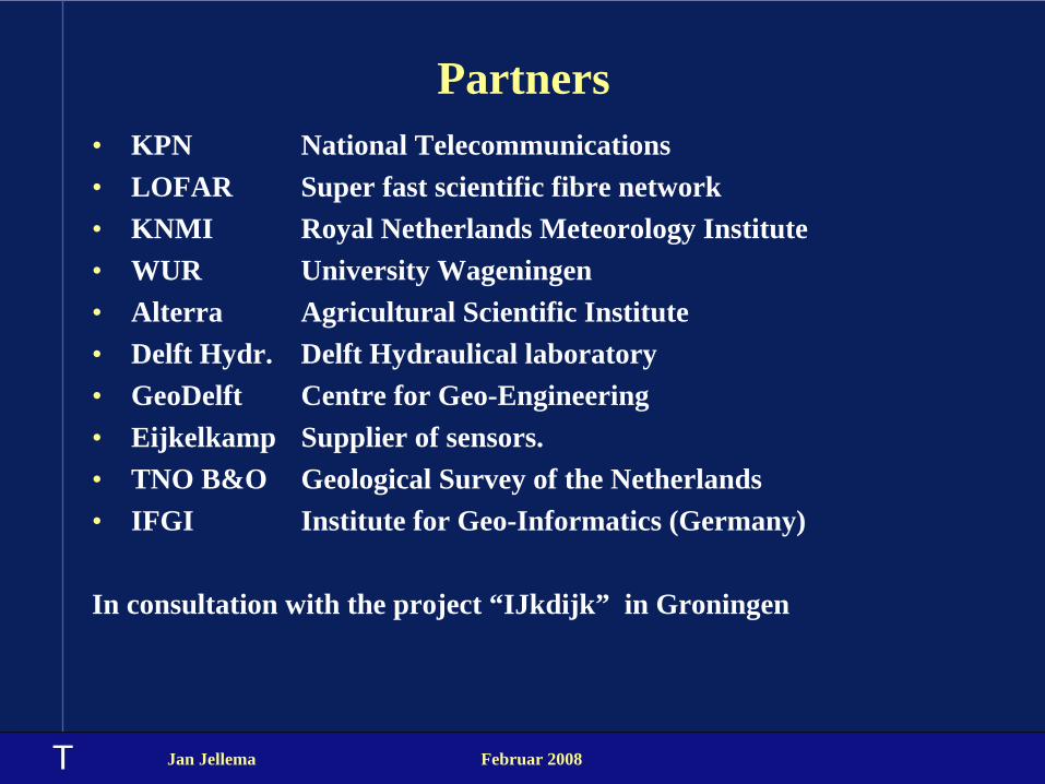
Partners• KPN National Telecommunications• LOFAR Super fast scientific fibre network• KNMI Royal Netherlands Meteorology Institute• WUR University Wageningen• Alterra Agricultural Scientific Institute• Delft Hydr. Delft Hydraulical laboratory• GeoDelft Centre for Geo-Engineering• Eijkelkamp Supplier of sensors.• TNO B&O Geological Survey of the Netherlands• IFGI Institute for Geo-Informatics (Germany)
In consultation with the project “IJkdijk” in Groningen
T Jan Jellema Februar 2008
WorkPackages
.