t gps fundamentals your location is: 37 o 23.323’ n 122 o 02.162’ w
TRANSCRIPT

T
GPS FundamentalsGPS Fundamentals
Your location is:37o 23.323’ N
122o 02.162’ W

T
Global Positioning SystemGlobal Positioning System
Your location is:37o 23.323’ N
122o 02.162’ W

T
Satellite Signal StructureSatellite Signal StructureCarrier L1 L2
Frequency 1575.42 MHz 1227.60 MHz
Wavelength 19cm 24cm
Code Modulation C/A-code -
P(Y)-code P(Y)-code
NAVDATA NAVDATA
C/A - Coarse Acquisition Code
P - Precise Code (Y-Code when encrypted)
NAVDATA - Satellite health, satellite clock corrections, and ephemeris parameters.
T
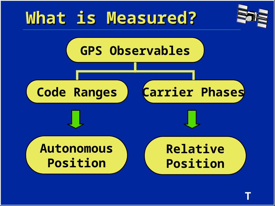
GPS Observables
AutonomousPosition
RelativePosition
What is Measured?What is Measured?
Code Ranges Carrier Phases
T
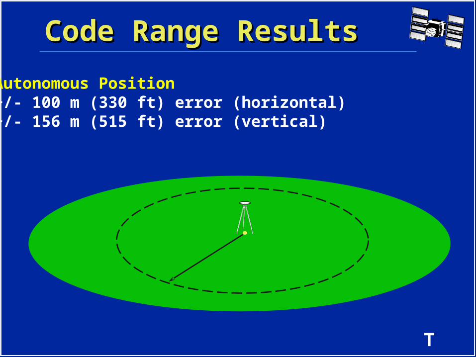
Code Range ResultsCode Range Results
Autonomous Position+/- 100 m (330 ft) error (horizontal)+/- 156 m (515 ft) error (vertical)
T
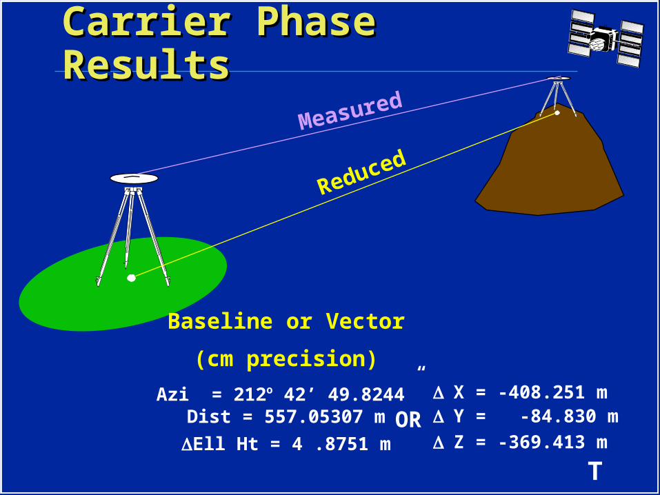
Carrier Phase ResultsCarrier Phase Results
Measured
Reduced
Baseline or Vector
(cm precision)
Azi = 212o 42’ 49.8244”Dist = 557.05307 m
Ell Ht = 4 .8751 m
X = -408.251 mY = -84.830 m
Z = -369.413 mOR

T
ECEF Coordinate SystemECEF Coordinate System
+Z
-Y
+X
X
YZ
ECEFX = -2691542.5437 mY = -4301026.4260 mZ = 3851926.3688 m
T
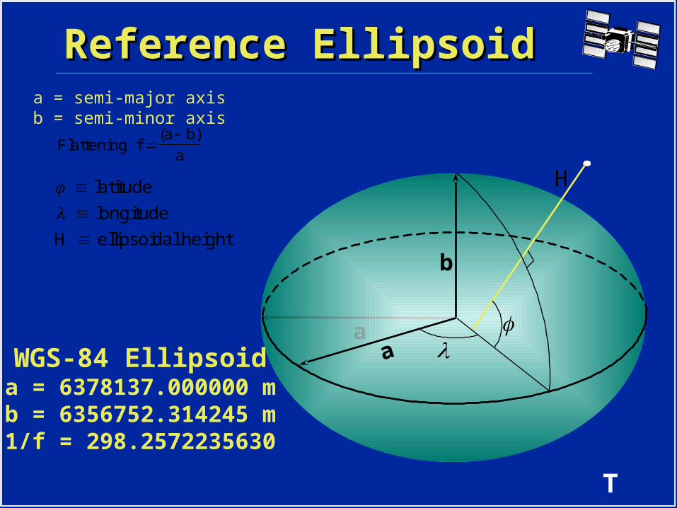
Reference EllipsoidReference Ellipsoid
a
b
a = semi-major axisb = semi-minor axis
Flattening f(a b)
a
b
a
H latitude
longitude
H ellipsoidal height
WGS-84 Ellipsoida = 6378137.000000 mb = 6356752.314245 m1/f = 298.2572235630
T
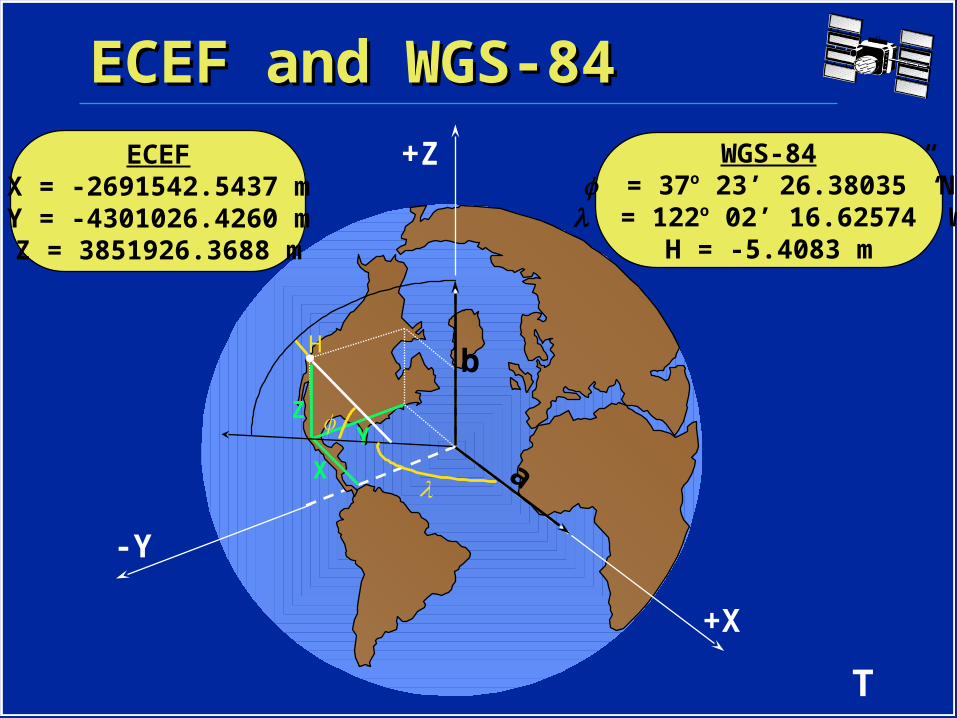
ECEF and WGS-84ECEF and WGS-84
+Z
-Y
+X
ECEFX = -2691542.5437 mY = -4301026.4260 mZ = 3851926.3688 m
X
YZ
b
a
H
WGS-84 = 37o 23’ 26.38035” N = 122o 02’ 16.62574” W
H = -5.4083 m

T
GPS Heights vs. ElevationsGPS Heights vs. Elevations
h = Orthometric HeightH = Ellipsoid Height
N = Geoid Height
h = H - N
NNN
h hh
H HH
Earth’s Surfa
ce
Ellipsoid
Geoid

T
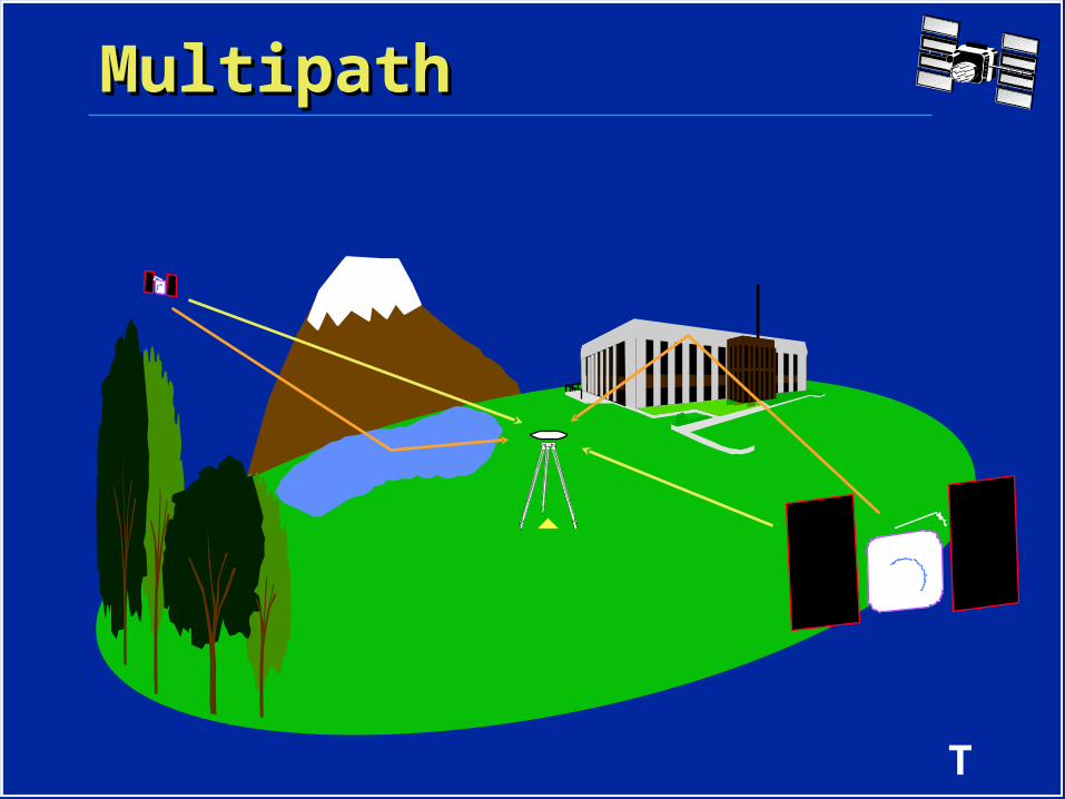
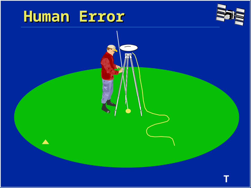
Errors Sources in GPSErrors Sources in GPS
• Selective Availability (SA) and Anti-Spoofing (AS)
• Multipath
• Ionospheric Noise
• Human Error

T
• Selective Availability (SA)• Clock dither• Ephemeris error
• Anti-Spoofing (AS)• Encryption of the P-code signal
SA and ASSA and AS
100 meters
????????
T
MultipathMultipath

T
Ionospheric EffectsIonospheric Effects
Ionosphere
< 10 km > 10 km
T
Human ErrorHuman Error

T
Survey RequirementsSurvey Requirements10:30 10:35
T
SummarySummary• There are three segments to GPS.
All must be working to use GPS.• There are 2 GPS signals, L1 and L2.• Code Range measurements result
in autonomous positions with several meter precision.
• Carrier Phase measurements result in relative positions with centimeter precision.

T
Summary (cont.)Summary (cont.)• GPS results are in reference to an
ECEF coordinate system and the WGS-84 ellipsoid.
• Errors in GPS can be minimized by planning and utilizing proper surveying techniques.
• At least 4 SVs are required to determine a position or survey with GPS.
• At least 2 receivers are required to survey with GPS.

T
Questions?Questions?