table of contents - mta maryland bus service web viewalignment between dundalk ave/centre place and...
TRANSCRIPT

Posted December 5, 2016 1

NOTICE OF PUBLIC HEARINGSVolume Two of Two: BaltimoreLink Route Booklet
The Maryland Department of Transportation’s Maryland Transit Administration gives notice of public hearings regarding the proposed BaltimoreLink Network Redesign.
Posted December 5, 2016
Posted December 5, 2016 2

Table of Contents Current MTA Route Crosswalk.......................................................................................................6
Route Sheet Instructions............................................................................................................. 17
CityLink Blue................................................................................................................................ 18
CityLink Brown.............................................................................................................................22
CityLink Gold................................................................................................................................26
CityLink Green..............................................................................................................................29
CityLink Lime................................................................................................................................32
CityLink Navy............................................................................................................................... 35
CityLink Orange............................................................................................................................41
CityLink Pink.................................................................................................................................44
CityLink Purple.............................................................................................................................47
CityLink Red................................................................................................................................. 51
CityLink Silver...............................................................................................................................55
CityLink Yellow (need confirmation of turn-by-turns).................................................................59
LocalLink 21................................................................................................................................. 67
LocalLink 22................................................................................................................................. 71
LocalLink 26................................................................................................................................. 74
LocalLink 28................................................................................................................................. 78
LocalLink 29................................................................................................................................. 81
LocalLink 30................................................................................................................................. 84
LocalLink 31................................................................................................................................. 87
LocalLink 33................................................................................................................................. 91
LocalLink 34................................................................................................................................. 93
LocalLink 36................................................................................................................................. 96
LocalLink 37................................................................................................................................. 99
LocalLink 51............................................................................................................................... 102
LocalLink 52............................................................................................................................... 105
LocalLink 53............................................................................................................................... 107
LocalLink 54............................................................................................................................... 111
LocalLink 56............................................................................................................................... 115
Posted December 5, 2016 3

LocalLink 57............................................................................................................................... 119
LocalLink 59............................................................................................................................... 122
LocalLink 62............................................................................................................................... 125
LocalLink 65............................................................................................................................... 129
LocalLink 67............................................................................................................................... 133
LocalLink 69............................................................................................................................... 136
LocalLink 70............................................................................................................................... 140
LocalLink 71............................................................................................................................... 144
LocalLink 73............................................................................................................................... 148
LocalLink 75............................................................................................................................... 151
LocalLink 76............................................................................................................................... 157
LocalLink 77............................................................................................................................... 162
LocalLink 78............................................................................................................................... 165
LocalLink 79............................................................................................................................... 168
LocalLink 80............................................................................................................................... 171
LocalLink 81............................................................................................................................... 174
LocalLink 82............................................................................................................................... 176
LocalLink 83............................................................................................................................... 180
LocalLink 85............................................................................................................................... 182
LocalLink 87............................................................................................................................... 184
LocalLink 89............................................................................................................................... 186
LocalLink 91............................................................................................................................... 190
LocalLink 92............................................................................................................................... 193
LocalLink 93............................................................................................................................... 199
LocalLink 94............................................................................................................................... 202
LocalLink 95............................................................................................................................... 206
Express BusLink 102...................................................................................................................208
Express BusLink 103...................................................................................................................212
Express BusLink 105...................................................................................................................214
Express BusLink 106...................................................................................................................217
Express BusLink 107...................................................................................................................220
Posted December 5, 2016 4

Express BusLink 115...................................................................................................................224
Express BusLink 120...................................................................................................................227
Express BusLink 150...................................................................................................................231
Express BusLink 154...................................................................................................................235
Express BusLink 160 (need turn-by-turn)...................................................................................239
Express BusLink 164...................................................................................................................243
Posted December 5, 2016 5

Current MTA Route Crosswalk The Proposed Route Change Crosswalk below is your guide to the plan. You can find the routes you currently ride in this table and see how they would change under the BaltimoreLink plan.
Current Route Proposed Route(s)
Summary of Changes
Local Bus 1 LocalLink 91, LocalLink 94, CityLink Navy
• Alignments between the Mondawmin Metro SubwayLink Station and Cylburn Avenue, including service to Coldspring-Newton, will be incorporated into the LocalLink 91, and passengers can continue to downtown via the Metro SubwayLink or CityLink Navy and Yellow.
• Alignment between Pratt St and Fort McHenry will be incorporated into LocalLink 94.
• The majority of the No. 1 alignment between the Mondawmin Metro SubwayLink Station and downtown will be incorporated into the CityLink Navy.
Local Bus 3 LocalLink 53, CityLink Green, CityLink Silver, Express BusLink 103
Alignment between Sheppard Pratt and Taylor Avenue will be incorporated into the LocalLink 53.
Alignment between Goucher Blvd and 33rd Street will be incorporated into the CityLink Green.
Alignment between 33rd Street/The Alameda and North Avenue will be incorporated into the CityLink Silver.
Service to Cromwell Bridge Park & Ride will be provided on Express BusLink 103 during peak hours only.
Posted December 5, 2016 6

Current Route Proposed Route(s)
Summary of Changes
Local Bus 4 LocalLink 62, CityLink Navy
Alignment between Dundalk Ave/Centre Place and Community College of Baltimore County (CCBC) Essex, will be incorporated into the LocalLink 62 and will also extend to White Marsh.
Alignment between Turner Station and Dundalk Ave/Centre Place will be incorporated into the CityLink Navy.
Local Bus 5 CityLink Pink, CityLink Yellow
Alignment between Cedonia and Erdman Avenue will be incorporated into the CityLink Pink.
The connection between Cedonia and Johns Hopkins Hospital will also be provided on the CityLink Pink, and passengers can continue to downtown via the Metro SubwayLink, CityLink Purple and Brown, or LocalLink 56.
Portions of the No. 5 alignment between the Mondawmin Metro SubwayLink Station and North Avenue (including service to Lakeview Towers) will be incorporated into the CityLink Yellow.
Local Bus 7 LocalLink 65, CityLink Lime
Alignment between Canton and downtown will be incorporated into the LocalLink 65.
Alignment between Mondawmin Metro SubwayLink Station and Dolphin Street will be incorporated into the CityLink Lime.
Local Bus 8 CityLink Red The full alignment will be replaced by the CityLink Red.
Local Bus 9 LocalLink 93 The full alignment will be replaced by LocalLink 93 and will extend service to Towson Town Center.
Posted December 5, 2016 7

Current Route Proposed Route(s)
Summary of Changes
Local Bus 10 CityLink Navy, CityLink Purple, LocalLink 62
Portions of the No. 10 alignment between Bullneck and Carey Street will be incorporated into the CityLink Navy.
The connection from Bullneck, Turner Station, and Dundalk to downtown will be provided on the CityLink Navy.
The No. 10 alignment between Rolling Road/Rte. Forty and Gilmor Street will be incorporated into the CityLink Purple.
The alignment between Boston Street and Ponca Street will be incorporated into LocalLink 62.
The connection between Rolling/Route Forty and Paradise to downtown will be incorporated into the CityLink Purple.
Local Bus 11 LocalLink 51 The full alignment will be replaced by into the LocalLink 51.
Local Bus 12 LocalLink 52 The entire No. 12 alignment will be replaced by the LocalLink 52.
Local Bus 13 CityLink Gold, LocalLink 22
The entire No. 13 alignment to Fells Point and the branch to Federal Street will be replaced by the CityLink Gold.
The Linwood/East branch of the No. 13 will be incorporated into the LocalLink 22.
Local Bus 14 LocalLink 69, LocalLink 70
Alignment between Jumpers Hole and Patapsco Light RailLink Station will be incorporated into the LocalLink 69.
Alignment between Annapolis and Patapsco Light RailLink Station will be incorporated into the LocalLink 70.
Posted December 5, 2016 8

Current Route Proposed Route(s)
Summary of Changes
Local Bus 15 LocalLink 34, LocalLink 79, LocalLink 80, CityLink Brown
The Westview branch of the No. 15 will be incorporated into the LocalLink 34.
Alignment between CMS and Walbrook Junction will be incorporated into the LocalLink 79.
Alignment between Walbrook Junction and Paca Street will be incorporated into the LocalLink 80.
Alignment between Overlea Loop and Eager Street will be incorporated into the CityLink Brown and will extend service to White Marsh.
Local Bus 16 LocalLink 29 The entire No. 16 alignment, with the exception of the Violetville deviation, will be replaced by the LocalLink 29.
Local Bus 17 LocalLink 75 Alignment between Parkway Center and Arundel Mills, with the exception of portions of Aviation Boulevard, Candlewood Road, and Dorsey Road, will be incorporated into the LocalLink 75.
The late night connection between UMD Medical Center, BWI Airport, and Arundel Mills will be incorporated into the LocalLink 75.
Local Bus 18 LocalLink 92 The various branches will be replaced by the LocalLink 92.
Local Bus 19 LocalLink 54 Both branches of the current No. 19 (Carney and Goucher & Taylor), with the exception of service along Howard Street, will be replaced by the LocalLink 54.
LocalLink 54 service will operate on Eutaw Street instead of Howard Street to avoid interaction with the Light RailLink service.
Posted December 5, 2016 9

Current Route Proposed Route(s)
Summary of Changes
Local Bus 20 LocalLink 78 Alignment between CMS and Pulaski Street (West Baltimore MARC) will be replaced by the LocalLink 78. Passengers can continue to downtown from West Baltimore MARC via the CityLink Blue, Orange, Green, or Pink routes.
Local Bus 21 CityLink Lime Alignment between Eastern Avenue and Mondawmin, with the exception of service on Lafayette Street and Gilmor Avenue, will be replaced by the CityLink Lime.
Local Bus 22 LocalLink 22 The entire No. 22 alignment will be replaced by the LocalLink 22.
Local Bus 23 LocalLink 77, CityLink Orange
Alignment between Rolling Road/Route Forty and West Baltimore MARC, including Wildwood Parkway service, will be replaced by the LocalLink 77. Passengers can continue to downtown via CityLink Blue, Orange, Green, or Pink.
Alignment between Fox Ridge and downtown will be incorporated into the CityLink Orange.
Local Bus 24 LocalLink 59 Alignment between Rolling Mill Road and Whispering Woods, and the No. 24 alignment between Pulaski Highway and Moravia Park will be replaced by the LocalLink 59, with service operating through Bayview Medical Center.
Local Bus 26 LocalLink 65, CityLink Blue, CityLink Orange
Alignment between Dundalk Marine Terminal and Holabird Avenue will be replaced by the LocalLink 65, with service continuing to downtown.
Alignment between Ponca Street and downtown will be replaced by the CityLink Orange.
Alignment between Highland Avenue and downtown will be replaced by the CityLink Blue.
Posted December 5, 2016 10

Current Route Proposed Route(s)
Summary of Changes
Local Bus 27 LocalLink 31, LocalLink 73, LocalLink 71, LocalLink 82, LocalLink 94
Alignment between Rogers Avenue and Sinai Hospital will be incorporated into the LocalLink 31.
Alignment between Waterview Avenue and Pratt Street will be incorporated into the LocalLink 73.
The connection from Cherry Hill to downtown will be provided on LocalLink 71 via Locust Point.
Alignment between Reisterstown Plaza Metro SubwayLink Station and Belvedere Avenue will be incorporated into the LocalLink 82, including service to the Seton Business Park.
Alignment between Belvedere Avenue and Martin Luther King, Jr. Blvd will be incorporated into the LocalLink 94.
Local Bus 29 LocalLink 71 Alignment between Hanover Street and Cherry Hill Light RailLink Station, with the exception of service on Waterview Avenue and to the Multi-Purpose Building, will be replaced by the LocalLink 71.
Local Bus 31 CityLink Gold, CityLink Navy, LocalLink 65
Alignment on Boston Street in Canton will be incorporated into the CityLink Gold.
Alignment on O’Donnell Street, Boston Street, and Dundalk Avenue will be incorporated into the CityLink Navy.
Service to CCBC Dundalk will be incorporated into the LocalLink 65.
Local Bus 33 LocalLink 28 The entire No. 33 alignment will be replaced by the LocalLink 28.
Posted December 5, 2016 11

Current Route Proposed Route(s)
Summary of Changes
Local Bus 35 LocalLink 32, LocalLink 56, LocalLink 76
Alignment between White Marsh and Guilford Avenue will be incorporated into the LocalLink 56.
Alignment between Calvert Street and Maiden Choice Lane, including service to Crossroads Business Park, will be incorporated into the LocalLink 76.
Access to Blind Industries will be maintained on the CityLink Yellow.
Local Bus 36 LocalLink 53, CityLink Yellow
Alignment between downtown and Riverview will be incorporated into the CityLink Yellow, with service operating on Lombard Street and Pratt Street instead of Baltimore Street and Fayette Street.
Alignment between Northern Parkway and North Avenue will be incorporated into the LocalLink 53. Passengers can continue to downtown via the Light RailLink, CityLink Green, Silver, or Red, or LocalLink 51.
Local Bus 38 LocalLink 38 Alignment between Hilton Parkway and Walbrook Junction will be incorporated into the LocalLink 38.
Quick Bus 40 CityLink Blue, CityLink Orange
Portions of the Quick Bus 40 alignment between the Centers for Medicare and Medicaid Services (CMS) and Bayview Boulevard will be replaced by the CityLink Blue.
Alignment between Bayview Boulevard and Paca Street will be replaced by the CityLink Orange.
Posted December 5, 2016 12

Current Route Proposed Route(s)
Summary of Changes
Local Bus 44 LocalLink 30, LocalLink 31
Alignment between Rosedale and Rogers Avenue Station will be replaced by the LocalLink 30.
Alignment between Rogers Avenue Metro SubwayLink Station and Security Square Mall will be incorporated into the LocalLink 31, including select trips to Security West and Social Security.
Quick Bus 46 CityLink Pink, CityLink Purple
Alignment between Cedonia and Erdman Avenue will be replaced by the CityLink Pink.
The connection between Cedonia and Johns Hopkins Hospital will be preserved on the CityLink Pink, and passengers can continue to downtown via the Metro SubwayLink or CityLink Purple or Brown, or LocalLink 56.
Alignment between Paradise Loop and Gilmor Street will be replaced by the CityLink Purple, which will continue downtown.
Quick Bus 47 LocalLink 80, CityLink Brown
Alignment between Overlea Loop and Washington Street will be replaced by the CityLink Brown and will extend to White Marsh, while still offer connections to downtown.
Alignment between Walbrook Junction and Edmondson Avenue will be incorporated into LocalLink 80, which will continue to downtown.
Quick Bus 48 CityLink Red The full Quick Bus 48 alignment Street will be replaced by the CityLink Red.
Local Bus 50 LocalLink 57 The entire No. 50 alignment will be replaced by the LocalLink 57.
Posted December 5, 2016 13

Current Route Proposed Route(s)
Summary of Changes
Local Bus 51 LocalLink 26, LocalLink 73, LocalLink 82
Cherry Hill branch between Hanover Street and Mondawmin Metro SubwayLink Station will be replaced by the LocalLink 26.
Alignment between Patapsco Light RailLink Station and the Horseshoe Casino will be incorporated into the LocalLink 73.
Alignment between Mondawmin Metro SubwayLink Station and Rogers Avenue Metro SubwayLink Station will be incorporated into the LocalLink 82.
Local Bus 52 CityLink Lime • The entire No. 52 alignment between Milford Mill Road and Mondawmin Metro SubwayLink Station will be replaced by the CityLink Lime.
Local Bus 53 LocalLink 83 • The entire No. 53 alignment will be replaced by the LocalLink 83.
Local Bus 54 LocalLink 81, LocalLink 85
• Alignment between Randallstown and Milford Mill Metro SubwayLink Station will be replaced by the LocalLink 81, with service extended to Deer Park Plaza.
• Alignment between Milford Mill Metro SubwayLink Station and North Avenue will be incorporated into the LocalLink 85.
Local Bus 55 LocalLink 36 The entire No. 55 alignment will be replaced by the LocalLink 36.
Local Bus 56 LocalLink 87 The entire No. 56 alignment will be replaced by the LocalLink 87.
Local Bus 57 LocalLink 34, LocalLink 31
Alignment between Liberty Road and Rogers Avenue Metro SubwayLink Station will be replaced by the LocalLink 34.
The connection between Rogers Avenue Metro SubwayLink Station and Security Boulevard will be preserved on LocalLink 31.
Posted December 5, 2016 14

Current Route Proposed Route(s)
Summary of Changes
Local Bus 58 LocalLink 33, LocalLink 34, CityLink Brown
Alignment between Mt Washington Light RailLink Station and Belair Road will be incorporated into the LocalLink 33.
Portions of the No. 58 alignment between Falls Road and Park Heights Avenue will be incorporated into LocalLink 34. LocalLink 34 will connect to the Metro SubwayLink at Rogers Avenue.
Alignment between Overlea and White Marsh will be incorporated into the CityLink Brown.
Local Bus 59 LocalLink 89 Alignment between Red Run Boulevard and Patterson Avenue will be replaced by the LocalLink 89 with service extended to Rogers Avenue Metro SubwayLink Station.
Local Bus 60 LocalLink 34 Alignment on Smith Avenue will be replaced by the LocalLink 34, which will connect to the Metro SubwayLink at Rogers Avenue.
Local Bus 61 LocalLink 95 The entire No. 61 alignment will be replaced by the LocalLink 95.
Local Bus 64 LocalLink 67, Express BusLink 164, CityLink Silver
Alignment between Marley Neck/Energy Parkway and Curtis Bay will be replaced by the LocalLink 67, with service continuing to downtown.
The connection between downtown and Riviera Beach will be incorporated into the Express BusLink 164.
Curtis Bay alignment between Curtis Bay and North Avenue will be incorporated into the CityLink Silver (with the exception of the deviation into Port Covington), with service extended to University Parkway and Morgan State.
Posted December 5, 2016 15

Current Route Proposed Route(s)
Summary of Changes
Local Bus 77 LocalLink 37, CityLink Yellow
Portions of the No. 77 alignment between University of Maryland – Baltimore County (UMBC) and Riverview, including connections to Halethorpe MARC, will be replaced by the CityLink Yellow.
The entire No. 77 alignment between Old Court Metro SubwayLink Station and University of Maryland – Baltimore County (UMBC) will be replaced by the LocalLink 37.
Local Bus 91 LocalLink 31, LocalLink 80, CityLink Yellow, CityLink Gold
Alignment between Rogers Avenue Metro SubwayLink Station and Sinai Hospital will be incorporated into the LocalLink 31.
Alignment between Rogers Avenue Metro SubwayLink Station and Walbrook Junction, including service on Garrison Boulevard, will be replaced by the LocalLink 80 which will continue downtown to City Hall.
Portions of the No. 91 alignment between North Avenue and downtown will be incorporated into the CityLink Yellow.
Alignment on North Avenue will be replaced by the CityLink Gold.
Local Bus 97 LocalLink 82 Alignment between Monte Verde Apartments and Mondawmin Metro SubwayLink Station will be replaced by the LocalLink 82.
Local Bus 98 LocalLink 22 The entire No. 98 alignment, with the exception of service on Keswick Road, will be replaced by the LocalLink 22.
Posted December 5, 2016 16

Current Route Proposed Route(s)
Summary of Changes
Local Bus 99 LocalLink 37, Express BusLink 107
Portions of the No. 99 alignment between Old Court and University of Maryland – Baltimore County (UMBC) will be incorporated into the LocalLink 37.
Connections between Old Court Metro SubwayLink Station, Security Boulevard, Catonsville, Community College of Baltimore County (CCBC) Catonsville, University of Maryland – Baltimore County (UMBC) and BWI Airport will be provided on the Express BusLink 107.
Express Bus 103
Express BusLink 103
The entire Express Bus 103 alignment will be replaced by the Express BusLink 103.
Express Bus 104
Express BusLink 103
The entire Express Bus 104 alignment between Cromwell Bridge and the Alameda will be replaced by the Express BusLink 103, with service continuing to downtown.
Express Bus 105
Express BusLink 105
The entire Express Bus 105 alignment will be replaced by Express BusLink 105.
Express Bus 110
CityLink Purple The Express Bus 110 alignment between Rolling Road/Route Forty and Gilmor Street will be replaced by the CityLink Purple, which will also connect to downtown.
Express Bus 115
Express BusLink 115
The entire Express Bus 115 alignment will be replaced by the Express BusLink 115.
Express Bus 119
Express BusLink 154
The entire Express Bus 119 (both Carney and Goucher &Taylor alignments), with the exception of service on Howard Street service, will be replaced by the Express BusLink 154.
Express BusLink 154 service will operate on Eutaw Street instead of Howard Street to avoid interaction with the Light RailLink service.
Posted December 5, 2016 17

Current Route Proposed Route(s)
Summary of Changes
Express Bus 120
Express BusLink 120
The entire Express Bus 120 alignment will be replaced by the Express BusLink 120.
Express Bus 150
Express BusLink 150
The Express Bus 150 alignment, with the exception of Edmondson Avenue and Long Branch Park & Ride, will be replaced by the Express BusLink 150.
Service will also be extended to Harbor East on Express BusLink 150.
Express Bus 160
Express BusLink 160
The entire Express Bus 160 alignment will be replaced by the Express BusLink 160.
Express Bus 164
Express BusLink 164
The Express Bus 164 connection from downtown to Riviera Beach will be incorporated into Express BusLink 164.
Posted December 5, 2016 18

Route Sheet Instructions The following pages contain detailed information on all of the proposed BaltimoreLink routes, including to/from locations, level of service, transit connections, destinations, and turn-by-turn directions. The information provided directly matches the information provided in the route sheet booklet and interactive maps provided on BaltimoreLink.com. The content has been reformatted to be screen reader friendly and accessible for people who are blind or visually impaired. Each route sheet is formatted from top to bottom as described below.
1. The route name includes the type and number of the proposed route. For example, “CityLink Pink” or “LocalLink 21.”
2. Below the route name is the “to/from” or the beginning and ending locations of the proposed route.
3. The span, or hours of service, describes the operating hours of the proposed route on weekdays, Saturday, and/or Sunday.
4. Frequency describes how often buses will arrive during different time periods. On weekdays, the time periods listed below are approximately associated with the identified hours. Once scheduled, time periods will vary by route to meet capacity needs. Some routes’ AM or PM Peak periods may begin earlier or end later than what is described below.
a. The Early time period is from 3:00 a.m. to 7:00 a.m.b. The AM Peak is from 7:00 a.m. to 9:00 a.m.c. The Midday time period is from 9:00 a.m. to 4:00 p.m.d. The PM Peak is from 4:00 p.m. to 6:00 p.m.e. The Evening time period is from 6:00 p.m. to 10:00 p.m.f. The Late Night time period is from 10:00 p.m. to the end of service.
5. Below the weekday hours of service are frequency tables for Saturday and Sunday. Saturday and Sunday hours are broken out by “Day” or “Other.” The Day time period for weekends varies by route; specific hours will be described for each proposed route.
6. Rail connections, if any, are listed by Metro Subway, Light Rail, and MARC Train.7. Connections to CityLink routes are listed.8. Points of Interested served by the proposed route are listed.9. Current local, quick, and express bus routes served by the alignment of the proposed
BaltimoreLink route are listed.10. A paragraph describing the overall changes from the current route(s) to proposed
route is provided.11. Turn-by-turn directions are provided to replace the visual maps of the route
booklets.
Posted December 5, 2016 19

CityLink Blue CMS to Hopkins Bayview, with select trips from Westgate
Hours of Service from CMS
Weekday: 4:00 a.m. to 1:00 a.m.
Saturday: 8:00 a.m. to 11:00 p.m.
Sunday: 9:00 a.m. to 9:00 p.m.
Hours of Service from Westgate
Weekday: 4:00 a.m. to 6:00 a.m.; 7:00 p.m. to 3:00 p.m.
Saturday: 24 hours
Sunday: 24 hours
Frequency Table
Time Period Frequency from CMS Frequency from Westgate
Frequency of All Trips (Edmondson Village to Hopkins Bayview)
Weekday Early 60 mins 30 mins 20-30 minsWeekday AM Peak 10 mins - 10 minsWeekday Midday 15 mins - 15 minsWeekday PM Peak 10 mins - 10 minsWeekday Evening 40 mins 40 mins 20 minsWeekday Late Night 60 mins 30 mins 20 to 30 minsSaturday (8:00 a.m. to 9:00 p.m.)
30 mins 30 mins 15 mins
Saturday Other 30-60 mins 60 mins 20-60 minsSunday (9:00 a.m. to 9:00 p.m.)
30 mins 30 mins 15 mins
Sunday Other - 60 mins 60 mins
Rail Stations Served
Metro Subway Lexington Market Shot Tower
Light Rail Lexington Market
Posted December 5, 2016 20

MARC Train West Baltimore
CityLink Transfers
All
Points of Interest Served
Bayview Medical Center Edmonson Village Security Square (select trips) Patterson Park
Current Routes
26 QB40
Route description
CityLink Blue will largely replace the current Quickbus 40 and provide service between Centers for Medicare and Medicaid Services (CMS) and Johns Hopkins Bayview. CityLink Blue will operate along the US 40 Expressway between West Baltimore MARC and downtown to reduce travel times to and from West Baltimore (CityLink Orange and LocalLink 80 will provide service to this area). Within downtown, CityLink Blue will operate on Saratoga Street and provide transfers to other CityLink and LocalLink routes. East of downtown, CityLink Blue, in conjunction with CityLink Orange, will also provide service to the busy Fayette Street corridor which is currently served by the current Quickbus 40 and the current No. 23 route.
Turn-by-turn Description
From Centers for Medicare and Medicaid Services (CMS) to Hopkins Bayview (southbound) The route begins at CMS, heading east via Security Boulevard for three and a half miles. Continue onto Cooks Lane, heading south east for three quarters of a mile. Slight left onto Edmondson Avenue, heading east for two miles. Slight right onto West Franklin Street, heading east for half a mile. Continue onto West Mulberry Street/US-40 West, heading east for one and a quarter
mile. Right onto North Green Street. Left onto West Saratoga Street, continuing onto East Saratoga Street, for three quarters
of a mile. Right onto Guilford Ave, heading south for two tenths of a mile.
Posted December 5, 2016 21

Left onto East Baltimore Street, heading east for three quarters of a mile. Left onto North Central Avenue. Right onto East Fayette Street heading east for one and a half miles. Right onto North Highland Avenue, continuing onto South Highland Avenue, for a half
mile. Left onto Bank Street. Right onto South Conkling Street. Left onto Eastern Avenue, heading east for one mile Left onto Bayview Boulevard. Right at Mason Lord Drive heading north for three tenths of a mile. Left onto Nathan Shock Drive. Right onto Bioscience Drive heading north for a quarter mile. Route terminates at Johns Hopkins Bayview.
From Hopkins Bayview to CMS (northbound) The route begins at Johns Hopkins Bayview heading west on East Lombard Street for a
quarter mile. Left onto Bayview Boulevard, heading north for approximately a half mile. Right onto Eastern Avenue, heading west for one mile. Right onto South Conkling Street. Left onto Bank Street heading west for a few hundred feet. Right onto South Highland Avenue, continuing onto North Highland Avenue, for a half
mile. Left onto East Fayette Street, heading west for two and three tenths miles. Right onto North Calvert Street, heading north for a few hundred feet. Left onto East Saratoga Street, continuing onto West Saratoga Street, for two tenths of a
mile. Right onto North Paca Street heading north for a few hundred feet. Left onto West Franklin Street/US-40 West, heading west for two and a quarter miles. Left onto Edmondson Avenue, heading west for two miles. Right onto Cooks Lane, heading west for three quarters of a mile. Continue onto Security Boulevard for approximately three and a half miles Route terminates at CMS.
From Westgate to Hopkins Bayview (southbound) Route begins on Edmondson Avenue, heading east for two and three quarter miles. Slight right onto West Franklin Street, heading east for half a mile. Continue onto West Mulberry Street/US-40, heading east for one and three quarter
miles.
Posted December 5, 2016 22

Right onto North Green Street. Left onto West Saratoga Street, continuing east onto East Saratoga Street, for three
quarters of a mile. Right onto Guilford Ave, heading south for a quarter mile. Left onto East Baltimore Street, heading east for three quarters of a mile. Left onto North Central Avenue. Right onto East Fayette Street heading east for one and a half miles. Right onto North Highland Avenue, continuing onto South Highland Avenue, for a half
mile. Left onto Bank Street. Right onto South Conkling Street. Left onto Eastern Avenue, heading east for one mile Left onto Bayview Boulevard. Right at Mason Lord Drive heading north for three tenths of a mile. Left onto Nathan Shock Drive. Right onto Bioscience Drive heading north for a quarter mile. Route terminates at Johns
Hopkins Bayview.
From Hopkins Bayview to Westgate (northbound) The route begins at Johns Hopkins Bayview heading west on East Lombard Street for a
quarter mile. Left onto Bayview Boulevard, heading north for approximately a half mile. Right onto Eastern Avenue, heading west for one mile. Right onto South Conkling Street. Left onto Bank Street heading west for a few hundred feet. Right onto South Highland Avenue, continuing onto North Highland Avenue, for a half
mile. Left onto East Fayette Street, heading west for two and three tenths miles. Right onto North Calvert Street, heading north for a few hundred feet. Left onto East Saratoga Street, continuing onto West Saratoga Street, for two tenths of a
mile. Right onto North Paca Street heading north for a few hundred feet. Left onto West Franklin Street/US-40 West, heading west for two and a quarter miles. Left onto Edmondson Avenue, heading west for two and three quarter miles where the
route terminates.
Posted December 5, 2016 23

CityLink Brown Overlea to Downtown, with select trips from White Marsh
Hours of Service from Overlea
Weekday: 24 hours
Saturday: 5:00 a.m. to 3:00 a.m.
Sunday: 5:00 a.m. to 2:00 a.m.
Hours of Service from White Marsh
Weekday: 5:00 a.m. to 11:00 p.m.
Saturday: 8:00 a.m. to 11:00 p.m.
Sunday: 9:00 a.m. to 9:00 p.m.
Frequency Table
Time Period Frequency from Overlea Frequency from White Marsh
Weekday Early 30 to 60 mins 60 minsWeekday AM Peak 9 mins 20 minsWeekday Midday 15 mins 30 minsWeekday PM Peak 9 minsWeekday Evening 20 mins 40 minsWeekday Late Night 40 mins -Saturday (8:00 a.m. to 11:00 p.m.) 15 mins 30 minsSaturday Other 45 mins -Sunday (9:00 a.m. to 9:00 p.m.) 30 mins 60 minsSunday Other 45 mins -
Rail Stations Served
Metro Subway Charles Center Johns Hopkins Hospital
Light Rail Convention Center
MARC Train Camden
Posted December 5, 2016 24

CityLink Transfers
All
Points of Interest Served
Clifton Park Convention Center Inner Harbor Johns Hopkins Hospital Little Italy White Marsh (select trips)
Current Routes
15 58 QB47
Route Description
CityLink Brown largely replaces the current No. 15 route and Quickbus 47 between Overlea and downtown, with the exception that CityLink Brown will operate via Broadway, Lombard Street and Pratt Street and layover at Pratt Street and Greene Street instead of Madison Street/Monument Street, Hillen Street/Gay Street, and Saratoga Street, all of which will be served by other CityLink routes. It would also extend on select trips to White Marsh, adding another connection from the east side of the city to this major generator.
Turn-by-turn Description
From Overlea to Downtown (southbound) The route begins at Overlea Loop. Right onto Belair Road, heading southwest for approximately four and a half miles. Continue onto North Gay Street for three quarters of a mile heading west. Right onto East Preston Street for a few hundred feet. Left onto North Broadway, continuing onto South Broadway, for one mile. Right onto East Lombard Street, continuing onto West Lombard Street, for
approximately two miles. Left onto South Martin Luther King Jr. Boulevard, heading south for a few hundred feet. Left onto West Pratt Street at University of Maryland Medical Center, where route
terminates.
From Downtown to Overlea (northbound)
Posted December 5, 2016 25

The route begins at West Pratt Street, heading east for a half mile. Continue onto East Pratt Street heading east for one and two tenths miles. Left onto South Broadway, continuing onto North Broadway for approximately one mile. Right onto North Gay Street, heading east for approximately one mile. Veer right onto Belair Road, heading northeast for four and a quarter miles. Arrive at Overlea Loop, where route terminates.
From White Marsh to Downtown (southbound) The route begins at White Marsh Park & Ride, continuing on White Marsh Mall Ring
Road for a half mile. Right to arrive at the Sears Parking Lot Bus Stop. Right onto White Marsh Mall Ring Road for a quarter mile. Left onto Sandpiper Circle for a half mile heading south. Left onto Corporate Drive heading east for a quarter mile. Right onto Town Center Drive heading east for a half mile. Left onto Campbell Boulevard. Right onto Honeygo Boulevard heading north for half a mile. Left onto White Marsh Boulevard, heading west for two miles. Left onto Belair Road, heading southwest for six and three quarter miles. Continue onto North Gay Street for three quarters of a mile heading west. Right onto East Preston Street for a few hundred feet. Left onto North Broadway, continuing onto South Broadway, for one mile. Right onto East Lombard Street, continuing onto West Lombard Street, for
approximately two miles. Left onto South Martin Luther King Jr. Boulevard, heading south for a few hundred feet. Left onto West Pratt Street at University of Maryland Medical Center, where route
terminates.
From Downtown to White Marsh (northbound) The route begins at West Pratt Street, heading east for a half mile. Continue onto East Pratt Street heading east for one and two tenths miles. Left onto South Broadway, continuing onto North Broadway for approximately one mile. Right onto North Gay Street, heading east for approximately one mile. Veer right onto Belair Road, heading northeast for six and three quarter miles. Right onto the White Marsh Boulevard Exit Ramp for three tenths of a mile. Left to merge onto State Highway Forty-three/White Marsh Boulevard, heading east for
approximately two miles. Right onto Honeygo Boulevard, heading south for a half mile. Left onto Campbell Drive heading east for a few hundred feet.
Posted December 5, 2016 26

Right onto Town Center Drive for a half mile. Left onto Corporate Drive for a quarter mile. Right onto Sandpiper Circle heading north for a half mile. Right onto White Marsh Mall Ring Road for three tenths of a mile. Left to arrive at Sears Parking Lot Bus Stop. Left onto White Marsh Mall Ring Road for three tenths of a mile. Right onto Campbell Boulevard. Left onto Honeygo Boulevard heading west for a quarter mile. Left into the White Marsh Park and Ride where the route terminates.
Posted December 5, 2016 27

CityLink Gold Walbrook Junction to Berea, with select trips to Canton Crossing
Hours of Service to Berea
Weekday, Saturday, and Sunday: 24 hours
Hours of Service to Canton Crossing
Weekday: 4:00 a.m. to 2:00 a.m.
Saturday: 5:00 a.m. to 2:00 a.m.
Sunday: 5:00 a.m. to 1:00 a.m.
Frequency Table
Time Period Frequency to Berea Frequency to Canton Crossing
Weekday Early 30-60 mins 60 minsWeekday AM Peak 10 mins 20 minsWeekday Midday 15 mins 30 minsWeekday PM Peak 10 mins 20 minsWeekday Evening 20 mins 30 minsWeekday Late Night 30-60 mins 60 minsSaturday (8:00 a.m. to 8:00 p.m.) 15 mins 30 minsSaturday Other 30-60 mins 60 minsSunday (8:00 a.m. to 8:00 p.m.) 15 mins 30 minsSunday Other 30-60 mins 60 mins
Rail Stations Served
Metro Subway Penn North Johns Hopkins Hospital (select trips)
Light Rail North Avenue
MARC Train N/A
CityLink Transfers
Brown Lime
Posted December 5, 2016 28

Navy Pink Red Silver Yellow All CityLinks (select trips)
Points of Interest Served
Johns Hopkins Hospital (select trips) Station North Arts District Walbrook Junction
Current Routes
13 31
Route Description
CityLink Gold will replace the current No. 13 alignment between Walbrook Junction and Canton via Boston Street. The current No. 13 deviation between Walbrook Junction and Patterson Park Avenue/Federal Street will also be unchanged. The Linwood Avenue/East Avenue branch of the current No. 13 will be accommodated by LocalLink 22.
Turn-by-turn Description
From Walbrook Junction to Berea (eastbound) The route begins at Walbrook Junction, heading east on West North Avenue for three
miles. Continue onto East North Avenue for two miles. Right onto North Patterson Park Avenue, heading south for two tenths of a mile. Arrive in Berea where the route terminates.
From Berea to Walbrook Junction (westbound) The route begins in Berea, heading south on North Patterson Park Avenue. Left onto East Federal Street for a few hundred feet. Left onto North Milton Avenue, heading north for a quarter mile. Left onto East North Avenue, continuing onto West North Avenue, for four and three
quarter miles. Right onto Bloomingdale Road, heading northwest for two tenths of a mile. Veer left onto Clinton Avenue, heading west for a few hundred feet. Left onto Edgewood Street, heading south for a few hundred feet.
Posted December 5, 2016 29

Left onto West North Avenue, where the route terminates at Walbrook Junction.
From Walbrook Junction to Canton Crossing (southbound) The route begins at Walbrook Junction, heading east on West North Avenue for three
miles. Continue onto East North Avenue for one and three tenths miles. Right onto North Wolfe Street, continuing onto South Wolfe Street, for two miles. Left onto Fleet Street, heading east for a few hundred feet. Veer right onto Boston Street, heading southeast for one mile. Right onto South Highland Avenue, heading south for three tenths of a mile. Right onto Eastbourne Avenue where the route terminates at Canton Crossing.
From Canton Crossing to Walbrook Junction (northbound) The route begins at Canton Crossing, heading north on South Clinton Street for a half
mile. Left onto Boston Street, heading northeast for one mile. Left onto Fleet Street. Right onto South Washington Street, continuing onto North Washington Street, for two
miles. Left onto East North Avenue, continuing onto West North Avenue, for four and three
tenths miles. Right onto Bloomingdale Road, heading northwest for two tenths of a mile. Veer left onto Clinton Avenue, heading west for a few hundred feet. Left onto Edgewood Street, heading south for a few hundred feet. Left onto West North Avenue, where the route terminates at Walbrook Junction.
Posted December 5, 2016 30

CityLink Green West Baltimore MARC to Towson
Hours of Service
Weekday: 24 hours
Saturday: 5:00 a.m. to 3:00 a.m.
Sunday: 5:00 a.m. to 2:00 a.m.
Frequency Table
Time Period FrequencyWeekday Early 30 minsWeekday AM Peak 10 minsWeekday Midday 15 minsWeekday PM Peak 10 minsWeekday Evening 20 minsWeekday Late Night 30 minsSaturday (8:00 a.m. to 8:00 p.m.) 15 minsSaturday Other 60 minsSunday (8:00 a.m. to 8:00 p.m.) 30 minsSunday Other 60 mins
Rail Stations Served
Metro Subway Charles Center
Light Rail Penn Station University Center/Baltimore Street
MARC Train Penn Station West Baltimore
CityLink Transfers
All
Points of Interest Served
Towson Town Center Goucher & Taylor
Posted December 5, 2016 31

Morgan State University of Baltimore/UMD Medical Center
Current Routes
3 20 36
Route Description
CityLink Green largely replaces the current No. 3 route between Towson and downtown, however it would operate via Goucher Boulevard between Joppa Road and Loch Raven Boulevard and via Kirk Avenue and North Avenue between 33rd Street and Charles Street. The route would also extend to West Baltimore MARC primarily via Baltimore Street, Fulton Street, and Monroe Street.
Turn-by-turn Description
From West Baltimore MARC to Towson (northbound) The route begins at West Baltimore MARC Station, Lot A. Right onto North Smallwood Street. Left onto West Mulberry Street, heading east for a quarter mile. Right onto North Monroe Street, heading south for three tenths of a mile. Left onto West Baltimore Street, heading east for approximately two miles. Left onto North Charles Street, heading north for a half mile. Right at East Centre Street. Left onto Washington Place for a few hundred feet. Left onto East Madison Street. Right onto North Charles Street heading north for approximately one mile. Right onto East North Avenue heading east for a half mile. Left onto Homewood Avenue for a few hundred feet. Veer right onto Kirk Avenue heading northeast for one mile. Left onto The Alameda, heading north for a half mile. Veer right onto Loch Raven Boulevard, heading north for approximately four miles. Left onto Taylor Avenue, continuing onto Goucher Boulevard, heading northwest for
one mile. Left onto East Joppa Road for approximately one mile. Right onto Dulaney Valley Road heading north for a quarter mile. Right onto Fairmount Avenue for a quarter mile. Arrive at Towson Town Center, where the route terminates.
Posted December 5, 2016 32

From Towson Town Center to West Baltimore MARC Station (southbound) The route begins at Towson Town Center, heading east on Fairmount Avenue. Turn right to continue onto Fairmount Avenue. Left onto East Joppa Road, heading east for half a mile. Right onto Goucher Boulevard, continuing onto Taylor Avenue, heading southeast for
one mile. Right onto Loch Raven Boulevard, heading south for approximately three and three
quarter miles. Left onto The Alameda, heading south for a half mile. Veer right onto Kirk Avenue, heading south for approximately one mile. Left onto Homewood Avenue for a few hundred feet. Right onto East North Avenue for a half mile. Left onto Saint Paul Street heading south for one and a half miles. Right onto East Fayette Street, continuing onto West Fayette Street, for three quarters
of a mile. Left onto Martin Luther King Jr Boulevard. Right onto West Baltimore Street, heading west for one mile. Right onto North Fulton Avenue, heading north for three tenths of a mile. Left onto West Franklin Street, heading west for three tenths of a mile. Left onto North Smallwood Street. Right to arrive at West Baltimore MARC Station, Lot A, where the route terminates.
Posted December 5, 2016 33

CityLink Lime Northwest Hospital to Upton Metro, with select trips to Harbor East
Hours of Service to Upton Metro
Weekday: 24 hours
Saturday: 5:00 a.m. to 3:00 a.m.
Sunday: 5:00 a.m. to 2:00 a.m.
Hours of Service to Harbor East
Weekday: 4:00 a.m. to 1:00 a.m.
Saturday: 5:00 a.m. to 1:00 a.m.
Sunday: 6:00 a.m. to midnight
Frequency Table to Upton Metro
Frequency Table
Time Period Frequency to Upton Metro Frequency to Harbor EastWeekday Early 20-40 mins 40 minsWeekday AM Peak 10 mins 20 minsWeekday Midday 15 mins 30 minsWeekday PM Peak 10 mins 20 minsWeekday Evening 15 mins 30 minsWeekday Late Night 30-60 mins 60 minsSaturday (8:00 a.m. to 8:00 p.m.) 20 mins 40 minsSaturday Other 30-60 mins 60 minsSunday (8:00 a.m. to 8:00 p.m.) 20 mins 40 minsSunday Other 30-60 mins 60 mins
Rail Stations Served
Metro Subway Mondawmin Penn North Upton State Center (select trips)
Light Rail Cultural Center/State Center (select trips)
MARC Train
Posted December 5, 2016 34

N/A
CityLink Transfers
Navy Yellow Gold All CityLinks (select trips)
Points of Interest Served
Northwest Hospital Randallstown Mondawmin State Center (select trips) Harbor East (select trips)
Current Routes
7 21 52
Route Description
CityLink Lime will replace the current No. 52 route and will extend service to Northwest Hospital. It will also replace the current No. 21 alignment along Caroline Street, Preston Street, and Biddle Street and connect to Mondawmin via Pennsylvania Avenue. Every other trip from Northwest Hospital will deviate at the Upton Metro Subway Station.
Turn-by-turn Description
From Northwest Hospital to Upton Metro (southbound) Route begins at Northwest Hospital on Carlson Lane and turns right onto Old Court Road
heading northeast for a quarter mile. Right onto Liberty Road heading southeast for four miles. Continue onto Liberty Heights Avenue heading southeast for approximately three and a
half miles. Right onto Reisterstown Road for a half mile. Continue onto Pennsylvania Avenue for three quarters of a mile heading east. Right onto Laurens Street, where route terminates at Upton Metro Subway Station.
From Upton Metro to Northwest Hospital (northbound)
Posted December 5, 2016 35

Route begins at Upton Metro Subway Station on North Fremont Avenue heading northwest.
Left onto Pennsylvania Avenue heading west for a half mile. Continue onto Reisterstown Road for a half mile heading west. Left onto Liberty Heights Avenue for approximately three and a half miles. Continue onto Liberty Road for four miles heading northwest. Left onto Old Court Road heading west for a quarter mile. Left onto Carlson Lane, where route terminates at Northwest Hospital.
From Northwest Hospital to Harbor East (southbound) Route begins at Northwest Hospital on Carlson Lane and turns right onto Old Court Road
heading northeast for a quarter mile. Right onto Liberty Road heading southeast for four miles. Continue onto Liberty Heights Avenue heading southeast for approximately three and a
half miles. Right onto Reisterstown Road for a half mile. Continue onto Pennsylvania Avenue for one mile heading east. Left onto Dolphin Street, heading northeast for three tenths of a mile. Right onto North Eutaw Street, heading southeast for a quarter mile. Left onto Martin Luther King Junior Boulevard. Veer right onto West Read Street. Left onto West Chase Street for a few hundred feet. Left onto Martin Luther King Junior Boulevard. Right onto West Biddle Street for a few hundred feet. Continue onto East Biddle Street, heading east for one mile. Right onto North Caroline Street, heading south for approximately one mile. Continue onto South Caroline Street for half a mile, where trip terminates.
From Harbor East to Northwest Hospital (northbound) The route begins in Harbor East at South Caroline Street and Eastern Avenue. Right onto Fleet Street for a few hundred feet. Right onto South Central Ave. Right onto Eastern Ave for a few hundred feet. Left onto South Caroline Street, continuing onto North Caroline Street, for one and a
half miles. Left onto East Preston Street, continuing onto West Preston Street, for one and a
quarter miles. Left onto North Howard Street. Right onto West Preston Street for a few hundred feet.
Posted December 5, 2016 36

Right onto North Eutaw Street for a few hundred feet. Left onto Dolphin Street, heading southwest for three tenths of a mile. Right onto Pennsylvania Avenue, heading northwest for one mile. Continue onto Reisterstown Road for a half mile heading west. Left onto Liberty Heights Avenue for approximately three and a half miles. Continue onto Liberty Road for four miles heading northwest. Left onto Old Court Road heading west for a quarter mile. Left onto Carlson Lane, where route terminates at Northwest Hospital.
Posted December 5, 2016 37

CityLink Navy Dundalk & Watersedge to Mondawmin Metro, with select trips from Turner Station
Hours of Service from Dundalk & Watersedge
Weekday, Saturday, and Sunday: 24 hours
During weekday midday and Saturday day (8:00 a.m. to 10:00 pm.) time periods, every other trip will operate to and from Center Place Loop in Dundalk instead of Watersedge.
Hours of Service from Turner Station
Trips after 10:00 p.m. will depart from Turner Station instead of Watersedge.
Frequency Table
Time Period FrequencyWeekday Early 30 minsWeekday AM Peak 10 minsWeekday Midday 15-30 minsWeekday PM Peak 10 minsWeekday Evening 20 minsWeekday Late Night -Saturday (8:00 a.m. to 10:00 p.m.) 15-20 minsSaturday Other 45-60 minsSunday (7:00 a.m. to 8:00 p.m.) 30 minsSunday Other 60 mins
Rail Stations Served
Metro Subway Charles Center Mondawmin
Light Rail Convention Center
MARC Train Camden
CityLink Transfers
All
Posted December 5, 2016 38

Points of Interest Served
Dundalk Fells Point Hollins Market Inner Harbor Mondawmin Patterson Park
Current Routes
1 10 31
Route Description
CityLink Navy largely replaces the current No. 10 route between downtown and Dundalk and portions of the current No. 31 route. It will serve the majority of the Dundalk Avenue and Eastern Avenue service on the current No. 10 and the O'Donnell Street portion of the current No. 31. The CityLink Navy will also extend to Mondawmin via Riggs/Gilmor/Presstman from Carey to provide West Baltimore residents with a connection to Mondawmin that is similar to the current No. 1 route.
Turn-by-turn Description
From Dundalk & Centre Place to Mondawmin Metro Station (northbound) Route begins at Dundalk Avenue & Center Place Loop. Right onto South Dundalk Avenue, continuing onto North Dundalk Avenue, for one and
a half miles. Left onto Boston Street heading west for approximately a half mile. Veer left onto O'Donnell Street heading west for one and a quarter miles. Right onto South Conkling Street heading north for approximately a half mile. Left onto Eastern Avenue heading west for approximately two miles. Right onto South President Street heading north for a quarter mile. Left onto East Lombard Street, continuing onto West Lombard Street, for approximately
two miles. Right onto South Carey Street, continuing onto North Carey Street, for one mile. Left onto Riggs Avenue heading west for a quarter mile. Right onto North Gilmor Street heading north for three tenths of a mile. Left onto Presstman Street for a few hundred feet. Right onto North Fulton Avenue, heading north for half a mile.
Posted December 5, 2016 39

Left onto Reisterstown Road heading west for three tenths of a mile. Left onto Gwynns Falls Parkway heading west for a half mile. Right onto Tioga Parkway heading northwest for a quarter mile. Right onto Liberty Heights Avenue for a few hundred feet. Right to arrive at the Mondawmin Metro Station, where route terminates.
From Mondawmin Metro Station to Dundalk & Centre Place (southbound) The route begins at Mondawmin Metro Station and turns right onto Liberty Heights
Avenue. Right onto Reisterstown Road heading southeast for approximately a half mile. Right onto North Fulton Avenue heading south for a half mile. Left onto Presstman Street for a few hundred feet. Right onto North Gilmor Street. Left onto Riggs Avenue, heading east for a quarter mile. Right onto North Carey Street, continuing onto South Carey Street, for one mile. Left onto West Pratt Street, continuing onto East Pratt Street, for two miles. Right at South President Street heading south for a few hundred feet. Left onto Eastern Avenue heading east for approximately two miles. Right onto South Conkling Street heading south for a half mile. Left onto O'Donnell Street and veering right onto O'Donnell Street Cutoff for one and a
quarter miles. Veer left onto Boston Street, heading east for approximately three quarters of a mile. Right onto Dundalk Avenue continuing southeast for one and a half miles, where route
terminates at Dundalk Avenue & Centre Place loop.
From Watersedge to Mondawmin Metro Station (northbound) The route begins at Watersedge and turns left onto Dundalk Avenue, heading west for a
half mile. Take the third exit at roundabout onto Sollers Point Road heading west for a quarter
mile. Left onto North Avondale Road heading south for a quarter mile. Right onto William Wade Avenue, continuing onto Main Street, for a few hundred feet. Right onto Fleming Drive. Right onto New Pittsburg Ave for a few hundred feet. Right onto Main Street heading north for a half mile. Left onto Dundalk Ave heading northwest for two and a half miles. Left onto Boston Street heading west for a half mile. Veer right onto O'Donnell Street Cut Off for a half mile. Left onto O’Donnel Street heading west for one mile.
Posted December 5, 2016 40

Right onto South Conkling Street heading north for approximately a half mile. Left onto Eastern Avenue heading west for approximately two miles. Right onto South President Street heading north for a quarter mile. Left onto East Lombard Street, continuing onto West Lombard Street, for two miles. Right onto South Carey Street, continuing onto North Carey Street, for one mile. Left onto Riggs Avenue heading west for a quarter mile. Right onto North Gilmor Street heading north for three tenths of a mile. Left onto Presstman Street for a few hundred feet. Right onto North Fulton Avenue, heading north for half a mile. Left onto Reisterstown Road heading west for three tenths of a mile. Left onto Gwynns Falls Parkway heading west for a half mile. Right onto Tioga Parkway heading northwest for a quarter mile. Right onto Liberty Heights Avenue for a few hundred feet. Right to arrive at the Mondawmin Metro Station, where route terminates.
From Mondawmin Metro Station to Watersedge (southbound) The route begins at Mondawmin Metro Station and turns right onto Liberty Heights
Avenue. Right onto Reisterstown Road heading southeast for approximately a half mile. Right onto North Fulton Avenue heading south for a half mile. Left onto Presstman Street for a few hundred feet. Right onto North Gilmor Street. Left onto Riggs Avenue, heading east for a quarter mile. Right onto North Carey Street, continuing onto South Carey Street, for one mile. Left onto West Pratt Street, continuing onto East Pratt Street, for two miles. Right at South President Street heading south for a few hundred feet. Left onto Eastern Avenue heading east for approximately two miles. Right onto South Conkling Street heading south for a half mile. Left onto O'Donnell Street and veering right onto O'Donnell Street Cutoff for one and a
quarter miles. Veer left onto Boston Street, heading east for approximately three quarters of a mile. Right onto Dundalk Avenue continuing southeast for two and a half miles. Right onto Main Street heading south for a half mile. Left onto New Pittsburg Avenue for a few hundred feet. Left onto Fleming Drive. Left onto Main Street, continuing onto William Wade Avenue, for a few hundred feet. Left onto North Avondale Road heading north for a quarter mile. Right onto Sollers Point Road heading east for two tenths of a mile.
Posted December 5, 2016 41

Take the first exit from the roundabout and continues onto Dundalk Avenue, heading southeast for approximately three quarters of a mile.
Arrive at Watersedge, where route terminates.
From Turner Station to Mondawmin Metro Station (northbound) Route begins at Turner Station, heading west on Avondale Road. Left onto William Wade Avenue, continuing onto Main Street, for a few hundred feet. Right onto Fleming Drive. Right onto New Pittsburg Ave for a few hundred feet. Right onto Main Street heading north for a half mile. Left onto Dundalk Ave heading northwest for two and a half miles. Left onto Boston Street heading west for a half mile. Veer right onto O'Donnell Street Cut Off for a half mile. Left onto O’Donnel Street heading west for one mile. Right onto South Conkling Street heading north for approximately a half mile. Left onto Eastern Avenue heading west for approximately two miles. Right onto South President Street heading north for a quarter mile. Left onto East Lombard Street, continuing onto West Lombard Street, for two miles. Right onto South Carey Street, continuing onto North Carey Street, for one mile. Left onto Riggs Avenue heading west for a quarter mile. Right onto North Gilmor Street heading north for three tenths of a mile. Left onto Presstman Street for a few hundred feet. Right onto North Fulton Avenue, heading north for half a mile. Left onto Reisterstown Road heading west for three tenths of a mile. Left onto Gwynns Falls Parkway heading west for a half mile. Right onto Tioga Parkway heading northwest for a quarter mile. Right onto Liberty Heights Avenue for a few hundred feet. Right to arrive at the Mondawmin Metro Station, where route terminates.
From Mondawmin Metro Station to Turner Station (southbound) The route begins at Mondawmin Metro Station and turns right onto Liberty Heights
Avenue. Right onto Reisterstown Road heading southeast for approximately a half mile. Right onto North Fulton Avenue heading south for a half mile. Left onto Presstman Street for a few hundred feet. Right onto North Gilmor Street. Left onto Riggs Avenue, heading east for a quarter mile. Right onto North Carey Street, continuing onto South Carey Street, for one mile. Left onto West Pratt Street, continuing onto East Pratt Street, for two miles.
Posted December 5, 2016 42

Right at South President Street heading south for a few hundred feet. Left onto Eastern Avenue heading east for approximately two miles. Right onto South Conkling Street heading south for a half mile. Left onto O'Donnell Street and veering right onto O'Donnell Street Cutoff for one and a
quarter miles. Veer left onto Boston Street, heading east for approximately three quarters of a mile. Right onto Dundalk Avenue continuing southeast for two and a half miles. Right onto Main Street heading south for a half mile. Left onto New Pittsburg Avenue for a few hundred feet. Left onto Fleming Drive. Left onto Main Street, continuing onto William Wade Avenue, for a few hundred feet. Left onto North Avondale Road, continuing onto South Avondale Road, for a quarter
mile. Arrive at Turner Station, where route terminates.
Posted December 5, 2016 43

CityLink Orange Essex to West Baltimore MARC
Hours of Service
Weekday: 24 hours
Saturday: 5:00 a.m. to 2:00 a.m.
Sunday: 5:00 a.m. to 2:00 a.m.
Frequency Table
Time Period FrequencyWeekday Early 60 minsWeekday AM Peak 10 minsWeekday Midday 15 minsWeekday PM Peak 10 minsWeekday Evening 20 minsWeekday Late Night 60 minsSaturday (8:00 a.m. to 11:00 p.m.) 20 minsSaturday Other 60 minsSunday (8:00 a.m. to 11:00 p.m.) 20 minsSunday Other 60 mins
Rail Stations Served
Metro Subway Charles Center
Light Rail Baltimore Street
MARC Train West Baltimore
CityLink Transfers
All
Points of Interest Served
Bayview Medical Center Eastpoint Mall Fox Ridge Middle River
Posted December 5, 2016 44

Johns Hopkins Hospital
Current Routes
23 26 QB40
Route Description
CityLink Orange will largely replace the current No. 23 route between West Baltimore MARC and Fox Ridge as well as the Quickbus 40 between West Baltimore MARC and Middle River. Service from downtown to West Baltimore MARC will provide local service along Franklin Street and Mulberry Street.
Turn-by-turn Description
From West Baltimore MARC to Essex (eastbound) Start at the West Baltimore MARC Station, Lot A. Right onto North Smallwood Street, heading south. Left onto West Mulberry Street, heading east for approximately one mile. Right onto North Schroeder Street, heading south for three tenths of a mile. Left onto West Baltimore Street, continuing onto East Baltimore Street, for two miles. Left onto North Central Avenue. Right onto East Fayette Street, heading east for one and six tenths of a mile. Right onto North Highland Avenue, continuing onto South Highland Avenue, for a
quarter mile. Left onto East Lombard Street for approximately one mile. Right onto Bayview Boulevard, heading south for approximately half a mile. Left onto Eastern Avenue, heading east for approximately three and four tenths miles. Continue onto Eastern Boulevard for one and a half miles. Veer right to continue onto Old Eastern Avenue, heading east for one mile. Right onto Back River Neck Road for approximately one mile. Right onto Middleborough Road for approximately one mile. Right onto South Marlyn Avenue, heading west for two tenths of a mile. Right onto Foxwood Lane. Left onto Bayner Road, where the trip terminates.
From Essex to West Baltimore MARC Station (westbound) Start at Bayner Road and Sandalwood Road. Left onto Sandalwood Road, heading south for a few hundred feet. Left onto South Marlyn Avenue, heading east for three tenths of a mile.
Posted December 5, 2016 45

Left onto Middleborough Road, heading northeast for one mile. Left onto Back River Neck Road, heading northwest for approximately one mile. Left onto Old Eastern Avenue for three quarters of a mile. Left onto Eastern Boulevard, heading west for approximately one and a half miles. Continue onto Eastern Avenue for approximately three and a half miles. Right onto Bayview Boulevard, heading north for four tenths of a mile. Left onto East Lombard Street heading west for approximately one mile. Right onto South Highland Avenue, continuing onto North Highland Avenue, for one
quarter mile. Left onto East Fayette Street, continuing onto West Fayette Street, for three and a half
miles. Right onto North Schroeder Street heading north for three tenths of a mile. Left onto West Franklin Street for approximately one mile. Left onto North Smallwood Street. Right to arrive at West Baltimore MARC Station, Lot A, where the trip terminates.
Posted December 5, 2016 46

CityLink Pink Cedonia to West Baltimore MARC
Hours of Service
Weekday: 24 hours
Saturday: 5:00 a.m. to 3:00 a.m.
Sunday: 5:00 a.m. to 3:00 a.m.
Frequency Table
Time Period FrequencyWeekday Early 60 minsWeekday AM Peak 10 minsWeekday Midday 15 minsWeekday PM Peak 10 minsWeekday Evening 20 minsWeekday Late Night 30 minsSaturday (8:00 a.m. to 11:00 p.m.) 20 minsSaturday Other 60 minsSunday (8:00 a.m. to 11:00 p.m.) 20 minsSunday Other 60 mins
Rail Stations Served
Metro Subway Johns Hopkins Hospital
Light Rail Centre Street
MARC Train West Baltimore
CityLink Transfers
All
Points of Interest Served
Johns Hopkins Hospital
Current Routes
5 QB46
Posted December 5, 2016 47

Route Description
CityLink Pink will largely replace the current No. 5 route and Quickbus 46 between Johns Hopkins Hospital and Cedonia. The route will also extend to the West Baltimore MARC transit center and will traverse downtown via Centre Street and Madison Street.
Turn-by-turn Description
From Cedonia to West Baltimore MARC (westbound) Start at Cedonia Loop and head toward Cedonia Avenue. Left onto Cedonia Avenue, heading south for one mile. Cedonia Avenue becomes Sinclair Lane, heading southwest for two and a half miles. Left onto Edison Highway, heading south for half a mile. Right onto East Preston Street, heading west for approximately one mile. Left onto North Wolfe Street for approximately half a mile. Right onto East Madison Street and continuing onto West Madison Street heading west
for one and three quarter miles. West Madison Street becomes McCulloh Street. Continue on McCulloh Street, heading west for a quarter mile. Left onto Dolphin Street, heading southwest for a quarter mile. Right onto Pennsylvania Avenue, heading northwest for a few hundred feet. Left onto West Lafayette Avenue heading west for approximately one mile. Turn left onto North Monroe Street, heading south for a quarter mile. Right onto West Franklin Street, heading west. Left onto North Smallwood Street, heading south. Right at the West Baltimore MARC Station Lot A, where the trip terminates.
From West Baltimore MARC to Cedonia (eastbound) Start at West Baltimore MARC Lot A. Right onto North Smallwood Street, heading south. Head east on West Mulberry Street for a quarter mile. Left onto North Fulton Avenue, heading north for half a mile. Right onto West Lafayette Avenue, heading east for three quarters of a mile. Right onto Pennsylvania Avenue, heading southeast. Left onto Dolphin Street, heading northeast for a tenth of a mile. Right onto Druid Hill Avenue for approximately half a mile. Druid Hill Avenue becomes West Centre Street. Continue on West Centre Street, heading east for a quarter mile. West Centre Street becomes East Centre Street. Continue on East Centre Street, heading east for approximately a half mile. East Centre Street becomes East Monument Street.
Posted December 5, 2016 48

Continue on East Monument Street, heading east for one mile. Left onto North Patterson Park Avenue heading north for a half mile. Right onto East Preston Street for three quarters of a mile. Left onto Edison Highway, heading north for half a mile. Right at Sinclair Lane, heading northeast for approximately two and a half miles. Veer left onto Cedonia Ave, heading north for one mile. Right onto Cedonia Loop where trip terminates.
Posted December 5, 2016 49

CityLink Purple Paradise Loop to Johns Hopkins Hospital, with select trips to Catonsville
Hours of Service from Paradise Loop
Weekday: 24 hours
Saturday: 5:00 a.m. to 3:00 a.m.
Sunday: 5:00 a.m. to 2:00 a.m.
Hours of Service from Catonsville
Weekday: 5:00 a.m. to 11:00 p.m.
Saturday: 7:00 a.m. to 11:00 p.m.
Sunday: 8:00 a.m. to 10:00 p.m.
Frequency Table
Time Period Frequency from Paradise Frequency from CatonsvilleWeekday Early 30-60 mins 60 minsWeekday AM Peak 10 mins 20 minsWeekday Midday 15 mins 30 minsWeekday PM Peak 10 mins 20 minsWeekday Evening 20 mins 40 minsWeekday Late Night 60 mins -Saturday (9:00 a.m. to 7:00 p.m.) 15 mins 30 minsSaturday Other 20-60 mins 30 minsSunday (Day) 60 mins 60 minsSunday Other 60 mins 60 mins
Rail Stations Served
Metro Subway Charles Center Johns Hopkins Hospital
Light Rail Baltimore Street
MARC Train N/A
Posted December 5, 2016 50

CityLink Transfers
All
Points of Interest Served
Johns Hopkins Hospital UMD Medical Center Yale Heights Catonsville (select trips) Rolling Road and Route Forty (select trips)
Current Routes
10 110 QB46
Route Description
CityLink Purple will largely replace the current No. 10 route and Express Bus 110 route between downtown and Rolling Road & Route Forty and the Quickbus 46 between downtown and Paradise Loop. The route will also extend to Johns Hopkins Hospital but will use a different alignment (Baltimore Street/Fayette Street and Broadway) than the Quickbus 46 between downtown and the hospital.
Turn-by-turn Description
From Paradise Loop to Johns Hopkins Hospital (eastbound) The route begins at Paradise Loop, continuing east onto Frederick Road for three tenths
of a mile. Continue onto Frederick Avenue for approximately one mile, heading east. Right onto South Beechfield Avenue, heading south for a few hundred feet. Continue on Colleen Road, which continues onto South Beechfield Avenue, for a quarter
mile, heading south. Left onto Thornfield Road, heading north for a few hundred feet. Right at Cedar Garden Road for a quarter mile, heading east. Left onto Yale Avenue for half a mile, heading north. Right onto Frederick Avenue for approximately two miles, heading east. Right onto West Pratt Street for approximately a half mile, heading east. Left onto South Gilmor Street, heading north for two tenths of a mile. Right onto West Baltimore Street, continuing onto East Baltimore Street, for two miles. Left onto North Central Avenue, heading north.
Posted December 5, 2016 51

Right onto East Fayette Street, heading east for half a mile. Left onto North Washington Street for a quarter mile, heading north. Left onto East Madison Street. Left onto North Wolfe Street, where the route terminates.
From Johns Hopkins Hospital to Paradise Loop (westbound) Start at North Wolfe Street and Monument Street on the far side. Right onto East Fayette Street, continuing onto West Fayette Street, for two and a third
miles. Left onto North Schroeder Street, heading south. Right onto West Baltimore Street for approximately a half mile, heading west. Left onto South Gilmor Street, heading south. Right onto West Lombard Street, heading west for three tenths of a mile. Left onto Frederick Avenue for approximately two miles, heading west. Turn left onto Yale Avenue for approximately a half mile, heading south. Right onto Cedar Garden Road for a quarter mile, heading northwest. Left onto Thornfield Road, heading south. Right onto South Beechfield Avenue, heading north. South Beechfield Avenue becomes Colleen Road. Continue onto Colleen Road for a quarter mile, heading northwest. Continue onto South Beechfield Avenue, heading north. Left onto Frederick Avenue for approximately one mile, heading west. Continue onto Frederick Road for approximately three tenths of a mile, heading west. Arrive at Paradise Loop, where the route terminates.
From Catonsville to Johns Hopkins Hospital (eastbound) Start at Rolling Road and Route Forty Bus Stop in Parking Lot. Left onto North Rolling Road for approximately one mile, heading south. Left onto Frederick Road for approximately two and a half miles, heading east. Continue onto Frederick Avenue for approximately one mile, heading east. Right onto South Beechfield Avenue, heading south for a few hundred feet. Continue on Colleen Road, which continues onto South Beechfield Avenue, for a quarter
mile, heading south. Left onto Thornfield Road, heading north for a few hundred feet. Right at Cedar Garden Road for a quarter mile, heading east. Left onto Yale Avenue for half a mile, heading north. Right onto Frederick Avenue for approximately two miles, heading east. Right onto West Pratt Street for approximately a half mile, heading east. Left onto South Gilmor Street, heading north for two tenths of a mile.
Posted December 5, 2016 52

Right onto West Baltimore Street, continuing onto East Baltimore Street, for two miles. Left onto North Central Avenue, heading north. Right onto East Fayette Street, heading east for half a mile. Left onto North Washington Street for a quarter mile, heading north. Left onto East Madison Street. Left onto North Wolfe Street, where the route terminates.
From Johns Hopkins Hospital to Catonsville (westbound) Start at North Wolfe Street and Monument Street on the far side. Right onto East Fayette Street, continuing onto West Fayette Street, for two and a third
miles. Left onto North Schroeder Street, heading south. Right onto West Baltimore Street for approximately a half mile, heading west. Left onto South Gilmor Street, heading south. Right onto West Lombard Street, heading west for three tenths of a mile. Left onto Frederick Avenue for approximately two miles, heading west. Turn left onto Yale Avenue for approximately a half mile, heading south. Right onto Cedar Garden Road for a quarter mile, heading northwest. Left onto Thornfield Road, heading south. Right onto South Beechfield Avenue, heading north. South Beechfield Avenue becomes Colleen Road. Continue onto Colleen Road for a quarter mile, heading northwest. Continue onto South Beechfield Avenue, heading north. Left onto Frederick Avenue for approximately one mile, heading west. Continue onto Frederick Road for approximately two and a half miles, heading west. Right onto North Rolling Road for approximately one mile, heading north. Right to enter Giant Parking Lot. Left onto Rolling Road and Route Forty Bus Stop in Parking Lot, where the route
terminates.
Posted December 5, 2016 53

CityLink Red Towson to Downtown, with select trips from Lutherville Light Rail
Hours of Service from Towson
Weekday, Saturday, and Sunday: 24 hours
Hours of Service from Lutherville Light Rail
Weekday: 24 hours
Saturday: 6:00 a.m. to midnight
Sunday: 6:00 a.m. to 8:00 p.m.
Frequency Table
Time Period Frequency from Towson Frequency from Lutherville Light Rail
Weekday Early 30 mins 60 minsWeekday AM Peak 9 mins 20 minsWeekday Midday 12 mins 24 minsWeekday PM Peak 9 mins 20 minsWeekday Evening 15-20 mins 40 minsWeekday Late Night 30 mins 60 minsSaturday (8:00 a.m. to 11:00 p.m.) 12 mins 30 minsSaturday Other 30-60 mins 60 minsSunday (8:00 a.m. to 11:00 p.m.) 20-30 mins 30 minsSunday Other 30-60 mins 60 mins
Rail Stations Served
Metro Subway Charles Center
Light Rail University Center/Baltimore Street Convention Center Lutherville (select trips)
MARC Train N/A
CityLink Transfers
All
Posted December 5, 2016 54

Points of Interest Served
City Hall Towson Town Center Waverly Lutherville (select trips)
Current Routes
8 QB48
Route Description
CityLink Red will largely replace the current No. 8 route and Quickbus 48, using the same alignment between Lutherville Light Rail and downtown and will continue to serve the UMD Medical Center Transit Center.
Turn-by-turn Description
From Towson to Inner Harbor (southbound) The route begins at Towson Town Center on Fairmount Avenue. Right onto East Joppa Road for a quarter mile. Take the fourth right at the roundabout onto York Road, heading south for
approximately four and a half miles. Continue onto Greenmount Avenue, continuing onto Forrest Street, for three miles. Right onto Hillen Street, heading southwest for three tenths of a mile. Continue onto East Pleasant Street. Left onto Guilford Avenue, heading south for a quarter mile. Right onto East Fayette Street, continuing onto West Fayette Street, for approximately
one mile. Left onto North Martin Luther King Junior Boulevard. Left onto West Baltimore Street for a quarter mile, where trip terminates.
From Inner Harbor to Towson (northbound) The route begins on West Baltimore Street, continuing onto East Baltimore Street, for
approximately one mile. Left onto North Gay Street, heading north for a half mile. Continue onto Ensor Street for a few hundred feet Left onto Forrest Street, continuing onto Greenmount Avenue, heading north for three
miles. Continue onto York Road, heading north for approximately four and a quarter miles.
Posted December 5, 2016 55

Take the second exit at the roundabout onto Dulaney Valley Road, heading north for a quarter mile.
Left onto Fairmount Avenue for two tenths of a mile, where trip terminates at Towson Town Center.
From Lutherville to Inner Harbor (southbound) The route begins by exiting the Lutherville Light Rail Station, heading east on West
Ridgely Road for a quarter of a mile. Right onto York Road, heading south for one and a half miles. Left onto Fairmount Avenue, heading east for half a mile. Right onto Dulaney Valley Road, heading south for a quarter of a mile. Arrive at Towson
Town Center. Take the third right in the roundabout to continue onto York Road, heading south for
approximately four and a half miles. Continue onto Greenmount Avenue, continuing onto Forrest Street, for three miles. Right onto Hillen Street, heading southwest for three tenths of a mile. Continue onto East Pleasant Street. Left onto Guilford Avenue, heading south for a quarter mile. Right onto East Fayette Street, continuing onto West Fayette Street, for approximately
one mile. Left onto North Martin Luther King Junior Boulevard. Left onto West Baltimore Street for a quarter mile, where trip terminates.
From Inner Harbor to Lutherville (Northbound) The route begins on West Baltimore Street, continuing onto East Baltimore Street, for
approximately one mile. Left onto North Gay Street, heading north for a half mile. Continue onto Ensor Street for a few hundred feet Left onto Forrest Street, continuing onto Greenmount Avenue, heading north for three
miles. Continue onto York Road, heading north for approximately four and a quarter miles. Take the second exit at the roundabout onto Dulaney Valley Road, heading north for a
quarter mile. Right onto York Road, heading north for one and a half miles. Left onto West Ridgely Road, heading west for two tenths of a mile. Left to arrive at the Lutherville Light Rail Station, where trip terminates.
Posted December 5, 2016 56

CityLink Silver Curtis Bay to Johns Hopkins University, select trips to Morgan State University
Hours of Service to Johns Hopkins University
Weekday: 24 hours
Saturday: 5:00 a.m. to 3:00 a.m.
Sunday: 5:00 a.m. to 2:00 a.m.
Hours of Service to Morgan State University
Weekday, Saturday, and Sunday: 5:00 a.m. to midnight
Frequency Table
Time Period Frequency to Johns Hopkins University
Frequency to Morgan State University
Weekday Early 30 mins 30 minsWeekday AM Peak 10 mins 30 minsWeekday Midday 15 mins 30 minsWeekday PM Peak 10 mins 30 minsWeekday Evening 20 mins 40 minsWeekday Late Night 30-60 mins 60 minsSaturday (8:00 a.m. to 8:00 p.m.) 20 mins 30-40 minsSaturday Other 30-60 mins 60 minsSunday (8:00 a.m. to 8:00 p.m.) 20 mins 30-40 minsSunday Other 30-60 mins 60 mins
Rail Stations Served
Metro Subway Charles Center
Light Rail Penn Station
MARC Train Penn Station
CityLink Transfers
All
Posted December 5, 2016 57

Points of Interest Served
Brooklyn Homes Curtis Bay Harbor Hospital Federal Hill Penn Station Johns Hopkins Hospital Morgan State University (select trips)
Current Routes
3 64
Route Description
CityLink Silver will largely replace the current No. 64 route between Curtis Bay and North Avenue, with service extended to University Parkway to add a connection with Johns Hopkins University and to supplement the proposed LocalLink 51 on Charles Street. Select trips will replace current No. 3 route service along 33rd Street and extend to Morgan State University.
Turn-by-turn Description
From Curtis Bay to Johns Hopkins University (northbound) The route begins on Pennington Avenue, heading south for a half mile. Right onto Church Street, heading west for a half mile. Right onto Virginia Avenue, heading north for a quarter mile. Continue onto Sixth Street for a few hundred feet. Right onto Tenth Street, heading northeast for approximately one half mile. Left onto East Patapsco Avenue, heading west for approximately one mile. Right onto South Hanover Street, heading north for a quarter mile. Left onto Baltic Avenue. Right onto Potee Street/Maryland Two, heading north for a few hundred feed. Veer left onto South Hanover Street, heading north for approximately two miles. Turn right onto West Wells Street, heading east for two tenths of a mile. Left onto Light Street, heading north for three tenths of a mile. Left onto East Fort Avenue, heading west for a few hundred feet. Right onto South Charles Street, continuing onto North Charles Street, for one and half
miles. Veer right onto East Centre Street, continuing left onto Washington Place/North Charles
Street, for a few hundred feet.
Posted December 5, 2016 58

Veer left onto East Madison Street, continuing right onto North Charles Street, heading north for two and a quarter miles.
Arrive at Johns Hopkins University, where trip terminates.
From Johns Hopkins University to Curtis Bay (southbound) The trip begins at Johns Hopkins University, heading northeast on East University
Parkway. Left onto North Charles Street, heading south for approximately a half mile. Left onto East Thirty-third Street for a few hundred feet. Right onto Saint Paul Street/Maryland Two, heading south for approximately three
miles. Continue onto Light Street, heading south for approximately one and a half miles. Right onto East Wells Street, continuing onto West Wells Street, for a few hundred feet. Left onto South Hanover Street, heading south for approximately one mile. Veer right onto Potee Street, continuing onto Maryland Two, heading southeast for
approximately one mile. Continue onto Frankfurst Avenue, heading east for two tenths of a mile. Right onto South Hanover Street, heading south for three tenths of a mile. Left onto East Patapsco Avenue, heading east for three quarters of a mile. Right onto Tenth Street, heading south for half a mile. Left onto Sixth Street, continuing onto Virginia Avenue, heading southeast for three
tenths of a mile. Left onto Church Street, heading west for approximately half a mile. Left onto Curtis Avenue, heading north for approximately half a mile. Left onto Spruce Street, where the trip terminates.
From Curtis Bay to Morgan State University (northbound) The route begins on Pennington Avenue, heading south for a half mile. Right onto Church Street, heading west for a half mile. Right onto Virginia Avenue, heading north for a quarter mile. Continue onto Sixth Street for a few hundred feet. Right onto Tenth Street, heading northeast for approximately one half mile. Left onto East Patapsco Avenue, heading west for approximately one mile. Right onto South Hanover Street, heading north for a quarter mile. Left onto Baltic Avenue. Right onto Potee Street/Maryland Two, heading north for a few hundred feed. Veer left onto South Hanover Street, heading north for approximately two miles. Turn right onto West Wells Street, heading east for two tenths of a mile. Left onto Light Street, heading north for three tenths of a mile.
Posted December 5, 2016 59

Left onto East Fort Avenue, heading west for a few hundred feet. Right onto South Charles Street, continuing onto North Charles Street, for one and half
miles. Veer right onto East Centre Street, continuing left onto Washington Place/North Charles
Street, for a few hundred feet. Veer left onto East Madison Street, continuing right onto North Charles Street, heading
north for two and a quarter miles. Right onto East Thirty-Third Street, heading east for one and a quarter miles. Left onto Maryland Five-forty-two, continuing onto The Alameda for approximately a
half mile. Veer right onto Loch Raven Boulevard, heading north for approximately one mile. Right onto East Cold Spring Lane, heading east or three tenths of a mile. Right onto Hillen Road, heading south for three tenths of a mile. Arrive at Morgan State University, where trip terminates.
From Morgan State University to Curtis Bay (southbound) The trip begins at Morgan State University, heading south on Hillen Road for
approximately one mile. Right onto East Thirty-third Street, heading west for one and half miles. Left onto Saint Paul Street/Maryland Two, heading south for approximately three miles. Continue onto Light Street, heading south for approximately two and a quarter miles. Right onto East Wells Street, continuing onto West Wells Street, for a few hundred feet. Left onto South Hanover Street, heading south for approximately one mile. Veer right onto Potee Street, continuing onto Maryland Two, heading southeast for
approximately one mile. Continue onto Frankfurst Avenue, heading east for two tenths of a mile. Right onto South Hanover Street, heading south for three tenths of a mile. Left onto East Patapsco Avenue, heading east for three quarters of a mile. Right onto Tenth Street, heading south for half a mile. Left onto Sixth Street, continuing onto Virginia Avenue, heading southeast for three
tenths of a mile. Left onto Church Street, heading west for approximately half a mile. Left onto Curtis Avenue, heading north for approximately half a mile. Left onto Spruce Street, where the trip terminates.
CityLink Yellow (need confirmation of turn-by-turns) Riverview to Mondawmin, with a branch from UMBC via Kaiser Medical
Posted December 5, 2016 60

Hours of Service from Riverview
One Late Night Trip from Riverview will serve Kaiser Medical in both directions.
Weekday: 24 hours
Saturday: 5:00 a.m. to 3:00 a.m.
Sunday: 5:00 a.m. to 2:00 a.m.
Hours of Service from UMBC via Kaiser
Weekday: 5:00 a.m. to 11:00 a.m.
Saturday: 8:00 a.m. to 11:00 p.m.
Sunday: 9:00 a.m. to 9:00 p.m.
Frequency Table
Time Period Frequency from Riverview
Frequency from UMBC via Kaiser
Frequency of All Trips (Halethorpe Farms Road to Mondawmin)
Weekday Early 60 mins 60 mins 30 minsWeekday AM Peak 20 mins 20 mins 10 minsWeekday Midday 30 mins 30 mins 15 minsWeekday PM Peak 20 mins 20 mins 10 minsWeekday Evening 40 mins 40 mins 20 minsWeekday Late Night 60 mins - 60 minsSaturday Day 60 mins 30 mins 20 minsSaturday Other 60 mins - 60 minsSunday Day 60 mins 30 mins 20 minsSunday Other 60 mins - 60 mins
Rail Stations Served
Metro Subway Charles Center Mondawmin State Center
Light Rail Convention Center Cultural Center/State Center
MARC Train
Posted December 5, 2016 61

Camden Halethorpe (select trips)
CityLink Transfers
All
Points of interest Served
Mondawmin Lansdowne Station Montgomery Park Kaiser Medical (select trips) Reservoir Hill (select trips) Riverview (select trips) UMBC (select trips)
Current Routes
5 36 77 91
Route Description
CityLink Yellow will replace the current No. 36 route between Riverview and downtown and will operate along Lombard Street/Pratt Street instead of Baltimore Street/Fayette Street in downtown in order to alleviate bus bunching. There is also secondary branch of the service which will replace the current No. 77 route between Washington Boulevard and UMBC. The CityLink Yellow will also replace the connection between downtown and Mondawmin on the current No. 5 and No. 7 routes, and the current No. 91 route on Eutaw Place.
Turn-by-turn Description
From Riverview to Mondawmin Metro Station (northbound) The trip starts on Hollins Ferry Road, heading northeast for a half mile. Left onto Fifth Avenue, heading west for a few hundred feet. Left onto Bero Road, heading south for three tenths of a mile. Right onto Hollins Ferry Road, heading east for two miles. Right onto Halethorpe Farms Road, heading north for a half mile. Left onto Washington Boulevard, heading northeast for five miles. Left onto South Martin Luther King Junior Boulevard, heading north for half a mile.
Posted December 5, 2016 62

Right onto West Pratt Street, continuing onto East Pratt Street, for one mile. Left onto North Gay Street, heading north for a quarter mile. Left onto Fallsway, heading north for three quarters of a mile. Continue onto Guilford Avenue. Left onto East Preston Street, continuing onto West Preston Street, for a half mile. Left onto North Howard Street. Right onto West Preston Street, heading southeast for two tenths of a mile. Right onto North Eutaw Street, continuing onto Eutaw Place, for one mile. Right onto Whitelock Street, heading east for a quarter mile. Left onto Lakeview Avenue, heading north for a few hundred feet. Right onto Druid Park Lake Drive, heading east for a few hundred feet. Right onto Park Avenue, heading south for a few hundred feet. Right onto Whitelock Street, heading west for a half mile. Right onto Eutaw Place, heading north for a quarter mile. Left onto Cloverdale Road, heading southwest for a few hundred feet. Right onto McCulloh Street, heading north for a half mile. Left onto Liberty Heights Avenue, heading southwest for a few hundred feet. Left onto Maryland Twenty-six. Veer right to arrive at Mondawmin Metro Station, where trip terminates.
From Mondawmin Metro Station to Riverview (southbound) Route begins at Mondawmin Metro Station and turns right onto Liberty Heights Avenue
for a quarter mile. Right onto Swan Drive, heading southeast for three tenths of a mile. Continue onto Druid Hill Avenue for three tenths of a mile. Left onto Cloverdale Road for a few hundred feet. Right onto Madison Avenue, heading southeast for a quarter mile. Left onto Whitelock Street for three tenths of a mile. Left onto Lakeview Avenue, heading north for a few hundred feet. Right onto Druid Park Lake Drive, heading east for a few hundred feet. Right onto Park Avenue, heading south for a few hundred feet. Right onto Whitelock Street, heading west for a half mile. Left onto Madison Avenue, heading southeast for a quarter mile. Left onto West North Avenue for a few hundred feet. Right onto Eutaw Place, continuing onto North Eutaw Street, for one mile. Left onto North Martin Luther King Junior Boulevard for a few hundred feet. Veer right onto West Read Street for a few hundred feet. Veer left onto West Chase Street for a few hundred feet. Veer left onto North Martin Luther King Junior Boulevard for a few hundred feet.
Posted December 5, 2016 63

Right onto West Biddle Street, continuing onto East Biddle Street, for a quarter mile. Right onto Guilford Avenue, continuing onto South Street, heading south for one and a
quarter miles. Right onto East Lombard Street, continuing onto West Lombard Street, for one mile. Left onto North Martin Luther King Junior Boulevard, continuing onto South Martin
Luther King Junior Boulevard, for a half mile. Right onto Washington Boulevard, heading southwest for two and three quarter miles. Left onto Hammonds Ferry Road, heading south for three tenths of a mile. Right onto Lansdowne Road, heading west for a quarter mile. Left onto Washington Boulevard for one and three quarter miles. Left onto Halethorpe Farms Road for a half mile. Left onto Hollins Ferry Road for one and a half mile, where trip terminates.
From UMBC to Mondawmin Metro Station (northbound) The trip begins at UMBC on Hilltop Circle and continues for one and a half miles. Left onto Poplar Avenue, heading east for a quarter mile. Left on Shelbourne Road for a quarter mile. Right onto Linden Avenue, heading southeast for a half mile. Right onto East Drive, heading south for a quarter mile. Continue onto Carville Avenue, heading south for a half mile. Left onto Francis Avenue, continuing onto Ridge Avenue, heading east for a few hundred
feet. Right onto Selma Avenue, heading southeast for three tenths of a mile. Left onto Washington Boulevard, heading northeast for one and three quarter miles. Left onto Twin Springs Road, heading northwest for a few hundred feet. Right onto Odensos Lane for a half mile, arriving at Kaiser Medical. Left onto Twin Springs Road for a quarter mile. Left onto Washington Boulevard, heading northeast for three miles. Left onto South Martin Luther King Junior Boulevard, heading north for a half mile. Right onto West Pratt Street, continuing onto East Pratt Street, for one mile. Left onto North Gay Street, heading north for a quarter mile. Left onto Fallsway, heading north for three quarters of a mile. Continue onto Guilford Avenue. Left onto East Preston Street, continuing onto West Preston Street, for a half mile. Left onto North Howard Street. Right onto West Preston Street, heading southeast for two tenths of a mile. Right onto North Eutaw Street, continuing onto Eutaw Place, for one mile. Right onto Whitelock Street, heading east for a quarter mile. Left onto Lakeview Avenue, heading north for a few hundred feet.
Posted December 5, 2016 64

Right onto Druid Park Lake Drive, heading east for a few hundred feet. Right onto Park Avenue, heading south for a few hundred feet. Right onto Whitelock Street, heading west for a half mile. Right onto Eutaw Place, heading north for a quarter mile. Left onto Cloverdale Road, heading southwest for a few hundred feet. Right onto McCulloh Street, heading north for a half mile. Left onto Liberty Heights Avenue, heading southwest for a few hundred feet. Left onto Maryland Twenty-six. Right to arrive at Mondawmin, where trip terminates.
From Mondawmin Metro Station to UMBC (southbound) Route begins at Mondawmin and turns right onto Liberty Heights Avenue for a quarter
mile. Right onto Swan Drive for a quarter mile. Continue onto Druid Hill Avenue for a quarter mile. Left onto Cloverdale Road for a few hundred feet. Right onto Madison Avenue for a quarter mile. Left onto Whitelock Street for a quarter mile. Left onto Lakeview Avenue for a few hundred feet. Right onto Druid Park Lake Drive for a few hundred feet. Right onto Park Avenue for a few hundred feet. Right onto Whitelock Street for a half mile. Left onto Madison Avenue for a quarter mile. Left onto West North Avenue for a few hundred feet. Right onto Eutaw Place for three quarters of a mile. Continue onto North Eutaw Street for a quarter mile. Left onto North Martin Luther King Junior Boulevard for a few hundred feet. Continue onto West Read Street for a few hundred feet. Left onto West Chase Street for a few hundred feet. Left onto North Martin Luther King Junior Boulevard for a few hundred feet. Right onto West Biddle Street for a few hundred feet. Continue onto East Biddle Street for a quarter mile. Right onto Guilford Avenue for one mile. Right onto East Lombard Street, continuing onto West Lombard Street for one mile. Left onto North Martin Luther King Junior Boulevard and continue onto South Martin
Luther King Junior Boulevard for a half mile. Right onto Washington Boulevard for two and three quarter miles. Left onto Hammonds Ferry Road for a quarter mile. Right onto Lansdowne Road for a quarter mile.
Posted December 5, 2016 65

Continue onto Twin Springs Road for a quarter mile. Right onto Odensos Lane for a half mile, arriving at Kaiser Medical. Left onto Twin Springs Road for a quarter mile. Right onto Washington Boulevard for one and a quarter miles. Right at Winans Avenue for a quarter mile. Left at Selma Avenue. Left onto Ridge Avenue. Continue onto Francis Avenue. Right onto Oregon Avenue for a half mile. Continue onto East Drive for a quarter mile. Left onto Linden Avenue for a half mile. Left onto Shelbourne Road for a quarter mile. Right onto Poplar Avenue for a quarter mile. Left onto Hilltop Circle for a quarter mile, where trip terminates.
Late Night Trip From Riverview to Mondawmin Metro Station via Kaiser (northbound) The trip starts on Hollins Ferry Road, heading northeast for a half mile. Left onto Fifth Avenue, heading west for a few hundred feet. Left onto Bero Road, heading south for three tenths of a mile. Right onto Hollins Ferry Road, heading east for two miles. Right onto Halethorpe Farms Road, heading north for a half mile. Left onto Washington Boulevard, heading northeast for one and three quarter miles. Left onto Twin Springs Road, heading northwest for a few hundred feet. Right onto Odensos Lane for a half mile, arriving at Kaiser Medical. Left onto Twin Springs Road for a quarter mile. Left onto Washington Boulevard, heading northeast for three miles. Left onto South Martin Luther King Junior Boulevard, heading north for a half mile. Right onto West Pratt Street, continuing onto East Pratt Street, for one mile. Left onto North Gay Street, heading north for a quarter mile. Left onto Fallsway, heading north for three quarters of a mile. Continue onto Guilford Avenue. Left onto East Preston Street, continuing onto West Preston Street, for a half mile. Left onto North Howard Street. Right onto West Preston Street, heading southeast for two tenths of a mile. Right onto North Eutaw Street, continuing onto Eutaw Place, for one mile. Right onto Whitelock Street, heading east for a quarter mile. Left onto Lakeview Avenue, heading north for a few hundred feet. Right onto Druid Park Lake Drive, heading east for a few hundred feet. Right onto Park Avenue, heading south for a few hundred feet.
Posted December 5, 2016 66

Right onto Whitelock Street, heading west for a half mile. Right onto Eutaw Place, heading north for a quarter mile. Left onto Cloverdale Road, heading southwest for a few hundred feet. Right onto McCulloh Street, heading north for a half mile. Left onto Liberty Heights Avenue, heading southwest for a few hundred feet. Left onto Maryland Twenty-six. Right to arrive at Mondawmin Metro Station, where trip terminates.
Late Night Trip From Mondawmin Metro Station to Riverview via Kaiser (southbound) Route begins at Mondawmin Metro Station and turns right onto Liberty Heights Avenue
for a quarter mile. Right onto Swan Drive, heading southeast for three tenths of a mile. Continue onto Druid Hill Avenue for three tenths of a mile. Left onto Cloverdale Road for a few hundred feet. Right onto Madison Avenue, heading southeast for a quarter mile. Left onto Whitelock Street for three tenths of a mile. Left onto Lakeview Avenue, heading north for a few hundred feet. Right onto Druid Park Lake Drive, heading east for a few hundred feet. Right onto Park Avenue, heading south for a few hundred feet. Right onto Whitelock Street, heading west for a half mile. Left onto Madison Avenue, heading southeast for a quarter mile. Left onto West North Avenue for a few hundred feet. Right onto Eutaw Place, continuing onto North Eutaw Street, for one mile. Left onto North Martin Luther King Junior Boulevard for a few hundred feet. Veer right onto West Read Street for a few hundred feet. Veer left onto West Chase Street for a few hundred feet. Veer left onto North Martin Luther King Junior Boulevard for a few hundred feet. Right onto West Biddle Street, continuing onto East Biddle Street, for a quarter mile. Right onto Guilford Avenue, continuing onto South Street, heading south for one and a
quarter miles. Right onto East Lombard Street, continuing onto West Lombard Street, for one mile. Left onto North Martin Luther King Junior Boulevard, continuing onto South Martin
Luther King Junior Boulevard, for a half mile. Right onto Washington Boulevard, heading southwest for two and three quarter miles. Left onto Hammonds Ferry Road for a quarter mile. Right onto Lansdowne Road for a quarter mile. Continue onto Twin Springs Road for a quarter mile. Right onto Odensos Lane for a half mile, arriving at Kaiser Medical. Left onto Twin Springs Road for a quarter mile.
Posted December 5, 2016 67

Left onto Washington Boulevard for one and three quarter miles. Left onto Halethorpe Farms Road for a half mile. Left onto Hollins Ferry Road for one and a half mile, where trip terminates.
Posted December 5, 2016 68

LocalLink 21 Woodberry Light Rail to Canton Crossing
Hours of Service
Weekday, Saturday, and Sunday: 4:00 a.m. to 1:00 a.m.
Frequency Table
Time Period FrequencyWeekday Early 50 minsWeekday AM Peak 33 minsWeekday Midday 31 minsWeekday PM Peak 33 minsWeekday Evening 37 minsWeekday Late Night 45 minsSaturday (5:00 a.m. to 10:00 p.m.) 30 minsSaturday Other 60 minsSunday (5:00 a.m. to 10:00 p.m.) 30 minsSunday Other 60 mins
Rail Stations Served
Metro Subway Johns Hopkins Hospital
Light Rail Woodberry
MARC Train N/A
CityLink Transfers
Blue Brown Gold Green Navy Orange Pink Purple Red Silver
Posted December 5, 2016 69

Points of Interest Served
Canton Crossing Hampden Johns Hopkins Hospital Remington
Current Routes
13 98
Route Description
LocalLink 21 will replace the eastern branch of the current No. 13 route and the Hampden Shuttle (current No. 98), providing crosstown service between Canton and the Woodberry Light Rail Station. It will also provide crosstown service on 25th Street and connect this neighborhood to both the Metro (John Hopkins Hospital) and the Light Rail (Woodberry).
Turn-by-turn Description
From Woodberry Light Rail to Canton Crossing (southbound) Start at Clipper Road and Union Avenue. Left onto Union Avenue for one fifth of a mile, heading east. Left onto Buena Vista Avenue for three tenths of a mile, heading north. Right onto West Forty-first Street for approximately half a mile, heading east. Continue onto West Fortieth Street for a few hundred feet, heading east. Right onto Roland Avenue for approximately half a mile, heading south. Left onto West Thirty-sixth Street for approximately one fifth of a mile, heading east. Right onto Chestnut Avenue for a quarter mile, heading south. Left onto West Thirty-third Street for approximately one fifth of a mile, heading east. Right onto Remington Avenue for approximately half a mile, moving southeast. Left onto Twenty Seventh Street for a few hundred feed, moving east. Right onto North Howard Street for approximately one fifth of a mile, moving south. Left onto West Twenty-Fifth Street for approximately one fifth of a mile, moving east. Continue onto East Twenty-Fifth Street for approximately one and one fifth mile, moving
east. Right onto Harford Road for approximately two fifths of a mile, moving southwest. Left onto East North Avenue for approximately two-fifths of a mile, moving east. Right onto North Wolfe Street for approximately one mile, moving south. Left onto East Monument Street for approximately half a mile, moving east. Right onto North Milton Avenue for a few hundred feet, moving south.
Posted December 5, 2016 70

Left onto McElderry Street for three tenths of a mile, moving east. Right onto North Linwood Avenue for two tenths of a mile, moving south. Left onto East Baltimore Street for approximately a quarter mile, moving east. Right onto South East Avenue for approximately one mile, moving south. Left onto Toone Street for a few hundred feet, moving east. Right onto South Clinton Street for a few hundred feet, moving south. Left onto Boston Street for a few hundred feet, moving east. Right onto South Highland Avenue for three tenths of a mile, moving south. Right onto Eastbourne Avenue for a few hundred feet, moving west. Right onto South Clinton Street for one tenth of a mile, moving north, arriving at the end
of the route.
From Canton Crossing to Woodberry Light Rail (northbound) Start at South Clinton Street for approximately half a mile, moving north. Left onto Boston Street for approximately a tenth of a mile, moving west. Right onto South East Avenue for approximately one mile, moving north. Left onto East Baltimore Street for approximately a quarter mile, moving west. Right onto North Linwood Avenue for two fifths of a mile, moving north. Left onto McElderry Street for three tenths of a mile, moving west. Right onto North Milton Avenue for approximately one fifth of a mile, moving north. Left onto East Madison Street for approximately two fifths of a mile, moving west. Right onto North Washington Street for approximately nine tenths of a mile, moving
north. Left onto East North Avenue for approximately half a mile, moving west. Right onto Harford Road for approximately two fifths of a mile, moving northeast. Left onto East Twenty-Fifth Street for approximately one and a fifth miles, moving west. Continue on West Twenty-Fifth Street for approximately one fifth of a mile, moving
west. Right onto North Howard Street for one fifth of a mile, moving north. Left onto Twenty Seventh Street for a few hundred feed, moving west. Right onto Remington Avenue for approximately half a mile, moving northwest. Left onto West Thirty-third Street for approximately one fifth of a mile, heading west. Right onto Chestnut Avenue for approximately three tenths of a mile, heading north. Left onto West Thirty-sixth Street for approximately one fifth of a mile, heading west. Right onto Roland Avenue for approximately half a mile, heading north. Left onto West Fortieth Street for a few hundred feet, heading west. Continue onto West Forty-first Street for approximately four fifths of a mile, heading
west. Left onto Druid Park Drive for approximately a tenth of a mile, heading south west.
Posted December 5, 2016 71

Right at Clipper Road for approximately a tenth of a mile, heading north, to the end of the route.
Posted December 5, 2016 72

LocalLink 22 Mondawmin Metro to Hopkins Bayview
Hours of Service
Weekday, Saturday, and Sunday: 4:00 a.m. to 2:00 a.m.
Frequency Table
Time Period FrequencyWeekday Early 30 minsWeekday AM Peak 10 minsWeekday Midday 15 minsWeekday PM Peak 10 minsWeekday Evening 30 minsWeekday Late Night 45 minsSaturday (8:00 a.m. to 8:00 p.m.) 23 minsSaturday Other 45 minsSunday (8:00 a.m. to 8:00 p.m.) 24 minsSunday Other 45 mins
Rail Stations Served
Metro Subway Mondawmin
Light Rail N/A
MARC Train N/A
CityLink Transfers
Blue Brown Green Lime Navy Orange Pink Red Silver Yellow
Posted December 5, 2016 73

Points of Interest Served
Bayview Medical center Johns Hopkins University Mondawmin
Current Routes
22
Route Description
LocalLink 22 will replace the current 22 line and will follow its exact alignment.
Turn-by-turn Description
From Mondawmin Metro to Hopkins Bayview (eastbound) The route begins at Mondawmin Metro Station. Left onto Liberty Heights Avenue, heading northwest for half a mile. Right onto Druid Park Drive, heading northeast for one and a quarter miles. Left onto West Forty-first Street, heading northeast for approximately one mile. Continue onto West Fortieth Street, heading east for half a mile. Veer right onto West University Parkway, continuing onto East University Parkway, for
one mile. Left onto East Thirty-third Street, heading east for three quarters of a mile. Veer right onto The Alameda, heading north for six tenths of a mile. Left onto Harford Road, heading northeast for six tenths of a mile. Right onto Erdman Avenue, heading southeast for approximately one mile. Right onto Edison Highway, heading south for one and a half miles. Left onto East Monument Street for a few hundred feet. Right onto North Highland Avenue, continuing onto South Highland Avenue, for
approximately one mile. Left onto Bank Street for a few hundred feet. Right onto South Conkling Street. Left onto Eastern Avenue, heading east for one mile. Left onto Bayview Boulevard, heading north for a quarter mile. Left onto Alpha Commons Drive, heading west for a quarter mile. Veer right onto Cassell Drive, where the trip terminates at Johns Hopkins Bayview.
From Hopkins Bayview to Mondawmin Metro (westbound) The route begins at Johns Hopkins Bayview on Cassell Drive. Right onto Eastern Avenue, heading west for approximately one mile.
Posted December 5, 2016 74

Right onto South Conkling Street. Left onto Bank Street for a few hundred feet. Right onto South Highland Avenue, continuing onto North Highland Avenue, for three
quarters of a mile. Left onto East Madison Street for a few hundred feet. Right onto Edison Highway, heading north for one and three tenths of a mile. Left onto Erdman Avenue, heading northwest for approximately one mile. Left onto Harford Road, heading south for half a mile. Right onto The Alameda, heading north for half a mile. Left onto East Thirty-third Street, heading west for approximately one mile. Veer right onto East University Parkway, continuing onto West University Parkway,
heading northwest for one mile. Left onto West Fortieth Street, heading west for half a mile. Veer right onto West Forty-first Street, heading west for approximately one mile. Right onto Druid Park Drive, heading west for one and a quarter miles. Left onto Liberty Heights Avenue, heading southeast for six tenths of a mile. Veer right to arrive at Mondawmin Metro Station, where trip terminates.
Posted December 5, 2016 75

LocalLink 26 Brooklyn Park & Ride to Mondawmin Metro
Hours of Service
Weekday: 4:00 a.m. to 1:00 a.m.
Saturday: 4:30 a.m. to 1:00 a.m.
Sunday: 4:30 a.m. to 1:00 a.m.
Frequency Table
Time Period FrequencyWeekday Early 30 minsWeekday AM Peak 15 minsWeekday Midday 15 minsWeekday PM Peak 15 minsWeekday Evening 20 minsWeekday Late Night 60 minsSaturday (8:00 a.m. to 8:00 p.m.) 36 minsSaturday Other 60 minsSunday (8:00 a.m. to 8:00 p.m.) 36 minsSunday Other 60 mins
Rail Stations Served
Metro Subway Mondawmin
Light Rail Cherry Hill
MARC Train West Baltimore
CityLink Transfers
Blue Brown Gold Green Lime Navy Orange Pink
Posted December 5, 2016 76

Purple Silver Yellow
Points of Interest Served
Brooklyn Park & Ride Cherry Hill Multipurpose Center Harbor Hospital Horseshoe Casino Mondawmin Port Covington
Current Routes
51
Route Description
LocalLink 26 will replace the No. 51 route between Mondawmin and Cherry Hill and will extend to South Baltimore Park and Ride. It will not connect Cherry Hill to Patapsco like the current No. 51 does, as this connection will be provided on LocalLink 71. Additionally, the connection on the current No. 51 route from Mondawmin to Rogers Avenue will be provided on LocalLink 82. Shortening the route will help improve reliability.
Turn-by-turn Description
From Brooklyn to Mondawmin Metro (northbound) The route begins at Brooklyn Park & Ride on Baltic Avenue, heading west. Right onto Potee Street, continuing onto Maryland Two, for a few hundred feet. Left onto South Hanover Street, heading northwest for a half mile. Left onto Reedbird Avenue for a few hundred feet. Right onto Seamon Avenue, heading north for a quarter mile. Left onto Cherry Hill Road, heading west for a half mile. Left onto Cherryland Road, heading south for a quarter mile. Right onto Roundview Road for a few hundred feet. Left onto Bunche Road Right onto Bethune Road. Right onto Round Road, heading north for a quarter mile. Left onto Woodview Road. Right onto Shellbanks Road for a few hundred feet. Right onto Giles Road.
Posted December 5, 2016 77

Left onto Cherry Hill Road, heading north for three quarter of a mile. Left onto Waterview Avenue and continue onto the ramp for approximately one quarter
mile. Right onto Annapolis Road, heading north for a quarter mile. Veer right onto the ramp to Maryland Two-ninety-five, continuing for three quarters of
a mile. Merge left onto Russell Street. Right onto Haines Street. Left onto Warner Street. Left onto Bayard Street, heading northwest for approximately a half mile. Left onto Wicomico Street, heading southwest for a half mile. Right onto South Monroe Street, heading northwest for three quarters of a mile. Left onto Eagle Street for a few hundred feet. Right onto South Pulaski Street, continuing onto North Pulaski Street, for one mile. Left onto Edmondson Avenue for a few hundred feet. Right onto North Bentalou Street, heading north for one and a quarter of a mile. Right onto Windsor Avenue for a few hundred feet. Left onto North Pulaski Street, heading north for a quarter of a mile. Left onto Gwynn Falls Parkway, heading west for approximately half a mile. Right onto Tioga Parkway, heading north for approximately one quarter of a mile. Right onto Liberty Heights Avenue for a few hundred feet. Veer right to arrive at Mondawmin Metro Station, where trip terminates.
From Mondawmin Metro to Brooklyn (southbound) The route begins at the Mondawmin Metro Station, existing onto Liberty Heights
Avenue. Veer right onto Maryland Twenty-six. Continue onto Reisterstown Road, continuing onto North Monroe Street, for a few
hundred feet. Right onto Gwynns Falls Parkway. Left onto North Pulaski Street, heading south for a quarter mile. Right onto Windsor Avenue for a few hundred feet. Left onto North Bentalou Street, heading south for one and a quarter mile. Left onto Edmondson Avenue for a few hundred feet. Right onto North Pulaski Street, continuing onto South Pulaski Street, for one mile. Left onto Wilkens Avenue for a few hundred feet. Right onto South Monroe Street, heading south for approximately one mile. Left onto Wicomico Street, heading to northeast for a quarter mile. Right onto Bush Street, heading southeast for a quarter mile.
Posted December 5, 2016 78

Right onto Russell Street, continuing onto Maryland Two-ninety-five, for three quarters of a mile.
Veer right onto an off-ramp, continuing onto Manokin Street, for a few hundred feet. Right onto Annapolis Road, heading south for a quarter mile. Veer left onto Waterview Avenue, heading southeast for a quarter mile. Right onto Cherry Hill Road, heading south for three quarter of a mile. Right onto Giles Road. Left onto Shellbanks Road for a few hundred feet. Left onto Woodview Road. Right onto Round Road, heading south for a half mile. Left onto Bethune Road. Left onto Bunche Road. Right at Roundview Road for a few hundred feet. Left at Cherryland Road, heading east for a quarter mile. Right onto Cherry Hill Road, heading east for a half mile. Right at Potee Street for a quarter mile, continuing onto Maryland Two, for three
quarters of a mile. Continue onto Frankfurst Avenue, heading southeast for a quarter mile. Right onto South Hanover Street. Right onto Baltic Avenue to arrive at Brooklyn Park & Ride, where trip terminates.
Posted December 5, 2016 79

LocalLink 28 Moravia to Rogers Avenue Metro Station
Hours of Service
Weekday: 5:00 a.m. to 1:00 a.m.
Saturday: 6:00 a.m. to 1:00 a.m.
Sunday: 7:30 a.m. to 11:00 p.m.
Frequency Table
Time Period FrequencyWeekday Early 30 minsWeekday AM Peak 15 minsWeekday Midday 20 minsWeekday PM Peak 15 minsWeekday Evening 30 minsWeekday Late Night 45 minsSaturday (6:00 a.m. to 8:00 p.m.) 30 minsSaturday Other 45 minsSunday Day 60 minsSunday Other 60 mins
Rail Stations Served
Metro Subway West Cold Spring Rogers Avenue
Light Rail Cold Spring Lane
MARC Train N/A
CityLink Transfers
Brown Green Pink Red Silver
Posted December 5, 2016 80

Points of Interest Served
Moravia Park Morgan State
Current Routes
33
Route Description
LocalLink 28 will replace the 33 line in its entirety, from Moravia Park to Rogers Avenue Metro. The alignment will not change.
Turn-by-turn Description
From Moravia to Rogers Avenue Metro (westbound) The route begins on Moravia Road, heading north for two miles. Left onto Harford Road, heading southwest for half a mile. Right onto Argonne Drive, heading west for three quarters of a mile. Right onto Hillen Road, heading north for a half mile. Left onto East Cold Spring Lane, continuing onto West Cold Spring Lane, for five miles. Right onto Dolfield Avenue, heading northwest for a half mile. Right onto Garrison Boulevard. Left onto Wabash Avenue, heading west for three tenths of a mile. Right onto Eldorado Avenue. Left to arrive at Rogers Avenue Metro Station.
From Rogers Avenue Metro Station to Moravia (eastbound) Start at Rogers Avenue Metro Station, veering right onto Eldorado Avenue. Left onto Wabash Avenue, heading east for three tenths of a mile. Right onto Garrison Boulevard. Left onto Dolfield Avenue, heading southeast for half a mile. Left onto West Cold Spring Lane, continuing onto East Cold Spring Lane, for five miles. Right onto Hillen Road, heading south for a half mile. Left onto Argonne Drive, heading east for three quarters of a mile. Left onto Harford Road, heading northeast for a half mile. Right onto Moravia Road, heading southeast for two miles. Right onto Sinclair Lane, heading west for a quarter mile. Left onto Bowleys Lane, heading south for half a mile. Veer left onto Moravia Park Drive for a few hundred feet. Left onto Moravia Road for four tenths of a mile, where the route terminates.
Posted December 5, 2016 81

Posted December 5, 2016 82

LocalLink 29 Brooklyn to Mondawmin Metro
Hours of Service
Weekday: 4:00 a.m. to 2:00 a.m.
Saturday: 4:00 a.m. to 2:00 a.m.
Sunday: 5:00 a.m. to 1:00 a.m.
Frequency Table
Time Period FrequencyWeekday Early 30 minsWeekday AM Peak 20 minsWeekday Midday 30 minsWeekday PM Peak 20 minsWeekday Evening 30 minsWeekday Late Night 30 minsSaturday (7:00 a.m. to 7:00 p.m.) 30 minsSaturday Other 60 minsSunday Day 60 minsSunday Other 60 mins
Rail Stations Served
Metro Subway Mondawmin
Light Rail Patapsco
MARC Train N/A
CityLink Transfers
Blue Lime Gold Navy Purple Silver Yellow
Posted December 5, 2016 83

Points of Interest Served
Brooklyn Homes Saint Agnes Hospital Violetville Walbrook Junction
Current Routes
16 38
Route Description
LocalLink 29 will largely replace the current No. 16 route between Brooklyn Homes and Mondawmin. The alignment through Violetville will be streamlined to operate only on Joh Avenue and Benson Avenue. North of North Avenue, the route will continue to operate to Mondawmin in order to connect to Shoppers grocery store and maintain school tripper connections.
Turn-by-turn Description
From Brooklyn to Mondawmin Metro (northbound) The route begins at Brooklyn Homes, on Eighth Street. Left onto Sixth Street, heading south for a quarter mile. Left onto Tenth Street, heading north for approximately half a mile. Left onto East Patapsco Avenue, continuing onto West Patapsco Avenue, for two miles. Left to arrive at Patapsco Light Rail Loop. Left to exit Patapsco Light Rail onto West Patapsco Avenue, heading west for two miles. Merge onto South Caton Avenue, heading north for a few hundred feet. Left onto Georgetown Road, continuing onto Joh Avenue, for three quarters of a mile. Right onto Benson Avenue, heading northeast for a half mile. Left onto South Caton Avenue, heading north for three quarters of a mile. Left onto South Hilton Street, continuing onto North Hilton Street, for three quarters of
a mile. Veer right onto Hilton Parkway, heading for two tenths of a mile. Right onto the on-ramp and continue right onto Edmondson Avenue for three tenths of
a mile. Left onto Poplar Grove Street, heading north for a half mile. Veer left onto Bloomingdale Road, heading north for three quarters of a mile. Right onto West North Avenue, heading east for three quarters of a mile. Left onto North Warwick Avenue, heading north for a half mile.
Posted December 5, 2016 84

Left onto Gwynns Falls Parkway for a few hundred feet. Right onto Tioga Parkway, heading northeast for a quarter mile. Right onto Liberty Heights Avenue for a few hundred feet. Right to enter the Mondawmin Metro Station Bus Loop, where trip terminates.
From Mondawmin Metro to Brooklyn (southbound) The route begins at Mondawmin Metro Station Bus Loop. Right onto Liberty Heights Avenue. Right onto Reisterstown Road for a few hundred feet. Continue onto North Monroe Street for a few hundred feet. Right onto Gwynns Falls Parkway, heading west for a quarter mile. Left onto North Warwick Avenue, heading south for a half mile. Right onto West North Avenue, heading west for three quarters of a mile. Left onto Bloomingdale Road, heading southeast for three quarters of a mile. Slight right onto Poplar Grove Street, heading south for half a mile. Right onto Edmondson Avenue, heading west for approximately half a mile. Right onto off-ramp to turn right onto Hilton Parkway heading south for a quarter mile. Left onto North Hilton Street, continuing onto South Hilton Street, for one mile. Veer right onto South Caton Avenue, heading south for three quarters of a mile. Right onto Benson Avenue, heading southwest for a half mile. Left onto Joh Avenue, heading southeast for three quarters of a mile. Right onto South Caton Avenue for a few hundred feet. Veer left onto West Patapsco Avenue, heading southeast for two miles. Veer right to arrive at the Patapsco Light Rail Loop. Right onto West Patapsco Avenue, continuing onto East Patapsco Avenue, for two miles. Right onto Tenth Street, heading south for approximately half a mile. Right onto Sixth Street, heading northwest for three tenths of a mile. Right onto Brooklyn Avenue. Right onto Audrey Avenue to arrive at Brooklyn Homes, where trip terminates.
Posted December 5, 2016 85

LocalLink 30 Rogers Avenue Metro to Rosedale
Hours of Service
Weekday: 4:00 a.m. to 2:00 a.m.
Saturday: 5:00 a.m. to 1:30 a.m.
Sunday: 5:00 a.m. to 1:00 a.m.
Frequency Table
Time Period FrequencyWeekday Early 30 minsWeekday AM Peak 15 minsWeekday Midday 15 minsWeekday PM Peak 15 minsWeekday Evening 20 minsWeekday Late Night 30 minsSaturday (6:00 a.m. to 8:00 p.m.) 20 minsSaturday Other 60 minsSunday (10:00 a.m. to 6:00 p.m.) 30 minsSunday Other 60 mins
Rail Stations Served
Metro Subway Rogers Avenue
Light Rail N/A
MARC Train N/A
CityLink Transfers
Brown Green Pink Red
Points of Interest Served
Rosedale Industrial Park Belvedere Square
Posted December 5, 2016 86

Sinai Hospital Good Samaritan Hospital Pimlico Racetrack
Current Routes
44
Route Description
LocalLink 30 will replace the current No. 44 route between Rogers Avenue Metro Station and Rosedale. Transfers to LocalLink 31, the replacement for the portion of the current No. 44 route between Rogers Avenue Metro and Security Square Mall, will be available at Sinai Hospital and Rogers Avenue Metro. Splitting the current No. 44 will shorten the route and increase reliability.
Turn-by-turn Description
From Rogers Avenue Metro to Rosedale (eastbound) Start at Rogers Avenue Metro Station, veering right onto Eldorado Avenue. Right onto Wabash Avenue, heading west for three tenths of a mile. Right onto North Rogers Avenue, continuing onto West Rogers Avenue, for a half mile. Left onto Reisterstown Road for a few hundred feet. Right onto West Northern Parkway, heading east for one and a half miles. Right onto Preakness Way, heading south for a quarter mile. Left onto West Belvedere Avenue, heading east three tenths of a mile. Right onto West Northern Parkway, continuing onto East Northern Parkway, for three
miles. Right onto Clearspring Road. Left onto East Belvedere Avenue, heading southeast for two miles. Continue onto Echodale Avenue, heading southeast for one and a half miles. Veer left onto Corse Avenue for a few hundred feet. Continue onto Frankford Avenue, heading south for two miles. Left onto Moravia Park Drive, heading southeast for a half mile. Left onto Pulaski Highway, heading northeast for three tenths of a mile. Right onto Sixty-fifth Street for a few hundred feet, where route terminates.
From Rosedale to Rogers Avenue Metro (westbound) The route begins on East Biddle Street. Left onto Sixty-sixth Street for a few hundred feet. Left onto Pulaski Highway, heading southwest for approximately half a mile. Right onto Moravia Park Drive, heading southwest for a half mile.
Posted December 5, 2016 87

Right onto Frankford Avenue, heading north for two miles. Veer left onto Corse Avenue for a few hundred feet. Veer right onto Echodale Avenue, heading north for two miles. Continue onto East Belvedere Avenue, heading northwest for two miles. Right onto Clearspring Road. Left onto East Northern Parkway, continuing onto West Northern Parkway, for three
miles. Left onto West Belvedere Avenue, heading southwest for three tenths of a mile. Right onto Preakness Way, heading north for a quarter mile. Left onto West Northern Parkway, heading northwest for one and a half miles. Left onto Maryland One-forty/Reisterstown Road for a few hundred feet. Right onto West Rogers Avenue, continuing onto North Rogers Avenue, for three tenths
of a mile. Left onto Wabash Avenue, heading east for a quarter mile. Left onto Eldorado Avenue. Continue onto the Rogers Avenue Metro Station Loop, where route terminates.
Posted December 5, 2016 88

LocalLink 31 Security Square to Sinai Hospital, with select trips from Social Security
Hours of Service from Security Square
Weekday: 4:00 a.m. to 2:00 a.m.
Saturday: 5:00 a.m. to 1:30 a.m.
Sunday: 5:00 a.m. to 1:00 a.m.
Hours of Service from Social Security
Weekday: 5:00 a.m. to 9:00 a.m.; 2:00 p.m. to 7:00 p.m.
Frequency Table
Time Period Frequency from Security Square
Frequency from Security Square
Frequency of All Trips (Security Boulevard to Sinai Hospital)
Weekday Early 30 mins 60 mins 20-30 minsWeekday AM Peak 30 mins 30 mins 15 minsWeekday Midday 20 mins 60 mins 15-20 minsWeekday PM Peak 30 mins 30 mins 15 minsWeekday Evening 20 mins - 20 minsWeekday Late Night 30 mins - 30 minsSaturday (6:00 a.m. to 8:00 p.m.) 20 mins - 20 minsSaturday Other 60 mins - 60 minsSunday (10:00 a.m. to 6:00 p.m.) 30 mins - 30 minsSunday Other 60 mins - 60 mins
Rail Stations Served
Metro Subway Rogers Avenue
Light Rail N/A
MARC Train N/A
CityLink Transfers
Blue Lime
Posted December 5, 2016 89

Points of Interest Served
Sinai Hospital Security Square Mall (select trips) Social Security (select trips) Security West (select trips)
Current Routes
27 44 91
Route Description
LocalLink 31 will replace the western portion of the current No. 44 route between Rogers Avenue Metro Station and Security Square Mall. It will also provide service on Belvedere Avenue between Wabash Avenue and Sinai Hospital to replace the current No. 27 and No. 91 route service on this corridor. Select peak period trips will serve Security West and Social Security directly instead of serving Security Square Mall. Transfers to the LocalLink 30, the replacement for the eastern portion of the current No. 44 route, will be available at Rogers Avenue Metro Station and at Sinai Hospital.
Turn-by-turn Description
From Security Square to Sinai Hospital (eastbound) The route begins at the Security Square Mall AMC Movie Theater. Continue onto Security Square Mall Ring Road for a half mile. Right onto North Rolling Road, for a few hundred feet. Right onto Security Boulevard, heading east for one mile. Left onto Woodlawn Drive, heading north for one and three tenths of a mile. Continue onto Gwynn Oak Avenue, heading east for one mile. Left onto North Rogers Avenue, heading northeast for one and three tenths miles. Right onto Wabash Avenue, heading east for a quarter mile. Left onto Eldorado Avenue, continuing to Rogers Avenue Metro Station Loop. Right onto Eldorado Avenue. Left onto Wabash Avenue, heading east for a quarter mile. Left onto West Belvedere Avenue, heading northeast for one and half miles. Right onto West Northern Parkway. Right onto Greenspring Avenue, heading south for a quarter mile. Right onto Cylburn Avenue, where the route terminates at Sinai Hospital.
Posted December 5, 2016 90

From Sinai Hospital to Security Square (westbound) The route begins at Sinai Hospital, heading west on Cylburn Avenue. Veer right onto Lanier Avenue, heading northwest for a quarter mile. Left onto West Belvedere Avenue, heading southwest for one and three tenths of a
mile. Right onto Wabash Avenue, heading west for a quarter mile. Right onto Eldorado Avenue, continuing to Rogers Avenue Metro Station Loop. Right onto Eldorado Avenue. Right onto Wabash Avenue, heading west for a quarter mile. Left onto North Rogers Avenue, heading south for one and three tenths miles. Right onto Gwynn Oak Avenue, heading west for one mile. Continue onto Woodlawn Drive, heading south for one and three tenths miles. Right onto Security Boulevard, heading west for one mile. Left onto North Rolling Road, heading south for two tenths of a mile. Left onto Rolling Bend Road. Right onto Security Square Mall Ring Road for a half mile. Arrive at Security Square Mall AMC Movie Theater, where route terminates.
From Social Security to Sinai Hospital (eastbound) The route begins at the Social Security Administration. Right onto Security Road for a few hundred feet. Left onto Woodlawn Drive for a quarter mile. Right onto Parallel Drive, continuing on a counter clockwise loop for approximately one
mile. Left onto Woodlawn Drive, heading north for one and three quarter miles. Continue onto Gwynn Oak Avenue, heading east for one mile. Left onto North Rogers Avenue, heading northeast for one and three tenths miles. Right onto Wabash Avenue, heading east for a quarter mile. Left onto Eldorado Avenue, continuing to Rogers Avenue Metro Station Loop. Right onto Eldorado Avenue. Left onto Wabash Avenue, heading east for a quarter mile. Left onto West Belvedere Avenue, heading northeast for one and half miles. Right onto West Northern Parkway. Right onto Greenspring Avenue, heading south for a quarter mile. Right onto Cylburn Avenue, where the route terminates at Sinai Hospital.
From Sinai Hospital to Social Security (westbound) The route begins at Sinai Hospital, heading west on Cylburn Avenue. Veer right onto Lanier Avenue, heading northwest for a quarter mile.
Posted December 5, 2016 91
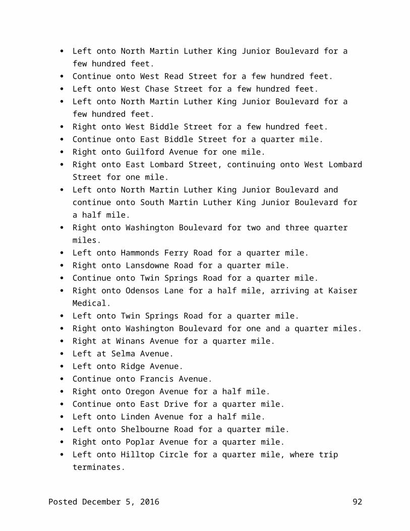
Left onto West Belvedere Avenue, heading southwest for one and three tenths of a mile.
Right onto Wabash Avenue, heading west for a quarter mile. Right onto Eldorado Avenue, continuing to Rogers Avenue Metro Station Loop. Right onto Eldorado Avenue. Right onto Wabash Avenue, heading west for a quarter mile. Left onto North Rogers Avenue, heading south for one and three tenths miles. Right onto Gwynn Oak Avenue, heading west for one mile. Continue onto Woodlawn Drive, heading south for one and three quarter miles. Right onto Parallel Drive, continuing on a counter clockwise loop for approximately one
mile. Arrive at Social Security Administration, where route terminates.
Posted December 5, 2016 92

LocalLink 33 Mount Washington Light Rail to Overlea
Hours of Service
Weekday: 5:00 a.m. to midnight
Saturday: 5:00 a.m. to midnight
Sunday: 7:00 a.m. to 10:00 p.m.
Frequency Table
Time Period FrequencyWeekday Early 35 minsWeekday AM Peak 35 minsWeekday Midday 35 minsWeekday PM Peak 35 minsWeekday Evening 35 minsWeekday Late Night 45 minsSaturday Day 60 minsSaturday Other 60 minsSunday Day 60 minsSunday Other 60 mins
Rail Stations Served
Metro Subway N/A
Light Rail Mount Washington
MARC Train N/A
CityLink Transfers
Brown Green Red
Points of Interest Served
Belvedere Square Gilman School Mount Washington
Posted December 5, 2016 93

Overlea
Current Routes
58
Route Description
LocalLink 33 will replace the current No. 58 between Mt. Washington Station and Overlea. Current No. 58 route service west of Mt. Washington Station will be provided on LocalLink 34. Current No. 58 route service to White Marsh will be provided on CityLInk Brown.
Turn-by-turn Description
From Mount Washington Light Rail to Overlea (eastbound) The route begins at Mount Washington Light Rail, heading south onto Sulgrave Avenue. Left onto Kelly Avenue, heading east for one quarter of a mile. Right onto Falls Road, heading south for approximately half a mile. Left onto West Northern Parkway, continuing onto East Northern Parkway, heading east
for approximately six miles. Veer right to continue onto Fleetwood Avenue, heading east for approximately half a
mile. Left onto Belair Road for a few hundred feet, where trip terminates at East Overlea
Avenue.
From Overlea to Mount Washington Light Rail (westbound) The route begins on Belair Road at West Overlea Avenue, heading south for a few
hundred feet. Left onto East Northern Parkway, continuing onto West Northern Parkway, heading
west for six and a half miles. Right onto Falls Road, heading north for approximately half a mile. Left onto Kelly Avenue, heading west for three tenths of a mile. Right onto Sulgrave Avenue to arrive at Mount Washington Light Rail.
Posted December 5, 2016 94

LocalLink 34 Westview to Falls Road Light Rail
Hours of Service
Weekday: 5:30 a.m. to midnight
Saturday: 6:00 a.m. to 11:00 p.m.
Sunday: 6:00 a.m. to 11:00 p.m.
Frequency Table
Time Period FrequencyWeekday Early 60 minsWeekday AM Peak 30 minsWeekday Midday 60 minsWeekday PM Peak 30 minsWeekday Evening 60 minsWeekday Late Night 60 minsSaturday Day 60 minsSaturday Other 60 minsSunday Day 60 minsSunday Other 60 mins
Rail Stations Served
Metro Subway Rogers Avenue
Light Rail Mount Washington Falls Road
MARC Train N/A
CityLink Transfers
Blue Lime
Points of Interest Served
Westview Mall
Posted December 5, 2016 95

Current Routes
15 57 58 60
Route Description
LocalLink 34 will replace current No. 15 route service to Westview Mall and current No. 58 route service between Mt. Washington Light Rail Station and Park Heights Avenue. It will connect these two areas with the Metro at Rogers Avenue (via the current No. 57 alignments from the south) and the Light Rail at Mt. Washington Light Rail Station and Falls Road Light Rail Station.
Turn-by-turn Description
From Westview to Falls Road Light Rail (eastbound) The route begins at Westview Shopping Center on Ingleside Avenue, heading northeast
for a mile and a half. Continue onto North Forest Park Avenue, continuing onto West Forest Park Avenue, for
a two and a half miles. Left onto Garrison Boulevard for a few hundred feet. Left onto Liberty Heights Avenue heading west for three quarters of a mile. Right onto Gwynn Oak Avenue heading north for a half mile. Right onto Belvieu Avenue, heading east for a half mile. Left onto West Belvedere Avenue for a few hundred feet. Left onto Wabash Avenue heading west for a half mile. Right onto North Rogers Avenue, continuing onto West Rogers Avenue, for
approximately half a mile. Left onto Reisterstown Road for a few hundred feet. Right onto West Northern Parkway heading east for a half mile. Left onto Park Heights Avenue heading northwest for a quarter mile. Right onto Glen Avenue heading northeast for three quarters of a mile. Right onto Cross Country Boulevard heading east for a quarter mile. Left onto Greenspring Avenue, heading northwest for three quarters of a mile. Left onto Willow Glen Road, heading west or a quarter mile. Left onto Fallstaff Road, heading west for half a mile. Right onto Clarks Lane, heading north for half a mile. Right onto Smith Avenue, heading east for one and a half miles. Right onto Greely Road.
Posted December 5, 2016 96

Left onto Kelly Avenue, heading east for half a mile. Left onto Falls Road, heading north for a half mile. Right onto Lakeside Drive. Continue straight to arrive at entrance to Falls Road Light Rail Station, where trip
terminates.
From Falls Road Light Rail to Westview (westbound) The route begins by exiting Falls Road Light Rail Station. Left onto Falls Road for a half mile heading south. Right onto Kelly Avenue heading west for a half mile. Right onto Greely Road. Left onto Smith Avenue, heading west for one and a half miles. Left onto Clarks Lane, heading south for half a mile. Left onto Fallstaff Road, heading east for half a mile. Right onto Willow Glen Road, heading east for a quarter mile. Right onto Greenspring Avenue, heading south for three quarters of a mile. Left onto Cross Country Boulevard, heading southwest for three quarters of a mile. Quick right onto Glen Avenue for three quarters of a mile. Left onto Park Heights Avenue heading south for a quarter mile. Right onto West Northern Parkway heading southwest for a half mile. Left onto Reisterstown Road for a few hundred feet. Right onto West Rogers Avenue, continuing onto North Rogers Avenue for a half mile. Left onto Wabash Avenue heading southeast for a half mile. Right onto West Belvedere Avenue for a few hundred feet. Right onto Belvieu Avenue for a half mile. Left onto Gwynn Oak Avenue for a half mile. Left onto Liberty Heights Avenue for three quarters of a mile. Right onto Garrison Boulevard for a few hundred feet. Right onto West Forest Park Avenue heading east for a mile and a quarter. Continue onto North Forest Park Avenue for a mile and a quarter. Continue onto Ingleside Avenue heading southwest for a mile and a quarter. Right onto Craftswood Road for a quarter mile. Left onto Craigmont Road, where the route terminates at Westview Shopping Center.
Posted December 5, 2016 97

LocalLink 36 Towson to Essex
Hours of Service
Weekday: 5:00 a.m. to midnight
Saturday: 5:30 a.m. to midnight
Sunday: 6:30 a.m. to 10:30 p.m.
Frequency Table
Time Period FrequencyWeekday Early 30 minsWeekday AM Peak 25 minsWeekday Midday 30 minsWeekday PM Peak 25 minsWeekday Evening 45 minsWeekday Late Night 45 minsSaturday (10:00 a.m. to 7:00 p.m.) 30 minsSaturday Other 60 minsSunday Day 70 minsSunday Other 70 mins
Rail Stations Served
Metro Subway N/A
Light Rail N/A
MARC Train N/A
CityLink Transfers
Brown Green Orange Red
Points of Interest Served
Franklin Square Hospital Goucher and Taylor
Posted December 5, 2016 98

Towson
Current Routes 55
Route Description
LocalLink 36 will replace the current No. 55 route from Fox Ridge to Towson along the same alignment.
Turn-by-turn Description
From Towson to Essex (eastbound) The route begins at Towson Town Center, heading east on Fairmount Avenue. Right to stay on Fairmount Avenue heading south for a quarter mile. Left onto East Joppa Road, heading east for half a mile. Right onto Goucher Boulevard, heading southeast for one mile. Continue onto Taylor Avenue, heading southeast for a half mile. Right onto Hillsway Avenue, heading south for three quarters of a mile. Continue onto McClean Boulevard, heading south for a quarter mile. Left onto East Northern Parkway, heading east for one and a quarter miles. Continue onto Fleetwood Avenue, heading east for a half mile. Left onto Belair Road, heading north for a half mile. Right onto Fullerton Avenue, heading east for half a mile. Slight right onto Leslie Avenue. Left onto Kenwood Avenue, heading south east for one mile and a half. Left onto Golden Ring Road, heading east for half a mile. Left onto Philadelphia Road, heading north east for one mile and a half. Left onto Hospital Drive, heading north for approximately half a mile. Left onto Franklin Square, heading west for approximately half a mile. Left onto Rossville Boulevard, heading south for two miles. Left onto Stemmers Run Road, heading southeast for one and a quarter miles. Continue onto Back River Neck Road for one mile. Right onto Middleborough Road, heading west for one mile. Right onto South Marlyn Avenue, heading west for a quarter mile. Right onto Foxwood Lane. Left onto Bayner Road for a few hundred feet where trip terminates.
From Essex to Towson (westbound) The route begins on Sandalwood Road and turns left onto South Marlyn Avenue for a
quarter mile.
Posted December 5, 2016 99

Left onto Middleborough Road, heading north for one mile. Left onto Back River Neck Road, heading northwest for one mile. Continue onto Stemmers Run Road, heading northwest for one and a half miles. Veer right onto Rossville Boulevard, heading north for one and a quarter miles. Right onto Philadelphia Road, heading northeast for three quarters of a mile. Left onto Hospital Drive, heading west for a half mile. Left onto Franklin Square Drive, heading west for a half mile. Left onto Rossville Boulevard, heading south for three quarters of a mile. Right onto Philadelphia Road, heading southwest for three quarters of a mile. Right onto Golden Ring Road, heading west for half a mile. Right onto Kenwood Avenue, heading north west for one mile and a half. Right onto Leslie Avenue. Slight left onto Fullerton Avenue, heading west for half a mile. Left onto Belair Road, heading south for a half mile. Right onto East Northern Parkway, heading west for two and a quarter miles. Right onto McClean Boulevard, heading north for approximately a half mile. Continue onto Hillsway Avenue, heading north for three quarters of a mile. Left onto Taylor Avenue, heading west for a half mile. Continue onto Goucher Boulevard, heading northwest for one mile. Left onto East Joppa Road, heading west for three quarters of a mile. Right onto Dulaney Valley Road, heading north for one quarter of a mile. Right onto Fairmount Avenue for two tenths of a mile. Arrive at Towson Town Center, where the trip terminates.
Posted December 5, 2016 100

LocalLink 37 UMBC to Old Court Metro
Hours of Service
Weekday: 5:00 a.m. to 1:00 a.m.
Saturday: 6:00 a.m. to 1:30 a.m.
Sunday: 6:00 a.m. to 1:00 a.m.
Frequency Table
Time Period FrequencyWeekday Early 30 minsWeekday AM Peak 20 minsWeekday Midday 30 minsWeekday PM Peak 20 minsWeekday Evening 30 minsWeekday Late Night 60 minsSaturday (8:00 a.m. to 7:00 p.m.) 30 minsSaturday Other 60 minsSunday Day 60 minsSunday Other 60 mins
Rail Stations Served
Metro Subway Old Court
Light Rail N/A
MARC Train N/A
CityLink Transfers
Blue Lime Purple Yellow
Points of Interest Served
CCBC Catonsville Old Court
Posted December 5, 2016 101

Rutherford Business Park Security Square Mall Social Security Administration UMBC
Current Routes
77 99
Route Description
LocalLink 37 will replace the current No. 77 route between Old Court Metro Station and UMBC. In the southbound direction on weekdays, there are approximately 1,600 boardings between Old Court Metro Station and Security Square Mall but only 1,000 alightings, so 600 people are riding through. Therefore, a one-seat connection between Old Court Metro Station and UMBC/CCBC was preserved. Ridership between UMBC and Patapsco on the current 77 line is significantly lower than that between Old Court and UMBC. The Yellow UMBC branch replaces the current 77 route between UMBC and Halethorpe MARC.
Turn-by-turn Description
From UMBC to Old Court Metro (northbound) The route begins at UMBC on Hilltop Circle. Left onto Walker Avenue, heading northwest for two tenths of a mile. Left onto Wilkens Avenue, heading south for approximately one mile. Right onto South Rolling Road, heading northwest for a half mile. Left onto Campus Drive, looping around CCBC Catonsville, for one and three quarters of
a mile. Left onto South Rolling Road, heading north for a quarter mile. Right onto Bloomsbury Avenue, heading north for one mile. Continue onto Ingleside Avenue for one and three tenths miles. Left onto Craigmont Road, heading north for three quarters of a mile. Right onto Crosby Road, heading northeast for a quarter mile. Continue onto Woodlawn Drive, heading north for one mile. Left onto Security Boulevard, heading west for one mile. Right onto North Rolling Road, heading north for one and a half miles. Right onto Windsor Boulevard, heading east for approximately a half mile. Left onto Lord Baltimore Drive, heading north for a quarter mile. Left onto Windsor Mill Road, heading northwest for three quarters of a mile. Veer right onto North Rolling Road, heading north for a half mile. Right onto Milford Mill Road, heading northeast for a half mile.
Posted December 5, 2016 102

Left onto Liberty Road, heading west for one and a quarter miles. Right onto Old Court Road, heading east for two and a half miles. Left to arrive at the Old Court Metro Loop, where trip terminates.
From Old Court Metro to UMBC (southbound) The route begins at the Old Court Metro Loop. Right onto Old Court Road, heading southwest for two and a half miles. Left onto Liberty Road, heading east for one and a quarter miles. Right onto Milford Mill Road for a half mile, heading southwest. Left onto North Rolling Road for a half mile, heading south. Left onto Windsor Mill Road for three quarters of a mile, heading southeast. Right onto Lord Baltimore Drive, heading south for a quarter mile. Right onto Windsor Boulevard, heading southeast for three tenths of a mile. Left onto North Rolling Road for one and a half miles, heading south. Continue onto Security Boulevard for one mile. Right onto Woodlawn Drive, heading south for one mile. Continue onto Crosby Road, heading southwest for a quarter mile. Left onto Craigmont Road, heading south for three quarters of a mile. Right onto Ingleside Avenue, heading north for one and a quarter miles. Continue onto Bloomsbury Avenue for one mile. Left onto South Rolling Road, heading south for a quarter mile. Right onto Campus Drive, looping around CCBC Catonsville, for one and three quarter
miles. Right onto South Rolling Road, heading south for a half mile. Left onto Wilkens Avenue, heading north for three quarters of a mile. Right onto Walker Avenue, heading east for a quarter mile. Left onto Hilltop Circle for three quarters of a mile. Arrive at UMBC, where trip terminates.
Posted December 5, 2016 103

LocalLink 51 Towson to Downtown
Hours of Service
Weekday: 5:00 a.m. to 12:30 a.m.
Saturday: 5:30 a.m. to 12:30 a.m.
Sunday: 5:30 a.m. to 12:30 a.m.
Frequency Table
Time Period FrequencyWeekday Early 35 minsWeekday AM Peak 30 minsWeekday Midday 35 minsWeekday PM Peak 30 minsWeekday Evening 45 minsWeekday Late Night 60 minsSaturday (9:00 a.m. to 10:00 p.m.) 30 minsSaturday Other 60 minsSunday (10:00 a.m. to 7:00 p.m.) 30 minsSunday Other 60 mins
Rail Stations Served
Metro Subway Charles Center
Light Rail University Center/Baltimore Street Penn Station
MARC Train Penn Station
CityLink Transfers
All
Points of Interest Served
Inner Harbor Johns Hopkins University Loyola Notre Dame
Posted December 5, 2016 104

Penn Station Towson Town Center University of Baltimore
Current Routes
11
Route Description
LocalLink 51 will replace the current No. 11 route between Downtown and Towson.
Turn-by-turn Description
From Towson to Downtown (southbound) The route begins at Towson Town Center on Fairmount Avenue, heading south for a
quarter mile. Right onto East Joppa Road for approximately a half mile heading west. Slight right onto York Road at the traffic circle and right onto West Pennsylvania Avenue
for a quarter mile. Left onto Bosley Avenue for a quarter mile heading south. Continue onto West Towsontown Boulevard for one mile heading west. Left onto North Charles Street for a quarter mile heading south. Left onto GBMC Loop for approximately three quarters of a mile. Arrive at GBMC Hospital (Bus turns into hospital). Left onto North Charles Street heading south for one mile. Left onto Bellona Avenue for a quarter mile. Left onto Stevenson Lane for a quarter mile. Right onto Dumbarton Road for a quarter mile. Right onto Rodgers Forge Road for a quarter mile. Left onto Bellona Avenue for one mile. Right onto East Northern Parkway for a half mile. Left onto North Charles Street and continuing for two and three quarter miles. Right onto West Twenty-ninth Street. Left onto Maryland Avenue for one and a half miles. Left onto Cathedral Street for a half mile. Continue onto Liberty Street for a quarter mile. Continue onto Hopkins Place for a quarter mile, where trip terminates.
From Downtown to Towson (northbound) The trip begins on South Sharp Street and turns left onto West Conway Street. Left onto South Charles Street and continuing onto North Charles Street for one mile.
Posted December 5, 2016 105

Right onto East Centre Street and quick left onto Washington Place. Left onto East Madison Street and quick right onto North Charles Street, continuing
north for two and three quarter miles. Continue onto Charlcote Road for a few hundred feet. Left onto Saint Paul Street for a quarter mile. Right onto North Charles Street for one and a quarter miles. Right onto East Northern Parkway for a half mile. Left onto Bellona Avenue for one mile. Right onto Rodgers Forge Road for a few hundred feet. Left onto Dumbarton Road for a quarter mile. Left onto Stevenson Lane for a quarter mile. Right onto Bellona Avenue for a quarter mile. Right onto North Charles Street for one mile. Right onto GBMC Loop for three quarters of a mile. Right onto North Charles Street for one mile. Right onto West Towsontown Boulevard for one mile. Left onto Bosley Avenue for a quarter mile. Right onto West Chesapeake Avenue for a quarter mile. Left onto York Road for a quarter mile, Right onto Dulaney Valley Road for a quarter mile. Right onto Fairmount Avenue for a quarter mile. Arrive at Towson Town Center, where trip terminates.
Posted December 5, 2016 106

LocalLink 52 Stella Maris to Greenmount North
Hours of Service
Weekday: 5:00 a.m. to 11:00 a.m.; 2:00 p.m. to midnight
Saturday: 6:00 a.m. to 11:00 a.m.; 2:00 p.m. to midnight
Sunday: 6:00 a.m. to 11:00 a.m.; 2:00 p.m. to midnight
Frequency Table
Time Period Frequency/TripsWeekday Early 1 roundtripWeekday AM Peak 1 roundtripWeekday Midday 2 roundtripsWeekday PM Peak 1 roundtripWeekday Evening 1 roundtripWeekday Late Night -Saturday Day 5 roundtripsSaturday Other -Sunday Day 5 roundtripsSunday Other -
Rail Stations Served
Metro Subway N/A
Light Rail N/A
MARC Train N/A
CityLink Transfers
Green Gold Red Silver
Points of Interest Served
Towson Town Center Stella Maris
Posted December 5, 2016 107

Current Routes
12
Route Description
LocalLink 52 will replace the current No. 12 route in its entirety. This route is scheduled to shift times at Stella Maris and will also provide assistance to the CityLink Red on Greenmount Avenue/York Avenue.
Turn-by-turn Description
From Greenmount North to Stella Maris (northbound) The route begins West Twenty-fifth Street, continuing onto East Twenty-fifth Street, for
one mile heading east. Right onto Kirk Avenue, heading southwest for approximately a half mile. Left onto Homewood Avenue heading south for a few hundred feet. Right onto East North Avenue, heading east for a few hundred feet. Right onto Greenmount Avenue heading north for two miles. Continue onto York Road heading north for four and a quarter miles. Right onto Dulaney Valley Road heading north for three and a half miles. Left onto Stella Maris Drive for a mile. Left onto Pot Spring Road for a few hundred feet. Right onto Gallager Center for a quarter mile, where the trip terminates at Stella Maris.
From Stella Maris to Greenmount North (southbound) The route begins at Stella Maris Gallager Center and turns left onto Pot Spring Road. Right onto Stella Maris Drive heading south for one mile. Right onto Dulaney Valley Road heading south for three and a half miles. Left onto York Road heading south for four and a quarter miles. Continue onto Greenmount Avenue heading south for one and a half miles. Left onto East Twenty-fifth Street, heading east for a half mile. Right onto Kirk Avenue heading south for a half mile. Left onto Homewood Avenue for a few hundred feet. Right onto East North Avenue for a few hundred feet. Right onto Greenmount Avenue, heading north for a half mile. Left onto East Twenty-fifth Street, continuing onto West Twenty-fifth Street for
approximately one half mile, where trip terminates.
Posted December 5, 2016 108

LocalLink 53 Hillendale to North Avenue Light Rail, with select trips from Sheppard Pratt
Hours of Service from Hillendale
Weekday, Saturday, and Sunday: 4:00 a.m. to 2:00 a.m.
Hours of Service from Sheppard Pratt
Weekday: 4:00 a.m. to 1:00 a.m.
Saturday: 6:00 a.m. to 11:00 p.m.
Sunday: 6:00 a.m. to 11:00 p.m.
Frequency Table
Time Period Frequency from Hillendale Frequency from Sheppard Pratt
Weekday Early 30 mins 60 minsWeekday AM Peak 15 mins 30 minsWeekday Midday 20 mins 40 minsWeekday PM Peak 15 mins 30 minsWeekday Evening 30 mins 60 minsWeekday Late Night 35-65 mins 60 minsSaturday Day 30 mins 60 minsSaturday Other 30-60 mins 60 minsSunday Day 30 mins 60 minsSunday Other 30-60 mins 60 mins
Rail Stations Served
Metro Subway N/A
Light Rail North Avenue
MARC Train N/A
CityLink Transfers
Green Gold Red Silver
Posted December 5, 2016 109

Points of Interest Served
Goucher & Taylor Morgan State University Sheppard Pratt Hospital (select trips) Towson Town Center (select trips)
Current Routes
3 36
Route Description
LocalLink 53 will largely replace the current 36 line between North Avenue and Northern Parkway and the current 3 line between Taylor Avenue and Sheppard Pratt Hospital. Passengers traveling to downtown will be able to transfer to the CityLink Green along Loch Raven Boulevard/Kirk Avenue, the CityLink Red, CityLink Silver, and LocalLink 51 in Towson and on North Avenue, the Light RailLink at North Avenue Station, or the CityLink Silver at 33rd Street. This would force 1,300 transfers (2,700 boardings and 1,400 alightings). Most trips from downtown on this route will short turn at Goucher & Taylor. Select trips will continue to Sheppard Pratt Hospital.
Turn-by-turn Description
From Hillendale to North Avenue Light Rail (southbound) The route begins on Goucher Boulevard, heading north for a quarter mile. Right onto Taylor Avenue for a few hundred feet. Right onto Loch Raven Boulevard, heading south for one and a half miles. Right onto East Northern Parkway, heading west for a half mile. Left onto the Alameda, heading south for two miles. Right onto Argonne Drive, heading west for a half mile. Left onto Ellerslie Avenue, heading south for three tenths of a mile. Left onto East Thirty-Sixth Street, heading east for a half mile. Right onto the Alameda, heading south for a quarter mile. Continue onto Maryland Five-forty-two and veer left onto the Alameda for a few
hundred feet. Veer right onto Kirk Avenue, heading southwest for one mile. Left onto Homewood Avenue, heading south for a few hundred feet. Right onto East North Avenue, continuing onto West North Avenue, for one mile. Right onto McMechen Street. Arrive at North Avenue Light Rail, where trip terminates.
Posted December 5, 2016 110

From North Avenue Light Rail to Hillendale (northbound) The route begins by exiting the North Avenue Light Rail on McMechen Street. Left onto West North Avenue, continuing onto East North Avenue, for three quarters of
a mile. Left onto Homewood Avenue for a few hundred feet. Veer right onto Kirk Avenue, heading northeast for one mile. Left onto the Alameda, heading north for a half mile. Left onto East Thirty-Sixth Street, heading west for a half mile. Right onto Ellerslie Avenue, heading north for a quarter mile.
Right onto Argonne Drive, heading northeast for a half mile. Left onto the Alameda, heading north for two miles. Right onto East Northern Parkway, heading east for a half mile. Left onto Loch Raven Boulevard, heading north for two and three quarter miles. Left onto Goucher Boulevard for a quarter mile, where trip terminates.
From Sheppard Pratt to North Avenue Light Rail (southbound) The route begins at Sheppard Pratt on Campus View Drive, continuing onto Gatehouse
Drive. Left onto Pratt Drive, heading east for a quarter mile. Right onto Campus View Drive for a few hundred feet. Right onto Osler Drive, heading south for a half mile. Left onto Stevenson Lane, heading east for a quarter mile. Left onto York Road heading north for one and a quarter miles. Right onto East Joppa Road, heading east for approximately one mile. Right onto Goucher Boulevard, heading southeast for a half mile. Left onto Putty Hill Avenue, heading east for a quarter mile, Left onto La Salle Road, heading north for a quarter mile. Right onto East Joppa Road, heading east for three quarters of a mile. Right onto Loch Raven Boulevard, heading south for two and three quarter miles. Right onto East Northern Parkway, heading west for a half mile. Left onto the Alameda, heading south for two miles. Right onto Argonne Drive, heading west for a half mile. Left onto Ellerslie Avenue, heading south for three tenths of a mile. Left onto East Thirty-Sixth Street, heading east for a half mile. Right onto the Alameda, heading south for a quarter mile. Continue onto Maryland Five-forty-two and veer left onto the Alameda for a few
hundred feet. Veer right onto Kirk Avenue, heading southwest for one mile. Left onto Homewood Avenue, heading south for a few hundred feet.
Posted December 5, 2016 111

Right onto East North Avenue, continuing onto West North Avenue, for one mile. Right onto McMechen Street. Arrive at North Avenue Light Rail, where trip terminates.
From North Avenue Light Rail to Sheppard Pratt (northbound) The route begins by exiting the North Avenue Light Rail on McMechen Street. Left onto West North Avenue, continuing onto East North Avenue, for three quarters of
a mile. Left onto Homewood Avenue for a few hundred feet. Veer right onto Kirk Avenue, heading northeast for one mile. Left onto the Alameda, heading north for a half mile. Left onto East Thirty-Sixth Street, heading west for a half mile. Right onto Ellerslie Avenue, heading north for a quarter mile.
Right onto Argonne Drive, heading northeast for a half mile. Left onto the Alameda, heading north for two miles. Right onto East Northern Parkway, heading east for a half mile. Left onto Loch Raven Boulevard, heading north for two and three quarter miles. Left onto East Joppa Road, heading west for three quarters of a mile. Left onto La Salle Road, heading south for a quarter mile. Right onto Putty Hill Avenue, heading west for a quarter mile. Right onto Goucher Boulevard, heading north for a half mile. Left onto East Joppa Road, heading west for one mile.
Right onto York Road, heading south for one and a quarter miles. Right onto Stevenson Lane, heading west for a quarter mile. Right onto Osler Drive, heading north for a half mile. Left onto Campus View Drive heading west for a quarter mile. Arrive at Sheppard Pratt, where trip terminates.
Posted December 5, 2016 112

LocalLink 54 Hillendale to State Center, with a branch from Carney
Hours of Service (Hillendale and Carney branches)
Weekday: 24 hours
Saturday: 5:00 a.m. to 2:00 a.m.
Sunday: 5:00 a.m. to 2:00 a.m.
Frequency Table
Time Period Frequency from Hillendale
Frequency from Carney
Frequency of All Trips (Northern Parkway to State Center)
Weekday Early 60 mins 60 mins 30 minsWeekday AM Peak 20 mins 30 mins 12 minsWeekday Midday 30 mins 30 mins 15 minsWeekday PM Peak 20 mins 30 mins 12 minsWeekday Evening 40 mins 40 mins 20 minsWeekday Late Night 60 mins 60 mins 30 minsSaturday (8:00 a.m. to 8:00 p.m.)
30 mins 30 mins 15 mins
Saturday Other 60 mins 60 mins 30 minsSunday Day 60 mins 60 mins 30 minsSunday Other 60 mins 60 mins 30 mins
Rail Stations Served
Metro Subway Lexington Market State Center
Light Rail Centre Street Convention Center Cultural Center Lexington Market University Center/Baltimore Street
MARC Train Camden
Posted December 5, 2016 113

CityLink Transfers
All
Points of Interest Served
Inner Harbor Lexington Market State Center Carney (select trips) Goucher & Taylor (select trips)
Current Routes
19
Route Description
LocalLink 54 will replace the current 19 line and maintain its two branches to Goucher & Taylor and the Carney Park and Ride. The proposed alignment will not change with one minor exception: buses will no longer operate on Howard Street in the northbound direction and instead, both directions will use Eutaw Street to avoid conflicts with the Light RailLink.
Turn-by-turn Description
From Hillendale to State Center (southbound) The route begins at Goucher Boulevard at Taylor Avenue and turns right onto Taylor
Avenue, heading east for a half mile. Right onto Hillsway Avenue, heading south for three quarters of a mile. Continue onto McClean Boulevard heading south for a quarter mile. Left onto East Northern Parkway, heading east, for approximately one mile. Right onto Harford Road, heading southwest for three and a half miles. Right onto East Twentieth Street, heading southwest for a quarter mile. Left onto Aisquith Street for a few hundred feet, continuing onto North Aisquith Street
for a half mile. Right onto Harford Avenue heading south for a quarter mile. Continue onto Ensor Street for a quarter mile. Right onto Hillen Street heading southwest for a half mile, continuing onto East Pleasant
Street. Left onto Guilford Avenue, heading south for a quarter mile. Continue onto South Street for a few hundred feet. Right onto East Lombard Street, continuing onto West Lombard Street, heading west for
a half mile.
Posted December 5, 2016 114

Right onto South Eutaw Street and continuing onto North Eutaw Street for one and a quarter miles.
Right onto Dolphin Street heading north for a quarter mile. Right onto North Howard Street for a few hundred feet. Right onto West Preston Street for a quarter mile. Left onto North Eutaw Street for a few hundred feet, where route terminates at State
Center.
From State Center to Hillendale (northbound) The route begins at North Eutaw Street and Preston Street and heads south for one and
a quarter miles, continuing onto South Eutaw Street. Left onto West Pratt Street and continuing onto East Pratt Street for approximately
three quarters of a mile. Left onto South Gay Street and continuing onto North Gay Street, heading north for
approximately three quarters of a mile. Continue onto Ensor Street heading northeast for a half mile. Continue onto Harford Avenue heading northeast for three quarters of a mile. Continue onto Harford Road heading northeast for four and a half miles. Left onto East Northern Parkway heading west for approximately one mile. Right onto McClean Boulevard heading northwest for approximately half a mile. Continue onto Hillsway Avenue, heading north for three quarters of a mile. Left onto Taylor Avenue heading northwest for a quarter mile. Left onto Loch Raven Boulevard heading south for approximately a quarter mile. Right onto Goucher Boulevard, where route terminates at Goucher Boulevard and
Taylor Avenue.
From Carney to State Center (southbound) The route begins at the Carney Park and Ride and turns right onto Jomat Avenue. Right onto Harford Road continuing southwest for seven and a quarter miles. Right onto East 20th Street, heading southwest for a quarter mile. Left onto Aisquith Street for a few hundred feet, continuing onto North Aisquith Street
for a half mile. Right onto Harford Avenue heading south for a quarter mile. Continue onto Ensor Street for a quarter mile. Right onto Hillen Street heading southwest for a half mile, continuing onto East Pleasant
Street. Left onto Guilford Avenue, heading south for a quarter mile. Continue onto South Street for a few hundred feet.
Posted December 5, 2016 115

Right onto East Lombard Street, continuing onto West Lombard Street, heading west for a half mile.
Right onto South Eutaw Street and continuing onto North Eutaw Street for one and a quarter miles.
Right onto Dolphin Street heading north for a quarter mile. Right onto North Howard Street for a few hundred feet. Right onto West Preston Street for a quarter mile. Left onto North Eutaw Street for a few hundred feet, where route terminates at State
Center.
From State Center to Carney (northbound) The route begins at North Eutaw Street and Preston Street and heads south for one and
a quarter miles, continuing onto South Eutaw Street. Left onto West Pratt Street and continuing onto East Pratt Street for approximately
three quarters of a mile. Left onto South Gay Street and continuing onto North Gay Street, heading north for
approximately three quarters of a mile. Continue onto Ensor Street heading northeast for a half mile. Continue onto Harford Avenue heading northeast for three quarters of a mile. Continue onto Harford Road heading northeast for seven and a quarter miles. Left onto Jomat Avenue for a few hundred feet, where route terminates at Carney Park
and Ride.
Posted December 5, 2016 116

LocalLink 56 White Marsh to Downtown, with select service from the White Marsh Park & Ride
Hours of Service
Trips after 9:00 p.m. will operate to and from the White Marsh Park and Ride instead of the White Marsh Mall.
Weekday: 4:00 a.m. to 1:30 a.m.
Saturday: 4:00 a.m. to 1:00 a.m.
Sunday: 5:30 a.m. to 1:00 a.m.
Frequency Table
Time Period FrequencyWeekday Early 30 minsWeekday AM Peak 20 minsWeekday Midday 20 minsWeekday PM Peak 20 minsWeekday Evening 30 minsWeekday Late Night 60 minsSaturday (8:00 a.m. to 9:00 p.m.) 30 minsSaturday Other 60 minsSunday (8:00 a.m. to 9:00 p.m.) 40 minsSunday Other 60 mins
Rail Stations Served
Metro Subway Charles Center Johns Hopkins Hospital
Light Rail University Center/Baltimore Street
MARC Train N/A
CityLink Transfers
All
Points of Interest Served
Franklin Square Hospital
Posted December 5, 2016 117

Johns Hopkins Hospital Rosedale Industrial Park White Marsh Mall
Current Routes
35
Route Description
LocalLink 56 will replace the eastern half of the current No. 35 route from White Marsh to Fayette Plaza. Transfers are available to LocalLink 76 at Fayette Plaza for current 35 passengers to continue their trips. This will increase the reliability of this very long route while minimizing forced transfers (approximately 800 per day, or 27% of all passengers boarding east of downtown) and eliminating duplication of services in downtown.
Turn-by-turn Description
From White Marsh Mall to Downtown (southbound) Start at White Marsh Mall Ring Road for approximately three tenths of a mile. Left onto Sandpiper Circle for a half mile heading south. Left onto Corporate Drive heading east for two tenths of a mile. Right onto Town Center Drive heading east for a half mile. Right onto Campbell Boulevard heading east for three quarters of a mile. Right onto Philadelphia Road heading south for one mile. Right onto King Avenue heading west for a half mile. Left onto Franklin Square Drive heading west for one mile. Left onto Rossville Boulevard heading south for a few hundred feet. Right onto Philadelphia Road heading west for three miles. Continue onto Pulaski Highway for one and a half miles heading west. Veer right onto East Monument Street for approximately one mile heading west. Veer right onto East Madison Street heading west for approximately two and a quarter
miles. Left onto Guilford Avenue for a half mile. Right onto East Fayette Street for approximately a quarter mile head west. Veer right onto West Fayette Street for a few hundred feet, where the route terminates
at the intersection of West Fayette Street and North Eutaw Street.
From Downtown to White Marsh Mall (northbound) The route begins on West Fayette Street heading west for three tenths of a mile. Left onto North Eutaw Street heading south for a few hundred feet. Left onto West Baltimore Street heading east for three tenths of a mile.
Posted December 5, 2016 118

Continue onto East Baltimore Street heading east for a few hundred feet. Left onto North Calvert Street heading north for a half mile. Right onto East Centre Street heading east for a quarter mile. Continue onto East Monument Street for approximately three miles heading east. Veer left onto Pulaski Highway heading east for approximately two miles. Left onto 66th Street heading west for a few hundred feet. Right onto Philadelphia Road heading east for approximately three miles. Left onto Rossville Boulevard heading north for three quarters of a mile. Right onto Franklin Square Drive heading east for one mile. Right onto King Avenue heading east for a half mile. Left onto Philadelphia Road heading north for one mile. Left onto Campbell Boulevard heading west for three quarters of a mile. Left onto Town Center Drive heading west for a half mile. Left onto Corporate Drive heading south for two tenths of a mile. Right onto Sandpiper Circle heading north for approximately a half mile. Right onto White Marsh Mall Ring Road for a few hundred feet where the route
terminates at the Sears Parking Lot Bus Stop.
From White Marsh Park & Ride to Downtown (southbound) The route begins at White Marsh Park & Ride and turns left onto White Marsh Mall Ring
Road for two tenths of a mile. Left onto Campbell Boulevard heading east for a few hundred feet. Right onto Honeygo Boulevard heading west for a half mile. Left onto Sandpiper Circle for a half mile heading south. Left onto Corporate Drive heading east for two tenths of a mile. Right onto Town Center Drive heading east for a half mile. Right onto Campbell Boulevard heading east for three quarters of a mile. Right onto Philadelphia Road heading south for one mile. Right onto King Avenue heading west for a half mile. Left onto Franklin Square Drive heading west for one mile. Left onto Rossville Boulevard heading south for a few hundred feet. Right onto Philadelphia Road heading west for three miles. Continue onto Pulaski Highway for one and a half miles heading west. Veer right onto East Monument Street for approximately one mile heading west. Veer right onto East Madison Street heading west for approximately two and a quarter
miles. Left onto Guilford Avenue for a half mile. Right onto East Fayette Street for approximately a quarter mile head west. Veer right onto West Fayette Street for a few hundred feet, where the route terminates.
Posted December 5, 2016 119

From Downtown to White Marsh Park & Ride (northbound) The route begins on West Fayette Street heading west for three tenths of a mile. Left onto North Eutaw Street heading south for a few hundred feet. Left onto West Baltimore Street heading east for three tenths of a mile. Continue onto East Baltimore Street heading east for a few hundred feet. Left onto North Calvert Street heading north for a half mile. Right onto East Centre Street heading east for a quarter mile. Continue onto East Monument Street for approximately three miles heading east. Veer left onto Pulaski Highway heading east for approximately two miles. Left onto 66th Street heading west for a few hundred feet. Right onto Philadelphia Road heading east for approximately three miles. Left onto Rossville Boulevard heading north for three quarters of a mile. Right onto Franklin Square Drive heading east for one mile. Right onto King Avenue heading east for a half mile. Left onto Philadelphia Road heading north for one mile. Left onto Campbell Boulevard heading west for three quarters of a mile. Left onto Town Center Drive heading west for a half mile. Left onto Corporate Drive heading south for two tenths of a mile. Right onto Sandpiper Circle heading north for approximately a half mile. Right onto Honeygo Boulevard heading north for three quarters of a mile. Left into the White Marsh Mall Park & Ride where the route terminates.
Posted December 5, 2016 120

LocalLink 57 From Belair & Erdman, with select long trips
Hours of Service for Short Trips
Weekday: 8:00 a.m. to 4:30 p.m.; 6:30 p.m. to 7:15 p.m.
Saturday: 8:00 a.m. to 7:15 p.m.
Sunday: 9:30 a.m. to 6:30 p.m.
Hours of Service for Long Trips
Weekday: 6:00 a.m. to 8:00 a.m.; 4:30 p.m. to 6:30 p.m.
Frequency Table
Time Period Frequency for Short Trips
Frequency for Long Trips
Weekday Early - -Weekday AM Peak 40 mins 20 minsWeekday Midday 40 mins -Weekday PM Peak 20 mins 20 minsWeekday Evening - -Weekday Late Night - -Saturday Day 40 mins -Saturday Other 40 mins -Sunday Day 40 mins -Sunday Other 40 mins -
Rail Stations Served
Metro Subway N/A
Light Rail N/A
MARC Train N/A
CityLink Transfers
Brown Pink
Posted December 5, 2016 121

Points of Interest Served
Belair-Edison Parkside Shopping Center (long trips) Erdman Shopping Center (long trips)
Current Routes
50
Route Description
LocalLink 57 will replace the current No. 50 route in its entirety. The current 50 line is a heavily-used shuttle for the Belair-Edison neighborhood with good productivity.
Turn-by-turn Description
From Belair & Erdman (short trips) Trip begins at Erdman Avenue and turns right onto Belair Road for a few hundred feet
heading northeast. Right onto Mayfield Avenue heading southeast for approximately a two tenths of a mile. Left onto Mannasota Avenue heading northeast for approximately three quarters of a
mile. Continue onto Bowleys Lane heading southeast for three quarters of a mile. Right onto Sinclair Lane heading southwest for approximately three quarters of a mile. Right onto Chesterfield Avenue heading northwest for a half mile. Left onto Brehms Lane heading west for approximately a quarter mile. Right onto Erdman Avenue for a few hundred feet, where the trip terminates at Belair-
Edison.
From Belair & Erdman (long trips) Trip begins at Erdman Avenue and turns right onto Belair Road in a few hundred feet
heading northeast. Right onto Mayfield Avenue heading southeast for approximately a quarter mile. Left onto Mannasota Avenue heading northeast for approximately three quarters of a
mile. Continue onto Bowleys Lane heading southeast for three quarters of a mile. Left onto Sinclair Lane for a quarter mile. Right onto Moravia Road for a half mile. Left onto Moravia Park Drive for a quarter mile. Left onto Frankford Avenue for a half mile. Left onto Sinclair Lane for a quarter mile.
Posted December 5, 2016 122

Right onto Parkside Shopping Center for a quarter mile. Right onto Sinclair Lane for one mile. Right onto Chesterfield Avenue heading northwest for a half mile. Left onto Brehms Lane heading west for approximately a quarter mile. Left on Mannasota Avenue and quick left onto Edison Highway. Left onto Erdman Avenue for approximately a half mile. Right into the Erdman Shopping Center. Right onto Edison Highway for a half mile. Left onto Erdman Avenue, where trip terminates.
Posted December 5, 2016 123

LocalLink 59 Whispering Woods to Moravia
Hours of Service
Weekday: 5:30 a.m. to midnight
Saturday: 5:30 a.m. to midnight
Sunday: 7:00 a.m. to 11:00 p.m.
Frequency Table
Time Period FrequencyWeekday Early 60 minsWeekday AM Peak 45 minsWeekday Midday 60 minsWeekday PM Peak 45 minsWeekday Evening 60 minsWeekday Late Night 60 minsSaturday Day 60 minsSaturday Other 60 minsSunday Day 60 minsSunday Other 60 mins
Rail Stations Served
Metro Subway N/A
Light Rail N/A
MARC Train Martin State Airport
CityLink Transfers
Pink Orange Blue
Points of Interest Served
Whispering Woods Middle River Eastpoint Mall
Posted December 5, 2016 124

Bayview Medical Center Armistead Gardens Moravia Park
Current Routes
24
Route Description
LocalLink 59 will replace the current No. 24 route between Whispering Woods and Moravia Park.
Turn-by-turn Description
From Whispering Woods to Moravia (westbound) Trip begins at the bus loop on Eastern Avenue at Biscayne Bay. The bus heads southwest
on Maryland One-fifty West/Eastern Avenue toward Biscayne Bay Boulevard for one mile.
Left onto Bowleys Quarters Road and continue south for approximately one half mile. Left onto Carroll Island Road and continue west for a quarter mile. Left onto Eastern Boulevard and continue southwest for three and a quarter miles. Left onto Stemmers Run Road for approximately a half mile. Right onto Old Eastern Avenue for three quarters of a mile. Left onto Eastern Boulevard for one and a half miles. Continue onto Eastern Avenue for three and a half miles. Right onto Bayview Boulevard for approximately a half mile. Continue onto the ramp and continue onto the Harbor Tunnel Thruway for three
quarters of a mile. Take Exit Thirteen and turn right onto Debelius Avenue. Right onto Erdman Avenue. Right onto Mapleton Avenue. Right onto Pulaski Highway. Left onto Armistead Way for a quarter mile. Left onto Harper Way. Right onto Wright Avenue for a half mile. Right onto Orville Avenue. Left onto Federal Street for a quarter mile. Right onto Erdman Avenue for approximately a half mile.
Right onto Sinclair Lane for one and a quarter miles. Right onto Moravia Road for a half mile.
Posted December 5, 2016 125

Left onto Moravia Park Drive, where trip terminates.
From Moravia to Whispering Woods (eastbound) The trip begins on Moravia Park Drive and turns left onto Frankford Avenue, continuing
north for approximately three quarters of a mile. Left onto Sinclair Lane heading west for one and three quarter miles. Left onto Erdman Avenue for approximately one half mile heading south. Left onto Federal Street for a quarter mile. Right onto Orville Avenue. Left onto Wright Avenue for a half mile. Left onto Harper Way. Right onto Armistead Way for a quarter mile. Right at Pulaski Highway for a quarter mile. Right onto the ramp to Erdman Avenue, and continuing onto the Harbor Tunnel
Thruway for approximately three quarters of a mile. Take Exit Twelve and turn right onto East Lombard Street. Right onto Bayview Boulevard for a half mile. Left onto Eastern Avenue for three and a half miles. Continue onto Eastern Boulevard for one and a half miles. Continue onto Old Eastern Avenue for three quarters of a mile. Left onto Stemmers Run Road for a half mile. Right onto Eastern Boulevard for three and a quarter miles. Right onto Carroll Island Road for a quarter mile. Left onto Bowleys Quarters Road for a quarter mile. Right onto Eastern Avenue for one mile. Left onto Whispering Woods Loop, where trip terminates.
Posted December 5, 2016 126

LocalLink 62 Hopkins Bayview to CCBC Essex
Hours of Service
Weekday: 4:30 a.m. to 11:00 p.m.
Saturday: 6:00 a.m. to 10:30 p.m.
Sunday: 7:00 a.m. to 10:30 p.m.
Frequency Table
Time Period FrequencyWeekday Early 60 minsWeekday AM Peak 30 minsWeekday Midday 40 minsWeekday PM Peak 30 minsWeekday Evening 45 minsWeekday Late Night -Saturday Day 60 minsSaturday Other 60 minsSunday Day 60 minsSunday Other 60 mins
Rail Stations Served
Metro Subway N/A
Light Rail N/A
MARC Train N/A
CityLink Transfers
Blue Orange Navy
Points of Interest Served
Bayview Medical Center CCBC Dundalk CCBC Essex
Posted December 5, 2016 127

Eastpoint Mall
Current Routes
4 10
Route Description
LocalLink 62 will replace the current No. 4 route. However, instead of turning south on Dundalk Avenue to end at Turner Station, it will instead turn north on Dundalk Avenue to cover the northern portion of the current No. 10 and will end at Eastern Bus Division.
Turn-by-turn Description
From Hopkins Bayview to CCBC Essex (northbound) The route begins at Ponca Street at Eastern Bus Division. Left onto Eastern Avenue heading east for a half mile. Veer right onto Dundalk Avenue, continuing onto North Dundalk Avenue then South
Dundalk Avenue, heading southeast for two and half miles. Left onto South Center Place. Right onto Shipping Place. Left onto Dunmanway, heading east for a half mile. Left onto Sollers Point Road, heading north for approximately one half mile. Veer right onto Delvale Avenue, heading north for a half mile. Right onto Holabird Avenue, heading east for three quarters of a mile. Continue onto Wise Avenue for two and a half miles. Left onto North Point Boulevard, heading northwest for one and a half miles. Left onto Cove Road. Right onto North Point Road, heading west for two and three quarter miles. Right onto Eastern Avenue, heading east for one and three quarter miles. Continue onto Eastern Boulevard for one and a half miles. Continue onto Old Eastern Avenue for three quarters of a mile. Left onto Stemmers Run Road, heading north for a half mile. Right onto Eastern Boulevard, heading east for one and a quarter miles. Right onto Ramp and continue onto Martin Boulevard for a half mile. Veer right onto Middle River Road, heading northwest for three quarters of a mile. Left onto Compass Road, heading west for three quarters of a mile. Right onto Martin Boulevard, heading northwest for a half mile. Left onto Kelso Drive, heading west for three quarters of a mile. Right onto Rossville Boulevard, heading northwest for three quarters of a mile.
Posted December 5, 2016 128

Right onto Philadelphia Road, heading east for three quarters of a mile. Left onto Hospital Drive, heading northwest for a half mile. Left onto Franklin Square Drive, heading west for approximately a half mile. Right onto Rossville Boulevard, heading north for approximately a half mile. Veer right onto College Drive. Right to stay on College Drive, heading south for a quarter mile, where trip terminates at
CCBC Essex.
From CCBC Essex to Hopkins Bayview (southbound) The route begins at CCBC Essex and turns onto College Drive heading north for a quarter
mile. Left onto College Drive heading south. Left onto Rossville Boulevard, heading south for a quarter mile. Left onto Franklin Square Drive, heading east for approximately a half mile. Right onto Hospital Drive, heading southeast for approximately a half mile. Right onto Philadelphia Road, heading west for three quarters of a mile. Left onto Rossville Boulevard, heading southeast for three quarters of a mile. Left onto Kelso Drive, heading east for three quarters of a mile. Right onto Martin Boulevard, heading southeast for approximately a half mile. Left onto Compass Road, heading east for three quarters of a mile. Right onto Middle River Road, heading southeast for three quarters of a mile. Left onto Martin Boulevard, heading for a quarter mile. Right onto Eastern Boulevard, heading southwest for one and a quarter miles. Left onto Stemmers Run Road, heading south for approximately a half mile. Right onto Old Eastern Avenue, heading southwest for three quarters of a mile. Continue onto Eastern Boulevard for one and a half miles. Continue onto Eastern Avenue for one and three quarter miles. Continue onto Ramp and turn right onto North Point Boulevard for three quarters of a
mile. Continue onto Ramp and veer right onto Merritt Boulevard. Left onto North Point Road, heading west for three and a quarter miles. Continue onto North Point Boulevard for one and a half miles. Right onto Wise Avenue, heading west for two and a half miles. Continue onto Holabird Avenue for three quarters of a mile. Left onto Delvale Avenue, heading south for a half mile. Left onto Sollers Point Road, heading southeast for approximately a half mile. Right onto Sollers Point Road. Veer right onto Dunmanway for a half mile. Right onto Shipping Place.
Posted December 5, 2016 129

Left onto South Center Place. Right onto South Dundalk Avenue, continuing onto North Dundalk Avenue, for a half
mile. Continue onto Dundalk Avenue heading northwest for two miles. Left onto Eastern Avenue, heading west for a half mile. Right onto Ponca Street to arrive at Eastern Bus Division where trip terminates.
Posted December 5, 2016 130

LocalLink 65 Downtown to CCBC Dundalk
Hours of Service
Weekday: 4:00 a.m. to 11:00 p.m.
Saturday: 4:00 a.m. to 11:00 p.m.
Sunday: 4:00 a.m. to 11:00 p.m.
Frequency Table
Time Period FrequencyWeekday Early 60 minsWeekday AM Peak 12 minsWeekday Midday 60 minsWeekday PM Peak 15 minsWeekday Evening 60 minsWeekday Late Night -Saturday Day 60 minsSaturday Other 60 minsSunday Day 60 minsSunday Other 60 mins
Rail Stations Served
Metro Subway Charles Center
Light Rail University Center/Baltimore Street
MARC Train N/A
CityLink Transfers
Blue Brown Gold Green Lime Navy Orange Purple
Posted December 5, 2016 131

Red Silver Yellow
Points of Interest Served
Amazon Canton CCBC Dundalk Dundalk Marine Terminal
Current Routes
7 26 31
Route Description
LocalLink 65 will replace current No. 26 route service to Amazon and the Dundalk Marine Terminal from downtown. It will also replace current No. 31 route connection from downtown to CCBC Dundalk and current No. 7 route service from Downtown to Canton via Lombard Street, Pratt Street, Patterson Park Avenue, Fait Avenue, and Hudson Street.
Turn-by-turn Description
From CCBC to Downtown (westbound) Trip begins at CCBC Dundalk and heads south onto Community College Driveway for a
quarter mile. Left onto Sollers Point Road, heading southeast for approximately a half mile. Right at Dunmanway heading west for a half mile. Right onto Shipping Place. Left onto South Center Place. Left onto South Dundalk Avenue, continuing onto Dundalk Avenue, heading south for a
quarter mile. Right onto Belclare Road. Right onto Broening Highway heading northwest for two and a quarter miles. Left onto Holabird Avenue, heading west for a half mile. Veer right onto Poncabird Pass for a few hundred feet. Veer right onto Ponca Street for a half mile. Left onto O Donnell Street, heading west for three quarters of a mile. Right onto South Conkling Street.
Posted December 5, 2016 132

Left onto Hudson Street, heading west for a half mile. Right onto South Kenwood Avenue. Left onto Fait Avenue, heading west for three tenths of a mile. Right onto South Montford Avenue, then immediate left onto Essex Street. Right onto South Patterson Park Avenue, heading north for a half mile. Left onto East Lombard Street, heading west for one and three quarter miles. Right onto South Charles Street, continuing onto North Charles Street, for a quarter
mile. Left onto West Fayette Street, where trip terminates.
From Downtown to CCBC Dundalk (eastbound) Trip begins on West Fayette Street and continues west for a quarter mile. Left onto North Eutaw Street. Left onto West Baltimore Street for a few hundred feet. Right onto Hopkins Place heading south for a quarter mile. Left onto West Pratt Street, continuing onto East Pratt Street, for one and three quarter
miles. Right onto South Patterson Park Avenue, heading south for approximately a half mile. Left onto Essex Street. Right onto South Montford Street and immediate left onto Fait Avenue, heading east for
approximately a half mile. Right onto South Linwood Avenue. Left onto Hudson Street, heading east for a half mile. Right onto South Conkling Street for a few hundred feet. Left onto O Donnell Street, heading east for three quarters of a mile. Right onto Ponca Street, heading south for a half mile. Veer left onto Poncabird Pass. Veer left onto Holabird Avenue, heading east for a half mile. Right onto Broening Highway, heading south for two miles. Left onto Belcare Road. Left onto Dundalk Avenue, continuing onto South Dundalk Avenue, heading north for a
quarter mile. Right onto South Center Place. Right onto Shipping Place. Left onto Dunmanway, heading east for a half mile. Left onto Sollers Point Road for a half mile. Right onto Community College Driveway, heading north for a quarter mile. Right into CCBC Dundalk, where trip terminates.
Posted December 5, 2016 133

Posted December 5, 2016 134

LocalLink 67 Marley Neck to Downtown
Hours of Service
Weekday: 5:00 a.m. to midnight
Saturday: 6:00 a.m. to 9:00 p.m.
Sunday: 6:00 a.m. to 9:00 p.m.
Frequency Table
Time Period FrequencyWeekday Early 60 minsWeekday AM Peak 60 minsWeekday Midday 60 minsWeekday PM Peak 60 minsWeekday Evening 60 minsWeekday Late Night 60 minsSaturday Day 90 minsSaturday Other 90 minsSunday Day 90 minsSunday Other 90 mins
Rail Stations Served
Metro Subway Charles Center
Light Rail N/A
MARC Train N/A
CityLink Transfers
Blue Brown Green Navy Orange Purple Red Silver
Posted December 5, 2016 135

Yellow
Points of Interest Served
Curtis Bay Energy Parkway Marley Neck Under Armour
Current Routes
64
Route Description
LocalLink 67 will replace current No. 64 route service to Marley Neck and Energy Parkway and will end service at City Hall.
Turn-by-turn Description
From Marley Neck to Downtown (westbound) The route begins on Swan Creek Drive. Left onto Cabot Drive, continuing for a quarter mile. Right onto Fort Smallwood Road, heading north for a quarter mile. Continue onto Hawkins Point Road for one and a half miles. Continue onto Pennington Avenue for three quarters of a mile. Right onto Birch Street. Left at Curtis Avenue, heading north for one mile. Left onto East Patapsco Avenue, heading west for one and a quarter miles. Right onto South Hanover Street, heading north for a quarter mile. Left onto Baltic Avenue. Right onto Potee Street, continuing onto Maryland Two. Veer left to merge onto South Hanover Street, heading north for approximately two
miles. Right onto West Wells Street, continuing onto East Wells Street, for a few hundred feet. Left onto Light Street for a quarter mile heading north. Left onto East Fort Avenue for a few hundred feet. Right onto South Charles Street, heading north for one mile. Right onto East Baltimore Street, heading east for three tenths of a mile. Left onto North Gay Street for a few hundred feet. Right onto East Saratoga Street, where trip terminates.
From Downtown to Marley Neck (eastbound)
Posted December 5, 2016 136

The route begins on North Frederick Street heading south. Right onto East Fayette Street, heading west for a quarter mile. Left onto Saint Paul Street, continuing onto Light Street for one and a half miles heading
south. Right onto Wells Street for a few hundred feet. Left onto South Hanover Street, heading south for one mile. Right onto Potee Street for a half mile, continuing onto Maryland Two for a quarter
mile, heading southeast. Continue onto Frankfurst Avenue for a few hundred feet. Right onto South Hanover Street, heading southwest for a quarter mile. Left onto East Patapsco Avenue, heading southeast for one mile. Veer right onto Pennington Avenue for one and three quarter miles. Continue onto Hawkins Point Road, heading east for one and a half miles. Continue onto Fort Smallwood Road, heading south for two miles. Right onto Energy Parkway, heading west for a half mile. Right onto Solley Road, heading north for three quarters of a mile. Left onto Fort Smallwood Road, heading north for three quarters of a mile. Right onto Kembo Road, for two tenths of a mile. Left onto Swan Creek Drive for a quarter mile, where trip terminates.
Posted December 5, 2016 137

LocalLink 69 Jumpers Hole to Patapsco Light Rail
Hours of Service
After Light Rail is closed, trips will operate to and from the University of Maryland Transit Center.
Weekday: 4:45 a.m. to 2:00 a.m.
Saturday: 6:00 a.m. to midnight
Sunday: 6:00 a.m. to midnight
Frequency Table
Time Period FrequencyWeekday Early 60 minsWeekday AM Peak 60 minsWeekday Midday 60 minsWeekday PM Peak 60 minsWeekday Evening 60 minsWeekday Late Night 60 minsSaturday (10:00 a.m. to 7:00 p.m.) 50 minsSaturday Other 60 minsSunday (10:00 a.m. to 7:00 p.m.) 65 minsSunday Other 120 mins
Rail Stations Served
Metro Subway N/A
Light Rail Patapsco Cromwell/Glen Burnie
MARC Train N/A
CityLink Transfers
Silver
Points of Interest Served
Baltimore-Washington Medical Center
Posted December 5, 2016 138

Brooklyn Jumpers Hole Quarterfield Shopping Center
Current Routes
14
Route Description
LocalLink 69 will replace the current No. 14 route Jumpers Hole service in its entirety, with the exception of service to Baymeadow Industrial Park which is discontinued. Late night service will continue to serve downtown when Light RailLink is closed.
Turn-by-turn Description
From Jumpers Hole to Patapsco Light Rail (northbound) The route begins on Jumpers Hole Road, heading south for three tenths of a mile. Right onto Ritchie Highway heading north for three quarters of a mile. Right onto the ramp towards Mountain Road, continuing east for three quarters of a
mile. Left onto Baltimore Annapolis Boulevard, heading northwest for one mile. Left onto Marley Station Road, heading west for three quarters of a mile. Right onto Ritchie Highway, heading northwest for one mile. Left onto Aquahart Road, heading west for approximately half a mile. Left onto Oakwood Road, heading south for approximately one mile. Right onto Hospital Drive, heading west for three quarters of a mile. Left onto Crain Highway South, heading south west for one mile. Veer right onto ramp to merge onto Interstate Ninety-Seven North toward Baltimore,
heading northwest for one mile. Take exit Thirteen then turn left onto Quarterfield Road, heading west for two miles. Right onto George Clauss Boulevard, heading north for a quarter mile to enter a
roundabout. Take the fourth exit of the roundabout, heading south on George Clauss Boulevard for a
quarter mile. Left onto Quarterfield Road, heading northeast for one mile. Left onto Crain Highway South, heading northeast for three quarters of a mile. Left onto Baltimore Annapolis Boulevard, heading northwest for three quarters of a
mile. Left to enter Cromwell/Glen Burnie Light Rail Station.
Posted December 5, 2016 139

Exit station by taking a right onto Baltimore Annapolis Boulevard, heading south east for a few hundred feet.
Left onto Eighth Avenue Northwest heading northeast for one mile. Left onto Crain Highway North, heading north for approximately three quarters of a
mile. Take ramp to turn left onto Ritchie Highway, heading north for three and a quarter
miles. Veer right onto South Hanover Street, heading north for one quarter of a mile. Left onto East Patapsco Avenue, continuing onto West Patapsco Avenue, heading west
for one and one quarter miles. Left to arrive Patapsco Light Rail Station, where trip terminates.
From Patapsco Light Rail Station to Jumpers Hole (southbound) The route begins at Patapsco Light Rail Station, heading north. Right onto West Patapsco Avenue, heading east for one and one quarter of a mile. Right onto South Hanover Street, heading south for a quarter mile. Veer left onto Ritchie Highway, heading south for three and a quarter miles. Right onto Crain Highway North, heading south for one mile. Right onto Eighth Avenue Northwest, heading southwest for one mile. Right onto Baltimore Annapolis Boulevard, heading northwest for a quarter mile. Left to arrive at Cromwell/Glenn Burnie Light Rail Station. Exit station by taking a right onto Baltimore Annapolis Boulevard, heading south for
approximately half a mile. Right onto Crain Highway North, heading south west for three quarters of a mile. Right onto Quarterfield Road, heading southwest for one and one quarter of a mile. Right onto George Clauss Boulevard, heading north for a quarter mile to enter a
roundabout. Take the fourth exit of the roundabout, heading south on George Clauss Boulevard for a
quarter mile. Continue straight to take the ramp onto Interstate Ninety-Seven South, heading
southeast for one mile. Take exit twelve ramp to turn left onto New Cut Road. Left onto Crain Highway, heading northeast for one mile. Right onto Hospital Drive, heading east for three quarters of a mile. Left onto Oakwood Road, heading north for one mile. Right onto Aquahart Road, heading east for approximately one quarter of a mile. Right onto Richie Highway, heading southeast for one mile. Left onto Marley Station Road, heading northeast for three quarters of a mile. Right onto Baltimore Annapolis Boulevard, heading southeast for one mile.
Posted December 5, 2016 140

Continue straight onto Jumpers Hole Road, heading south for half a mile, where route terminates.
From Jumpers Hole to University of Maryland Medical Center (northbound) The route begins on Jumpers Hole Road, heading south for three tenths of a mile. Right onto Ritchie Highway heading north for three quarters of a mile. Right onto the ramp towards Mountain Road, continuing east for three quarters of a
mile. Left onto Baltimore Annapolis Boulevard, heading northwest for one mile. Left onto Marley Station Road, heading west for three quarters of a mile. Right onto Ritchie Highway, heading northwest for one mile. Left onto Aquahart Road, heading west for approximately half a mile. Left onto Oakwood Road, heading south for approximately one mile. Right onto Hospital Drive, heading west for three quarters of a mile. Left onto Crain Highway South, heading south west for one mile. Veer right onto ramp to merge onto Interstate Ninety-Seven North toward Baltimore,
heading northwest for one mile. Take exit Thirteen then turn left onto Quarterfield Road, heading west for two miles. Right onto George Clauss Boulevard, heading north for a quarter mile to enter a
roundabout. Take the fourth exit of the roundabout, heading south on George Clauss Boulevard for a
quarter mile. Left onto Quarterfield Road, heading northeast for one mile. Left onto Crain Highway South, heading northeast for three quarters of a mile. Left onto Baltimore Annapolis Boulevard, heading northwest for three quarters of a
mile. Left to enter Cromwell/Glen Burnie Light Rail Station. Exit station by taking a right onto Baltimore Annapolis Boulevard, heading south east for
a few hundred feet. Left onto Eighth Avenue Northwest heading northeast for one mile. Left onto Crain Highway North, heading north for approximately three quarters of a
mile. Take ramp to turn left onto Ritchie Highway, heading north for three and a quarter
miles. Veer right onto South Hanover Street, heading north for three quarters of a mile. Left onto Baltic Avenue. Right onto Potee Street/Maryland Two for a few hundred feet. Left onto South Hanover Street, heading north for three quarters of a mile. Left onto Waterview Avenue, heading west for one mile.
Posted December 5, 2016 141

Right onto Annapolis Road, heading north for a quarter mile. Left onto Russell Street. Right onto Ramp onto Maryland Two-ninety-five/Russell Street, heading north for half a
mile. Veer left onto Russell Street, heading north for one mile. Right onto South Paca Street for a few hundred feet. Left onto West Lombard Street, heading west for three tenths of a mile. Right onto South Martin Luther King Junior Boulevard for a few hundred feet. Right onto West Baltimore Street to arrive at University of Maryland Medical Center,
where trip terminates.
From University of Maryland Medical Center to Jumpers Hole (southbound) The route begins at University of Maryland Medical Center heading east on West
Baltimore Street. Right onto South Greene Street, heading south for a quarter mile. Continue onto Russell Street, heading south for one mile. Continue onto Maryland Two-ninety-five/Russell Street, heading south for a half mile. Continue onto Ramp onto Manokin Street, heading east for a quarter mile. Right onto Annapolis Road, heading south for a quarter mile. Left onto Waterview Avenue, heading east for one mile. Right onto Potee Street, continuing onto Potee Street/Maryland Two, for three quarters
of a mile. Continue onto Frankfurst Avenue for a few hundred feet. Right onto South Hanover Street, heading south for three quarters of a mile. Veer left onto Ritchie Highway, heading south for three and a quarter miles. Right onto Crain Highway North, heading south for one mile. Right onto Eighth Avenue Northwest, heading southwest for one mile. Right onto Baltimore Annapolis Boulevard, heading northwest for a quarter mile. Left to arrive at Cromwell/Glenn Burnie Light Rail Station. Exit station by taking a right onto Baltimore Annapolis Boulevard, heading south for
approximately half a mile. Right onto Crain Highway North, heading south west for three quarters of a mile. Right onto Quarterfield Road, heading southwest for one and one quarter of a mile. Right onto George Clauss Boulevard, heading north for a quarter mile to enter a
roundabout. Take the fourth exit of the roundabout, heading south on George Clauss Boulevard for a
quarter mile. Continue straight to take the ramp onto Interstate Ninety-Seven South, heading
southeast for one mile.
Posted December 5, 2016 142

Take exit twelve ramp to turn left onto New Cut Road. Left onto Crain Highway, heading northeast for one mile. Right onto Hospital Drive, heading east for three quarters of a mile. Left onto Oakwood Road, heading north for one mile. Right onto Aquahart Road, heading east for approximately one quarter of a mile. Right onto Richie Highway, heading southeast for one mile. Left onto Marley Station Road, heading northeast for three quarters of a mile. Right onto Baltimore Annapolis Boulevard, heading southeast for one mile. Continue straight onto Jumpers Hole Road, heading south for half a mile, where route
terminates.
Posted December 5, 2016 143

LocalLink 70 Annapolis to Patapsco Light Rail
Hours of Service
Trips will operate to and from University of Maryland Transit Center when Light Rail is closed.
Weekday: 5:00 a.m. to 1:00 a.m.
Saturday: 6:30 a.m. to midnight
Sunday: 6:00 a.m. to midnight
Frequency Table
Time Period FrequencyWeekday Early 60 minsWeekday AM Peak 45 minsWeekday Midday 60 minsWeekday PM Peak 45 minsWeekday Evening 60 minsWeekday Late Night 60 minsSaturday (10:00 a.m. to 7:00 p.m.) 50 minsSaturday Other 60 minsSunday (10:00 a.m. to 7:00 p.m.) 60 minsSunday Other 60 mins
Rail Stations Served
Metro Subway N/A
Light Rail Patapsco Cromwell/Glen Burnie
MARC Train N/A
CityLink Transfers
Silver
Points of Interest Served
Anne Arundel Community College
Posted December 5, 2016 144

Baltimore-Washington Medical Center Brooklyn Jumpers Hole
Current Routes
14
Route Description
LocalLink 70 will replace the current No. 14 route Annapolis branch, including service to Anne Arundel Community College, in its entirety with the exception of service to Baymeadow Industrial Park, which is discontinued. Late night service will continue to serve downtown when Light RailLink is closed.
Turn-by-turn Description
From Annapolis to Patapsco Light Rail Station (northbound) The route begins heading south on Calvert Street for two tenths of a mile. Left onto West Street for a few hundred feet. Right onto Church Circle. Right onto College Avenue for a few hundred feet. Left onto Saint Johns Street for a few hundred feet. Left onto Calvert Street. Right onto Bladen Street for a few hundred feet. Continue onto Rowe Boulevard, heading northwest for half a mile. Right onto Taylor Avenue for a few hundred feet. Right onto Annapolis Street for a few hundred feet. Left onto Baltimore Annapolis Boulevard, heading east for one mile. Continue onto Maryland Four-fifty. Continue onto Ritchie Highway/Maryland Two, heading northwest for four and a
quarter miles. Left onto Aquahart Road, heading west for three tenths of a mile. Left onto Oakwood Road, heading south for approximately one mile. Right onto ramp, continuing onto Hospital Drive, heading west for three quarters of a
mile. Right onto Crain Highway South, heading north for one and three quarters of a mile. Left onto Baltimore Annapolis Boulevard, heading northwest for three quarters of a
mile. Left to arrive at Cromwell/Glen Burnie Light Rail Station. Right onto Baltimore Annapolis Boulevard, heading southeast for two tenths of a mile.
Posted December 5, 2016 145

Left onto Eighth Avenue Northwest, heading northeast for one mile. Left onto Crain Highway North, heading northeast for approximately one mile. Right onto Ramp. Left onto Ritchie Highway, heading north for three miles. Veer right onto South Hanover Street, heading northeast for three tenths of a mile. Left onto West Patapsco Avenue, heading west for one mile. Left to enter the Patapsco Light Rail Station, where route terminates.
From Patapsco Light Rail Station to Annapolis (southbound) The route begins at Patapsco Light Rail Station. Right onto West Patapsco Avenue, heading south for one and two tenths of a mile. Right onto South Hanover Street, heading south for one third of a mile. Left onto Ritchie Highway, heading south for three miles. Right onto Crain Highway North, heading south for one mile. Right onto Eighth Ave Northwest, heading southwest for one mile. Right onto Baltimore Annapolis Boulevard for a few hundred feet. Left to arrive at Cromwell Light Rail Station (Far side). Right onto Baltimore Annapolis Boulevard, heading southeast for three quarters of a
mile. Right onto Crain Highway North, heading southwest for one and half miles. Left onto Hospital Drive, heading east for three quarters of a mile. Left onto Oakwood Road, heading north for one mile. Right onto Aquahart Road, heading east for a third of a mile. Right onto Ritchie Highway, heading southeast for six miles. Right onto Baltimore Annapolis Boulevard, heading south for two miles. Left onto Jones Station Road. Right onto Ritchie Highway, heading south for five miles. Veer right onto Baltimore Annapolis Boulevard, heading southwest for one mile. Right onto Annapolis Street for a few hundred feet. Left onto Taylor Avenue for a few hundred feet. Left onto Rowe Boulevard, heading southeast for a half mile. Right onto Calvert Street for a few hundred feet. Left onto West Street for a few hundred feet. Right onto Church Circle for a few hundred feet. Right onto College Avenue for a few hundred feet. Left onto Saint Johns Street for a few hundred feet. Left onto Calvert Street, where trip terminates.
Posted December 5, 2016 146

From Annapolis to Patapsco Light Rail Station via Anne Arundel Community College (northbound)
The route begins heading south on Calvert Street for two tenths of a mile. Left onto West Street for a few hundred feet. Right onto Church Circle. Right onto College Avenue for a few hundred feet. Left onto Saint Johns Street for a few hundred feet. Left onto Calvert Street. Right onto Bladen Street for a few hundred feet. Continue onto Rowe Boulevard, heading northwest for half a mile. Right onto Taylor Avenue for a few hundred feet. Right onto Annapolis Street for a few hundred feet. Left onto Baltimore Annapolis Boulevard, heading east for one mile. Continue onto Maryland Four-fifty. Continue onto Ritchie Highway/Maryland Two, heading northwest for four and a
quarter miles. Right onto West Campus Drive, heading east for half a mile. Right onto Anne Arundel Community College Road, heading east for half a mile. Veer left onto College Parkway, heading west for half a mile. Right onto ramp to enter Ritchie Highway, heading northwest for half a mile. Left onto Jones Station Road. Right onto Baltimore Annapolis Boulevard, heading northwest for two miles. Left onto Ritchie Highway, heading northwest for six miles. Left onto Aquahart Road, heading west for three tenths of a mile. Left onto Oakwood Road, heading south for approximately one mile. Right onto ramp, continuing onto Hospital Drive, heading west for three quarters of a
mile. Right onto Crain Highway South, heading north for one and three quarters of a mile. Left onto Baltimore Annapolis Boulevard, heading northwest for three quarters of a
mile. Left to arrive at Cromwell/Glen Burnie Light Rail Station. Right onto Baltimore Annapolis Boulevard, heading southeast for two tenths of a mile. Left onto Eighth Avenue Northwest, heading northeast for one mile. Left onto Crain Highway North, heading northeast for approximately one mile. Right onto Ramp. Left onto Ritchie Highway, heading north for three miles. Veer right onto South Hanover Street, heading northeast for three tenths of a mile. Left onto West Patapsco Avenue, heading west for one mile. Left to enter the Patapsco Light Rail Station, where route terminates.
Posted December 5, 2016 147

From Patapsco Light Rail Station to Annapolis via Anne Arundel Community College (southbound)
The route begins at Patapsco Light Rail Station. Right onto West Patapsco Avenue, heading south for one and two tenths of a mile. Right onto South Hanover Street, heading south for one third of a mile. Left onto Ritchie Highway, heading south for three miles. Right onto Crain Highway North, heading south for one mile. Right onto Eighth Ave Northwest, heading southwest for one mile. Right onto Baltimore Annapolis Boulevard for a few hundred feet. Left to arrive at Cromwell Light Rail Station (Far side). Right onto Baltimore Annapolis Boulevard, heading southeast for three quarters of a
mile. Right onto Crain Highway North, heading southwest for one and half miles. Left onto Hospital Drive, heading east for three quarters of a mile. Left onto Oakwood Road, heading north for one mile. Right onto Aquahart Road, heading east for a third of a mile. Right onto Ritchie Highway, heading southeast for six miles. Right onto Baltimore Annapolis Boulevard, heading south for two miles. Left onto Jones Station Road. Right onto Ritchie Highway, heading south for half a mile. Left onto College Parkway, heading east for half a mile. Right onto Anne Arundel Community College Road, heading south for half a mile. Left onto West Campus Drive, heading west for half a mile. Left onto West Campus Drive. Left onto Ritchie Highway, heading south for approximately three miles. Left onto Ramp for three tenths of a mile, to continue onto Ritchie Highway for one
mile. Veer right onto Baltimore Annapolis Boulevard, heading southwest for one mile. Right onto Annapolis Street for a few hundred feet. Left onto Taylor Avenue for a few hundred feet. Left onto Rowe Boulevard, heading southeast for a half mile. Right onto Calvert Street for a few hundred feet. Left onto West Street for a few hundred feet. Right onto Church Circle for a few hundred feet. Right onto College Avenue for a few hundred feet. Left onto Saint Johns Street for a few hundred feet. Left onto Calvert Street, where trip terminates.
From Annapolis to University of Maryland Medical Center (northbound)
Posted December 5, 2016 148

The route begins heading south on Calvert Street for two tenths of a mile. Left onto West Street for a few hundred feet. Right onto Church Circle. Right onto College Avenue for a few hundred feet. Left onto Saint Johns Street for a few hundred feet. Left onto Calvert Street. Right onto Bladen Street for a few hundred feet. Continue onto Rowe Boulevard, heading northwest for half a mile. Right onto Taylor Avenue for a few hundred feet. Right onto Annapolis Street for a few hundred feet. Left onto Baltimore Annapolis Boulevard, heading east for one mile. Continue onto Maryland Four-fifty. Continue onto Ritchie Highway/Maryland Two, heading northwest for four and a
quarter miles. Right onto West Campus Drive, heading east for half a mile. Right onto Anne Arundel Community College Road, heading east for half a mile. Veer left onto College Parkway, heading west for half a mile. Right onto ramp to enter Ritchie Highway, heading northwest for half a mile. Left onto Jones Station Road. Right onto Baltimore Annapolis Boulevard, heading northwest for two miles. Left onto Ritchie Highway, heading northwest for six miles. Left onto Aquahart Road, heading west for three tenths of a mile. Left onto Oakwood Road, heading south for approximately one mile. Right onto ramp, continuing onto Hospital Drive, heading west for three quarters of a
mile. Right onto Crain Highway South, heading north for one and three quarters of a mile. Left onto Baltimore Annapolis Boulevard, heading northwest for three quarters of a
mile. Left to arrive at Cromwell/Glen Burnie Light Rail Station. Right onto Baltimore Annapolis Boulevard, heading southeast for two tenths of a mile. Left onto Eighth Avenue Northwest, heading northeast for one mile. Left onto Crain Highway North, heading northeast for approximately one mile. Right onto Ramp. Left onto Ritchie Highway, heading north for three miles. Veer right onto South Hanover Street, heading north for three quarters of a mile. Left onto Baltic Avenue. Right onto Potee Street/Maryland Two for a few hundred feet. Left onto South Hanover Street, heading north for three quarters of a mile.
Posted December 5, 2016 149

Left onto Waterview Avenue, heading west for one mile. Right onto Annapolis Road, heading north for a quarter mile. Left onto Russell Street. Right onto Ramp onto Maryland Two-ninety-five/Russell Street, heading north for half a
mile. Veer left onto Russell Street, heading north for one mile. Right onto South Paca Street for a few hundred feet. Left onto West Lombard Street, heading west for three tenths of a mile. Right onto South Martin Luther King Junior Boulevard for a few hundred feet. Right onto West Baltimore Street to arrive at University of Maryland Medical Center,
where trip terminates.
From University of Maryland Medical Center to Annapolis (southbound) The route begins at University of Maryland Medical Center heading east on West
Baltimore Street. Right onto South Greene Street, heading south for a quarter mile. Continue onto Russell Street, heading south for one mile. Continue onto Maryland Two-ninety-five/Russell Street, heading south for a half mile. Continue onto Ramp onto Manokin Street, heading east for a quarter mile. Right onto Annapolis Road, heading south for a quarter mile. Left onto Waterview Avenue, heading east for one mile. Right onto Potee Street, continuing onto Potee Street/Maryland Two, for three quarters
of a mile. Continue onto Frankfurst Avenue for a few hundred feet. Right onto South Hanover Street, heading south for one third of a mile. Left onto Ritchie Highway, heading south for three miles. Right onto Crain Highway North, heading south for one mile. Right onto Eighth Ave Northwest, heading southwest for one mile. Right onto Baltimore Annapolis Boulevard for a few hundred feet. Left to arrive at Cromwell Light Rail Station (Far side). Right onto Baltimore Annapolis Boulevard, heading southeast for three quarters of a
mile. Right onto Crain Highway North, heading southwest for one and half miles. Left onto Hospital Drive, heading east for three quarters of a mile. Left onto Oakwood Road, heading north for one mile. Right onto Aquahart Road, heading east for a third of a mile. Right onto Ritchie Highway, heading southeast for six miles. Right onto Baltimore Annapolis Boulevard, heading south for two miles. Left onto Jones Station Road.
Posted December 5, 2016 150

Right onto Ritchie Highway, heading south for half a mile. Left onto College Parkway, heading east for half a mile. Right onto Anne Arundel Community College Road, heading south for half a mile. Left onto West Campus Drive, heading west for half a mile. Left onto West Campus Drive. Left onto Ritchie Highway, heading south for approximately three miles. Left onto Ramp for three tenths of a mile, to continue onto Ritchie Highway for one
mile. Veer right onto Baltimore Annapolis Boulevard, heading southwest for one mile. Right onto Annapolis Street for a few hundred feet. Left onto Taylor Avenue for a few hundred feet. Left onto Rowe Boulevard, heading southeast for a half mile. Right onto Calvert Street for a few hundred feet. Left onto West Street for a few hundred feet. Right onto Church Circle for a few hundred feet. Right onto College Avenue for a few hundred feet. Left onto Saint Johns Street for a few hundred feet. Left onto Calvert Street, where trip terminates.
Posted December 5, 2016 151

LocalLink 71 Patapsco Light Rail to Downtown
Hours of Service
Weekday: 5:00 a.m. to 2:00 a.m.
Saturday: 5:00 a.m. to 2:00 a.m.
Sunday: 5:00 a.m. to 2:00 a.m.
Frequency Table
Time Period FrequencyWeekday Early 60 minsWeekday AM Peak 30 minsWeekday Midday 45 minsWeekday PM Peak 30 minsWeekday Evening 45 minsWeekday Late Night 60 minsSaturday (80:00 a.m. to 8:00 p.m.) 30 minsSaturday Other 60 minsSunday (8:00 a.m. to 8:00 p.m.) 40 minsSunday Other 60 mins
Rail Stations Served
Metro Subway Charles Center Lexington Market
Light Rail Cherry Hill Lexington Market Patapsco University Center/Baltimore Street
MARC Train N/A
CityLink Transfers
Blue Brown Green
Posted December 5, 2016 152

Navy Orange Purple Red Silver Yellow
Points of Interest Served
Cherry Hill Lexington Market Medstar Harbor Hospital Port Covington
Current Routes
29
Route Description
LocalLink 71 will provide service between Patapsco, Cherry Hill, Port Covington, Federal Hill, downtown, and Lexington Market, providing the downtown-to-Cherry Hill connection that the current No. 27 route provides. It will also replace the current No. 29 route (Cherry Hill Circulator) but provide two-way service through Cherry Hill between the Light Rail and Harbor Hospital.
Turn-by-turn Description
From Patapsco Light Rail Station to Downtown (northbound) The route begins at Patapsco Light Rail Station. Left onto West Patapsco Avenue, heading west for half a mile. Right onto Annapolis Road, heading north for approximately one mile. Right onto Waterview Avenue, heading east for three tenths of a mile. Right onto Cherry Hill Road, heading south for half a mile. Right onto Giles Road. Left onto Shellbanks Road for a few hundred feet. Left onto Woodview Road. Right onto Round Road, heading south for three tenths of a mile. Left onto Bethune Road. Left onto Bunche Road. Right onto Roundview Road for a few hundred feet. Left onto Cherryland Road, heading northwest for a quarter mile.
Posted December 5, 2016 153

Right onto Cherry Hill Road, heading east for half a mile. Right onto Seamon Avenue, heading south for a quarter mile. Left onto Reedbird Avenue for a few hundred feet. Left onto South Hanover Street, heading north for one mile. Right onto East Cromwell Street, heading east for half a mile. Right onto East McComas Street, heading east for a quarter mile. Left onto Key Highway, heading northeast for one and a half miles. Right onto Light Street, heading north for half a mile. Veer left onto South Calvert Street, continuing onto North Calvert Street, for a quarter
mile. Left onto East Fayette Street for a few hundred feet. Right onto West Fayette Street, heading west for half a mile. Right onto North Martin Luther King Junior Boulevard for a few hundred feet. Right onto West Saratoga Street, heading east for two tenths of a mile. Arrive at Lexington Market, where the route terminates.
From Downtown to Patapsco Light Rail Station (southbound) The route begins at Lexington Market on West Saratoga Street, heading east. Right onto North Eutaw Street, heading south for a quarter mile. Left onto West Baltimore Street, continuing onto East Baltimore Street, for
approximately half a mile. Right onto Light Street, heading south for half a mile. Veer left onto Key Highway, heading southeast for a quarter mile. Left onto East McComas Street, heading west for a half mile. Veer right onto East Cromwell Street, heading southwest for half a mile. Left onto South Hanover Street, heading south for half a mile. Right onto Potee Street, heading southeast for half a mile. Right onto Reedbird Avenue. Right onto Seamon Avenue, heading north for a quarter mile. Left onto Cherry Hill Road, heading west for a half mile. Left onto Cherryland Road, heading southeast for a quarter mile. Right onto Roundview Road for a few hundred feet. Left onto Bunche Road. Right onto Bethune Road. Right onto Round Rd, heading northwest for three tenths of a mile. Left onto Woodview Road. Right onto Shellbanks Road a few hundred feet. Right onto Giles Road. Left onto Cherry Hill Road, heading north for a half mile.
Posted December 5, 2016 154

Left onto Waterview Avenue, heading northwest for a quarter mile. Left onto Annapolis Road, heading south for approximately one mile. Left onto West Patapsco Avenue, heading southeast for three quarters of a mile. Veer right to arrive at Patapsco Light Rail Station, where the route terminates.
Posted December 5, 2016 155

LocalLink 73 Patapsco Light Rail to Downtown
Hours of Service
Weekday: 5:00 a.m. to 2:00 a.m.
Saturday: 5:00 a.m. to 2:00 a.m.
Sunday: 5:00 a.m. to 2:00 a.m.
Frequency Table
Time Period FrequencyWeekday Early 60 minsWeekday AM Peak 30 minsWeekday Midday 40 minsWeekday PM Peak 30 minsWeekday Evening 40 minsWeekday Late Night 60 minsSaturday Day 40 minsSaturday Other 40 minsSunday Day 40 minsSunday Other 40 mins
Rail Stations Served
Metro Subway Charles Center
Light Rail Patapsco University Center/Baltimore Street
MARC Train N/A
CityLink Transfers
Brown Green Navy Orange Purple Red Silver
Posted December 5, 2016 156

Yellow
Points of Interest Served
Baltimore Highlands Greyhound Bus Terminal Horseshoe Casino
Current Routes
27 51
Route Description
LocalLink 73 will replace the current No. 51 route between Patapsco Station, Baltimore Highlands, and the Horseshoe Casino. It will also replace the connection between Patapsco, the Horseshoe Casino, and downtown that is currently available on the No. 27 route.
Turn-by-turn Description
From Patapsco Light Rail Station to Downtown (Northbound) The route begins at Patapsco Light Rail Station. Left onto West Patapsco Avenue, heading west for half a mile. Left onto Annapolis Road, heading south for approximately one mile. Right onto Virginia Avenue, heading west for approximately one quarter of a mile. Right onto McDowell Lane, heading north for half a mile. Continue onto Myrtle Avenue, heading north for a few hundred feet. Left onto Tulip Avenue, heading north for a few hundred feet. Left onto Daisy Avenue. Right onto Hollins Ferry Road, heading north for one and one quarter of a mile. Right onto Waterview Avenue, heading east for approximately one quarter of a mile. Left onto Annapolis Road, heading north for one quarter of a mile. Left onto Russell Street. Merge onto Maryland Two-Ninety-Five North heading north for
half a mile. Continue onto Russell Street, heading northeast for a few hundred feet. Right onto Haines Street. Left onto Warner Street. Left onto Bayard Street. Right onto Russell Street, heading north for three quarters of a mile. Continue onto South Paca Street, heading north for one quarter of a mile. Right onto West Baltimore Street, continuing onto East Baltimore Street, for half a mile.
Posted December 5, 2016 157

Right onto Light Street for a few hundred feet. Right onto East Lombard Street, continuing onto West Lombard Street, for a quarter
mile. Left onto Hopkins Place where trip terminates.
From Downtown to Patapsco Light Rail Station (southbound) The route begins on West Pratt Street, heading east. Left onto South Charles Street. Left onto West Lombard Street, heading west for a half mile. Left onto South Greene Street, for a few hundred feet. Continue onto Russell Street, heading south for approximately one mile. Left onto Bayard Street. Right onto Warner Street. Right onto Haines Street. Left on Russell Street, heading south for a few hundred feet. Continue onto Maryland Two-Ninety-Five South, heading south for half a mile. Take the exit toward Westport. Continue onto Manokin Street, heading east for a few hundred feet. Right onto Annapolis Road, heading south for one quarter of a mile. Right onto Waterview Avenue, heading west for approximately half a mile. Left onto Hollins Ferry Road, heading south for one and one quarter of a mile. Left onto Daisy Avenue. Right onto Tulip Avenue, for a few hundred feet. Right onto Myrtle Avenue, for a few hundred feet. Continue onto McDowell Lane, heading south for half a mile. Left onto Virginia Avenue, heading east for three tenths of a mile. Left onto Annapolis Road, heading north for one mile. Right onto West Patapsco Avenue, heading south east for approximately half a mile. Right to arrive at Patapsco Light Rail Station, where trip terminates.
Posted December 5, 2016 158

LocalLink 75 Arundel Mills to Patapsco Light Rail, with select trips to Parkway Center
Hours of Service from Arundel Mills
After Light Rail is closed, trips will operate from University of Maryland Transit Center instead of Patapsco Light Rail.
Weekday, Saturday and Sunday: 24 hours
Hours of Service from Parkway Center
Weekday: 6:30 a.m. to 8:30 a.m.; 3:30 p.m. to 5:30 p.m.
Frequency Table
Time Period Frequency from Arundel Mills
Frequency from Parkway Center
Weekday Early 60 mins -Weekday AM Peak 30-60 mins 60 minsWeekday Midday 60 mins -Weekday PM Peak 30-60 mins 60 minsWeekday Evening 60 mins -Weekday Late Night 60 mins -Saturday Day 60 mins -Saturday Other 60 mins -Sunday Day 60 mins -Sunday Other 60 mins -
Rail Stations Served
Metro Subway N/A
Light Rail BWI Airport BWI Business Park Nursery Road Patapsco
MARC Train BWI Airport
CityLink Transfers
N/A
Posted December 5, 2016 159

Points of Interest Served
Arundel Mills BWI Airport BWI Business Park Parkway Center (select trips)
Current Routes
17
Route Description
LocalLink 75 will replace the current No. 17 route in three major patterns. Daytime service will operate between Patapsco and Parkway Center during peak periods and between Patapsco and Arundel Mills during off-peak periods. Midday service and evening service to Parkway Center North will be eliminated due to very low ridership. Late night service will operate between downtown and Arundel Mills. Overall alignments will remain largely unchanged with one exception: service will be shifted from Aviation Boulevard/Dorsey Road to New Ridge Road, as Aviation Boulevard and Dorsey Road have very low ridership.
Turn-by-turn Description
From Arundel Mills to Patapsco Light Rail (northbound) The route begins on Arundel Mills Circle, at Arundel Mills. Left onto Mills Drive. Left onto Arundel Mills Boulevard, heading northeast for approximately one mile. Right onto Dorsey Road for a few hundred feet. Left onto Ridge Road, heading north for a quarter mile. Right onto New Ridge Road, heading northeast for one and a half miles. Right onto Stoney Run Road, heading east for three tenths of a mile. Continue onto ramp onto Airport Loop/Aviation Boulevard, heading north for
approximately one mile. Left onto Amtrak Way, heading north for one and a third miles, turning around at the
BWI Thurgood Marshall Airport Station, and heading south on Amtrak Way. Left onto Airport Loop/Aviation Boulevard, heading east for a quarter mile. Veer right onto ramp onto Interstate One-ninety-five, heading south for three tenths of
a mile. Continue onto BWI Bus Loop for approximately one mile. Continue onto Elm Road heading northwest for half a mile. Right onto Terminal Road for a few hundred feet. Right onto Elkridge Landing Road for a few hundred feet.
Posted December 5, 2016 160

Right to pull into Bus Loop. Left onto Elkridge Landing Road, heading west for approximately two miles. Left onto Winterson Road, heading west for three tenths of a mile. Right onto Concourse Drive heading northeast, turning around at the roundabout, and
heading southwest onto Concourse Drive. Left onto Winterson Road, heading east for one mile. Left onto International Drive. Right onto Aero Drive for a few hundred feet. Left onto Corporate Boulevard for a few hundred feet. Right onto West Nursery Road, heading north for half a mile. Right onto Progress Drive, heading east for a quarter mile. Left onto Digital Drive, heading north for a quarter mile. Right onto West Nursery Road, heading east for three quarters of a mile. Continue onto Nursery Road, heading east for one and a quarter miles. Left onto Baltimore Annapolis Boulevard, continuing onto Annapolis Road, heading
north for two miles. Right onto West Patapsco Avenue, heading southeast for half a mile. Right to arrive at Patapsco Light Rail Station, where trip terminates.
From Patapsco Light Rail to Arundel Mills (southbound) The route begins at Patapsco Light Rail Station. Left onto West Patapsco Avenue, heading west for half a mile. Left onto Annapolis Road, heading south for one and half miles. Continue onto Baltimore Annapolis Boulevard, heading south for three tenths of a mile. Right onto Nursery Road, heading west for one and a quarter miles. Continue onto West Nursery Road, heading southwest for three quarters of a mile. Left onto Digital Drive, heading south for a quarter mile. Right onto Progress Drive, heading west for a quarter mile. Left onto West Nursery Road, heading south for half a mile. Left onto Corporate Boulevard for a few hundred feet. Right onto Aero Drive for a few hundred feet. Left onto International Drive. Right onto Winterson Road, heading west for one mile. Right onto Concourse Drive heading northeast, turning around at the roundabout, and
heading southwest onto Concourse Drive. Left onto Winterson Road, heading east for three tenths of a mile. Right onto Elkridge Landing Road, heading south for one and a half miles. Right to pull into Bus Loop. Right onto Elkridge Landing Road
Posted December 5, 2016 161

Right onto Airport Loop/Aviation Boulevard, heading west for a quarter mile. Left onto Terminal Road for a few hundred feet. Left onto Elm Road heading southeast for a quarter mile. Veer right onto BWI Bus Loop, continuing for one mile. Continue onto Elm Road, heading north for half a mile. Right onto Terminal Road for a few hundred feet. Left onto Airport Loop/Aviation Boulevard, heading west for approximately one mile. Right onto Amtrak Way, heading north for one and a third miles, turning around at the
BWI Thurgood Marshall Airport Station, and heading south on Amtrak Way. Right onto Aviation Boulevard, heading south for half a mile. Left onto ramp onto Stoney Run Road, heading west for a quarter mile. Left onto New Ridge Road, heading south for one and a half miles. Left onto Ridge Road, heading south for a quarter mile. Right onto Dorsey Road for a few hundred feet. Left onto Arundel Mills Boulevard, heading southwest for half a mile. Right onto Arundel Way. Left onto Arundel Mills Circle, arriving at Arundel Mills, where the route terminates.
From Parkway Center to Patapsco Light Rail (northbound) The Route begins on Standard Drive, at Parkway Center, heading southwest for half a
mile. Left onto Parkway Drive. Right onto Park Circle Drive, heading northwest for half a mile. Left onto Coca Cola Drive, heading southwest for half a mile. Left onto Ramp onto Maryland One-hundred, heading southeast for one and a half
miles. Continue onto Exit Ten-A to continue onto Arundel Mills Boulevard, heading southwest
for a quarter mile. Right onto Arundel Way. Left onto Arundel Mills Circle, heading west for a quarter mile. Left onto Mills Drive. Left onto Arundel Mills Boulevard, heading northeast for approximately one mile. Right onto Dorsey Road for a few hundred feet. Left onto Ridge Road, heading north for a quarter mile. Right onto New Ridge Road, heading northeast for one and a half miles. Right onto Stoney Run Road, heading east for three tenths of a mile. Continue onto ramp onto Airport Loop/Aviation Boulevard, heading north for
approximately one mile.
Posted December 5, 2016 162

Left onto Amtrak Way, heading north for one and a third miles, turning around at the BWI Thurgood Marshall Airport Station, and heading south on Amtrak Way.
Left onto Airport Loop/Aviation Boulevard, heading east for a quarter mile. Veer right onto ramp onto Interstate One-ninety-five, heading south for three tenths of
a mile. Continue onto BWI Bus Loop for approximately one mile. Continue onto Elm Road heading northwest for half a mile. Right onto Terminal Road for a few hundred feet. Right onto Elkridge Landing Road for a few hundred feet. Right to pull into Bus Loop. Left onto Elkridge Landing Road, heading west for approximately two miles. Left onto Winterson Road, heading west for three tenths of a mile. Right onto Concourse Drive heading northeast, turning around at the roundabout, and
heading southwest onto Concourse Drive. Left onto Winterson Road, heading east for one mile. Left onto International Drive. Right onto Aero Drive for a few hundred feet. Left onto Corporate Boulevard for a few hundred feet. Right onto West Nursery Road, heading north for half a mile. Right onto Progress Drive, heading east for a quarter mile. Left onto Digital Drive, heading north for a quarter mile. Right onto West Nursery Road, heading east for three quarters of a mile. Continue onto Nursery Road, heading east for one and a quarter miles. Left onto Baltimore Annapolis Boulevard, continuing onto Annapolis Road, heading
north for two miles. Right onto West Patapsco Avenue, heading southeast for half a mile. Right to arrive at Patapsco Light Rail Station, where trip terminates.
From Patapsco Light Rail to Parkway Center (southbound) The route begins at Patapsco Light Rail Station. Left onto West Patapsco Avenue, heading west for half a mile. Left onto Annapolis Road, heading south for one and half miles. Continue onto Baltimore Annapolis Boulevard, heading south for three tenths of a mile. Right onto Nursery Road, heading west for one and a quarter miles. Continue onto West Nursery Road, heading southwest for three quarters of a mile. Left onto Digital Drive, heading south for a quarter mile. Right onto Progress Drive, heading west for a quarter mile. Left onto West Nursery Road, heading south for half a mile. Left onto Corporate Boulevard for a few hundred feet.
Posted December 5, 2016 163

Right onto Aero Drive for a few hundred feet. Left onto International Drive. Right onto Winterson Road, heading west for one mile. Right onto Concourse Drive heading northeast, turning around at the roundabout, and
heading southwest onto Concourse Drive. Left onto Winterson Road, heading east for three tenths of a mile. Right onto Elkridge Landing Road, heading south for one and a half miles. Right to pull into Bus Loop. Right onto Elkridge Landing Road Right onto Airport Loop/Aviation Boulevard, heading west for a quarter mile. Left onto Terminal Road for a few hundred feet. Left onto Elm Road heading southeast for a quarter mile. Veer right onto BWI Bus Loop, continuing for one mile. Continue onto Elm Road, heading north for half a mile. Right onto Terminal Road for a few hundred feet. Left onto Airport Loop/Aviation Boulevard, heading west for approximately one mile. Right onto Amtrak Way, heading north for one and a third miles, turning around at the
BWI Thurgood Marshall Airport Station, and heading south on Amtrak Way. Right onto Aviation Boulevard, heading south for half a mile. Left onto ramp onto Stoney Run Road, heading west for a quarter mile. Left onto New Ridge Road, heading south for one and a half miles. Left onto Ridge Road, heading south for a quarter mile. Right onto Dorsey Road for a few hundred feet. Left onto Arundel Mills Boulevard, heading southwest for half a mile. Right onto Arundel Way. Left onto Arundel Mills Circle, heading west for a quarter mile. Left onto Mills Drive. Left onto Arundel Mills Boulevard. Left onto Maryland One-hundred heading northwest for one and half miles. Right onto Exit Eight for a quarter mile. Right onto Coca-Cola Drive, heading north for three tenths of a mile. Right onto Park Circle Drive, heading southeast for half a mile. Left onto Parkway Drive. Right onto Standard Drive, at Parkway Center, where trip terminates.
From Arundel Mills to University of Maryland Medical Center (northbound) The route begins on Arundel Mills Circle, at Arundel Mills. Left onto Mills Drive. Left onto Arundel Mills Boulevard, heading northeast for approximately one mile.
Posted December 5, 2016 164

Right onto Dorsey Road for a few hundred feet. Left onto Ridge Road, heading north for a quarter mile. Right onto New Ridge Road, heading northeast for one and a half miles. Right onto Stoney Run Road, heading east for three tenths of a mile. Continue onto ramp onto Airport Loop/Aviation Boulevard, heading north for
approximately one mile. Left onto Amtrak Way, heading north for one and a third miles, turning around at the
BWI Thurgood Marshall Airport Station, and heading south on Amtrak Way. Left onto Airport Loop/Aviation Boulevard, heading east for a quarter mile. Veer right onto ramp onto Interstate One-ninety-five, heading south for three tenths of
a mile. Continue onto BWI Bus Loop for approximately one mile. Continue onto Elm Road heading northwest for half a mile. Right onto Terminal Road for a few hundred feet. Right onto Elkridge Landing Road for a few hundred feet. Right to pull into Bus Loop. Left onto Elkridge Landing Road, heading west for approximately two miles. Left onto Winterson Road, heading west for three tenths of a mile. Right onto Concourse Drive heading northeast, turning around at the roundabout, and
heading southwest onto Concourse Drive. Left onto Winterson Road, heading east for one mile. Left onto International Drive. Right onto Aero Drive for a few hundred feet. Left onto Corporate Boulevard for a few hundred feet. Right onto West Nursery Road. Right onto Ramp onto Maryland Two-ninety-five/Russell Street, heading north for five
miles. Veer left onto Russell Street, heading north for one mile. Right onto South Paca Street for a few hundred feet. Left onto West Lombard Street, heading west for three tenths of a mile. Right onto South Martin Luther King Junior Boulevard for a few hundred feet. Right onto West Baltimore Street to arrive at University of Maryland Medical Center,
where trip terminates.
From University of Maryland Medical Center to Arundel Mills (southbound) The route begins at University of Maryland Medical Center heading east on West
Baltimore Street. Right onto South Greene Street, heading south for a quarter mile. Continue onto Russell Street, heading south for one mile.
Posted December 5, 2016 165

Continue onto Maryland Two-ninety-five/Russell Street, heading south for five miles. Continue onto Ramp onto Nursery Road, heading west for a quarter mile. Continue onto West Nursery Road, heading southwest for three quarters of a mile. Left onto Digital Drive, heading south for a quarter mile. Right onto Progress Drive, heading west for a quarter mile. Left onto West Nursery Road, heading south for half a mile. Left onto Corporate Boulevard for a few hundred feet. Right onto Aero Drive for a few hundred feet. Left onto International Drive. Right onto Winterson Road, heading west for one mile. Right onto Concourse Drive heading northeast, turning around at the roundabout, and
heading southwest onto Concourse Drive. Left onto Winterson Road, heading east for three tenths of a mile. Right onto Elkridge Landing Road, heading south for one and a half miles. Right to pull into Bus Loop. Right onto Elkridge Landing Road Right onto Airport Loop/Aviation Boulevard, heading west for a quarter mile. Left onto Terminal Road for a few hundred feet. Left onto Elm Road heading southeast for a quarter mile. Veer right onto BWI Bus Loop, continuing for one mile. Continue onto Elm Road, heading north for half a mile. Right onto Terminal Road for a few hundred feet. Left onto Airport Loop/Aviation Boulevard, heading west for approximately one mile. Right onto Amtrak Way, heading north for one and a third miles, turning around at the
BWI Thurgood Marshall Airport Station, and heading south on Amtrak Way. Right onto Aviation Boulevard, heading south for half a mile. Left onto ramp onto Stoney Run Road, heading west for a quarter mile. Left onto New Ridge Road, heading south for one and a half miles. Left onto Ridge Road, heading south for a quarter mile. Right onto Dorsey Road for a few hundred feet. Left onto Arundel Mills Boulevard, heading southwest for half a mile. Right onto Arundel Way. Left onto Arundel Mills Circle, arriving at Arundel Mills, where the route terminates.
Posted December 5, 2016 166

LocalLink 76 CCBC Catonsville to Downtown, with select trips via Crossroads Business Park
Hours of Service from CCBC Catonsville
Weekday: 4:00 a.m. to 1:30 a.m.
Saturday: 5:00 a.m. to 1:00 a.m.
Sunday: 5:30 a.m. to 1:00 a.m.
Hours of Service from CCBC Catonsville via Crossroads Business Park
Weekday: 4:30 a.m. to 9:00 a.m.; 2:00 p.m. to 7:00 p.m.; 10:00 p.m. to midnight
Frequency Table
Time Period Frequency from CCBC Catonsville
Frequency from CCBC Catonsville via Crossroads Business Park
Weekday Early 30 mins 60 minsWeekday AM Peak 20 mins 60 minsWeekday Midday 20 mins -Weekday PM Peak 20 mins 60 minsWeekday Evening 20 mins 60 minsWeekday Late Night 30 mins 60 minsSaturday (8:00 a.m. to 8:00 p.m.) 30 mins -Saturday Other 60 mins -Sunday (8:00 a.m. to 8:00 p.m.) 30 mins -Sunday Other 60 mins -
Rail Stations Served
Metro Subway Charles Center
Light Rail Convention Center
MARC Train Camden
CityLink Transfers
Blue Brown Green
Posted December 5, 2016 167

Navy Orange Purple Red Silver Yellow
Points of Interest Served
CCBC Catonsville City Hall Convention Center Crossroads Business Park (select trips) Inner Harbor Saint Agnes Hospital UMBC
Current Routes
35
Route Description
LocalLink 76 largely replaces the current 35 line between downtown (Fayette Plaza) and UMBC, with extended service to CCBC Catonsville. Select trips will also serve the Crossroads Business Park with extended service hours. Transfers are available to LocalLink 56 at Fayette Plaza for current 35 passengers to continue their trips towards Philadelphia Road and White Marsh.
Turn-by-turn Description
From CCBC Catonsville to Downtown (northbound) The route begins at CCBC Catonsville, Lot Five. Right onto South Rolling Road heading south for a half mile. Left onto Wilkens Avenue, continuing through the roundabout onto Wilkens Avenue,
heading northeast for half a mile. Right onto Walker Avenue for a quarter mile. Right onto Hilltop Circle for one mile. Right onto Poplar Avenue, heading east for a quarter mile. Left onto Shelbourne Road, heading north for two tenths of a mile. Left onto Linden Avenue. Right onto Westland Boulevard, heading north for half a mile. Left onto Maiden Choice Lane, heading west for three tenths of a mile.
Posted December 5, 2016 168

Right onto Wilkens Avenue, heading northeast for three and a half miles. Left onto South Gilmor Street for a few hundred feet. Right onto West Pratt Street, continuing onto East Pratt Street, for two miles. Left onto Calvert Street, heading north for half a mile. Right onto East Lexington Street, heading east for a quarter mile. Left onto North Gay Street for a few hundred feet. Left onto East Saratoga Street, where route terminates.
From Downtown to CCBC Catonsville (southbound) The route begins at North Frederick Street heading south for a few hundred feet. Right onto East Fayette Street heading west for approximately a quarter mile. Left onto Saint Paul Street, continuing onto Light Street, for a quarter mile. Right onto East Lombard Street, continuing onto West Lombard Street, for one and
three quarter miles. Left onto South Gilmor Street for a quarter mile. Right onto Wilkens Avenue, heading west for two and a quarter miles. Left onto Maiden Choice Lane, heading south for a third of a mile. Right onto Westland Boulevard, heading southwest for half a mile. Left onto Linden Avenue. Right onto Shelbourne Road, heading southwest for two tenths of a mile. Right onto Poplar Avenue, heading northwest for a quarter mile. Left onto Hilltop Circle for one mile. Left onto Walker Avenue, heading west for a few hundred feet. Left onto Wilkens Avenue, continuing through the roundabout onto Wilkens Avenue,
heading southwest for half a mile. Right onto South Rolling Road, heading north for a half mile. Left onto Campus Drive and make clockwise loop around CCBC Catonsville where trip
terminates.
From CCBC Catonsville to Downtown via Crossroads Business Park (northbound) The route begins at CCBC Catonsville, Lot Five. Right onto South Rolling Road heading south for a half mile. Left onto Wilkens Avenue, continuing through the roundabout onto Wilkens Avenue,
heading northeast for half a mile. Right onto Walker Avenue for a quarter mile. Right onto Hilltop Circle for one mile. Right onto Poplar Avenue, heading east for a quarter mile. Left onto Shelbourne Road, heading north for two tenths of a mile. Left onto Linden Avenue.
Posted December 5, 2016 169

Right onto Westland Boulevard, heading north for half a mile. Left onto Maiden Choice Lane, heading west for three tenths of a mile. Right onto Wilkens Avenue, heading northeast for three quarters of a mile. Right onto Desoto Road, heading southeast for three quarters of a mile. Left onto Georgetown Road, heading east for a few hundred feet. Left onto Bernard Drive, heading northwest for a quarter mile. Left onto Wilmarco Avenue. Veer right onto South Dukeland Street, heading north for three tenths of a mile. Right onto Wilkens Avenue, heading east for one mile. Left onto South Gilmor Street for a few hundred feet. Right onto West Pratt Street, continuing onto East Pratt Street, for two miles. Left onto Calvert Street, heading north for half a mile. Right onto East Lexington Street, heading east for a quarter mile. Left onto North Gay Street for a few hundred feet. Left onto East Saratoga Street, where route terminates.
From Downtown to CCBC Catonsville via Crossroads Business Park (southbound) The route begins at North Frederick Street heading south for a few hundred feet. Right onto East Fayette Street heading west for approximately a quarter mile. Left onto Saint Paul Street, continuing onto Light Street, for a quarter mile. Right onto East Lombard Street, continuing onto West Lombard Street, for one and
three quarter miles. Left onto South Gilmor Street for a quarter mile. Right onto Wilkens Avenue, heading west for one mile. Left onto South Dukeland Street, heading southeast for three tenths of a mile. Veer left onto Wilmarco Avenue. Right onto Bernard Drive heading southeast for a quarter mile. Right onto Georgetown Road for a few hundred feet. Right onto Desoto Road, heading northwest for three quarters of a mile. Left onto Wilkens Avenue, heading west for approximately two miles. Left onto Maiden Choice Lane, heading south for a third of a mile. Right onto Westland Boulevard, heading southwest for half a mile. Left onto Linden Avenue. Right onto Shelbourne Road, heading southwest for two tenths of a mile. Right onto Poplar Avenue, heading northwest for a quarter mile. Left onto Hilltop Circle for one mile. Left onto Walker Avenue, heading west for a few hundred feet. Left onto Wilkens Avenue, continuing through the roundabout onto Wilkens Avenue,
heading southwest for half a mile.
Posted December 5, 2016 170

Right onto South Rolling Road, heading north for a half mile. Left onto Campus Drive and make clockwise loop around CCBC Catonsville where trip
terminates.
Posted December 5, 2016 171

LocalLink 77 West Baltimore MARC Station to Catonsville
Hours of Service
Weekday: 4:00 a.m. to 2:00 a.m.
Saturday: 4:00 a.m. to 2:00 a.m.
Sunday: 4:00 a.m. to 2:00 a.m.
Frequency Table
Time Period FrequencyWeekday Early 45 minsWeekday AM Peak 25 minsWeekday Midday 25 minsWeekday PM Peak 25 minsWeekday Evening 30 minsWeekday Late Night 60 minsSaturday (4:00 a.m. to 10:00 p.m.) 36 minsSaturday Other 60 minsSunday (4:00 a.m. to 10:00 p.m.) 51 minutesSunday Other 120 minutes
Rail Stations Served
Metro Subway N/A
Light Rail N/A
MARC Train West Baltimore
CityLink Transfers
Blue Green Orange Pink Purple
Points of Interest Served
Edmondson Village
Posted December 5, 2016 172

Rolling Road and Route Forty Wildwood
Current Routes
23
Route Description
LocalLink 77 will replace the current No. 23 route between Rolling Road & Route Forty and the West Baltimore MARC station, including service on Wildwood Parkway. At West Baltimore MARC, a new transit hub will provide connections to four CityLink routes that will connect to downtown or Johns Hopkins Hospital.
Turn-by-turn Description
From West Baltimore MARC Station to Catonsville (westbound) The route begins at West Baltimore MARC Station, Lot A. Left onto North Smallwood Street for a few hundred feet. Left onto West Franklin Street heading west for three quarters of a mile. Left onto Edmondson Avenue heading west for one mile. Right onto Wildwood Parkway heading north for a half mile. Left onto Stokes Drive for a few hundred feet. Left onto North Woodington Road for three quarters of a mile. Right onto Edmondson Avenue for four and a quarter miles. Right onto North Rolling Road for a half mile. Right at the ramp to shopping center at Rolling Road and Route Forty, where the trip
terminates.
From Catonsville to West Baltimore MARC Station (eastbound) The route begins at Route Forty Plaza. Head west toward North Rolling Road. Left onto North Rolling Road, heading south for half a mile. Left onto Edmondson Avenue, heading east for four and a quarter miles. Left onto North Woodington Road heading north for three quarters of a mile. Right onto Stokes Drive for a few hundred feet. Right onto Wildwood Parkway heading south for a half mile. Left onto Edmondson Avenue heading east for one mile. Right onto West Franklin Street heading east for a half mile. Continue onto West Mulberry Street for a quarter mile. Left onto North Smallwood Street. Arrive at West Baltimore MARC Station, Lot A.
Posted December 5, 2016 173

LocalLink 78 Centers for Medicare and Medicaid Services (CMS) to West Baltimore MARC Station
Hours of Service
Weekday: 4:00 a.m. to 2:00 a.m.
Saturday: 4:00 a.m. to 2:00 a.m.
Sunday: 4:00 a.m. to 2:00 a.m.
Frequency Table
Time Period FrequencyWeekday Early 35 minsWeekday AM Peak 15 minsWeekday Midday 20 minsWeekday PM Peak 15 minsWeekday Evening 30 minsWeekday Late Night 60 minsSaturday (8:00 a.m. to 8:00 p.m.) 20 minsSaturday Other 60 minsSunday (8:00 a.m. to 8:00 p.m.) 30 minsSunday Other 60 mins
Rail Stations Served
Metro Subway N/A
Light Rail N/A
MARC Train West Baltimore
CityLink Transfers
Blue Green Orange Pink
Points of Interest Served
CMS Edmondson Village
Posted December 5, 2016 174

Security Square Westview Mall
Current Routes
20
Route Description
LocalLink 78 will replace current MTA service on the No. 20 route between CMS and West Baltimore MARC. At West Baltimore MARC, passengers can transfer to four CityLink routes (Pink, Green, Blue, or Orange) to continue downtown, depending on their final destination.
Turn-by-turn Description
From CMS to West Baltimore MARC Station (eastbound) The route begins at CMS and travels along Security Boulevard for a half mile heading
east. Right onto North Rolling Road for one mile heading south. Left onto Crosby Road heading east for three quarters of a mile. Right onto Craigmont Road for three quarters of a mile. Left onto Ingleside Avenue for three quarters of a mile heading northeast. Right onto Harwall Road heading east for a half mile. Right onto Saint Agnes Lane heading south for a quarter mile. Left onto Baltimore National Pike heading east for one mile. Continue onto Edmondson Avenue for three quarters of a mile heading east. Right onto North Athol Avenue heading south for a quarter mile. Left onto Old Frederick Road heading southeast for a half mile. Left onto South Culver Street, continuing onto North Culver Street, for a quarter mile. Right onto West Caton Avenue heading east for a quarter mile. Left onto West Baltimore Street heading east for one and a quarter miles. Left onto North Pulaski Street for a half mile. Left onto West Franklin Street for a few hundred feet. Left onto North Smallwood Street. Arrive at West Baltimore MARC Station.
From West Baltimore MARC Station to CMS (Westbound) The route begins at West Baltimore MARC Station. Right onto North Smallwood Street for a few hundred feet. Left onto West Mulberry Street for a few hundred feet. Right onto North Pulaski Street for a quarter mile. Right onto West Baltimore Street heading west for one and a quarter miles.
Posted December 5, 2016 175

Right onto West Caton Avenue heading west for a quarter mile. Left onto North Monastery Avenue, continuing onto South Monastery Avenue, heading
southwest for a half mile. Right onto Old Frederick Road for a half mile heading northwest. Right onto North Athol Avenue for a quarter mile heading north. Left onto Edmondson Avenue for three quarters of a mile heading west. Continue onto Baltimore National Pike for one mile heading west. Right onto Saint Agnes Lane for a quarter mile. Left onto Harwall Road for a half mile heading west. Left onto Ingleside Avenue heading southwest for three quarters of a mile. Right onto Craigmont Road for three quarters of a mile heading west. Left onto Crosby Road for three quarters of a mile. Right onto North Rolling Road heading north for approximately one mile. Left onto Security Boulevard heading west for a half mile. Arrive at CMS on Security Boulevard, where trip terminates.
Posted December 5, 2016 176

LocalLink 79 Centers for Medicare and Medicaid Services (CMS) to Mondawmin Metro
Hours of Service
Weekday: 5:00 a.m. to midnight
Saturday: 6:00 a.m. to midnight
Sunday: 6:00 a.m. to midnight
Frequency Table
Time Period FrequencyWeekday Early 60 minsWeekday AM Peak 30 minsWeekday Midday 45 minsWeekday PM Peak 30 minsWeekday Evening 60 minsWeekday Late Night 60 minsSaturday (8:00 a.m. to 8:00 p.m.) 36 minsSaturday Other 60 minsSunday (8:00 a.m. to 8:00 p.m.) 40 minsSunday Other 60 mins
Rail Stations Served
Metro Subway Mondawmin
Light Rail N/A
MARC Train N/A
CityLink Transfers
Blue Gold Lime Navy Yellow
Points of Interest Served
CMS
Posted December 5, 2016 177

Coppin State University Mondawmin Security Square Mall Walbrook Junction
Current Routes
15
Route Description
LocalLink 79 will replace current No. 15 route service from Walbrook Junction to CMS, including service to the Bernard E Mason Apartments. It will also replace current No. 16 route and Mondawmin Shuttle (97 route) from Walbrook Junction to Mondawmin.
Turn-by-turn Description
From Mondawmin Metro to CMS (westbound) The trip begins at the Mondawmin Metro Station and turns left onto, heading west on
Liberty Heights Avenue. Left onto Tioga Parkway, heading southwest for approximately one half mile. Left onto Gwynns Falls Parkway for a few hundred feet. Right onto North Warwick Avenue, heading south for a half mile. Right onto West North Avenue, heading west for three quarters of a mile. Right onto Bloomingdale Road, heading north for a quarter mile. Left onto Clifton Avenue, heading west for three quarters of a mile. Continue onto Talbot Road. Continue onto Clifton Road, heading west for a half mile. Right onto Westchester Road. Left onto Lawina Road. Right onto Wakefield Road, heading north east for a quarter mile. Right onto Fairview Avenue. Left onto Granada Avenue. Left onto West Forest Park Avenue, heading west for three quarters of a mile. Continue onto North Forest Park Avenue for a half mile. Left onto Dickey Hill Road, heading east for a quarter mile. Right onto Tucker Lane. Left onto Windsor Mill Road. Left onto Windsor Gardens Lane for a quarter mile, and turning around onto Windsor
Gardens Lane in the opposite direction. Right onto Windsor Mill Road, heading west for three quarters of a mile.
Posted December 5, 2016 178

Left onto Kernan Drive, heading southwest for a quarter mile. Right onto Security Boulevard, heading west for two and a half miles Arrive at CMS on Security Boulevard, where trip terminates.
From CMS to Mondawmin Metro (eastbound) The trip begins on Security Boulevard at CMS, heading east for two and a half miles. Right onto Kernan Drive, heading northeast for a quarter mile. Right on Windsor Mill Road, heading east for three quarters of a mile. Left onto Windsor Gardens Lane for a quarter mile, and turning around onto Windsor
Gardens Lane in the opposite direction. Right onto Windsor Mill Road for a few hundred feet. Right onto Tucker Lane. Left onto Dickey Hill Road, heading west for a quarter mile. Right onto North Forest Park Avenue for a half mile. Continue onto West Forest Park Avenue, heading east for three quarters of a mile. Right onto Granada Avenue for a few hundred feet. Right onto Fairview Avenue. Left onto Wakefield Road, heading south for a quarter mile. Left onto Lawina Road. Right onto Westchester Road for a few hundred feet. Left onto Clifton Road for a quarter mile. Right onto Talbot Road for a quarter mile. Continue onto Clifton Avenue, heading east for three quarters of a mile. Right onto Denison Street. Left onto West North Avenue, heading east for approximately one mile. Left onto North Warwick Avenue for a half mile. Left onto Gwynns Falls Parkway, heading west for a few hundred feet. Right onto Tioga Parkway, heading northeast for a quarter mile. Right onto Liberty Heights Avenue. Right to arrive at Mondawmin Metro Station, where trip terminates.
Posted December 5, 2016 179

LocalLink 80 Rogers Avenue Metro to Downtown
Hours of Service
Weekday: 24 Hours
Saturday: 5:00 a.m. to 4:00 a.m.
Sunday: 5:00 a.m. to 2:00 a.m.
Frequency Table
Time Period FrequencyWeekday Early 30 minsWeekday AM Peak 10 minsWeekday Midday 15 minsWeekday PM Peak 10 minsWeekday Evening 30 minsWeekday Late Night 45 minsSaturday (8:00 a.m. to 8:00 p.m.) 20 minsSaturday Other 60 minsSunday (8:00 a.m. to 8:00 p.m.) 20 minsSunday Other 60 mins
Rail Stations Served
Metro Subway Rogers Avenue Lexington Market
Light Rail Lexington Market
MARC Train N/A
CityLink Transfers
All
Points of Interest Served
Lexington Market Walbrook Junction
Posted December 5, 2016 180

Current Routes
15 91 QB47
Route Description
LocalLink 80 will replace current No. 91 route service between Rogers Avenue Metro and Walbrook Junction (Garrison Boulevard) and current No. 15 route service between Walbrook Junction and downtown.
Turn-by-turn Description
From Rogers Avenue Metro to Downtown (eastbound) Trip begins by exiting the Rogers Avenue Metro Station loop and turning right onto
Eldorado Avenue. Left onto Wabash Avenue, heading east for a quarter mile. Right onto Garrison Boulevard, heading south for two and a quarter miles. Left onto Clifton Avenue. Right onto Denison Street. Left onto West North Avenue. Right onto Bloomingdale Road, heading south for three quarters of a mile. Continue onto Poplar Grove, heading south for a half mile. Left onto Edmondson Avenue, heading east for one and a half miles. Right onto North Arlington Avenue, heading south for a quarter mile. Left onto West Saratoga Street, continuing onto East Saratoga Street, for one mile. Right onto Saint Paul Street. Left onto East Lexington Street, heading east for a quarter mile. Left onto North Gay Street. Right onto East Saratoga Street, where trip terminates.
From Downtown to Rogers Avenue Metro (westbound) Trip begins on East Saratoga Street and turns right onto North Frederick Street. Right onto East Fayette Street for a quarter mile, heading west. Right onto North Calvert Street. Left onto East Saratoga Street, continuing onto West Saratoga Street, for one and a
quarter miles. Right onto North Arlington Avenue, heading north for a quarter mile. Left onto Edmondson Avenue, heading west for one and a half miles. Right onto Poplar Grove Street, heading north for a half mile.
Posted December 5, 2016 181

Continue onto Bloomingdale Road, heading north for three quarters of a mile. Left onto Clifton Avenue. Right onto Garrison Boulevard, heading north for two and a quarter miles. Left onto Wabash Avenue, heading west for a quarter mile.
Right onto Eldorado Avenue. Left to arrive at the Rogers Avenue Metro Station, where trip terminates.
Posted December 5, 2016 182

LocalLink 81 Deer Park Shopping Center to Milford Mill Metro Station
Hours of Service
Weekday: 4:00 AM a.m. to 2:00 a.m.
Saturday: 4:00 AM a.m. to 2:00 a.m.
Sunday: 4:00 AM a.m. to 2:00 a.m.
Frequency Table
Time Period FrequencyWeekday Early 60 minsWeekday AM Peak 30 minsWeekday Midday 30 minsWeekday PM Peak 30 minsWeekday Evening 60 minsWeekday Late Night 60 minsSaturday (8:00 a.m. to 8:00 p.m.) 30 minsSaturday Other 60 minsSunday (8:00 a.m. to 8:00 p.m.) 30 minsSunday Other 60 mins
Rail Stations Served
Metro Subway Milford Mill
Light Rail N/A
MARC Train N/A
CityLink Transfers
Lime
Points of Interest Served
Deer Park Shopping Center Randallstown
Current Routes
54
Posted December 5, 2016 183

Route Description
LocalLink 81 will replace current MTA service on the No. 54 route between Milford Mill Metro Station and Randallstown. It will also extend service further west on Liberty Road to Deer Park Road. This will provide new service to an area with high transit need and that has received numerous requests for service in the past.
Turn-by-turn Description
From Deer Park Shopping Center to Milford Mill Metro Station (eastbound) The route begins on Deer Park Road. Left onto Liberty Road heading southeast for six and three quarter miles. Left onto Milford Mill Road heading northeast for three and a half miles. Right onto Roman Frasier Lane heading south for a half mile. Left onto Rockland Avenue, heading south for a quarter mile. Arrive at Milford Mill Metro Station, where trip terminates.
From Milford Mill Metro Station to Deer Park Shopping Center (westbound) The route begins at Milford Mill Metro Station, on Rockland Avenue. Right onto Roman Frasier Lane heading north for a quarter mile. Left onto Milford Mill Road, heading southwest for three and a half miles. Right onto Liberty Road, heading northwest for six and a half miles. Right onto Marriottsville Road, heading north for a half mile. Left onto Winands Road, heading west for a half mile. Left onto Deer Park Road, heading south for approximately one half mile. Arrive at Deer Park Shopping Center, where trip terminates.
Posted December 5, 2016 184

LocalLink 82 Park Circle to Reisterstown Plaza Metro
Hours of Service
Weekday: 4:00 a.m. to midnight
Saturdays: 4:30 a.m. to midnight
Sundays: 5:00 a.m. to midnight
Frequency Table
Time Period FrequencyWeekday Early 30 minsWeekday AM Peak 30 minsWeekday Midday 30 minsWeekday PM Peak 30 minsWeekday Evening 30 minsWeekday Late Night 60 minsSaturday (8:00 a.m. to 8:00 p.m.) 36 minsSaturday Other 60 minsSunday (8:00 a.m. to 8:00 p.m.) 36 minsSunday Other 60 mins
Rail Stations Served
Metro Subway Mondawmin Reisterstown Plaza Rogers Avenue West Cold Spring
Light Rail N/A
MARC Train N/A
CityLink Transfers
Lime Navy Yellow
Posted December 5, 2016 185

Points of Interest Served
Monte Verde Apartments Mondawmin Seton Business Park SSA (Reisterstown Plaza)
Current Routes
27 51 97
Route Description
LocalLink 82 will replace the current No. 51 route between Mondawmin and Rogers Avenue Metro Station. It will also extend to the Seton Business Park and Reisterstown Plaza to replace the current No. 27 route service there. The LocalLink 82 will provide two-way service between West Cold Spring Metro Station and Mondawmin and will provide service to Monte Verde Apartments, much like the current No. 97 route.
Turn-by-turn Description
From Park Circle to Reisterstown Plaza Metro (westbound) The route begins on Cottage Avenue and turns left onto Violet Avenue. Left onto Park Heights Avenue for a half mile heading southeast. Left onto Maryland One-Forty/Reisterstown Road for a few hundred feet. Right onto Druid Park Drive for a few hundred feet. Left onto Towanda Avenue heading south for a quarter mile. Left onto Ocala Avenue for a few hundred feet heading east. Right onto Reisterstown Road heading east for a quarter mile. Right to arrive at Mondawmin Metro Station and exits right onto Liberty Heights
Avenue. Right onto Reisterstown Road. Veer right onto North Monroe Street for a quarter mile. Right onto Elgin Avenue for a few hundred feet. Right onto North Pulaski Street for a few hundred feet. Left onto Gwynns Falls Parkway for one and a quarter miles heading west. Right onto North Hilton Street heading north for one mile. Left onto Dolfield Avenue heading northwest for a half mile. Right onto Belle Avenue for a few hundred feet.
Posted December 5, 2016 186

Left onto Wabash Avenue and arrive at West Cold Spring Metro Station. Bus exits by turning right onto Wabash Avenue.
Left onto West Cold Spring Lane for a few hundred feet. Right onto Dolfield Avenue for a half mile. Right onto Garrison Boulevard for a few hundred feet. Left onto Wabash Avenue for a quarter mile heading west. Right onto Eldorado Avenue and arrive at Rogers Avenue Metro Station. Bus exits by
turning right onto Eldorado Avenue. Right onto Wabash Avenue heading east for a half mile. Left onto West Northern Parkway heading west for a half mile. Right onto Metro Drive for a half mile. Left onto Marion Drive for a few hundred feet. Left onto Mount Hope Drive for approximately a half mile. Left at Veritas Park Drive for a few hundred feet. Right into Reisterstown Plaza Metro Station where the trip terminates.
From Reisterstown Plaza Metro to Park Circle (eastbound) The route begins at Reisterstown Plaza Metro Station and turns left onto Veritas Park
Drive. Right onto Mount Hope Drive heading west for a half mile. Right onto Marion Drive for a few hundred feet. Right onto Metro Drive for a half mile. Left onto West Northern Parkway for a half mile heading east. Right onto Wabash Avenue for a half mile heading east. Left onto Eldorado Avenue for a few hundred feet. Left into the Rogers Avenue Metro Station and exits by turning right onto Eldorado
Avenue for a few hundred feet. Left onto Wabash Avenue for a half mile. Right onto Garrison Boulevard for a few hundred feet. Left onto Dolfield Avenue for a half mile heading east. Left onto West Cold Spring Lane for a few hundred feet. Right onto Wabash Avenue for a few hundred feet. Left into West Cold Spring Metro Station for a quarter mile and exits by turning left onto
Dorithan Road for a few hundred feet. Right onto Belle Avenue for a few hundred feet. Left onto Dolfield Avenue heading east for a half mile. Right onto Hilton Road heading south for one mile. Left onto Gwynns Falls Parkway for one and a quarter miles heading east. Right onto North Monroe Street for a quarter mile.
Posted December 5, 2016 187

Right onto Elgin Avenue for a few hundred feet. Right onto North Pulaski Street heading north for a few hundred feet. Left onto Gwynns Falls Parkway for approximately a half mile heading east. Right onto Tioga Parkway for a quarter mile. Right onto Liberty Heights Avenue for a few hundred feet. Right into Mondawmin Metro Station and exits onto Liberty Heights Avenue. Left onto Reisterstown Road heading west for a quarter mile. Left onto Ocala Avenue for a few hundred feet heading west. Right onto Towanda Avenue heading north for a quarter mile. Right onto Druid Park Drive heading north for a few hundred feet. Left onto Park Heights Avenue hearing northeast for a quarter mile. Right onto Ulman Avenue. Left onto Cottage Avenue for a few hundred feet. Right onto Violet Avenue, where trip terminates.
Posted December 5, 2016 188

LocalLink 83 Old Court Metro to Mondawmin Metro
Hours of Service
Weekday: 4:00 a.m. to 2:00 a.m.
Saturday: 4:30 a.m. to 2:00 a.m.
Sunday: 5:00 a.m. to 2:00 a.m.
Frequency Table
Time Period FrequencyWeekday Early 30 minsWeekday AM Peak 20 minsWeekday Midday 30 minsWeekday PM Peak 20 minsWeekday Evening 30 minsWeekday Late Night 60 minsSaturday (8:00 a.m. to 8:00 p.m.) 20 minsSaturday Other 30 minsSunday (8:00 a.m. to 8:00 p.m.) 24 minsSunday Other 30 mins
Rail Stations Served
Metro Subway Old Court Mondawmin
Light Rail N/A
MARC Train N/A
CityLink Transfers
Lime Navy Yellow
Points of Interest Served
Mondawmin Pikesville
Posted December 5, 2016 189

Current Routes
53
Route Description
LocalLink 83 will replace the current No. 53 route in its entirety.
Turn-by-turn Description
From Old Court Metro Station to Mondawmin Metro Station (southbound) The route begins at Old Court Metro Station and exits the station by turning left onto
Old Court Road heading north for one mile. Right onto Reisterstown Road for six miles heading southeast. Continue onto Maryland Twenty-six for a few hundred feet. Right into the Mondawmin Metro Station, where trip terminates.
From Mondawmin Metro Station to Old Court Metro Station (northbound) The route begins at Mondawmin Metro Station and exits the station by turning right
onto Liberty Heights Avenue. Left onto Swan Drive, continuing onto Reisterstown Road for six miles heading
northwest. Left onto Old Court Road heading west for one mile. Arrive at Old Court Metro Station, where trip terminates.
Posted December 5, 2016 190

LocalLink 85 Milford Mill Metro to Penn North Metro
Hours of Service
Weekday: 4:00 a.m. to 2:00 a.m.
Saturday: 4:00 a.m. to 2:00 a.m.
Sunday: 4:00 a.m. to 2:00 a.m.
Frequency Table
Time Period FrequencyWeekday Early 30 minsWeekday AM Peak 15 minsWeekday Midday 15 minsWeekday PM Peak 15 minsWeekday Evening 30 minsWeekday Late Night 45 minsSaturday (8:00 a.m. to 8:00 p.m.) 15 minsSaturday Other 30 minsSunday (8:00 a.m. to 8:00 p.m.) 20 minsSunday Other 30 mins
Rail Stations Served
Metro Subway Milford Mill Mondawmin Penn North
Light Rail N/A
MARC Train N/A
CityLink Transfers
Gold Lime Navy Yellow
Posted December 5, 2016 191

Points of Interest Served
Mondawmin
Current Routes
54
Route Description
LocalLink 85 will replace the current No. 54 route between Milford Mill Station and Penn-North. LocalLink 81 will provide service on the current No. 54 route west of Milford Mill Station to Randallstown.
Turn-by-turn Description
From Milford Mill Metro to Penn North Metro (southbound) The route begins at Milford Mill Metro Station on Rockland Avenue. Right onto Roman Frasier Lane for a few hundred feet. Right onto Milford Mill Road, heading northeast for half a mile. Continue onto Slade Avenue for half a mile. Right onto Park Heights Avenue, heading southeast for four and a half miles. Left onto Reisterstown Road, heading southeast for one mile. Left onto North Fulton Avenue, heading east for a quarter mile. Right onto Druid Hill Avenue, heading southeast for half a mile. Right onto West North Avenue, heading west for a quarter mile. Arrive at Penn-North Metro Station, where trip terminates.
From Penn North Metro to Milford Mill Metro (northbound) The route begins at Penn-North Metro Station, heading northwest on Pennsylvania
Avenue for three tenths of a mile. Continue onto Reisterstown Road, heading northwest for one mile. Continue onto Park Heights Avenue, heading northwest for four and a half miles. Left onto Slade Avenue for half a mile. Continue onto Milford Mill Road, heading southwest for half a mile. Left onto Roman Frasier Lane, heading southeast for a quarter mile. Left onto Rockland Avenue. Arrive at Milford Mill Metro Station, where trip terminates.
Posted December 5, 2016 192

LocalLink 87 Glyndon to Owings Mills Metro
Hours of Service
Weekday: 5:00 a.m. to 1:00 a.m.
Saturday: 6:00 a.m. to 1:00 a.m.
Sunday: 6:00 a.m. to 1:00 a.m.
Frequency Table
Time Period FrequencyWeekday Early 35 minsWeekday AM Peak 35 minsWeekday Midday 40 minsWeekday PM Peak 35 minsWeekday Evening 35 minsWeekday Late Night 60 minsSaturday (9:00 a.m. to 8:00 p.m.) 35 minsSaturday Other 70 minsSunday (9:00 a.m. to 8:00 p.m.) 35 minsSunday Other 70 mins
Rail Stations Served
Metro Subway Owings Mills
Light Rail N/A
MARC Train N/A
CityLink Transfers
N/A
Points of Interest Served
Owings Mills Reisterstown
Current Routes
56
Posted December 5, 2016 193

Route Description
LocalLink 87 will replace the current No. 56 route in its entirety from Glyndon to Owings Mills Station and Town Center.
Turn-by-turn Description
From Glyndon to Owings Mills Metro Station (southbound) The route begins between Old Hanover Road and Hanover Road. Continue onto Hanover Road heading south for a half mile. Continue onto Main Street heading south for one and a half miles. Continue onto Reisterstown Road for three and a half miles. Right onto Painters Mill Road heading south for a half mile. Right into the Owings Mills Metro Station and exits by turning right and heading south
on Painters Mill Road for a half mile. Right onto Red Run Boulevard for a quarter mile. Right onto Mill Run Circle for three quarters of a mile, where trip terminates.
From Owings Mills Metro Station to Glyndon (northbound) The route begins at Mill Run Circle and turns left onto Red Run Boulevard for a half mile. Left onto Painters Mill Road heading north for a half mile. Left into the Owings Mills Metro Station and exits by turning left and heading north on
Painters Mill Road for a half mile. Left onto Reisterstown Road heading north for three and a half miles. Continue onto Main Street heading north for one and a half miles. Continue onto Hanover Pike heading north for a half mile. Right onto Old Hanover Road for a few hundred feet. Left to arrive between Old Hanover Road and Hanover Road, where the trip terminates.
Posted December 5, 2016 194

LocalLink 89 Owings Mills Metro to Rogers Avenue Metro, with select trips from Redland Court
Hours of Service from Owings Mills Metro
Weekday: 5:00 a.m. to 1:00 a.m.
Saturday: 5:30 a.m. to 1:00 a.m.
Sunday: 5:30 a.m. to 1:00 a.m.
Hours of Service from Redland Court
Weekday: 6:00 a.m. to 9:00 a.m.; 1:00 p.m. to 7:00 p.m.
Frequency Table
Time Period Frequency from Owings Mills Metro
Frequency from Redland Court
Weekday Early 60 mins -Weekday AM Peak 30 mins 30 minsWeekday Midday 30 mins 60 minsWeekday PM Peak 30 mins 30 minsWeekday Evening 45 mins -Weekday Late Night 60 mins -Saturday Day 35 mins -Saturday Other 60 mins -Sunday Day 35 mins -Sunday Other 60 mins -
Rail Stations Served
Metro Subway Owings Mills Rogers Avenue
Light Rail N/A
MARC Train N/A
CityLink Transfers
N/A
Posted December 5, 2016 195

Points of Interest Served
Owings Mills Pikesville Red Run Blvd (select trips) Reisterstown Plaza
Current Routes
59
Route Description
LocalLink 89 will replace the current No. 59 route and will be extended to Rogers Avenue Metro in order to increase connectivity to other BaltimoreLink routes. Select trips, primarily during peak periods, will continue to operate to Redland Court.
Turn-by-turn Description
From Owings Mills to Rogers Avenue Metro (southbound) The route begins on Mill Run Circle and turns right onto Mall Access Road. Left onto Red Run Boulevard heading east for a half mile. Left onto Painters Mill Road, heading east for approximately one half mile. Left onto Owings Mill Metro Loop for a quarter mile. Left onto Painters Mill Road, heading north for approximately one half mile. Right onto Reisterstown Road, heading southeast for six and a half miles. Right onto West Rogers Avenue, heading west for a quarter mile. Continue onto North Rogers Avenue for a quarter mile. Left onto Wabash Avenue, heading east for one quarter of a mile. Left onto Eldorado Avenue. Left to enter Rogers Avenue Metro Station.
From Rogers Avenue Metro to Owings Mills (northbound) The route begins at Rogers Avenue Metro Station, heading south toward Wabash
Avenue. Right onto Wabash Avenue, heading west for one quarter of a mile. Right onto North Rogers Avenue and continuing onto West Rogers Avenue, heading
northeast for approximately half a mile. Left onto Reisterstown Road, heading north west for six and a half miles. Left onto Painters Mill Road, heading west for a half mile. Right into the Owings Mills Metro Loop. Exit the Metro Loop and turn right onto Painters Mill Road for a half mile.
Posted December 5, 2016 196

Right onto Red Run Boulevard, heading north for one quarter mile. Right onto Mill Run Circle for three quarters of a mile, where trip terminates.
From Redland Court to Rogers Avenue Metro (southbound) The route begins at Redland Court in Owings Mills, heading east. Right onto Red Run Boulevard, heading south for one mile. Right onto Red Brook Boulevard, heading west for half a mile. Right onto Red Brook Boulevard Loop for approximately a quarter mile. Bus turns around and heads east for approximately one half mile. Right onto Red Run Boulevard, heading south for one and three quarters of a mile. Left onto Painters Mill Road, heading east for approximately one mile, stopping halfway
at Owings Mills Metro Station. Right onto Reisterstown Road, heading southeast for six and a half miles. Right onto West Rogers Avenue, heading west for a quarter mile. Continue onto North Rogers Avenue for a quarter mile. Left onto Wabash Avenue, heading east for one quarter of a mile. Left onto Eldorado Avenue. Left to enter Rogers Avenue Metro Station.
From Rogers Avenue Metro to Redland Court (northbound) The route begins at Rogers Avenue Metro Station, heading south toward Wabash
Avenue. Right onto Wabash Avenue, heading west for one quarter of a mile. Right onto North Rogers Avenue and continuing onto West Rogers Avenue, heading
northeast for approximately half a mile. Left onto Reisterstown Road, heading north west for six and a half miles. Left onto Painters Mill Road, heading west for a half mile. Right into the Owings Mills Metro Loop. Exit the Metro Loop and turn right onto Painters Mill Road for a half mile. Right onto Red Run Boulevard, heading north for one quarter mile. Right onto Mill Run Circle for one mile. Right onto Red Run Boulevard, heading northwest for one and a quarter miles. Left onto Red Brook Boulevard, heading west for half a mile. Arrive at job center. Turn
around, head east for another half a mile. Left onto Red Run Boulevard, heading north for one mile. Left at Redland Court, where trip terminates.
Posted December 5, 2016 197

LocalLink 91 Sinai Hospital to Mondawmin Metro
Hours of Service
Monday-Friday: 5:00 a.m. to 1:00 a.m.
Saturday: 5:00 a.m. to 1:00 a.m.
Sunday: 5:00 a.m. to 1:00 a.m.
Frequency Table
Time Period FrequencyWeekday Early 40 minsWeekday AM Peak 40 minsWeekday Midday 40 minsWeekday PM Peak 40 minsWeekday Evening 40 minsWeekday Late Night 40 minsSaturday Day 40 minsSaturday Other 40 minsSunday Day 40 minsSunday Other 40 mins
Rail Stations Served
Metro Subway Mondawmin Metro
Light Rail N/A
MARC Train N/A
CityLink Transfers
Lime Navy Yellow
Points of Interest Served
Mondawmin Newtown Sinai Hospital
Posted December 5, 2016 198

Current Routes to be Replaced
1
Route Description
LocalLink 91 will replace the current No. 1 route between Mondawmin Station and Sinai Hospital (including service to Newtown).
Turn-by-turn Description
From Sinai Hospital to Mondawmin Metro Station (southbound) The route begins at Sinai Hospital on West Belvedere Avenue, heading east. Right onto West Northern Parkway. Right onto Greenspring Avenue, heading south for approximately one half mile. Left onto Springarden Drive for a quarter mile. Right onto Tamarind Road for a quarter mile. Right onto Yellowwood Avenue for approximately one half mile. Left onto Springarden Drive. Left onto Greenspring Avenue, heading south for approximately one and a half miles. Right onto Druid Park Drive, heading south west for approximately half a mile. Left onto Reisterstown Road, heading south for half a mile. Right onto Liberty Heights Avenue. Arrive at Mondawmin Metro Station.
From Mondawmin Metro Station to Sinai Hospital (northbound) The route beings at the Mondawmin Metro Station, exiting right onto Liberty Heights
Avenue. Left onto Swan Drive. Continue onto Reisterstown Road, heading northwest for a half mile. Continue onto Park Heights Avenue. Right onto Druid Park Drive, heading northeast for a half mile. Left onto Greenspring Avenue, heading north for one and a half miles. Right onto Springarden Drive. Right onto Yellowwood Avenue for a half mile. Left onto Tamarind Road for a quarter mile. Left onto Springarden Drive for a quarter mile. Right onto Greenspring Avenue for a few hundred feet. Left onto Cylburn Avenue for a few hundred feet. Right onto Lanier Avenue for a quarter mile. Right onto West Belvedere Avenue, head east for a few hundred feet. Arrive at Sinai Hospital, where trip terminates.
Posted December 5, 2016 199

Posted December 5, 2016 200

LocalLink 92 Luckman Park to Copper Ridge/Owings Mills Center/Scotts Hill/Velvet Valley
Hours of Service
Weekday: varies
Sunday: varies
Frequency Table
Time Period Frequency/TripsWeekday Early -Weekday AM Peak 6 tripsWeekday Midday -Weekday PM Peak 8 tripsWeekday Evening -Weekday Late Night -Saturday Day -Saturday Other -Sunday Day 9 tripsSunday Other -
Rail Stations Served
Metro Subway Old Court
Light Rail N/A
MARC Train N/A
CityLink Transfers
N/A
Points of Interest Served
Velvet Valley, Copper Ridge, Owings Mills Center, Scotts Hill
Current Routes
18
Posted December 5, 2016 201

Route Description
LocalLink 92 will replace the current No. 18 route in its entirety.
Turn-by-turn Description
From Luckman Park to Velvet Valley (northbound) Route begins at Luckman Park, heading southwest on Glen Avenue for half a mile. Right onto Park Heights Avenue, heading north for one mile. Right onto Fallstaff Road. Continue onto Cross Country Boulevard, heading east for one mile. Left onto Taney Road, heading north for half a mile. Left onto Greenspring Avenue, heading north for a third of a mile. Right onto Willow Glen Drive, heading east for a quarter mile. Continue onto Green Meadow Parkway. Left onto Edenvale Road, heading north for a quarter mile. Left onto Farringdon Road, heading west for three tenths of a mile. Right onto Pimlico Road for a few hundred feet. Left onto Smith Avenue, heading west for one and a half miles. Right onto Seven Mile Lane, heading north for a half mile. Left onto Old Court Road, heading west for three quarters of a mile. Right onto Park Heights Avenue, heading north for three and a half miles. Right onto David S Brown Main Drive, heading east for a quarter mile. Arrive at Bais Yaakov School for Girls, where route terminates.
From Velvet Valley to Luckman Park (southbound) Route begins at Bais Yaakov School for Girls, heading west on David S Brown Main Drive
for a quarter mile. Left onto Park Heights Avenue, heading south for three and a half miles. Left onto Old Court Road. Veer right onto Old Court Road, heading east for a quarter mile. Right onto Seven Mile Lane, heading south for a half mile. Left onto Smith Avenue, heading east for one and half miles. Right onto Pimlico Road for a few hundred feet. Left onto Farringdon Road, heading east for three tenths of a mile. Right onto Edenvale Road, heading south for a quarter mile. Right onto Green Meadow Parkway, heading west for three tenths of a mile. Continue onto Willow Glen Drive, heading west for a quarter mile. Left onto Greenspring Avenue, heading south for three tenths of a mile. Right onto Taney Road, heading southwest for a half mile.
Posted December 5, 2016 202

Right onto Cross Country Boulevard, heading west for one mile. Continue onto Fallstaff Road for a few hundred feet. Left onto Park Heights Avenue, heading south for one mile. Left onto Glen Avenue, heading east for half a mile. Arrive at Luckman Park, where the trip terminates.
From Luckman Park to Copper Ridge (northbound) Route begins at Luckman Park, heading southwest on Glen Avenue for half a mile. Right onto Park Heights Avenue, heading north for one mile. Right onto Fallstaff Road. Continue onto Cross Country Boulevard, heading east for one mile. Left onto Taney Road, heading north for half a mile. Left onto Greenspring Avenue, heading north for a third of a mile. Right onto Willow Glen Drive, heading east for a quarter mile. Continue onto Green Meadow Parkway. Left onto Edenvale Road, heading north for a quarter mile. Left onto Farringdon Road, heading west for three tenths of a mile. Right onto Pimlico Road for a few hundred feet. Right onto Smith Avenue, heading east for one mile. Right onto Bais Yaakov Middle School Driveway, heading west for three tenths of a mile. Arrive at Bais Yaakov Middle School, where trip terminates.
From Copper Ridge to Luckman Park (southbound) The route begins at Bais Yaakov Middle School, heading east on Bais Yaakov Middle
School Driveway for a few hundred feet. Left onto Smith Avenue, heading west for one mile. Right onto Pimlico Road for a few hundred feet. Left onto Farringdon Road, heading east for three tenths of a mile. Right onto Edenvale Road, heading south for a quarter mile. Right onto Green Meadow Parkway, heading west for three tenths of a mile. Continue onto Willow Glen Drive, heading west for a quarter mile. Left onto Greenspring Avenue, heading south for three tenths of a mile. Right onto Taney Road, heading southwest for a half mile. Right onto Cross Country Boulevard, heading west for one mile. Continue onto Fallstaff Road for a few hundred feet. Left onto Park Heights Avenue, heading south for one mile. Left onto Glen Avenue, heading east for half a mile. Arrive at Luckman Park, where the trip terminates.
From Luckman Park to Scotts Hill (northbound)
Posted December 5, 2016 203

Route begins at Luckman Park, heading southwest on Glen Avenue for half a mile. Right onto Park Heights Avenue, heading north for one mile. Right onto Fallstaff Road. Continue onto Cross Country Boulevard, heading east for one mile. Left onto Taney Road, heading north for half a mile. Left onto Greenspring Avenue, heading north for a third of a mile. Right onto Willow Glen Drive, heading east for a quarter mile. Continue onto Green Meadow Parkway. Left onto Edenvale Road, heading north for a quarter mile. Left onto Farringdon Road, heading west for three tenths of a mile. Right onto Pimlico Road for a few hundred feet. Left onto Smith Avenue, heading west for one and a half miles. Right onto Seven Mile Lane, heading north for a half mile. Left onto Old Court Road, heading west for approximately three miles. Right onto Scotts Level Road, heading north for three tenths of a mile. Left onto Maryknoll Road, heading northwest for half a mile. Right onto Scotts Level Road, heading southeast for half a mile. Left onto Old Court Road, heading east for half a mile.
From Scotts Hill to Luckman Park (southbound) The route begins heading east on Old Court Road for approximately two miles. Veer right onto Old Court Road for a quarter mile. Right onto Seven Mile Lane, heading south for a half mile. Left onto Smith Avenue, heading east for one and half miles. Right onto Pimlico Road for a few hundred feet. Left onto Farringdon Road, heading east for three tenths of a mile. Right onto Edenvale Road, heading south for a quarter mile. Right onto Green Meadow Parkway, heading west for three tenths of a mile. Continue onto Willow Glen Drive, heading west for a quarter mile. Left onto Greenspring Avenue, heading south for three tenths of a mile. Right onto Taney Road, heading southwest for a half mile. Right onto Cross Country Boulevard, heading west for one mile. Continue onto Fallstaff Road for a few hundred feet. Left onto Park Heights Avenue, heading south for one mile. Left onto Glen Avenue, heading east for half a mile. Arrive at Luckman Park, where the trip terminates.
From Luckman Park to Owings Mills Center (northbound) Route begins at Luckman Park, heading southwest on Glen Avenue for half a mile.
Posted December 5, 2016 204

Right onto Park Heights Avenue, heading north for one mile. Right onto Fallstaff Road. Continue onto Cross Country Boulevard, heading east for one mile. Left onto Taney Road, heading north for half a mile. Left onto Greenspring Avenue, heading north for a third of a mile. Right onto Willow Glen Drive, heading east for a quarter mile. Continue onto Green Meadow Parkway. Left onto Edenvale Road, heading north for a quarter mile. Left onto Farringdon Road, heading west for three tenths of a mile. Right onto Pimlico Road for a few hundred feet. Left onto Smith Avenue, heading west for one and a half miles. Right onto Seven Mile Lane, heading north for a half mile. Left onto Old Court Road, heading west for approximately one mile. Veer right onto Ramp onto Reisterstown Road, heading north for approximately four
miles. Right onto Rosewood Lane, heading northeast for a quarter mile. Right onto Torah Institute Driveway, heading southeast for half a mile. Left onto Rosewood Lane, heading southwest for a quarter mile. Right onto Reisterstown Road for a few hundred feet. Left onto Ramp onto Owings Mills Boulevard, heading north for one mile. Right onto Crondall Lane, heading east for half a mile. Left onto Cronhill Drive, heading north for half a mile. Arrive at Owings Mills Center, where route terminates.
From Owings Mills Center to Luckman Park (southbound) The route begins on Cronhill Drive, heading west for a few hundred feet. Left onto Cronridge Drive, heading south for three tenths of a mile. Right onto Crondall Lane, heading west for a quarter mile. Left onto Owings Mills Boulevard, heading south for one mile. Left onto Ramp, then right onto Reisterstown Road for a few hundred feet. Left onto Rosewood Lane, heading northeast for a quarter mile. Right onto Torah Institute Driveway, heading southeast for half a mile. Left onto Rosewood Lane, heading southwest for a quarter mile. Left onto Reisterstown Road, heading south for approximately four miles. Left onto Old Court Road, heading east for half a mile. Veer right onto Old Court Road for a quarter mile. Right onto Seven Mile Lane, heading south for a half mile. Left onto Smith Avenue, heading east for one and half miles. Right onto Pimlico Road for a few hundred feet.
Posted December 5, 2016 205

Left onto Farringdon Road, heading east for three tenths of a mile. Right onto Edenvale Road, heading south for a quarter mile. Right onto Green Meadow Parkway, heading west for three tenths of a mile. Continue onto Willow Glen Drive, heading west for a quarter mile. Left onto Greenspring Avenue, heading south for three tenths of a mile. Right onto Taney Road, heading southwest for a half mile. Right onto Cross Country Boulevard, heading west for one mile. Continue onto Fallstaff Road for a few hundred feet. Left onto Park Heights Avenue, heading south for one mile. Left onto Glen Avenue, heading east for half a mile. Arrive at Luckman Park, where the trip terminates.
Posted December 5, 2016 206

LocalLink 93 Hunt Valley to Towson
Hours of Service
Weekday: 4:00 a.m. to 1:00 a.m.
Saturday: 6:00 a.m. to midnight
Sunday: 6:00 a.m. to midnight
Frequency Table
Time Period FrequencyWeekday Early 60 minsWeekday AM Peak 30 minsWeekday Midday 40 minsWeekday PM Peak 30 minsWeekday Evening 45 minsWeekday Late Night 60 minsSaturday (8:00 a.m. to 8:00 p.m.) 40 minsSaturday Other 60 minsSunday Day 60 minsSunday Other 60 mins
Rail Stations Served
Metro Subway N/A
Light Rail Lutherville McCormick Road Timonium Fairground Warren Road
MARC Train N/A
CityLink Transfers
Green Red
Points of Interest Served
Hunt Valley Town Center
Posted December 5, 2016 207

Maryland State Fairgrounds Towson Town Center
Current Routes
9
Route Description
LocalLink 93 will replace the current No. 9 route in its entirety from Hunt Valley to Lutherville Light Rail Station and will be extended to Towson Town Center to increase connectivity.
Turn-by-turn Description
From Hunt Valley to Towson (southbound) The trip begins heading south on International Circle toward Ensemble Court for a half
mile. Right onto McCormick Road heading south for a quarter mile. Right onto Schilling Circle heading east for three quarters of a mile. Right onto McCormick Road heading south for a half mile. Continue onto Beaver Dam Road heading east for a half mile. Left onto West Warren Road for a half mile. Continue onto Warren Road for one mile. Right onto Ridgland Road for a few hundred feet. Right onto Cranbrook Road and continue west for about one mile. Left onto York Road for a half mile. Right onto West Padonia Road heading west for a half mile. Left onto Deereco Road heading west for about a half mile. Continue onto Greenspring Drive heading south for one mile. Left onto West Timonium Road heading east for a quarter mile. Right onto York Road heading south for three quarters of a mile. Right onto West Ridgely Road and continue east for three quarters of a mile. Left into the Lutherville Light Rail Loop. Right onto West Ridgely Road for a quarter mile. Right onto York Road for one and a half miles. Left onto Fairmount Avenue for three quarters of a mile, where trip terminates.
From Towson to Hunt Valley (northbound) The trip begins on Fairmount Avenue and turns right onto East Joppa Road. Right onto Dulaney Valley Road for a quarter mile. Left onto Fairmount Avenue for a half mile. Right onto York Road for one and a half miles.
Posted December 5, 2016 208

Left on West Ridgely Road for a quarter mile. Left into the Lutherville Light Rail Loop. Right onto West Ridgely Road for a quarter mile. Left onto York Road and continue north for three quarters of a mile. Left onto West Timonium Road and continue west for one quarter mile. Right onto Greenspring Drive and continue north for one mile. Continue east onto Deereco Road for a half mile. Right onto West Padonia Road heading east for about a half mile. Left onto York Road and continue north for about half a mile. Right onto Cranbrook Road and continue east for about one mile. Left onto Ridgland Road for a few hundred feet. Left onto Warren Road heading west for about one and a half miles. Right onto Beaver Dam Road heading west for a half mile. Continue straight onto McCormick Road heading north for a half mile. Left onto Schilling Circle heading west for three quarters of a mile. Left onto McCormick Road heading north for a quarter of a mile. Left onto International Circle for a half mile, heading north, where the trip terminates.
Posted December 5, 2016 209

LocalLink 94 Sinai Hospital to Fort McHenry
Hours of Service
Monday-Friday: 4:00 a.m. to 1:00 a.m.
Saturday: 4:00 a.m. to 1:00 a.m.
Sunday: 5:00 a.m. to 1:00 a.m.
Frequency Table
Time Period FrequencyWeekday Early 60 minsWeekday AM Peak 37 minsWeekday Midday 37 minsWeekday PM Peak 37 minsWeekday Evening 45 minsWeekday Late Night 60 minsSaturday (7:00 a.m. to 7:00 p.m.) 40 minsSaturday Other 60 minsSunday (7:00 a.m. to 7:00 p.m.) 40 minsSunday Other 60 mins
Rail Stations Served
Metro Subway Lexington Market Charles Center
Light Rail Mount Washington Mount Royal Cultural Center Centre Street Lexington Market University Center/Baltimore Street Convention Center
MARC Train Camden
CityLink Transfers
All
Posted December 5, 2016 210

Points of Interest Served
Sinai Hospital Mount Washington Village at Cross Keys Hampden Cultural Center Lexington Market Inner Harbor Fort McHenry
Current Routes to be Replaced
1 27
Route Description
LocalLink 94 will replace the current No. 27 route between Belvedere Avenue and downtown and the current 1 line between Fort McHenry and downtown. Between downtown and Fort McHenry, it will operate along the same alignment as the current 1 line.
Turn-by-turn Description
From Sinai Hospital to Fort McHenry (southbound) The route begins by exiting the Sinai Hospital Loop. Right onto West Belvedere Avenue. Right onto West Northern Parkway. Right onto Greenspring Avenue for a quarter mile. Right onto Cylburn Avenue. Right onto Lanier Avenue for a quarter mile. Left onto West Belvedere Avenue. Right onto Preakness Way for a quarter mile. Left onto West Northern Parkway. Right onto Pimlico Road. Right onto Ken Oak Road heading east for a half mile. Left onto Cross Country Boulevard for a half mile.
Right onto Bonnie View Drive. Right onto Kelly Avenue heading east for one mile. Right onto Falls Road heading south for two and a half miles. Left onto West Thirty-Sixth Street for a quarter mile. Right onto Chestnut Avenue for a quarter mile.
Posted December 5, 2016 211

Left onto West Thirty-Third Street. Right onto Remington Avenue for a half mile. Left onto West Twenty-Seventh Street. Right onto North Howard Street, heading south for a half mile. Right onto West Madison Street. Left onto North Eutaw Street and continuing onto South Eutaw Street for one mile. Left onto West Pratt Street and continuing onto East Pratt Street, heading east for
approximately one half mile. Right onto Light Street heading south for one quarter mile. Right onto East Lee Street. Left onto South Charles Street. Right onto West Hughes Street. Left onto South Hanover Street heading south for a half mile. Left onto West Fort Avenue. Continue for one and three quarter miles southeast on East Fort Avenue, where trip
terminates at Fort McHenry.
From Fort McHenry to Sinai Hospital (northbound) The route begins on East Fort Avenue and heading northwest for two miles. Right onto South Charles Street, heading north for one mile. Left onto West Lombard Street, heading west for a quarter mile. Right onto South Eutaw Street and continue onto North Eutaw Street for one mile. Right onto North Martin Luther King Junior Boulevard for a few hundred feet. Left onto North Howard Street for one and one quarter miles. Left onto West Twenty-Seventh Street. Right onto Remington Avenue for a half mile heading northwest. Left onto West Thirty-Third Street. Right onto Chestnut Avenue for a quarter mile. Left onto West Thirty-Sixth Street for a quarter mile. Right onto Falls Road heading north for two and a half miles. Left onto Kelly Avenue heading west for one mile. Left onto Bonnie View Drive. Left onto Cross Country Boulevard heading south for a half mile. Right onto Ken Oak Road for a half mile. Left onto Pimlico Road. Left onto West Northern Parkway. Right onto Preakness Way for a quarter mile. Left onto West Belvedere Avenue. Right onto Sinai Hospital Loop, where trip terminates.
Posted December 5, 2016 212

Posted December 5, 2016 213

LocalLink 95 Roland Park to Downtown
Hours of Service
Weekday: 5:30 a.m. to 9:30 a.m.; 2:00 p.m. to 7:00 p.m.
Frequency Table
Time Period FrequencyWeekday Early 30 minsWeekday AM Peak 30 minsWeekday Midday 30 minsWeekday PM Peak 30 minsWeekday Evening -Weekday Late Night -Saturday Day -Saturday Other -Sunday Day -Sunday Other -
Rail Stations Served
Metro Subway Charles Center
Light Rail Penn Station University Center/Baltimore Street
MARC Train Penn Station
CityLink Transfers
All
Points of Interest Served
Inner Harbor Johns Hopkins Station North Arts District
Current Routes
61
Posted December 5, 2016 214

Route Description
LocalLink 95 will replace the current No.61 route in its entirety from Roland Park to Inner Harbor.
Turn-by-turn Description
From Roland Park to Downtown (southbound) The route begins on Roland Avenue at Bellemore Road and heads south on Roland
Avenue for approximately two miles. Left onto West University Parkway, continuing onto East University Parkway, for one
and a quarter miles. Right onto Saint Paul Street heading south for approximately three miles. Continue heading south onto Light Street for a half mile. Right onto East Conway Street for a few hundred feet. Right onto South Charles Street, where trip terminates.
From Downtown to Roland Park (northbound) The route begins by heading north on South Charles Street for a half mile and continuing
onto North Charles Street for a half mile. Veer right onto East Centre Street, continuing left onto Washington Place/North Charles
Street, for a few hundred feet. Veer left onto East Madison Street, continuing right onto North Charles Street, heading
north for two and a half miles. Left onto West University Parkway heading northwest for one mile. Continue onto Roland Avenue heading north for one and three quarter miles, where trip
terminates at Bellemore Road and Roland Avenue.
Posted December 5, 2016 215

Express BusLink 102 White Marsh to Towson
Hours of Service
Weekday: 6:00 a.m. to 8:00 p.m.
Saturday: 8:00 a.m. to 7:00 p.m.
Frequency Table
Time Period FrequencyWeekday Early -Weekday AM Peak 45 minsWeekday Midday 60 minsWeekday PM Peak 45 minsWeekday Evening 60 minsWeekday Late Night -Saturday Day 60 minsSaturday Other 60 minsSunday Day -Sunday Other -
Rail Stations Served
Metro Subway N/A
Light Rail N/A
MARC Train N/A
CityLink Transfers
Brown Green Red
Points of Interest Served
North Plaza Sheppard Pratt Hospital Towson Town Center Towson Courthouse
Posted December 5, 2016 216

Towson University White Marsh
Current Routes
N/A
Route Description
Express BusLink 102 will be unchanged.
Turn-by-turn Description
From White Marsh Park & Ride to Towson University (westbound) Trip begins at White Marsh Park & Ride and continues along White Marsh Mall Access
Road / Mercantile Road heading west for a quarter mile. Bus stops at White Marsh Park & Ride (stop ID: 5674).
Left onto White Marsh Mall Ring Road. Bus stops at Sears Parking Lot, then continues right at Mall Ring Road heading west. Left at Sandpiper Circle heading south for a half mile. Left at Corporate Drive heading east for a quarter mile. Right onto Town Center Place continuing east for a half mile. Bus stops at 8221 Town
Center (stop ID: 3136). Left at Campbell Boulevard and quick right onto Honeygo Boulevard heading north for a
half mile. Left onto White Marsh Boulevard heading west for one and a quarter miles. Right onto the exit for Belair Road. Belair Road becomes Dunfield Road. Continue west
for one mile. Left onto Walther Boulevard heading south for a half mile. Bus stops at Walther
Boulevard & Walther Center (stop ID: 13779). Right onto the ramp for Interstate Six-ninety-five West heading west for two miles. Right at Exit Thirty B for Perring Parkway heading north for a half mile. Right onto Waltham Woods Road heading south for a half mile. Bus stops at Waltham
Woods & North Plaza (stop ID: 13773). Right onto East Joppa Road for two and a half miles heading west. Right onto Goucher Boulevard heading west for three quarters of a mile. Continue onto Fairmount Avenue for a quarter mile. Bus stops at Farimount & Towson
Gate (stop ID: 12381). Left onto Dulaney Valley Road for a quarter mile heading south. Continue straight through traffic circle and exit at York Road heading south. Right onto West Pennsylvania Avenue heading west for a quarter mile.
Posted December 5, 2016 217

Left onto Bosley Avenue heading south for a quarter mile. Right onto Towsontown Boulevard heading east for a half mile. Left onto Osler Drive where route terminates at Towson University Enrollment Services.
Bus stops at Osler & Towson University Enrollment Services (stop ID: 13770).
From Towson University to White Marsh Park & Ride (eastbound) Trip begins at Towson University Enrollment Services at Osler Drive and turns right
heading south on Emerson Drive for about a half mile. Bus stops at Osler & Towson University Enrollment Services (stop ID: 13770).
Bus turns right to continue on Emerson Drive. Right at West Towsontown Boulevard continuing east for approximately three quarters
of a mile. Left onto Bosley Avenue heading north for a quarter mile. Right onto West Chesapeake Avenue heading east for a quarter mile. Left onto York Road heading north for approximately a quarter mile. Continue straight through traffic circle to Dulaney Valley Road heading north for a
quarter mile. Right onto Fairmount Avenue heading east for approximately one quarter mile. Bus
stops at Farimount & Towson Gate (stop ID: 12558). Continue onto Goucher Boulevard heading east for a half mile. Left onto East Joppa Road heading east for two and a quarter miles. Left onto Perring Parkway heading north for a half mile. Right onto Waltham Woods Road heading north for a half mile. Bus stops at Waltham
Woods & North Plaza (stop ID: 13773). Right onto East Joppa Road heading east for a quarter mile. Left onto Perring Parkway heading south for a quarter mile. Right onto the ramp for Interstate Six-ninety-five East, and continuing onto Interstate
six-ninety-five East for approximately one and three quarter miles. Left at Exit Thirty-one C to White Marsh Boulevard. Left onto Walther Boulevard heading north for three quarters of a mile. Bus stops at
Walther Boulevard & Walther Center (stop ID: 13774). Right onto Dunfield Road heading east for three quarters of a mile. Right onto Belair Road heading southwest for a quarter mile. Right onto ramp to access White Marsh Boulevard, and continue on White Marsh
Boulevard for two and a half miles. Right onto Honeygo Boulevard for a quarter mile heading south. Right at Mercantile Road heading west to enter White Marsh Park and Ride. Stop is
located at south end of parking lot along roadway. Bus stops at White Marsh Park & Ride (stop ID: 5674).
Posted December 5, 2016 218

Bus continues on White Marsh Mall Access Road for one tenth of a mile, and turns left onto White Marsh Mall Ring Road.
Bus stops at Sears Parking Lot, then continues right at Mall Ring Road heading west. Left at Sandpiper Circle heading south for a half mile. Left at Corporate Drive heading east for a quarter mile. Right onto Town Center Place continuing east for a half mile. Bus stops at 8221 Town
Center (stop ID: 3136). Left at Campbell Boulevard and quick right onto Honeygo Boulevard heading north for a
quarter mile. Bus returns to White Marsh Park & Ride where the route terminates. Bus stops at White
Marsh Park & Ride (stop ID: 5674).
Posted December 5, 2016 219

Express BusLink 103 Cromwell Bridge to Downtown
Hours of Service
Weekday: 6:30 a.m. to 9:00 a.m.; 4:00 a.m. to 6:00 p.m.
Frequency Table
Time Period Frequency/TripsWeekday Early -Weekday AM Peak 10 tripsWeekday Midday -Weekday PM Peak 9 tripsWeekday Evening -Weekday Late Night -Saturday Day -Saturday Other -Sunday Day -Sunday Other -
Rail Stations Served
Metro Subway Charles Center
Light Rail Camden Penn Station
MARC Train Camden Penn Station
CityLink Transfers
All
Points of Interest Served
Inner Harbor
Current Routes
103
Posted December 5, 2016 220

104
Route Description
Express BusLink 103 will replace the current 103 line in its entirety.
Turn-by-turn Description
From Cromwell Bridge to Downtown (southbound) The route begins at Cromwell Bridge Park and Ride and turns left onto Cromwell Bridge
Road, heading east. Right onto Loch Raven Boulevard heading south for six miles. Continue onto Loch Raven Road for a half mile heading south. Right onto East Twenty-fifth heading west for a half mile. Left onto Saint Paul Street heading south for two miles. Continue onto Light Street for a few hundred feet. Right onto East Lombard Street and continue onto West Lombard Street, heading west
for a quarter mile. Left onto Hopkins Place. Continue onto South Sharp Street for a few hundred feet. Left onto West Conway Street for a few hundred feet. Left onto South Charles Street, where trip terminates.
From Downtown to Cromwell Bridge (northbound) The route begins on South Charles Street and continues onto North Charles Street,
heading north for approximately three quarters of a mile. Right onto East Centre Street. Left onto Washington Place for a few hundred feet. Left onto East Madison Street. Right onto North Charles Street for one and a quarter miles, heading north. Right onto East Twenty-Fifth Street for a half mile. Left onto Loch Raven Road and continue onto Loch Raven Boulevard for six and a half
miles heading north. Left onto Cromwell Bridge Road heading west. Right onto Cromwell Bridge Park and Ride, where trip terminates.
Posted December 5, 2016 221

Express BusLink 105 Cedonia to Downtown
Hours of Service
Weekday: 6:55 a.m. to 8:55 a.m.; 4:25 p.m. to 5:55 p.m.
Frequency Table
Time Period Frequency/TripsWeekday Early -Weekday AM Peak 4 tripsWeekday Midday -Weekday PM Peak 3 tripsWeekday Evening -Weekday Late Night -Saturday Day -Saturday Other -Sunday Day -Sunday Other -
Rail Stations Served
Metro Subway Charles Center Lexington Market
Light Rail Lexington Market University Center/Baltimore Street
MARC Train N/A
CityLink Transfers
All
Points of Interest Served
Cedonia Lexington Market Johns Hopkins Hospital
Posted December 5, 2016 222

Current Routes
105
Route Description
Express BusLink 105 will replace the current 105 line in its entirety.
Turn-by-turn Description
From Cedonia to Downtown (southbound) The trip begins at the Cedonia Bus Loop and turns left onto Cedonia Avenue. Continue south on Cedonia Avenue for one mile. Continue west onto Sinclair Lane for two miles. Left onto Erdman Lane heading west for a half mile. Right onto Federal Street for a half mile heading west. Continue on East Federal Street. Left onto Edison Highway heading south for three quarters of a mile. Right onto East Madison Street, heading west for one and three quarter miles. Left onto Ensor Street. Right onto Hillen Street heading southwest for a half mile. Left onto North Holliday Street for a few hundred feet. Left onto East Lexington Street heading west for a few hundred feet. Right onto North Frederick Street. Right onto East Fayette Street, continuing onto West Fayette Street, heading west for
three quarters of a mile. Right onto North Eutaw Street, continuing north for a quarter mile, where trip
terminates.
From Downtown to Cedonia (northbound) Trip begins on North Eutaw Street and heads south for a quarter mile. Left onto West Baltimore Street, continuing onto East Baltimore Street, heading east for
three quarters of a mile. Left onto North Gay Street for a half mile heading north. Left onto Ensor Street for a quarter mile. Right onto East Monument Street, heading east for one and three quarter miles. Left onto Edison Highway heading north for three quarters of a mile. Right onto Federal Street for a half mile heading east. Left onto Erdman Lane heading east for a half mile. Right onto Sinclair Lane heading east for two miles. Continue onto Cedonia Avenue for one mile heading north.
Posted December 5, 2016 223

Right into the Cedonia Bus Loop, where trip terminates.
Posted December 5, 2016 224

Express BusLink 106 Owings Mills Metro to Towson
Hours of Service
Weekday: 6:00 a.m. to 8:00 p.m.
Frequency Table
Time Period FrequencyWeekday Early -Weekday AM Peak 45 minsWeekday Midday 60 minsWeekday PM Peak 45 minsWeekday Evening 60 minsWeekday Late Night -Saturday Day -Saturday Other -Sunday Day -Sunday Other -
Rail Stations Served
Metro Subway Owings Mills
Light Rail N/A
MARC Train N/A
CityLink Transfers
Green Red
Points of Interest Served
Owings Mills Pikesville Towson Town Center Towson Courthouse Towson University Sheppard Pratt Hospital
Posted December 5, 2016 225

Current Routes
N/A
Route Description
Express BusLink 106 will be unchanged.
Turn-by-turn Description
From Owings Mills Metro Station to Towson University (eastbound) The route begins at Owings Mills Metro Station where the bus picks up in the bus loop.
Bus stops at Owings Mills Metro Station (stop ID: 7457) Left onto Painters Mill Road heading north for a half mile. Left onto Reisterstown Road for a quarter mile heading northwest. Left onto the ramp to Owings Mills Boulevard, continuing southwest on Owings Mills
Boulevard for a half mile. Right onto the ramp for Interstate Seven-ninety-five South, continuing onto Interstate
Seven-ninety-five South for four and a half miles. Left at Exit One A onto Interstate Six-ninety-five East heading east for one mile. Right at Exit Twenty onto Reisterstown Road heading southeast for three quarters of a
mile. Bus stops at Reisterstown & Village (stop ID: 11275) Left onto Old Court Road heading east for three quarters of a mile. Bus continues left onto Old Court Road which becomes Stevenson Road heading
northeast for three quarters of a mile. Right onto the ramp for Interstate Six-ninety-five East, heading east for six and three
quarter miles. Right at Exit Twenty-seven A to Dulaney Valley Road South and continuing on Dulaney
Valley Road for approximately one mile. Bus stops at 714 Dulaney Valley Road (stop ID: 10654)
Continue through roundabout onto York Road heading south and making a quick right onto West Pennsylvania Avenue heading west for a quarter mile.
Left onto Bosley Avenue heading south for a quarter mile. Right onto Towsontown Boulevard heading west for a half mile. Left onto Osler Drive at Towson University Enrollment Services where route terminates.
Bus stops at Osler & Towson University Enrollment Services (stop ID: 13770)
From Towson University to Owings Mills Metro Station (westbound) The route begins at Osler Drive at Towson University Enrollment Services and turns right
onto Emerson Drive heading west for a half mile. Bus stops at Osler & Towson University Enrollment Services (stop ID: 13770)
Posted December 5, 2016 226

Right onto West Towsontown Boulevard heading east for three quarters of a mile. Left onto Bosley Avenue heading north for a quarter mile. Right onto West Chesapeake Avenue heading east for a quarter mile. Left onto York Road heading north. Continue straight through roundabout to Dulaney Valley Road North for approximately
one mile. Bus stops at Dulaney Valley Road (MACY’S) (stop ID: 10680) Left onto ramp for Interstate Six-ninety-five West and continue on Interstate Six-ninety-
five West for six and a half miles. Right at Exit Twenty-one and continues south on Stevenson Road for three quarters of a
mile. Continue onto Old Court Road for three quarters of a mile. Right onto Reisterstown Road for a half mile. Bus stops at Reisterstown & Beltway (stop
ID: 11285) Left onto ramp for Interstate Six-ninety-five West and continue on Interstate Six-ninety-
five for one mile. Right at Exit Nineteen to Interstate Seven-ninety-five and continue onto Interstate
Seven-ninety-five heading northwest for three and a quarter miles. Right at Exit Four to Owings Mills Boulevard and continue north on Owings Mills
Boulevard for one and a quarter miles. Right onto Reisterstown Road heading east for one half mile. Right onto Painters Mill Road heading south for a half mile. Right at entrance to Owings Mills Metro Station where route terminates. Bus stops at
Owings Mills Metro Station (stop ID: 7457)
Posted December 5, 2016 227

Express BusLink 107 Old Court Metro to BWI Airport
Hours of Service
Weekday: 6:30 a.m. to 9:00 a.m.; 3:30 p.m. to 6:00 p.m.
Frequency Table
Time Period Frequency/TripsWeekday Early -Weekday AM Peak 2 roundtripsWeekday Midday -Weekday PM Peak 2 roundtripsWeekday Evening -Weekday Late Night -Saturday Day -Saturday Other -Sunday Day -Sunday Other -
Rail Stations Served
Metro Subway Old Court
Light Rail BWI Airport
MARC Train BWI Rail Station
CityLink Transfers
Blue Purple
Points of Interest Served
BWI Airport BWI Rail Station CCBC Catonsville Owings Mills Security Square UMBC
Posted December 5, 2016 228

Current Routes
N/A
Route Description
Express BusLink 107 will be unchanged.
Turn-by-turn Description
From Old Court Metro to BWI Airport/Rail (southbound) The route begins at the Old Court Metro Station. Bus stops at Old Court Metro Station
(stop ID: 6965) Left onto Old Court Road, heading east for one mile. Left onto Reisterstown Road, heading north for half a mile. Merge onto I-Six-ninety-five South toward Glen Burnie, heading south for five miles. Take Exit Seventeen for Security Boulevard, heading west for approximately half a mile. Right onto Security Boulevard, heading east for approximately half a mile. U-turn at Security Boulevard. Bus stops at Security & CMS (stop ID: 6995) Merge onto Interstate Six-ninety-five South toward Glen Burnie, heading south for two
and a half miles. Take Exit Fourteen for Edmondson Avenue, heading west for approximately one quarter
mile. Left onto Ingleside Avenue, heading south for approximately half a mile. Ingleside Avenue becomes Bloomsbury Avenue, heading south for approximately one
mile. Left onto South Rolling Road, heading south for a quarter mile. Right onto Campus Drive, heading west for approximately half a mile, then looping
clockwise around CCBC Catonsville, heading east for another half a mile. Bus stops at CCBC Catonsville (stop ID: 7026)
Right onto South Rolling Road, heading south for half a mile. Left onto Wilkens Avenue, heading east for half a mile. Right onto Walker Avenue, heading east for approximately a quarter mile. Bus stops at
Walker & Baltimore County Police Station (UMBC) (stop ID: 7029) Right onto Hilltop Road, heading south for approximately a quarter mile toward UMBC. Right onto UMBC Boulevard, heading south for half a mile. Merge onto Interstate One-ninety-five East, heading southeast for approximately four
miles. Continue onto Friendship Road, heading south for one mile, arriving at BWI Airport. Bus
stops at BWI Marshall Airport (stop ID: 3317)
Posted December 5, 2016 229

Continue onto Interstate One-ninety-five West, heading northwest for approximately half a mile.
Take Exit One for State Highway One-seventy South/Airport Loop/Aviation Boulevard, heading west for half a mile.
Right onto Amtrak Way, heading north for three quarters of a mile. Arrive at BWI Amtrak Station. Bus stops at BWI MARC Station (stop ID: 12461).
From BWI Airport Amtrak Station to Old Court Metro Station (Northbound) The route begins at BWI Amtrak Station. Head south onto Amtrak Way for half a mile.
Bus stops at BWI MARC Station (stop ID: 12461) Left onto State Highway One-seventy North/Airport Loop/Aviation Boulevard, heading
east for three quarters of a mile. Right onto Terminal Road. Left onto Elm Road, heading southeast for a quarter mile. Merge onto Friendship Road, heading north for one mile, arriving at BWI Airport. Bus
stops at BWI Marshall Airport (stop ID: 3317) Continue onto Interstate One-ninety-five West, heading northeast for approximately
five miles. Exit at UMBC Boulevard, heading north for half a mile. Left onto Hilltop Circle, heading north for approximately half a mile. Right onto Hilltop Road, heading east to UMBC, heading east. Turn around and head west for a quarter mile on Hilltop Road. Left onto Walker Avenue, heading west for approximately a quarter mile. Bus stops at
Walker & Baltimore County Police Station (UMBC) (stop ID: 7053) Left onto Wilkens Avenue, heading southwest for half a mile. Right onto Rolling Road, heading northwest for half a mile. Left onto Campus Drive. Arrive at CCBC Catonsville. Turn around onto Campus Drive. Bus
stops at CCBC Catonsville (stop ID: 7026) Left onto South Rolling Road, heading northwest for a quarter mile. Right onto Bloomsbury Avenue, heading north for one mile. Bloomsbury Avenue becomes Ingleside Avenue, heading north for approximately half a
mile. Right onto Edmondson Avenue, heading east for approximately half a mile. Left to merge onto Interstate Six-ninety-five North toward Towson, heading north for
two and a quarter miles. Take Exit Seventeen to merge onto Security Boulevard, heading west for three quarters
of a mile. Right onto Security Boulevard, heading east for three quarters of a mile. U-turn at Security Boulevard. Bus stops at Security & CMS (stop ID: 6995)
Posted December 5, 2016 230

Left to merge onto Interstate Six-ninety-five North, heading north for approximately five miles.
Take Exit Twenty towards Reisterstown Road. Right onto Reisterstown Road, heading south for half a mile. Right at Old Court Road, heading west for one mile. Arrive at Old Court Metro Station. Bus stops at Old Court Metro Station (stop ID: 6965).
Posted December 5, 2016 231

Express BusLink 115 Perry Hall to Downtown
Hours of Service
Service includes reverse commute trips from North Avenue to Perry Hall.
Weekday: 6:15 a.m. to 8:30 a.m.; 4:15 p.m. to 6:15 p.m.
Frequency Table
Time Period Frequency/TripsWeekday Early -Weekday AM Peak 5 roundtripsWeekday Midday -Weekday PM Peak 6 roundtripsWeekday Evening -Weekday Late Night -Saturday Day -Saturday Other -Sunday Day -Sunday Other -
Rail Stations Served
Metro Subway Lexington Market Johns Hopkins Hospital
Light Rail Lexington Market
MARC Train N/A
CityLink Transfers
Blue Brown Gold Green Lime Pink Purple Red
Posted December 5, 2016 232

Silver Yellow
Points of Interest Served
Lexington Market
Current Routes
115
Route Description
Express BusLink 115 will replace the current 115 line in its entirety, including reverse commute trips.
Turn-by-turn Description
From Perry Hall to Downtown (southbound) The trip begins on Perry Hall Boulevard heading north for a quarter mile. Left to stay on Perry Hall Boulevard for another quarter mile. Left onto Chapel Road for a quarter mile heading west. Left onto Belair Road, heading southwest for nine and a half miles. Continue onto North Gay Street heading south for a half mile. Left onto North Wolfe Street heading south for a half mile. Right onto East Madison Street heading west for three quarters of a mile. Left onto Ensor Street for a quarter mile. Right onto Hillen Street heading west for a half mile. Continue onto East Pleasant Street. Left onto North Holliday Street. Right onto East Saratoga Street, continuing onto West Saratoga Street for three quarters
of a mile, where trip terminates.
From Downtown to Perry Hall (northbound) Trip begins on West Saratoga Street, continuing onto East Saratoga Street, for a half
mile. Right onto Saint Paul Street for a few hundred feet. Left onto East Lexington Street for a quarter mile. Left onto North Gay Street for a quarter mile. Left onto Ensor Street for a quarter mile. Right onto East Monument Street heading east for three quarters of a mile. Left onto North Washington Street heading north for a half mile. Right onto North Gay Street for a half mile.
Posted December 5, 2016 233

Continue onto Belair Road, heading northeast for nine and a half miles. Right onto Chapel Road for a quarter mile heading east. Right onto Perry Hall Road for a quarter mile heading south, where trip terminates.
Posted December 5, 2016 234

Express BusLink 120 White Marsh to Downtown/Johns Hopkins Hospital
Hours of Service
Service includes reverse commute trips.
Weekday: 6:15 a.m. to 9:15 a.m.; 3:30 p.m. to 6:30 p.m.
Frequency Table
Time Period Frequency/TripsWeekday Early -Weekday AM Peak 12 roundtripsWeekday Midday -Weekday PM Peak 12 roundtripsWeekday Evening -Weekday Late Night -Saturday Day -Saturday Other -Sunday Day -Sunday Other -
Rail Stations Served
Metro Subway Charles Center Johns Hopkins Hospital
Light Rail Centre Street Convention Center Lexington Market University Center/Baltimore Street
MARC Train N/A
CityLink Transfers
All
Points of Interest Served
White Marsh Johns Hopkins Hospital
Posted December 5, 2016 235

Current Routes
120
Route Description
Express BusLink 120 will replace the current 120 line in its entirety.
Turn-by-turn Description
From White Marsh Park & Ride to Downtown/Johns Hopkins Hospital (southbound) The trip begins at the White Marsh Pike and Ride and turns left onto Honeygo
Boulevard, continuing southeast for one quarter mile. Right onto the ramp towards White Marsh Boulevard/Maryland Forty-three and
continuing for one quarter mile. Right onto Interstate Ninety-five south for thirteen and three quarter miles. Take Exit Fifty-three and continue onto Interstate three-ninety-five for one mile. Continue onto South Howard Street, heading north for a half mile. Right onto West Baltimore Street, continuing onto East Baltimore Street, for a quarter
mile. Left onto North Calvert Street heading north for a half mile. Right onto East Centre Street for a quarter mile heading east. Continue for one mile heading east on East Monument Street. Arrive at Johns Hopkins Hospital, where trip terminates.
From Downtown/Johns Hopkins Hospital to White Marsh Park & Ride (northbound) Trip begins at Johns Hopkins Hospital, heading south on North Wolfe Street for a few
hundred feet. Left onto Jefferson Street. Left onto North Washington Street, heading north for a quarter mile. Left onto East Madison Street, heading west for one and one quarter miles. Left onto Guilford Avenue, heading south for a half mile. Right onto East Saratoga Street heading east for a few hundred feet. Left onto Saint Paul Street heading south for a quarter mile. Continue onto Light Street heading south. Right onto East Lombard Street, continuing onto West Lombard Street, for a quarter
mile. Left onto South Howard Street, heading south for a quarter mile. Continue onto Interstate Three-ninety-five for three quarter miles and continue onto
the ramp towards Interstate Ninety-five for three quarters of a mile. Continue onto Interstate Ninety-five heading north for fourteen and one quarter miles.
Posted December 5, 2016 236

Take Exit Sixty-seven B towards White Marsh Boulevard and continue onto White Marsh Boulevard for three quarters of a mile.
Left onto Honeygo Boulevard for a few hundred feet. Right onto Mercantile Road for a few hundred feet. Arrive at the White Marsh Park and Ride where trip terminates.
Reverse Commute from White Marsh to Johns Hopkins Hospital/Downtown (southbound) The trip begins at the White Marsh Pike and Ride and turns right onto Honeygo
Boulevard, continuing southeast for three quarters of a mile. Left onto Sandpiper Circle, heading south for a half mile. Left onto Corporate Drive, heading north for a quarter mile. Right onto Town Center Place, heading east for a half mile. Left onto Campbell Boulevard for a few hundred feet. Left onto Honeygo Boulevard, heading north for a half mile. Right onto the ramp towards White Marsh Boulevard and continuing for three quarters
of a mile. Right onto Interstate Ninety-five south for thirteen and three quarter miles. Take exit Fifty-three and continue onto Interstate three-ninety-five for one mile. Continue onto South Howard Street for a half mile. Continue onto North Howard Street for a half mile. Right ono West Centre Street, continuing onto East Centre Street, for three quarters of a
mile. Continue onto East Monument Street heading west for one mile. Right onto North Wolfe Street, arriving at Johns Hopkins Hospital, where trip
terminates.
Reverse Commute from Downtown/Johns Hopkins Hospital to White Marsh (northbound) Trip begins at Johns Hopkins Hospital on East Monument Street, heading east for two
miles. Continue onto Pulaski Highway for one and one quarter miles. Right onto Moravia Road for a quarter mile. Right onto the ramp towards the Harbor Tunnel Thruway for one and one quarter miles. Continue on Interstate Ninety-five, heading north for six miles. Take Exit Sixty-seven B towards White Marsh Boulevard and continue on White Marsh
Boulevard for three quarters of a mile. Left onto Honeygo Boulevard, heading south for a half mile. Left onto Campbell Boulevard for a few hundred feet. Right onto Town Center Place, heading south for a half mile. Left onto Corporate Drive, heading west for a quarter mile.
Posted December 5, 2016 237

Right onto Sandpiper Circle, heading north for a half mile. Right onto Honeygo Boulevard, heading northeast for three quarters of a mile. Left onto Mercantile Road for a few hundred feet. Arrive at White Marsh Park and Ride, where trip terminates.
Posted December 5, 2016 238

Express BusLink 150 Columbia to Downtown/Harbor East
Hours of Service
Weekday: 5:45 a.m. to 8:30 a.m.; 4:45 p.m. to 7:45 p.m.
Frequency Table
Time Period Frequency/TripsWeekday Early -Weekday AM Peak 3 inbound trips, 2 outbound tripsWeekday Midday -Weekday PM Peak 2 inbound trips, 3 outbound tripsWeekday Evening -Weekday Late Night -Saturday Day -Saturday Other -Sunday Day -Sunday Other -
Rail Stations Served
Metro Subway Charles Center Lexington Market Shot Tower
Light Rail Lexington Market University Center/Baltimore Street
MARC Train West Baltimore
CityLink Transfers
Blue Brown Green Lime Navy Orange
Posted December 5, 2016 239

Pink Purple Red Silver Yellow
Points of Interest Served
Columbia Town Center Harbor East Harpers Choice Long Gate Shopping Center
Current Routes
150
Route Description
Express BusLink 150 will be unchanged.
Turn-by-turn Description
From Columbia to Harbor East (eastbound) The route begins in Columbia, at 5482 Harpers Farm Road. Bus stops at Harpers Farm &
Cedar (stop ID: 11772). Head east on Harpers Farm Road for half a mile. Left onto Twin Rivers Road, heading east for one mile. Right onto Broken Land Parkway, heading south. Left onto Town Center Avenue, heading east. Right toward Columbia Mall, heading
southeast. Arrive at Columbia Mall. Bus stops at Columbia Mall & South Ring (stop ID: 11779).
Exit Columbia Mall by turning left onto Little Patuxent Parkway, heading northeast for one and three quarters of a mile.
Merge onto U.S. Route Twenty-Nine North via the ramp to Baltimore, heading northeast for approximately four miles.
Take exit Twenty-Four A to merge onto Route Forty East, heading east for approximately four miles.
Right onto North Rolling Road, heading south. Left onto Giant and Walmart Shopping Center, heading east. Right onto North Rolling Road, heading north. Bus stops at Rolling & Route Forty (stop
ID: 180).
Posted December 5, 2016 240

Right onto Route Forty East/Baltimore National Pike, heading east for three miles. Continue onto Edmondson Avenue, heading east for two miles. Veer right onto West Franklin Street, heading east for approximately half a mile. West Franklin Street becomes West Mulberry Street, heading east for approximately a
one and three quarter miles. Right onto North Greene Street, heading south for approximately one quarter mile. Bus
stops at Saratoga & Greene (stop ID: 10533). Left onto West Baltimore Street, heading east for half a mile. Continue onto East Baltimore Street, heading east for half a mile. Bus stops at Baltimore
& Charles (stop ID: 66). Right onto South President Street, heading south east for half a mile. Left onto Fleet Street, heading east for half a mile. Left onto South Broadway, heading north. Left onto Eastern Avenue, heading west. Left onto South Caroline Street, heading south. Arrive at Harbor East. Bus stops at Caroline & Eastern (stop ID: 9486).
From Harbor East to Columbia (westbound) Begin at Harbor East, heading south onto South Caroline Street. Bus stops at Caroline &
Eastern (stop ID: 9486). Right onto Fleet Street, heading west for one quarter of a mile. Right onto South President Street, continuing onto North President Street, for half a
mile. Left onto East Fayette Street, continuing onto West Fayette Street, for three quarters of
a mile. Bus stops at Fayette Plaza (stop ID: 10567). Right onto North Paca Street, heading north for approximately one quarter mile. Bus
stops at Paca & Saratoga (stop ID: 10545). Left onto West Franklin Street and Route Forty West/Baltimore National Pike, heading
west for two and a half miles. Left onto North Rolling Road, heading south. Left to arrive at Giant and Walmart Shopping center. Right onto North Rolling Road, heading north. Bus stops at Rolling & Route Forty (stop
ID: 180). Left onto Baltimore National Pike/Route Forty West, heading west for four miles. Merge onto U.S. Route Twenty-Nine E South toward Columbia, heading south for four
miles. Take exit Twenty-B toward Columbia/Town Center, heading east for approximately
three quarters of a mile. Merge onto Little Patuxent Parkway, heading southeast for one and a half miles.
Posted December 5, 2016 241

Right onto Mall Access Road, heading north. Arrive at Columbia Mall. Bus stops at Columbia Mall & South Ring (stop ID: 11844).
Exit Columbia Mall by turning right onto Broken Land Parkway, heading north. Left onto Twin Rivers Road, heading west for one mile. Right onto Harpers Farm Road, heading northwest for half a mile. Arrive at 5495 Harpers Farm Road, Columbia. Bus stops at Harpers Farm & Cedar (stop
ID: 11849).
Posted December 5, 2016 242

Express BusLink 154 Hillendale to State Center Metro, with a branch from Carney
Hours of Service from Hillendale
Weekday: 6:45 a.m. to 9:00 a.m.; 4:15 p.m. to 6:00 p.m.
Hours of Service from Carney
Weekday: 7:00 a.m. to 8:30 a.m.; 4:30 p.m. to 6:15 p.m.
Frequency Table
Time Period Frequency from Hillendale Frequency from CarneyWeekday Early - -Weekday AM Peak 6 trips 7 tripsWeekday Midday - -Weekday PM Peak 5 trips 7 tripsWeekday Evening - -Weekday Late Night - -Saturday Day - -Saturday Other - -Sunday Day - -Sunday Other - -
Rail Stations Served
Metro Subway Lexington Market State Center
Light Rail Centre Street Cultural Center Lexington Market University Center/Baltimore Street
MARC Train Camden
CityLink Transfers
All
Posted December 5, 2016 243

Points of Interest Served
State Center Lexington Market Goucher & Taylor (select trips) Carney Park & Ride (select trips)
Current Routes
119
Description
Express BusLink 154 will replace the current No. 119 route and maintain its two branches to Goucher & Taylor and the Carney Park and Ride. The proposed alignment will not change with one minor exception: buses will no longer operate on Howard Street in the northbound direction and instead, both directions will use Eutaw Street to avoid conflicts with the Light Rail.
Route Description
From Hillendale to State Center Metro (southbound) The trip begins on Goucher Boulevard and turns right onto Taylor Avenue, heading east
for a half mile. Right onto Hillsway Avenue heading south for three quarters of a mile. Continue onto McClean Boulevard for a quarter mile. Continue onto East Northern Parkway heading east for approximately one mile. Right onto Harford Road, heading south for four and one quarter miles. Right onto East Twentieth Street for a quarter mile. Left onto North Aisquith Street for a half mile. Right onto Harford Avenue for a quarter mile heading south. Continue onto Ensor Street for a quarter mile. Right onto Hillen Street heading southwest for a half mile. Continue onto East Pleasant Street and a quick left onto Guilford Avenue for a quarter
mile. Continue onto South Street for a few hundred feet. Right onto East Lombard Street, continuing onto West Lombard Street, for a half mile. Right onto South Eutaw Street, continuing onto North Eutaw Street, for approximately
one and one quarter miles. Right onto Dolphin Street, heading east for a quarter mile. Right onto North Howard Street for a few hundred feet. Right onto West Preston Street for a quarter mile. Arrive at State Center Metro Station, where trip terminates.
Posted December 5, 2016 244

From State Center Metro to Hillendale (northbound) The trip begins at State Center Metro Station, heading south on North Eutaw Street,
continuing onto South Eutaw Street, for one mile. Left onto West Pratt Street, continuing onto East Pratt Street, for a half mile. Left onto South Gay Street, continuing onto North Gay Street, for a half a mile. Left onto Ensor Street, heading northeast for half a mile. Continue onto Harford Avenue for three quarters of a mile, heading northeast. Continue onto Harford Road for four and a half miles, heading northeast. Left onto East Northern Parkway heading west for one mile. Right onto McClean Boulevard for a quarter mile. Continue onto Hillsway Avenue heading north for three quarters of a mile. Left onto Taylor Avenue for a quarter mile, heading northwest. Left onto Loch Raven Boulevard for a quarter mile. Right onto Goucher Boulevard for a few hundred feet, where trip terminates.
From Carney to State Center Metro (southbound) The trip begins at Carney Park and Ride and turns right onto Jomat Avenue. Right onto Harford Road, heading south for seven and one quarter miles. Right onto East Twentieth Street for a quarter mile. Left onto North Aisquith Street for a half mile. Right onto Harford Avenue for a quarter mile heading south. Continue onto Ensor Street for a quarter mile. Right onto Hillen Street heading southwest for a half mile. Continue onto East Pleasant Street and a quick left onto Guilford Avenue for a quarter
mile. Continue onto South Street for a few hundred feet. Right onto East Lombard Street, continuing onto West Lombard Street, for a half mile. Right onto South Eutaw Street, onto North Eutaw Street, for approximately one and a
quarter miles. Right onto Dolphin Street for a quarter mile. Right onto North Howard Street for a few hundred feet. Right onto West Preston Street for a quarter mile. Arrive at State Center Metro Station, where trip terminates.
From State Center Metro to Carney (northbound) The trip begins at State Center Metro Station, heading south on North Eutaw Street,
continuing onto South Eutaw Street, for one mile. Left onto West Pratt Street, continuing onto East Pratt Street, for a half mile. Left onto South Gay Street, continuing onto North Gay Street, for a half a mile.
Posted December 5, 2016 245

Left onto Ensor Street, heading northeast for half a mile. Continue onto Harford Avenue for three quarters of a mile, heading northeast. Continue onto Harford Road for seven and one quarter miles, heading northeast. Left onto Jomat Avenue for a few hundred feet. Left into the Carney Park and Ride, where trip terminates.
Posted December 5, 2016 246

Express BusLink 160 Essex to Downtown/Hopkins Hospital, select trips from Whispering Woods
Hours of Service from Essex
Weekday: 6:45 a.m. to 8:00 a.m.; 4:15 p.m. to 6:00 p.m.
Hours of Service from Whispering Woods
Weekday: 6:15 a.m. to 8:15 a.m.; 4:30 p.m. to 6:15 p.m.
Frequency Table
Time Period Frequency from Essex Frequency from Whispering Woods
Weekday Early - -Weekday AM Peak 2 trips 2 tripsWeekday Midday - -Weekday PM Peak 2 trips 2 tripsWeekday Evening - -Weekday Late Night - -Saturday Day - -Saturday Other - -Sunday Day - -Sunday Other - -
Rail Stations Served
Metro Subway Charles Center Johns Hopkins Hospital Shot Tower
Light Rail Convention Center University Center/Baltimore Street
MARC Train Martin State Airport
CityLink Transfers
All
Points of Interest Served
Johns Hopkins Hospital
Posted December 5, 2016 247

Current Routes
160
Route Description
Express BusLink 160 will replace the current 160 line in its entirety.
Turn-by-Turn Description
Essex to Downtown/Johns Hopkins Hospital (northbound) The route begins on Bayner Road. Left onto Sandalwood Road. Left onto South Marlyn Avenue, heading east for three tenths of a mile. Left onto Middleborough Road, heading north for one mile. Left onto Back River Neck Road, heading northwest for one mile. Left onto Old Eastern Avenue, heading west for three quarters of a mile. Left onto Eastern Boulevard, heading southwest for one and a half miles. Continue onto Eastern Avenue, heading southwest for two and half miles. Continue onto ramp onto Interstate Ninety-five, heading south for approximately six
miles. Take Exit Fifty-three to continue onto Interstate Three-ninety-five heading north for one
mile. Continue onto South Howard Street, heading north for three tenths of a mile. Right onto West Baltimore Street, continuing onto East Baltimore Street, for half a mile. Left onto North Gay Street. Left onto Ensor Street, heading northeast for a quarter mile. Right onto East Monument Street heading east for three quarters of a mile. Arrive at Johns Hopkins Hospital, where route terminates.
Downtown/Johns Hopkins Hospital to Essex (southbound) The route begins at Johns Hopkins Hospital, heading south on North Wolfe Street for a
quarter mile. Right onto East Fayette St, continuing onto West Fayette Street, for one and a half miles. Left onto North Liberty Street. Continue onto Hopkins Place for a few hundred feet. Right onto West Lombard Street. Left onto South Howard Street, heading south for a quarter mile. Continue onto Interstate Three-ninety-five, heading south for three quarters of a mile. Continue onto Ramp onto Interstate Ninety-five, heading north for five and a half miles. Veer right onto Exit Ramp, heading northeast for a quarter mile.
Posted December 5, 2016 248

Right onto Eastern Avenue, heading east for two and a half miles. Continue onto Eastern Boulevard, heading northeast for one and a half miles. Continue onto Old Eastern Avenue, heading northeast for approximately one mile. Right onto Back River Neck Road, heading southeast for one mile. Right onto Middleborough Road, heading south for one mile. Right onto South Marlyn Avenue, heading west for a quarter mile. Right onto Foxwood Lane. Left onto Bayner Road for a few hundred feet, where the route terminates.
Whispering Woods to Downtown/Johns Hopkins Hospital (northbound) The route begins at Whispering Woods Loop, turning onto Eastern Avenue heading west
for one mile. Left onto Bowleys Quarters Road, heading south for one mile. Left onto White Pine Road. Left to enter the Seneca Bay Apartments Loop, continuing around for a few hundred
feet. Right onto White Pine Road for a few hundred feet. Right onto Bowleys Quarters Road, heading north for half a mile. Left onto Carroll Island Road, heading northwest for three tenths of a mile. Left onto Eastern Boulevard, heading west for three and a quarter miles. Left onto Stemmers Run Road, heading south for half a mile. Right onto Old Eastern Avenue, heading west for three quarters of a mile. Left onto Eastern Boulevard, heading southwest for one and a half miles. Continue onto Eastern Avenue, heading southwest for two and half miles. Continue onto ramp onto Interstate Ninety-five, heading south for approximately six
miles. Take Exit Fifty-three to continue onto Interstate Three-ninety-five heading north for one
mile. Continue onto South Howard Street, heading north for three tenths of a mile. Right onto West Baltimore Street, continuing onto East Baltimore Street, for half a mile. Left onto North Gay Street. Left onto Ensor Street, heading northeast for a quarter mile. Right onto East Monument Street heading east for three quarters of a mile. Arrive at Johns Hopkins Hospital, where route terminates.
Downtown/Johns Hopkins Hospital to Whispering Woods (southbound) The route begins at Johns Hopkins Hospital, heading south on North Wolfe Street for a
quarter mile. Right onto East Fayette St, continuing onto West Fayette Street, for one and a half miles.
Posted December 5, 2016 249

Left onto North Liberty Street. Continue onto Hopkins Place for a few hundred feet. Right onto West Lombard Street. Left onto South Howard Street, heading south for a quarter mile. Continue onto Interstate Three-ninety-five, heading south for three quarters of a mile. Continue onto Ramp onto Interstate Ninety-five, heading north for five and a half miles. Veer right onto Exit Ramp, heading northeast for a quarter mile. Right onto Eastern Avenue, heading east for two and a half miles. Continue onto Eastern Boulevard, heading northeast for one and a half miles. Continue onto Old Eastern Avenue, heading northeast for approximately one mile. Left onto Stemmers Run Road, heading north for half a mile. Right onto Eastern Boulevard, heading east for three miles. Right onto Carroll Island Road, heading southeast for a quarter mile. Right onto Bowleys Quarters Road, heading south for half a mile. Left onto White Pine Road. Left to enter the Seneca Bay Apartments Loop, continuing around for a few hundred
feet. Right onto White Pine Road for a few hundred feet. Right onto Bowleys Quarters Road, heading north for approximately one mile. Right onto Eastern Avenue, heading east for one mile. Right to arrive at Whispering Woods Loop, where route terminates.
Posted December 5, 2016 250

Express BusLink 164 Riviera Beach to Downtown
Hours of Service
Monday-Friday: 6:00 a.m. to 9:00 a.m.; 3:30 p.m. to 6:30 p.m.
Frequency Table
Time Period Frequency/TripsWeekday Early -Weekday AM Peak 2 tripsWeekday Midday -Weekday PM Peak 2 tripsWeekday Evening -Weekday Late Night -Saturday Day -Saturday Other -Sunday Day -Sunday Other -
Rail Stations Served
Metro Subway Charles Center
Light Rail N/A
MARC Train N/A
CityLink Transfers
Blue Brown Green Navy Orange Purple Red Silver Yellow
Posted December 5, 2016 251

Points of Interest Served
Curtis Bay Energy Parkway Riviera Beach
Current Routes to be Replaced
64 164
Route Description
Express BusLink 164 will largely replace the current No. 64 routes and No. 164 route between downtown and Riviera Beach. It will also serve Energy Parkway.
Turn-by-turn Description
From Riviera Beach to Downtown (northbound) The trip begins on Riviera Drive and turns right onto Fort Smallwood Road. Continue on Fort Smallwood Road heading northwest for two miles. Continue onto Energy Parkway heading west for a half mile. Right onto Solley Road for a quarter mile. Left onto Fort Smallwood Road heading northwest for one and a half miles. Continue onto Hawkins Point Road heading northwest for one and a half miles. Continue onto Pennington Avenue for three quarters of a mile. Right onto Birch Street. Left onto Curtis Avenue, heading north for one mile. Left onto East Patapsco Avenue, heading west for one and one quarter miles. Right onto South Hanover Street for a quarter mile heading north. Left onto Baltic Avenue. Right onto Potee Street. Continue onto Maryland Two. Left onto South Hanover Street heading north for one and three quarter miles. Right onto West Wells Street and continue onto Wells Street for a few hundred feet. Left onto Light Street heading north for a quarter mile. Left onto East Fort Avenue. Right onto South Charles Street for one and one quarter miles. Right onto East Baltimore Street for a quarter mile. Left onto North Gay Street for a few hundred feet. Right onto East Saratoga Street, where trip terminates.
Posted December 5, 2016 252

From Downtown to Riviera Beach (southbound) The trip begins on East Saratoga Street and turns right onto North Frederick Street. Right onto East Fayette Street heading west for a quarter mile. Left onto Saint Paul Street. Continue onto Light Street for one and a half miles. Right onto Wells Street and continue onto West Wells Street for a few hundred feet. Left onto South Hanover Street heading south for one mile. Right onto Potee Street for a half mile heading south. Continue for a quarter mile onto Maryland Two. Continue onto Frankfurst Avenue for a quarter mile. Right onto South Hanover Street for a quarter mile heading south. Left onto East Patapsco Avenue heading south for one mile. Continue onto Pennington Avenue heading south for one and three quarter miles. Left onto Hawkins Point Road for one and a half miles. Continue onto Fort Smallwood Road heading southeast for one and a half miles. Right onto Solley Road for a quarter mile. Left onto Energy Parkway for a half mile. Right onto Fort Smallwood Road, continuing southeast for two miles. Left onto Riviera Drive for a quarter mile. Left onto Arbutus Road for a few hundred feet. Left onto Dale Road. Left onto Greenway Road, where trip terminates.
Posted December 5, 2016 253

Posted December 5, 2016 254