task sb-05 geo work plan symposium 2014 sb–05 : impact assessment of human activities component...
TRANSCRIPT
Task SB-05
GEO Work Plan Symposium 2014
SB–05 : Impact assessment of human activities
Component C1: Tools and Information for Impact Assessment and Energy Policy Planning
Thierry Ranchin, Mines ParisTech
Component C2: Impact Monitoring System for Geo-Resource Exploration and Exploitation
Stéphane Chevrel, BRGM
Task SB-05
Key 2014 Outputs• SB-05-C1:
– A portal enabling the collection of, and access to, EnerGEO data (focused on energy and environmental impacts)
– A modeling platform that will enable planners and governments to forecast and monitor the environmental impact of changes in the energy mix (not fully documented, under finalization)
• SB-05-C2:– Demonstration of the potential of innovative EO methods and their
integration into monitoring appraoches• Integration of spaceborne, airborne and in situ monitoring methods into EO-
based products– development of “generic” EO-based integrated products for monitoring
and assessing environmental and societal impacts of mining activities…– Organisation of stakeholder “trialogue” workshops
• At mining site level with mining company, regulators and civil society• At institutional level with representatives from extractive industry (EUROMINES,
ETP-SMR), EC DGs (ENV, RTD, ENTR,…), EEA, NGOs… – E-training facilities
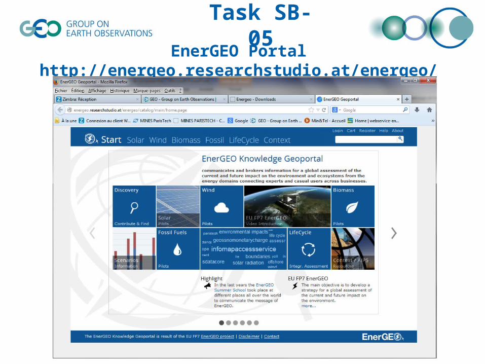
Task SB-05EnerGEO Portal
http://energeo.researchstudio.at/energeo/catalog/main/home.page
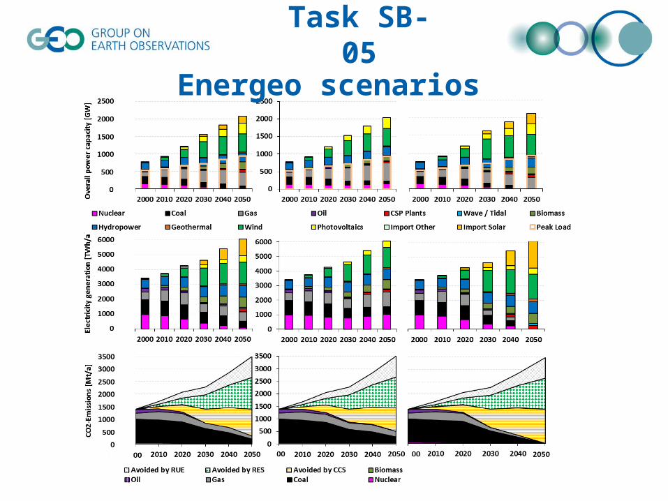
Task SB-05
Energeo scenarios
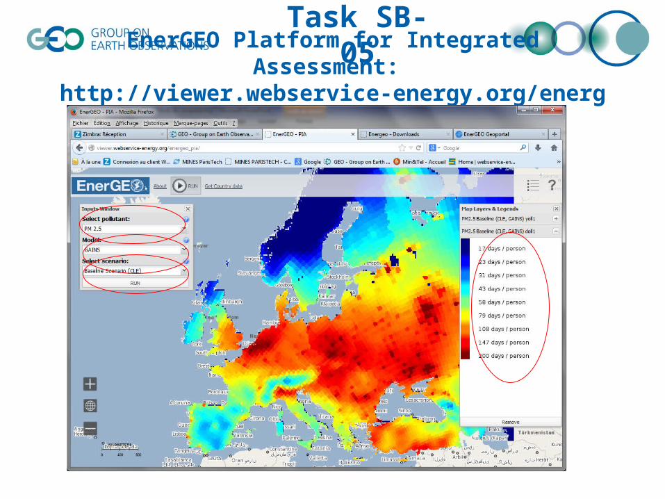
Task SB-05EnerGEO Platform for Integrated Assessment:
http://viewer.webservice-energy.org/energeo_pia/
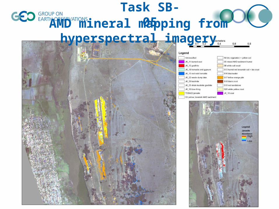
Task SB-05AMD mineral mapping from hyperspectral imagery
Task SB-05

Task SB-05
Global Urban Footprint (GUF) programme Global Urban Footprint (GUF) programme
• Global high resolution binary mask of built up areasGlobal high resolution binary mask of built up areas• From high resolution SAR data acquired during the From high resolution SAR data acquired during the
TanDEM-X missionTanDEM-X mission• SB-04SB-04
Task SB-05
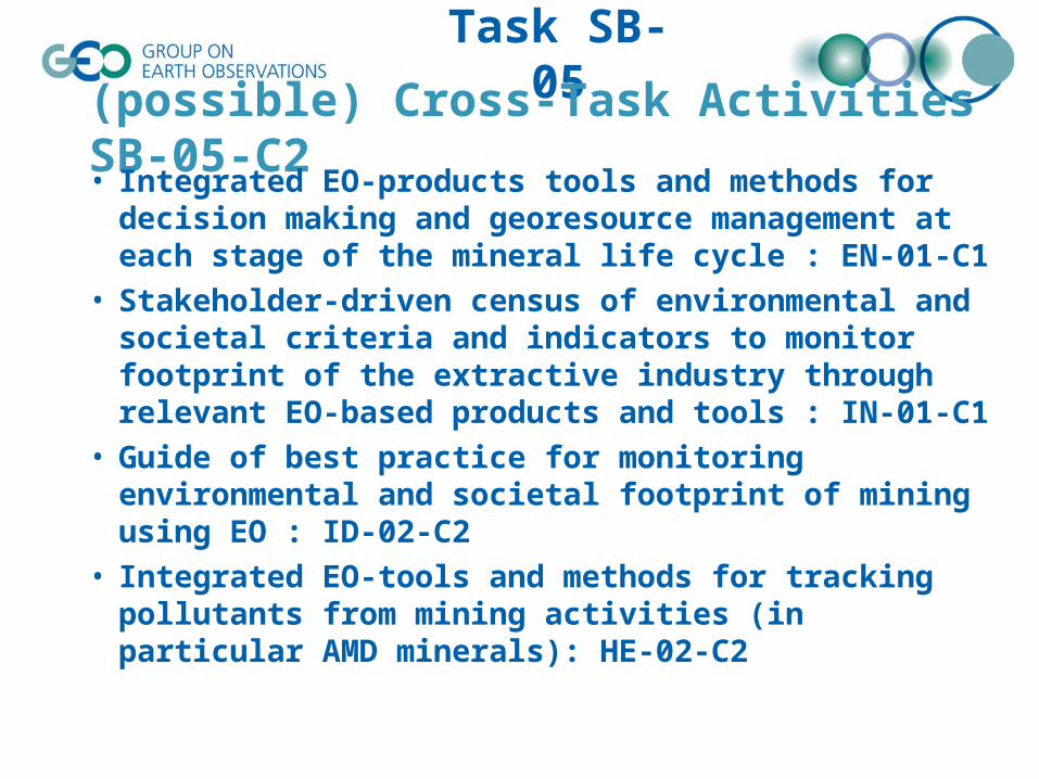
(possible) Cross-Task Activities SB-05-C2• Integrated EO-products tools and methods for decision
making and georesource management at each stage of the mineral life cycle : EN-01-C1
• Stakeholder-driven census of environmental and societal criteria and indicators to monitor footprint of the extractive industry through relevant EO-based products and tools : IN-01-C1
• Guide of best practice for monitoring environmental and societal footprint of mining using EO : ID-02-C2
• Integrated EO-tools and methods for tracking pollutants from mining activities (in particular AMD minerals): HE-02-C2
Task SB-05
Evidence of the Use of Task-related Systems, Datasets, Information Products, and Services
(by which communities? use statistics? role of users in implementation?)
• SB-05-C1: – Environmental, Energy and Health datasets for the impact assessments– Use of cohorts for air pollution impacts on health (epidemiologists)
Task SB-05
Policy Linkages (e.g. Conventions, Protocols, International Programmes)
• EU Raw Material Initiative• European Innovation Partnership (EIP) on raw
materials• Flagship initiative "Resource Efficient Europe"• Africa Mining Vision 2050
– http://www.africaminingvision.org/about.html– “how mining can contribute better to local development by
making sure workers and communities see real benefits from large-scale industrial mining and that their environment is protected”.
Task SB-05
Challenges, Issues, and Gaps Hindering Progress
• Currently, there are no more funded activities under SB-05-C1 and C2– FP7 Projects EnerGEO (C1), EO-MINERS and ImpactMin (C2) ended 2012-
2013• Component C2
– Lack of satellite borne hyperspectral sensor for mineral and vegetation mapping
– Lack of continuity for ASTER data• But WorldView-3 data to come (at cost)
– Lack of extractive industry engagement (private sector) or their representatives
– How to identify, collect and harmonize in situ monitoring data?• Regional, national, global networks• Citizen engagement, citizens’ observatories
– Access to socio-economic data• Local to global
– DTMs vs. DEMs
Task SB-05
Intervention needed from GEO Members and POs to Achieve 2015 Strategic Targets
• C1 : Generalization of the task to other SBA (Human activities but only related to energy)
– Presently impacts of energy uses– Cross cutting issues: water and health, atmosphere (air pollution) and health, …– Communities to support the work
• C2 : develop close links with GEO IP to ensure minerals as one of the next GEO strategic targets
– Role of China, EU, South Africa, US…– Newly created Working Group on Coal and Environment (WGCE) as part of the
Energy CoP• Support possible global initiatives
– Global mineral mapping from ASTER imagery• CSIRO’s Mineral map of Australia (IN-02)• PECOMINES-like global mapping (mine wastes)
– Global illegal mining inventory (ex French Guyana)– Material Flow Analysis (MFA) for monitoring raw material extraction :
contribution of COPERNICUS (EU) and GEOSS (global)? – Role of UAVs in in situ data collection?
Task SB-05
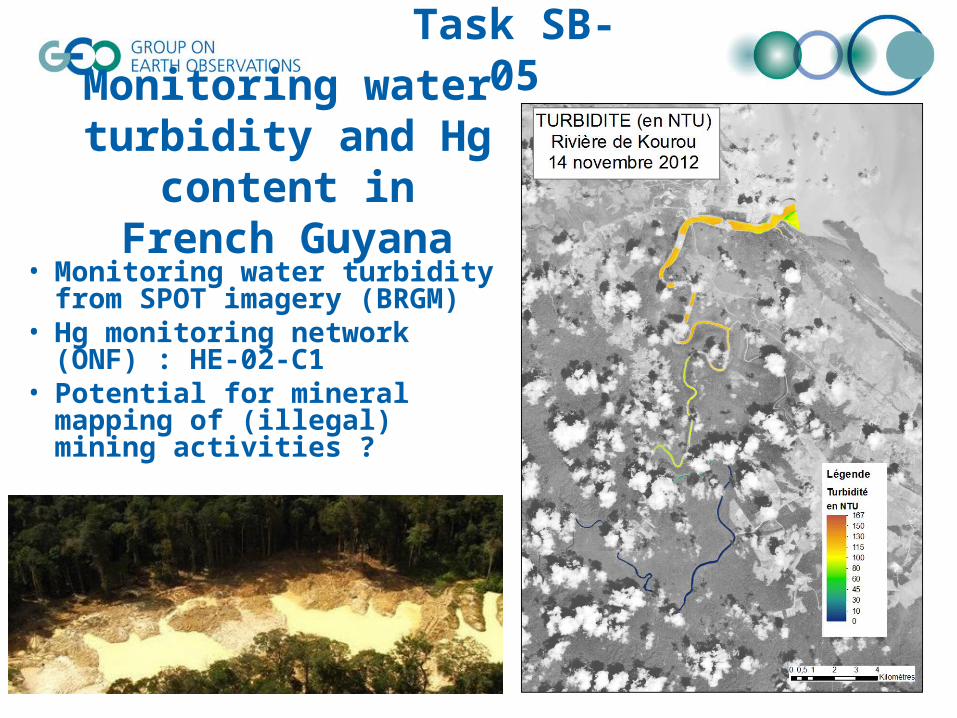
Monitoring water turbidity and Hg content
in French Guyana• Monitoring water turbidity from
SPOT imagery (BRGM)• Hg monitoring network (ONF) :
HE-02-C1• Potential for mineral mapping of
(illegal) mining activities ?
Task SB-05
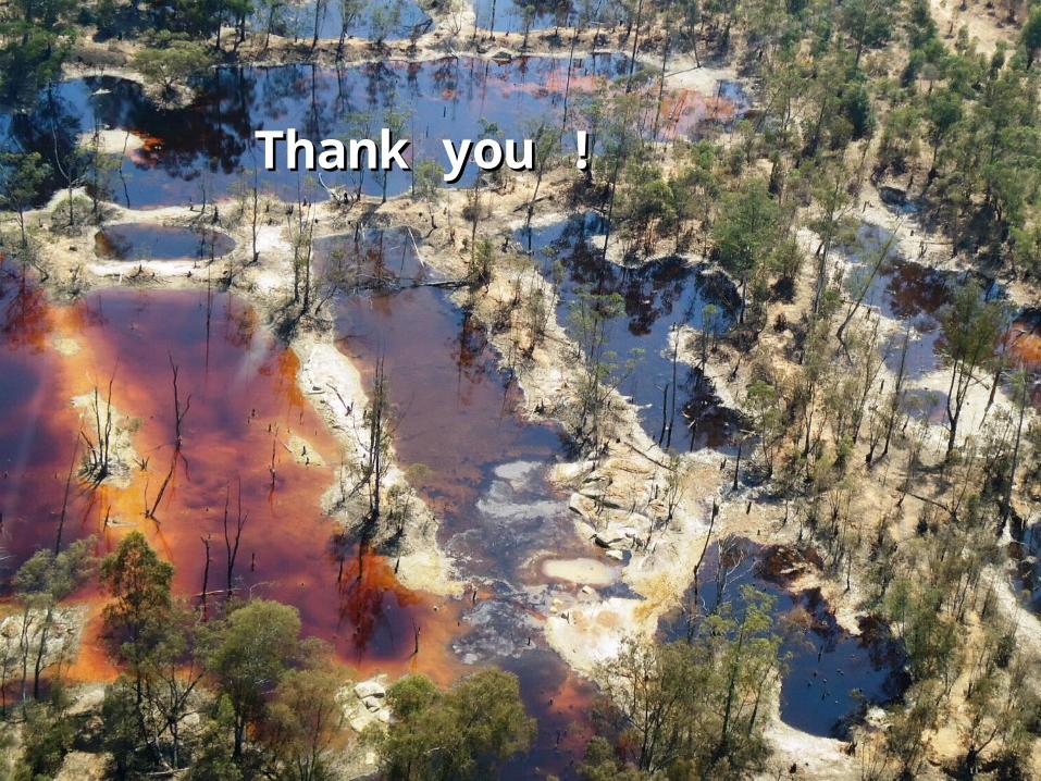
Thank you !Thank you !