technical 90 years of surveying and mapping - ee.co.za 2009... · morris, we start this short...
TRANSCRIPT

Surveyingtechnical
26 PositionIT – Nov/Dec 2010
90 years of surveying and mapping
by Richard Wonnacott, CD:NGI
The South African national surveying and mapping agency, now known as the Chief Directorate: National Geo-spatial Information (NGI), turned 90 years old in October 2010 and has proudly served the country by providing a sound, uniform, modern, geodetic reference frame and country wide coverage of topographical maps and data of various scales, types and formats.
The roots of the organisation go even further back than the last 90 years, however, with the first
serious geodetic survey having taken place in 1752 when Abbé de LaCaille measured an arc of meridian between Cape Town and Aurora in the Western Cape. For the following 168 years the foundation for an integrated country wide geodetic reference frame was built upon through the leadership and visionary work of the astronomers Sir Thomas Maclear and Sir David Gill, the hard work of Colonel W Morris and parties of Royal Engineers and the vision and dedication of J J Bosman. Much has been written about the excellent work of LaCaille, Maclear and Gill and others but this brief article is more about the last 90 years of the NGI.
Without detracting from the sterling work of LaCaille, Maclear, Gill and Morris, we start this short history with J J Bosman or, more formally, Johannes Jacobus Bosman. Prior to his appointment in 1892 as “Examiner of Diagrams” in the Office of the Surveyor General, Bosman set out and observed a triangulation scheme extending from Vryburg to the 20th meridian in what was then a part of Bechuanaland (now Botswana). With this background, interest and skill, he was appointed as the Geodetic Officer by the Surveyor General in Cape Town in 1903 with the task of undertaking a secondary triangulation of the Cape Colony. The result of this work is the well known Bosman co-ordinate system which was linked to geodetic triangulation and which still crops up from time to time even today. A similar secondary triangulation was undertaken in Natal under the direction of August Hammar.
Bosman retired as the Director of Secondary Triangulation in 1919 and W C van der Sterr was appointed to take over from him.
Willem Cornelius van der Sterr was born in Amsterdam and worked in his early career on the establishment of triangulation on the Witwatersrand goldfields. On his appointment as the Director of Secondary Triangulation, one of the first things he did was to write two reports which were to have a profound impact on the survey industry in South Africa. In the one report, Van der Sterr discussed the reorganisation of the survey department of the mandated territory of South West Africa (now Namibia). In his second report,
Van der Sterr stressed the importance of basing all surveys on the main triangulation and the establishment of a survey organisation for the Union of South Africa for the economic development of the country. These reports resulted in the establishment of the Trigonometrical Survey Office (TSO) as a union office in 1920.
For the first six years of its existence, the Trigonometrical Survey Office was based in Parliament Street in Cape Town but in 1929 was transferred to Mowbray where it and its successors have been ever since.
During the early years of Trig Survey, as it was commonly known, Van der
Fig. 1: The first Trigonometrical Survey Office staff in 1920. Standing left to right: Oscar Schreiber, W White-Phillips, J F N Biesman-Simons. Seated left to right: W C van der Sterr, JJ Bosman, EW Andrews.

technicalSURVEYING
28 PositionIT – Nov/Dec 2010
Sterr busied himself organising the new office and looking into the broader picture of the South African survey scene. In 1921, he sat on a commission established by the Governor-General of South Africa to “enquire into matters concerning the Surveys of Land.” At the end of their deliberations and enquiries the commission submitted 30 recommendations most of which have had a more than significant impact on the survey industry in South Africa. A few of these were that:
l The primary, secondary and tertiary triangulation of the country must be completed
l The topographical survey of the country be commenced
l A central office to control trigonometrical and topographical surveys be established
l A central mapping office be established
l The offices above to be based in Cape Town
l A director general of surveys be appointed
l Wherever possible all cadastral surveys be based upon the main triangulation
l A survey regulations board be established
l A consolidating land survey act be passed that would control cadastral surveys and embody all the recommendations of the commission.
It is uncertain whether or not these recommendations formally established the Trigonometrical Survey Office as they were made in 1921, a year after the supposed establishment of the office in 1920. What is clear, however, is that on the recommendation of the Commission, the Land Survey Act of 1927 was drafted and enacted with all the ramifications that that act has had on cadastral surveying in South Africa.
In 1927 Van der Sterr was awarded a D.Sc by the University of Cape Town and continued as the Director of the Trigonometrical Survey Office until his death in May 1933. The contribution that Dr. van der Sterr made to surveying and mapping in South Africa was enormous and he must stand alongside Sir Thomas Maclear and Sir David Gill.
With the foundation of a national surveying and mapping agency having been laid and, building upon the pioneering and visionary work of Maclear, Gill, Bosman and others, Van der Sterr and his successors went about fulfilling the recommendations of the commission. The organisational structure and name of the national surveying and mapping agency and the control of cadastral surveying may have changed over the past 90 years but the fundamentals of those recommendations remain the guiding principles of the industry.
Since the establishment of the Trigonometrical Survey Office (TSO)
Fig. 2: Repsold theodolite 254 mm (10 inch) used by Sir David Gill circa 1890 on display in the CD:NGI Museum.
under the direction of Van der Sterr, perhaps the most significant changes have been the revolutionary technological changes driven largely by massive advances in electronics and the development of electronic equipment and computing devices that have had the most profound impact on the way that surveying and mapping has progressed.
When Van der Sterr assumed the directorship of the TSO in 1920, all geodetic angular measurements would have been done using open circle theodolites with the diameter of the horizontal circles ranging in size from a “paltry” 203 mm (8 inches) up to nearly 609 mm (24 inches). These instruments were made primarily of brass with the graduations on the horizontal and vertical circles being of silver with up to five evenly spaced vernier micrometers to read the circles. These were large and cumbersome instruments and in the case of the larger theodolites came in many boxes and required great teams of labourers to transport them to the tops of mountains. In 1925 Heinrich Wild introduced the then revolutionary Wild T2 and T3 theodolites for tertiary and geodetic triangulation with their enclosed engraved glass circles and verniers which, in the case of the T3, are capable of reading to 0,2 seconds of arc (equivalent to the diameter of a R1 coin at about 20,1 km). The horizontal circle of the T3 is approximately 140 mm (5½ inches) and was far more compact than the previous “open circle” theodolites and became the work horses of all secondary and primary triangulation carried out by many national agencies responsible for the establishment of geodetic control. South Africa was no different and these theodolites were used right up until the early 1990s when high precision and accuracy satellite positioning became the norm.
In order to define the size or scale of any form of triangulation it is necessary to know the length of at least one side of a triangle and in geodetic triangulation the normal procedure up until the mid 1950s was to measure what is known as a base over flat terrain and extend the triangulation from the extremities of the base. Maclear took five months to measure a base near Darling of approximately 13,7 km long using six 3,05 m (10 feet) iron bars placed end to end in a leap frog fashion. The last
Fig. 3: "Wild T3 104 mm (5 1/2 inch) geodetic theodolite on display in the NGI museum. The maker's plate reads "Heinrich Wild, Heerbrugg, Schweiz, No 1."
technicalSURVEYING
PositionIT – Nov/Dec 2010 29
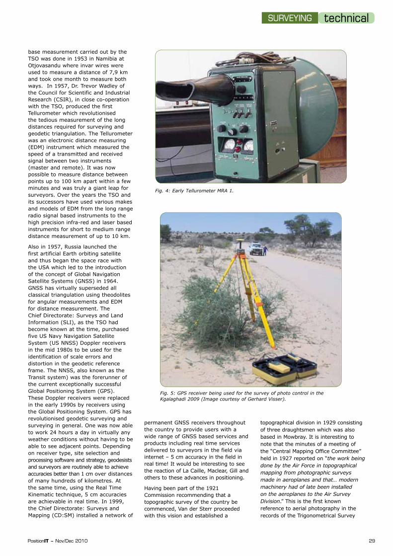
Fig. 4: Early Tellurometer MRA 1.
Fig. 5: GPS receiver being used for the survey of photo control in the Kgalaghadi 2009 (Image courtesy of Gerhard Visser).
base measurement carried out by the TSO was done in 1953 in Namibia at Otjovasandu where invar wires were used to measure a distance of 7,9 km and took one month to measure both ways. In 1957, Dr. Trevor Wadley of the Council for Scientific and Industrial Research (CSIR), in close co-operation with the TSO, produced the first Tellurometer which revolutionised the tedious measurement of the long distances required for surveying and geodetic triangulation. The Tellurometer was an electronic distance measuring (EDM) instrument which measured the speed of a transmitted and received signal between two instruments (master and remote). It was now possible to measure distance between points up to 100 km apart within a few minutes and was truly a giant leap for surveyors. Over the years the TSO and its successors have used various makes and models of EDM from the long range radio signal based instruments to the high precision infra-red and laser based instruments for short to medium range distance measurement of up to 10 km.
Also in 1957, Russia launched the first artificial Earth orbiting satellite and thus began the space race with the USA which led to the introduction of the concept of Global Navigation Satellite Systems (GNSS) in 1964. GNSS has virtually superseded all classical triangulation using theodolites for angular measurements and EDM for distance measurement. The Chief Directorate: Surveys and Land Information (SLI), as the TSO had become known at the time, purchased five US Navy Navigation Satellite System (US NNSS) Doppler receivers in the mid 1980s to be used for the identification of scale errors and distortion in the geodetic reference frame. The NNSS, also known as the Transit system) was the forerunner of the current exceptionally successful Global Positioning System (GPS). These Doppler receivers were replaced in the early 1990s by receivers using the Global Positioning System. GPS has revolutionised geodetic surveying and surveying in general. One was now able to work 24 hours a day in virtually any weather conditions without having to be able to see adjacent points. Depending on receiver type, site selection and processing software and strategy, geodesists and surveyors are routinely able to achieve accuracies better than 1 cm over distances of many hundreds of kilometres. At the same time, using the Real Time Kinematic technique, 5 cm accuracies are achievable in real time. In 1999, the Chief Directorate: Surveys and Mapping (CD:SM) installed a network of
permanent GNSS receivers throughout the country to provide users with a wide range of GNSS based services and products including real time services delivered to surveyors in the field via internet – 5 cm accuracy in the field in real time! It would be interesting to see the reaction of La Caille, Maclear, Gill and others to these advances in positioning.
Having been part of the 1921 Commission recommending that a topographic survey of the country be commenced, Van der Sterr proceeded with this vision and established a
topographical division in 1929 consisting of three draughtsmen which was also based in Mowbray. It is interesting to note that the minutes of a meeting of the “Central Mapping Office Committee” held in 1927 reported on “the work being done by the Air Force in topographical mapping from photographic surveys made in aeroplanes and that… modern machinery had of late been installed on the aeroplanes to the Air Survey Division.” This is the first known reference to aerial photography in the records of the Trigonometrical Survey

technicalSURVEYING
30 PositionIT – Nov/Dec 2010
Office although there is a set of aerial photography in the archives of this office that date back to 1926 and covers portions of the Cape Peninsula and Saldanha Bay. Mapping from photographs was not a new concept in South Africa as Dr. H G Fourcade had in fact developed the principles of stereo photogrametry in 1901 using cameras on the ground to produce terrestrial stereographic pairs of photographs of Table Mountain in Cape Town. This technique became known as terrestrial photogrametry and was the forerunner of aerial photogrametry.
Fig. 6: Gloster A.R 24 Survey aircraft used for aerial photography by the Aircraft Operating Company circa 1931. Note camera operators open cockpit at front of aircraft. Only two such aircraft were built. (Image courtesy of AOC Geomatics – Chris Tanner).
Fig. 7: A modern digital mapping camera being installed in Cessna Golden Eagle CIII in 2008. (Image courtesy of Geospace International – Bernhard Jacobs).
The 1926 aerial photography of the Cape Peninsula appears to have been experimental in nature and no serious effort was made to commence a systematic mapping programme to cover South Africa using aerial photography. A number of project based aerial surveys had been undertaken for irrigation and geological purposes but other than that all topographical mapping by the TSO was done using terrestrial methods including plane table mapping. The report of a “Meeting of the Topographical Survey and Mapping Conference” chaired by W Whittingdale, Van der Sterr’s successor, in 1936 reflects the following:
“Mapping from air survey had been carried out by the Aircraft Operating Company, notably for Geological Survey. The Air Force had also carried out aerial photography for various Departments, but it was generally agreed that under South African conditions, topographical mapping by air survey was more expensive than by ground methods, except in difficult country.”
The conference also recommended among other things that:
“…The mapping (of South Africa) on a scale of 1:50 000 be finished within a maximum of 15 years…”
It was not until 1937 that the systematic mapping of South Africa commenced using aerial photography as the basis of the programme. Unfortunately the Second World War intervened between 1939 and 1945 and the 15 year ambition to complete the mapping of the country was not realised until 1976.
Aerial survey cameras have not been immune to technological developments and whereas the early cameras used 152 mm or 210 mm films, digital aerial survey cameras are now the norm which has eliminated the need for the chemical processing of the film and, where necessary, the scanning of the film products to obtain digital images for mapping purposes. The production of mapping products from aerial photography has gone from using analogue stereoplotters to analytical plotters and finally to the digital soft copy compilation of topographical maps and data.
The South African Navy Hydrographic Office and the Hermanus Magnetic Observatory both have direct connections with the Trigonometrical Survey Office. In 1954 the Minister of Defence agreed to the establishment of a Hydrographic Office for South Africa under the control of the South African Navy with the co-operation of the TSO. The newly established Hydrographic Office occupied premises at the TSO in Mowbray for a few years before moving to other premises and finally to Silvermine where it is currently situated.
In 1841, the first systematic geomagnetic observations to be undertaken in South Africa took place at the present South African Astronomical Observatory where Sir Thomas Maclear was the Astronomer Royal. The programme never really progressed and it was only in 1932 that the continuous recording of various geomagnetic parameters was commenced in support of the International Polar Year. These activities were undertaken by Dr. Ogg of

technicalSURVEYING
32 PositionIT – Nov/Dec 2010
the University of Cape Town (UCT). After some protracted negotiations, the UCT observatory was moved to the TSO in 1937 still under the direction of Dr. Ogg. Because of the high levels of electrical interference with the observations in the urban Mowbary area, the observatory was moved to Hermanus in 1941 and in 1969 the Hermanus Magnetic Observatory came under the control of the CSIR thus ending its organisational relationship with the TSO.
Although no longer tied through a single parent department or organisation, the current South African Hydrographic Office, the Hermanus Magnetic Observatory and the present Chief Directorate: National Geo-spatial Information all enjoy a very close working relationship and co-operate formally and informally on many levels of work.
Looking back over the past 90 years, there are a number of individuals, events or years that have had a profound impact on the organisation that was originally known as the Trigonometrical Survey Office and what is now known as the Chief Directorate: National Geo-spatial Information. The vision, dedication and hard work of men such as Sir Thomas Maclear, Sir David Gill and J J Bosman before 1920 laid the foundation of the geodetic control for the country upon which all geospatial information is based even today. Dr. Willem Cornelius van der Sterr laid the foundation for the organisation when he was appointed as the Director of Trigonometrical Survey in 1920 and went on to have a profound influence on surveying in South Africa by drafting and guiding the Land Survey
Act of 1927 into reality and organising the TSO to take on the responsibility of topographical mapping and geodetic surveying in South Africa. The Land Survey Act and the current variation of that act notably the Land Survey Act 8 of 1997, has been the basis for all cadastral surveying in South Africa.
On a technological front, the 1920s saw the introduction of the closed circle Wild T3 geodetic theodolite which was used for over 70 years for geodetic triangulation. The 1920s also saw the first experiments with aerial photography for mapping.
Perhaps the most outstanding years for surveying and geodesy at the TSO came in 1957 when the Tellurometer was developed by Dr. Trevor Wadley in conjunction with the TSO and the launch of the first artificial Earth orbiting satellite, Sputnik, by the Russians which signaled a completely new era for national mapping agencies including the Trig Survey as it was known colloquially. The latter event has perhaps been the most significant as we now rely almost entirely on space based positioning techniques and to a lesser extent on Earth observation satellites for mapping and the detection of changes to the environment by both natural and human factors.
What does the future hold for the Chief Directorate: National Geo-spatial Information (NGI)? There is no doubt that the future of topographical mapping lies with satellite based Earth observation and that at some time in the very near future NGI
will be able to make use of data from South Africa’s own remote sensing satellite. There will be an increased reliance on GNSS and with the proliferation of systems and the ever increasing drive towards interoperability of systems such as GPS (USA), GLONASS (Russia), COMPASS (Beidou) (China), Galileo (Europe) and others. Surveyors will be spoilt for choice for positioning. As in the past, NGI will continue to adopt new technologies and adapt their applications to suit South African conditions and further evolve and develop as an organisation to proudly serve the country as envisaged by the founders of TSO 90 years ago.
References
[1] Chief Directorate: Surveys and Mapping: 80 Years of Surveying and Mapping South Africa, Department of Land Affairs; 2000.
[2] T Maclear: Verification and Extension of La Caille’s Arc of Meridian at the Cape of Good Hope., Published by Order of the Lord Commissioners of the Admiralty, 1886.
[3] J C Beattie, A W Roberts, D Williams, W C van der Sterr, H M Shaw and M L van der Spuy: Report of the Survey Commission, Published in the Government Gazette of the Union of South Africa, 1921.
[4] Minutes of Departmental meetings: 1927 and 1936.
[5] G H Menzies: The Otjovasandu Base-line Measurement, South West Africa, Surveyor General South West Africa, 1953.
Contact Richard Wonnacott, CD:NGI, Tel 021 658-4304, [email protected]