teesta barrage project – a brief review of unattained goals and...
TRANSCRIPT

International Journal of Science and Research (IJSR) ISSN (Online): 2319-7064
Index Copernicus Value (2013): 6.14 | Impact Factor (2015): 6.391
Volume 5 Issue 5, May 2016
www.ijsr.net Licensed Under Creative Commons Attribution CC BY
Teesta Barrage Project – A Brief Review of
Unattained Goals and Associated Changes
Baishali Mukherjee1, Ujwal Deep Saha
2
1, 2University of Calcutta, Department of Geography, 35, Ballygunge Circular Road, Ballygunge, Kolkata – 700019, India
Abstract: The Teesta Barrage Project that has been conceived in the year 1975-76 had a grand plan for the revival of agricultural
economy of six districts of North Bengal- Cooch Behar, Jalpaiguri, Darjeeling, North Dinajpur, South Dinajpur and Malda which did
not have any strong industrial base. The project is still incomplete and there is a very little chance for the completion of the entire project
as executed. The dam constructed aimed to control flood, bring lands under irrigation, generate hydro electricity, navigation, fishing
and tourism which after the completion of the first phase is still unachieved and far from fulfilment. This paper is attempted to study the
objectives behind the construction of the project along with its achievements and unachieved goals. Changing natural habitat with
emphasis on the impact of the project over human life in the catchment area have been tried to determine through selected study of
respondents and using Remote Sensing techniques. The changes of LULC attributes within the catchment area in due course of time
have few striking characteristics along with increasing sufferings for the locals due to some changes in geo- economic environment.
Keywords: Teesta barrage, flood, irrigation, LULC, geo-economic environment
1. Introduction
Any part of the world dependent on agricultural practices
require ample amount of water for crop production and if the
concerned area is associated with rainfall variability then
demand of irrigated water will be higher. North Bengal is
endowed with 60% of total water resource in West Bengal
[7]. To exploit such huge resource base and to supply
irrigated water a barrage was constructed on the mightiest
river of North Bengal, Teesta in 1975-76, in 6 districts of
north Bengal which had no such industrial base and required
a strong irrigation related infrastructure to meet its demand
mainly for agriculture during the dry months. The North
Bengal plains are associated with high rainfall variability
and it gets rainfall accounting for lower than average rainfall
frequently. 90% of total annual rainfall in concentrated in 4
summer months followed by a long spell of time with
rainfall averaging 0-50 mm [8]. Often monsoon gets delayed
and the agricultural fields suffer from acute shortage of
water. Such gap between required water and available water
in this region has to be met through the supply of irrigated
water. Until the Teesta Barrage Project (TBP) there were
literally no such large irrigation schemes in North Bengal.
Amount of Teesta‟s water received by Bangladesh gets
reduced, due to TBP, raised a conflict between 2
neighbouring states and the circumstances became more
complex as 5 more dams were constructed upstream.
Environmental condition during post dam period below the
TBP raised so much concern among the researcher
presently. Application of Remote sensing and GIS for
evaluation of environmental condition of the area lying
below the TBP is undertaken by many researchers [1]. This
research work is aimed at the evaluation of changing
environmental condition in terms of vegetation, ground
moisture and land use pattern of a certain part of TBP
command area through applying RS-GIS techniques along
with the scenario of gaps present between proposed aims
and its implementation has been done.
2. Geographical settings of the study area
To evaluate the environmental condition a certain extent of
TBP lying closest to Teesta River has been taken into
consideration. The flat low lying plain land in Jalpaiguri and
Coochbehar districts of West Bengal is lying on the fringe of
Teesta mega fan. Teesta followed a straight course with
numerous wandering channels below the barrage constructed
at Gajoldoba in Jalpaiguri with an average width of 2.3 kms
approximately. Such low lying plain areas, considered as
one of
Paper ID: NOV163797 2027
International Journal of Science and Research (IJSR) ISSN (Online): 2319-7064
Index Copernicus Value (2013): 6.14 | Impact Factor (2015): 6.391
Volume 5 Issue 5, May 2016
www.ijsr.net Licensed Under Creative Commons Attribution CC BY
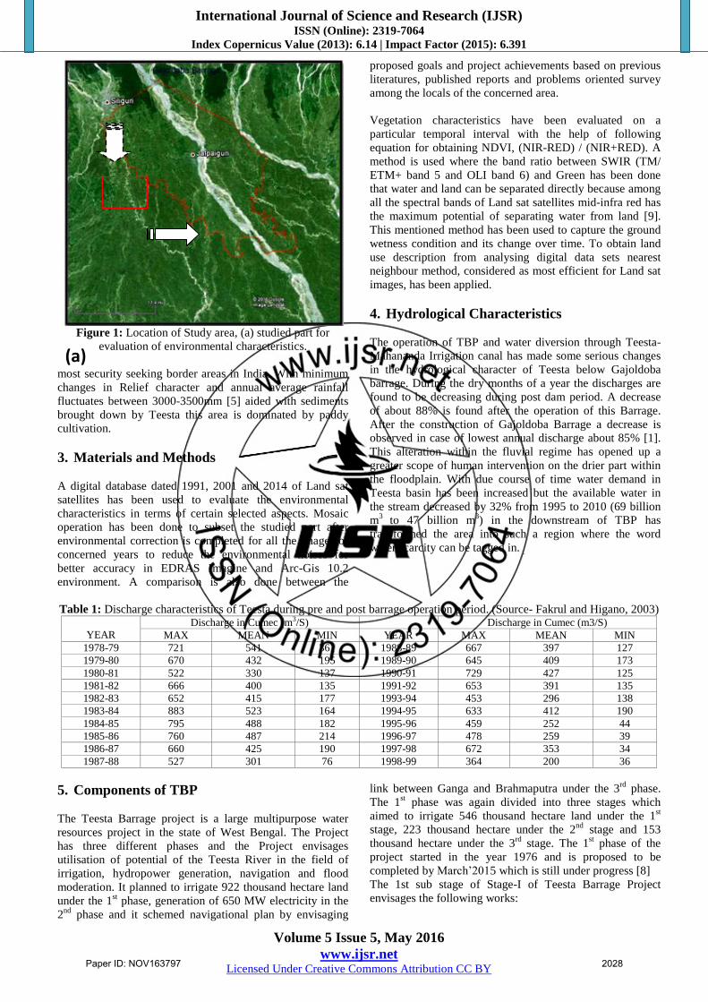
Figure 1: Location of Study area, (a) studied part for
evaluation of environmental characteristics.
most security seeking border areas in India. With minimum
changes in Relief character and annual average rainfall
fluctuates between 3000-3500mm [5] aided with sediments
brought down by Teesta this area is dominated by paddy
cultivation.
3. Materials and Methods
A digital database dated 1991, 2001 and 2014 of Land sat
satellites has been used to evaluate the environmental
characteristics in terms of certain selected aspects. Mosaic
operation has been done to subset the studied part after
environmental correction is completed for all the images of
concerned years to reduce the environmental noises for
better accuracy in EDRAS Imagine and Arc-Gis 10.2
environment. A comparison is also done between the
proposed goals and project achievements based on previous
literatures, published reports and problems oriented survey
among the locals of the concerned area.
Vegetation characteristics have been evaluated on a
particular temporal interval with the help of following
equation for obtaining NDVI, (NIR-RED) / (NIR+RED). A
method is used where the band ratio between SWIR (TM/
ETM+ band 5 and OLI band 6) and Green has been done
that water and land can be separated directly because among
all the spectral bands of Land sat satellites mid-infra red has
the maximum potential of separating water from land [9].
This mentioned method has been used to capture the ground
wetness condition and its change over time. To obtain land
use description from analysing digital data sets nearest
neighbour method, considered as most efficient for Land sat
images, has been applied.
4. Hydrological Characteristics
The operation of TBP and water diversion through Teesta-
Mahananda Irrigation canal has made some serious changes
in the hydrological character of Teesta below Gajoldoba
barrage. During the dry months of a year the discharges are
found to be decreasing during post dam period. A decrease
of about 88% is found after the operation of this Barrage.
After the construction of Gajoldoba Barrage a decrease is
observed in case of lowest annual discharge about 85% [1].
This alteration within the fluvial regime has opened up a
greater scope of human intervention on the drier part within
the floodplain. With due course of time water demand in
Teesta basin has been increased but the available water in
the stream decreased by 32% from 1995 to 2010 (69 billion
m3
to 47 billion m3) in the downstream of TBP has
transformed the area into such a region where the word
water scarcity can be tagged in.
Table 1: Discharge characteristics of Teesta during pre and post barrage operation period. (Source- Fakrul and Higano, 2003)
YEAR
Discharge in Cumec (m3/S) Discharge in Cumec (m3/S)
MAX MEAN MIN YEAR MAX MEAN MIN
1978-79 721 541 361 1988-89 667 397 127
1979-80 670 432 195 1989-90 645 409 173
1980-81 522 330 137 1990-91 729 427 125
1981-82 666 400 135 1991-92 653 391 135
1982-83 652 415 177 1993-94 453 296 138
1983-84 883 523 164 1994-95 633 412 190
1984-85 795 488 182 1995-96 459 252 44
1985-86 760 487 214 1996-97 478 259 39
1986-87 660 425 190 1997-98 672 353 34
1987-88 527 301 76 1998-99 364 200 36
5. Components of TBP
The Teesta Barrage project is a large multipurpose water
resources project in the state of West Bengal. The Project
has three different phases and the Project envisages
utilisation of potential of the Teesta River in the field of
irrigation, hydropower generation, navigation and flood
moderation. It planned to irrigate 922 thousand hectare land
under the 1st phase, generation of 650 MW electricity in the
2nd
phase and it schemed navigational plan by envisaging
link between Ganga and Brahmaputra under the 3rd
phase.
The 1st phase was again divided into three stages which
aimed to irrigate 546 thousand hectare land under the 1st
stage, 223 thousand hectare under the 2nd
stage and 153
thousand hectare under the 3rd
stage. The 1st phase of the
project started in the year 1976 and is proposed to be
completed by March‟2015 which is still under progress [8]
The 1st sub stage of Stage-I of Teesta Barrage Project
envisages the following works:
(a)
Paper ID: NOV163797 2028

International Journal of Science and Research (IJSR) ISSN (Online): 2319-7064
Index Copernicus Value (2013): 6.14 | Impact Factor (2015): 6.391
Volume 5 Issue 5, May 2016
www.ijsr.net Licensed Under Creative Commons Attribution CC BY
a) Construction of a barrage across river Teesta at
Gajoldoba in the Jalpaiguri district.
b) Construction of distributaries, minors, sub-minors and
water courses covering a length of 2450.00 km (approx.)
for sub-stage-1 of stage-I.
c) Construction of 27 Nos. of Regulator and fall structures,
including 3 Nos. of Power Falls.
d) Construction of 166 Nos. of bridges on main canals
including crossings of Railway Lines, National Highway,
State Highway and Major District Roads.
e) Construction of residential and non-residential buildings,
stack-yards, stores and go downs throughout the Project
Area.
f) Construction of Inspection paths, approach roads and
other allied works.
g) Two pick-up barrages, one across the Mahananda River
at Fulbari in Jalpaiguri district and other across river
Dauk at Chopra in Uttar Dinajpur district.
h) Construction of five main canals namely:
i. Teesta- Mahananda Link Canal for the length of
25.75 km.
ii. Mahananda Main Canal for the length of 32.33 km.
iii. Dauk Nagar Main Canal for the length of 80.20 km.
iv. Nagar Tangon Main Canal for the length of 42.20 km.
v. Teesta- Jaldhaka Main Canal for the length of 30.31
km.
6. Project Achievements
After the completion of the 1st sub stage, the Teesta Barrage
project has been able to achieve the following:
6.1. Irrigation
Work on the project started 35 years ago for irrigating the
fields of North Bengal. The 210-km canal network, a crucial
part of Teesta Barrage Project, would have helped to irrigate
9.22 lakh hectares, now it is managed to water 66,000
hectares which is less than 10% of the proposed plan. Work
on the three barrages of the project that were to have been
built along with the canals to take the river water to the
interiors of North Bengal is under developed.
6.2. Hydro Power Generation
The 1st Sub-stage was to generate 650 M.W. of hydropower
from three canal falls in the Mahananda main canal. The
reservoir that was planned to be constructed during the
second phase of the Teesta irrigation project cannot be now
undertaken since the NHPC has already started working
towards the implementation of the 'low dam' just 400 m.
upstream of the Coronation bridge. So the plan to generate
an additional 600 MW power under the TBP will probably
never take off.
6.3. Flood Mitigation
There has been record of the shifting courses of the Tista in
recent history. Now there are cut-offs from the flow of Tista
and appear to be derelict channels where the beds are risen
with deposition of sand-silt .As a result of these have
become perennial source of water logging and flood over the
North Bengal plains. Construction of 12 Nos. of Major
Cross Drainage structures on main canals including major
aqueducts on crossings of rivers and Construction of 27 Nos.
of regulator will decrease the intensity of floods in this
region, but the construction is incomplete and has failed to
reduce flood.
6.4. Communication and Construction
The project was to develop transportation as well as
communication in this region .It is stated that 166 Nos. of
bridges on main canals including crossings of Railway
Lines, National Highway, State Highway and Major District
Roads will be constructed. Not only that Construction of
distributaries, minors, sub-minors and water courses up to 8
ha. Blocks covering a length of 4200 km.(approx.) in an area
of 3.42 lakh ha. C.C.A. in the six districts of North Bengal.
Apart from this Construction of residential and non-
residential buildings, stack-yards, stores and Go downs
throughout the Project Area will change the social
environment. Still around the barrages local village
population is residing in „Kuccha‟ houses mainly.
Constructions of transport arteries through the embankments
and Barrage road have reduced the distance with Kolkata
and other districts.
6.5. Recreation and Tourism Development
The region is based on three T, such as Tea-Timber-
Tourism. This place has high eco tourism potential. The
project has encouraged things of attraction. Around the
gigantic, magnificent beautiful Barrage and its head works
there are green parks, flower gardens, course of the Teesta
and the Silt Trap. These barrages have become famous
picnic spots in Darjeeling and Jalpaiguri district. The
implementation of project has change the economic
condition of people a bit. Small restaurants and shops are ran
by local people near the barrages. Recently a „Eco Tourism
Park‟ is under construction which is in the catchment area of
Gajoldoba Barrage and it has promising future for the
development of the economy of the local area.
7. Changing Environmental Condition
Construction of barrage is a way of river impoundments
where changes in the fluvial regime of downstream portion
of the barrage will undoubtedly change and the
environmental setup in terms of ground condition as well as
land use characteristics will also experience changes. In case
of dependence for economic utilisation of land on the river is
quite significant then the change could be immense
depending upon the nature of the project in action. In the
study area of this research work NDVI and Tasselled-cap
transformation has been applied to detect the changes in
green coverage and ground wetness characteristics with
associated quantification to analyse the changes.
7.1. NDVI study
NDVI on TM and OLI data has been done to showcase the
nature of vegetation richness based on RED and NIR bands.
Recent and ancillary data are used to capture the overall
change of vegetation coverage and its nature over time on
the area under study (see Fig 3). It‟s evident here that due to
Paper ID: NOV163797 2029

International Journal of Science and Research (IJSR) ISSN (Online): 2319-7064
Index Copernicus Value (2013): 6.14 | Impact Factor (2015): 6.391
Volume 5 Issue 5, May 2016
www.ijsr.net Licensed Under Creative Commons Attribution CC BY
human encroachment and establishing the barrage and its
associated structures dense forest cover has been cleared in
due course of time. Whereas sparsely distributed forest
cover has been seen gaining its areal distribution may be
with the effect of social forestry and remaining fragments of
previous dense forests. Low NDVI values signifies barren
land [1] and within the braiding plain it seems to be
decreasing which is because of ever increasing human
pressure that transforms fresh depositions into crop lands.
Overall dense vegetation cover has been decreased in a
striking manner and alongside croplands has been gaining its
areal coverage with comparatively increased irrigation
facilities day by day. Here in this case irrigation projects has
partial relationship to increase or decrease vegetation within
the project boundary [1]. Northern part of west Bengal
receives quite high, just less than 1000mm [5] but average
trend of getting rainfall is has been reduced except those
years experienced extreme events [6] which may have
partial relationship with decreasing vegetation cover.
Figure 3: NDVI map of study area during 1991, 2001, 2014
(respectively from top) and graphical distribution of NDVI
values
7.2. Ground wetness characteristics
In due course of time wetness characteristics within the
fluvial regime has been decreased. Due to spilling of water
from the irrigation sub canal human induced wetlands
emerged in Jalpaiguri district with in the study area (see Fig
3). The over ground wetness excluding the braid plain has
increased. Such increased ground wetness did not help the
crop cultivation as these wet grounds are used to grow low
quality jute during July to September and from November to
April vegetables like tomato, chilli is cultivated. On the
other hand these human induced wetlands have actually
reduced the areal extent of crop lands in this region.
7.3 Changes in Land use and Land cover
Decreasing ground moisture content [1] and inability of
providing irrigation facilities result in increase of barren
surface in certain parts. Eventually increasing wet surface
along the irrigation sub canals is also responsible for
decreased agricultural land as well in the northern part. Due
to decreasing river discharge during lean period river „chars‟
are used as agricultural fields. Thus, agricultural fields get
increased along the main channel as well as in the active
braidplain. Area occupied by active river had been decreased
by 54.22% from 1991 to 2014. Settlements had been grew in
with passage of time as Jalpaiguri town attracts more
population and rural settlements emerged into this region in
search of better livelihood around the multipurpose project.
It was increased by 15% by 2014 from 1991. Wetlands had
shown a decreasing trend from 2001 to 2014 probably due to
the transformation of such land into agricultural fields to
some extent for vegetables and fibre crops. Thus there is an
overall transformation of land use as well land cover
characteristics which is clearly guided by human
intervention and has also shown the significant failure of
TBP within its command area. Although cultivation of Rabi
crops like Sunflower has been increased due to better
availability of water through the irrigation canals compared
to before. This results in decreased amount of cultivable
fallow.
Paper ID: NOV163797 2030

International Journal of Science and Research (IJSR) ISSN (Online): 2319-7064
Index Copernicus Value (2013): 6.14 | Impact Factor (2015): 6.391
Volume 5 Issue 5, May 2016
www.ijsr.net Licensed Under Creative Commons Attribution CC BY
Figure 4: Ground wetness map during 1991, 2001 and 2014.
Wetlands present beside irrigation sub canals.
Paper ID: NOV163797 2031

International Journal of Science and Research (IJSR) ISSN (Online): 2319-7064
Index Copernicus Value (2013): 6.14 | Impact Factor (2015): 6.391
Volume 5 Issue 5, May 2016
www.ijsr.net Licensed Under Creative Commons Attribution CC BY
Figure 5: LULC maps and areal occupation by different
LULC attributes during 1991, 2001 and 2014.
8. Conclusion
Teesta Barrage has been declared as National Project. The
total expenditure of the project up to March‟09 was 1236.01
Crores. The Planning has been done as per the guide lines of
the National Project. Besides, Irrigation & Waterways
department, being the nodal department has taken necessary
initiations for other activities as laid down in the guide line
of the National Project. As a whole the over ambitious
project is still far from reaching its real objectives. And
negative impacts on the associated environment are of great
concern from socio-economic perspective.
Reference
[1] A. Rahman, “Water scarcity-induced change in
vegetation cover along Teesta River catchments in
Bangladesh”, Master‟s Thesis in Physical Geography
and Quaternary Geology, Stockholm University,
XXXXV, 2013.
[2] D.C. Sarkar, B.K. Pramanik, A.I. Zerin, I. Ara,
“Climatic Impact Assessment of Teesta barrage Project
in Bangladesh”, International journal of Civil and
Environmental Engineering, II (1), February, 2006.
[3] G. Kundu, “Decadal Growth of Irrigation in Jalpaiguri
District”, The Journal of Bengal Geographer, pp. 59-66,
October, 2012.
[4] Irrigation and Waterways Department, Government of
West Bengal, “ A Note on the Teesta Barrage Project,
West Bengal”, 1996.
[5] L. Starkel, S. Sarkar, R. Soja, P. Prokop, “Present day
evolution of Sikkimese-Bhutanese Himalayan
piedmont”, Instytut Geografii i Przestrzennego
Zagospodarowania PAN im. Stanisława Leszczyckiego,
Warszawa, 2008
[6] R. Pal, S. S. Biswas, B. Mondal, M. K. Pramanik,
“Landslide and Flood in the Teesta Basin: Historical
Evidence, Causes and Consequences”, Journal of Indian
Geophysics Union, XX (2), pp. 209-215, April, 2016.
[7] R. Afroz, A. Rahman, “Transboundary River Water for
Ganges and Teesta Rivers in Bangladesh: An
Assessment”, Global Science and Technology Journal, I
(1), pp. 100-111, July, 2013.
[8] R. De, “Teesta Barrage Project” in Sechpatra, Irrigation
and Waterways Department, Govt. of West Bengal,
(special eds.), pp. 31-34, June, 2002.
[9] R. Ray, S. Mondal, Remote Sensing on Wetland
Environment, Lambert Academic Publisher, Germany,
2014.
[10] S. Banik, “Socio Economic Impact of Gajoldoba Teesta
Multiple River Valley Project”, The Journal of Bengal
Geographer, pp. 46-52, October, 2012.
Author Profile
Baishali Mukherjee has received her B.Sc and M.Sc
Degree in Geography from University of Calcutta
(CU) and she stays in Sakherbajar, Kolkata. She is
presently a research scholar at CU.
Ujwal Deep Saha has received his B.Sc and M.Sc
Degree in Geography from University of Calcutta (CU)
and he stays in Baruipur, Kolkata. He is presently a
Junior Research Fellow at CU.
2014
Paper ID: NOV163797 2032