tererro mine project · •the mill site •50 acres of tailings the mill was connected to pecos...
TRANSCRIPT


Vicinity Map
EMOU*
LSFH*
PMOU *
* Highway 63

Mining History 1882 First discovery of mineralization
Operated from 1903-1907 and 1926-1939 from 1800’ bgs
Employed an average of 600 (largest payroll in NM)
Population of 3000 in Town of Tererro
Ore rich in Pb and Zn, small amounts of Au, Ag and Cu
~2.3 tons of ore processed, ~$40M of minerals
11,137 lbs. of gold
352,664 lbs. of silver
19,297,000 lbs. of copper
138,412,000 lbs. lead
440,683,000 lbs. zinc
Ore trans via a 12 mile long aerial tramway (longest in NA)

Contamination History 1940-1979 Mine and mill waste used as construction and maintenance
material. 1950 NM State Game Commission purchased all properties related to the mine and mill and transferred these assets to the NM State Game Commission 1982 LSFH was expanded. Following fish kill NMED conducted a preliminary water quality study in the area and found metals in seeps and surface water discharges around the Pecos Mine
1991 Spring runoff resulted in fish kill (90,000) 1985 Comprehensive investigation of the area was conducted 1992 Administrative Order on Consent (AOC) Amax Resource Conservation Company was required to follow CERCLA

Pecos Mine OU

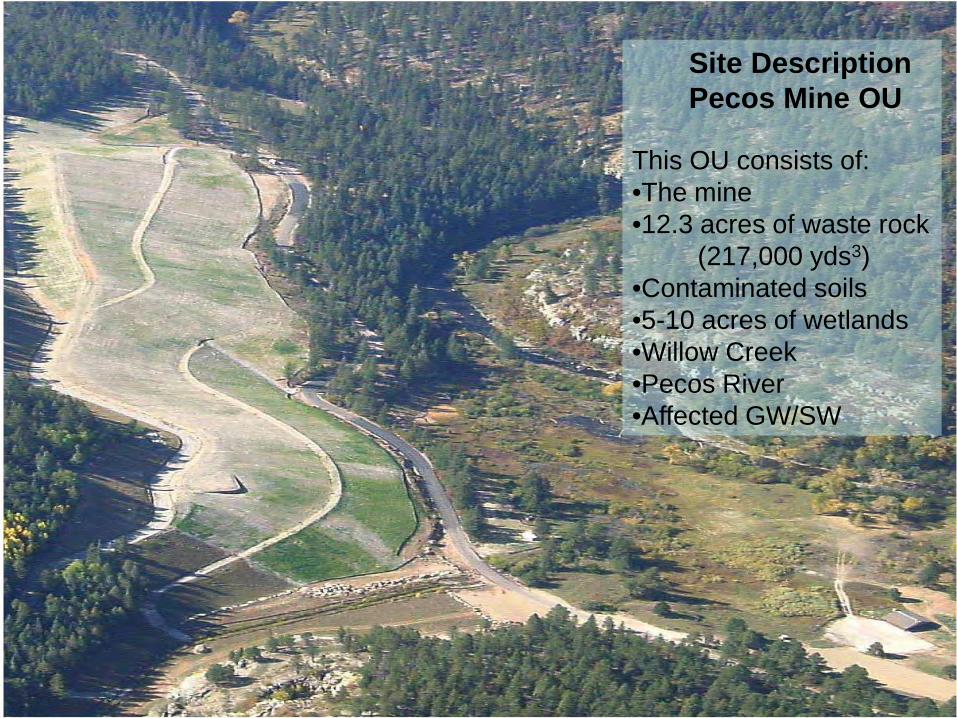
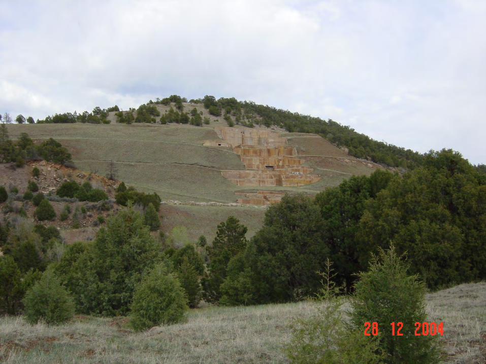
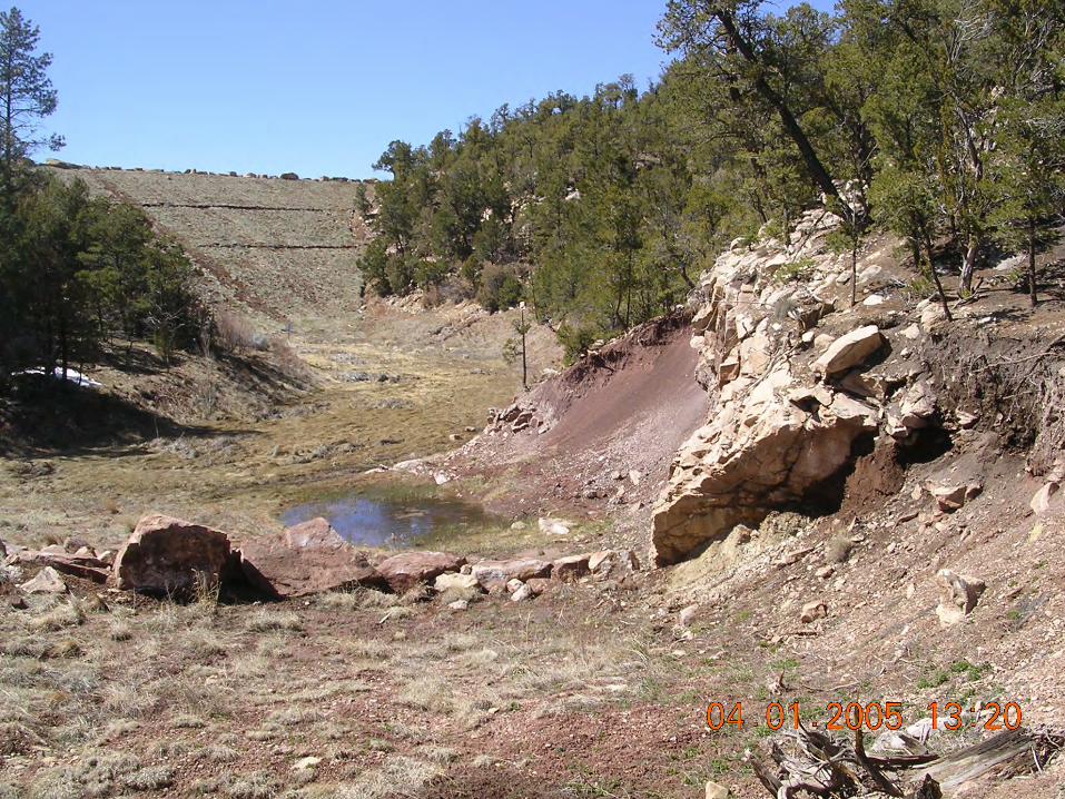
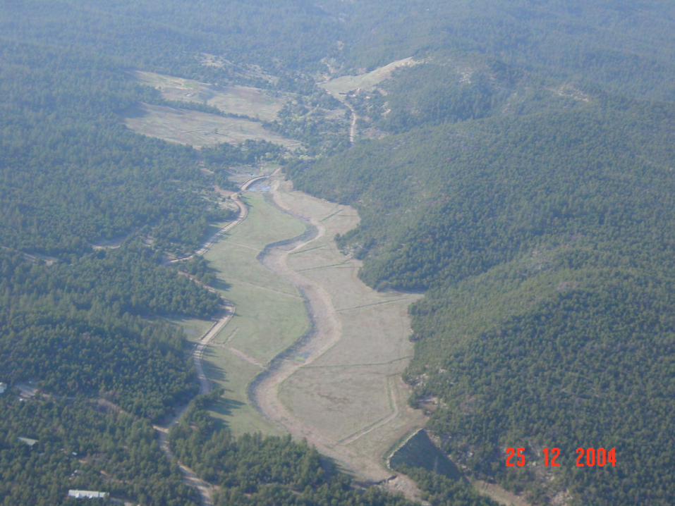
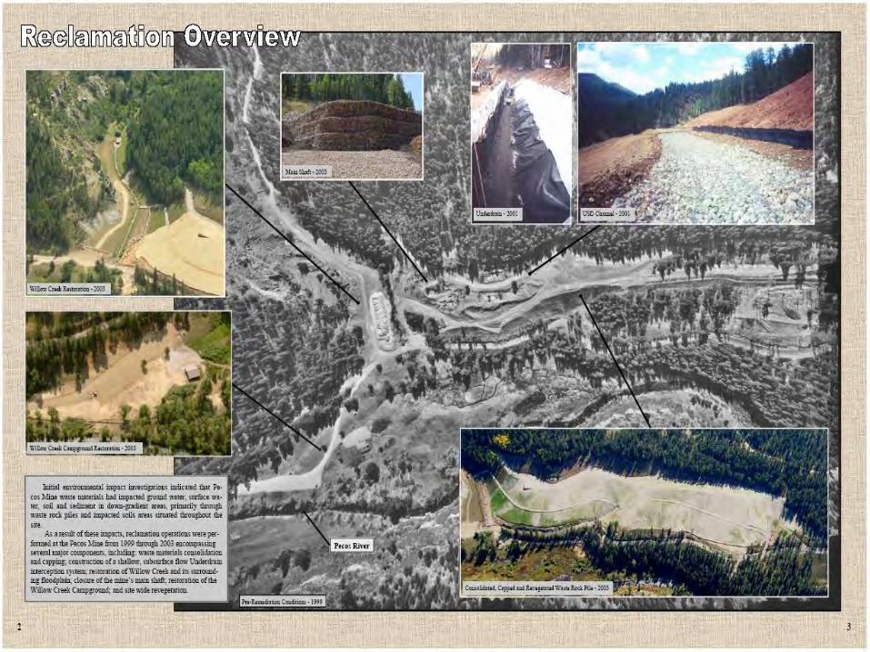
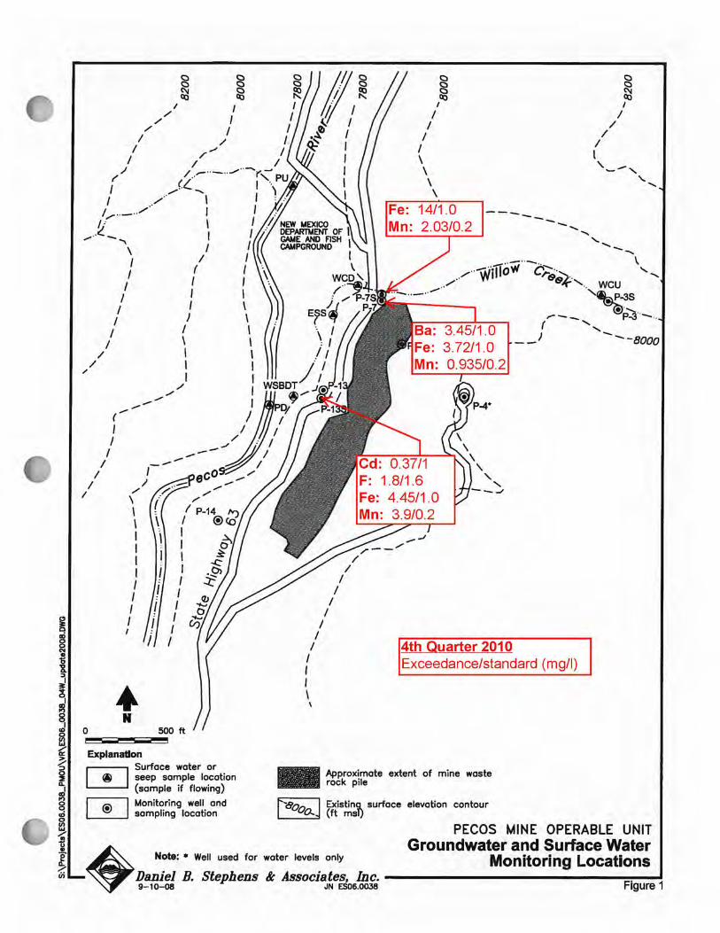
Site Description Pecos Mine OU This OU consists of: •The mine •12.3 acres of waste rock (217,000 yds3) •Contaminated soils •5-10 acres of wetlands •Willow Creek •Pecos River •Affected GW/SW

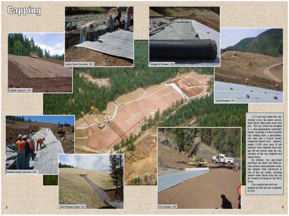
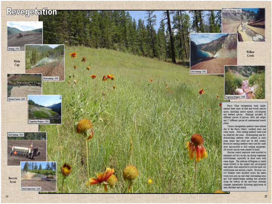
Cleanup Actions Pecos Mine OU The remedy for the mine included: •Excavation and consolidation of all associated wastes •Installing a cap overlaying an impermeable geosynthetic clay liner •Restoring Willow Creek and associated wetlands and riparian habitats •Revegetating disturbed areas •Diverting both subsurface and surface water flows around the capped waste pile. •Restore GW/SW

Phase Date Description
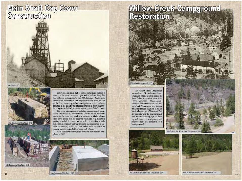
1 1999-2000 Willow Creek Restoration
2 1999-2002 Materials Consolidation
3 2000-2001 Surface/Subsurface drainage
4 2001-2003 Mid-slope and perimeter channel
5 2002-2003 Capping and vegetation


Site Description El Molino OU This OU consists of: •The Mill site •50 acres of tailings The mill was connected to Pecos Mine by a 12 mile aerial tramway. Mill tailings were deposited in 2 impoundments in Alamitos Canyon. A third impoundment was located approximately 1 mile from the confluence of Alamitos Creek and Pecos River and was constructed to collect eroded material from the original tailings impoundments.