the challenge of development in a world cultural · pdf filethe challenge of development in a...
TRANSCRIPT

1
The Challenge of Development in a World
Cultural Heritage Site
Case Study of Borobudor Area in Java
Melva Eryani Marpaung
Head of Planning and Programs Division
Directorate General of Spatial Planning, Ministry of Public
Works, Indonesia
1 Urban Sector Review
1.1 Basic General Data
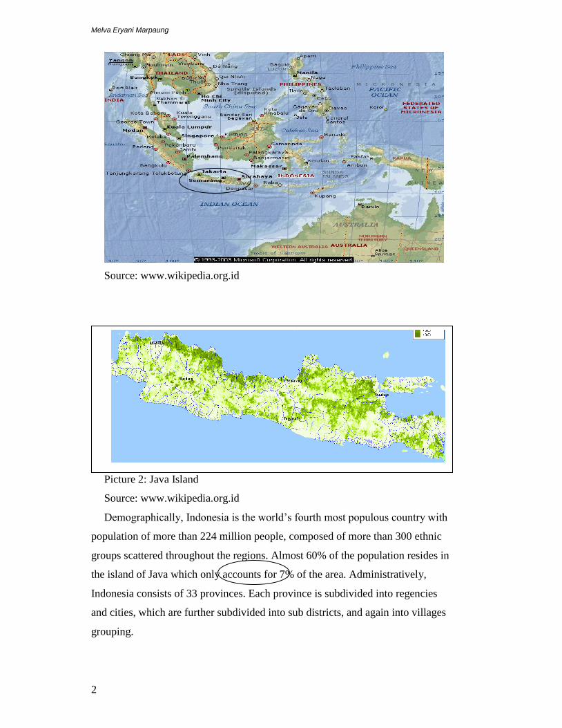
Indonesia is an archipelagic country composes of more than 17,504 islands, which
only around 6,000 are inhabited. The total land area is around 1.9 million square
kilometres. Out of this, only 700 thousands square kilometres (38% of all the
land) is habitable area. The five largest islands are Java, Sumatera, Kalimantan,
Sulawesi and Papua. Jakarta is the capital city of Indonesia located in Java Island.
Picture 1: Indonesia Map
Melva Eryani Marpaung
2
Source: www.wikipedia.org.id
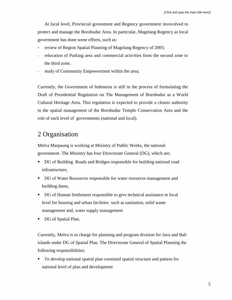
Picture 2: Java Island
Source: www.wikipedia.org.id
Demographically, Indonesia is the world’s fourth most populous country with
population of more than 224 million people, composed of more than 300 ethnic
groups scattered throughout the regions. Almost 60% of the population resides in
the island of Java which only accounts for 7% of the area. Administratively,
Indonesia consists of 33 provinces. Each province is subdivided into regencies
and cities, which are further subdivided into sub districts, and again into villages
grouping.

[Click and type the main title here!]
3
Demography and Health
Indonesian population is the forth biggest country in the world after China, India
and United States. The average density is 134 people per square kilometre (374
per sq mi), and Java is the world most populous island, has a population density
940 people per square kilometre (2435 per sq mi). Almost 60% of the population
resides in the island of Java which only accounts for 7% of the area
The population growth rate was 1.2 % in 2007. By 2025 it is estimated that about
65% of Indonesia’s population or 180 million people will occupy urban areas,
primarily in 16 large and metropolitan cities.
Life expectancy at birth in 2006 was 68 years old. Fertility rate 2.2 total birth
per woman, mortality rate under 5 was 34 per 1000.
Economy
Indonesia’s estimated Gross Domestic Product (GDP) for 2007 is US$ 408
billion; the estimated nominal per capita GDP is US$1,812. The services sector is
the economy’s largest and accounts for 45.3%, this followed by industry (40.7%)
and agriculture (14%). However agriculture employs more people than other
sector, accounting for 45.3% for the 95 million strong workforce.This is followed
by the services sector (36.9%) and industry (18.8%). Major industries include
petroleum and natural gas, textiles, apparel, and mining. Major agricultural
products include palm oil, rice, tea, coffee, spices, and rubber.
1.2 Urban Facts and Figures
Indonesia currently has big problems in conserve and protects the heritage and
conservation areas. Many heritage buildings and conservation areas are destroyed
due to there are no attention to preserve and to conserve.
1.3 Policy
Various attempts to conserve the Borobudur Temple Area and its Cultural
Landscape were introduced in the form of laws and regulations. It is clearly stated
in the Government Regulation No. 26 of 2008 on National Spatial Planning, that
Borobudur Temple Area is stipulated as National Strategic Area which is

Melva Eryani Marpaung
4
prioritized in spatial management due to its important influence in the national
point of view to state sovereignty, defence and state security (since Magelang is
the hub of arial war training zone), economy, society, culture, and/or environment,
including regions established as part of world heritage.
Directorate General of Spatial Planning under Ministry of Public Works has
developed a scenario on spatial planning for the Borobudur Temple Area. The
mission of the spatial planning includes the following:
To conserve the site;
To preserve and control development in the cultural heritage area (temporarily
freeze);
To increase the physical quality/vitality of the area;
To increase the appreciation and involvement of the community in the
activities (economy, social, cultural) in the area.
1.4 Actors and their Roles
Borobudur Temple is stipulated as a national strategic area and thus, is prioritized
in spatial management and development. National and local government have
responsibilities to protect and and manage the Borobudur area.
At national level, Ministry of Public Works (Directorate General of Spatial
Planning) and Ministry of Tourism have main responsibilities to protect the
heritage area and to control the develoment in this area. Directorate General of
Spatial Planning under Ministry of Public Works, as national government has
established attempts to enhance control effort in Borobudur Temple area and its
surrounding which are:
- evaluation of 1979 Master Plan of Borobudur Temple by JICA; and
- arrangement of Conservation Zoning Regulation in Borobudur Temple Area,
the regulation needs to be strengthened to ensure the conservation of the
Borobudur Temple and its setting as well as support the efforts to increase the
welfare of the local community.
[Click and type the main title here!]
5
At local level, Provincial govenment and Regency government invovolved to
protect and manage the Borobudur Area. In particular, Magelang Regency as local
government has done some efforts, such as:
- review of Region Spatial Planning of Magelang Regency of 2005;
- relocation of Parking area and commercial activities from the second zone to
the third zone;
- study of Community Empowerment within the area;
Currently, the Government of Indonesia is still in the process of formulating the
Draft of Presidential Regulation on The Management of Borobudur as a World
Cultural Heritage Area. This regulation is expected to provide a clearer authority
in the spatial management of the Borobudur Temple Conservation Area and the
role of each level of governments (national and local).
2 Organisation
Melva Marpaung is working at Ministry of Public Works, the national
government. The Ministry has four Directorate General (DG), which are;
DG of Building Roads and Bridges responsible for building national road
infrastructure,
DG of Water Resources responsible for water resources management and
building dams,
DG of Human Settlement responsible to give technical assistance to local
level for housing and urban facilities such as sanitation, solid waste
management and, water supply management
DG of Spatial Plan.
Currently, Melva is in charge for planning and program division for Java and Bali
islands under DG of Spatial Plan. The Directorate General of Spatial Planning the
following responsibilities:
To develop national spatial plan consisted spatial structure and pattern for
national level of plan and development
Melva Eryani Marpaung
6
To develop policies and strategies for development of national strategies areas
such as preserved and heritage area, conservation area, metropolitan area, etc at
national concern.
To develop plan and program for infrastructure development
To give technical assistance to local government which are provincial and
district governments to develop their own spatial plans.
3 Urban Problem
The Borobudur area is one of the world cultural heritages, which not only has
economic value but also cultural, social, spiritual, and historical values. It located
10 km from Magelang city, Central Java Province, Java Island.
Borobudur is a major tourist destination area in Magelang Regency. This is
shown by the number of tourist visited the place, about two millions, compared to
the number of tourist that visited other areas in Magelang Regency which only
ranging between six thousands to almost three hundred thousands.
In the Magelang Regency Spatial Plan 2005, Borobudur District, under the
Sub-Region Development II is planned as one of the national tourism
development centres, besides other regency functions, centre of municipal
government, trade, economic activities, and wet-land agriculture. In addition, the
Borobudur area consisted 470.683 inhabitants.

[Click and type the main title here!]
7
As mentioned above, the Borobudur Heritage Area is stipulated as National
Strategic Area which is prioritized in spatial management due to its important
influence in the national point of view to state sovereignty, defence and state
security, economy, society, culture, and/or environment, including regions
established as part of world heritage.
Table 1: Total Population and Density at Borobudur Area, 2005
No Subdistrict Total Population
(inhabitants) Total Area (ha)
Total courtyard (ha)
Density Bruto (inh/ha)
Density Nett (nib/ha)
Distribution (%)
1 Salaman 66.826 6.887 1.775 9 37 5,68
2 Borobudur 54.628 5.455 1.491 10 10 4,68
3 Ngluwar 28.966 2.244 585 12 49 2,49
4 Salaman 43.631 3.163 742 13 13 3,73
5 Muntilan 72.047 2.861 820 25 87 6,22
6 Mungkid 65.605 3.742 1.026 17 17 5,62
7 Mertoyudan 93.699 4.535 1.327 20 70 8,09
8 Tempuran 45.281 4.904 911 9 9 3,86
Total 470.683 33.791 3063.619 115 292
Source : Magelang Statistics, 2005

Melva Eryani Marpaung
8
Picture 3: Borobudur Heritage area and surrounding
Source: Draft Report, the Conservation Zoning Regulation of Borobudur Temple Area,
Ministry of Public Works, Jakarta, 2007.
Issues and Problems
There are several conservation and management issues in the preservation of
Borobudur heritage area, which are:
1. Development pressure is one of the present and future challenges that have
to be faced in the preservation of Borobudur World Heritage. The
surroundings of the temple have experienced rapid development and have
changed the setting from rural landscape into urban area. The uncontrolled
development has caused an environmental degradation that threats the
preservation of the temple.
2. The environmental degradation in Borobudur surroundings has led to
another consequence which is an announcement from UNESCO to remove
Borobudur from World Heritage List. This situation cannot be separated
from the involvement of Borobudur Tourism Park Company (PT.Taman
Wisata) since so many local people run their economic activities in the

[Click and type the main title here!]
9
park followed by housing growth which are considered coming closer to
the site. The propensity of the development generates increased urban area
within. Another issue is the proposed commercial street, as it would result
in enlargement of proportion of land and particularly commercialization
around the temple. In the absence of clear policies and regulations for the
development in the surroundings area has caused the emergence of
development pressure, for example the presence of communication tower
and industrial buildings nearby, the coming closer settlement to the
monument and the existence of commercial activities. These urban
behaviours remain a threat to the integrity of the landscape surrounding
the World Cultural Heritage.
3. Moreover, the development pressure has caused significant land-use
changes within the surrounding areas. It also generates commercialization
endeavours around the temple, particularly since Borobudur Temple was
acknowledged as World Culture Heritage in 1991 (Winarni, 2006). The
table below illustrates the changes:
Table 2: Land-Use Changes in Years
Land-Use Changes Period
Changes of use from paddy field to settlements 1860 – present
Changes of use from paddy field to settlements and parks 1983 – present
Changes of use from paddy filed to commercials and services 1979 – present
Buildings : changes from traditional architecture to modern building 1970s – present
Accesibility : the development of a by – pass road 1979 – present
changes from open space to buildings managed by PT. Taman
Wisata (museum, hotel, office, etc.).
1973 – present
Open space changes to hotel, homestay, kiosk, art shop, terminal,
housing, street, market, vihara
1860 – present
Source : Winarni, 2006

Melva Eryani Marpaung
10
Picture 4: Pressure of Urban Activities at surrounding area.
Source: Draft Report, The Conservation Zoning Regulation of Borobudur Temple Area,
Ministry of Public Works, Jakarta, 2007.
Based on the issues and problems explained above, some questions arised to be
considered on developing solutions in concrete strategies and action plans, which
are:
1. How can comprehensive strategic plan protect cultural heritage area from
urban pressure?
2. How can local government develop economic activities and in order to
increase the physical quality and vitality of the cultural heritage area?
3. How to increase the appreciation and involvement of the local community in
the economical, social, and cultural activities related to cultural heritage area?
4 Proposal for Change and Improvement
Action Plans have to establish to enhance protection and controlled development
efforts in Borobudur Temple based on those below recommendations:
1. Developing Comprehensive strategic plan is a tool that can protect cultural
heritage area from urban pressure if there is strong government initiative.
2. Developing economic activities and in order to increase the physical quality
and vitality of the cultural heritage area if there is an integration of
conservation effort.
3. The appreciation and involvement of the local community can be increased in
the economical, social, and cultural activities related to the heritage area if
there is an effort concerning the integration of local community together with
the heritage area.

[Click and type the main title here!]
11
The Action Plans should be taken to address the above recommendations:
1. The formulation of the Comprehensive Strategic Plan of Borobudur Heritage
and Conservation Area is based on the following considerations:
Conservation aspect;
Integration Urban and Rural aspect;
Tourism and local economic aspect;
Social aspect;
Infrastructure development;
Management aspect;
The plan should be developed together with National and Local Governments
and committed to be implemented with other sectors related at national and
local level.
2. The Comprehensive Strategic Plan should consist such as consistent
Development Control Plan, enforcing regulations, active, ongoing involvement of
institutions. The Development Control Plan of the area is formulated by the
means of conservation code apart with zoning regulation. This classification
conservation grouped based on the character below:
a. Zone P1 is a zone with the main action to preserve everything without any
changes for development. This zone is restricted and protection area for
Borobudur, Pawon and Mendut temples and its protection area, river and
paddy fields (ex ancient lake).
b. Zone P2 is a zone with very restricted development that not interfere the
temples and surroundings ecosystem with the main land use is for open
space. The kind of development arranged with the urban design concept.
This zone is characterized for Borobudur Temple Cultural Park.
c. Zone P3 is a restricted development zone with restricted changes that not
interfere the temples and surroundings ecosystem. The physical
development arranged with the area design concept that toward to a
delicate variation in rural tone. This zone is specified by rural settlements.
d. Zone P4 is special development zone for commercial, cultural and social
function. The physical development arranged with the area design concept
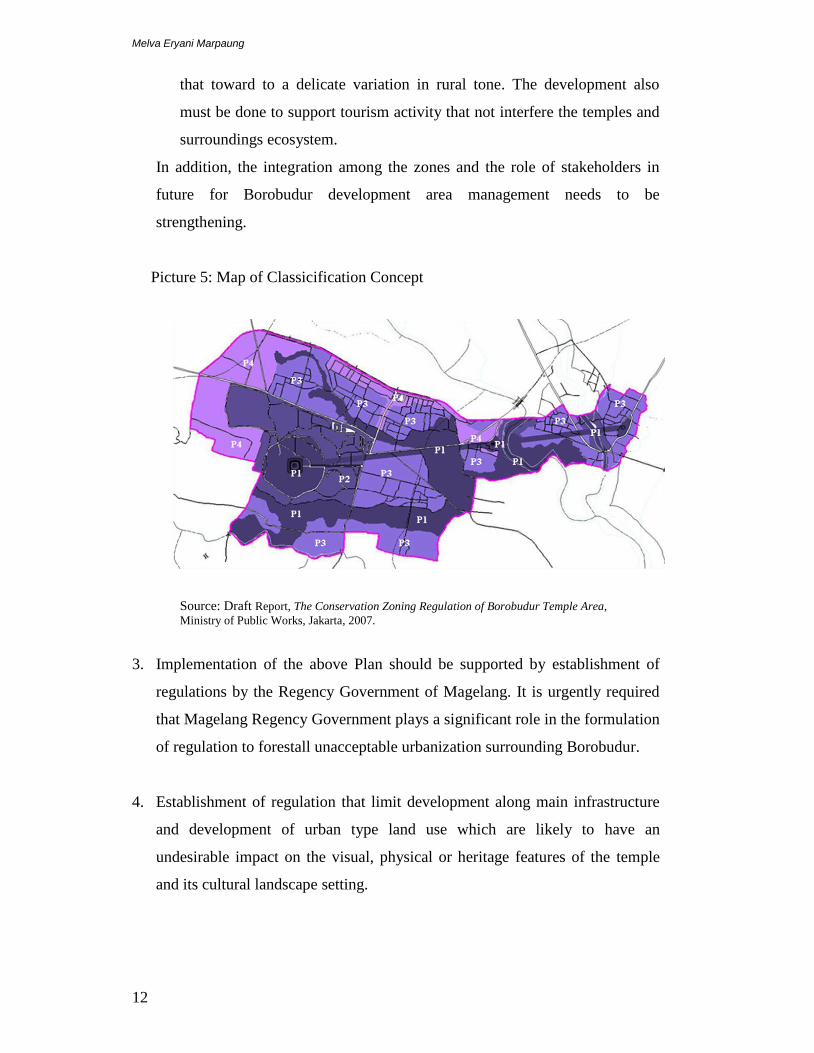
Melva Eryani Marpaung
12
that toward to a delicate variation in rural tone. The development also
must be done to support tourism activity that not interfere the temples and
surroundings ecosystem.
In addition, the integration among the zones and the role of stakeholders in
future for Borobudur development area management needs to be
strengthening.
Picture 5: Map of Classicification Concept
Source: Draft Report, The Conservation Zoning Regulation of Borobudur Temple Area,
Ministry of Public Works, Jakarta, 2007.
3. Implementation of the above Plan should be supported by establishment of
regulations by the Regency Government of Magelang. It is urgently required
that Magelang Regency Government plays a significant role in the formulation
of regulation to forestall unacceptable urbanization surrounding Borobudur.
4. Establishment of regulation that limit development along main infrastructure
and development of urban type land use which are likely to have an
undesirable impact on the visual, physical or heritage features of the temple
and its cultural landscape setting.

[Click and type the main title here!]
13
5. Establishment an institution consisted national, provincial and regency
government, private sectors, community groups to develop concrete roles of
each stakeholders to work together in the implementation of the Plan.
6. Also establishment informal partnership decrease conflicts and different
concern amongst the community. Also the partnership is to develop economic
and social activities which are suitable to community and to the character of
the Borobudur heritage area.
References
1. Executive Summary, Borobudur Prambanan, JICA, 1979.
2. Magelang Regency in Numbers, Indonesian Statistic Centre, Jakarta, 2005.
3. Magelang Regency Spatial Plan, Planning Book, Bappeda Magelang, 2006.
4. ‘Mission Report: Reactive Monitoring Mission to Borobudur Temple
Compounds, 2007.
5. Final Report, The Conservation Zoning Regulation of Borobudur Temple
Area, Ministry of Public Works, Jakarta, 2007.
6. Gurung, Himalchuli, Shifting Paradigm on World Heritage Site Conservation:
The Archaeology Site of Borobudur Temple, Proceeding of Re-Thinking
Borobudur, Ministry of Public Works, Jakarta, 2008.
7. Wasthony, Chairil, The Perspective of Magelang Regency Government in
Development of Borobudur Cultural Heritage Tourism Area, Proceeding of
Re-Thinking Borobudur, Ministry of Public Works, Jakarta, 2008.
8. Adhisakti, Laretna T, The Concept of Architecture Design for Borobudur
Heritage Area, Proceeding of Re-Thinking Borobudur, Ministry of Public
Works, Jakarta, 2008.
9. www.wikipedia.org.id