the city of curitiba: planning for sustainability - an...
TRANSCRIPT
World Bank
April 2009
Institute for Research and Urban Planning of CuritibaInstitute for Research and Urban Planning of CuritibaCléver Ubiratan Teixeira de Almeida
President
The City of Curitiba:The City of Curitiba:Planning for Sustainability Planning for Sustainability --
an Approach all Cities can Affordan Approach all Cities can Afford
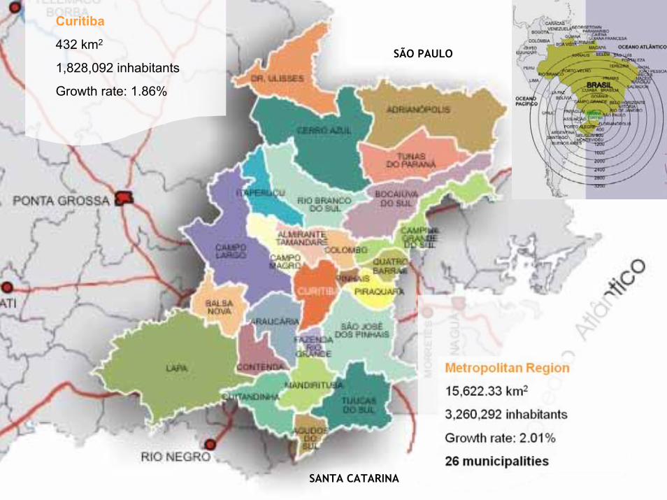
Curitiba
432 km2
1,828,092 inhabitants
Growth rate: 1.86%
SÃO PAULO
SANTA CATARINA

Evolution of Urban Growth
ANO POPULAÇÃO
2008 3.260.000
1985 1.560.000
1975 940.000
1965 455.000
1955 350.000
2014 4.000.000
PLANNING PROCESS
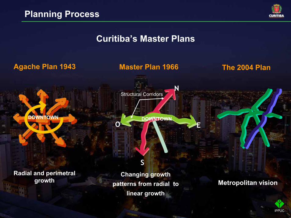
Agache Plan 1943
Radial and perimetral growth
DOWNTOWN
Master Plan 1966
Curitiba’s Master Plans
The 2004 Plan
N
S
O EDOWNTOWN
Structural Corridors
Metropolitan visionChanging growth
patterns from radial to linear growth
Planning Process

I – Mobility and public transport;
II – Social housing;III – Economic Development;IV – Social Development;V – Public Safety;VI – Environmental Management and Sustainable Development.
Sectorial Plans
Methodology
• Diagnosis and evaluation and discussion with the community
• Proposals to be discussed with the community
Planning Process
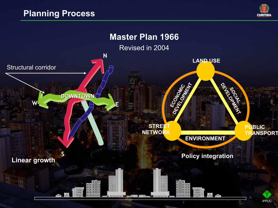
Master Plan 1966Revised in 2004
N
S
W E
Linear growth
DOWNTOWNDOWNTOWN
Structural corridorLAND USE
STREET NETWORK
SOCIAL
DEVELOPMENT
ECON
OMIC
DEVE
LOPM
ENT
ENVIRONMENT
PUBLIC TRANSPORT
Policy integration
Planning Process

Street NetworkStreet Network Public TransportPublic TransportLand UseLand Use
Planning Process

MOBILITY ANDPUBLIC TRANSPORT
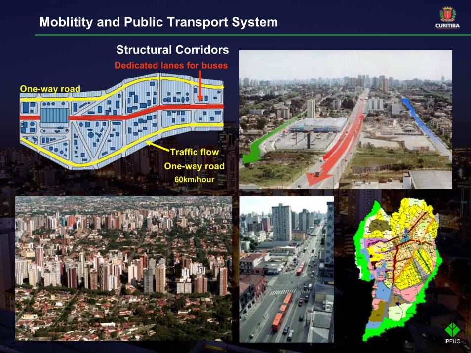
Structural Corridors
One-way road
Dedicated lanes for buses
Traffic flowOne-way road
60km/hour
Moblitity and Public Transport System
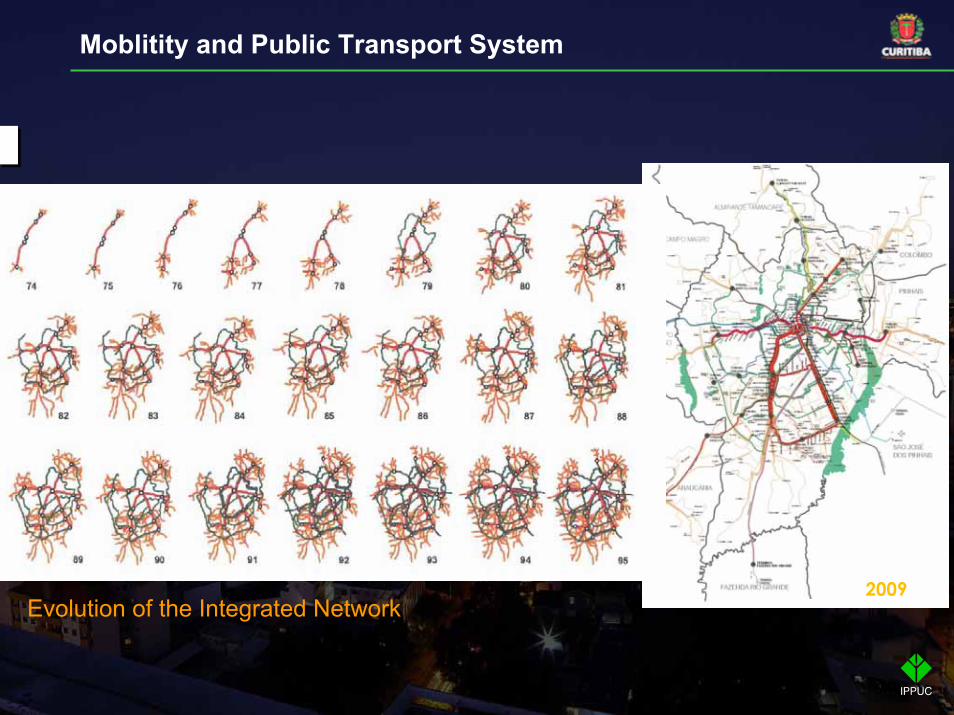
2009Evolution of the Integrated Network
Moblitity and Public Transport System
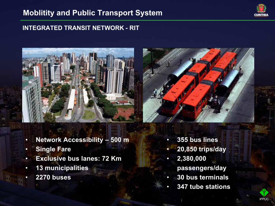
• Network Accessibility – 500 m• Single Fare• Exclusive bus lanes: 72 Km• 13 municipalities• 2270 buses
INTEGRATED TRANSIT NETWORK - RIT
Moblitity and Public Transport System
• 355 bus lines• 20,850 trips/day• 2,380,000
passengers/day• 30 bus terminals• 347 tube stations

BUS TYPES
Moblitity and Public Transport System
INTER-NEIGHBOURHOODS LINE FEEDER LINE CONVENTIONAL LINE
INTER-HOSPITALS LINE DOWNTOWN CIRCULAR LINE SPECIAL EDUCATION LINE
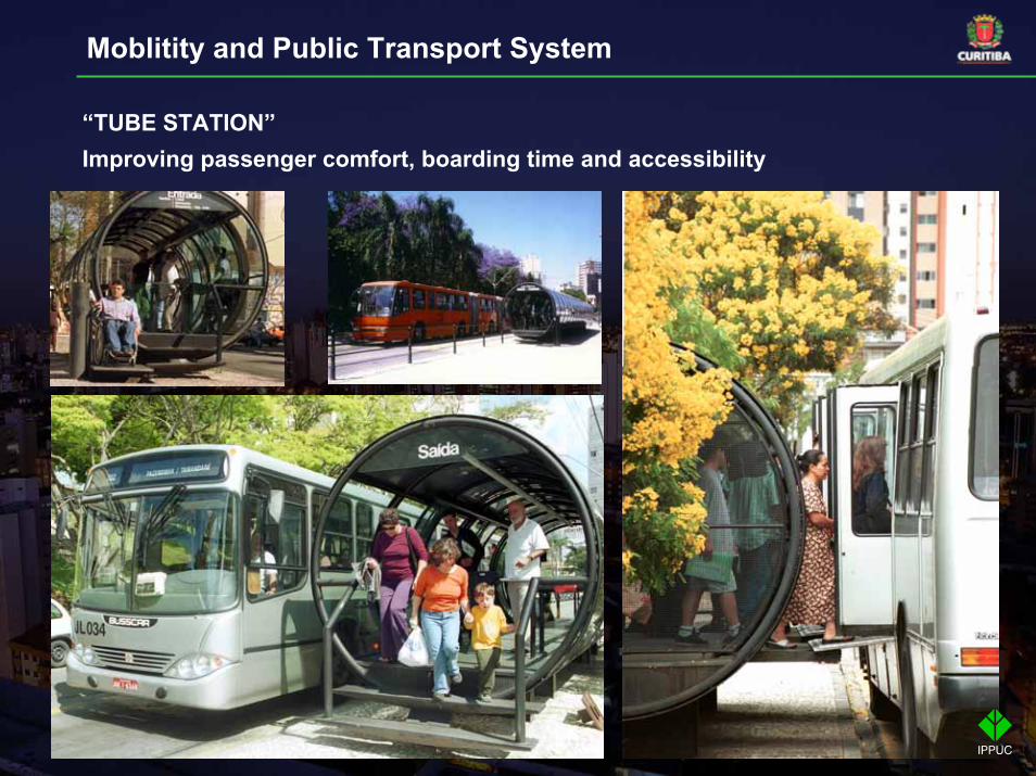
“TUBE STATION”Improving passenger comfort, boarding time and accessibility
Moblitity and Public Transport System
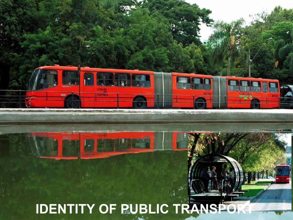
IDENTITY OF PUBLIC TRANSPORT
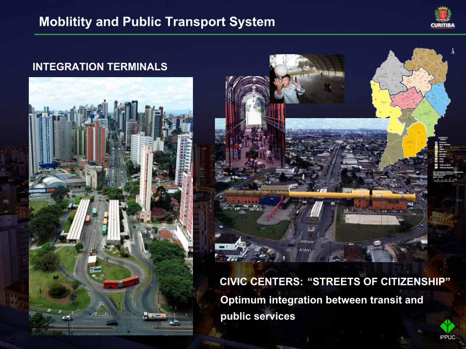
INTEGRATION TERMINALS
Optimum integration between transit and public services
CIVIC CENTERS: “STREETS OF CITIZENSHIP”
Moblitity and Public Transport System
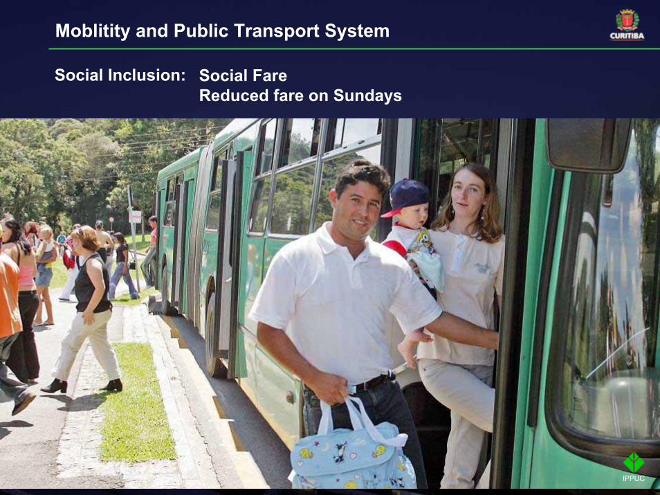
Social FareReduced fare on Sundays
Social Inclusion:
Moblitity and Public Transport System
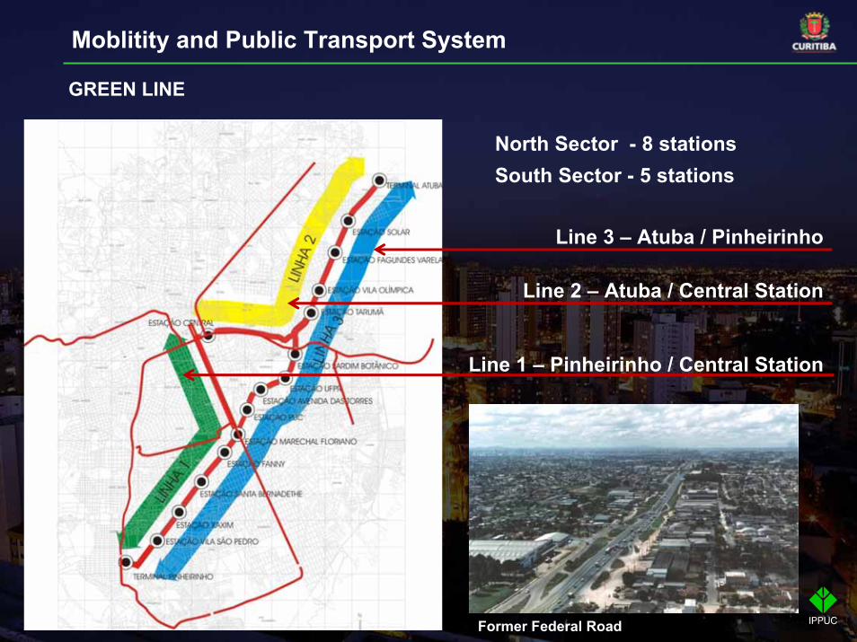
North Sector - 8 stationsSouth Sector - 5 stations
Line 2 – Atuba / Central Station
Line 3 – Atuba / Pinheirinho
Line 1 – Pinheirinho / Central Station
Former Federal Road
GREEN LINE
Moblitity and Public Transport System

Total length: 18km23 districts affected(287,000 people)
GREEN LINE
Moblitity and Public Transport System

Staggering tube stations and creating a new lane at specific pointsallowing the buses to take over
Moblitity and Public Transport System
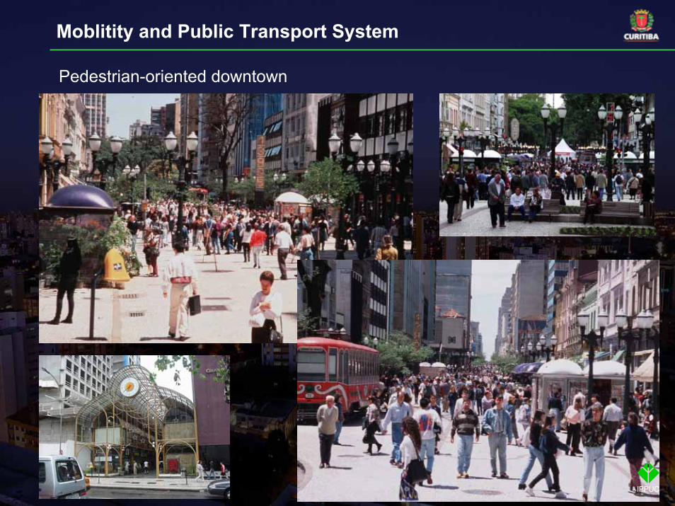
Pedestrian-oriented downtown
Moblitity and Public Transport System
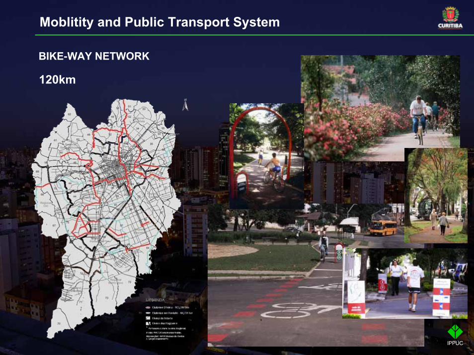
BIKE-WAY NETWORK
120km
Moblitity and Public Transport System
HERITAGE PRESERVATION
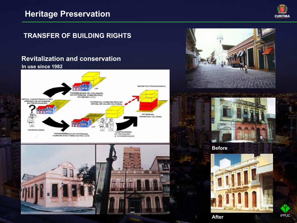
TRANSFER OF BUILDING RIGHTS
In use since 1982
Before
After
Revitalization and conservation
Heritage Preservation
ENVIRONMENTAL PRESERVATION
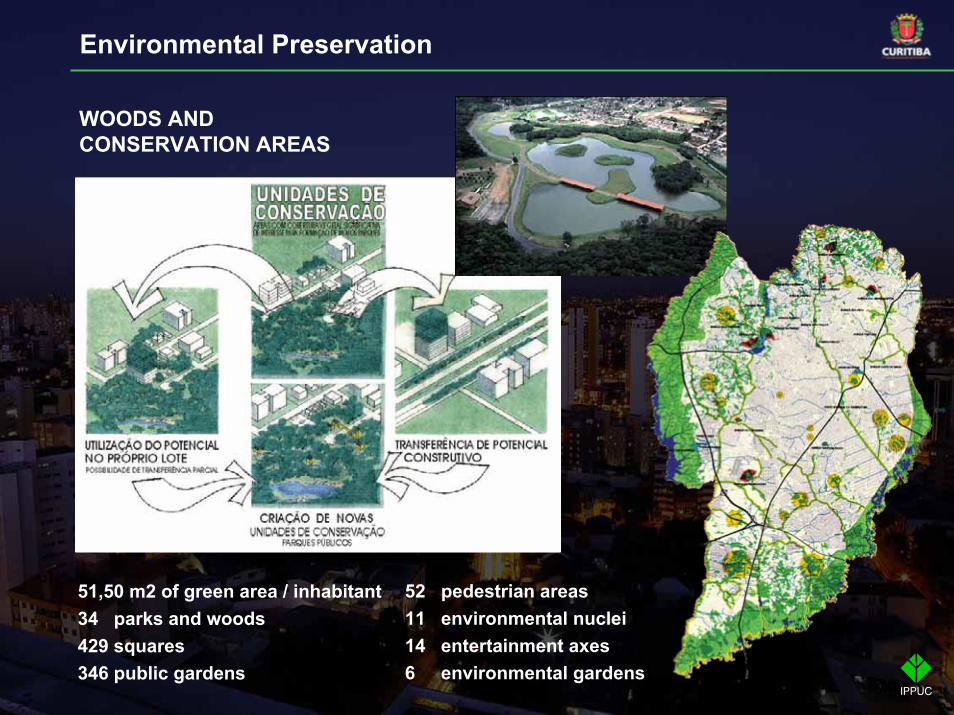
WOODS AND CONSERVATION AREAS
51,50 m2 of green area / inhabitant34 parks and woods429 squares346 public gardens
52 pedestrian areas11 environmental nuclei14 entertainment axes6 environmental gardens
Environmental Preservation
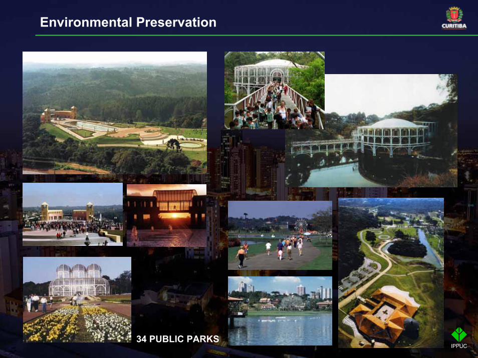
34 PUBLIC PARKS
Environmental Preservation
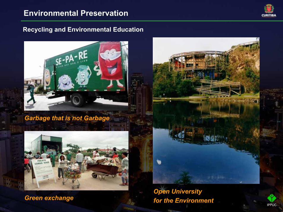
Recycling and Environmental Education
Garbage that is not Garbage
Green exchangeOpen University for the Environment
Environmental Preservation
SOCIAL HOUSING
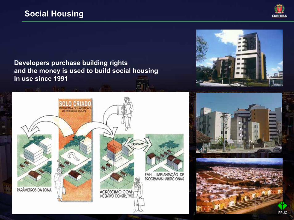
Developers purchase building rights and the money is used to build social housingIn use since 1991
Social Housing
SOCIOECONOMICDEVELOPMENT
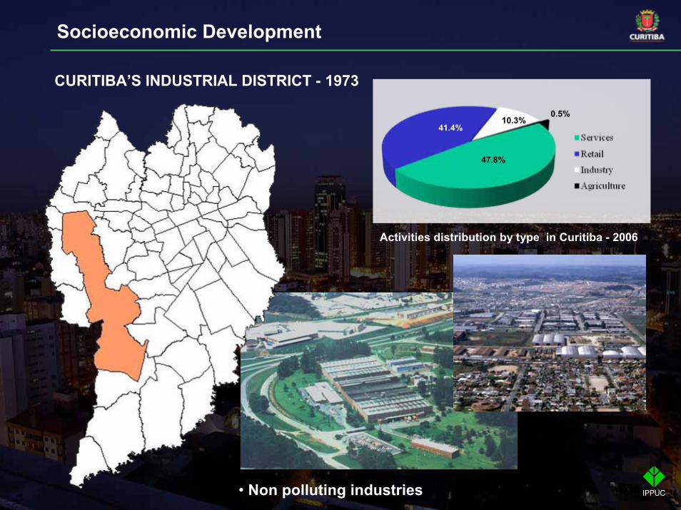
CURITIBA’S INDUSTRIAL DISTRICT - 1973
• Non polluting industries
0.5%
47.8%
41.4%10.3%
Activities distribution by type in Curitiba - 2006
Socioeconomic Development
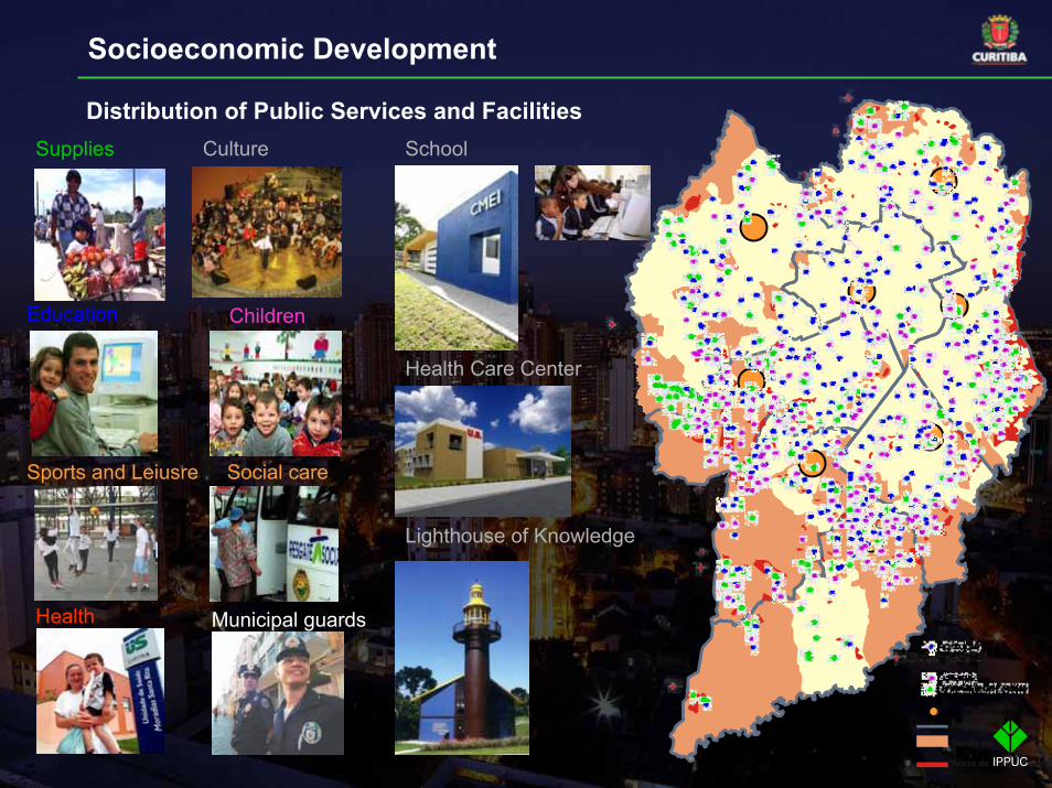
Municipal guards
Sports and Leiusre Social care
Distribution of Public Services and Facilities
Health
Supplies Culture
Education Children
Regionais
Renda até 3 SM
Áreas de Ocupação Irreg
RUA DA CIDADANIA
School
Health Care Center
Lighthouse of Knowledge
Socioeconomic Development
PLANS 2009 - 2012
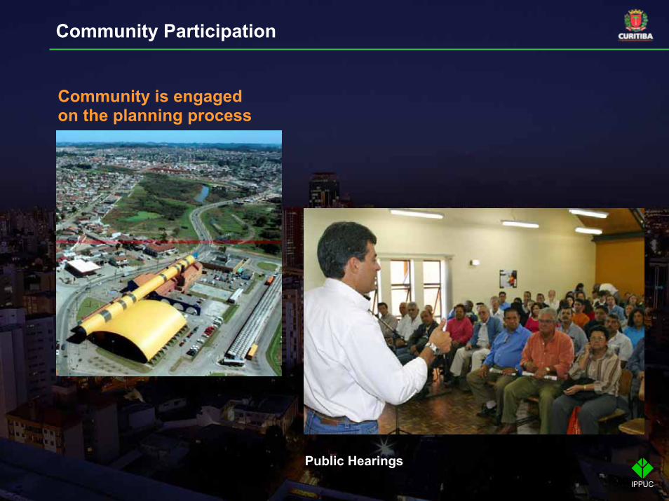
Community is engaged on the planning process
Public Hearings
Community Participation
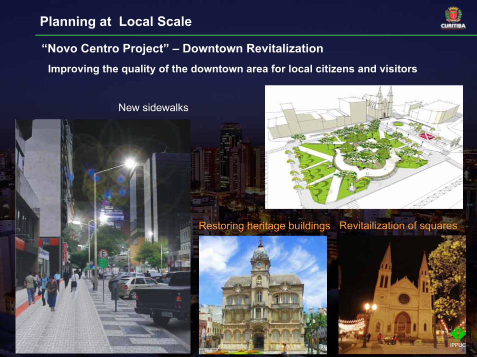
New sidewalks
Restoring heritage buildings Revitailization of squares
“Novo Centro Project” – Downtown RevitalizationImproving the quality of the downtown area for local citizens and visitors
Planning at Local Scale
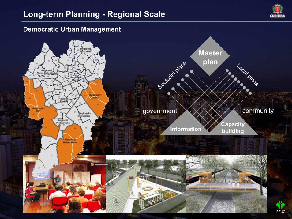
Long-term Planning - Regional Scale
Democratic Urban Management
government community
Sector
ial pl
ans Local plans
Master plan
InformationCapacity building

Negative growth< CuritibaCuritiba> Curitiba
TUNAS DO PARANÁ
ADRIANÓP OLIS
CAMPO LARGO
P INHAISQUATRO BARRAS
RIO BRANCO DO S UL
ALM IRANTETAM ANDARÉ
CAM POM AGRO
ITAPE RUÇU
CAM P INA GRANDE DO S UL
BOCAIÚVA DO SUL
COLOM BO
BALSANOVA
M ANDIRITUBA
QUITANDINHA
CONTENDA
ARAUCÁRIA
TIJUCAS DO S UL
AGUDOS DO S UL
S ÃO JOSÉ DOS P INHAIS
P IRAQUARA
CERRO AZUL
CURIT IBA
FAZE NDA RIO
GRANDE
DR. ULIS SE S
LAPA
Water and sewage systemsWasteHealth
Capacity building at the reginal levelIntermunicipal partnerships
Planning for Metropolitan Region
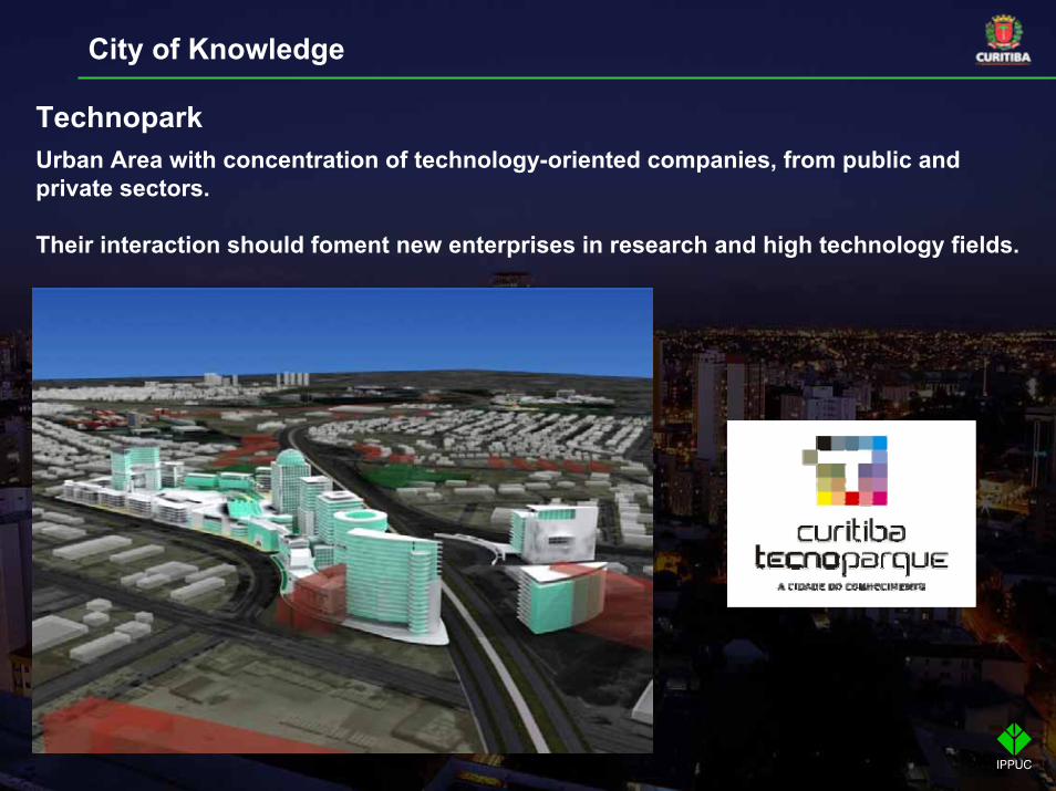
City of Knowledge
TechnoparkUrban Area with concentration of technology-oriented companies, from public and private sectors.
Their interaction should foment new enterprises in research and high technology fields.
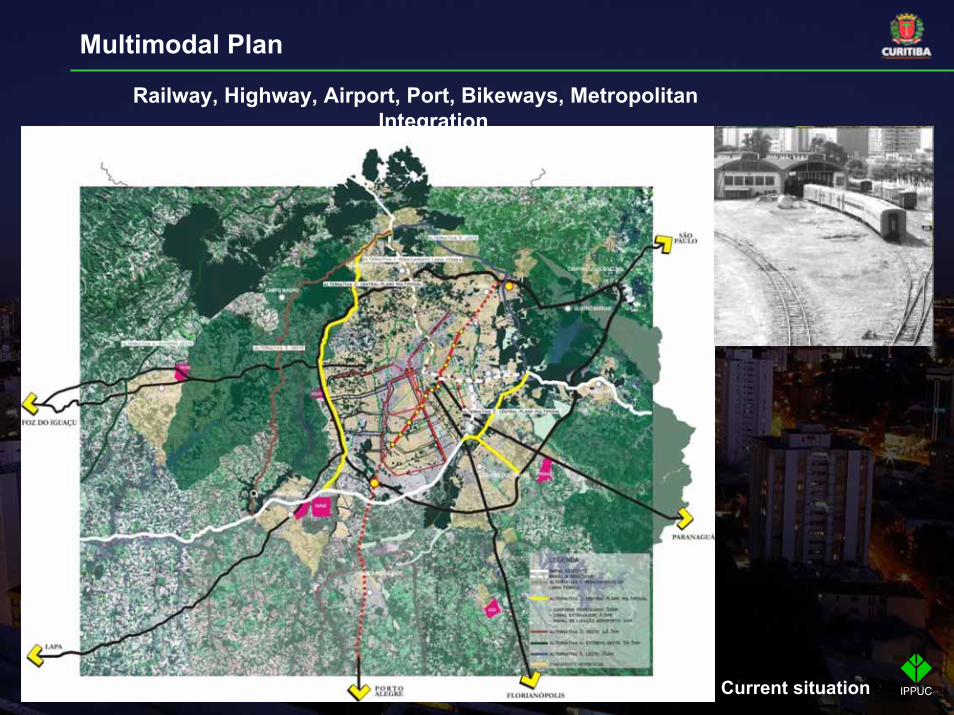
Railway, Highway, Airport, Port, Bikeways, Metropolitan Integration
Current situation
Multimodal Plan
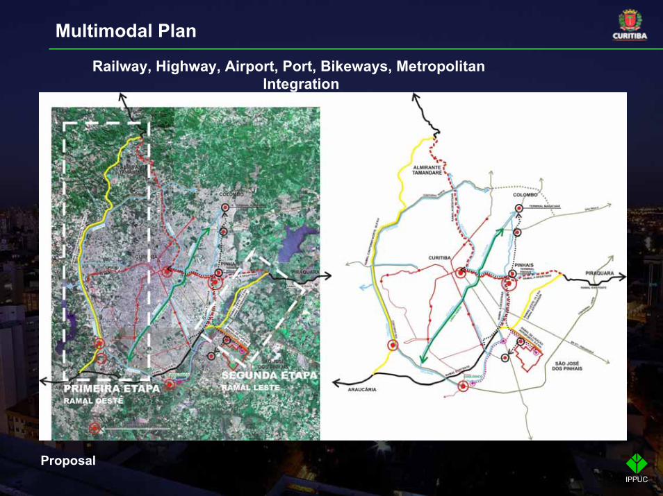
Proposal
Railway, Highway, Airport, Port, Bikeways, Metropolitan Integration
Multimodal Plan
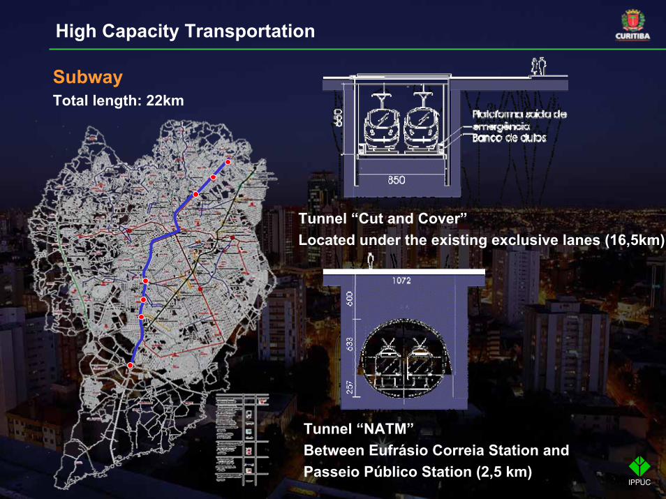
SubwayTotal length: 22km
Tunnel “Cut and Cover”Located under the existing exclusive lanes (16,5km)
Tunnel “NATM”Between Eufrásio Correia Station and Passeio Público Station (2,5 km)
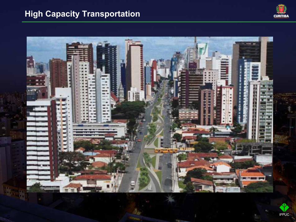
High Capacity Transportation
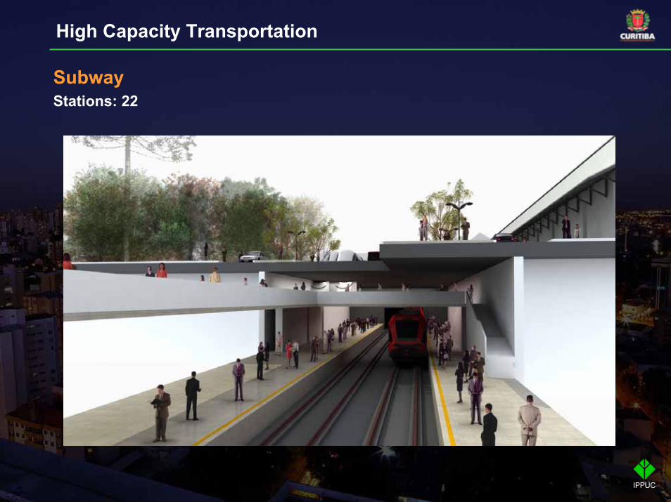
High Capacity Transportation
SubwayStations: 22
High Capacity Transportation
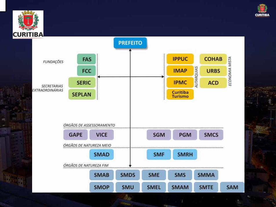
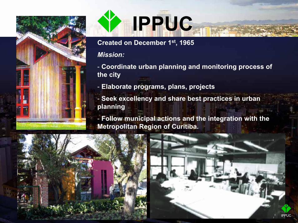
IPPUCCreated on December 1st, 1965
Mission:
- Coordinate urban planning and monitoring process of the city
- Elaborate programs, plans, projects
- Seek excellency and share best practices in urban planning
- Follow municipal actions and the integration with the Metropolitan Region of Curitiba.
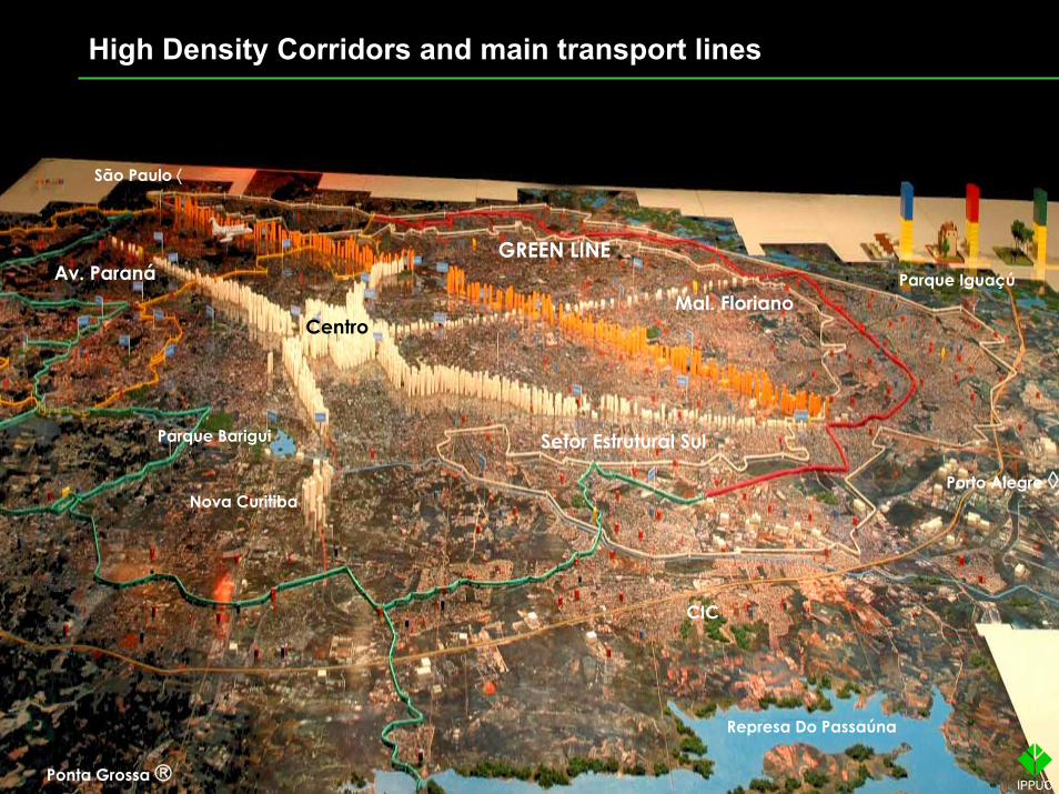
Setor Estrutural Sul
Nova Curitiba
Av. Paraná
Represa Do Passaúna
CentroMal. Floriano
Parque IguaçúGREEN LINE
Porto Alegre ◊
Ponta Grossa ®
CIC
Parque Barigui
São Paulo ⟨
High Density Corridors and main transport lines