the creation and survival of some scots royal … · web viewin 1518 the queen briefly repossessed,...
TRANSCRIPT

JOHN HARRISON, HISTORICAL SERVICES
The Creation and Survival of Some Scots
Royal LandscapesEdinburgh Castle, Holyroodhouse,
Linlithgow, Falkland & Stirling (v. 2)
© John G Harrison
October 2016
This paper brings together evidence, much of it new, about the landscapes of the main Scots royal residences of the sixteenth century. It relates landscape change to change within the residences and to changing fashions in sports and entertainment and shows that not all were deer parks. Indeed, the parks were multifunctional, fulfilling needs as diverse as pasture for the stable and meat for the table. Survival has largely depended on public access; the importance of the fairly intact landscapes at Stirling is emphasised. This latest 'edition' incorporates some new work, by myself and others, since 2012.

Contents
Introduction 2
Edinburgh Castle 4
Holyroodhouse and Park 6
Linlithgow Peel and Park 11
Falkland 17
Stirling 25
King’s Knot and Haining 41
Discussion 51
Acknowledgements 62
Bibliography 63
1

Introduction
This paper presents case studies of the royal lands in the vicinity of Edinburgh Castle,
Holyroodhouse, Linlithgow Palace and Falkland Palace with a more extended study
of those at Stirling. It draws mainly on documentary evidence, though recent survey
work at Stirling is discussed. It tries to ascertain the former extent and disposition of
the lands, their core functions from time to time and aspects of their destruction or
survival. The focus is more on entire landscapes and their relationship to the residence
than on individual features (archaeological, upstanding etc) within them. Whilst it
presents detailed new information about each of the landscapes it also emphasises
comparison (national and international) as the vital key to identifying the unique and
the universal features. Such comparison is also essential to making rational decisions
about management, protection or development.
The most commonly documented historical functions of the landscapes are pasture
and hay for horses with deer absent at some sites and a minor concern at others. But
prestige, display and aesthetic considerations were also important, as they were in
analogous situations elsewhere in Britain and Europe. Edinburgh Castle’s modest
meadow-lands were disposed of in the early sixteenth century and probably cannot
now be identified with certainty. At Linlithgow, the Peel survives to the south of the
loch whilst the park (to the north) is now an improved agricultural landscape as is the
former park at Falkland. At Holyrood and Stirling major elements of the former
landscapes survive and their sixteenth century state can be appreciated; indeed, at
Stirling even the earlier landscapes have left their print on the modern town. Survival
has been linked to rights of public access as well as a realisation of the ‘heritage’
value - though recent developments prove that none are safe from vandals with
bulldozers and good intentions.
The five sites considered were the favoured Scots royal residences of the sixteenth
century. James V had around 30 residences though Holyrood, Stirling, Linlithgow and
Falkland accounted for some 66% of the recorded time during his adult reign
(Thomas, 2005, App. B, 244). Edinburgh Castle, dismissed as draughty and
uncomfortable by Bishop Lesley, was mainly valued for security, as when Mary
Queen of Scots chose it for the birth of her child, weeks after her secretary had been
murdered by a group including her husband [Figure 1].
2

Figure 1; Edinburgh Castle and the inhospitable slopes of the castle rock, a less than ideal
residence (photo JGH).
Edinburgh and Stirling are confirmed as royal residences from the twelfth century
when Edinburgh, Stirling and Linlithgow are all recorded as castles associated with
sheriffdoms (Duncan, 1978, 162). Stirling and Edinburgh were in fairly regular use in
all reigns and Linlithgow, though at times less favoured, was probably always
available. Falkland, on the other hand, had been the caput of the earldom of Fife
before being forfeited to the crown in 1425 and adopted as a royal residence from
1459. It is a measure of the scale of change required that a town was created at
Falkland to ease the supply and accommodation problems presented by regular royal
use (Brown, 1994, 73, 113; ER Vol. VI lxxviii-lxxix; ER Vol. XI 428; RMS Vol. II,
706-728). At Holyrood, as with other major monastic houses, there had probably
always been some accommodation available for occasional royal use. A king’s
chamber is mentioned in 1472 and a queen’s chamber in 1473 though it was only in
1503, on the marriage of James IV and Margaret Tudor, that building of a palace
began (Dunbar, 1999; Fawcett, 1994; TA 1 46; NAS GD112/58/200/1;
GD220/2/1/63). James had secured the revenues before that time. The creation of a
purpose-built royal palace coincided with preparations for his marriage to Margaret
Tudor in 1503 (Macdougall, 1989, 155; Dunbar, 1999, 56-8). Holyrood was, thus, the
last of the suite to be acquired and the story of its landscapes is radically different
from the others. 3

Recent scholarly study of castles has tended to emphasise their role as noble
residences and to downplay their purely military role (Coulson, 2003; Creighton,
2005; Liddiard, 2007). Creighton (2012, p. 85) notes that early excavations of
medieval castles concentrated on the defences, turning to the interior and social
aspects only after the 1950s and 1960s; it was even later when investigations turned to
the wider context of landscape. Much the same might be said for historical studies and
for later periods. In Scotland, Tabraham (1997), Dunbar (1999) and Howard (1999)
all emphasise residence and amenity over defence and control though there has so far
been little work on the landscapes (but see Gilbert, 1979; Harrison, 2007; Dennison
and Colman, c. 2000; Márkus, 2010; Wickham-Jones, 1996; Dingwall, 2007). There
is no contradiction in saying that Edinburgh and Stirling were also recognised
strongholds and both were modernised with artillery defences, perhaps even from the
mid fifteenth century. In Stirling, particularly, the potential for artillery defence
influenced a major re-organisation of the surrounding landscape about 1506, to be
discussed below. The castle built by Edward I at Linlithgow evidently made some
show of defensibility and so might the pre-royal castle at Falkland. But Falkland and
Linlithgow’s defensive potential must have all-but vanished with the advent of
artillery. The architect made no serious attempt to remedy of the obvious weakness of
the site of Holyrood (Fawcett, 1994; Dunbar, 1999).
Edinburgh Castle
The site of Edinburgh Castle has been occupied since the Bronze Age and has been an
elite residence since before the emergence of Scotland itself (Driscoll et al.1997).
The situation of Edinburgh and Stirling invite comparison with English royal castles
of the twelfth and early thirteenth centuries which were often approached through an
associated town (Liddiard, 2007, 18-22). Revenues of lands in Lothian were applied
to its maintenance during the English occupation of the early fourteenth century but
the later convention was to finance much building and repair work from the great
customs of the burgh. That is in contrast to Stirling, Linlithgow and Falkland which
had extensive lands dedicated to their upkeep, albeit these were far from sufficient for
the most lavish developments. Although Coulson writes of the ‘umbilical link’ which
usually exists between castle and terrain (2003, 56) Creighton, considering mainly
post-Conquest English castles, suggests that royal castles had relatively less extensive
4

economic lands than others (2005, 91). Of course, monarchs had other sources of
revenue.
Gardens outside Edinburgh Castle are on record in the 1140s and these might have
been in the vicinity of the Grassmarket, towards modern Shandwick Place and Bread
Street, perhaps extending even as far as Tolcross. Though it is vegetables and an
orchard which feature in the records, this need not preclude a 'leisure and pleasure'
aspect (Brown, 2012); there were barras [sports facilities] adjacent to the King’s
Stables. During the English occupation of 1335, however, the rents of these gardens
were not being collected though the gardens are again on record in 1363. Thereafter
the gardens may have been less extensive. A garden within the castle is recorded in
1435 and onions from the garden are mentioned in 1493 and 1494 (Brown, 2012;
Innes 1840; RMS I, App 2, 578, no 985; ER 4, 623; ER 10, 589).
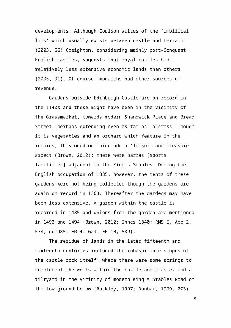
The residue of lands in the later fifteenth and sixteenth centuries included the
inhospitable slopes of the castle rock itself, where there were some springs to
supplement the wells within the castle and stables and a tiltyard in the vicinity of
modern King’s Stables Road on the low ground below (Ruckley, 1997; Dunbar, 1999,
203). But the sporting facilities were not ideal. Events were sometimes held
elsewhere. In 1456, as war with England threatened, land at Greenside, near Calton
Hill was allocated for ‘practicing tournaments and games of war’, the surprise being
that no location had been permanently designated earlier (ER I clxiv, 238; Stevenson,
2006, 20).
The “King’s Meadow” supplied hay for the horses from the fourteenth century
(ER II, 289; ER III, 53, 118; ER V, 309). But from 1516 the meadow was leased to
Walter Chepman, (better known as Scotland’s first printer) with power to plough
where it was dry enough; it was later feued to Chepman without any requirement to
supply hay. The meadow was probably superfluous once the Crown had full control
of Holyrood and its meadows (discussed below). The sources place the meadow
variously at Liberton or beside the Figgate Burn whilst in 1578 John Huchesoun was
described as the heritor of the King’s Meadow, lying at the Lady Bridgend, beside
Pepper Mylne (modern Peffer Mill), in the barony of Craigmillar (ER XIV, cxii, 217,
220, 488; RMS III 407; RMS IV 1424; NAS RD1/26 f. 284; RPC III, 716). The exact
location probably cannot now be recovered but it was certainly south of Holyrood
Park, several kilometres from Edinburgh Castle.
5

Holyroodhouse and Park
Work on the pre-existing gardens in the immediate vicinity of Holyrood probably
proceeded even as the abbey was being converted into a major royal residence in the
early sixteenth century. The site was at the tail of the long slope of the castle rock and
considerable drainage work was required (Jamieson, 1994). Figure 2 shows the
generally level site, well-adapted to gardens. The striking contrast to the situation of
Edinburgh Castle, at the top end of the slope, was to be reflected in the settled comfort
and modernity of the residence, a metaphor surely not lost on the political class of the
time.
Figure 2 Holyroodhouse, on level ground from the steep slopes of the nearby park (photo JGH).
The adjacent lands of Arthur’s Seat and Salisbury Crags had been part of more
extensive economic estates belonging to Holyrood and Kelso Abbeys. These assets
had come into royal control somewhat earlier, as James IV had appointed his son as
commendator of both abbeys. However, that was not necessarily accompanied by any
change of use from the mix of arable and pasture of the late medieval period
(Wickham-Jones, 1996, 27; RCAHMS, 1999). In 1540 James V enclosed Salisbury
Crags and Arthur’s Seat, taking in some additional land close to Duddingston Loch.
The area is then referred to as a Park. However, if this is seen in the long tradition of
encouraging enclosure of ‘parks’ near noble residences, it need not imply any
intention to stock it with deer or to use it for hunting. New documentary evidence
shows that that was certainly not the outcome (RPS A1504/3/119: 1458/3/28;
1535/16, all accessed June 2010]. [Figure 3]
6

Figure 3. Holyrood Park (courtesy Historic Scotland)
In November 1540, the king appointed one of his favoured courtiers, John
Tennant, as keeper of the park (ADC, 540; RMS III, entry 2216; TA VII, 429; TA
VIII, 55). By the time of the king’s death, two years later, the revenue from the
king’s flocks and herds, here and elsewhere, was claimed to be 2000 merks per year.
Within days of the king’s funeral and Arran’s appointment as governor, some of the
flocks were dispersed, some seized by Buccleuch to compensate for some confiscated
from him, others more formally by Arran’s warrant (Murray, 1983, 57-8; Murray,
1965, 24-5). However, the flocks did not vanish. In 1545 the former occupants of
certain meadows and other areas complained of being dispossessed by the late king
but the officials cited did not appear and the case probably lapsed for the time (ADC,
540). In 1553 the comptroller complained that the former proprietor and his tenants at
Wester Duddingston had broken down the park dyke there and deprived the queen of
400 acres which she and her father had possessed for 11 years previously (ie since the
late king had it enclosed). The proprietor was able to produce an agreement with the
7
late king and the case again lapsed (ADC, 619). In 1558 the comptroller again
complained that the tenants of Wester Duddingston had cast down the dykes, built
their own walls and pastured their stock in the area which had been possessed for the
previous three or four years as part of the patrimony of the crown, preventing the
Master of Works from undertaking repairs by their injurious language. Again, the
case was continued and the resolution is unclear (NAS CS7/17, f. 298). The following
year the Master of Works spent £12 8s 11d on rebuilding or repairing the park dykes
with stone and lime (Paton, 1957, 299). It is significant that it was not the core lands
of the former Abbey which was so contentious but land at Duddingston, which the
king had additionally taken into his new park [Figure 4]. As late as 1853 the question
was raised whether the debtors, living in the Abbey sanctuary, risked arrest by their
creditors if they went skating on Duddingston Loch (NAS CR4/172).
Figure 4 The Holyrood Park dyke plunges into Duddingston Loch (photo JGH)
In the 1550s and early 1560s the keeper of the royal stock in Holyrood Park was
John Huntar who was allowed to keep his own riding horse, four work horses, 6 kye
and their followers, a bull, 140 sheep and to till and sow five acres for his own use in
addition to the stock ‘pertening to the quenis grace, given him by my Lord comtroller
in hirdlie charge and keeping’ (NAS E2/1 f. 6). There are several records of thefts of
the royal stock from the park (Pitcairn, 1833, I, p. 381, p. 388).
8

Between February 1557 and November 1559, John Huntar supplied the queen’s
master flesher with 29 veal calves, 128 sheep and 66 lambs from the park for the royal
kitchens, the hides, tallow and other by-products being disposed of in various ways. In
June 1559 two ‘childer’ went from Edinburgh to Falkland and brought back 7 kye and
4 ‘great veals’ which were also put in the ‘park of Edinburgh’ and other stock were
brought later. In March 1558 21 sheep were driven from Edinburgh to Stirling, clearly
intended for the royal table there (NAS E34/22/1). A house was built for Huntar in the
park and over the next few years, wool, cheese and sheep were sold and some sheep
supplied to the royal household (ER XVII, 133, 233, 378-9). In 1565 Huntar,
described as burgess of the Canongate, was formally made keeper of the Park of
Holyroodhouse in consideration of the good service he had done to the queen’s late
mother in keeping the park. He was to keep not only the park but ‘the abbotis dow and
grantleys myre’ on a tack of 19 years, paying yearly 1200 stones of hay from the
meadows to the queen’s master stabler; he was to plant three parks of broom, each of
six acres in the most suitable place for the use of the queen’s sheep, he was to account
for those kye, oxen and sheep of the queen’s put into his charge by the comptroller, to
uphold the dykes and the fences of the meadows and to prevent intrusions by others
and their stock. In compensation he could keep his own stock as previously and was
to be paid £20 with an additional allowance for creating broom parks (NAS E2/1 f.
77-8). The household accounts show beef, mutton and other provisions regularly
supplied ‘du parc dEdinbourg’ [Figure 5]
9

Figure 5 Extract (in French) from Mary’s household books. The first entry records 71 sheep and
five ‘vedelles’ [bullocks] from the park of Edinburgh, the second 38 rabbits from the warren at
Dunbar (NAS E33/6 courtesy Keeper of the Records of Scotland).
This crucial series of documents makes it clear that, whilst the queen could enjoy
the amenity of the park, it was mainly an economic asset. Deer were occasionally
brought to Holyrood from Falkland and might have been hunted but as a very rare
event, perhaps being coursed within special enclosures (Fletcher, 2011, 115). Sheep
and extensive pursuit of deer do not sit easily together, Indeed, as Fletcher (2011)
points out, most parks were too small for the all-out pursuit of deer by horses and
hounds. Fynes Moryson’s passing remark of 1591 that Holyrood had a park ‘of hares,
conies and deare’ is less than convincing evidence for a substantial and regularly-
hunted herd (Brown, 1973, p. 83). Provision of hay for the royal stables was a
constant concern at all royal residences and Mary (like her father) was not ashamed to
keep her own commercial flocks and herds, a practice derided as un-princely by
Henry VIII (Sadler I, 17-45).
A few of the later sixteenth century keepers (or their deputies or subtenants) seem
to have supplied some hay and fodder for the royal stables. But a proposal of 1591,
which noted how profitable the flocks at Holyrood and elsewhere had been to James
V, foresaw serious difficulties about capitalising any restocking and it seems that by
that time, the park was stocked entirely by the tenants and largely for their benefit.
John Robertson, flesher, tacksman of the park in 1599 did not even pay hay and
mutton as rent; he permitted quarrying of stone, so long as no damage was done to his
corn, grass or stock (Forbes Gray, 1932, 184; NAS GD26/7/393). That said, between
the 1610s and 1630s, there are records of substantial numbers of sheep, held in the
park before being driven to England for the kings' use (E24/36 f. 34v; E25/19). In
1617 the tenant was to remove his stock in preparation for the king’s visit, so that it
could be used for wedders [castrated male sheep] and other stock for use of the
household; ploughing was forbidden for a time (RPC XI, 7).
Later, the position of keeper became hereditarily associated with the nobility.
Ploughing was forbidden in some of the eighteenth century leases of the sheep
pasture, though the shepherds continued to live within the bounds of the park which
was, in effect, divided into a number of sheep farms. For example there is a 1631
record of James Ker in Canongate, occupier of the part of the park of Holyroodhouse
called Salsberrie (Forbes Gray, 1932, 189-192; CS7/444 f. 463). In 1839 there were
10

six grazing lots, 11 meadows and some small ‘sundries’ let for modest sums, some of
the meadows irrigated for part of the year from the public sewers (NAS CR4/261;
NAS CR4/167; PP 1852 volume XXVI, Woods and Forests, 62; NAS MW3/65 and
MW3/66; Smith, 1975). Wickham Jones (1996, 43) thinks the park was last ploughed
in 1610 though a plea that ploughing should be allowed at Stirling around 1730 was
supported by a claim that it had recently been permitted at Holyrood (NLS Ms 17603
f.81-2).
Bonfires - an important feature of all sorts of royal events - were lit both in the Close
at Holyrood and also on Arthur's Seat, to mark events from Guy Fawkes night to
Charles I's 'happy arrival in England from France' (E21/80 f. 47r; E21/89 f. 31r).
Holyrood Park found many other uses, including army camps and stone quarries
(extensively described by Forbes Gray) and sheep pasture continued until 1977 when
sheep were forced out by increasing levels of traffic (Wickham-Jones, 1996, 45).
Access for walks, in spite of earlier attempts to control public access, was evidently
well-established by the late eighteenth century and the early nineteenth century saw
conscious attempts to provide easier access with walks and roads. People who had
come to regard the Park as a public space, pressed for cessation of quarrying (which
threatened Salisbury Crags) and for preservation of Hutton’s Section. A scheme
introduced by Prince Albert formalised usages which had been growing for decades –
and arguably created a ‘royal park’ in a sense which had never previously existed at
Holyrood.
Linlithgow Peel and Park
Although Linlithgow was established as a royal burgh and had a castle by the mid
twelfth century, it is uncertain how far it was used as a royal residence before the
fourteenth century (Duncan, 1978, 162; McNeill & MacQueen, 1996, 193). Most of
the lands of the lordship of Linlithgow, which existed in the twelfth century, had
either been feued or gifted to religious houses by the fifteenth century (Ferguson,
1910, 1-2). Linlithgow provides the obvious place to rest or change horses on a
journey from Edinburgh to Stirling or Glasgow and the west. With a burgh adjacent to
provide supplies and accommodation some use must always have been made of it.
Edward I constructed a castle here during the English occupation and thereafter
parliaments and councils met at Linlithgow but it was only under Robert II that
11

surviving royal acts are regulary dated from Linlithgow, suggesting that it was in
periodic use as a royal residence (McNeill and MacQueen, 1996, 173-5; Dennison &
Colman, 2000, 18; Boardman, 1996, 273, 279; Dunbar, 1999, 5).
Figure 6 Linlithgow Palace with the surrounding Peel and the burgh church in the background
(photo JGH)
In the early fifteenth century, in parallel with the creation of a new palace at
Linlithgow by James I, more records of the landscape begin to appear. In 1427-8
almost £20 was spent purchasing 35 roods of land east of the palace for the king’s use
and in 1433-4 money was spent on the park, though how much is unclear (ER IV,
450, 556). Queen Joan may have used it more than her husband, James I. In the
sixteenth century it was described as a ’palyce of plesance’ which might serve as a
pattern for Portugal or France, a view which was certainly idealized but hints at its
ethos (Lyndsay, Papyngo, lines 638-9). From the later 1440s, in spite of the estate
being assigned to Mary of Gueldres, the accounts become both more numerous and
more detailed. There are records of gardens, of meadows supplying hay for the royal
horses as well as income from the eel ark at the outflow of the loch, where eels had
been caught for centuries and either sold or consumed at the various residences (ER
passim, particularly Vol. V). Lands in the lordship of Linlithgow from the 1450s to
1497, both east and west of the burgh paid £14 14s 2d rent (eg ER V, 457; RMS II,
462). This rent was allocated to the Keeper of the Palace and then, about 1506, these
acres were assigned to the abbot and convent of Holyrood in exchange for land at
Newhaven. In 1518 the queen briefly repossessed, but as her possession threatened to
curtail the prayers for her husband’s soul as well as the livelihoods of the tenants of
12

Newhaven, she relinquished them and the abbey (later the commendator) retained
them for the rest of the sixteenth century (eg ER XII, 574; ADC 123,131). These
might be some of the roods purchased in 1427-8. A new mill built in 1457 at the east
end of the burgh was probably adjacent to the eastern part of this land and must have
been on the feeder stream, entering the south east angle of the loch (ER VI, 323).
Mills are amongst the most characteristic features of castle landscapes, providing not
only a practical function but symbolising productivity and prosperity (Liddiard, 2005,
106). Two or three acres of land were attached to this mill and rent paid for it until
1480 when the mill was said to have been destroyed, perhaps during work on the
palace (see below) remaining ruinous for many years (ER IX,16). In 1513 the mill at
the east end of Linlithgow with its rent of 5 merks was granted to Sir Alexander
McCulloch, keeper of the palace (Ferguson, 1910, 270). There was also a mill on the
outflow burn to the west but this was not on royal land nor likely to fall within the
visible landscape.
From the 1450s there are occasional records of costs for maintaining the ward,
peel and meadows of Linlithgow but there is only a single reference to a park (eg ER
V, 428, 588). In 1472-3 costs were incurred for cutting and carting the hay of the
meadow of the ward. Through the rest of the century, this meadow was sometimes
leased for £10 but, more often, this sum was allowed as the grass or hay were eaten by
the king’s or queen’s horses. For example, in 1480 it was allowed as it was eaten by
the horses engaged on the works at the palace (ER XI, 105). The lands of Lochsyde
are recorded as part of the lordship of Linlithgow from the 1450s paying a rent of £6
13s 4d (10 merks) rising to £8 without explanation in 1463-4. Between 1479 and 1480
(corresponding to work on the palace) Lochsyde was converted into a park and the
rent not then collected as it was occupied by the king (RMS II 462; ER V, 457; ER
IX, 105). The Lochsyde park is, surely, the one shown on the north side of the loch on
Pont’s manuscript map with Bonnitoun to its east [Figure 7].
13

Figure 7 Pont's map of c. 1600 has north to the bottom so 'The Park' is north of the loch
(courtesy NLS).
By the 1850s this park corresponded to the farm of Parkhead, which was still crown
property, though reduced to rectilinear fields [Figure 8].
Figure 8 Looking north from Linlithgow Palace. Parkhead Farm is seen amongst regular fields in
the mid ground across the loch (photo JGH).
Amongst the first acts of James IV in 1488 were appointments of keepers of
various royal estates and houses, including of George Parkle as captain, keeper and
governor of the palace of Linlithgow, with the loch, the peel or park, meadow and
shrubbery (RMS II 1735). Butts, presumably in the area still referred to as the Bow
Butts, are mentioned in the early sixteenth century (TA IV, 341, 346, 347). It is
sometimes claimed that there were lists but there is no primary evidence for them.
14

James V added a tennis court to the sporting facilities and this appears to have been
west of the Kirkgate, quite close to the castle (Dennison and Colman, 20). The
meadows continued to supply hay and pasture for the royal horses and the grazing
figures explicitly in the appointment of Robert Hamilton as keeper in 1543 (Ferguson,
1910, 261- 301; ER XI, XII, XIII passim).
In 1566 the documents refer explicitly to ‘parks, loch, meadows, garden, yard and
orchards’, recognising that there was more than one park, evidently the peel and the
lands on the north shore. The primary purpose of the Linlithgow parks was to provide
pasture and hay. As at Holyrood, the word need imply nothing more than enclosed
grassland. This is not to detract from their ornamental or prestige value as horse
pasture was a recognised use of parkland and pasturing horses – indeed, any
productive landscape – had its own aesthetic attraction (Liddiard, 2007,104). In the
1560s, the keepers were to create and maintain broom faulds within the park, to make
it suitable for pasturing the queen’s mares, to decorate the peel by planting trees, to
control poaching with guns and to keep stray livestock out of the park or peel. Sir
Robert Melville’s management efforts, in 1567, were explicitly to enhance these
amenities ‘for the delight of the queen’ (Ferguson, 1919, 278-9; RMS IV 1768).
from the late 1560s into the 1580s there was a decline in interest - indeed, for a
time the palace was occupied by a garrison and used as a prison. Interest revived as
James VI took control. There was renewed work on gardens, orchards and other
amenities, including an expansion of the stables. A boat was built ‘for carting men
and horses over the loch’ (presumably between the ‘park’ on the north and the peel to
the south) (Juhala, 127, 14, 128-9, 131). In 1587 the grant to the new keeper mentions
the ‘peillis’ and loch, meadows, gardens and orchards; the tenant could plough the
land within the broom faulds and hedges or keep them for pasture (RMS V, 1417). At
this period hedges in Scotland were commonly associated with prestigious gardens,
orchards and similar sites (Harrison, 2004). In 1599 James VI complained of
encroachments by the burgesses close to the Watergate which impeded the watering
of his horses and had flooded his orchards (Hendrie, 1989, 55-6). By the time of the
royal visit of 1617 parts of the park had been already ‘revin out’ but the Privy Council
ordered the rest to be kept to pasture wedders for the household during the visit
(quoted Ferguson, 1910, 283).
15

Although the last hereditary keeper held nominal office until his death in 1853
practical control of the estate, including Parkhead, was back in Crown hands, via the
Office of Woods and Forests, by 1840 (Ferguson, 1910, 300-1; NAS C31/1 p. 111).
In 1853 the royal estate comprised the farm of Parkhead (134 acres plus 3 acres for
the gasworks) the loch (104 acres) and the peel and lands around the palace (20 acres)
(CR4/273/6). The land around the palace was grazed by cattle and there was a glue-
factory in the vicinity; in 1855 it was proposed that grazing should be limited to sheep
(CR4/274; CR4/272/6; CR4/277/7). From 1856 a keeper was appointed to facilitate
access to the ruins and to prevent people playing games (quoits was particularly
frowned on); this instruction formalised and regulated long-standing public access
(CR4/27/4; CR4/275).
Meanwhile there had been extensive encroachments by buildings, gardens, a gas
works and pits dug to bury rubbish whilst changes in the water levels associated with
a paper mill on the outflow (the Loch Burn) also impinged. By the mid nineteenth
century it was no longer possible to walk round the loch even when negotiations with
the proprietor of Bonnytoun opened up the north shore (NAS CR4/273; NAS
CR4/274; NAS CR4/275; NAS CR4/276; Ordnance Survey 1st Edition).
An older royal landscape within the Lordship of Linlithgow is suggested by names
such as Kingsfield, current in the fifteenth century rentals but out of direct royal
control and though the revenues were collected by the keepers it is doubtful if they
were applied to maintenance of the residence (eg RMS IX, 641; CR4/269, CR4/272-7
for revenues 1704-1853). The peel itself must have been in royal hands since a royal
residence was first constructed there. But James I thought it necessary to purchase
new land ‘for his own use’ around the time the palace was being built, presumably
expanding on that core. Lochsyde was converted into a park so late as 1479-80. A
new landscape had been created, anticipating a new phase of royal occupation.
Gardens and orchards were clearly on the southern shore, probably on the low ground
west of the residence where they were flooded in the later sixteenth century, a core
area close to the residence. It was partly a landscape of pleasure as would be expected
for a ‘palace of pleasance’. The loch provided views and a splendid setting for the
residence as well as a productive fishery. The gardens could provide fruit, herbs,
flowers, honey and walks. The park or parks provided hay and pasture for horses and
a few sheep for the table. But the few instances of Linlithgow being used for hunting
16

need imply no more than hawking in the surrounding countryside. My earlier
conclusion (version 1 of this paper) that there is no evidence for the park ever being
stocked with deer or used for hunting has now been further supported by John Gilbert
(2014).
Falkland
Falkland, with its extensive supporting lands, had been the seat of the earls of Fife,
an earldom held by the Albany Stewarts and forfeit to the crown in 1425 following
the return of James I from England (Brown, 1994, 73). The park of the late medieval
and early modern period had formerly been part of a more extensive forest, perhaps a
royal hunting area even in Pictish times (Gilbert, 1979, 215; Márkus, 2010). The
residence and inner core of the landscape (with gardens, orchards, stables etc) are on a
gentle slope. The park was mainly on the plain (the Howe of Fife) to the north. There
was also an extensive economic landscape (arable, meadows, hill pasture and rented
farms) both on the plain and in the nearby Lomond Hills, providing supplies and
revenues to support the residence.
James I himself made little use of Falkland but in 1451 James II granted the royal
manor of Falkland to his wife Mary of Gueldres and thereafter Falkland was much
favoured for relaxation (Dunbar, 1999, 21; RPS, 1451/6/3. Accessed: 7 March 2009).
Mary may have taken a personal interest in the gardens there, using a gallery and
doorways to link them to the residence. It has recently been suggested that the East
Range at Falkland may date to this period (much earlier than previously thought). If
so, then the entire site was being re-orientated, to connect to the burgh (Cooper, 1999,
820; Clark, 2013; Harrison, 2016, p. 4).
In the sixteenth century Lament of the Papyngo Falkland is discussed as a remote
place where a courtier could hardly get a beer. In the 1580s, Bowes said that Falkland
was a small private place with little accommodation; when he was there, James VI
was almost inaccessible (Lyndsay, Papyngo, lines 640-6; CSP V, p.464, p. 474).
Whilst the single act issued at Falkland during the 28 year reign of James III might
suggest that he made minimal use of it (McNeill and McQueen, 2000, 180) the hay
continued to be cut and carted at substantial cost each year and the fences and ditches
of the park were extended at significant extra costs over those of routine maintenance
around 1467 (ER VIII, 92, 98, 177, 181, 232, 292, 500). That would fit with the later
pattern of a regular royal presence at a site where business was excluded.
17

From 1454 there was expenditure on building work on the residence and stables.
The gardens become a regular expense and there was work on the park pale. There
were payments for purchase of hay and it may be that this was an initial difficulty,
overcome as pasture for the horses and hay meadows both at Falkland and
Auchtermuchty were brought into regular use to supply this key need (ER V, 427,
472, 533, 537, 687, 689).
In 1459 some 22 plots of land in the vicinity of the residence were feued to people
who were obliged to provide accommodation, food, stabling and fodder for a total of
250 people and horses when required (ER, VI, lxxviii-lxxix; RMS II, 706-728; ER IX
654; ER XI,428). The prestigious, productive significance of towns on the approach
to castles has already been mentioned but the terms of the creation of the town of
Falkland at this late date suggests that supply was a key role for earlier castle-burghs
(Harrison, 2007).
Creation of the town was possible because there was still a lot of land in direct
royal control, facilitating changes to suit royal needs. So, at the same time as the
burgh was being created, new enclosures were created round the ward and woods of
Falkland under the supervision of Margery Baty, expanding the park into what had
previously been the agricultural countryside (ER VI, 419, 566). Through the 1460s
Baty continued to maintain the fences and ditches of the park; in 1461 she was
maintaining up to 46 marts (fat cattle) for the queen in the park, continuing to
supervise the cattle after the death of Mary of Gueldres in 1462.
Between 1471 and 1478 Baty was paid substantial amounts of grain for
maintenance of ditches associated with Duville, Davole or Dowele, later Devillie,
where there was some woodland (RMS VIII, 98, 181, 296, 500). The name indicates
‘bad land or non-farm’ ie a place unsuitable for farming (Taylor and Marcus, 2008,
154-5).In 1496, there was a payment for maintenance of the ditches of the ‘Dovile’
and of the meadow of Falkland (ER X, 596). John Gilbert has now shown this site to
the further north than I previously (v. 1, 2012) thought (Gilbert, 2104). Significantly,
a site called Mireside on Ainslie’s map of 1775 and Myreside on modern maps is on
the lower reaches of a north-facing slope, with extensive flat, ground to the north.
The drainage and the extension of the park undertaken by Baty clearly pushed the
park limits eastward towards Mireside. On the 25” OS map of 1895, sinuous medieval
rigs are seen to encroach unevenly onto the plain, in a pattern characteristic of peat
18

cutting and marsh drainage (Middleton et al. 1995, pp 121-125 [Figure 9]. Sadly, I
understand, that these rigs have been recently (since 2012) ploughed out.
Figure 9. Sinuous rigs east of Falkland encroach on marshland (NLS)
The eastward extension was initially managed as meadows for hay production. The
sum of 40s annually with some grain had been paid each year from the 1450s for
upkeep of the park fences. But from the mid 1490s a similar sum was paid for
maintenance of the ditches and pools around the meadow of Falkland (ER X, 484) a
phrase which recurs regularly thereafter. Again, this suggests deliberate management
of the landscape with both the meadow and the pools having a value. Other
documents describe the marshes, mosses and pools in the area as assets. In 1641 the
forester of Falkland had charge of the marshes as well as of the woods, pastures and
other assets, Darnoe, on the east side of the east marsh being specially mentioned
(Retours, I, Fife, entries 113, 261, 603, 606). An 1824 drainage proposal still involved
cutting down through as much as 3 metres of peat, in some places interleaved with
clay but with a sandy and clay bottom at a depth of up to 5 metres (NAS RHP 24154).
Whilst it might be argued that pools and ditches were simply the incidentals of the
mixture of arable and ineradicable marsh, payments for construction of a loch, the
‘new stank’ which was stocked with pike in 1504 (TA II, 448, 461) confirm that there
19

was an extensive water-management scheme around Falkland on a scale not
previously noted for Scotland at this date, though very extensive schemes are reported
elsewhere (Silvester, 1999). To underscore the continued value of the wetland
landscape and its management, 50 years later the feu tenants of the royal lands of Fife
were required to have their yards walled, hedged or ditched, to enclose meadows ‘in
all places where they may be had’, to plant alder, willow and hazel in bogs and other
wet places and to have pools and ponds for fish (ER XVII, 719). And, confirming the
importance of wildfowl, in 1611 a man was pursued before the Privy Council at the
instance of the keeper for shooting His Majesty’s geese in Falkland Park whilst geese
from Falkland were regularly supplied for the royal table in the sixteenth century
(RPC second series VIII, 320; NAS E33/6/1 ‘provision’ Feb 1562; E33/7/1 f. 42r).
The creation of the loch in 1504 came towards the end of a scheme which was
underway by 1497 when drink money was paid to the dykers at Falkland (TA I p.
332). From 1502 an allowance was made each year to compensate for the loss of the
pasture of 24 cattle in the park (ER XII, 137) a payment which continues regularly
thereafter. Such an investment in the facilities might also be related to changes in the
administration of the wider Falkland estate at this period. Between 1508 and 1511 the
crown rental rose from £733 to £1530 as a result of feuing – though that would, in
future, limit the crown’s freedom to manage all the land at will (Macdougall, 1989,
159).
Deer are not recorded in the Falkland park prior to 1480 when there was a payment
for some cows to nurse fawns (ER IV, 54) but it was deer which displaced the cattle
in 1502 (ER XII, 521) and in 1503 eight deer were caught in a specially constructed
pen in the park and transported to Edinburgh for the king’s wedding celebrations (ER
XII, 525). The initial temporary pen was replaced by something more permanent
about 1505 and deer nets supplied for the capture, which was to become quite a
routine procedure (TA II 120, 171, 344). Grain and fodder was provided for the deer
(and other ‘wild’ animals including goats) in the park and small numbers of live deer
were frequently moved from Falkland to Holyrood, Stirling and other royal sites
thereafter.
The system of trenches to the west of the park may have been used as traps for
wild deer, driven from the nearby Lomond Hills, which could then be put in the parks
at Falkland or taken (live) to other royal parks (Márkus, 2010). They might also have
20

been used to recapture deer which strayed from the park since in 1617 it was noted
that parts of the park pale had been taken down to allow the deer to range and special
instructions were issued that none were to slay these, so as to preserve the sport for
His Majesty (RPC XI, 7). Such breaks might explain earlier compensation for damage
caused by stray deer (ER 19, 157). Presumably the system depended on feeding the
deer within the park to ensure they did not stray too far.
Internal management of the park appears to have been quite fluid with enclosures
frequently formed and changed sometimes to confine a particular species. In 1508 the
king himself stalked a deer in the park with a culverin, the only example of a monarch
hunting in a park known to Gilbert (who did not consider records much after 1500)
(1979, 57). Margaret Tudor is reported to have shot a buck on her journey north for
her marriage to James IV (Laynesmith, 2004, 248) but the hunting methods are
usually unclear; the issue is extensively discussed by Fletcher (2011).
The ‘ward’ which provided the main pasture for deer in the park in the early
sixteenth century was at or extended to Darnoe (ER XIII, 503). Darnoe seems to have
been allowed to the park keeper at this time but then leased again until 1531 when it
was again ‘waste’ for a park for the pasture of fallow deer (ER XIII, 208 and passim).
Early records had mentioned red and roe deer but fallow deer now became the main
focus. Pitscottie comments explicitly on James V hunting fallow deer at Falkland after
the arrival of de Guise (Pitscottie I, 381) and Lydnsay, in the Papyngo (line 644)
again comments on the fallow deer. They had been introduced to Scotland at least by
1288 and had seemingly been counted as ‘greater game’ since the 1420s (Gilbert,
1979, 98; ibid 219). In 1541 a special enclosure was made for the wild boar
(sangwelaris) a gift for James V from the king of France. How long they survived is
not known but, at his death in December 1542, the king had several ‘sangler’ spears
(TA VII, 461, 472; Harrison, 2006b, 23).
21

Figure 10 Gordon's map depicts the Falkland park pale and extensive woodland (NLS)
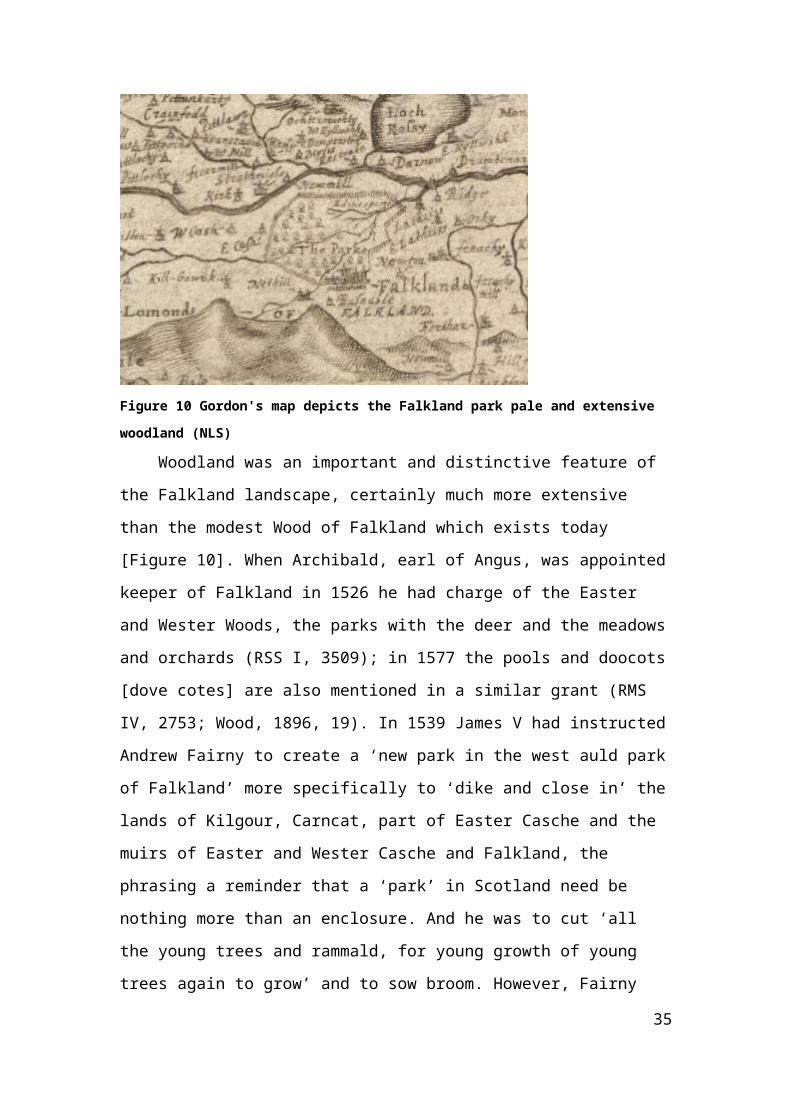
Woodland was an important and distinctive feature of the Falkland landscape,
certainly much more extensive than the modest Wood of Falkland which exists today
[Figure 10]. When Archibald, earl of Angus, was appointed keeper of Falkland in
1526 he had charge of the Easter and Wester Woods, the parks with the deer and the
meadows and orchards (RSS I, 3509); in 1577 the pools and doocots [dove cotes] are
also mentioned in a similar grant (RMS IV, 2753; Wood, 1896, 19). In 1539 James V
had instructed Andrew Fairny to create a ‘new park in the west auld park of Falkland’
more specifically to ‘dike and close in’ the lands of Kilgour, Carncat, part of Easter
Casche and the muirs of Easter and Wester Casche and Falkland, the phrasing a
reminder that a ‘park’ in Scotland need be nothing more than an enclosure. And he
was to cut ‘all the young trees and rammald, for young growth of young trees again to
grow’ and to sow broom. However, Fairny also sowed oats; after the king’s death this
precipitated several disputes, particularly one with Sir William Scott of Balwery, who
claimed heritable rights over this land and now demanded compensation (ADC, 1932,
522-3, 622; NAS CS6/23 ff 163r-164v; NASCS7/7 f. 110 and 139). At the same time
the Exchequer Rolls refer to the conversion of the lands of Darno into a park and there
was an allowance for the pasture of the fallow deer at Darno (ER XVII,. 208,, 326,.
511).
Andrew Fairny was later the heritable forester and when William Fairny succeeded
in 1552 (RMS IV 685) he had rights to the ‘crop and bark’ of the woods as well as to
pasture 26 cattle in the woods, use of various meadows and other benefits. In 1555 the
wood of Falkland was found to be ‘for the most part old, failed and decayed’ and was 22

to be ‘cut and enclosed of new, kept and fenced for the raising of the young growth’
(RPS, A1555/6/24. Date accessed: 11 April 2008). This, like many other sixteenth
century records, implies wood-pasture.
Whilst live game was sometimes moved from Falkland to other residences for
sport, it was commoner (and a great deal easier) to move dead birds and animals and
this was frequent. For example, in February 1544 when game and poultry were
required for a special festival for the household of Marie de Guise at Stirling, a man
was sent to Falkland to get them. The household books of Mary queen of Scots show
regular supplies of geese and other game from Falkland to other royal residences
(NAS E33/3 extra-ordinary expenses f. 3v and passim). In the early 1560s Buchanan
describes Falkland as ‘a castle with a village of the same name, situate near a small
wood, in which a broad horned species of stags – commonly, but improperly, called
fallow deer- were kept’ (Aikman, II, 454).
In 1590 the lands of Falkland were reported as amongst the assets ill-advisedly
disponed by the Crown and steps were in hand to recover control to increase revenues
following the king’s marriage. It was suggested the lands should be cleared of other’s
stock and then either re-let or stocked with the king’s own stock (RPC, IV,536) The
following year, a report suggested that Falkland would support two extra bowgangs of
kye and 140 slaughter marts for the larder in addition to keeping the deer and the
mares as they had done in the late queen regent’s time (NAS GD26/7/393). About that
time, all the tenants were warned to remove their stock from the woods and parks as
well as from the Lomonds of Fife. There were protests and the withdrawals of stock
appear to have been merely symbolic, followed by a rapid return (NAS NP1/53A/1 f.
3v-4r). These moves at Falkland were part of much wider efforts to improve the royal
finances and make the parks and other lands more economic (Murray, 1971). But
there were limits to economy and in 1591-2 forty ‘fallow dere masles’ to supplement
a herd depleted by the king’s hunting were actually imported to Falkland from
Colchester after a good deal of correspondence about the technical issues (CSP Scot
X, 458, 468, 505, 512, 519, 674). Fynes Moryson confirms that James VI spent much
time hunting and hawking at Falkland ‘for which this ground is much commended’
(quoted Brown, 1973, 147). There had been at least one previous restocking when, in
April 1586 James VI escorted some bucks to Falkland where they were fed bran, oats
and hay before being released to join the other deer (Juhala, 2000, 144).
23

In 1594 Falkland was to be handed over to the queen herself and put in the hands
of people who had her interests at heart, the present keepers to surrender their offices
and to clear the part of the wood where the king’s bow of kye pastured, all horses,
cattle and other stock belonging to others to be removed within 24 hours (RPC V,
135). Formal record was made of the instruction to Beaton to remove and to hand
over the keys of the palace and demit office, though he certainly resisted these efforts
for a time (NAS NP1/53a/1 f. 76r-v). In 1595 the park was said to consist of ‘the
Darno, Alleris and Devalie’ (Murray, 1971, 144). In 1598, Richard and John Scott in
Cashe, adjacent to the park, were accused of threatening the keeper of the park of
Falkland with pistols and as they failed to appear were to be denounced as rebels
(RPC V, 466). Only in 1602 did Beaton, whose ancestors were said to be kindly
tenants and occupiers of Darno ‘past memory of man’ resign his holdings and his
office, with generous compensation (RPC VI, 495-6). But the whole issue remained
highly contentious.
Two men were banished from Fife for killing the park deer in 1605 (RPC VI, 23)
and the keeper in 1612 had charge of the woods, the fallow deer and the pasturage
with upkeep of the walls, wood pasture and woods of Falkland (RMS VII entry 644).
In anticipation of the royal visit of 1617 it was noted that parts of the park pale had
been taken down to allow the deer to range and special instructions were issued that
none were to slay these, so as to preserve the sport for His Majesty (RPC XI, 7).
In 1641, three distinct words, ‘lucorum, silvarum, saltuum’ are used to describe the
woods; the nuanced differences understood at the time must remain uncertain but it is
probably safe to understand ‘saltuum’ as wood pasture with ‘silvarum’ as denser
woodland (Retours, I, Fife, entry 606) Such distinctions again imply management – or
at least an intention or expectation of management, of different aspects of the wood.
But any significant demand for long-term management for royal hunting was now
past. When John Macky toured Scotland in the 1720s, he lamented the loss of the oak
trees from the park which, whether or not it had formerly been eight miles in
circumference as he thought, had now been ploughed up with only vestiges of the
former pales still remaining (Macky, 1723). By the late eighteenth century the farm
of ‘Falkland Wood or Park’ was one of the largest in the parish (Brown, 1792, 444).
The New Statistical Account commented on the vanished fallow deer and lamented
the once great wood had been felled by Cromwell for military use (Wilson, 1834/5,
24

923). The 1st Edition Ordnance Survey map confirms that, by the mid nineteenth
century, the area north of Falkland palace was divided into rectilinear fields, a modern
farming landscape though John Gilbert has now retrieved a great deal of evidence for
its detailed layout (Gilbert, 2014). But Falkland from the late fifteenth to the late
sixteenth century had been the royal game preserve and deer park par excellence – the
only site where deer of one sort or another were consistently present and whence they
could be sent to other palaces. And, strikingly for Britain, the site of a significant area
of managed wetlands.
Stirling
Figure 11 The dramatic siting of Stirling Castle seen from the south-west.
The author’s personal interest probably partly explains the very extensive
documentation discovered for the Stirling landscapes. But that is not the whole story;
they really are very well documented on account of their importance.
The outline of the park as it existed in the twelfth century is also pretty clear and a
good overall impression can be formed of the sixteenth century landscapes and their
relationship to the castle. The broad evolution of the landscapes will be considered
first, followed by a more detailed examination of the documentary and physical
evidence for two particularly important areas, the King’s Knot and the Haining
[Figure 18 & 19].
The obvious comparison between the sites of Stirling and Edinburgh Castles has
often been made – and there is an equally obvious contrast with the setting of the
other main residences (Figures 1, 2 and 11). The landscape advantages of Stirling
must have contributed to its being so favoured in the sixteenth century and might even
have contributed to its choice as a major religious centre and so to it being favoured
for festivals such as baptisms, coronations and Christmas.
25

The earliest records place the castle within the royal demesne in the early twelfth
century with the burgh in the vicinity. At some time between 1165 and 1174 a part of
the demesne was enclosed for a park (Regesta I, 40; Regesta II, 206-7). South and
west of the town the parish boundary corresponds to the nineteenth century park
boundary suggesting that parish and park were being formed contemporaneously
[Figure 12]
Figure 12 Thomson's map shows Stirling's parish boundary (red) following the outline of the
park south and west of the castle (Courtesy NLS).
The Stirling park included an area of post-glacial estuarine alluvium or carse clay
south and west of the castle and glacio-fluvial deposits interspersed with boulder clay
in the High Park, the Gowane Hills and the steep slopes around the castle itself (IGS,
1974). How far that diversity of soils was reflected in the medieval or early modern
land use is not clear, except that the main garden areas were on the better soils, albeit
there may also have been some importation of soils there.
Other lands, scattered across Stirlingshire, known as the Lordship of Stirling,
provided revenues for maintenance of the castle, and were assigned, along with the
castle, to queens consort, queens dowager and to the later keepers of the castle
(Fraser, 1872, entry 20; ER I, 178-181; RMS II 462: NAS E40/10; GD90/2/47;
26

GD124/1/933). A significant complication for documentary research is that though
geographically adjacent to the burgh and its lands, the royal landscapes were
administratively distinct and the burgh records scarcely mention them, though some
leases survive amongst the sheriff court records for the eighteenth century. Doubtless
such precincts (in Stirling latterly known as the constabulary) existed at other sites
also (Harrison, 2010).
About 1260 a New Park was formed near St Ninians Kirk, a couple of miles or so
from the castle, construction continuing until after the death of Alexander III in 1286.
This New Park (which was not contiguous with the Old) was also enclosed. Its tree-
cover perhaps played a role in the Scots strategy at the Battle of Bannockburn (1314)
- though the dense wood which figures in some accounts is a figment, totally
incompatible with its status as a park. It included (or was adjacent to) a wood where
woodcock could be hunted, the ‘Cockshot’ which gave its name to modern Coxet
Hill. Payments to two park keepers and other officials about 1288 suggest that the
two parks may both have functioned together for a time and it is not clear which is
intended in late fourteenth century records of deer and of hay being cut in the park or
parks. In 1369-1370 the New Park was granted to Alexander Porter, its keeper, and at
the same time substantial areas close by (Touchadam, Touchmolar, Cultenhove and
Touchgorm) were granted by Robert II to Andrew Murray and Sir Thomas Erskine.
These lands were all described in the respective royal charters in phrases such as
‘terrarum nostrarum’ [our lands]. They were, in turn, very close to or even
contiguous with the former royal hunting areas of Dundaff and Strathcarron. It may be
that the parks were merely the last remnants of a huge hunting area south and west of
Stirling, comprising much of the ancient parish of St Ninians. That would also explain
the phrase ‘our forests between the Forth and the Carron’ in a charter by Robert I
(Gilbert, 1979, 23, 94, 120, 170; Miller, 1922; Miller, 1933; Harrison, 2006a; RMS I
entries 305, 317, 324; ER I, 38; Renwick, 1884, 14-5).
There were earlier and later local grants to the Erskines. In 1387, Erskine’s wife
protested against her husband’s granting lands to Alexander Porter, lord of the New
Park. Although the grant of the New Park to Porter reserved the vert and venison for
the king, it allowed Porter to use the timber within the park for his own buildings.
Though future charters reserved the king’s rights in the New Park, it gradually
reverted to agricultural use and was integrated into the Murrays’ Touchadam estate,
27

commemorated by the farm name Newpark (NAS GD124/1/729; Miller, 1922, 103).
Figure 13 Old and New Parks; the letters SC denote Stirling Castle (Gilbert, 1979).
Raploch, lying to the north of the castle, was crown land in 1329 though it is never
said to be a part of the park (ER I, 178). The slight evidence points to the Old Park
being mainly pasture, perhaps with some arable and meadow in the gap from 1260 to
the fifteenth century (ER I, 50; Fraser, 1872, 391). The picture in the fourteenth
century is of recurrent alienation and recovery of parts of the Old Park, though some
areas, including Parkfield, Middlecroft and Bennies Croft had been alienated earlier.
The then keeper Agnes Keiller, after granting the area later known as the Rude Croft
to the Rude Altar of the parish kirk, resigned the residue of the Old Park into the
king’s hands in 1363, retaining the adjacent lands of Kipmad (NAS GD124/1/517;
RMS I 380; Ronald, 1899, 96-101, 107; Cook, 1907, 122-5). These latter changes
might be related to economic factors in the wake of the Black Death of the late 1340s
(Thirsk, 1997, 11; Nicholson, 1997, 148).
There are references to tournaments held in Stirling in 1398, to ‘lists for combat’ in
1404 and to the famous battle between Burgundian and Scots knights in 1449 in the
presence of James II and his new wife, an event which, from the descriptions and in
28

keeping with the fashions of the time, would have required considerable space, stands
for the spectators and so on (ER III, 436, 596; Stevenson, 2005, 52-3, 72-9, 115).
Repairs to royal stables at Stirling are noted in 1434 (ER IV, 565, 593). And in 1453
there are payments for renting two houses ‘in Stirling’ to store oats and victual and for
maintenance of a garden whilst a pleasure garden at Stirling is mentioned in 1458 (ER
V, 479, 597; Grove, 1989, 6). However, there is no contemporary indication of the
locations of these features and ‘in Stirling’ could mean in the town, in the demesne or
in the vicinity.
In the years between 1428 and 1434 records begin to appear of hay cut in meadows
at Cornton, Innerallan and at Powis, in Logie parish, sites scattered up to several
kilometres from Stirling itself. The meadow of Stirling was cut in 1434 and in the
same year Cornton is referred to as a grange (ER IV, 444, 592-3). In 1450 some 24
acres of the meadow of Stirling were cut, 20 acres at Cornton, 14 at Innerallan; a
meadow at Row is briefly mentioned as cut in 1453. Cornton is a kilometre or so
north of the castle, across the River Forth, the other sites are even more distant. In the
mid fifteenth century, Raploch and Innerallan are also referred to as granges and
equipment for ploughing and working the land as well as cutting and harvesting the
hay and the grains grown on the lands was bought(ER V, 395-7, 598.). In 1455, one
of the Cornton proprietors was granted substantial lands in Aberdeenshire in
compensation for the loss of Cornton to the Crown(ER VI, lxxvi, 69, 277, 523, 560).
In the 1460s and 1470s Innerallan, Cornton and Raploch were sometimes let for a
grain rent or a mixture of cash and grain but hay was still cut in a range of meadows
for royal use. In the 1470s there are two payments for cleaning ditches or pools beside
the meadow of Stirling (ER VII, 25, 69, 600-1; ER VIII, 160,562). From 1479 there
are payments for cutting and winning the hay of the ward ‘under the castle walls of
Stirling’. There are also late fifteenth and early sixteenth century records of livestock
belonging to the king and queen and kept on royal lands in Menstrie Glen in the Ochil
hills, again several kilometres away (RCAHMS, 2001).
Clearly, very substantial royal use was being made of widely-scattered lands; hay
was a key crop, stacked and probably consumed by the horses where it was grown.
There are few records in these years of use of the Old Park but it had not lost its
identity but was rented or assigned to royal officials for some 10 merks yearly from
1455 onward. In 1488 £4 was paid for cutting the meadows of Logie and Stirling and
29

£2 for cutting and winning hay in ‘the ward under the castle’; this ward had existed
earlier and in 1357-9 had paid no rent as it was in the hands of the Countess of
Strathearn (ER I, 575). It is unclear why the focus of royal interest shifted, in these
decades, from the parks to the wider landscapes. The castle was used as a royal
nursery and it was James III second most favoured site though he sealed only 47
documents there, compared with 820 at Edinburgh. Perhaps, like Falkland, it was a
retreat rather than a place for business (McNeill and MacQueen, 1996, 180). Perhaps,
too, the livestock in Menstrie Glen were used to supply the royal table, suggesting
comparison with mid sixteenth century Holyrood Park.
Following his accession in 1488, James IV initiated a series of radical changes,
both within and around the castle including the feuing (effectively the sale) of many
of the more scattered lands used for hay and pasture during the previous century, a
deficit which must have been made up by purchases of fodder from other sources
(Menzies Fergusson, II, 89, 92, 161; Macdougall, 1989, 160). The more local
landscape changes were underway by 1493 and were probably complete about 1507
and indicate a decisive shift of focus, back to the park-lands in parallel with extensive
building work within the castle; construction of the King’s Old Building, the Great
Hall, the new ceremonial entrance to the castle (the Forework) and the creation and
endowment of the collegiate Chapel Royal (Fawcett, 1995; Dunbar, 1999). In 1507
work began on construction of a new choir for the town’s church (Renwick, 1884,
71). As at other sites, work on the landscapes is thus part of a wider project,
enhancing the facilities and importance of Stirling and signalling intentions to use it in
new ways.
Modest payments for gardens and gardeners at Stirling are recorded from the reign
of James III but, by 1499, a new garden had been created in ‘the ward under the
castle’ an area previously cut for hay. Planting of fruit trees, vines, vegetables and
other plants in and about the new garden continued after that (ER VII, 429, 562. ER
X, 2; ER XI, 144; TA I, clxvi-vii, 364, 370, 377-8, 386, 390; Grove, 1989, 8-13).
Brown (2012) considers that gardens in some detail. The old and new gardens co-
existed and sometimes had different gardeners. The ‘new garden under the walls of
the castle’ and the ‘great garden’ feature prominently in the records (ER XI, 144; ER
XII, 76, 216, 334, 401, 539; ER XIII 22-3 and passim). Features such as vines many
look overoptimistic (outdoor grapes are not a notable feature of local gardens today!)
30

but Cooper points out the potential for training vines and fruit trees to make arbours
(1999, 821).
In 1506 the Crown relinquished the Justinflats to the town of Stirling in exchange
for the far inferior land of the Gowane Hills (to the north of the castle); the Justinflats
corresponds to the area round modern Victoria Square and is just outside the modern
park boundary (Renwick, 1884, 69-71; Ronald, 1899, 102-4) [Figure 14]. The
objectives of this unequal exchange can be deduced from the consequences. Most
obviously, castle-based artillery now had sufficient range to cover the strategically
crucial Stirling Bridge and control of the Gowane Hills secured the sight-lines
(Sadler, 203-4). The Justinflats had been where the ‘justing’ or jousting took place
(www.dsl.ac.uk/dsl/ ‘justing’); a charter of 1540 mentions an area called the Buttis,
between Parkfield on the east and Justinflattis on the west and south parts (SCA
SB6/3/1a/4) so this had been the sports area where tournaments would have taken
place previously. James IV had lost money at the Stirling butts (probably betting) in
1497.
Figure 14 Between the 12th century and 1506 the lands highlighted to the south were alienated by
the crown; the Gowane Hills, to the north, were taken in exchange for the last tranche in 1506
(1st Edition OS, NLS).
As part of this landscape redesign, new butts were constructed ‘furth of the garding
beside the stable’. That places them in a field directly beneath the castle and still
called the Butt Park [Figure 15]. The former site of the stables is on its northern edge
and (both) gardens to the south and east (TA I, 329; TA II, 368; SCA B66/1/24 p.
31
289). Lists (stands for the spectators) are not documented until 1529 (below) but may
well have existed earlier. Moving these key facilities reflects changes in the nature of
the jousting and tournaments from medieval melee to a more intimate, ritualised and
symbolic activity which the spectators would watch from close quarters and the new
emphasis on tilting. That required a regular, linear course which must have been on
the only level part of the Butt Park, parallel to the modern wall (Barker, 1986, 34-6,
147; Chambers, 1923, 139-40; Clepham, 1919, 38; Stevenson, 2006, 185-7). So, the
exchange can be related to both practical and cultural pressures and seen within the
context of wider landscape redesign.
Figure 15 The white house at far left is close to the former stables, the camera and the yellow
ragwort are in 'the gardens', placing the butts on the level ground in the field between (photo
JGH)
By early 1506 both the Gowane Hills and the Old Park (henceforth known as the
King’s Park) were enclosed with stone walls (ER XVIIII, 25; Renwick, 1884, 69-70).
Within the re-designed landscape, a new road was made (the ‘nether gait under the
craig in Stirling’). New fish ponds were created and the park loch was enclosed with
stakes by the gardener; as it was immediately stocked with fish brought from
Linlithgow this may have been a new feature or a radical reconstruction of the old
loch (TA I, 84, 105, 145-6, 152, 362, 372, 420). From 1502 Raploch was declared
waste as pasture for the horses of the king and the former lease on the park was
terminated (ER XII, 76, 140). The park was stocked with deer and a white bull and
white cow. Swans (rare birds in sixteenth century Scotland) were bought for the loch.
There was a white peacock and, perhaps even rarer and more exotic, some of the deer
were also white (TA I, 348-9, 355, 419, 424; TA IV, 76; Gilbert, 1979, 220; Fletcher,
2011, 127-131).32

So, in the years between about 1493 and 1506 the landscape around Stirling Castle
was transformed. The park was re-created and restocked, the gardens greatly
extended, the sporting facilities moved and modernised, a loch was created or
radically redesigned as an ornamental feature. This designed landscape would have
been wholly or partly visible from the residential buildings on the west side of the
castle and have provided vantage points from which the iconic views of the
dominating castle could be appreciated. The stables, outside the castle but also within
view to the north-west, were convenient to the Raploch pastures and doubtless formed
a pleasing architectural feature within the castle views. The washing green was
probably already on an adjacent site, a little down the hill, as it was later in the
century (Ronald, 1899, 105-7). At a practical level, this removed ‘thirsty’ activities
from within the castle and reduced the need for incessant movements of fodder and
manure through the splendid new entrance gateway. Removing the stables from
within the bounds of the castle was also in line with modern ideas about hygiene
(Fleming, 1898, 33-6; Henderson, 1999, 209).
The wider countryside round about was one of settled agricultural prosperity rather
than the impenetrable morasses and marshes of popular imagination (Harrison and
Tipping, 2007). That is the force of the statement in 1583 that the West Quarter of
Stirling Castle was the ‘best and maist plesand’ of the Scots royal palaces with
the maist plesand sycht of all the foure airthis, in speciall perk and gairdin,
deir thairin, up the raweris [rivers] of [Forth, Teith, Allan, Goody and down
the Forth] quhair thair standis many greit stane howssis (Paton, 1957, 310).
Following the death of James IV in 1513 the castle and its associated lands were
assigned to his widow. In 1525 Walter Cunningham was appointed as gardener and
forester of her park, the family continuing in that office into the seventeenth century
(NAS GD124/10/9; ER XXI, 412; TA VII, 336, 480). In 1529 the queen resigned her
interest in favour of her son (James V) who now began to meet the costs. However, in
the 1530s the lands of Raploch were still let out to tenants and servants of the queen
dowager for mixed grain and money rents (ER XV, 549-550).
In 1530, the prelates of the shire of Edinburgh were warned to send their oxen to
be pastured in the park at Stirling during a period of heightened military tension and
this sort of use of the park for pasture of military draft animal is probably under-
recorded (TA V, 217) – even in this case, it is the payment for the proclamation which
33

appears in the record, not costs or direct reference to the pasturage. A road from the
castle to the park, mentioned in 1531, may have been the former ‘nether gait under the
craig’. The road is still traceable across the steep slope below the castle and continued
in use into the early nineteenth century (TA V, 436; SCA B66/9/1 p. 154-156; NAS
SC67/7/30 bundle 1706, Craigforth v. Hamilton; Wood’s Map of Stirling, 1820,
Figure 16).
Figure 16 Wood's map of 1820 still shows the 1531 road trending from near the castle entrance
across the Butt Park (NLS)
Work on the gardens and park dyke continued through the 1530s in parallel with
work on creating a new palace at Stirling for James V, the lists ‘under the castle’ were
extended in 1534, new stables were being constructed in 1539 and the ‘great horses’
or stud horses were probably based in Stirling at this time. The lists got further
attention in 1537-8, reflecting the energetic young James V’s passion for chivalric
sports for which copious equipment such as spears was supplied. However, there are
no indications of deer at Stirling in these years, and though James V did hunt at
Falkland most of his hunting was in wilder terrain such as the Highland and Border
hills (TA V, 381; TA VI, 154, 180, 194, 225, 381; Paton, 1957, 227-8; Thomas, 2005,
70-9, 200-3; Fawcett, 1995, 55-64; Harrison, 2011, 13-23).
The death of James V again brought developments to a close. His widow, Marie de
Guise, occupied Stirling as her dower house from July 1543 though she was less often
present after 1548. She had a stable of a dozen or so horses and some mules. When
34
cattle were bought in August 1543 they were kept in the park until slaughtered and
salted ready for the coronation feast of Mary queen of Scots (NAS E33/3; E33/3/4 f.
23v). But otherwise, partly owing to loss of the appropriate records, there are few
indications of how she used the lands.
The main development during the adult reign of Mary queen of Scots was the use
of Stirling for the baptismal festival of Prince James in 1566. Earlier in the century,
some major royal festivities had been in Edinburgh with the focus of the more
intimate events beside Holyrood (Dunbar, 1999, 59; Thomas, 2005, 57-8, 190-5;
Stevenson, 2006). However, the Great Hall at Holyrood was abandoned about the mid
sixteenth century (Dunbar, 1999, 109). Stirling, with its huge hall and extensive
modern accommodation was the obvious alternative. A key innovation in 1566 was
siting of the outdoor events in The Valley, an area outside the castle with rising
ground on at least two sides. The ritualised siege of a symbolic castle and other parts
of this outdoor entertainment were loaded with political and cultural symbolism and
mark a new departure in Scots royal entertainments (Lynch, 1990). It was essential for
the audience to be close to the action if they were to be able to observe the detail and,
since the festivities took place outdoors in December, a site close to cover was clearly
desirable. The move to Stirling and use of the Valley were sufficiently successful to
be repeated for the baptism of James’s own son, Prince Henry, in 1594.
In 1578 the Privy Council was concerned that the horses of strangers visiting the
king scattered the deer and ate the grass which should support them in winter; they
were to find other forage. Later this was re-enacted and shooting with cross bows,
hand bows and culverins in the park forbidden, particularly when the deer were
fawning, an important record as it confirms that, at this stage, Stirling had a breeding
herd (RPC III, 20, 173). Hume of Polwarth noted the white cattle and fallow deer in
the park in his Promine of 1580 (see below).
John Erskine, later earl of Mar and already keeper of the castle, was granted the
captaincy, with the park and garden, the Raploch, Gallowhillis [Gowane Hills] and
pertinents for life in 1561, grants confirmed in 1566, when the Park Loch is also
specified. He was to pay £100, was to act as forester of the park and was allowed the
pasture of six horses in the park (RSS V, 901 and 2977; NAS GD124/11/1). Mar and
his successors increased their holdings in and around the Raploch over the coming
decades and this may explain why, probably in 1582, new royal stables had been built
35

in the upper part of the town of Stirling (NAS GD124/1/628, /655, /678, /677, /725;
GD124/17/191, /192; SCA B66/16/5 f 152; Juhala, 2000, 130; Fleming, 1898, 27-30).
General management of the park seems to have been reorganised under Robert
Cunningham, doubtless directed by Mar (Grove, 1989, 15). Nonetheless a Report of
1591 found that Stirling was in the king’s hands, except ‘a meane part of the Hay
which my lord Mar for the keeping of that palace is in use to intromet with to his own
behoof rather by custom than by title’. There was sufficient hay and straw at Stirling,
Falkland and Holyroodhouse to maintain the king’s 40 horses all year round; the
parks should be dedicated to that use only and the master stabler should be ‘dealt
with’ to accept that, suggesting that he may have been making some use of the assets
for his own profit (GD26/7/393). Discussions of the management continued for some
years, urged on by Sir John Skene and the advice of the queen herself (who was a
much more efficient manager than James). In 1595 Skene reported that Stirling would
support no other stock ‘besyd the deir and the quhyt ky’, a final record of the white
cattle. The Park would also yield 80 ‘dawarkis’ of hay (Murray, 1971, 144), a dawark
being the hay one person could cut in a day (DSL). The Cunninghams continued in
day to day control up to and beyond 1603 organising activities such as hay making
(ER XXI, 39, 412).
In 1612 Robert Ayson from nearby Craigforth was accused of cutting greenwood
and disturbing the deer in the park (RPC IX, 512). The anticipated royal visit of 1617
involved extensive work at Stirling, broken down as £1937 Scots for the Park Dyke
and £13, 479 Scots [=£1123 Sterling] for the Castle/ Palace though most of the
extensive manuscript has been lost through water damage (Imrie & Dunbar, 1982,
24-31, 443-446). There was further extensive work on the gardens between the mid
1620s and 1633. These works, to be discussed in more detail below, included several
attempts to fence the garden against deer.
By the later seventeenth century the park must have looked likely to suffer the
same fate as Falkland by conversion to agriculture. In 1668, for example, the Earl of
Mar’s Parks at Stirling were to ‘to hold as many cows and oxen as will serve the
house for a year (ie 30) two year’s sheep (120) and twelve saddle horses and 30 acres
of hay’, the hay to be sufficient that the stock should be well fed and not half starved
as formerly (NAS GD124/15). But royal interest was not dead yet and on 20 July
1671 the Lords of the Treasury issued a Warrant to Sir William Bruce, Master of the
36

Works to ‘visit’ the park dyke and ‘take present course for effectual repairing of it, for
the use his Majestie designes it’ (NAS GD29/92). Unfortunately, the consequent
work was done on a contract, which does not seem to survive. However, it probably
involved the near complete reconstruction of the park dyke (NAS E36/32, accounts
1674-9; E36/31 p. 20 ff accounts paid 1677 to 1679). Simultaneously, extensive work
was undertaken within the castle, essentially updating the palace seemingly to make it
fit, once again, for royal occupation. That, however, was a last flourish of royal
interest and, within twenty years or so, even the palace was being adapted for military
occupation. (Gallagher and Ewart, nd, 100-102).
The then earl of Mar was forfeit and fled into exile in 1715 though his
representatives managed to retain control of parts of his former assets, including the
Haining at Stirling (see below). But until the mid nineteenth century the park and
other assets formed parts of the emoluments of the successive governors and were
mainly let for pasture, a new farm created some time in the early nineteenth century
(Harrison, 2007(b) 12-14; NAS C31/2 f. f. 23v-35v). In 1850 it was reported that the
old perimeter wall was dilapidated and needed to be rebuilt;
It has originally been a very high, heavy wall, probably the enclosure of a
royal deer park, and the expense of rebuilding it thoroughly would far exceed
its benefit for the farm. As the boundary wall of a royal park, it is for the
Board to determine if it should be fully restored (PP, 1852-3 LV, Woods and
Forests, 109).
The accounts for this and subsequent years show extensive work on the perimeter
wall and its demolition was regretted by some contemporaries (Wright, 1998, 16).
Most of the surviving wall, whilst following the parish boundary, is probably from the
1850s but one extended section, east from St Thomas Well is of far superior build and
can be assumed to date from 1671 at least, its great height suggesting that the purpose
Charles II envisaged was, once again, as a deer park [Figure 17].
37

Figure 17 The park dyke near St Thomas Well, of massive build and probably dating from the
1670s on an older line (photo JGH).
From the later seventeenth century the tenant sublet most of the former park for
pasture to the inhabitants and for cattle coming to the town’s fairs (SCA B66/25/779/1
bundle 5; NAS CC21/19/1 bundle 3, Edmondston v. others). The tenant was obliged
to lease pasture to the army at a reasonable price when required. From 1717 the castle
governors usually let the whole of the Park, Knot, Butts, Gowane Hills and pasture of
the braes round the castle to a single, well-to-do local man who sublet to several
others; ground was to be available for military camps and exercises as required and
(perhaps partly for that reason) ploughing of parts not previously ploughed was
forbidden, the ‘High Park’ being particularly preserved, though probably the carse
ground was always arable( NLS Ms 17603 f 71r-82v; FRC A/AAF40/30/3/22;
A/AAF40/30/3/2; NAS SC67/49/26 p 176). The King’s Park farm was probably
created for the principal tenant (then Charles Pollock) about 1803 but the tenants
continued to sublet parts of the extensive farm, including the Gowane Hills, Knot,
Haining and braes around the castle (NAS CC21/13/25 p 158).
Public paths round the immediate castle environs and Gowane Hills were laid
out in the 1790s and early 1800s as extensions to the even older Back Walk (Harrison,
2007 (b)) but reports from the 1820s to 1850s show that access was even more
extensive than this. The farm tenants demanded rent abatements for damage caused
by the creation and use of the race-course (operational roughly from 1804-1854), for 38

extensive access by the public and use of the land by the army for camps, displays and
exercises (Sloan et al.1986; SCA Stirling Council Minutes Index, 27 Dec 1804, 5 Oct
1805, 4 Oct 1806, 3 Oct 1807, 27 July 1809, 3 June 1829; PP 1852-3 LVI p.521).
Local people and visitors could not be excluded from parts of the area such as the
Gowane Hills, ‘so suitable for exercise and for viewing the scenery’ and ‘in itself
replete with historical recollections’. All parts were sometimes grazed necessitating
an abundance of styles (NAS CR4/260).
Figure 18The great angular mound of the King's Knot seen from the castle; the 'Queen's Knot' is
lower and to its right; the wall (right to left) in mid ground separates the Knots from the Haining
(Photo JGH).
New regulations about public access on the farm had been made in the early 1840s
in response to the tenant’s complaints but access was still problematic. In the early
1860s it was suggested that the racecourse in the main body of the park should be
used only for races not for walking and horse-riding, games such as quoits and cricket
were to be forbidden and publicans prevented from setting up beer tents on Saturdays.
A lodge at the entrance was suggested so that a keeper could prevent such trespasses
and firmer demarcation was proposed between the publicly accessible and the
39

agricultural areas (NAS CR4/264). Many of these proposals may well have been
unworkable.
A particularly interesting report of 1850 found that no part of the High Park was
ploughed though it was well-suited to turnips. The encroachments by the army and
the public were altogether exceptional but the vicinity of the town and garrison
offered compensations both in terms of potential markets and the availability of
‘fertilising substances’, including manure from the town and material from the castle
latrines (PP 1852-3, Woods and Forests, 106; PP, 1833 XXXIV, Woods and Forests,
30; PP 1852-3 LVI, Woods and Forests, 521; PP 1852-3 LV, 57-8, 105-116). So, as
at other sites, there was an awareness of conflict between heritage and public access
on the one hand and rational and economic management of the land for agriculture on
the other. Its historical importance was presumably why the Stirling lands were
retained in 1851 when all other historic Crown lands except Windsor were disposed
of (http://www.andywightman.com/docs/CERWG-FinalReport12.06.pdf, paragraphs
3.8 and 3.9).
Amenity became ever more important – and was not always sympathetic to
heritage. As golf took more space there was increased drainage and landscaping -
though the course was still used for grazing until about the mid twentieth century
(NAS RHP2934; McCutcheon, 1986, 127; Morris 1936, 105). In May 1893, 23.5
acres of the park were leased to Stirling Town Council to be used as a public park and
has been ferociously landscaped. Presumably it was at that time that sections of the
former dyke were replaced by the present railings and the old five-bar gate entrance
replaced with the modern gates (Campbell, 1924, 95-6). The balance continued to be
leased as The King’s Park Farm, which included the Gowane Hills to the north of the
castle (PP 1852-3 LV, 57-8; PP1899 XVIII, Woods and Forests, 26).
In the later sixteenth century the Crown had disposed of some properties to royal
servants who built houses between the Gowane Hills and the castle and so created a
small suburb within the constabulary of the castle; some contiguous land was
disponed to Stirling Burgh Council in the 1880s to create the Ballengeich Cemetery,
the two together making a significant gap in the modern Crown lands at Stirling
[Figure 19] (Harrison, 2010, p. 50; http://www.stirling-lhs.org/burialgrounds) The
balance of the Gowane Hills within the royal estate continued in pasture until some
time after WWII.
40

Figure 19 The Old Playfield, in the foreground, was alienated by the Crown in the late sixteenth
century; the cemetery beyond the wall to the right in the 1880s (Photo JGH)
King’s Knot and Haining
The King’s Knot, a prominent and enigmatic feature of Stirling, needs to be
considered in some detail, along with the adjacent area known as the Haining. The
Knot is a massive, stepped mound, now grass-covered and within a much larger
enclosure. The Haining comprises a level field with the steep wooded slope above; the
Haining is between the Knot and the castle itself and may have provided an access
route from the castle to the Knot area and the park more generally [Figure 20]
Figure 20 The castle is to the north; the Haining is the field and
wooded slope north and east of the Knot (OS 1st Edn courtesy NLS).
Between the fourteenth and sixteenth centuries, Stirling was sometimes associated
with King Arthur and the Round Table and was sometimes written of under the 41

Arthurian name Snowdon; in those accounts, the Round Table is a landscape feature
somewhere near the castle. There is a substantial modern literature (see, for example,
Loomis, 1947, Loomis, 1955-6; Ditmas, 1974; Lacy 1991; Gidlow, 2004). There is no
documentary or archaeological evidence to support suggestions that a real King
Arthur lived at Stirling. Like stories of Roman occupation at Stirling, the claims were
intended to enhance the prestige of an important royal site by associating it with
heroic figures of the past. The stories are not, in themselves, evidence for events in the
long-distant past.
But antiquarian assumptions that the ‘Round Table’ at Stirling corresponded to the
Knot cannot be so readily dismissed. In 1375, Barbour says of Edward II and his
followers, fleeing Stirling Castle after Bannockburn ‘beneath the castle went they
soon / right by the Round table away’ (Duncan, 1977, Book 13, lines 378-379). In the
sixteenth century Lindsay writes of Stirling as ‘Snawdoun, with thy touris hie, Thy
Chapill-Royal, Park and Tabill Round’ (Papyngo, lines 633-4).The first is not
inconsistent with the position of the Knot ‘beneath’ the castle. The towers, the chapel
royal and the park were all entirely real features of the Stirling which Lindsay knew.
It is perfectly reasonable to wonder if there was some feature, perhaps already
ancient, which was clearly visible and known as the Round Table, perhaps having a
role in the chivalric entertainments which were so fashionable during the reigns
particularly of James IV and V (Stevenson, 2006).
The Knot is now grass-covered, its enclosure somewhat truncated by the early
nineteenth century Dumbarton Road and the slightly later road, Royal Gardens. To its
north and within the enclosure are much slighter earthworks, sometimes called the
Queen’s Knot [Figure 18]. These physical remains, the results of modern
topographical and geophysical survey and the cultural and historical background are
discussed by Digney et al (2012) and Digney & Jones (2013). Aerial photographs
show an earthen enclosure even further northwest, now cut by the roads but seemingly
related to the Knots. The entire area slopes down towards the north and much of the
Queen’s Knot area is now very wet; this slope, incidentally, means that stories of
canals and royal boating parties are fantasy! King’s and Queen’s Knot can both be
seen from the Ladies Lookout on the west side of the castle, site of the former West
Quarter and gallery of James V’s palace; the potential views of ‘the garden’ were one
42

of the reasons advanced for adapting the West Quarter as the main royal residence in
1583 (Paton, 1957, p. 310, quoted above).
Much of the evidence for the area is ambiguous and it is particularly trying that the
name Knot appears only in the 1740s; it is not explicitly the King’s Knot until
1767(NAS, CC21/13/13 p. 440-444; SC67/49/17 p. 439; CC21/13/14 p. 13 ff Dated
28 Nov 1767). In 1757 it was called ‘the King’s knock or mount’. ‘Knock’ in Scots
place names sometimes derives from the Gaelic word for a knoll or mound but only
with other (and preferably earlier) examples could we be sure if this offers a more
persuasive etymology than the usual assumption that it refers to the site’s former
existence as a ‘knot garden’ – one comprised of intricately-designed flower beds
(Maitland 1757, p. 194).
Vosterman’s late seventeenth century view of the castle and town shows the Knot
well to the north of its true position The Knot cannot be seen from the artist’s
viewpoint, high on the ridge to the west and the anomaly is most easily explained as
‘cut and paste’ of an important feature to a visible and prominent position. Early
ordnance plans, which often depict the Knot rather sketchily, make a similar move,
this time to squeeze it onto their rectangular papers at a reasonable scale (NLS
MS.1646 Z.02/19a). Both knots appear in their true position on a plan of the town as
it was in 1745, labelled as ‘Knot or Flower Garden’ (NA MPHH 1/204). A detailed
plan of 1806 shows the King’s Knot in very much its modern form, within the un-
truncated enclosure but without the Queen’s Knot (NA MF1/22). A plan of 1840
shows even more detail, including the Queen’s Knot and a deep trench to the south
east of the Knot but not aligned with it; the trench is still there (Loudon, 1840).
In fact, when the earliest plans were made, the Knot was long-abandoned as a
garden. Around 1706 Sibbald had written of an orchard ‘and the Vestiges of a large
and spacious garden’. A little later Defoe wrote of ‘formerly large gardens... the
figure of the walks and grass-plats remains plain to be seen, they are very old
fashion’d’. Loveday who visited in 1732 also writes of the ‘vestiges’ of a garden
within the park at Stirling (Sibbald, 1706 [1892], 44-5; Defoe, 1991, p.333; Loveday,
1890, 230-1).
The plans and visitors’ comments and the absence of evidence for work later in the
seventeenth century support the theory that the Knots were made, in more or less their
present form for Charles I in the later 1620s. Restoration work in the nineteenth
43

century did not, as sometimes suggested, seriously alter the design (RCAHMS, 1963,
219-220; Rogers, 1876, p. 112; NA MW1/368).
In June 1625 Charles issued a warrant to John, earl of Mar (principal treasurer of
Scotland but also hereditary keeper of Stirling Castle and its park) to appoint a
‘skilfull and well experimented gardener in England to go and reside at Stirline for
reparation of the orchard adjoining his Majestys Park of Stirline,’ This, he had been
informed, was ‘for lack of attendance become wilde and overgrown with bushes and
brambles’ a state of affairs which reflected badly on the kingdom and should be
remedied (NAS GD124/10/30). William Watt was appointed as gardener. Documents
located in 2016 show that his salary was a substantial £360 Scots (£30 sterling) pa It
was paid from Martinmas (11 Nov) 1625 to December 1636, much longer than
previously thought (NRS E24/43 f. 31r ; E24/44, pensions, 1626-7; E25/45 fees etc;
E24/46 f. 24v; E24/47 f. 31 r; E24/50 f. 31r; E24/52 fees, unpaginated; E26/4 f. 13
r. entry 191). In addition, in 1625-6 the Master of Works paid him £333 6s 8d to pay
workmen and other necessary expenses in 'plotting and reforming of his majesty's
gairdins at Stirling (E24/43 f. 31r) whilst between 1627 and 1629 around £1379 Scots
were spent for wages, materials and provisions ‘at the platting and contriving of his
Majesties new gairden and orcheard park of Stirling’, out of a total of £5592 spent at
Stirling during the period. Further work over the next few years included repairing the
garden walls with turf and then for making a stone wall ‘for inkeeping of the
deare’[Figure 21]. The major explicit expense ended in time for the king’s visit to
Stirling in 1633 though, even so, the garden walls were again rebuilt in stone in 1638
(Imrie and Dunbar, 1982, p. 230, 242, 257. 258, 370; RPC XIII, p. 705; RCAHMS,
1965, p. 187; NAS GD124/11/12). Clearly, Watts oversaw substantial work at
Stirling.
44

Figure 21 Looking from the Haining to a nineteenth century ‘kissing gate’ through the wall 'for
inkeeping of the deare' (Photo Smith Art Gallery and Museum).
But, there was an existing, if neglected garden and orchard in crown hands even
before Watt began work. Indeed, there were probably two major orchards in the area,
one of them in the Haining. In 1582 James VI had given the Haining ‘haugh and brae’
(that is the level ground and the steep slope above it) to the Countess of Mar (his
widowed former nurse, whose son was hereditary keeper of the castle and the park).
The family’s Stirling mansion, Mar’s Wark, had been built in the 1570s and the
Haining was a major addition to its already extensive gardens beside the town’s
churchyard. The Haining was then said to be bounded by the Rude Croft, by a spring
or well and by ‘the garden hedge’ on its south side. A new grant in 1620 to the earl of
Mar again gives the bounds of the Haining including the king’s orchard called the
garden and the garden of the earl’s own great building or New Wark in Stirling (RMS
V, 390; RMS VII 2125; GD124/1/641; NAS GD124/1/639; RCAHMS, 1963, p. 285).
45

Figure 22 Only a few large stones (arrows) now remain on the line of the King's Dyke,
documented in 1582 (Photo JGH)
The well or spring can be identified as the Butt Well; Rude Croft lay to the east
and just a year or so earlier the boundaries of the Rude Croft had included ‘the king’s
dyke’ (B66/1/24 p. 276-7; dated [] 1581). Remains of that dyke, consisting of huge
stones, can still be seen running up the hill from the top of Royal Gardens [Figure 22].
This all means that the Knot enclosure corresponded to the hedged garden of the early
1580s – well before Watt got to work. Geophysical survey in 2011 confirms the
impression of aerial photographs that there is older structure underlying the King’s
Knot and it may be that these features, buried by Watt, were as obvious in the
medieval period as is the Knot today, though their origin was unknown (Digney,
2012; see also Digney et al. http://www.stirling-lhs.org/kings-knot-survey.html) What
would be more natural than to explain them as remains of some previous, prestigious
work, the Round Table of the famous (and ubiquitous) King Arthur?
The Haining formed the main focus of James IV’s ‘new garden’ or ‘great garden’
created in the 1493-1506 period in ‘the ward under the castle’. But something in
excess of 2,500 trees, many of them fruit trees, but with willows, thorns and even
vines in addition to flowers and vegetables, would not all have fitted in the Haining so
the new garden must have been more extensive (ER XI and XII passim). This would
explain why, in the 1620s, 50 years after James VI had given the Haining to the
46

Countess of Mar, there was still a royal ‘garden and orchard’ at Stirling for Watt to
renovate.
The Countess’s heirs continued to hold the Haining as a garden and orchard and
there are passing records of their various gardeners, sometimes said to be ‘in Haining’
(SCA B66/16/6 31 May 1626; SCA B66/9/6 p 32 r; NAS CC21/5/5 p.23-9; ibid, p.
367-376). In 1685 John Edmondstone and his wife (he, by that time was also the main
lessee of the pasture within the park) took a life tenancy of
all and haill the houses upon the haining braehead of Sterling … with the
haining brae and orchyaird under the Brae called the haining yairds together
with the Kitchen yaird upon the west side of our great Ludging in Sterling and
with the over and under growth of the saids yairds and orchyaird (SCA
B66/9/14 p 331).
Their duties included supplying vegetables and herbs for the earl and his
household when in Stirling and an obligation to uphold the dykes and look after the
fruit trees, planting replacements as required. In spite of the then Earl of Mar’s
forfeiture in 1715, his managers retained this part of the estate and in the 1720s
Edmondstone’s widow still possessed the Haining in terms of this lease. In 1719 her
manager or subtenant complained of boys stealing pears from the trees there (SCA
B66/25/779/2 (1719)). In 1726 a report found that the fruit trees (199 apple and pear
trees, 86 plums, 2 geans [cherry trees] and 46 ‘others’) were all neglected as were the
timber trees whilst the hedges and stone walls were so decayed that horses and cattle
could get through (FRC A/AAF40/30/3 Item 22; SCA, B66/25/779/3 bundle 1726;
NAS, GD124/6/205; NAS GD124/6/205).
Mention in the 1582 grant of ‘the garden hedge’ separating the Haining from the
garden on the south side, confirms that the Knot area was garden ground at that stage.
The boundary is now defined by a stone wall, the base more substantial and
seemingly older than the upper parts. That boundary is marked on a plan of 1806 (NA
MF1/22). South of the wall (ie on the Knot side) there is a wet hollow and south of
that again the remains of an earth bank, which probably, at one time, extended along
almost the whole boundary. On that bank have been two very large hawthorn trees
(both dead and removed since 2012) and a large ash tree whilst the wall has been built
around another very big, hollow ash [Figure 23]. A report of 1839 mentions five ashes
and a damaged elm on the boundary with the Erskine properties as amongst the very
47

few trees of any value on the Crown estate (NAS CR4/260). The earth bank (already
truncated) and several large trees on the line of the wall are depicted on the OS map
surveyed in 1858 (large scale Stirling sheet XVII.3.8) [Figure 24].
Figure 23 The more distant of the two thorns blew over in December 2011; the earth bank is
typical of early hedge banks. There is another big, hollow ash in the line of wall to the right
(Photo JGH)
Medieval and early-modern hedges were often planted on large earth banks, such
as this one. It is unlikely that a hedge would have been established here after the
1720s when the existing hedge was ‘gappy’. It therefore seems likely that this was the
line of the hedge documented in 1582. That hedge is likely to have been created as
part of the work for James IV, between 1493 and 1506. However, dendro-analysis of
one of the fallen hawthorns showed it to have been growing only since the nineteenth
century (Mills, 2102) though the earth bank and the ditch would also be worthy of
further work. An anonymous author in 1835 (p. 135) describes a ‘low fence’ between
the Haining and Knot (a fence at this time could be almost any enclosure). Whilst the
evidence is ambiguous, the ‘best fit’ at present is that, in the early nineteenth century,
the southern boundary of the Haining was a low wall interspersed with trees and
running parallel to a hedge bank. Some trees have been lost meanwhile and the wall
was probably heightened during the 'restoration' of the Knot in the 1860s.
48

Figure 24 The truncated earth bank, parallel to the wall dividing the Knot enclosure from the
Haining on the 1st Edn OS (1860); there are more trees than today on the wall line (NLS)
After the disputes of the 1720s the Erskine managers were able to regain control of
the Haining and in 1734 leased ‘all and haill the Hayning yeards Brae dwelling
houses with the office houses presently ruinous lying on the South side of the Castle
of Stirling’ to Christopher Russell, merchant. It was accepted that the ‘fences’ were
ruinous and need not be further repaired whilst the house would be put in order and
was then to be maintained. Russell, a merchant, then sublet to William Graeme (NAS
GD124/15/1407; NAS, SC67/49/14 p. 34; SCA B66/9/17 p 59). So the orchard,
which had clearly been in decay for decades, was now to be abandoned and, like the
Knot, it was simply let for pasture. But Nimmo (1777, p.250) reports that there were
still vestiges of fruit trees somewhere in the garden in the late eighteenth century and
Chambers describes the Haining Brae, noting that at the Butt Well, the public walk
‘runs upon the very terrace’ of the former gardens, of which remains were still to be
49

seen. It was ‘in a very warm and delightful spot’ and old people could recall fruit trees
on the brae above, one report singling out ‘guigne’ trees (Scots ‘gean’ or cherry)
(Chambers, 1830, 52, Anon, 1835, 135). By that time, as Wood’s map of 1820
shows, the slope was wooded (as it is today) but decades later still Charles Rogers
suggested that the ‘hanging gardens’ of the Haining should be restored whilst Fleming
noted the terracing above the walk as part of the former garden (Rogers, 1876, p, 112,
p. 116; Fleming, 1898, p. 118). Ronald (1899) and Cook (1907) both recognised the
Haining as the former royal garden.
Indeed, partly overgrown by trees and partly rebuilt, there are still terraces on the
slope close to the Butt Well, partly serving as retaining walls for a path which winds
steeply up the slope (Figure 25). The terraces might have been created for the
Erskines of Mar between the 1580s and 1710s but it seems much more likely that
these, too, are part of the original garden, created for James IV.
Figure 25 Terraces on the steep slope of the Haining at the Butt Well (Photo JGH)
The full nature of the ‘restoration’ work carried out on the Knot c. 1860-1870s is
not presently clear. But comparison of plans before and after does not suggest that the
changes were radical, though the enclosure has been truncated by roads, as noted
above (NA MW1/368, /371; NA MF1/22; Loudon, 1842; Rogers, 1876, 110-1).
50

In 1933 the Haining was sold to Stirling Council by the residual Erskine of Mar
estate (NAS RS119/1166 f.55r -59r). A dozen or so Nissen huts were erected in the
1940s along the bottom of the slope and the north end and the bases of some can still
be seen. In the 1950s local people recall the Haining haugh used as a dump for stones
from demolished buildings. The haugh is now mainly used for dog walking, several
sections of the terracing on the brae have collapsed and been replaced in recent years.
But this neglected area still retains important features and the identification of its
former boundaries has provided the key to elucidating more of the history of the Knot
area.
Discussion
As the understanding of castles has shifted from a focus on defence to a focus on
residence, administration, ceremonial and prestige, so the landscapes have come to be
recognised as integral to the castles themselves, the ‘castle extended beyond the
walls’, as it were. Even Edinburgh Castle, with its minimal landscapes (within the
well-documented period, at least) had meadows, stables and gardens, whilst the burgh
supported it economically, substituting for the lordships of Linlithgow or of Stirling.
Indeed, the burghs, though not considered in detail here, were an integral part of the
castle landscapes. Apart from revenues, goods and services, they provided a fitting
final approach to all the residences, routes for civic processions and entrances and,
however modest, had implications of prosperity and modernity. All the castles were
set back from the built-up areas so that visitors had a full view of the main facade on
their approach. At Stirling, an inventory of the early 1580s describes the view thus
created by James IV as ‘the foure roundis of the foir entries qlk is the haill utwart
beautie of the place’ (NAS E37/2).
All five examples, even Holyrood which was set on low ground, could be seen
from a distance, a point made by many early views. And it is a curious paradox that,
in several cases, the views from these urban residences were mainly over countryside,
rather than over the adjacent town. At Stirling, even from the windows on the upper
floor of the palace, very little of the sixteenth century town can be seen; at
Linlithgow, the loch dominates views from the west and north windows and none of
the principal residential rooms looked directly towards the town. This may reflect the
Scots aristocratic idealisation of the rural life countered by the practical availability of
urban amenities (Brown, 2000, 210). Indeed, the country was never far away and
51

even when resident in Edinburgh Castle prior to the birth of her son, Mary was able to
walk a mile out of town into the countryside on her own feet - to the reporter’s
evident astonishment (CSP II, 276).
A striking feature is that the landscapes were changed frequently. James I’s
landscape work at Linlithgow, James IV’s at Stirling, Falkland and Holyrood and
James V’s at Stirling all corresponded to major interior work,. Work inside and
outside must have been driven by the same pressures, changing fashions, new notions
about chivalry, sporting ideals and religious organisation and about the right
relationship of residence and environs. The creation of the King’s Knot at Stirling,
incorporating older features, is very much within a tradition which would continue, in
later centuries, with the incorporation of ruined towers and houses as ‘follies’ into
newly-designed ‘classical’ landscapes (Lazarro, 1999). Under Charles II, the Stirling
park dyke was rebuilt at the same time as major work within the castle, including the
palace. Such dynamic change means that there is no single model which can fully
describe these landscapes throughout their period of royal use.
The landscapes mix practical and aesthetic ideals and were dynamically adapted to
cultural and technical change. James IV’s artillery required clear sight-lines from the
castle to Stirling Bridge so he took control of the intervening land – that did not
conflict with the ideal of rural views and allowed him, at the same time, to re-site the
sporting facilities to accommodate changing fashions. Fodder for horses was sine qua
non; but handsome horses and well-designed stables could become a landscape asset
in themselves. The Holyrood ‘ranch’ with its meadows, cattle and sheep was
eminently practical and a significant economic asset. Its very productiveness made it
an aesthetically pleasing sight and it was available for hawking or other exercise.
Swans, herons and peacocks were primarily ornamental status symbols – but that
might not save them from the kitchen if required.
The ideal view from any high-status residence included open water (Creighton,
2005, 79). The loch at Linlithgow was a source of coarse fish, particularly eels; but
the views across it remain one of the most striking features of the site with the James
V fountain in the central courtyard as another watery feature. Stirling and Falkland
had lesser lochs – both either wholly or partly artificial. The loch at Stirling, with its
ornamental birds, was probably within view of the residence; the ‘stanks’ at Falkland
were probably not visible but were mainly practical, supplying fish and wild-fowling.
52

In 1600 James VI ordered herons in the vicinity of Falkland to be protected when the
numbers fell (RPC VI, 113). This is unusual in Britain, where wildfowling was not
usually prestigious as it was in France where reserves for wildfowling were common
(Smout, 2000, 96). In the seventeenth century Stirling also had a doocot [dove cote],
another productive and visual asset, often placed close to the residence (Williamson,
1997, 92-117). At Holyrood, the level ground allowed men and women within the
residence to watch the sports for the marriage of James IV and Margaret Tudor from
different windows (Dunbar, 1999, 59). At Stirling, of course, though there was at least
one small internal garden, the topography meant that the main gardens were
inevitably quite distant, albeit visible.
Even the ideals of landscape settings varied with time and would be adapted to the
realities of topography or past use. Gardens were the focus of particular interest and
‘ideal’ gardens often feature in poetry (Cooper, 1999). Digney (2012) suggests that
James IV would already have been aware of and perhaps influenced by changing
ideals in Italian gardening. Idealised medieval gardens were often private places,
frequently enclosed by hedges, as parts of the real gardens at Stirling and Linlithgow
appear to have been. For example,
Now was there maide fast by the touris wall
A garden faire, and in the corneris set
Ane herbere grene, with wandis long and small
Railit about, and so with treeis set
Was all the place, and hawthorn hedges knet,
That lyfe was non, walkying there for bye
That might within scarce any wight espye. (The Kings Quair, James I, attrib).
Dunbar, in The Tretis of the Tua Mariit Wemen and the Wedo, describes 'ane
gudlie grein garth, full of gay flouris, / Hegeit, of ane huge hicht, with hawthorne
treis'. And in his Palice of Honour (p. 45) Douglas describes the fertile, productive
landscape about the dream palace and then (p. 68) the ‘herbeir’ with the fousie, [pond]
fishes and water fowl, all frequent features of the ideal, though reality intrudes when
the dreamer falls into the fish pond!
Home of Polwarth describes a god-like young James VI descending ‘Fra
Snawdoun Castell’ [Stirling] in May 1573 to see ‘the gardings gay’... with ‘flouris of
53

ane hundreth heuinlie hewis’. In the park even the ‘wilde quhite cullourit Ky and
falow deir’ conspire to entertain the king and the birds sing for his delight. ‘Bot to
behald it was ane perfite Ioy.’ Polwarth’s prime purpose is to praise (indeed, to flatter)
the king. The prestigious landscapes (which he owns and controls) underline the
king’s authority.
The post-medieval garden was less enclosed, ideally laid out symmetrically on the
same line as the residence, perhaps already accessible from the main rooms by doors
opening directly on to the terraces or parterres. The Scots royal site best suited to that
sort of arrangement was Holyrood, though how far it was achieved is unclear
(Guillaume, 1999, 103-136; de Jonge, 1999, 185-206; Jamieson, 1994. Brown, 2012).
Hunting in parks was important. But it was far from the only activity or function;
indeed, throughout the period and both for kings and queens, hunting in more remote,
unenclosed forests, was probably preferred and was readily available in Scotland.
There was a wider range of species to hunt (including ample red and roe deer) and
much wilder terrain. It is hunts of that sort which attracted the attention of foreign
visitors to Scotland. These involved sweeping vast areas for quarry, requiring
hundreds of men and huge costs. These hunts reinforced notions of lordship and
connection with ancestral practice and, where monarchs participated in such drives in
the Highlands, would have associated them with Highland culture (Gilbert, 1979;
Howard, 1999, 295; Brown, 2000, 213; Schama, 1995, 145). But hunting in parks
could also be idealised and yet have practical aspects and the keeping of fallow deer
as the major species at Falkland and Stirling through the sixteenth century was in line
with contemporary European fashion. They had been introduced to Scotland in the
thirteenth century. But, in Scotland, unlike in England, red deer remained common
and roe deer seem to have been almost universal. Those fully-wild species were
always available for hunting, at suitable seasons, in deer forests in more remote areas
Fallow deer are smaller than red deer and more easily confined; they are gregarious,
half-tamed, astonishingly beautiful and had been established as fashionable in
English parks from the twelfth century (Fletcher, 2011, 97-103; Gilbert, 1979). So, if
time was too short for a jaunt to the deer forests of the Highlands or the Southern
Uplands, fallow deer in the adjacent park offered an alternative, a variety of quarry.
But park hunting is not often recorded, in Scotland or elsewhere; James IV once
stalked a deer with a gun at Falkland and, as has been seen, James VI exhausted the
54

available supplies of deer there, so that new ones had to be imported from England.
Coursing of deer is also widely known and at least twice deer were taken from
Stirling to Edinburgh to be coursed. But hunting in parks was regarded - indeed, had
to be – less dramatic and satisfying than hunting in open country (Fletcher, 2011, 109-
110, 115). It was, perhaps, more important to have the deer park than to plunder it on
a regular basis for venison. The parks were not just an extension of the larder.
Variety in hunting also mattered and the prey might have include small birds
caught by hawks or hares pursued by hounds; James IV had a bag for larks as well as
employing a larkman and larks figure frequently on the royal menus. If the only
requirement was for food then deer could be shot by the park keeper and, since
sometimes there was betting on the outcome, deer might also have been released to
run another day (Howard, 1999, 295; Fletcher, 2011, 104-119). Parks or no, most
venison recorded as served on the Scots royal table was received as gifts from nobles;
other game was also gifted, bought in the markets or paid as rent for feudal tenures
whilst rabbits were supplied mainly from a warren at Dunbar (Figure 26).
Figure 26 Extract (in French) from Mary's household books; the first entry records 71 sheep and
five bullocks from the park of Edinburgh, the second 38 rabbits from the warren at Dunbar
(NAS Courtesy Keeper of the Records).
Any form of hunting was good exercise and provided practice in horsemanship. It
was a metaphor for war. It was a companionable activity, which allowed the
monarch’s favoured fellow-hunters a degree of informal and intimate contact which
was difficult in the confines of the ritualised court. But hunting was most important
55

because it was not useful or necessary; noble hunting had rules which nobody
seriously hunting ‘for the pot’ would have observed; it was a princely and privileged
activity for just that reason. Moreover, an Act of 1600 declared that nobody was to
hunt wild fowl, hares or deer ‘except such as by their revenues may bear the charges
and burden of the hawks, hounds and dogs requisite in such pastimes’ because these
creatures ‘has been created for the recreation of mankind as for their sustentation’
(RPS 1600/11/47 accessed 10 July 2010. God had made these animals for the purpose
of providing fun and food for the elite! It is this idealised hunting (in idealised
landscapes) that we see in medieval tapestries and it should not be forgotten that these
might depict rabbit hunts (The Hunt of the Cunnings) as well as deer or even unicorn
hunts.
But, important though hunting was, pasture for horses was even more important
and featured in all these landscapes at all times – and, indeed, at a great many other
noble residences where there was no pretence of having a deer park. All the active
landscapes also included meadows for hay which were sometimes supplemented by
purchases or supplies from other local sources (eg ER I, 7, 73, 302, 361; ER VI, 396-
7, 479, 595; ER V,472-3, 689).
The mix of ideals and practical demands with inescapable constraints such as
topography meant that a degree of compromise must always have been involved.
Indeed we see that directly in a report of the 1591 as officials tried to balance
conflicting demands. At Stirling, for example, there was hay and some straw paid as
rent for royal lands in the area as well as what grew in the park; together this was
thought to be sufficient for the royal horses, the deer and the white cattle so long as
other encroachments were prevented. Falkland had supported two herds of milk cattle
as well as 140 fat cattle for the larder, the deer and the mares in the 1550s and could
do so again if full control was recovered. But in both cases there were political and
tenurial problems. Removal of encroaching stock from the Falkland park and from the
Lomond Hills was ordered but compliance was only symbolic and brief (see above).
At Holyrood, James V had held a huge stock of sheep and cattle as a significant
economic asset. But, the reporter in the 1590s thought, even if James VI managed to
regain full control (which presented significant difficulties) he could not afford to
stock it properly. A range of underhand wheezes were proposed to get round this
liquidity problem but all were either rejected or failed and the king never did fully
56

recover Holyrood Park (NAS GD26/7/393). The Keeper of Linlithgow Palace had
overall control of the lands there, both north and south of the loch, into the nineteenth
century. At Stirling, the earls of Mar clearly came to treat the park and its gardens as
near-private property into the eighteenth century, even managing to retain some
interest in the Haining after the forfeiture of 1715. A review of the Keeperships of
Edinburgh, Dumbarton, Stirling and Blackness Castles of 1837 suggests some unease
about the arrangements whilst there was litigation between the crown and the keeper
of Holyrood Park around the same period eventually resulting in its return to royal
control (NAS CR4/11; CR4/155 -9). An 1839 report on Stirling discussed past,
contemporary and future management and suggested that control should be retrieved
from the Governor of the Castle. But the reporter then contemplated sale of parts of
the land (NAS CR4/260).
By around the mid nineteenth century, any remaining revenues from Crown lands
in Scotland had been resumed by the Crown and the keeperships abolished or, in
some cases, continued or revived in modified form (eg NAS CR4/273/8; Wickham-
Jones, 1996, 37). However, as hinted at by the Stirling report, the upshot was
sometimes sale of peripheral lands and transfer of some core areas to control by
government through the Office of Woods and Forests (NAS CR4/269; PP 1852-3, vol.
LVI,523; Fergusson, 1910, 300-1). Until the last few years, the King’s Park at Stirling
was the only one of these landscapes to remain as a substantial remnant of the
‘ancient possessions’ of the Crown in Scotland though even at Stirling the castle and
King’s Knot have been owned by Scottish ministers and some parts of the landscapes
have been sold (CERWG, 2006, passim). Only in 2013 was the Park sold to Stirling
Council (which, in turn, has effectively sold much of it to the golf club, on a long
lease).
Astonishingly, given their locations close to towns, only at Edinburgh Castle
(where the lands passed from royal control very early) have major parts of the royal
landscapes been lost to urbanisation. At Falkland, the gardens have been extensively
redesigned several times in the past century and the wider landscapes have been all-
but lost to rectilinear improved fields (though the possibility that some elements have
survived cannot be discounted). At Linlithgow the small and rather late ‘park’ on the
north side of the loch, still referred to as the Crown Farm in 1863, was by that time
formed into rectilinear fields (CR4/264; OS map).
57
There were already complaints of encroachment onto the loch shore at Linlithgow
by urban gardens and other activities by the late sixteenth century. But most of the
lands south of the loch do survive, albeit rather savagely landscaped (as witness the
smooth lawns and rounded slopes so obvious today). Already, in the 1830s land at the
north west of the loch had been landscaped to facilitate public access (CR4/275/6;
CR4/275/5). The Peel was grazed by cattle belonging to a local cow-feeder in the
1850s (CR4/276/4) but other encroachments meant it was no longer possible to walk
round the loch, as it had been in the past though there was a path along the north side.
This concern about the path was a crucial symptom of change. For, by this time,
public access was accepted and was to be gradually expanded.
The growing importance of access has been briefly described for Holyrood Park
where the early nineteenth century public insisted on their right of access, resisted
encroachments by quarrying and fought for protection of Hutton’s Section. Prince
Albert, perhaps responding to this ‘spirit of the age’ secured proper access and even
some fairly non-intrusive facilities (Wickham-Jones, 1996). Early records at
Linlithgow are rather of the ‘thou shalt not’ sort with a prohibition on playing quoits
or drying washing in the courtyard and grounds of the palace in 1845 (NAS
CR4/272/6) Even that is far from a blanket exclusion in favour of ‘property rights’
and the following year, steps were in hand to secure full public access across the Peel
and, it was suggested, it should now only be grazed by sheep (NAS CR4/274/2;
CR4/276/6). It is even possible that the outlines of garden arrangements survived at
Linlithgow until the replacement of sheep by lawnmowers demanded smooth lawns
crossed by ‘properly made’ paths with full access right round the loch. Linlithgow,
indeed, illustrates a regular theme; where public access was secured in the nineteenth
century, some protective measures were put in place. At Falkland, in contrast, where
the park was turned over to private agriculture at an early date, little remains.
Holyrood Park is a big property, cut through by roads, paths and even a railway
since the early nineteenth century. There, too, pasture was restricted to sheep from the
early 1850s (PP 1852-3 LVI, 523) but, mowing being impossible on such terrain,
when the sheep were removed on account of the conflict with increasing traffic, the
result has been a gradual encroachment by whins and scrub, potentially a major
problem for this key site. But full public access is now secure and development seems
unimaginable in such an iconic area.
58

At Stirling the story involves the same threads but is more complex and the future
presently (October 2016) even less secure than it seemed four years ago. Conflicting
pressures on the landscapes, clearly growing for some time, are distilled in an official
report of 1839 which notes that ‘the eyes of the neighbourhood are now familiarised
to the neglected state of these grounds but strangers and foreigners are confounded at
seeing the contrast between the Estate and all those adjoining’. This was the more so
as it was Crown property and, the reporter concluded, if it were privately owned ‘the
whole would be quickly improved to the profit of the owner and delight of others’.
What he deplores is not the failure of conservation but the failure of agricultural
development. But, he recognised, the army had to have access for exercises and
camps and the public could not be excluded altogether - and perhaps not at all from
some parts. The report recognises that some care was necessary to preserve the
historical associations.
The massive former park dyke (originally five feet wide at base and nine feet high)
was no longer stock-proof and there was a dilemma, to either undertake expensive
restoration or merely deal with the practical, agricultural issue. The Knot enclosure
was so wet that ‘much of the ancient construction can hardly be traced and along the
march with the Earl of Mar it is a perfect swamp, impassable by man or beast’.
Drainage, it was said, must not damage the Knot for no one could be ‘so void of taste
as to desire that the ancient construction of the King’s Knot should be obliterated or in
any way defaced’. The issue was how to manage public access to a historic site which
was also grazed by livestock. The report also made various proposals about changes
to the agricultural regime (including better drainage and enclosures). Tree planting
and recreation of ornamental gardens were often proposed (NAS CR4/260; Rogers,
1876, 116). As at Linlithgow, by the 1840s, regulating access was the aim, rather than
exclusion, though access reduced the agricultural value.
By the early 1850s the drainage and enclosure work was underway and the King’s
Park Farm buildings and farm house had been improved (PP 1852-3 vol. LV, 111-6,
379; PP 1852-3, vol. LVI, 172, 521). Major work on the Park Dyke and other
enclosures with drainage and ditching were undertaken between about 1850 and 1861
and the ‘new’ sections are very obvious. Only the section of the dyke along the
southern edge is now of the original scale, massively thick and up to four metres high
59

[Figure 17] (PP 1854 XXXVIII, 111; PP 1854-5 XXIX, 153; PP 1857-8 XXXI, 145;
PP 1860 XXX, 146, 175; PP 1862 XXVIII, 175).
From that stage on, as at Holyrood, access, amenity and heritage have been vital
factors in the evolution of the Stirling landscapes. In the early twentieth century, some
encroachments on the park were resisted by the Stirling Crown Land Protection
Committee, a body with a national reach who were instrumental in securing the
repositioning of a development of small holdings from the Raploch Road area,
immediately beneath the castle, to a less obtrusive position (Aitken et al. 1984, 19-26;
NA T1/11359; NAS MW1/374). Perhaps they did not resist other developments such
as the gradually growing impact of golf. The removal of grazing animals from the
castle braes and Gowane Hills, doubtless seen as a victory at the time, can now be
seen to have led to disastrous scrub and woodland encroachment. Most of the roads
running through the landscapes were created in the early nineteenth century but the
twentieth century saw the motorway and extensive widening of existing roads, with
little public protest or archaeological investigation. Very recently, a path was
bulldozed through the ramparts of the Iron Age fort on the Gowane Hills. Some of the
developments (such as the building of Nissen Huts in the Haining during World War
II) were as understandable as they now seem regrettable, though the Nissen Huts have
now become archaeological sites in their own right.
Holyrood, as has been seen, was not a royal site before the sixteenth century
and was never a ‘park’ in the classic sense of a deer park. Much has been lost at
Falkland and Linlithgow. What survives at Stirling is by far the most intact of the
medieval royal landscapes in Scotland and is of European importance. The outline of
the twelfth century park and many sites in and around the sixteenth century park are
quite readily identifiable so that their relationship to the castle can be clearly defined
and the overall evolution of the landscapes can be understood – for example, the
takeover of the Gowane Hills in response to changing needs for defence and sporting
activities. Many historical features, though easily ignored, are fossilised in the
modern landscape. For example, the sweep of the modern road curving past the golf
club preserves the outline of the land relinquished by James IV in favour of the town
in 1506 [Figure 27]. There is a huge potential for further work, including fuller
documentary studies, survey, geophysics and researches on the castle middens. But
60

even the preliminary work presented here, allows the relations of the parts to the
whole and to the castle, to be understood.
Figure 27 Rail, verge and road curve along the line created in 1506 by James IV's exchange of
land with the town.
But, however rich the parts, it is the integrity of the Stirling landscapes which
makes them so outstanding. The park dyke, whilst substantially rebuilt several times,
is likely to follow the original for much of its length. Sections of the upstanding dyke
on the south side are likely to be seventeenth century whilst the King’s Dyke at the
Haining is documented in the 1580s and may be much older. The location of internal
and ancillary features such as the stables and washing greens can be identified and
explained and new features, such as the recently re-identified sixteenth century road
to the stables and the terraces in the Haining, continue to emerge even without a full
formal survey. All can be interpreted in their relationships to the castle and seen to be
very much more than ‘the sum of the parts’.
The concern is that, since the transfer from Crown ownership to control by Stirling
Council, the pressure for 'development' has increased and the concern with research,
integrity and conservation, will be even less. Figures 27, 28 and 29, one taken about
ten years ago, the others on 4 Oct 2016, show the dangers of 'vandals with bulldozers'.
Ironically, it was the international importance of these landscapes which persuaded
the Crown Estate to allow the transfer to Scottish Ministers and so the sale to Stirling
Council. Quite recently, the nearby Conservation Area was expanded to include the
Park. Two years ago, the Council were pondering applying for World Heritage Site
61

status. Yet, early in 2016, they created a substantial area of hard standing, in the most
prominent and visible part of the views, right below the castle, a view described as
the most pleasant in all the four airts in 1583 (see page.33, above). This does not
augur well for the future.
Figures 27, 28 and 29 - all taken from the castle, 2012 (top left) to 2016. The tracks and 'hard standing' - right in the middle of the views and in a 'Conservation Area' - were first created in 2014 with further work in 2016, seemingly in hopes of attracting 'events' - which have yet to materialise.
Acknowledgements
It would be impossible to thank all who have contributed to the research presented
here or who have facilitated making it available. Stephen Digney must head the list
for his enquiring and open mind, for hours of discussion, for his keen observation and
his warm support. John Ballantyne has delved in the archives for years, finding
sources which no deliberate search could ever find – and has willingly made the
information available; John’s material has particularly contributed to the radically
new view of Holyrood Park presented here. Members of Stirling Local History
Society did not just contribute to the survey of the King’s Knot but have stimulated
discussions, asked questions and pushed the Stirling landscapes up the national
agenda. Robin Callander and Andy Wightman have supplied information about
62

property ownership – historical and contemporary – and Robin keeps asking
questions, always a huge help. Marilyn Brown was endlessly helpful and her
monumental book (Brown, 2012) has appeared since the first draft of this paper. John
Gilbert allowed me to use Figure 12 from his foundational book on medieval hunting
in Scotland and we have discussed many issues, regarding Falkland and other sites..
Thanks to the Trustees of the National Library of Scotland for the extracts from
various maps. The Keeper of the Records of Scotland (Figure 26) and to Historic
Scotland for Figure 3 and for permission to draw on research carried out for them as
part of the Stirling Castle Palace Project. Thanks, too, to the Smith Art Gallery and
Museum for Figure 21. Hundreds of people out for walks – some organised and some
just ‘out with the dog’- have responded to my excited talk about landscapes with
smiles, nods and astonishment at what they had previously overlooked; that makes it
all seem worthwhile.
Bibliography
[ADC ] Acts of the Lords of Council in Public Affairs, 1501-1554, Hannay R. K. (ed)
Edinburgh.
Aitken, P., Cunningham C. & McCutcheon, R., 1984. The Homesteads; Stirling’s
Garden Suburb, Stirling.
Aikman J. (ed) 1827. The History of Scotland ... of George Buchanan, Glasgow.
Anon. 1835. A New Description of Stirling, Stirling.
Barker, J.R.V. 1986. The Tournament in England, 1100-1400, Woodbridge.
Bertelli, S., Cardini, F and Zorzi, Elvira, 1986. Italian Renaissance Courts, Facts on
File Publications, New York.
Boardman, S. I., 1996. The Early Stewart Kings: Robert II and Robert III 1371-1406,
Tuckwell, East Linton.
Brown, K.M., 2000. Noble Society in Scotland; Wealth, Family and Culture, from
Reformation to Revolution, Edinburgh.
Brown, M. 2012. Scotland's Lost Gardens: From the Garden of Eden to the Stewart
Palaces, Royal Commission on the Ancient and Historical Monuments of Scotland.
63

Brown, Michael (1994), James I, East Linton, Scotland: Tuckwell Press.
Brown, A., 1792. ‘The Parish of Falkland’ Statistical Account of Scotland, vol. 4,
437-449, Edinburgh.
Brown, P. Hume, 1973. Early Travellers in Scotland, Thin, Edinburgh.
Campbell, J.W., 1923-4. ‘Some Recollections of Stirling and its Vicinity 70 years
ago’, Transactions of the Stirling Natural History and Archaeological Society,44, 94
– 116.
[CSP] Calendar of State Papers relating to Scotland and Mary, Queen of Scots,
various dates, Edinburgh.
Chambers, E.K., 1923,The Elizabethan Stage, Oxford.
Chambers, R., 1830. Picture of Stirling: A series of eight views with historical and
descriptive notices, Stirling.
Jonathan Clark, 2013. Falkland Palace East Range Standing Building Recording,
Jan-Feb 2013, Report for NTS (https://canmore.org.uk/site/29787/falkland-
palace)
Clepham, R.C., 1919. The tournament: its periods and phases with a preface by
Charles J. ffoulkes, London.
Cook, W. B. 1907. ‘The King’s Park of Stirling in History and Record’ in
Transactions of the Stirling Natural History and Archaeological Society, volume 29,
110-136.
Cooper, S., 1999. ‘Ornamental structures in the medieval gardens of Scotland’,
Proceedings of the Society of Antiquaries of Scotland, volume 129, 817-839.
Creighton, O. H. 2005, Castles and Landscapes; Power, Community and
Fortification in Medieval England, Equinox, London
Creighton, O.H., 2012, Early European Castles: Aristocracy and Authority, AD800-
1200, Bristol
[CERWG] Crown Estate Review Working Group, 2006. The Crown Estate in
Scotland – New Opportunities for Public Benefits. A Report.
Defoe, D. 1991. A Tour thro’ the whole Island of Great Britain, P. N. Furbank and W.
R. Owens (ed), Yale University Press, New Haven and London.64

Dennison E P and R Coleman, Historic Linlithgow, Edinburgh c. 2000
Digney S., 2012. ‘”The best and most pleasant situation”; A survey of the King’s
Knot, Stirling’, Archaeology Scotland, (Issue 14, Summer 2012) p. 4-5.
Digney, S., Maldonado, A., Jones R. & Poller, T., 2012. ‘The King’s Knot, Stirling:
Geophysical and Topographic Survey’, http://www.stirling-lhs.org/kings-knot-
survey.html
Digney, S and Jones R., 2013. 'Recent Investigations at the King's Knot, Stirling',
Forth Naturalist and Historian, volume 36, 129-147.
Dingwall, C (2007) Deer Parks in Scotland; a neglected heritage. The History,
Ecology and Landscape of Medieval Parks and Parklands. Proceedings of a
conference held in Sheffield. Landscapes and Archaeology, vol. 6, 2007, 25-29.
Ditmas, E. M. R., 1974.'The Round Table at Stirling' Bulletins Bibliographiques de la
Société Internationale Arthurienne, 26, p. 188-196.
Dunbar, J.G., 1999. Scottish Royal Palaces: The Architecture of the Royal Residences
during the Late Medieval and Early Renaissance Periods, Tuckwell, East Linton.
Duncan, A.A.M., 1977. John Barbour; The Bruce, An Edition with Notes, Canongate,
Edinburgh.
Duncan, A.A.M., 1978. Scotland: The Making of the Kingdom, Edinburgh.
Fawcett, R., 1994. The Architectural History of Scotland; Scottish Architecture from
the Accession of the Stewarts to the Reformation, 1371-1560, Edinburgh University
Press.
Fawcett, R., 1995. Stirling Castle, Historic Scotland/ Batsford.
Ferguson J., 1910. Linlithgow Palace, Its History and Traditions, Edinburgh.
Fleming, J.S., 1898. Old Nooks of Stirling Delineated and Described, Stirling.
Fletcher, J. 2011. Gardens of Earthly Delight: The History of Deer Parks,
Windgather, Oxford.
Forbes Gray,W., 1932. ‘The Quarrying of Salisbury Crags’ in Book of the Old
Edinburgh Club, volume 18, p. 181-210.
Fraser, W. 1872. The Cartulary of Cambuskenneth. Grampian Club, Edinburgh.
65

Gallagher, E. & Ewart, G., ‘The History and Archaeology of Stirling Castle Palace’
http://sparc.scran.ac.uk/publications/leve4Publications
Gidlow, C., 2004. The Reign of Arthur, Sutton.
Gilbert, J.M., 1979. Hunting and Hunting Reserves in Medieval Scotland, John
Donald, Edinburgh.
Gilbert, J.M., 2014. 'Falkland Park to c. 1603' Tayside and Fife Archaeological
Committee, Volume 19/20 (2014), p. 79-102.
Grove, D. 1989, Stirling; The King’s Knot, typescript Report for Historic Scotland.
Guillaume, J. 1999, ‘Le jardin mis en ordre; jardin et château en France du XVe au
XVIIe siècle’, p. 103-136 in J, Guillaume (ed) Architecture, Jardin, Paysage ;
L’Environnement du Château et de la Villa aux XVe et XVIe siècles, Picard, Paris.
Harrison, J G., 2004. ‘Hedges in Scotland, particularly in East Lothian,’ A report for
the Royal Commission on the Ancient and Historical Monuments of Scotland.
Harrison, J.G., 2006 (a). ‘Coxet Hill and the New Park of Stirling’ Forth Naturalist
and Historian, volume 29, pp. 29-33.
Harrison, J. G. 2006 (b). ‘The Wardrobe Inventories of James V particularly BL
Royal 18 C xiv f. 184-215, covering December 1542-February 1543’ an unpublished
Report for Historic Scotland.
Harrison, J.G. 2007. ‘The Royal Court and the Community of Stirling to 1603,’ Forth
Naturalist and Historian, volume, 30, 29-49.
Harrison, J.G., 2007 (b). ‘King of the castle: Stirling castle's landscape setting’
http://sparc.scran.ac.uk/home/homePage.html
Harrison, J.G., 2010. ‘The Kirkyard and Cemeteries beside Stirling Castle’, Forth
Naturalist and Historian, volume 33, 49-59.
Harrison J.G., 2011. Rebirth of a Palace; The Royal Court at Stirling Castle, Historic
Scotland.
Harrison, J. G. 2016. Falkland Palace; Some Documentary Evidence, A Report for
National Trust for Scotland.
66
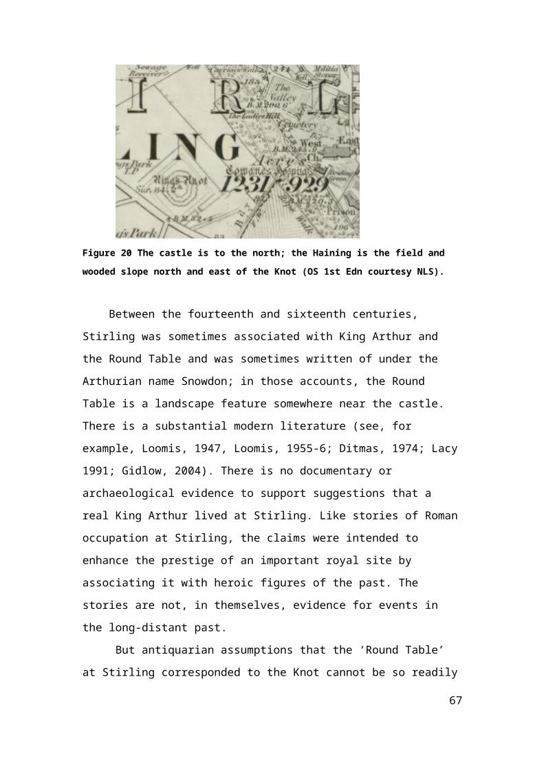
Harrison J.G. & Tipping R., 2007. ‘Early historic settlement on the western carselands
of the Forth Valley; a reappraisal’ Proceedings of the Society of Antiquaries of
Scotland, volume 137, 461-470.
Henderson, P., 1999. ‘Visual Setting of the English Country House, 1500-1625’ p.
207-218 in. J, Guillaume (ed) Architecture, Jardin, Paysage ; L’Environnement du
Château et de la Villa aux XVe et XVIe siècles, Picard, Paris.
Hendrie, W. F. 1989, Linlithgow: Six Hundred Years a Royal Burgh, Edinburgh.
Howard, D., 1999. ‘Chasse, sports et plaisirs autour des châteaux d’ Écosse,’ p 295-
306 in Guillaume (ed) Architecture, Jardin, Paysage; L’environnement du château et
de la villa aux XVe et XVIe siècles, Paris, Picard.
[IGS] Institute of Geological Sciences, 1974. Stirling – Sheet 39W (Drift Edition).
Edinburgh, HMSO.
Imrie, J. & Dunbar, J. G., 1982. Accounts of the Masters of Works for Royal Palaces
and Castles; 1616-1649, HMSO.
Innes, C., 1840. Liber Cartarum Sancte Crucis; Munimenta Ecclesie Sancte Crucis
De Edwinesburg, Bannatyne Club, Edinburgh.
Jamieson, F., 1994. ‘The Royal Gardens of Holyroodhouse, 1500-1603’. Garden
History, volume 22 18-36.
de Jonge, K., 1999. ‘L’environnement des châteaux dans les Pays-Bas méridionaux au
XVIe siècle et au début du XVIIe siècle, p. 185-206 in Guillaume (ed) Architecture,
Jardin, Paysage; L’environnement du château et de la villa aux XVe et XVIe siècles,
Paris, Picard.
Juhala, A.L., 2000. The Household and Court of King James VI of Scotland, 1567-
1603, unpublished Ph D Thesis, University of Edinburgh.
Lacy, N.J (ed) 1991. The New Arthurian Encyclopedia, Garland.
Laynesmith, J.L. 2004. The Last Medieval Queens; English Queenship 1445-1503,
Oxford UP.
67

Lazzaro, C., 1999. ‘The Sixteenth Century Central Italian Villa and the Cultural
Landscape’, p 29-44 in Guillaume, J. (ed) Architecture, Jardin, Paysage;
L’environnement du château et de la villa aux XVe et XVIe siècles, Paris, Picard.
Liddiard, R. 2007. Castles in Context; Power, Symbolism and Landscape, 1066 to
1500, Windgather, Macclesfield.
Loomis, R.S., 1947. ‘From Segontium to Sinadon – The Legends of a Cité Gaste’
Speculum, volume 22, 520-533.
Loomis R. S. 1955-56 ‘The Arthurian Legend in Scotland’, Proceedings of the
Society of Antiquaries of Scotland, volume 89 1-22.
Loudon, J.C., 1842. ‘Recollections of a Gardening Tour in Scotland’, Gardener’s
Magazine, volume 18, 596-606.
Loveday, J. 1890. Diary of a Tour in 1732, Roxburghe Club, Edinburgh.
Lyndsay, Sir David, The Testament and Complaynt of the Papyngo.
Lynch, M., 1990. ‘Queen Mary’s Triumph: the Baptismal Celebrations at Stirling in
December 1566’, Scottish Historical Review, LXIX, 1-21.
Macdougall, N., 1997. James IV, Tuckwell, East Linton.
Macky, J. 1723. A Journey Through Scotland [by the author of A Journey through
England], London.
McNeill P.G.B. & MacQueen H.L.1996. Atlas of Scottish History to 1707,
Edinburgh.
Maitland, W., 1757. The History and Antiquities of Scotland ... In Two Volumes...
London.
Márkus, G. 2010. Place-names, Protein and Power; the meaning of the Falkland
trenches, Falkland Centre for Stewardship.
Middleton R, Wells C E and Huckerby E, 1995, The Wetlands of North Lancashire,
Lancaster.
Miller, E. 1922. ‘The Site of the New Park in Relation to the Battle of Bannockburn’,
Transactions of the Stirling Natural History and Archaeological Society, volume 44
92-137
68

Miller E., 1933. ‘New Park and Torbrex on 24th June, 1314 – New Evidence’ ,
Transactions of the Stirling Natural History and Archaeological Society, volume 55,
89-129.
Mills, C., 2012. King’s Knot, Stirling: Dendrochronology of a fallen hawthorn,
Unpublished Report for Historic Scotland.
Morris, D.B. 1923. ‘The Hereditary Office of Keeper of Stirling Castle and the Earls
of Mar’ Transactions of Stirling Natural History and Archaeological Society, volume
45, 105-115.
Morris D.B., 1936. ‘Notes’, Transactions of Stirling Natural History and
Archaeological Society, volume 59, 105.
Murray A.L. 1965. ‘Accounts of the Pursemaster 1539-40’ Scottish History Society,
Miscellany X, 13-51.
Murray, A.L., 1971, ‘Sir John Skene and the Exchequer, 1594-1612’ pp. 125-155 in
Stair Society Miscellany, Edinburgh.
Murray A.L. 1983. ‘Financing the Royal Household: James V and his comptrollers
1513-43’, pp. 41-59 in The Renaissance and Reformation in Scotland : essays in
honour of Gordon Donaldson, edited by Ian B. Cowan & Duncan Shaw, Scottish
Academic Press, Edinburgh.
Nicholson R., 1997. Scotland, The Later Middle Ages, Mercat Press, Edinburgh.
Nimmo, W. 1777. A General History of Stirlingshire, Edinburgh.
Paton, H.M., 1957. Accounts of the Masters of Works, 1529-1616, HMSO.
Pitcairn, R. 1833. Criminal Trials in Scotland, Tait, Edinburgh.
[PP] Parliamentary Papers, various dates.
[RMS] Register of the Great Seal of Scotland, various dates.
[RSS] Register of the Privy Seal of Scotland, various dates.
[Retours] Inquisitionum ad Capellam Domini Regis Retornatarum… Abbreviatio,
Edinburgh, 1811
[RPC] Register of the Privy Council of Scotland, various dates.
[RPS] Records of the Parliaments of Scotland - http://www.rps.ac.uk/69

Regesta Regum Scotorum, I, The Acts of Malcolm IV, ed. G.W.S. Barrow (Edinburgh,
1960).
Regesta Regum Scotorum, II, The Acts of William I, ed. G.W.S. Barrow (Edinburgh,
1971).
R. Renwick (ed) Charters and other Documents relating to the Royal Burgh of
Stirling AD1124-1705, Glasgow, 1884
Rogers, C. 1876. Leaves from my Autobiography, London.
Ronald, J. 1899. Landmarks of Old Stirling, Stirling.
[RCAHMS] Royal Commission on the Ancient and Historical Monuments of
Scotland, 1963. Stirlingshire, HMSO.
RCAHMS, 1999. Holyrood Park; the Archaeology of the Royal Park, Broadsheet 6,
Edinburgh.
RCAHMS, 2001. Well Shelterd and Watered; Menstrie Glen, A Farming Landscape
Near Stirling, Edinburgh.
Ruckley, N.A., 1997, ‘The Geological Setting’ pp. 15-21 in Stephen Driscoll & Peter
Yeoman, 1997. Excavations within Edinburgh Castle in 1988-91, Edinburgh, Society
of Antiquaries of Scotland.
[Sadler] The State Papers and Letters of Sir Ralph Sadler, ed. Arthur Clifford,
Edinburgh, 1809.
Schama, S. 1995. Landscape and Memory, HarperCollins, London.
Sibbald, R. The History and Description of Stirlingshire, 1707 (reprinted, Stirling,
1892).
Silvester, R. 2000. ‘Medieval Reclamation of Marsh and Fen’, p. 122-140 in Cook H.
& Williamson T. Water Management in the English Landscape; Field, Marsh and
Meadow, Edinburgh.
Sloan G. et al.1986, Stirling Races, Stirling.
Smith, P.J., 1975, ‘The Foul Burns of Edinburgh; Public Health Attitudes and
Environmental Change’ in Scottish Geographical Magazine, volume 91(1), 25-37.
70

Smout, T.C., 2000. Nature Contested; Environmental History of Scotland and
Northern England Since 1600, Edinburgh UP.
Stevenson, K., 2006. Chivalry and Knighthood in Scotland, 1424-1513, Boydell,
Woodbridge.
Márkus, G. 2010. Scotland’s Castles, Batsford/ Historic Scotland, London.
Taylor, S., 2000. ‘Lowland Transhumance in the Howe of Fife: a toponomist’s eye
view’, Lecture and notes, Centre for Environmental History and Policy, University of
St Andrews.
Taylor S. & Marcus G., 2008. The Place-names of Fife, Volume 2; Central Fife
between the Rivers Leven and Eden, Shaun Tyas, Donington.
Thirsk, J., 1997. Alternative Agriculture; A History from the Black Death to the
Present Day, Oxford.
Thomas, A., 2005. Princelie Majestie: The Court of James V of Scotland, 1528-1542,
John Donald, Edinburgh.
Whiteley M, 1999. ‘Relationship between Garden, Park and Princely Residence in
Medieval France’ p. 91-102 in Jean Guillaume (ed.) Architecture, Jardin, Paysage:
L’environnement du Chateau et de la Villa aux XVe et XVIe Siècle, Paris; Picard.
Wickham-Jones, C.R., 1996. Arthur’s Seat and Holyrood Park; A Visitor’s Guide,
Historic Scotland.
Williamson, T., 1997. Fish, fur and feather; man and nature in the post-medieval
landscape. pp. 92-117 in Barker, K. and Darvill, T (ed.) Making English Landscapes,
Bournemouth.
Wilson, A, 1834-5. ‘The Parish of Falkland’, New Statistical Account, volume 9 p.
920- 940.
Wood, W., 1896. Keepers of the castle and palace of Falkland from the forfeiture of
the Earls of Fife to the present time compiled by W. Wood, factor (Scotland).
Wright, I.M. 1998. Stirling Letters by Isabella Murray Wright (1846-1932),
transcribed by Sue Jamieson, Stirling, Smith Art Gallery and Museum.
71

ARCHIVAL SOURCES
FRC - Fife Records Centre
FRC A/AAF40/ Rothes Papers
NA – National Archives (UK at Kew)
MF1/22 Plan of Stirling Castle and Kings Land 1806.
MPHH 1/204 Map of Stirling: showing the town, Castle and surrounding lands and
the attack of the rebels in 1745, probably contemporary.
NAS - National Archives of Scotland
C31/1 Records of Deeds recorded in Chancery 1844-6.
C31/2 Records of Deeds recorded in Chancery 1847-52
CC21/5 Register of Testaments
CC21/13 Stirling Commissary Court Register of Deeds and Protests
CC21/19 Stirling Commissary Court, Loose papers, 17th to 19th centuries
CR4/ Records of the Crown Estate in Scotland 19th century
CS7/ Court of Session, Register of Acts and Decreets
CS6/23 Acta Dominorum Consilii et Sessionis 1546-7.
E2/1 Exchequer Records of Signatures 1561-5
E33/3 Household Accounts of Mary of Guise-Lorraine 1543-4
E33/6/ Household Accounts, ditto, 1561[2]
E33/7/ Household Accounts of Mary, Queen of Scots
E34/22 Account of Henderson, de Guise’s flesher, 1558-9
E37/2 Inventory and Robert report on Stirling Castle, 1583
E40/10 Rental of the King’s Lands [south of Forth] 1542
GD26/ Leven and Melville Muniments
GD29/ Kinross House Papers
GD90/ Yule collection
GD112/ Breadalbane papers
GD124/ Mar and Kellie Papers
GD220/ Montrose papers
MW1/368 Restoration of King’s Knot, Stirling, 1866-8
MW1/374 Papers regarding King’s Knot, Stirling, 1906-1911
72

MW3/65 & /66Leases of Holyrood grazings
NP1/53A/ Notarial protocol book of Stephen Patersone [Falkland] 1590-1612
RD1/26 Register of Deeds, First Series, Scott’s Office, 1586-7
RHP 24154 Plan of drain at Falkland 1824
RHP2934 Drainage plan, King’s Park Golf Course, 1909
RS119/ Register of Sasines, Stirlingshire
SC67/7/ Stirling Sheriff Court Processes
SC67/49/ Stirling Sheriff Court Register of Deeds
NLS National Library of Scotland
NLS Ms 17603 f 71r-82v Royal grants to Erskines of Mar
MS.1646 Z.02/19a A Plan of the Town and Castle of Sterling 1725
Stirling Council Archives
B66/1/24 Miscellaneous notarial material 1544-1590
B66/9/ Stirling Burgh Register of Deeds
B66/16/ Stirling Burgh Court Book
B66/23/ Stirling Burgh Treasurers’ Accounts
B66/25/779/ Stirling Burgh Court Processes
SB6/3/1a/4 Spittal’s Hospital Accounts and titles etc
Stirling Council Minutes, typescript Index, nineteenth century.
73