the distribution of spatial distributions communities of ... · the distribution of communities ......
TRANSCRIPT

The distribution of communities
Spatial distributions of communities Part I: Community structure and gradients

Outline
Part I:
1. Basic definitions
2. Community function – energy
3. Spatial patterns
Part II:
1. Terrestrial classifications
2. Aquatic classifications

Basic definitions
Population
Group of inter-breeding individuals of a particular species
Metapopulation
set of local populations of a species that are linked by dispersal among those population (e.g. source-sink)

Basic definitions
Community
• Assemblage of interacting organisms that share the same habitat
• Boundaries – sharp or diffuse; somewhat arbitrary
– ecotone: transition zone between communities

Basic definitions
Ecosystem
• A set of abiotic and biotic components interacting in a given environment
• Emphasizes function

Basic definitions
Biome
• A defined area of similar climate and vegetation type; it may contain different taxa in different regions
• Defined by physiognomy, leaf type, plant density
• Highlights the role of the
physical environment in
determining characteristics
of species assemblages
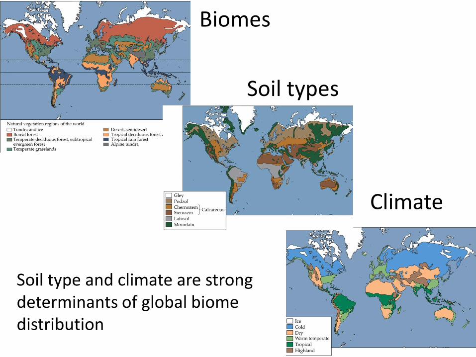
Biomes
Soil types
Climate
Soil type and climate are strong determinants of global biome distribution

Hie
rarc
hy

How do species’ characteristics (niche) affect community organization?
• Body size
• Trophic level
Community Organization: an energetic perspective

Body size :
1. Larger organisms require more energy
2. Smaller organisms require more energy per unit
3. Larger organisms generally have a greater capacity to withstand prolonged stress (higher storage reserves)

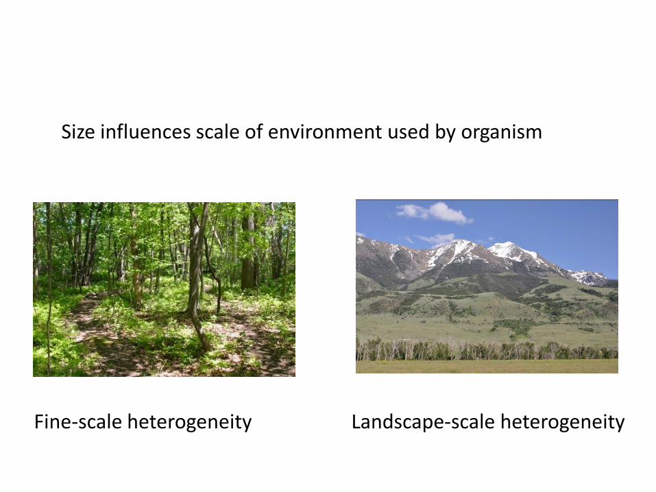
Size influences scale of environment used by organism
Fine-scale heterogeneity Landscape-scale heterogeneity
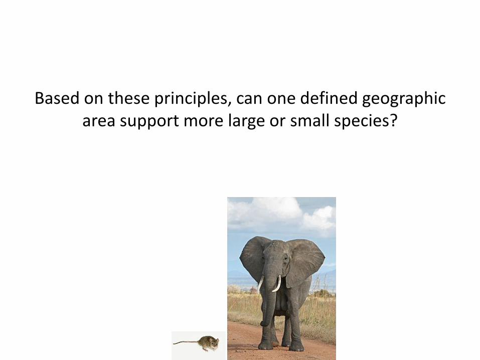
Based on these principles, can one defined geographic area support more large or small species?


Community Organization
Trophic Level (how organisms acquire energy)
Primary producers – produce biomass from inorganic compounds (autotrophs or chemoautotrophs) Herbivores/primary consumers – organisms that eat a plant-based diet (heterotrophs). Carnivore/secondary consumers –organisms that get nutrition from animal tissues (heterotrophs) Detritovores – consume detritus (heterotophs)
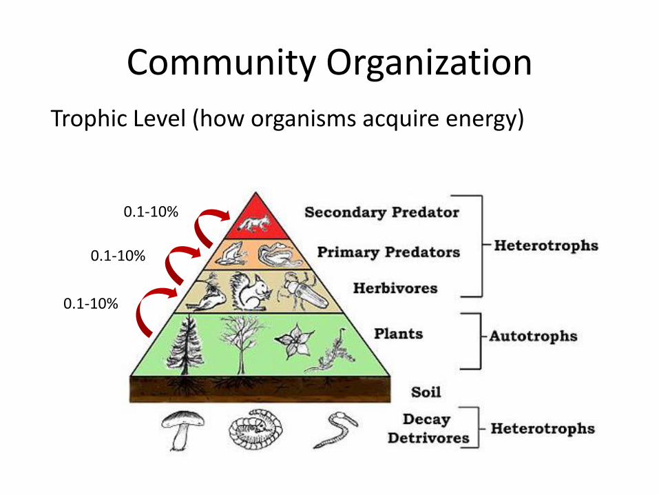
0.1-10%
0.1-10%
0.1-10%
Community Organization
Trophic Level (how organisms acquire energy)

Trophic Level (how organisms acquire energy)
Less energy available to higher trophic levels • Smaller carrying capacity • Fewer species • Larger and more generalized
Community Organization

Why are there rarely more than 5 trophic levels?

Spatial Patterns

Ecotone:
Zone of transition between two habitats or communities
Example: intertidal zone

Spatial Patterns
• Narrow ecotones can occur with abrupt environmental change (e.g. lake shore) – Species likely limited to one community
• Wide ecotones – often occur with gradual transitions between more similar communities – May support species from both communities
– May support ecotone specialists
– Can have high species richness

Environmental gradient
Ecotone specialists

Theoretical distributions of species along an environmental gradient
Robert Whittaker 1975
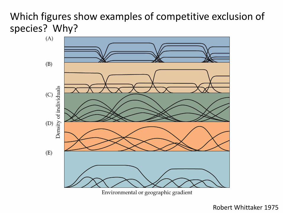
Which figures show examples of competitive exclusion of species? Why?
Robert Whittaker 1975
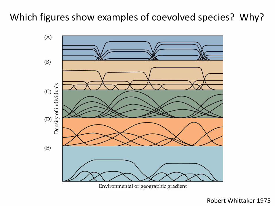
Which figures show examples of coevolved species? Why?
Robert Whittaker 1975

Distribution of trees along an elevation gradient in the Sierra Nevada (CA)
Yeaton 1981
Biological interactions or physical factors?
Spatial Patterns

So… what’s the typical pattern?
• Species typically replace each other gradually along smooth environmental gradients
but
• When species with similar niches come into contact, sharp boundaries can be observed due to competitive exclusion
• Sharp boundaries can also result from abrupt changes in environmental conditions (i.e. lake shore)

Spatial distributions of communities
Spatial distributions of communities Part II: Classifications

Classifying communities
• Difficult to classify communities into discrete units - do not represent discrete associations of species in space/time
• But…humans like to classify
• Quantitative patterns - multivariate statistical techniques used to quantify degree of similarity between two communities – Climate and soil have strong effect on types of plants in a region

Whittaker 1975

Terrestrial Vegetation Types
• Forest
• Woodland
• Shrubland
• Scrub
• Grassland
• Desert
• Tundra

• Evergreen and deciduous forests
• Dry & wet temperate forests
Temperate Forest

Tropical Forest
•Mainly broadleaf dominated
•Decidous dry forests
•Evergreen rainforests

Adaptation of species to low soil nutrients
• Buttressing of dominant plants
– Shallow roots stretch over surface, buttressing increases stability and increase flow of dissolved nutrients
– Convergent architecture
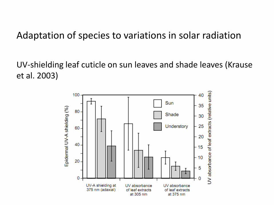
Adaptation of species to variations in solar radiation
UV-shielding leaf cuticle on sun leaves and shade leaves (Krause et al. 2003)

Adaptation of species to variations in solar radiation
Understory plants – large broad leaves
Epiphytes – plant that grows on another plant (non-parasite)
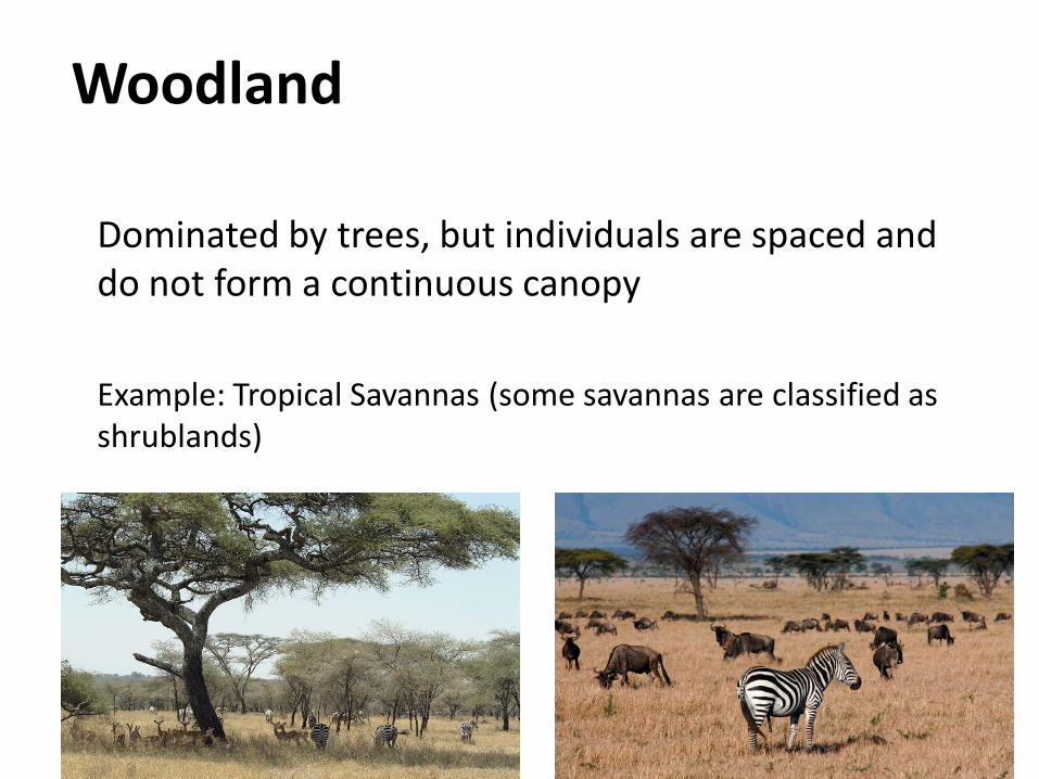
Woodland
Dominated by trees, but individuals are spaced and do not form a continuous canopy
Example: Tropical Savannas (some savannas are classified as shrublands)

Adaptation of species to drought
Grasses – rapid growth during wet periods, water and nutrient storage in roots during dry periods
Taproots – enlarged straight tapering root that grows vertically
Trees store water in trunks, roots

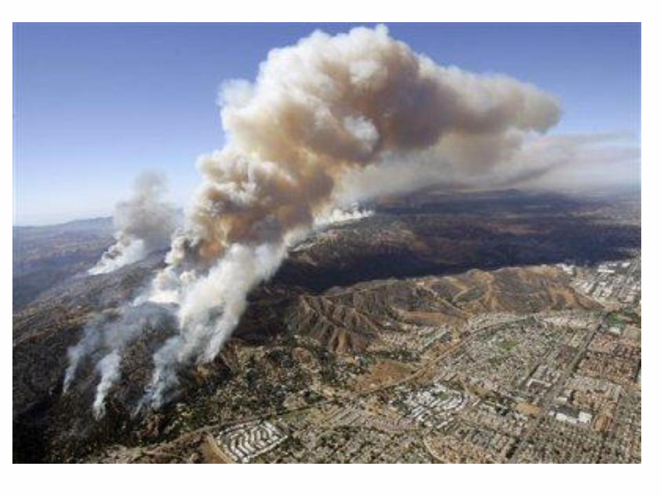
Adaptation of species to fire
Perennial grasses – have rhizomes and can resprout (some have argued this is an adaptation to herbivory)
Thick bark – protect vascular tissue from heat damage

Baobab (Adansonia) Africa, Australia, Madagascar
Long-lived
Water storage in trunk
Tap root
Deciduous
Fire-resistant bark

Shrubland
Continuous layer of shrubs, up to several meters high
Example: Chaparral (sclerophyllous)

Adaptation of species to drought
Sclerophyllous – “sclero” = hard, phyll = leaf
Leaves – hard, thick, leathery, small (minimize moisture loss)

Chamise (Adenostoma fasciculatum)
Evergreen chaparral shrub native to California (2-12 ft tall)
Extensive root system (including taproot)
Fires generally occur frequently (e.g. 10-40 yrs)
Volatile secondary chemicals promote fire
Resprouts
Heat stimulates seed germination

Scrub
Shrubby individuals widely spaced
Example: Coastal sage scrub, coastal California

Adaptations to drought
Soft wax-covered leaves reduce moisture loss
Drought-deciduous leaves
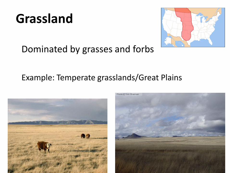
Grassland
Dominated by grasses and forbs
Example: Temperate grasslands/Great Plains
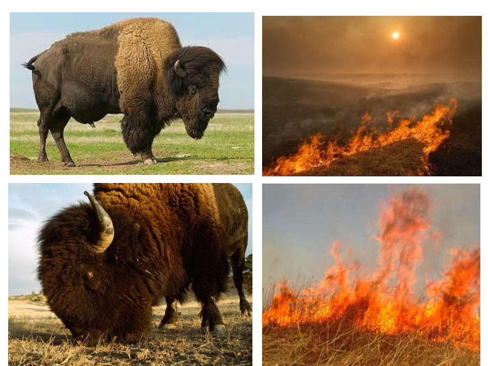
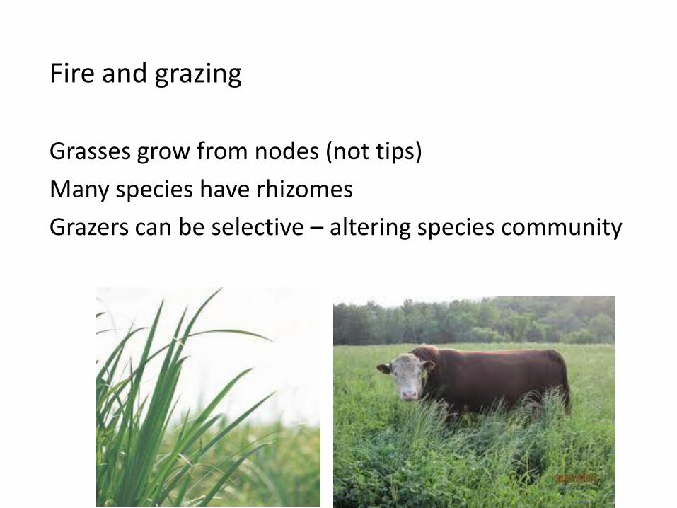
Fire and grazing
Grasses grow from nodes (not tips)
Many species have rhizomes
Grazers can be selective – altering species community

Bison as a keystone species
N availability higher in grazed areas Knapp et al 1991

Bison as a keystone species
Grass photosynthesis higher in grazed areas
Knapp et al 1991

Bison as a keystone species
grazed
ungrazed
Knapp et al 1991

Great Plains grasslands evolved under influence of bison (Bison bison) but currently dominated by cattle (Bos taurus)
• What are the differences in the grazing behaviors of bison and cattle in a tall grass prairie? (Allred et al. 2011)
• Methods: Collared bison and cattle with GPS and monitored locations
• Results: – Cattle – preferred riparian zones
– Bison – not limited by proximity to water
• Implications: cattle in riparian areas may alter vegetation (reduced veg cover, decreased productivity)
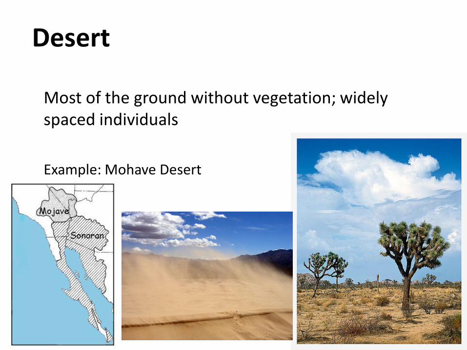
Desert
Most of the ground without vegetation; widely spaced individuals
Example: Mohave Desert

Adaptations to heat and drought
Thick cuticle
Spines, hairs (reflect solar radiation)
Self-shade (pines, leaves)
Water storage
Shallow root system
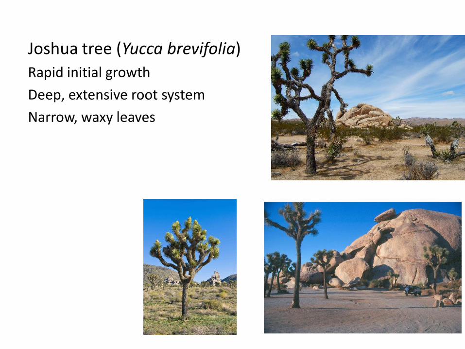
Joshua tree (Yucca brevifolia)
Rapid initial growth
Deep, extensive root system
Narrow, waxy leaves

Tundra
Treeless biome under stressful environmental conditions
Example: Alpine tundra

Adaptations to cold and dry
Mats or cushion growth form
Dwarf shrubs
Dark and hairy (absorb/trap heat)
Tap roots


Aquatic communities
Physical factors that affect aquatic organisms are different than terrestrial systems
– Three-dimensional space
– Less temporal variation in temperature
– Variations in salinity, light, pressure, water movement, nature of substrate

Aquatic communities
• Marine (oceanographers)– salinity varies ~ 35 ppt
• Freshwater (limnologists) – salinity usually < 0.5 ppt
Green Lakes Valley, CO

• 1.37 billion cubic km in volume
• Temperature, light, pressure, substrate
• Marine classification – primarily based on water temp
Arctic
subarctic Northern temperate
Northern sub-tropical
Tropical
Southern sub-tropical
Southern temperate
subantarctic
Antarctic
Marine community classification

Marine community classification
Photic zone – “well lit”
Aphotic zone
Boundary is somewhat arbitrary, but usually set where light is less than 1-10% of incident solar radiation. Deepens with distance from coast Important ecologically
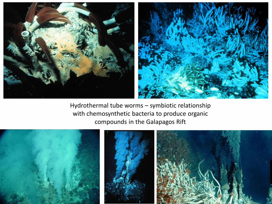
Hydrothermal tube worms – symbiotic relationship with chemosynthetic bacteria to produce organic
compounds in the Galapagos Rift

Bathymetry – depth and configuration of ocean bottom 1. Intertidal 2. Neritic 3. Bathyal 4. Abyssal
Marine community classification
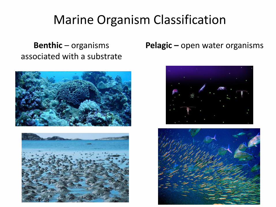
Pelagic – open water organisms Benthic – organisms associated with a substrate
Marine Organism Classification
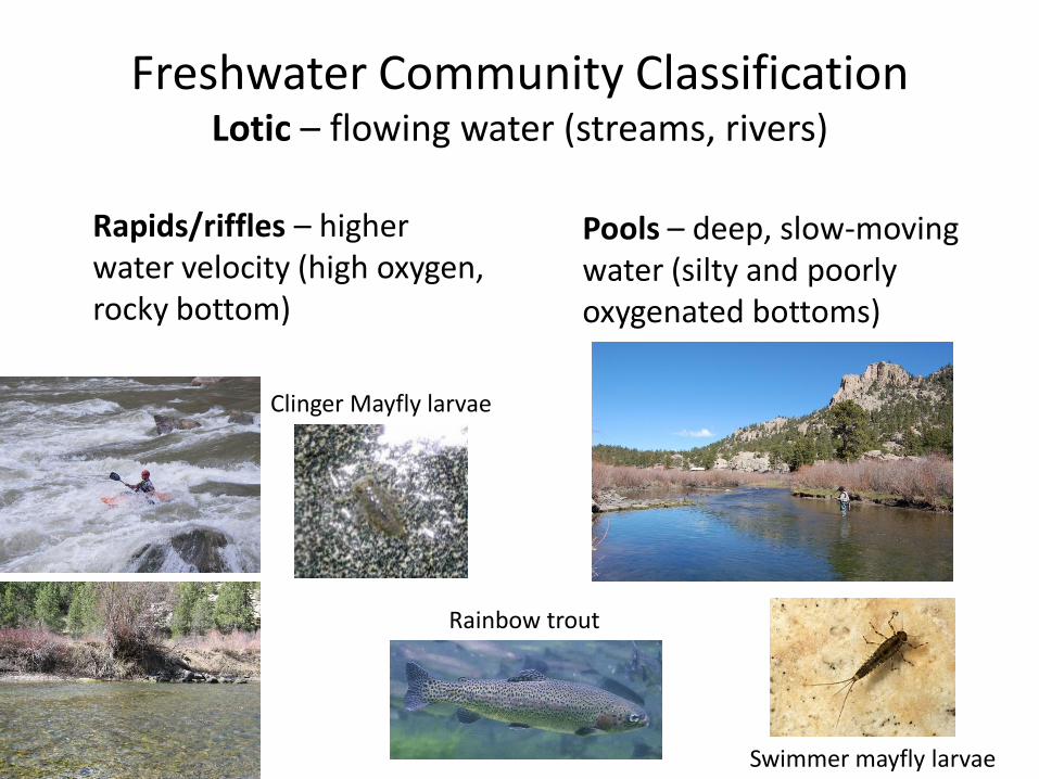
Freshwater Community Classification Lotic – flowing water (streams, rivers)
Rapids/riffles – higher water velocity (high oxygen, rocky bottom)
Pools – deep, slow-moving water (silty and poorly oxygenated bottoms)
Clinger Mayfly larvae
Rainbow trout
Swimmer mayfly larvae

Littoral – light penetrates to bottom (rooted veg)
Limnetic – offshore water that light penetrates for effective photosynthesis (phytoplankton)
Profundal – beyond depth of effective light penetration
Freshwater Community Classification Lentic – standing water (lakes, ponds)

Eutrophic – ample/excessive nutrients, often shallow, warmer, lower oxygen content, subject to algal blooms (high primary productivity) Oligotrophic – low nutrient content, higher oxygen at depth (colder), lower primary productivity
Freshwater Community Classification Lentic – standing water (lakes, ponds)

Eutrophication - Table Rock Lake, Missouri

Freshwater Communities Rare community - Hypersaline Lake
Example: Great Salt Lake