the geon lidar workflow: an internet-based tool for the distribution and processing of lidar point...
Post on 19-Dec-2015
218 views
TRANSCRIPT
The GEON LiDAR Workflow: An Internet-Based Tool for the Distribution and
Processing of LiDAR Point Cloud Data
Christopher J. Crosby, J Ramón Arrowsmith, Jeffrey Connor, Gilead Wurman
Efrat Frank, Ashraf Memon, Vishu Nandigam, Chaitan Baru
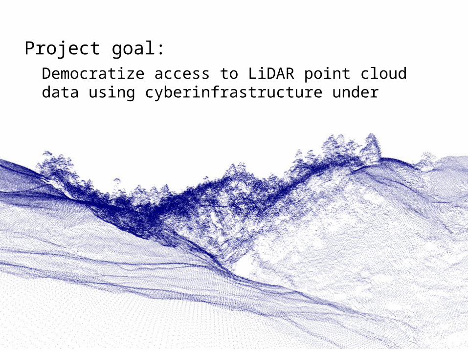
Project goal:Democratize access to LiDAR point cloud data using cyberinfrastructure under development by the GEON project.
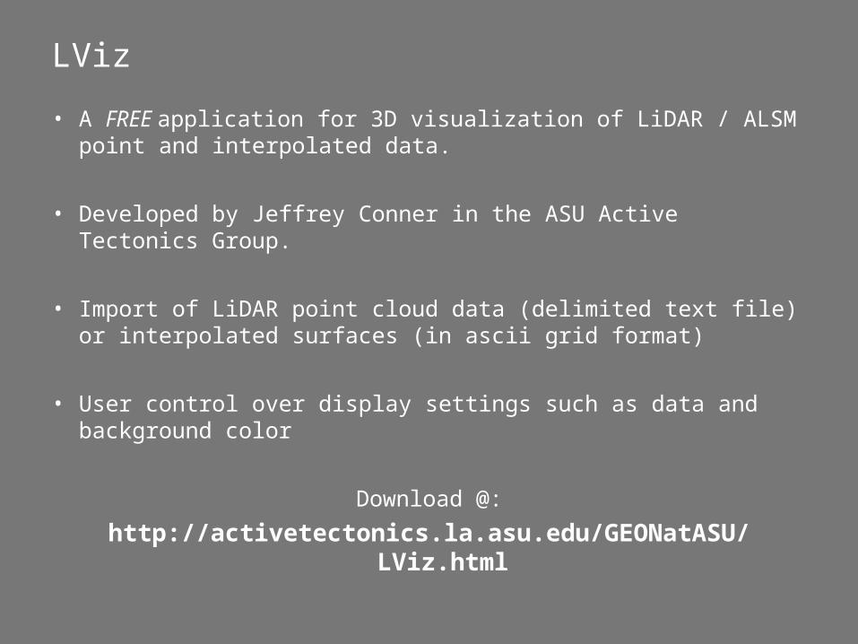
LViz
• A FREE application for 3D visualization of LiDAR / ALSM point and interpolated data.
• Developed by Jeffrey Conner in the ASU Active Tectonics Group.
• Import of LiDAR point cloud data (delimited text file) or interpolated surfaces (in ascii grid format)
• User control over display settings such as data and background color
Download @:
http://activetectonics.la.asu.edu/GEONatASU/LViz.html

LViz:http://activetectonics.la.asu.edu/GEONatASU/LViz.html

~1.1 million data points interpolated to produce this DEM
• Data typically viewed as DEM
• Creation of DEMs required interpolation of huge quantities of point data.
• Currently difficult to access and process these data volumes.


~1.2 billion data points
Example Data Set:
• Northern San Andreas fault and associated marine terraces.
• Flown February 2003
• Funded by NASA in collaboration w/ USGS.
• ~418 Square Kilometers

The Computational Challenge:
• LiDAR/ALSM generates massive data volumes - billions of returns are not uncommon in these data sets.
• Distribution of these volumes of point cloud data to users via the internet represents a significant challenge.
• Processing and analysis of these data requires significant computing resources not available to most geoscientists.
• Interpolation of these data challenges typical GIS / interpolation software.– our tests indicate that ArcGIS, Matlab and similar software
packages struggle to interpolate even a small portion of these data.

• “GEON was designed as an equal collaboration between Information Technology (IT) and Geoscience researchers, with the goal of developing an enabling IT platform to facilitate the next generation of Geoscience research.”
• Distributed network:
ASU node “Agassiz”:

The Vision:• Utilize the
cyberinfrastructure developed by GEON to offer online data distribution, interpolation to grid, and analysis of large LiDAR datasets.
• Utilize modular web services to complete a variety of processing and analysis tasks.
• Completely internet-based workflow:– Point cloud to
visualization
• Offer users control of interpolation and analysis parameters. Conceptual GEON LiDAR Workflow
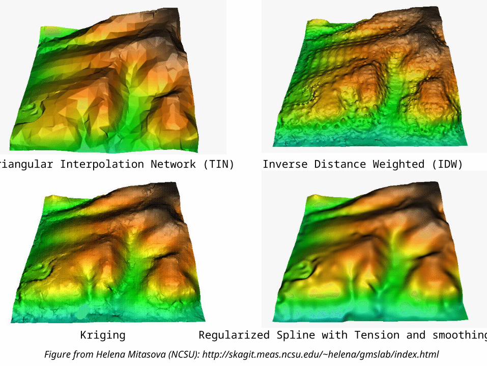
Triangular Interpolation Network (TIN) Inverse Distance Weighted (IDW)
Kriging Regularized Spline with Tension and smoothing (RST)
Figure from Helena Mitasova (NCSU): http://skagit.meas.ncsu.edu/~helena/gmslab/index.html

• Goal is to provide an interactive processing environment where users can iterate and explore various interpolation and processing options.– Optimize landscape representation based upon application
of the data.
• By using distributed computing resources, user is able to quickly run multiple jobs and compare results.– Similar iteration may take days or weeks on a single local
machine.
• Leave computationally intensive data processing to resources available through GEON and offer user downloadable products in common file formats they can work with locally.


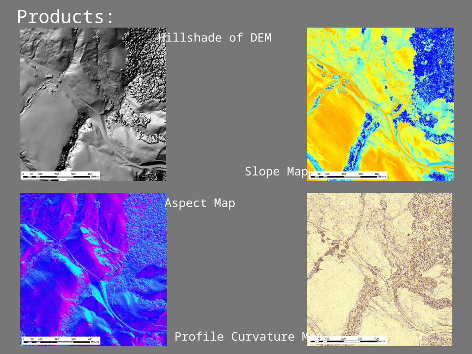
Products:Hillshade of DEM
Slope Map
Aspect Map
Profile Curvature Map

Implementation Overview:• Internet-based LiDAR processing workflow that utilizes advanced spatial
databases (IBM DB2), GRASS Open Source GIS, Kepler Workflow manager and web service technology to distribute, interpolate, and analyze LiDAR data.
GRASS GIS

GLW Status
• Three datasets online:
1. Northern San Andreas Fault
2. West Rainier Seismic Zone
3. Eastern California Shear Zone NCALM / Mike Oskin PI
• Total of ~2.5 billion LiDAR returns available via GLW.
• More data sets in the queue:
• Hector Mine EQ
• NCALM Napa Valley
• Others…
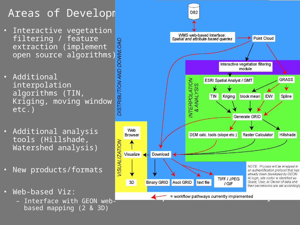
Areas of Development:
• Interactive vegetation filtering / feature extraction (implement open source algorithms)
• Additional interpolation algorithms (TIN, Kriging, moving window etc.)
• Additional analysis tools (Hillshade, Watershed analysis)
• New products/formats
• Web-based Viz:– Interface with GEON web-
based mapping (2 & 3D)
Conceptual GEON LiDAR Workflow
GEON LiDAR Workflow could be adopted as a valuable infrastructure resource for democratizing access to future LiDAR point cloud datasets for the geoscience community
More information on the GLW is available @:
http://www.geongrid.org/science/lidar.html
http://activetectonics.la.asu.edu/ASU_GEON/research.html
Please send feedback to: