the impact of earthquake and monsoon induced …/media/shared/documents/events/past...the impact of...
TRANSCRIPT

The impact of earthquake and monsoon induced
Landslides on Rural and Remote Transport
Infrastructure. A case study from Nepal.
Dr. Michael Whitworth
Principal Engineering Geologist/Geomorphologist
@geo_whitworth @AECOM
Presentation Outline
• Background to Nepal
• Transport Infrastructure-Rural vs Remote
• Monsoon vs Earthquake Induced Landslides
• Case Study 1-Ariniko Highway
• Case Study 2-Remote Communities
• Disaster Resilience Scorecard
• Summary/Conclusions
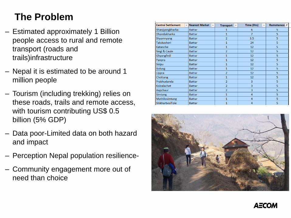
The Problem
– Estimated approximately 1 Billion
people access to rural and remote
transport (roads and
trails)infrastructure
– Nepal it is estimated to be around 1
million people
– Tourism (including trekking) relies on
these roads, trails and remote access,
with tourism contributing US$ 0.5
billion (5% GDP)
– Data poor-Limited data on both hazard
and impact
– Perception Nepal population resilience-
– Community engagement more out of
need than choice

Introduction
• 2015 Gorkha Earthquake
• Over 3500 individual landslides mapped
• Largest individual landslide within Langtang
Valley (Avalanche induced)
• 10% of fatalities due to landslides?
• Major road and infrastructure largely
unaffected (Gorkha-Kathmandu-Chautara)
• Significant Impact on rural and remote
access
• Monsoon Induced Landslides
• Annual occurrence
• 100’s of landslides annually
• 100’s of fatalities annually
• Largest recent Jure Landslide with over
400 fatalities
• Impacts all levels of transport
infrastructure

Nepal-Country Profile

Locations

Transport Routes

Road Network-Strategic – Managed by Nepal
Department of Roads
– Predominantly tarmac to
district centres
– Limited impact from
earthquake, but significant
impact from other triggers
– Some asset management
– Maintenance reactive
– Some geohazard
assessment >20 years old
– Currently undertaking and
planning further roads

Road Network-District/Village Network
– Under the control of
DoLiDAR
– Typically from District
centres
– Typically Earthen or gravel
– Heavily impacted by
monsoons and EQ
landslides
– Villages fund new roads
– Little to no thought on
geohazards
– Then adopted by DoLiDAR

Road Network-Trails
– Under the control of DoLiDAR
– Extensive network
– Several days walk to road head
for some villages
– Critical lifeline for access to
markets, health care and
schools
– Significant impact from both
EQ and monsoon landslided
– No of people along routes and
financial metrics unknown
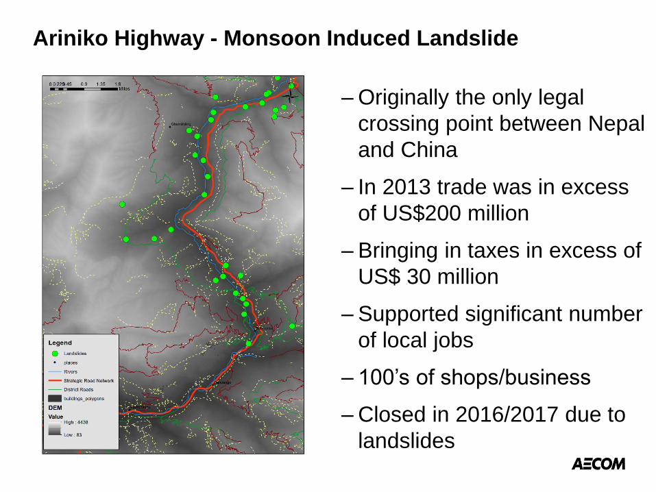
Ariniko Highway - Monsoon Induced Landslide
– Originally the only legal
crossing point between Nepal
and China
– In 2013 trade was in excess
of US$200 million
– Bringing in taxes in excess of
US$ 30 million
– Supported significant number
of local jobs
– 100’s of shops/business
– Closed in 2016/2017 due to
landslides
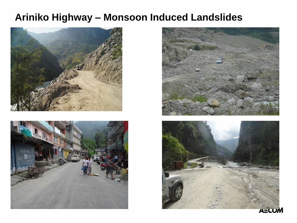
Ariniko Highway – Monsoon Induced Landslides

Remote Communities- Earthquake Induced Landslides
– Location of study area along
Mansalu Trekking circuit
– Over 20,000 trekkers
annually prior to earthquake
– Several million income to
local economy
– No Figures post-earthquake,
but significant parts of route
& infrastructure remains
closed
– Difficult to assess wider
impact i.e. access to market

Remote Communities- Earthquake Induced Landslides

Remote Mountain Communities

Risk Analysis vs Resilience of Systems
With limited data classic risk
assessment approach difficult
to apply
Alternative to investigate the
resilience of systems (roads)
to landslides occurrence
Resilience defined as the
ability to recover
Typically applied to cities and
have applied to Kathmandu
Can it be applied to an
individual system
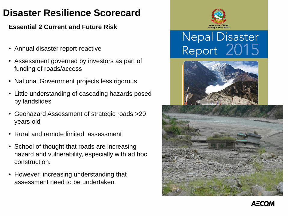
Disaster Resilience Scorecard
Essential 2 Current and Future Risk
• Annual disaster report-reactive
• Assessment governed by investors as part of
funding of roads/access
• National Government projects less rigorous
• Little understanding of cascading hazards posed
by landslides
• Geohazard Assessment of strategic roads >20
years old
• Rural and remote limited assessment
• School of thought that roads are increasing
hazard and vulnerability, especially with ad hoc
construction.
• However, increasing understanding that
assessment need to be undertaken

Essential 8 Critical Infrastructure-Roads
• Post Event Strategic and District Roads
typically reopen within few days to weeks
• Although some larger events closed roads
completely
• More rural and remote access can take longer
• Perception that the impact of earthquake
induced landslides on very remote not
addressed and may take many years
• Appear to be more resilient to annual monsoon
events
• Difficult to prioritise beyond strategic and
district roads due to limited data and
assessment
• Response needs to be pro-active rather than
reactive
• Roads creating slope preconditioning

Essential 4 Resilient Urban Development
• Transport infrastructure critical to
resilient urban development
• Land use planning improving, with
development restricted in certain
areas and certain conditions >20
degree slopes
• Resettlement plans take in to
account geohazards including
landslides of settlement, but to be
seen if access considered.
• Massive historical legacy
• Issues with difference and
understanding of developments
linked to earthquake and monsoon
induced landslides
Summary/Conclusions
– Rural and remote access significantly impacted by monsoon
and earthquake induced landslides
– Monsoon and earthquake induced landslide pose different
problems both spatially and temporarily
– More resilient to annual monsoon landslides
– Problem is how to access and prioritise
– Assessment of resilience on option, but certainly not the best
– But need data to support assessment
– Not all doom and gloom as significant effort ongoing to improve
resilience and assessment to a range of hazards

Thank you