the judicial role of the surveyor - taps-inc.com · the judicial role of the surveyor ... thomas...
TRANSCRIPT
0
The Judicial Role of the
Surveyor
~ and ~
Surveyor Ethics
Tennessee Association ~ of ~
Professional Surveyors
Murfreesboro Tennessee
March 26 2016
Presented by
Gary R Kent PS The Schneider Corporation
Indianapolis Indiana copy 2016 Gary R Kent PS The Schneider Corporation Indianapolis Indiana
1
Synopsis
Only two persons can truly resolve a disputed boundary or title problem Those persons do not
include attorneys title companies or surveyors And in a sense they do not even include judges
and juries - at least not of their own volition This program explores the role that the
professional surveyor can and arguably should take in helping property owners establish or
maintain their common boundary in the location that they were perfectly satisfied with - at least
until the surveyor showed up We will look at the role of the surveyor as related to boundaries
not only from a statutory standpoint but also as eloquently expressed by renowned Michigan
Supreme Court Chief Justice Thomas Cooley in his seminal 1881 treatise The Judicial Function
of Surveyors As a part of this we will review the dynamic that exists between matters of title
and matters of survey including a close look at title insurance We will also review several
examples that demonstrate the problem and offer an alternative to what is often the standard
approach by surveyors We will outline a new approach that has the surveyor helping property
owners avoid the expense and angst of unnecessarily litigating boundaries when there has been
acquiescence to an accepted line by both owners
Program
The Definition of Surveying ndash Tennessee Statute
Rules of Professional Conduct ndash Tennessee Administrative Law
Boundaries and the Status Quo
Matters of Title vs Matters of Survey
o Boundary Law
Unwritten Rights and the Surveyorrsquos Role
o Marketable Title
o The Role of Title Insurance
o Recordation Acts
o JuniorSenior Rights
The Judicial Function of Surveyors Justice Thomas M Cooley 1881
A Proposal
o A Statute of Limitation on Boundaries Jeffery N Lucas PLS Esq
o Limited License Legal Technician ndash State of Washington
o The Surveyorrsquos Roles and Responsibilities Gary R Kent PS 2014
Examples and scenarios
Mediation and the Role of the Mediator
NOTE- The author of this paper and presentation is not an attorney It is the authorrsquos intent that neither
this paper nor the presentation should be considered legal advice or a substitute for consultation with
an attorney
2
The Role of the Land Surveyor in Boundary Determinations
The Regulation of Land Surveying
The definition of surveying in all states allows the registered surveyor to rely upon the work of
unlicensed subordinates working under his or her direct supervision There are relatively few
registered surveyors in the United States (probably on the order of 40000)
The practice of Land Surveying is in all states regulated by a state board Some states like
West Virginia Maine New Hampshire and Indiana have boards that regulate only Land
Surveyors Many other states however have ldquojointrdquo boards that regulate more than one
profession ndash typically engineering and surveying
Surveying is part Science part Law and part Art
The science aspect is generally the science of measurement ndash using angle measuring devices
(theodolites total stations) distance measuring devices (electronic distance measuring
instruments steel tapes) and GPS (global positioning system which uses satellites)
The law aspects relate to the interpretation and resolution of legal descriptions and boundaries
There are no statutes or legislated laws that tell surveyors how to determine boundaries the rules
for that are from a body of common law derived from hundreds of years of court cases related to
boundary disputes and legal descriptions Surveyors cannot make proper boundary
determinations without studying and understanding what the ldquoweight of authorityrdquo has been in
case law
The art aspect could be said to apply to the judgments and decisions in the field related to where
and to what extent to look for evidence and how that information is all presented For example
having a gut feeling on where to dig to try and find a stone marker set in 1840 or how to most
effectively run a survey line from one location across a ravine and river and through the trees to
another location
Surveying can also be seen as part ldquodoingrdquo and part ldquothinkingrdquo Itrsquos one thing to make a
measurement with todayrsquos technologies virtually anyone can make very precise survey-grade
measurements But itrsquos an entirely different thing to understand where to make the
measurements from and to what and how to apply those measurements to the facts and evidence
at hand so a defensible boundary opinion can be made
The retracement of a boundary is the professional opinion of the surveyor That opinion is based
on the evidence available to the surveyor and if that evidence changes the opinion may well
change Evidence comes in many forms ndash from the writings from what is found in the field
from verbal and written statements from measurements and from historical information
Two competent surveyors faced with the same evidence will generally come to the same opinion
although there are occasions when the surveyors will simply have differing opinions as to how to
interpret or weigh certain pieces of evidence This can result in the two surveyors arriving at
different conclusions as to a boundary location If the surveyors cannot resolve the differences
satisfactorily and if the affected owners are inclined to litigate a final determination will be
made by a court
3
Tennessee Definition of Land Surveying1
Practice of land surveying means any service of work the adequate performance of
which involves the application of special knowledge of the principles of mathematics the
related physical and applied sciences and the relevant requirements of law for adequate
evidence to the act of measuring and locating lines angles elevations natural and man-
made features in the air on the surface of the earth within underground workings and on
the beds of bodies of water for the purpose of determining areas and volumes for the
monumenting of property boundaries and for the platting and layout of lands and
subdivisions of land including the topography drainage alignment and grades of streets
and for the preparation and perpetuation of maps records plats field notes records and
property descriptions that represent these surveyshellip
Rules of Professional Conduct2
Boundaries ldquothe Status Quordquo and the Surveyor
What constitutes the line is a matter of law where it is is a matter of fact Smothers v
Schlosser 163 SE 2d 127 - NC Court of Appeals 1968 [internal citations omitted]
1 Tennessee Code 62-18-102(3) 2 Rules of the Tennessee Board of Examiners for Land Surveyors Chapter 0820-4 Rules of Professional Conduct
4
The vocation of a surveyor is limited to the ascertainment of definite lines He may
ascertain where the lines and corners specified in the description of the given tract of real
estate actually are He does not have the power to determine what the terms of such
description ought to be Where the line lies and where its corners are is a question and
on which the surveyor on account of his superior facilities for doing so may be called
upon to officially determine What the lines and corners are is a matter of law which
courts can alone declare Wilson v Powell (1905) 37 IndApp 44 70 NE 611
With respect to boundaries the surveyor deals with matters of survey primarily location ndash the
ldquowhererdquo of a boundary Sometimes the boundary location is not in question ndash the deed
description is unambiguous and there are no issues with the adjoiners Many times however the
description(s) require interpretation andor extrinsic evidence to eliminate or resolve the
ambiguities Either way we are in the realm of ldquowhererdquo - which falls in the authority of the
surveyor on which to give an opinion based on his or her survey
Alternatively the law deals with ldquowhatrdquo that boundary line is ndash in essence what the boundary
represents with respect to title (ownership) These concepts of ldquowhererdquo and ldquowhatrdquo are often
however not mutually exclusive The best example of that is with unwritten rights
Unwritten Rights ndash Title Doctrine or Evidence of Intent
There are a number of means by which boundaries can be established by unwritten means Yet
each of these doctrines would seem to be contrary to the otherwise inviolate Statute of Frauds
which requires that conveyances of real property must be in writing The courts have found a way
around this conundrum however by determining that in some cases these doctrines do not
necessarily transfer title but rather merely fix what were otherwise uncertain lines
In other cases particularly when the intent of the words in the conveyance is exceptionally
ambiguous they may point to acquiescence estoppel parol agreement or practical location as the
best evidence of that intent
When applied in the former manner these are simply title doctrines the evidence of which
surveyors normally locate note and show as evidence contrary to the written title
However surveyors often neglect to recognize that when considered in the latter manner this
evidence can provide proper guidance when ldquotryingrdquo to resolve a particularly intractable boundary
property Rather they will harken back to their comfort with mathematics and concoct a solution
that - relative to the long-standing lines of possession is entirely irrational - but provides a clear
means by which they can justify their opinion Math
Adverse Possession
Everyone can agree that the doctrine of adverse possession falls in the realm of title not survey
The necessary elements typically include all most or some version of the following adverse or
hostile open and notorious visible actual exclusive and with a claim of right or color of title
Some states also require payment of the property taxes due on the area being claimed The
statutory period varies from 3 to 21 years depending on the state with some states providing for
shorter periods if the claimant can show color of title that the taxes had been paid andor if the
nature of the possession was especially open
5
Courts do not look kindly on the doctrine of adverse possession which is why every single
element most be proven - typically by ldquoclear and convincingrdquo evidence Failure to prove only
one of the elements is enough to defeat the entire claim However when a claim of unwritten
rights is perfected in a court of law it (1) confirms that the boundary of the ownership has
changed from the original written title line and (2) creates marketable title to the ownership line
Adverse Possession ndash Tennessee
Generally acquisition by adverse possession for the requisite period of time whether
statutory or under common law must be (a) actual and exclusive (b) open visible and
notorious (c) continuous and peaceable and (d) hostile and adverse Ralph E Boyer
Survey of the Law of Property 233 236 (3d ed1981) The adverse possession of real
estate is not only inconsistent with the right of the title holder but may when all elements
of the doctrine are present create an actual ownership interest 10 Thompson on Real
Property sect 8701 at 73-74 (David A Thomas ed 1994)
[L]imitations of real property actions ie the statutory forms of adverse possession are
found in Tennessee Code Annotated sections 28-2-101 through 103 Initially land
granted by the state for example requires only a period of seven years adverse
possession under a recorded assurance or color of title[3] terms which are used
interchangeably TennCode Ann sect 28-2-101 (2000) see eg Slatton v Tenn Coal
Iron amp RR Co 109 Tenn 415 75 SW 926 927 (Tenn1902) Another provision
Tennessee Code Annotated section 28-2-105 does not require any proof of a state land
grant but does prescribe assurance of title for thirty years and a minimum of seven years
of adverse possession The limitations on actions statutes described in Tennessee Code
Annotated sections 28-2-102 and 103 are defensive only barring only the remedy Kittel
v Steger 121 Tenn 400 117 SW 500 503 (Tenn1909) These rights may be utilized
by the adverse holder only in the defense of a suit and not as a means to bar use by the
rightful owner Savely v Bridges 57 TennApp 372 418 SW2d 472 479
(TennCtApp1967) Tennessee Code Annotated section 28-2-102 provides a defense
when there is assurance of title and seven years possession this statute serves as
protection as to the entire boundary as described Section 28-2-103 which does not
involve color of title protects an adverse holder after a period of seven years but only as
to that portion of the land in his actual possession Shearer v Vandergriff 661 SW2d
680 682 (Tenn 1983)
Cumulus Broadcasting Inc v Shim 226 SW 3d 366 - Tenn Supreme Court 2007
Acquiescence Parol Agreement Practical Location Estoppel and Repose
As suggested above with a few exceptions the courts view other unwritten boundary doctrines -
acquiescence practical location and parol agreement - as being either manifestations of prior
boundary line agreements or the best evidence of an otherwise ambiguous intent This is contrary
to adverse possession which arises out of contentious situations Even the doctrines of estoppel
and repose could be seen as representing boundary line agreements ndash in essence inverse
agreements whereby the inaction of one party can be taken as an implied acceptance of a claim
by an adjoiner
6
Each of the various unwritten boundary doctrines has its own set of specific requirements that
must be met in order for a court to perfect a claim of title Some requirements are problematic in
that they require a look inside the mind of the claimant and some requirements are
counterintuitive As an example of the former in some states a claim of adverse possession is
defeated if it can be shown that the claimant did not intend to possess someone elsersquos land (ie it
was lsquoby mistakerdquo) With regard to the latter in some states a parol agreement between two
parties to set a common line is not valid if there is no conflict in the written title or if a survey
would have otherwise resolved the uncertainty
Acquiescence
There are several theories that the doctrine of acquiescence is based on One is the situation in
which acquiescence is considered evidence of some prior oral agreement between two adjoining
owners who were either uncertain or in dispute over the location of the true boundary Long
acquiescence to a line (usually a fence) by both parties is considered evidence of that parol
agreement In some states definitive evidence of the dispute or uncertainty must be provided to
prove boundary by acquiescence
Another theory is simply that long acquiescence in a line without objection by either party (for
the statutory period which can vary state-to-state) establishes the boundary
Both of these theories could be seen to essentially rely on estoppel whereby the adjoiners are
prevented from disputing the line because of their - or their predecessorsrsquo - previous agreement
or because of their long acceptance to the line
Finally if a conveyance is made that mistakenly does not describe to an intended boundary long
acquiescence to the intended line can cause the line to move to the intended line
The general rule on title by acquiescence is state in 11 CJS Boundaries which reads in
pertinent part as follows
In order to establish a boundary by acquiescence it is not necessary that the acquiescence
should be manifested by a conventional agreement but recognition and acquiescence
must be mutual and both parties must have knowledge of the existence of a line as a
boundary line
The question as to what constitutes acquiescence must be decided from the particular
facts of the case and no absolute rule can be applied to every case Generally it depends
on the acts or declarations of the parties interested on inferences or presumptions from
their conduct or on their silence Failure to object to an encroachment with knowledge
that the owner thereof claims to that line may amount to acquiescence establishing the
line as a boundary
Recognition of and acquiescence in a line as the true boundary line of ones land not
induced by mistake and continued through a considerable period of time affords strong
if not conclusive evidence that the line so recognized is in fact the true line and it
supports an inference or presumption that there has been an agreement fixing it as the
true line Where recognition and acquiescence have continued for the period of time
prescribed by statutes concerning acquiescence or for the period required by statutes of
limitations for acquisition of title by adverse possession the presumption that the line is
in fact the true line or that there has been an agreement fixing it as the true line becomes
7
conclusive and the line as acquiesced in is conclusively established as the boundary As
established it will control courses and distances called for in the title deeds or grants and
the parties need not rely on paper title
11 CJS Boundaries sectsect 79 and 81 (1973) see also Bingham v Doles No W2002-
00104-COA-R3-CV 2002 WL 32335659 (Tenn Ct App June 3 2002)
Beaty v Wright Tenn Court of Appeals 2006
Parol Agreement
In general parol agreements to set boundaries between adjoining landowners have effect only
when there is an uncertainty or dispute as to the true location of the line however the exact
requirements vary state-to-state and the doctrine is more stringently viewed in some states In
other states the doctrine on its own is seen as violating the statute of frauds and it exists only in
concert with other doctrines like acquiescence or practical location
It is well settled that parties owning adjoining lands may by agreement establish a
boundary line between their land where there is no certain and established line known to
them Winborn v Alexander 39 TennApp 1 279 SW2d 718 726 (1954) Such an
agreement may be established by oral agreement and is not subject to the statute of
frauds Brooks v Brake No 01A01-9508-CH-00365 1996 WL 252322 at 5 (TennCt
App May 15 1996) (no perm app filed) (citing Thornburg v Chase 606 SW2d 672
674 (TennCtApp1980)) In order to establish the existence of an oral boundary
agreement a party must prove that
[t]he boundary line fixed by the [oral] agreement [is] definite certain and clearly
marked and that it [is] made by adjoining landowners with reference to the uncertain
or disputed boundary line between their lands In order to enforce an oral agreement to
establish the location of a boundary line the parties must show 1) a dispute or
uncertainty as to the true location of the boundary line 2) the agreement of the parties or
their predecessors in interest as to the location of the boundary 3) that the boundary line
established by the oral agreement is definite and certain and 4) possession and use of the
property up to the agreed boundary by the parties or their predecessors in interest or
acquiescence in the boundary line
Brooks 1996 WL 252322 at 5 (emphasis added) (quoting Inman v Nutt No 01-A-01-
9209-CH-00352 1993 WL 46519 at 2 (TennCtApp Feb24 1993) (no perm app
filed))) Once parties establish a boundary line pursuant to oral agreement they and their
successors are estopped from challenging the line even if it is later discovered that the
parties were mistaken as to the location of the line at the time of the agreement Galbraith
v Lunsford 87 Tenn 89 9 SW 365 368 (1888)
Jack v Dillehay 194 SW 3d 441 - Tenn Court of Appeals 2005
Estoppel
Estoppel is rooted in the courtsrsquo propensity to prevent unjust enrichment and boundaries can be
established based on this doctrine
8
Equitable estoppel is a legal doctrine founded on concepts of equity and fair dealing It
prevents a party from asserting a legal claim or defense which is contrary to or
inconsistent with his prior action or conduct 28 AMJUR 2d Estoppel and Waiver sect 40
The doctrine is described in Church of Christ v McDonald 171 SW2d 817 (Tenn
1943) as follows
Equitable estoppel is the effect of the voluntary conduct of a party whereby he is
absolutely precluded both at law and in equity from asserting rights which might
perhaps have otherwise existed either of property of contract or of remedy as against
another person who has in good faith relied upon such conduct and has been led thereby
to change his position for the worse and who on his part acquires some corresponding
right either of property of contract or of remedy
Church of Christ v McDonald 171 SW2d at 821
Equitable estoppel may arise not only from written or spoken words or from deeds but
also from the silence of one who is under a duty to speak or an omission to act by one
who has a duty to act Burks v Elevation Outdoor Advertising LLC 220 SW3d 478
491 (Tenn Ct App 2006) Douglass v Rowland 540 SW2d 252 254 (Tenn Ct App
1976) (citing Duke v Hopper 486 SW2d 744 748 (Tenn Ct App 1972)) As our
Supreme Court has stated
We think there is no principle more firmly embedded in equity than that where an owner
stands by and sees another erect valuable structures upon his property in the belief that he
is upon his own land the owner is estopped from asserting any claim resulting from or
arising out of the transaction
LaRue v Greene County Bank 166 SW2d 1044 1050 (Tenn 1942)
Keenan v Fodor Tenn Court of Appeals 2011
Practical Location
Boundary by practical location does not appear as an independent unwritten title doctrine in most
states but it is addressed in other states In those states it seems to be a doctrine that relates to
other unwritten boundaries such as those by acquiescence parol agreement and estoppel
Practical location of a boundary line to be effectual `must be an act of the parties either
express or implied and it must be mutual so that both parties are equally affected by it It
must be definitely and equally known understood and settled If unknown uncertain or
disputed it cannot be a line practically located (Hubbell v McCulloch 47 Barb 287
299) Where land is unimproved and uncultivated the mere running of a line through the
woods ex parte by one of the owners so long as such line is not settled upon and
mutually adopted by the adjoining owners as a division line is an immaterial fact In such
a case until the adjoining owner 240240 shows his assent to it it would amount to a
mere expression of the individual opinion of the owner who ran the line (Adams v
Warner 209 App Div 394 397 see also 1 NY Jur 2d Adjoining Landowners sect 142)
Hadix v Schmelzer 186 AD 2d 239 - NY Appellate Div 2nd Dept 1992
A party can establish a boundary by practical location in three ways (1) by acquiescing
in the boundary for a sufficient period of time to bar a right of entry under the statute of
9
limitations (2) by expressly agreeing with the other party on the boundary and then by
acquiescing to that agreement or (3) by estoppel Slindee 760 NW2d at 907 (citing
Theros v Phillips 256 NW2d 852 858 (Minn 1977))
To establish a boundary by practical location through acquiescence a person must show
by evidence that is clear positive and unequivocal that the alleged property line was
acquiesced in for a sufficient length of time to bar a right of entry under the statute of
limitations which is 15 years in Minnesota The acquiescence required is not merely
passive consent but conduct from which assent may be reasonably inferred Id Besides
arguing that respondents acquiesced in the gravel road as the boundary line because they
knew about the garage concrete slab and shrubs on the land in dispute and did not
object appellants did not present any evidence of conduct on the part of respondents
from which to infer that they acquiesced in the new boundary line Accordingly the
district court did not err in determining that appellants failed to provide evidence of direct
conduct as opposed to mere passive consent from which assent could be reasonably
inferred
To establish a boundary by practical location through express agreement a person must
prove that an express agreement between the landowners set an `exact precise line
between [their properties] and that the agreement had been acquiesced to `for a
considerable time Without a specific discussion identifying the boundary line or a
specific boundary-related action clearly proving that the parties or their predecessors in
interest had agreed to a specific boundary a boundary is not established by practical
location based on express agreement [A]n express agreement requires more than
unilaterally assumed unspoken and unwritten mutual agreements corroborated by neither
word nor act Appellants argue that the district court failed to recognize the specific
boundary-related actions of the parties including [their] maintenance of the yard up to
the road the construction of a garage and the placement of a cement slab up to the road
all with no objection by [r]espondents But again appellants failed to present evidence
that respondents agreed to the new boundary line beyond their passive failure to object to
appellants use of the disputed land
Finally to establish a boundary by practical location through estoppel a person must
show that the parties whose rights are to be barred silently looked on with
knowledge of the true line while the other party encroached upon it or subjected himself
to expense in regard to the land which he would not have had the line been in dispute
[E]stoppel requires knowing silence on the part of the party to be charged and
unknowing detriment by the other Because neither party claims to have had knowledge
of the true boundary line between their properties prior to the 2001 survey the district
court correctly determined that appellants estoppel claim fails as a matter of law
Watkins v Patch Minn Court of Appeals 2013 (Memorandum Decision not for
publication) [internal citations and quotation marks omitted]
10
Unwritten Rights and the Surveyorrsquos Role
All of the doctrines that alter ownership by unwritten means represent matters of title not
survey And title by unwritten means can only be perfected by a court If a surveyor decides to
act on his or her lsquoopinionrsquo that unwritten rights have operated and move a written boundary line
to conform to that opinion he or she has stepped over the line - out of survey and into title
However no less than Thomas Cooley Chief Justice of the Michigan Supreme Court in 1881
wrote
ldquoSurveyors are not and cannot be judicial officers but in a great many cases they act in
a quasi-judicial capacity with the acquiescence of parties concernedhelliprdquo3
Thus if the surveyor can bring the affected parties together and convince them to acquiesce to a
long-established and ostensibly a long-agreed upon line then the surveyor might have lsquocoverrsquo to
survey to the agreed-upon line
In such cases however it is virtually a given that the surveyor after preparing such a survey
should also prepare descriptions and an exhibit showing and describing to the agreed upon line
and then go no further until the owners engage an attorney or attorneys to see that the proper
written documents are prepared and recorded memorializing and providing notice of the agreed-
upon line Otherwise what may have been an agreement in the moment could easily devolve
into a dispute later and into which the surveyor will most assuredly be dragged into
Additionally there are very important but not always obvious issues such as the treatment of
mortgages setback requirements and jurisdictional regulations such as ldquolot line adjustmentsrdquo
that might affect - or be affected by - the new line and which must be properly vetted by an
attorney
Also if the elements of whatever doctrine the surveyor relied on as the basis for his or her
opinion were actually not met (including those elements that impossibly require one to climb
inside the head of one or both of the parties) the surveyor is at great risk if the written title line
was disregarded and there was actually no acquiescence by the parties to the surveyed line
But the surveyor may be uncomfortable or concerned about violating standards practicing law or
determining a matter of title Or perhaps despite an attempt the neighbor and client simply
could not be convinced to agree to the line that represents the surveyorrsquos opinion Either way
the surveyor will be left with surveying to the written title line and showing any conflicts with
adjoinersrsquo deeds or with occupationpossession Except in a few states this is actually what is
expected of surveyors andor required by state statutes or administrative coderule (standards)
Either way no matter what line the surveyor decides to go with there must be clear
communication of the necessary information so the client does not act ill-advisedly and cause a
problem with an adjoiner For example perhaps there is a five foot overlap with an adjoiner and
the clientrsquos written title line falls five feet over the neighborrsquos fence If the surveyor deems it
necessary to monument that location (or if the parties could not otherwise be brought to
agreement) he or she had better clearly understand what is going on and advise the client
accordingly Why Because the client will most assuredly assume that she owns to the rebar
3 The Judicial Function of Surveyors Thomas M Cooley 1881 (included later in this handout)
11
and take steps to exercise domain over to that line (5 feet over the fence) to the detriment of the
adjoinerrsquos rights
Surveyors also need to be familiar with what their state courts have said about the nature of
boundary line agreements
Marketable Record Title Acts
Marketable Title Acts exist in about 20 states under a variety of names The purpose of these acts
is to allow for the removal of potential title defects of lsquoancientrsquo origin by essentially enacting
statutes of limitation that act to clear away obscure property rights that might otherwise cloud
title
Under a Marketable Title Act it is possible to extinguish ancient interests whether they are
revealed in the present day or in the future unless the holders of such interests act to protect their
interests by recent recordation
Marketable Title Acts vary substantively in the states that have them Differences include the
property interests that are subject to the act the statutory period of limitation the period of time
allowed for recording of notices preserving rights and exceptions contained therein
According to one source states that have some form of Marketable Title Act include California
Colorado Connecticut Florida Kansas Illinois Indiana Iowa Michigan Minnesota Nebraska
North Carolina North Dakota Ohio Oklahoma Rhode Island South Dakota Utah Vermont
and Wyoming
Marketable Record Title Act ndash North Carolina4
sect 47B-1 Declaration of policy and statement of purpose
It is hereby declared as a matter of public policy by the General Assembly of the State of
North Carolina that
(1) Land is a basic resource of the people of the State of North Carolina and
should be made freely alienable and marketable so far as is practicable
(2) Nonpossessory interests in real property obsolete restrictions and technical
defects in titles which have been placed on the real property records at
remote times in the past often constitute unreasonable restraints on the
alienation and marketability of real property
(3) Such interests and defects are prolific producers of litigation to clear and
quiet titles which cause delays in real property transactions and fetter the
marketability of real property
(4) Real property transfers should be possible with economy and expediency
The status and security of recorded real property titles should be
determinable from an examination of recent records only
It is the purpose of the General Assembly of the State of North Carolina to provide that if
a person claims title to real property under a chain of record title for 30 years and no other
4 North Carolina General Statutes Chapter 47B ndash Real Property Marketable Title Act
12
person has filed a notice of any claim of interest in the real property during the 30-year period
then all conflicting claims based upon any title transaction prior to the 30-year period shall be
extinguished (1973 c 255 s 1)
sect 47B-2 Marketable record title to estate in real property 30-year unbroken chain of
title of record effect of marketable title
(a) Any person having the legal capacity to own real property in this State who alone
or together with his predecessors in title shall have been vested with any estate in real property
of record for 30 years or more shall have a marketable record title to such estate in real
property
(b) A person has an estate in real property of record for 30 years or more when the
public records disclose a title transaction affecting the title to the real property which has been
of record for not less than 30 years purporting to create such estate either in
(1) The person claiming such estate or
(2) Some other person from whom by one or more title transactions such estate
has passed to the person claiming such estate
with nothing appearing of record in either case purporting to divest such claimant of the estate
claimed
(c) Subject to the matters stated in GS 47B-3 such marketable record title shall be
free and clear of all rights estates interests claims or charges whatsoever the existence of
which depends upon any act title transaction event or omission that occurred prior to such
30-year period All such rights estates interests claims or charges however denominated
whether such rights estates interests claims or charges are or appear to be held or asserted by
a person sui juris or under a disability whether such person is natural or corporate or is private
or governmental are hereby declared to be null and void
(d) In every action for the recovery of real property to quiet title or to recover damages
for trespass the establishment of a marketable record title in any person pursuant to this statute
shall be prima facie evidence that such person owns title to the real property described in his
record chain of title (1973 c 255 s 1 c 881 1981 c 682 s 11)
Title Insurance
In the United States the system of land tenure does not in and of itself provide for a definitive
guarantee or even assurance of ownership except in the half dozen states where title registration
is available (and even in those states it is not required and is seldom used)
Thus we rely on title insurance companies to provide for the continuity confidence and
permanence in title that is necessary for a functioning society Because the system does not
inherently provide the necessary assurances title companies conduct searches and risk analyses
and then provide insurance so conveyances mortgages and other actions and transactions
involving real estate can take place generally without the concern or liability associated with
finding that someone else owns the property that you paid for and thought was yours
Because of its importance and ubiquity in real estate conveyancing title insurance is relatively
heavily regulated in most states
13
It is important for surveyors to note that a title commitment is not a statement as to the condition
of title of a property It merely states the terms and conditions under which the insurer is will to
issue the policy The Insurance Code of California does a good job of pointing this out viz
1234011 Preliminary report commitment or binder are reports furnished in
connection with an application for title insurance and are offers to issue a title policy
subject to the stated exceptions set forth in the reports and such other matters as may be
incorporated by reference therein The reports are not abstracts of title nor are any of the
rights duties or responsibilities applicable to the preparation and issuance of an abstract
of title applicable to the issuance of any report Any such report shall not be construed as
nor constitute a representation as to the condition of title to real property but shall
constitute a statement of the terms and conditions upon which the issuer is willing to
issue its title policy if such offer is accepted [emphasis added]
Title Registration (ldquoTorrensrdquo)
Torrens Title Registration is a system of registering land titles whereby the state essentially
guarantees an indefeasible title to those included in the register Once title to real estate is
registered it is transferred not by the traditional deed but rather through the written registration
In short in an ldquoabstract systemrdquo of title the abstract is evidence of title In the Torrens system
the Certificate of Title is the title
The primary advantage of title registration is that it simplifies conveyances of real property and
provides for a state guarantee as to the ownership of absolute title It is very common in many
parts of the world however in the United States the only states that provide for some form of
title registration are Colorado Georgia Hawaii Massachusetts Minnesota New York North
Carolina Ohio Pennsylvania Virginia and Washington It is not widely used in any state and
Illinois repealed its registration of title law a few years ago At one time twenty states had
statutes authorizing title registration5
Disadvantages of title registration include the time and costs involved in the preparation and
review of a complete abstract of title and survey and the remedying of any deficiencies
Recordation Statutes
Where there is a gap or overlap between properties ndash representing some sort of conflicting
juniorsenior rights - some surveyors will (and in some states like New England and Texas
must) research the chain of title to attempt to determine which deed is senior Surveyors need to
recognize that this is an exercise in title and not a matter of survey In doing so the surveyor is
essentially deciding who ldquoownsrdquo written title to the area in question However the answer is not
always clear by simply examining the written record This is because the effect and order of
recordation and the date of execution of conflicting deeds can differ from state to state and may
be dependent on whether there was notice to subsequent purchasers of prior conveyances6
Another very simply way of saying this is that the first deed recorded is not necessarily the
senior deed
5 Reference is made to httpwwwinversecondemnationcominversecondemnation201004land-court-schmand-court-state-disregards-torrens-title-claiming-unstated-preexisting-rightshtml 6 See httpwwwlegalmatchcomlaw-libraryarticlerecording-actshtml
14
Race statute
Also known as the Race to the courthouse The rule that the document recorded first wins and
will have priority over any later recordings
bull States that follow the Race statute Delaware Louisiana and North Carolina [One
source found also included Maryland]
Notice statute
A later buyer who pays fair value for the property and does not have notice that there were any
other earlier conflicting interests wins and will have priority over any later recordings If a prior
interest records first but not until after a subsequent purchaser paid fair value that recordation
has no effect
bull States that follow the Notice statute Alabama Arizona Connecticut Florida Illinois
Iowa Kansas Kentucky Maine Massachusetts Missouri New Hampshire New
Mexico Oklahoma Rhode Island South Carolina Tennessee Vermont and West
Virginia
Race-Notice statute
A later buyer who pays fair value does not have notice of any other earlier conflicting interests
and records first wins and will have priority over any later recordings
bull States that follow the Race-Notice statute Alaska Arkansas California Colorado
District of Columbia Georgia Hawaii Idaho Indiana Maryland Michigan
Minnesota Mississippi Montana Nebraska Nevada New Jersey New York North
Dakota Ohio (regarding mortgages Ohio follows the Race statute) Oregon
Pennsylvania (regarding mortgages PN follows Race) South Dakota Texas Utah
Washington Wisconsin and Wyoming [Note one source found stated that Maryland is
a race state]
There is a simple yet excellent diagram from The National Paralegal College
(httpnationalparalegaledu) viz
httpnationalparalegaledupublic_documentscourseware_asp_filesrealPropertyRecordingSyst
emNoticeandRaceasp that graphically depicts the effect of the three types of recording statutes
JuniorSenior Rights
In most public land survey states and in many of the colonial states surveyors do not routinely
attempt to resolve juniorsenior conflicts Rather they simply report the potential conflict which
is what the ALTAACSM Standards require
In some states like in New England and Texas however surveyors must attempt to lsquoresolversquo
juniorsenior relationships in order to comply with their respective statesrsquo laws
Some surveyors around the country outside New England or Texas would suggest that there is
only one boundary and in order to properly determine its location the surveyor must resolve the
junior senior relationship This argument creates an interesting dichotomy in attitudes towards
title No knowledgeable surveyor would suggest that title should or could be resolved by a
15
surveyor when it is potentially affected by unwritten rights (eg adverse possession
acquiescence) because they know it is the purview of the courts to ascertain whether or not such
rights have been successfully achieved and to perfect written title if they have
Yet most real estate attorneys would assert that resolving juniorsenior rights is also a title issue
not a survey issue The ALTAACSM Survey Standards ever since 1962 and in the 2011
version in particular also take this stance When preparing an ALTAACSM Land Title Survey
the surveyor is to disclose the gap or overlap to the title company and client prior to delivering
the final survey ldquofor determination of a course of action concerning juniorsenior rightsrdquo 7
Aside from boundaries per se surveyors do get indirectly involved in title when performing an
ALTAACSM Land Title Survey The primary purpose of the ALTAACSM Survey Standards
is for the surveyor to locate and show those conditions observed that could adversely affect title
to the property being surveyed Such conditions would include potential prescriptive easements
and adverse claims by others By virtue of a proper and complete Land Title Survey the title
company is appropriately informed of such conditions and can by virtue of listing them in the
title commitment likewise inform the interested parties and help facilitate responses or solutions
that will eventually aid in a successful real estate transaction
JuniorSenior Rights ndash Tennessee8
The rules of the Tennessee Board of Examiners state that the surveyor must identify adjoining
tracts by ownerrsquos name and deed reference but no indication was found that the relationship of
the liens of the surveyed tract with its adjoiners must be determined
It is typically the practice of surveyors in nearly all states ndash and in fact is required in most statesrsquo
standards and in the ALTANSPS Land Title Survey standards ndash to make a determination as to
the relation of the surveyed lines with its adjoiners In at least one case it would appear that
surveyors told they must resolve juniorsenior conflicts although the author has been told this
regulation has more to do with the senority of surveys not deeds9 But can they really do this
The reality is that where there is a title or boundary conflict there are only two parties who can
resolve the issue Those parties are not the title company attorneys surveyors or even judges
and juries - except in only one case
No only the two affected owners can resolve the problems And they can do it by agreement hellip
or by litigation (which is the only time that judges and juries can get involved) But surveyors
can assist owners by not misleading them and by guiding them based on their extensive
understanding of boundary law
7 2011 Minimum Standard Details Requirements for ALTAACSM Land Title Surveys Section 6Bvii 8 Land Surveying Practice Guidelines ndash February 2000 httpwwwopnysedgovprofpelslsurvguidehtms5 9 General Rules of Procedures and Practices Texas Board of Professional Land Surveying sect66316 Boundary Construction ndash ldquo(a) When delineating a property or boundary line as an integral portion of a survey the land surveyor shall respect juniorsenior property rights helliprdquo
16
Surveyors mislead owners every day without realizing it This is because the typical owner
thinks surveyors ldquotell them what they ownrdquo Yet every surveyor knows that professional
surveyors do not have the legal authority to determine ownership Whether or not surveyors
should be having that conversation up-front is open for debate but one thing is not debatable If
we surveyors do not recognize the disconnect between what owners think we are doing and what
we are really doing we are leading them down a path to ndash at best - completely unnecessary and
often indefensible conflicts with their neighbors and ndash at worst ndash litigation that will cost tens of
thousands of dollars
17
THE [QUASI-]JUDICIAL FUNCTIONS OF SURVEYORS Thomas M Cooley Chief Justice Michigan Supreme Court - January 1881
[italicized and underlined highlights added]
When a man has had a training in one of the exact sciences where every problem within its
purview is supposed to be susceptible of accurate solution he is likely to be not a little impatient
when he is told that under some circumstances he must recognize inaccuracies and govern his
action by facts which lead him away from the results which theoretically he ought to reach
Observation warrants us in saying that this remark may frequently be made of surveyors
In the State of Michigan all our lands are supposed to have been surveyed once or more and
permanent monuments fixed to determine the boundaries of those who should become
proprietors The United States as original owner caused them all to be surveyed once by sworn
officers and as the plan was simple and was uniform over a large extent of territory there
should have been with due care few or no mistakes and long rows of monuments should have
been perfect guides to the place of any one that chanced to be missing The truth unfortunately is
that the lines were very carelessly run the monuments inaccurately placed and as the recorded
witnesses to these were many times wanting in permanency it is often the case that when the
monument was not correctly placed it is impossible to determine by the record with the aid of
anything on the ground where it was located The incorrect record of course becomes worse than
useless when the witnesses it refers to have disappeared
It is perhaps generally supposed that our town plats were more accurately surveyed as indeed
they should have been for in general there can have been no difficulty in making them
sufficiently perfect for all practical purposes Many of them however were laid out in the
woods some of them by proprietors themselves without either chain or compass and some by
imperfectly trained surveyors who when land was cheap did not appreciate the importance of
having correct lines to determine boundaries when land should have become dear The fact
probably is that town surveys are quite as inaccurate as those made under the authority of the
general government
Recovering Lost Corners
It is now upwards of fifty years since a major part of the public surveys in what is now the State
of Michigan were made under authority of the United States Of the lands south of Lansing it is
now forty years since the major part were sold and the work of improvement begun A
generation has passed away since they were converted into cultivated farms and few if any of
the original corners and quarter stakes now remain
The corner and quarter stakes were often nothing but green sticks driven into the ground Stones
might be put around or over these if they were handy but often they were not and the witness
trees must be relied upon after the stake was gone Too often the first settlers were careless in
fixing their lines with accuracy while monuments remained and an irregular brush fence or
something equally untrustworthy may have been relied upon to keep in mind where the blazed
line once was A fire running through this might sweep it away and if nothing was substituted in
its place the adjoining proprietors might in a few years be found disputing over their lines and
18
perhaps rushing into litigation as soon as they had occasion to cultivate the land along the
boundary
If now the disputing parties call in a surveyor it is not likely that any one summoned would
doubt or question that his duty was to find if possible the place of the original stakes which
determined the boundary line between the proprietors However erroneous may have been the
original survey the monuments that were set must nevertheless govern even though the effect be
to make one half-quarter section ninety acres and the adjoining seventy for parties buy or are
supposed to buy in reference to these monuments and are entitled to what is within their lines
and no more be it more or less While the witness trees remain there can generally be no
difficulty in determining the locality of the stakes When the witness trees are gone so that there
is no longer record evidence of the monuments it is remarkable how many there are who
mistake altogether the duty that now devolves upon the surveyor
It is by no means uncommon that we find men whose theoretical education is thought to make
them experts who think that when the monuments are gone the only thing to be done is to place
new monuments where the old ones should have been and would have been if placed correctly
This is a serious mistake The problem is now the same that it was before To ascertain by the
best lights of which the case admits where the original lines were The mistake above alluded to
is supposed to have found expression in our legislation though it is possible that the real intent
of the act to which we will refer is not what is commonly supposed
An act passed in 1869 Compiled Laws 593 amending the laws respecting the duties and powers
of county surveyors after providing for the case of corners which can be identified by the
original field notes or other unquestionable testimony directs as follows Second Extinct
interior section corners must be reestablished at the intersection of two right lines joining the
nearest known points on the original section lines east and west and north and south of it
Third Any extinct quarter-section corner except on fractional lines must be established
equidistant and in a right line between the section corners in all other cases at its proportionate
distance between the nearest original corners on the same line The corners thus determined the
surveyors are required to perpetuate by noting bearing trees when timber is near
To estimate properly this legislation we must start with the admitted and unquestionable fact
that each purchaser from the government bought such land as was within the original boundaries
and unquestionably owned it up to the time when the monuments became extinct If the
monument was set for an interior section corner but did not happen to be at the intersection of
two right lines joining the nearest known points east and west and north and south of it it
nevertheless determined the extent of his possessions and he gained or lost according as the
mistake did or did not favor him
Extinct Corners
It will probably be admitted that no man loses title to his land or any part thereof merely because
the evidences become lost or uncertain It may become more difficult for him to establish it as
against an adverse claimant but theoretically the right remains and it remains a potential fact
19
so long as he can present better evidence than any other person And it may often happen that
notwithstanding the loss of all trace of a section corner or quarter stake there will still be
evidence from which any surveyor will be able to determine with almost absolute certainty where
the original boundary was between the government subdivisions
There are two senses in which the word extinct may be used in this connection one is the sense
of physical disappearance The other the sense of loss of all reliable evidence If the statute
speaks of extinct corners in the former sense it is plain that a serious mistake was made in
supposing that surveyors could be clothed with authority to establish new corners by an arbitrary
rule in such cases As well might the statute declare that if a man loses his deed he shall lose his
land altogether
But if by extinct corner is meant one in respect to the actual location of which all reliable
evidence is lost then the following remarks are pertinent
1 There would undoubtedly be a presumption in such a case that the corner was correctly fixed
by the government surveyor where the field notes indicated it to be
2 But this is only a presumption and may be overcome by any satisfactory evidence showing
that in fact it was placed elsewhere
3 No statute can confer upon a county surveyor the power to establish corners and thereby bind
the parties concerned Nor is this a question merely of conflict between State and federal law it
is a question of property right The original surveys must govern and the laws under which they
were made must govern because the land was bought in reference to them and any legislation
whether state or federal that should have the effect to change these would be inoperative
because it would disturb vested rights
4 In any case of disputed lines unless the parties concerned settle the controversy by agreement
the determination of it is necessarily a judicial act and it must proceed upon evidence and give
full opportunity for a hearing No arbitrary rules of survey or evidence can be laid down
whereby it can be adjudged
The Facts of Possession
The general duty of a surveyor in such a case is plain enough He is not to assume that a
monument is lost until after he has thoroughly sifted the evidence and found himself unable to
trace it Even then he should hesitate long before doing anything to the disturbance of settled
possessions Occupation especially if long continued often affords very satisfactory evidence of
the original boundary when no other is attainable and the surveyor should inquire when it
originated how and why the lines were then located as they were and whether a claim of title
has always accompanied the possession and give all the facts due force as evidence
Unfortunately it is known that surveyors sometimes in supposed obedience to the state statute
disregard all evidences of occupation and claim of title and plunge whole neighborhoods into
quarrels and litigation by assuming to establish corners at points with which the previous
occupation cannot harmonize
20
It is often the case when one or more corners are found to be extinct all parties concerned have
acquiesced in lines which were traced by the guidance of some other corner or landmark which
may or may not have been trustworthy but to bring these lines into discredit when the people
concerned do not question them not only breeds trouble in the neighborhood but it must often
subject the surveyor himself to annoyance and perhaps discredit since in a legal controversy the
law as well as common sense must declare that a supposed boundary long acquiesced in is better
evidence of where the real line should be than any survey made after the original monuments
have disappeared Stewart vs Carleton 31 Mich Reports 270 Diehl vs Zanger 39 Mich
Reports 601 And county surveyors no more than any others can conclude parties by their
surveys
The mischiefs of overlooking the facts of possession most often appear in cities and villages In
towns the block and lot stakes soon disappear there are no witness trees and no monuments to
govern except such as have been put in their places or where their places were supposed to be
The streets are likely to be soon marked off by fences and the lots in a block will be measured off
from these without looking farther Now it may perhaps be known in a particular case that a
certain monument still remaining was the starting point in the original survey of the town plat
or a surveyor settling in the town may take some central point of departure in his surveys and
assuming the original plat to be accurate he will then undertake to find all streets and all lots by
course and distance according to the plat measuring and estimating from his point of departure
This procedure might unsettle every line and every monument existing by acquiescence in the
town it would be very likely to change the lines of streets and raise controversies everywhere
Yet this is what is sometimes done the surveyor himself being the first person to raise the
disturbing questions
Suppose for example a particular village street has been located by acquiescence and used for
many years and the proprietors in a certain block have laid off their lots in reference to this
practical location Two lot owners quarrel and one of them calls in a surveyor that he may make
sure his neighbor shall not get an inch of land from him This surveyor undertakes to make his
survey accurate whether the original was so or not and the first result is he notifies the lot
owners that there is an error in the street line and that all fences should be moved say one foot
to the east Perhaps he goes on to drive stakes through the block according to this conclusion Of
course if he is right in doing this all the lines in the village will be unsettled but we will limit
our attention to the single block It is not likely that the owners generally will allow the new
survey to unsettle their possessions but there is always a probability of finding someone to do
so We shall have a lawsuit and with what result
Fixing Lines by Acquiescence
It is a common error that lines do not become fixed by acquiescence in less time than twenty
years In fact by statute road lines may become conclusively fixed in ten years and there is no
particular time that shall be required to conclude private owners where it appears that they
have accepted a particular line as their boundary and all concerned have cultivated and
claimed up to it Public policy requires that such lines be not lightly disturbed or disturbed at all
after the lapse of considerable time The litigant therefore who in such a case pins his faith on
21
the surveyor is likely to suffer for his reliance and the surveyor himself to be mortified by a
result that seems to impeach his judgment
Of course nothing in what has been said can require a surveyor to conceal his own judgment or
to report the facts one way when he believes them to be another He has no right to mislead and
he may rightfully express his opinion that an original monument was at one place when at the
same time he is satisfied that acquiescence has fixed the rights of the parties as if it were at
another But he would do mischief if he were to attempt to establish monuments which he knew
would tend to disturb settled rights the farthest he has a right to go as an officer of the law is
to express his opinion where the monument should be at the same time that he imparts the
information to those who employ him and who might otherwise be misled that the same
authority that makes him an officer and entrusts him to make surveys also allows parties to
settle their own boundary lines and considers acquiescence in a particular line or monument
for any considerable period as strong if not conclusive evidence of such settlement The peace of
the community absolutely requires this rule It is not long since that in one of the leading cities
of the State an attempt was made to move houses two or three rods into a street on the ground
that a survey under which the street had been located for many years had been found in a more
recent survey to be erroneous
The Duty of the Surveyor
From the foregoing it will appear that the duty of a surveyor where boundaries are in dispute
must be varied by the circumstances
1 He is to search for original monuments or for the places where they were originally located
and allow these to control if he finds them unless he has reason to believe that agreements of the
parties express or implied have rendered them unimportant By monuments in the case of
government surveys we mean of course the corner and quarter stakes blazed lines or marked
trees on the lines are not monuments they are merely guides or finger posts if we may use the
expression to inform us with more or less accuracy where the monuments may be found
2 If the original monuments are no longer discoverable the question of location becomes one of
evidence merely It is merely idle for any State statute to direct a surveyor to locate or establish
a corner as the place of the original monument according to some inflexible rule The surveyor
on the other hand must inquire into all the facts giving due prominence to the acts of parties
concerned and always keeping in mind first that neither is opinion nor his survey can be
conclusive upon the parties concerned and second that courts and juries may be required to
follow after the surveyor over the same ground and that it is exceedingly desirable that he
govern his action by the same lights and the same rules that will govern theirs
It is always possible when corners are extinct that the surveyor may usefully act as a mediator
between parties and assist in preventing legal controversies by settling doubtful lines Unless he
is made for this purpose an arbitrator by legal submission the parties of course even if they
consent to follow his judgment cannot on the basis of mere consent be compelled to do so but if
he brings about an agreement and they carry it into effect by actually conforming their
occupation to his lines the action will conclude them Of course it is desirable that all such
22
agreements be reduced to writing but this is not absolutely indispensable if they are carried into
effect without
I have thus indicated a few of the questions with which surveyors may now and then have
occasion to deal and to which they should bring good sense and sound judgment Surveyors are
not and cannot be judicial officers but in a great many cases they act in a quasi-judicial
capacity with the acquiescence of parties concerned and it is important for them to know by
what rules they are to be guided in the discharge of their judicial functions What I have said
cannot contribute much to their enlightenment but I trust will not be wholly without value
23
A Statute of Limitation on Boundaries10
By Jeffery N Lucas PLS Esq
June 16 2014
One of the things that has often fascinated me about the law as I continue to read and write about
it is the concept of a statute of limitations That after a certain amount of time something that was
once a wrong while it may not ever become a right will eventually be forgiven and we can
move on and not worry about it anymore Limitations on negligence is a good example To
clarify I am talking in the civil context and not the criminal
I have often told surveyors that property law especially boundary law has built-in limitations
periods These are not statutorily enacted limitations but court-made limitations The most
common in the boundary context are the so-called location doctrines the common grantor
doctrine the doctrine of monuments boundary by oral agreement boundary by acquiescence
boundary by practical location estoppel and the all-encompassing rule of repose Most rules of
repose are in the 20 to 30 year range
Since McArthur v Carries Admr 32 Ala 75 (1858) this State has followed a rule of repose or
rule of prescription of 20 years This principle of repose or prescription is similar to a statute of
limitations but not dependent upon one and broader in scope It is a doctrine that operates in
addition to laches Unlike laches however the only element of the rule of repose is time It is not
affected by the circumstances of the situation by personal disabilities or by whether prejudice
has resulted or evidence obscured It operates as an absolute bar to claims that are unasserted for
20 years[1]
Adverse possession is also a boundary establishment doctrine but it is more than that It will also
settle the title question along with the location question More than this however since it is
always statutorily enacted it also serves as a statute of limitations
Falling right on the heels of these doctrines are the fundamental principles of land surveying
You are either an original surveyor laying out original lines for the first time or you are a
following surveyor whose only function is to retrace where these lines were originally laid out
not to correct them As we all know there is a lot more that goes into that discussion and Irsquom not
going there with this column because I have other ground to cover
The point to be made is that unlike a statute of limitations where a wrong may never become a
right in the boundary context a mistake in location will eventually be the correct location in due
course because of the fundamental principles of land surveying and the built-in court-made
limitationsmdashif surveyors would allow this to happen
10 Reprinted by permission from the author and POB Magazine
24
But many surveyors simply canrsquot or wonrsquot allow this to happen and this is the point of this
column and has been the point of several of my most recent columnsmdashhow can we work towards
a practice model that maintains the status quo as opposed to constantly upsetting the applecart
Good Public Policy
The reason we have statutes of limitation is that they fulfill valuable public policy needs Life is
too short after a certain amount of time we need to be able to move on Adverse possession says
in essence if you arenrsquot going to take care of your property we will give to somebody who is
already doing that job This goes back to the ancient idea that we do not want to see property go
unused especially if someone else is willing to use it and make it productive for society as a
whole
As a matter of public policy and for the repose of society it has long been the settled
policy of this state as of others that antiquated demands will not be considered by the
courts and that without regard to any statute of limitations there must be a time beyond
which human transactions will not be inquired into[2]
I recently covered a statute of limitations case guised as an easement case for my monthly
newsletter It is a case I have covered in this column in the past HampF Land Inc v Panama City-
Bay County Airport and Industrial District[3] but this time around I had a totally different take-
away given my somewhat recent interest in exploring ideas that could fundamentally change the
way land surveying is practicedmdashhopefully for the bettermdashand keep traditional land surveying
relevant well into the 21st century
The Marketable Record Title Act
The reason I first covered the case was because it dealt with the Marketable Record Title Act
(MRTA) as it has been enacted in Florida My most recent reason for revisiting the case was
MRTArsquos impact on a common law way of necessitymdashan implied easement servicing a
landlocked piece of property As the Florida Supreme Court noted MRTA is both a recording
statute and a statute of limitations on old stale claims The court gave us a basic explanation of
MRTA
In landmark legislation fundamentally revamping Florida property law the Florida
Legislature adopted MRTA in 1963 for the purpose of simplifying and facilitating land
title transactions MRTA was designed to simplify conveyances of real property stabilize
titles and give certainty to land ownership MRTA is based on the Model Marketable
Title Act which was proposed in 1960 with multiple objectives (1) to limit title searches
to recently recorded instruments only (2) to clear old defects of record (3) to establish
perimeters within which marketability can be determined (4) to reduce the number of
quiet title actions and (5) to reduce the costs of abstracts and closings[4]
Do you see what I see The title attorneys and title companies got together and decided that they
wanted a model law that would simplify the task of searching and insuring title A process that
would eliminate old problems ensure marketability reduce litigation and associated liability
25
and reduce costs Another thing that it does is it levels the playing field so that all of the title
companies and title attorneys are working from the same basic parameters It also establishes a
correct answer Couldnrsquot the land surveying professionmdashthe guys and gals in charge of the
location questionmdashuse something akin to MRTA
MRTA sets up something called the ldquoroot of titlerdquo which refers to the last title transaction
creating the estate in question and which was recorded at least thirty years ago Once there is a
root of title it extinguishes all earlier claims in the record to the same property In essence this is
now the superior conveyance The public policy issue here are clear Society hates ancient
controversies and MRTA extinguishes them after 30 years
Herersquos The Rub
I am almost loath to say what Irsquom about to say next because I know I am going to get the
flaming-arrow e-mails I can already hear the cries of heresy the wailing and gnashing of teeth
and the inevitable lynch mobs gathering at the next conference I attend This actually happened
once The only reason I was spared is that my wife was there and they took pity on her because
they did not want her to see me dangling by the neck from a second-story balcony But I digress
Folks hellip after thirty years the location question should be a settled matter I donrsquot care if you find
an original monument set by George Washington If it doesnrsquot match the status quo as has been
established for the last thirty years pull it up take it home and put it on the mantel Everybody
else wants to move on save the land surveying profession Life is too short and our standing in
society is too precarious for us to continue to be the source of ancient controversies when it
comes to boundaries We need to be problem solvers not trouble makers
One of the built-in rubs that we have within the land surveying profession which is actually part
of the land surveyorrsquos DNA is our never-ending search for ancient controversies We are taught
at the very beginning of our career that we must find the original monuments set by the original
surveyor no matter how long that takes or how long these monuments have come up missing
Even if the rest of the world has moved on it seems the surveyorrsquos duty is to remain focused on
the past
Another problem that we have that is fairly wide-spread is surveyors of the past did not do this
work diligently They didnrsquot exhaust all measures to find missing original monuments Shortcuts
were taken evidence ignored math applied and new corners set These new corners get accepted
by the local landowners improvements get built to them new subdivisions hang off of them
reliance sets in and then some county surveyor decides to dig up the intersection and finds the
original sandstone monument six feet down and 825 feet away from the spike that was in the
middle of the intersection and used by everyone for the last 60 years To what end
There Needs to be an End
We could use a model code similar to MRTA except with a focus on settling the location
question as MRTA settles the title question Notwithstanding many of the obvious problems with
accomplishing such a task (lawyers guns and money to name a few) the Model Marketable
26
Title Act was first promulgated in 1960 Last time I wrote about this I did an internet search to
try and find out how many states had adopted the model act At that time I read an article that
said about 22 out of 50 states had adopted some form of the act It only took 50 years to get that
many jurisdictions onboard I donrsquo think we have that kind of time on our hands at least I know I
donrsquot
That does not mean that we could not use a MRTA type code as a model for what should be
acceptable practice A survey on the record that goes unchallenged for over thirty years should
become the ldquoroot of locationrdquo and settle the question of location extinguishing all previous
surveys and boundary evidence to the contrary Once it has reached this status it should also
settle all future location questions
I certainly canrsquot predict the future but one thing I am fairly confident of is that our current
practice model which is let the chips fall where they may will eventually bring an end to
traditional surveying as we currently know it (that part of surveying that requires licensure) If
thatrsquos all we have to offer there will be faster and easier ways to do it and the land surveyorrsquos
services will no longer be neededmdashafter allmdashthere will be an app for that
Footnotes
[1] McDurmont v Crenshaw 489 So2d 550 552 (Ala1986)
[2] Id at 552
[3] Panama City-Bay County Airport and Industrial District 736 So2d 1167 (Fla1999)
[4] Id at 1171
27
The following three columns are reprinted with permission of American Surveyor Magazine and the author
28
29
30
31
Mediation in the State of Tennessee11
WHAT IS MEDIATION
MEDIATION A voluntary settlement process to help you resolve disputes
Mediation is an informal process where a mediator helps people with a dispute to reach
agreement The mediation process identifies important issues clarifies misunderstandings
explores solutions and negotiates settlement
The mediator is not a judge and does not make a decision or impose a solution on the dispute
Rather the mediator helps those involved in the dispute talk to each other thereby allowing them
to resolve the dispute themselves The mediator manages the mediation session and remains
impartial
HISTORY OF MEDIATION IN TENNESSEE
Alternative Dispute Resolution (ADR) otherwise known as mediation is a concept that is
sweeping the country It is recognized as a way to reduce delay reduce cost and increase
consumer satisfaction in the outcome of their disputes In 1992 the Tennessee Supreme Court
created a commission to study dispute resolution in Tennessee ldquowith a view toward the use and
implementation of procedures to expedite and enhance the efforts of the courts to secure the just
speedy and inexpensive determination of disputesrdquo
The recommendations of the 1992 commission resulted in the enactment of Supreme Court Rule
31 in January 1996 Rule 31 created a system where litigants courts and attorneys can locate
qualified alternative dispute resolution mediators and other neutrals and enlist their assistance in
resolving matters pending before courts of record
Rule 31 does not affect dispute resolution programs or individual cases that are resolved outside
the Rule 31 system Any case may go to mediation arbitration or other form of dispute
resolution without having to go through the Rule 31 process The Rule was set up to assist the
court in obtaining a mediator or other neutral when the court or the parties want one
Rule 31 also established a new Alternative Dispute Resolution Commission that spent over a
year devising a way that ADR neutrals could be trained and approved for use by the courts
During this time the Rule was amended to include more detail regarding the credentials and
training required for mediators The current Rule was filed in December 1996 and amended in
subsequent years
The first list of Rule 31 mediators was sent to the statersquos clerks and judges in March 1997
FAQs12
WHAT IS THE MEDIATORrsquoS ROLE The mediator is not a judge and does not make a decision or impose a solution on the dispute
Rather the mediator helps those involved in the dispute talk to each other thereby allowing them
to resolve the dispute themselves The mediator manages the mediation session and remains
impartial
11 httpswwwtncourtsgovprogramsmediation 12 httpswwwtncourtsgovprogramsmediationresources-public
32
HOW DOES MEDIATION WORK
At the mediation session each person involved in the dispute presents a summary of his or her
point of view If you have an attorney he or she may go with you to the mediation session if you
want The mediator will meet with everyone together and may also meet individually with each
side This offers participants the opportunity to communicate to the mediator their real interests
in the dispute as well as to vent anger or frustrations outside the presence of the opposing side
The mediator will work with each person until an agreement is reached that is acceptable to
everyone The agreement is put in writing and signed by the people involved with the advice of
their attorneys
HOW LONG DOES MEDIATION TAKE
The time required for mediation varies It depends on the complexity of the issues and the
concerns of the people involved It may be necessary to meet with the mediator more than once
WHO PAYS FOR THE MEDIATION
The cost of mediation is shared equally by the persons involved unless they agree otherwise You
should know in advance what the mediator charges and when payment is expected
WHAT TYPES OF DISPUTES CAN BE MEDIATED
Landlord and Tenant
Neighbor and Community
Business
Consumer
Employer and Employee
Divorce and Family
Juvenile
Negligence
Products Liability
Construction
Contracts
Personal and Real Property
Environmental
Other Civil Matters
WHAT ARE THE BENEFITS OF MEDIATION
People keep control over the resolution of their own problem
33
Disputes can be settled promptly A mediation session can be scheduled as soon as everyone
agrees to use mediation to resolve the dispute even before a lawsuit may be filed
Mediation costs are significantly less than taking a case to trial
Mediation promotes better relationships through cooperative problem-solving and improved
communication
Mediation is private and confidential The mediator and the people in the dispute must maintain
the confidentiality of the information disclosed during mediation
Mediation is voluntary Although a judge may order a case to proceed to mediation the
mediation may be terminated at any time by the people involved or by the mediator Settlement
is also entirely voluntary If you cannot reach an agreement you still have the right to take the
dispute before a judge or jury
HOW DO I LOCATE A MEDIATOR OR FIND OUT MORE ABOUT MEDIATION
A roster of active Rule 31 listed mediators can be found on the Administrative Office of the
Courts website at wwwtncourtsgov (select ldquoProgramsrdquo then ldquoMediationrdquo then Find a
Mediator) To find out more about mediation ask your attorney the court clerk your local bar
association or call the Alternative Dispute Resolution Commission
Tennessee Alternative Dispute Resolution Commission
511 Union Street Suite 600
Nashville TN 37219
Phone (615) 741-2687
Fax (615) 741-6285
Become a Rule 31 Mediator13
Before applying for Listing as Rule 31 Mediator applicants are required pursuant to Rule 31
Section 17 to meet certain qualifications in Education Work Experience and Training
There are two different types of mediators general civil and family Applicants can become
listed as one type or as both types Applicants must have at least a baccalaureate degree and must
complete a 40 or 46-hour ADR Commission approved training before submitting an application
to become a listed mediator
From 13 httpswwwtncourtsgovprogramsmediationbecome-rule-31-mediator
34
From httpwwwtncourtsgovsitesdefaultfilesdocsgeneral_civil_requirements_0pdf
35
Surveyor Ethics
36
37
38
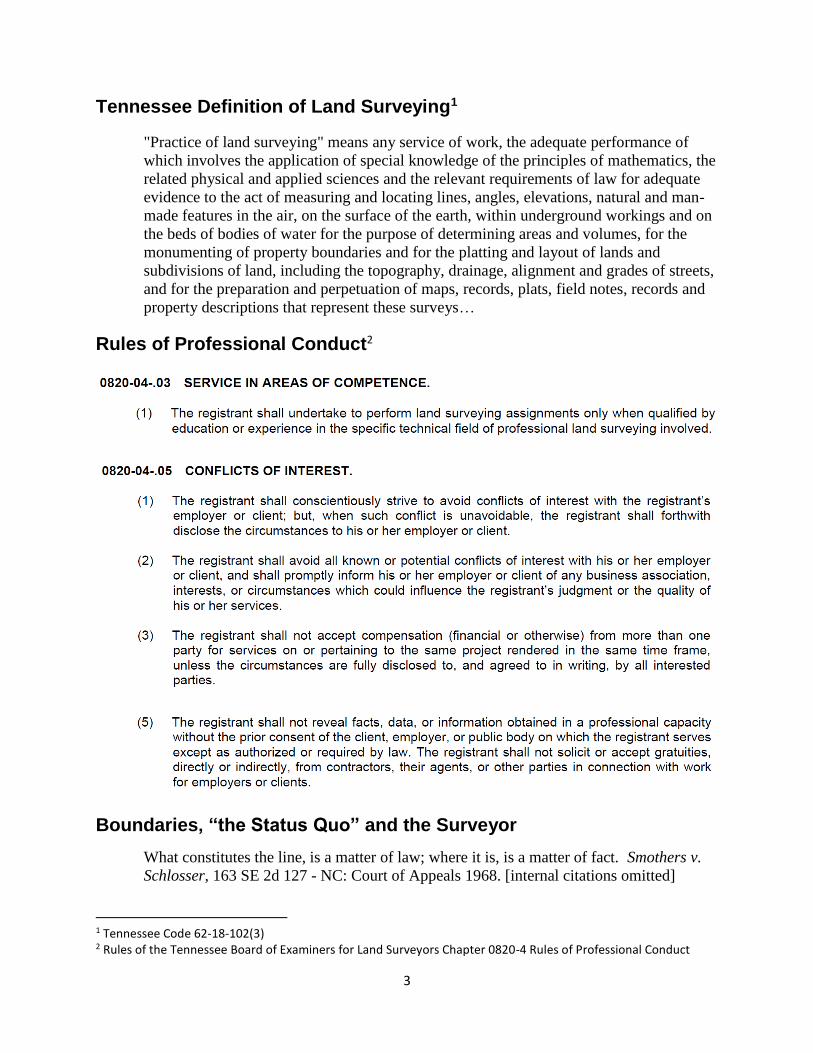
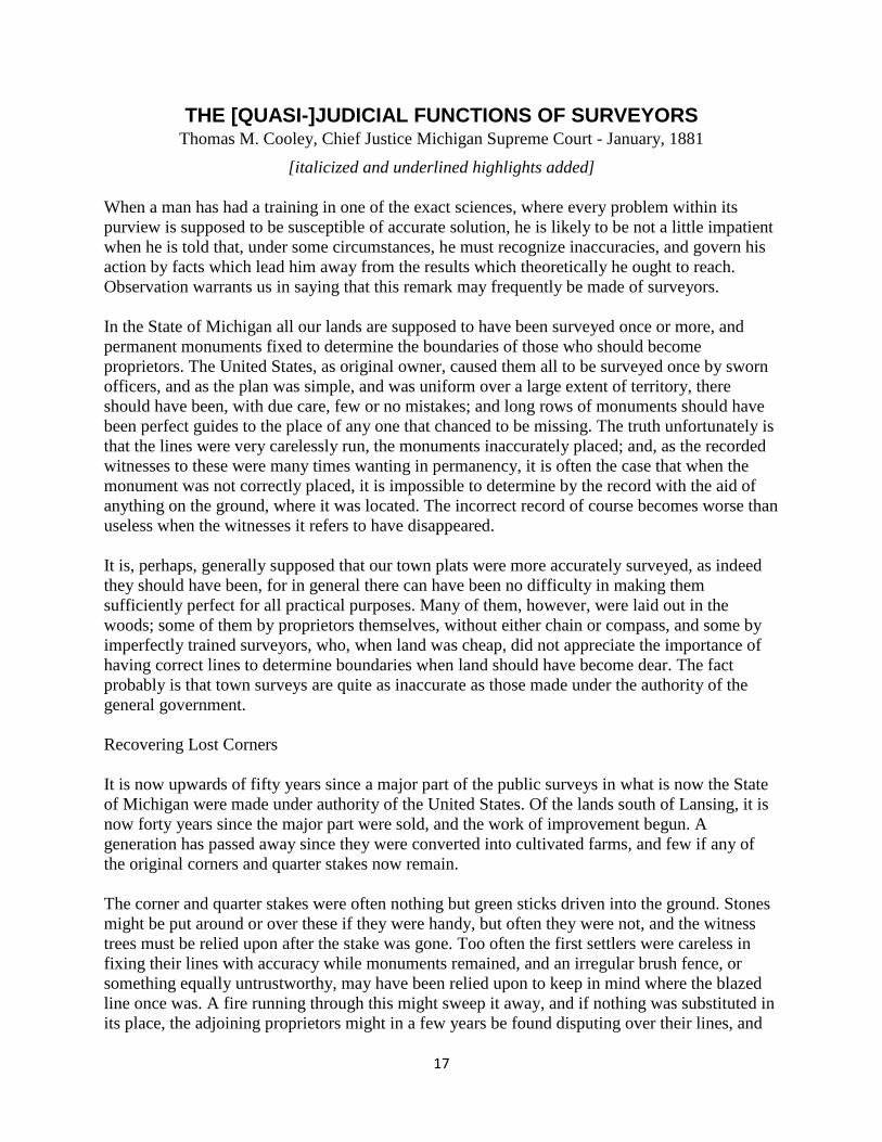
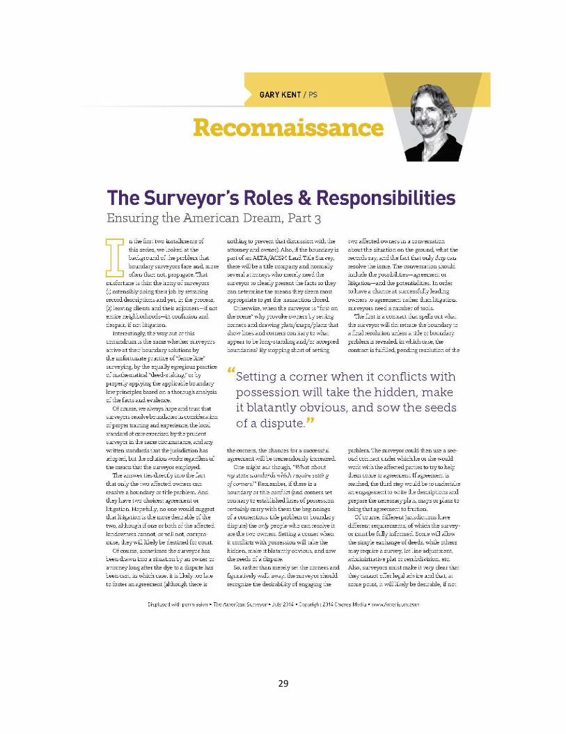

34
From httpwwwtncourtsgovsitesdefaultfilesdocsgeneral_civil_requirements_0pdf
35
Surveyor Ethics
36
37
38

35
Surveyor Ethics
36
37
38
36
37
38
37
38

38