the manzano mountain state park - new...
TRANSCRIPT

The Manzano Mountain State Park History of Title and History of the
Manzano Land Grant
Malcolm Ebright President, Center for Land Grant Studies
Submitted to the Commission for Public Records
pursuant to Contract #09-36099-008720
6/15/2009

Table of Contents 1. Introduction ................................................................................................................ 4 2. Early History of the Area/ the Salinas Pueblos ............................................................ 5 3. The Manzano Land Grant and its Adjudication............................................................ 8 4. The Community of Manzano...................................................................................... 15 5. Neighboring Land Grants: Tajique ............................................................................. 21 6. Manzano Mountain State Park Abstract Narrative ..................................................... 23 7. Creation and Operation of Manzano Mountain State Park ......................................... 31 8. Conclusion ................................................................................................................ 35 Appendix A - Chain of Title of Manzano Mountain State Park ............................................ 36 Appendix B - Manzano Grant Documents .......................................................................... 41 Appendix C - Bibliography ................................................................................................. 47 Appendix D - Photo Credits ................................................................................................ 49 Appendix E - Map of Manzano Mountain State Park and Land Grants ............................... 50 Appendix F - Map of Manzano Mountain State Park .......................................................... 51
Cover photo: Nuestra Señora de los Dolores Church and the community of Manzano, Manzano, New Mexico; 1870-1880. Courtesy Daniel Antonio Herrera.
2

Table of Figures Figure 1. Ruin of Quarai mission............................................................................... 5 Figure 2. Map showing Manzano and surrounding area. ........................................... 6 Figure 3. Ruin of the Abó mission.............................................................................. 7 Figure 4. View of Manzano. ....................................................................................... 9 Figure 5. Original settlement of Manzano. ............................................................... 11 Figure 6. Children at Manzano Reservoir. ................................................................ 12 Figure 7. The torréon of Manzano............................................................................ 13 Figure 8. Santos Silva, resident of Manzano. ........................................................... 17 Figure 9. Population of Villages in East Mountain Area (U.S. Census)...................... 20 Figure 10. Map of the Manzano, Torreón, and Tajique Grants. .................................. 22 Figure 11. Plat of the Manzano State Park................................................................. 30 Figure 12. Layout of facilities at Manzano Mountains State Park. .............................. 34
3

1. Introduction
This report on the Manzano Mountain State Park is rendered pursuant to a contract
between the Center for Land Grant Studies and the Commission of Public Records (the Agency)
dated September 9, 2008. Paragraph 1 of the contract provides for a review by the Center for
Land Grant Studies of each of seven abstracts to be provided by the Agency. After making a
detailed review of the abstract the contractor shall provide, “a synopsis of the chain of title,
identification of any discrepancies or breaks in the chain of title, and a brief history of the land
grant in which the State Park is located.” This report covers findings concerning the Manzano
Mountain State Park (deliverable 1A7) within the Manzano Land Grant and was written by
Malcolm Ebright.
While the abstract provided for the Manzano Mountain State Park was more complete
than some other abstracts, some minor gaps required additional research to fill in. I was able
to obtain copies of deeds, maps and survey plats from the New Mexico State Parks Division of
the Energy, Minerals, and Natural Resources Department, and received valuable assistance
from Trustees of the Manzano Land Grant. I received valuable assistance from George Kayser
of New Mexico Abstract Company.
I was assisted by research assistant Carisa Williams Joseph, Richard Salazar (former
State Archivist), and Sandra Jaramillo (Director, State Records Center and Archives). Special
thanks to Christy Tafoya, Rebecca Procter, and Dave Gatterman of the New Mexico Sate Parks
Division of the Energy, Minerals and Natural Resources Department for making their extensive
files available. Many thanks as well to Daniel Antonio Herrera, vice president and
commissioner of the Manzano land grant and to Orlando Lopez, commissioner and president of
the Manzano Land grant.
4

2. Early History of the Area/ the Salinas Pueblos
Manzano lies within the region known to early Spanish chroniclers as the “Salinas
Province,” a center of the Franciscan missionaries’ efforts to Christianize the Indians.
Coronado’s expedition in 1540 apparently missed the Salinas Pueblos of Quarai, Abó, and Las
Humanas, the Indian villages near Manzano. Padre Rodriguez and the soldier, Chamuscado,
on their return to the Rio Grande Valley in 1581 passed near the salt lakes east of Manzano
after which the Salinas Province gets its name. Whether they passed through the site of
Manzano is not known, but they may have gone by the nearby pueblo of Quarai. Somewhere
in the vicinity Fray Juan de Santa Maria, one of the priests who accompanied the Rodriguez
expedition, was killed by the Maguas Indians. The expedition of Espejo in 1583 probably
visited only the Pueblo of Abó, which is about 18 miles west of Mountainair. The expedition of
Juan de Oñate in 1598 visited the pueblos of Quarai and Abó.1
Figure 1. Ruin of Quarai mission.
1 George P. Hammond and Agapito Rey, Juan de Oñate, Colonizer of New Mexico, 1595-1628 (Albuquerque: University of New Mexico Press, 1953), 18, 319, 393, 482-83; Wesly R. Hurt, Manzano: A Study of Community Disorganization (New York: AMS Press, 1989), 18-19.
5

The first missionary work in the Salinas province was in 1598 by Fray Francisco de San
Miguel, a chaplain of Oñate’s army who ministered to the pueblos of Quarai, Abó, and Tabirá
from his headquarters at Pecos. In the summer of 1629, Fray Francisco de Acevedo went to
the Salinas area and began construction of the large mission churches at Abó, Tabirá, and
Quarai. Apparently, no mission was established in the vicinity of the site of Manzano, although
many people, including Wesley Hurt, report finding projectile points, pot sherds and isolated
house sites indicating the presence of Indian farm houses. In addition, the ruins of a small
Indian village are found near the old spring of Manzano, about two miles east of the village.2
Figure 2. Map showing Manzano and surrounding area.
As can be seen from the above map, of the three Salinas Pueblos of Abó, Quarai, and
Gran Quivira (Las Humanos), Quarai is the closest to Manzano. Quarai was a former Tiwa
pueblo about thirty miles east of the Rio Grande and two miles south of Manzano. The
following description of Quarai is based on Murphy’s Salinas Pueblo Missions: Quarai is set in a
juniper forest that slopes toward a tree-lined, spring-fed stream, which flows from the base of
2 Hurt, Manzano, 19; Dan Murphy, Salinas Pueblo Missions: Abó, Quarai, and Gran Quivira, (Southwest Parks and Monuments Association, 1993).
6

the Manzano Mountains. This stream flows eastward through farmland, to the Salinas out in
the Estancia Basin. “At the time of its occupancy it was the southernmost Tiwa pueblo of the
Salinas region. Quarai was the seat of a Spanish mission from 1629, and contained a
monastery and a church dedicated to the Immaculate Conception, the walls of which are still
standing. Quarai had 600 inhabitants immediately prior to its abandonment. Between 1664
and 1669 the people of this pueblo allied with the Apache, during a moment of friendliness of
the latter, to rout the Spaniards, but the plot was discovered and the leader executed. About
1674 the Apache compelled the Quarai people to flee to Tajique, twelve miles northward. The
latter Indian village remained inhabited until about 1675, when its occupants succumbed to
Apache attacks, and moved to El Paso settling in the village of Ysleta del Sur, farther down the
Rio Grande, where their descendants now reside.”3
Figure 3. Ruin of the Abó mission.
Abó was built on an outcrop of the same red sandstone around the shoulder of the
Manzano Mountains from Quarai and astride the trail to Abó Pass, which leads to the Rio
Grande Valley. Abó, stood beside a cluster of springs flowing into a desert stream. The
mountains are farther away from Abó than from Quarai, but Abó had the advantage of being on
the trade route through the pass. Despite their relative proximity to Quarai, the people of Abó
3 Murphy, Salinas Pueblo Missions, 12. Frederick Webb Hodge, Handbook of American Indians North of Mexico (Totowa, New Jersey: Rowman and Littlefield, 1975), 1: 336-37.
7

spoke Tompiro. As with Quarai and Abó, Las Humanas was built from the rock upon which it
stood. The building became an impressive structure of perhaps 240 rooms arranged in
concentric circles around a central kiva. The Tompiro-speaking community of Las Humanas
had trade advantages as the settlement nearest the nomadic Indians who lived on the plains to
the south and east. Though the sandy soil nearby was good for raising corn, water was scarcer
at Las Humanas than at Quarai and Abó, which had streams nearby. The people at Las
Humanas compensated by building surface-water catchment systems, cisterns, and wells.4
According to Frederick Hodge, Abo became the seat of the mission of San Gregorio,
founded in 1629 by Fray Francisco de Acevedo, who erected a large church and monastery, the
walls of which are still standing, and died there August 1, 1644. Tenabo and Tabira were the
visitas of Abó mission. Considering the ruins now on both banks of the arroyo as those of a
single pueblo, the population during the early mission period was probably 2,000. Owing to
Apache depredations, many of the inhabitants fled to El Paso as early as 1671, and prior to the
Pueblo Revolt of 1680 the village was entirely abandoned. The Piros of Senecu del Sur claim to
be the last descendants of the Abó people.5
The sites of both Quarai and Abó are within the Manzano Land Grant and have had
Hispanic settlements near them. Abó has one at present and Quarai had a settlement led by
Miguel Lucero in the 1830s, as mentioned earlier.
3. The Manzano Land Grant and its Adjudication
As early as 1703, the pastures in the Estancia Valley at the foot of Manzano Peak had
been used for grazing by shepherds and stock-raisers as far away as Santa Cruz. Well before
the petition for the Manzano Grant in 1829, the town of Manzano began to be formed around a
lake that still exists near the community. It is said that Governor Alberto Maynez started to
form the settlement in 1815 with settlers in the Tomé area, including Miguel and Juan Lucero
who were interested in forming a new community. The Manzano settlement was mentioned in
the 1823 petition for the Casa Colorado Grant since forty-one persons from Manzano formed
the nucleus of that grant, and by 1829 there were over 170 families in the settlement of
Manzano.6
4 Murphy, Salinas Pueblo Missions, 12-13. 5 Hodge, Handbook, 1: 6. 6 Town of Casa Colorado Grant, SG 5, Roll 12, fr. 840 et seq.; Bowden, “Private Land Claims,” 2: 205-10. “Manzano,” Office of the State Historian Website, http://www.newmexicohistory.org/filedetails.php?fileID=21220.
8

Figure 4. View of Manzano.
On September 22, 1829, José Manuel Trujillo and 172 other citizens of Manzano,
petitioned the Ayuntamiento of Tomé for a grant covering the following lands: “ . . . from north
to south, from Torreón to the old mission of Abó, and from east to west, from the Mesa de los
Jumanos to the mountain.” They stated that the grant would be used for common pastures
and other uses necessary for every town established on the basis of common and private
property. The petitioners, whose names were listed in the margin of the document, agreed as a
condition of the grant to, “construct a regular terraced house of adobe in the square where the
chapel is to be constructed (for which permission has been granted us).” Each settler agreed to
bring with him his property of every description, contribute to all community labor, procure the
increase and prosperity of the town, defend with arms the firesides of his town to the fullest
extent against any enemy. Any settler not residing in said town with the family belonging to
him, who shall remove to another settlement, shall lose all right he may have acquired to his
property. The petitioners asked the ayuntamiento to appoint a committee to investigate their
petition, establish the boundaries of the town as requested in their petition, and refer their
petition to the Territorial Deputation for its approval.7
Three days later the ayuntamiento considered the petition and decided to refer the
matter to the Territorial Deputation, as requested, with a report that no impediment to the
7 Petition for the Manzano Grant, Tomé, September 22, 1829, Town of Manzano Grant, SG 23, Roll 15, fr. 652-54, translation, 667-68.
9

grant request was known except that “all the arable land located within the requested premises
belonged to the Retired Lieutenant Colonel Bartolomé Baca, who would be satisfied with the
land which he would receive as a new settler together with the lands he has purchased from
other settlers provided that although he will not establish his residence there he will cultivate
and improve the lands which may be recognized as his.”8 Bartolomé Baca was governor of New
Mexico from 1824-1825 and during that time, he was quite active in approving requests for
land within pueblos such as Pecos whose population was dwindling. Baca had acquired land
in the Manzano area and may have purchased the interests in the common lands of some of
the Manzano settlers. His descendants and successors applied for approval of the Bartolomé
Baca land grant in 1878.9
On November 28, 1829, the Territorial Deputation of New Mexico issued a decree
granting the petitioners a league of land in each direction and directing Alcalde Jacinto
Sanchez of Tomé, to place the grantees in possession of the land, allotting to each of the
grantees all of the tillable land they could cultivate, leaving the rest for future settlers.10 On
December 23, 1829, Sanchez went to Manzano with the settlers and proceeded to perform a
rough survey of the grant. The settlers requested that the Alto del Pino de la Virgin be
established as the central point of the grant, so Alcalde Sanchez started his survey at that
point measuring one league in each of the four cardinal directions. The boundaries were: on
the north, two solitary cedar trees in the Cañon del Alto which was also known as the Cañon of
the deceased Ulas; on the south, by the rise on the opposite side of the gulf of the Ciénega; on
the east, by the red mesa known as the Rancho de Pedro de la Torre; and on the west, by the
summit of the hill. When Sanchez started the allocation of the irrigable lands amongst the
settlers they asked to remain in possession of the lands they were occupying and the request
was granted.11
The community of Manzano, which was built around an existing lake grant was made,
continued to expand, as did other communities on the grant. As will be discussed in section
four regarding the community of Manzano, the original village followed the plan of a fortified
plaza, with a fortified watchtower (torréon) on the south and two reservoirs connected by an
irrigation ditch, the main reservoir and the Tanque de la Joya.12
8 Report of the Ayuntamiento of Tomé, Tomé, September 25, 1829. Town of Manzano Grant, SG 23, Roll 15, fr. 654, translation 668-69. 9 Bartolomé Baca Grant. Bowden, “Private Land Claims,” 2: 217-27. 10 Grant by the New Mexico Territorial Deputation; Santa Fe, November 28, 1829. Town of Manzano Grant, SG 23, Roll 15, fr. 655, translation, 669-70. 11 Act of possession, Manzano, December 24, 1829. Town of Manzano Grant, SG 23, Roll 15, fr. 650-51, translation, 670-71. 12 Hurt, Manzano, 239.
10

Figure 5. Original settlement of Manzano.
Besides the reservoirs and the torreón, the other important feature of the community
were the apple orchards that give it its name. While local tradition reports that the oldest
apple orchard at Manzano was planted by the Spanish missionaries at Quarai, Florence Hawley
Ellis found by a study of the tree rings of the apples that the trees were planted no earlier than
1800. Such a date would place the planting during the period when Manzano was settled. It
may be that the present trees are shoots or seedlings from an earlier orchard whose trees died
out. From the founding of Manzano until about 1880 raids by the Navajo were frequent. These
hostile Indians forced the Manzaneños to organize their village plan and life style for purposes
of defense. Some of the precautions taken against the Indians are revealed in the village plan
as shown in Figure 5. The community was built around a central plaza and surrounded by a
high wall pierced with loopholes. At the three entrances to the town were heavy wooden gates,
two on the north and one on the south where guards were stationed. The main part of the
village northeast of the reservoir near a fort and torréon which are still standing. Generally the
houses had flat roofs so that men could station themselves on top when there was a raid. For
additional protection the first church, a rectangular building, was surrounded by a circular
wall.”13
13 Hurt, Manzano, ??.
11

Figure 6. Children at Manzano Reservoir.
At the northeast of the pueblo was another dam and reservoir called the Tanque de la
Joya, the dry bed of which is still present. Running along the south and west sides of the town
and connecting with the south reservoir was a ditch called the Acequia del Molino (ditch of the
mill), which had at least one of the old water mills. According to informants there were four
mills at one time located on the irrigation ditches that surrounded the town, with two being on
the ditch that connected the two reservoirs. The mills were round stone buildings using the
principle of the undershot wheel. At one time two other mills stood by the south reservoir and
another by the northern one. About 1872 the last mill was abandoned and the Manzano
residents had to haul their corn to Belen for grinding. The torréon with the accompanying
buildings was one of the village’s most prominent structures. It is believed to be nearly as old
as the town itself.14
Soon after the formation of the office of the Surveyor General of New Mexico in 1854,
the Manzano land grant had its first formal contact with the United States. On January 9,
1856, Ramon Cisneros, for himself and on behalf of the other residents of the Town of
Manzano, filed the grant in Surveyor General Williams Pelham’s office and presented a petition
seeking its confirmation. The petition described the grant as covering the land described in the
petition to the ayuntamiento in 1829.15 Pelham received the testimony of two witnesses who
14 Hurt, Manzano, 24-5. 15 Petition of Ramon Cisneros, et al., for the Manzano Grant, January 9, 1856, Town of Manzano Grant, SG 23, Roll 15, fr. 656-57.
12

Figure 7. The torréon of Manzano.
stated that the Town of Manzano was in existence in 1846 and that the decree of the Territorial
Deputation was genuine.16 Pelham announced his decision on August 10, 1859, holding that
the grant was valid. He recommended its confirmation by Congress to the Town of Manzano to
the extent of one league in the four cardinal directions.17 Congress confirmed the claim in
accordance with Pelham’s recommendation by Act approved June 21, 1860.18 The grant was
surveyed in February, 1877, by Deputy Surveyors Sawyer & McElroy at 17,360.97 acres, the
size of a pueblo league.
On May 24, 1886, in response to a request by W. F. Blanchard, GLO Commissioner
Strother M. Stockslager ordered Surveyor General George W. Julian to examine the case, and if
he found no objectors, to prepare a description of the grant for incorporation into the patent.19
Julian made and investigation and concluded that the grant was a diamond-shaped tract with
points one league in each of the cardinal directions from the Alto del Pino de la Virgen instead
of a four-square league tract. Therefore he ordered Deputy Surveyor Charles Ratliff to resurvey
the grant, an almost unprecedented action for which he had no authority.20
16 Testimony of Francisco Baca y Ortiz and Simon Delgado, Town of Manzano Grant, SG 23, Roll 15, fr. 659-62. 17 Decision of William Pelham, Santa Fe, August 10, 1859, Town of Manzano Grant, SG 23, Roll 15, fr. 675-76. 18 Bowden, “Private Land Claims,” 2: 245-46. 19 GLO Commissioner Strother Stockslager to George W. Julian, Washington, D.C., May 24, 1886, Town of Manzano Grant, SG 23, Roll 15, fr. 677-79. 20 Bowden, “Private Land Claims,” 2: 246.
13

Julian disregarded two objections to the proposed survey and to the earlier Sawyer and
McBroom Survey filed by the Commissioners of the Manzano land grant. The first was filed by
Commissioners Perea, Zamora, and Lopez in addition to forty signed grant residents and 220
more. The second was filed by the three commissioners alone. It was somewhat longer and
contained more arguments against the surveys. The gist of the protests was that the lands
beyond the four square leagues were also being used as common lands by the grant residents
and should be confirmed. Instead, Julian was planning to reduce the four square leagues by
half. It is surprising that Julian made no mention of these protests that were directed to him,
though he was told to proceed only if he found no objection.21
Ratliff surveyed the grant at 8,689.74 acres, or one-half the size of the grant depicted by
the Sawyer & McElroy Survey. On July 27, 1900 GLO Commissioner Binger Herman, asked
the Surveyor General to explain why the Ratliff survey was executed “making angles of 45° with
the meridians rather than making a square. Herman attached a report by Special Agent
Benjamin P. Douglass and asked the Surveyor General to make an exhaustive statement
including “a recommendation for action to be taken by this office to secure a complete and final
adjustment of this long delayed and troublesome complication.” Apparently Julian’s arbitrary
actions in ordering the Ratliff Survey were coming back to haunt the Surveyor General’s
Office.22
Secretary Trimble’s decision was indeed exhaustive. He noted that other grants were
also made to be measured from a center point to the four cardinal directions and in all those
cases, “it was customary to complete such boundaries by running east and west and north and
south lines through the given points until points of intersection were reached,” thus making a
square. Trimble cited the Ortiz mine grant “where the boundaries were given as two leagues
from the mine as a center to the four cardinal points.” A General Land Office decision in that
grant held “that Congress intended to confirm to the claimants four leagues square, or sixteen
square leagues.”
Trimble then cited the Agua Negra Grant in which the intent of the Mexican government
could be determined directly from the grant documents. The petition for the grant asked for
one league square (emphasis added) or a league in each cardinal direction from the center point
of the Agua Negra Spring. The petitioners were placed in possession of four square leagues and
21 Protest to survey, Filomenio Perea, José Zamora, and Martín Lopez, Commissioners of the Manzano Land Grant, plus 40 additional signed petitioners and 220 more families to G. W. Julian, Manzano, October 24, 1887, Town of Manzano Grant, SG 23, Roll 15, fr. 680-81; Protest to survey by Filomenio Perea, José Zamora, and Martín Lopez, Manzano, Commissioners of the Manzano Land Grant, November 25, 1887, Town of Manzano Grant, SG 23, Roll 15, fr. 682-83, translation, 684-89. 22 GLO Commissioner Binger Herman to U.S. Surveyor General, Washington, D.C., July 27, 1900, Town of Manzano Grant, SG 23, Roll 15, fr. 691.
14

the grant was approved by the Surveyor General. Like the Manzano grant the Agua Negra
grant was surveyed at a little over 17,000 acres, but like the Manzano grant, Surveyor General
Julian ordered it resurveyed in the shape of a diamond, thus reducing the acreage of the Agua
Negra grant by half. After a similar reexamination of that survey by the GLO, a decision was
made that “the description given in the Act of juridical possession should control.” It was
ordered that “the first survey showing the grant to contain four square leagues was the correct
one and Julian’s resurvey was rejected.”23
The owners of the grant protested, and on May 14, 1904, Secretary of Interior J. H.
Trimble rejected the Ratliff Survey in one of the most reasonable decisions in the history of the
Surveyor General, ordering a resurvey of the grant. A new survey of the grant was made in
1904 by W. V. Hall for 17,360.24 acres. A patent, based on Hall’s survey, was issued on
February 8, 1907, to the Town of Manzano Grant.24
4. The Community of Manzano
As mentioned in Section 3, the community of Manzano had been in existence well
before the petition for the grant in 1829 with over 170 families comprising the settlement. The
community was somewhat spread out, as an anonymous author described on the Office of the
State Historian’s website: “The Town of Manzano consisted of at least two parts. One was
called the Plaza de Apodaca, and was apparently the present main plaza of the town. This part
of town clustered around the springs, reservoir, and headwaters of the irrigation system that
watered the fields. Associated with the Plaza de Apodaca were two apple orchards that may
have been present when the first settlers arrived to establish the town of Manzano. The second
part of the town was the Plaza de Ojitos, where most of the citizens of the town resided. Ojitos
was approximately one mile southeast down the Arroyo de Manzano, and according to local
tradition was on the site of an Indian pueblo.”25
Manzano has always been a small village of around 700 inhabitants dedicated to
farming and subsistence agriculture. In a survey of Manzano and other Mountain villages
such as Torreon, Tajique, and Punta de Agua Chris Wilson gives a summary of the village
economy in Manzano and other small villages in Torrance County. The small livestock
holdings of most families complemented their subsistence farming. Cattle gradually became
more important, while goats were raised for milk and as a delicacy. Most families maintained a
23 Decision by Acting GLO Commissioner J. H. Trimble, Town of Manzano Grant, SG 23, Roll 15, fr. 692-99. 24 Bowden, “Private Land Claims,” 2: 246-47. 25 “Manzano,” Office of the State Historian Website, http://www.newmexicohistory.org/filedetails.php?fileID=21220.
15
team of horses or a mule for transportation and fieldwork. Many kept a few chickens; some
families, a milk cow, a hog, or an occasional turkey. Irrigated fields were small; most families
held under five acres. Corn, beans, and squash were the early staples, complimented by chili,
onions, carrots, cabbage, turnips, and, later, wheat and potatoes. Other crops included
tobacco (punche mexicano), rye, oats, hay and sorghum. Peaches, and to a lesser degree,
cherries and plums were also significant crops throughout the area, although late frosts
destroyed the apple crop one year in three on average, and the peach blossoms every other
year. Wool was woven for clothing, and hides tanned for clothing and shoes. In some villages,
yucca was processed into soap, and pottery was made. Gathered plants included quelites
(lambsquarters) and verdolagas (purslane); capulín (chokecherries), gooseberries and wild
plums; napalito (cactus) and cactus flowers; piñon (pine nuts) and acorns; lemita (squawbush),
cota (wild tea), and numerous other medicinal plants. Local game included deer, antelope and
rabbits. From the earliest settlement, men sought work, primarily outside the immediate area,
to augment their limited agricultural resources. The Spanish settlers along the Rio Grande had
long gone to the Plains of eastern New Mexico and western Texas to hunt buffalo each fall and
buffalo meat and robes provided a substantial resource for Manzano and the East Mountain
villages from the start. Trade with the Apaches and Comanches, both on the Plains and at the
villages, contributed further to commerce. 26
Indian raids were also a regular occurrence that accompanied trading activities. Navajo
raids were frequent but relations with Indians were not always hostile. Numerous stories of
relations with various Indian tribes, some involving petitioners for the Manzano Grant, have
been recounted by Wesley Hurt. Many have to do with Genízaros who married into the
Hispanic pool of settlers, providing a unique history similar to other Genízaro communities
such as Abiquiú and Tomé. Manzano was for many years a center of contact with the Apaches,
Navajos, and Pueblo Indians, a relationship that was sometimes friendly. Pueblo Indians used
to go to the salt lakes in the Estancia Valley for their salt. During their travel the Indians from
the southern Rio Grande pueblos usually went through Abó Pass, missing Manzano. Those
who came from the north, however, occasionally passed through the town and were often
friendly. Many of the people of Manzano and neighboring communities had close friends
among members of the different bands of Indians, such as Juan Archuleta, who married a
woman in Torreón and moved to that village where he became the local capitán of the
vigilantes.
26 Chris Wilson, Historic Resources Reconnaissance Survey of the Manzano and Sandia Mountain Villages (Santa Fe: Historic Preservation Division, Office of Cultural Affairs); for more on cota and other medicinal plants used by the Hispanic villagers, see L. S. M. Curtin, Healing Herbs of the Upper Rio Grande (Los Angeles: Southwest Museum, 1965), 70, passim.
16
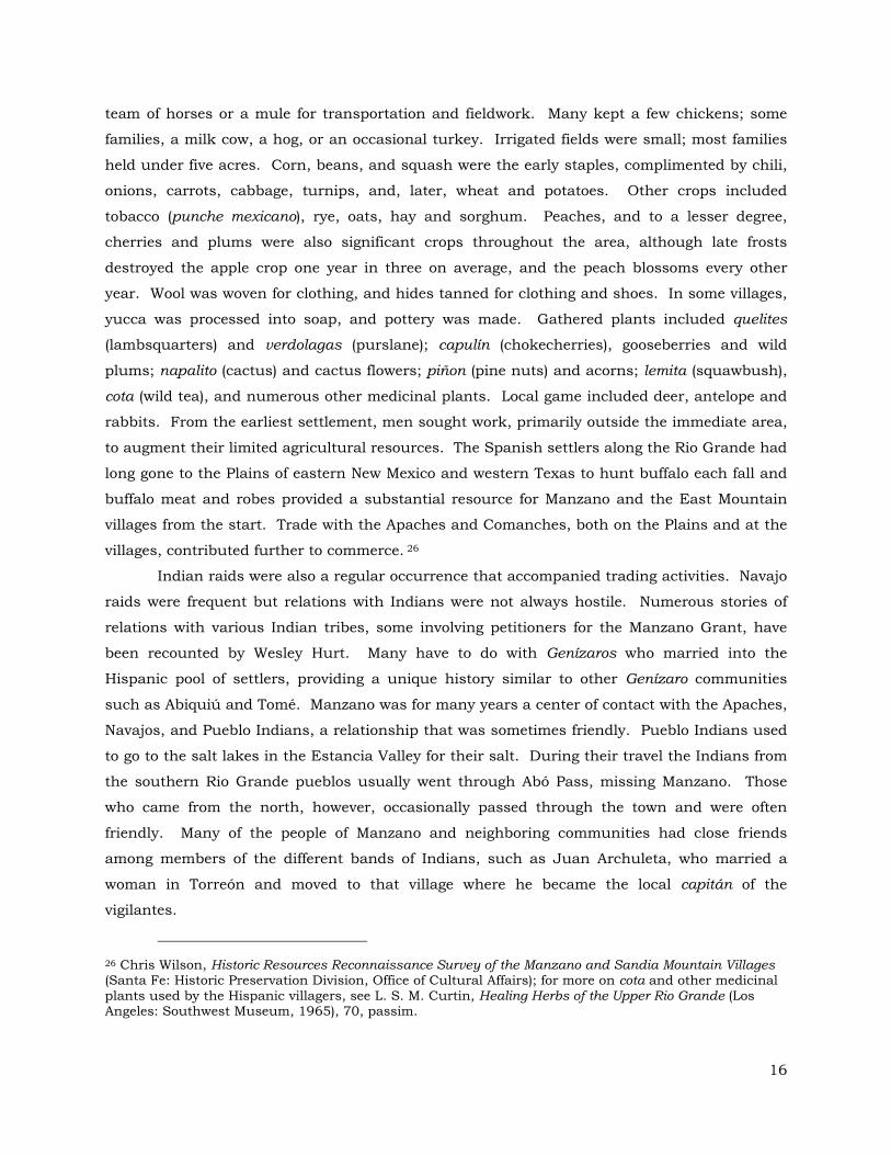
Figure 8. Santos Silva, resident of Manzano.
Although he had many Indian friends, he was known as one of the bravest Indian fighters of
Manzano.27 At Manzano the best Indian fighters were Juan Carillo and Genebro Aragon. Many
stories regarding problems with the Navajo are remembered at Manzano. One involved a
woman in Manzano who was cooking bread when a Navajo came to the window asking for
some. She had a pan full of hot lard and threw it in his face. He ran about 50 feet and died,
so the story goes.28 The custom of taking Indian catives was common and sanctioned by
Spanish law. These Genízaros were usually purchased.29 “For example, Filimeno Sanchez had
27 Hurt, Manzano, 28. 28 Hurt, Manzano, 29. 29 Malcolm Ebright and Rick Hendricks, The Witches of Abiquiú: The Governor, the Priest, the Genízaro Indians, and the Devil, (Albuquerque: University of New Mexico Press, 2006), 30-31.
17

from twenty to thirty Genízaro servants under his control, among whom were five male and
four female Indian slaves, two of whom were bought from Gregorio Quintana, their captor.
These Indians had all been bought when young and were adopted into the Sanchez family.
Their value was about five pesos or the price of a horse. Genízaros were purchased from
Indians who had held them captive or were obtained by trading.30
The Genízaros contributed much to the richness of Manzano culture for they were
responsible for the introduction of blanket weaving and several other Indian traits.
Intermarriage with Genízaros appears to have been common. Records show that four of
Filomeno Sanchez’s slaves were Navajo men named Eugenio, Manuel, Julian, and Rafael; four
were women named Tomasita, Maria, Bartola, and Cruz. Manuel had a son, named Eugenio,
by a Spanish-American woman of Manzano. Eugenio married a native of Manzano, Rosa
Sanchez, who is still alive. Eugenio died in 1936, the last living of the former Navajo slaves at
Manzano. Manuel Sanchez, a full-blooded Indian, was another of Filimeno’s Genízaros who
lived with a local woman, Isabel Serna. Another full-blooded Indian in Manzano was José
Antonio Silva, who retained the Indian custom of wearing long hair with a red band wrapped
around it. The father of another man was a Genízaro Indian from Las Nutrias. Juan Archuleta
brought to Manzano an Indian boy and girl from Quelites, a Genízaro settlement in the Rio
Grande Valley. Nana Cruz was a half Indian who lived in Manzano. At the age of 25 she was
captured by the Navajos, and later escaped and returned to Manzano. Later she married a
Navajo and went to live with him in Cañon Bonito near Cebolleta. In time she left her husband
and went to the Spanish fort at Cebolleta where she remained until a wagon train from
Manzano took her back to her home in the village. Cruz Otero was another woman from
Manzano who was captured by the Indians, who later released her and she came back to
Manzano to live. Dionicio Molino was a Navajo who was taken captive when young near La
Joya. He was later captured by his tribe. After several years he escaped and came back to
Punta de Agua where he made his living as a sheepherder.”31
“The elites still remembered at Manzano are Tomás Sanchez, Filimeno Sanchez, Miguel
Lucero, Juan Lucero and Antonio Roble. Only Tomás Sanchez was included in the list of the
original grant petitioners. It is said that Filomeno Sanchez operated many covered wagons
throughout the Southwest hauling and trading supplies. When Manzano was under Mexican
rule, he made his fortune trading with Chihuahua City. After the American rule he changed his
30 Hurt, Manzano, 30. 31 Hurt, Manzano, 31-32.
18

route to Leavenworth, Kansas, and during the gold rush of 1849, drove large herds of livestock
to California.”32
In the 1840s, many men worked in the booming mines to the north at San Pedro and
Real de San Francisco (now Golden). Others worked as teamsters on a branch of the Santa Fe
Trail that split off at the Pecos River and ran through Tijeras Canyon to Albuquerque. Later,
they helped build and operate the early railroads. At the turn of the century, a small coal mine
northeast of Tijeras, and several lime kilns operated by Charles Campo of San Antonio provided
a handful of jobs, although more local men went to work in the coal fields at Madrid, and the
silver mines at Mogollon. Portable sawmills appeared after the Civil War and over the years
were set up at one time or another in most of the canyons on the west side of the Sandia and
Manzano Mountains. The cutting and hauling of fire wood to Albuquerque also provided a
source of cash for the villages around Tijeras Canyon. While most of those who operated the
village grocery and mercantile stores were Hispanos, they were joined by the Dow family at
Chilili and Tajique, and Syrian-born Tammons Tabet at Manzano.33
The business directory for 1915 for Manzano shows Tabet, the Candelarias, and Eleno
Zamora as the primary merchants while Valentino Candelaria and Jose Z. Candelaria, whose
descendants would loom large in the land grant dealings, are listed as attorneys.
MANZANO
Town in Torrance County, 18 miles northwest from Estancia, the nearest railroad point, and 20 miles northwest of Willard, the banking point. Stock raising and farming the industries. Population of neighborhood 1,000. Candelaria, Nestor, postmaster. Candelaria, Jose Z , attorney. Candelaria, Valentino, attorney. Candelaria & Bro., general merchandise. Padilla, Jesus M., saloon. Romero, Seraficio, lumber contractor. Sanches, Eugenio, justice peace. Sedillo, Juan P., blacksmith. Tabet, Tammons, general merchandise. Zamora, Eleno, general merchandise. Zamora, Max, saloon, hotel.34
Three developments of the first decade of the twentieth Century profoundly affected the
mountain villages: the construction of two nearby railroad lines, and Anglo-American
32 Hurt, Manzano, 32-33. 33 Wilson, Manzano and Sandia Mountain Villages, 11-12. 34 New Mexico State Business Directory 1915, 499.
19

homesteading boom in the Estancia Valley, and the placement of much of the mountains under
the control of the U.S. Forest Service. A new railroad, the Santa Fe (later New Mexico) Central
was built south from the Santa Fe Railway station at Lamy through the middle of the Estancia
Valley in 1902 and 1903. Then between 1903 and 1906, the Santa Fe built the so-called Belen
Cut-off east through Abó Pass and out across the Texas Panhandle. Many men, especially
from the Torrance County villages such as Manzano, found work on the construction and later
operation of this cut-off. In addition, Las Vegas timber baron Eugenio Romero employed many
men in the sawmills he set up in the Manzano Mountains to supply the Santa Fe with one-and-
a-half million railroad ties. Romero sold his mills to I. K. McKinney who continued to log the
Manzanos until 1932. In conjunction with the construction of the New Mexico Central, the
Estancia Valley was opened to homesteading, and a new county was created (largely out of
eastern Valencia county) and named for a Pennsylvania investor behind the Santa Fe Central,
Francis J. Torrance. Over 500 homesteads were filed in the valley in 1905 and 1906; about
two-thirds of these homesteaders came form Iowa, Kansas and Oklahoma. The new railroad
towns of Moriarty, Estancia, and Mountainair quickly supplanted Manzano as the leading
mercantile center for the area.
The population of the Torrance County mountain villages, including Manzaño, show a
fairly stable population until the 1940s when the population of most villages was cut in half.
Torrance County
1860 1870 1890 1910 1930 1940 1950
Tajique 351 534 350 783 325 376 290
Torreon 425 - 363 783 325 373 290
Manzano 831 738 658 607 708 812 434
Punta de Agua
237 338 290 632 393 414 215
Figure 9. Population of Villages in East Mountain Area (U.S. Census).
Most of the homesteads failed as farms, and after a second wave of homesteaders in the
early 1920s (largely from Texas), the pinto bean emerged as the main cash crop of the valley.
Many Hispanos homesteaded additional lands east of their villages, and also began to raise
beans by dry land methods. Although the new fenced homesteads in the Estancia Valley
severely curtailed the commercial in the mountain villages, beans became a significant cash
crop from Chilili to Manzano. While a few families made bootleg whiskey during Prohibition,
20

wood hauling remained the primary source of cash.35 Large portions of both the Manzano and
Sandia Mountains went into the Manzano Forest Reserve in 1906, which was renamed the
Cibola National Forest in 1931, and was finally designated wilderness area under the
Wilderness Preservation Act of 1964. Residents of the land grants and villages such as
Manzano at first continued as they had for generations to graze their livestock, gather firewood,
and cut timber in the forests. But the gradual imposition of regulations, permits, fees and
outright prohibitions, substantially curtailed access to these resources by World War II. The
Forest Service instead developed the mountains as recreation areas for city dwellers, primarily
from Albuquerque.36 The Manzano Mountain State Park is an example of such a recreation
area developed by the State of New Mexico. For further discussion of the creation and
operation of the Manzano Mountain State Park see section 7.
5. Neighboring Land Grants: Tajique
The grants neighboring Manzano to the north, Torreón and Tajique, were both
community grants, and were confirmed by the surveyor general about the same time as was
Manzano. Apparently, the common lands of all three of these grants have been greatly
diminished since they were patented in the early 1900s. The following is a brief history of the
Tajique grant which had similar property tax difficulties as did the Manzano Grant.
On March 9, 1834, Manuel Sanchez, for himself and on behalf of nineteen other
residents of the Town of Valencia petitioned Governor Francisco Sarracino for a grant of land at
a place called Tajique. Sanchez stated that the cropland with which the applicants supported
their families at Valencia was limited and that making the grant would be in accordance with
the laws. They described the Tajique tract as being one-half league in circumference.37 Eight
days later Sarracino temporarily granted the land to the petitioners so that they could plant
their crops. Sarracino stipulated that the grant was made subject to confirmation by the
Departmental Assembly. The decree concluded by ordering Alcalde Vicente Otero of Valencia
to make the requested grant, within the boundaries set forth in the petition, provided no injury
would result to third parties.38 On April 9, 1834 Alcalde Otero went to the grant and set aside
a town site of 132 varas; he then measured one-half league in each cardinal direction form the
center of the town site.
35 Wilson, Manzano and Sandia Mountain Villages, 10, 13-15. 36 Wilson, Manzano and Sandia Mountain Villages, 15. 37 Petition of Manuel Sanchez, et al., March 9, 1834, Valencia. Town of Tajique Grant, SG 21, Roll 15, fr. 578. 38 Governor Sarracino’s Decree, April 9, 1834. Town of Tajique Grant, SG 21, Roll 15, fr. 578-79.
21

Figure 10. Map of the Manzano, Torreón, and Tajique Grants.
The monuments that marked the boundaries were: north, a pine tree marked with a
cross in the Cañon de los Migas; south, a thicket of cedars a little above the Cañon de los
Pinos; east, a lone pine; and west, a pine marked with a cross on the Mesita de la Cueva.
Otero delayed allocating farmlands and house lots to individuals because seven grantees were
absent, but authorized the grantees to plant the un-allocated land, and cautioned that he
would divide the lands without considering who had planted what initially. A man would plant
land that might end up another’s when Otero allocated the tracts, so he promised that the land
a man was allocated would be as well developed as the land he would plant, cultivate, harvest
and leave behind. On December 24, 1834, Otero returned to Tajique and divided the farm
22

lands into seventeen tracts measuring one hundred and twelve varas from east to west and
allotted them amongst the seventeen families living on the grant. Alcalde Otero reminded each
family of the obligation to ensure that the lands that each grantee received were as well
cultivated as the land they had worked prior to the allocation, which now might belong by
chance to another, and that they needed to complete this by April 1, 1835. Otero concluded by
giving the grantees a certified copy of the grant.39
On February 3, 1857 the inhabitants of the Town of Tajique petitioned Surveyor
General William Pelham seeking confirmation of the grant.40 On May 6, 1859 Pelham held a
hearing on the claim, questioning two witnesses who answered: that they had no interest in the
grant, that they knew that the grant had been settled prior to 1842 and existed when the
United States took possession of New Mexico in 1846, and that the town had a population of
about 420 souls.41 In a decision dated May 10, 1859 Pelham held that title to the grant was
complete, and in view of its existence in 1846, the grant should be recognized by Congress.42
The Thirty-sixth Congress confirmed the Tajique grant on June 21, 1860. The grant was
surveyed in February 1877 by Deputy Surveyors Sawyer & McElroy for 7,185.55 acres.
However, a patent for the property was not issued until March 18, 1912.43 An April 5, 1912,
the commissioners of the Tajique Grant, Roman Montoya, Filomeno Sanchez, and Maximiliano
Montoya signed a receipt for the patent indicating that they were “fully authorized to receive a
receipt for the patent.”44
6. Manzano Mountain State Park Abstract Narrative
After the survey of the Manzano grant was executed in accordance with the decision of
GLO Commissioner Trimble, the Board of Commissioners of the grant attempted to take
delivery of the patent. As early as 1893, J. Francisco Chavez “on account of a request of the
Manzano grant owners,” asked Surveyor General Edward F. Hobart the cost of the Manzano
grant survey so that the owners could collect the money, pay it to the Surveyor General, and
request delivery of the patent. It is not clear who the owners were that Chavez was referring to,
but they were probably not the grant residents. Chavez seems to have been interested in
getting the patent himself; (his interest in acquiring land for speculation can be seen in his P.S.
39 Act of possession, Tajique, December 24, 1834. Town of Tajique Grant, SG 21, Roll 15, fr. 580-85. 40 Petition for confirmation, February 3, 1857. Town of Tajique Grant, SG 21, Roll 15, fr. 586-88. 41 Statement of Pedro Candelaria and José Maria Lucero, Town of Tajique Grant, SG 21, Roll 15, fr. 596-97. 42 Pelham decision, Santa Fe, May 10, 1859, SG 21, Roll 15,, fr. 598-99. 43 Bowden, “Private Land Claims,” 2: 250:53. 44 Receipt for patent; Tajique, April 5, 1912, SG 21, Roll 15,, fr. 602-3.
23

asking for some blank forms to make application for small holding claims).45 It was not until
1906 that the Board of Commissioners of the Manzano grant actually received the patent. In a
letter dated June 19, 1906, the board notified the Surveyor General that José de Jesus Romero
had resigned as treasurer and Diego Serna had been appointed in his place and was
authorized to receive the patent.46
Nevertheless, when the patent was in fact delivered a year later on March 15, 1907, it
was José de Jesus Romero who signed for it.47 This early jockeying among the Manzano Land
Grant Commissioners for receipt of the patent and thus control over the common lands was an
ominous sign of what appears to have been conflict between the grant commissioners and the
members of the grant. Another cause of the loss of the common lands of the Manzano grant
was the unfair tax system imposed on the common lands, and the unfair practices of lawyers
who often seem to have taken advantage of the factionalism to reap legal fees paid in land.
Two early documents that were not found in the abstract reveal the connection between
this factionalism and the loss of land. The first is a complaint to partition the Manzano grant
filed by eighteen plaintiffs and attorney N. B. Laughlin against a long list of defendants as
members of the Manzano Grant. It is not clear what relationship N. B. Laughlin had to the
Manzano Grant for it does not appear that he represented the grant either at its confirmation
or at the time protests were filed against the initial Sawyer and McBroom Survey. In any case,
Laughlin, along with the other plaintiffs, was claiming an interest in the grant and asking that
the grant be divided or partitioned among the parties. The commissioners of the Manzano
Grant and the individual plaintiffs filed separate answers each represented by different
attorneys. H. B. Hamilton of Capitan, New Mexico represented the individual defendants and
the law firm of Renehan and Davies represented the commissioners of the Manzano Land
Grant: José de Jesus Romero, Teodoro Candelaria, Valentine Candelaria, Juan José Turrieta,
and Gabino Baca. No order or final decree is found in the court file, nor is there any reference
to this partition suit in the abstract; so it may not have been pursued to completion. In one
document, although the land was probably not divided, land grant members conveyed a one-
half interest in the grant to N. B. Laughlin. It is likely that the lawyers for both sides were paid
in land. This was probably the first point at which the common land of the Manzano Land
Grant began to be lost or privatized to outsiders and members of the land grant.
45 J. Francisco Chavez to Surveyor General Edward F. Hobart, Santa Fe, March 9, 1893, Town of Manzano Grant, SG 23, Roll 15, fr. 700-701. 46 Manzano grant members Candido Padillo, Valentino Candelario, José Candelario and grant commissioners Diego Serna, and Juan H. Sanchez to Surveyor General, Manzano, June 19, 1906, Town of Manzano Grant, SG 23, Roll 15, fr. 711-12. 47 Receipt for delivery of patent by Surveyor General Morgan O. Llewellyan to José de Jesus Romero, Santa Fe, March 15, 1907. Town of Manzano Grant, SG 23, Roll 15, fr. 713.
24

Although the entire grant was not partitioned as a result of this suit, the names of the
plaintiffs and of the grant commissioners are an indication of the members of the different
factions within the grant. A year after the filing of the partition suit, members of the grant filed
an election contest which showed that the composition of the factions was changing. On
September 7, 1909, a regular election was held at which the following individuals were elected
commissioners: Eriberto Gutierrez, Juan José Turrieta, Valentine Candelaria, Daniel Torrez
and Candido Padilla. Candido Padilla was elected secretary and Valentine Candelaria was
elected treasurer. The conflict over the election centered on the allegation by the former
treasurer José de Jesus Romero, that the election was illegal because more than half those
casting votes were minors or otherwise not entitled to vote. Accordingly, he refused to deliver
the “books, papers and property and cash on hand,” to the new treasurer. Since José de Jesus
Romero had signed the receipt for the patent to the Manzano Land Grant, the papers he was
refusing to deliver must have included the patent as well.48 It is not clear if the dispute was
resolved for there is no final decree, only an order by Judge John R. McFie that the
Defendants, including José de Jesus Romero and Candido Padilla, appear in his chambers on
March 17, 1910. Presumably, José de Jesus Romero was convinced that he had to give up “the
books, papers and property and cash,” of the Manzano Land Grant to the new treasurer.
Presumably, as well, this litigation did not benefit the land grant in any way, and was in
fact, detrimental because the lawyers representing the factions were probably paid in land,
thus reducing the pool of common lands. There is little indication in the abstract of how the
common lands were reduced from approximately 17,000 acres at the time of the patent to less
than 200 acres at present.
The foregoing material was not in the abstract, but helps to explain the material that is
in the abstract. The following discussion relates specifically to the abstract. In general terms
from the period around 1907 to the late 1930s most of the common lands seem to have been
lost. In 1939, the Manzano Springs Community Ditch filed a declaration of water rights, which
shows the names of the owners of irrigated tracts of land and the acreage irrigated. Then
starting in 1961 there are a series of documents showing how most of the property now
comprising the Manzano Mountain State Park was acquired from the Manzano Land Grant
(these transactions are highlighted).
Throughout the period from 1907 to 1920 there are several tax sale certificates showing
the sale to Torrance County of large portions of the common lands for relatively small amounts
of unpaid taxes. For example page 16 of the abstract shows the tax sale of 15,150 acres for
48 Petition [in] Quo Warranto and Replication [in] Quo Warranto, Torrance County District Court Cause No. 147, SRCA, Santa Fe.
25

less than $350 in unpaid taxes and interest. During this same period there is some indication
that the grant was trying to redeem these common lands by paying the unpaid taxes. In 1912,
at page 14 of the abstract, there is a redemption certificate showing a reconveyance back to the
grant of 17,370 acres upon payment of taxes in the amount of $1489 for the years 1905, 1906
and 1907. This is the only redemption certificate in the abstract showing a conveyance back to
the grant of portions of the common lands sold for taxes.
Other attempts to redeem portions of the common lands sold for taxes occurred in 1915
and 1920. In 1915 suit was filed by the commissioners of the Manzano Grant seeking
permission to sell land to raise money to pay taxes due in the amount of $300, and to pay off a
promissory note for $400 to the Bank of Willard. Those funds were to have been used to pay
back taxes, but it is not clear whether they were used for that purpose. After receiving
permission from the court, the grant raised $1350 by selling three tracts of land. In 1920 a
similar suit was filed whereby the grant received permission to sell another 66 acres to raise
$310. This was another way in which the common lands were diminished. During the period
from 1910 until 1927 the grant entered into several oil and gas leases and a timber lease, but
there is no indication of the grant receiving any income from these leases. As mentioned, by
the late 1920s the grant was estimating the common lands to cover no more than 3,000 to
5,000 acres.
In 1939 the Manzano Spring Community Ditch filed a declaration of water rights
showing the following individuals as owners of irrigable land:
26

1939 Manzano Spring Community Ditch Declaration of Water Rights
Name Name Acres Acres Aragon, Boné 9.0 Baca y Barela, Frank 2.9 Cagel, B. E. 129.0 Cagel, B. E. 44.8 Candelaria, A. 80.0 Candelaria, Anastacio 158.0 Candelaria, Antonio 80.0 Candelaria, Antonio 10.2 Candelaria, Ramon 16.6 Candelaria, Valentine 20.6 Candelaria, Valentine 14.6 Candelaria, Valentine 13.7 Candelarias 7.0 Candelarias 6.3 Chavez, Eulalio 5.4 Garcia, Cesario Estate (Rafael and Ramon)
5.0
Garcia, Rafael and Ramon 47.5 Griego, Clemente .9 Lopez, Santiago .4 Lueras, Clemente 13.0 Lueras, Clemente 5.4 Lueras, Clemente .91 Lueras, S. 2.0 Luna, Melcor 30.0 Martinez, B. 2.0 Morales, Celestino 4.6 Morales, Frank 14.6 Otero, Cruz 62.7 Otero, Cruz 42.5 Otero, Cruz 34.5 Perea, Joe 31.9 Romero, J. R. 10.0 Romero, Roque/ Aragon, Roque 17.0 Romero, Roque/ Aragon, Roque 10.6 Romero, Serafico 6.9 Romero, Serafico 6.7 Romero, Serafico 5.7 Romero, Serafico 4.8
Romero, Serafico 4.5 Sanchez y Padilla, José 13.7 Sanchez y Salas, Fr. 15.4 Sanchez y Salas, Fr. 2.0 Sanchez y Salas, Frank 14.8 Sanchez y Sanchez, José 118.0 Sanchez y Sanchez, José 40.0 Sanchez y Sanchez, José 25.0 Sanchez, José 40.0 Sanchez, José 27.0 Sandoval, Pablo 88.0 Sandoval, Pablo 32.0 Sedillo, Dolores 7.6 Sedillo, Juan P. 16.2 Silva, Santiago 11.0 Silva, Santiago 3.9 Sisneros, Isidro 26.35 Sisneros, Isidro 12.1 Sisneros, Isidro 11.4 Sisneros, Isidro 10.0 Smith, J. C. 51.15 Smith, J. C. 48.0 Smith, J. C. 8.6 Tabet, Elias 18.6 Trujillo, Rufino 65.6 Trujillo, Rufino 11.2 Turrieta, Canuto 32.6 Turrieta, Canuto 28.3 Turrieta, Cecilio 41.4 Turrieta, J. 7.8 Zamora, Ignacio & Santiago 8.34 Zamora, Lucas 22.8 Zamora, Lucas 15.6 Zamora, Lucas 8.5 Zamora, Lucas 8.0 Zamora, Lucas 4.0 Zamora, Lucas 4.0
27

In the fall of 1961 Desiderio and Rosenda Candelaria filed a quiet title suit
against the grant and numerous other parties that led to the privatization of 1201 acres
of common lands. It is from this tract that the core of the Manzano State Park was
established (color coded yellow on map marked Appendix E).
There is a tradition among some current grant commissioners that this lawsuit
was tainted by illegality or at least by some misunderstanding. The entire court file
(which was not in the abstract) was examined in order to address this question.
Conversations with current grant commissioners Daniel Antonio Herrera (Vice
President) and Orlando Lopez (President), including an extensive interview with Daniel
Antonio Herrera, whose grandfather Antonio Herrera was President of the Board of
Commissioners at the time of the lawsuit. An analysis of the chain of title of the
Manzano Mountain State Park is provided along with a discussion of the interview with
Daniel Antonio Herrera.
The court file of the quiet title suit brought by Desiderio and Rosenda
Candelaria, Torrance County Cause No. 4554, reveals that after publication of notice
and the filing of numerous disclaimers and returns of service, judgment was awarded
quieting the title of the plaintiffs in 1201.4 acres of land without a trial. The file
contains a return of service showing that Antonio Herrera was served with a copy of the
amended complaint on August 22, 1961 by Sheriff Eloy Gonzales. In another document
on file in the quiet title suit, Antonio B. Herrera signed an affidavit stating that he was
president of the Manzano Land Grant, that the serving members of the Board were
“Antonio Herrera, President; Julian Romero, Treasurer; José J. Padilla, Secretary;
Gilbert Torres, Member; and Louis Martinez, Member and that the Manzano Grant
Commission, Town of Manzano, and La Merced de Manzano were one and the same
identical organization.” It thus appears that the Grant Board was notified of the quiet
title suit, but since there was no trial, it is not clear how the plaintiffs Desiderio and
Rosenda Candelaria would have established their title to 1201 acres of common lands if
put to their proof.
In 1962 Desiderio Candelaria quitclaimed a one-third interest in the 1201 acre
tract to his three sons, Erminio, Julian, and Eleno and in 1973 those three sons and
their wives conveyed a 160-acre tract from the larger tract to the State Parks and
Recreation Commission of New Mexico for $200 per acre or $32,000. The acquisition
and operation of the State Park are discussed further in section seven of this report.
Daniel Antonio Herrera, the grandson of Antonio Herrera stated that his
grandfather had understood that the land grant was going to provide the land to the
State for the state park, and he felt betrayed by Desiderio Candelaria when he realized

that Desiderio had privatized the land and his sons had sold it to the State for the
Manzano Mountain State Park.49 According to Herrera, his grandfather had been trying
to organize the situation as to how much land the grant owned, to pay taxes on this
land, and to examine past transactions involving questionable deeds given by members
of the board of trustees covering grant lands.
The minutes of the meetings of the grant Board of Commissioners for September
3, 1961 confirm the view that the Manzano grant was not in agreement with the
Desiderio Candelario lawsuit and were attempting to hire a lawyer to challenge the suit
on behalf of the land grant. At that meeting it was decided that the President, Antonio
Herrera and the Secretary, Joe Padilla should make an appointment with Albuquerque
attorney Oscar Beasley for September 23, 1981, and ask Beasley to explain and clarify
the quiet title suit and to represent the grant. The Grant Board agreed to pay the
lawyer 50 to 100 acres of land, 5% of the proceeds or whatever fee he asked. On
September 23, 1961 Antonio Herrera and Joe Padilla had agreed to meet two other
board members, Luis Martinez and Ricardo Lopez, to proceed to Albuquerque for the
meeting with Beasley. When neither Martinez nor Lopez could be found, Herrera and
Padilla went to Albuquerque to meet with Beasley. However, “no definite arrangements
[were made] with the lawyer because we could not get all the board members together.”
No answer was filed on behalf of the Manzano Land Grant and a default judgment was
rendered against them.50
In 1988 the Manzano Land Grant Commission transferred land to Pamela Lopez
who in turn conveyed a portion of that land to Steven Jennings. In December 2005,
Jennings and his wife transferred a 20.878-acre tract of land to the State Parks Division
(color-coded orange on Exhibit F) that became part of the Manzano Mountain State
Park. The final tracts conveyed to the State Park are not listed in the abstract. The
first is a conveyance from James and Veronica Lopez of another 20.878 acres (color-
coded green on Exhibit F) and the second is a conveyance of 54.25 acres (color coded
blue on Exhibit F).
This concludes the narrative of the Manzano Mountain State park abstract. The
description of the property to be searched in the abstract included only the initial 160
acres purchased from the Candelaria sons. This might explain why the last two tracts
discussed (color-coded green and blue) were not in the abstract.
49 Interview, June 12, 2009, with Daniel Antonio Herrera, State Records Center and Archives, Santa Fe. 50 Minutes of meeting on September 3, 1961 of the Board of Commissioners of the Manzano Land Grant, Manzano, New Mexico. Records of Torrance County, Estancia.
29

Figure 11. Plat of the Manzano State Park.
30

7. Creation and Operation of Manzano Mountain State Park
Manzano Mountains State Park was established in 1973 after a period of
negotiation, preparation, and planning that lasted as long as a decade. Discussions
about a state park to be created out of Manzano Land Grant lands may have began as
early as the fall of 1961 when Desiderio Candelaria and his wife Rosenda quieted title to
1201 acres of lands out of which the core of the park was created. By the early 1970s
the Manzano Park site was being considered along with two sites near Chilili for a
proposed State Park that would include an outdoor arena theater as a component. In a
December 1971 report by architects Pacheco and Graham the Manzano site is
recommended over the two Chilili sites “due to its proximity to existing utilities and a
developed roadway.”51 By November 1972 the property was appraised at $200 per acre
and Eleno Candelaria was advised by the New Mexico State Park and Recreation
Commission pursuant to Section 301 of Public law 91-646 that the appraised value for
200 acres was $40,000. In March of 1973 an Environmental Impact Statement was
completed, and the amount of land to be purchased was reduced to 160 acres. Under
the Public Objection to the Project section the study notes that “this park will be in
existence because of the support and interest of the local citizens.”52 Having made it
through the bureaucratic process, by August 8, 1973 an agreement of sale and
purchase of 160 acres was entered into between the Candelarias and the State Park
and Recreation Commission whereby the Candelarias would exchange a warranty deed
to the 160 acres for $32,000. Section 9 of the agreement was conditional on approval
by the State Department of Finance and Administration pursuant to section 11-2-65
New Mexico Statutes Annotated.53 The funds for the purchase of the 160-acre tract
that was the core of the park came from the New Mexico State park and Recreation
Commission, although there was an earlier attempt to obtain funding for acquisition
costs from the Land and Water Conservation fund of the Bureau of Outdoor Recreation,
a division of the U.S. Department of the Interior. It is not clear whether the land and
51 Pacheco and Graham, Archuleta, “A Feasibility Study for a Proposed Chilili-Manzano State Park.” December 1971, State Park and Recreation Commisison, Legislative Council Services, Exp. 42, folder 873 NMSRCA. 52 Agreement of sale and purchase between State Park and Recreation Commission and Candelarias, August 8, 1973, Manzano State Park (35-00261), State Engineers Records, folder 2495, NMSRCA, Santa Fe. 53 Environmental Impact Statement for Manzano State Park, Manzano State Park (35-00261), State Engineers Records, folder 2495, NMSRCA, Santa Fe.
31

water conservation fund monies were received but it is possible that some Bureau of
Outdoor Recreation Funds were received and used for site improvements at the
Manzano Mountains State Park.54
Operation of the Manzano Mountain State Park
The following description of Manzano Mountain State Park is taken from Virginia
McLemore article about the park.
“Eighteen mile northwest of Mountainair in the foothills of the Manzano Mountains and south of the village of Manzano, lies Manzano Mountains State park, established in 1973. There are no apple trees at Manzano Mountains State park, but Gambel oak, Emory oak, piñon, ponderosa pine, and alligator juniper trees are abundant. The alligator juniper is named for the checkered pattern on the bark of older trees, which resembles an alligator’s hide. Nearby, Tajique, Torreón, and 4th of July Canyons in the Manzano Mountains contain some of the largest stands of Rocky Mountain and big-toothed maple trees in the Southwest; spectacular fall colors attract visitors from throughout the area. The Manzano mountains also play an important role as a raptor flyway during spring and fall migrations. Some species of birds may fly 200 miles in a day and several thousand miles in a season. The park has a field checklist available to visitors who enjoy bird watching. The state park lies on the western edge of a closed basin, called the Estancia Basin, which initially formed as a depositional basin during the Early Pennsylvanian with the deposition of the Sandia Formation and Madera Group. The present structural basing formed when the Sandia, Manzano, Manzanita, and Los Pinos Mountains were uplifted during formation of the Rio Grande rift about 20-15 million years ago. During the last ice age between 24,000 and 12,000 years before the present, a large pluvial lake filled the basin. The maximum extent of the lake was approximately 40 miles long, 23 miles wide, and it would have covered the towns of Estancia and Willard with nearly 100 ft of water. Shore features, cliffs, terraces, beach ridges, and other lake features, preserved in the Estancia Basin east of the state park, record a series of changing water levels in the lake from 24,000 to 12,000 years before present caused by rapid shifts in climate. Lake Estancia gradually dried up after about 12,000 years before present and the floor became exposed. These lakes did not have any outlets to the Rio Grande or anywhere else, and the water became saline over time, in part as a result of evaporation and also as a result of contributions from underlying Yeso evaporates. Today, a complex of playa lakes and surrounding gypsum and clay dunes remain following excavation of the ancient lake bottom since about 8,000 years before present by southwesterly wind. As saline water in some of the playas evaporated, a residue of halite (salt) and minor sodium sulfates and magnesium sulfates precipitated. The deposits of halite became valuable commodities to the Pueblo Indians that settled at Abó, Quarai, and Gran Quivira and later to the Spanish and Anglo
54
32

settlers. Today the playa lakes in Estancia Basin range in size from a few acres to more than twelve miles long. Manzano Mountains State Park lies in the foothills of the Manzano Mountains and on the edge of the Estancia Basin. Park visitors enjoy camping, bird watching, photography, hiking, horseback riding, mountain biking, and cross-country skiing. The Quarai unit of the Salinas Pueblo Missions National Monument lies southeast of the state park and is a tribute to early settlement of the basin. The geologic evolution of the Estancia Basin influenced human occupation in the area. As mentioned earlier, the playa lakes that formed in the area contained salts, which led to early settlement and mining of the salt (halite) in the basin by Pueblo Indians. These Indians established trade routes with the Plains Indians to the east and with other Pueblo Indians along the Rio Grande.55
At present, the Manzano Mountain State Park, at an elevation of 7,300 feet, is
reached via a paved road off NM-55 near Manzano. This same road continues on to Red
Canyon and the Manzano Mountains Wilderness area, established in 1978. The
36,970-acre Manzano Mountains Wilderness ranges from juniper woodland at
approximately 5,000 feet to pine and aspen at approximately 10,000 feet. It is
administered by the Cibola National Forest. Popular activities at the state park include
camping, bird watching, photography, hiking, horseback riding, mountain biking and
cross-country skiing. Horseshoe pits are also available. The park has restrooms (no
showers), electrical hookups, RV dump station, seventeen campsites, and a large group
pavilion. A half-mile nature trail wanders throughout much of the park grounds; other
park trails connect to trails in the Cibola National Forest via a gate at the forest
boundary. One of the forest trails reaches the crest of the Manzano Mountains at an
elevation of 10,098 feet. The Manzano Mountains lie in the background to the west and
the Estancia Basin lies to the east. The state park is open from mid-April through
October. The main Visitor Center for the Salinas Pueblo Missions National Monument
is headquartered in Mountainair. The monument, established in 1980, consists of
three pueblo sites and Spanish missions: Abó, Quarai, and Gran Quivira. The Quarai
site, also on NM-55, is a few miles southeast of the Manzano Mountains State Park,
south of Punta de Agua.56
55 Virginia McLemore, “Manzano Mountains State Park and Abó and Quarai units of Salinas Pueblo Missions National Monument,” New Mexico Geology (November 2000): 111-12. 56 McLemore, “Manzano Mountains State Park,” New Mexico Geology (November 2000): 108.
33

Figure 12. Layout of facilities at Manzano Mountains State Park.
34

8. Conclusion
The Manzano Land Grant was a community land grant made in 1829 by the
New Mexico Territorial Deputation. Although it may have been reduced in acreage from
the amount of land originally claimed, it was confirmed for over 17,000 acres and a
patent was delivered to a commissioner of the Manzano Land Grant on February 8,
1907. According to the current president and vice-president of the grant, only about
200 acres of common lands remain in the Manzano Land Grant. While loss of lands for
non-payment of taxes accounts for some of that lost land, it would appear that much of
the common lands of the Manzano Grant were privatized by earlier land grant
commissioners. It appears also appears that some land was lost to pay lawyers fees.
When the Quiet Title Suit was filed against the grant by Desiderio and Rosenda
Candelaria in 1961 the grant commissioners tried to contact a lawyer to represent the
grant but were unsuccessful. As a result, the lands that form the central core of
Manzano Mountain State Park were acquired as a result of a default judgment in the
quiet title suit.
The Manzano Mountain State Park was established to benefit the community of
Manzano, however some individuals in the community of Manzano are not in support of
the park, as they so not see many benefits coming to the community of Manzano.57
57 Inteview with Daniel Antonio Herrera, June 12, 2009, SRCA, Santa Fe.
35

Appendix A - Chain of Title of Manzano Mountain State Park
Date/ Page of Abstract
Document
Grantor Grantee/ Official
Book/ Page
Legal Description
1 Caption
2 Index
3 Plat Torrance County
(Not Public Record)
4 Plat Eleno Candelaria, et al
Public B: 2
5 Reference Plat
A: 212
6 Plat Julian Candelaria
Public B: 26
7 Plat Dolores Candelaria
Public B: 305
8 Reference Plat
B: 334
9 Plat Pamela Lopez, et al
Public C: 149
10 Plat Torres, et al Townsite of Manzano Land Grant
Public F: 78
11-12 Declaration USA Town of Manzano
71: 316 Statement re: survey of grant/ portion of patent
13 1910 9.20
Contract Grant Trustees
J. F. Byrd A1: 13 Agreement to cut timber/ only over 18” diameter/ seven trustees signed
14 1912 8.1
Redemption Certificate
Treasurer Manzano Grant
A1: 80 Common lands sold for taxes in 1905, 1906, 1907; redeemed for $1489.65
15 1913 5.5
Tax sale Treasurer Torrance Co. 8440 acres sold for unpaid taxes
16 1913 5.5
Tax sale Treasurer Torrance Co. 15,150 acres sold for unpaid taxes
36

17
Tax sale Treasurer Torrance Co. 1500 acres sold for unpaid taxes
18-19 Tax sale Treasurer Torrance Co. A2B: 140 3,000 acres conveyed to Torrance County since no bidders at tax sale
20-35 1915 11.24
DC In the matter of the indebtedness of La Merced del Manzano
#592 Lawsuit requesting permission to sell part of common lands to pay $300 back taxes and to pay a $400 promissory note to Bank of Willard; Judge Edward Medler orders committee of three to report what tracts included in common lands and recommend which should be sold – three tracts sold for $1350
36 1916 12.22
Contract Manzano Grant
P. H. Padilla A1: 250 Mining lease – grant receives 5% of the proceeds of the mining operation
37 1917 7.16
Contract Manzano Grant
Manzano Coal & Copper Co.
A1: 154 Mining lease in common lands – grant receives 5% of the proceeds of the mining operation
38 1919 5.9
Tax sale Treasurer Torrance Co. 9616 acres
39 Tax sale Treasurer Torrance Co. 1000 acres
40-45 1920 8.10
District Court
State of N.M. Manzano Grant
#1036 Grant receives permission to sell approximately 66 acres for $310 in 7 transactions ($4.7/acre)
46 19?? 2.22
Tax sale Treasurer Torrance Co. 1000 acres
47 1920 2.22
Tax sale Treasurer Torrance Co. 8514 acres
48 1927 6.3
Oil and Gas Lease
Manzano Grant
Navajo Oil Co.
34: 368 Lease covers all unallotted lands (common lands) estimated at 3,000 acres
37

49-50 1928 10.1
Oil and Gas Lease
Manzano Grant
Navajo Oil Co.
22: 244 Company shall pay grant $250 per year for gas produced in each well
51 1927 6.1
Agreement Navajo Oil Co.
W. M. Smith 31: 400 Assignment of Oil leases including one from the Manzano Grant covering 5,000 acres
53-54 ASSN Navajo Oil Co.
W. M. Smith 22: 195 Assignment of oil leases including one from the Manzano Grant covering 3,000 acres
55 1927 10.4
Release W. M. Smith Navajo Oil Co.
42: 1 Disclaims any interest in the Navajo Manzano well
56-59 1939 5.15
Declaration of Water Rights
Manzano Spring Community Ditch
Ditch comissioners declare water rights for 77 land owners irrigating
60 1942 1.8
Right of Way Manzano Grant
USDA 61: 442 Telephone line easement
61-62 1953 11.7
Incorporation N.M. Corporation Commission
Manzano Mutual Domestic Water Association
94: 632 Officers: Louis Quuintana, Pres.; Roman Garcia, V.P.; Roy Silva, Secty & Treas; Benito Lovato, Board member; Antonio B. Herrera, Board member
63-66 1956 6.2
Mining Lease Manzano Grant
Manuel Sanchez, et al
111: 1 Grant leases to Manuel Sanchez, Dennnis Dohl & Florencio Baca for 5 years at $200/ year plus 10% of the minerals removed
67-69 1950 12.6
Easement Manzano Grant
Torrance County
Right of way easement
70-72 1950 12.6
Easement Manzano Grant
Torrance County
Right of way easement
73-75 1950 12.6
Easement Manzano Grant
Torrance County
Right of way easement
76-77 1950 12.6
Easement Manzano Grant
Torrance County
Right of way easement
38

78-79 1950 12.6
Easement Manzano Grant
Torrance County
Right of way easement
80-81 1995
Easement Manzano Grant
Manzano Mutual Domestic Water Association
271: 3682
Easement for installation of an underground domestic water delivery sytem
82 199
Quitclaim Deed
Manzano Grant – Title to Subject Property
All Land Owners
273: 2105
Oil and gas and other minerals quitclaimed to land owners
83-95 1961 11.10
Quiet Title Suit
Candelaria, et al
Padilla, et al Title to 1201 acres (of grant common lands) quieted in Desiderio Candelaria and Rosenda Candelaria; default judgement against Town of Manzano and Manzano Land Grant
96-97 1962 10.27
Quitclaim Deed
Desiderio Candelario
Ermino Candelaria, et ux
145: 401 1/3 of above-described tract from Desiderio Candelaria, a widower
98-99 1962 10.27
Quitclaim Deed
Desiderio Candelaria
Eleno Candelaria, et ux
145: 403 1/3 of above-described tract from Desiderio Candelaria a widower
100-101 1962 10.27
Quitclaim Deed
Desiderio Candelaria
Julian Candelaria, et ux
F145: 405
1/3 of above-described tract from Desiderio Candelaria a widower
102 1973 8.8
Warranty Deed
Eleno Candelaria, et al
State Parks and Recreation Committee of New Mexico
199: 729 160 acres surveyed by W. A. Thomas, July 1973
103-4
Easement Eleno Candelaria
Mountain States Tel. And Tel. Co.
216: 256
105 Easement Eleno Candelaria
N.M. State Highway Department
248: 485
106 Easement Eleno Candelaria
N.M. State Highway Department
248: 485
107 Warranty Deed
Desiderio Candelaria, et ux
Ermino Candelaria, et ux
250: 736
39

108 Warranty Deed
Desiderio Candelaria, et ux
Ermino Candelaria, et ux
250: 737
109 1988 6.3
Manzano Grant Commission
Pamela Lopez, et al
Special Warranty Deed
258: 1721
17 1/2 acres conveyed by grant commissioners: Chairman, George Ramirez; Secty, Ted Lopez; Treasurer, Nancy Townsen
110 Warranty Deed
Pamela Lopez, et al
Steven J. Jennings, et ux
277: 4216
111 Easement Steven Jennings, et ux
Public 303: 1570
112-113 Warranty Deed
Steven Jennings, et ux
State of N.M. Energy, Minerals, and Natural Resources Department
303: 4539
114 Statement of Taxes
40

Appendix B - Manzano Grant Documents
41
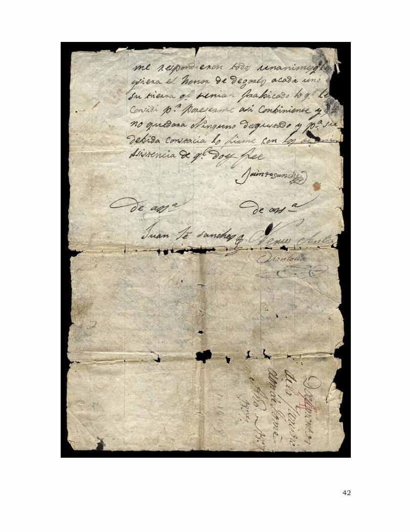
42

43

44

45

46

Appendix C - Bibliography
Baxter, John O. Las Carneradas: Sheep Trade in New Mexico, 1700-186. Albuquerque: University of New Mexico Press, 1987.
Bowden, J. J. “Private Land Claims in the Southwest,” 6 vols. LLM thesis, Southern Methodist University, 1969.
Ebright, Malcolm. Land Grants and Lawsuits in Northern New Mexico. 1994; reprint edition, Santa Fe: Center for Land Grant Studies Press, 2005.
Ebright, Malcolm and Hendricks, Rick. The Witches of Abiquiú: The Governor, the Priest, the Genízaro Indians, and the Devil. Albuquerque: University of New Mexico Press, 2006.
Ellis, Florence Hawley. “Tomé and Father J. B. R.” New Mexico Historical Review 30(2): 89-114; 30(3): 195-220.
Ellis, Florence H. and Baca, Edwin. “The apuntes of Father J. B. Rallier.” New Mexico Historical Review 32(3): 259-273.
Espinosa, Gilberto, and Chavez, Tibo J. El Rio Abajo. Privately printed.
Fairchild-Parks, Jeffrey, Dean, J. S., and Betancourt, Julio. “Tree rings, drought, and the Pueblo abandonment of south-central New Mexico in the 1670s.” Manuscript on file, Laboratory or Tree-ring Research, University of Arizona, and Research Office, U.S. Geological Survey, Tucson.
Hammond, George P. and Rey, Agapito. Juan de Oñate, Colonizer of New Mexico, 1595-1628. Albuquerque: University of New Mexico Press, 1953.
. The Rediscovery of New Mexico, 1580-1594. University of New Mexico Press, Albuquerque.
Hickerson, Nancy Parrott. The Jumanos: Hunters and Traders of the South Plains. Austin: University of Texas Press, 1994.
Hodge, Frederick Webb. Handbook of American Indians North of Mexico. Totowa, New Jersey: Rowman and Littlefield, 1975. Volume 1.
Hurt, Wesley R. Manzano: A Study of Community Disorganization. New York: AMS Press, 1989.
Padilla-Gutiérrez, Rita. “The Town of Tomé Land Grant: A History of Honor, Pride and Tragedy,” unpublished manuscript in the author’s possession.
Manzano Land Grant. Minutes of meetings and expense record. Torrance County Records, Estancia.
McLemore, Virginia. “Manzano Mountains State Park and Abó and Quarai units of Salinas Pueblo Missions National Monument,” New Mexico Geology (November 2000).
Murphy, Dan. Salinas Pueblo Missions: Abó, Quarai, and Gran Quivira. Southwest Parks and Monuments Association, 1993.
47

Riley, Robert. “New Mexico Villages in a Future Landscape.” Landscape (Winter 1969): 3-12.
Scholes, France V. “The Supply Service of the New Mexican Missions in the Seventeenth Century, III.” New Mexico Historical Review 5(4): 386-404.
Simmons, Marc. Albuquerque: A Narrative History. Albuquerque: University of New Mexico Press, 1982.
. The Little Lion of the Southwest: A life of Manuel Antonio Chaves. Chicago: The Swallow Press, 1973.
Spalding, Lucien. "Memories of Manzano," New Mexico Magazine (July 1984).
Twitchell, Ralph Emerson. Spanish Archives of New Mexico. 2 vol. Cedar Rapids, Iowa: Torch Press, 1914.
48

Appendix D - Photo Credits
Figure 1. Ruin of Quarai mission. Murphy, Salinas Pueblo Missions, p. 35. Figure 2. Map showing Manzano and surrounding area, from Murphy, Salinas Pueblo
Missions, precedes p. 1.
Figure 3. Ruin of the Abó mission. Murphy, Salinas Pueblo Missions, p. 34. Figure 4. View of Manzano. Riley, "New Mexico Villages," Landscape (Winter 1969). Figure 5. Original settlement of Manzano, from Hurt, Manzano, 239. Figure 6. Children at Manzano Reservoir. Clockwise from boy in cowboy hat: Casimero
Silva, Patricia Silva, Lorrain Silva, Rita Nuñez, and dogs Sweety and Chuco. Cavalliere G. Ketchum, from Spalding, "Memories of Manzano," (July 1984): 65.
Figure 7. The torréon of Manzano. Photo by Jesse L. Nusbaum, courtesy the Museum of New Mexico, negative 13863.
Figure 8. Santos Silva, resident of Manzano, from Spalding, “Memories of Manzano,” New Mexico Magazine (July 1984).
Figure 9. Population of Villages in East Mountain Area (U.S. Census).
Figure 11. Plat of the Manzano State Park. Figure 12 Layout of facilities at Manzano Mountains State Park. Virginia McLemore,
"Manzano Mountains State Park," New Mexico Geology, (November 2000): 1.
49

50
Appendix E - Map of Manzano Mountain State Park and Land Grants

Appendix F - Map of Manzano Mountain State Park
51