the need for lunar and planetary cartography planning · pdf file2014 october 22 . b. a....
TRANSCRIPT
The Need For Lunar and Planetary Cartography Planning
U.S. Department of the Interior U.S. Geological Survey
Lunar Exploration Analysis Group (LEAG) 2014 October 22
B. A. Archinal1, R. L. Kirk1, L. R. Gaddis1, J. Hagerty1, J. Skinner1, T. N. Titus1, L. P. Keszthelyi1, T. Hare1, S. J. Lawrence2, R. Beyer3,4, A. Nefian4, T. Fong4, and T. Duxbury5 1USGS, 2SESE-ASU, 3SETI Institute, 4NASA Ames, 5George Mason University
Outline • Background • End of planning by the Planetary Cartography
Working Group (PCGMWG) • Need for NASA planetary cartography
planning • Examples: Geodetic control, standards • Cartographic issues for lunar researchers • Recommendation
2014 October 22 2

Background • Global maps and mosaics are integral to planetary missions
• Both for planning and as products, starting in development and continuing through mission operations and data analysis
• In recognition, NASA established several committees, working groups, and panels
• Objective: Plan systematic global data acquisition, data processing and development of cartographic products suitable for planetary exploration
• From 1974 to 2012: • 1974: Lunar Photography and Cartography Committee (LPACC) • 1977: Lunar and Planetary Photography and Cartography
Committee (LPPACC) • 1979: Planetary Cartography Working Group (PCWG)
• Produced two 10-year plans and a supplement (at right)
• 1994: Planetary Cartography & Geologic Mapping Working Group (PCGMWG)
• Included the chair of the NASA Geologic Mapping Subcommittee (GeMS)
2014 October 22 3

End of the PCGMWG • From 1994 to 2012, the PCGMWG made cartography
recommendations to NASA • Drafted 10 year cartography plan in 2006 • Recommendations briefed to NASA PSD in 2008 >> “wait
for Decadal Survey” • Submitted white paper on cartography to NRC Decadal
Survey • The PCGMWG stopped making formal cartography
recommendations in 2012 (FACA issues?) • Still reviews USGS PG&G Cartography proposal
• This leaves a major gap in long-term planning for cartography in the planetary science community • Groups on mapping standards for Moon & Mars don’t make
general recommendations on cartography planning (LGCWG, 2007~2009; MGCWG, mid 1990’s to present)
2014 October 22 4
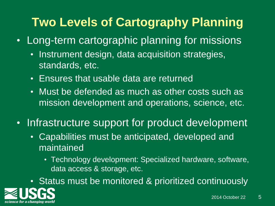
Two Levels of Cartography Planning • Long-term cartographic planning for missions
• Instrument design, data acquisition strategies, standards, etc.
• Ensures that usable data are returned • Must be defended as much as other costs such as
mission development and operations, science, etc.
• Infrastructure support for product development • Capabilities must be anticipated, developed and
maintained • Technology development: Specialized hardware, software,
data access & storage, etc.
• Status must be monitored & prioritized continuously 2014 October 22 5

Examples: Geodetic Control • Only way to register data in a
common frame • Yields KNOWN level of accuracy
• Applications: Geology, mineralogy,
ISRU, site selection, landing and landed operations
• Other benefits: Seam removal, proper orthometric projection of data; registration of multispectral data, proper photometric correction, change detection
• Should all lunar datasets be controlled – as the NASA Advisory Council recommended in 2007?
iPhone map without proper control and/or topographic
base
Current M3 vs. WAC GLD100 DEM Apollo 15 and Hadley Rille site
(Courtesy: M^3 Team, ACT) 2014 October 22 6
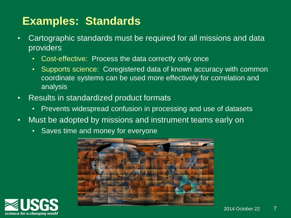
Examples: Standards • Cartographic standards must be required for all missions and data
providers • Cost-effective: Process the data correctly only once • Supports science: Coregistered data of known accuracy with common
coordinate systems can be used more effectively for correlation and analysis
• Results in standardized product formats • Prevents widespread confusion in processing and use of datasets
• Must be adopted by missions and instrument teams early on • Saves time and money for everyone
2014 October 22 7
• Who establishes lunar cartographic standards and ensures that they are followed?
• What new technologies and methods are needed for lunar data processing? • How will such techniques be developed & tested? • Who will do this work, and where?
• How will resources for R&A be prioritized to address these issues? • Will PDART help or hurt?
2014 October 22 8
Cartographic Issues for Lunar Data - 1
Cartographic Issues for Lunar Data - 2
• How are data from international missions to be incorporated? • Who will do it?
• Clementine data are still important • How will they be registered to LRO data, and at
what accuracy? • How will lunar topography data be merged?
• LOLA, WAC stereo, NAC stereo, Kaguya LALT and TC stereo, C-1 TMC stereo, Apollo Metric and Panoramic
2014 October 22 9

• What is the positional accuracy of the WAC data? • Do they need to be controlled, if only to know the accuracy?
• Will all NAC stereo images (all NAC images?) be checked for jitter? • Is it important to make DTMs from all NAC stereo images?
• Who will do it? • Is a new lunar mission required for operational or scientific
purposes? • Uniform, high resolution topo mapping? Registration of data? • High resolution multispectral coverage for resource location?
• What requirements should there be on future lunar and planetary missions for mapping? • Calibration, processing, products?
2014 October 22 10
Cartographic Issues for Lunar Data - 3
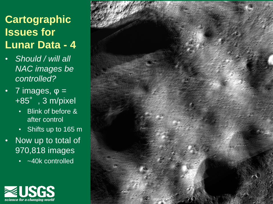
• Should / will all NAC images be controlled?
• 7 images, φ = +85°, 3 m/pixel • Blink of before &
after control • Shifts up to 165 m
• Now up to total of 970,818 images • ~40k controlled
2014 October 22 11
Cartographic Issues for Lunar Data - 4
PCGMWG: Final Recommendation
“Our key recommendation centers on the need to create a long range planetary mapping and cartography plan. This could be done by the PCGMWG, with advocacy voiced by this Decadal Survey process (or a similar NRC study). With such a plan, cartography can become an integral part of all spacecraft missions and instruments, beginning in the development stages and continuing through mission operations and the data analysis portions of the mission. Without such a plan, the status quo will remain and the potential utility of the vast amounts of detailed data provided by these missions will remain either delayed or underutilized for the benefit of scientific discovery.” PCGMWG White Paper, J.R. Johnson et al., submitted to the NRC Decadal Survey, 2010
2014 October 22 12

Recommendation
• The planetary Advisory Groups (including LEAG) need to issue “findings” that a new cartographic planning group should be chartered to address cartographic and planetary mapping needs • Clive Neal (for LEAG) started this in September • Some PSD discussion that PCGMWG perhaps
should begin to do planning again, acting as an Analysis Group
• Need to reinforce such actions and discussion and push forward!
2014 October 22 13

Backup
2014 October 22 14
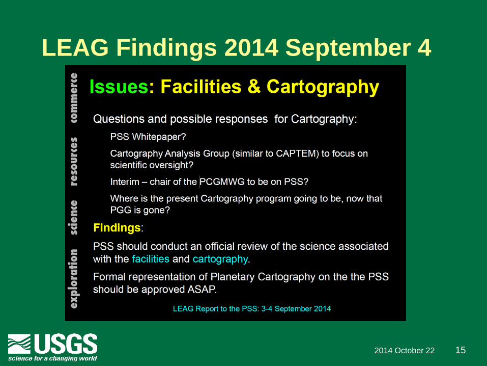
LEAG Findings 2014 September 4
2014 October 22 15

Resources on Planetary Cartography Planning • See
http://astrogeology.usgs.gov/groups/nasa-planetary-cartography-planning • Index and links to 36 documents, 1981 to present • Including items cited above
2014 October 22 16

NASA Advisory Council Short description of the Recommendation Lunar orbital data sets should be geodetically controlled and accurately co-registered to create cartographic products that will enable fusion, integration, and manipulation of all past and future data relevant to lunar exploration. Major reasons for the Recommendation This recommendation results from considering how best to integrate the various data sets (US and international) that will be returned from the Moon in the next 5-8 years as well as those previously obtained. Improved positional accuracy for locations around the globe and for accurate co-registration of all available data sets is needed to maximize safety, reliability and efficiency in lunar human and robotic exploration operations. - NASA Advisory Council (2007). Recommendation S-07-C-13 of the NASA Advisory Council to NASA Administrator Griffin, p. 14, http://bit.ly/x0HnnM
2014 October 22 17