the pinhoti national recreation trail, located in the ... · the pinhoti national recreation trail,...
TRANSCRIPT
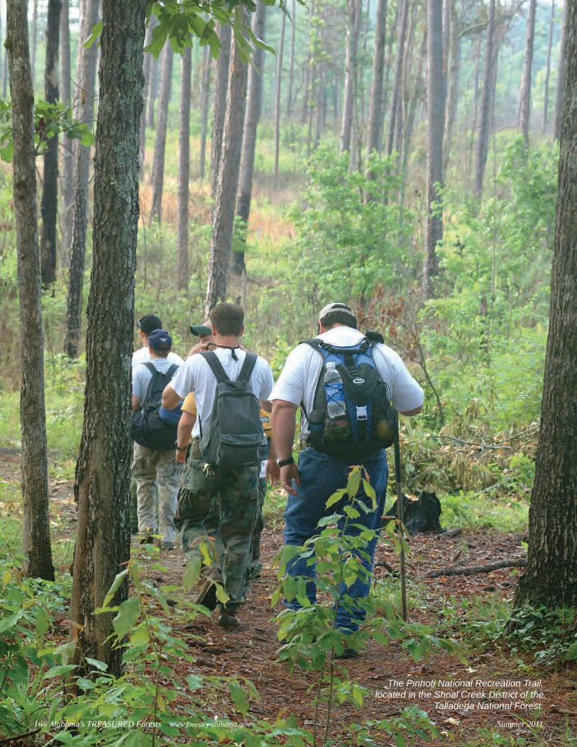
The Pinhoti National Recreation Trail, located in the Shoal Creek District of the
Talladega National Forest.
16 / Alabama’s TREASURED Forests www.forestry.alabama.gov Summer 2011
There was a time when it seemed that no one cared about those lands in Alabama which the USDA Forest Service now manages for the public. Thanks to the 1911 Weeks Act that enabled the Forest Service to purchase eroded
and cut-over private lands in the eastern United States, these same lands are now conservation success stories.
“Alabama’s National Forests were not always the beautiful areas as many individuals see them today,” said Steve Lohr, for-est supervisor for the National Forests in Alabama. “During the early 1900s, much of the land was eroded and heavily cut-over. Many people had little regard for the value or future of the for-ests. Most of the land that eventually became the National Forests in Alabama was either stripped wastelands or abandoned, low-productive farm lands that no one wanted.”
The Weeks Act was part of the changing national attitude that evolved in the early twentieth century toward conserving public lands. Poor conservation ethics and the epic west-ern wildfires of 1910 led to support for the Weeks Act. When President William Taft signed the bill on March 1, 1911, a century of conservation was launched – providing clean water, restoring forests, and reducing catastrophic wildfires. The federal government could now buy up land in the eastern United States for restora-tion and protection.
Weeks Act acquisitions led to the creation of 52 national for-ests on 20 million acres that includes public lands in Alabama. The four that were established in this state – Bankhead, Conecuh, Talladega and Tuskegee National Forests – include approximately 670,000 public-owned acres located across 17 counties of Alabama.
The Weeks Act enabled federal agencies to form partnerships to not only control wildfires, but also prevent erosion and flood-ing. A cooperative fire agreement between the Forest Service and the Alabama Forestry Commission allows the agencies to share resources to respond to emergencies. This partnership also brings state and federal natural resource managers together to develop solutions to manage threats that impact all boundaries, such as wildfires, southern pines beetles, or cogongrass.
National Forests provide communities with clean water, air, wildlife habitat, outdoor recreation opportunities, and jobs. One fifth of the entire nation’s clean drinking water flows from land acquired through the Weeks Act. In Alabama, eight communities
rely on national forests as a water source: Double Springs, Haleyville, Birmingham, Talladega, Sylacauga, Piedmont, Heflin, and Goodwater are serviced by watersheds in the Bankhead National Forest and Talladega National Forest (Shoal Creek and Talladega Districts).
The Forest Service first reserved public land in Alabama in 1918 under the Alabama purchase unit known today as the Bankhead National Forest. When the Forest Service acquired Alabama’s public lands, more than half of the forested area was cut over. The only forests that were not cut excessively were the Shoal Creek and Talladega Districts of the Talladega National Forest. These forestlands had fair site conditions with low-quali-ty timber because of the rocky soils.
Through the years, Forest Service employees and numerous partners have demonstrated proper land management that today
provides multiple benefits. The Forest Service is committed to continuing a conservation legacy by working together
with numerous management partners on many issues of interest in Alabama. Some examples include restoring the native longleaf pine ecosystem and
protecting communities from the threat of wildfire by using prescribed (controlled) fire to reduce hazardous fuel
accumulations. Other examples include working with partners to implement a red-cockaded woodpecker recovery and habitat improvement program; controlling the spread of cogongrass, a non-native invasive species; and working with communities on conservation education.
“The National Forests in Alabama look quite different than they did when the lands were acquired,” said Lohr. “The once bare, eroded lands have been replanted and are now productive forests.”
The Weeks Act provided new opportunities for conservation, but people did the work, and people are key to future successes. Forest Service employees are proud to be a part of that success – to wear the uniform and care for the land. Forest Service employees and numerous partners are continuing to reach across landscapes to restore national forests and tackle large issues such as climate change, water supply, and land restoration. Thanks to the Weeks Act, strong partnerships with federal, state, and local agencies are improving the Forest Service’s ability to change lives and landscapes. Now that’s something to celebrate.
By Tammy F. Truett Public Affairs Staff Officer, National Forests in Alabama
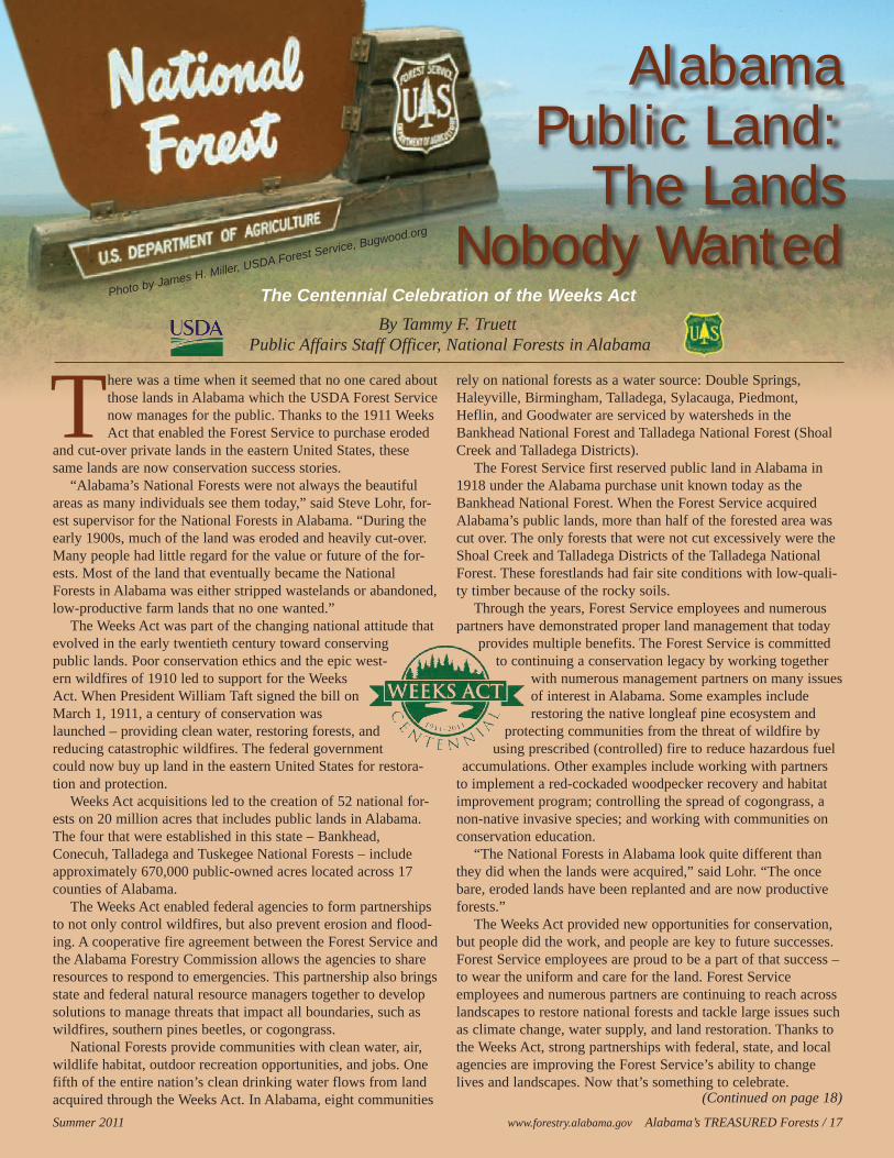
AlabamaPublic Land:
The LandsNobody Wanted
Photo by James H. Miller, USDA Forest Service, Bugwood.org
Summer 2011 www.forestry.alabama.gov Alabama’s TREASURED Forests / 17
The Centennial Celebration of the Weeks Act
(Continued on page 18)
18 / Alabama’s TREASURED Forests www.forestry.alabama.gov Summer 2011
Alabama Public Land(Continued from page 17)
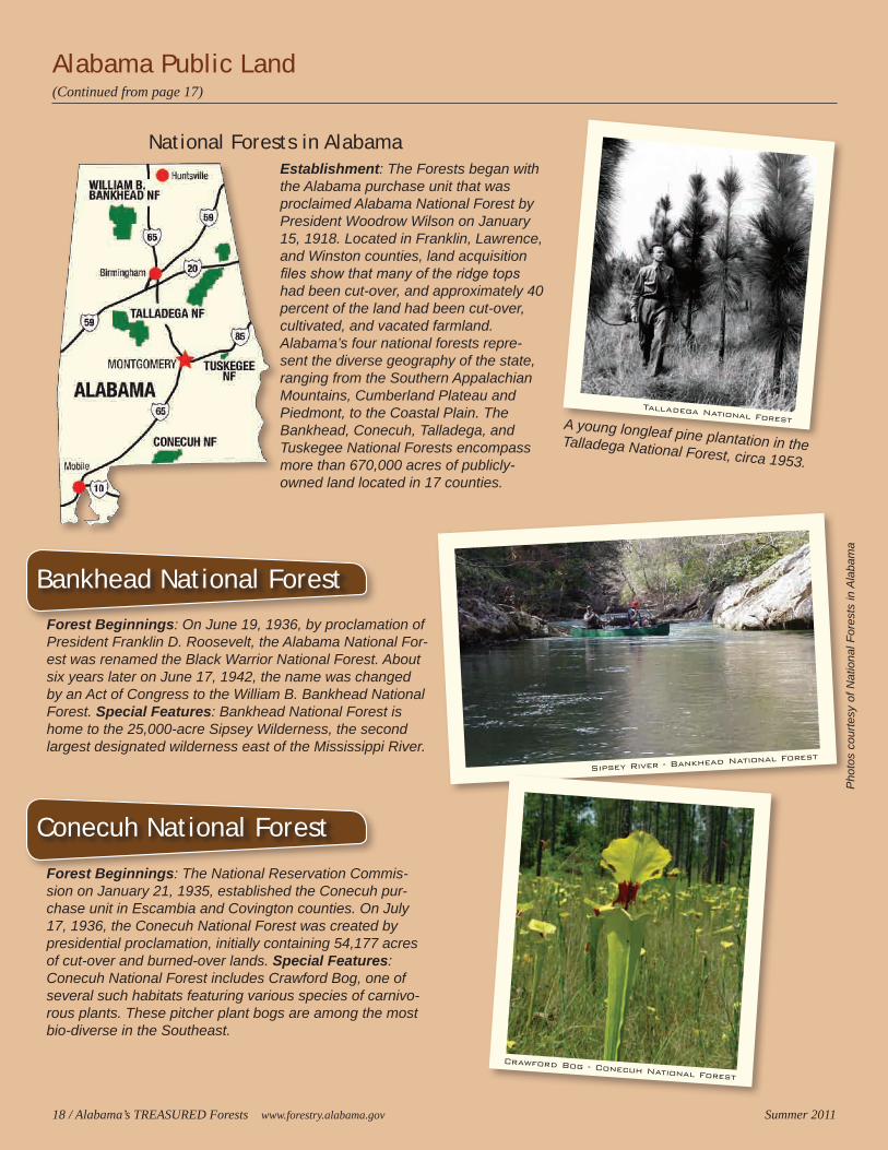
Establishment: The Forests began with the Alabama purchase unit that was proclaimed Alabama National Forest by President Woodrow Wilson on January 15, 1918. Located in Franklin, Lawrence, and Winston counties, land acquisition files show that many of the ridge tops had been cut-over, and approximately 40 percent of the land had been cut-over, cultivated, and vacated farmland. Alabama’s four national forests repre-sent the diverse geography of the state, ranging from the Southern Appalachian Mountains, Cumberland Plateau and Piedmont, to the Coastal Plain. The Bankhead, Conecuh, Talladega, and Tuskegee National Forests encompass more than 670,000 acres of publicly-owned land located in 17 counties.
National Forests in Alabama
Forest Beginnings: On June 19, 1936, by proclamation of President Franklin D. Roosevelt, the Alabama National For-est was renamed the Black Warrior National Forest. About six years later on June 17, 1942, the name was changed by an Act of Congress to the William B. Bankhead National Forest. Special Features: Bankhead National Forest is home to the 25,000-acre Sipsey Wilderness, the second largest designated wilderness east of the Mississippi River.
Forest Beginnings: The National Reservation Commis-sion on January 21, 1935, established the Conecuh pur-chase unit in Escambia and Covington counties. On July 17, 1936, the Conecuh National Forest was created by presidential proclamation, initially containing 54,177 acres of cut-over and burned-over lands. Special Features: Conecuh National Forest includes Crawford Bog, one of several such habitats featuring various species of carnivo-rous plants. These pitcher plant bogs are among the most bio-diverse in the Southeast.
A young longleaf pine plantation in the Talladega National Forest, circa 1953.
Conecuh National Forest
Bankhead National Forest
Sipsey River - Bankhead National Forest
Crawford Bog - Conecuh National Forest
Pho
tos
cour
tesy
of N
atio
nal F
ores
ts in
Ala
bam
a
Talladega National Forest
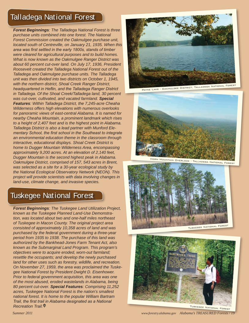
Forest Beginnings: The Talladega National Forest is three purchase units combined into one forest. The National Forest Commission created the Oakmulgee purchase unit, located south of Centreville, on January 21, 1935. When this area was first settled in the early 1800s, stands of timber were cleared for agricultural purposes and to build homes. What is now known as the Oakmulgee Ranger District was about 60 percent cut-over land. On July 17, 1936, President Roosevelt created the Talladega National Forest out of the Talladega and Oakmulgee purchase units. The Talladega unit was then divided into two districts on October 1, 1945, with the northern district, Shoal Creek Ranger District, headquartered in Heflin, and the Talladega Ranger District in Talladega. Of the Shoal Creek/Talladega land, 30 percent was cut-over, cultivated, and vacated farmland. Special Features: Within Talladega District, the 7,245-acre Cheaha Wilderness offers high elevations with numerous overlooks for panoramic views of east-central Alabama. It is named for nearby Cheaha Mountain, a prominent landmark which rises to a height of 2,407 feet and is the highest point in Alabama. Talladega District is also a lead partner with Munford Ele-mentary School, the first school in the Southeast to integrate an environmental education theme in the classroom through interactive, educational displays. Shoal Creek District is home to Dugger Mountain Wilderness Area, encompassing approximately 9,200 acres. At an elevation of 2,140 feet, Dugger Mountain is the second highest peak in Alabama. Oakmulgee District, comprised of 157, 543 acres in Brent, was selected as a site for a 30-year ecological study by the National Ecological Observatory Network (NEON). This project will provide scientists with data involving changes in land-use, climate change, and invasive species.
Forest Beginnings: The Tuskegee Land Utilization Project, known as the Tuskegee Planned Land-Use Demonstra-tion, was located about two and one-half miles northeast of Tuskegee in Macon County. The original project area consisted of approximately 10,358 acres of land and was purchased by the federal government during a three-year period from 1935 to 1938. The purchase of this land was authorized by the Bankhead-Jones Farm Tenant Act, also known as the Submarginal Land Program. This program’s objectives were to acquire eroded, worn-out farmland; resettle the occupants; and develop the newly purchased land for other uses such as forestry, wildlife, and recreation. On November 27, 1959, the area was proclaimed the Tuske-gee National Forest by President Dwight D. Eisenhower. Prior to federal government acquisition, this area was one of the most abused, eroded wastelands in Alabama, being 80 percent cut-over. Special Features: Comprising 11,252 acres, Tuskegee National Forest is the nation’s smallest national forest. It is home to the popular William Bartram Trail, the first trail in Alabama designated as a National Recreation Trail.
Talladega National Forest
Tuskegee National Forest
Tuskegee National Forest
Tuskegee National Forest
Summer 2011 www.forestry.alabama.gov Alabama’s TREASURED Forests / 19
Horn Mountain Overlook - Talladega National Forest
Payne Lake - Oakmulgee District, Talladega National Forest