the pismo preserve -...
TRANSCRIPT
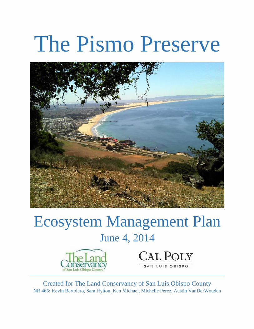
The Pismo Preserve
Ecosystem Management Plan June 4, 2014
Created for The Land Conservancy of San Luis Obispo County NR 465: Kevin Bertolero, Sara Hylton, Ken Michael, Michelle Perez, Austin VanDerWouden

2 | P a g e
Executive Summary
The Pismo Preserve is a 900-acre property on the central coast of California containing scenic
views of the ocean, offering the public a taste of pristine, undeveloped land containing Coast
Live Oak Woodland, Central Coast Scrub and Grasslands.
In order to divert land use away from development, The Land Conservancy of San Luis Obispo
County will manage this large landscape for public benefit. The funds for management are
allocated within the purchase price and provide ample support to maintain the ecosystem in a
manner suitable with the goals and ethos of stakeholders and The Land Conservancy. Such
objectives include designing and maintaining a system of trails, preventing soil erosion, restoring
native grasslands, contracting the range of invasive species, facilitating access by hikers, bikers,
and equestrians, preserving legacy oaks while supporting new oak growth, and serving public
interest while promoting healthy relationships with adjacent landowners, all in a socially and
environmentally responsible manner. With the adoption of the proposed Ecosystem Management
Plan, a first step is taken in acknowledging the responsibility human actions have on the
environment. These human impacts can be mitigated, or in some cases may prove to benefit land.
Where contingencies occur, adaptive management strategies will be adopted to allow a degree of
fluidity to cover any lapse in foresight or change in climate, political or otherwise.
As humans come to understand Nature, it becomes realized that we are inextricably linked to the
land. More than an economic resource, this Preserve will allow the union of the user with a
genuine sense of identity, connecting them to their community, to their heritage, to their soul.
Sustainable land stewardship promises to balance environmental health, economic feasibility and
social fulfillment. The Pismo Preserve strikes such a balance through its congruence with this
management plan.

3 | P a g e
Table of Contents Introduction ..................................................................................................................................... 6
Environmental Assessment ............................................................................................................. 7
Ecosystem Management Definition ............................................................................................ 7
Problem Statement ...................................................................................................................... 7
Background & General Location ................................................................................................ 7
Pismo Preserve ........................................................................................................................ 7
The Land Conservancy of San Luis Obispo County ............................................................... 8
San Luis Obispo County .......................................................................................................... 8
Issues and Concerns .................................................................................................................... 9
Public’s Issues ......................................................................................................................... 9
Government and Regulatory Agencies’ Concerns .................................................................. 9
Vision Statement ......................................................................................................................... 9
Scale ............................................................................................................................................ 9
Temporal .................................................................................................................................. 9
Spatial .................................................................................................................................... 10
Key Attributes ........................................................................................................................... 10
Components ........................................................................................................................... 10
Structures ............................................................................................................................... 10
Composition........................................................................................................................... 10
Processes & Functions ........................................................................................................... 12
Environmental Indicators (EIs)/Reference & Management Variability ................................... 13
Soil Erosion ........................................................................................................................... 13
Native Perennial Grasses ....................................................................................................... 14
Number of Visitors ................................................................................................................ 14
Trail Usage ............................................................................................................................ 14
Traffic .................................................................................................................................... 14
Dominant Species Indicators ................................................................................................. 15
Traditional Management Planning ................................................................................................ 15
Existing Condition of EIs .......................................................................................................... 15
Soil Erosion ........................................................................................................................... 15
Native Perennial Grasslands .................................................................................................. 15
Number of Visitors ................................................................................................................ 16

4 | P a g e
Trail Usage ............................................................................................................................ 16
Traffic .................................................................................................................................... 16
Dominant Species .................................................................................................................. 16
Plan Goals & Objectives ........................................................................................................... 16
Projects ...................................................................................................................................... 19
Parking Lot ............................................................................................................................ 19
Water Trough ......................................................................................................................... 19
Large Item Disposal ............................................................................................................... 19
Trail building ......................................................................................................................... 19
Practices .................................................................................................................................... 24
Cattle Grazing ........................................................................................................................ 24
Bee Keeping .......................................................................................................................... 24
Programs.................................................................................................................................... 24
Environmental Interpretation ................................................................................................. 24
Maintenance ........................................................................................................................... 24
Monitoring ............................................................................................................................. 24
Administration ........................................................................................................................... 25
Responsibilities ...................................................................................................................... 25
Authorities ............................................................................................................................. 25
Budgets and Funding ............................................................................................................. 26
Appendices .................................................................................................................................... 27
Appendix A: Photo Points ......................................................................................................... 28
Appendix B: E-mail Correspondence ....................................................................................... 33
References ..................................................................................................................................... 35

5 | P a g e
List of Figures
Figure 1. Map of the Pismo Preserve. ............................................................................................. 8
Figure 2. Map of current trails ..................................................................................................... 21
Figure 3. Points of interest ........................................................................................................... 22
Figure 4. Map of potential trails ................................................................................................... 23

6 | P a g e
Introduction
The 900-acre Preserve contains unique social and environmental qualities that need to be
managed appropriately. Located on the Central Coast of California, the Pismo Preserve currently
is not open to the public. The ideal state would include conservation and recreational users
including hikers, bikers, and equestrians. The Land Conservancy of San Luis Obispo County is
currently raising the funds to purchase the Pismo Preserve to make this possible. There have
been some issues from the public regarding traffic, cattle grazing, trespassing and more. There
are several government agencies concerns, but most of the agencies are in favor of the purchase
by The Land Conservancy. The property contains a unique combination of oak woodlands, oak
savannahs, and grasslands. There are many thriving wildlife and plant species within the habitat
provided by the Pismo Preserve. To manage the property, environmental indicators were chosen,
including soil erosion, native perennial grasslands, number of visitors, trail usage, traffic, and
dominate species. To achieve the desired future condition, specific goals and objects were
created. These goals and objectives will be revisited periodically and management actions
changed based on the outcome of monitoring and management variability. The Ecosystem
Management Plan will provide a comprehensive adaptive management plan to move the property
to its best state providing not only for conservation, but recreation as well.

7 | P a g e
Environmental Assessment
Ecosystem Management Definition
Ecosystem management is a balanced method of ensuring the viability of an integrated network
of natural processes and functions on a landscape. It is most practical when operations occur on a
biologically-defined scale such as a watershed, and incorporates the human dimension in
management decisions. Broadly, it is understood that natural resources must be utilized in a
sustainable manner both in the long-term and short-term, where determining what constitutes
sustainability is determined within the ecosystem management plan. The successful plan is able
to adaptively meet the needs of the public while monitoring the health of the environment and
protecting its vital components. This includes considerations not only for the species that rely on
it but also the essential processes and functions necessary for maintaining diverse, dynamic, and
productive ecosystems.
Problem Statement The ideal state of the Pismo Preserve would primarily entail recreational use for the public while
minimizing impacts to the property, promoting good relations with surrounding landowners,
maintaining natural ecosystem processes, maintaining grazing areas where appropriate, and
meeting the overall conservation goals of The Land Conservancy of San Luis Obispo County
(LCSLO). The current state of the property excludes recreational users, though has some trails,
and does not incorporate a conservation or monitoring plan. If an ecosystem management plan is
not put in place, several consequences could occur, including soil erosion, habitat degradation,
and loss of potential economic gain due to tourism within the area.
Background & General Location
Pismo Preserve
The proposed Pismo Preserve is a 900-acre property located between Shell Beach and Pismo
Beach abutted to Highway 101 on its southwestern border, and bounded by Price Canyon Road
to the East (Figure 1). It includes extensive grasslands, coastal scrub, and oak woodland near
riparian corridors, providing public pleasure of California’s central coast in a natural condition.
LCSLO is currently in the process of raising funds to purchase and maintain this parcel, which is
currently owned by PB Coast Views LLC, in the hopes of providing recreational usage while
ensuring sound stewardship of the Preserve.

8 | P a g e
Figure 1. Map of the Pismo Preserve within San Luis Obispo County and aerial of the property, provided by The Land
Conservancy of San Luis Obispo County.
The Land Conservancy of San Luis Obispo County
The Land Conservancy of San Luis Obispo County (LCSLO) is a non-profit organization that
aims to protect local land and natural resources, working with both private landowners and
government agencies in a way that is mutually beneficial for all parties involved. Their main
goals include preventing poorly planned development, protecting drinking water sources,
restoring and protecting wildlife habitat, and promoting family farms and ranches. Through the
help of the community and collaborative partnerships, LCSLO is able to permanently conserve
land and heritage for future generations.
LCSLO manages several properties and trails, such as the Bob Jones Trail, Stenner Springs
Preserve and West Cuesta Ridge Trail, Froom Ranch Open Space Preserve, Maino Open Space,
and many others throughout San Luis Obispo County, that meet their conservation goals as well
as provide recreational opportunities for the public. The Pismo Preserve will be managed in a
similar manner, but on a greater scale and with a greater diversity of trails for different users
(hikers, bikers, equestrians) due to its larger area.
San Luis Obispo County
San Luis Obispo County has a longstanding history of providing public access to land for the
benefit of local communities. The city of San Luis Obispo established the Natural Resources
Protection Program in 1995 to enhance, restore, and conserve such land. It is a prime example of
the context that local municipalities hold when managing easements and open spaces. The
communities of the central coast are more ecologically sensitive and have greater levels of
political participation than many other regions in California, making development of
aesthetically appealing and ecologically untouched land in these areas exceedingly difficult.
Public support for conservation projects, conversely, has maintained a high degree of momentum
through the past decades in acquiring properties for multi-use purposes that involve some form
of preservation and recreation.

9 | P a g e
Issues and Concerns
Public’s Issues
There are several issues regarding different aspects of the Preserve that the public may be
concerned with. Near the Preserve, residents may be concerned with parking and the increased
traffic within the city of Pismo Beach due to this new recreational area.
The other issues directly involve the Preserve. One issue is preventing trespassing onto the
neighbor’s property from a specific trail that is at the border of the property boundary. Another
issue involves preventing litter and pollution from disrespectful visitors. There are some
concerns regarding cattle grazing, because there is not a designated area for this activity, and
there could be potential harm from interaction between visitors and the cattle, as well as
erosional concerns. Additional issues in regards to the trails include user experience and potential
problems with different types of trails, such as for hiking vs. biking vs. equestrian.
Government and Regulatory Agencies’ Concerns
There are several agencies that may have concerns regarding the Pismo Preserve. Concerning
land use, San Luis Obispo County (SLO County) and the California Coastal Commission (CCC)
will have an interest in this property because the Preserve is within their jurisdiction. The
landowners, The Land Conservancy of San Luis Obispo County (LCSLO), will be concerned
with land use as well.
Because Pismo Creek runs through a small portion of the property, water quality issues and the
sensitive species it contains will be a concern of the Regional Water Quality Control Board
(RWQCB), the California Department of Fish and Wildlife (DFW), and the Environmental
Protection Agency (EPA). However, for the purposes of this report, water quality issues will not
be discussed.
There are some listed endangered and threatened species on the Preserve and in Pismo Creek,
which would be a concern to the U.S. Fish and Wildlife Service (FWS), DFW, and EPA.
Some roads may be improved and/or aligned, so this will be a concern to Cal Fire. The CCC and
Wildlife Conservation Board (WCB) will have an interest in this Preserve as well, as they are the
primary sources of funding.
Vision Statement Pismo Preserve will be the premier conservation and recreational area for bikers, hikers, and
equestrians to enjoy the beauty of California’s central coast.
Scale
Temporal
Beginning in mid-2014, the existing trails and roads will be mapped. The trails will be analyzed
to determine how they will be aligned and if/where new trails should be implemented. The goal
is to have the trails completed and open to the public by the spring/summer of 2015. As with all

10 | P a g e
properties LCSLO owns or manages, the property will be monitored each year to ensure that the
goals of the Preserve are still met. If they are not met in future years, LCSLO will then
implement the best strategy to achieve those goals.
Spatial
Realigning existing trails and making new ones will take several factors into account. Because
this property has some steep canyons, topography will be considered when creating new trails
and connecting some existing trails into loops. Trespassing is a major concern, so fences and
signage will be implemented when realigning trails along property boundaries to ensure visitors
stay within the Preserve. Another major concern is creating the least amount of impact on
sensitive areas, so this will be analyzed and considered as well. The Preserve does not currently
have a designated area for cattle grazing. Identifying areas where this practice is best suited will
be identified as to not cause any disturbance among the cattle or visitors. As this Preserve will
be open to the public for recreation, user experience is of great importance, and the trails will
reflect this concern.
Although water quality will be a concern in managing the property, practices and actions
concerning Pismo Creek will not be discussed due to its far proximity from existing trails or
areas where new trails will be created, for the purpose of this management plan is based on the
recreational trails.
Key Attributes
Components
Pismo Preserve consists of a variety of trees, shrubs, grasses, grazing area, birds, fish, wildlife,
and a stretch of Pismo Creek. Human activity will be a major component of the Preserve in the
form of public recreation, which includes hiking, biking, and horse trails.
Structures
Within the Preserve, there are rolling hills on the northwest and northeast slopes consisting of
non-native grasses sustained by cattle grazing. The Preserve also consists of narrow canyons
with steep slopes vegetated with coast live oak woodland. The riparian corridor along Pismo
Creek borders the southwest portion of the Preserve, in which some sensitive faunal species can
be found.
Composition
Lithosphere: The Pismo Preserve lithosphere contains a combination of Quaternary deposits and
Tertiary and older rocks. A large portion of the site is on a Pismo formation. The Squire member,
which consists of massive, white, calcareous, fine- to medium-grained, quartzose to arkosic, silty
sandstone; and the Edna member which consists of buff, massive arkosic to quartzose sandstone,
fine- to coarse-grained, are the primary Tertiary and older rocks most present within the site. The
most common Quaternary deposit within the Preserve site is the Young alluvial valley deposits
featuring unconsolidated sand, silt, and clay-bearing alluvium that was deposited on floodplains
and along valley floors (Wiegers).
11 | P a g e
Atmosphere: Atmosphere is not a significant concern for the management goals or ecosystem
goals of the Preserve due to coastal proximity and low industrial services in the surrounding area.
The atmospheric conditions within the Preserve are in accordance with the air quality standards
set by the California Environmental Protection Agency (CEPA) and the California Air Resources
Board (CARB).
Hydrosphere: The southwest portion of the Pismo Preserve contains a stretch of Pismo Creek,
which runs along Price Canyon Road and drains into the Pacific Ocean at Pismo Beach. Pismo
Creek falls within the Pismo Creek/Edna Area watershed, originating at the confluence of East
Corral de Piedra and West Corral de Piedra Creeks. Pismo Creek is listed as an impaired water
body by the California Water Resource Control Board. Sources of flow to Pismo Creek include
precipitation, groundwater, return flows from irrigation, and emanating deep groundwater. The
average rainfall for the area is 16.5 to 27 inches annually (WMP).
Biosphere: The land within the Pismo Preserve features a diverse range of California’s plants,
animals and aquatic life. The Preserve contains a variety of native and non-native plant
communities, beginning with the most dominate: Coast Live Oak Woodland, Coastal Sage
Scrub, Non-Native Grasslands, Coast Live Oak Woodland with non-native grasses, Chaparral,
and more. Pismo Creek, which runs along the southwest edge of the property, contains many
endangered and sensitive species such as: Red-legged frog, Southwestern Pond turtle, Steelhead
trout, stickleback, mosquitofish, crayfish, and the Santa Cruz garter snake. Other aquatic species
are also present in the area. There are no signs of endangered avian species on the Preserve;
however, three species of concern are: California Gull, Yellow Warbler and double-crested
Cormorant. Many other avian species are present on the Preserve as well. Many small mammals
are present on the property, as well as other larger species such as: badgers, gray fox, coyote and
mule deer (Szabo).
Pedosphere: The pedosphere within the Pismo Preserve Site contains eleven different soil types.
Of these eleven varying soil types, there are two soils considered sandy and therefore regarded
important in respect to their function in providing habitat for the Pismo clarkia. These sandy soils
include the Elder Sandy Loam and the Still Gravelly Sandy Clay Loam. Along with providing
suitable habitat for the Pismo clarkia, the Elder Sandy Loam is also able to provide the
sustainment of annual grasses, forbs, and limited hardwoods. Located along a drainage course,
which runs across the northeastern boundary of the Project Site, the Elder Sandy Loam is
characterized as having a moderately rapid permeability, a low water erosion hazard, a high
water capacity, and an effective rooting depth of 60 inches. On the southwestern edge of the site
runs a thin band of Still Gravelly Sandy Clay Loam. With a moderately slow permeability, high
water capacity, slow to moderate surface runoff, and effective rooting depth of 60 cm, the Still
Gravelly Sandy Clay Loam provides an appropriate habitat for grasses, forbs, and occasional
hardwoods (Szabo).
Human: Human impact and use will be a critical component of the ecosystem. Those uses will
consist of recreational use (hiking, biking, horseback riding) and ranching (cattle grazing).
Management will be a critical key in ensuring that the water quality of Pismo Creek does not
decrease and natural ecosystem processes and functions are not deterred due to those activities.

12 | P a g e
Processes & Functions
There are many processes and functions acting on and within the Pismo Preserve. There are
degrees of control that can be exhibited on these processes ranging from none to high. The three
foundational processes are solar radiation, moisture regimes and geomorphology. These account
for all potential productivity on the site and can have little to no influence from human activity.
The terrain, topography and aspect of the site provide variations and diversity in biological
capabilities and functions. For example, a southern facing steep hill will receive more solar
radiation than the northern aspect and subsequently will be hotter and drier. Steepness and soil
quality will function to retain or drain water and provide a stable, mineral rich (or poor) substrate
for plant life.
Rainfall is a process that determines hospitality of a site, and functions to nourish plant and
animal life, and recharge groundwater. When evaluated alongside the geology, the process of
erosion becomes a vital consideration. Erosion removes vegetation and suitable habitats, adds
sediment to water courses and the ocean, and alters nutrient loads that can result in unnatural
levels of microbial blooms or toxicity for marine life. The average rainfall in the nearby city,
Pismo Beach, is approximately 17 inches annually. However, due to the proximity of the site to
the ocean, humidity can be higher and fog can function as supplemental water supplies for the
biological community. This process reduces evapotranspiration rates in plants and cools the
region, keeping an average high temperature of 68F and a low of 48F.
Processes more prone to human management include growth and movement of biological
communities including plants and animals, and enjoyment of the site by humans (recreation).
There is also a degree of influence to be exerted on the process of nutrient cycling, and small
scale alteration of the soils. The solar radiation fuels the growth of plants.
Plants function as a food source, shelter and aesthetic resource for many species. They may also
function to filter sunlight and water, allowing for a diverse range of life and cleaner resources.
However, the relationship is not linear. Plants affect the environment and are affected by it.
Some may not be able to grow in a certain soil quality, but some may improve the quality by
hosting nitrogen fixers and adding organic matter. This creates a pathway for the process of
succession. Succession may be influenced by altering the stages of plant life through grazing or
human degradation. Oaks are the physically dominant species in parts of the property, and
function to shade the area and tap into water located deeper underground. Grazing may reduce
oak recruitment from over-browsing. Through the process of oak reproduction, acorns are made
and serve as feed for rodents and birds.
Many rodents dig and alter soil structure, improving aeration. Birds reduce pest and other insect
populations, and are enjoyable to hear and observe. Animal movement beyond grazing practices
are necessary for seed dispersal, nutrient (fecal and urinary) deposition, and structural changes in
plant communities. The site is important as a wildlife corridor, allowing animals to rest and feed
on it while travelling to and from nests and other primary habitats.
Humans impede animal migration through the process of land acquisition and fence construction.
Trail construction will be a process that can function to allow for the recreational movement of

13 | P a g e
humans to reduce impacts across the land by focusing them on managed areas. Fires were
traditionally a common process shaping ecosystems, but on this site it may be suppressed with
the exception of prescribed burns when essential.
Soil microbes are important components acting on ecosystems, yet are generally left unmanaged
due to the level of complexity therein. The scale of management is not practical, despite the fact
that microbes play a role in nitrogen fixation, water quality, soil quality, decomposition rates,
consumption of leachates, plant health, and animal health.
It is not practical to assume all processes and functions can be managed on an ecosystem, and
even less so to assume that we understand all the acting processes. The best management plans
for natural resources, however, are a good foundation for appropriate action and decision
making. When the broad picture and overlying mechanisms are understood, and when processes
are adaptively managed on a feasible scale, multiple needs and uses can be addressed for a given
ecosystem.
Environmental Indicators (EIs)/Reference & Management Variability
To assess the effectiveness of the Pismo Preserve in conserving the natural state of the land, the
Ecosystem Management Plan will use certain Environmental Indicators. These environmental
indicators will provide information regarding the planned projects impacts on soil, flora, fauna,
water quality, air quality, and the public’s use of the land. With each environmental indicator
data will be collected and analyzed within specific timeframes to evaluate the implications of the
land preservation.
Soil Erosion
Soil erosion indicators will be used to track the impact of trail use on the condition of the
property’s soils. Heavily increased use of the present trails and the development of new trails
could potentially cause issues as a result of soil compaction and vegetation removal.
Reference Variability: Present soil erosion is limited to ranching operations or natural functions
of the ecosystem.
Management Variability: Increase in the amount of human presence on the land will result in a
drastic increase in soil interference. Problems may arise from compaction and soil erosion due to
human, horse, and bike travel over the soil. Efforts should be made to keep people on the trails to
limit human interference to non-trail soils. Erosion pegs and bank erosion pegs can be used at
specific points throughout the Preserve to monitor for the extent of impact caused by activities.
Soil should not be allowed to decrease more than half a centimeter each year. Monthly
monitoring should be performed to ensure that soil does not display any significant concerns.

14 | P a g e
Native Perennial Grasses
Reference Variability: Introduction of Mediterranean annual grasses from Spanish colonists
greatly diminished the population of native grasses throughout the state. The site of the Pismo
Preserve has become dominated by naturalized European grasses and invasive forbs. Currently
there are several areas of native grasses on the site.
Management Variability: Management approaches will be used to maintain the current native
grass population on their present site and also encourage the spread of the native grasses
throughout more regions of the Preserve. No decrease to native grass populations should be
allowed and land managers should increase the native population density by one percent
annually. Monitoring of the native grass population should be performed each season to ensure
no decreases to the number of species are occurring.
Number of Visitors
Reference Variability: The land is currently closed to the public and features limited human
presence. Recreational visitors are prohibited from the Preserve property.
Management Variability: Development of the Preserve will encourage a drastic increase in the
number of visitors to the area. People will be allowed to enter the property for recreational
activities including hiking, biking, and equestrian use. The Preserve is targeted to have a steady
amount of visitors without having an amount of visitors that results in significant impacts to the
land or visitor’s enjoyment of the site. The Preserve should achieve a target of 3,000 visitors per
month. (Theobald)
Trail Usage
Reference Variability: Present trails are maintained for vehicular movement throughout the
property. These trails are not intended for human hiking and do not facilitate recreational
activities. Management will be done to enhance the quality of current trails and to construct new
trails which will be promoting of different abilities and intentions.
Management Variability: Trail building will be done to make trails entertaining and challenging
to promote human use. Certain scenic points of the Preserve will be highlighted through
developed trails. Short trails will feature a target of 2,000 visitors per month, while longer trails
will have a target of 500 visitors per month. The Preserve should feature less use of the
equestrian and biking trails which are more impactful on the land. Target rates for equestrian
trails are 200 visitors per month and target rate for bike riders is 300 visitors per month.
Traffic
Reference Variability: Mattie Road and Longview Avenue both connect to entrances into the
property. Currently, gates keep people from continuing onto the Preserve’s roadways. The
property leads to very little traffic on these roads.

15 | P a g e
Management Variability: With the opening of the Pismo Preserve, Mattie Road will have a
substantial increase in the amount of vehicle traffic. Visitors will be prohibited from entering
through Longview Ave. and the road should not experience a significant increase in traffic.
Parking at the Pismo Preserve should feature enough space to prevent visitors from parking on
Mattie Road. The threshold for traffic will be to not necessitate parking on Mattie Road and have
no alteration to traffic on Longview Ave. Monthly traffic monitoring of Longview Ave. will be
performed to ensure no increase in the amount of vehicular traffic.
Dominant Species Indicators
Oak trees in the Preserve most likely contribute the most biomass to the ecosystem on the
property and will be selected as dominant species indicators to monitor any potential changes to
the composition of the present ecosystem.
Reference Variability: Quercus agrifolia occupy a significant portion of the land with the two
most common plant communities including oak woodland and annual grassland.
Management Variability: The oak woodlands will be a major attraction to the Preserve and
populations should be managed to maintain their strong presence on the site. Monitoring of oak
health and regeneration should be made to ensure there is no significant losses to the oak
woodland range through the Preserve, and that there is a present and healthy younger generation.
Seasonal monitoring should be performed to ensure no threats or loss of the oak population. Oak
woodland communities present on the Preserve should maintain a population of 70 trees per acre
(TPA) and a sapling regeneration of 100 TPA. The oak groves should be monitored annually to
ensure a healthy regeneration of the oaks. Saplings categorized as regeneration will have a dbh
less than 4 inches. Within groves of oak woodland, canopy cover should not decrease below
50%. Monitoring of oaks should include an inspection for any insects, diseases, or natural
disturbances which may be posing a threat to the oak population.
Traditional Management Planning
Existing Condition of EIs
Soil Erosion
Soil erosion is currently evident on some of the roads and cattle trails. There is little evidence of
bank cutting or erosion in ephemeral stream channels due to the dense vegetation along the
banks. The desired future condition is to have no soil erosion outside of natural processes.
Native Perennial Grasslands
Native Grasses currently exist only in small portions of the Preserve in isolated areas. The
desired future condition is to increase the density and/or spatial distribution throughout the
Preserve.
16 | P a g e
Number of Visitors
There are currently no visitors on the property. The desired future condition is to have
approximately 36,000 visitors per year.
Trail Usage
There is currently no trail usage, the desired future condition will be to have all trails being used
by the different parties: hikers, equestrians, and mountain bikers.
Traffic
There are currently no traffic impacts caused by this project. The desired future condition would
be to maintain appropriate traffic conditions, especially for those that live in nearby
communities.
Dominant Species
Currently oaks are the dominate species on the property and should remain that way. The desired
future condition is to have a healthy oak stand with regeneration of new oaks occurring.
Plan Goals & Objectives
1. Design and build trail systems
o Use trail building techniques that follow best management practices and connect
users to points of interest before the Preserve opens and any time creating new
trails.
o Establish maps and signs to provide locational awareness before the opening of
the Preserve.
o Incorporate multiple users into trail system before the opening of the Preserve.
o Adaptive management can be used for placement of trails. Where footpaths
develop after years of use, incorporate or redirect into primary trail systems if
there are not causing any negative impacts. The trail system should be reevaluated
every three years.
2. Have no soil erosion beyond natural processes
o Fix and maintain all driving roads with a rocked surface, water bars or rolling dips
prior to the Preserve opening to the public.
o Build trails with the least amount of cutting possible by using the natural contours
of the land prior to the Preserve opening to the public.
o Use sound trail and road building practices to prevent surface flows along them
prior to the Preserve opening to the public.
o Use the monitoring techniques described in the programs and reevaluate the
objectives after five years.
3. To restore native grasslands
o Use seeding to encourage the regeneration of perennial grasses. After five years,
if it seems to be successful, then continue practices – if not then reevaluate.
o Limit the amount of cattle grazing initially to minimize impacts to native grasses
annually, while monitoring the impacts of the cattle. Then consult a specialist to
reevaluate the grazing practices after five years.

17 | P a g e
o Limit people in the sensitive areas, and after five years of monitoring reevaluate.
4. Limit invasive species to their current extent and/or reduce their area of coverage
o Determine species classified as invasive and necessary for removal prior to
implementing flora related projects before the opening of the Preserve.
o Eradicate invasive species communities through removing all standing individuals
and seeds from the property through use of any tools, herbicides, cattle grazing or
hand-pulling techniques found necessary per species. Reevaluate techniques in
five years doing annual monitoring of the species in targeted areas.
o Establish native communities in former habitat of invasives and in disturbed sites
to encourage the natives to outcompete the invasive species in future generations.
Monitoring of these areas should occur annually and after five years for the
objective.
5. Open the Preserve to be accessible to hikers, bikers and equestrians.
o Maintain an adequate amount of long trails, short trails, and easily accessible
trails by the time of the opening of the Preserve to the public.
o Plan trails to limit traffic complications arising from varying users. Trails should
be designed to reduce the amount of confrontations between equestrian riders,
bikers, and hikers. This should be completed within two years of opening.
o Provide trails with enough width to accommodate horses as well as enough water
sources to prevent dehydration. This should be completed prior to opening the
Preserve.
o Perform weekly maintenance to bike trails to ensure no obstructions or hazards
have developed throughout the trails. This should be done as long as the trails are
open.
o Foster strong relationships with community organizations that may help maintain
trails for their use, including the Central Coast Concerned Mountain Bikers
(CCCMB). Reevaluate outside partnerships every five years to ensure a good
working relationship.
6. Create trails in both socially and environmentally sound ways.
o Maintain at least one trail within the boundary that is accessible for visitors of all
abilities before the Preserve opens.
o Establish trails with as little of impact to the current ecosystem. Prevent trails
from impeding native grass and riparian communities by establishing a 100-foot
buffer from these designated areas, or construct bridges where crossings are
necessary before the Preserve opens or whenever new trails are being created.
o Monitor oak groves, riparian corridors, and native grass communities adjacent to
the Preserve’s trails each month to ensure no significant degradations of
communities are occurring every two years. Should an impact be made, trails
should be rerouted away from sensitive areas.
o Use trail construction best management practices to control erosion and user
concentration any time creating new trails.
7. Maintain large oak trees and new regeneration of oaks.
o Prohibit the removal of any current oak trees within the boundary of the Preserve
unless they are a hazard to people. This objective should be reevaluated after ten
years in case there is a need to open up canopy space for regeneration.

18 | P a g e
o Ensure the healthy regeneration of oak species through plantings as needed in
areas of low regeneration every five years and use monitoring projects each year.
o Protect oaks from grazing cattle and deer as well as from being outcompeted by
other plant species through strategic planting and maintenance. Use monitoring
and reevaluate after ten years.
8. Attract tourists and locals to visit and enjoy the Preserve.
o Implement advertising campaigns such as brochures at local hotels, radio
commercials, social media campaigns and posters to ensure people are aware of
the new recreational opportunity. After two years, refocus the effort to the most
effective form of advertising.
o Use customer surveys to determine what people did and did not enjoy about their
visit, and revisit all objectives and goals concerning visitor happiness in order to
bring in more visitors after two years of opening.
o After annual targets for visitors are met, reevaluate need for advertising and focus
attention to user needs.
9. Maintain friendly relations with neighbors.
o Redirect recreational traffic away from fence lines and housing developments
where possible, using path design and signage before the Preserve opens. These
should be continually maintained.
o Discourage parking in neighboring developments to reduce traffic impacts. This
will be done by making the designated parking area easily accessible and well-
known. This needs to be completed before the Preserve opens and should be
maintained continually.
o Maintain regular stakeholder meetings annually beginning after the purchase and
annually thereafter.
10. Adopt multiple uses to serve the greatest public needs.
o Hiking is the prominent use serving much of the public, and will be maintained
through proper trail maintenance. This will occur on the property indefinitely,
however this should be revisited every five years to ensure humans are not having
negative impacts on the environment.
o Biking is another aspect of the local culture that should be maintained on the
property by creating trails that appeal to mountain bikers. These trails must be
maintained appropriately throughout time. This should be revisited every five
years to ensure there are no issues between users.
o Equestrian use, though relatively limited, is a service the property can offer
without detriment to other uses, and special care needs will be taken to make sure
their needs are met. There will need to be a variety of trails that can serve as
options for equestrians to enjoy on the Preserve. This should be revisited in five
years to be sure the trails are still considered safe for both horse and rider and that
there is no negative impact on conservation goals.
o Beekeeping is currently a practice on the property and should be maintained to
provide local honey and to aid in pollen fertilization. The bees will need to be
revisited after the first year of opening since they can prove to be a hazard for
people, especially those allergic.
o Scientific and academic involvement from the local University may benefit in the
understanding of the natural environment and the value of the property. Signs can

19 | P a g e
be made for senior projects by the graphics art department, or maps can be made
in GIS classes. Working with local partners will help increase the conservation
efforts and create learning opportunities to serve the public. Reevaluation of this
objective should be done after five years.
Projects
Parking Lot
Currently, there is not a designated parking lot for the property. The proposed parking lot will be
constructed at the entrance off of Mattie Road. The lot and entrance road will be paved. The
parking lot will also have an ADA restroom, information kiosk, and picnic tables.
Water Trough
A few water troughs remain alongside existing trails. However, they are rusted and went unused
for an extended period of time, so they must be replaced and restored with water flow.
Large Item Disposal
There are currently large items, such as an old well and items around the designated parking lot
area that will need to be disposed of.
Trail building
There are a number of existing trails throughout the property. The existing trails will be
maintained; however, the trails may be altered and new trails will be built to maximize user
experience. Certain trails will allow biking and horseback riding. The trails will be designed to
deter visitors from veering off trail and harming the sensitive environment.
Mapping Potential Trails
Though there are many variations of trails that can be placed on the Pismo Preserve and
networked into the existing roads, the map herein (Figure 4) has chosen certain routes for
simulation purposes.
The westernmost potential trail is connected to the ridgeline service road and runs south down an
oak-covered ridge adjacent to a draw. This path was chosen in estimation of use due to public
attraction and desire for exploration within oak groves. This route connects the user to the
parking area.
The northernmost potential trail connects part of the road to a well, which can be developed as a
watering station in the future. It runs along what appears to be an old deer trail or some other
portion of discontinued road. This makes it more convenient to develop into a hiking trail. Once
the portion with the descriptor “Loop to Well” connects with the “Well”, it runs southwest along
a ridge to reconnect with a portion of road to create a looped trail system.
Farther east, there are two parallel potential trails. They represent the easternmost extent of
potential trails that the public would be invited to hike. One or both segments of trail could be

20 | P a g e
built. They each run along a ridgeline south and connect to a portion of service road. To
discourage migration east and into neighbor’s property or environmentally sensitive areas, the
western trail could be chosen, and a gate across the service road farther east could redirect users.
The bottom portion of these parallel trails are joined and run down the service road. The user is
encouraged to continue following the trail instead of taking the road east towards the housing
developments. The potential trail crosses this road and loops to a View.
From the View or vista, users can travel west to reconnect to a road to reach a potential bench,
and continue on potential trail southwest towards the parking area. They can also choose a
southern running potential trail leading to a different potential bench or scenic spot, and follow it
until they reach a service road that does not loop with other portions of road. This service road
can be followed southwest to the parking area.

21 | P a g e
Figure 2. Map of current trails and roads at the Pismo Preserve in San Luis Obispo County, CA. Map created by Kevin Bertolero.

22 | P a g e
Figure 3. Points of interest to aid in developing potential trails at the Pismo Preserve in San Luis Obispo County, CA. Map created by Kevin Bertolero.

23 | P a g e
Figure 4. Map of potential trails in addition to the existing roads of the Pismo Preserve in San Luis Obispo County, CA. Map created by Kevin Bertolero.
24 | P a g e
Practices
Cattle Grazing
An agreement was reached with the neighbor to continue the allowance of their cattle grazing on
the Preserve. This practice will help in fire and invasive management. The cattle rancher will be
responsible for maintaining fences throughout the entire property.
Bee Keeping
Bee keeping is currently occurring on the property and will continue in localized areas away
from main trails, due to a potential health hazard for those who are allergic to them.
Programs
Environmental Interpretation
Environmental interpretation signs will be installed throughout the Preserve at key locations to
provide information on important plant and animal species and ecosystem processes to inform
the public. This will also include information about the fire danger and hopefully prevent any
human-caused fires in the area. A consultant will be employed to create the signs and present
that information to the public. Guided hikes should also be done throughout the year to ensure
people are valuing their experience at the Pismo Preserve.
Maintenance
The maintenance program will include trash disposal, portable toilet maintenance, water trough
checks, and trail maintenance. Maintenance should be upheld regularly and completed as needed,
with popular trails requiring more maintenance than low-use trails.
Monitoring
Soil Erosion: Soil erosion will be measured in key areas such as drainages and ephemeral
streams – especially those crossed by a trail or road, in trail and road cuts, and other places for
potential erosion. It should be measured after each significant storm event. One monitoring
technique that can be done is implementing a small piece of rebar in the bank that could be
measured each time.
Native Perennial Grasses: Surveys should be done annually, including a baseline study, to
determine if the coverage and density of native grasses are changing. This can be done through
transect sampling in areas known to have native grasses.
Number of Visitors and Trail Usage: They can be monitored one of two ways, the first, is having
visitor sign in logs at key points such as: the parking lot, the peak of a trail, benches, etc. which
can be monitored. One issue with this is that not everyone will sign in. Another possible way is
to install game cameras at key locations, not only could this capture visitor use but also any
prohibited activity and wildlife.

25 | P a g e
Traffic: Traffic should be monitored both on Mattie Rd. and Longview Ave. prior to the opening
of the Preserve to establish a baseline in a similar manner to how the county monitors traffic in
similar situations. Monitoring should be done again during peak tourism times to ensure that
there is not a significant impact.
Dominant Species - Oak Trees: Permanent plots should be established along a randomly-placed
grid which will use a ⅕ acre plot to capture tree diameter, canopy cover, overall condition and
abundance of trees, regeneration, and associated understory species. These plots should be
measured and recorded annually.
Administration
Responsibilities
The Land Conservancy of San Luis Obispo County is responsible for the Pismo Preserve
including implementing the projects, practices, and programs.
In exchange for cattle grazing rights, the ranching organization will be responsible for fence
repair and maintenance.
Authorities
The authority on this project is the stewardship manager of the Pismo Preserve from The Land
Conservancy, who is currently Dylan Theobald, the stewardship manager of all properties The
Land Conservancy owns.

26 | P a g e
Budgets and Funding
As a part of the purchase of the property The Land Conservancy will set up a fund to manage the
Preserve. This includes maintenance of trails and hiring someone to manage the Preserve.
Item Description Cost and Funding annually ($)
Interest from established fund +60,000
Portion of Salary of Stewardship Manager -30,000
Trash collection and disposal -2,000
Portable Toilets rental and Service -2,000
Monitoring -5,000
Restoration -5,000
Road and trail maintenance -5,000
Insurance -8,000
Signage -500
Miscellaneous -2,500
Balance $0

27 | P a g e
Appendices

28 | P a g e
Appendix A: Photo Points
Water trough in central portion of the Preserve
Driving on one of the existing service roads within central portion of the Preserve

29 | P a g e
Future home site for current landowner within central portion of the Preserve
Viewpoint facing southwest

30 | P a g e
Viewpoint facing southeast
Potential trail near eastern portion of the Preserve
31 | P a g e
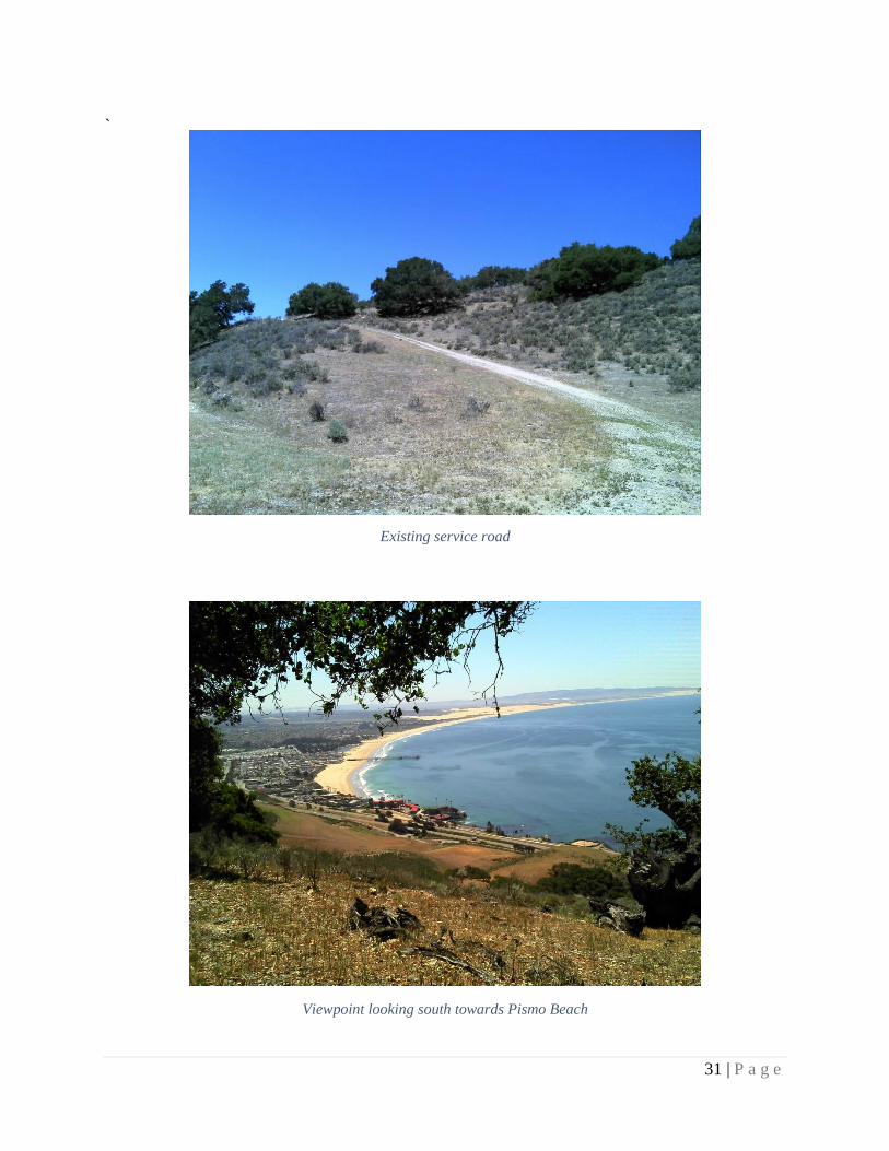
`
Existing service road
Viewpoint looking south towards Pismo Beach

32 | P a g e
View west towards Pismo Beach
Northernmost edge of property, view north towards Shell Beach

33 | P a g e
Appendix B: E-mail Correspondence

34 | P a g e
Email correspondence with Dylan Theobald, Stewardship Manager of LCSLO, concerning questions about the
Pismo Preserve.

35 | P a g e
References
Pismo Creek/Edna Area Watershed Management Plan (WMP). Central Coast Salmon
Enhancement – Pismo Creek/Edna Area Steering Committee. California, March 2009.
Szabo, Kristin. The Preserve at Pismo Beach. PCR Services Corporation. California, September
2005.
Theobald, Dylan. “Pismo Preserve Geo Database.” Email to Austin VanDerWouden. June 2,
2014.
Wiegers, Mark O. Preliminary Geologic Map of the Pismo Beach 7.5’ Quadrangle. California
Conservation. California, 2011.