the principle of levelling is to obtain vertical distances ... · pdf filed e f i n i t i o n...
TRANSCRIPT

Leve
lling
& C
onto
urin
g
Def
initi
on, P
rinci
ple,
& O
bjec
t of
Leve
lling
�D
efini
tion:
-Lev
ellin
g is
defin
ed a
s “an
art
of
deter
mini
ng th
e rela
tive h
eight
of d
iffer
ent
poin
ts on
, abo
veor
belo
wth
e sur
face
”.
Prin
cipl
e of
leve
lling
�Pr
incip
le:-T
he p
rincip
le of
leve
lling
is to
obt
ain
horiz
onta
l lin
e of s
ight
with
resp
ect t
o wh
ich
verti
cal d
istan
ces o
f the
poi
nts a
bove
or b
elow
this
line o
f sig
ht a
re fo
und.
Obje
ct o
f lev
ellin
g�
The o
bjec
tive o
f lev
ellin
g is
to�
1) F
ind
the e
levat
ion
of g
iven
poin
t with
re
spec
t to
some
assu
med
refer
ence
line
calle
d da
tum.
�2)
To es
tabl
ishpo
int a
t req
uire
d ele
vatio
nwi
th re
spec
t to
datu
m.

Def
initi
ons
used
in le
velli
ng�
Leve
l sur
face
:-It
is th
e sur
face
par
allel
to th
e me
an sp
hero
idal
surfa
ce o
f the
earth
�Le
vel l
ine:-
Line
lyin
g on
leve
l sur
face
.�
Hor
izon
tal p
lane
:-H
oriz
onta
l pla
ne th
roug
h a
poin
t is a
pla
ne ta
ngen
tial t
o lev
el su
rface
.�
Hor
izon
tal l
ine:
-It i
s a st
raig
ht li
ne ta
ngen
tial
to le
vel l
ine.
�D
atum
:-“It
is a
n ar
bitra
ry le
vel s
urfa
ce fr
om w
hich
ele
vatio
n of
poi
nts m
ay b
e refe
rred
”. In
Indi
a me
an se
a lev
el is
cons
ider
ed a
s dat
um o
f zer
o ele
vatio
n it
is sit
uated
at
Kara
chi.
Mea
n sea
leve
l is t
he a
vera
ge h
eight
of s
ea fo
r all
stage
s of
tides
it is
deriv
ed by
ave
ragi
ng th
e hou
rly ti
de h
eight
ove
r a
perio
d of
19
year
s.�
Elev
atio
n or
Red
uced
leve
l:-It
is he
ight
or d
epth
of a
ny
poin
t abo
ve o
r belo
w an
y da
tum.
It is
deno
ted a
s R.L
.
�Be
nch
Mar
k (B
.M.):
-It i
s a fi
xed
refer
ence
poi
nt o
f kno
wn
eleva
tion
with
resp
ect t
o da
tum.
�
Line
of c
ollim
atio
n:-I
t is a
line
join
ing
the i
nter
sectio
n of
cr
oss h
airs
of d
iaph
ragm
to th
e opt
ical c
entre
of o
bjec
t gla
ss an
d its
cont
inua
tion.
It is
also
kno
wn a
s lin
e of s
ight
.�
Heig
ht o
f ins
trume
nt:-
It is
the e
levat
ion
of li
ne o
f co
llima
tion
with
resp
ect t
o da
tum
�Ba
ck si
ght:-
It is
a sta
ff re
adin
g ta
ken
at a
kno
wn
eleva
tion.
It is
the f
irst s
taff
read
ing
take
n af
ter se
tup
of
instr
umen
t.

�Fo
re si
ght(
F.S.):
-It
is th
e las
t sta
ff re
adin
g ta
ken
deno
ting
the s
hifti
ng o
f the
instr
umen
t.�
Inter
medi
ate s
ight
.(I.S
.):-It
is st
aff r
eadi
ng ta
ken
on a
po
int w
hose
eleva
tion
is to
be d
eterm
ined
. All
staff
read
ing
betw
een
B.S.
and
F.S. a
re In
terme
diat
e sig
ht.
�Ch
ange
Poi
nt:-
It is
a po
int o
n wh
ich b
oth
fore
and
bac
k sig
ht a
re ta
ken.
Inst
rum
ents
for l
evel
ling
�Th
e fol
lowi
ng in
strum
ents
are e
ssent
ially
requ
ired
for l
evell
ing
�Le
vel
�Le
velli
ng st
aff
Leve
l and
type
s of
leve
l�
Leve
l:-Th
e ins
trume
nt u
sed to
furn
ish h
oriz
onta
l lin
e of
sigh
t for
obs
ervi
ng st
aff r
eadi
ngs a
nd d
eterm
inin
g R.
L.s
�Ty
pes
�D
umpy
leve
l�
Tilti
ng le
vel
�W
ye le
vel
�Au
toma
tic le
vel
Dum
py le
vel
�Th
eD
umpy
level
isa
simpl
e,co
mpac
tan
dsta
ble
instr
umen
t.Th
etele
scope
isrig
idly
fixed
toits
supp
orts.
Hen
ceit
cann
otbe
rota
tedab
outh
oriz
onta
laxi
s.

Tilti
ng le
vel
�It
isal
sokn
own
asI.O
.P.lev
el(In
dian
offic
ePat
tern)
.In
this
level
the
telesc
ope
tilts
abou
tits
horiz
onta
lax
ishe
ncei
tisc
alled
tiltin
glev
el
Wye
leve
l�
The e
ssent
ial d
iffer
ence
betw
een
wye l
evel
and
othe
r lev
els is
th
at in
wye
leve
l the
teles
cope
is ca
rried
by tw
o ve
rtica
l wye
su
ppor
ts. T
he te
lesco
pe ca
n be
rota
ted, m
oved
or e
ven
raise
d in
wy
es.
Auto
mat
ic le
vel
�It
is al
so k
nown
as s
elf a
ligni
ng le
vel.
It is
a re
cent
dev
elopm
ent.
The f
unda
ment
al d
iffer
ence
betw
een
auto
leve
l and
oth
er le
vels
is th
at th
e lev
ellin
g is
not m
anua
lly b
ut it
is le
velle
d au
toma
tical
ly. It
is a
chiev
ed by
incli
natio
n co
mpen
satin
g de
vice
.

Leve
lling
Sta
ffs�
Leve
lling
staf
fs ar
e sca
les o
n wh
ich th
ese d
istan
ces
are m
easu
red.
�Le
velli
ng st
affs
are o
f two
type
s�
Self
read
ing
staff
�Ta
rget
staff
Self
read
ing
staf
f�
The s
elf re
adin
g sta
ff ca
n be
read
dire
ctly
by th
e lev
el ma
n lo
okin
g th
roug
h th
e tele
scope
.�
Comm
on ty
pes o
f self
read
ing
staffs
�Or
dina
ry st
aff
�So
pwith
teles
copi
c sta
ff�
Fold
ing
Staf
f
Targ
et s
taff
�Fo
r ver
y pr
ecise
wor
ks a
nd si
ght t
arge
t sta
ff ar
e used
. A
mova
ble t
arge
t is p
rovi
ded
in th
is sta
ff. A
vern
ier is
pr
ovid
ed o
n ta
rget
to g
ive p
recis
e rea
ding
. In
targ
et sta
ff lev
el ma
n di
rects
the s
taff
man
to m
ove t
he ta
rget
up
and
down
unt
il it
bisec
ts by
the l
ine o
f sig
ht. T
he st
aff
man
obser
ve th
e sta
ff re
adin
g

Benc
h M
arks
�Be
nch
mark
is a
poi
nt o
f kno
wn el
evat
ion
�Th
ere a
re 4
kin
ds o
f ben
ch m
arks
�GT
S (G
reat
trig
onom
etrica
lly su
rvey
ben
ch m
ark)
�Pe
rman
ent b
ench
mar
k�
Arbi
trary
ben
ch m
ark
�Te
mpor
ary
benc
h ma
rk
GTS
Benc
h m
ark
�Th
ey a
re th
e ben
ch m
arks
esta
blish
ed w
ith ve
ry h
igh
degr
ee o
f pr
ecisi
on a
t reg
ular
inter
vals
by th
e sur
vey
of In
dia
Dep
artm
ent
all o
ver t
he co
untry
The
ir po
sitio
n an
d R.
Ls va
lues
abov
e mea
n sea
l lev
el at
Kar
achi
are
give
n in
cata
logu
e for
med
by th
e de
partm
ent .
�M
ean
sea le
vel
Perm
anen
t Ben
ch m
ark
�Pe
rman
ent
benc
hma
rksa
refix
edin
betw
een
GTS
benc
hma
rks
bygo
vt.a
genc
iessu
chas
railw
ays,
PWD,
etc.T
hisb
ench
mark
sar
ewr
itten
onpe
rman
ent
objec
tssu
chas
miles
tone
s,cu
lverts
,br
idge
setc
their
valu
ear
ecle
arly
writt
enan
dth
eirpo
sitio
nar
ere
cord
edfo
rfut
urer
efere
nce .
�Ar
bitra
ry b
ench
mar
ks:-
These
are
refer
ence
poi
nts w
hose
R.L.
s are
arb
itrar
ily a
ssume
d. Th
ey a
re u
sed in
smal
l wor
ks
such
ben
ch m
ark
may
be a
ssume
d as
100
. or 5
0 m
�Te
mpor
ary
benc
h ma
rks:-
They
are
the r
efere
nce p
oint
s est
ablis
hed
durin
g th
e lev
ellin
g op
eratio
ns w
hen
ther
e is a
br
eak
in w
ork,
or a
t the
end
of d
ay’s
work
the v
alue
of
redu
ced
levels
are
mar
ked
on so
me p
erma
nent
obj
ects
such
as
ston
es, tr
ees e
tc.
Tem
pora
ry A
djus
tmen
ts o
f a le
vel
�Th
ese a
djus
tmen
ts ar
e per
form
ed a
t eve
ry se
tup
of
instr
umen
t �
Setti
ng u
p of
leve
l�
Leve
lling
of t
elesco
pe�
Focu
sing
of th
e eye
pea
ce�
Focu
sing
of o
bjec
t gla
ss
�Se
tting
up
the l
evel:
-Thi
s inc
lude
s �
A) F
ixin
g th
e ins
trume
nt o
n tri
pod
�B)
Lev
ellin
g th
e ins
trume
nt a
ppro
xima
tely
by Tr
ipod
�Le
velli
ng:-
Leve
lling
Lev
ellin
g is
done
with
the h
elp o
f foo
t scre
ws.
The p
urpo
se of
leve
lling
is to
mak
e ver
tical
axi
s tru
ly ve
rtica
l. It
is do
ne w
ith th
e help
of f
oot s
crews
�A)
Pla
ce th
e tele
scope
par
allel
to a
pai
r of f
oot s
crew
then
hol
d th
e fo
ot sc
rews
betw
een
thum
b an
d fir
st fin
ger a
nd tu
rn th
em ei
ther
in
ward
or o
utwa
rd u
ntil
the l
ongi
tudi
nal b
ubbl
e com
es in
the
cent
re.
�B)
Turn
the t
elesco
pe th
roug
h 90
0so
that
it li
es pa
ralle
l to
third
foot
scr
ew, t
urn
the s
crew
until
the b
ubbl
e com
es in
the
cent
re.
�Fo
cusin
g th
e eye
piec
e:-T
o fo
cus t
he ey
e piec
e, ho
ld a
whi
te pa
per i
n fro
nt o
f obj
ect g
lass,
and
mov
e the
eye p
iece i
n or
ou
t till
the c
ross
hair
are d
istin
ctly
seen.
�Fo
cusin
g of
obj
ect g
lass:
-Dire
ct th
e tele
scope
to th
e lev
ellin
g sta
ff an
d on
look
ing
thro
ugh
the t
elesco
pe, t
urn
the f
ocus
ing
screw
till
the i
mage
app
ears
clear
and
shar
p.
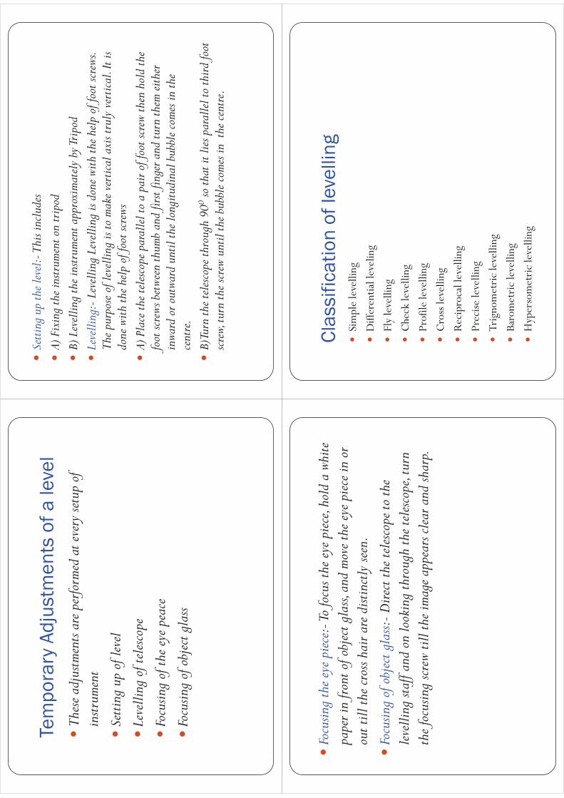
Clas
sific
atio
n of
leve
lling
�Si
mpl
e le
velli
ng
�D
iffer
entia
l lev
elin
g
�Fl
y le
velli
ng
�C
heck
leve
lling
�Pr
ofile
leve
lling
�C
ross
leve
lling
�R
ecip
roca
l lev
ellin
g
�Pr
ecise
leve
lling
�Tr
igno
met
ric
leve
lling
�Ba
rom
etri
c le
velli
ng
�H
yper
som
etri
c le
velli
ng

�Si
mple
levell
ing:
-It i
s the
simp
lest m
ethod
used
, whe
n it
is re
quire
d to
find
the d
iffer
ence
in el
evat
ion
betw
een
2 po
ints.
�D
iffer
entia
l Lev
ellin
g:-T
his m
ethod
is u
sed to
find
the
diffe
renc
e in
the e
levat
ion
betw
een
poin
ts if
they
are
too
far
apar
t or t
he d
iffer
ence
in el
evat
ion
betw
een
them
is to
o mu
ch.
�Fl
y lev
ellin
g:-F
ly le
velli
ng is
just
like d
iffer
entia
l lev
ellin
g ca
rried
out
to ch
eck
the a
ccur
acy
of le
velli
ng w
ork.
In fl
y lev
ellin
g on
ly B
.S. a
nd F.
S. ar
e tak
en
�Ch
eck
levell
ing:
-Thi
s kin
d of
leve
lling
is ca
rried
out
to
chec
k th
e acc
urac
y of
wor
k. It
is do
ne a
t the
end
of th
e day
s wo
rk in
the f
orm
of fl
y lev
ellin
g to
conn
ect t
he fi
nish
ing
poin
t and
star
ting
poin
t.�
Prof
ile le
velli
ng o
r L-S
ectio
n:-T
his m
ethod
is u
sed fo
r ta
king
leve
ls al
ong
the c
entre
line
of a
ny a
lignm
ent l
ike
road
, rai
lway
cana
l etc.
The
obj
ect i
s to
deter
mine
the
undu
latio
ns o
f the
gro
und
surfa
ce a
long
the a
lignm
ent

�Cr
oss-
sectio
ning
:-Th
is op
eratio
n is
carr
ied o
ut
perp
endi
cula
r to
alig
nmen
t at a
n in
terva
l of 1
0, 2
0 ,3
0,
40 m
. The
idea
is to
mak
e an
estim
ate o
f ear
thwo
rk.
�Pr
ecise
leve
lling
:-It
is us
ed fo
r esta
blish
ing
benc
h ma
rks f
or
futu
re p
ublic
use.
It is
carr
ied o
ut w
ith h
igh
degr
ee o
f ac
cura
cy u
sing
adva
nced
instr
umen
ts�
Trig
nome
tric l
evell
ing:
-In
this
meth
od ve
rtica
l dist
ance
s be
twee
n po
ints
are c
ompu
ted by
obs
ervi
ng h
oriz
onta
l di
stanc
es an
d ve
rtica
l ang
le be
twee
n po
ints.
�Ba
rome
tric l
evell
ing:
-In
this
meth
od th
e alti
tude
diff
eren
ce
is de
termi
ned
by m
eans
of a
bar
omete
r.�
Hyp
osom
etric
levell
ing:
-Th
ewo
rkin
gof
Hyp
osom
etry
for
deter
mini
ngth
eele
vatio
nde
pend
sup
onth
efa
ctth
atth
etem
pera
ture
atwh
ichwa
terbo
ilsva
ries
with
the
atmo
sphe
ricpr
essur
e.Th
ebo
iling
poin
tofw
ater
redu
cesa
thi
gher
altit
udet
husk
nowi
ngth
eboi
ling
poin
tofw
ater,
the
atmo
sphe
ricpr
essur
eca
nbe
calcu
lated
and
know
ing
the
atmo
sphe
ricpr
essur
eal
titud
eor
eleva
tion
can
bede
termi
ned
Reci
proc
al le
velli
ng�
Rec
ipro
cal
leve
lling
:-Thi
sme
thod
isad
opte
dto
accu
ratel
yde
termi
neth
edi
ffere
nce
oflev
elbe
twee
ntw
opo
ints
which
are
far
apar
t.It
isal
sous
edwh
enit
isno
tpos
sible
toset
uplev
elin
mid
way
betw
een
two
poin
ts�
Let
Aan
dB
beth
etw
opo
ints
onop
posit
eba
nks
ofa
rive
r.It
isre
quir
edto
find
outt
hele
veld
iffer
ence
betw
een
A&
B
�Se
tup
the
leve
lver
yne
arto
Aan
dta
keth
ere
adin
gat
Aan
dB
let
the
read
ing
bea1
and
b1
�Sh
iftth
ele
vela
ndse
tup
very
near
toB
and
obse
rve
Aan
dB
toge
tre
adin
ga2
and
b2
�Le
tdis
the
true
diffe
renc
eof
leve
lbet
wee
nA
and
B,an
de=
erro
rdu
eto
curv
atur
e,re
frec
tion
and
impe
rfec
tadj
ustm
ent.

�T
hus t
o el
imin
ate
the
erro
r ta
ke a
n av
erag
e of
the
diffe
renc
e in
el
evat
ion
take
n fr
om 2
poi
nts
�i.e
. fro
m A
the
true
diff
eren
ce w
ill b
e =
(b1-
e)-a
1
�Fr
om B
the
diffe
renc
e w
ill b
e= b
2-(a
2-e)
�T
here
fore
d=
{(b1
-a1)
+ (b
2-a2
)}/2
b1’
a1
b1e
�T
hus t
o el
imin
ate
the
erro
r ta
ke a
n av
erag
e of
the
diffe
renc
e in
el
evat
ion
take
n fr
om 2
poi
nts
�i.e
. fro
m A
the
true
diff
eren
ce w
ill b
e =
(b1’
�Fr
om B
the
diffe
renc
e w
ill b
e= b
2-(a
2’
�T
here
fore
d=
{(b1
’
‘
a1Li
ne o
f col
limat
ion
leve
l Lin
e
AB
Riv
er
b2
a2
ea2
’Li
ne o
f col
limat
ion
leve
l Lin
e
AB
Riv
er
�T
hus t
o el
imin
ate
the
erro
r ta
ke a
n av
erag
e of
the
diffe
renc
e in
ele
vatio
n ta
ken
from
2 p
oint
s
�i.e
. fro
m A
the
true
diff
eren
ce w
ill b
e =
(b1’
-e)-
a1
�Fr
om B
the
diffe
renc
e w
ill b
e= b
2-(a
2’-e
)
�T
here
fore
d=
{(b1
-a1)
+ (b
2-a2
)}/2
Met
hods
of R
educ
ing
leve
ls�
Heig
ht o
f Ins
trume
nt M
ethod
:-Thi
s meth
od co
nsist
of
findi
ng H
.I. fo
r eve
ry se
tup
of in
strum
ent,
and
then
ob
tain
ing
the R
.L. o
f poi
nt o
f refe
renc
e with
resp
ect t
o H
.I
Stat
ion
B.S
I.S
F.S
H.I
R.L
Rem
ark
A0.
910
0.9
100.
00B.
M
B1.
199
.800
C1.
450
1.05
101.
399
.850
C.P
.
D1.
550
99.7
50
B.S
0.9m
I.S
1.
1mF.
S 1.
05m
B.S
1.45
mF.
S=1.
55 m
A 1
00 m
B 99
.8m
C
99.
85 m
D
99.
750
m
B.M
10
0
M.
HI
C .P
.

Rise
and
fall
met
hod
�Th
is me
thod
cons
ist o
f dete
rmin
ing
the d
iffer
ence
of
level
betw
een
cons
ecut
ive p
oint
s by
comp
arin
g ea
ch
poin
t with
imme
diat
e pre
cedi
ng p
oint
.
Rise
And
Fal
l Met
hod
Stat
ion
B.S
I.S
F.S
Ris
eFa
llR
.LR
emar
k
A0.
910
0.00
B.M
B1.
10.
299
.800
C1.
450
1.05
0.05
99.8
50C
.P.
D1.
550
0.1
99.7
50
B.S
0.9m
I.S
1.1
mF.
S 1.
05m
B.S
1.45
mF.
S=1.
55 m
A 1
00 m
B 99
.8m
C
99.
85 m
B.M
10
0
M.
D 9
9.75
0 m
C
.P.
Exam
ple
�T
he fo
llow
ing
staf
f rea
ding
s wer
e ob
serv
ed su
cces
sivel
y w
ith
a le
vel t
he in
stru
men
t is m
oved
by
thir
d six
th a
nd e
ight
h re
adin
gs.
�: 2
.228
:1.6
06 :0
.988
:2.0
90 :2
.864
:1.2
62 0
.602
:1.9
82
:1.0
44 :2
.684
m e
nter
the
read
ing
in r
ecor
d bo
ok a
nd
calc
ulat
e R
.L. i
f the
firs
t rea
ding
was
take
n at
a B
.M o
f 43
2.38
3m
H.I.
Met
hod
Stat
ion
B.S
I.S
F.S
HI
RL
REM
AR
KS
12.
228
434.
612
432.
384
MB.
M.
21.
606
433.
006
32.
090
0.98
843
5.71
443
3.62
43R
DC
.P.
42.
864
432.
850
50.
602
1.26
243
5.05
443
4.45
26T
HC
.P
61.
044
1.98
243
4.11
643
3.07
28T
HC
.P
72.
684
431.
432
5.96
46.
916
CH
ECK
∑ B
.S-
∑ F
.S=
5.9
64-6
.916
= -0
.952
=
LA
ST R
.L-F
IRST
R.L
= 4
31.4
32-4
32.3
84=
-0.9
52

Rise
and
fall
met
hod
Stat
ion
B.S
I.S
F.S
Ris
eFa
llR
L R
EMA
RK
S
12.
228
432.
384
MB.
M.
21.
606
0.62
243
3.00
6
32.
090
0.98
80.
618
433.
624
3RD
C.P
.
42.
864
0.77
443
2.85
0
50.
602
1.26
21.
602
434.
452
6TH
C.P
61.
044
1.98
21.
3843
3.07
28T
HC
.P
72.
684
1.64
431.
432
5.96
46.
916
CH
ECK
∑ B
.S-
∑ F
.S=
5.9
64-6
.916
= -0
.952
=
LA
ST R
.L-F
IRST
R.L
= 4
31.4
32-4
32.3
84=
-0.9
52∑
RIS
E-∑
FA
LL=
2.8
42-3
.794
=-0
.952
Cont
our
100
105
110
120
A co
ntou
r is a
n im
agin
ary
line j
oini
ng p
oint
s of e
qual
ele
vatio
n
Cont
our I
nter
val
�Th
e ver
tical
dist
ance
betw
een
any
two
cons
ecut
ive
cont
ours
is kn
own
as co
ntou
r int
erva
lC
onto
ur in
terv
al
Char
acte
ristic
s of
con
tour
line
s�
A ser
ies o
f con
tour
line
s with
hig
her v
alue
insid
e in
dica
te a
hill
�A
series
of c
onto
ur li
nes w
ith lo
wer v
alue
insid
e the
loop
al
ways
indi
cate
depr
essio
n�
Clos
e con
tour
line
s ind
icate
steep
slop
e�
Wid
e con
tour
line
s ind
icate
flatte
r slo
pe�
Cont
our l
ines
neve
r cro
ss ea
ch o
ther
exce
pt in
case
of
over
hang
ing
cliff.
�Al
l poi
nts o
n a
cont
our l
ines
have
equa
l elev
atio
n

Uses
of C
onto
urs
�Th
e nat
ure o
f gro
und
surfa
ce o
f a re
gion
can
be k
nown
�Co
ntou
r map
help
s in
loca
ting
prop
er si
tefo
r brid
ges,
dams
, rese
rvoi
rs etc
.�
Capa
city
of a
reser
voir
can
be ca
lcula
ted w
ith th
e help
of
cont
our m
ap�
The q
uant
ity o
f cut
ting
and
fillin
g ca
n be
dete
rmin
ed
from
cont
our m
aps.
�Ro
utes
for r
oads
, rai
lway
s, ca
nals
etc ca
n be
trac
ed.
Erro
rs in
Lev
ellin
g�
The f
ollo
wing
are
the d
iffer
ent s
ourc
es of
Err
ors
�Pe
rson
al E
rror
�Th
e Ins
trume
nts m
ay n
ot b
e lev
eled
�Th
e foc
usin
g of
eye p
iece a
nd o
bjec
tive g
lass
may
not b
e pe
rfect
�Th
e par
alla
x ma
y no
t be e
limin
ated
�Th
e pos
ition
of s
taff
may
have
chan
ged
�En
try a
nd re
cord
ing
in th
e fiel
d bo
ok m
ay n
ot b
e cor
rect
�Th
e sta
ff ma
y no
t be f
ully
exten
ded,
may
not b
e held
ve
rtica
l.
�InstrumentalError:
�ThePermanentadjustmentoftheinstrumentmay
notbeperfect.Thatisthelineofcollimationmay
notbehorizontalline
�Theinternalarrangementoffocusingtubemay
notbecorrect
�Thegraduationofthestaffmaynotbeperfect

�ErrorsduetoNaturalCauses:
�TheCurvatureoftheEarthmayaffectthestaff
readingswhenthedistanceofsightislong.
�Theeffectofrefractionmaycauseawrongstaff
reading
�Therearesomeerrorsinstaffreadingsdueto
highvelocitywind.
Cur
vatu
re C
orre
ctio
n�
For
long
sight
sth
ecu
rvat
ure
ofea
rth
can
effe
ctst
aff
read
ings
.T
helin
eof
sight
isho
rizo
ntal
but
the
leve
llin
eis
curv
edan
dpa
ralle
lto
the
mea
nsp
hero
idal
surf
ace
ofth
eea
rth.
The
vert
ical
dist
ance
betw
een
the
line
ofsig
htan
dle
vel
line
atpa
rtic
ular
plac
eis
calle
dth
ecu
rvat
ure
corr
ectio
n
�T
heef
fect
ofcu
rvat
ure
isto
caus
eth
eob
ject
sight
edto
appe
arlo
wer
than
they
real
lyar
e.
�C
urva
ture
corr
ectio
nis
alw
aysS
ubtr
activ
e(-
)
�Tr
uest
affr
eadi
ng=
(Obs
erve
dst
affr
eadi
ng-0
.078
5D
2)m
�W
here
D=
dist
ance
inK
m.
Cur
vatu
re C
orre
ctio
n
(-)
Cur
vatu
re
effe
ct
Ref
ract
ion
�T
hera
yof
light
pass
thro
ugh
laye
rsof
air
ofdi
ffere
ntde
nsiti
esan
dre
frac
tor
bent
dow
n.T
heef
fect
ofre
frac
tion
isto
mak
eth
eob
ject
appe
arhi
gher
then
they
real
lyar
e.R
efra
ctio
nva
ries
cons
ider
ably
with
clim
ate
cond
ition
s.
�H
owev
erit
ista
ken
as
�C
r=0.
0112
D2
m(+
)
�R
efra
ctio
nis
alw
aysa
dditi
ve
�Tr
uest
aff
read
ing=
Obs
erve
dst
aff
read
ing
+R
efra
ctio
nco
rrec
tion.

Ref
ract
ion
(+)
Ref
ract
ion
effe
ct�
than
ks