the professional mapping drone - paksoy teknİk · our acclaimed flight planning & control...
TRANSCRIPT
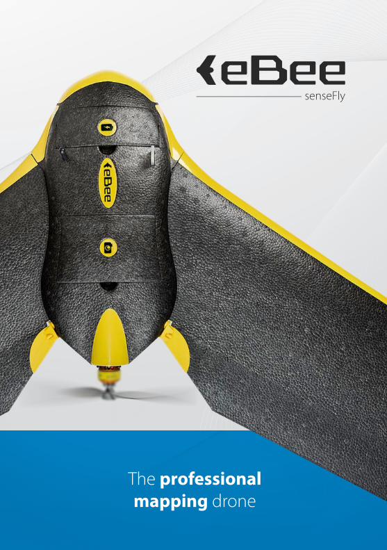
The professional mapping drone

4 reasons to choose the eBee
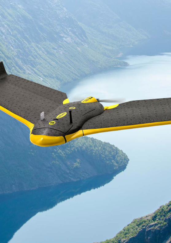
01. Map more, more accurately The eBee can cover up to 12 km2 (4.6 mi2) in a single automated flight,
while flights over smaller areas, flown at lower altitudes, can acquire images with a ground sampling distance (GSD) of down to 1.5 cm (0.6 in) per pixel.
02. No flying skills required! The eBee is the easiest to use professional drone on the market, used by
thousands of customers around the world. To launch it, just throw the eBee into the air! It then flies, captures images and lands itself. (However you can always alter its flight plan or land manually if required.)
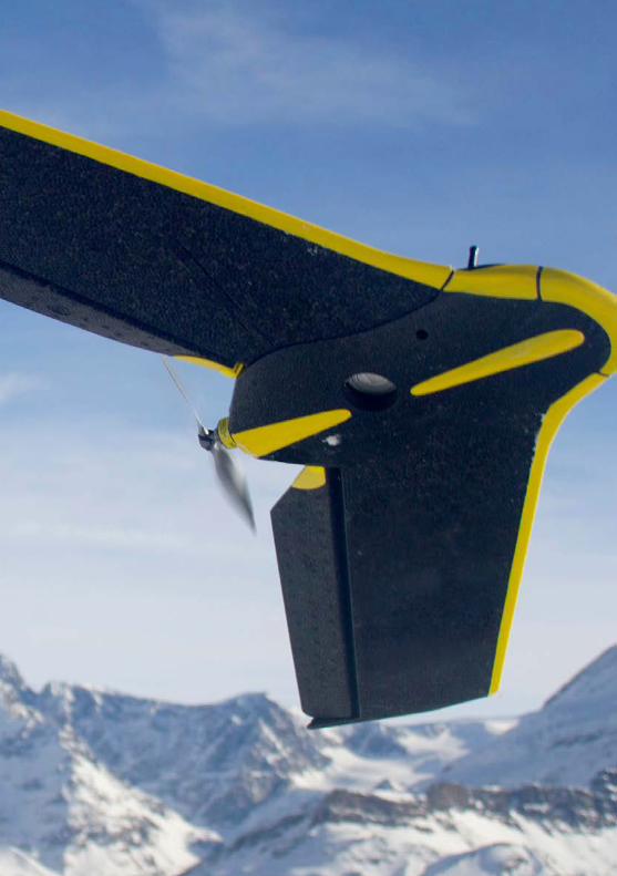
03. Because safety matters Thanks to its ultra-light foam construction the eBee weighs just 700 g
(1.5 lb), which vastly minimises its impact energy. It also features a safety-conscious rear-mounted propeller and senseFly’s cutting-edge autopilot, which manages a wide range of intelligent failsafe behaviours.
04. Your complete solution The eBee contains everything you need to start mapping today, including
a high-resolution RGB camera, batteries, radio modem and eMotion, our acclaimed flight planning & control software. All supplied with our sturdy carry-on sized case. The eBee’s imagery can then be processed and analysed using your photogrammetry software of choice, such as Pix4Dmapper Pro.
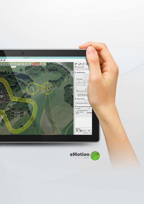

01. Plan your flight
senseFly ’s intuit ive eMotion sof tware simplifies the process of planning and pre-checking your eBee mapping mission.
Plan: First, import your preferred background map. Then define the area you want to map. Lastly, specify your required ground resolution, with a GSD of down to 1.5 cm (0.6 in) per pixel, plus the image overlap you require.
eMotion then automatically generates a full flight plan, including calculating the eBee’s
required altitude and displaying its projected trajectory on the background map.
Flying over uneven terrain? Use eMotion’s 3D mission planning feature, which uses elevation data to define absolute waypoint alt itudes for more consistent ground resolutions and improved mission safety.
Simulate: Ensure your flight’s success by running a virtual mission that simulates wind strength and direction. Then make any flight plan updates required and prepare to launch.
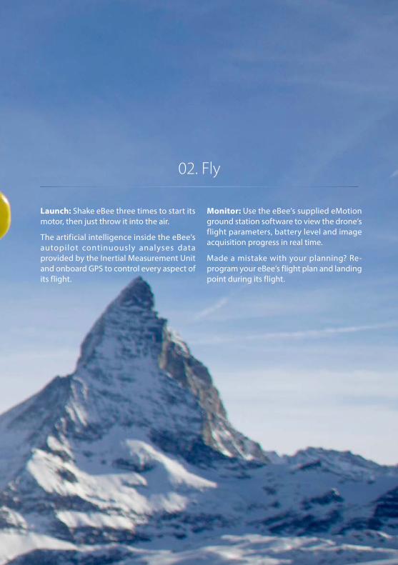
02. Fly
Launch: Shake eBee three times to start its motor, then just throw it into the air.
The artificial intelligence inside the eBee’s autopilot continuously analyses data provided by the Inertial Measurement Unit and onboard GPS to control every aspect of its flight.
Monitor: Use the eBee’s supplied eMotion ground station software to view the drone’s flight parameters, battery level and image acquisition progress in real time.
Made a mistake with your planning? Re-program your eBee’s flight plan and landing point during its flight.

Onboard artificial intelligence• Analyses data from Inertial MeasurementUnit & onboard GPS• Optimises every aspect of eBee’s flight
Super lightweight• Durable EPP foam body & wings• Take-off weight: 0.69 kg (1.52 lbs)
Oblique imaging function Multiple drone operation
* When combined with ground control point (GCP) data (also possible without GCPs using eBee RTK).** Based on the following test conditions: take off at approx. sea level, take off point in centre of desired coverage area, flight altitude of 1,000 m (3,280 ft) above ground (for a GSD of 30 cm (11.8 in)), no wind, moderate weather temp. (18 C/64.4 F), new fully charged battery.
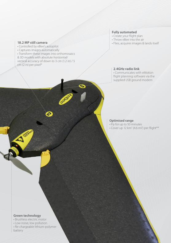
Optimised range• Fly for up to 50 minutes• Cover up 12 km2 (4.6 mi2) per flight**
Fully automated• Create your flight plan• Throw eBee into the air• Flies, acquires images & lands itself
Green technology• Brushless electric motor• Low noise, low pollution• Re-chargeable lithium-polymer battery
18.2 MP still camera • Controlled by eBee’s autopilot • Captures images automatically• Transform these images into orthomosaics & 3D models with absolute horizontal/vertical accuracy of down to 3 cm (1.2 in) / 5 cm (2 in) per pixel*
2.4GHz radio link• Communicates with eMotion flight planning software via the supplied USB ground modem


03. Create
Process: After using eMotion’s built-in Flight Data Manager to pre-process, geotag and organise your flight’s images, simply import these files into professional photogrammetry software such as Pix4Dmapper Pro.
In just a few clicks you can transform these images into geo-referenced orthomosaics, 3D point clouds, triangle models, and digital surface models (DSMs).
Trust: With the eBee’s GSD of down to 1.5 cm, relative orthomosaic/3D model accuracy of 1-3x GSD, and absolute horizontal/vertical accuracy of down to 3/5 cm, you can have full confidence in the accuracy of the outputs you produce.


Choose your accessory
The eBee is supplied as standard with an 18.2 MP RGB camera. An additional RAW-friendly RGB camera and a thermal camera are also available (usable one at a
time), plus there is a handy radio tracker for extra peace of mind when flying in the most challenging of environments.
WX RGB
S110 RGB
thermoMAP
Like all eBee cameras, this 18.2 MP model has been adapted so that it can be controlled by the drone’s autopilot. It acquires regular image data in the visible spectrum and its exposure parameters are set automatically.
The 12 MP S110 RGB acquires regular image data in the visible spectrum. However unlike the slightly higher resolution WX, its exposure parameters can be set manually and it can also output RAW format image files.
thermoMAP enables the eBee to capture thermal video and still images, allowing you to create thermal maps of a site (for example, to assess a mine’s water distribution or check for solar panel hotspots).
If you are planning to fly your eBee in extreme situations, such as areas with high winds, very mountainous areas, out of line of sight, or over very large coverage areas, this accessory is a useful extra safeguard against unexpected loss. It comprises a small transmitter that fits snugly next to the eBee’s battery bay, plus a portable handheld receiver.
Radio tracker
Supplied

Technical specifications
Weight (inc. supplied camera)Wingspan
MaterialPropulsion
BatteryCamera (supplied)
Cameras (optional)Carry case dimensions
Hardware
Operation
Approx. 0.69 kg (1.52 lbs)96 cm (38 in)EPP foam, carbon structure & composite partsElectric pusher propeller, 160 W brushless DC motor11.1 V, 2150 mAhWX (18.2 MP)S110 RGB, thermoMAP55 x 45 x 25 cm (21.6 x 17.7 x 9.8 in)
50 minutes 40-90 km/h (11-25 m/s or 25-56 mph) Up to 3 km (1.86 mi) 12 km2 / 4.6 mi2 (at 974 m / 3,195 ft altitude AGL)Up to 45 km/h (12m/s or 28 mph) Down to 1.5 cm (0.6 in) per pixel1-3x GSDDown to 3 cm (1.2 in) / 5 cm (2 in)1-5 m (3.3-16.4 ft)Yes (inc. mid-air collision avoidance) YesApprox. 5 m (16.4 ft)
Maximum flight timeNominal cruise speed
Radio link rangeMaximum coverage (single flight)
Wind resistanceGround Sampling Distance (GSD)
Relative orthomosaic/3D model accuracyAbsolute horizontal/vertical accuracy (w/GCPs) Absolute horizontal/vertical accuracy (no GCPs)
Multi-drone operationAutomatic 3D flight planning
Linear landing accuracy
Package contents
• eBee foam body (inc. all electronics & built-in autopilot)
• Pair of detachable wings
• WX RGB still camera (inc. 16 GB SD card, battery, USB cable & charger)
• 2.4 GHz USB radio modem for data link (inc. USB cable)
• Two Lithium-Polymer battery packs & charger
• Spare propeller
• Carry case with foam protection
• Remote control & accessories (for safety pilots)
• User manual
• eMotion flight planning & control software

www.sensefly.com
Content and images non contractual © 2016 senseFly Ltd
Where can you buy your eBee? Visit www.sensefly.com/about/where-to-buy to locate your nearest distributor.
senseFly Ltd Route de Genève 381033 Cheseaux-LausanneSwitzerland
Swiss made
About senseFly: senseFly designs, assembles and markets autonomous mini-drones and related software solutions for civil professional applications such as precision agriculture, land surveying, GIS, construction, environmental conservation and more.

EN
For eBee updatessubscribe to our newsletter at
www.sensefly.com