the unique natural areas - tompkins county
TRANSCRIPT

UNIQUE NATURAL AREAS
What is a Unique Natural Area? The Unique Natural Areas (UNAs) of Tompkins County are sites with outstanding environmental qualities, as defined by the Tompkins County Environmental Management Council, that are deserving of special attention for preservation and protection. UNAs include such natural features as gorges, woods, swamps, fens, cliffs, and streams. They lie on both publicly and privately owned lands and are generally not open to the public. Anyone wishing to visit a site on private land must obtain permission from the owner or owners. Why are Unique Natural Areas Important? Unique Natural Areas are recognized because of the outstanding qualities that render them “unique” within Tompkins County. Often, the characteristics that make a site unique are extremely vulnerable to a wide range of both direct and indirect impacts and may be compromised by disturbing the site. For this reason, the UNA Inventory incorporates an array of data that can be utilized in planning efforts to help identify and mitigate potential impacts to a UNA. What are the Criteria for a Unique Natural Area? At least one of five criteria must be met to classify an area as a UNA: 1. Important Natural Community: the site includes a state-designated wetland, a designated natural
area/preserve, historical botanical/zoological characteristics, important teaching characteristics, an old-growth forest, a plant or animal community type that is rare or scarce in the County, diverse flora or fauna, a birding site, and/or a wilderness character.
2. Quality of Example: the site is considered the best representative, or example, of an ecosystem, plant
community, or animal community of high quality within the County. These sites typically contain especially large individuals, dense populations, and/or a particularly diverse mixture of species.
3. Rare or Scarce Plants or Animals: the site contains plant or animal species that have been
recognized as rare or scarce at a national, state, or local level; has critical migration, reproductive, or feeding habitat for rare or scarce animal species; and/or has reports of large mammals.
4. Geological Importance: the site includes a rare or outstanding example of geological features or
processes and/or a paleontological site. 5. Aesthetic/Cultural Qualities: the site contains acknowledged outstanding natural or scenic beauty as
viewed from within or from a distance, has recreational value, is designated as urban greenspace, and/or has cultural/historic/archeological significance.
35

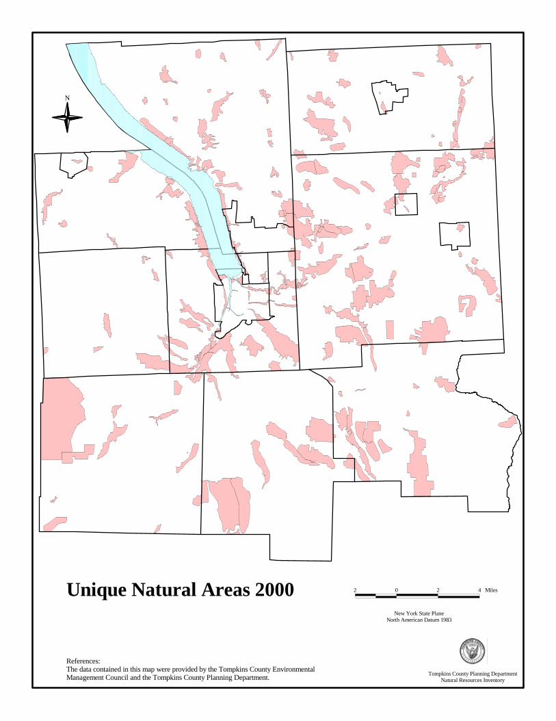
Unique Natural Areas in Tompkins County One hundred and ninety-two (192) sites, located throughout the County, are designated as UNAs. They range in size from 0.5 to 4,216 acres, with at least one UNA located in each municipality. Table 5: Unique Natural Areas by Municipality, 1999 Municipality Number of UNA sites Acres of UNAs % of municipality City of Ithaca 12 451.0 11.6% Town of Caroline 20 4,150.0 11.8% Town of Danby 12 4,938.8 14.3% Town of Dryden 58 10,091.0 16.7% Town of Enfield 9 923.9 3.9% Town of Groton 24 2,298.5 7.3% Town of Ithaca 30 3,985.3 20.6% Town of Lansing 31 2,732.8 6.1% Town of Newfield 15 6,166.8 16.3% Town of Ulysses 11 1,512.7 6.4% Vil. of Cayuga Heights 4 86.4 7.7% Village of Dryden 1 50.0 4.8% Village of Freeville 3 85.5 12.2% Village of Groton 2 61.7 5.8% Village of Lansing 7 293.5 9.9% Vil. of Trumansburg 1 27.6 3.5% Total 192* 37,855.5 12.0% *Column does not total because many UNAs straddle municipal borders and are therefore counted twice.
Maps and Data The current UNA boundaries, as documented in 2000, are based on the 1999 tax parcel boundaries and have been revised with the assistance of aerial photos and field visits. Information available for each UNA includes the reason for selecting the site, special land use information, adjacent land use data, vulnerability of the site, vegetation cover types, ecological communities, rare, threatened or endangered species, geologic and water features, slope, and soils. Site information from the Unique Natural Areas Inventory of Tompkins County and accompanying paper or digital maps are available from the Tompkins County Planning Department. Copies of the Inventory and paper maps have been distributed to local governments and libraries throughout the County. Resources and References Tompkins County Environmental Management Council. January 2000 (revised). Unique Natural Areas Inventory of Tompkins County. Tompkins County Planning Department and Tompkins County Department of Information Technology Services. Tompkins County Planning Department, 121 East Court Street, Ithaca, NY 14850, 607-274-5560.
36
References:The data contained in this map were provided by the Tompkins County Environmental Management Council and the Tompkins County Planning Department.
N
Unique Natural Areas 2000New York State Plane
North American Datum 1983
2 0 2 4 Miles
Tompkins County Planning DepartmentNatural Resources Inventory

NEW YORK STATE PARKS, FORESTS AND WILDLIFE MANAGEMENT AREAS
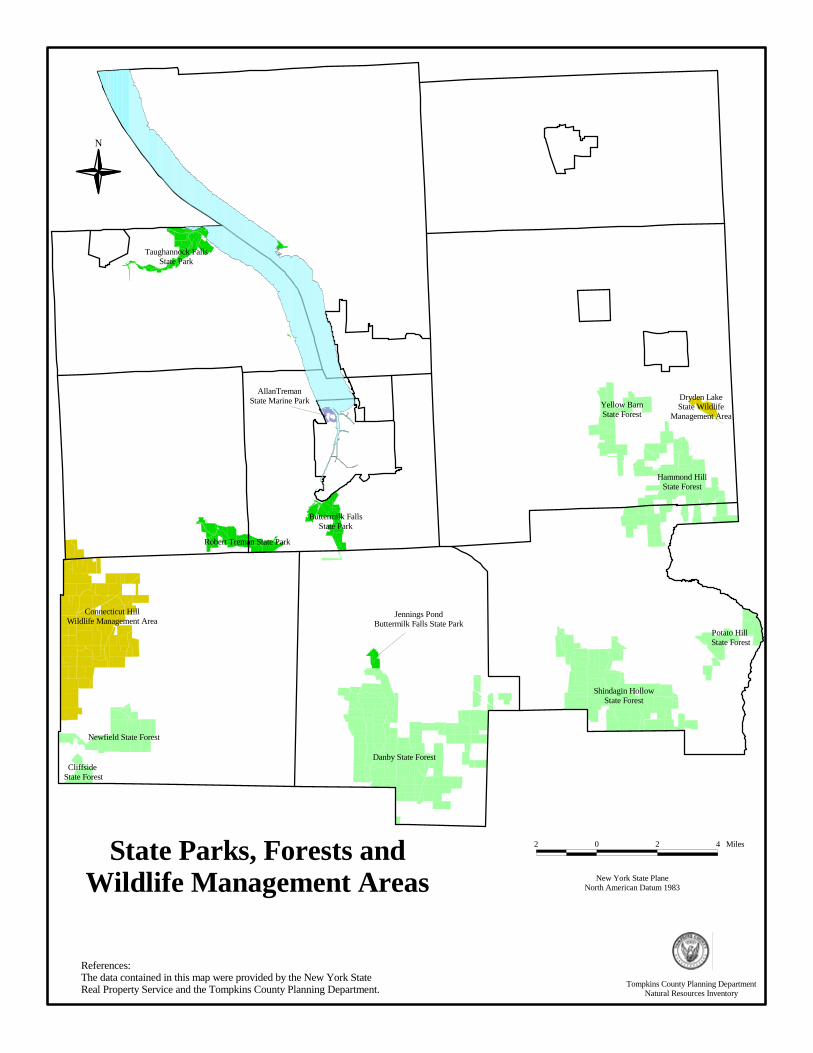
What are New York State Parks? State Parks are tracts of land owned and maintained by the State of New York. Because they are owned by the State, all citizens have access to the lands. State Parks are managed by the New York State Office of Parks, Recreation, and Historic Preservation, primarily for recreation and tourism. In general, these lands usually contain outstanding natural or historic resources. Permitted uses, such as hunting, fishing, biking, camping, ATV, and snowmobile and horseback riding, vary from park to park. New York State Parks in Tompkins County There are four State Parks located in Tompkins County: Robert H. Treman, Taughannock Falls, Buttermilk Falls, and Allan H. Treman State Marine Park. Robert H. Treman (Enfield Glen), Taughannock Falls, and Buttermilk Falls all have dramatic gorges, swimming, camping, hiking, and picnicking facilities. Jennings Pond, part of Buttermilk Falls State Park, is geographically disconnected from the Park’s gorge, and contains a large pond with swimming and picnic facilities. Allan H. Treman State Marine Park is located on Cayuga Lake and has a 400-slip marina and boat launch. Taughannock Falls State Park also has a marina and boat launch. Although not designated as a State Park, there is also some significant undeveloped state-owned land, known locally as Salt Point, which is located at the outflow of Salmon Creek on Cayuga Lake, next to the Lansing Town Park and Marina at Myers Point. What are New York State Forests? State Forests are tracts of land owned and maintained by the State of New York. Because they are owned by the State, all citizens have access to the lands. State Forests are managed by the New York State Department of Environmental Conservation (DEC), Division of Forests and Lands. They are managed for forestry, water quality, wildlife protection, and recreation. Permitted uses, such as hunting, fishing, biking, camping, ATV, and snowmobile and horseback riding, vary from forest to forest. New York State Forests in Tompkins County There are eight State Forests in Tompkins County (encompassing approximately 32,000 acres), concentrated in the southern portion of the County: Hammond Hill, Robinson Hollow, Cliffside, Newfield, Danby, Shindagin Hollow, Potato Hill, and Yellow Barn. The DEC Region 7 Recreational Master Plan, to be released in August 2001, will outline a plan to develop trails designed specifically for mountain biking, hiking, horseback riding, snowmobile, and ATV use. As part of this effort, the DEC will develop maps and trail markers to assist those visiting the forests. This initiative will take several years to complete. What are New York State Wildlife Management Areas? State Wildlife Management Areas (WMAs) are tracts of land owned and maintained by the State of New York. Because they are owned by the State, all citizens have access to the lands. WMAs are managed by the New York State Department of Environmental Conservation (DEC), Division of Fish and Wildlife. They are managed for certain species or groups of species. Permitted uses, such as hunting, fishing, biking, camping, ATV, and snowmobile and horseback riding, vary from area to area. New York State Wildlife Management Areas in Tompkins County Tompkins County has two WMAs: Dryden Lake (207 acres) and Connecticut Hill (11,045 acres). Why are These State Lands Important? State Parks, Forests, and Wildlife Management Areas protect important lands from development and uses that may damage their natural features. These State lands provide recreational and cultural opportunities, protect key plant and animal species and their habitats, and protect watersheds and the quality of water in the area. They also add economic value to their surrounding areas by enhancing tourism and increasing land values. In addition, they provide important educational opportunities for teaching about botany,
38
natural history, entomology, etc. Although municipal governments do not have direct control of these lands, they may be able to use them in their planning efforts to create greenways, biological corridors, and recreational trails. New York State WMAs and Forests are also utilized for logging. Logging in State Forests are monitored by the DEC to ensure that trees of varying sizes and ages are left for future generations. The focus of logging activities in WMAs is to manage habitat and provide a diversity of vegetation types and wildlife species. Maps and Data For map information, in paper or digital format, contact the Tompkins County Planning Department. For management plans and further information about New York State Forests and WMAs, contact the New York State DEC. For information on New York State Parks, contact the New York State Office of Parks, Recreation, and Historic Preservation. Resources and References New York State Department of Environmental Conservation (DEC), Region 7, 1285 Fisher Avenue, Cortland, NY 13045-1090, 607-753-3095. New York State Department of Parks, Recreation and Historic Preservation, Finger Lakes State Park Region, PO Box 1055, 2221Taughannock Park Road, Trumansburg, New York 14886, 607-387-7041. http://nysparks.state.ny.us/ New York State Forests and Wildlife Management Areas: http://www.dec.state.ny.us/ New York State Marine Park: http://www.cce.cornell.edu/seagrant/marinas/bcmarinas.html Tompkins County Planning Department, 121 East Court Street, Ithaca, NY 14850, 607-274-5560.
39
References:The data contained in this map were provided by the New York State Real Property Service and the Tompkins County Planning Department.
N
New York State PlaneNorth American Datum 1983
2 0 2 4 MilesState Parks, Forests andWildlife Management Areas
Taughannock FallsState Park
Robert Treman State Park
Buttermilk FallsState Park
AllanTremanState Marine Park
Hammond HillState Forest
Yellow BarnState Forest
Shindagin HollowState Forest
Danby State Forest
Connecticut HillWildlife Management Area
Potato Hill State Forest
Newfield State Forest
Dryden LakeState Wildlife
Management Area
Cliffside State Forest
Jennings PondButtermilk Falls State Park
Tompkins County Planning DepartmentNatural Resources Inventory
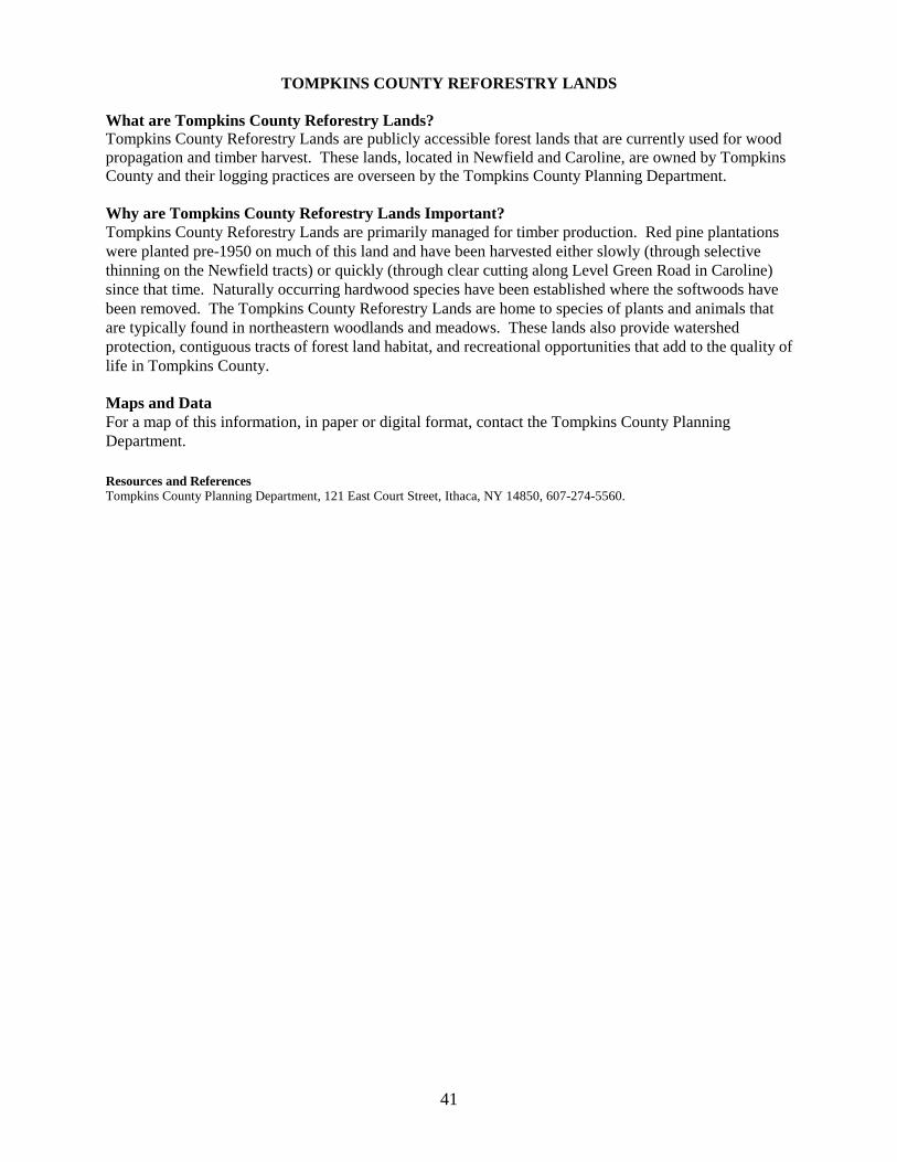
TOMPKINS COUNTY REFORESTRY LANDS What are Tompkins County Reforestry Lands? Tompkins County Reforestry Lands are publicly accessible forest lands that are currently used for wood propagation and timber harvest. These lands, located in Newfield and Caroline, are owned by Tompkins County and their logging practices are overseen by the Tompkins County Planning Department. Why are Tompkins County Reforestry Lands Important? Tompkins County Reforestry Lands are primarily managed for timber production. Red pine plantations were planted pre-1950 on much of this land and have been harvested either slowly (through selective thinning on the Newfield tracts) or quickly (through clear cutting along Level Green Road in Caroline) since that time. Naturally occurring hardwood species have been established where the softwoods have been removed. The Tompkins County Reforestry Lands are home to species of plants and animals that are typically found in northeastern woodlands and meadows. These lands also provide watershed protection, contiguous tracts of forest land habitat, and recreational opportunities that add to the quality of life in Tompkins County. Maps and Data For a map of this information, in paper or digital format, contact the Tompkins County Planning Department. Resources and References Tompkins County Planning Department, 121 East Court Street, Ithaca, NY 14850, 607-274-5560.
41
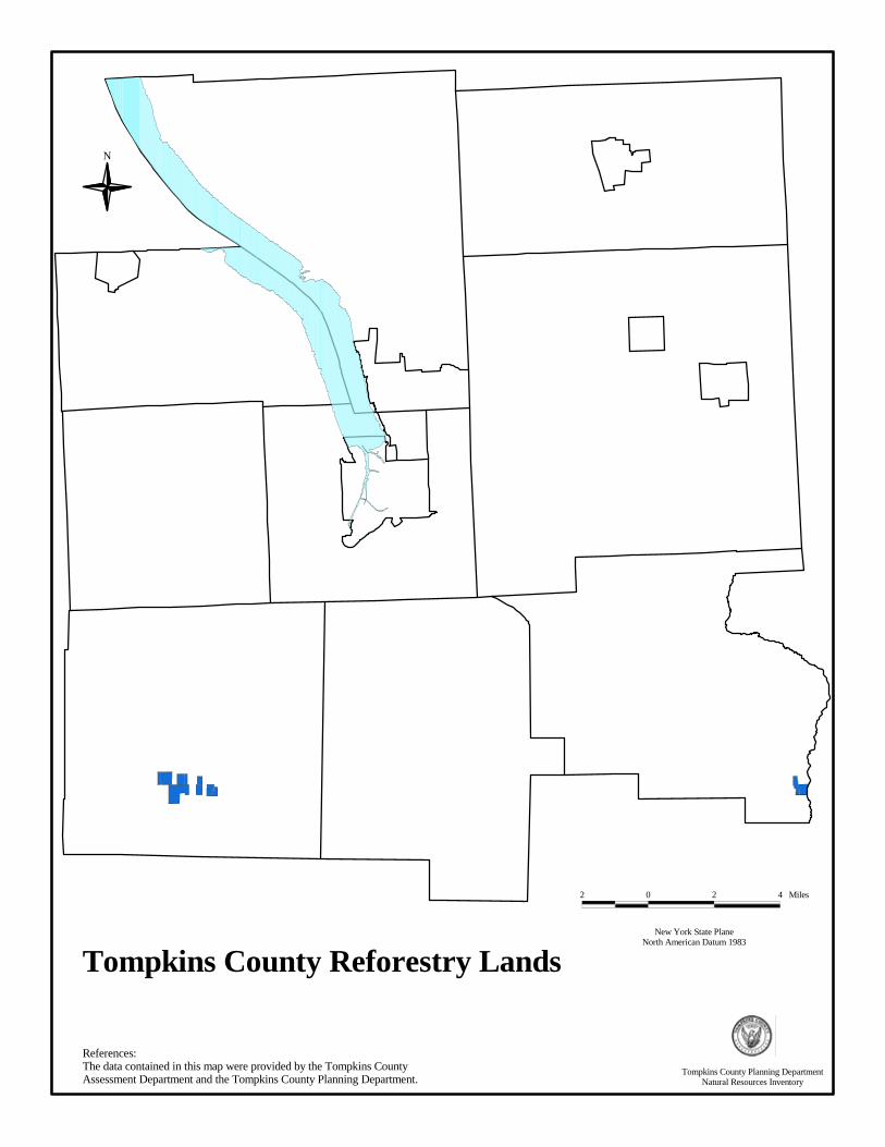
Tompkins County Reforestry Lands
N
References:The data contained in this map were provided by the Tompkins County Assessment Department and the Tompkins County Planning Department.
Tompkins County Planning DepartmentNatural Resources Inventory
New York State PlaneNorth American Datum 1983
2 0 2 4 Miles

IMPORTANT BIRD AREAS What are Important Bird Areas? The National Audubon Society, with the support of the American Bird Conservancy, initiated the New York Important Bird Areas (IBAs) Program in the spring of 1996. Designation of an area as a significant bird habitat under the IBA Program requires that the site satisfy at least one of the following criteria: �� Site contains a concentration of birds in significant numbers when breeding, in winter, or during
migration; �� Site supports a population of a species that is endangered, threatened, or of special concern; �� Site contains assemblages of species characteristic of a representative rare, threatened, or unique
habitat; or �� Long-term avian research or monitoring occurs on the site Across New York State, 127 IBAs have been identified. Furthermore, in 1997, New York State passed a law allowing IBAs located on state land to be designated as Bird Conservation Areas. Why are Important Bird Areas Important? The IBA Program is important for avian conservation because it identifies significant bird habitats so that others may protect those lands. Many avian species have distinct life history requirements and/or habitat needs that are fulfilled by the qualities of IBAs. The IBA program informs local citizens and governments about these unique areas and encourages local voluntary conservation efforts. Important Bird Areas in Tompkins County In Tompkins County, four IBAs have been identified: 1. Cayuga Lake supports a very diverse bird community, providing important bird habitat to migrating
and wintering waterfowl (at least 37 species of ducks and geese) and rare and endangered species. Of state protected bird species, two endangered (Bald Eagle and Black Tern), two threatened (Pied-billed Grebe and Common Tern), and two of special concern (Common Loon and Osprey) are known to use Cayuga Lake for either wintering or migratory habitat.
2. The Caswell Road Grassland Complex (1343 acres) is a privately owned hunting club in the Town
of Dryden. The abandoned farmland serves as a breeding site for three threatened species (Northern Harrier, Upland Sandpiper, and Henslow’s Sparrow), a species of special concern (Grasshopper Sparrow), and two more common species (Savannah Sparrow and Bobolink). The hunting club currently manages the property for Wild Turkey, Ring-necked Pheasant, and White-tailed Deer, which does not seem to interfere with the grassland birds.
3. The Salmon Creek IBA (500 acres) encompasses a one-mile long stretch on both sides of Salmon
Creek in the Town of Lansing. The area is heavily wooded with a dense understory. Home to a number of songbirds, the site is important breeding habitat for Cerulean Warblers (46 pairs in 1997), which is a state listed species of special concern. Within this IBA, land ownership is fragmented. The Finger Lakes Land Trust has purchased 3 parcels totalling 33 acres and hopes to work with other riparian landowners on future conservation efforts.
4. The Connecticut Hill Wildlife Management Area (WMA) (11,045 acres) is a state-owned forest in
the Town of Newfield managed by the New York State Department of Environmental Conservation primarily for conservation, recreation, and forestry. The site is home to a breeding community of Ruffed Grouse, Wild Turkey, Northern Goshawk, Hermit Thrush, Red-breasted Nuthatch, Acadian Flycatcher, Louisiana Waterthrush, and a variety of warblers. Three species of State special concern breed in this WMA: Sharp-shinned Hawk, Cooper’s Hawk, and Northern Goshawk.
43

Maps and Data The boundaries of the IBAs are not published. In order to protect landowner privacy, the National Audubon Society of New York State does not release paper maps of the IBAs and no digital files exist at this time. The general locations of the sites are depicted in point data. The shores of Cayuga Lake were used to identify the Cayuga Lake IBA and the boundary of the Connecticut Hill Wildlife Management Area was used to identify that IBA. The private landowners of the Caswell Road and Salmon Creek IBAs have requested that Audubon not publish those locations at this time. The New York IBA program recently received a grant to map the IBAs on a geographical information system. Digitizing of the information is scheduled to be completed by the end of 2002. Resources and References National Audubon Society of New York State, 200 Trillium Lane, Albany, NY 12203, 518-869-9731. Email: [email protected]. Webpage: http://ny.audubon.org.
A book entitled Important Bird Areas in New York State is available from the National Audubon Society of New York State.
44
NATURAL HERITAGE SITES What is a Natural Heritage Site? A Natural Heritage Site is a point or area representing specific natural resource information documented by the New York Natural Heritage Program. The goal of this program, a joint venture of the New York State Department of Environmental Conservation (DEC) and The Nature Conservancy (TNC) since 1985, is to compile and maintain an up-to-date inventory of the location and status of New York State’s rarest animal and plant species and its ecological communities. The Natural Heritage Program monitors the status of 755 rare plant species, 417 rare animal species, and 165 ecological community types in New York State. Why are Natural Heritage Sites Important? The databases maintained by the New York Natural Heritage Program can assist in identifying threatened or endangered species and ecological communities in Tompkins County. This knowledge can be incorporated into planning, conservation, and natural resources management to help conserve the plants, animals, and ecological communities that represent the County’s natural heritage. Though not a requirement of the State Environmental Quality Review Act (SEQRA), the Natural Heritage Program will search its databases upon request for proposed actions subject to SEQRA review. Natural Heritage Sites in Tompkins County Currently, the Natural Heritage Program databases list 14 rare plant species, 3 rare animal species, and 9 significant ecological community types in Tompkins County. Maps and Data Information on the status and distribution of rare and endangered animals and plants, and the best examples of New York State’s ecological communities, is collected, stored, and analyzed in databases maintained by the Natural Heritage Program. This information has been assembled from historical records and collections maintained by scientific institutions such as the New York State Museum, and from field surveys by staff from the New York Natural Heritage Program and other scientific groups. Neither site-specific nor comprehensive surveys for rare species and significant natural communities have been conducted for the entire state. Therefore, these data cannot be relied on as a definitive statement of the presence or absence of rare species or significant ecological communities, and cannot be substituted for on-site surveys that may be required for environmental assessment. The Tompkins County Planning Department is authorized to make paper maps of this data only at a scale equal to or greater than 1:100,000. No data may be released by TCPD digitally. For a paper map of this information, contact the Tompkins County Planning Department. For information concerning the data, or to request site specific information, contact the New York Natural Heritage Program. Resources and References NYS DEC, Division of Fish, Wildlife, and Marine Resources http://www.dec.state.ny.us/website/dfwmr/index.html
New York Natural Heritage Program: Overview. February 2001. New York State DEC and The Nature Conservancy. New York State DEC: Endangered Species http://www.dec.state.ny.us/website/dfwmr/wildlife/endspec/index.html NYS Natural Heritage Program Information Services, NYS DEC, 625 Broadway, Albany, NY 12233-4757, 518-402-8935. http://www.nynhp.org
45
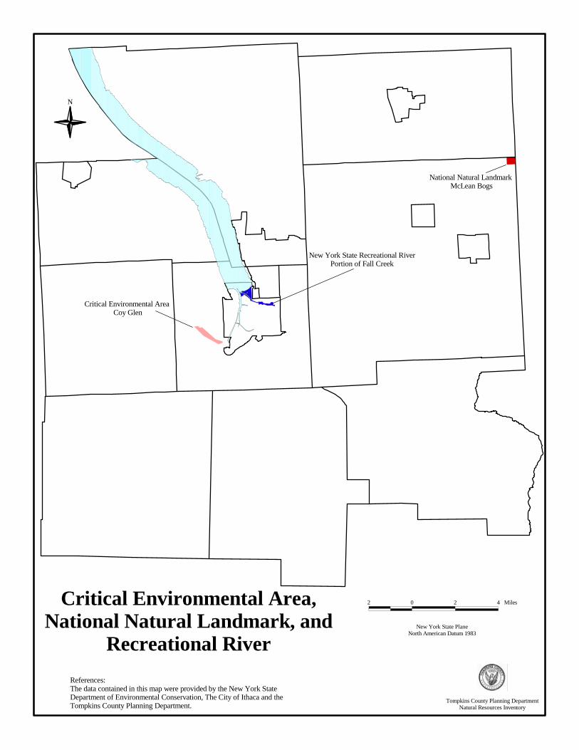
CRITICAL ENVIRONMENTAL AREAS, NATIONAL NATURAL LANDMARKS, AND NEW
YORK STATE RECREATIONAL RIVERS CRITICAL ENVIRONMENTAL AREAS What are Critical Environmental Areas? Under New York State Environmental Quality Review Act (SEQRA) Regulations, local agencies may designate, via local legislation, specific geographic areas within their boundaries as Critical Environmental Areas (CEAs). State agencies may also designate CEAs on state owned, managed, or regulated lands. For final approval, all CEAs must be mapped and announced through public notice and a public hearing. Why are Critical Environmental Areas Important? The designation of a Critical Environmental Area provides some regulatory protection for a site and functions as an indicator to developers, local officials, and other governmental agencies that the site is of significant environmental value. Critical Environmental Areas in Tompkins County Coy Glen, located in the Town of Ithaca, is the only CEA in Tompkins County. Coy Glen is an important botanic and geologic site, and is home to uncommon ecological communities and rare species. Many rare species reside in the hilltop forests of Coy Glen and the gorge walls provide habitat for scarce liverworts, mosses, and ferns. NATIONAL NATURAL LANDMARKS What are National Natural Landmarks? A National Natural Landmark is a nationally significant natural area that has been designated by the U.S. Secretary of the Interior. To be nationally significant, a site must be one of the best examples of a type of biotic community or geologic feature in its physiographic province. To date, 587 sites throughout the United States have been designated as National Natural Landmarks. Why are National Natural Landmarks Important? As required by the National Environmental Policy Act, federal agencies must consider National Natural Landmarks when assessing the impacts of their actions on the environment. Also, under SEQRA, applicants must state if the proposed project is contiguous to a site listed on the Register of National Natural Landmarks. All National Natural Landmarks are field checked every five years for evidence of significant change using the National Park Service’s National Natural Landmark national significance criteria. The goal of the NNL program is to identify, recognize, and encourage the protection of sites containing the best remaining examples of ecological and geological components of the nation’s landscape. National Natural Landmarks in Tompkins County McLean Bogs, located in the Town of Dryden, is the only designated National Natural Landmark in Tompkins County. McLean Bogs is recognized as an important glacial landform and contains significant deciduous forests, lakes, and ponds. The characteristics that make this site unique are extremely vulnerable to a wide range of both direct and indirect impacts and may be compromised by disturbing the site. Anyone wishing to visit McLean Bogs must obtain permission from Cornell University (Cornell Plantations), which owns and manages the National Natural Landmark. NEW YORK STATE RECREATIONAL RIVERS What are New York State Recreational Rivers? New York State Recreational Rivers are unique water bodies that are designated for protection by state legislative action. Proposals for designation can come from local governments, agencies, or citizen groups, but must be submitted to the New York State Department of Environmental Conservation (DEC), the governor, and the New York State legislature for approval or modification. The DEC is also
46
responsible for issuing permits within the boundaries of designated rivers, though they are able to delegate the administration of the river to local governments. Why are New York State Recreational Rivers Important? Recreational Rivers in New York State are protected by Article 15, Title 27 of the Environmental Conservation Law, entitled the New York State Wild, Scenic, and Recreational River System Act. Its purpose is to preserve and protect designated water bodies (including rivers, streams, creeks, runs, kills, rills, branches, and lakes) and their immediate environs for present and future generations. New York State Recreational Rivers in Tompkins County In 1990, the State of New York designated a stretch of Fall Creek a Recreational River at the request of the City of Ithaca. Running from the west face of the footbridge between Thurston Avenue and Beebe Lake to its confluence with Cayuga Lake, it is the only water body in Tompkins County with this designation. The DEC delegated administration of the Fall Creek Recreational River to the City of Ithaca Planning Department. The designation of Fall Creek as a Recreational River mandates the preservation and restoration of its natural, scenic, and recreational qualities. Prohibited uses include: 1) modification of the waterway by impoundment, diversion, rip-rap, bulkheads, structures, or improvements impeding or altering the natural flow of water or free-flowing condition of the river, 2) private dwellings, mobile homes, and multiple family dwellings located within the 100 year flood plain or within 150 feet of the river and/or tributary bank, 3) forest management roads or tributary bridges within 150 feet, and 4) waste treatment, storage, or disposal, except in temporary storage containers. Permits are required for other land uses and development within the Recreational River boundary, such as residential dwellings, docks, and private water supply wells. Maps and Data Generalized boundary data for Coy Glen, McLean Bogs, and Fall Creek are available in both digital and paper format from the Tompkins County Planning Department. Detailed information concerning actual boundary lines of McLean Bogs, and information as to its unique features, may be obtained from the National Park Service, Washington Office, which provides overall program policy and direction for the National Natural Landmark program. Requests to visit McLean Bogs should be directed to Cornell Plantations at Cornell University. All questions about the Fall Creek Recreational River, including official map boundaries and required permits, should be submitted to the City of Ithaca Planning Department. The DEC office in Cortland can answer general questions about the New York State Wild, Scenic, and Recreational River Act. Resources/References City of Ithaca Planning Department, 108 East Green Street, Ithaca, NY 14850, 607-274-6550. Cornell Plantations, One Plantations Road, Ithaca, NY 14850, 607-255-9638. National Natural Landmark Program, National Park Service, P.O. Box 37127, Washington, D.C. 20013-7127 [email protected] and http://www.nature.nps.gov/partner/nnlp.htm New York State Department of Environmental Conservation, P.O. Box 1169, Fisher Ave., Cortland, NY 13045, 607-753-3095. New York State Environmental Quality Review Regulations (SEQR) Regulations Section 617.14(g). New York State Wild, Scenic and Recreational River System Act. Article 15, Title 27 of the Enviro. Conservation Law 6 NYCRR, Part 666. Tompkins County Planning Department, 121 East Court Street, Ithaca, NY 14850, 607-274-5560.
47
N
Critical Environmental Area,National Natural Landmark, and
Recreational River
References:The data contained in this map were provided by the New York StateDepartment of Environmental Conservation, The City of Ithaca and the Tompkins County Planning Department.
New York State PlaneNorth American Datum 1983
2 0 2 4 Miles
New York State Recreational RiverPortion of Fall Creek
Critical Environmental Area Coy Glen
National Natural Landmark McLean Bogs
Tompkins County Planning DepartmentNatural Resources Inventory
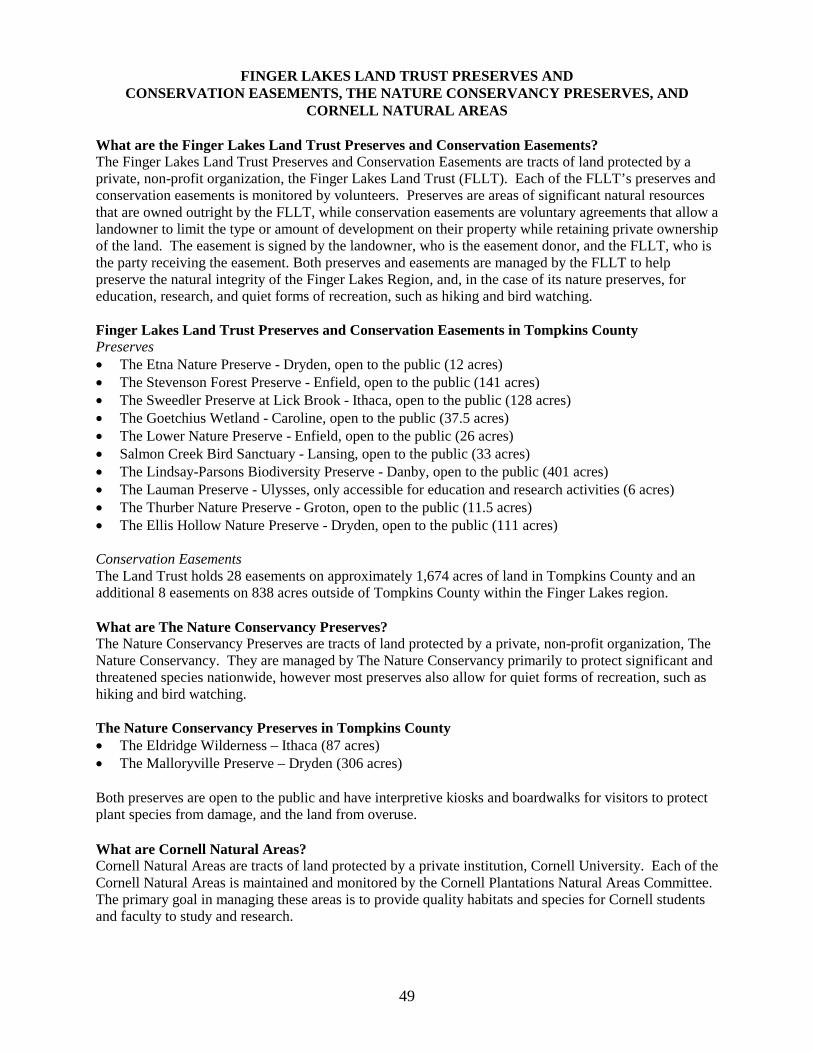
FINGER LAKES LAND TRUST PRESERVES AND CONSERVATION EASEMENTS, THE NATURE CONSERVANCY PRESERVES, AND
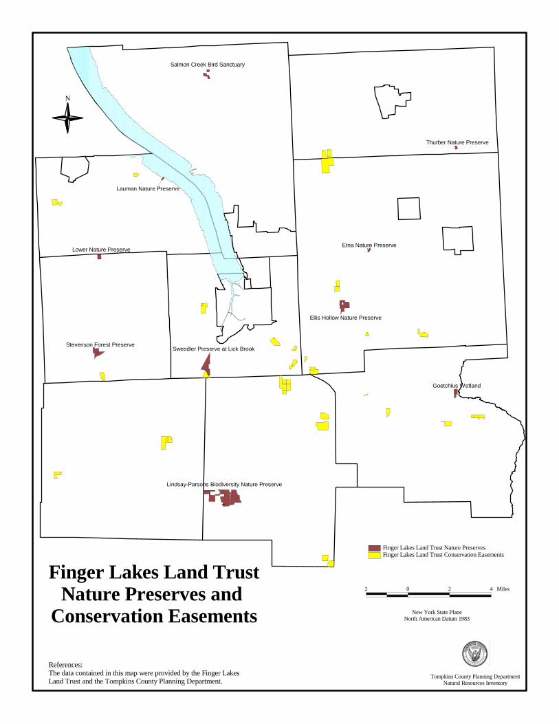
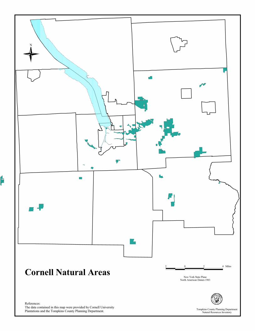
CORNELL NATURAL AREAS What are the Finger Lakes Land Trust Preserves and Conservation Easements? The Finger Lakes Land Trust Preserves and Conservation Easements are tracts of land protected by a private, non-profit organization, the Finger Lakes Land Trust (FLLT). Each of the FLLT’s preserves and conservation easements is monitored by volunteers. Preserves are areas of significant natural resources that are owned outright by the FLLT, while conservation easements are voluntary agreements that allow a landowner to limit the type or amount of development on their property while retaining private ownership of the land. The easement is signed by the landowner, who is the easement donor, and the FLLT, who is the party receiving the easement. Both preserves and easements are managed by the FLLT to help preserve the natural integrity of the Finger Lakes Region, and, in the case of its nature preserves, for education, research, and quiet forms of recreation, such as hiking and bird watching. Finger Lakes Land Trust Preserves and Conservation Easements in Tompkins County Preserves �� The Etna Nature Preserve - Dryden, open to the public (12 acres) �� The Stevenson Forest Preserve - Enfield, open to the public (141 acres) �� The Sweedler Preserve at Lick Brook - Ithaca, open to the public (128 acres) �� The Goetchius Wetland - Caroline, open to the public (37.5 acres) �� The Lower Nature Preserve - Enfield, open to the public (26 acres) �� Salmon Creek Bird Sanctuary - Lansing, open to the public (33 acres) �� The Lindsay-Parsons Biodiversity Preserve - Danby, open to the public (401 acres) �� The Lauman Preserve - Ulysses, only accessible for education and research activities (6 acres) �� The Thurber Nature Preserve - Groton, open to the public (11.5 acres) �� The Ellis Hollow Nature Preserve - Dryden, open to the public (111 acres) Conservation Easements The Land Trust holds 28 easements on approximately 1,674 acres of land in Tompkins County and an additional 8 easements on 838 acres outside of Tompkins County within the Finger Lakes region. What are The Nature Conservancy Preserves? The Nature Conservancy Preserves are tracts of land protected by a private, non-profit organization, The Nature Conservancy. They are managed by The Nature Conservancy primarily to protect significant and threatened species nationwide, however most preserves also allow for quiet forms of recreation, such as hiking and bird watching. The Nature Conservancy Preserves in Tompkins County �� The Eldridge Wilderness – Ithaca (87 acres) �� The Malloryville Preserve – Dryden (306 acres) Both preserves are open to the public and have interpretive kiosks and boardwalks for visitors to protect plant species from damage, and the land from overuse. What are Cornell Natural Areas? Cornell Natural Areas are tracts of land protected by a private institution, Cornell University. Each of the Cornell Natural Areas is maintained and monitored by the Cornell Plantations Natural Areas Committee. The primary goal in managing these areas is to provide quality habitats and species for Cornell students and faculty to study and research.
49

Cornell Natural Areas in Tompkins County Off Campus: �� Palmer-Adams Preserve at Bald Hill (146 acres) �� Fischer Old-Growth Forest at Cayuga Inlet Valley (34 acres) �� Russell Wildlife Preserve at Cayuga Marsh (27 acres) �� James W. and Helene D. Allen Wetland Preserve at Cayuga Lake (95 acres) �� Carter Creek at Connecticut Hill (426 acres) �� Coy Glen (127 acres) �� Conwell Tract (20 acres), Travis Wildflower Preserve (24 acres), and Durland Bird Sanctuary (173
acres) at Ellis Hollow Wetlands �� Fringed Gentian Natural Area (31 acres), Radio Lab Fields (151 acres), and Cornell Experimental
Ponds at Etna Fringed Gentian Area �� Howard Edward Babcock Preserve at Lick Brook (27 acres) �� Biological Station at Lighthouse Point (15 acres) �� Monkey Run Natural Area at Monkey Run (500+ acres) �� Frost Ravine (31 acres), Mount Pleasant Farm (600+ acres), and Pine Woods (204 acres) at Mount
Pleasant �� Newman Preserve at Renwick Slope (6 acres) �� Slaterville Wildflower Preserve (379 acres) and Williams Preserve (38 acres) at Slaterville 600 �� Polson Preserve at Snyder Hill (95 acres) �� Astronomy Lab in South Danby (60 acres) �� Jane E. Hardy Preserve at Steep Hollow Creek (3 acres) �� Jane McDaniel Tract at Townley Swamp (62 acres) On Campus: �� There are 24 Natural Areas on and near the Cornell University campus (approximately 500 acres). All Natural Areas are open for public visits, however, large groups should notify Cornell Plantations prior to visiting the site. Why are these Preserves, Conservation Easements, and Natural Areas Important? Nature preserves, conservation easements, and natural areas protect important lands from development and uses that may damage their natural features. These lands protect key plant and animal species and their habitats, protect watersheds and the quality of water in the area, and provide recreational opportunities to everyone. They also add economic value to their surrounding areas by enhancing tourism and increasing land values. In addition, they provide important educational opportunities for teaching about botany, natural history, entomology, etc. Although municipal governments do not have direct control of these lands, they may be able to use them in their planning efforts to create greenways, biological corridors, and recreational trails. Maps and Data For a map of this information, in paper or digital format, contact the Tompkins County Planning Department. For information on Finger Lakes Land Trust Preserves and Conservation Easements, contact the Finger Lakes Land Trust. For information on The Nature Conservancy Preserves, contact The Nature Conservancy. For information on Cornell Natural Areas, contact the Cornell Plantations. Resources and References Cornell Plantations, Cornell University, One Plantations Road, Ithaca, NY 14851; Phone: 607-255-3020; Fax: 607-255-2404; http://www.plantations.cornell.edu Finger Lakes Land Trust: http://www.fllt.org/ 202 East Court Street, Ithaca, NY 14850; Phone: 607-275-9487; Fax: 607-275-0037 Ostman, Nancy L. and F. Robert Wesley. 1997. Field Guide to Cornell’s Off-Campus Natural Areas. Cornell Plantations.
50

Ostman, Nancy L. and F. Robert Wesley. 1999. Field Guide to Cornell’s Natural Areas On and Near Campus. The Nature Conservancy: http://www.tnc.org Central & Western New York Chapter Office, 339 East Avenue, Suite 300, Rochester, NY 14604-2615; Phone: 716-546-8030 Fax: 716-546-7825
Tompkins County Planning Department, 121 East Court Street, Ithaca, NY 14850, 607-274-5560.
51
Lindsay-Parsons Biodiversity Nature Preserve
Sweedler Preserve at Lick Brook
Ellis Hollow Nature Preserve
Stevenson Forest Preserve
Lower Nature Preserve
Goetchius Wetland
Salmon Creek Bird Sanctuary
Etna Nature Preserve
Thurber Nature Preserve
Lauman Nature Preserve
Finger Lakes Land TrustNature Preserves and
Conservation Easements
N
References:The data contained in this map were provided by the Finger Lakes Land Trust and the Tompkins County Planning Department.
New York State PlaneNorth American Datum 1983
2 0 2 4 Miles
Finger Lakes Land Trust Conservation EasementsFinger Lakes Land Trust Nature Preserves
Tompkins County Planning DepartmentNatural Resources Inventory
New York State PlaneNorth American Datum 1983
2 0 2 4 Miles
References:The data contained in this map were provided by The Nature Conservancy and the Tompkins County Planning Department.
N
The Nature ConservancyPreserves
Malloryville Fen Preserve
Eldridge Wilderness Preserve
Tompkins County Planning DepartmentNatural Resources Inventory
Cornell Natural Areas
N
New York State PlaneNorth American Datum 1983
2 0 2 4 Miles
References:The data contained in this map were provided by Cornell University Plantations and the Tompkins County Planning Department. Tompkins County Planning Department
Natural Resources Inventory