the value of digitalglobe high resolution imagery in disaster … · digitalglobe proprietary and...
TRANSCRIPT
DigitalGlobe Proprietary and Business Confidential
The Value of DigitalGlobe High Resolution Imagery in Disaster Risk Management Derren Yong Senior Director, North Asia Sales
Sanduwa, Democratic Republic of Congo | May 20, 2012 | WorldView-2
DigitalGlobe Proprietary and Business Confidential
A DigitalGlobe Story: Colorado Flooding Rescue (Sep 2013) (1/2)
United Nations International Conference on Disaster Risk Identification, Assessment and Monitoring
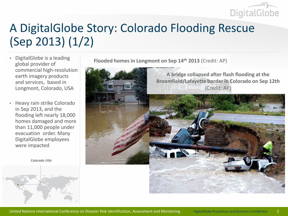
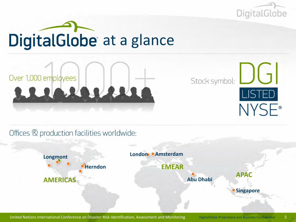
• DigitalGlobe is a leading global provider of commercial high-resolution earth imagery products and services, based in Longmont, Colorado, USA
• Heavy rain strike Colorado in Sep 2013, and the flooding left nearly 18,000 homes damaged and more than 11,000 people under evacuation order. Many DigitalGlobe employees were impacted
2
Flooded homes in Longmont on Sep 14th 2013 (Credit: AP)
A bridge collapsed after flash flooding at the Broomfield/Lafayette border in Colorado on Sep 12th
(Credit: AP)
Colorado USA
DigitalGlobe Proprietary and Business Confidential
A DigitalGlobe Story: Colorado Flooding Rescue (Sep 2013) (2/2)
United Nations International Conference on Disaster Risk Identification, Assessment and Monitoring
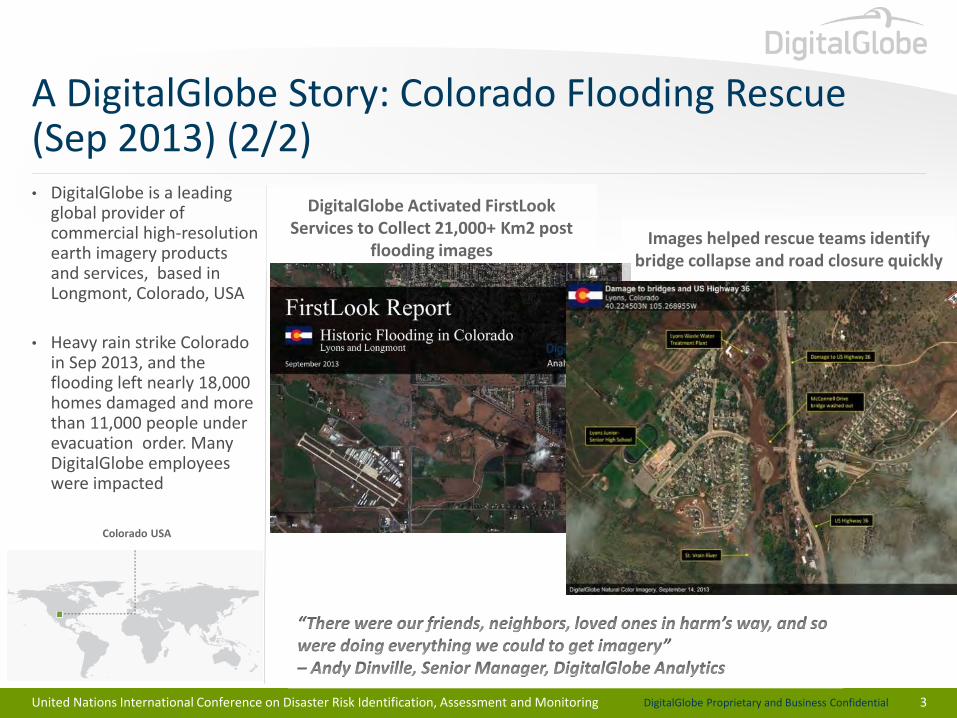
• DigitalGlobe is a leading global provider of commercial high-resolution earth imagery products and services, based in Longmont, Colorado, USA
• Heavy rain strike Colorado in Sep 2013, and the flooding left nearly 18,000 homes damaged and more than 11,000 people under evacuation order. Many DigitalGlobe employees were impacted
3
Colorado USA
DigitalGlobe Activated FirstLook Services to Collect 21,000+ Km2 post
flooding images Images helped rescue teams identify
bridge collapse and road closure quickly
DigitalGlobe Proprietary and Business Confidential
DigitalGlobe Overview
4
DigitalGlobe Proprietary and Business Confidential
United Nations International Conference on Disaster Risk Identification, Assessment and Monitoring 5
at a glance
Longmont
Herndon
London
Abu Dhabi
Singapore
Amsterdam
AMERICAS
EMEAR APAC
DigitalGlobe Proprietary and Business Confidential
United Nations International Conference on Disaster Risk Identification, Assessment and Monitoring 6
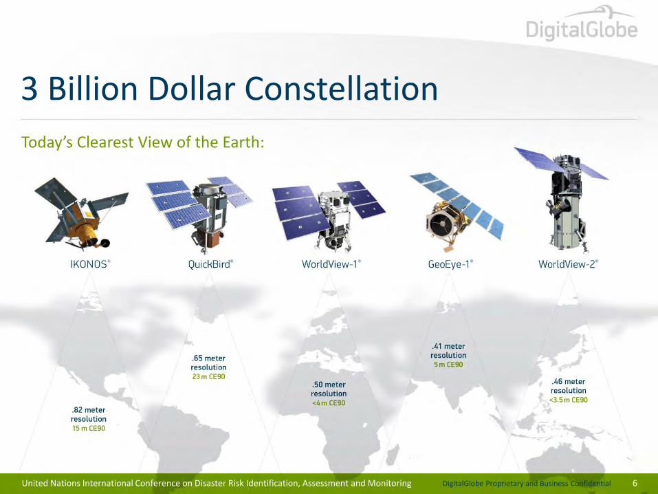
3 Billion Dollar Constellation
Today’s Clearest View of the Earth:
DigitalGlobe Proprietary and Business Confidential
United Nations International Conference on Disaster Risk Identification, Assessment and Monitoring 7
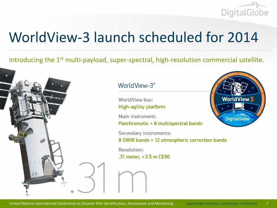
WorldView-3 launch scheduled for 2014
Introducing the 1st multi-payload, super-spectral, high-resolution commercial satellite.
DigitalGlobe Proprietary and Business Confidential
8
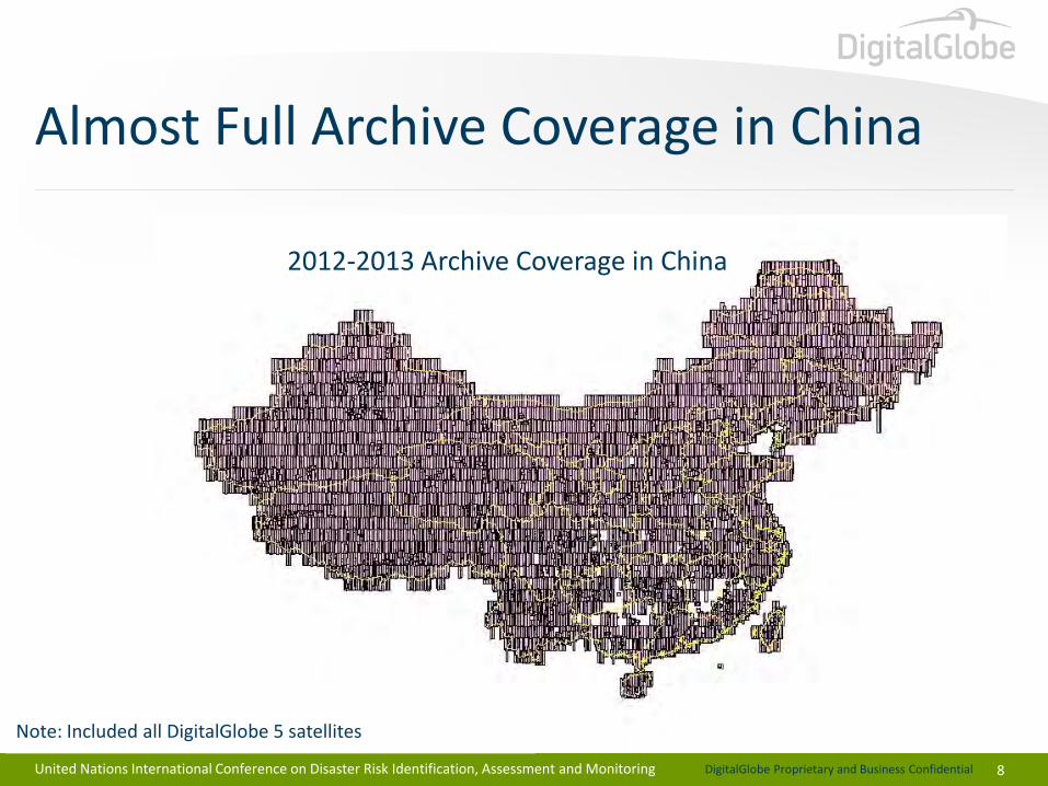
Almost Full Archive Coverage in China
United Nations International Conference on Disaster Risk Identification, Assessment and Monitoring
2012-2013 Archive Coverage in China
Note: Included all DigitalGlobe 5 satellites
DigitalGlobe Proprietary and Business Confidential
DigitalGlobe Approach to Disaster Risk Management
9
DigitalGlobe Proprietary and Business Confidential
10
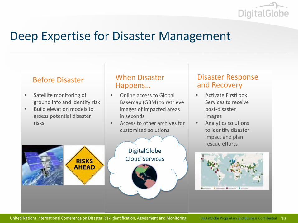
Deep Expertise for Disaster Management
United Nations International Conference on Disaster Risk Identification, Assessment and Monitoring
Before Disaster
• Satellite monitoring of ground info and identify risk
• Build elevation models to assess potential disaster risks
When Disaster Happens…
Disaster Response and Recovery
• Online access to Global Basemap (GBM) to retrieve images of impacted areas in seconds
• Access to other archives for customized solutions
• Activate FirstLook Services to receive post-disaster images
• Analytics solutions to identify disaster impact and plan rescue efforts
DigitalGlobe Cloud Services
DigitalGlobe Proprietary and Business Confidential
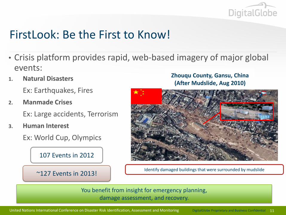
FirstLook: Be the First to Know!
11
• Crisis platform provides rapid, web-based imagery of major global events:
1. Natural Disasters
Ex: Earthquakes, Fires
2. Manmade Crises
Ex: Large accidents, Terrorism
3. Human Interest
Ex: World Cup, Olympics
You benefit from insight for emergency planning, damage assessment, and recovery.
107 Events in 2012
Identify damaged buildings that were surrounded by mudslide ~127 Events in 2013!
N
Zhouqu County, Gansu, China (After Mudslide, Aug 2010)
United Nations International Conference on Disaster Risk Identification, Assessment and Monitoring
DigitalGlobe Proprietary and Business Confidential
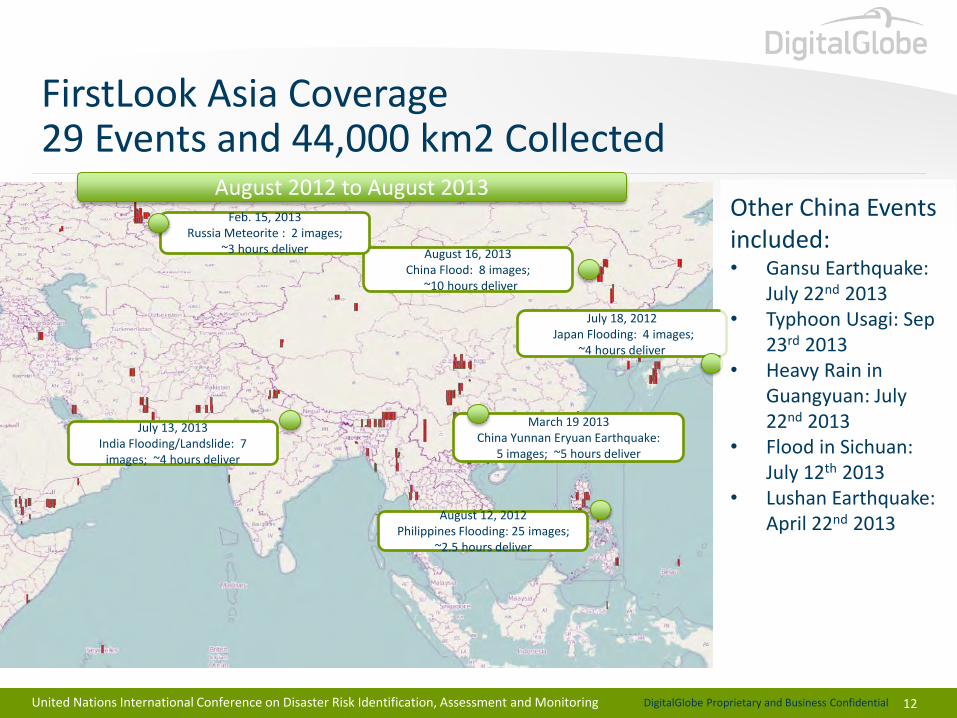
FirstLook Asia Coverage 29 Events and 44,000 km2 Collected
12
July 18, 2012 Japan Flooding: 4 images;
~4 hours deliver
July 13, 2013 India Flooding/Landslide: 7
images; ~4 hours deliver
March 19 2013 China Yunnan Eryuan Earthquake:
5 images; ~5 hours deliver
August 16, 2013 China Flood: 8 images;
~10 hours deliver
Feb. 15, 2013 Russia Meteorite : 2 images;
~3 hours deliver
August 12, 2012 Philippines Flooding: 25 images;
~2.5 hours deliver
August 2012 to August 2013 Other China Events included: • Gansu Earthquake:
July 22nd 2013 • Typhoon Usagi: Sep
23rd 2013 • Heavy Rain in
Guangyuan: July 22nd 2013
• Flood in Sichuan: July 12th 2013
• Lushan Earthquake: April 22nd 2013
United Nations International Conference on Disaster Risk Identification, Assessment and Monitoring
DigitalGlobe Proprietary and Business Confidential
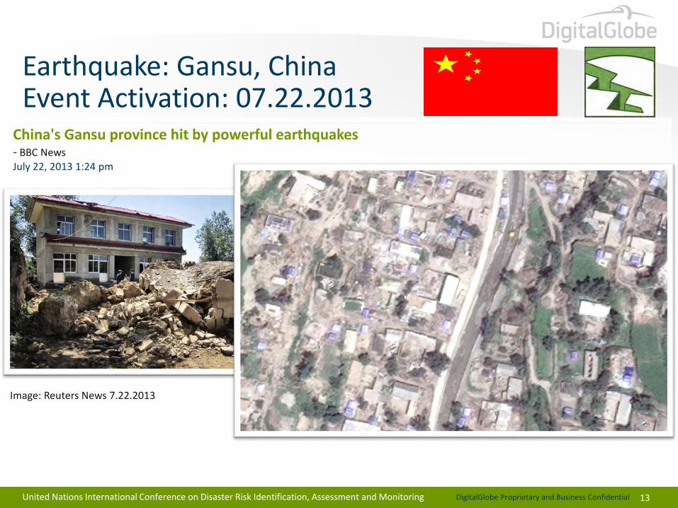
China's Gansu province hit by powerful earthquakes - BBC News July 22, 2013 1:24 pm
Image: Reuters News 7.22.2013
13
Earthquake: Gansu, China Event Activation: 07.22.2013
United Nations International Conference on Disaster Risk Identification, Assessment and Monitoring
DigitalGlobe Proprietary and Business Confidential
14
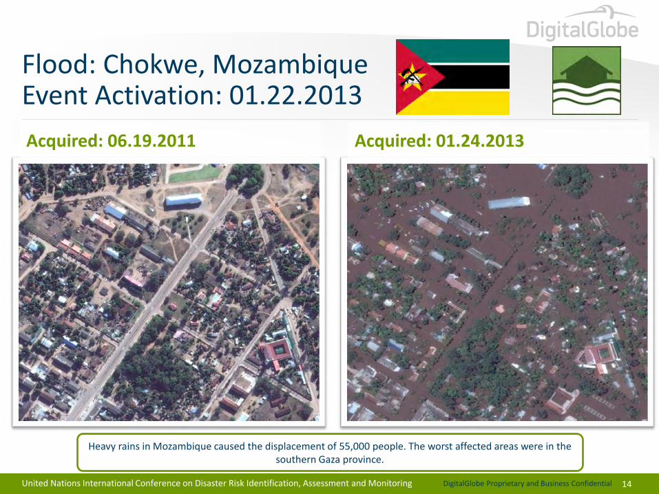
Flood: Chokwe, Mozambique Event Activation: 01.22.2013
Heavy rains in Mozambique caused the displacement of 55,000 people. The worst affected areas were in the southern Gaza province.
Acquired: 06.19.2011 Acquired: 01.24.2013
United Nations International Conference on Disaster Risk Identification, Assessment and Monitoring

DigitalGlobe Proprietary and Business Confidential
15
Fire: Dunalley, Tasmania, Australia Event Activation: 01.03.2013
Acquired: 08.27.2012 Acquired: 01.05.2013
Bushfires burned about 29,000 hectares in southeast Tasmania. In Dunalley, 65 homes and an elementary school were destroyed.
United Nations International Conference on Disaster Risk Identification, Assessment and Monitoring
DigitalGlobe Proprietary and Business Confidential
16
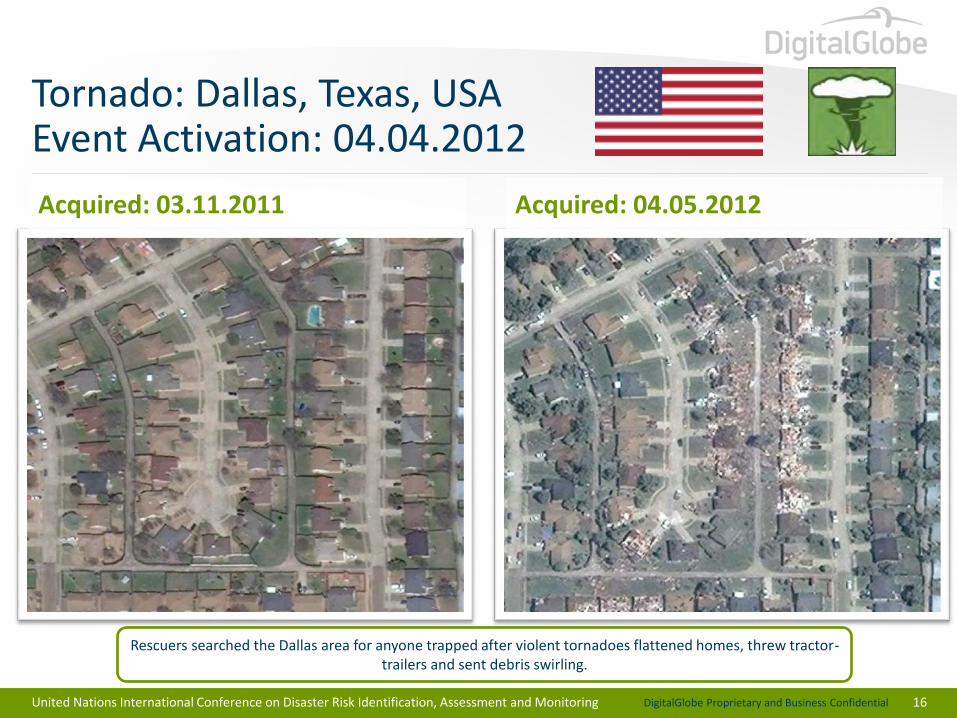
Tornado: Dallas, Texas, USA Event Activation: 04.04.2012
Rescuers searched the Dallas area for anyone trapped after violent tornadoes flattened homes, threw tractor-trailers and sent debris swirling.
Acquired: 03.11.2011 Acquired: 04.05.2012
United Nations International Conference on Disaster Risk Identification, Assessment and Monitoring
DigitalGlobe Proprietary and Business Confidential
17
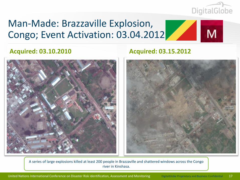
Man-Made: Brazzaville Explosion, Congo; Event Activation: 03.04.2012
A series of large explosions killed at least 200 people in Brazzaville and shattered windows across the Congo river in Kinshasa.
Acquired: 03.10.2010 Acquired: 03.15.2012
United Nations International Conference on Disaster Risk Identification, Assessment and Monitoring
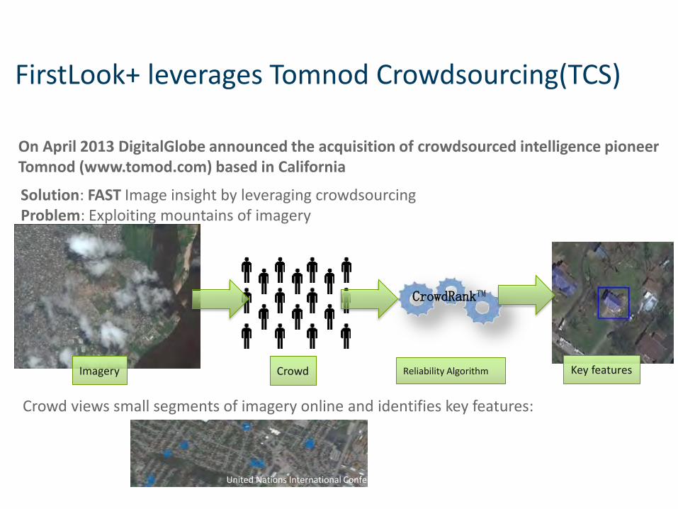
FirstLook+ leverages Tomnod Crowdsourcing(TCS)
18
Solution: FAST Image insight by leveraging crowdsourcing Problem: Exploiting mountains of imagery
On April 2013 DigitalGlobe announced the acquisition of crowdsourced intelligence pioneer Tomnod (www.tomod.com) based in California
CrowdRankTM
Imagery Crowd Reliability Algorithm Key features
Crowd views small segments of imagery online and identifies key features:
United Nations International Conference on Disaster Risk Identification, Assessment and Monitoring
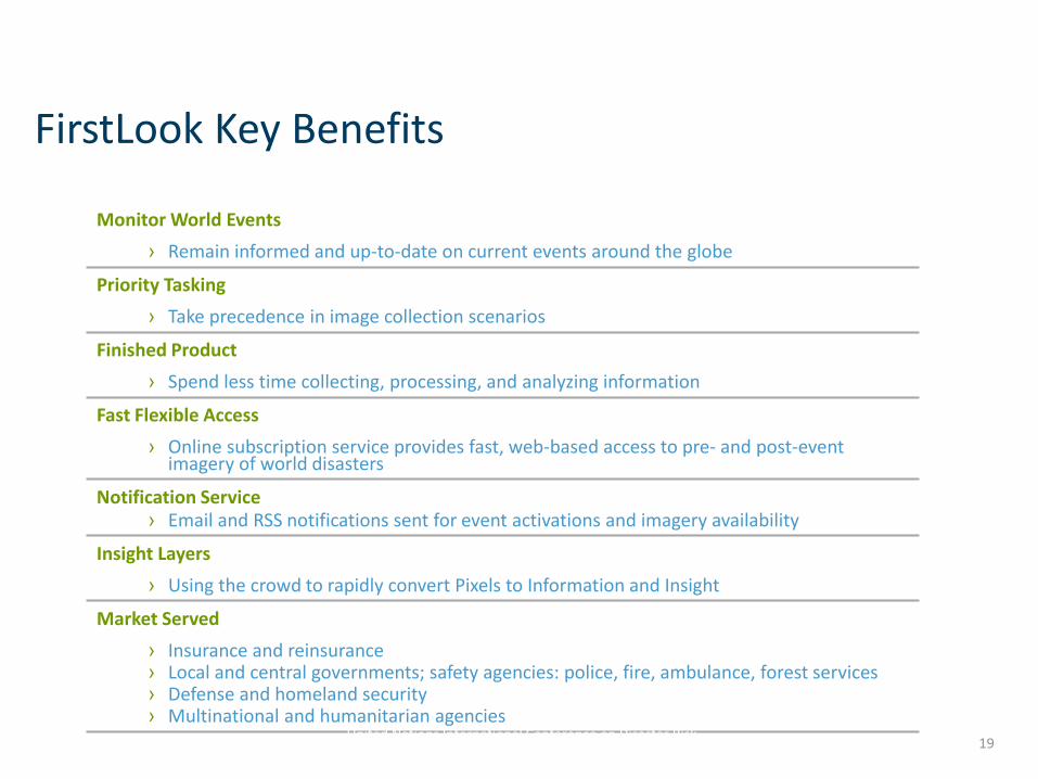
FirstLook Key Benefits
19
Monitor World Events
› Remain informed and up-to-date on current events around the globe
Priority Tasking
› Take precedence in image collection scenarios
Finished Product
› Spend less time collecting, processing, and analyzing information
Fast Flexible Access
› Online subscription service provides fast, web-based access to pre- and post-event imagery of world disasters
Notification Service › Email and RSS notifications sent for event activations and imagery availability
Insight Layers
› Using the crowd to rapidly convert Pixels to Information and Insight
Market Served
› Insurance and reinsurance › Local and central governments; safety agencies: police, fire, ambulance, forest services › Defense and homeland security › Multinational and humanitarian agencies
United Nations International Conference on Disaster Risk Identification, Assessment and Monitoring
DigitalGlobe Proprietary and Business Confidential
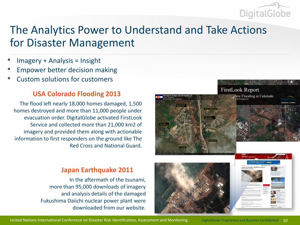
• Imagery + Analysis = Insight • Empower better decision making • Custom solutions for customers
USA Colorado Flooding 2013 The flood left nearly 18,000 homes damaged, 1,500
homes destroyed and more than 11,000 people under evacuation order. DigitalGlobe activated FirstLook
Service and collected more than 21,000 km2 of imagery and provided them along with actionable
information to first responders on the ground like The Red Cross and National Guard.
The Analytics Power to Understand and Take Actions for Disaster Management
20
Japan Earthquake 2011 In the aftermath of the tsunami,
more than 95,000 downloads of imagery and analysis details of the damaged
Fukushima Daiichi nuclear power plant were downloaded from our website.
United Nations International Conference on Disaster Risk Identification, Assessment and Monitoring
DigitalGlobe Proprietary and Business Confidential
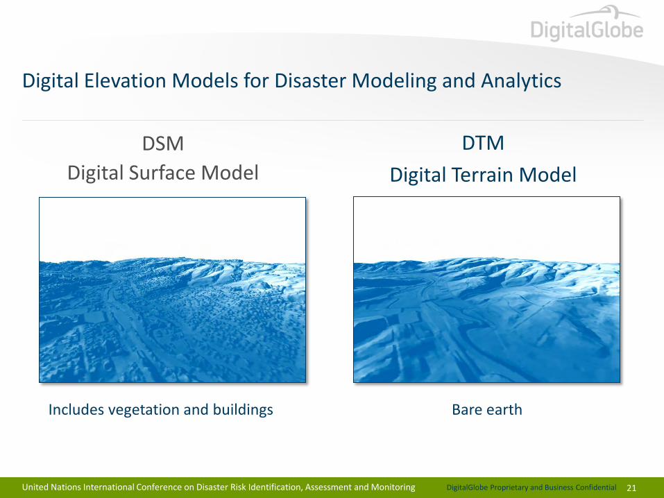
Digital Elevation Models for Disaster Modeling and Analytics
21
DSM
Digital Surface Model
DTM
Digital Terrain Model
Includes vegetation and buildings Bare earth
United Nations International Conference on Disaster Risk Identification, Assessment and Monitoring
DigitalGlobe Proprietary and Business Confidential
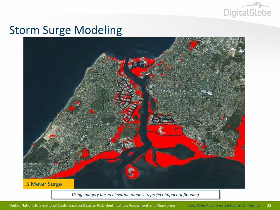
Storm Surge Modeling
22
1 Meter Surge 2 Meter Surge 5 Meter Surge
Using imagery based elevation models to project impact of flooding
United Nations International Conference on Disaster Risk Identification, Assessment and Monitoring
DigitalGlobe Proprietary and Business Confidential
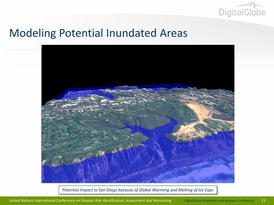
Modeling Potential Inundated Areas
23
Potential Impact to San Diego because of Global Warming and Melting of Ice Caps
United Nations International Conference on Disaster Risk Identification, Assessment and Monitoring
DigitalGlobe Proprietary and Business Confidential
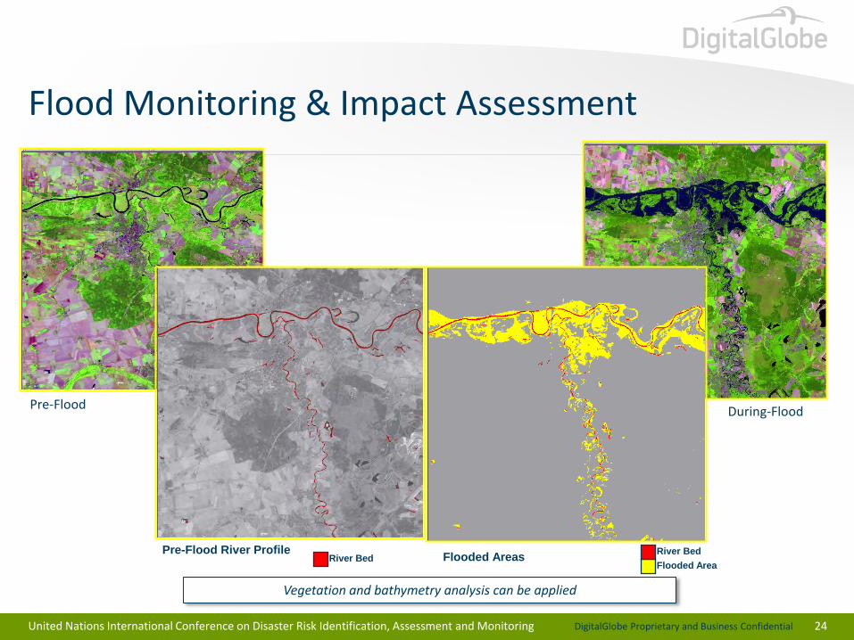
Flood Monitoring & Impact Assessment
24
Pre-Flood River Profile Flooded Areas
Flooded Area River Bed
River Bed
Pre-Flood During-Flood
Vegetation and bathymetry analysis can be applied
United Nations International Conference on Disaster Risk Identification, Assessment and Monitoring