the wai 420 marine issues report - ministry of justice · the wai 420 marine issues report ... doc...
TRANSCRIPT
The Wai 420
Marine Issues Report
A Report to the Waitangi Tribunal for the Wairarapa Ki Tararua (Wai 863) Inquiry
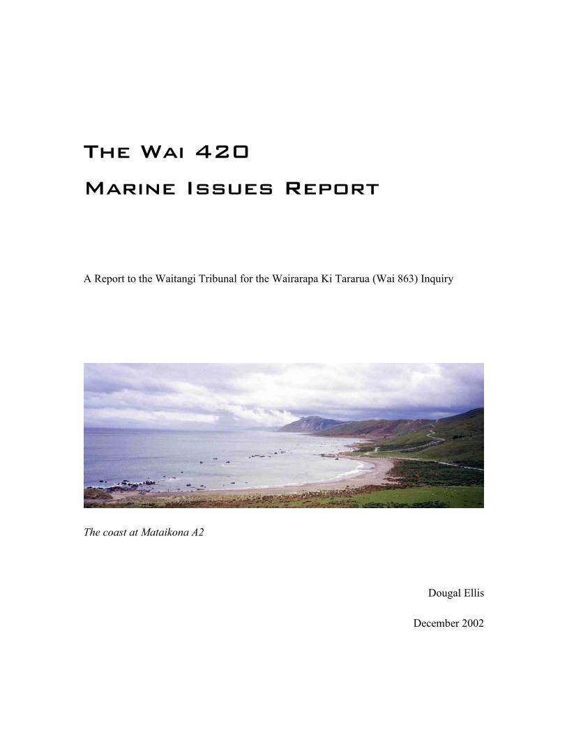
The coast at Mataikona A2
Dougal Ellis
December 2002
2
INTRODUCTION 4
The Claim 4
The Commission 4
Methodology 5
Location and Names 6
The Author 7
Figure 1: Location of the Mataikona blocks 8
THE LEGAL TITLE OF THE MATAIKONA BLOCK 9
The Blue Water Title 9
Does Mataikona A2 have a Blue Water title? 13
Surveys and the Court’s Intention 14
CUSTOMARY RIGHTS: OWNERSHIP, OCCUPATION, USE 18
Continuous and Exclusive Ownership 18
Occupation 23
Resources from the Sea 28
Agar Seaweed 31
Table of Collection of Agar 1943-1948 (tons) 31
3
ACCESS AND EXCLUSION 33
The Early Period of European Settlement 34
Roads 35
Other Forms of Access 39
COASTAL COMMUNITIES, THE COUNCIL AND FORESHORE CONTROL 42
The Akitio Coastal Community 43
The Growth of Council control 46
Council Reserve Initiatives 47
Foreshore Control By-laws 51
Regional Councils and the Current Foreshore Regime 52
A Test Case 56
THE OWNERS AND THE MINISTRY OF FISHERIES 57
CONCLUSION 59
BIBLIOGRAPHY 63
APPENDIX 66
ML3025 pt 1 66
ML 3025 pt 2 67
ML 3025 pt 3 68
ML 3025 pt 4 69
4
Introduction
The Claim
The Wai 420 claim asks the Tribunal to confirm the ‘blue water title’ of the Proprietors of
Owahanga Station to the land known as Mataikona A2 block. The claim stated that the
‘Amoco NZ Exploration Co Ltd application for exploratory oil and gas drilling off the
Wairarapa14 Coast will prejudicially affect the mana of the hapu Te Hika a Paapauma’.1
The claim was subsequently consolidated in the Wairarapa ki Tararua inquiry in 1994.2
Further details provided by counsel refine the claim issues as twofold.3 First, that the
Maori owners of the Mataikona A2 block have a ‘title’ that extends beyond the line of
mean high water springs to include the foreshore, the sea and the seabed beyond. The
basis of that title is both legal and customary. The second part of the claim is that the
Crown has impinged on the rights associated with that title by its assumption of
ownership and management of the ‘coastal marine area’, defined as the sea and seabed
that extends from the high water mark to the limits of the territorial sea – some 12 miles
off the coast of Aotearoa.4
The Commission
The Tribunal commissioned this report on 21 October 2002 to provide information on:5
� the nature of the legal title of the owners to the Mataikona A2 block and otherrelevant land titles;
� Maori traditional and post-contact occupation of the Mataikona coast, including useof foreshore and sea and any issues of access.
1 Wai 420 statement of claim, 22 Nov 19932 Registration direction, Wai 863, doc # 2.153 ‘Memorandum of counsel for Wai 420 being a response to the memorandum – directions of the presidingofficer, dated 13 August 2002’, 5 September 2002, Wai 863, doc # 2.1294 Resource Management Act section 2(1) ‘Interpretations’ 5 Wai 863, doc # 3.17
5
� Crown policies and legislation that relate to that have specifically affected that coastalblock and its resources.
Methodology
Research for this report was carried out over four weeks in November and December
2002. Research focussed on local government archives at Masterton and Woodville,
National Archives Wellington and Land Information New Zealand (LINZ), Wellington.
A number of people have been consulted including Department of Conservation and
Ministry of Fisheries staff, the claim manager Mr George Matthews, and regional and
county council personnel. The author would like to thank those people who provided
information for the production of this report. In the limited time available, oral interviews
of claimants concerning traditional fishing rights were not completed. The report has
instead relied on information in the Rangitane O Wairarapa report on Customary Fishing
which contains such information from kaumatua and others who are members of the
claimant group.6 The claimants will also be able to provide the Tribunal with information
on this topic during the hearing process.
This report does not examine in detail the Crown’s legal ownership of the foreshore and
seabed. Although the issue is perhaps central to the claim, information on this topic is
readily available to the claimants through, for example, the Rangahaua Whanui
‘Foreshore’ report by Richard Boast.7 In addition, foreshore, coast and marine issues
have been researched in some detail for this inquiry by Cathy Marr in her Environmental
Overview report for the Wairarapa region.8 This report should be read in conjunction
with the Marr report which contains much information that is directly relevant to the Wai
420 claim. This report also relies on research by Phillip Cleaver in his ‘History of the
6 H Rimene, M Kawana, A Rimene, J Potangaroa, ‘Nga Uri O Hamua, Keeping the Wolves from our Door:Customary Fishing Project July 2001-January 2002’, Rangitane o Wairarapa, Masterton (hereafter Rimeneet al) 7 R Boast, ‘The Foreshore’ Rangahaua Whanui report, Waitangi Tribunal November 19968 C Marr, ‘Wairarapa Twentieth Century Environmental Overview Report: Lands, Forests and Coast’,August 2001(not yet filed at time of writing)
6
Purchase and Reserves of the Castlepoint block’, and Tony Walzl’s ‘Crown
Administration of Wairarapa Maori Land in the 20th Century’.9 The document bank
compiled by Barbara Gawith and Eve Hartley for the Mataikona blocks has been of great
assistance. Page numbers from the Mataikona volumes of the Gawith and Hartley
document bank are referenced in the footnotes as ‘GH p X’.
Location and Names
The coast, foreshore, sea and seabed referred to in this report is adjacent to approximately
17,000 acres of land located on the east coast of the lower North Island (referred to in this
report as the Wairarapa east coast) between the Mataikona and Owahanga Rivers (refer
figure 1). Originally, the Native Land Court and survey records refer to this land as the
‘Mataikona block’.10 The name derives from the river which forms the southern border of
the block. The name ‘Mataikona’ comes from the Maori words mataitai (to collect food)
and kona (there).11 Thus the name is symbolic with the focus of the claim, the traditional
right of Maori to gather resources from the area. Confusion can arise as the subdivision to
the south of the Mataikona River is also called ‘Mataikona’. As such, the words
‘Mataikona block’ are used to distinguish the land in question from the subdivision to the
south.
In the twentieth century, the Mataikona block was developed as a sheep and cattle station
under the stewardship of the Maori Trustee and then the Department of Maori Affairs.
The farm was called ‘Owahanga Station’, after the river which defines the northern
border of the block. Thus the ‘Owahanga station’ is on the ‘Mataikona block’. The river
on the northern border has numerous spellings – Owahanga, Owhanga, Oahanga, and
Aohanga. This report uses ‘Owahanga’ for both the station and the river.
9 P Cleaver, ‘A History of the Purchase and Reserves of the Castle Point Block’, August 2000, Wai 863,A6, and T Walzl, ‘Wairarapa Land Issues Overview, 1900-2000’ November 2002 (not yet filed) 10 See later in Title History section11 Meaning supplied by Mr George Matthews.
7
The Author
The author is a Research Officer with the Waitangi Tribunal. He has an MA in history
from the University of Auckland. He has written several reports for the Tribunal and
works as a Facilitator in the Hauraki and now the Wairarapa ki Tararua inquiries. All
opinions contained herein are those of the author and not the Tribunal itself.

8
Figure 1: Location of the Mataikona blocks
9
The Legal Title of the Mataikona block
The Blue Water Title
In 1992 a member of the law firm of Johnson Lawrence Elder wrote to the chartered
accountants for the Owahanga station. The letter stated:12
The land comprised in Mataikona A2 has never been surveyed in accordance withthe survey regulations. Accordingly, any natural boundaries such as rivers and theocean, impliedly form part of the title ... This being the case the owners canregard themselves as having for all intents and purposes a title in respect of theocean boundary which extends as far as the natural ebb and flow of the tide atany point in time ... This is an unusual situation and has arisen because a CrownGrant has never been issued for this land. [...] The extent of the Mataikona blockwas determined by the partition order of the Maori Land Court registered underProvisional Register 9/173 in the Land Transfer Office.’
The following documents were included in the letter: 1. Minutes Maori Land Court 23 March 1869 ordering titles to issue for Mataikona2. Order vesting Mataikona A block in Maori Trustee in 1957 (Maori PR 9/173)3. Order deleting the land known as Mataikona A1 from the above order
The belief that Mataikona and indeed other stations in the region have a ‘blue water title’
through lack of survey or an unsurveyed Crown Grant is present in historical records and
popular conception.13 Some officials concur in this view. A senior policy analyst at the
Ministry of Fisheries considered that:14
From Orongorongo around to Cape Turnagain, where stations have a title down tothe sea, their title is to the low water mark – a blue water title.
A memorandum on coastal issues to the Dannevirke County Council circa 1983 noted:15
12 M J Switzer, of Johnston Lawrence Elder to J P Dodson, Chartered accountants, 17 March 1992 (lettersupplied by counsel for Wai 420) 13 The term ‘blue water title’ in this situation seems something of a misnomer, however, as blue waterwould seem logically to refer to that part of the ocean where the land is always covered by water – that is,beyond the foreshore.14 Discussion with Terry Lynch, Senior Policy Analyst, Ministry of Fisheries, 1 October 2002 15 ‘Dannevirke County Foreshore Reserve’ unnamed and undated memorandum in file ‘Foreshore Control1983’ Dannevirke County Council 1.9/2/5 Box 16 Woodville Archive
10
Nevertheless, tact will be required when liaising with land owners. Many of theirforebears were granted “Victorian Titles” to much of the land in question givingpossession right down to the low water mark.
The Horizons.mw (the trading name of the Manawatu-Wanganui Regional Council)
Coastal Plan of January 2002 states under ‘land tenure’:16 Most of the Region’s coastal marine area is in Crown ownership. There are fewexceptions to this. The mouth of the Hokio stream down to the open sea is ownedby the tangata whenua and managed by the Horowhenua Lake Trustess. On theeast coast a blue water title is claimed by the Maori owners of Moawhango [sic]station for the stretch of foreshore between Owahanga River mouth south toMataikona River mouth, although this has yet to be settled.
Current government policy is that the Crown owns the foreshore and seabed through
legislation – the most recent example being the Foreshore and Seabed Endowment
Revesting Act of 1991.17 The idea of the Crown owning the foreshore really dates back to
the importation of English statute and common law following the assumption of
sovereignty by the British Crown in 1840. The application of English laws to Aotearoa
was further entrenched through such legislation as the ‘English Laws Act’ of 1858. As
part of the importation of the English laws, New Zealand government law makers have
argued that the rights of the Crown in England to ‘own’ such things as gold, the
foreshore, seabed, navigable rivers, wild animals and birds also apply in New Zealand.18
English law at the time distinguished between the coastal land, the foreshore (the area
between high and low water marks) and the sea and seabed. The Crown was held to own,
by presumptive right, the foreshore, the beds of tidal rivers, the seabed and coastal
waters. The Crown was not required to demonstrate how it owned those places, and the
burden of proof of ownership by express or presumed Crown grant was on the private
subject.19
16 Horizons.mw Regional Coastal Plan: Change 1 & 2, Jan 2002, p 18 17 For a full summary of the Crown’s legal position see Crown law closing submissions, Hauraki Inquiry,Wai 686 AA1, November 2002. Also Boast, Marr 18 Ben White in C Marr, Dr R Hodge and B White, ‘Crown Laws, Policies and Practices in relation to Floraand Fauna, 1840 – 1912’, Wai 262, K519 Boast pp 25-26
11
Through legislation such as the Harbours Acts of the nineteenth and twentieth centuries
and most recently the Resource Management Act 1991, the Crown, which retains the
underlying or ‘radical’ title to the foreshore and seabed, can vest temporary ownership
and/or control of the same to others – Harbour Boards, territorial local authorities and
regional councils for example. Such vestings or ‘grants of control’ allowed those
organisations to construct wharves or pass regulations controlling public access and use.
Similarly the Public Reserves Act of 1854 enabled the governor in council to: 20 grant and dispose of any land reclaimed from the sea, and of any land below high-water mark in any harbour, arm or creek of the sea, or in any navigable river or onthe sea coast within the said Colony ...
but contained the important proviso that:nothing herein contained shall prejudice the rights of persons claiming waterfrontage.
As such, the Act recognised that ‘water frontage’ was an important and valuable right and
that the legislation should be careful to not divest people of such rights.
Government policy in the early colonial period was more accepting not only of private
rights to water frontage, but also of the idea that private citizens could have rights over
the foreshore and seabed itself. For example, the Crown granted titles to the foreshore in
fee simple to individual private citizens. This appears generally to have occurred in the
early days of the colony when survey plans perhaps took in a tidal mudflat or river, or
where minerals occurred in the seabed (copper off Kawau Island is one such example).
Private individuals with such personal property rights to the foreshore and seabed are
listed in the Appendices to the Journals of the House of Representatives of 1868.21
At that time (1868) the Native Land Court also had the ability to investigate title to the
foreshore:22
20 Cited in P Hughes, Acting Chief Surveyor, ‘Reserves Along Water Boundaries’, Department of Surveyand Land Information, Wellington, 1994, p 8 21 ‘Return Of Land Lying Between High and Low water marks on the coast of the colony’ AJHR 1868, C3,pp 2-6 22 NZ Institute of Surveyors, ‘The Surveyor and the Law’ Feb 1993 (‘reformatted’) p 20

12
The jurisdiction of the Maori Land Court over the foreshore was briefly suspendedin the Auckland province whilst a proclamation of 18 May 1872 remained in forceand finally taken away over the whole country by the Harbours Act 1878 s 147,which was the forerunner of the Harbours Act 1950 s 150. After 1878 it was nolonger competent for the Maori Land Court to investigate the title to, or issue anyfreehold order in respect of the foreshore.
As such, it has been argued that the foreshore is simply ‘uninvestigated’ customary Maori
land.23 At the time of the Castlepoint transaction in 1853, ownership of the foreshore and
seabed was not an issue between Maori and the Crown. The Castlepoint deed does not
refer to the foreshore or coastal waters. It notes that the Maori owners ceded the land:24 … me ona rakau, me ona wai me ona kohatu o raro ranei o te whenua o rungaranei o te whenua me nga aha noa iho aha noa iho o aua whenua ki a Wikitoria teKuini o Ingrini
… with its trees, its waters its minerals whether underneath or on the earth andeverything pertaining to that land to Victoria Queen of England
The owners reserved certain places to themselves within the wider Castlepoint
transaction. The boundaries of the Mataikona reserve were recorded in the deed as: … ki waenganui o te awa o Oahanga o Mataikona kei kei Waiohakura te tapahangao uta haere tika tonu ki Arawata ko te Moana tonu te rohe o tetahi taha.
… between the Oahanga River and Mataikona the inland boundary is at Waihokurathence in a direct line to Arawata the sea is the other boundary.
There is no evidence that Maori drew a distinction between coastal land and foreshore
land, or the seabed. The assumption could be made that for Maori it was simply a matter
of fact that with respect to the reserves, they retained everything ‘pertaining to that land’
including fishing rights and foreshore and seabed ownership.
This was not an unreasonable assumption, not only in Maori terms, but also in European.
There is evidence in both Native Land Court jurisprudence25, the 1858 Reserves Act, and
the specific Crown Grants recorded in the AJHR of 1868 that individuals or groups could
have rights to the foreshore and that those rights can be recognised in New Zealand law.
23 Boast p 6824 Castlepoint deed, 22 June 1853, ‘Maori deeds of land purchase in the North Island of New Zealand’(Turtons deeds), Vol 2, No.85, p 261

13
These rights can attach to individuals (AJHR), or groups (Native Land Court awards).
Furthermore, if a person or persons had rights such as water frontage, those rights were
important and deserved protection from the perhaps unintended consequence of
government legislation.
Does Mataikona A2 have a Blue Water title?
This research has not been able to confirm a legal Blue Water title associated with the
Mataikona block. The Native Land Court did not specifically award a title to the
foreshore or seabed, there was no Crown grant issued for the same to the owners and the
block would appear to have been surveyed a number of times to the high water mark.
As noted above, the Mataikona reserve was created from the Castlepoint transaction in
1853. Maori did not transfer the land to the Crown which then granted it back. The land
was simply excepted from the transfer. As such, its legal status until 1869 was
‘customary Maori land’. In 1869, the Native Land Court investigated and awarded title to
the owners of the Mataikona block under section 17 of the Native Land Act of 1867. This
title by survey, pertained only to the land up to the high water mark. In 1959, when the
various subdivisions were re-amalgamated in preparation for development farming, the
title was registered for the first time under the Torrens system when it received a
Provisional Register number and then a certificate of title. The owners and their
successors have retained the Mataikona reserve land, practically complete, down to the
present, where it is classified as Maori freehold land.26
25 Chief Judge Fenton awarded Maori fishing rights in the Kauwaeranga 1870 foreshore in 1872. See Boastp 49 26 The title history will be discussed in greater detail in following sections.
14
Surveys and the Court’s Intention
At the title investigation in the Native Land Court in 1869 the surveyor Wilkinson gave
the following testimony:27 I am a licensed surveyor. I made the survey of the land shown on the map beforethe court. The survey has been made in accordance with the rules. ... Theboundaries are nearly all natural ... On the north by the Oahanga stream – on thewest by the Waingongoro and Mataikona creeks, on the s.w. by the Mataikonariver, on the east by the ocean. The boundaries were pointed out by Karaitiana,Taraipine and Wiremu te Whare. There was no opposition to this survey.
The survey plan produced in the court and later signed by Judge Monro is Maori Land
plan 3025 and is available from landonline or from LINZ Wellington. The survey plan
contains the following declaration signed by Wilkinson and dated ‘Dec 1868’:28 This is to certify that the rules for the guidance of ‘Native Land Surveyors’ havebeen adhered to upon this survey.
Wilkinson appears to have surveyed the Mataikona block to the high water mark. ML
3025 shows a double line along the coast. On the outer (seaward) line is written ‘low
water mark’. The coastal boundary pegs (shown at the ends of the later partitions), lines
and bearings all seem to refer to the inner line, which one would assume is the high water
mark.
At the title investigation in 1869, the owners requested the block be divided into three
portions to allow all names of those with an interest to be on the title.29 Judge Henry
Monro delayed the issue of the certificate until the partitions requested were surveyed
and mapped.30 The lines are shown on ML 3025 and appear to extend to the inner (high
water mark?) line where ‘peg and trench’ is shown on the plan.
Once the additional survey was completed, and the mortgage attached to the block for
survey removed, the certificates could issue. This occurred in October 1869 but the title
was antevested to the date of the title investigation when the owners had apparently
27 Wairarapa Native Land Court minute book 1 H, Tuesday 23 March 1869, fol 5628 ML 3025, LINZ Wellington 29 Wairarapa Native Land Court minute book 1 H, Tuesday 23 March 1869, fol 57
15
leased the bulk of the land to a European - Sutherland. A sketch of each subdivision was
attached to the certificates when they issued. These sketches do not distinguish high from
low water mark. The three certificates, which are all identical other than the land area and
partition and owners’ names, state the land is:31 [B]ounded ... towards the east by the sea on the plan drawn hereon or hereuntoannexed. ... be made to vest in the grantee on the 27 day of March 1869.
The certificates do not specifically state that the title includes the foreshore, as occurred
in Hauraki when Judge Fenton issued ‘rights’ to Maori to the foreshore at Kauaeranga.32
Nor does the survey plan indicate that the boundary includes the foreshore, nor any part
of the sea. It seems, on the contrary, to mark the high water line as the boundary of the
land to which the title refers.
The demarcation of low or high water mark continues in subsequent plans. In 1895, after
a long court case, the Mataikona blocks were further partitioned. The compiled plans
attached to the 1895 partitions show a double line at the coast marked high water mark
and low water mark. Between the two is written the word ‘shingle’. The internal
subdivision lines appear to extend to the inner high water mark line, perhaps indicating
that is the boundary of the land which has been subdivided.33
In 1898 the Akitio Road Board commissioned a road from the coast at Mataikona to
Pongaroa township, some miles inland. This road is shown on plan SO 14136 and
includes some coastal detail.34 The plan records the waka tauranga (canoe landing site) as
‘Aohanga Bay’ and notes the position of the ‘boat entrance’ between the reef and the
coast. At the beach, the ‘landing place’, and ‘landing shed’ are shown. Specifically, there
is a single line at the seaward boundary of the land named ‘high water mark’.
30 Order of the Native Land Court, Mataikona 3 block, 27 March 1869, (GH doc bank p 628-629) NoteOrder for certificate of title says requires survey within 6 months. 31 Native Land Court certificate of title 13 Oct 1869, ‘Entered in book 15 Wairarapa No 43 page 43 (GH pp529, 624) 32 Boast p 5033 Native Land Court partition order 19 July 1895, Mataikona 2 block order file, Maori Land CourtHastings, (GH p 574) 34 LINZ Wellington
16
Mataikona 3 block was divided into Mataikona 3A and 3B in 1895. The survey was not
completed however until 1920 and is shown on DOSLI plan WD 3463.35 The coast is
shown as a thick line with the inner border marked ‘H.W.M.’ Again, boundary pegs are
shown as positioned on the inner line and the partition line with Mataikona 2 block ends
at the inner line.
Surveys conducted in 1959 and 1968 on the Mataikona blocks do not show the seaward
boundary as either high or low water mark.36 They are plans compiled in the survey
office from earlier plans. An explanation for the lack of detail on the coastal boundary is
perhaps offered by S R Kinnear, Registered Surveyor, who states:37 In NZ, where a person’s land abuts onto tidal waters, the boundary is generally themean high water mark by virtue of s 35 of the Crown Grants Act 1908.
The line is dynamic in nature and subject to constant change [due to accretion orerosion]. If the boundary of a property was a fixed boundary and not subject toaccretion and/or erosion the boundary would be represented on the depositedplan and the title by a series of measured straight lines or ‘right lines’. Theboundary would then not move with the action of the sea.
The surveys of 1959 and 1968 show the coast of the Mataikona blocks as a ‘wavy line’
and not a series of straight lines. The lack of demarcation between high and low water
marks in the later plans may thus be due to the provisions of the above legislation and
consequent survey practice.
Thus the survey documents appear to show a clear intention to demarcate the legal
boundary of the Mataikona blocks as the high water mark. There was likely a divergence
of understanding, however, between official practice and Maori belief. The survey
regulations and title followed English legal assumptions and there is no evidence that the
Maori owners were aware of those assumptions. On the contrary, the natural boundaries
referred to ‘the ocean’ and the owners would have assumed they held rights to the
adjacent ocean according to Maori custom. The later surveys compiled in the survey
office would have done little to change this Maori view and no evidence has been found
35 Surveyed by W A Hutton, Feb 1920. Certified correct 16 July 1920. LINZ Wellington. 36 ML 4729, ‘Plan of Mataikona A’, April 1959 and ML 5181, June 1968 LINZ Wellington 37 The Surveyor and the Law New Zealand Institute of Surveyors, March 1996
17
that the Crown communicated the implications of its ‘legal’ ownership and control of the
same.

18
Customary Rights: Ownership, Occupation, Use
Despite the lack of evidence for a title to the foreshore based on survey or an award of the
court, a strong argument can be made that the claimants have a customary title to the
foreshore and sea adjacent to their lands and that they have never willingly or knowingly
relinquished this. For the claimants to demonstrate a case for customary ownership rights
to the foreshore and sea off the Mataikona block the following are useful:38
1. Continuous and exclusive ownership and occupation of the area2. Continuous and exclusive use of the resources 3. Restriction or denial to others of access to those resources.
The following section will examine the historical evidence for each of those subject areas
in turn.
Continuous and Exclusive Ownership
The claimants can demonstrate a record of continuous ownership of the Mataikona block
adjacent to the foreshore and sea under discussion. The ownership of the adjacent land, in
the absence of the facility in New Zealand law for Maori to ‘own’ their customary
foreshore and seas, serves to assist the case for rights to the same. The claimants’ legal
ownership of the Mataikona block has already been documented by Cleaver in his report
to the Tribunal ‘History of the Purchase and Reserves of the Castlepoint block’.39 Some
salient points in the story of that record ownership are recorded below.
The owners of the Mataikona block reserved the land from the 1853 Castlepoint
transaction where the Crown gained rights to some 250,000 acres of east coast Wairarapa
land. Unlike other transactions at that time, the boundaries of both the land transferred to
the Crown (the wider Castlepoint purchase) and the Mataikona Native Reserve, were
38 See for example Boast p 60 39 Op Cit
19
clearly defined by sketch plan and natural boundaries. A large group of owners of the
Mataikona block signed the subsequent Castlepoint deed.40
It appears that about 1868 a government survey encroached on the Mataikona Reserve.
Te Whakarato wrote to Chief Judge Fenton in 1868 claiming:41
the land I retained as a dwelling place for myself since 1852 has been taken by thegovernment.
Possibly as a consequence of the survey dispute with the Crown, (discussed in Cleaver42)
Te Whakarato on behalf of the owners applied to the Native Land Court to have the title
to the Mataikona Reserve determined.43 Judge Monro presided over the investigation of
title on 23 March 1869. Te Whakarato appeared as the principle witness for the
claimants: He testified:44 I belong to the Ikaopapauma tribe and reside at Mataikona. ...This land belongs tome and some others of my tribe. We derive our right from our ancestor TeMatau…This land belonged to him in former times. His descendents have been inpossession ever since and we are in possession now ... our title is not disputed thatI am aware of. There are more than 10 owners on the land so we wish for 3 grantsin order that all may be in the grants. One line to run .... There are more than 30owners. We have arranged among ourselves who are to be in the grants and who isto be “hei [sic] hapu” (Registered under cl 17/67). The grantees of NorthMataikona are: [10 names] No.2 ... [etc]
No one appeared as counter claimants and the Judge subsequently ordered three
certificates of title to issue under section 17 of the 1869 Native Land Act to three blocks
of land named Mataikona 1, 2 and 3, upon completion of survey.45 The initial survey had
only delineated the outer boundary of the block. The judges orders awaited completion of
the partition surveys and subsequently issued in October 1869, with the title antevested to
29 March 1896, the day the owners reportedly signed a lease with Sutherland.46
Two points arise from the above. First, the owners appear to have been obliged by a
boundary dispute, to establish a ‘legal’ title to their land. Second, clearly the owners were
40 Cleaver pp 31-3341 GH p 48242 Cleaver p 11543 Whakarato to Native Land Court, 13 November 1868 (GH p 479) 44 Wairarapa Native Land Court, minute Book 1 H, Tuesday 23 March 1869, fol 5645 Order of Native Land Court for certificate of title Mataikona 3, 27 March 1896 (GH p 629)
20
familiar with Native Land Court legislation and opted for section 17 titles as they allowed
more people to be on the title, either as ‘official’ owners on the front of the certificate or
by having their interests registered in the court. Such a title was as close as the then
Native Land legislation approached to ‘communal ownership.’ Te Whakarato’s reference
to the ‘hapu’ is perhaps how the owners interpreted clause 17, as a kind of hapu title. It
was not, of course, as those on the title were ‘tenants in common’ – a group of people
having undetermined individual interests in the land.47 The Native land legislation of the
time was incapable of delivering a true customary title, based on a collective right to the
land.
In 1892 some owners felt they were not receiving a fair proportion of the lease income.48
One decided to run sheep on part of the block. The lessees (Sheath and Hume at that
time) were unable to prevent this as they could not fence off the part of the block which
was legally theirs (relative interests being undetermined).49 The disaffected owner
applied to the court for a determination of relative interests. Te Whakarato wrote to the
court asking that only the interest of the one owner be determined:50
Let the restrictions remain on the other shares. Let his [her] share alone be heardbecause he causes trouble over the shares of the others [translation].
Under the legislation of the time, a partition would have meant subdividing the land into
parcels with no more than 20 names in each. Aporo Hare, one of the owners explained,
however, that following a meeting of owners outside the court:51
so far as he could understand the matter it was not proposed to subdivide the landbut only to enter into a written arrangement to place all the persons on the samefooting and to impose conditions that no application should be made to the NativeLand Court to subdivide the land except with the consent of a majority of theowners and that no one should sell their share.
46 Cleaver p 115. See also (?) to Fenton, 21 October 1869, Mataikona block file (GH p ?) 47 Order of Native Land Court re Mataikona 1 & 3 blocks, 27 March 1869, states that names on back be‘tenants in common’ (GH pp 527, 628)48 Reta Potangaroa to Chief Judge Native Land Court 14 February 1887, (GH pp 517-518, translation p520) 49 Sheath & Hume to CJ Native Land Court, 9 April 1897, (GH p 641-642) This letter refers to the earlierevents. 50 Whakarato to Chief Judge, Native Land Court, 30 March 1893, (GH p 407) 51 Wairarapa Native Land Court, minute book 18A, 13 Oct 1892, fols 226-227

21
Clearly Te Whakarato and Hare wanted to retain the land and were concerned the
restrictions would be lifted if the land was partitioned. The minute books record that Te
Hika A Papauma decided to withdraw the application to subdivide:52 because it meant dividing the land into too many blocks owing to the law requiringthat not more than 20 persons should be placed in a title.
Applicant Ihipera Patumoai (sp?) abandoned attempt to have interest defined andresolved to make up quarrel with relatives concerning the sheep she had placed onthe land and was now willing to place those sheep in the custody of KaraitianaWakarato.
Karaitiana Korou objected as he did not believe the proposal on how to divide the rent
was fair. He pointed out that:53 Say take the case of one of the original owners who had died and say 10 personshad been appointed to succeed. Under the terms of the lease the ten personswere each entitled to a full share in the annual rent in place of only being entitledto receive a tenth share of one interest.
The other owners, it seemed, had arranged a form of communal title – where the
community, as it existed at the time, owned the land and distributed the rent equally
among themselves. Whether this was a ‘customary’ arrangement or not, it was a decision
arrived at by the collective owners. The Court, however, was bound by the laws of the
land and pointed out:54 that if this was the mode of apportioning the rent it was a mistake... It was veryevident from the statement of Karaitiana that the relative interests of the landshould be determined ... it was a mistake to suppose that the land would beallowed to remain in its present position as the law had now placed all the personsboth on the title as well as the registered owners on the same footing [clause 97and 98 of the Act of 1873] and the same rights and privileges had been conferredon the successors ... so that any one person might apply to the court to have hisshare determined . If [this was done] it would be the means of setting aside thepresent title which they appeared to consider now operated as a safeguard againstall innovations but they were under a mistake in supposing this as the very personsnamed in the body of the certificate no longer had paramount control ... Any oneperson could apply to the court to make partition thereof. It would be seentherefore that it was quite impossible to prevent the land from being subdividedand the best plan was ... to have it done as speedily as possible.
The determination of relative interests and partition did not proceed until 1895. The
court, presumably at the request of the owners reimposed the restrictions on alienation
52 Wairarapa Native Land Court min bk 18A, Tuesday 14 October 1892, fol 23053 Wairarapa Native Land Court min bk 18A, Tuesday 14 October 1892, fol 239

22
except by lease for no longer than 21 years.55 Again, the evidence in the court records
show Te Hika a Papauma trying to effect a communal approach to land ownership and a
strong will to retain the land as a single piece.
In 1917 the Crown considered acquiring the Mataikona blocks for the resettlement of
returned soldiers. The government required the Native Land Purchasing Board to place
restrictions on alienation of the land to any party other than the Crown for a period of one
year.56 However, a solicitor for the principal owners wrote to the Native Land Purchase
Board saying:57
As a matter of fact our clients inform us that they have not the least intention ofselling the land to someone else; nor, they inform us, do they intend to sell to thegovernment. It is their desire to keep the lands for themselves, and when Mr.Hume’s leases fall in, to farm that land on their own account. They feel that thesale of the lands either to the Government or to anyone else would be contrary totheir own best interests.
It is believed that none of the Native owners would be prepared to sell theirinterests to the Government; but, whether this be so or not, we are instructed bythe principal owners to say that, so far as they are concerned, they are notprepared to sell and are not prepared to enter into any negotiations. ... Theydesire therefore not to be approached in any way with regard to a sale, as they donot want to sell and do not want to negotiate.
Again, the owners show a strong collective will to retain their lands. The successors to
the original owners down to the present have similarly continued to retain possession of
their ancestral lands. The Mataikona blocks are currently owned by a Maori
Incorporation called ‘The Proprietors of Owahanga Station.’ It is classified as Maori
freehold land.58
54 Wairarapa Native Land Court min bk 18A, Tuesday 14 October 1892, fol 24055 See Partition Orders for Mataikona blocks, 4 June 1895, ‘inanlienable except by lease not exceeding 21years’. (GH p 589, 590, 599) 56 Walzl, p 6057 Walzl, pp 62-6358 Cleaver pp 147-148
23
Occupation
The owners’ continuous occupation of the Mataikona blocks is clear in the documentary
record. The Native and Maori Land Court records, survey plans, and government files all
show a continuous occupation by at least some of the owners sufficient to keep the ‘fires
alive’, since before the time of the Treaty until the present.
Beginning with the pre-historical period, current archaeological information records:59
� nine archaeological sites of Maori origin for the Castlepoint region including twourupa, middens and ovens;60
� fourteen archaeological sites of Maori origin in the Whakataki to Mataikona Riverarea including three pa, an urupa, terraces, middens, ovens, a karaka grove and amonument. ‘Waipori’s mark’ is a stone cairn monument at Whakataki erected in 1842to commemorate a treaty between Ngati Awa and local Maori in 1839;61
� three archaeological sites of Maori origin for the Owahanga area – two pa and amidden;62 and
� one Maori cemetery reserve at Akitio River mouth.63
The Native Land Court minute books contain numerous references to the owners’
occupation of the block. At the title investigation Karaitiana Te Whakarato described a
total of 11 settlements on Mataikona:64 We are now living on the land ... we have houses and cultivations on it now, wehave never been disturbed. We have now a settlement at Te Ika Puru, at Te Kapa,Whakarunia Te Waka, Waimaunu, Makirikiri, Mangatawara, Te Korekai,Otahumatarua, Potaka, Karaka a Paka, Tokitoki.
Wilkinson’s survey supports Te Whakarato’s evidence of extensive occupation and use
of the land. Surveyors were instructed to record the ‘Native names of all rivers, hills,
cultivations and pieces of land’.65 On ML plan 3025 Wilkinson recorded the names of
numerous villages and cultivations as well as other features, both natural and human
59 The Historic Places Trust is currently updating its site register for the east Wairarapa coast.60 T Atkinson, ‘The Wairarapa Coast – A literature Review’ (Draft report) not dated. Department ofConservation, Masterton, p 2461 Atkinson, p 20 62 Atkinson, p 1863 B Dix, H Robertson, G McAlpine et al, Coastal Resource Inventory First Order Survey: WellingtonConservancy, DOC Wellington, October 1990, p 103 64 Wairarapa Native Land Court, minute book 1 H, Tuesday 23 March 1869, fol 5665 New Zealand Gazette 1867, 5 April 1867, p 137

24
made. Along the north bank of the Mataikona river (the southern border of the block),
starting from the coast and going inland to Makatote creek at the western end of the
property Wilkinson recorded the following places: at the mouth was ‘Teikapuru Village’;
about one kilometre inland was ‘Otaane’ where ‘Sutherland’s Homestead’ (the lessee)
was situated; another kilometre inland was ‘Otahumatarua Village’; further up at the
junction of the Mataikona and Waipaua Rivers was ‘Potaka’ where Wilkinson recorded
huts and cultivations; several more kilometres up river he noted a grass flat named
Karaka a Paka and not far on from there, at Tarataho creek, ‘old cultivations’; now
perhaps five or six kilometres inland was Toki Toki where again ‘huts and cultivations’
are noted. Going north along the coast starting again at Teikapuru village, Wilkinson
recorded: at Te Kapa ‘cultivations’; at ‘Whakarunia Te Waka’ there were ‘cultivations
and huts’; further north ‘Ngapuke’ was the site of an ‘old pah’ and at ‘Rua Tupapako’ on
the mouth of the Owahanga River Wilkinson observed a ‘pile of stones’, most likely a
memorial cairn. Heading inland again from the mouth of the Owahanga river, on the
south bank he noted: at ‘Makirikiri Creek’ an ‘old cultivation’ and ‘hut’; at Mangatarawa
another ‘old pah’ and just north were ‘huts’; at Te Kore Kai where stood the ‘Ferry
house’ there appear to be cultivations marked, but not named as such; further inland at
Kopiro were ‘old cultivations’ and beyond that point places are named only –
Kapakapanui, Mangatorehe, Te Umuarunga Te Rangi, Te Rereahowhatu until finally we
reach Te Ateahunuku, a ‘grassy flat’ at the rear of the block.66
The various successions orders to the Mataikona block after 1869 usually include the
residence of the successor, often ‘Mataikona’ or ‘Owahanga’.67 In 1890 Whakarato said
he would convene a meeting of owners at Mataikona to discuss various questions at
issue. 68 Presumably the meeting was at Mataikona because that was where most owners
lived.
66 ML 3025. Wilkinson was accompanied by Karaitiana Te Whakarato and other owners on his survey –see title investigation above.67 For example Wairarapa Native Land Court minute book 6 fols 121, 247, 307 68 Wairarapa Native Land Court minute book 16, 22 September 1890, fol 319

25
Other evidence from the minute books in the 1890s pointing to occupation by the owners
includes:
� By October 1892 Ihipera Patuwai was running sheep on part of the land causing a
quarrel with other owners.69
� In 1894 Karaitiana Te Whakarato as a witness in the court named twelve different
hapu having rights to the land.70 Later in the same case he said: ‘the descendants of
the hapu I named yesterday have occupied this land continuously since time of gift to
Te Matau. They were living on it when I put the land through the court and no one
disputed their right.’71
� In 1895, Wirihana Te Oioi stated: ‘I live at Mataikona. I am a member of Te Hika O
Papauma hapu.’ At the same hearing Te Manihera stated: ‘Te Hika O Papauma were
once a numerous tribe and have held the mana over this land down to the present time
– the remnant of the tribe still residing there.’ Karaitiana Te Whakarato also gave
evidence saying at one point: ‘Managtawiri [a former pa of Te Matau’s] – that is
where we are now living’.72
� Other chiefs also lived in the block, Hami Te Potangaroa for example, in 1895.73
Further proof that the owners continued to occupy the block is also evident in the lands
excepted from the various leasing agreements with Europeans. In 1892 the court recorded
the sublease of two reserves from the lessee of the blocks, A Sheath, to the owners (at
peppercorn rentals). The court located the blocks thus:74 200 acres on the Oahanga River to the northeast of and abutting the Mangatawaistream and 200 acres on the sea coast at the place called Whakarunia Te Wakaand extending to the boundary line between Mataikona 1 and 2 blocks.
69 Wairarapa Native Land Court minute book 18A, 14 October 1892, fol 23070 Wairarapa Native Land Court minute book 21, 20 November 1894, fol 5171 Wairarapa Native Land Court minute book 21, 28 November 1894, fol 8472 Wairarapa Native Land Court minute book 22, various dates, fols 248, 255, 27473 Wairarapa Native Land Court minute book 22, 3 May 1895, fol 30574 Wairarapa Native Land Court minute book 23, 17 April 1896, fol 34
26
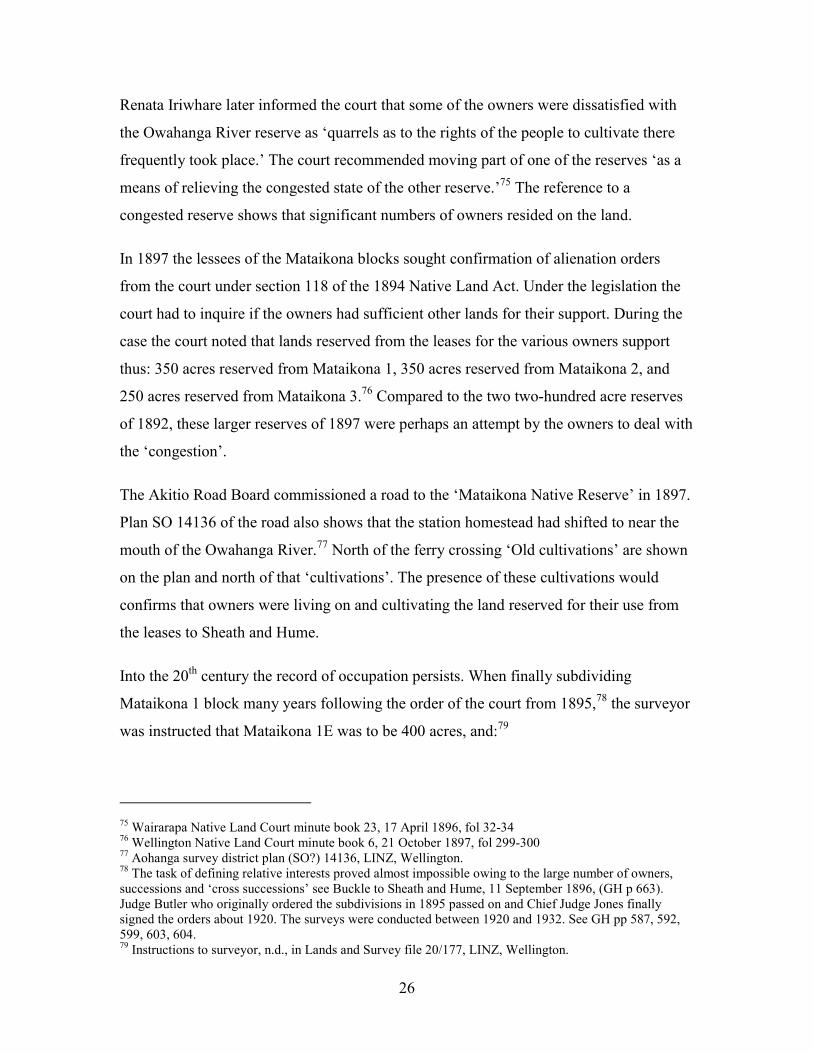
Renata Iriwhare later informed the court that some of the owners were dissatisfied with
the Owahanga River reserve as ‘quarrels as to the rights of the people to cultivate there
frequently took place.’ The court recommended moving part of one of the reserves ‘as a
means of relieving the congested state of the other reserve.’75 The reference to a
congested reserve shows that significant numbers of owners resided on the land.
In 1897 the lessees of the Mataikona blocks sought confirmation of alienation orders
from the court under section 118 of the 1894 Native Land Act. Under the legislation the
court had to inquire if the owners had sufficient other lands for their support. During the
case the court noted that lands reserved from the leases for the various owners support
thus: 350 acres reserved from Mataikona 1, 350 acres reserved from Mataikona 2, and
250 acres reserved from Mataikona 3.76 Compared to the two two-hundred acre reserves
of 1892, these larger reserves of 1897 were perhaps an attempt by the owners to deal with
the ‘congestion’.
The Akitio Road Board commissioned a road to the ‘Mataikona Native Reserve’ in 1897.
Plan SO 14136 of the road also shows that the station homestead had shifted to near the
mouth of the Owahanga River.77 North of the ferry crossing ‘Old cultivations’ are shown
on the plan and north of that ‘cultivations’. The presence of these cultivations would
confirms that owners were living on and cultivating the land reserved for their use from
the leases to Sheath and Hume.
Into the 20th century the record of occupation persists. When finally subdividing
Mataikona 1 block many years following the order of the court from 1895,78 the surveyor
was instructed that Mataikona 1E was to be 400 acres, and:79
75 Wairarapa Native Land Court minute book 23, 17 April 1896, fol 32-3476 Wellington Native Land Court minute book 6, 21 October 1897, fol 299-30077 Aohanga survey district plan (SO?) 14136, LINZ, Wellington. 78 The task of defining relative interests proved almost impossible owing to the large number of owners,successions and ‘cross successions’ see Buckle to Sheath and Hume, 11 September 1896, (GH p 663).Judge Butler who originally ordered the subdivisions in 1895 passed on and Chief Judge Jones finallysigned the orders about 1920. The surveys were conducted between 1920 and 1932. See GH pp 587, 592,599, 603, 604. 79 Instructions to surveyor, n.d., in Lands and Survey file 20/177, LINZ, Wellington.

27
This [1E] is for a papakainga and the persons who take interests in it suffer areduction of 5 to 4 in the other divisions. ... As to the woolshed and buildings andyards on No.1C the owners of the other subdns are to have the right to bring theirsheep there and shear them on the payment of a sum of not more than 10/- perday ... such money to be paid to Te Ohonga Paraone.
The survey order infers that owners were living on and farming parts of the block. When
Crown Land ranger Sutherland was sent to report on the possible Crown purchase of the
Mataikona property in 1917. He noted that at Mataikona 1 (the northern part):80
There is also a Native Pah. Several families of natives reside at the Pah and havesmall areas cultivated...The homestead is situated on this block as well as the OldHotel and several native dwellings around the flats near the station.
Of Mataikona 3, the south section, Sutherland wrote: There is also several native houses on the flats at the mouth of the river, andsome small areas of cultivation.
The records of the Department of Maori Affairs management of the Oahanga station from
the 1950s also contain numerous oblique references to owners occupying and using the
land – either as labourers, farmers or seaweed gatherers. For example, several owners
continued to occupy and farm the block in 1951.81 Some owners requested houses and a
papakainga site at the annual meeting of owners in 1952.82 Other evidence of occupation
includes the presence of a Native school from 1940 to 1966, and a marae.83
As ample information is available to the Tribunal on the record of ownership and
occupation in the 20th century in the report of Tony Walzl on the Crown’s administration
of Maori land in the 20th century and it is not repeated here. Mr Walzl’s research
demonstrates not only occupation and ownership but a close and involved relationship
between the owners and the Maori Trustee and the Department of Maori Affairs over the
management of their land. This continuous relationship, in the latter half of the 20th
80 Ranger Sutherland to Commissioner Crown Lands, 1917, Land & Survey file 20/177, LINZ Wellington. 81 Walzl p 28182 Walzl, p 28783 Lands and Survey file CL 2/13, LINZ Wellington.

28
century, is a subject upon which the claimants could also provide oral and other evidence.
Resources from the Sea
This small village of only a few huts, called Waiorango [about 2 km north ofcastlepoint cove] serves merely as a resort for fishing for the Natives of Mataikona... At the village we got a good meal of potatoes and crayfish (of which lattersome hundreds were hung up on poles to dry)...
Colenso 184384
This cove presents perhaps the finest view of seaside rocks I have yet seen...TheNatives...are the most civil people I have yet met with in this country they hadgiven us pork potatoes & crawfish refrained from begging accepted our profferedpayment for the pig.
Weld, n.d.85
The two former sections demonstrate a continuous and uninterrupted ownership and
occupation of the lands adjacent to the foreshore and sea claimed by the Wai 420
claimants. The following seeks to show a continual use of the resources from the adjacent
sea, including fish, shellfish, and seaweed.
The lands reserved from the Castlepoint purchase in 1853 were mostly coastal. Many of
the blocks Maori reserved from later transactions to Europeans in Wairarapa and Tamaki
Nui a Rua were coastal. There are several obvious reasons for the Maori preference to
reserve coastal land – transport, rain and food. Transport by canoe or walking the coast
was one way of getting around the district. Early Europeans also preferred the coastal
route between Wellington and Napier before the inland forests were felled and roads and
railways built.86 The coastal lands were of better quality (possibly receiving a higher
rainfall) than those slightly inland so proved more fertile area for cultivation.87 Thirdly,
84 Castle Point Historical Committee 1965:41. Quoted in Atkinson, p 20 85 Quoted in Atkinson, p 2086 Marr, p 10487 Ranger Sutherland report, Walzl para 1.112 and 1.113

29
and most importantly, the coast was a valuable source of food – particularly paua, kuku
(mussels) and koura (crayfish), but also finfish such as hapuku, kahawai and whitebait.88
References to fishing in the Native Land Court minutes for Mataikona block are few and
scattered. It is mundane to observe that the Native Land Court was concerned with rights
to land and maintained a hierarchy of take (rights) of which resource use was only one
factor. The claim to title of Mataikona by Te Whakarato on behalf of Te Hika a Papauma
was unopposed so little information about rights, including fishing rights, was recorded.
The events in Hauraki which led to the Crown first suspending and then cancelling the
Native Land Court’s jurisdiction below high water mark did not occur until the 1870s.
Those claiming Mataikona in 1869 were not alerted, perhaps, to the Crown’s yet to be
asserted prerogative over the foreshore and seabed and thus may not have felt the need to
assert their own rights to the same.
During the Mataikona partition case in 1894, Wirihana Te Oioi said his ancestor ‘Te
Matau and his children collected food on the land – caught rats and pidgeons at
Kapurangi, wekas and rats at Onengarara ...[and] crawfish [sic] at Whakaoma.’89
Karaitiana Te Whakarato affirmed the right of Te Matau to fish at Rangiwhakaoma.90
Karaitiana Korou stated that at the mouth of the Rangiwhakaoma stream: ‘Everyone in
the locality had a right to fish there.’91
Korou’s reference to everyone having rights to fish at the Rangiwhakaoma stream mouth
indicates that for Maori fishing was not an open access public right, as it is now.92 Some
Maori had rights to fish at one place, others at another.93 In some places, all the local
Maori had a right to fish. The claimants to Mataikona in 1869 and even down to the turn
of the century probably believed they retained their ‘legal’ right to gather fish and also to
88 Rimemne et al, Customary Fishing Project, and T Chrisp, Rangitane customary interests in theWairarapa, draft report, p 51 89 Wairarapa Native Land Court minute book 22, 22 April 1895, fol 24990 Wairarapa Native Land Court minute book 22, 29 April 1895, fol 28291 Wairarapa Native Land Court minute book 22, 2 May 1895, fol 29492 In the sense that in an area where recreational fishing is allowed, any member of the public may fishthere. 93 Rimemne et al, ‘Customary Fishing Project’, Setting the Scene, final page
30
exclude others from doing the same as they had always done. The Treaty guaranteed their
right to fisheries, and the government had done nothing yet to disturb those rights.
The incursion of Europeans and the consequent pressure on sea resources was reduced in
the Mataikona region by inaccessibility, to the coast in general and the station coastline in
particular. As such, friction between the exclusive and possessory Maori fishing right and
the developing Pakeha idea of common access was likely greatly reduced. In more recent
times however, the issue has come to the fore.
The story of Waimimiha a fishing reserve noted in the Castlepoint sale but not surveyed,
and the struggle of Maori to get the area defined in the early part of this century is
covered in reports to the Tribunal by Cleaver and Walzl. The main petitioner on the
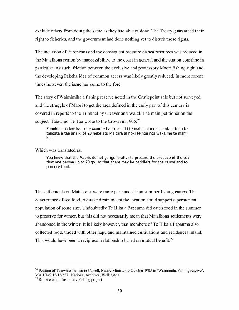
subject, Taiawhio Te Tau wrote to the Crown in 1905:94 E mohio ana koe kaore te Maori e haere ana ki te mahi kai moana kotahi tonu tetangata a tae ana ki te 20 heke atu kia tara ai hoki te hoe nga waka me te mahikai.
Which was translated as: You know that the Maoris do not go (generally) to procure the produce of the seathat one person up to 20 go, so that there may be paddlers for the canoe and toprocure food.
The settlements on Mataikona were more permanent than summer fishing camps. The
concurrence of sea food, rivers and rain meant the location could support a permanent
population of some size. Undoubtedly Te Hika a Papauma did catch food in the summer
to preserve for winter, but this did not necessarily mean that Mataikona settlements were
abandoned in the winter. It is likely however, that members of Te Hika a Papauma also
collected food, traded with other hapu and maintained cultivations and residences inland.
This would have been a reciprocal relationship based on mutual benefit.95
94 Petition of Taiawhio Te Tau to Carroll, Native Minister, 9 October 1905 in ‘Waimimiha Fishing reserve’,MA 1/149 15/13/257 National Archives, Wellington95 Rimene et al, Customary Fishing project
31
Agar Seaweed
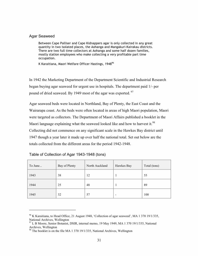
Between Cape Palliser and Cape Kidnappers agar is only collected in any greatquantity in two isolated places, the Aohanga and Mangakuri-Kairakau districts.There are two full time collectors at Aohanga and some half dozen families,mostly station employees who make collecting a very profitable part timeoccupation.
K Karaitiana, Maori Welfare Officer Hastings, 194896
In 1942 the Marketing Department of the Department Scientific and Industrial Research
began buying agar seaweed for urgent use in hospitals. The department paid 1/- per
pound of dried seaweed. By 1949 most of the agar was exported. 97
Agar seaweed beds were located in Northland, Bay of Plenty, the East Coast and the
Wairarapa coast. As the beds were often located in areas of high Maori population, Maori
were targeted as collectors. The Department of Maori Affairs published a booklet in the
Maori language explaining what the seaweed looked like and how to harvest it.98
Collecting did not commence on any significant scale in the Hawkes Bay district until
1947 though a year later it made up over half the national total. Set out below are the
totals collected from the different areas for the period 1942-1948.
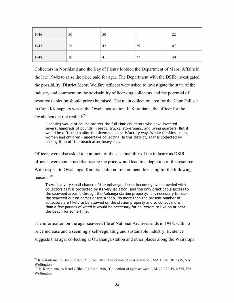
Table of Collection of Agar 1943-1948 (tons)
To June... Bay of Plenty North Auckland Hawkes Bay Total (tons)
1943 38 12 1 55
1944 25 48 1 89
1945 32 57 - 100
96 K Karaitiana, to Head Office, 21 August 1948, ‘Collection of agar seaweed’, MA 1 370 19/1/335,National Archives, Wellington 97 L B Moore, Senior Botanist, DSIR, internal memo, 19 May 1949, MA 1 370 19/1/335, NationalArchives, Wellington 98 The booklet is on the file MA 1 370 19/1/335, National Archives, Wellington
32
1946 50 50 - 122
1947 28 42 25 107
1948 10 41 77 140
Collectors in Northland and the Bay of Plenty lobbied the Department of Maori Affairs in
the late 1940s to raise the price paid for agar. The Department with the DSIR investigated
the possibility. District Maori Welfare officers were asked to investigate the state of the
industry and comment on the advisability of licensing collectors and the potential of
resource depletion should prices be raised. The main collection area for the Cape Palliser
to Cape Kidnappers was at the Owahanga station. K Karaitiana, the officer for the
Owahanga district replied:99 Licensing would of course protect the full time collectors who have investedseveral hundreds of pounds in jeeps, trucks, storerooms, and living quarters. But itwould be difficult to allot the licenses in a satisfactory way. Whole families – men,women and children – undertake collecting. In this district, agar is collected bypicking it up off the beach after heavy seas.
Officers were also asked to comment of the sustainability of the industry as DSIR
officials were concerned that rasing the price would lead to a depletion of the resource.
With respect to Owahanga, Karaitiana did not recommend licensing for the following
reasons:100 There is a very small chance of the Aohanga district becoming over-crowded withcollectors as it is protected by its very isolation, and the only practicable access tothe seaweed areas is through the Aohanga station property. It is necessary to packthe seaweed out on horses or use a jeep. No more than the present number ofcollectors are likely to be allowed on the station property and to collect morethan a few pounds of weed it would be necessary for collectors to live on or nearthe beach for some time.
The information on the agar seaweed file at National Archives ends in 1948, with no
price increase and a seemingly self-regulating and sustainable industry. Evidence
suggests that agar collecting at Owahanga station and other places along the Wairarapa
99 K Karaitiana, to Head Office, 21 June 1948, ‘Collection of agar seaweed’, MA 1 370 19/1/335, NA,Wellington100 K Karaitiana, to Head Office, 21 June 1948, ‘Collection of agar seaweed’, MA 1 370 19/1/335, NA,Wellington
33
coast continues into the present. The station files from the 1950s contain isolated
references to seaweed collection. On 18 and 19 January 1954, the Director of Maori Land
Settlement inspected Owahanga and noted:101
Mr Moon, the new manager, is showing that he is quickly getting a grip ofOwahanga matters pertaining to the management, and his stock handling andmanagement to date are sound. He has many difficulties to contend with on astation of this size, pertaining to staff, resident owners, and agar seaweedcollectors, but he is handling the position firmly and with tact.
In 1968 the Marine Department received a letter from a collector who had been ordered
off the beach at Mataikona while collecting on the grounds that the ‘Aohanga Trust’
owns all the land, including the beach down to the water.102 Toni Atkinsons, ‘Coastal
Literature Review’ circa 2001 lists a number of eastern Wairarapa coast sites as agar
seaweed collecting areas.103 Current regional council coastal plans show commercial
seaweed collecting is prohibited within a half nautical mile of the Castlepoint basin and
within two nautical miles of the Owahanga River mouth estuary.104 Mr Matthews, the
Wai 420 claim manager has indicated he wishes to bring oral evidence on agar collection
by the claimant community to the Tribunal.
Access and Exclusion
Any argument for customary rights or a presumed Crown Grant over the foreshore and
sea of the Owahanga station would need to demonstrate that the use rights were not
general public rights but pertained exclusively to those owning the adjacent land.
Obviously the owners had fairly unfettered access to the marine area off the station by
virtue of land ownership. The question is whether the public could similarly access the
marine area.
101 Quoted in Walzl, p 290 102 D Elmsley to Marine Department, n.d. MA 1 370 19/1/335, NA, Wellington103 Atkinson, pp 18, 19, 21, 25 104 Atkinson pp 95, 101

34
As noted in various sources quoted above, the Owahanga station itself has been isolated
by distance and poor roads. The coast even more so, with no public road access at all to
the beach between the Mataikona and Owahanga Rivers. In fact, there is no public access
road to the coast between Mataikona and Akitio - a distance of nearly 20 kilometres. The
public can, of course, gain access to the Owahanga marine resources both deep water and
foreshore by boat, and the foreshore can be legally traversed by land at low tide from
either the Mataikona River or Akitio. The following section considers the various
methods of access to the area in question in order to determine whether the owners have
managed to keep their marine resources exclusively for their own use.
The Early Period of European Settlement
The first Europeans to the Wairarapa valley travelled by boat or ship along the coast.
Landing was restricted by the lack of harbours or even safe landing places. Coastal foot
travel was, however, a necessity for early European lease holders driving their flocks
from Wellington or the Hawkes Bay. Until roads and rails were built, this was the best
way to access the coastal pasture country. It is unlikely however that the numbers of
Europeans in the early colonial period posed a threat to the marine resources of the
Maori. European settlements did not develop significantly on the coast until the second
half of the twentieth century. The European presence on the coast was principally as
owners of large lease hold sheep stations – big areas with relatively small numbers. The
main European population centres were inland in the wide Wairarapa valley.
To aid access for settlement was one reason the Crown reserved the coasts of Crown land
as it did in Ordinance No. 7602, sec 6 of the Legislative Council (1851-53) which states
that: no grant of land shall be recommended to the said Commissioner ... which shallcomprehend any headland ... which may be required for any purpose of publicutility, nor any land situated on the seashore within one hundred of high watermark.
This was one source for the ‘Queen’s chain’ concept in New Zealand. In line with the
Ordinace No.7602, lands along the Wairarapa coast from the Castlepoint and other
35
transactions were offered for selection to new settlers in the New Zealand Gazette on 7
Feb 1854 with the following proviso: Excepting always certain Native Reserves along the coast to be hereafterparticularly defined and a travel reserve along the coast throughout the distancefrom ten to twenty chains wide [approximately 200-400 metres] as the same maybe determined.
This travel reserve is not mentioned in any of the Mataikona titles or plans. According to
Lands and Surveys, no coastal land was subsequently Crown granted to settlers with the
reserve excepted.105 Creating the Queen’s chain on the Wairarapa east coast would have
alerted Maori to the fact that the Crown had assumed legal ownership and control over
the foreshore and thus divested them of their valuable rights to the sea.
The Deeds office at LINZ contains one reference to the travel reserve at Mataikona. A
succession order to the Mataikona 1 block was registered in the Deeds office in 1903 (the
only succession order that was) and a sketch plan of the block on the order in the Deeds
registry book shows a wide yellow strip from the ferry and along the river bank to the
coast and then to the landing shed. It is marked ‘road reserve’ with no other information
attched.106 There was a road then in existence, however, which went over the hill to the
ferry from the landing shed on the coast – that is along a completely different route. As
such, the yellow ‘road reserve’ appears as something of a ‘lone oddity’ and raises more
questions than it answers: why for example, was only one of dozens of successions orders
registered in the Deeds office?
Roads
Maori Land plan 3025 of 1868, the first survey of the Mataikona block, shows no drawn
road or landing place on the Mataikona blocks, but the presence of a road is indicated in
writing. This ‘road’ seems to go from the coast at Whakarunia te Waka, over the hills to
105 G Turner, W Carlin and W Kimbers, Coastal Reserves Investigation: Dannevirke County, DepartmentLands & Survey, Oct 1983 in file ‘Foreshore Control 1983’, Dannevirke County Council 1.9/2/5 Box 16,Woodville Archives

36
the junction of the Waimaunu creek and the Owahanga River, then to the ferry crossing at
Te Kore Kai and then inland via the Owahanga River valley.
In 1898 the Akitio Road Board commisioned a public road to be constructed upon the
route of the road mentioned in ML 3025. This road is shown in Survey Office plan 14136
and is known as the ‘Aohanga Valley Road’.107 The plan names the beach at Whakarunia
te Waka as ‘Aohanga Bay’ and shows a ‘boat entrance’ to the north between a reef and a
coastal point, a landing place and a ‘landing shed’. The formed road follows that
mentioned above. The plan is signed by the chairman of the Akitio Road Board and
annotated: I hereby certify that the road shown on this plan ... is in use by the public and hasbeen formed or improved out of the public funds of the Akitio Road District.
The taking of land for this road is discussed in the Public Works report to the Tribunal by
Phillip Cleaver.108 The main point for the purpose of this report is to note that there was
public access to Mataikona block coast in 1898.
Local settlers of Pongaroa (the nearest town to Owahanga station) began lobbying the
government in the early part of this century to improve local ‘ports’ to facilitate the
growth of the district. The Marine Department made several inspections of the coastal
area at Akitio and Owahanga station to determine the feasibility of building a wharf or
landing facility. The marine department engineer considered the Owahanga landing road
too difficult and the landing too exposed for development. A local timber company had
built a wharf at Akitio beach some years earlier and although it was rotten, due to poor
construction materials being used, it was still standing, and held out some hope that a
more substantial wharf or landing arrangement was possible.109
106 See Deeds Index No. 28 fol 357 and Deeds file 147 fol 247, LINZ, Wellington107 LINZ, Wellington108 C Marr, P Cleaver and L Schuster,’The Taking of Maori Land for Public Works in the Wairarapa kiTararua District: 1880 – 2000’, draft report, December 2002, pp 93-94 109 District Engineer to Engineer in Chief, 21 November 1910, M 4/16, National Archives, Wellington

37
In 1914, after significant settler pressure, the Minister of Marine, Mr Fisher, eventually
agreed to spend £15,000 on upgrading the wharf at Akitio, on the proviso that the settlers
build a freezing works to justify the cost.110 The Marine Department initially advanced
£1,000 towards improving the existing wharf, and then inquired as to progress of
fundraising for the freezing works. The Akitio County Clerk responded that the war had
interfered with the fundraising. 111
The wharf and shed at Akitio at 1910112
In October 1919 the ‘Pongaroa correspondent’ in the Wairarapa Age newspaper praised
the: sterling settlers who have been fighting for years against the greatest disabilitiesso far as communication with the markets is concerned... The Hon F M B Fisherpromised to improve the port facilities but the promise was never redeemed. Assuch, smaller settlers are now slowly but surely abandoning their farms to largerholders...
110 Dominion, 24 March 1914 in ‘Oahanga and Akitio’, M 4/16, National Archives, Wellington111 H River Robinson County Clerk, Akitio to F M B Fisher, 13 Nov 1914, M 4/16 ‘Oahanga and Akitio’,National Archives, Wellington112 Photos attached to report from District Engineer to Engineer in Chief, 21 November 1910, M 4/16,National Archives, Wellington

38
If the government has a soul at all it will do something to assist the men who havebraved the vicissitudes of the back blocks in order to bring the wilderness intosubjection.
The file records no further action taken and it seems the wharf was not built.
Ranger Sutherland, in his report to the Commissioner of Crown Lands in 1917 also
discussed the problems of access. Sutherland noted:113 The land is distant some sixty miles form the Wellington-Napier railway line Theaccess by road is by way of Masterton-Waimata road on the south to Whakataki,thence along the sea coast to the Mataikona river (mostly private road fromWhakataki to river). From Pongaroa the access is by the Aohanga valley road whichis partly metalled dray road with streams all bridged. The Aohanga valley road is adray road to land-shed on the coast, but it is bad in winter. There is also accessfrom the Akitio landing by formed dray road, river bridged. The Akitio road leadsout to Dannevirke. Coastal steamers call weekly at Akitio or when weather suits,also occasionally at the Aohanga landing bringing stores etc and taking wool, andother produce away.
Despite the existence of the road, it seems unlikely that the public used it to get to the
coast – Akitio would have been the more likely option having both a wharf and a better
road.114 The steamer most likely only called at the Owahanga landing for station
business, and the ranger’s report shows that access to the station from Pongaroa was
difficult in winter.
ML Plan 4729 titled ‘Plan of Mataikona A’ was compiled in the survey office in April
1959 for the re-amalgamation of the Mataikona blocks. The road from the landing place
to the ferry is shown on the plan and above are written the word ‘not public’. The same
annotation occurs slightly north on part of the Aohanga Valley road going inland from
the ferry crossing. The plan says ‘see report on file 11/362. This file, although listed in
the index, could not be located by LINZ staff. It is likely the station owners applied to
have the road closed. In any respects, the track from the station to the coast does not
follow the old legal road which is reportedly now unusable.115
113 Sutherland report, 1917, Lands & Survey file 20/177, LINZ Wellington 114 District Engineer to Engineer in Chief, 21 November 1910, M 4/16, National Archives, Wellington115 K Karaitiana, to Head Office, 21 June 1948, ‘Collection of agar seaweed’, MA 1 370 19/1/335, NA,Wellington
39
In summary, although technically the public had access to the coast through paper roads,
such access was practically very difficult. As such, the Maori owners would have been
been assured in their belief that they effectively owned and controlled ‘the coast’ –
including the foreshore and sea adjacent.
Other Forms of Access
Access along the foreshore itself has been ‘legally’ possible for many years. As discussed
above, the beach was the main transport route to and from markets until inland roads and
railways were constructed. The small European population was unlikely to have
threatened Maori coastal resources in that early period. Evidence located by this research
concerning people using the coast to access the Owahanga marine resources is minimal.
About 1968, however, one D Elmsley wrote to the Marine Department in Wellington
saying:116
Having been ordered off the beach situated between the Matai Kona river and theAohanga River, whilst collecting agar seaweed, on the grounds the Aohanga Trustowns all the land, including the beach to the water. ... I am unable to obtaincoherent facts concerning these claims I crave your indulgence in supplying thisinformation ...
The Marine Department referred the matter to Maori Affairs commenting:117 Normally the foreshore is Crown land and this department allows the collection ofseaweed and drift wood without control unless it is a commercial venture
The secretary of Maori Affairs referred the question to an official who commented:118 To the best of my knowledge there is no Crown land between the Owahangastation and high water mark. In any case there is no access to the beach at anypart of Owahanga except over station property and the manager would be
116 D Elmsley to ‘Chief Surveyor’, Marine Department, Wellington, n.d., ‘Collection of agar seaweed’, MA1 370 19/1/335, National Archives, Wellington 117 Secretary Marine to Secretary Maori Affairs, 8 March 1968, ‘Collection of agar seaweed’, MA 1 37019/1/335, National Archives, Wellington 118 Note on letter Secretary Marine to Secretary Maori Affairs, 8 March 1968, ‘Collection of agar seaweed’,MA 1 370 19/1/335. The gates being left open may explain why the road to the station was made ‘notpublic’.
40
prefectly justified in ordering anybody to leave – I would encourage him to do soas we have numerous cases of gates being left open.
Maori Affairs referred the question to the District Officer in Palmerston North who
replied:119
As far as I know no claim has ever been made by the Maori Trustee or the stationstaff that the foreshore is station property
...Generally, authority to cross the beach is limited to owners, mainly in search ofsea- food, and, of course, station staff.
There is however a legal road going down to the sea coast. It is formed to thestation homestead only. From there on the track on the ground follows a quitedifferent course, and we would say that the legal road as delineated on theenclosed plan would be impossible to follow. No one would therefore have a legalright to use the track once the formed road ends.
We could not, of course, stop anyone from getting on to the foreshore by boat,but they could not go beyond the high water mark as they would then be on thestation property. The station title would apparently go down to the mean highwater mark as we know of no foreshore reserve.
The district officer’s comments are enlightening in several ways. First he confirms that
only owners and station staff have access to the beach, through the station. Second, he
notes that it would actually be very difficult to pick seaweed (or fish) without stepping
onto the dry land of the beach, which was private land. Finally, he confirms that the legal
road to the coast from the station house is actually unformed and unusable. In practice
therefore, although people could legally traverse the foreshore at Owahanga station to
fish or collect seaweed, it was extremely impracticable considering the problem of access
and removal of the harvest. The owners could and did enforce their ‘exclusive rights’ to
the beach on those who came to harvest marine resources.
119 Palmerston Nth Dist Officer to Head Office, 27 March 1968, ‘Collection of agar seaweed’, MA 1 37019/1/335, National Archives, Wellington

41
The present road from the station to the coast
A road now goes from Whakataki to the Mataikona river, where a swing bridge crosses
the river to the Owahanga station. The road continues up the south bank of the Mataikona
River. According to Peter Himona, fisheries compliance officer for the Wairarapa region,
the public can access the Owahanga station foreshore quite easily by fording the
Mataikona River near the mouth (it is not deep and sometimes blocks in rough seas). He
comments that people regularly walk, take quad bikes and even 4WD vehicles across the
river and along the coast, particularly at low tides. A three wire fence runs down to the
water from the station lands but according to Himona, ‘people just push it over’.120
120 Discussion with Peter Himona, Ministry of Fisheries Compliance Officer, Masterton, 6 December 2002

42
The best way to get to the marine area off Owahanga station, of course, is by boat.
Commercial cray and paua and recreational fishers fish off the Mataikona coast by boat
or use boats to access the foreshore.121 The Wai 420 claim manager George Matthews
believes that the off shore commercial fishing is desecrating the coastline.122 There is
little official information available specifically about the prevalence of private or
commercial marine craft and the impact of fishing in the waters off the station or on the
coast. Marr has included general information about commercial and other fishing in the
region. Commercial and recreational fishers (and poachers) currently have legal access to
the foreshore and off-shore marine area in question by boat.
Undoubtedly technology – quad bike, four wheel drive vehicle, aluminium boats and
better bigger and safer fishing technology is threatening the station owners long held
exclusive access privileges over their marine area.123 The growth in numbers of
recreational fishers and poachers is also a threat. The steady improvement of coastal
access roads and most significantly, the growth of coastal communities magnify this
threat. The growth of coastal communities is considered in the next section.
Coastal Communities, the Council and Foreshore Control
Marr has looked at the development of bach subdivisions in the area from Castlepoint
south to Matakitaki, and in Palliser Bay at Ocean Beach. To avoid unnecessarily
repeating information, similar subdivisions developed in the Dannevirke county,
particularly at Akitio. Marr also looked at the policies and provision of foreshore and
esplanade reserves for the Wairarapa region.124 This report will consider the growth of
the Akitio beach community and the stimulus this provided for foreshore control by the
local council. It will also consider Crown reserves policy and its implementation by the
Dannevirke County Council whose district includes the entirety of the Mataikona block.
121 Peter Himona 6 December 2002122 George Matthews, 17 September 2002123 Peter Himona, 6 December 2002
43
The Akitio Coastal Community
Much of the land around Akitio beach and river mouth was transferred to the Crown as
part of the Castlepoint deal in 1853. An area of 105 acres south of the Akitio River mouth
was Crown granted back to the owners on 4 July 1877, antevested to 25 February 1858.
The owners appear to have purchased this land with the Crown providing some if the
money. Why or how this happened is not known but it may have been for a reserve
agreed by the Crown but never actioned.125 In 1930, about two acres of the block were
taken for a road. The road effectively separated the land from the foreshore, and also,
according to plans, separated the bulk of the land from the cemetery reserve, which is
shown as between the road and the sea.126 The whole of the original area of Akitio 28,
apart from the land taken for a road, is still in Maori ownership today.127 As such, given
the size of the land available, Maori are still, and always have been, significant
landholders at Akitio beach.
The Akitio coastal community began as informal baches some on public reserve land or
on land subdivided from the local station.128 Foreshore control by the Council developed
out of public pressure from Akitio residents. On 13 January 1937 the Akitio Couty Clerk
wrote to the Secretary of the Marine Department saying that the council had received
complaints about cars speeding on the beach and asking that the council have authority to
restrict such actions.129
124 Marr, p 115125 Cleaver, pp 105-106 126 Plan (MD 7547?) contained in file ‘Akitio beach’, 1.2/2/3 Box 1, Woodville Archives127 Cleaver, pp 109, 111128 P Davis, County Clerk to Rt Hon Sir Keith Holyoake, 24 Nov 1976, in file ‘Property, Akitio BeachCamp 1975-1977’, 1.9/2/5 Box 30, Woodville Archives 129 County clerk to Secretary Marine, 11 Jan 1937, ‘Akitio Beach’ file, 1.2/2/3 Box 1, Woodville Archives

44
Under the Harbours Act 1923, the Marine Department had responsibility for
administering the foreshore. The Secretary Marine responded asking for a plan showing
the area over which the council wished to have control. The clerk obliged and on 11
February 1937 an Order in Council vesting a small part of the Akitio foreshore in the
Akitio County Council was published in the New Zealand Gazette. The area vested was
from the mouth of the river south to the end of the then subdivision and for a period of 21
years.130 This foreshore area included the ‘Maori cemetery’ reserve noted above. On 3
September 1958, under section 165 of the Harbours Act 1950, another order vesting the
foreshore at Akitio in the Akitio County Council for a further 21 years was published in
the gazette.131
The Marine Department advised the county it would need to pass suitable by-laws under
section 158 of the Harbours Act 1923.132 Whether such by-laws were passed or not, they
appear to have been ineffective or perhaps forgotten as in November 1954, Akitio beach
resident Ross Herbert wrote to the council complaining about a number of issues
including the need for by-laws to prevent speeding and that baches were encroaching on
the road. Most of the letter however, concerned opposition to shore based commercial
crayfishing which Herbert opposed because:133
1. Only the tail was used so it was very wasteful
2. It reduced the inshore recreational catch
3. Locals had taken crayfish for a long time
4. It may lead to commercial whitebaiting in rivers
Herbert ended his letter with an appeal that the council should preserve area because it
was ‘isolated and attractive’.
The small amount of land available on the coastal strip and the very limited road access
to the coast throughout the area meant that land at Akitio was in demand. By 1969 Akitio
130 New Zealand Gazette, 1937, p 387 131 New Zealand Gazette 1958 No.56, p 1205132 Secretary Marine to Dannevirke County clerk, 16 March 1937, ‘Akitio Beach’ file, 1.2/2/3 Box 1,Woodville Archive
45
had 52 house sites.134 As the settlement grew, the Commissioner of Works required the
council to provide services such as water, and to control sewerage disposal under the
Town and Country Planning Act 1953.135 The provision of services in turn made Akitio a
more attractive site for residential sites.
In 1975 the county applied for a variation in the district scheme to allow additional
subdivision at the south end of the beach. Initially the Minister of Works objected on the
grounds that there was no foreshore reserve provision and inadequate controls for
sewerage disposal. The Wairarapa Catchment Board also objected on those grounds and
also because of the likelihood of marine erosion due to the land being unstable. The
Board also noted there was no provision for water supply and drainage. 136 The plan was
altered to provide a 30 metre esplanade reserve and also a recreation reserve, part of
which was a camping ground. This varied plan was accepted and became operational in
February 1976.137
The Dannevirke County Council absorbed the Akitio County Council in 1979 after which
the Akitio County Council ceased to exist. The Dannevirke County encompassed the
entirety of the Owahanga station lands. The Dannevirke County Council also took over
the foreshore control vested in the Akitio County Council in 1958. The vesting was
repeated in 1979 but to the Dannevirke County Council, and with the area extended
further to the south to cover the additional subdivision.138 The Minister of Transport
approved the County’s foreshore control by-laws in 1979.139
133 Ross Herbert to Chairman Akitio County Council, 6 Nov 1954, ‘Akitio Beach’ file, 1.2/2/3 Box 1,Woodville Archive134 Akitio District Scheme, 1969, file ‘Town and Country Planning’, Akitio County Council, 1.2/2/3 Box17, Woodville Archive135 F R Askin, Commissioner of Works, to Akitio County Clerk, 7 May 1970, file ‘Town and CountryPlanning’, Akitio County Council, 1.2/2/3 Box 17, Woodville Archive136 ‘Town and Country Planning’, Akitio County Council, 1.2/2/3 Box 17, Woodville Archive137 Akitio County Approved District Scheme map 2A, Feb 1976, file ‘Property Domains and Reserves’,Dannevirke County Council 1.9/2/5 Box 32, Woodville Archive 138 New Zealand gazette, 21 June 1979, No. 55 p 1888 139 New Zealand gazette, 8 November 1979, No. 102 p 3246

46
The need for by-laws was due to pressures on the coast from increasing populations. In
the early 1980s the Dannevirke County Council receive a number of complaints from
residents at Akitio beach concerning:140
� commercial fishing operations, particularly the smell, the refuse generated, damage tothe foreshore (by launching and retrieving boats), the road space used by parked boatsand trailers, and the fact that commercial fishers were operating in a residential zone;
� the water supply (insufficient quantity); � motorcycles and other vehicles speeding or just driving on the beach; � people lighting fires; and� the overcrowded camping ground.
Similar public complaint to councils also occurred at Castlepoint and the Mataikona
subdivision, which developed just south of Owahanga station lands in the late 1970s.
Again, the focus of complaint was often commercial fishers.141 The councils however,
accepted the presence of the commercial fishers and did not move to restrict their
activities in any significant way. At Akitio, for example, the council solved the parking
congestion caused by commercial fishing trailers and vehicles by allowing boats and
trailers to be parked on the recreation reserve.142
The Growth of Council control
In November 1982, E Breese for the Regional Secretary of Transport wrote to the
Dannevirke County Clerk, stating: The Dannevirke County Council currently has a grant of control over the area onthe south bank of the Akitio river. The ministry prefers local authorities to havecontrol over large stretches of coast as opposed to small pockets. The Ministry isinterested in knowing if the Council would be interested in extending its grant ofcontrol over all the areas of the County bounding the coast. ... Your neighbour theWaipukara [sic] District Council has had a grant of control for all of its coastal areasince 1976, and it has worked very successfully.
140 See various letters from residents in file ‘Property Domains and Reserves’, Dannevirke County Council1.9/2/5 Box 32, Woodville Archive 141 See for example A Foreman to County clerk, 10 October 1975, in ‘Castlepoint Reserves and MataikonaCounty Properties and Reserves 1969-1977, Masterton Archives. 142 M Lingard to Services and Assets Manager, 3 September 1992, Tararua District Council ‘AkitioCommunity Board’ , 0/2/1, series 2 Box 6, Woodville Archives
47
The county accepted this suggestion and on 24 November, 1983 an order in council
granting control over the entire area of the county foreshore to the Dannevirke County
Council was published in the gazette.143
Council Reserve Initiatives
The second schedule of the Town and Country Planning Act in operation at the time
made provision for district planning schemes to ‘have regard to the relationship between
land use and water use’. This allowed councils to include in its district scheme policies
for the management of the part of the foreshore which was below mean high water level
and was technically outside the district.144 The Department of Lands and Surveys
commissioned a National Coastal Reserves Investigation in October 1983 and provided
the Dannevirke County Council with a specific report on coastal reserves in its region.145
This ‘Coastal Reserves Investigation: Dannevirke County’ report looked at land use,
water use, archaeological and historical issues, contemporary legislation and animal and
plant species and protection. Other than archaeological records, it did not refer to Maori
at all. The report recommended a series of coastal reserves in Dannevirke county to:
� Provide public access to and along the coast;
� Preserve the quality of the coast for future generations;
� Provide public recreation;
� Preserve natural, historical, scenic, scientific or other special features; and
� Preserve habitats for species of waterfowl, wildlife and marine life.146
143 New Zealand gazette No. 196 p 4059, 24 November 1983 144 T Law for Secretary of Transport to Dannevirke County Clerk, 18 Dec 1978, file ‘Foreshore Control1983’ Dannevirke County Council 1.9/2/5 Box 16, Woodville Archives 145 G Turner, W Carlin and W Kimbers, Coastal Reserves Investigation: Dannevirke County, DepartmentLands & Survey, Oct 1983 in file ‘Foreshore Control 1983’, Dannevirke County Council 1.9/2/5 Box 16,Woodville Archives, (hereafter ‘Coastal Reserves report’) 146 Coastal Reserves report, ‘Preface’

48
The report contained a number of detailed and specific reserve recommendations. Most
importantly for the owners of Owahanga station, it recommended the county ‘acquire’:
� a two hectare reserve on the north bank of the Mataikona River from the mouth to700 metres inland;147
� a reserve in the middle of the Mataikona block coast at the kainga of Whakarunia TeWaka which was described as the ‘old homestead’ site;148 and
� a six hectare reserve at the Owahanga River mouth to allow access from the road tothe station to the estuary and the coast.149
All these specific recommendations involved acquiring land from the Mataikona block.
Furthermore, along the entire length of the county coast, the report recommended a
twenty metre ‘easement’ to provide a strip of land to allow for free public access. The
proposed easement would therefore include another ‘28 hectares of part Mataikona A2
block (being 14 km x 20 m).’150
The report made much of historical precedents for allowing public access to the entire
coast. It cited the intention to except a travel reserve from the lands offered for selection
in the gazette in 1853 and ordinances of the legislative council (the ‘queens chain’
principle).151 Although none of these reserves had actually been implemented, the authors
felt: It can be seen that the public rights have been frittered away considerably overthe years and that the public’s historic right to access on the coast predates thatof even the current owners’ ancestors
A later document (a type of memorandum) to the Dannevirke County Council (not signed
nor dated) entitled ‘Dannevirke County Foreshore Reserve’ contains further information
147 Coastal Reserves report, pp 22-23148 Coastal Reserves report, pp 24-25149 Coastal Reserves report, pp 26-27 150 Coastal Reserves report, pp 32-33151 Coastal Reserves report, pp 9-10

49
on the reserves proposal.152 The document notes that the county foreshore had been
classified as a recreation reserve and that the county had been granted control of the
reserve under the provisions of the Harbours Act for a period of 21 years.
The memorandum also recorded that the ‘Coastal Reserves Investigation’ report was:153 adopted in its entirety by the Dannevirke County Council and its reserves andeasements proposals, to the extent that they pertain to the foreshore, and itsimmediate vicinity, thus figure among council’s management objectives withregard to the Foreshore Reserve.
As for justification for the reserve proposals the council was advised: The proposed provision of coastal easements and reserves to permit public accessalong the length of the Reserve is a long term management objective. Ample timeis thus available to negotiate mutually satisfactory arrangements with landowners. There is considerable historical precedent for public access right alongthe coast, predating even the rights of the present owners’ ancestors. [Although]the establishment of reserves and public access along the County coast amounts tomore than the restoration of former public rights neglected or ignored for 130years.
And to implement the reserves proposals the memorandum noted that: Sympathetic liaison with landowners will be an initial necessity in theimplementation of management policies
It can only be assumed, from the absence of any reference to it in the file, that the writers
of both the Roastal Reserves Investigation report and the later Dannevirke County
Foreshore Reserve document were unaware that the owners of the Owahanga station
were Maori and descendents of the original Maori owners of the county lands. Free
public access to the foreshore was unlikely to have been a customary right in the time
before the Pakeha and this highlights how invisible the Maori viewpoint was in the whole
process. It is indeed ironic that the traditional lands of Te Hika A Papauma constituted
over a third of the county’s coastal land, and that the land had been retained from the first
‘historic’ European land purchase in the district in 1853, and yet ignored in the
consideration of ‘historic rights’ in 1983.
152 In file ‘Foreshore Control 1983’, Dannevirke County Council 1.9/2/5 Box 16, Woodville Archives

50
The Coastal Reserves Investigation report also discussed the possible impact on the
marine biota of commercial fishers operating in the proposed reserves. The commercial
and recreational fish species sought at that time were crayfish, paua, and fin species. In
terms of commercial fishing, the cray fishery totalled 95 percent and the remaining 5
percent was fin. The report concluded that the ‘presence of fishers does not preclude
reservation’, but noted there was a risk of depletion of marine biota from reserved areas –
particularly shell fish.154
There is an inherent contradiction in the reserves proposal which sought to:
� Preserve habitats for wildlife; and
� Provide recreational access to the public along the entire length of the foreshore,
It was common knowledge at the time that an increase in public access would lead to the
depletion of the marine resources, particularly shellfish. As noted in the Coastal Reserve
Investigation report:155 It would be inconsistent if reserve areas were to become zones of marinedestruction relative to adjacent areas.
Such consequences were inevitable, especially in a area where the council had limited
ability to enforce its by-laws. A report to the Masterton County Council on ‘The Effects
of a Proposed Resort Development at Riversdale Beach on the Natural Coastal
Environment’ in 1978 noted that:156 Increased human population in the area will inevitable lead to ecological changesin the shore and shallow sublittoral areas as a result of increased exploitation ofpopular edible invertebrates, and fish [and]
Education of the general public would help reduce adverse effects such as thosethat are being caused at present by a general failure to return overturnedboulders to their original position and by the taking of undersized paua andcrayfish [emphasis added]
Yet the reserves recommended by the Lands and Survey report, recommendations
adopted in their entirety by the Dannevirke County Council, did not allow for any
153 Dannevirke County Foreshore Reserves, 1.9/2/5 Box 16, Woodville Archives 154 Coastal Reserves Report pp 16-17 155 Coastal Reserves report p 17

51
‘adjacent’ areas which might be protected from such effects. The entire coast was to be
opened up for public access and recreational use.
The reserve proposals affecting Owahanga station were accorded a low priority in the
report. According to county officials, there is no current intention to implement such
reserves. A recreation reserve at Akitio was afforded a higher priority and this has
subsequently been acquired. In terms of other actions, the Minister of Transport approved
of the Dannevirke County Council’s foreshore control by-laws in February 1986.157
Foreshore Control By-laws
The by-laws adopted by the Dannevirke County Council in 1983 covered such things as:
� Appointing officers as wardens to enforce by-laws;� Controlling rubbish on the foreshore, including the cleaning of fish; � Controlling boat speed and access; and � Prohibiting the obstruction of or impeding of traffic on the foreshore.
The by-laws also included charges for landing fish/crayfish and beaching commercial
vessels.158
Again, the county files contain no information as to the impact of the by-laws on the
owners of the Owahanga station (or anyone for that matter) but they certainly applied to
that area of the foreshore. For example, the by-laws made it illegal for the owners to
prevent vehicles or people moving along the Mataikona block foreshore as the wire fence
mentioned above was designed to do. Similarly, the by-laws meant the council could
have charged the owners for landing fish and launching or retrieving boats from their
land. The regulations would also allow the county to prohibit the owners taking sand or
seaweed from their foreshore. Although there is no evidence that such by-laws have been
156 R Grace and M Larcombe, January 1978, Riversdale Beach 1977-1978, file ref 8/13, MastertonArchives paras 10, 11157 New Zealand Gazette No. 17/460, 13 February 1986158 ‘Foreshore Control By-laws 1983’, in file ‘Foreshore Control 1983’ Dannevirke County Council 1.9/2/5Box 16, Woodville Archives

52
or are enforced on the Owahanga station owners, they represent a significant
encroachment by the Crown on the traditional rights of the owners.
Regional Councils and the Current Foreshore Regime
Management and control of the coastal environment changed considerably in the 1989-
1991 period with the introduction of three pieces of legislation: the 1989 Fisheries Act,
the 1991 Foreshore and Seabed Endowment Revesting Act and the 1991 Resource
Management Act. Under the Foreshore Revesting Act, ownership of the foreshore is in
the Crown and administered by the Department of Conservation. Section 4(1) of the Act
revoked the vesting of the coast in the Dannevirke County Council (the grant of control)
of 1983.
The Resource Management Act (RMA) is the key legislation that regulates the
management of the foreshore and coastal marine area – defined as the seabed and
seawater from mean high water springs to the 12 mile limit of the territorial seas. The
Ministry of Fisheries retains responsibility over most marine animals. The Department of
Conservation controls marine mammals and all species within marine reserves and other
special areas. It also has general responsibility for the coastal marine area. In practice,
this responsibility is delegated to regional councils which have ‘on the ground’ control.
The Minister of Conservation retains a supervisory role. Regional councils must produce
regional coastal plans which comply with the New Zealand Coastal Policy Statement.
The county councils’ responsibility ends at the high water mark.
Most of the Mataikona A2 block is now within the Manawatu-Wanganui Regional
council (‘Horizons.mw’). A small portion of the block, from the ridge just north of the
Mataikona River down to the river itself is in the Wellington Regional Council. All of the
land is included in the Tararua District Council, and under that body, the Dannevirke
County Council is the territorial local authority.
Under the Resource Management Act administering bodies are obliged to:
53
‘...recognise and provide for...The relationship of Maori and their culture andtraditions with their ancestral lands, water, sites, waahi tapu, and other taonga.’[Section 6(e)]
‘...have particular regard to ...Kaitiakitanga.’ [Section7(a)]
‘...take into account the principles of the Treaty of Waitangi (Te Tiriti OWaitangi).’ [Section 8]
Furthermore, the First schedule of the Act (Part I Clause 3(1)(d)) requires Councils, when
preparing policy statements and Plans, to consult tangata whenua through iwi authorities
and tribal runanga.
Horizons.mw for example, plans to:159 Recognise nga hapu and nga iwi as Treaty partners in the management of coastalresources by:
where appropriate, transferring certain functions, powers or duties to an iwiauthority for the management of specific coastal resources which are of specialvalue to nga hapu and nga iwi
where appropriate, delegating functions powers or duties to a committee ofCouncil (representing and comprised of the relevant tangata whenua) for themanagement of specific coastal resources...
providing processes of meaningful consultation...
having regard to hapu and iwi management Plans, recognised by iwi authorities,when considering resource consent applications in the coastal marine area
The Wellington Regional Coastal plan states:160
[2.1.7] The management of the coastal marine area needs to take into account theprinciples of the Treaty of Waitangi, including the active protection of Maori rightsand interests and the involvement of the tangata whenua in decision makingprocesses.
[2.1.8] Tangata whenua are concerned that their role as kaitiaki in the coastalmarine area is not adequately recognised.
[2.1.9] Tangata whenua are concerned that activities in the coastal marine areaare monitored and controlled so that the following are not lost or degraded:
159 Horizons.mw, Regional Coastal Plan, Change 1 and 2, 9 March 2002, p 59 160 Wellington Regional Council, ‘Regional Coastal Plan for the Wellington Region’, May 2000, p 4

54
• characteristics of special spiritual, historical or cultural significance totangata whenua, including waahi tapu, mahinga maataitai, taurangawaka and areas of taonga raranga; and
• values which are important to tangata whenua, including themaintenance and enhancement of mauri, the mana of iwi or hapu, andthe ability of tangata whenua to provide manaakitanga (hospitality).
[2.1.10] Tangata whenua wish to have access to and use of traditional coastalresources, such as mahinga maataitai and taonga raranga, and wish to undertakeenvironmental enhancement.
[2.1.11] Tangata whenua wish to initiate development projects in the coastalmarine area.
[2.1.12] Tangata whenua are concerned that people carrying out activities in thecoastal marine area are often not aware of the impacts of those activities oncharacteristics of significance to tangata whenua Activities could threatenspiritual values and the health of mahinga maataitai.
Both regional councils would thus appear to have adopted policies to implement the
requirements of the Resource Management Act with respect to Maori and the Treaty.
Furthermore, the Wellington Regional council acknowledges Maori involvement may
extend beyond conservationists to development. Horizons.mw recognises Maori
ownership of the mouth of the Hokio stream down to the sea.161
However, both the Horizons.mw and Wellington Regional coastal plans also endorse the
‘free public access to the foreshore’ philosophy noted earlier in the Lands and Survey
Coastal Reserves Investigation report of 1983. The authority for this policy is section 6 of
the Resource Management Act which states;In achieving the purpose of this Act, all persons exercising functions and powersunder it...shall recognise and provide for the following matters of nationalimportance
(d) the maintenance and enhancement of public access to and along the coastalmarine area lakes and rivers. [emphasis added]
Thus, the Wellington Regional Coastal plan notes at section 2.1.4 that:162 There is a strong desire by people and communities to:
161 Horizons.mw Coastal Plan change 1 and 2, Jan 2002, p 18 162 Wellington Regional Council ‘Regional Coastal Plan for the Wellington Region’, May 2000, p 3

55
• maintain or enhance public access along and within the coastal marine area;[and]
• use and preserve coastal resources for social, economic and cultural purposes
Similarly the Horizons.mw plan provides at section 21.1 that:Most of the land adjacent to the coastal marine area of this region is in privateownership. ... The primary mechanism for enhancing access to the coastal marinearea is through esplanade reserves and esplanade strip provisions of the Actassociated with subdivisions. The powers to take these apply to territorialauthorities and not the Regional Council. There is a need for local authorities toadopt a co-ordinated and co-operative approach to managing access.
As such, a tension between access to and along the coast by the public and the protection
of the coastal environment from depletion of sought-after sea foods is apparent. In truth,
it is the restricted public access afforded by private ownership of the land up to the high
water mark which most likely has preserved the coastal environment in areas such as thre
Mataikona block. That the Crown should now be advocating increased public access at
the expense of private ownership is, perhaps, ironic. It is doubly so when the owners are
iwi who preserved their lands and associated marine resources from the advancing Crown
in 1853 and have continued to guard those resources since.
The question of the public access rights being of national importance is not borne out by
developing regional council policy. Regional councils in Auckland, Northland, Waikato
and Bay of Plenty are considering options for levying ‘coastal occupancy charges’ under
the RMA to the owners of marinas, wharves and other exclusive foreshore and seabed
users. The chairman of the Auckland Regional Council’s environment committee, in
defending the proposed charges, noted that:163 The people affected will probably say … it’s a terrible thing and it will add to thecost of occupying the coast, but it’s accepted that if you have exclusive use onland, you have to pay
The RMA 1991 is technically about ‘management’ rather than ‘ownership’. However,
this sidelines some very fundamental issues over ownership of areas such as waterways
and the foreshore. As the Tribunal’s Whanganui report notes, the RMA is not:164
163 A Beston, ‘Councils Getting Hooks into Sea Pursuits’, NZ Herald, 1 November, 2002, p 1 164 Wanganui River Report, Waitangi Tribunal, 1999, p xvi
56
neutral on property rights, though it may claim to be, for in large measure theeffect of the Act is to subsume them. Though on its face it is a management Act,where questions of ownership do not arise, in effect the Atihaunui right ofownership and control is vested in statutory authorities.
A Test Case
In 2000, ‘The Proprietors of Mataikona Station’ (the owners) applied to the Wellington
Regional Council for a resource consent to construct a marine farm on the Mataikona A2
coast. The application referred to ‘Toheroa and clam culture. Aquaculture. As a
commercial activity as a continuation of customary stewardship.’ The application
envisaged depositing clams or toheroa into numerous 30 metre wide sand filled craters
which predominate along the up to 600 metre wide shore platform of the Owahanga
station lands. The shellfish would be held in place using mesh attached to the rock bottom
by glue or drilling.165
The owners’ claim to possess a ‘Blue Water title’ was elaborated in some detail in the
application. If the owners could demonstrate that they owned the land below high water
mark they would not have to apply for an exclusive occupation permit. The owners’
stated their title was founded on: undisturbed use, occupation, and possession since (Maori) time immemorial. Thetitle in possession has not been disturbed by Crown exercise of sovereigntythrough prerogative or statutory instruments or (prescriptive) adverse use andoccupation by third parties.
As the marine farm proposal would involve structures on the foreshore it was classed as a
restricted coastal activity under the Resource Management Act. The initial fee for
processing such an application was $810.00 which the owners provided. However, the
Wellington Regional Council subsequently raised the fee to $10,125.00, saying the
application required three ‘restricted coastal activity’ permits and was thus very
expensive to process.166 The owners protested contending an ‘unduly prescriptive and
165 D Riddiford to G Kneebone, 4 September 2000, Wellington Regional Council, Masterton 166 G Kneebone, to G Matthews, 26 July 2001, Wellington Regional Council, Masterton

57
expensive approach has been adopted in the processing unnecessarily adding to the
costs.’167 Due to the high charges, and now the moratorium on granting marine farm
licences, the owners are no longer proceeding with the application.
Upon receipt of the initial application, the Department of Conservation advised that the
proposed marine farm area was adjacent to an area of Outstanding Conservation Value –
being the Whakataki-Mataikona forshore (recognised by the Wellington Regional Coastal
Plan). Furthermore the Mataikona River mouth was a breeding area for Banded dotterel.
As the proposed marine farm was in a high wave energy environment the risk of
structures coming loose and damaging either the Outstanding Conservation area or the
birds. The department believed the station’s ownership rights ‘go only to mean high
water mark’ and that ‘an occupation right under the Resource Management Act will
therefore be need to be applied for.’ In conclusion the Department of Conservation
considered that:168
Public rights of access to this area of foreshore and seabed should not beprejudiced. It is therefore unlikely the Department would support an applicationfor exclusive occupation on such a grand scale.
Thus, the public right to access the foreshore was considered more important than Maori
rights to preserve and develop areas of significance to them. The regional council also
seemed not to consider that the application was from Maori, and as such, stated goals in
their regional coastal plan could be referred to.
The Owners and the Ministry of Fisheries
As well as government policy and regulation of the fishing industry, especially paua and
crayfish, Marr has also dealt with the general government policy towards customary
167 D Riddiford to G Kneebone, 19 December 2000, Wellington Regional Council, Masterton168 B Carrick Department of Conservation Wellington to D Riddiford, 30 November 2000, WellingtonRegional Council, Masterton

58
Maori fishing rights. Salient points are that there is a historical record of Wairarapa ki
Tararua Maori protest concerning the depletion of fishing resources and agitation for the
protection of customary fishing rights. Most notably the two petitions of 1950 containing
over 100 signatures of Maori from Owahanga River to Cape Turikirae. These peteitions
protested the commercial fishing industry’s effect on customary fishing. Marr also
discussed the Crown’s poor performance in making provision for customary fishing
rights.169
Recent developments stemming from the 1996 Fishing Act and have led to the creation of
two taiapure customary fishing areas in Palliser Bay and one at Porangahau.170 There are
no similar reserves in Te Hika a Papauma’s district, although three kaitiaki have been
nominated which is the initial step in forming such reserves.171
Ministry of Fisheries and Department of Conservation officials are currently working
actively in the Wairarapa ki Tararua region. DOC staff are interested in promoting a
network of marine protection areas as part of the government’s biodiversity strategy. A
ranga of options are available from full marine reserves through mataitai and taiapure
reserves to variations in Total Allowable Catch and Total Allowable Commercial Catch
for a particular area.172 Ministry of Fisheries officers as noted above are working with iwi
to establish customary fishing areas under the 1996 Fisheries Act. Neither mataitai nor
taiapure reserves are intended as fishing areas for Maori only. They are areas that are
managed by Maori, for the public. Maori management operates in association with either
a local authority or the Minister of Fisheries.
The decreasing levels of marine stocks is a key concern for iwi generally and the Wai 420
claimants in particular. Oral tradition records that 100 years ago or more, marine species,
especially finfish, paua and crayfish were much more plentiful on the Wairarapa east
coast.173 Marr has noted that the Quota Management System is still ‘on trial’ for many
169 Marr p 144-149, 151-155 170 Marr, pp 153-154, New Zealand Gazette 5 December 1996171 Discussion with Andrew Luke, Customary Fisheries Co-ordinator, Ministry of Fisheries, 1 October 2002172 Interview with Department of Conservation staff, Masterton, 2 Oct 2002173 Rimene et al ‘Customary Fishing Project’
59
fish species. Similarly it is not known if the current Total Allowable Catch for the
crayfish and paua fisheries is sustainable, due in part to the prevalence of poaching.174
The National Institute of Water and Air (NIWA) attempted a paua growth and stock
levels study several years ago at Owahanga. Approximately 600 paua were tagged in
1999 but so far NIWA have only had about 30-40 returned, which is insufficient to draw
any meaningful conclusions.175 The Department of Conservation has commissioned a
diving survey of the entire eastern Wairarapa coastline but so far have not been able to
dive off Owahanga due to unsuitable conditions.176
Evidence of poaching in the Wairarapa region is common. The media regularly reports
Fisheries officers breaking ‘poaching rings’. Fisheries officers estimate the amount being
taken illegally on top of the commercial, recreational and customary catch is likely to be
severely depeleting the various fisheries.177 Masterton based Fisheries Compliance
Officer Peter Himona estimates he currently receives from three to four complaints a day
in summer concerning possible poaching. He stated he regularly received complaints
about poachers from the Owahanga station owners.178
Conclusion
This report has been unable to demonstrate that the owners of the Mataikona A2 block
have a clear blue water title based on a lack of survey or a survey that included part of the
sea or the mention of the foreshore or sea in a Crown Grant, certificate of title or judges
order. There is little record of what was actually discussed at the time the reserve was
created in 1853, and the implication is that the owners retained the land with its
associated water rights as they understood it, not under common law presumptions. The
174 Marr p 151 175 Discussion with Ren Naylor, National Institute of Water and Air, Wellington, 20 September 2002176 Interview with DOC staff, Masterton, 2 Oct 2002177 See for example Wairarapa Times Age 9 July 2002, Eco News, 14 March, 2002(http://www.cdnn.info/eco), Ministry of Fisheries press release 5 Aug 1999. 178 Peter Himona, 6 December 2002.

60
block appears to have been surveyed to the high water mark in 1868 and subsequent
surveys have reflected this. Neither the claimants nor the court make specific mention of
including the foreshore or seabed in the title during its investigation in March 1869,
although Maori claimants noted ancestral fishing rights in the hearing to determine
relative interests (to land) in 1895.
This report has, however, provided historical evidence for a strong customary title to the
foreshore and seabed of the Mataikona A2 block based on continuous ownership and
occupation of the adjacent lands. There was no evidence of the Maori owners willingly or
knowingly relinquishing those rights. The historical record shows that the original
owners, as much as was legally possible in New Zealand law, sought a communal title to
their lands which were defined as belonging to the hapu Te Hika a Papauma. The leaders
of that community sought to prevent the individualisation, partition and alienation of the
land but this proved impossible under the legislative regime and the block was partitioned
in 1895, (although not completed until 1922). The will to retain the lands persisted
however, with the result that today the block is nearly as complete as when reserved from
the Castlepoint sale 150 years ago. This is a remarkable achievement and demonstrates
the strength of the community will to retain their ancestral lands.
Ownership and occupation of the block, in Maori terms, came with a bundle of rights to
utilise the adjacent marine resources including fish, shellfish and seaweed. The fishing
resource was undoubtedly one reason why the owners chose to reserve the Mataikona
block from the Castlepoint transaction. Evidence given for the Mataikona block in the
Native Land Court in 1895 show that fishing rights were not a general ‘public’ right of all
Maori, but attached to certain people at certain places. This accords with the general
understanding of Maori fishing rights in other parts of the country. The archival records
show the owners collected agar seaweed for commercial gain, investing time and money
in equipment, with the Crown’s knowledge and acquiescence in the late 1940s and
through to at least the late 1960s.
This report has also examined the case for exclusive ownership, occupation, and use of
the marine resources. In the early colonial period Europeans used the coast for access to
61
the inland Wairarapa from Napier or Wellington. It is unlikely however, that the number
of Europeans involved posed a threat to Maori marine resources. European coastal
settlements did not develop until the middle of the twentieth century. By that time,
distance and poor quality roads restricted land access to the Owahanga coast. Sometime
before 1959 the ‘public’ status of the road to the Owahanga station and from the station
building to the coast was revoked. The ‘legal’ road from the station buildings to the
landing shed on the coast, due to deterioration, is now effectively a paper road only and
unusable since the late 1960s. The public road from Whakataki to the Mataikona River at
the south of the block now enables the public to access the foreshore quite easily by
fording the river and passing along the foreshore. The owners have built a fence to try
and prevent people crossing to the station above high water mark but have no legal means
of preventing people travelling along the forshore.
Access to the foreshore and sea off Mataikona block by boat has been restricted
historically by the lack of safe landing facilities or anchorage. This was typical along the
entire coast and served to limit the number of fishers. More recently however, with
developments in marine craft technology, better access roads and the growth of local
subdivisions, the threat to the traditional marine resources of Te Hika a Papauma has
increased. Commercial, recreational and even customary fishers (not connected to the
owners) have legal access rights to take fish and shellfish from the foreshore and sea of
the Mataikona block. Poachers are also stripping large amounts of crayfish and paua from
the Wairarapa coast. Claimants and fisheries officers believe that the numbers of fishers
of all types are steadily increasing.
Crown control of the foreshore in the area in question has devolved to local councils.
Council foreshore control evolved through the growth of local seaside communities but
was localised to those communities. A shift in government policy in the early 1980s
meant the Dannevirke County Council became controlling authority for the whole of the
county coastline, including the Owahanga station’s. The council then proceeded to
develop a foreshore reserves policy which emphasised public access to and along the
entire coast without reference to the fact that nearly half the coastline was owned by
Maori who had significant rights under the Treaty of Waitangi to have their fishing rights

62
protected. The dual focus of public access and wildlife and habitat protection were also
quite contradictory. In truth, the private and exclusive Maori control of the station
foreshore in this century was one reason marine resources have survived in that location.
It is mundane to observe that increased recreational use by the public has led to drastic
depletion of marine resources, especially in the foreshore.
The Resource Management Act now regulates all aspects of the coastal marine area.
Under the Act, the Wellington and Manawatu-Wanganui regional councils are the
administrators, under the supervision of the Department of Conservation. The Act obliges
Regional councils to consider the rights of Maori under the Treaty of Waitangi when
forming regional coastal plans. Significantly, however, the Resource Management Act
sets Maori customary fishing rights, which are often private and exclusive, against a
public ‘right of free access’ to and along the foreshore. Maori custom, can be seen to
have protected the coastal marine area at Owahanga through excluding as much as
possible, public access and associated resource depletion. This is consistent with the
Maori role of kaitiaki or guardian. The customary rights of Te Hika a Papauma to the
foreshore and marine area associated with their traditional lands – the Mataikona block,
are now under considerable threat from the open public access policies of the Crown.
Throughout much of the last 150 years, the impact of the Crown on the coast off
Mataikona block has been in the form of fishing regulations and policies. Marr has
discussed the legislation and policies that most concerned Wairarapa iwi, particularly the
commercial fishing industry. What is evident at this point is that paua, crayfish and
finfish stock levels are considerably reduced and under increasing pressure from all types
of fishing – commercial, recreational and poaching.
63
Bibliography
Primary Sources:
New Zealand Gazette (various years)
Appendices to the Journals of the House of Representatives (AJHR) 1868, C3
Maori deeds of land purchase in the North Island of New Zealand’ (Turtons), Vol 2
Wairarapa Native Land Court minute books 1 H, 6, 16, 18A, 21, 22, 23
Archives New Zealand, Wellington:
‘Waimimiha Fishing reserve’, MA 1/149 15/13/257
‘Collection of agar seaweed’, MA 1 370 19/1/335
‘Oahanga and Akitio’, M 4/16
‘Owahanga Station’ MAORI 1 246 13/1 pts 1, 2
Woodville Archives:
‘Foreshore Control 1983’ Dannevirke County Council 1.9/2/5, Box 16
‘Akitio beach’, Akitio County Council, 1.2/2/3, Box 1
‘Property, Akitio Beach Camp 1975-1977’, Akitio County Council, 1.9/2/5, Box 30
‘Town and Country Planning’, Akitio County Council, 1.2/2/3, Box 17
‘Property Domains and Reserves’, Dannevirke County Council 1.9/2/5, Box 32

64
‘Akitio Community Board’ , Tararua District Council, 0/2/1, series 2 Box 6
Masterton Archives:
‘Castlepoint Reserves and Mataikona County Properties and Reserves 1969-1977’
‘Riversdale Beach 1977-1978’
Other
Wellington Regional Council, ‘Regional Coastal Plan for the Wellington Region’, May
2000
Horizons.mw, Regional Coastal Plan: Change 1 & 2, Jan 2002
LINZ Wellington:
ML 3025
WD 3463
ML 4729
ML 5181
(SO?) 14136
Lands and Survey file 20/177
Lands and Survey file CL 2/13
Deeds Index No. 28 fol 357 and Deeds file 147 fol 247
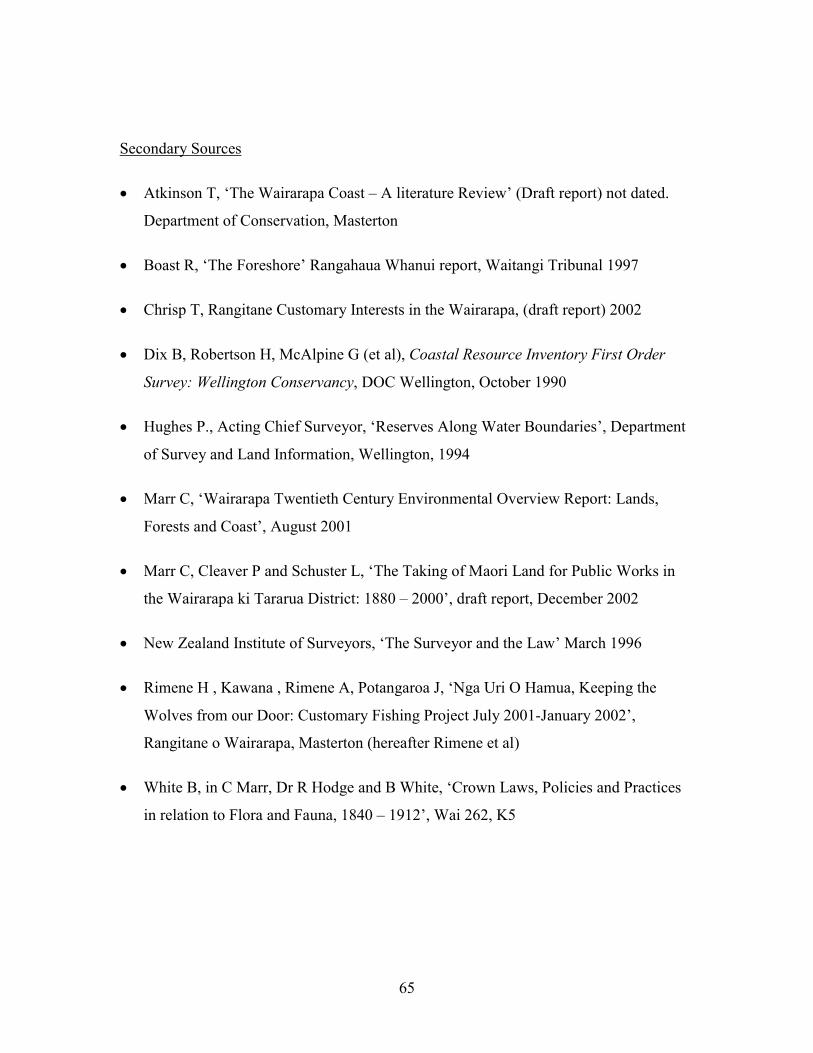
65
Secondary Sources
� Atkinson T, ‘The Wairarapa Coast – A literature Review’ (Draft report) not dated.
Department of Conservation, Masterton
� Boast R, ‘The Foreshore’ Rangahaua Whanui report, Waitangi Tribunal 1997
� Chrisp T, Rangitane Customary Interests in the Wairarapa, (draft report) 2002
� Dix B, Robertson H, McAlpine G (et al), Coastal Resource Inventory First Order
Survey: Wellington Conservancy, DOC Wellington, October 1990
� Hughes P., Acting Chief Surveyor, ‘Reserves Along Water Boundaries’, Department
of Survey and Land Information, Wellington, 1994
� Marr C, ‘Wairarapa Twentieth Century Environmental Overview Report: Lands,
Forests and Coast’, August 2001
� Marr C, Cleaver P and Schuster L, ‘The Taking of Maori Land for Public Works in
the Wairarapa ki Tararua District: 1880 – 2000’, draft report, December 2002
� New Zealand Institute of Surveyors, ‘The Surveyor and the Law’ March 1996
� Rimene H , Kawana , Rimene A, Potangaroa J, ‘Nga Uri O Hamua, Keeping the
Wolves from our Door: Customary Fishing Project July 2001-January 2002’,
Rangitane o Wairarapa, Masterton (hereafter Rimene et al)
� White B, in C Marr, Dr R Hodge and B White, ‘Crown Laws, Policies and Practices
in relation to Flora and Fauna, 1840 – 1912’, Wai 262, K5
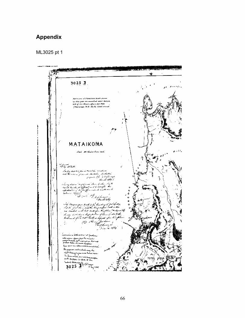
66
Appendix
ML3025 pt 1
67
ML 3025 pt 2
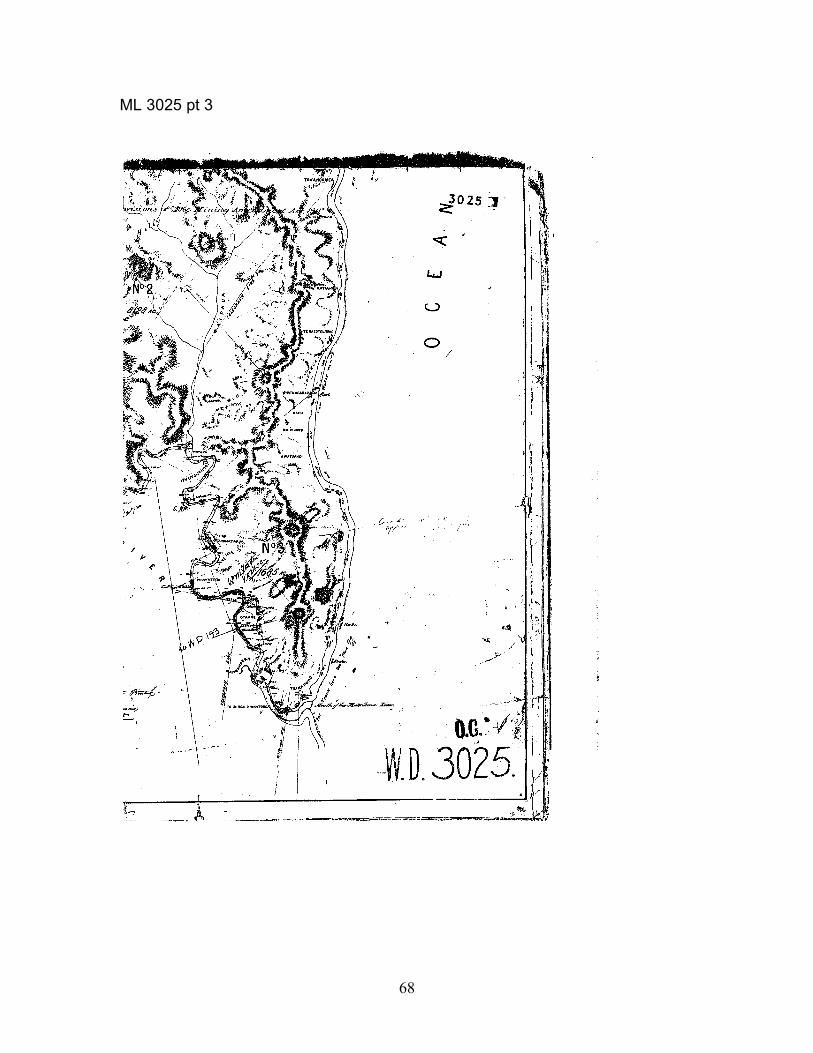
68
ML 3025 pt 3
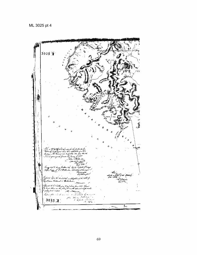
69
ML 3025 pt 4