t.i.p. no. b-4967 scotland and... · handclearing associated with the relocation of power...
TRANSCRIPT


PROJECT COMMITMENTS
T.I.P. No. B-4967
Bridge No. 8 over Lumber River
on SR 1203/SR 1412
Scotland and Hoke CountiesFederal Aid Project No. BRZ-1203(2)
W.B.S. No. 40158.1.1
COMMITMENTS FROM PROJECT DEVELOPMENT AND DESIGN
Roadway Design – Bicycle Lanes
The design will provide a four feet paved shoulders on both sides of the road and a minimum
of four feet offset on the bridge with bike-safe railings (two bar metal rail)
Division Eight – As Built Construction Plans
This project involves construction activities on or adjacent to FEMA-regulated stream(s).
Therefore, the Division shall submit sealed as built construction plans to the Hydraulics Unit
upon completion of project construction, certifying that the drainage structures and roadway
embankment that are located within the 100-year floodplain were built as shown in the
construction plans, both horizontally and vertically.
Hydraulics Unit – FEMA Coordination
The Hydraulics Unit will coordinate with the NC Floodplain Mapping Program (FMP), to
determine status of project with regard to applicability of NCDOT’s Memorandum of
Agreement, or approval of a Conditional Letter of Map Revision (CLOMR) and subsequent
final Letter of Map Revision (LOMR).
Roadside Environmental Unit, Division Resident Engineer – Sensitive Watersheds
Drowning Creek is designated High Quality Waters (HQW), therefore it will be subject to
all Design Standards in Sensitive Watersheds.
PDEA – National Park Service – Lumber River
When the type of permit is determined, PDEA will coordinate with the National Park Service
regarding the Lumber River, which is classified as National Wild and Scenic River.
COMMITMENTS FROM PERMITTING
PDEA – National Park Service – Lumber River
The Section 404 permit from the Corps of Engineers requires that the project “be conducted
in accordance with the information NCDOT provided to the USACE and the National Park
Service (NPS) dated November 30, 2015 and February 19, 2016 regarding the construction
of the new bridge. Specifically, this information was provided to obtain NPS concurrence
regarding compliance with Section 7(a) of the Wild and Scenic Rivers Act.
Permit Green Sheet Page 1 of 2April 2016

Failure to construct the bridge in accordance with this information would constitute non-
compliance with your USACE permit.” The NPS by letter dated March 24, 2016 concurred
that the project will have no direct and adverse effect on the river provided that NCDOT
adheres “to best management practices, removal of bridge piers in the water thus enhancing
free flow, and an improved aesthetic design which will both minimize visual contrast while
allow the river to be seen from the bridge.”
Permit Green Sheet Page 2 of 2
April 2016

U.S. ARMY CORPS OF ENGINEERSWILMINGTON DISTRICT
Action Id. SAW-2009-01701 County: Scotland U.S.G.S. Quad: NC-SILVER HILL
GENERAL PERMIT (REGIONAL AND NATIONWIDE) VERIFICATION
Permittee: NCDOT-NEU Chris RivenbarkAddress: 1548 Mail Service Center Raleigh, NC 27699
Telephone Number: 919-733-3141
Size (acres) 6.9 (approximately) Nearest Town RaefordNearest Waterway Drowning Creek River Basin LumberUSGS HUC 03040203 Coordinates Latitude: 34.973915
Longitude: -79.377937
Location description: The site is located along SR 1203/1412 (Turnpike Road) over Drowning Creek at NCDOT Bridge #8 in Hoke and Scotland Counties, North Carolina.
Description of projects area and activity: This authorization is for the permanent discharge of clean fill material associated with an existing bridge replacement project. Permanent impacts include the placement of fill within 0.02 acre of jurisdictional wetlands and mechanized land clearing within 0.06 acre of jurisdictional wetlands. Additionally, this authorizes 0.03 acre of handclearing associated with the relocation of power transmission poles. The NCDOT TIP for this project is B-4967.
Applicable Law: Section 404 (Clean Water Act, 33 USC 1344)Section 10 (Rivers and Harbors Act, 33 USC 403)
Authorization: Regional General Permit Number or Nationwide Permit Number: NWP 3 Maintenance.SEE ATTACHED RGP or NWP GENERAL, REGIONAL AND SPECIAL CONDITIONS
Your work is authorized by the above referenced permit provided it is accomplished in strict accordance with the attached conditions and your submitted application and attached information dated September 24, 2016 including updated informationregarding impacts (submitted November 30, 2015) and updated information regarding compliance with Section 7(a) of the Wild and Scenic Rivers Act (submitted to the Department of Interior and USACE on February 19, 2016). Any violation of the attached conditions or deviation from your submitted plans may subject the permittee to a stop work order, a restoration order, a Class I administrative penalty, and/or appropriate legal action.
Special Conditions:
1. This USACE permit does not authorize you to take a threatened or endangered species, in particular, the Northern Long-eared Bat (NLEB) (Myotis septentrionalis). In order to legally take a listed species, you must have separate authorization under the Endangered Species Act (ESA) (e.g., a Biological Opinion (BO) under the ESA, Section 7, with “incidental take” provisions with which you must comply). The U.S. Fish and Wildlife Service’s (USFWS’s) Programmatic BO titled "Northern Long-eared Bat (NLEB) Programmatic Biological Opinion for North Carolina Department of Transportation (NCDOT) Activities in Eastern North Carolina (Divisions 1-8),” dated March 25, 2015, and adopted on April 10, 2015, contains mandatory terms and conditions to implement the reasonable and prudent measures that are associated with “incidental take” that are specified in the BO. Your authorization under this USACE permit is conditioned upon your compliance with all the mandatory terms and conditions (incorporated by reference into this permit) associated with incidental take of the BO. Failure to comply with the terms and conditions associated with incidental take of the BO, where a take of the listed species occurs, would constitute anunauthorized take, and would also constitute non-compliance with your USACE permit. The USFWS is the appropriate authority to determine compliance with the terms and conditions of its BO and with the ESA.
2. This project must be conducted in accordance with the information NCDOT provided to the USACE and the National Park Service (NPS) dated November 30, 2015 and February 19, 2016 regarding the construction of the new bridge. Specifically, thisinformation was provided to obtain NPS concurrence regarding compliance with Section 7(a) of the Wild and Scenic Rivers Act. Failure to construct the bridge in accordance with this information would constitute non-compliance with your USACE permit.

This verification will remain valid until the expiration date identified below unless the nationwide authorization is modified, suspended or revoked. If, prior to the expiration date identified below, the nationwide permit authorization is reissued and/or modified, this verification will remain valid until the expiration date identified below, provided it complies with all requirements of the modified nationwide permit. If the nationwide permit authorization expires or is suspended, revoked, or is modified, such that the activity would no longer comply with the terms and conditions of the nationwide permit, activities which have commenced (i.e., are under construction) or are under contract to commence in reliance upon the nationwide permit, will remain authorized provided the activity is completed within twelve months of the date of the nationwide permit’s expiration, modification or revocation, unless discretionary authority has been exercised on a case-by-case basis to modify, suspend or revoke the authorization.
Activities subject to Section 404 (as indicated above) may also require an individual Section 401 Water Quality Certification. You should contact the NC Division of Water Quality (telephone 919-807-6300) to determine Section 401 requirements.
For activities occurring within the twenty coastal counties subject to regulation under the Coastal Area Management Act (CAMA), prior to beginning work you must contact the N.C. Division of Coastal Management in Morehead City, NC, at (252) 808-2808.
This Department of the Army verification does not relieve the permittee of the responsibility to obtain any other required Federal, State or local approvals/permits.
If there are any questions regarding this verification, any of the conditions of the Permit, or the Corps of Engineers regulatory program, please contact Andrew Williams at 919-554-4884 x26 or [email protected].
Corps Regulatory Official: ___________________________ Date: 03/29/2016Expiration Date of Verification: 03/18/2017
Determination of Jurisdiction:
A. Based on preliminary information, there appear to be waters of the US including wetlands within the above described project area. This preliminary determination is not an appealable action under the Regulatory Program Administrative Appeal Process ( Reference 33 CFR Part 331).
B. There are Navigable Waters of the United States within the above described project area subject to the permit requirements of Section 10 of the Rivers and Harbors Act and Section 404 of the Clean Water Act. Unless there is a change in the law or our published regulations, this determination may be relied upon for a period not to exceed five years from the date of this notification.
C. There are waters of the US and/or wetlands within the above described project area subject to the permit requirements of Section 404 of the Clean Water Act (CWA)(33 USC § 1344). Unless there is a change in the law or our published regulations, this determination may be relied upon for a period not to exceed five years from the date of this notification.
D. The jurisdictional areas within the above described project area have been identified under a previous action. Please reference jurisdictional determination issued 10/26/2010. Action ID: SAW-2009-01701.
Basis For Determination: The jurisdictional determination for this project is based on preliminary jurisdictional determination data that was verified by the Corps of Engineers on October 26, 2010: Wetlands WA, WC, WD, and WE, meet the hydrophytic vegetation, wetland hydrology, and hydric soil criteria of the 1987 Corps of Engineers Wetland Delineation Manual and the Atlantic and Gulf Coastal Plain Supplement and appear to be contiguous with and/or adjacent to Drowning Creek, a tributary that eventually flows to the Little Pee Dee River.
Remarks: None
E. Attention USDA Program Participants
This delineation/determination has been conducted to identify the limits of Corps’ Clean Water Act jurisdiction for the particular site identified in this request. The delineation/determination may not be valid for the wetland conservation provisions of the Food Security Act of 1985. If you or your tenant are USDA Program participants, or anticipate participation in USDA programs, you should request a certified wetland determination from the local office of the Natural Resources Conservation Service, prior to starting work.
Digitally signed by WILLIAMS.ANDREW.E.1244561655 DN: c=US, o=U.S. Government, ou=DoD, ou=PKI, ou=USA, cn=WILLIAMS.ANDREW.E.1244561655 Date: 2016.03.29 15:28:22 -04'00'

F. Appeals Information (This information applies only to approved jurisdictional determinations as indicated in Band C above).
This correspondence constitutes an approved jurisdictional determination for the above described site. If you object to this determination, you may request an administrative appeal under Corps regulations at 33 CFR Part 331. Enclosed you will find a Notification of Appeal Process (NAP) fact sheet and request for appeal (RFA) form. If you request to appeal this determination you must submit a completed RFA form to the following address:
US Army Corps of EngineersSouth Atlantic DivisionAttn: Jason Steele, Review Officer60 Forsyth Street SW, Room 10M15Atlanta, Georgia 30303-8801
Phone: (404) 562-5137
In order for an RFA to be accepted by the Corps, the Corps must determine that it is complete, that it meets the criteria for appeal under 33 CFR part 331.5, and that it has been received by the Division Office within 60 days of the date of the NAP. Should you decide to submit an RFA form, it must be received at the above address by Not Applicable.**It is not necessary to submit an RFA form to the Division Office if you do not object to the determination in this correspondence.**
Corps Regulatory Official: ______________________________________________________Andrew Williams
Date of JD: 10/26/2010Expiration Date of JD: No expiration
The Wilmington District is committed to providing the highest level of support to the public. To help us ensure we continue to do so, please complete our customer Satisfaction Survey online at http://regulatory.usacesurvey.com/.
Copy furnished (via email):
Jeffrey R. Duncan, PhDNational Park Service-Southeast RegionFisheries and Aquatic Resources535 Chestnut St. Suite 207Chattanooga, TN 37402
Digitally signed by WILLIAMS.ANDREW.E.1244561655 DN: c=US, o=U.S. Government, ou=DoD, ou=PKI, ou=USA, cn=WILLIAMS.ANDREW.E.1244561655 Date: 2016.03.29 15:28:52 -04'00'
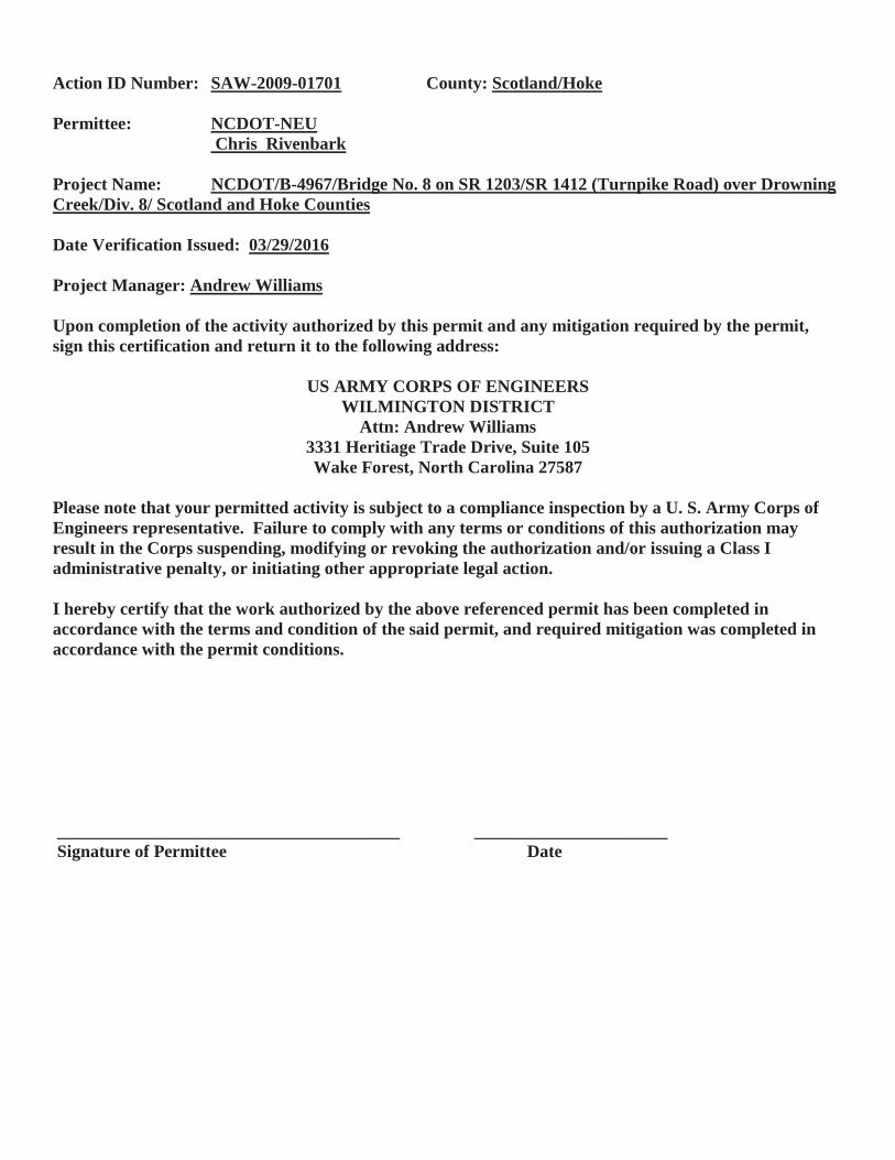
Action ID Number: SAW-2009-01701 County: Scotland/Hoke
Permittee: NCDOT-NEUChris Rivenbark
Project Name: NCDOT/B-4967/Bridge No. 8 on SR 1203/SR 1412 (Turnpike Road) over Drowning Creek/Div. 8/ Scotland and Hoke Counties
Date Verification Issued: 03/29/2016
Project Manager: Andrew Williams
Upon completion of the activity authorized by this permit and any mitigation required by the permit, sign this certification and return it to the following address:
US ARMY CORPS OF ENGINEERSWILMINGTON DISTRICT
Attn: Andrew Williams3331 Heritiage Trade Drive, Suite 105Wake Forest, North Carolina 27587
Please note that your permitted activity is subject to a compliance inspection by a U. S. Army Corps of Engineers representative. Failure to comply with any terms or conditions of this authorization may result in the Corps suspending, modifying or revoking the authorization and/or issuing a Class I administrative penalty, or initiating other appropriate legal action.
I hereby certify that the work authorized by the above referenced permit has been completed in accordance with the terms and condition of the said permit, and required mitigation was completed in accordance with the permit conditions.
_______________________________________ ______________________Signature of Permittee Date

State of North Carolina | Department of Transportation | PDEA-Natural Environment Section 1020 Birch Ridge Drive, 27610 | 1598 Mail Service Center | Raleigh, North Carolina 27699-1598
919-707-6000 T 919-212-5785 F
November 30, 2015 Mr. Andy Williams U.S. Army Corps of Engineers Regulatory Field Office 3331 Heritage Trade Drive, Suite 105 Wake Forest, NC 27587 Dear Mr. Williams: Subject: Additional information regarding the replacement of Bridge No. 8 over
Drowning Creek on SR 1203/1412 (Turnpike Road), Hoke and Scotland Counties, North Carolina. Federal Aid Project No. BRZ-1203(2), TIP Project B-4967.
Reference: National Park Service letter to the U.S. Army Corps of Engineers dated
November 4, 2015 As you are aware, the North Carolina Department of Transportation (NCDOT) proposes to replace the existing Bridge No. 8 over Drowning Creek on SR 1203/1412 (Turnpike Road) in Hoke and Scotland Counties, North Carolina. NCDOT has received a copy of the November 4, 2015 letter from the National Park Service (NPS) to the U.S. Army Corps of Engineers requesting additional information about the proposed bridge. The existing Bridge No. 8 was built in 1951, and is considered in poor condition and structurally deficient with a sufficiency rating of 27.46 out of 100 for a new structure. This project is scheduled to be let for construction on June 21, 2016 due to its age and deteriorated condition. Specifically, the NPS requested additional information regarding 1) justification for placement of bridge abutments (i.e. width of the new span), 2) a description of impact avoidance measures associated with the removal of the old span, 3) a description of how the bridge design and aesthetics minimize the contrast of the structure with the surrounding environment, and 4) an evaluation of the potential recreational access to the river. These issues are addressed below: 1) Bridge abutment placement: The existing bridge is a 6 span structure (6 @ 35' - overall
length=210'). Presently there are 3 bents within the normal water surface/ordinary high water. The new bridge will be a 3 span structure (1 @ 70'; 1 @ 85'; 1 @ 70' box beam - overall length=225') and will have no bents within the normal water surface. Based on modeling the new bridge will result in minimal impact to backwater with slight decreases in 10, 25, and 100 yr storm events.
2) Impact avoidance measure associated with demolition: The existing bridge has a timber deck. Demolition will involve removal of the exiting beams, and under normal BMP’s very little if


State of North Carolina | Department of Transportation | PDEA-Natural Environment Section 1020 Birch Ridge Drive, 27610 | 1598 Mail Service Center | Raleigh, North Carolina 27699-1598
919-707-6000 T 919-212-5785 F
February 19, 2016 Jeffrey R. Duncan, PhD National Park Service‐Southeast Region Fisheries and Aquatic Resources 535 Chestnut St. Suite 207 Chattanooga, TN 37402 423‐987‐6127 Reference: Replacement of Hoke County Bridge No. 8, SR 1412/1203 (Turnpike Road/Horace Waiter Road) over the Lumber River (Drowning Creek); STIP# B‐4967 Dr. Duncan, The North Carolina Department of transportation (NCDOT) is proposing to replace Hoke County Bridge No. 8 that carries SR 1412/1203 (Turnpike/Horace Waiter Road) across Drowning Creek/Lumber River (STIP Project B‐4967). As part of this project NCDOT has submitted a Nationwide permit application to the US Army Corps of Engineers (USACE) under Section 404 of the Clean Water Act. The project site is located at the point where Drowning Creek transitions to become the Lumber River. Further, beginning at the bridge, the Lumber River is designated as Scenic under Section 7 of the Wild and Scenic Rivers Act. The National Parks Service (NPS) has requested as part of their Section 404 permit application that the NCDOT show that the construction of the new bridge will not jeopardize the qualities of the river that gained it its Scenic designation. Attached please find the NCDOT Bridge Survey & Hydraulic Design Report, Structure Design Plans, and the Field Analysis performed by a Registered Landscape Architect requested by the NPS. Together, they provide documentation that the proposed structure will not jeopardize the Lumber River’s Free‐Flowing Condition or the eight outstandingly remarkable values – Scenic; Recreational; Geological; Fish; Wildlife; Prehistoric; Historic; and Other (Botany) – on which this segment of the Lumber River gained its Scenic designation. NCDOT’s Bridge Survey Report details the hydraulic analysis of the proposed structure. The report shows that the construction of the new bridge will increase the total hydraulic opening at the bridge site for the calculated 100 year storm (Q100) from 1433 to 1545 square feet. This will be accomplished by excavating approximately 500 cubic yards of asphalt debris and some existing roadway embankment fill. Additionally the existing three interior bridge bents will be removed from the channel and/or the channel edge and be replaced with two interior bents located outside the normal wetted perimeter of the channel. Rip‐rap is proposed to protect both roadway embankment slopes of the new structure but is minimal in its extent and will be placed well outside the normal channel. Placement of this rip‐rap will provide bank stabilization during flood flows and ensure the integrity of existing channel geometry at, and downstream of, the bridge site. The proposed structure will therefore not inhibit the Lumber River’s Free‐Flowing Condition.


1
NATIONWIDE PERMIT 3
DEPARTMENT OF THE ARMY
CORPS OF ENGINEERS
FINAL NOTICE OF ISSUANCE AND MODIFICATION OF NATIONWIDE PERMITS
FEDERAL REGISTER
AUTHORIZED MARCH 19, 2012
Maintenance. (a) The repair, rehabilitation, or replacement of any previously authorized,
currently serviceable structure, or fill, or of any currently serviceable structure or fill authorized
by 33 CFR 330.3, provided that the structure or fill is not to be put to uses differing from those
uses specified or contemplated for it in the original permit or the most recently authorized
modification. Minor deviations in the structure's configuration or filled area, including those due
to changes in materials, construction techniques, requirements of other regulatory agencies, or
current construction codes or safety standards that are necessary to make the repair,
rehabilitation, or replacement are authorized. Any stream channel modification is limited to the
minimum necessary for the repair, rehabilitation, or replacement of the structure or fill; such
modifications, including the removal of material from the stream channel, must be immediately
adjacent to the project or within the boundaries of the structure or fill. This NWP also authorizes
the repair, rehabilitation, or replacement of those structures or fills destroyed or damaged by
storms, floods, fire or other discrete events, provided the repair, rehabilitation, or replacement is
commenced, or is under contract to commence, within two years of the date of their destruction
or damage. In cases of catastrophic events, such as hurricanes or tornadoes, this two-year limit
may be waived by the district engineer, provided the permittee can demonstrate funding,
contract, or other similar delays.
(b) This NWP also authorizes the removal of accumulated sediments and debris in the
vicinity of existing structures (e.g., bridges, culverted road crossings, water intake structures,
etc.) and/or the placement of new or additional riprap to protect the structure. The removal of
sediment is limited to the minimum necessary to restore the waterway in the vicinity of the
structure to the approximate dimensions that existed when the structure was built, but cannot
extend farther than 200 feet in any direction from the structure. This 200 foot limit does not
apply to maintenance dredging to remove accumulated sediments blocking or restricting outfall
and intake structures or to maintenance dredging to remove accumulated sediments from canals
associated with outfall and intake structures. All dredged or excavated materials must be
deposited and retained in an area that has no waters of the United States unless otherwise
specifically approved by the district engineer under separate authorization. The placement of
new or additional riprap must be the minimum necessary to protect the structure or to ensure the
safety of the structure. Any bank stabilization measures not directly associated with the structure
will require a separate authorization from the district engineer.
(c) This NWP also authorizes temporary structures, fills, and work necessary to conduct
the maintenance activity. Appropriate measures must be taken to maintain normal downstream
flows and minimize flooding to the maximum extent practicable, when temporary structures,
work, and discharges, including cofferdams, are necessary for construction activities, access fills,
or dewatering of construction sites. Temporary fills must consist of materials, and be placed in a
manner, that will not be eroded by expected high flows. Temporary fills must be removed in

2
their entirety and the affected areas returned to pre-construction elevations. The areas affected by
temporary fills must be revegetated, as appropriate.
(d) This NWP does not authorize maintenance dredging for the primary purpose of
navigation. This NWP does not authorize beach restoration. This NWP does not authorize new
stream channelization or stream relocation projects.
Notification: For activities authorized by paragraph (b) of this NWP, the permittee must
submit a pre-construction notification to the district engineer prior to commencing the activity
(see general condition 31). The pre-construction notification must include information regarding
the original design capacities and configurations of the outfalls, intakes, small impoundments,
and canals. (Sections 10 and 404)
Note: This NWP authorizes the repair, rehabilitation, or replacement of any previously
authorized structure or fill that does not qualify for the Clean Water Act Section 404(f)
exemption for maintenance.
3
NATIONWIDE PERMIT CONDITIONS
The following General Conditions must be followed in order for any authorization by a NWP to
be valid:
1. Navigation. (a) No activity may cause more than a minimal adverse effect on
navigation.
(b) Any safety lights and signals prescribed by the U.S. Coast Guard, through regulations
or otherwise, must be installed and maintained at the permittee's expense on authorized facilities
in navigable waters of the United States.
(c) The permittee understands and agrees that, if future operations by the United States
require the removal, relocation, or other alteration, of the structure or work herein authorized, or
if, in the opinion of the Secretary of the Army or his authorized representative, said structure or
work shall cause unreasonable obstruction to the free navigation of the navigable waters, the
permittee will be required, upon due notice from the Corps of Engineers, to remove, relocate, or
alter the structural work or obstructions caused thereby, without expense to the United States. No
claim shall be made against the United States on account of any such removal or alteration.
2. Aquatic Life Movements. No activity may substantially disrupt the necessary life cycle
movements of those species of aquatic life indigenous to the waterbody, including those species
that normally migrate through the area, unless the activity's primary purpose is to impound
water. All permanent and temporary crossings of waterbodies shall be suitably culverted,
bridged, or otherwise designed and constructed to maintain low flows to sustain the movement of
those aquatic species.
3. Spawning Areas. Activities in spawning areas during spawning seasons must be
avoided to the maximum extent practicable. Activities that result in the physical destruction (e.g.,
through excavation, fill, or downstream smothering by substantial turbidity) of an important
spawning area are not authorized.
4. Migratory Bird Breeding Areas. Activities in waters of the United States that serve as
breeding areas for migratory birds must be avoided to the maximum extent practicable.
5. Shellfish Beds. No activity may occur in areas of concentrated shellfish populations,
unless the activity is directly related to a shellfish harvesting activity authorized by NWPs 4 and
48, or is a shellfish seeding or habitat restoration activity authorized by NWP 27.
6. Suitable Material. No activity may use unsuitable material (e.g., trash, debris, car
bodies, asphalt, etc.). Material used for construction or discharged must be free from toxic
pollutants in toxic amounts (see Section 307 of the Clean Water Act).
7. Water Supply Intakes. No activity may occur in the proximity of a public water supply
intake, except where the activity is for the repair or improvement of public water supply intake
structures or adjacent bank stabilization.

4
8. Adverse Effects From Impoundments. If the activity creates an impoundment of water,
adverse effects to the aquatic system due to accelerating the passage of water, and/or restricting
its flow must be minimized to the maximum extent practicable.
9. Management of Water Flows. To the maximum extent practicable, the pre-construction
course, condition, capacity, and location of open waters must be maintained for each activity,
including stream channelization and storm water management activities, except as provided
below. The activity must be constructed to withstand expected high flows. The activity must not
restrict or impede the passage of normal or high flows, unless the primary purpose of the activity
is to impound water or manage high flows. The activity may alter the pre-construction course,
condition, capacity, and location of open waters if it benefits the aquatic environment (e.g.,
stream restoration or relocation activities).
10. Fills Within 100-Year Floodplains. The activity must comply with applicable FEMA-
approved state or local floodplain management requirements.
11. Equipment. Heavy equipment working in wetlands or mudflats must be placed on
mats, or other measures must be taken to minimize soil disturbance.
12. Soil Erosion and Sediment Controls. Appropriate soil erosion and sediment controls
must be used and maintained in effective operating condition during construction, and all
exposed soil and other fills, as well as any work below the ordinary high water mark or high tide
line, must be permanently stabilized at the earliest practicable date. Permittees are encouraged to
perform work within waters of the United States during periods of low-flow or no-flow.
13. Removal of Temporary Fills. Temporary fills must be removed in their entirety and
the affected areas returned to pre-construction elevations. The affected areas must be
revegetated, as appropriate.
14. Proper Maintenance. Any authorized structure or fill shall be properly maintained,
including maintenance to ensure public safety and compliance with applicable NWP general
conditions, as well as any activity-specific conditions added by the district engineer to an NWP
authorization.
15. Single and Complete Project. The activity must be a single and complete project. The
same NWP cannot be used more than once for the same single and complete project.
16. Wild and Scenic Rivers. No activity may occur in a component of the National Wild
and Scenic River System, or in a river officially designated by Congress as a “study river” for
possible inclusion in the system while the river is in an official study status, unless the
appropriate Federal agency with direct management responsibility for such river, has determined
in writing that the proposed activity will not adversely affect the Wild and Scenic River
designation or study status. Information on Wild and Scenic Rivers may be obtained from the
appropriate Federal land management agency responsible for the designated Wild and Scenic
River or study river (e.g., National Park Service, U.S. Forest Service, Bureau of Land
Management, U.S. Fish and Wildlife Service).

5
17. Tribal Rights. No activity or its operation may impair reserved tribal rights, including,
but not limited to, reserved water rights and treaty fishing and hunting rights.
18. Endangered Species. (a) No activity is authorized under any NWP which is likely to
directly or indirectly jeopardize the continued existence of a threatened or endangered species or
a species proposed for such designation, as identified under the Federal Endangered Species Act
(ESA), or which will directly or indirectly destroy or adversely modify the critical habitat of such
species. No activity is authorized under any NWP which “may affect” a listed species or critical
habitat, unless Section 7 consultation addressing the effects of the proposed activity has been
completed.
(b) Federal agencies should follow their own procedures for complying with the
requirements of the ESA. Federal permittees must provide the district engineer with the
appropriate documentation to demonstrate compliance with those requirements. The district
engineer will review the documentation and determine whether it is sufficient to address ESA
compliance for the NWP activity, or whether additional ESA consultation is necessary.
(c) Non-federal permittees must submit a pre-construction notification to the district
engineer if any listed species or designated critical habitat might be affected or is in the vicinity
of the project, or if the project is located in designated critical habitat, and shall not begin work
on the activity until notified by the district engineer that the requirements of the ESA have been
satisfied and that the activity is authorized. For activities that might affect Federally-listed
endangered or threatened species or designated critical habitat, the pre-construction notification
must include the name(s) of the endangered or threatened species that might be affected by the
proposed work or that utilize the designated critical habitat that might be affected by the
proposed work. The district engineer will determine whether the proposed activity “may affect”
or will have “no effect” to listed species and designated critical habitat and will notify the non-
Federal applicant of the Corps’ determination within 45 days of receipt of a complete pre-
construction notification. In cases where the non-Federal applicant has identified listed species or
critical habitat that might be affected or is in the vicinity of the project, and has so notified the
Corps, the applicant shall not begin work until the Corps has provided notification the proposed
activities will have “no effect” on listed species or critical habitat, or until Section 7 consultation
has been completed. If the non-Federal applicant has not heard back from the Corps within 45
days, the applicant must still wait for notification from the Corps.
(d) As a result of formal or informal consultation with the FWS or NMFS the district
engineer may add species-specific regional endangered species conditions to the NWPs.
(e) Authorization of an activity by a NWP does not authorize the “take” of a threatened or
endangered species as defined under the ESA. In the absence of separate authorization (e.g., an
ESA Section 10 Permit, a Biological Opinion with “incidental take” provisions, etc.) from the
U.S. FWS or the NMFS, The Endangered Species Act prohibits any person subject to the
jurisdiction of the United States to take a listed species, where "take" means to harass, harm,
pursue, hunt, shoot, wound, kill, trap, capture, or collect, or to attempt to engage in any such
conduct. The word “harm” in the definition of “take'' means an act which actually kills or injures
wildlife. Such an act may include significant habitat modification or degradation where it
actually kills or injures wildlife by significantly impairing essential behavioral patterns,
including breeding, feeding or sheltering.
6
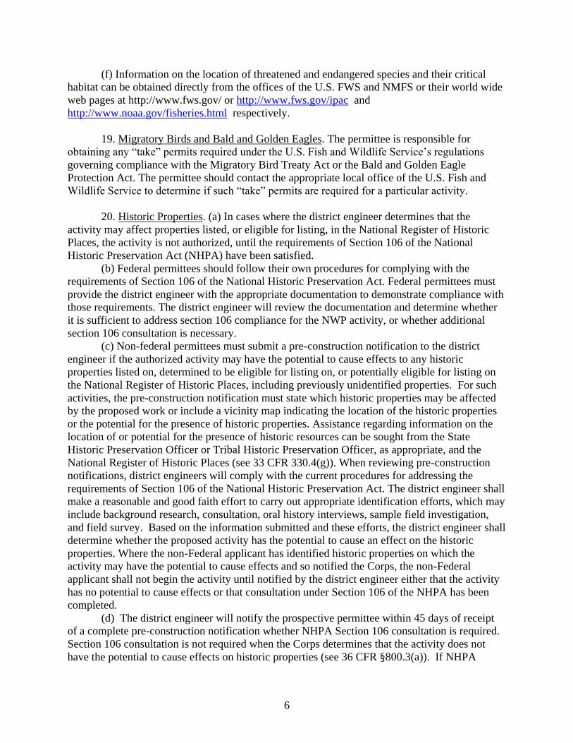
(f) Information on the location of threatened and endangered species and their critical
habitat can be obtained directly from the offices of the U.S. FWS and NMFS or their world wide
web pages at http://www.fws.gov/ or http://www.fws.gov/ipac and
http://www.noaa.gov/fisheries.html respectively.
19. Migratory Birds and Bald and Golden Eagles. The permittee is responsible for
obtaining any “take” permits required under the U.S. Fish and Wildlife Service’s regulations
governing compliance with the Migratory Bird Treaty Act or the Bald and Golden Eagle
Protection Act. The permittee should contact the appropriate local office of the U.S. Fish and
Wildlife Service to determine if such “take” permits are required for a particular activity.
20. Historic Properties. (a) In cases where the district engineer determines that the
activity may affect properties listed, or eligible for listing, in the National Register of Historic
Places, the activity is not authorized, until the requirements of Section 106 of the National
Historic Preservation Act (NHPA) have been satisfied.
(b) Federal permittees should follow their own procedures for complying with the
requirements of Section 106 of the National Historic Preservation Act. Federal permittees must
provide the district engineer with the appropriate documentation to demonstrate compliance with
those requirements. The district engineer will review the documentation and determine whether
it is sufficient to address section 106 compliance for the NWP activity, or whether additional
section 106 consultation is necessary.
(c) Non-federal permittees must submit a pre-construction notification to the district
engineer if the authorized activity may have the potential to cause effects to any historic
properties listed on, determined to be eligible for listing on, or potentially eligible for listing on
the National Register of Historic Places, including previously unidentified properties. For such
activities, the pre-construction notification must state which historic properties may be affected
by the proposed work or include a vicinity map indicating the location of the historic properties
or the potential for the presence of historic properties. Assistance regarding information on the
location of or potential for the presence of historic resources can be sought from the State
Historic Preservation Officer or Tribal Historic Preservation Officer, as appropriate, and the
National Register of Historic Places (see 33 CFR 330.4(g)). When reviewing pre-construction
notifications, district engineers will comply with the current procedures for addressing the
requirements of Section 106 of the National Historic Preservation Act. The district engineer shall
make a reasonable and good faith effort to carry out appropriate identification efforts, which may
include background research, consultation, oral history interviews, sample field investigation,
and field survey. Based on the information submitted and these efforts, the district engineer shall
determine whether the proposed activity has the potential to cause an effect on the historic
properties. Where the non-Federal applicant has identified historic properties on which the
activity may have the potential to cause effects and so notified the Corps, the non-Federal
applicant shall not begin the activity until notified by the district engineer either that the activity
has no potential to cause effects or that consultation under Section 106 of the NHPA has been
completed.
(d) The district engineer will notify the prospective permittee within 45 days of receipt
of a complete pre-construction notification whether NHPA Section 106 consultation is required.
Section 106 consultation is not required when the Corps determines that the activity does not
have the potential to cause effects on historic properties (see 36 CFR §800.3(a)). If NHPA

7
section 106 consultation is required and will occur, the district engineer will notify the non-
Federal applicant that he or she cannot begin work until Section 106 consultation is completed. If
the non-Federal applicant has not heard back from the Corps within 45 days, the applicant must
still wait for notification from the Corps.
(e) Prospective permittees should be aware that section 110k of the NHPA (16 U.S.C.
470h-2(k)) prevents the Corps from granting a permit or other assistance to an applicant who,
with intent to avoid the requirements of Section 106 of the NHPA, has intentionally significantly
adversely affected a historic property to which the permit would relate, or having legal power to
prevent it, allowed such significant adverse effect to occur, unless the Corps, after consultation
with the Advisory Council on Historic Preservation (ACHP), determines that circumstances
justify granting such assistance despite the adverse effect created or permitted by the applicant.
If circumstances justify granting the assistance, the Corps is required to notify the ACHP and
provide documentation specifying the circumstances, the degree of damage to the integrity of
any historic properties affected, and proposed mitigation. This documentation must include any
views obtained from the applicant, SHPO/THPO, appropriate Indian tribes if the undertaking
occurs on or affects historic properties on tribal lands or affects properties of interest to those
tribes, and other parties known to have a legitimate interest in the impacts to the permitted
activity on historic properties.
21. Discovery of Previously Unknown Remains and Artifacts. If you discover any
previously unknown historic, cultural or archeological remains and artifacts while accomplishing
the activity authorized by this permit, you must immediately notify the district engineer of what
you have found, and to the maximum extent practicable, avoid construction activities that may
affect the remains and artifacts until the required coordination has been completed. The district
engineer will initiate the Federal, Tribal and state coordination required to determine if the items
or remains warrant a recovery effort or if the site is eligible for listing in the National Register of
Historic Places.
22. Designated Critical Resource Waters. Critical resource waters include, NOAA-
managed marine sanctuaries and marine monuments, and National Estuarine Research Reserves.
The district engineer may designate, after notice and opportunity for public comment, additional
waters officially designated by a state as having particular environmental or ecological
significance, such as outstanding national resource waters or state natural heritage sites. The
district engineer may also designate additional critical resource waters after notice and
opportunity for public comment.
(a) Discharges of dredged or fill material into waters of the United States are not
authorized by NWPs 7, 12, 14, 16, 17, 21, 29, 31, 35, 39, 40, 42, 43, 44, 49, 50, 51, and 52 for
any activity within, or directly affecting, critical resource waters, including wetlands adjacent to
such waters.
(b) For NWPs 3, 8, 10, 13, 15, 18, 19, 22, 23, 25, 27, 28, 30, 33, 34, 36, 37, and 38,
notification is required in accordance with general condition 31, for any activity proposed in the
designated critical resource waters including wetlands adjacent to those waters. The district
engineer may authorize activities under these NWPs only after it is determined that the impacts
to the critical resource waters will be no more than minimal.

8
23. Mitigation. The district engineer will consider the following factors when
determining appropriate and practicable mitigation necessary to ensure that adverse effects on
the aquatic environment are minimal:
(a) The activity must be designed and constructed to avoid and minimize adverse effects,
both temporary and permanent, to waters of the United States to the maximum extent practicable
at the project site (i.e., on site).
(b) Mitigation in all its forms (avoiding, minimizing, rectifying, reducing, or
compensating for resource losses) will be required to the extent necessary to ensure that the
adverse effects to the aquatic environment are minimal.
(c) Compensatory mitigation at a minimum one-for-one ratio will be required for all
wetland losses that exceed 1/10-acre and require pre-construction notification, unless the district
engineer determines in writing that either some other form of mitigation would be more
environmentally appropriate or the adverse effects of the proposed activity are minimal, and
provides a project-specific waiver of this requirement. For wetland losses of 1/10-acre or less
that require pre-construction notification, the district engineer may determine on a case-by-case
basis that compensatory mitigation is required to ensure that the activity results in minimal
adverse effects on the aquatic environment. Compensatory mitigation projects provided to offset
losses of aquatic resources must comply with the applicable provisions of 33 CFR part 332.
(1) The prospective permittee is responsible for proposing an appropriate compensatory
mitigation option if compensatory mitigation is necessary to ensure that the activity results in
minimal adverse effects on the aquatic environment.
(2) Since the likelihood of success is greater and the impacts to potentially valuable
uplands are reduced, wetland restoration should be the first compensatory mitigation option
considered.
(3) If permittee-responsible mitigation is the proposed option, the prospective permittee is
responsible for submitting a mitigation plan. A conceptual or detailed mitigation plan may be
used by the district engineer to make the decision on the NWP verification request, but a final
mitigation plan that addresses the applicable requirements of 33 CFR 332.4(c)(2) – (14) must be
approved by the district engineer before the permittee begins work in waters of the United States,
unless the district engineer determines that prior approval of the final mitigation plan is not
practicable or not necessary to ensure timely completion of the required compensatory mitigation
(see 33 CFR 332.3(k)(3)).
(4) If mitigation bank or in-lieu fee program credits are the proposed option, the
mitigation plan only needs to address the baseline conditions at the impact site and the number of
credits to be provided.
(5) Compensatory mitigation requirements (e.g., resource type and amount to be provided
as compensatory mitigation, site protection, ecological performance standards, monitoring
requirements) may be addressed through conditions added to the NWP authorization, instead of
components of a compensatory mitigation plan.
(d) For losses of streams or other open waters that require pre-construction notification,
the district engineer may require compensatory mitigation, such as stream rehabilitation,
enhancement, or preservation, to ensure that the activity results in minimal adverse effects on the
aquatic environment.
(e) Compensatory mitigation will not be used to increase the acreage losses allowed by
the acreage limits of the NWPs. For example, if an NWP has an acreage limit of 1/2-acre, it
cannot be used to authorize any project resulting in the loss of greater than 1/2-acre of waters of

9
the United States, even if compensatory mitigation is provided that replaces or restores some of
the lost waters. However, compensatory mitigation can and should be used, as necessary, to
ensure that a project already meeting the established acreage limits also satisfies the minimal
impact requirement associated with the NWPs.
(f) Compensatory mitigation plans for projects in or near streams or other open waters
will normally include a requirement for the restoration or establishment, maintenance, and legal
protection (e.g., conservation easements) of riparian areas next to open waters. In some cases,
riparian areas may be the only compensatory mitigation required. Riparian areas should consist
of native species. The width of the required riparian area will address documented water quality
or aquatic habitat loss concerns. Normally, the riparian area will be 25 to 50 feet wide on each
side of the stream, but the district engineer may require slightly wider riparian areas to address
documented water quality or habitat loss concerns. If it is not possible to establish a riparian area
on both sides of a stream, or if the waterbody is a lake or coastal waters, then restoring or
establishing a riparian area along a single bank or shoreline may be sufficient. Where both
wetlands and open waters exist on the project site, the district engineer will determine the
appropriate compensatory mitigation (e.g., riparian areas and/or wetlands compensation) based
on what is best for the aquatic environment on a watershed basis. In cases where riparian areas
are determined to be the most appropriate form of compensatory mitigation, the district engineer
may waive or reduce the requirement to provide wetland compensatory mitigation for wetland
losses.
(g) Permittees may propose the use of mitigation banks, in-lieu fee programs, or separate
permittee-responsible mitigation. For activities resulting in the loss of marine or estuarine
resources, permittee-responsible compensatory mitigation may be environmentally preferable if
there are no mitigation banks or in-lieu fee programs in the area that have marine or estuarine
credits available for sale or transfer to the permittee. For permittee-responsible mitigation, the
special conditions of the NWP verification must clearly indicate the party or parties responsible
for the implementation and performance of the compensatory mitigation project, and, if required,
its long-term management.
(h) Where certain functions and services of waters of the United States are permanently
adversely affected, such as the conversion of a forested or scrub-shrub wetland to a herbaceous
wetland in a permanently maintained utility line right-of-way, mitigation may be required to
reduce the adverse effects of the project to the minimal level.
24. Safety of Impoundment Structures. To ensure that all impoundment structures are
safely designed, the district engineer may require non-Federal applicants to demonstrate that the
structures comply with established state dam safety criteria or have been designed by qualified
persons. The district engineer may also require documentation that the design has been
independently reviewed by similarly qualified persons, and appropriate modifications made to
ensure safety.
25. Water Quality. Where States and authorized Tribes, or EPA where applicable, have
not previously certified compliance of an NWP with CWA Section 401, individual 401 Water
Quality Certification must be obtained or waived (see 33 CFR 330.4(c)). The district engineer or
State or Tribe may require additional water quality management measures to ensure that the
authorized activity does not result in more than minimal degradation of water quality.

10
26. Coastal Zone Management. In coastal states where an NWP has not previously
received a state coastal zone management consistency concurrence, an individual state coastal
zone management consistency concurrence must be obtained, or a presumption of concurrence
must occur (see 33 CFR 330.4(d)). The district engineer or a State may require additional
measures to ensure that the authorized activity is consistent with state coastal zone management
requirements.
27. Regional and Case-By-Case Conditions. The activity must comply with any regional
conditions that may have been added by the Division Engineer (see 33 CFR 330.4(e)) and with
any case specific conditions added by the Corps or by the state, Indian Tribe, or U.S. EPA in its
section 401 Water Quality Certification, or by the state in its Coastal Zone Management Act
consistency determination.
28. Use of Multiple Nationwide Permits. The use of more than one NWP for a single and
complete project is prohibited, except when the acreage loss of waters of the United States
authorized by the NWPs does not exceed the acreage limit of the NWP with the highest specified
acreage limit. For example, if a road crossing over tidal waters is constructed under NWP 14,
with associated bank stabilization authorized by NWP 13, the maximum acreage loss of waters
of the United States for the total project cannot exceed 1/3-acre.
29. Transfer of Nationwide Permit Verifications. If the permittee sells the property
associated with a nationwide permit verification, the permittee may transfer the nationwide
permit verification to the new owner by submitting a letter to the appropriate Corps district office
to validate the transfer. A copy of the nationwide permit verification must be attached to the
letter, and the letter must contain the following statement and signature:
“When the structures or work authorized by this nationwide permit are still in existence at
the time the property is transferred, the terms and conditions of this nationwide permit, including
any special conditions, will continue to be binding on the new owner(s) of the property. To
validate the transfer of this nationwide permit and the associated liabilities associated with
compliance with its terms and conditions, have the transferee sign and date below.”
_____________________________________________
(Transferee)
_____________________________________________
(Date)
30. Compliance Certification. Each permittee who receives an NWP verification letter
from the Corps must provide a signed certification documenting completion of the authorized
activity and any required compensatory mitigation. The success of any required permittee-
responsible mitigation, including the achievement of ecological performance standards, will be
addressed separately by the district engineer. The Corps will provide the permittee the
certification document with the NWP verification letter. The certification document will
include:

11
(a) A statement that the authorized work was done in accordance with the NWP
authorization, including any general, regional, or activity-specific conditions;
(b) A statement that the implementation of any required compensatory mitigation was
completed in accordance with the permit conditions. If credits from a mitigation bank or in-lieu
fee program are used to satisfy the compensatory mitigation requirements, the certification must
include the documentation required by 33 CFR 332.3(l)(3) to confirm that the permittee secured
the appropriate number and resource type of credits; and
(c) The signature of the permittee certifying the completion of the work and mitigation.
31. Pre-Construction Notification. (a) Timing. Where required by the terms of the NWP,
the prospective permittee must notify the district engineer by submitting a pre-construction
notification (PCN) as early as possible. The district engineer must determine if the PCN is
complete within 30 calendar days of the date of receipt and, if the PCN is determined to be
incomplete, notify the prospective permittee within that 30 day period to request the additional
information necessary to make the PCN complete. The request must specify the information
needed to make the PCN complete. As a general rule, district engineers will request additional
information necessary to make the PCN complete only once. However, if the prospective
permittee does not provide all of the requested information, then the district engineer will notify
the prospective permittee that the PCN is still incomplete and the PCN review process will not
commence until all of the requested information has been received by the district engineer. The
prospective permittee shall not begin the activity until either:
(1) He or she is notified in writing by the district engineer that the activity may proceed
under the NWP with any special conditions imposed by the district or division engineer; or
(2) 45 calendar days have passed from the district engineer’s receipt of the complete PCN
and the prospective permittee has not received written notice from the district or division
engineer. However, if the permittee was required to notify the Corps pursuant to general
condition 18 that listed species or critical habitat might be affected or in the vicinity of the
project, or to notify the Corps pursuant to general condition 20 that the activity may have the
potential to cause effects to historic properties, the permittee cannot begin the activity until
receiving written notification from the Corps that there is “no effect” on listed species or “no
potential to cause effects” on historic properties, or that any consultation required under Section
7 of the Endangered Species Act (see 33 CFR 330.4(f)) and/or Section 106 of the National
Historic Preservation (see 33 CFR 330.4(g)) has been completed. Also, work cannot begin under
NWPs 21, 49, or 50 until the permittee has received written approval from the Corps. If the
proposed activity requires a written waiver to exceed specified limits of an NWP, the permittee
may not begin the activity until the district engineer issues the waiver. If the district or division
engineer notifies the permittee in writing that an individual permit is required within 45 calendar
days of receipt of a complete PCN, the permittee cannot begin the activity until an individual
permit has been obtained. Subsequently, the permittee’s right to proceed under the NWP may be
modified, suspended, or revoked only in accordance with the procedure set forth in 33 CFR
330.5(d)(2).
(b) Contents of Pre-Construction Notification: The PCN must be in writing and include
the following information:
(1) Name, address and telephone numbers of the prospective permittee;
(2) Location of the proposed project;

12
(3) A description of the proposed project; the project’s purpose; direct and indirect
adverse environmental effects the project would cause, including the anticipated amount of loss
of water of the United States expected to result from the NWP activity, in acres, linear feet, or
other appropriate unit of measure; any other NWP(s), regional general permit(s), or individual
permit(s) used or intended to be used to authorize any part of the proposed project or any related
activity. The description should be sufficiently detailed to allow the district engineer to
determine that the adverse effects of the project will be minimal and to determine the need for
compensatory mitigation. Sketches should be provided when necessary to show that the activity
complies with the terms of the NWP. (Sketches usually clarify the project and when provided
results in a quicker decision. Sketches should contain sufficient detail to provide an illustrative
description of the proposed activity (e.g., a conceptual plan), but do not need to be detailed
engineering plans);
(4) The PCN must include a delineation of wetlands, other special aquatic sites, and other
waters, such as lakes and ponds, and perennial, intermittent, and ephemeral streams, on the
project site. Wetland delineations must be prepared in accordance with the current method
required by the Corps. The permittee may ask the Corps to delineate the special aquatic sites and
other waters on the project site, but there may be a delay if the Corps does the delineation,
especially if the project site is large or contains many waters of the United States. Furthermore,
the 45 day period will not start until the delineation has been submitted to or completed by the
Corps, as appropriate;
(5) If the proposed activity will result in the loss of greater than 1/10-acre of wetlands and
a PCN is required, the prospective permittee must submit a statement describing how the
mitigation requirement will be satisfied, or explaining why the adverse effects are minimal and
why compensatory mitigation should not be required. As an alternative, the prospective
permittee may submit a conceptual or detailed mitigation plan.
(6) If any listed species or designated critical habitat might be affected or is in the vicinity
of the project, or if the project is located in designated critical habitat, for non-Federal applicants
the PCN must include the name(s) of those endangered or threatened species that might be
affected by the proposed work or utilize the designated critical habitat that may be affected by
the proposed work. Federal applicants must provide documentation demonstrating compliance
with the Endangered Species Act; and
(7) For an activity that may affect a historic property listed on, determined to be eligible
for listing on, or potentially eligible for listing on, the National Register of Historic Places, for
non-Federal applicants the PCN must state which historic property may be affected by the
proposed work or include a vicinity map indicating the location of the historic property. Federal
applicants must provide documentation demonstrating compliance with Section 106 of the
National Historic Preservation Act.
(c) Form of Pre-Construction Notification: The standard individual permit application
form (Form ENG 4345) may be used, but the completed application form must clearly indicate
that it is a PCN and must include all of the information required in paragraphs (b)(1) through (7)
of this general condition. A letter containing the required information may also be used.
(d) Agency Coordination: (1) The district engineer will consider any comments from
Federal and state agencies concerning the proposed activity’s compliance with the terms and
conditions of the NWPs and the need for mitigation to reduce the project’s adverse
environmental effects to a minimal level.

13
(2) For all NWP activities that require pre-construction notification and result in the loss
of greater than 1/2-acre of waters of the United States, for NWP 21, 29, 39, 40, 42, 43, 44, 50,
51, and 52 activities that require pre-construction notification and will result in the loss of greater
than 300 linear feet of intermittent and ephemeral stream bed, and for all NWP 48 activities that
require pre-construction notification, the district engineer will immediately provide (e.g., via e-
mail, facsimile transmission, overnight mail, or other expeditious manner) a copy of the
complete PCN to the appropriate Federal or state offices (U.S. FWS, state natural resource or
water quality agency, EPA, State Historic Preservation Officer (SHPO) or Tribal Historic
Preservation Office (THPO), and, if appropriate, the NMFS). With the exception of NWP 37,
these agencies will have 10 calendar days from the date the material is transmitted to telephone
or fax the district engineer notice that they intend to provide substantive, site-specific comments.
The comments must explain why the agency believes the adverse effects will be more than
minimal. If so contacted by an agency, the district engineer will wait an additional 15 calendar
days before making a decision on the pre-construction notification. The district engineer will
fully consider agency comments received within the specified time frame concerning the
proposed activity’s compliance with the terms and conditions of the NWPs, including the need
for mitigation to ensure the net adverse environmental effects to the aquatic environment of the
proposed activity are minimal. The district engineer will provide no response to the resource
agency, except as provided below. The district engineer will indicate in the administrative record
associated with each pre-construction notification that the resource agencies’ concerns were
considered. For NWP 37, the emergency watershed protection and rehabilitation activity may
proceed immediately in cases where there is an unacceptable hazard to life or a significant loss of
property or economic hardship will occur. The district engineer will consider any comments
received to decide whether the NWP 37 authorization should be modified, suspended, or revoked
in accordance with the procedures at 33 CFR 330.5.
(3) In cases of where the prospective permittee is not a Federal agency, the district
engineer will provide a response to NMFS within 30 calendar days of receipt of any Essential
Fish Habitat conservation recommendations, as required by Section 305(b)(4)(B) of the
Magnuson-Stevens Fishery Conservation and Management Act.
(4) Applicants are encouraged to provide the Corps with either electronic files or multiple
copies of pre-construction notifications to expedite agency coordination.
D. District Engineer’s Decision
1. In reviewing the PCN for the proposed activity, the district engineer will determine
whether the activity authorized by the NWP will result in more than minimal individual or
cumulative adverse environmental effects or may be contrary to the public interest. For a linear
project, this determination will include an evaluation of the individual crossings to determine
whether they individually satisfy the terms and conditions of the NWP(s), as well as the
cumulative effects caused by all of the crossings authorized by NWP. If an applicant requests a
waiver of the 300 linear foot limit on impacts to intermittent or ephemeral streams or of an
otherwise applicable limit, as provided for in NWPs 13, 21, 29, 36, 39, 40, 42, 43, 44, 50, 51 or
52, the district engineer will only grant the waiver upon a written determination that the NWP
activity will result in minimal adverse effects. When making minimal effects determinations the
district engineer will consider the direct and indirect effects caused by the NWP activity. The
district engineer will also consider site specific factors, such as the environmental setting in the

14
vicinity of the NWP activity, the type of resource that will be affected by the NWP activity, the
functions provided by the aquatic resources that will be affected by the NWP activity, the degree
or magnitude to which the aquatic resources perform those functions, the extent that aquatic
resource functions will be lost as a result of the NWP activity (e.g., partial or complete loss), the
duration of the adverse effects (temporary or permanent), the importance of the aquatic resource
functions to the region (e.g., watershed or ecoregion), and mitigation required by the district
engineer. If an appropriate functional assessment method is available and practicable to use, that
assessment method may be used by the district engineer to assist in the minimal adverse effects
determination. The district engineer may add case-specific special conditions to the NWP
authorization to address site-specific environmental concerns.
2. If the proposed activity requires a PCN and will result in a loss of greater than 1/10-
acre of wetlands, the prospective permittee should submit a mitigation proposal with the PCN.
Applicants may also propose compensatory mitigation for projects with smaller impacts. The
district engineer will consider any proposed compensatory mitigation the applicant has included
in the proposal in determining whether the net adverse environmental effects to the aquatic
environment of the proposed activity are minimal. The compensatory mitigation proposal may be
either conceptual or detailed. If the district engineer determines that the activity complies with
the terms and conditions of the NWP and that the adverse effects on the aquatic environment are
minimal, after considering mitigation, the district engineer will notify the permittee and include
any activity-specific conditions in the NWP verification the district engineer deems necessary.
Conditions for compensatory mitigation requirements must comply with the appropriate
provisions at 33 CFR 332.3(k). The district engineer must approve the final mitigation plan
before the permittee commences work in waters of the United States, unless the district engineer
determines that prior approval of the final mitigation plan is not practicable or not necessary to
ensure timely completion of the required compensatory mitigation. If the prospective permittee
elects to submit a compensatory mitigation plan with the PCN, the district engineer will
expeditiously review the proposed compensatory mitigation plan. The district engineer must
review the proposed compensatory mitigation plan within 45 calendar days of receiving a
complete PCN and determine whether the proposed mitigation would ensure no more than
minimal adverse effects on the aquatic environment. If the net adverse effects of the project on
the aquatic environment (after consideration of the compensatory mitigation proposal) are
determined by the district engineer to be minimal, the district engineer will provide a timely
written response to the applicant. The response will state that the project can proceed under the
terms and conditions of the NWP, including any activity-specific conditions added to the NWP
authorization by the district engineer.
3. If the district engineer determines that the adverse effects of the proposed work are
more than minimal, then the district engineer will notify the applicant either: (a) That the project
does not qualify for authorization under the NWP and instruct the applicant on the procedures to
seek authorization under an individual permit; (b) that the project is authorized under the NWP
subject to the applicant’s submission of a mitigation plan that would reduce the adverse effects
on the aquatic environment to the minimal level; or (c) that the project is authorized under the
NWP with specific modifications or conditions. Where the district engineer determines that
mitigation is required to ensure no more than minimal adverse effects occur to the aquatic
environment, the activity will be authorized within the 45-day PCN period, with activity-specific

15
conditions that state the mitigation requirements. The authorization will include the necessary
conceptual or detailed mitigation or a requirement that the applicant submit a mitigation plan that
would reduce the adverse effects on the aquatic environment to the minimal level. When
mitigation is required, no work in waters of the United States may occur until the district
engineer has approved a specific mitigation plan or has determined that prior approval of a final
mitigation plan is not practicable or not necessary to ensure timely completion of the required
compensatory mitigation.
FURTHER INFORMATION
1. District Engineers have authority to determine if an activity complies with the terms
and conditions of an NWP.
2. NWPs do not obviate the need to obtain other federal, state, or local permits,
approvals, or authorizations required by law.
3. NWPs do not grant any property rights or exclusive privileges.
4. NWPs do not authorize any injury to the property or rights of others.
5. NWPs do not authorize interference with any existing or proposed Federal project.
DEFINITIONS
Best management practices (BMPs): Policies, practices, procedures, or structures
implemented to mitigate the adverse environmental effects on surface water quality resulting
from development. BMPs are categorized as structural or non-structural.
Compensatory mitigation: The restoration (re-establishment or rehabilitation),
establishment (creation), enhancement, and/or in certain circumstances preservation of aquatic
resources for the purposes of offsetting unavoidable adverse impacts which remain after all
appropriate and practicable avoidance and minimization has been achieved.
Currently serviceable: Useable as is or with some maintenance, but not so degraded as to
essentially require reconstruction.
Direct effects: Effects that are caused by the activity and occur at the same time and
place.
Discharge: The term “discharge” means any discharge of dredged or fill material.
Enhancement: The manipulation of the physical, chemical, or biological characteristics of
an aquatic resource to heighten, intensify, or improve a specific aquatic resource function(s).
Enhancement results in the gain of selected aquatic resource function(s), but may also lead to a
decline in other aquatic resource function(s). Enhancement does not result in a gain in aquatic
resource area.
Ephemeral stream: An ephemeral stream has flowing water only during, and for a short
duration after, precipitation events in a typical year. Ephemeral stream beds are located above the
water table year-round. Groundwater is not a source of water for the stream. Runoff from rainfall
is the primary source of water for stream flow.
Establishment (creation): The manipulation of the physical, chemical, or biological
characteristics present to develop an aquatic resource that did not previously exist at an upland
site. Establishment results in a gain in aquatic resource area.
High Tide Line: The line of intersection of the land with the water’s surface at the
maximum height reached by a rising tide. The high tide line may be determined, in the absence
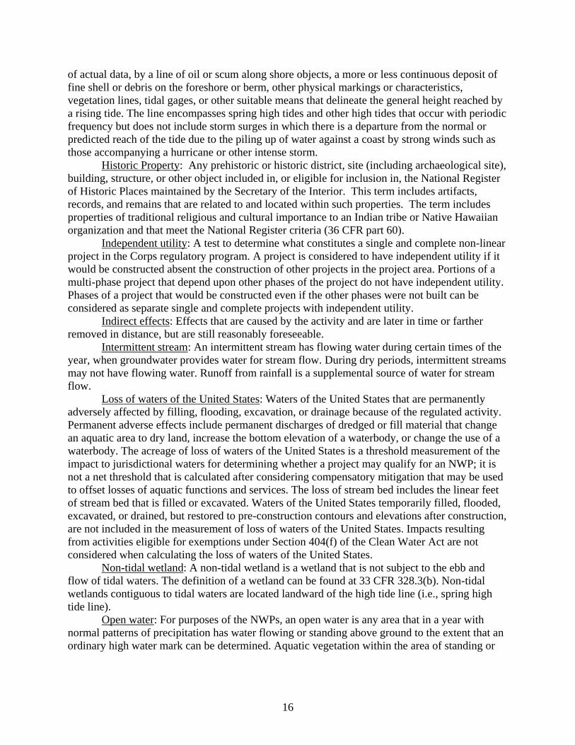
16
of actual data, by a line of oil or scum along shore objects, a more or less continuous deposit of
fine shell or debris on the foreshore or berm, other physical markings or characteristics,
vegetation lines, tidal gages, or other suitable means that delineate the general height reached by
a rising tide. The line encompasses spring high tides and other high tides that occur with periodic
frequency but does not include storm surges in which there is a departure from the normal or
predicted reach of the tide due to the piling up of water against a coast by strong winds such as
those accompanying a hurricane or other intense storm.
Historic Property: Any prehistoric or historic district, site (including archaeological site),
building, structure, or other object included in, or eligible for inclusion in, the National Register
of Historic Places maintained by the Secretary of the Interior. This term includes artifacts,
records, and remains that are related to and located within such properties. The term includes
properties of traditional religious and cultural importance to an Indian tribe or Native Hawaiian
organization and that meet the National Register criteria (36 CFR part 60).
Independent utility: A test to determine what constitutes a single and complete non-linear
project in the Corps regulatory program. A project is considered to have independent utility if it
would be constructed absent the construction of other projects in the project area. Portions of a
multi-phase project that depend upon other phases of the project do not have independent utility.
Phases of a project that would be constructed even if the other phases were not built can be
considered as separate single and complete projects with independent utility.
Indirect effects: Effects that are caused by the activity and are later in time or farther
removed in distance, but are still reasonably foreseeable.
Intermittent stream: An intermittent stream has flowing water during certain times of the
year, when groundwater provides water for stream flow. During dry periods, intermittent streams
may not have flowing water. Runoff from rainfall is a supplemental source of water for stream
flow.
Loss of waters of the United States: Waters of the United States that are permanently
adversely affected by filling, flooding, excavation, or drainage because of the regulated activity.
Permanent adverse effects include permanent discharges of dredged or fill material that change
an aquatic area to dry land, increase the bottom elevation of a waterbody, or change the use of a
waterbody. The acreage of loss of waters of the United States is a threshold measurement of the
impact to jurisdictional waters for determining whether a project may qualify for an NWP; it is
not a net threshold that is calculated after considering compensatory mitigation that may be used
to offset losses of aquatic functions and services. The loss of stream bed includes the linear feet
of stream bed that is filled or excavated. Waters of the United States temporarily filled, flooded,
excavated, or drained, but restored to pre-construction contours and elevations after construction,
are not included in the measurement of loss of waters of the United States. Impacts resulting
from activities eligible for exemptions under Section 404(f) of the Clean Water Act are not
considered when calculating the loss of waters of the United States.
Non-tidal wetland: A non-tidal wetland is a wetland that is not subject to the ebb and
flow of tidal waters. The definition of a wetland can be found at 33 CFR 328.3(b). Non-tidal
wetlands contiguous to tidal waters are located landward of the high tide line (i.e., spring high
tide line).
Open water: For purposes of the NWPs, an open water is any area that in a year with
normal patterns of precipitation has water flowing or standing above ground to the extent that an
ordinary high water mark can be determined. Aquatic vegetation within the area of standing or

17
flowing water is either non-emergent, sparse, or absent. Vegetated shallows are considered to be
open waters. Examples of “open waters” include rivers, streams, lakes, and ponds.
Ordinary High Water Mark: An ordinary high water mark is a line on the shore
established by the fluctuations of water and indicated by physical characteristics, or by other
appropriate means that consider the characteristics of the surrounding areas (see 33 CFR
328.3(e)).
Perennial stream: A perennial stream has flowing water year-round during a typical year.
The water table is located above the stream bed for most of the year. Groundwater is the primary
source of water for stream flow. Runoff from rainfall is a supplemental source of water for
stream flow.
Practicable: Available and capable of being done after taking into consideration cost,
existing technology, and logistics in light of overall project purposes.
Pre-construction notification: A request submitted by the project proponent to the Corps
for confirmation that a particular activity is authorized by nationwide permit. The request may be
a permit application, letter, or similar document that includes information about the proposed
work and its anticipated environmental effects. Pre-construction notification may be required by
the terms and conditions of a nationwide permit, or by regional conditions. A pre-construction
notification may be voluntarily submitted in cases where pre-construction notification is not
required and the project proponent wants confirmation that the activity is authorized by
nationwide permit.
Preservation: The removal of a threat to, or preventing the decline of, aquatic resources
by an action in or near those aquatic resources. This term includes activities commonly
associated with the protection and maintenance of aquatic resources through the implementation
of appropriate legal and physical mechanisms. Preservation does not result in a gain of aquatic
resource area or functions.
Re-establishment: The manipulation of the physical, chemical, or biological
characteristics of a site with the goal of returning natural/historic functions to a former aquatic
resource. Re-establishment results in rebuilding a former aquatic resource and results in a gain in
aquatic resource area and functions.
Rehabilitation: The manipulation of the physical, chemical, or biological characteristics
of a site with the goal of repairing natural/historic functions to a degraded aquatic resource.
Rehabilitation results in a gain in aquatic resource function, but does not result in a gain in
aquatic resource area.
Restoration: The manipulation of the physical, chemical, or biological characteristics of a
site with the goal of returning natural/historic functions to a former or degraded aquatic resource.
For the purpose of tracking net gains in aquatic resource area, restoration is divided into two
categories: re-establishment and rehabilitation.
Riffle and pool complex: Riffle and pool complexes are special aquatic sites under the
404(b)(1) Guidelines. Riffle and pool complexes sometimes characterize steep gradient sections
of streams. Such stream sections are recognizable by their hydraulic characteristics. The rapid
movement of water over a course substrate in riffles results in a rough flow, a turbulent surface,
and high dissolved oxygen levels in the water. Pools are deeper areas associated with riffles. A
slower stream velocity, a streaming flow, a smooth surface, and a finer substrate characterize
pools.
Riparian areas: Riparian areas are lands adjacent to streams, lakes, and estuarine-marine
shorelines. Riparian areas are transitional between terrestrial and aquatic ecosystems, through

18
which surface and subsurface hydrology connects riverine, lacustrine, estuarine, and marine
waters with their adjacent wetlands, non-wetland waters, or uplands. Riparian areas provide a
variety of ecological functions and services and help improve or maintain local water quality.
(See general condition 23.)
Shellfish seeding: The placement of shellfish seed and/or suitable substrate to increase
shellfish production. Shellfish seed consists of immature individual shellfish or individual
shellfish attached to shells or shell fragments (i.e., spat on shell). Suitable substrate may consist
of shellfish shells, shell fragments, or other appropriate materials placed into waters for shellfish
habitat.
Single and complete linear project: A linear project is a project constructed for the
purpose of getting people, goods, or services from a point of origin to a terminal point, which
often involves multiple crossings of one or more waterbodies at separate and distant locations.
The term “single and complete project” is defined as that portion of the total linear project
proposed or accomplished by one owner/developer or partnership or other association of
owners/developers that includes all crossings of a single water of the United States (i.e., a single
waterbody) at a specific location. For linear projects crossing a single or multiple waterbodies
several times at separate and distant locations, each crossing is considered a single and complete
project for purposes of NWP authorization. However, individual channels in a braided stream or
river, or individual arms of a large, irregularly shaped wetland or lake, etc., are not separate
waterbodies, and crossings of such features cannot be considered separately.
Single and complete non-linear project: For non-linear projects, the term “single and
complete project” is defined at 33 CFR 330.2(i) as the total project proposed or accomplished by
one owner/developer or partnership or other association of owners/developers. A single and
complete non-linear project must have independent utility (see definition of “independent
utility”). Single and complete non-linear projects may not be “piecemealed” to avoid the limits
in an NWP authorization.
Stormwater management: Stormwater management is the mechanism for controlling
stormwater runoff for the purposes of reducing downstream erosion, water quality degradation,
and flooding and mitigating the adverse effects of changes in land use on the aquatic
environment.
Stormwater management facilities: Stormwater management facilities are those facilities,
including but not limited to, stormwater retention and detention ponds and best management
practices, which retain water for a period of time to control runoff and/or improve the quality
(i.e., by reducing the concentration of nutrients, sediments, hazardous substances and other
pollutants) of stormwater runoff.
Stream bed: The substrate of the stream channel between the ordinary high water marks.
The substrate may be bedrock or inorganic particles that range in size from clay to boulders.
Wetlands contiguous to the stream bed, but outside of the ordinary high water marks, are not
considered part of the stream bed.
Stream channelization: The manipulation of a stream’s course, condition, capacity, or
location that causes more than minimal interruption of normal stream processes. A channelized
stream remains a water of the United States.
Structure: An object that is arranged in a definite pattern of organization. Examples of
structures include, without limitation, any pier, boat dock, boat ramp, wharf, dolphin, weir,
boom, breakwater, bulkhead, revetment, riprap, jetty, artificial island, artificial reef, permanent
19
mooring structure, power transmission line, permanently moored floating vessel, piling, aid to
navigation, or any other manmade obstacle or obstruction.
Tidal wetland: A tidal wetland is a wetland (i.e., water of the United States) that is
inundated by tidal waters. The definitions of a wetland and tidal waters can be found at 33 CFR
328.3(b) and 33 CFR 328.3(f), respectively. Tidal waters rise and fall in a predictable and
measurable rhythm or cycle due to the gravitational pulls of the moon and sun. Tidal waters end
where the rise and fall of the water surface can no longer be practically measured in a predictable
rhythm due to masking by other waters, wind, or other effects. Tidal wetlands are located
channelward of the high tide line, which is defined at 33 CFR 328.3(d).
Vegetated shallows: Vegetated shallows are special aquatic sites under the 404(b)(1)
Guidelines. They are areas that are permanently inundated and under normal circumstances have
rooted aquatic vegetation, such as seagrasses in marine and estuarine systems and a variety of
vascular rooted plants in freshwater systems.
Waterbody: For purposes of the NWPs, a waterbody is a jurisdictional water of the
United States. If a jurisdictional wetland is adjacent – meaning bordering, contiguous, or
neighboring – to a waterbody determined to be a water of the United States under 33 CFR
328.3(a)(1)-(6), that waterbody and its adjacent wetlands are considered together as a single
aquatic unit (see 33 CFR 328.4(c)(2)). Examples of “waterbodies” include streams, rivers, lakes,
ponds, and wetlands.

20
Final Regional Conditions 2012
NOTICE ABOUT WEB LINKS IN THIS DOCUMENT:
The web links (both internal to our District and any external links to collaborating agencies) in
this document are valid at the time of publication. However, the Wilmington District Regulatory
Program web page addresses, as with other agency web sites, may change over the timeframe of
the five-year Nationwide Permit renewal cycle, in response to policy mandates or technology
advances. While we will make every effort to check on the integrity of our web links and provide
re-direct pages whenever possible, we ask that you report any broken links to us so we can keep
the page information current and usable. We apologize in advanced for any broken links that
you may encounter, and we ask that you navigate from the regulatory home page (wetlands and
stream permits) of the Wilmington District Corps of Engineers, to the “Permits” section of our
web site to find links for pages that cannot be found by clicking directly on the listed web link in
this document.
Final 2012 Regional Conditions for Nationwide Permits (NWP) in the
Wilmington District
1.0 Excluded Waters
The Corps has identified waters that will be excluded from the use of all NWP’s during certain
timeframes. These waters are:
1.1 Anadromous Fish Spawning Areas
Waters of the United States identified by either the North Carolina Division of Marine Fisheries
(NCDMF) or the North Carolina Wildlife Resources Commission (NCWRC) as anadromous fish
spawning areas are excluded during the period between February 15 and June 30, without prior
written approval from NCDMF or NCWRC and the Corps.
1.2 Trout Waters Moratorium
Waters of the United States in the twenty-five designated trout counties of North Carolina are
excluded during the period between October 15 and April 15 without prior written approval from
the NCWRC. (See Section 2.7 for a list of the twenty-five trout counties).
1.3 Sturgeon Spawning Areas as Designated by the National Marine Fisheries Service
(NMFS)
Waters of the United States designated as sturgeon spawning areas are excluded during the
period between February 1 and June 30, without prior written approval from the NMFS.
21
2.0 Waters Requiring Additional Notification
The Corps has identified waters that will be subject to additional notification requirements for
activities authorized by all NWP’s. These waters are:
2.1 Western NC Counties that Drain to Designated Critical Habitat
For proposed activities within Waters of the U.S. that require a Pre-Construction Notification
pursuant to General Condition 31 (PCN) and are located in the sixteen counties listed below,
applicants must provide a copy of the PCN to the US Fish and Wildlife Service, 160 Zillicoa
Street, Asheville, North Carolina 28801. This PCN must be sent concurrently to the US Fish and
Wildlife Service and the Corps Asheville Regulatory Field Office. Please see General Condition
18 for specific notification requirements related to Federally Endangered Species and the
following website for information on the location of designated critical habitat.
Counties with tributaries that drain to designated critical habitat that require notification to the
Asheville US Fish and Wildlife Service: Avery, Cherokee, Forsyth, Graham, Haywood,
Henderson, Jackson, Macon Mecklenburg, Mitchell, Stokes, Surry, Swain, Transylvania, Union
and Yancey.
Website and office addresses for Endangered Species Act Information:
The Wilmington District has developed the following website for applicants which provides
guidelines on how to review linked websites and maps in order to fulfill NWP general condition
18 requirements: http://www.saw.usace.army.mil/wetlands/ESA
Applicants who do not have internet access may contact the appropriate US Fish and Wildlife
Service offices listed below or the US Army Corps of Engineers at (910) 251- 4633:
US Fish and Wildlife Service
Asheville Field Office
160 Zillicoa Street
Asheville, NC 28801
Telephone: (828) 258-3939
Asheville US Fish and Wildlife Service Office counties: All
counties west of and including Anson, Stanly, Davidson, Forsyth and Stokes Counties
US Fish and Wildlife Service
Raleigh Field Office
Post Office Box 33726
Raleigh, NC 27636-3726
Telephone: (919) 856-4520
Raleigh US Fish and Wildlife Service Office counties: all counties east of and including
Richmond, Montgomery, Randolph, Guilford, and Rockingham Counties.

22
2.2 Special Designation Waters
Prior to the use of any NWP in any of the following identified waters and contiguous wetlands in
North Carolina, applicants must comply with Nationwide Permit General Condition 31 (PCN).
The North Carolina waters and contiguous wetlands that require additional notification
requirements are:
“Outstanding Resource Waters” (ORW) or “High Quality Waters” (HQW) as designated by the
North Carolina Environmental Management Commission; “Inland Primary Nursery Areas”
(IPNA) as designated by the NCWRC; “Contiguous Wetlands” as defined by the North Carolina
Environmental Management Commission; or “Primary Nursery Areas” (PNA) as designated by
the North Carolina Marine Fisheries Commission.
2.3 Coastal Area Management Act (CAMA) Areas of Environmental Concern
Non-federal applicants for any NWP in a designated “Area of Environmental Concern” (AEC) in
the twenty (20) counties of Eastern North Carolina covered by the North Carolina Coastal Area
Management Act (CAMA) must also obtain the required CAMA permit. Development activities
for non-federal projects may not commence until a copy of the approved CAMA permit is
furnished to the appropriate Wilmington District Regulatory Field Office (Wilmington Field
Office – 69 Darlington Avenue, Wilmington, NC 28403 or Washington Field Office – 2407
West 5th Street, Washington, NC 27889).
2.4 Barrier Islands
Prior to the use of any NWP on a barrier island of North Carolina, applicants must comply with
Nationwide Permit General Condition 31 (PCN).
2.5 Mountain or Piedmont Bogs
Prior to the use of any NWP in a Bog classified by the North Carolina Wetland Assessment
Methodology (NCWAM), applicants shall comply with Nationwide Permit General Condition 31
(PCN). The latest version of NCWAM is located on the NC DWQ web site at:
http://portal.ncdenr.org/web/wq/swp/ws/pdu/ncwam .
2.6 Animal Waste Facilities
Prior to use of any NWP for construction of animal waste facilities in waters of the US, including
wetlands, applicants shall comply with Nationwide Permit General Condition 31 (PCN).
2.7 Trout Waters
Prior to any discharge of dredge or fill material into streams or waterbodies within the twenty-
five (25) designated trout counties of North Carolina, the applicant shall comply with
Nationwide Permit General Condition 31 (PCN). The applicant shall also provide a copy of the
notification to the appropriate NCWRC office to facilitate the determination of any potential

23
impacts to designated Trout Waters. Notification to the Corps of Engineers will include a
statement with the name of the NCWRC biologist contacted, the date of the notification, the
location of work, a delineation of wetlands, a discussion of alternatives to working in the
mountain trout waters, why alternatives were not selected, and a plan to provide compensatory
mitigation for all unavoidable adverse impacts to mountain trout waters.
NCWRC and NC Trout Counties
Western Piedmont Region
Coordinator
Alleghany Caldwell Watauga
20830 Great Smoky Mtn.
Expressway
Ashe Mitchell Wilkes
Waynesville, NC 28786 Avery Stokes
Telephone: (828) 452-2546 Burke Surry
Mountain Region Coordinator Buncombe Henderson Polk
20830 Great Smoky Mtn.
Expressway
Cherokee Jackson Rutherford
Waynesville, NC 28786 Clay Macon Swain
Telephone: (828) 452-2546 Graham Madison Transylvania
Fax: (828) 452-7772 Haywood McDowell Yancey
3.0 List of Corps Regional Conditions for All Nationwide Permits
The following conditions apply to all Nationwide Permits in the Wilmington District:
3.1 Limitation of Loss of Perennial Stream Bed
NWPs may not be used for activities that may result in the loss or degradation of greater than
300 total linear feet of perennial, intermittent or ephemeral stream, unless the District
Commander has waived the 300 linear foot limit for ephemeral and intermittent streams on a
case-by-case basis and he determines that the proposed activity will result in minimal individual
and cumulative adverse impacts to the aquatic environment. Loss of stream includes the linear
feet of stream bed that is filled, excavated, or flooded by the proposed activity. Waivers for the
loss of ephemeral and intermittent streams must be in writing and documented by
appropriate/accepted stream quality assessments*. This waiver only applies to the 300 linear feet
threshold for NWPs.
*NOTE: Applicants should utilize the most current methodology prescribed by Wilmington
District to assess stream function and quality. Information can be found at:
http://www.saw.usace.army.mil/wetlands/permits/nwp/nwp2012 (see “Quick Links”)

24
3.2 Mitigation for Loss of Stream Bed
For any NWP that results in a loss of more than 150 linear feet of perennial and/or
ephemeral/intermittent stream, the applicant shall provide a mitigation proposal to compensate
for more than minimal individual and cumulative adverse impacts to the aquatic environment.
For stream losses less than 150 linear feet, that require a PCN, the District Commander may
determine, on a case-by-case basis that compensatory mitigation is required to ensure that the
activity results in minimal adverse effect on the aquatic environment.
3.3 Pre-construction Notification for Loss of Streambed Exceeding 150 Feet.
Prior to use of any NWP for any activity which impacts more than 150 total linear feet of
perennial stream or ephemeral/ intermittent stream, the applicant must comply with Nationwide
Permit General Condition 31 (PCN). This applies to NWPs that do not have specific notification
requirements. If a NWP has specific notification requirements, the requirements of the NWP
should be followed.
3.4 Restriction on Use of Live Concrete
For all NWPs which allow the use of concrete as a building material, live or fresh concrete,
including bags of uncured concrete, may not come into contact with the water in or entering into
waters of the US. Water inside coffer dams or casings that has been in contact with wet concrete
shall only be returned to waters of the US when it is no longer poses a threat to aquatic
organisms.
3.5 Requirements for Using Riprap for Bank Stabilization
For all NWPs that allow for the use of riprap material for bank stabilization, the following
measures shall be applied:
3.5.1. Filter cloth must be placed underneath the riprap as an additional requirement of its use in
North Carolina waters.
3.5.2. The placement of riprap shall be limited to the areas depicted on submitted work plan
drawings.
3.5.3. The riprap material shall be clean and free from loose dirt or any pollutant except in trace
quantities that would not have an adverse environmental effect.
3.5.4. It shall be of a size sufficient to prevent its movement from the authorized alignment by
natural forces under normal conditions.
3.5.5. The riprap material shall consist of clean rock or masonry material such as, but not limited
to, granite, marl, or broken concrete.

25
3.5.6. A waiver from the specifications in this Regional Condition may be requested in writing.
The waiver will only be issued if it can be demonstrated that the impacts of complying with this
Regional condition would result in greater adverse impacts to the aquatic environment.
3.6 Safe Passage Requirements for Culvert Placement
For all NWPs that involve the construction/installation of culverts, measures will be included in
the construction/installation that will promote the safe passage of fish and other aquatic
organisms. The dimension, pattern, and profile of the stream above and below a pipe or culvert
should not be modified by widening the stream channel or by reducing the depth of the stream in
connection with the construction activity. The width, height, and gradient of a proposed culvert
should be such as to pass the average historical low flow and spring flow without adversely
altering flow velocity. Spring flow should be determined from gage data, if available. In the
absence of such data, bankfull flow can be used as a comparable level.
In the twenty (20) counties of North Carolina designated as coastal counties by the Coastal Area
Management Act (CAMA): All pipes/culverts must be sufficiently sized to allow for the burial of
the bottom of the pipe/culvert at least one foot below normal bed elevation when they are placed
within the Public Trust Area of Environmental Concern (AEC) and/or the Estuarine Waters AEC
as designated by CAMA, and/or all streams appearing as blue lines on United States Geological
Survey (USGS) 7.5-minute quadrangle maps.
In all other counties: Culverts greater than 48 inches in diameter will be buried at least one foot
below the bed of the stream. Culverts 48 inches in diameter or less shall be buried or placed on
the stream bed as practicable and appropriate to maintain aquatic passage, and every effort shall
be made to maintain the existing channel slope. The bottom of the culvert must be placed at a

26
depth below the natural stream bottom to provide for passage during drought or low flow
conditions.
Culverts are to be designed and constructed in a manner that minimizes destabilization and head
cutting. Destabilizing the channel and head cutting upstream should be considered and
appropriate actions incorporated in the design and placement of the culvert.
A waiver from the depth specifications in this condition may be requested in writing. The waiver
will be issued if it can be demonstrated that the proposal would result in the least impacts to the
aquatic environment.
All counties: Culverts placed within riparian and/or riverine wetlands must be installed in a
manner that does not restrict the flow and circulation patterns of waters of the United States.
Culverts placed across wetland fills purely for the purposes of equalizing surface water do not
have to be buried.
3.7 Notification to NCDENR Shellfish Sanitation Section
Applicants shall notify the NCDENR Shellfish Sanitation Section prior to dredging in or
removing sediment from an area closed to shell fishing where the effluent may be released to an
area open for shell fishing or swimming in order to avoid contamination from the disposal area
and cause a temporary shellfish closure to be made. Such notification shall also be provided to
the appropriate Corps of Engineers Regulatory Field Office. Any disposal of sand to the ocean
beach should occur between November 1 and April 30 when recreational usage is low. Only
clean sand should be used and no dredged sand from closed shell fishing areas may be used. If
beach disposal were to occur at times other than stated above or if sand from a closed shell
fishing area is to be used, a swimming advisory shall be posted, and a press release shall be
issued by the permittee.
3.8 Preservation of Submerged Aquatic Vegetation
Adverse impacts to Submerged Aquatic Vegetation (SAV) are not authorized by any NWP
within any of the twenty coastal counties defined by North Carolina’s Coastal Area Management
Act of 1974 (CAMA).
3.9 Sedimentation and Erosion Control Structures and Measures
3.9.1. All PCNs will identify and describe sedimentation and erosion control structures and
measures proposed for placement in waters of the US. The structures and measures should be
depicted on maps, surveys or drawings showing location and impacts to jurisdictional wetlands
and streams.


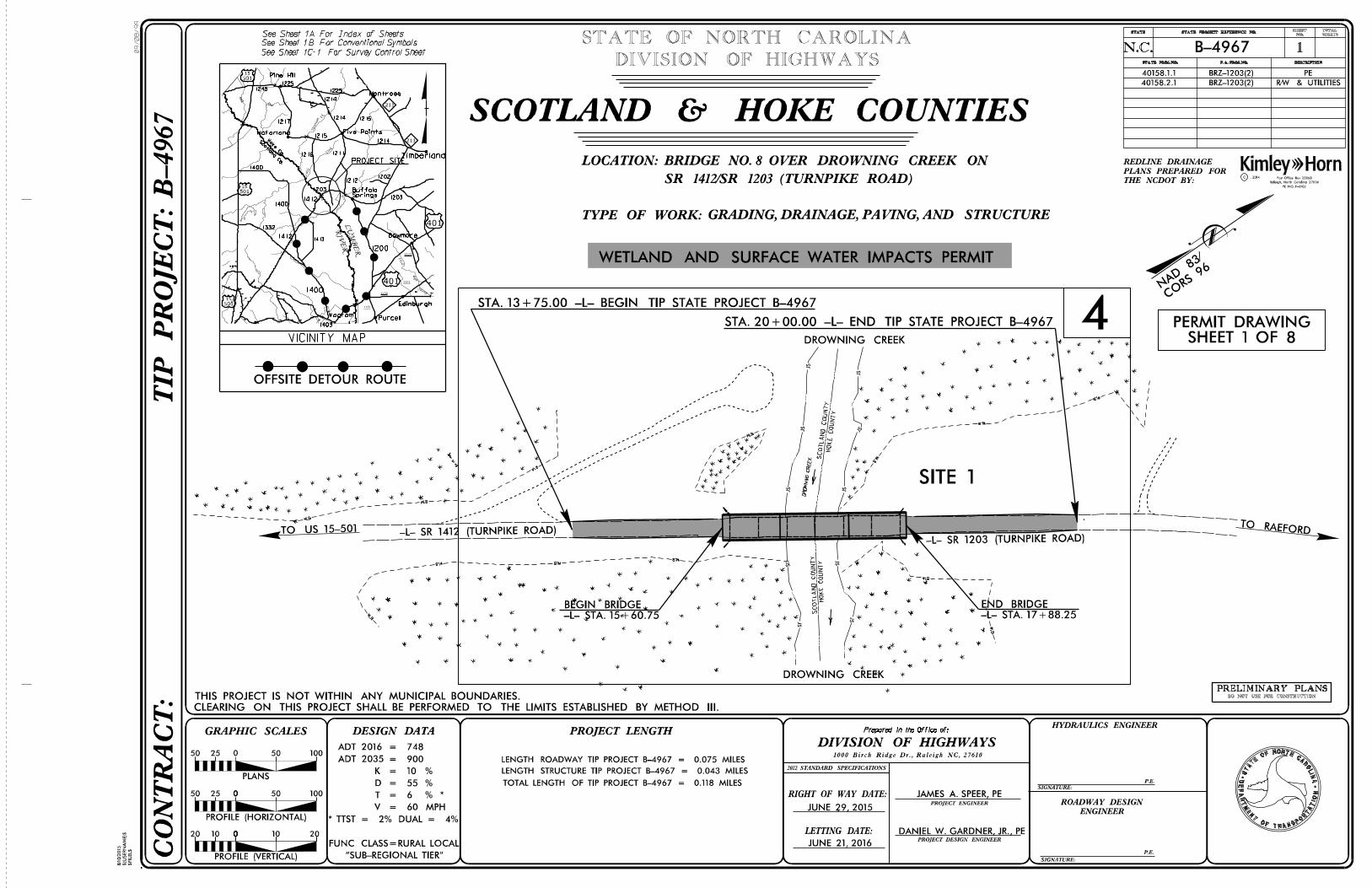


Hand Existing ExistingPermanent Temp. Excavation Mechanized Clearing Permanent Temp. Channel Channel Natural
Site Station Structure Fill In Fill In in Clearing in SW SW Impacts Impacts StreamNo. (From/To) Size / Type Wetlands Wetlands Wetlands in Wetlands Wetlands impacts impacts Permanent Temp. Design
(ac) (ac) (ac) (ac) (ac) (ac) (ac) (ft) (ft) (ft)1 -L- 14+58.39 TO 16+16.77 RT Bridge 0.01 0.03
1 -L- 15+26.83 TO 15+64.46 LT Bridge < 0.01 < 0.01
1 -L- 17+31.00 TO 17+88.20 RT Bridge 0.01
1 -L- 17+11.60 TO 17+25.35 LT Bridge < 0.01
TOTALS*: 0.02 0.05 0 0 0
*Rounded totals are sum of actual impacts
NOTES:
Revised 2013 10 24 SHEET 8 OF 8
EXISTING INTERIOR PIERS WILL BE REMOVED FROM THE CAUSEWAY.
WETLAND PERMIT IMPACT SUMMARYWETLAND IMPACTS SURFACE WATER IMPACTS
SCOTLAND & HOKEB - 4967
NC DEPARTMENT OF TRANSPORTATIONDIVISION OF HIGHWAYS
8/7/2015

-L- STA. 15+60.75BEGIN BRIDGE
STA. 13+75.00 -L- BEGIN TIP STATE PROJECT B-4967
STA. 20+00.00 -L- END TIP STATE PROJECT B-4967
TO US 15-501TO RAEFORD-L- SR 1412 (TURNPIKE ROAD)
-L- SR 1203 (TURNPIKE ROAD)
-L- STA. 17+88.25END BRIDGE
4DROWNING CREEK
DROWNING CREEK
LU
MB
ER
RIV
ER
HO
KE
CO
UN
TY
SC
OT
LA
ND
CO
UN
TY
HO
KE
CO
UN
TY
SC
OT
LA
ND
CO
UN
TY
WC
Wet Pt
Wet pt
WB
1122
1124
1233
1219
1120
1219
1219
1214
1214
1218
1218
2215
1545
G Clark R
d
Aberd
een R
d
Woodberry Dr
Woo
dberry Dr
Laurinburg R
d
.04
.21
.34
.25
.88
.75
.40
.34
.48
1.05
2.53
1.2
0
.32
.20
401
RIV
ER
Little
Buffalo
Creek
Little
Creek
Mountain
211
211
RO
CKFIS
H
Raft
Swam
p
Ck.
BaptistNazareth
1412
1413
13241324
1408
1412
1409
1410
1403
1403
1372
1508
1408
1403
1403
1410 1406
1400
1412
1411
1409
1415
1415
1411
13291324
1412
1412
1414
1408
1.32
1.79
.83
.42
1.11
.55
.46
.99
.47
1.57
.46
.23
.19
.41
.34
1.2
8
.22
.48
.77
.14
1.1
8
.07
.91
.34
.83
5.3
2
Troll Rd
Terry R
d
Dro
wnin
g
Creek
Shoe
Heel
R.R.
1.0
6
501
15
Godof
Church Holy BibleFriendship
Aberd
een R
oad
LU
MB
ER
.11
2.1
9
.08
1.9
5
.23
.76
.15
SpringsBuffalo
1203
1203
1412
Timberland
Five Points
Montrose
Pine Hill
McFarland
1400
1216
1215
1217
1245
1225
1214
1225
1214
1211
1212
1214
1215
1202
1200
Bowmore
1332
1400
1400
1403
501
15
501
15
401
Edinburgh
Purcell
Scotland Co.
Hoke Co.
Wagram
PROJECT SITE
VICINITY MAP
14131412
211
OFFSITE DETOUR ROUTE
SITE 1
NOV. 2, 2015
SHEET 1 OF 3
UTILITY PERMIT DRAWING
INCOMPLETE PLANSDO NOT USE FOR R/W ACQUISITION
DO NOT USE FOR CONSTRUCTIONPRELIMINARY PLANS
09/08/99
02-
NO
V-2015 13:5
7R:\
Utilitie
s\
Engin
eerin
g\
UB
O\
Proj\
B4967_
Ut_tsh_
UE1_
psh.d
gn
$$$$
US
ER
NA
ME$$$$
TIP P
ROJE
CT:
B-4967
UTILITIES SECTION ENGINEER
UTILITIES SQUAD LEADER PROJECT ENGINEER
UTILITIES PROJECT DESIGNER
Roger Worthington, P.E.
Steve McKee, P.E.
J.T. Yoon, P.E.
XXDE
PA
RT
M
ENT OF TRANSPO
RT
ATI
ON
ST
ATE
OF
NORTH CAR
OLI
NA
INDEX OF SHEETS
SHEET NO. DESCRIPTION
UE-1 TITLE SHEET
UTILITY RELOCATION PLAN SHEETS UE-2
SHEET NO.
B-4967 UE-1STATE OF NORTH CAROLINADIVISION OF HIGHWAYS
T.I.P. NO.
SR 1412/SR 1203 (TURNPIKE ROAD)LOCATION: BRIDGE NO.8 OVER DROWNING CREEK ON
TYPE OF WORK: TRANSMISSION TOWER RELOCATION
SCOTLAND & HOKE COUNTY
UTILITIES PERMIT PLANS
PREPARED IN THE OFFICE OF:
FAX (919) 250-4151PHONE (919) 707-6690RALEIGH NC 27699-15551555 MAIL SERVICES CENTER
DIVISION OF HIGHWAYS
UTILITIES ENGINEERINGUTILITIES UNIT
UTILITY OWNERS ON PROJECT
(A) POWER ; LUMBER RIVER EMC
0
0
0
PROFILE (HORIZONTAL)
GRAPHIC SCALES
PLANS
PROFILE (VERTICAL)
0
00
50 50
50 50
2010510
25 100
25 100
CORS 9
6
NAD
83/

HC HCCLEARING
DENOTES HAND
0.018 / 0.0144 ACRE
TRANSMISSION LINE
HAND CLEARING FOR POWER
B-4967 UE-2
NOV. 02, 2015
SHEET 2 OF 3
UTILITY PERMIT DRAWING
RE
VIS
ION
S
HYDRAULICSROADW AY DESIGN
ENGINEER ENGINEER
R/W SHEET NO.
SHEET NO.PROJECT REFERENCE NO.
02
-N
OV
-2
01
5 1
3:4
3R
:\U
tili
ties\E
ng
ineerin
g\U
BO
\Pro
j\B
49
67
_U
t_4
_U
E2
_p
sh
.dg
n$$$$U
SE
RN
AM
E$$$$
8/17/99
DO NOT USE FOR CONSTRUCTIONPRELIMINARY PLANS
18" RCP
WOOD WW WOOD WW
WOODS
WOODS
WOODS
WOODS
WOODS
SOIL & GRAVEL DRIV
ESOIL & GRAVEL
DRIVE
30" RCP
BRIDGE #8 = WOOD & STEEL BRIDGE WITH PAVED DECK
LU
MBER RIV
ER
TO RAEFORD
TURNPIKE ROAD (SR 1203 & 1412)
19’ PAVED ROADWAY
TO US 15-501
HOKE COUNTY
SCOTLAND COUNTY
HOKE COUNTY
SCOTLAND COUNTY
BRUSH
BRUSH
60.0
0’
EXISTING R/W
EXISTING R/W
EXISTING R/W
EXISTING R/W
60.0
0’
10 15 20
NAD
83
CORS 9
6
-L- STA. 13+ 75.00 BEGIN STATE PROJECT B-4967
-L- STA. 20+ 00.00 END STATE PROJECT B-4967
F F
F
F F
F F
F
F
F
F
F
F F
F
F
WC
Wet Pt
Wet pt
WB
25’ CLEARANCE
EXISTING
30’ CLEARANCE
PROPOSED
AREA FOR EXISTING LINE
UTILITY COMPANY ALREADY CLEARED THIS

Hand Existing Existing Permanent Temp. Excavation Mechanized Clearing Permanent Temp. Channel Channel Natural
Site Station Structure Fill In Fill In in Clearing in SW SW Impacts Impacts StreamNo. (From/To) Size / Type Wetlands Wetlands Wetlands in Wetlands Wetlands impacts impacts Permanent Temp. Design
(ac) (ac) (ac) (ac) (ac) (ac) (ac) (ft) (ft) (ft)1 -L- 15+33.49 TO 15+87.56 LT POWER TRANSMISSION LINE 0.02 -L- 17+12.56 TO 17+53.93 LT POWER TRANSMISSION LINE 0.01
TOTALS*: 0.03 0 0 0
NOTES:
REVISED 11/ 2/ 2015 SHEET 3 OF 3
WETLAND PERMIT IMPACT SUMMARYWETLAND IMPACTS SURFACE WATER IMPACTS
SCOTLAND & HOKEB - 4967
NC DEPARTMENT OF TRANSPORTATIONDIVISION OF HIGHWAYS
11/4/2015
EXISTING TRANSMISSION LINE HAS 25' CLEARANCE FROM THE LINE AND UTILITY COMPANY HAS ALREADY CLEARED THIS AREA.PROPOSED TRANSMISSION LINE WILL HAVE 30' CLEARANCE AND UTILITY COMPANY NEEDS ADDITIONAL HAND CLEARING.